You are currently viewing a new version of our website. To view the old version click .

Remote Sensing, Volume 14, Issue 18

September-2 2022 - 257 articles

Cover Story: 
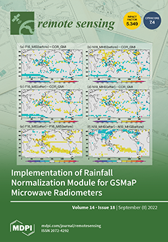
The Global Satellite Mapping of Precipitation (GSMaP) provides multi-satellite precipitation products using multiple passive microwave (PMW) imagers/sounders. Different specifications of the instruments and different precipitation estimation algorithms cause inconsistent estimates for each satellite sensor. To mitigate the discrepancy of GSMaP estimates among PMW sensors, the Method of Microwave Rainfall Normalization (MMN) is implemented in its latest version (V05), released in December 2021. The basic idea of the MMN is to calibrate target PMW sensors with reference sensors using the cumulative distribution function of the precipitation rate in the last 30 days. Differences in the frequency of occurrence of rainfall intensity is investigated using an MMN table. The monthly mean rainfall and mean bias error are improved. View this paper
  • Issues are regarded as officially published after their release is announced to the table of contents alert mailing list .
  • You may sign up for email alerts to receive table of contents of newly released issues.
  • PDF is the official format for papers published in both, html and pdf forms. To view the papers in pdf format, click on the "PDF Full-text" link, and use the free Adobe Reader to open them.

Articles (257)

  • Article
  • Open Access
4 Citations
2,952 Views
20 Pages

19 September 2022

Permafrost and alpine vegetation are widely distributed in Tibet, which is a sensitive area for global climate change. In this study, we inverted the surface deformation from 22 May 2018 to 9 October 2021 in a rectangular area within the city of Linz...

  • Article
  • Open Access
4 Citations
2,339 Views
16 Pages

19 September 2022

We identified controlling factors of the inter-annual variations of surface PM2.5–aerosol optical depth (AOD) relationship in China from 2006 to 2017 using a nested 3D chemical transport model—GEOS-Chem. We separated the contributions fro...

  • Article
  • Open Access
2,848 Views
18 Pages

SSML: Spectral-Spatial Mutual-Learning-Based Framework for Hyperspectral Pansharpening

  • Xianlin Peng,
  • Yihao Fu,
  • Shenglin Peng,
  • Kai Ma,
  • Lu Liu and
  • Jun Wang

19 September 2022

This paper considers problems associated with the large size of the hyperspectral pansharpening network and difficulties associated with learning its spatial-spectral features. We propose a deep mutual-learning-based framework (SSML) for spectral-spa...

  • Article
  • Open Access
7 Citations
2,793 Views
19 Pages

19 September 2022

A segmented primary mirror is very important for extra-large astronomical telescopes, in order to detect the phase error between segmented mirrors. Traditional iterative algorithms are hard to detect co−phasing aberrations in real time due to t...

  • Article
  • Open Access
19 Citations
3,526 Views
24 Pages

Multiscale Ground Validation of Satellite and Reanalysis Precipitation Products over Diverse Climatic and Topographic Conditions

  • Muhammad Umer Nadeem,
  • Abdulnoor A. J. Ghanim,
  • Muhammad Naveed Anjum,
  • Donghui Shangguan,
  • Ghulam Rasool,
  • Muhammad Irfan,
  • Usama Muhammad Niazi and
  • Sharjeel Hassan

19 September 2022

The validity of two reanalysis (ERA5 and MEERA2) and seven satellite-based (CHIRPS, IMERG, PERSIANN-CCS, PERSIANN-CDR, PERSIANN-PDIR, PERSIANN, and TRMM) precipitation products was assessed in relation to the observations of in situ weather stations...

  • Communication
  • Open Access
6 Citations
3,149 Views
12 Pages

19 September 2022

Atmospheric aerosols can impact human health, necessitating the understanding of their distribution determinants, especially in urban areas. The study discusses the relationships between five major land cover types and aerosol optical depth (AOD) wit...

  • Article
  • Open Access
16 Citations
2,870 Views
22 Pages

Inter-Calibration and Statistical Validation of Topside Ionosphere Electron Density Observations Made by CSES-01 Mission

  • Alessio Pignalberi,
  • Michael Pezzopane,
  • Igino Coco,
  • Mirko Piersanti,
  • Fabio Giannattasio,
  • Paola De Michelis,
  • Roberta Tozzi and
  • Giuseppe Consolini

19 September 2022

The China Seismo-Electromagnetic Satellite (CSES-01) provides in situ electron density (Ne) observations through Langmuir probes (LPs) in the topside ionosphere since February 2018. CSES-01 is a sun-synchronous satellite probing the ionosphere around...

  • Article
  • Open Access
8 Citations
2,946 Views
14 Pages

19 September 2022

On the 15th of March 2021, the strongest sandstorm in a decade occurred in northern China, and had a great adverse impact on the natural environment and human health in northern China. Real-time monitoring of dust storms is becoming increasingly impo...

  • Technical Note
  • Open Access
10 Citations
7,589 Views
14 Pages

19 September 2022

With the increasing number of reservoirs on the Nile River Basin, it has become important to understand the reservoir operations in the basin for coordinated water management among the various countries. With the lack of a proper framework for data s...

  • Article
  • Open Access
16 Citations
4,480 Views
37 Pages

19 September 2022

In synthetic aperture radar (SAR) images, ship targets are characterized by varying scales, large aspect ratios, dense arrangements, and arbitrary orientations. Current horizontal and rotation detectors fail to accurately recognize and locate ships d...

of 26

Get Alerted

Add your email address to receive forthcoming issues of this journal.

XFacebookLinkedIn
Remote Sens. - ISSN 2072-4292Creative Common CC BY license