Next Issue
Volume 11, January-1
Previous Issue
Volume 10, November
 
 
remotesensing-logo

Journal Browser

Journal Browser

Remote Sens., Volume 10, Issue 12 (December 2018) – 212 articles

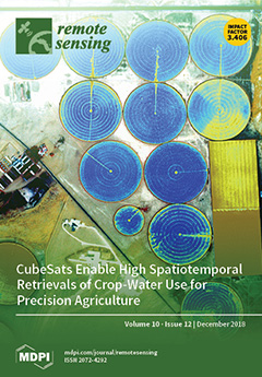
Cover Story (view full-size image): The compromise between spatial and temporal resolution remains a challenge in remote sensing. With recent advances in the use of CubeSat constellations, these spatiotemporal barriers are being overcome, with daily and 3 m resolution data now available. Here, we combine the new sensing capabilities of CubeSats with the well-established NASA PT-JPL model to estimate crop water use at unprecedented spatial and high temporal resolutions. We demonstrate this technology via an application in precision agriculture, where the characterization of spatial variability both between and within fields is required to quantify water needs and to establish effective irrigation scheduling. The advances being afforded by CubeSats have implications across disciplines and are fundamentally changing the way we observe the Earth. View this paper.
  • Issues are regarded as officially published after their release is announced to the table of contents alert mailing list.
  • You may sign up for e-mail alerts to receive table of contents of newly released issues.
  • PDF is the official format for papers published in both, html and pdf forms. To view the papers in pdf format, click on the "PDF Full-text" link, and use the free Adobe Reader to open them.
Order results
Result details
Section
Select all
Export citation of selected articles as:
25 pages, 6420 KiB  
Article
Geometric, Environmental and Hardware Error Sources of a Ground-Based Interferometric Real-Aperture FMCW Radar System
Remote Sens. 2018, 10(12), 2070; https://doi.org/10.3390/rs10122070 - 19 Dec 2018
15 pages, 10151 KiB  
Article
Numerical Mapping and Modeling Permafrost Thermal Dynamics across the Qinghai-Tibet Engineering Corridor, China Integrated with Remote Sensing
Remote Sens. 2018, 10(12), 2069; https://doi.org/10.3390/rs10122069 - 19 Dec 2018
18 pages, 6011 KiB  
Article
A Novel Tilt Correction Technique for Irradiance Sensors and Spectrometers On-Board Unmanned Aerial Vehicles
Remote Sens. 2018, 10(12), 2068; https://doi.org/10.3390/rs10122068 - 19 Dec 2018
17 pages, 5843 KiB  
Article
Automatic Mapping of Thermokarst Landforms from Remote Sensing Images Using Deep Learning: A Case Study in the Northeastern Tibetan Plateau
Remote Sens. 2018, 10(12), 2067; https://doi.org/10.3390/rs10122067 - 19 Dec 2018
19 pages, 5412 KiB  
Article
Extraction of Anisotropic Characteristics of Scattering Centers and Feature Enhancement in Wide-Angle SAR Imagery Based on the Iterative Re-Weighted Tikhonov Regularization
Remote Sens. 2018, 10(12), 2066; https://doi.org/10.3390/rs10122066 - 19 Dec 2018
23 pages, 14370 KiB  
Article
Super-Resolution Reconstruction and Its Application Based on Multilevel Main Structure and Detail Boosting
Remote Sens. 2018, 10(12), 2065; https://doi.org/10.3390/rs10122065 - 19 Dec 2018
13 pages, 5277 KiB  
Article
Assessing Effect of Targeting Reduction of PM2.5 Concentration on Human Exposure and Health Burden in Hong Kong Using Satellite Observation
Remote Sens. 2018, 10(12), 2064; https://doi.org/10.3390/rs10122064 - 19 Dec 2018
14 pages, 1417 KiB  
Letter
Model-Based Optimization of Spectral Sampling for the Retrieval of Crop Variables with the PROSAIL Model
Remote Sens. 2018, 10(12), 2063; https://doi.org/10.3390/rs10122063 - 19 Dec 2018
16 pages, 3933 KiB  
Article
Can UAV-Based Infrared Thermography Be Used to Study Plant-Parasite Interactions between Mistletoe and Eucalypt Trees?
Remote Sens. 2018, 10(12), 2062; https://doi.org/10.3390/rs10122062 - 19 Dec 2018
33 pages, 10449 KiB  
Article
Improving the Performance of 3-D Radiative Transfer Model FLIGHT to Simulate Optical Properties of a Tree-Grass Ecosystem
Remote Sens. 2018, 10(12), 2061; https://doi.org/10.3390/rs10122061 - 18 Dec 2018
12 pages, 4249 KiB  
Article
Comparative Analysis of Polarimetric SAR Calibration Methods
Remote Sens. 2018, 10(12), 2060; https://doi.org/10.3390/rs10122060 - 18 Dec 2018
16 pages, 24894 KiB  
Article
New Insights into Multiclass Damage Classification of Tsunami-Induced Building Damage from SAR Images
Remote Sens. 2018, 10(12), 2059; https://doi.org/10.3390/rs10122059 - 18 Dec 2018
22 pages, 18173 KiB  
Article
Spatial and Temporal Analysis of Precipitation and Effective Rainfall Using Gauge Observations, Satellite, and Gridded Climate Data for Agricultural Water Management in the Upper Colorado River Basin
Remote Sens. 2018, 10(12), 2058; https://doi.org/10.3390/rs10122058 - 18 Dec 2018
23 pages, 6658 KiB  
Article
Annual Cropland Mapping Using Reference Landsat Time Series—A Case Study in Central Asia
Remote Sens. 2018, 10(12), 2057; https://doi.org/10.3390/rs10122057 - 18 Dec 2018
30 pages, 5944 KiB  
Article
Calibrations and Wind Observations of an Airborne Direct-Detection Wind LiDAR Supporting ESA’s Aeolus Mission
Remote Sens. 2018, 10(12), 2056; https://doi.org/10.3390/rs10122056 - 18 Dec 2018
23 pages, 4873 KiB  
Article
Differing Responses to Rainfall Suggest More Than One Functional Type of Grassland in South Africa
Remote Sens. 2018, 10(12), 2055; https://doi.org/10.3390/rs10122055 - 18 Dec 2018
19 pages, 28952 KiB  
Article
2D vs. 3D Change Detection Using Aerial Imagery to Support Crisis Management of Large-Scale Events
Remote Sens. 2018, 10(12), 2054; https://doi.org/10.3390/rs10122054 - 17 Dec 2018
16 pages, 8579 KiB  
Article
A Deep Convolution Neural Network Method for Land Cover Mapping: A Case Study of Qinhuangdao, China
Remote Sens. 2018, 10(12), 2053; https://doi.org/10.3390/rs10122053 - 17 Dec 2018
18 pages, 4283 KiB  
Article
Convolutional Neural Network Based Multipath Detection Method for Static and Kinematic GPS High Precision Positioning
Remote Sens. 2018, 10(12), 2052; https://doi.org/10.3390/rs10122052 - 17 Dec 2018
23 pages, 11769 KiB  
Article
A Novel Method for High-Voltage Bundle Conductor Reconstruction from Airborne LiDAR Data
Remote Sens. 2018, 10(12), 2051; https://doi.org/10.3390/rs10122051 - 17 Dec 2018
18 pages, 6511 KiB  
Article
The Use of Photogrammetry to Construct Time Series of Vegetation Permeability to Water and Seed Transport in Agricultural Waterways
Remote Sens. 2018, 10(12), 2050; https://doi.org/10.3390/rs10122050 - 17 Dec 2018
10 pages, 8208 KiB  
Letter
Potential of Sentinel-1 Data for Monitoring Temperate Mixed Forest Phenology
Remote Sens. 2018, 10(12), 2049; https://doi.org/10.3390/rs10122049 - 17 Dec 2018
17 pages, 3565 KiB  
Article
Locking Status and Earthquake Potential Hazard along the Middle-South Xianshuihe Fault
Remote Sens. 2018, 10(12), 2048; https://doi.org/10.3390/rs10122048 - 17 Dec 2018
22 pages, 7820 KiB  
Article
Identifying Mangrove Species Using Field Close-Range Snapshot Hyperspectral Imaging and Machine-Learning Techniques
Remote Sens. 2018, 10(12), 2047; https://doi.org/10.3390/rs10122047 - 16 Dec 2018
19 pages, 6227 KiB  
Article
The Spatio-Temporal Evolution of River Island Based on Landsat Satellite Imagery, Hydrodynamic Numerical Simulation and Observed Data
Remote Sens. 2018, 10(12), 2046; https://doi.org/10.3390/rs10122046 - 16 Dec 2018
25 pages, 8838 KiB  
Article
Accuracy Assessment on MODIS (V006), GLASS and MuSyQ Land-Surface Albedo Products: A Case Study in the Heihe River Basin, China
Remote Sens. 2018, 10(12), 2045; https://doi.org/10.3390/rs10122045 - 16 Dec 2018
16 pages, 4128 KiB  
Article
On the Feasibility of Interhemispheric Patch Detection Using Ground-Based GNSS Measurements
Remote Sens. 2018, 10(12), 2044; https://doi.org/10.3390/rs10122044 - 16 Dec 2018
22 pages, 5113 KiB  
Article
Ship Classification and Detection Based on CNN Using GF-3 SAR Images
Remote Sens. 2018, 10(12), 2043; https://doi.org/10.3390/rs10122043 - 14 Dec 2018
21 pages, 7497 KiB  
Article
A Remote Sensing Approach for Mapping the Development of Ancient Water Management in the Near East
Remote Sens. 2018, 10(12), 2042; https://doi.org/10.3390/rs10122042 - 14 Dec 2018
14 pages, 3116 KiB  
Article
The Influence of Instrumental Line Shape Degradation on the Partial Columns of O3, CO, CH4 and N2O Derived from High-Resolution FTIR Spectrometry
Remote Sens. 2018, 10(12), 2041; https://doi.org/10.3390/rs10122041 - 14 Dec 2018
Previous Issue
Back to TopTop