You are currently viewing a new version of our website. To view the old version click .

Remote Sensing, Volume 10, Issue 11

November 2018 - 189 articles

Cover Story: 
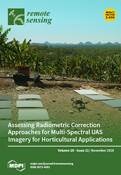
Farmers should be cautious of “off-the-shelf” drone image products, as they are unlikely to provide accurate information about the health of their crops. Despite the potential benefits of drone imagery to farmers, who seek regularly updated maps of individual trees and plants, this research shows that the multi-spectral images collected from drones must be processed with proper radiometric correction to accurately map and measure tree and plant properties. Correcting for variations due to drone-based image data collecting practice and associated variations in solar illumination properties was identified as the largest challenge to deliver image data suited to mapping changes in crop properties over time. Such inconsistencies could result in farmers being given the wrong information about their crops if the data are not processed by experienced operators with remote sensing expertise. View Paper here.
  • Issues are regarded as officially published after their release is announced to the table of contents alert mailing list .
  • You may sign up for email alerts to receive table of contents of newly released issues.
  • PDF is the official format for papers published in both, html and pdf forms. To view the papers in pdf format, click on the "PDF Full-text" link, and use the free Adobe Reader to open them.

Articles (189)

  • Article
  • Open Access
29 Citations
4,958 Views
13 Pages

Characteristics of BeiDou-3 Experimental Satellite Clocks

  • Yifei Lv,
  • Tao Geng,
  • Qile Zhao and
  • Jingnan Liu

22 November 2018

The characteristics of the improved Atomic Frequency Standard (AFS) operated on the latest BeiDou-3 experimental satellites are analyzed from day-of-year (DOY) 254 to 281, of the year 2017, considering the following three aspects: stability, periodic...

  • Article
  • Open Access
88 Citations
11,785 Views
19 Pages

Estimating Tree Position, Diameter at Breast Height, and Tree Height in Real-Time Using a Mobile Phone with RGB-D SLAM

  • Yongxiang Fan,
  • Zhongke Feng,
  • Abdul Mannan,
  • Tauheed Ullah Khan,
  • Chaoyong Shen and
  • Sajjad Saeed

21 November 2018

Accurate estimation of tree position, diameter at breast height (DBH), and tree height measurements is an important task in forest inventory. Mobile Laser Scanning (MLS) is an important solution. However, the poor global navigation satellite system (...

  • Article
  • Open Access
92 Citations
6,564 Views
18 Pages

21 November 2018

Numerous global-scale land-cover datasets have greatly contributed to the study of global environmental change and the sustainable management of natural resources. However, land-cover datasets inevitably experience information loss because of the nat...

  • Article
  • Open Access
35 Citations
5,265 Views
18 Pages

21 November 2018

Knowledge of forest productivity status is an important indicator of the amount of biomass accumulated and the role of terrestrial ecosystems in the carbon cycle. However, accurate and up-to-date information on forest biomass and forest succession re...

  • Article
  • Open Access
29 Citations
8,656 Views
19 Pages

Forest Cover and Vegetation Degradation Detection in the Kavango Zambezi Transfrontier Conservation Area Using BFAST Monitor

  • Michael Schultz,
  • Aurélie Shapiro,
  • Jan G. P. W. Clevers,
  • Craig Beech and
  • Martin Herold

21 November 2018

Forest cover and vegetation degradation was monitored across the Kavango-Zambezi Transfrontier Conservation Area (KAZA) in southern Africa and the performance of three different methods in detecting degradation was assessed using reference data. Brea...

  • Article
  • Open Access
64 Citations
6,909 Views
19 Pages

21 November 2018

In tree Aboveground Biomass (AGB) estimation, the traditional harvest method is accurate but unsuitable for a large-scale forest. The airborne Light Detection And Ranging (LiDAR) is superior in obtaining the point cloud data of a dense forest and ext...

  • Article
  • Open Access
11 Citations
5,060 Views
19 Pages

Using TanDEM-X Pursuit Monostatic Observations with a Large Perpendicular Baseline to Extract Glacial Topography

  • Sang-Hoon Hong,
  • Shimon Wdowinski,
  • Falk Amelung,
  • Hyun-Cheol Kim,
  • Joong-Sun Won and
  • Sang-Wan Kim

21 November 2018

Space-based Interferometric Synthetic Aperture Radar (InSAR) applications have been widely used to monitor the cryosphere over past decades. Owing to temporal decorrelation, interferometric coherence often severely degrades on fast moving glaciers. T...

  • Article
  • Open Access
52 Citations
4,649 Views
15 Pages

21 November 2018

Moderate Resolution Imaging Spectroradiometer (MODIS) land surface temperature (LST) products are widely used in ecology, hydrology, vegetation monitoring, and global circulation models. Compared to the collection-5 (C5) LST products, the newly relea...

  • Article
  • Open Access
39 Citations
5,401 Views
23 Pages

21 November 2018

Cloud detection, which is defined as the pixel-wise binary classification, is significant in satellite imagery processing. In current remote sensing literature, cloud detection methods are linked to the relationships of imagery bands or based on simp...

of 19

Get Alerted

Add your email address to receive forthcoming issues of this journal.

XFacebookLinkedIn
Remote Sens. - ISSN 2072-4292Creative Common CC BY license