


Abstract
Post-earthquake reconstruction can restore buildings and infrastructure without demonstrating broader territorial regeneration. This study proposes a non-compensatory and scale-explicit framework connecting risk reduction, cultural heritage conservation, land-use sustainability, socio-economic recovery, community resilience, and multilevel governance. The framework distinguishes strategic intention, documented delivery, contextual observation, and verified regeneration outcome and defines the documented regeneration coherence gap as an unverified, partial, or inconsistent evidentiary connection among these stages. Such a gap is not interpreted as proof that regeneration has failed or that territorial outcomes have not occurred. The framework is applied through an embedded single-case study comprising the Umbrian Valnerina, Valle Castoriana, and Piedivalle. The final corpus comprises 19 sources and 28 scale-specific coding units: 17 strategic intentions, five documented delivery records, and six contextual observations; no unit met the criteria for a verified regeneration outcome. Blind second coding of all 28 units produced perfect agreement for analytical role and evidence maturity, strong agreement for primary framework dimension and scale class, and lower reproducibility for relational effect (20/28 exact agreement; Cohen’s κ = 0.553; Gwet’s AC1 = 0.639). Scale-specific profiles show that Piedivalle primarily documents multidimensional site-level intentions, whereas delivery evidence concerns broader reconstruction and programme governance; these materials are not interpreted as successive stages of the same intervention. Because no coding unit met the criteria for a verified regeneration outcome, all outcome-dependent specifications remained structurally incomplete. The informative sensitivity analyses therefore concerned intention and delivery coverage, territorial-scale matching, primary-versus-linked dimensions, and the exclusion of the project-authored source. The framework therefore provides a reproducible evidence-mapping protocol rather than a causal evaluation of regeneration effectiveness.
1. Introduction
The repair or replacement of damaged buildings and infrastructure is the most visible component of post-disaster reconstruction, but it does not exhaust the objectives of recovery. The Sendai Framework for Disaster Risk Reduction 2015–2030 explicitly identifies recovery, rehabilitation, and reconstruction as opportunities to “Build Back Better”, linking the restoration of physical assets to the reduction in existing vulnerabilities and to the strengthening of social, economic, institutional, and environmental systems [1]. The same principle underlies the United Nations 2030 Agenda. In particular, Sustainable Development Goal 11 connects disaster risk reduction with participatory planning, cultural heritage protection, and more balanced relationships between urban and rural areas [2].
Turning these principles into post-earthquake policy is difficult because urgent housing, infrastructure, and service restoration often proceeds through sectoral and short-term interventions. Physical reconstruction may therefore coexist with persistent demographic, economic, social, and institutional fragility. The analytical problem is not simply whether rebuilding occurs, but whether risk reduction, heritage, land use, local economies, community capacity, and governance remain connected from strategy through implementation to observable territorial effects.
This issue is relevant in the Italian inner areas, where seismic and hydrogeological hazards intersect with long-term processes of depopulation, population ageing, limited accessibility to essential services, economic marginalisation, and the progressive deterioration of the built environment. At the same time, these territories preserve a substantial share of Italy’s historical settlements, cultural landscapes, traditional knowledge, and ecological resources. Their vulnerability is therefore not only physical. It derives from the interaction between exposure to natural hazards and a broader set of demographic, socio-economic, institutional, and environmental weaknesses. A major disruptive event, such as an earthquake, can accelerate dynamics that were already underway, transforming an emergency into a permanent condition of territorial decline.
The reconstruction of earthquake-affected inner areas must consequently address a twofold challenge. On the one hand, it must restore adequate levels of safety and functionality; on the other, it must preserve the identity of places and create the conditions for their long-term re-inhabitation. Research on the 2009 L’Aquila earthquake has shown that materially focused, top-down reconstruction can weaken community-territory relations and the capacity of affected populations to shape recovery processes [3]. The physical continuity of buildings does not necessarily ensure the continuity of a place. Historical centres are not only aggregates of structures to be repaired, but the spatial expression of social practices, collective memories, economic activities, and evolving relations between communities and their environment.
These perspectives indicate that cultural heritage, land-use choices, community capacity, and socio-economic recovery should be treated as interdependent components of territorial viability rather than as separate policy domains. Heritage may support identity and local development; the reuse of existing settlements may limit additional land take; and community capacities and viable economic activities are necessary to sustain long-term re-inhabitation [4,5,6,7,8,9,10].
Existing studies address post-earthquake place identity, heritage community resilience, multidimensional decision support for inner areas, circular reconstruction, and community-led heritage preservation [3,4,9,10,11]. However, these fields remain weakly integrated: risk reduction, heritage conservation, land use, socio-economic recovery, and inner-area development are generally assessed through separate disciplinary and policy frameworks. An operational approach is therefore needed to determine whether their simultaneous presence produces a coherent regeneration pathway rather than a collection of sectoral interventions.
Research on policy implementation has shown that policy intentions may not translate into action when responsibilities, resources, coordination, and institutional capacities are fragmented [12]. Policy-integration studies further indicate that the different components of an integrated strategy may advance at different rates or even in opposite directions [13]. The concept extends the implementation-gap perspective by asking not only whether stated intentions are implemented, but also whether integration among dimensions is maintained during delivery, produces observable outcomes, and remains coherent across nested territorial scales. It is therefore relational, multiscalar, and non-compensatory.
The regeneration coherence gap does not replace established approaches to policy implementation, policy integration, theory-based evaluation, contribution analysis, or disaster-recovery monitoring. Implementation-gap research examines whether policy commitments are translated into action, while policy-integration research addresses coordination among sectors, goals, and instruments. Theory-based evaluation and contribution analysis reconstruct the mechanisms connecting interventions and results, whereas recovery-monitoring frameworks use longitudinal indicators to distinguish recovery from broader contextual change. The proposed framework adds a scale-explicit and non-compensatory diagnostic layer: it requires the evidentiary connection among intention, delivery, and outcome to be demonstrated separately for each essential dimension and at the territorial scale supported by the source. A coherence gap therefore identifies an unverified or inconsistent link in the documented pathway; it is not, by itself, evidence of policy failure or causal non-effect [14,15,16].
Against this background, this study develops an interdisciplinary framework for assessing sustainable post-earthquake regeneration in vulnerable inner areas. The framework integrates six interdependent dimensions: risk reduction, cultural heritage conservation, land-use sustainability, socio-economic recovery, community resilience, and multilevel governance. Its applicability is explored through the case of the Valnerina area in Central Italy, a territory in which recurrent seismic events interact with a valuable historical and landscape heritage, demographic decline, and persistent socio-economic fragilities.
The study is guided by the following research questions:
RQ1. How can the six dimensions identified in the literature be integrated into a non-compensatory assessment of sustainable post-earthquake regeneration in vulnerable inner areas?
RQ2. At which territorial scales and for which dimension-stage combinations does the documentary corpus support strategic, delivery, and outcome coherence, and where does such coherence remain unverified?
RQ3. Which elements of the assessment constitute analytically transferable propositions, and which place-dependent boundary conditions limit their application to other earthquake-affected inner areas?
The study makes three contributions. First, it integrates six dimensions of sustainable post-earthquake regeneration within a non-compensatory framework. Second, it operationalises the regeneration coherence gap by distinguishing strategic intention, coordinated delivery, and observable outcomes. Third, it applies this distinction across three nested territorial scales, preventing project-level qualities from being generalised to the wider regeneration process. The case is therefore used analytically rather than presented as evidence of a completed regeneration model.
2. Theoretical Background and Conceptual Framework
2.1. From Post-Disaster Reconstruction to Sustainable Regeneration
The Build Back Better approach reframed post-disaster reconstruction as an opportunity to reduce existing risk rather than simply restore pre-event conditions [1]. This perspective requires a distinction between reconstruction, which primarily restores damaged assets and functions, and regeneration, which coordinates physical recovery with social, economic, environmental, institutional, and cultural transformation.
This distinction is particularly relevant in fragile inner areas, where earthquakes expose and accelerate pre-existing processes of depopulation, service reduction, economic decline, building abandonment, and institutional weakening. Physical reconstruction may therefore produce safer buildings without restoring their use, inhabitants, or relationships with the surrounding territory.
Sustainable post-earthquake regeneration must also connect different temporal horizons. Emergency measures and temporary facilities should respond to immediate needs without compromising long-term land-use, service, environmental, and development choices. Adaptability, reuse, transformation, and the coordinated recovery of housing, services, and economic activities can reduce the discontinuity between emergency response and territorial development.
Although recent studies increasingly address the environmental, economic, social, technical, and institutional dimensions of recovery [10,17], implementation remains fragmented across sectors, funding streams, and responsibilities. In this study, sustainable post-earthquake regeneration is therefore defined as a place-based and long-term process coordinating physical reconstruction with risk reduction, cultural heritage conservation, sustainable land use, socio-economic recovery, community capacity, and multilevel governance.
2.2. Risk Reduction and Cultural Heritage Resilience
Risk reduction is a non-negotiable dimension of post-earthquake regeneration. In historic settlements, however, vulnerability cannot be addressed exclusively through interventions on individual buildings. Masonry aggregates, street accessibility, public spaces, infrastructure, strategic buildings, and emergency routes must also be assessed at settlement and territorial scales [1,18].
Cultural heritage is not only an exposed asset. Historical buildings, public spaces, cultural landscapes, religious structures, traditional activities, and local construction knowledge support collective memory, attachment to place, and local economic activities. Their loss can therefore weaken social cohesion and territorial viability as well as produce physical and economic damage [3].
Heritage Community Resilience provides a basis for connecting heritage protection with community capacity [4]. Heritage contributes to resilience when it remains socially meaningful, supports local knowledge and collective action, and enables communities to maintain continuity while adapting to change. Conservation should consequently be coordinated with compatible adaptation, accessibility, energy improvement, new uses, and appropriate technological innovation.
The UNDRR Cultural Heritage Addendum similarly integrates heritage management with risk reduction, governance, local knowledge, participation, tourism, ecosystem services, and development policy [19]. Safety and heritage conservation should therefore be assessed as mutually dependent conditions: safety enables continued habitation, while heritage gives identity and meaning to re-inhabitation.
2.3. Land-Use Sustainability and the Regeneration of Inner Areas
Post-disaster demands for housing, services, and productive spaces can encourage peripheral construction and additional soil sealing, even where damaged, vacant, or underused buildings remain available. In inner areas, such choices may intensify settlement dispersion, infrastructure duplication, mobility requirements, and the abandonment of historic centres.
The European objective of achieving no net land take by 2050 prioritises the prevention of additional soil consumption, the reuse of developed land, and the restoration of degraded soils [5]. In post-earthquake contexts, this translates into a hierarchy favouring risk-informed reuse and regeneration of existing settlements before new construction.
Reuse cannot, however, be pursued regardless of exposure or future viability. Where relocation is necessary, decisions should be based on transparent assessments of physical risk, cultural values, social networks, accessibility, ecosystem functions, infrastructure costs, and effects on local economies.
Land-use sustainability also concerns the circular management of construction materials and building life cycles. Reuse, recycling, dry assembly, adaptable temporary structures, and local materials may reduce environmental impacts, but their benefits depend on effective recovery, maintenance, transformation, and end-of-life arrangements [10]. Land should therefore be treated as a finite territorial resource supporting ecosystems, cultural landscapes, agricultural production, mobility, and community continuity.
2.4. Community Resilience and Socio-Economic Recovery
Community resilience is a dynamic capacity to prepare for, respond to, recover from, and adapt to disturbance without necessarily restoring pre-event conditions [6,7]. It depends not only on physical assets but also on social networks, trust, local knowledge, leadership, institutional relationships, access to information, and collective action. These local capacities should be supported without transferring institutional responsibilities to affected communities [8].
Participation has democratic and operational value because residents possess knowledge of buildings, landscapes, production systems, vulnerabilities, and everyday uses. However, participation is meaningful only when it can influence priorities and decisions. Its assessment must therefore consider not only consultation mechanisms but also inclusiveness, representation, access to information, and the ability of older residents, low-income households, people with disabilities, migrants, isolated communities, and small businesses to influence the process.
Socio-economic recovery is inseparable from community resilience. Evidence on business recovery after disasters shows that economic recovery depends not only on repairing damaged premises, but also on the capacity of firms, workers, supply chains, and supporting institutions to adapt to prolonged disruption [20]. Reconstructed settlements cannot remain inhabited without employment, education, healthcare, mobility, commercial services, and opportunities for younger generations. Agriculture, agri-food production, craftsmanship, cultural activities, sustainable tourism, and heritage or environmental services may support recovery, but only when connected to accessible services, viable markets, local supply chains, and long-term investment.
The objective is therefore not simply population return but territorial re-inhabitation: the recovery of everyday practices, public spaces, services, social relationships, productive activities, and cultural transmission. Economic activities provide resources and reasons to remain, while active communities generate the knowledge, cooperation, and demand needed to sustain local development.
2.5. Multilevel Governance as an Integrative Capacity
Post-earthquake regeneration involves national and regional authorities, municipalities, emergency and heritage administrations, infrastructure managers, professionals, businesses, universities, associations, and residents. Their different mandates, procedures, datasets, funding mechanisms, and time horizons can generate discontinuities between emergency management, physical reconstruction, heritage conservation, environmental policy, and local development. Multilevel governance therefore requires both vertical coordination and horizontal integration among sectoral policies and public, private, research, and community actors [21].
Governance is both one analytical dimension and the mechanism integrating the others. Risk assessments influence land-use and investment decisions; heritage authorities define compatibility requirements; economic policies support production systems; municipalities connect reconstruction with services; and communities contribute local knowledge. Without coordination, individually valid actions may remain collectively inconsistent.
Three capacities are particularly relevant: strategic capacity, or the formulation of a shared long-term vision; coordination capacity, or the alignment of rules, funding, data, responsibilities, and interventions; and adaptive capacity, or the ability to monitor outcomes and revise decisions as territorial conditions change.
Transparency and traceability are also essential. Monitoring should extend beyond expenditure and construction progress to population return, housing use, service accessibility, land-use change, employment, heritage use, environmental effects, and participation. Governance thereby becomes an observable component of regeneration rather than an assumed background condition.
2.6. The Proposed Conceptual Framework
The literature reviewed above shows that sustainable post-earthquake regeneration results from the interaction of multiple dimensions that are frequently addressed separately. The proposed conceptual framework brings these dimensions together within a single analytical structure. It is based on the assumption that the sustainability of regeneration cannot be inferred from the satisfactory performance of one dimension alone. A settlement may become structurally safer while continuing to lose population; heritage may be restored without recovering viable uses; economic development may increase pressure on land and resources; participation may be formally present without influencing decisions; and technically sound interventions may remain fragmented in the absence of coordinated governance.
The framework comprises the six interdependent dimensions summarised in Table 1.
Table 1.
Conceptual dimensions of sustainable post-earthquake regeneration.
The six dimensions interact through synergies, dependencies, and trade-offs. Risk-reduction measures may protect lives and heritage while altering historic fabric or producing displacement; heritage-led development may strengthen identity and employment while increasing seasonal use or pressure on land. The framework therefore evaluates relationships among dimensions rather than treating their simultaneous presence as sufficient evidence of sustainability.
Four cross-cutting principles guide the framework: place-based integration, temporal continuity, participatory and inclusive decision-making, and adaptability. The assessment distinguishes contextual conditions, regeneration actions, and expected outcomes while examining coherence across three evidence stages: strategic intention, coordinated delivery, and verified outcome. A documented regeneration coherence gap is recorded when the bounded evidence corpus does not verify a complete, scale-consistent connection among these stages or when the documented relationship is partial or inconsistent. The diagnosis concerns evidentiary continuity; it is not, by itself, evidence of policy failure, non-effect, or the substantive absence of regeneration outcomes. Figure 1 summarises the six dimensions, the evidence-stage assessment, and the nested territorial scales.
Figure 1.
Conceptual framework for sustainable post-earthquake regeneration. Different colors distinguish the six analytical dimensions.
Contextual conditions include hazard, physical vulnerability, demographic trends, economic structure, institutional capacity, heritage values, and environmental resources. Regeneration actions comprise the policies, plans, projects, and community initiatives implemented across the six dimensions. Expected outcomes include safer and inhabited settlements, continued heritage use, reduced environmental pressure, viable economies, stronger community capacities, and more coherent governance.
The dimensions and assessment logic are transferable, but indicators, evidence thresholds, and evaluation criteria must be adapted to territorial conditions and data availability. Section 3 operationalises this structure for the Valnerina case.
At the territorial-system level, full regeneration coherence requires that all six dimensions satisfy the minimum conditions associated with the evidence stage being assessed. At project or asset scale, a dimension may be classified as not applicable only when this choice is explicitly justified; it cannot be treated as implicitly satisfied. Missing evidence is classified as unverified rather than assigned a negative score. Evidence from one dimension or territorial scale cannot compensate for missing evidence in another, and evidence at different scales can form a progression only when the sources establish a traceable connection to the same programme or intervention.
3. Materials and Methods
3.1. Research Design and Analytical Approach
Building on the conceptual framework developed in Section 2.6, this study adopts a theory-informed, embedded single-case study design to examine sustainable post-earthquake regeneration as a territorial process rather than as the sum of individual reconstruction projects [22]. The research combines conceptual framework development with a structured qualitative analysis of the Valnerina case in Central Italy. Documentary analysis was selected because the regeneration process is distributed across legislation, reconstruction programmes, spatial plans, technical reports, statistical datasets, project documents, and institutional strategies produced by different actors and at different territorial scales [23].
The analysis does not calculate a composite sustainability score or infer causal effects. It assesses whether proposed or implemented policies and actions form a coherent pathway across the six dimensions. Coherence is examined within dimensions, across dimensions, and over time. A regeneration coherence gap is recorded when strategic intention is present but implementation or outcome evidence is absent, partial, or inconsistent across dimensions or territorial scales. Evidence was considered partial in the interpretive assessment when implementation or outcome information covered only some components, periods, actors, or territorial scales, while the coding unit retained one of the evidence-stage categories listed in Table 2. Deductive coding based on the conceptual framework was subsequently refined through the case evidence to identify relationships and discontinuities not visible within individual dimensions.
Table 2.
Analytical coding structure used for the Valnerina case study.
3.2. Case Selection and Unit of Analysis
Valnerina was selected purposively as an information-rich critical case combining seismic exposure, historic settlements, tangible and intangible heritage, demographic decline, limited accessibility, fragile services and local economies, environmental constraints, and multilevel reconstruction governance. The case is not statistically representative; it is used to test whether the framework reveals relationships that conventional measures of expenditure, construction progress, or repaired buildings fail to capture.
The embedded case design comprises three nested case-study scales. National and regional evidence was coded as a contextual institutional scale and was not treated as a fourth embedded case unit. The Umbrian Valnerina constitutes the primary territorial case and provides the institutional, demographic, land-use, and reconstruction context. Within it, Valle Castoriana is treated as an embedded territorial unit whose relationships among settlements, heritage assets, mobility, services, environmental resources, and productive activities are examined in relation to the regional Smart Land and Functional Continuity Unit framework documented in [24]. This framework is used as a contextual strategic reference rather than as evidence of a formally adopted Valle Castoriana programme. Piedivalle and the Hortus Conclusus proposal constitute project-level embedded units used to examine how related territorial principles are translated into spatial, architectural, and construction decisions.
Evidence was interpreted only at the scale supported by its source. Project-level intentions were not treated as evidence of implementation or outcomes at the Valle Castoriana or Valnerina scales, and territorial trends were not attributed to individual projects without corroborating evidence.
3.3. Materials and Documentary Evidence
The final corpus comprised 19 sources: eight legislative and policy documents, ten technical and territorial sources, and one planning and project source. Sources were collected up to 2 August 2026 from official institutional repositories, publicly accessible databases, and the published project material described in Supplementary Table S1. The retained corpus generated 28 traceable coding units, each assigned to one primary framework dimension and one supported territorial scale, as reported in Supplementary Table S2.
Corpus construction followed a purposive and iterative documentary-search protocol. Searches were conducted in Normattiva and the Gazzetta Ufficiale, the repositories of the Extraordinary Commissioner for Reconstruction and the Umbria Region, ISTAT databases, ISPRA/SNPA land-consumption datasets, INGV repositories, the Ministry of Culture’s Vincoli in Rete and Carta del Rischio systems, and the institutional repository containing the published project material. Search strings combined the territorial names “Valnerina”, “Valle Castoriana”, “Preci” and “Piedivalle” with the Italian terms “terremoto 2016”, “ricostruzione”, “programma straordinario di ricostruzione”, “area interna”, “APQ”, “POR FESR”, “consumo di suolo”, “popolazione”, “bilancio demografico”, “patrimonio culturale”, “Smart Land” and “Hortus Conclusus”. The policy and monitoring search covered the period from 17 October 2016 to 2 August 2026. Earlier statistical and heritage records were retained only when required to establish pre-earthquake baselines or the pre-existing status of assets. Backward searches from legislation, plans and programme agreements were combined with forward searches for subsequent implementation and monitoring reports. No claim of documentary or theoretical saturation is made. Search closure was defined by the fixed corpus cut-off, completion of the specified repository-query combinations, duplicate removal and a final update check. Failure to identify an eligible source is therefore interpreted as absence of adequate evidence in the bounded corpus, not as absence of the underlying action or outcome.
Contemporaneous counts of the initial candidate set, duplicates, and excluded records were not retained during the original iterative search. These historical quantities are therefore reported as not retained (NR) in the Supplementary Materials and were not reconstructed retrospectively. Reproducibility is instead provided for the final retained corpus through source metadata, repository/query rules, inclusion criteria, evidence locations, and coding-unit traceability.
The empirical corpus comprised three source groups: (i) legislative and policy documents; (ii) technical and territorial evidence concerning hazard, damage, demographic change, land use, heritage, and reconstruction progress; and (iii) planning and project materials relating to Valle Castoriana and Piedivalle. Each source was assigned a unique code and metadata describing provenance, date, spatial and temporal coverage, analytical dimensions, and evidentiary role (Supplementary Table S1). Scientific literature used to construct the framework was excluded from the empirical corpus.
Source types were not treated as evidentially equivalent. Policy and project-authored materials could establish objectives and design intentions; signed agreements could establish formal delivery architecture; monitoring reports could document operations, expenditure, or completed works; and statistical and technical sources could document contextual change. Verified regeneration outcomes required time-comparable or convergent evidence linking implementation to territorial effects. Source positionality and dependence were explicitly audited: in particular, PRO-01 was restricted to stated intention at the Piedivalle/site scale and could not independently demonstrate implementation or effectiveness.
Sources were included when they were relevant to the case or its institutional context, had identifiable provenance and sufficient spatial or temporal specificity, and addressed at least one analytical dimension. Duplicates, promotional materials, and untraceable claims were excluded. Quantitative data were used descriptively without imputation or undocumented aggregation of non-comparable boundaries or years. Qualitative evidence informed the interpretation of objectives and processes but was treated as implementation or outcome evidence only when supported by records, monitoring data, or convergent sources. Evidence was coded at the finest spatial scale supported by each source.
3.4. Operationalisation of the Conceptual Framework
Documentary evidence was organised through a multidimensional matrix recording source, date, source evidentiary role, territorial scale, temporal phase, framework dimension, evidence description, expected outcome, evidence stage, and relational effect. The matrix combines three analytical axes—dimension, spatial-temporal location, and evidence stage—with a relational layer identifying synergies, dependencies, trade-offs, and unresolved gaps (Table 2).
A strategic intention is an objective, strategy, allocation, or proposed intervention contained in a policy, plan, or project. Documented delivery indicates that an action, operation, expenditure, completed work, or governance mechanism has been formally initiated or completed, but does not establish its territorial effect. An observed contextual condition documents a territorial condition or trend without sufficient evidence linking it to reconstruction. A verified regeneration outcome requires time-comparable or convergent independent evidence linking documented delivery to a territorial effect at the same supported scale.
Temporal phase records when the evidence refers to—pre-earthquake baseline, emergency, reconstruction, or long-term regeneration—whereas evidence stage records the type of claim that the source can support. Evidence collected during reconstruction may therefore remain an observed contextual condition when no attributable connection to reconstruction is demonstrated.
3.5. Analytical Procedure
The analysis was conducted through five successive stages.
In the first stage, a territorial baseline was reconstructed to distinguish pre-existing vulnerabilities from the direct and indirect consequences of the earthquake. Demographic decline, economic contraction, service accessibility, building vacancy, environmental pressures, and institutional capacity were considered as long-term territorial conditions rather than automatically interpreted as post-disaster outcomes.
In the second stage, each coding unit was assigned one primary framework dimension. Cross-dimensional relevance was recorded separately through the relational-effect and linked-dimensions fields. A single source could generate multiple coding units when distinct evidence items supported different dimensions. This procedure preserved interdependence without counting the same coding unit more than once in the dimension-level profile.
In the third stage, the analysis examined the progression from intention to implementation and from implementation to outcome. This made it possible to distinguish ambitious strategic narratives from measures that had entered the implementation phase and from changes that could be observed at the territorial level. Particular attention was paid to discontinuities, including restored buildings without viable uses, temporary facilities without an end-of-life strategy, development initiatives disconnected from accessibility and services, and participation processes with no traceable influence on decisions.
In the fourth stage, a cross-dimensional interaction analysis was conducted. Relationships were classified as follows:
- Synergies, when an action contributed positively to two or more dimensions;
- Dependencies, when progress in one dimension required prior or parallel action in another;
- Trade-offs, when improvement in one dimension was associated with a source-supported potential adverse effect in another;
- Unresolved gaps, when a relevant cross-dimensional relationship or possible tension was recognised but the available evidence did not justify a reliable classification as synergy, dependency, or trade-off.
In the fifth stage, evidence was synthesised into scale-specific, non-compensatory regeneration coherence profiles using the diagnostic rules reported in Table 3. No weighted sum was calculated because the heterogeneous evidence did not support defensible weights and because aggregation could conceal critical weaknesses. Strategic, delivery, or outcome coherence was assigned only when the corresponding minimum conditions were satisfied at the same territorial scale and, where applicable, for the same identifiable programme or intervention. Missing evidence was classified as unverified rather than treated as failure or assigned a negative score. Evidence from one dimension or territorial scale could not compensate for missing evidence in another. The resulting profiles distinguish documented coherence, partial or contested evidence, unverified connections, documented failures, and verified regeneration outcomes.
Table 3.
Scale-specific non-compensatory diagnostic protocol.
Importantly, the presence of intention and delivery evidence within the same framework dimension was not considered sufficient to establish a complete intention-to-delivery chain. Documentary continuity was recognised only when the evidence supported a traceable connection at the same territorial scale and, where applicable, within the same identifiable programme or intervention.
Robustness of the non-compensatory diagnosis was tested using the strict 6/6-dimension rule, a relaxed 5/6 rule, an applicability-based scale-specific rule, exclusion of the project-authored PRO-01 source, primary-versus-linked dimension coding, and a separate outcome-status sensitivity. No test produced a complete intention-delivery-verified-outcome chain because no coding unit met the criteria for a verified regeneration outcome. Linked dimensions were used for relational analysis and sensitivity only and could not substitute for primary evidence in stage completion (Supplementary Table S4).
Evidence stages assigned to individual coding units do not by themselves establish regeneration coherence. Coherence is evaluated at the level of a scale-specific profile. A profile covering fewer than all six dimensions is classified as partial or unverified, unless non-applicability has been explicitly justified at project or asset scale. Synergies do not advance an evidence stage; dependencies limit coherence to the lowest verified stage of the dimensions involved; and trade-offs produce a conditional diagnosis until mitigation or balancing measures are documented.
Unresolved gaps remain unverified and cannot be compensated by strengths in other dimensions.
Initial coding was conducted by M.L. A second researcher, D.B., independently coded all 28 units using the same controlled codebook without access to the first coder’s decisions. Six fields were compared before reconciliation: inclusion, primary framework dimension, analytical role, evidence maturity, relational effect, and scale class. Exact pre-consensus agreement was 96.4% for inclusion (27/28), 89.3% for primary framework dimension (25/28), 100% for analytical role (28/28), 100% for evidence maturity (28/28), 71.4% for relational effect (20/28), and 85.7% for scale class (24/28). Cohen’s κ/Gwet’s AC1 were respectively 0.000/0.963 for inclusion, 0.865/0.873 for primary dimension, 1.000/1.000 for analytical role, 1.000/1.000 for evidence maturity, 0.553/0.639 for relational effect, and 0.781/0.818 for scale class. The zero κ for inclusion results from the absence of category variability in the retained primary corpus, in which all 28 units were included, and is therefore interpreted together with exact agreement and AC1. Sixteen field-level disagreements across 13 units were subsequently examined through codebook-based reconciliation, with decisions and rationales reported in the Supplementary Materials. Pre-consensus reliability statistics were retained unchanged and were not recalculated after reconciliation.
3.6. Methodological Robustness
Methodological robustness relies on source traceability, explicit coding criteria, spatial and temporal differentiation, independent second coding, sensitivity analysis, and triangulation among documentary, statistical, spatial, and technical evidence. The procedure distinguishes strategic intentions, documented delivery, observed contextual conditions, and verified regeneration outcomes. Contextual trends are not attributed to reconstruction unless the source provides a defensible causal or evaluative connection. The lower pre-consensus reproducibility of relational-effect coding is treated as a methodological limitation and is reported transparently rather than obscured by post-reconciliation agreement.
4. Case-Study Context Across Nested Territorial Scales
4.1. The Umbrian Valnerina: Territorial and Settlement Structure
The Umbrian Valnerina is a predominantly mountainous area structured along the Nera River and its tributary valleys. Its dispersed settlement system comprises small historic centres, hamlets, religious complexes, agricultural land, woodland, and infrastructure adapted to narrow valleys and steep slopes. Historic masonry aggregates, narrow streets, retaining structures, public spaces, and strategic buildings form interconnected systems whose vulnerability cannot be assessed independently from accessibility, slope conditions, infrastructure continuity, and emergency management.
Distance from regional centres, limited public transport, dependence on road connections, and settlement fragmentation constrain access to services and economic opportunities, particularly for older residents, small businesses, and isolated communities. At the same time, the continuity among settlements, cultural landscapes, forests, agricultural land, and water systems constitutes a principal territorial resource. Figure 2 illustrates this relationship and the potential effects of reconstruction, relocation, infrastructure, and temporary facilities on the wider settlement system.
Figure 2.
Representative settlement morphology and landscape of the Valnerina area. Source: Paolo Verducci photographic archive; reproduced with permission.
4.2. Seismic Events and the Reconstruction Context
Valnerina formed part of the Central Italy seismic sequence that began on 24 August 2016 and continued through the Visso and Norcia events and subsequent activity into early 2017. The INGV technical synthesis documents the evolution of the sequence, fault-system activation, shaking, and historical seismicity, while QUEST macroseismic surveys document marked spatial differentiation and cumulative damage across settlements of the Umbrian Valnerina [25,26]. These sources establish the hazard and damage baseline for the study; they do not constitute evidence of regeneration outcomes. Residential buildings, public facilities, infrastructure, and cultural assets were affected, providing the physical context for the reconstruction measures subsequently formalised under Decree-Law No. 189/2016 and Law No. 229/2016 [25,26,27,28].
The institutional framework established after the earthquake was based principally on Decree-Law No. 189/2016 and its conversion into Law No. 229/2016 [27,28]. The reconstruction objectives included the repair and seismic strengthening of buildings, the restoration of public services and infrastructure, the protection of cultural heritage, and the reactivation of economic activities. At the same time, the scale and duration of the reconstruction raised a broader question: whether the process should be limited to restoring pre-event conditions or used to support a longer-term territorial regeneration strategy.
The resulting challenge is therefore to connect physical reconstruction with the long-term viability of settlements rather than restore pre-event assets in isolation.
4.3. Demographic, Socio-Economic, and Cultural Conditions
Long-term demographic trends confirm the structural fragility of the fourteen Valnerina municipalities. Their population declined from 19,669 residents in 2002 to 17,618 in 2025, corresponding to a reduction of 10.4%. Between 2016 and 2025 alone, the decline was 8.7%. Over the same period, the share of residents aged 65 and over increased from 25.9% to 29.3%, while the ageing index rose from 222.2 to 289.9. Demographic-balance data also indicate a persistent natural decrease: between 2016 and 2025, the cumulative natural balance was −1454. Positive international migration (+517) only partially compensated for this decline and for the negative internal migration balance (−760). These trends describe the territorial context but cannot be causally attributed to the earthquake or to reconstruction measures (sources TEC-03 and TEC-04 in Table S1; related coding units in Table S2).
These dynamics should not lead to an interpretation of Valnerina based exclusively on fragility. The area possesses a dense system of cultural, environmental, and productive resources. Agriculture, livestock farming, agri-food production, craftsmanship, tourism, and activities associated with landscape and heritage management continue to provide an important basis for local development. Traditional products and skills contribute to territorial identity and can support relationships among agriculture, hospitality, cultural tourism, and local supply chains.
The cultural identity of the area is also connected to its monastic settlements and to the historical relationship between religious communities, knowledge, agriculture, and care. Within Valle Castoriana, the Abbey of Sant’Eutizio and the historical Surgical School of Preci represent tangible and intangible components of this heritage. The knowledge associated with medicinal plants, traditional medical practices, religious life, and the organisation of monastic landscapes forms part of a wider cultural system rather than a collection of isolated monuments [24].
This heritage may support research, education, cultural production, local supply chains, and forms of tourism connected to territorial identity. However, heritage-led development requires continued use, local involvement, accessibility, services, and viable employment. The objective is therefore not simply population return but re-inhabitation: restoring residential functions, public spaces, social relationships, services, productive activities, and opportunities for cultural transmission.
4.4. Valle Castoriana Within the Regional Smart Land Framework
Within the wider Valnerina case, Valle Castoriana provides an embedded territorial unit comprising Preci, smaller settlements, and cultural sites historically connected to the Abbey of Sant’Eutizio. The regional Smart Land and Functional Continuity Unit framework presented in [24] is used here as a contextual planning reference. It links territorial safety, accessibility, distributed services, settlement continuity, productive networks, heritage, and environmental resources at the regional scale; it is not treated as evidence of a formally adopted Valle Castoriana Smart Land strategy.
Figure 3 presents a project-board elaboration of a possible Valle Castoriana Smart Land. It illustrates how the regional Smart Land principles discussed in [24] were explored at the valley scale through proposed connections among settlements, cultural sites, mobility systems, environmental and productive resources, and local project actions. The board is included as illustrative project material and was not treated as an additional coded source.
Figure 3.
Valle Castoriana Smart Land: project-board elaboration of a territorial vision, strategic network, and proposed local actions. Source: Paolo Verducci project archive, “Master PLAN-Interventi di ricostruzione e riqualificazione dei nuclei storici in Valle Castoriana”; unpublished project material, reproduced with permission. This project-board material is illustrative and was not coded as an independent empirical source or as evidence of formal adoption or implementation. Colors and symbols distinguish strategies, functions and routes.
The regional Smart Land framework documented in [24] is treated as evidence of strategic intention rather than implementation. Its analytical relevance lies in connecting safety, heritage, local economies, mobility, environmental resources, and services within an integrated territorial vision. Figure 3 provides an illustrative valley-scale elaboration of these principles, but it was not used as independent evidence of formal adoption or implementation. Neither the regional framework nor the project board documents the adoption of a Smart Land programme at the Valle Castoriana scale.
4.5. Piedivalle as a Project-Level Design Experiment
Piedivalle was examined as a project-level design experiment connecting temporary and permanent functions through adaptable modular structures [24]. The proposals included a community facility, public library, research and productive spaces associated with medicinal plants, accommodation, and other functions consistent with the broader Smart Land principles used as the territorial interpretive framework. Modularity was used not to create a standardised emergency settlement but to adapt buildings to local morphology, landscape, and changing functional requirements. These materials are assessed as project intentions and technical developments, not as evidence of implementation or regeneration outcomes.
5. Results
5.1. Overall Evidence Profile
The aggregated corpus contains 17 strategic-intention units, five documented delivery units, and six contextual observations; no unit provides sufficient evidence to verify a regeneration outcome. This aggregate distribution should not be interpreted as a single intention-delivery-outcome chain. Strategic intentions, delivery records, and contextual observations refer to different scales and, in several cases, to different programmes or interventions. PRO-01 alone provides six site-level strategic-intention units, whereas delivery evidence concerns broader reconstruction and programme governance. The following results are therefore presented as scale-specific evidence profiles. Table 4 summarises the distribution of coding units and distinct supporting sources across dimensions and evidence stages.
Table 4.
Distribution of scale-specific coding units and distinct supporting sources across analytical dimensions and evidence stages. Each cell reports coding units followed by distinct sources in parentheses. Counts describe corpus composition and source concentration and should not be interpreted as independent observations or performance scores. PRO-01 contributes six of the seventeen strategic-intention units and provides one site-level intention in each framework dimension.
Table 5 represents an evidence map rather than a continuous implementation chain. In particular, the multidimensional strategic intentions documented at Piedivalle cannot be connected automatically to regional or intermunicipal delivery records. No scale contains verified outcome evidence across all six dimensions.
Table 5.
Scale × dimension × evidence-stage map for the bounded documentary corpus.
5.2. Risk Reduction and Temporal Continuity
Risk reduction appears in the case study at both territorial and architectural scales. At the territorial scale, the regional Smart Land and Functional Continuity Unit framework documented in [24] associates safety with accessibility, mobility, service continuity, and the distribution of functions among settlements. This extends the meaning of risk reduction beyond the seismic strengthening of individual buildings. A settlement can remain vulnerable even after structural interventions if emergency access, essential services, communication networks, or local productive activities are not restored.
Official monitoring sources document progression in the reconstruction pipeline. At the Umbria scale, submitted private-reconstruction requests increased from 3463 in June 2021 to 3727 in June 2022 and 5469 in May 2026, while accepted or approved requests increased from 1687 to 2350 and 3948. The harmonised comparison reported in TEC-07 records 635 completed private worksites in June 2021 and 1116 in June 2022; TEC-08 records 2699 completed and 1110 ongoing sites in May 2026. Granted contributions rose from EUR 380.0 million in 2021 to EUR 516.6 million in 2022 and approximately EUR 1.54 billion in 2026, while disbursements increased from EUR 100.0 million to EUR 217.0 million and EUR 998.9 million, respectively (sources TEC-06-TEC-08 in Table S1; related coding units in Table S2).
At the fourteen-municipality Valnerina scale, the 2021 report indicates application coverage of 55.8% for estimated light-damage cases but only 10.3% for severe-damage cases. By June 2022, 50.4% of the total number of expected applications had been submitted, corresponding to 40.2% of the estimated financial value. These indicators document administrative and physical delivery but do not demonstrate occupancy, service recovery, continued heritage use, or a measured reduction in territorial risk.
At the project scale, the Piedivalle proposals connect emergency response with long-term use through a permanent community facility and adaptable modular buildings accommodating productive, cultural, research, library, and hospitality functions [24]. The design grammar shown in Figure 4 uses repetition, dimensional variation, displacement, and connection to adapt a common construction system to different uses.
Figure 4.
Modular design grammar developed for the Piedivalle proposal: (a) transformation of the base module through repetition and variation for library, productive, and hospitality functions; (b) connection with the context, opening towards the landscape, and final volumetric configurations. Source: Paolo Verducci project archive, “Caso studio_Hortus Conclusus—Riqualificazione dei piccoli centri di Collescille e Piedivalle”; corresponding published drawings in p. 44, Figures 12 and 13 of the cited book [24]; reproduced with permission. The project-authored material is used only as evidence of stated design intention at the Piedivalle/site scale and not as evidence of implementation or outcome.
From the perspective of temporal continuity, the principal result is the integration of two time horizons. The project is intended to provide usable spaces during reconstruction while avoiding structures that become functionally obsolete once the emergency phase ends. Adaptability, functional conversion, and the possibility of combining permanent and temporary components offer a potential response to the rigid separation between emergency architecture and long-term development.
At the Piedivalle scale, the evidence remains at the level of design and technical development. It supports a site-level strategic-intention profile but does not document project approval, construction or performance. At the Umbria and fourteen-municipality Valnerina scales, official monitoring reports document administrative and physical reconstruction delivery. These evidence sets concern non-equivalent interventions and territorial scales and are therefore reported separately; they do not constitute successive stages of the same implementation pathway. The scale-specific diagnosis is consequently strategic intention without linked project delivery at Piedivalle, and documented reconstruction delivery without verified territorial-risk outcomes at the broader scales.
5.3. Cultural Heritage Conservation and Place-Based Design
The Valnerina proposals interpret heritage as a basis for contemporary functions rather than solely as an asset to be restored. The Hortus Conclusus connects the Abbey of Sant’Eutizio, the Surgical School of Preci, medicinal plants, monastic knowledge, and agricultural practices with research, production, education, hospitality, and community use. Its central garden and contemporary building cluster seek compatibility through scale, spatial relationships, orientation, material choices, and continuity with the terraced landscape rather than through formal imitation. Figure 5 illustrates the proposed site arrangement and its relationship with the existing settlement and terraced landscape.
Figure 5.
Territorial and spatial integration of the Hortus Conclusus proposal: (a) site plan superimposed on the existing settlement and landscape; (b) axonometric view showing the modular buildings, central productive garden, public spaces, and relationships with the terraced slopes. Source: Paolo Verducci project archive, “Caso studio_Hortus Conclusus—Riqualificazione dei piccoli centri di Collescille e Piedivalle”; corresponding published drawings in pp. 45–46, Figures 14–16 of the cited book [24]; reproduced with permission. The project-authored material is used only as evidence of stated design intention at the Piedivalle site scale and not as evidence of implementation or outcome.
This result suggests that heritage compatibility does not necessarily require formal replication. Compatibility can also be pursued through scale, spatial relationships, material choices, landscape continuity, and the activation of locally significant knowledge. The project consequently links heritage conservation with research, education, production, hospitality, and public use.
The principal limitation concerns evidence maturity. The materials demonstrate a heritage-based design concept, but they do not document approval by conservation authorities, implementation, actual use, or effects on community identity. The project therefore indicates a potential synergy between heritage and regeneration, while its long-term cultural effects remain unverified.
TEC-09 provides contextual heritage evidence for the Chiesa di San Salvatore in Campi (VIR ID 149936; Carta del Rischio ID 20194). The record establishes identity, location, legal protection, and damage documentation, but the public fields for vulnerability, hazard, exposure, and seismic risk are not populated. It therefore supports heritage inventory and exposure context, not documented conservation or continued use.
5.4. Land-Use and Environmental Sustainability
The land-use dimension reveals positive cross-dimensional relationships, one documented trade-off, and one unresolved area-level evidentiary gap. At Piedivalle, the proposal is spatially concentrated and adjacent to the existing settlement rather than configured as an isolated development; however, the safety- and relocation-related use of previously undeveloped land creates a source-supported tension between risk reduction and land-use sustainability. At the wider Valnerina scale, aggregate land-take data describe an observed condition but cannot be attributed to reconstruction without spatial linkage to intervention areas.
At the construction scale, the modular hybrid steel-timber system, dry connections, X-Lam panels, and replaceable envelope components create potential for adaptation, maintenance, disassembly, and component reuse (Figure 6).
Figure 6.
Architectural and technical development of the Piedivalle proposal: (a) construction details of the hybrid steel-timber system, envelope layers, connections, flooring, and foundation; (b) visualisation of the completed public space and modular buildings under winter conditions. Source: Paolo Verducci project archive, “Caso studio_Hortus Conclusus—Riqualificazione dei piccoli centri di Collescille e Piedivalle”; corresponding published drawings in pp. 48 and 50, Figures 19–21, 24 and 25 of the cited book [24]; reproduced with permission. The project-authored material is used only as evidence of stated design intention at the Piedivalle site scale and not as evidence of implementation or outcome. Dashed boxes in panel (a) identify construction details shown at an enlarged scale.
The technical solution nevertheless demonstrates that reversibility is not absolute. While the superstructure and envelope contain dry-assembled and potentially reusable components, the reinforced-concrete foundations and site works create more permanent transformations. The environmental benefits of modularity therefore depend on the effective recovery of components, the duration and adaptability of use, and the balance between construction impacts and avoided future replacements.
At the wider Valnerina scale, TEC-05 records 2214.50 ha of consumed soil in 2024, corresponding to an area-weighted share of approximately 2.10%. Across the annual intervals from 2016–2017 to 2023–2024, the aggregate net increase was 67.24 ha, resulting from 78.97 ha of gross land take and 11.73 ha of restored surfaces. These municipal aggregates do not identify the location or cause of individual transformations and cannot be attributed to reconstruction without a spatial overlay between land-consumption changes and intervention areas (source TEC-05 in Table S1; coding unit S2-017 in Table S2).
A second issue concerns the use of previously undeveloped land. The proximity of the proposal to Piedivalle improves its relationship with the existing settlement but does not eliminate land take. The available Piedivalle project materials do not provide a comparative assessment between new construction and the recovery of vacant or damaged buildings within existing centres. Nor do they include a life-cycle assessment, a material recovery plan, or project-specific quantified evidence linking the proposal to land consumption, soil sealing, or ecosystem effects.
The proposal can consequently be considered consistent with several principles of circular and adaptable construction, but it cannot yet be interpreted as demonstrating land-use sustainability. The documented trade-off concerns the potential use of new land relative to risk-reduction objectives; permanent foundations and site works are treated as design limitations requiring further evidence rather than as additional coded trade-offs. A defensible judgement would require a risk-informed comparison with reuse alternatives and project-specific evidence on soil sealing, ecosystem effects, and life-cycle performance.
5.5. Socio-Economic Recovery
Taken together, the regional Smart Land framework and the Piedivalle programme connect agriculture, medicinal plants, inherited medical knowledge, research, education, craftsmanship, hospitality, tourism, and community services within a potential local value chain. This represents a strong cross-dimensional design intention because heritage and environmental resources are translated into possible productive functions, employment opportunities, and contemporary uses rather than treated solely as tourism narratives.
The evidence does not, however, demonstrate that these functions correspond to verified demand or that they can support viable employment over time. No business plan, investment programme, market assessment, management model, or data on expected and realised employment were available in the materials examined. Claims contained in the earlier project documentation regarding increased employment and transformative economic outcomes must therefore be reformulated as expected or potential effects.
The socio-economic result is consequently a coherent functional hypothesis rather than a demonstrated recovery outcome. Its implementation would require coordination among agricultural producers, research institutions, tourism operators, public administrations, investors, and residents. It would also require safeguards against excessive dependence on seasonal tourism and against the creation of facilities that cannot be sustained by local demand.
These functions constitute intended development pathways rather than documented socio-economic recovery. The demographic evidence records continuing population decline, ageing, and persistent natural decrease, while the corpus contains no attributable evidence concerning employment, business survival, service accessibility, demand, or population return.
5.6. Community Resilience
Community resilience is represented by one stated project intention and one contextual demographic-flow observation. The demographic balances record persistent natural decrease and only partial compensation through migration, but they do not identify the motivations for movement or distinguish earthquake-related displacement, return, or project effects.
5.7. Multilevel Governance
The regional Smart Land and Functional Continuity Unit framework expresses an integrative governance intention by connecting individual sites with settlement networks, mobility, services, environmental resources, productive activities, and regional objectives. Governance is both a dimension to be assessed and the mechanism required to translate these relationships into an implementable programme.
Multilevel governance is one of the two dimensions, together with risk reduction, for which documented implementation is available. The signed Valnerina Framework Programme Agreement (POL-07) establishes the contracting parties, responsible authorities, coordination bodies, intervention managers, funding sources, schedules, and monitoring duties. More specifically, at the Umbrian Valnerina scale, the approval of the APQ scheme (POL-06; S2-009) and the subsequent signing of the agreement (POL-07; S2-010) concern the same institutional process and document a traceable intention-to-delivery connection for governance. This procedural continuity does not establish effective coordination over time or verified territorial regeneration outcomes. Its intervention matrix allocates EUR 11,951,447.16 across 43 measures, although the individual measures remain stated intentions unless subsequent monitoring records demonstrate delivery. TEC-10 provides such subsequent programme-level evidence for part of the strategy: approximately EUR 2.2 million of FESR resources, seven financed operations, two completed operations, and EUR 599,865.45 in registered payments at 31 December 2022. These records demonstrate implementation of the governance and programme-delivery architecture, but not effective coordination over time or attributable territorial outcomes. The resulting gap is therefore between delivery and outcome rather than between intention and delivery.
5.8. The Documented Regeneration Coherence Gap: Synergies, Dependencies, Trade-Offs, and Unresolved Conditions
After codebook-based reconciliation, the 28 coding units comprised 12 Synergy classifications, 14 Dependency classifications, one Trade-off, and one Unresolved gap. These are coding-unit classifications rather than independent observations. Supplementary Table S3 makes the underlying cross-dimensional relationships traceable to source and coding-unit identifiers, territorial scale, connected dimensions, relationship type, and rationale. The four mechanisms discussed below are higher-order syntheses of recurrent relationships and are not additional independent coding units.
At the individual-relationship level, Supplementary Table S3 contains 57 links: 27 Synergy, 26 Dependency, two Trade-off, and two Unresolved gap classifications. These relationship-level counts are distinct from the 28 coding-unit classifications. Dependencies are interpreted as directional enabling or conditioning relationships, which may be regulatory, procedural, programmatic, or informational. Their evidentiary status depends on the underlying source: where the mechanism is supported only indirectly, the classification represents a conditional analytical interpretation requiring further empirical verification, not a demonstrated causal effect or evidence of implemented action. Source-specific qualifications are reported in Supplementary Table S3b.
The first connects cultural heritage, socio-economic recovery, and community resilience. The historical knowledge associated with medicinal plants and the Surgical School of Preci is translated into research, productive, educational, and public functions. Heritage is thereby interpreted as an active territorial resource.
The second connects risk reduction, community resilience, and temporal continuity. The dual-use community centre and adaptable modular buildings are intended to support both emergency response and ordinary activities, reducing the functional separation between temporary and permanent interventions.
The third connects architectural adaptability, resource circularity, and changing economic uses, although it does not by itself establish land-use sustainability. Modular construction permits different functions to share a common system and provides the potential for future conversion. This reduces the risk that buildings become obsolete when economic or community needs change.
The fourth connects governance, accessibility, and territorial cohesion. The Smart Land vision treats individual interventions as nodes within a wider network of mobility, services, heritage sites, and productive resources.
Beyond the single coding unit explicitly classified as a Trade-off, the qualitative interpretation identified four broader unresolved conditions that should not be counted as additional documented trade-offs.
S2-006 was retained as the single Trade-off because the source-supported evidence identifies a potential adverse land-use consequence associated with a risk-reduction/relocation choice at a defined scale. S2-017 was re-audited as an Unresolved gap because aggregate land-consumption change is documented but its cross-dimensional mechanism and attribution to reconstruction cannot be established. The four conditions discussed below are broader interpretive propositions generated by combining multiple relationships and evidence gaps and are therefore not additional coding records.
First, the construction of new facilities close to historic settlements may support rapid functional recovery but can consume additional land and reduce the incentive to reuse vacant buildings. Second, tourism and hospitality can diversify the economy but may reinforce seasonal use and create facilities that are weakly connected to permanent residents. Third, modular standardisation can reduce construction time and facilitate adaptation, but it must be reconciled with site-specific landscape and heritage conditions. Fourth, structures conceived as temporary can become permanent through prolonged use without adequate adaptation, management, or maintenance.
The principal result of the case study is not the absence of delivery, nor the demonstration that sustainable regeneration has already been achieved. The regional Smart Land framework and the Piedivalle design proposals show that a coherent, place-based, and multidimensional strategy can be formulated and translated into territorial and architectural intentions. At the wider Umbria and Valnerina scales, the corpus documents implementation in physical reconstruction and formal multilevel governance. What remains undocumented across all six dimensions is regeneration-outcome coherence.
6. Discussion
6.1. Interpreting the Regeneration Coherence Gap
The results reveal broad cross-dimensional integration at the level of planning and design, particularly in the Piedivalle evidence, together with documented delivery at the wider Umbria and Valnerina scales in physical reconstruction and multilevel governance. Delivery is therefore not absent, but it is dimensionally uneven and has not been connected to documented territorial outcomes. This pattern constitutes a documented regeneration coherence gap: the selected corpus does not verify continuity from strategic integration to delivery and territorial outcomes within the same dimension, intervention, and scale. It should not be interpreted as proof that regeneration has failed or that outcomes have not occurred.
Strategic coherence concerns the integration expressed in visions, policies, and designs; delivery coherence requires aligned responsibilities, financing, authorisations, schedules, management, and participation; outcome coherence requires evidence of territorial effects. The gap does not invalidate integrated strategies. It identifies where their potential loses continuity during implementation or remains unverified over time. The non-compensatory framework consequently prevents architectural quality, heritage restoration, or economic initiatives from concealing unresolved safety, social, environmental, or governance conditions.
Because no coding unit met the criteria for a verified regeneration outcome, all specifications requiring outcome evidence necessarily returned an incomplete intention–delivery–outcome chain. This result is structurally determined by the available evidence and does not, by itself, establish robustness to alternative completeness thresholds. The more informative sensitivity findings concern the distribution of strategic intentions and documented delivery across territorial scales, the exclusion of PRO-01, and the distinction between primary and linked dimensions. Risk reduction and multilevel governance both contain primary evidence of intention and delivery within the overall corpus; however, only multilevel governance presents a traceable, matched-scale intention-to-delivery connection through the Valnerina APQ process (POL-06 and POL-07). For risk reduction, such documentary continuity remains unverified. These findings clarify the evidentiary limits of the assessment without implying the substantive failure of regeneration.
6.2. Temporary, Permanent, and Adaptive Design
The Piedivalle proposal treats temporary and permanent components as phases of the same process, using modularity to enable functional change over time [24]. Dual-use facilities may reduce the obsolescence of emergency structures by supporting ordinary activities before and after disruptive events.
Nevertheless, flexibility should not be assumed solely from modular geometry. Effective adaptability also depends on ownership, management, building regulations, service systems, maintenance, and the economic capacity to modify spaces. A technically adaptable building may remain functionally rigid if no institution has responsibility or resources for its conversion. The design concept must therefore be accompanied by a documented life-cycle strategy specifying initial functions, possible transformations, maintenance responsibilities, conditions for relocation or removal, and the recovery of construction components.
The technical details also reveal that reversibility is a matter of degree. Dry-assembled steel and timber components can facilitate repair, replacement, and reuse, but reinforced-concrete foundations and permanent site works create lasting effects. The temporary or adaptable character of a building should consequently be assessed across the complete construction system rather than inferred from the demountability of its superstructure.
6.3. Heritage as a Living Territorial Resource
The case supports a territorial and functional interpretation of heritage [4,19]. The relationship among Sant’Eutizio, the Surgical School of Preci, medicinal plants, monastic landscapes, research, production, education, and community use shows how tangible and intangible heritage may support contemporary functions. Continued use therefore becomes as important as physical protection: conservation cannot be considered complete when restored assets remain disconnected from inhabitants and everyday activities.
There are, however, two potential risks. The first is the instrumentalisation of heritage, when cultural identity is reduced to a branding device without restoring meaningful local uses. The second is excessive dependence on tourism and hospitality. These activities may contribute to income and territorial visibility, but they can also produce seasonal employment, uneven benefits, and spaces designed primarily for visitors. Heritage-led regeneration should therefore be evaluated in relation to resident services, year-round activities, local ownership, and opportunities for younger generations.
The relationship between conservation and innovation also requires continuous negotiation. Contemporary buildings do not need to imitate historic forms, but their scale, siting, materials, accessibility, and landscape relationships must be assessed carefully. The Valnerina proposals suggest that compatibility can be achieved through spatial and territorial relationships rather than formal reproduction. Whether this compatibility is maintained through implementation would require evaluation by heritage authorities, communities, and users.
6.4. Land-Use Sustainability and Environmental Tensions
The case shows that modularity, compactness, and landscape integration do not in themselves establish land-use sustainability. In inner areas, new safe facilities may restore functions more rapidly than the recovery of historic buildings, but they can also consume land, duplicate infrastructure, and weaken incentives for reuse. Assessment should therefore compare new construction with risk-informed reuse alternatives rather than evaluate project quality in isolation.
The Piedivalle proposal limits dispersion by concentrating functions near the existing settlement, but the use of new land remains the documented cross-dimensional trade-off, while permanent foundations are a separate design limitation. A complete assessment would require comparable evidence on reuse alternatives, soil sealing, ecosystem effects, accessibility, infrastructure demand, construction impacts, and long-term use.
Similarly, demountable or replaceable components represent only a potential for circularity [10]. Effective recovery depends on reversible connections, material identification, disassembly planning, storage, transport, future demand, and responsible ownership. Environmental and end-of-life requirements should therefore be incorporated into emergency procurement, site selection, and design from the beginning.
6.5. Community Participation and Multilevel Governance
Community resilience cannot be inferred from the provision of shared spaces or the organisation of consultation activities. Participation is meaningful only when local knowledge and community priorities have a traceable influence on decisions [6,7,8].
The available materials demonstrate attention to local context but do not establish how priorities were selected, disagreements managed, or marginalised groups represented. This limitation is particularly relevant in an ageing and dispersed territory, where mobility, digital access, economic resources, and organisational capacity affect the possibility of participation.
The signed Valnerina Framework Programme Agreement and the FESR implementation report show that responsibilities, funding sources, monitoring duties, and some programme operations have been formally established. The unresolved governance issue is therefore not the absence of a delivery architecture, but the transition from formal programme implementation and expenditure to adaptive coordination, inclusive participation, and observable territorial effects.
Monitoring should extend beyond expenditure and construction progress to population and housing use, service accessibility, business continuity, employment, heritage use, additional land take, material recovery, participation, and distribution of benefits. These indicators would make the intention-delivery-outcome chain observable and governance empirically assessable. Table 6 summarises prospective indicators, data sources, temporal designs, and interpretation constraints for verifying regeneration outcomes.
Table 6.
Prospective monitoring requirements for verifying regeneration outcomes.
6.6. Transferability and Methodological Implications
The Valnerina application does not demonstrate that the framework is transferable across territories. It supports an analytically transferable proposition: other cases may be examined through the same six dimensions and the same scale-stage logic, provided that indicators, applicability conditions, and evidence thresholds are adapted locally. Relevant boundary conditions include hazard regime, settlement structure, heritage characteristics, institutional architecture, data availability, reconstruction maturity, and the capacity to conduct longitudinal monitoring. Comparative applications are required to test the robustness and transferability of the framework.
Comparable planning tensions are visible in other earthquake-affected settings, although they should not be treated as direct analogues. After the 2008 Wenchuan earthquake in China, national recovery planning integrated hazard mitigation with relocation and reconstruction strategies, while subsequent evaluations also identified tensions between top-down planning, local needs, public engagement, and resource allocation [29]. In Greece, the 1953 Ionian earthquake sequence had long-term demographic consequences, including substantial outmigration from the affected islands, illustrating how physical reconstruction can intersect with population viability [30]. In Portugal, Faial in the Azores provides a further peripheral seismic context in which reconstruction of traditional masonry has had to address local building culture and economic constraints [31], while recent regional evidence documents continuing demographic decline, ageing, service pressures, and spatial-planning challenges across the Azores [32]. These cases do not validate the Valnerina framework externally; rather, they identify boundary conditions, peripherality, demographic shrinkage, heritage-sensitive reconstruction, and multilevel governance, against which future comparative applications can be tested.
The study makes three methodological contributions: it separates integrated vision from implementation and effectiveness; treats the dimensions as non-compensatory; and evaluates synergies, dependencies, and trade-offs rather than assuming that multiple objectives are automatically coherent. In practice, reconstruction programmes could require interventions to document relationships with risk, heritage, land use, economic recovery, community capacity, and governance, together with responsibilities, monitoring indicators, and transformation or end-of-life arrangements.
6.7. Limitations and Future Research
The analysis is based on documentary, statistical, planning, and project materials differing in purpose, date, scale, and completeness. Institutional documents may represent intended benefits more clearly than delays, conflicts, unsuccessful actions, or distributional effects. Evidence is consequently stronger for strategic intentions and design development than for coordinated delivery and long-term outcomes.
The absence of verified regeneration outcomes in the matrix is an evidence status rather than a documented absence of outcomes. A finding of failure would require explicit evidence of non-achievement, discontinuation, adverse effects, or failure to meet a stated target; the documentary design cannot establish such a finding from missing or incomplete evidence. The strategic profile is influenced by source dependence because PRO-01 generates six coding units from one project-authored source. Excluding PRO-01 reduces local intention coverage but leaves the 0/6 full-chain conclusion unchanged. A further limitation concerns the search audit: contemporaneous counts of initial candidates, duplicates, and exclusions were not retained and were therefore not reconstructed retrospectively. Finally, inter-coder reproducibility was uneven across fields: analytical role and evidence maturity were perfectly reproduced, whereas relational effect showed 71.4% exact agreement (κ = 0.553; AC1 = 0.639), supporting cautious interpretation of cross-dimensional classifications.
The study does not include interviews, questionnaires, or systematic direct observation involving residents. It cannot therefore fully assess perceptions of safety, trust, attachment to place, satisfaction with reconstruction, or the lived experience of displacement and return. The single-case design also does not support statistical generalisation or direct causal attribution of territorial changes to individual projects.
Future research should combine the evidence matrix with longitudinal demographic, economic, land-use, heritage-use, and reconstruction data, together with participatory evaluation involving residents, businesses, institutions, and vulnerable groups. Further investigation should assess the life-cycle performance of adaptable structures, including seismic behaviour, energy performance, maintenance, conversion costs, component recovery, and land-use effects. This would allow the framework to evolve into a longitudinal monitoring instrument while preserving its non-compensatory and place-based character.
The frequencies reported in Table 4 describe the distribution and maturity of coding units, not intervention performance or the relative importance of the six dimensions. Context and baseline trends were retained as observed evidence but were not treated as regeneration outcomes or causally attributed to reconstruction.
7. Conclusions
This study developed an interdisciplinary framework for assessing sustainable post-earthquake regeneration in vulnerable inner areas. The framework integrates risk reduction, cultural heritage conservation, land-use sustainability, socio-economic recovery, community resilience, and multilevel governance within a non-compensatory and evidence-traceable analytical structure.
Application of the framework to 19 sources produced 28 scale-specific coding units: 17 strategic intentions, five documented delivery records, six contextual observations, and no verified regeneration outcomes. This result does not demonstrate that regeneration outcomes are absent; it indicates that outcome coherence remains unverified in the bounded documentary corpus. Strategic intentions, implementation records, and contextual observations are distributed across non-equivalent territorial scales and, in several cases, concern different programmes or interventions, so they cannot be combined into a single causal or implementation chain. The evidence profile shows that risk reduction contains intention and delivery records without a verified matched-scale connection, whereas multilevel governance documents an intention-to-delivery sequence through the Valnerina APQ process but lacks verified regeneration outcomes. In the other four dimensions, documentary continuity from intention to delivery remains unverified. The absence of verified outcomes necessarily prevents completion of the full chain under all outcome-dependent specifications, while the sensitivity analyses provide additional information on intention and delivery coverage, territorial-scale alignment, and source dependence. These classifications therefore describe documentary coverage and monitoring requirements rather than demonstrated regeneration failure.
The distinction among strategic, delivery, and outcome coherence constitutes the principal methodological contribution of the study. It makes the regeneration coherence gap visible and prevents the presence of integrated plans or high-quality projects from being interpreted automatically as evidence of sustainable territorial change. Sustainable regeneration requires not only coherent design intentions but also institutional continuity, inclusive participation, viable management arrangements, and monitoring extending beyond physical and financial completion.
For earthquake-affected inner areas, reconstruction should be planned as a long-term process of re-inhabitation. Temporary and permanent interventions must be connected; cultural heritage must retain active uses; new land take must be justified against reuse alternatives; and local development must respond to resident needs as well as territorial attractiveness.
Supplementary Materials
The following supporting information can be downloaded at: https://www.mdpi.com/article/10.3390/su182211717/s1, Tables S1–S12: S1, Documentary corpus and source metadata; S2, Source-level evidence coding matrix; S3a,b, Cross-dimensional relationship matrix and rationale; S4, Sensitivity analysis; S5a,b, Source inclusion, positionality and limitations; S6, Intention–delivery–outcome evidence profile; S7a,b, Nested-scale evidence map; S8, Prospective outcome monitoring; S9a,b, Independent blind coding and rationales; S10, Inter-coder reliability; S11, Relational-effect confusion matrix; S12a,b, Reconciliation decisions and rationales. The supporting information is provided as a self-contained Supplementary Materials document containing the documentary corpus and source metadata, source-inclusion and positionality audit, codebook and decision rules, complete evidence-coding matrix, relational matrix, scale-specific evidence map, sensitivity analyses, prospective monitoring framework, independent second-coder record, pre-consensus reliability statistics, relational confusion matrix, and reconciliation register.
Author Contributions
Conceptualization, M.L. and M.C.; methodology, M.L., D.B. and M.C.; software, D.B.; validation, D.B., M.L. and M.C.; formal analysis, M.L. and D.B.; investigation, D.B., M.C. and M.L.; resources, P.V.; data curation, D.B. and P.V.; writing—original draft preparation, D.B.; writing—review and editing, M.L. and M.C.; visualisation, D.B.; supervision, M.L. and M.C.; project administration, M.C. All authors have read and agreed to the published version of the manuscript.
Funding
This research received no external funding.
Institutional Review Board Statement
Not applicable. The study used publicly available documentary sources and aggregated territorial data and did not involve human participants or personal data.
Informed Consent Statement
Not applicable.
Data Availability Statement
The documentary corpus, evidence-coding matrix, relational matrix, codebook, source audit, inter-coder reliability results, reconciliation record, and sensitivity analyses supporting the findings are reported in the Supplementary Materials. Public datasets and documents are available from the institutional repositories identified in Supplementary Table S1. Original project materials used for illustrative figures are available from the corresponding author upon reasonable request, subject to applicable copyright restrictions.
Conflicts of Interest
The authors declare no conflicts of interest.
References
- United Nations Office for Disaster Risk Reduction (UNDRR). Sendai Framework for Disaster Risk Reduction 2015–2030; UNDRR: Geneva, Switzerland, 2015; Available online: https://www.undrr.org/publication/sendai-framework-disaster-risk-reduction-2015-2030 (accessed on 31 July 2026).
- United Nations General Assembly. Transforming Our World: The 2030 Agenda for Sustainable Development; Resolution A/RES/70/1; United Nations: New York, NY, USA, 2015; Available online: https://sdgs.un.org/2030agenda (accessed on 31 July 2026).
- Imperiale, A.J.; Vanclay, F. Top-down reconstruction and the failure to “build back better” resilient communities after disaster: Lessons from the 2009 L’Aquila Italy earthquake. Disaster Prev. Manag. 2020, 29, 541–555. [Google Scholar] [CrossRef] [Scilit]
- Fabbricatti, K.; Boissenin, L.; Citoni, M. Heritage Community Resilience: Towards new approaches for urban resilience and sustainability. City Territ. Archit. 2020, 7, 17. [Google Scholar] [CrossRef] [Scilit]
- European Commission. EU Soil Strategy for 2030: Reaping the Benefits of Healthy Soils for People, Food, Nature and Climate; COM(2021) 699 Final; European Commission: Brussels, Belgium, 2021; Available online: https://environment.ec.europa.eu/topics/soil-health/soil-strategy-2030_en (accessed on 31 July 2026).
- Norris, F.H.; Stevens, S.P.; Pfefferbaum, B.; Wyche, K.F.; Pfefferbaum, R.L. Community resilience as a metaphor, theory, set of capacities, and strategy for disaster readiness. Am. J. Community Psychol. 2008, 41, 127–150. [Google Scholar] [CrossRef] [Scilit] [PubMed]
- Magis, K. Community resilience: An indicator of social sustainability. Soc. Nat. Resour. 2010, 23, 401–416. [Google Scholar] [CrossRef] [Scilit]
- Imperiale, A.J.; Vanclay, F. Experiencing local community resilience in action: Learning from post-disaster communities. J. Rural Stud. 2016, 47, 204–219. [Google Scholar] [CrossRef] [Scilit]
- Dell’Ovo, M.; Dezio, C.; Mottadelli, M.; Oppio, A. How to support cultural heritage-led development in Italian inner areas: A multi-methodological evaluation approach. Eur. Plan. Stud. 2023, 31, 1799–1822. [Google Scholar] [CrossRef] [Scilit]
- Pradhananga, P.; ElZomor, M. Revamping sustainability efforts post-disaster by adopting circular economy resilience practices. Sustainability 2023, 15, 15870. [Google Scholar] [CrossRef] [Scilit]
- Li, S.; Cantini, L. Community-driven heritage preservation in mountainous regions: A comparative study of Italy and China. Built Herit. 2025, 9, 50. [Google Scholar] [CrossRef] [Scilit]
- Hudson, B.; Hunter, D.J.; Peckham, S. Policy failure and the policy-implementation gap: Can policy support programs help? Policy Des. Pract. 2019, 2, 1–14. [Google Scholar] [CrossRef] [Scilit]
- Candel, J.J.L.; Biesbroek, R. Toward a processual understanding of policy integration. Policy Sci. 2016, 49, 211–231. [Google Scholar] [CrossRef] [Scilit]
- Weiss, C.H. Theory-based evaluation: Past, present, and future. New Dir. Eval. 1997, 76, 41–55. [Google Scholar] [CrossRef] [Scilit]
- Mayne, J. Contribution analysis: Coming of age? Evaluation 2012, 18, 270–280. [Google Scholar] [CrossRef] [Scilit]
- Chang, S.E. Urban disaster recovery: A measurement framework and its application to the 1995 Kobe earthquake. Disasters 2010, 34, 303–327. [Google Scholar] [CrossRef] [Scilit] [PubMed]
- Mushtaha, A.W.; Alaloul, W.S. Sustainability factors influencing post-disaster reconstruction projects: Critical review and bibliometric analysis. Sustain. Futures 2025, 10, 100930. [Google Scholar] [CrossRef] [Scilit]
- Vettore, M.; Donà, M.; Carpanese, P.; Follador, V.; da Porto, F.; Valluzzi, M.R. A multilevel procedure at urban scale to assess the vulnerability and the exposure of residential masonry buildings: The case study of Pordenone, Northeast Italy. Heritage 2020, 3, 1433–1468. [Google Scholar] [CrossRef] [Scilit]
- United Nations Office for Disaster Risk Reduction (UNDRR). Disaster Resilience Scorecard for Cities: Cultural Heritage Addendum; Version 1.5.6; UNDRR: Geneva, Switzerland, 2022; Available online: https://mcr2030.undrr.org/sites/default/files/2023-02/Cultural%20Heritage%20Scorecard%20Addendum_v1.5.6_English.pdf (accessed on 31 July 2026).
- Chang, S.E.; Brown, C.; Handmer, J.; Helgeson, J.; Kajitani, Y.; Keating, A.; Noy, I.; Watson, M.; Derakhshan, S.; Kim, J.; et al. Business recovery from disasters: Lessons from natural hazards and the COVID-19 pandemic. Int. J. Disaster Risk Reduct. 2022, 80, 103191. [Google Scholar] [CrossRef] [Scilit] [PubMed]
- Labory, S.; Bianchi, P. Learning and Adaptation in Multi-Level Governance Frameworks: The Case of the Earthquake in the Emilia-Romagna Region in Italy. Working Papers, University of Ferrara, Department of Economics, 2015, No. 2015144. Available online: https://ideas.repec.org/p/udf/wpaper/2015144.html (accessed on 31 July 2026).
- Yin, R.K. Case Study Research and Applications: Design and Methods, 6th ed.; SAGE: Thousand Oaks, CA, USA, 2018. [Google Scholar]
- Bowen, G.A. Document Analysis as a Qualitative Research Method. Qual. Res. J. 2009, 9, 27–40. [Google Scholar] [CrossRef] [Scilit]
- Verducci, P. Sezioni Guida: Progettare Architetture Temporanee; Gangemi Editore: Rome, Italy, 2020; ISBN 978-88-492-3922-5. [Google Scholar]
- INGV—Gruppo di Lavoro sul Terremoto in Centro Italia. Relazione Sullo Stato Delle Conoscenze Sulla Sequenza Sismica in Centro Italia 2016–2017 (Aggiornamento al 2 Febbraio 2017); Istituto Nazionale di Geofisica e Vulcanologia: Rome, Italy, 2017. [Google Scholar] [CrossRef]
- INGV QUEST. Rilievi Macrosismici dei Terremoti del 2016–2017 in Italia Centrale. Available online: https://quest.ingv.it/rilievi-macrosismici (accessed on 2 August 2026).
- Italian Republic. Decreto-Legge 17 October 2016, No. 189. Gazzetta Ufficiale Della Repubblica Italiana, 18 October 2016; No. 244.
- Italian Republic. Law 15 December 2016, No. 229. Gazzetta Ufficiale Della Repubblica Italiana, 17 December 2016; No. 294.
- Ge, Y.; Gu, Y.; Deng, W. Evaluating China’s national post-disaster plans: The 2008 Wenchuan Earthquake’s recovery and reconstruction planning. Int. J. Disaster Risk Sci. 2010, 1, 17–27. [Google Scholar]
- Mavroulis, S.; Lekkas, E. Revisiting the most destructive earthquake sequence in the recent history of Greece: Environmental effects induced by the 9, 11 and 12 August 1953 Ionian Sea earthquakes. Appl. Sci. 2021, 11, 8429. [Google Scholar] [CrossRef] [Scilit]
- Costa, A.; Arêde, A. Strengthening of structures damaged by the Azores earthquake of 1998. Constr. Build. Mater. 2006, 20, 252–268. [Google Scholar] [CrossRef] [Scilit]
- OECD. Preparing for Demographic Change in the Azores, Portugal; OECD Regional Development Studies; OECD Publishing: Paris, France, 2025. [Google Scholar] [CrossRef] [Scilit]
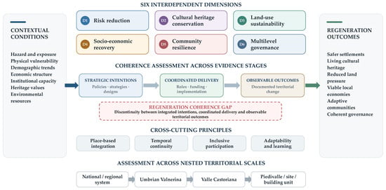
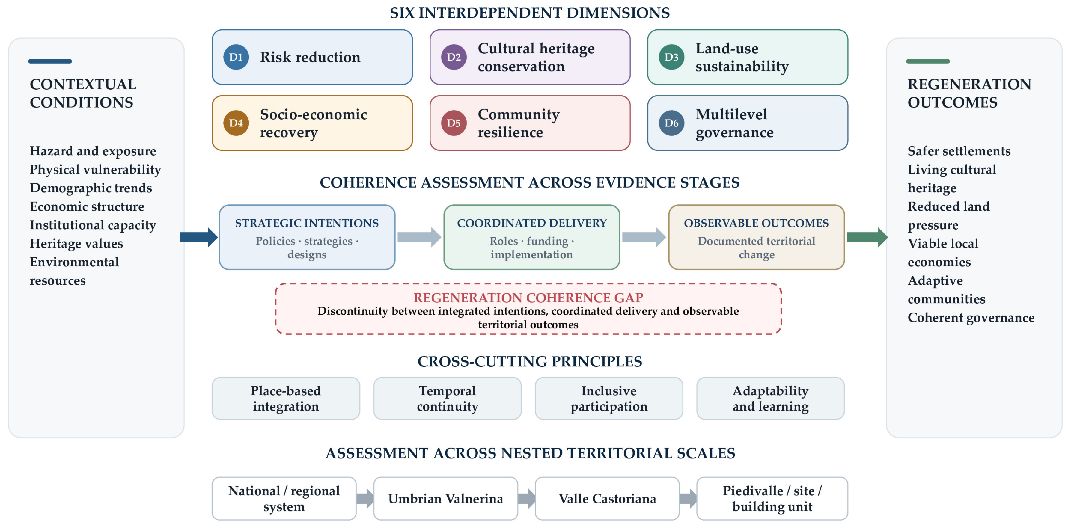
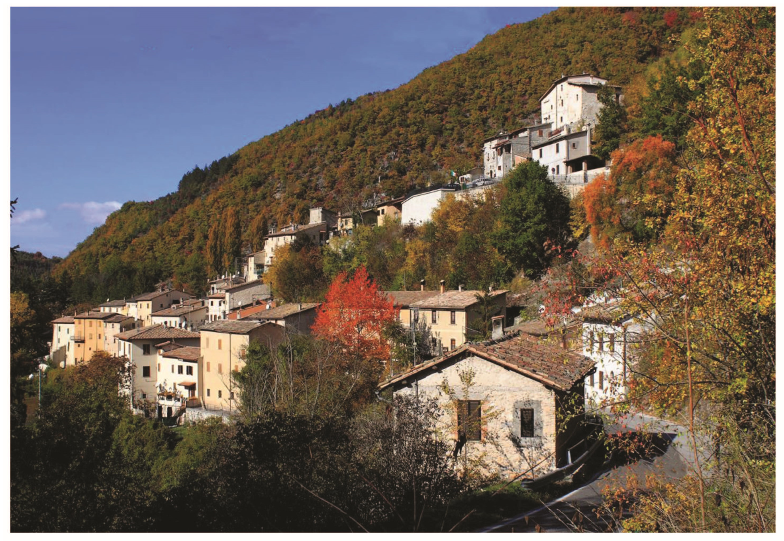
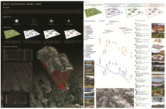
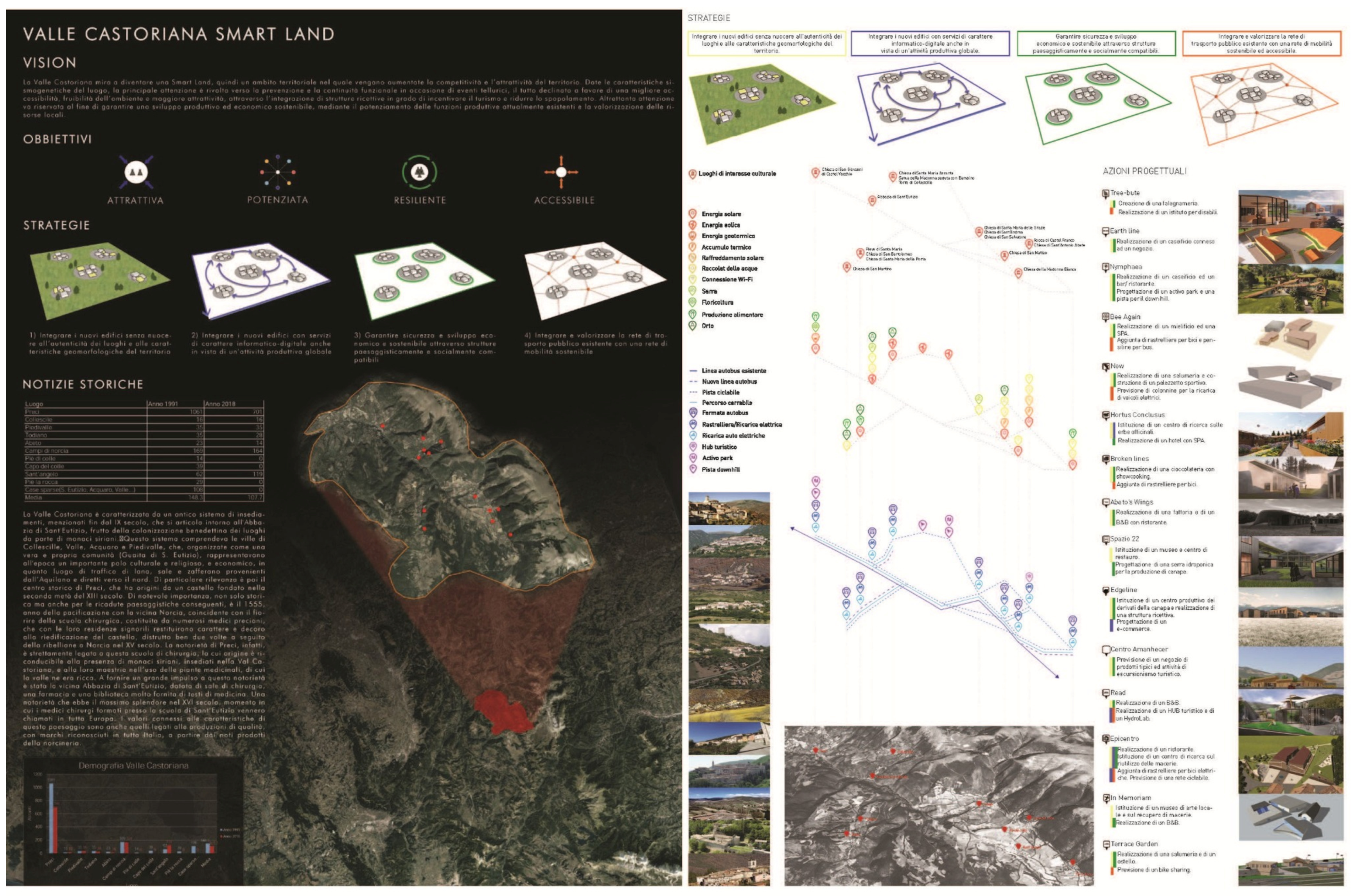
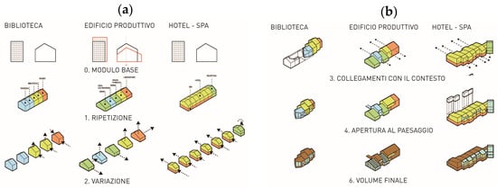
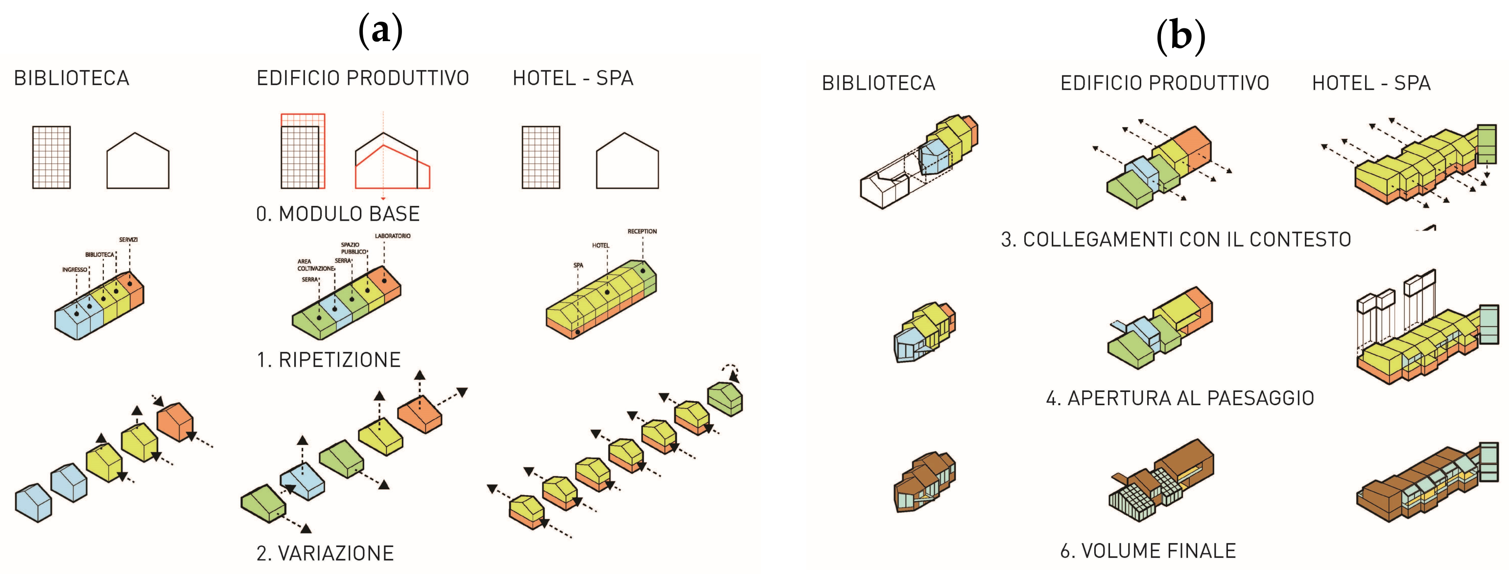
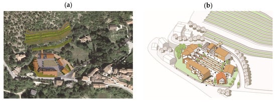
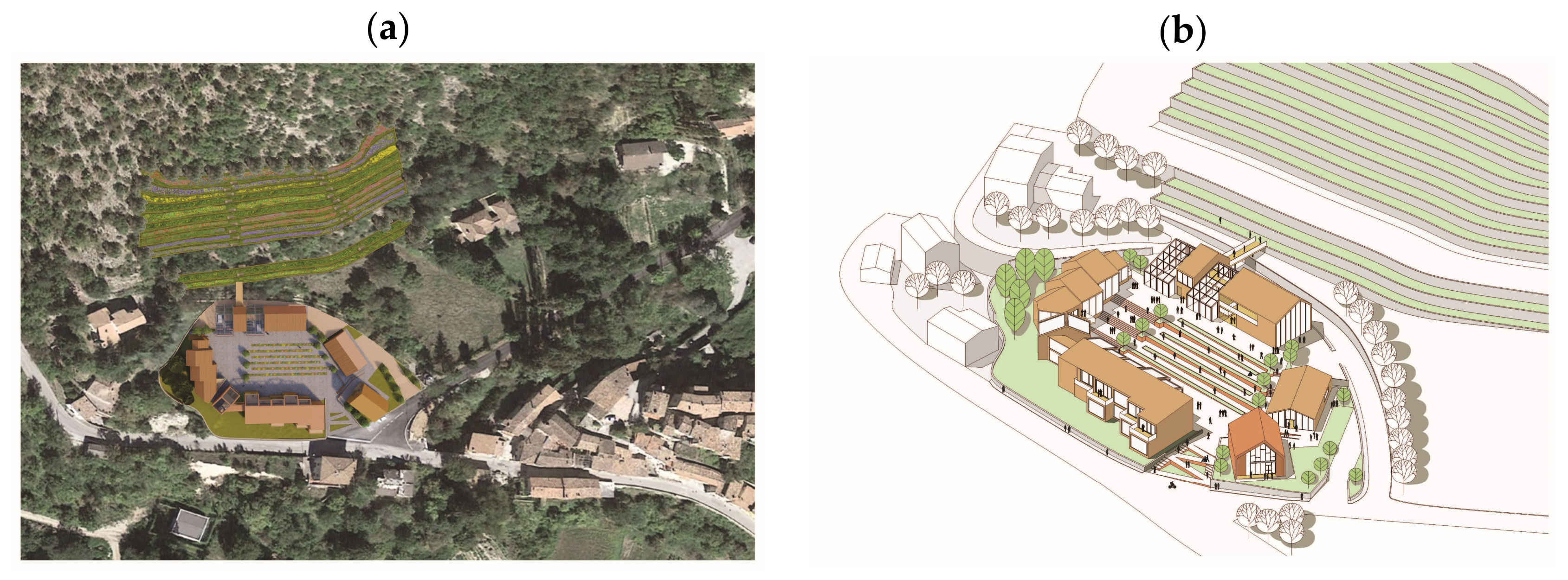
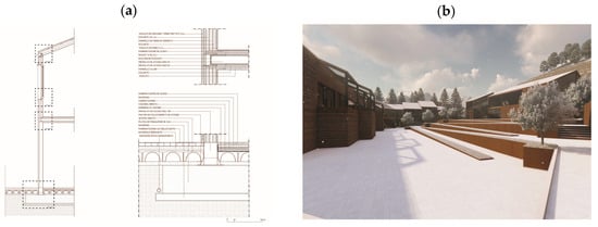
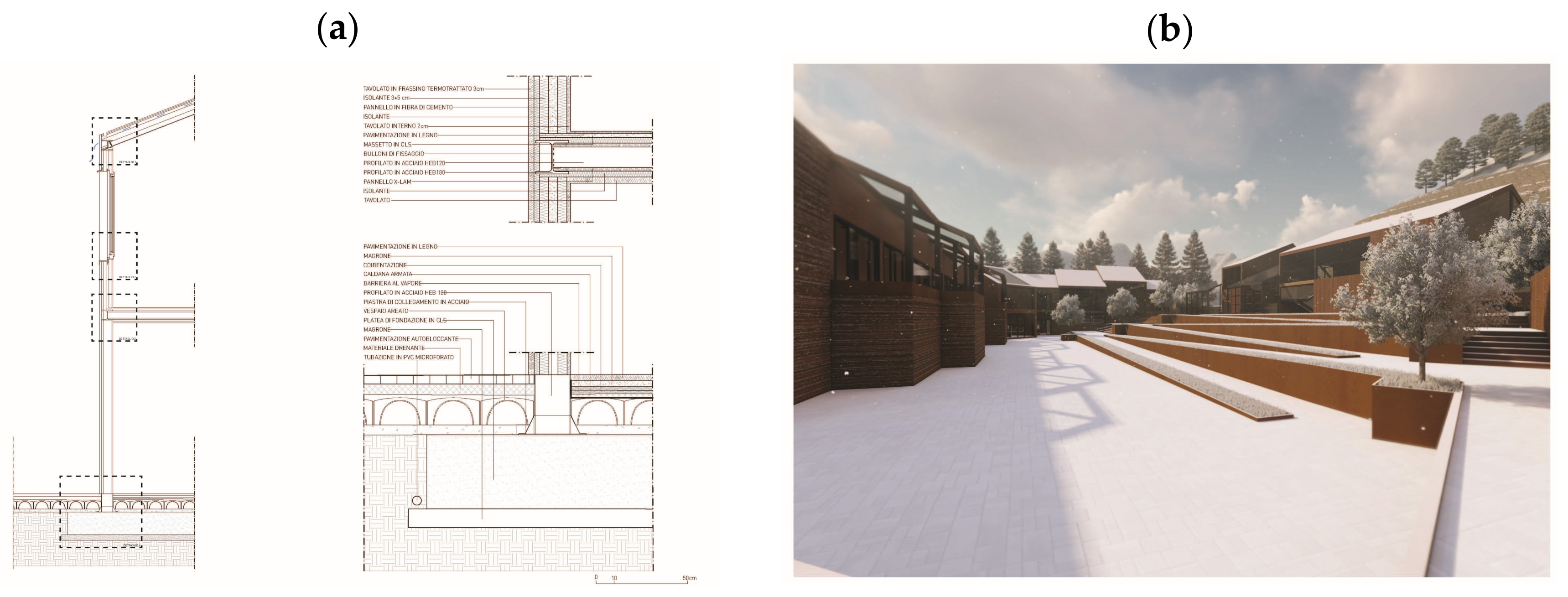

Disclaimer/Publisher’s Note: The statements, opinions and data contained in all publications are solely those of the individual author(s) and contributor(s) and not of MDPI and/or the editor(s). MDPI and/or the editor(s) disclaim responsibility for any injury to people or property resulting from any ideas, methods, instructions or products referred to in the content. |
© 2026 by the authors. Licensee MDPI, Basel, Switzerland. This article is an open access article distributed under the terms and conditions of the Creative Commons Attribution (CC BY) license.