Drones for Wildfire and Prescribed Fire Science

A special issue of Drones (ISSN 2504-446X).

Deadline for manuscript submissions: 31 December 2024 | Viewed by 16259

Special Issue Editors


E-Mail Website
Guest Editor
Office of Research and Development, U.S. Environmental Protection Agency, Research Triangle Park, Durham, NC, USA
Interests: aerial emission sampling; UAS; forest fires; oil fires; detonations

E-Mail Website
Guest Editor
Office of Research and Development, U.S. Environmental Protection Agency, Research Triangle Park, Durham, NC, USA
Interests: aerial emission sampling; UAS; forest fires; oil fires; detonations; stack sampling; gas chromatography

E-Mail Website
Guest Editor
Director of ACCELIGENCE Ltd., Nicosia, Cyprus
Interests: UAV design; computational fluid dynamics (CFD); embedded processing; wireless communication; firefighting; reforestation

E-Mail Website
Guest Editor
Cartographic and Land Engineering Department, Higher Polytechnic School of Avila, University of Salamanca, Hornos Caleros, 50 05003 Avila, Spain
Interests: photogrammetry; laser scanning; 3D modeling; topography; cartography
Special Issues, Collections and Topics in MDPI journals

E-Mail Website
Guest Editor Assistant
Director of ACCELIGENCE HELLAS Ltd. (Manufacturing Branch), Argiroupoli, Greece
Interests: UAV design; computational fluid dynamics (CFD); embedded processing; wireless communication; firefighting; reforestation

Special Issue Information

Dear Colleagues,

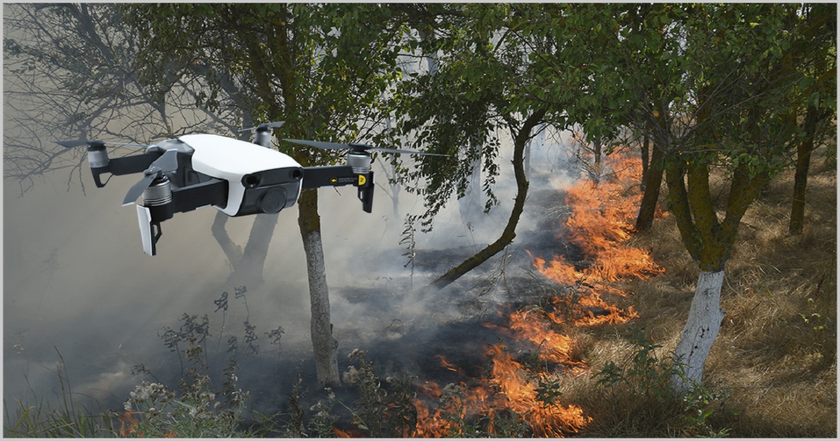
The use of unmanned aircraft systems (UASs, drones) for research and operations on wildland fires has been rapidly accelerated by developments in aircraft systems, sensors, telemetry, circuitry, and computers. UASs can be used for safety reasons to spot potential flare ups or maintain positional the awareness of crew members, support fire-fighting efforts through release of fire suppressants, take meteorological measurements in support of plume dispersion calculations and downwind population hazards, characterize vegetation both pre- and post-burn, understand fire dynamics, engage in spot ignitions, and sample emissions to characterize smoke hazards. The 3D positional flexibility, system portability, night time capability, and real time telemetry of drones provide on-scene incident responders with valuable information to aid their decision making. Recent advances in instantaneous, in-flight analyses provided by edge computation using 5G/6G networks will be crucial for generating products that can support the response stage and fire management decisions.

The goal of this Special Issue is to collect original research articles and review papers that provide insights into the growing use of UASs as an essential tool in wildland fire management.

The articles and review papers submitted must clearly and directly address topics related to unmanned platforms, such as UASs, as well as related technologies and applications in wildland fire management, covering any of the main steps in wildfires: prevention, response, restoration. The papers and review papers submitted must contribute with new and innovative insights, methods, or technologies to the field of UAS in wildland fire management.

This Special Issue will welcome manuscripts that link the use of UAS to the following wildland fire themes:

  • Firefighter safety;
  • Fire management and control;
  • Characterization of fire dynamics;
  • Plume dispersion;
  • Detection of downwind population risks;
  • Characterization of fire emissions;
  • Meteorological measurements;
  • Detailed forest mapping;
  • Edge computing and the generation of cartographic products on the fly;
  • Detection and tracking of elements (e.g., people, animals, vehicles, etc.).

We look forward to receiving your original research articles and review papers.

Dr. Brian K. Gullett
Dr. Johanna Aurell
Dr. Pantelis Velanas
Prof. Dr. Diego González-Aguilera
Guest Editors

Katerina Margariti
Guest Editor Assistant

Manuscript Submission Information

Manuscripts should be submitted online at www.mdpi.com by registering and logging in to this website. Once you are registered, click here to go to the submission form. Manuscripts can be submitted until the deadline. All submissions that pass pre-check are peer-reviewed. Accepted papers will be published continuously in the journal (as soon as accepted) and will be listed together on the special issue website. Research articles, review articles as well as short communications are invited. For planned papers, a title and short abstract (about 100 words) can be sent to the Editorial Office for announcement on this website.

Submitted manuscripts should not have been published previously, nor be under consideration for publication elsewhere (except conference proceedings papers). All manuscripts are thoroughly refereed through a single-blind peer-review process. A guide for authors and other relevant information for submission of manuscripts is available on the Instructions for Authors page. Drones is an international peer-reviewed open access monthly journal published by MDPI.

Please visit the Instructions for Authors page before submitting a manuscript. The Article Processing Charge (APC) for publication in this open access journal is 2600 CHF (Swiss Francs). Submitted papers should be well formatted and use good English. Authors may use MDPI's English editing service prior to publication or during author revisions.

Keywords

  • unmanned aircraft systems
  • drones
  • wildland fire
  • fire dynamics
  • sensors
  • firefighter safety
  • plume dispersion
  • meteorological measurements
  • fire emissions
  • exposure risk
  • fire prevention
  • fire response
  • fire restoration

Benefits of Publishing in a Special Issue

  • Ease of navigation: Grouping papers by topic helps scholars navigate broad scope journals more efficiently.
  • Greater discoverability: Special Issues support the reach and impact of scientific research. Articles in Special Issues are more discoverable and cited more frequently.
  • Expansion of research network: Special Issues facilitate connections among authors, fostering scientific collaborations.
  • External promotion: Articles in Special Issues are often promoted through the journal's social media, increasing their visibility.
  • e-Book format: Special Issues with more than 10 articles can be published as dedicated e-books, ensuring wide and rapid dissemination.

Further information on MDPI's Special Issue polices can be found here.

Published Papers (6 papers)

Order results
Result details
Select all
Export citation of selected articles as:

Research

24 pages, 14165 KiB  
Article
Real-Time Fire Detection: Integrating Lightweight Deep Learning Models on Drones with Edge Computing
by Md Fahim Shahoriar Titu, Mahir Afser Pavel, Goh Kah Ong Michael, Hisham Babar, Umama Aman and Riasat Khan
Drones 2024, 8(9), 483; https://doi.org/10.3390/drones8090483 - 13 Sep 2024
Cited by 3 | Viewed by 3057
Abstract
Fire accidents are life-threatening catastrophes leading to losses of life, financial damage, climate change, and ecological destruction. Promptly and efficiently detecting and extinguishing fires is essential to reduce the loss of lives and damage. This study uses drone, edge computing, and artificial intelligence [...] Read more.
Fire accidents are life-threatening catastrophes leading to losses of life, financial damage, climate change, and ecological destruction. Promptly and efficiently detecting and extinguishing fires is essential to reduce the loss of lives and damage. This study uses drone, edge computing, and artificial intelligence (AI) techniques, presenting novel methods for real-time fire detection. This proposed work utilizes a comprehensive dataset of 7187 fire images and advanced deep learning models, e.g., Detection Transformer (DETR), Detectron2, You Only Look Once YOLOv8, and Autodistill-based knowledge distillation techniques to improve the model performance. The knowledge distillation approach has been implemented with the YOLOv8m (medium) as the teacher (base) model. The distilled (student) frameworks are developed employing the YOLOv8n (Nano) and DETR techniques. The YOLOv8n attains the best performance with 95.21% detection accuracy and 0.985 F1 score. A powerful hardware setup, including a Raspberry Pi 5 microcontroller, Pi camera module 3, and a DJI F450 custom-built drone, has been constructed. The distilled YOLOv8n model has been deployed in the proposed hardware setup for real-time fire identification. The YOLOv8n model achieves 89.23% accuracy and an approximate frame rate of 8 for the conducted live experiments. Integrating deep learning techniques with drone and edge devices demonstrates the proposed system’s effectiveness and potential for practical applications in fire hazard mitigation. Full article
(This article belongs to the Special Issue Drones for Wildfire and Prescribed Fire Science)
Show Figures

Figure 1

26 pages, 6917 KiB  
Article
Tiny-Object Detection Based on Optimized YOLO-CSQ for Accurate Drone Detection in Wildfire Scenarios
by Tian Luan, Shixiong Zhou, Lifeng Liu and Weijun Pan
Drones 2024, 8(9), 454; https://doi.org/10.3390/drones8090454 - 2 Sep 2024
Cited by 2 | Viewed by 1992
Abstract
Wildfires, which are distinguished by their destructive nature and challenging suppression, present a significant threat to ecological environments and socioeconomic systems. In order to address this issue, the development of efficient and accurate fire detection technologies for early warning and timely response is [...] Read more.
Wildfires, which are distinguished by their destructive nature and challenging suppression, present a significant threat to ecological environments and socioeconomic systems. In order to address this issue, the development of efficient and accurate fire detection technologies for early warning and timely response is essential. This paper addresses the complexity of forest and mountain fire detection by proposing YOLO-CSQ, a drone-based fire detection method built upon an improved YOLOv8 algorithm. Firstly, we introduce the CBAM attention mechanism, which enhances the model’s multi-scale fire feature extraction capabilities by adaptively adjusting weights in both the channel and spatial dimensions of feature maps, thereby improving detection accuracy. Secondly, we propose an improved ShuffleNetV2 backbone network structure, which significantly reduces the model’s parameter count and computational complexity while maintaining feature extraction capabilities. This results in a more lightweight and efficient model. Thirdly, to address the challenges of varying fire scales and numerous weak emission targets in mountain fires, we propose a Quadrupled-ASFF detection head for weighted feature fusion. This enhances the model’s robustness in detecting targets of different scales. Finally, we introduce the WIoU loss function to replace the traditional CIoU object detection loss function, thereby enhancing the model’s localization accuracy. The experimental results demonstrate that the improved model achieves an mAP@50 of 96.87%, which is superior to the original YOLOV8, YOLOV9, and YOLOV10 by 10.9, 11.66, and 13.33 percentage points, respectively. Moreover, it exhibits significant advantages over other classic algorithms in key evaluation metrics such as precision, recall, and F1 score. These findings validate the effectiveness of the improved model in mountain fire detection scenarios, offering a novel solution for early warning and intelligent monitoring of mountain wildfires. Full article
(This article belongs to the Special Issue Drones for Wildfire and Prescribed Fire Science)
Show Figures

Figure 1

36 pages, 20585 KiB  
Article
A Novel Drone Design Based on a Reconfigurable Unmanned Aerial Vehicle for Wildfire Management
by Dimitris Perikleous, George Koustas, Spyros Velanas, Katerina Margariti, Pantelis Velanas and Diego Gonzalez-Aguilera
Drones 2024, 8(5), 203; https://doi.org/10.3390/drones8050203 - 16 May 2024
Cited by 2 | Viewed by 2472
Abstract
Our study introduces a new approach, leveraging robotics technology and remote sensing for multifaceted applications in forest and wildfire management. Presented in this paper is PULSAR, an innovative UAV with reconfigurable capabilities, able of operating as a quadcopter, a co-axial quadcopter, and a [...] Read more.
Our study introduces a new approach, leveraging robotics technology and remote sensing for multifaceted applications in forest and wildfire management. Presented in this paper is PULSAR, an innovative UAV with reconfigurable capabilities, able of operating as a quadcopter, a co-axial quadcopter, and a standalone octocopter. Tailored to diverse operational requirements, PULSAR accommodates multiple payloads, showcasing its adaptability and versatility. This paper meticulously details material selection and design methods, encompassing both initial and detailed design, while the electronics design section seamlessly integrates essential avionic components. The 3D drone layout design, accomplished using SOLIDWORKS, enhances understanding by showcasing all three different configurations of PULSAR’s structure. Serving a dual purpose, this study highlights UAV applications in forest and wildfire management, particularly in detailed forest mapping, edge computing, and cartographic product generation, as well as detection and tracking of elements, illustrating how a UAV can be a valuable tool. Following the analysis of applications, this paper presents the selection and integration of payloads onto the UAV. Simultaneously, each of the three distinct UAV configurations is matched with a specific forest application, ensuring optimal performance and efficiency. Lastly, computational validation of the UAV’s main components’ structural integrity is achieved through finite element analysis (FEA), affirming the absence of issues regarding stress and displacement. In conclusion, this research underscores the efficacy of PULSAR, marking a significant leap forward in applying robotics technology for wildfire science. Full article
(This article belongs to the Special Issue Drones for Wildfire and Prescribed Fire Science)
Show Figures

Figure 1

16 pages, 2675 KiB  
Article
Superpixel-Based Graph Convolutional Network for UAV Forest Fire Image Segmentation
by Yunjie Mu, Liyuan Ou, Wenjing Chen, Tao Liu and Demin Gao
Drones 2024, 8(4), 142; https://doi.org/10.3390/drones8040142 - 3 Apr 2024
Cited by 1 | Viewed by 1723
Abstract
Given the escalating frequency and severity of global forest fires, it is imperative to develop advanced detection and segmentation technologies to mitigate their impact. To address the challenges of these technologies, the development of deep learning-based forest fire surveillance has significantly accelerated. Nevertheless, [...] Read more.
Given the escalating frequency and severity of global forest fires, it is imperative to develop advanced detection and segmentation technologies to mitigate their impact. To address the challenges of these technologies, the development of deep learning-based forest fire surveillance has significantly accelerated. Nevertheless, the integration of graph convolutional networks (GCNs) in forest fire detection remains relatively underexplored. In this context, we introduce a novel superpixel-based graph convolutional network (SCGCN) for forest fire image segmentation. Our proposed method utilizes superpixels to transform images into a graph structure, thereby reinterpreting the image segmentation challenge as a node classification task. Additionally, we transition the spatial graph convolution operation to a GraphSAGE graph convolution mechanism, mitigating the class imbalance issue and enhancing the network’s versatility. We incorporate an innovative loss function to contend with the inconsistencies in pixel dimensions within superpixel clusters. The efficacy of our technique is validated on two different forest fire datasets, demonstrating superior performance compared to four alternative segmentation methodologies. Full article
(This article belongs to the Special Issue Drones for Wildfire and Prescribed Fire Science)
Show Figures

Figure 1

15 pages, 6798 KiB  
Article
Effects of UAS Rotor Wash on Air Quality Measurements
by Johanna Aurell and Brian K. Gullett
Drones 2024, 8(3), 73; https://doi.org/10.3390/drones8030073 - 21 Feb 2024
Cited by 1 | Viewed by 1943
Abstract
Laboratory and field tests examined the potential for unmanned aircraft system (UAS) rotor wash effects on gas and particle measurements from a biomass combustion source. Tests compared simultaneous placement of two sets of CO and CO2 gas sensors and PM2.5 instruments [...] Read more.
Laboratory and field tests examined the potential for unmanned aircraft system (UAS) rotor wash effects on gas and particle measurements from a biomass combustion source. Tests compared simultaneous placement of two sets of CO and CO2 gas sensors and PM2.5 instruments on a UAS body and on a vertical or horizontal extension arm beyond the rotors. For 1 Hz temporal concentration comparisons, correlations of body versus arm placement for the PM2.5 particle sensors yielded R2 = 0.85, and for both gas sensor pairs, exceeded an R2 of 0.90. Increasing the timestep to 10 s average concentrations throughout the burns improved the R2 value for the PM2.5 to 0.95 from 0.85. Finally, comparison of the whole-test average concentrations further increased the correlations between body- and arm-mounted sensors, exceeding an R2 of 0.98 for both gases and particle measurements. Evaluation of PM2.5 emission factors with single-factor ANOVA analyses showed no significant differences between the values derived from the arm, either vertical or horizontal, and those from the body. These results suggest that rotor wash effects on body- and arm-mounted sensors are minimal in scenarios where short-duration, time-averaged concentrations are used to calculate emission factors and whole-area flux values. Full article
(This article belongs to the Special Issue Drones for Wildfire and Prescribed Fire Science)
Show Figures

Figure 1

19 pages, 7435 KiB  
Article
Advancing Forest Fire Risk Evaluation: An Integrated Framework for Visualizing Area-Specific Forest Fire Risks Using UAV Imagery, Object Detection and Color Mapping Techniques
by Michal Aibin, Yuanxi Li, Rohan Sharma, Junyan Ling, Jiannan Ye, Jianming Lu, Jiesi Zhang, Lino Coria, Xingguo Huang, Zhiyuan Yang, Lili Ke and Panhaoqi Zou
Drones 2024, 8(2), 39; https://doi.org/10.3390/drones8020039 - 29 Jan 2024
Cited by 3 | Viewed by 3397
Abstract
Forest fires have significant implications for the Earth’s ecological balance, causing widespread devastation and posing formidable challenges for containment once they propagate. The development of computer vision methods holds promise in facilitating the timely identification of forest fire risks, thereby preventing potential economic [...] Read more.
Forest fires have significant implications for the Earth’s ecological balance, causing widespread devastation and posing formidable challenges for containment once they propagate. The development of computer vision methods holds promise in facilitating the timely identification of forest fire risks, thereby preventing potential economic losses. In our study conducted in various regions in British Columbia, we utilized image data captured by unmanned aerial vehicles (UAVs) and computer vision methods to detect various types of trees, including alive trees, debris (logs on the ground), beetle- and fire-impacted trees, and dead trees that pose a risk of a forest fire. We then designed and implemented a novel sliding window technique to process large forest areas as georeferenced orthogonal maps. The model demonstrates proficiency in identifying various tree types, excelling in detecting healthy trees with precision and recall scores of 0.904 and 0.848, respectively. Its effectiveness in recognizing trees killed by beetles is somewhat limited, likely due to the smaller number of examples available in the dataset. After the tree types are detected, we generate color maps, indicating different fire risks to provide a new tool for fire managers to assess and implement prevention strategies. This study stands out for its integration of UAV technology and computer vision in forest fire risk assessment, marking a significant step forward in ecological protection and sustainable forest management. Full article
(This article belongs to the Special Issue Drones for Wildfire and Prescribed Fire Science)
Show Figures

Figure 1

Back to TopTop