


Abstract
The paper presents a methodological framework for the integration, semantic organization and web-based dissemination of heterogeneous 3D archeological datasets. In particular, the study investigates strategies for model optimization, interoperability, multilevel information architecture and scientific visualization of complex archeological sites. The research builds upon an analysis of current workflows for 3D data acquisition, optimization, and dissemination, as well as a critical assessment of existing approaches to digital heritage communication. The proposed workflow supports the integration of datasets acquired at different spatial scales, from urban contexts to architectural elements and individual artifacts, enabling semantic correlation between geometric data and interpretative content. Alongside the technical aspects of model optimization, interoperability and web-based visualization, the research also examines the transmission of tangible and intangible cultural values during the transition from the physical environment to the digital domain. These technical and theoretical aspects are treated as complementary dimensions of a single methodological framework, ensuring consistency of the project in terms of data processing, accessibility, scientific rigor, and heritage interpretation. The workflow proposed is applied to the specific case of the walls of Pompeii, where the complex physical reality of the archeological site is accompanied by intangible characteristics, such as ancient techniques of warfare and siege. Using 3D models created during previous phases of the SCORPiò-NIDI project, the resulting web-based system provides layered access to information, facilitating both scientific analysis and dissemination activities while maintaining traceability of sources and clarity between acquired data and reconstructed hypotheses. The proposed framework contributes to current research on structured digital environments for Cultural Heritage and offers transferable methodologies for the management and dissemination of complex archeological datasets.
1. Introduction
Over the last two decades, the digital heritage sector has progressively redefined the epistemological and operational paradigms relating to the documentation, analysis and dissemination of Cultural Heritage (CH). The introduction and dissemination of methodologies and workflows based on the acquisition of digital data through the documentation of reality (in particular, terrestrial laser scanning and digital photogrammetry) allows the creation of digital twins with a very high degree of geometric, morphological, and rendering accuracy of artifacts. At the same time, the development of web platforms, immersive environments and three-dimensional information systems has expanded the possibilities for data use and consultation, facilitating remote access, multilevel navigation and the integration of heterogeneous content.
In this broader context, the digitization of CH concerns not only the capture of physical characteristics, but also the organization and communication of the information associated with them. Whilst physical characteristics are displayed directly, historical, cultural and contextual information requires additional strategies capable of linking geometric data to semantic content. This issue has been extensively discussed in studies on Intangible Cultural Heritage (ICH) [1,2,3,4], where value-based approaches have highlighted the challenges associated with transferring cultural meanings into digital environments. From this perspective, the transposition of CH is understood as a process involving not only technical operations of acquisition and modeling, but also the structuring of information and interpretation. Consequently, 3D models are the central components of information systems capable of integrating heterogeneous datasets and supporting various levels of analysis, interpretation, and dissemination. In this sense, the aim of the research is not to produce 3D models—already created in previous phases of the SCORPiò-NIDI project—but to define a methodological framework for their integration, optimization, semantic organization, and web-based dissemination in a structured digital environment. Particular attention is devoted to interoperability between heterogeneous datasets, multilevel information architecture, and scientific visualization strategies capable of supporting both analysis and dissemination activities. The 3D model is understood here not as a mere visual output, but as the central element of an information system that enables the correlation of geometric, historical, archeological, and interpretative data across different spatial scales.
Through a case study of the Pompeii city walls, the research proposes a workflow for the management and dissemination of 3D content of complex archeological sites, contributing to current discussions on web-based platforms used for the organization of structured digital environments for the scientific investigation and dissemination of tangible and intangible CH.
2. State of the Art on Dissemination Techniques
The growing use in recent decades of technologies and methodologies for acquiring digital data, such as terrestrial laser scanning (TLS) and digital photogrammetry [5,6], has enabled the use of reality-based 3D models of Cultural Heritage (CH), not only for study or conservation, but also for dissemination [7,8,9,10]. The high quality and accuracy achievable with 3D models facilitate online visualization and accessibility. Today, the use of 3D models for dissemination is widespread, with the growing contribution of international institutions that finance dedicated projects and create service networks to offer the possibility of using 3D models even to small museums and cultural sites [11]. The demand for digital products for study and dissemination is accompanied by necessary differences in the outputs produced, which lie mainly in the ways in which digital data is processed and optimized. In fact, acquisition techniques and methodologies allow us to obtain initial raw data in the form of point clouds and a first high-detail mesh derived from the triangulation of points, automatic or semi-automatic processes offered by most point cloud management and 3D modeling software. This model, which we can call Master, does not yet represent a digital twin of the cultural asset, since the latter is a real information system that integrates geometric, semantic, historical, and environmental data. However, starting from the Master model, the data can be further processed to make the models suitable for different study and dissemination purposes.
In general, we can distinguish between macro-categories of model uses and their characteristics: for display on online platforms and in applications (both serious games and Extended Reality), models must be optimized to allow real-time display, often online, and must therefore have few polygons to facilitate real-time rendering, but include maps for restoring surface and apparent detail.
Online visualization is applied to museum collections, buildings, and entire sites. Among the most widely used platforms is SketchfabTM [12] based on WebGL interfaces, which allow models to be viewed directly in the browser without the need for external software. Another platform is 3DHop, which, by breaking the model down into blocks, allows progressive loading by parts, enabling even heavy models to be viewed quickly [13,14].
In recent years, the use of 3D models has also become widespread in educational applications and video games developed with graphics and gaming engines [15], to create immersive environments that integrate playful dynamics and, in some cases, Extended Reality, to increase engagement and comprehension of tangible and intangible CH [16,17,18,19,20,21,22,23,24].
The combination of more than one methodology in the use of 3D models for dissemination helps balance the appeal of video game applications with the scientific nature of the content and makes the model available for specific study purposes by scholars [25,26].
The level of detail and development (LOD) of the 3D models used for the study or for specialized intervention operations [27] varies when referring to geometric detail and appearance detail, and depends on the specific project. It is possible to have multiple models with different levels of development and detail, with great geometric detail for data extraction, for example for documentation and 2D graphic rendering, or for specific analyses, and others that are semantically subdivided and simplified to serve as a digital reference in 3D-centered information systems for data entry [28,29,30]. In models reconstructing buildings that no longer exist or were never built, or in virtual anastylosis, created both as a study tool and for dissemination, the level of detail may vary and depend on the amount of information available [31,32,33,34].
Finally, physical reproduction from 3D models, derived from industrial prototyping, is now a technique widely applied to CH. In this case, the mesh must maintain surface detail, adapting to the print scale, and be free of topological errors in the arrangement of faces and closed (waterproof). The quality of the result depends on the print resolution and the materials used. For CH, the choice of techniques and materials varies according to the purpose. For research and conservation purposes [35], 3D printing is used to create replicas to be displayed in place of the originals for conservation reasons, or to print missing parts to be integrated during restoration work, and for dissemination purposes, with the increasingly frequent inclusion of tactile copies of works of art in museums or the reproduction of buildings that have disappeared or are inaccessible, which improve understanding and accessibility, particularly for blind or visually impaired people. The advantages of using 3D models of CH for dissemination via 3D printing include reduced time compared to manual production, high geometric accuracy for complex shapes, replicability at different scales, and no direct contact with the original during data acquisition when using digital technologies.
Table 1 summarizes the main uses of 3D models for study and dissemination purposes. The last column lists the key technical characteristics that models must possess to meet the requirements of their intended use. The LOD level is divided into geometric and texture to indicate the extent to which the model must accurately reflect geometric reality (e.g., for restoration purposes) and the extent to which it can be simplified to facilitate smooth online viewing, while maintaining a higher level of appearance detail through texture maps. The LOI indicates the levels of information contained in the model or its elements when semantically divided, as well as the accessibility of that information (e.g., view-only access or the ability to run specific queries). Semantic subdivision refers to the decomposition of the model into meaningful entities that can be individually associated with metadata, documentation, interpretative content, or analytical queries. The levels are only labeled “low,” “medium,” and “high” because they may vary depending on the specific project of each category.
Table 1.
Possible uses of 3D models for dissemination and study purposes.
3. Methodological Premises
3.1. The Theory of the Three Environments
The growing use of digital technologies for the documentation and dissemination of Cultural Heritage (CH) requires methodological frameworks capable of guiding the proper translation of cultural assets from the physical world to digital environments. In this context, the Theory of the Three Environments proposed by Echeverría in 1999 [36] provides a useful conceptual model for interpreting the relationships between material evidence, cultural meaning, and digital representation.
According to this theory, it is possible to identify three distinct yet interconnected environments. The first environment (E1) corresponds to the physical world and comprises material objects. The second environment (E2) corresponds to the social and cultural sphere, where CH acquires meaning through collective memory, interpretation, and cultural recognition. The third environment (E3) is the digital and virtual context [36].
When applied to CH, this framework highlights that heritage is not limited to its physical dimension. Cultural assets originate as material entities in E1, while their historical, symbolic, and social significance is constructed within E2. Through surveying, modeling, and digitization processes, both dimensions are transferred to E3, where they become digital resources that can be visualized, analyzed, and disseminated through different technological platforms.
From a technical standpoint, therefore, the transfer of CH to E3 cannot be limited to the mere production of geometric models, since the information pertaining to E2 requires further processes of semantic organization and information structuring. This aspect is particularly relevant in the case of Intangible Cultural Heritage (ICH), where cultural meanings, practices, knowledge and social values cannot be directly captured through geometric survey techniques and must instead be represented through associated documentation, metadata and interpretative content. Furthermore, the global accessibility of web-based systems introduces the risk of decontextualization, and digital content is characterized by technological dependency, platform obsolescence, and the continuous evolution of formats and interfaces [2,37].
It follows that the 3D model should not be considered merely as a visual representation of reality, but rather as the central element of a structured information system capable of integrating geometric data, historical documentation, archeological finds, and interpretive content. The Theory of the Three Environments thus provides a methodological framework for understanding how material evidence (E1), cultural interpretation (E2), and digital representation (E3) must be linked within a coherent system for scientific analysis and dissemination.
3.2. Guidelines and Strategies for Correct Transposition to the Digital Environment
The transition of Cultural Heritage from physical and social environments (E1 and E2) to the digital environment (E3) carries the risk of distortions in the transmission of information, particularly the gradual loss of scientific control over the information associated with digital representations. During the dissemination process, complex historical and archeological interpretations are often simplified to meet the needs of digital platforms and a non-specialist audience. This can lead to the loss of contextual information and reduce the transparency of the interpretive process.
A second issue is decontextualization, given that the E3 environment is globally accessible, regardless of the original physical and cultural contexts. Consequently, users may interact with isolated representations of artifacts, monuments, or archeological sites without understanding their relationships to the broader historical, spatial, and cultural framework.
A further challenge concerns the distinction between acquired data and interpretive content. Hypotheses regarding lost elements, past configurations, or functional interpretations are based on analytical reasoning, the results of which must remain clearly distinguishable to preserve scientific rigor and ensure the traceability of information sources.
The translation of CH into E3 is therefore not limited to the generation of geometric models but involves the creation of structured information systems in which geometric data is integrated with historical documentation, archeological evidence, metadata, and interpretive content. Semantic organization plays a fundamental role in this process, enabling the association of heterogeneous datasets with specific elements of the model and allowing for differentiated levels of access, visualization, and analysis.
Based on these considerations, four general methodological principles can be identified:
- Scientific traceability: All information associated with digital representations must be linked to verifiable sources and documentation.
- Distinction between empirical data and interpretation: Observed data and hypothetical reconstructions must remain explicitly distinguishable.
- Semantic consistency: Geometric entities, metadata, and associated documentation must be organized according to a coherent information structure.
- Preservation of context: Digital representations must maintain explicit relationships with the historical, archeological, and cultural contexts from which they derive.
These principles form the methodological foundation for the development of digital platforms capable of supporting both scientific research and public outreach.
3.3. Examples of Research on the Dissemination of Cultural Heritage
The methodological framework proposed in this research is based on previous experiences in the field of disseminating tangible and Intangible Cultural Heritage (ICH), where particular attention has been paid to the semantic organization of information, the preservation of interpretive consistency, and the integration of heterogeneous datasets within digital environments to promote accessibility and inclusivity in the understanding of CH [19,38].
An initial line of research focused on the dissemination of the ICH. The HERIVERSO project [24] aimed to transpose a religious festival into the digital environment, producing two educational and exploring mobile apps as outputs. The methodological process integrated the use of heterogeneous digital resources—such as images, videos, 360° media, and 3D representations—to compensate for the absence of tangible objects typical of ICH. These digital assets were employed not as isolated elements but as interconnected components within immersive and geolocated experiences, reinforcing the relationship between intangible practices and their territorial, social, and symbolic contexts. The research has made it possible to establish guidelines for the proper transposition of ICH to E3, highlighting the importance of maintaining source traceability, distinguishing between documented information and interpretive content, and structuring digital environments capable of preserving cultural meanings, while avoiding the reduction of the CH experience to mere recreational entertainment.
Further research conducted in the field of architectural and archeological heritage has explored the use of reality-based 3D models as components of structured information systems [19,33,38]. Particular attention has been devoted to linking geometric models with historical documentation, archival sources, interpretive reconstructions, and analytical data, enabling the integration of heterogeneous information within a coherent digital framework. These projects have also demonstrated the value of multilevel access strategies through the coexistence of different channels tailored to various user categories (panels containing text and images—basic level, QR codes for accessing detailed information or Extended Reality visualizations—intermediate level, and interactive screens with dedicated applications for reconstruction and specific queries—advanced level). Different categories of users can therefore access varying levels of information, ranging from summary views and exploration to detailed access to documentation, point clouds, reconstruction hypotheses, and analytical records for research and intervention activities [33,38].
The experiences gained in these previous projects form the methodological basis of this research, providing the definition of semantic relationships between datasets, the organization of multiscale information structures, and the integration of heterogeneous data within a digital environment designed for scientific analysis and dissemination.
3.4. Application of Methodological Guidelines to the Walls of Pompeii
In the case of the walls of Pompeii, the dissemination strategies proposed here consider the specific characteristics of the case study, the material available, the dissemination activities already underway, and possible future developments. The aim of the research is to construct a methodological framework capable of relating the three dimensions of heritage: the materiality of archaeological evidence (E1), the cultural dimension of historical practices (E2), and their representation in the digital environment (E3).
In the case of Pompeii city walls, E1 is represented by the set of material evidence relating to the city’s defensive system: on the one hand, the urban scale, documented by point clouds obtained using TLS, and on the other, the architectural scale of the walls, acquired through integrated TLS and digital photogrammetry techniques. Added to these are further material elements that are more specific yet of great interpretative relevance, such as spherical stone projectiles, reconstructions of war machines and traces of impact identifiable on the wall surfaces, which constitute direct evidence of the war dynamics that affected the defensive system throughout its history. All these elements, although belonging to the natural environment, are transformed through digital acquisition processes into computational datasets (point clouds, 3D meshes and reality-based models) that constitute the first level of transposition into the digital environment (E3).
Parallel to the material dimension is that of intangible heritage (E2), represented in this case by historical warfare practices and technical knowledge relating to the use of siege weapons and defensive strategies, particularly referring to the siege conducted by Sulla in 89 BC. Such knowledge does not manifest itself directly in the form of objects, but survives through historical sources, technical treatises, traditions of experimental archaeology and interpretations by scholars, constituting a cultural and interpretative dimension that cannot be documented through simple geometric acquisition procedures.
The integration of information relating to ICH involves the construction of interpretative scenarios that allow material objects to be linked to the historical practices that produced or used them. Reconstructions of weapons and war machines, for example, represent hypotheses based on archaeological sources, historical treatises and experimental verifications, as demonstrated by the activities carried out in the SCORPiò-NIDI project. In this sense, the digital model becomes a space of convergence between empirical data and scientific interpretation, allowing material evidence, technical knowledge and historical dynamics to be linked within a single information system.
3.5. 3D Datasets Integration in the Web-Based System
As summarized in the Section 2, the technical characteristics that the 3D models comprising the dataset must possess depend on the purpose of the specific project, the intended use of the elements that make up the dataset, and the software or web-based application used for visualization.
The case study is characterized by the availability of heterogeneous digital resources produced during different phases of the SCORPiò-NIDI project [39,40,41,42,43]. These datasets include urban-scale 3D models of the archeological site, detailed photogrammetric surveys of selected sectors of the city walls, high-resolution models of stone projectiles, digital reconstructions of siege machines, historical documentation, archeological records, and interpretative materials. Since the datasets were generated through different acquisition and modeling workflows, their integration into a single web-based environment required the definition of a structured methodology.
The first phase consisted of the assessment and classification of the available resources according to their scale, geometric complexity, information content, and intended use. Three principal levels were identified: territorial scale, architectural scale, and object scale. This multiscale organization was adopted to preserve the relationships between the defensive system of Pompeii, individual sectors of the walls, and the archaeological evidence associated with military activities.
A second phase concerned the preparation of the 3D datasets for web visualization. The original models presented significant differences in geometric resolution, texture quality, and file size. Direct publication of the source models would have generated excessive computational requirements and unacceptable loading times. Consequently, a preprocessing workflow was implemented involving mesh optimization, topology verification, texture adaptation, and conversion to interoperable formats suitable for real-time visualization through web browsers. The models used in the sample scene were provided by the other researchers of the project in .obj format. The section of wall used is approximately 118 linear meters long. To keep the dataset more manageable, it has been divided into three models, while maintaining the relative coordinates: left section: length 39.4 m; average height 4.5 m; 250k polygons; file size 25 MB; central tower: side length 7.5 m; height 13.4 m; 231k polygons; size 22.7 MB; right section: length 71.2 m; average height 3.8 m; 250k polygons; size 25.1 MB. The detailed model of the cavity left by the projectile is 0.25 m × 0.2 m × 0.15 m, has 135k polygons, and a 15 MB file size. The geometric detail is therefore much higher than that of the wall models.
In fact, optimization strategies were calibrated according to the role of each dataset within the information system. Large-scale models representing extensive portions of the analyzed part of the wall underwent higher levels of geometric simplification to facilitate navigation and reduce loading times. Conversely, models intended to support archeological interpretation, such as stone projectiles, impact traces, and selected architectural details, retained higher geometric resolution to preserve morphologically significant features. Texture maps were used to maintain visual fidelity while reducing geometric complexity whenever appropriate. Standardized metadata structures were associated with each dataset to facilitate information retrieval and maintain consistency throughout the platform.
Once the models had been optimized for web display according to the level of information and detail required for each, we moved on to the final phase: ensuring the models were compatible with the chosen platform, ATON v2026 [44]. This is an open-source platform specifically developed for the creation and dissemination of Web3D and WebXR applications for CH. The framework supports the online publication of interactive 3D environments accessible from desktop computers, mobile devices, and immersive Virtual Reality systems through standard web browsers, without requiring the installation of dedicated software. The framework is based on the separation of digital assets and scenes. 3D models, panoramas, multimedia assets, and other digital content are stored as elements that can be used across multiple scenes simultaneously, without the need to load all the models for each individual scene every time.
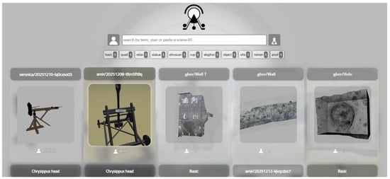
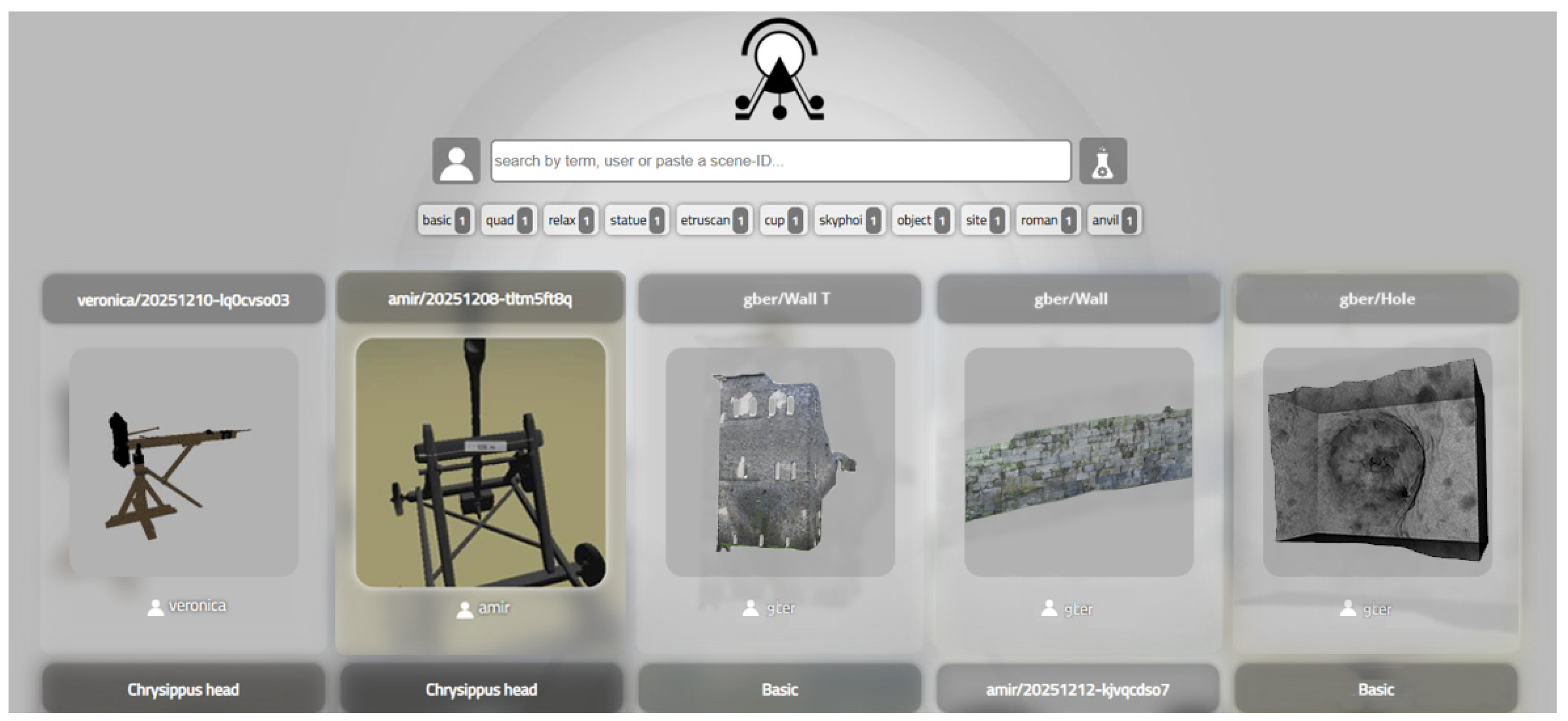
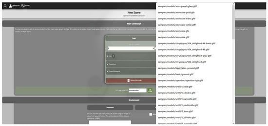
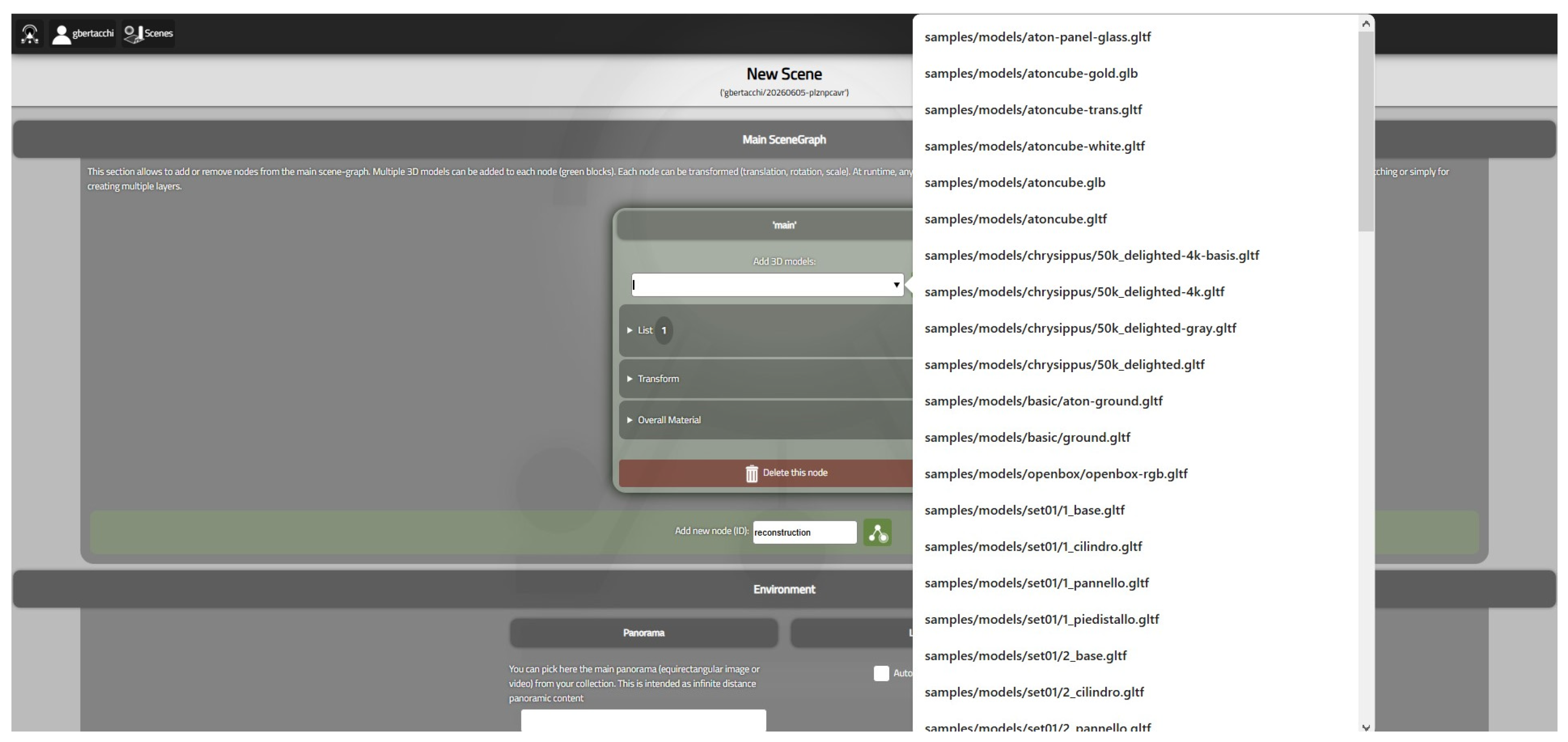
The 3D models are uploaded to the ATON platform v2026 in the .gltf format or its binary implementation (.glb); therefore, the available 3D models were exported in the required formats using the 3D modeling software McNeel Rhinoceros v8. The models were then uploaded to the remote folder set up for project users via the WebDav Drive v9 application. In this way, the models are available in each ATON v2026 collection and can be loaded into different scenes (Figure 1). In fact, during the “New Scene” wizard, ATON v2026 allows users to select models from the collection, choosing between samples and models in the remote folder.
Figure 1.
The collection in the ATON platform v2026 for online visualization and animation. Documentation and modeling: SCORPiò-NIDI project.
To support future scalability and information management, the datasets were organized according to a hierarchical structure capable of accommodating resources characterized by different levels of detail, reliability, and information density. Survey-derived data, archaeological evidence, and interpretative reconstructions were maintained as distinct information categories, ensuring transparency regarding the origin and scientific reliability of the available content.
The resulting framework provides the methodological basis for the subsequent implementation of the web-based platform and for the development of multilevel visualization strategies aimed at supporting both scientific investigation and dissemination activities.
4. Results
The methodological framework described in the previous sections was applied to the case study of the Pompeii city walls, resulting in the implementation of a web-based environment capable of integrating heterogeneous archeological datasets within a coherent semantic structure. The system combines reality-based models, archeological documentation, historical sources, and interpretative reconstructions.
The dissemination activities already developed within the SCORPiò-NIDI project are implemented through the ATON platform v2026 (Figure 1), which supports online visualization, animation, semantic annotation, and association of multimedia content [44]. The platform enables the integration of texts, images, videos, and supplementary documentation directly within the 3D environment, transforming individual models into interactive nodes of a broader knowledge system.
Once the models have been uploaded to the platform (see Section 3.5), the platform allows you to create scenes (Figure 2), enabling you to select the models to load along with their textures, the model’s display mode, and the environment’s characteristics (equirectangular image or video as panorama background and the lighting).
Figure 2.
The creation of a new scene in the ATON platform.
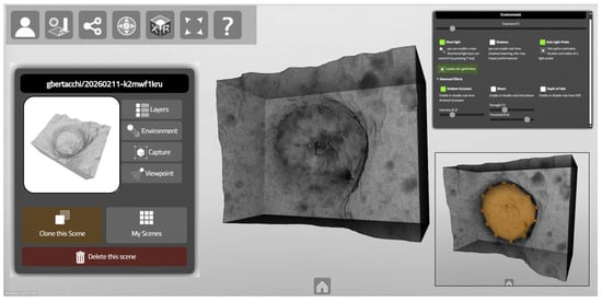
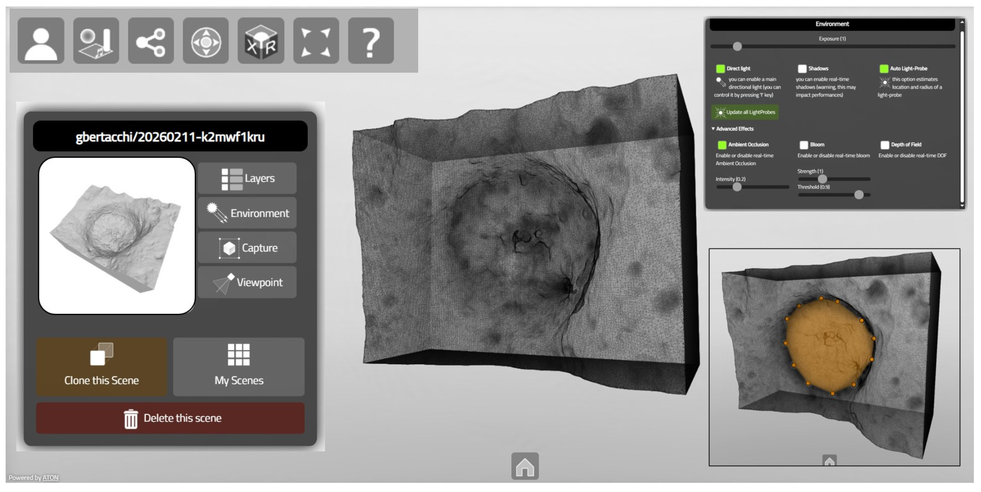
When you open the scene, various tools (Figure 3) allow you to control the display of the model and the environment, select a specific viewpoint, take screenshots, share the model, switch between first-person and orbit navigation modes, access VR, AR, or MR features, and add annotations (‘Annotate using basic sphere shape’ or ‘Annotate using convex shape’). With this last tool, specific portions of a model can be associated with historical information, archeological interpretations, analytical data, and visual documentation. This functionality supports layered information access, allowing users to progressively deepen their investigation without compromising the readability of the three-dimensional scene.
Figure 3.
In the ATON platform, 3D models of particular elements can be visualized and analyzed in the virtual environment. Documentation and modeling: SCORPiò-NIDI project.
The scenes created in ATON combine these elements to provide multilevel information tailored to the needs of different types of users. The resulting environment supports the visualization of datasets characterized by different spatial scales and information densities, while preserving semantic relationships between them. At the urban and architectural level, the platform provides access to detailed surveys of the wall sector analyzed, enabling the analysis of construction techniques, conservation conditions, and ballistic traces. At the object level, individual artifacts, projectiles, and reconstructed weapons can be examined together with the documentation and interpretations associated with them.
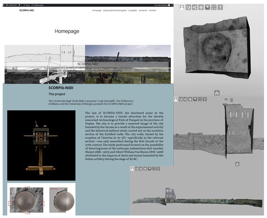
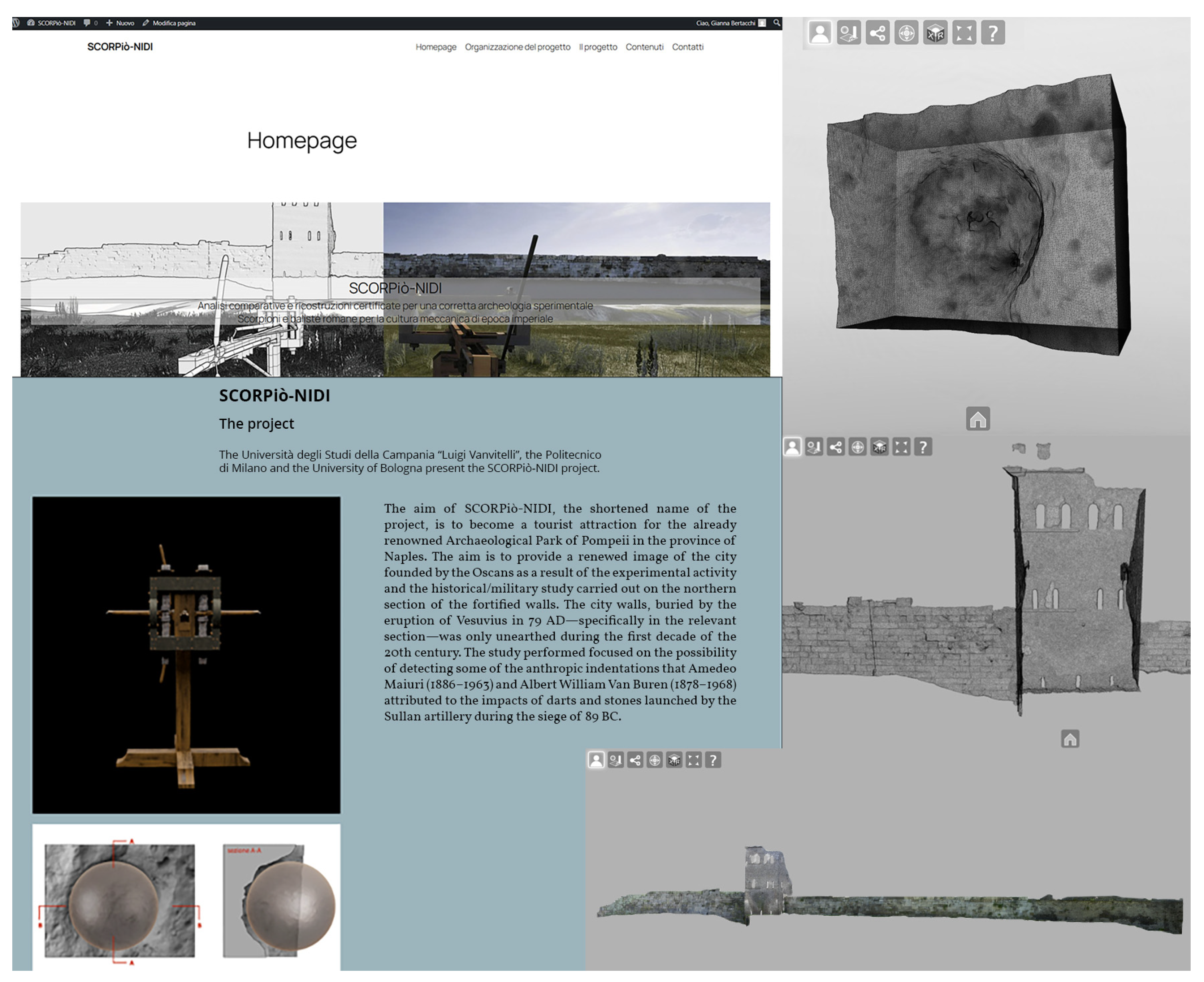
This hierarchical organization enables expert-oriented navigation through the available information. Users can move from general contextual information towards increasingly detailed analytical content, following either spatial relationships or thematic associations. The use of web platforms allows for multilevel navigation, organized by spatial scale (from the entire stretch of walls to the detail of a single element), and the dedicated web page provides access to different levels of information (descriptive, interpretative, technical) (Figure 4). The resulting environment supports interdisciplinary correlations between surveying data, archaeological interpretation, and historical research.
Figure 4.
The dedicated web page provides historical and analytical insights, along with 3D models, on the ATON platform for multilevel information. Documentation and modeling: SCORPiò-NIDI project.
5. Conclusions
This research proposed a methodological framework for the integration, semantic organization, and web-based dissemination of heterogeneous archeological datasets. Rather than focusing on the generation of 3D models, the study addressed the challenges associated with their integration into a structured digital environment capable of supporting both scientific investigation and dissemination activities. Particular attention was devoted to the integration of the technical workflow and the methodological framework, ensuring that both the tangible evidence (E1) and the associated cultural and interpretative values (E2) were coherently translated into the digital environment (E3) through structured datasets, semantic organization and multilevel information access.
The proposed workflow demonstrated how datasets characterized by different acquisition methodologies, spatial scales and information densities can be integrated within a coherent information system. Reality-based surveys, archeological documentation, historical sources and interpretative reconstructions were organized through a multilevel semantic structure that preserves the relationships between geometric data and associated knowledge resources. The distinction between acquired evidence and interpretative content was maintained throughout the system, ensuring transparency and scientific traceability.
The implementation of the framework through the ATON platform confirmed the potential of web-based technologies for the dissemination of complex archeological information. The use of semantic annotations, hierarchical information structures, and multilevel navigation strategies enabled users to move progressively from general contextual information to detailed analytical content. In this perspective, the 3D model functions not only as a visualization tool but also as an interface for information retrieval and knowledge exploration.
The proposed approach highlights the importance of semantic organization, interoperability, and information architecture in the management of digital heritage resources. The integration of heterogeneous datasets within a unified environment facilitates the correlation of archaeological evidence, documentation, and interpretative content while supporting different categories of users and levels of investigation.
Although developed for the case study of the Pompeii city walls, the proposed workflow is not site-specific. The methodology can be transferred to other archeological and Cultural Heritage contexts characterized by the presence of multiscale datasets and heterogeneous information sources, therefore offering a reusable approach for the organization, dissemination, and scientific exploitation of complex archeological datasets.
Author Contributions
Conceptualization, F.J.-V. and G.B.; methodology, F.J.-V.; investigation, F.J.-V. and G.B.; writing—original draft preparation, F.J.-V. and G.B.; writing—review and editing, G.B.; supervision, F.J.-V. All authors have read and agreed to the published version of the manuscript.
Funding
This research was partially supported by the project “SCORPiò-NIDI”, CUP B53D23022100006 (DD n. 1012/2023), funded by the Italian Ministry of Research under the PRIN (call DD n. 104/2022) funding initiative.
Institutional Review Board Statement
Not applicable.
Informed Consent Statement
Not applicable.
Data Availability Statement
The original contributions presented in this study are included in the article.
Acknowledgments
The authors would like to thank Adriana Rossi, and the other investigators of the SCORPiò-NIDI project for making available the material used in uploading the models to the platforms.
Conflicts of Interest
The authors declare no conflicts of interest.
Abbreviations
The following abbreviations are used in this manuscript:
| 3D | Three-Dimensional |
| CH | Cultural Heritage |
| ICH | Intangible Cultural Heritage |
| TLS | Terrestrial Laser Scanner |
References
- UNESCO. Text of the Convention for the Safeguarding of the Intangible Cultural Heritage. 2003. Available online: https://ich.unesco.org/en/convention (accessed on 3 February 2026).
- UNESCO. Charter for the Preservation of Digital Heritage. 2003. Available online: https://www.unesco.org/en/legal-affairs/charter-preservation-digital-heritage#description (accessed on 4 February 2026).
- Harrison, R. Heritage: Critical Approaches, 1st ed.; Routledge: London, UK, 2012. [Google Scholar] [CrossRef] [Scilit]
- Skublewska-Paszkowska, M.; Milosz, M.; Powroznik, P.; Lukasik, E. 3D technologies for intangible cultural heritage preservation—Literature review for selected databases. Herit. Sci. 2022, 10, 3. [Google Scholar] [CrossRef] [Scilit] [PubMed]
- Pieraccini, M.; Guidi, G.; Atzeni, C. 3D digitizing of cultural heritage. J. Cult. Herit. 2001, 2, 63–70. [Google Scholar] [CrossRef] [Scilit]
- Lian, Y.; Xie, J. The Evolution of Digital Cultural Heritage Research: Identifying Key Trends, Hotspots, and Challenges through Bibliometric Analysis. Sustainability 2024, 16, 7125. [Google Scholar] [CrossRef] [Scilit]
- Remondino, F.; El-Hakim, S. Image-based 3D Modelling: A Review. Photogramm. Rec. 2006, 21, 269–291. [Google Scholar] [CrossRef] [Scilit]
- Remondino, F.; Rizzi, A. Reality-based 3D documentation of natural and cultural heritage sites techniques, problems, and examples. Appl. Geomat. 2010, 2, 85–100. [Google Scholar] [CrossRef] [Scilit]
- Xing, Y.; Yang, S.; Fahy, C.; Harwood, T.; Shell, J. Capturing the Past, Shaping the Future: A Scoping Review of Photogrammetry in Cultural Building Heritage. Electronics 2025, 14, 3666. [Google Scholar] [CrossRef] [Scilit]
- Rodríguez-Gonzálvez, P.; Jiménez Fernández-Palacios, B.; Muñoz-Nieto, Á.L.; Arias-Sanchez, P.; Gonzalez- Aguilera, D. Mobile LiDAR System: New Possibilities for the Documentation and Dissemination of Large Cultural Heritage Sites. Remote Sens. 2017, 9, 189. [Google Scholar] [CrossRef] [Scilit]
- European Commission. Cultural Heritage and Cultural and Creative Industries (CCIs). Available online: https://research-and-innovation.ec.europa.eu/research-area/social-sciences-and-humanities/cultural-heritage-and-cultural-and-creative-industries-ccis_en#publications (accessed on 9 February 2026).
- Sketchfab. The Leading Platform for 3D & AR on the Web. Available online: https://sketchfab.com/ (accessed on 8 February 2026).
- Potenziani, M.; Callieri, M.; Dellepiane, M.; Corsini, M.; Ponchio, F. 3DHOP: 3D Heritage Online Presenter. Comput. Graph. 2015, 52, 129–141. [Google Scholar] [CrossRef] [Scilit]
- Potenziani, M.; Callieri, M.; Scopigno, R. Developing and Maintaining a Web 3D Viewer for the CH Community: An evaluation of the 3DHOP framework. In 16th Eurographics Workshop on Graphics and Cultural Heritage; Sablatnig, R., Wimmer, M., Eds.; Eurographics Association: Goslar, Germany, 2018. [Google Scholar]
- Cipriani, L.; Dresseno, A.; Agostini, P.; Fantini, F. Game engine to communicate and enhance the city and the territory: The pilot project “Chiuro, dal passato, il futuro”. In Rappresentazione Materiale/Immateriale—Drawing as (in) Tangible Representation. 40° Convegno Internazionale UID dei Docenti delle Discipline della Rappresentazione, Milano, Italy, 13–15 September 2018; Salerno, R., Ed.; Gangemi Editore International: Rome, Italy, 2018; pp. 1035–1042. [Google Scholar]
- Mortara, M.; Catalano, C.E.; Bellotti, F.; Fiucci, G.; Houry-Panchetti, M.; Petridis, P. Learning cultural heritage by serious games. J. Cult. Herit. 2014, 15, 318–325. [Google Scholar] [CrossRef] [Scilit]
- Mariotti, S. The Use of Serious Games as an Educational and Dissemination Tool for Archaeological Heritage. Potential and Challenges for the Future. Magazén 2021, 2, 1. [Google Scholar] [CrossRef] [Scilit]
- Rodriguez-Garcia, B.; Guillen-Sanz, H.; Checa, D.; Bustillo, A. A systematic review of virtual 3D reconstructions of Cultural Heritage in immersive Virtual Reality. Multimed. Tools Appl. 2024, 83, 89743–89793. [Google Scholar] [CrossRef] [Scilit]
- Bertacchi, S.; Bertacchi, G.; Cipriani, L. Chiuro laboratory: Integration of workflows from digital survey to optimised 3D urban models for interactive exploration. Appl. Geomat. 2021, 14, 131–150. [Google Scholar] [CrossRef] [Scilit]
- Museo dell’Ara Pacis. The Ara as It Was. The Redevelopment Project in Augmented Reality of the Ara Pacis, 2017. Available online: https://arapacis.it/en/mostre_ed_eventi/eventi/l_ara_com_era (accessed on 7 February 2026).
- Bertacchi, G.; Giacomini, F.; Iannucci, A.; Cipriani, L. From Digital Survey to Extended Reality. Possible Uses for the Cathedral of Udine. In Advances in Representation. Digital Innovations in Architecture, Engineering and Construction; Giordano, A., Russo, M., Spallone, R., Eds.; Springer: Cham, Switzerland, 2024; pp. 421–438. [Google Scholar] [CrossRef] [Scilit]
- Tsita, C.; Satratzemi, M. How serious games in cultural heritage are being evaluated. Συνέδρια της Eλληνικής Eπιστημονικής Ένωσης Τεχνολογιών Πληροφορίας & Eπικοινωνιών στην Eκπαίδευση 2022, 1, 97–104. [Google Scholar]
- DaCosta, B.; Kinsell, C. Serious Games in Cultural Heritage: A Review of Practices and Considerations in the Design of Location-Based Games. Educ. Sci. 2023, 13, 47. [Google Scholar] [CrossRef] [Scilit]
- Juan-Vidal, F.; Díaz-Maiquez, J.; Bertacchi, G.; Ibáñez-Vila, A.; Beltrán López, G. The Fruition of Intangible Heritage through Gamification: Accessibility, Inclusiveness, and Transmission of Values in the Heriverso Project. Disegnarecon 2024, 17, 32. [Google Scholar] [CrossRef]
- Apollonio, F.I.; Ballabeni, M.; Bertacchi, S.; Fallavollita, F.; Foschi, R.; Gaiani, M. From documentation images to restauration support tools: A path following the Neptune fountain in Bologna design process. Int. Arch. Photogramm. Remote Sens. Spat. Inf. Sci. 2017, XLII-5-W1, 329–336. [Google Scholar] [CrossRef] [Scilit]
- Liu, W.; Banfi, F. HBIM-based Virtual Reality for Serious Games: A Review and Research Directions Oriented to Built Heritage Dissemination. Int. Arch. Photogramm. Remote Sens. Spat. Inf. Sci. 2025, XLVIII-M-9-2025, 865–872. [Google Scholar] [CrossRef] [Scilit]
- Wang, J.; Zakaria, S.A. Design Application and Evolution of 3D Visualization Technology in Architectural Heritage Conservation: A CiteSpace-Based Knowledge Mapping and Systematic Review (2005–2024). Buildings 2025, 15, 1854. [Google Scholar] [CrossRef] [Scilit]
- Apollonio, F.I.; Basilissi, V.; Callieri, M.; Dellepiane, M.; Gaiani, M.; Ponchio, F.; Rizzo, F.; Rubino, A.R.; Scopigno, R.; Sobrà, G. A 3D-centered information system for the documentation of a complex restoration intervention. J. Cult. Herit. 2018, 29, 89–99. [Google Scholar] [CrossRef] [Scilit]
- Bertacchi, S.; Al Jawarneh, I.M.; Apollonio, F.I.; Bertacchi, G.; Cancilla, M.; Foschini, L.; Grana, C.; Martuscelli, G.; Montanari, R. SACHER Project: A Cloud Platform and Integrated Services for Cultural Heritage and for Restoration. In Goodtechs ’18 Proceedings of the 4th EAI International Conference on Smart Objects and Technologies for Social Good; Association for Computing Machinery: New York, NY, USA, 2018; pp. 283–288. [Google Scholar] [CrossRef] [Scilit]
- Apollonio, F.I.; Gaiani, M.; Bertacchi, S. Managing Cultural Heritage with Integrated Services Platform. Int. Arch. Photogramm. Remote Sens. Spat. Inf. Sci. 2019, XLII-2-W11, 91–98. [Google Scholar] [CrossRef] [Scilit]
- Frommel, S.; Apollonio, F.I.; Gaiani, M.; Bertacchi, G. Some reconstruction hypotheses of Leonardo’s project for the tiburio of the Milan cathedral by using 3D digital models. SCIRES-IT 2020, 10, 53–66. [Google Scholar] [CrossRef] [Scilit]
- Frommel, S.; Gaiani, M.; Garagnani, S. 3-D Digital Modeling and Giuliano da Sangallo’s Designs for Santa Maria delle Carceri in Prato. J. Soc. Archit. Hist. 2021, 80, 30–47. [Google Scholar] [CrossRef] [Scilit]
- Bertacchi, G.; Cipriani, L.; Giacomini, F.; Iannucci, A. Surveys and 3D models for virtual reconstruction. Applications for the Udine Cathedral (Rilievi e modelli 3D per la ricostruzione virtuale. Applicazioni per il Duomo di Udine). In Il Duomo di Udine. Storia e Architettura tra Medioevo e Rinascimento; Scalon, C., Ed.; Gaspari: Udine, Italy, 2023; pp. 443–487. (In Italian) [Google Scholar]
- Occhipinti, C.; Patroni, O.C.; Gaiani, M.; Cipriani, L.; Fantini, F. An Integrated Method for the Reconstruction of Private Renaissance Exhibition Rooms (camerini) Starting from Ippolito II d’Este’s Cabinet of Paintings at His Tiburtine Villa. Heritage 2025, 8, 54. [Google Scholar] [CrossRef] [Scilit]
- Neumüller, M.; Reichinger, A.; Rist, F.; Kern, C. 3D Printing for Cultural Heritage: Preservation, Accessibility, Research and Education. In 3D Research Challenges in Cultural Heritage. Lecture Notes in Computer Science; Ioannides, M., Quak, E., Eds.; Springer: Berlin/Heidelberg, Germany, 2014; Volume 8355. [Google Scholar] [CrossRef] [Scilit]
- Echeverría, J. The Lords of the Air; Telépolis and the Third Realm (Los Señores del Aire; Telépolis y el Tercer Entorno); Destino: Barcelona, Spain, 1999. (In Spanish) [Google Scholar]
- Thwaites, H. Digital Heritage: What Happens When We Digitize Everything? In Visual Heritage in the Digital Age; Springer Series on Cultural Computing; Ch’ng, E., Gaffney, V., Chapman, H., Eds.; Springer: London, UK, 2013. [Google Scholar] [CrossRef] [Scilit]
- Cipriani, L.; Fantini, F. (Eds.) CHIURO, The Future Lies in the Past, Methods and Strategies for the Digital Documentation of Small Historic Centers (CHIURO, Dal Passato il Futuro, Metodi e Strategie per la Documentazione Digitale di Centri Storici Minori); Quasar: Rome, Italy, 2025; Available online: https://digital.casalini.it/10.48235/1180 (accessed on 7 February 2026). (In Italian)
- Rossi, A. (Ed.) Discovering Pompeii: From Effects to Causes—From Surveying to the Reconstructions of Ballistae and Scorpiones. Available online: https://www.mdpi.com/2673-4591/96/1 (accessed on 7 February 2026).
- Rossi, A.; Gonizzi Barsanti, S.; Bertacchi, S. Use of Polybolos on the City Walls of Ancient Pompeii: Assessment on the Anthropic Cavities. Nexus Netw. J. 2024, 27, 243–272. (accessed on 7 February 2026). [Google Scholar] [CrossRef] [Scilit]
- Rossi, A.; Bertacchi, S. Tracing Metal Dart Impacts Through 3D Reverse Modeling on the Northern Walls of Pompeii. Eng. Proc. 2025, 96, 4. [Google Scholar] [CrossRef] [Scilit]
- Formicola, C.; Bertacchi, S.; Rossi, A. (Im)material Casts from the Sullan Period. Eng. Proc. 2025, 96, 5. [Google Scholar] [CrossRef] [Scilit]
- Fantini, F.; Bertacchi, S. Beyond the Museum: Virtual and Physical Replicas of Pompeii’s Siege Marks. Eng. Proc. 2025, 96, 11. [Google Scholar] [CrossRef] [Scilit]
- Casadei, V.; Di Modica, G. Access to Digital Cultural Heritage: Exploring Future Perspectives Through Open Tools of Research. Eng. Proc. 2025, 96, 10. [Google Scholar] [CrossRef] [Scilit]

Disclaimer/Publisher’s Note: The statements, opinions and data contained in all publications are solely those of the individual author(s) and contributor(s) and not of MDPI and/or the editor(s). MDPI and/or the editor(s) disclaim responsibility for any injury to people or property resulting from any ideas, methods, instructions or products referred to in the content. |
© 2026 by the authors. Licensee MDPI, Basel, Switzerland. This article is an open access article distributed under the terms and conditions of the Creative Commons Attribution (CC BY) license.