


Abstract
Nature-based solutions (NbS) are sustainable tools to mitigate the impacts of climate change and urbanization. Thus, we present a specific research activity of the “Tech4You” Project, whose main objective is to contribute to the widespread implementation of NbS. In this regard, a specific area of the Cerisano urban catchment was selected for the implementation of a rain garden. A preliminary design and a predictive model were developed to assess its hydrological performance. The findings are promising and show how this green infrastructure can positively contribute to urban stormwater management.
1. Introduction
The growth of impervious surfaces in urban areas has led to a significant alteration of the natural hydrological cycle, with an increase in urban flooding risk [1]. In this context, nature-based solutions (NbS) represent sustainable strategies to tackle the environmental challenges posed by the combined impacts of urbanization and climate change [2]. Among the several types of NbS, the rain garden (RG) is a bioretention system designed to collect, temporarily retain, and treat the runoff discharged from surrounding impermeable surfaces, such as roofs, roads, and pavements. Quantitative and qualitative benefits in stormwater management can be provided by these systems, as demonstrated by several studies [3,4].
Despite the widespread recognition of the advantages of these systems, their implementation on a large-scale urban level is still limited. Therefore, we present a specific action of the “Tech4You” Project, funded by Next Generation EU—Italian NRRP, whose main goal is to promote the adoption of NbS as an effective tool for water management in urban areas. The key outcome of this action is the design and full-scale implementation of a rain garden in a specific area of Cerisano (Calabria, Italy), which was selected as a pilot site for the project.
To achieve this goal, a preliminary design phase and laboratory tests were first conducted to define the rain garden’s stratigraphy; then, the hydrological effectiveness of this infrastructure was tested through simulations using the SWMM 5.2 software.
2. Materials and Methods
2.1. Site Description and RG Preliminary Design
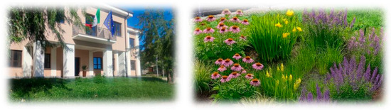
The area selected for the rain garden’s implementation is in front of the main entrance of the Municipal Offices of Cerisano (Figure 1), a small town in the Calabria region (southern Italy). The selection of this specific area was based on an evaluation of the entire Cerisano urban catchment using Iber-SWMM, an integrated 2D/1D urban drainage model [5]. According to the findings of that study, the zone of the Municipal Office Park, located close to the area where the RG will be implemented, is the most critical site for water accumulation.
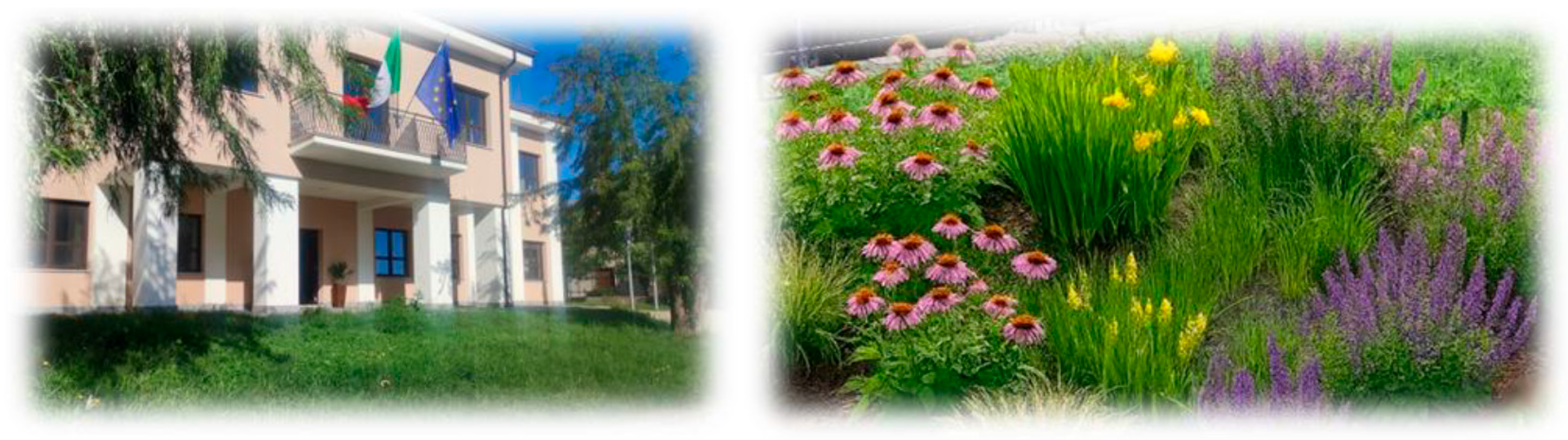
Figure 1.
Green area in front of the main entrance of the Cerisano Municipal Offices, where the RG will be installed (left); schematic detail of the planned RG (right).
The RG is designed to handle the entire runoff discharged from the City Hall rooftop. Thus, the impervious area treated by this green infrastructure is approximately 400 m2. Rainwater collected on the rooftop is currently discharged through a downspout system into the conventional urban drainage network. With the implementation of the RG, this volume of stormwater can be treated both quantitatively and qualitatively before being discharged into the sewer system.
The preliminary design of the RG was based on the definition of the infiltration area, the depths of the storage, soil, and surface layers, and the diameter and placement depth of the perforated drainpipe.
2.2. Predictive Model Development
To evaluate the hydrological behavior of the proposed RG in response to specific rainfall events, a simple predictive model was developed using EPA-SWMM [6]. For this specific case study, the following two conditions were simulated: (i) the current state (Scenario 0, without RG) and (ii) the post-intervention scenario (RG Scenario).
The LID control unit selected to simulate the rain garden is the “bioretention cell”. To define the cell’s stratigraphy, soil hydraulic properties were measured at the Urban Hydraulics and Hydrology Laboratory of the University of Calabria, Italy, using the HYPROP® device [7], which employs the simplified evaporation method proposed by Schindler et al. [8,9]. For the drainage layer, values from the literature were considered. Regarding the layer depths, since the “bioretention cell” unit does not include a specific section for the transition layer, this layer’s thickness was added to the soil layer in the model configuration. In this way, the total depth of the modeled rain garden matches the design specifications.
A synthetic Chicago hyetograph with a duration of 1 h, a time-to-peak ratio of 0.4, and a 15-year return period was used for the hydrodynamic simulation. This design rainfall event was defined based on the Intensity–Duration–Frequency (IDF) curves developed using the Gumbel extreme value distribution and historical rainfall data from the Cosenza rain gauge station [10]. The Soil Conservation Service Curve Number (SCS-CN) method was considered for infiltration.
Finally, the results of the predictive model were evaluated at the outlet node by comparing the maximum total inflow and total inflow volume between the case with NbS implementation (RG Scenario) and that without it (Scenario 0).
3. Results
3.1. Rain Garden Preliminary Design
The RG was defined with an infiltration area of 20 m2, approximately 5% of the rooftop area to be drained. The RG’s stratigraphy, defined at the end of the preliminary design stage, consists of (i) a waterproofing membrane; (ii) a 30 cm storage and drainage layer composed of gravel, with a drainpipe at the bottom; (iii) a 20 cm transition layer made of sand; (iv) a soil layer with a depth ranging from 40 cm to 60 cm; (v) a vegetation layer; and (vi) a berm with a minimum height of 20 cm to delimit the RG area and define its shape.
In more detail, the soil layer is a mixture composed of 45% sand, 30% organic compost, and 25% local soil substrate. The hydraulic properties of this mixture, assessed in the laboratory, showed a saturated volumetric water content of approximately 70% (0.70), meaning that the porosity is much higher than that of typical mineral soils. The soil water retention curve (SWRC) is relatively flat in its central section, which suggests that the soil does not release water quickly even as suction increases.
3.2. Predictive Model Results
To assess the hydrological effectiveness of the NbS, the following performance indices were evaluated: (i) the Maximum Total Inflow Reduction (%), calculated as the percentage difference in maximum total inflow at the outlet node between Scenario 0 and the RG Scenario, and (ii) the Total Inflow Volume Reduction (%), computed as the percentage difference in total inflow volume at the outlet node between Scenario 0 and the RG Scenario.
The findings showed a reduction of 21.3% in the maximum total inflow and a decrease of 49.3% in the total inflow volume at the outlet node. It should be noted that this is a simple predictive model that considers only the rooftop area discharged into the RG. Furthermore, the RG was modeled based on the first design configuration (i.e., a berm height of 20 cm, a soil thickness of 80 cm, including the transition layer, and a storage layer of 30 cm, and the drainage system was neglected in this model configuration).
4. Conclusions
In this study, a new rain garden system to be installed in the Municipality of Cerisano under the “Tech4You” Project is presented. The predictive model shows that the designed rain garden is a promising strategy for urban stormwater management. The specific NbS was further refined during the design phase by the company that won the cascade funding call of the project, and it is currently under construction.
Future studies will first examine different RG model configurations to evaluate the effect of specific design parameters on the hydrological efficiency of this NbS. Then, based on the pilot site, currently under development, the hydrological efficiency of the rain garden will be evaluated by considering the field data that will be collected; consequently, a calibrated and validated model will be developed.
Author Contributions
Conceptualization, S.A.P. and M.T.; methodology, S.A.P. and M.T.; software, S.A.P. and M.T.; formal analysis, S.A.P. and M.T.; investigation, S.A.P., M.T., B.P. and A.C.B.; data curation, S.A.P., M.T. and A.C.B.; writing—original draft preparation, S.A.P. and M.T.; writing—review and editing, S.A.P., M.T., B.P., A.C.B. and P.P.; visualization, S.A.P., M.T. and P.P.; supervision, P.P.; project administration, P.P.; funding acquisition, P.P. All authors have read and agreed to the published version of the manuscript.
Funding
This work was funded by the Next Generation EU—Italian NRRP, Mission 4, Component 2, Investment 1.5, call for the creation and strengthening of ‘Innovation Ecosystems’, building ‘Territorial R&D Leaders’ (Directorial Decree n.2021/3277), Project Tech4You—Technologies for climate change adaptation and quality of life improvement (n.ECS0000009). This work reflects only the authors’ views and opinions; neither the Ministry for University and Research nor the European Commission can be considered responsible for them.
Institutional Review Board Statement
Not applicable.
Informed Consent Statement
Not applicable.
Data Availability Statement
Datasets used in the current study are available from the authors upon reasonable request.
Acknowledgments
We would like to thank the Municipality of Cerisano for supporting this specific Tech4You Project research activity as a stakeholder.
Conflicts of Interest
The authors declare no conflicts of interest.
References
- Feng, B.; Zhang, Y.; Bourke, R. Urbanization impacts on flood risks based on urban growth data and coupled flood models. Nat. Hazards 2021, 106, 613–627. [Google Scholar] [CrossRef] [Scilit]
- Palermo, S.A.; Turco, M.; Pirouz, B.; Presta, L.; Falco, S.; De Stefano, A.; Frega, F.; Piro, P. Nature-based solutions for urban stormwater management: An overview. IOP Conf. Ser. Earth Environ. Sci. 2023, 1196, 012027. [Google Scholar] [CrossRef] [Scilit]
- Malaviya, P.; Sharma, R.; Sharma, P.K. Rain gardens as stormwater management tool. In Sustainable Green Technologies for Environmental Management; Springer: Singapore, 2019; pp. 141–166. [Google Scholar] [CrossRef] [Scilit]
- Dietz, M.E.; Clausen, J.C. A Field Evaluation of Rain Garden Flow and Pollutant Treatment. Water Air Soil Pollut. 2005, 167, 123–138. [Google Scholar] [CrossRef] [Scilit]
- Aparicio-Uribe, C.H.; Turco, M.; Palermo, S.A.; Saleh, M.M.; Russo, B.; Piro, P. Optimising Remote Sensors and Nature-Based Solutions Allocation Based on Hydrological 2D-1D Numerical Models: The Cerisano Case Study. Eng. Proc. 2026, 135, 13. [Google Scholar] [CrossRef] [Scilit]
- Rossman, L.; Simon, M. Storm Water Management Model User’s Manual, Version 5.2; EPA/600/R-22/030; US Environmental Protection Agency: Washington, DC, USA, 2022.
- UMS GmbH. UMS (2015): Manual HYPROP, Version 2015-01; UMS GmbH: München, Germany, 2015; Volume 37. [Google Scholar]
- Schindler, U.; Durner, W.; von Unold, G.; Mueller, L.; Wieland, R. The evaporation method: Extending the measurement range of soil hydraulic properties using the air-entry pressure of the ceramic cup. J. Plant Nutr. Soil Sci. 2010, 173, 563–572. [Google Scholar] [CrossRef] [Scilit]
- Schindler, U.; Durner, W.; von Unold, G.; Muller, L. Evaporation Method for Measuring Unsaturated Hydraulic Properties of Soils: Extending the Measurement Range. Soil Sci. Soc. Am. J. 2010, 74, 1071–1083. [Google Scholar] [CrossRef] [Scilit]
- Arpacal. 2023. Available online: http://www.cfd.calabria.it/index.php/dati-stazioni/dati-storici (accessed on 1 March 2023).
Disclaimer/Publisher’s Note: The statements, opinions and data contained in all publications are solely those of the individual author(s) and contributor(s) and not of MDPI and/or the editor(s). MDPI and/or the editor(s) disclaim responsibility for any injury to people or property resulting from any ideas, methods, instructions or products referred to in the content. |
© 2026 by the authors. Licensee MDPI, Basel, Switzerland. This article is an open access article distributed under the terms and conditions of the Creative Commons Attribution (CC BY) license.