


Abstract
The integration of remote sensors with nature-based solutions (NBS) offers new opportunities for suitable hydrological monitoring and risk reduction. This study implements 2D-1D numerical modelling tools to guide the allocation of both sensors and NBS interventions. Using the Cerisano catchment as a case study, the software IBER-SWMM (3.3.1–5.2 respectively) was employed to reproduce rainfall-runoff under different scenarios. Outputs were analysed to identify hydrologically sensitive zones where sensor deployment and NBS implementation would maximise monitoring efficiency and mitigation benefits. Results demonstrate how modelling supports effective decisions that are often limited by budget and site-specific constraints.
1. Introduction
Hydrological monitoring is crucial for managing water resources and mitigating flood risks. However, budgets often limit the number of sensors that can be deployed. In addition, the lack of detailed spatial and hydrological information makes it challenging to identify optimal locations for these interventions. Thus, monitoring networks may be suboptimal, reducing their effectiveness in risk mitigation and decision-making. This highlights the need for optimisation tools to guide cost-effective and strategically targeted deployments [1].
Traditional infrastructure-based approaches often face challenges such as high costs, limited scalability, and environmental degradation. In contrast, NBS have emerged as sustainable alternatives, leveraging natural processes to enhance resilience and provide ecological benefits. Moreover, NBS can be implemented considering site-specific constraints, retrofitting urban spaces in less invasive manners than infrastructural solutions. Recent studies highlight the hydrological impacts of various NBS interventions, demonstrating their effectiveness in water management and flood-risk reduction [2].
However, the effective deployment of NBS requires strategic planning, particularly in urban environments where space and resources are limited. Optimising the allocation of remote sensors and NBS interventions is crucial for maximising their benefits. Hydrological models, such as IBER-SWMM, simulate complex rainfall-runoff processes that offer valuable information to detect the most flood-vulnerable areas and the principal flow paths that runoff follows.
This study presents an approach in which a series of 2D numerical models guides the allocation of remote sensors and NBS in the town of Cerisano, located in the Calabria region in Italy. By simulating rainfall-runoff scenarios and identifying the recurrent hydrological sensitive zones. This methodology aims to optimise resources, enhance monitoring efficiency, and support informed decision-making in the adoption of retrofitted NBS in environments with highly constructed areas that limit implementation. The findings contribute to the development of cost-effective strategies for resilient urban water management.
2. Materials and Methods
2.1. Case Study
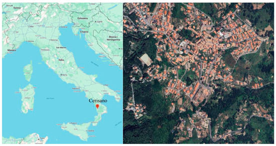
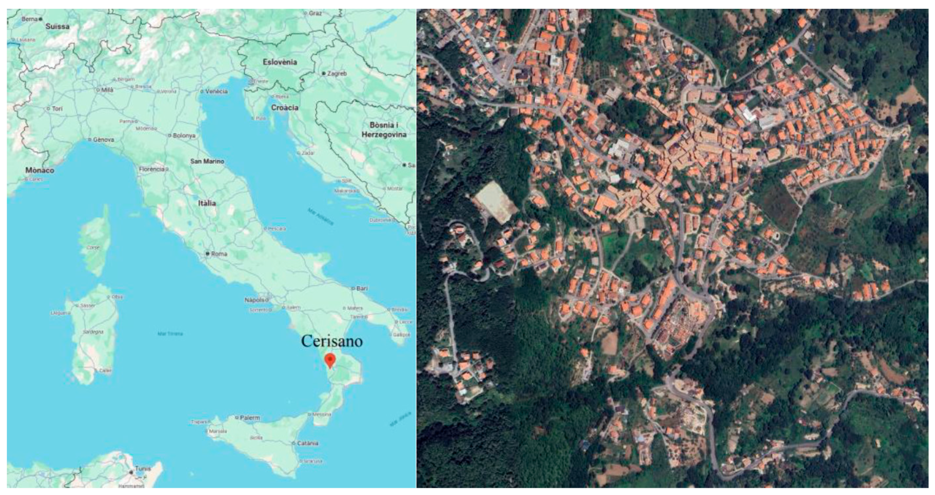
Cerisano is a town in the Calabria region of southern Italy, located in the province of Cosenza (Figure 1). It lies on the western slopes of the Sila Mountains, at an elevation of about 660 m above sea level. With a Mediterranean climate, rainfall is unevenly distributed, averaging 158 rainy days with a total annual precipitation of 563 mm. Its location in a hilly landscape makes Cerisano an interesting case for hydrological studies, as the area is subject to intense rainfall events, surface runoff, and associated risks.
Figure 1.
Cerisano’s geographic location in Italy (left) and satellite image of the town (right).
2.2. IBER-SWMM
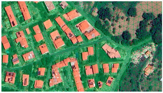
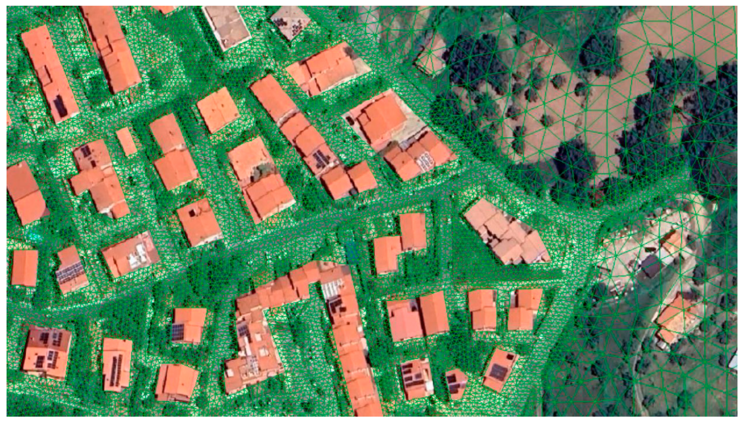
IBER-SWMM is an open-source, high-resolution 2D/1D dual drainage model that integrates in a continuous interaction the Iber model for two-dimensional surface flow [3] with the widely used one-dimensional Storm Water Management Model, SWMM. This coupling enables a fully integrated simulation of urban hydrology, surface hydraulics, and sewer network dynamics. Surface processes—including rainfall–runoff transformation on terrain and rooftops as well as overland flow—are solved with the Iber engine, which applies the depth-averaged 2D shallow water equations (2D-SWE). Hydrological processes are represented using a fully distributed approach, incorporating several infiltration models, including SCS, Horton, and Green-Ampt. Both hydrology and hydraulics are resolved on a single computational mesh, supported by a flexible mesh generator suitable for complex urban environments (Figure 2). Sewer system processes are simulated in SWMM, which employs the one-dimensional Saint-Venant equations to represent gradually varied unsteady flow [4]. Because of the fully distributed approach, the definition of hydrological subcatchments for rainfall–runoff computation is unnecessary, leaving SWMM dedicated solely to 1D flow conveyance [5]. In practice, it means that subcatchments are not created in SWMM. Subcatchments and runoff are generated by the fully distributed model (IBER) and continuously injected at the corresponding sewer nodes, allowing SWMM to focus on 1D flow conveyance. Due to Italian regulations, a basic assumption was made: all rooftop runoff is conveyed to the sewer system, whereas only a portion of street runoff reaches the drainage network through grate inlets.
Figure 2.
Computational mesh, in urban areas (2 m) and in non-urbanised areas (10 m).
2.3. Methodology
Three different rainfall return periods (10, 50, and 100 years) were modelled to identify critical flooding areas and runoff pathways. These simulations provided insights into potential real-world scenarios and served as a technical tool to support decision-making. Furthermore, the modelling outputs helped to delineate critical zones where NBS could be strategically implemented, ensuring that interventions are tailored to the specific hydrological and geomorphological needs of the selected urban area.
3. Results
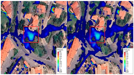
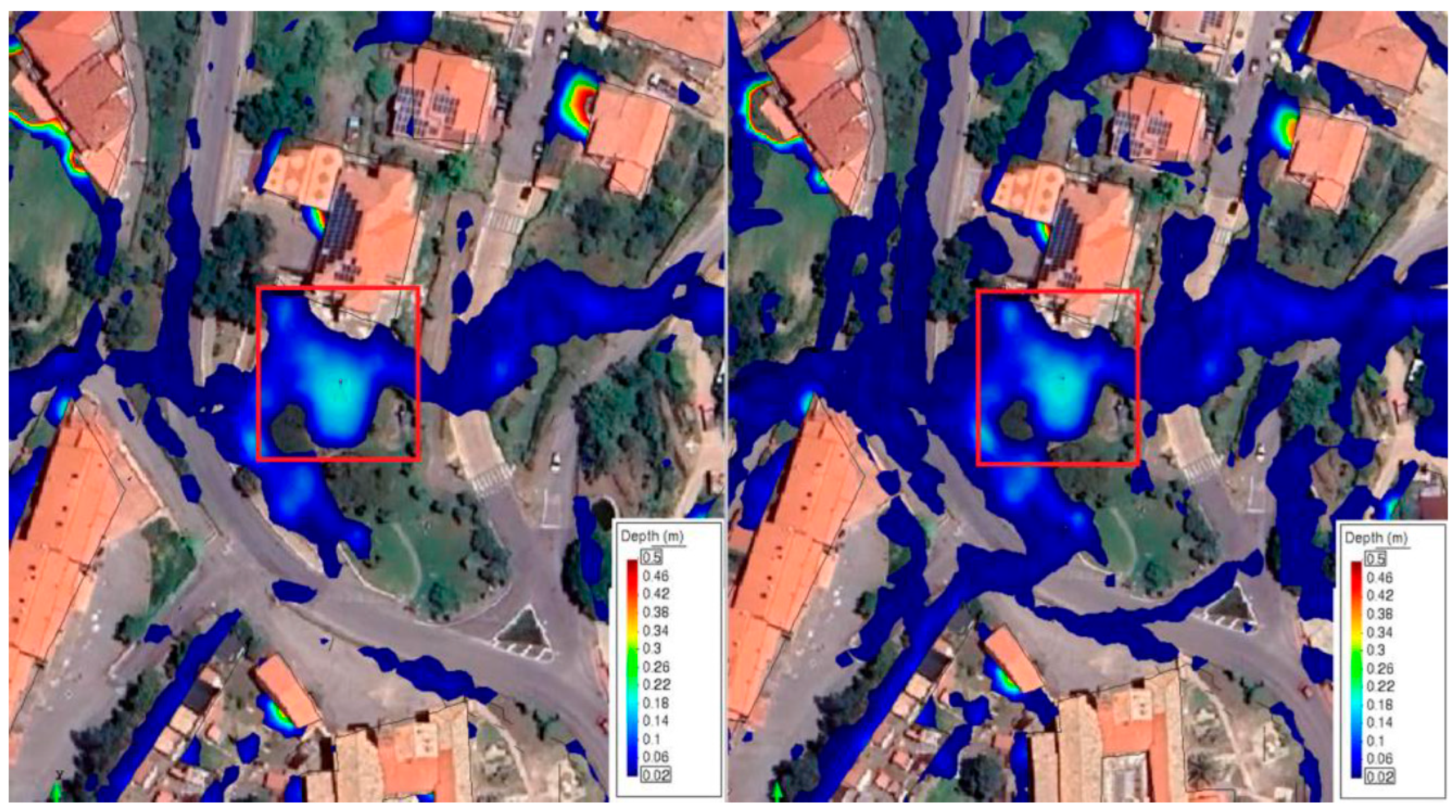
After less than two hours of simulation time (each return period), results were obtained. Figure 3 shows two rainfall event results (in the red rectangle), indicating the most critical zone for water accumulation, which coincides with the Municipal Office of Cerisano park, close to a children’s playground, as well as the predominant runoff pathway that channels accumulated surface water.
Figure 3.
Results of the most critical flooding areas for the 10 and 100-year return periods.
4. Discussion
In particular, the results guided the selection of optimal locations for deploying monitoring sensors, which can subsequently enhance numerical models through calibration and validation with observed data. Thus, depending on the selected sensor typology, these can also be used as early warning systems or water-quality checkpoints, among other options [6,7,8]. Despite its promising performance, the model will ultimately require calibration against experimental data to ensure its predictive reliability. Regarding the NBS, the results highlight a significant hydrological vulnerability within Cerisano. Even at this conceptual stage, based on the model outputs, we proposed that sensor and NBS placement should follow modelling analysis driven by predicted areas of relevance, including zones of elevated risk based on flow concentration and expected monitoring efficiency. The fact that this flood accumulation coincides with the park of the municipal office and its adjacent playground underlines not only the technical but also the social relevance of the finding and suggests a rain garden as the likely best NBS option. Outputs provide essential guidance for prioritising both monitoring and mitigation measures.
5. Conclusions
This study demonstrates that 2D numerical modelling tools can be a preliminary strategic, cost-effective, and evidence-based approach to improve resilience in urban catchments where space and resources are limited. The results were particularly useful in planning the selection of optimal locations for deploying monitoring sensors and NBS tailored to site-specific hydrological and social constraints, making the best use of the available resources.
Author Contributions
Conceptualisation, C.H.A.-U., S.A.P. and M.T.; methodology, C.H.A.-U.; software, C.H.A.-U., S.A.P., M.T. and M.M.S.; validation, P.P., B.R., M.T. and S.A.P.; formal analysis, M.T. and S.A.P.; investigation, C.H.A.-U., S.A.P. and M.T.; resources, P.P., B.R.; data curation, C.H.A.-U., S.A.P. and M.T.; writing—original draft preparation, C.H.A.-U.; writing—review and editing, B.R., P.P., M.T. and S.A.P.; visualisation, C.H.A.-U.; supervision, P.P., B.R., M.T. and S.A.P.; project administration, P.P.; funding acquisition, P.P. All authors have read and agreed to the published version of the manuscript.
Funding
This work was funded by the Next Generation EU-Italian NRRP, Mission 4, Component 2, Investment 1.5, call for the creation and strengthening of ‘Innovation Ecosystems’, building ‘Territorial R&D Leaders’ (Directorial Decree n.2021/3277)—project Tech4You-Technologies for climate change adaptation and quality of life improvement, n.ECS0000009. This work reflects only the authors’ views and opinions; neither the Ministry for University and Research nor the European Commission can be considered responsible for them.
Institutional Review Board Statement
Not applicable.
Informed Consent Statement
Not applicable.
Data Availability Statement
Datasets used in the current study are available from the authors upon reasonable request.
Acknowledgments
We would like to thank the Municipality of Cerisano for supporting this specific Tech4You Project research activity as a stakeholder.
Conflicts of Interest
The authors declare no conflicts of interest.
References
- Almohsen, A.S. Challenges Facing the Use of Remote Sensing Technologies in the Construction Industry: A Review. Buildings 2024, 14, 2861. [Google Scholar] [CrossRef] [Scilit]
- Aparicio Uribe, C.H.; Bonilla Brenes, R.; Hack, J. Potential of retrofitted urban green infrastructure to reduce runoff—A model implementation with site-specific constraints at neighborhood scale. Urban For. Urban Green. 2022, 69, 127499. [Google Scholar] [CrossRef] [Scilit]
- Bladé, E.; Cea, L.; Corestein, G.; Escolano, E.; Puertas, J.; Vázquez-Cendón, E.; Dolz, J.; Coll, A. Iber: Herramienta de simulación numérica del flujo en ríos. Rev. Int. Metodos Numer. Para Calc. Diseno Ing. 2014, 30, 1–10. [Google Scholar] [CrossRef] [Scilit]
- Turco, M.; Brusco, A.C.; Brunetti, G. Coupling Hydrus-1d and Epa Swmm to Assess the Multiscale Hydrological Benefits of a Green Infrastructure. Water Resour. Manag. 2025, 35, 8249–8265. [Google Scholar] [CrossRef] [Scilit]
- Sañudo, E.; García-Feal, O.; Hagen, L.; Cea, L.; Puertas, J.; Montalvo, C.; Alvarado-Vicencio, R.; Hofmann, J. IberSWMM+: A high-performance computing solver for 2D-1D pluvial flood modelling in urban environments. J. Hydrol. 2025, 651, 132603. [Google Scholar] [CrossRef] [Scilit]
- Piro, P.; Saleh, M.M.; Pirouz, B.; Turco, M.; Palermo, S.A. Smart and Innovative Systems for Urban Flooding Risk Management. In Proceedings of the IEEE 8th International Conference on Information and Communication Technologies for Disaster Management, ICT-DM, Cosenza, Italy, 13–15 September 2023. [Google Scholar]
- Piro, P.; Palermo, S.A.; Tropea, M.; Saleh, M.M.; De Rango, F. IoT and Artificial Intelligence Integration for a Stormwater Monitoring and Management System. In Numerical Computations: Theory and Algorithms; NUMTA 2023, Lecture Notes in Computer Science; Sergeyev, Y.D., Kvasov, D.E., Astorino, A., Eds.; Springer: Cham, Switzerland, 2025; Volume 14477. [Google Scholar] [CrossRef] [Scilit]
- Mudhafar Saleh, M.; Palermo, S.; Turco, M.; Pirouz, B.; Naghib, S.; Javadi, H.; Brusco, A.C.; Presta, L.; Falco, S.; De Stefano, A.; et al. Hydrodynamic Model of an Urban Drainage Network Using SWMM and GIS; XXXIX Convegno Nazionale di Idraulica e Costruzioni Idrauliche: Parma, Italy, 2024. [Google Scholar] [CrossRef]
Disclaimer/Publisher’s Note: The statements, opinions and data contained in all publications are solely those of the individual author(s) and contributor(s) and not of MDPI and/or the editor(s). MDPI and/or the editor(s) disclaim responsibility for any injury to people or property resulting from any ideas, methods, instructions or products referred to in the content. |
© 2026 by the authors. Licensee MDPI, Basel, Switzerland. This article is an open access article distributed under the terms and conditions of the Creative Commons Attribution (CC BY) license.