


Abstract
In November 1916, the Imperial German Navy conducted an ambitious raid against the Russian forces in the Baltic Sea. With the aim of attacking Russian ships in the coastal waters of Estonia, a squadron was dispatched from Libau. The operation proved to be very costly, with seven ships sunk by Russian mines and only minimal damage caused to the port of Paldiski. In 2025, the Estonian Maritime Museum conducted a survey of three of the seven Imperial German Navy large torpedo boats sunk north of Hiiumaa island in Estonia. The aim was to identify the wrecks and determine the potential threat the wrecks may pose to the environment from the fuel oil the boats carried. The assessment was time critical as the wrecks had sunk more than a hundred years ago, and due to the location, any oil spill from the wrecks could potentially impact Estonia, Finland, and/or Sweden. The research concluded that all three surveyed wrecks could still contain substantial amounts of fuel oil, and although the wrecks are not leaking and the collapse of the wrecks is not considered imminent, the risk mitigation should be carried out as soon as possible; the possibility for successful oil removal diminishes every year as the wrecks corrode and disintegrate.
1. Introduction
The Baltic Sea is a unique body of water. From a historical perspective, it has always been an important maritime trade route but also a bridge for different cultures, knowledge exchange, and migration. Many wars have been fought there, and the Baltic Sea was a major battleground during both World Wars. From an environmental perspective, it is a very sensitive ecosystem, with brackish waters, slow water turnover, and high human and industrial pressure. An oil spill that might go unnoticed in the ocean could be a major environmental threat in the Baltic Sea. And thirdly, from an archaeological perspective, the sea preserves our underwater cultural heritage remarkably well due to its low salinity (no Teredo navalis in the northern part of the sea), dark, cold waters, lack of oxygen, and almost no oil-eating bacteria. Having been a busy body of water, there is a large number of wrecks in the Baltic Sea. And while these wrecks have been archaeologically studied for decades, it has only been in the last decade or so when the research has included another dimension: environmental. The environment has always been part of the archaeological research but mainly as how the environment affects the wreck, not so much as how the wreck may affect the environment [1,2].
It was in the beginning of the 20th century when naval vessels started to convert from coal to oil-fuelled engines, with the British Royal Navy leading the way by starting the transition in 1904 [3]. The Imperial German Navy was much more cautious, and fully oil-fired propulsion was not widely adopted before World War I, largely due to Germany’s lack of secure oil sources. Oil has many advantages: better energy capacity, faster acceleration, greater speed, longer range, less smoke, and easier logistics [4,5]. This meant that in addition to being cultural heritage and memorials, the wrecks of many naval vessels became a potential threat to the environment. This threat was forgotten for decades, with the fuel oil safely trapped within steel hulls. Wrecks that have sunk during the 20th century have been predicted to collapse within 40–100 years from sinking [6]. And although wrecks preserve well in the Baltic Sea, the ships that had sunk during World War I are already well over the predicted maximum survival time, which increases their threat level exponentially.
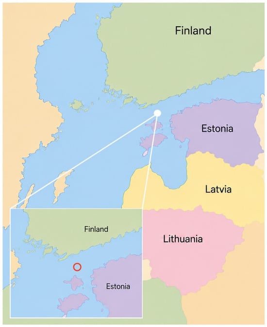
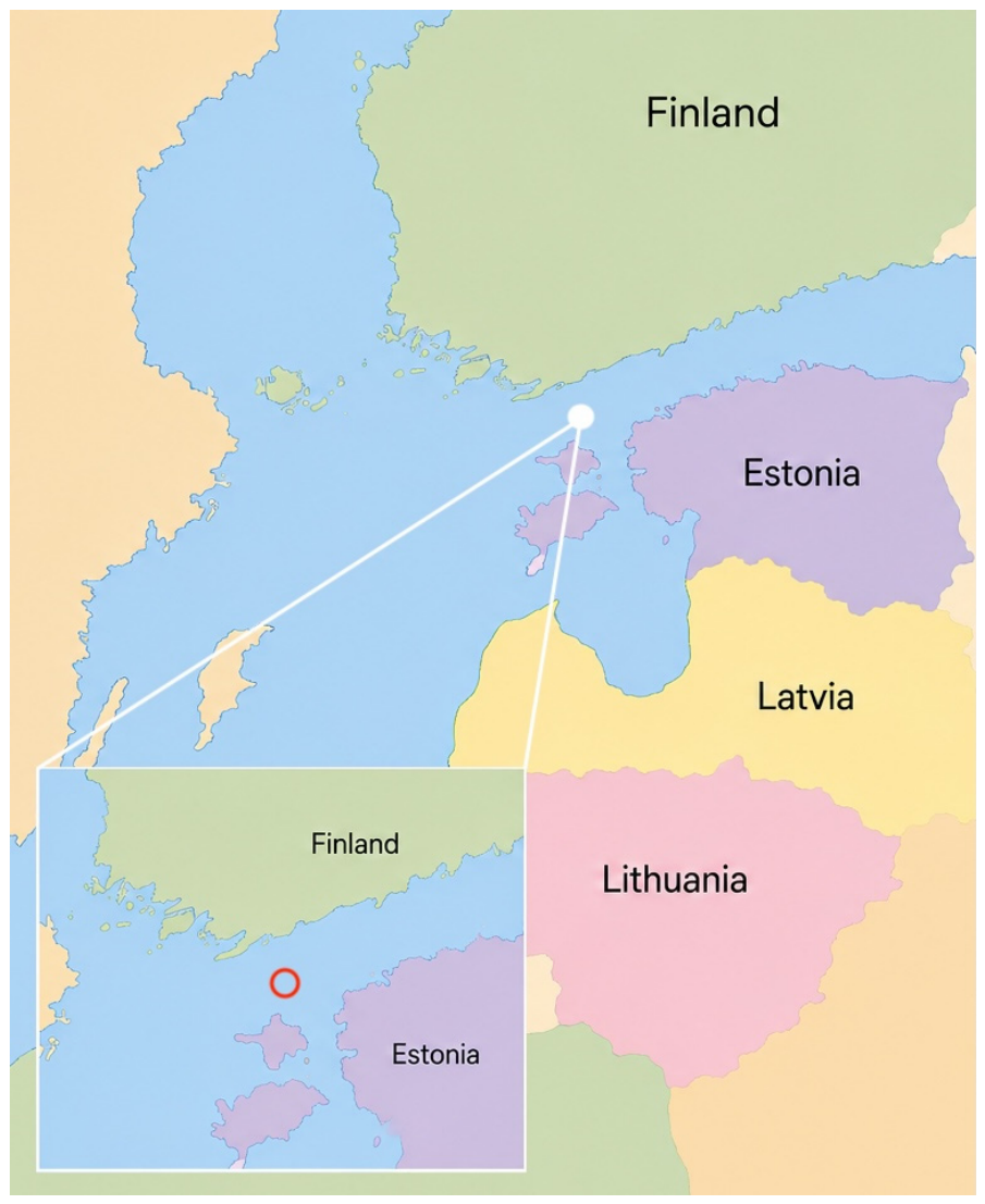
The subject of potentially polluting wrecks (PPWs) has been around for some time. Before World War II, there was no specific focus on the potential environmental danger arising from wrecks, but the issue emerged after the war because the number of sunken ships using hydrocarbon-based fuels increased dramatically [7,8]. Already in the 1960s, the subject of PPWs was occasionally mentioned by the specialist community (see, for example, [9]). The Torrey Canyon accident in 1967 was one of the first major oil spills covered by international media. And although this was not an oil spill from a historic wreck, it helped to bring the subject of environmental danger into public view, making the 1970s the real turning point in PPW recognition. Today, there are many case studies available about the environmental danger assessments and clean-up operations of PPWs around the world (see, for example, [10,11,12,13]). There are many different environmental risk assessment tools for wrecks—RULET [14], VRAKA [15], and DEEPP Project [16], to mention just a few—but so far, there is almost no international standardised approach to risk assessment [17]. However, lately, this issue has been approached by the international community through Project Tangaroa [18]. In the Baltic Sea, there have been and are numerous ongoing projects for assessment, monitoring, and mitigation of PPWs during the past two decades [19,20,21]. In Estonian waters, there are around 60 known PPWs [22] and less than 30 PPWs that have not yet been located or identified [23]. These numbers are constantly changing as new wrecks are found, and research is carried out on the wrecks, either confirming or eliminating the potential environmental threat. Only eleven of the PPWs are from times before World War II: eight German V25 class large torpedo boats, two British vessels, and one Imperial Russian vessel. One of the German vessels, SMS S31 was surveyed in 2023 and found likely to not be a major threat to the environment [24]. However, there are seven V25 class torpedo boat wrecks north of Hiiumaa island in Estonia (Figure 1). In 2025, the Estonian Maritime Museum surveyed three of the wrecks to determine their potential for environmental danger from oil spills.
Figure 1.
Location of the wrecks marked with red circle (Ivar Treffner, 2026).
1.1. Historic Background
The raid carried out by the X Torpedo boat flotilla against Baltisch Port, present-day Paldiski, Estonia, was the most conspicuous surface action undertaken by German naval forces in the Gulf of Finland in 1916, but it was also the costliest. The operation was influenced by several key factors: the German limited naval resources, the relatively inactive Russian fleet, and the existence of Russian minefields and barrier systems between Hanko peninsula in Finland and Dagö (present-day Hiiumaa island, Estonia) [25,26,27].
Rear Admiral Langemak, who commanded the reconnaissance and light naval forces operating from Libau (present-day Liepaja, Latvia), advanced the concept of “offensive defence”. The Russians were to be kept uncertain as to whether German light forces, submarines, aircraft, or airships could penetrate the inner Gulf of Finland. Langemak’s purpose was not merely to destroy individual vessels but to force the enemy to expend manpower and material on guard duties, minesweeping, and coastal-defence measures. German torpedo boats were to make demonstrative appearances, submarines were to conduct reconnaissance and minelaying, aircraft were to be carried forward by cruisers and torpedo boats, and Russian bases such as Reval, Mariehamn, Papenholm, and Rogoküll (present-day Tallinn (Estonia), Marienhamn (Finland), Papissaare (Estonia), and Rohuküla (Estonia)) were to be attacked when circumstances allowed [28].
The forces available to Langemak consisted mainly of light cruisers and torpedo boats. Earlier operations in 1916 involved the cruisers Straßburg, Kolberg, and Augsburg, the X Torpedo boat flotilla, boats of the VIII flotilla, and submarines and aircraft working in cooperation with the surface forces.
The immediate background to the Baltisch Port operation was the intelligence gathered by German submarines during 1916. U-boats had succeeded in entering the Gulf of Finland and in passing, at least in part, through the Russian “Forward” and “Middle” barrier positions. They had observed channels, buoys, net obstacles, and traffic in the areas of Reval, Hanko, Lappvik, and the Moon Sound (present-day Väinameri, Estonia). Especially important were reports suggesting that some form of passage might exist north of Dagö, in the direction of Tahkuna. Yet the success of the submarines encouraged a dangerous optimism. The fact that a submerged U-boat could pass beneath parts of a mine barrier did not mean that surface vessels could traverse the same area with comparable safety. Langemak and his staff underestimated the scale of the Russian barrier system, even though the reports of U-boats, agent intelligence, and earlier experience in the Gulf of Riga all pointed towards the need for greater caution [29].
The original target was Russian patrol forces thought to be in Kertel Bay (present-day Tareste Bay near Kärdla, Estonia). The operation began on 10 November 1916, when the weather appeared favourable, and the routes leading from Libau and Windau (today Ventspils, Latvia) had been checked by minesweepers. A more cautionary report came from U-19, which indicated that traffic east and west of Reval had ceased because of poor visibility, apart from movement through the inner archipelago route. This information reduced the assumed value of the operation’s targets, but Langemak did not let it halt the attempt. The X Torpedo boat flotilla advanced under Korvettenkapitän Wieting, whose flagship was S56. Supporting elements included Straßburg and Kolberg, boats assigned to mark the entrances and exits of the mine areas, and boats of the VIII flotilla used as anti-submarine protection for the cruisers [28,29].
The actual penetration began in the evening at 1800 hours CET at a speed of about twenty-one knots. Eleven torpedo boats proceeded in a narrow line ahead, separated by intervals of 300 to 400 metres. The weather was favourable from an operational standpoint: a light haze muted the moonlight, visibility was good, and the sea was calm. Before the flotilla had reached the meridian of Tahkuna, V75, eighth in the line, struck a mine abaft the bridge. The following two boats remained to assist her. V75 was soon lost, and S57 also struck a mine while assisting V75. G89 took off the crews and returned westward. Wieting continued the operation, as the loss of two boats was seen as a reasonable price for penetrating the minefield [29].
The strike on Baltisch Port took place in the early hours of 11 November. Once the Packerort (Pakri) lighthouse had been identified, S56, G90, and S59 entered the bay shortly after 0100 CET, while the remaining boats stayed farther out. The harbour and town were dark, and no naval targets were sighted. The torpedo boats opened fire on storage buildings, the railway station, and the signal station while avoiding the town itself. The range was only 600 to 1000 metres, and between 0123 and 0133 CET, the boats fired 162 high-explosive shells [28]. Some wooden structures were destroyed, but the incendiary effect was limited. According to the official Russian announcement, the casualties were nine killed (some sources claim ten killed, including a family of five [30]) and five wounded, about half of them civilians. Later information indicated that the storehouses also contained military horses and that the material damage was more substantial than the official account suggested [31].
The return passage turned the operation into a disaster. The flotilla was meant to cross the suspect area north of Dagö by the same route it had used on the outward voyage, but at 0315, V72 struck a mine. G90, S58, S59, and V76 were soon lost as well [29,31,32,33]. The damaged boats were generally not taken in tow but were scuttled by torpedoes or gunfire and charges. The rescue of personnel was comparatively successful. Although seven of the eleven torpedo boats of the flotilla were lost, casualties amounted to sixteen dead and twenty wounded [28]. Low casualties indicated good seamanship and discipline by officers and crews. This was commented in ship diaries and reports several times [32,33].
In operational terms, the outcome was ambiguous. The Germans achieved tactical surprise and succeeded in shelling Baltisch Port without immediate Russian resistance. The principal mission, however, was not fulfilled: no transports, destroyers, or other vessels were encountered either at sea or in the harbour.
At the strategic level, the operation was a failure. The loss of seven new torpedo boats was an excessive price, even if all assigned objectives had been achieved. The Russian “Forward Position” proved to be a barrier zone at least fifteen nautical miles wide and thirty nautical miles long. The average spacing of the mines was approximately 45 to 80 m [26,28]. This helps to explain how the flotilla could sometimes steam for a considerable distance inside the minefield without striking anything yet still lose several boats within a short period.
The Baltisch Port raid effectively brought German offensive operations by light surface forces in the Baltic Sea to a close for 1916. Langemak was later transferred to a less independent post, and Rear Admiral Hopman, considered experienced in Baltic warfare, replaced him as commander at Libau [25,28].
1.2. Background for the Current Survey
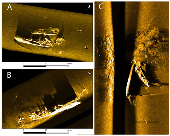
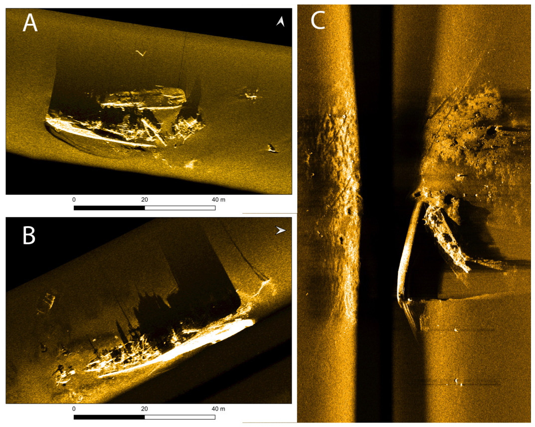
First, two of the wrecks were found in 2011 by the Estonian Transport Administration’s (then Estonian Maritime Administration) Hydrography department during regular seafloor mapping activities. In 2016, the Badewanne team (a multinational voluntary team of highly experienced technical rebreather divers specialising in finding, documenting, and identifying wrecks in the Baltic Sea for well over 25 years; see www.badewanne.fi (accessed on 11.05.2026)) dived the wrecks and identified them as G90 and S59 [34]. G90 was dived again in 2019. During these dives, the wrecks were visually surveyed, and videos and photos were taken, but the environmental assessment was not part of the agenda then. Both wrecks were declared Cultural Monuments in 2018. The other five supposed wrecks of the X Torpedo boat flotilla were found by the Estonian Transport Administration during their 2023 and 2024 mapping activities. Out of these five, three wrecks assumed to be S57, V72, and V75 were selected for the environmental threat assessment (Figure 2). One of the wrecks (assumed to be V76) was written off right away because of the depth (115 m) and lack of data. There was only a low-resolution multibeam echosounder (MBES) image available, and there was a small possibility that this may not be a X Torpedo boat flotilla wreck. The other wreck (possible S58) left out of the assessment had a good side-scan sonar image (SSS), showing the characteristic hull shape of a torpedo boat. However, the wreck was upside down and had sunken about halfway to the sediment. These two wrecks are to be studied in the future. Assessing more than three wrecks did not seem realistic within the timeframe and budget. However, the assessment of the wrecks was time critical for many reasons. The wrecks have been underwater already for 110 years, and their condition was not known. All these vessels had sunk due to the explosions and fire, which is considered an increased risk for collapse [8,35]. This, of course, is somewhat offset by the fact that the vessels were relatively new at the time of the sinking, meaning that their structural integrity was higher than it would have been on older ships. In addition, considering the smallness of the Baltic Sea and the location of the wrecks, a major oil spill would probably not affect only Estonia but possibly also pollute the shores of Finland and/or Sweden. And indirectly, all Baltic Sea states could be affected at a different level, as a lot of released oil does not reach the surface but is dispersed in the water column. The accumulation of pollutants from wrecks in the marine environment has been studied extensively, for example, in Poland, where the wrecks of Stuttgart and Franken provide an excellent research base [36,37], showing the negative impact on biodiversity and marine fauna [38]. A potentially polluting wreck in the Baltic Sea is not only the Coastal State’s “problem” in whose responsibility area it lies. PPWs should be viewed as a common problem for all Baltic Sea states, regardless of their location.
Figure 2.
Side-scan sonar images of the three wrecks: (A) V75, (B) V72, and (C) S57 (scans by Estonian Transport Administration).
2. Methodology for Identifying the Wrecks
For the identification of the wrecks, several methods were used: the geographical positions of the wrecks, comparing the physical differences of ships, and lastly comparing the damage observed underwater against the descriptions of the sinking events.
2.1. Location of the Wrecks
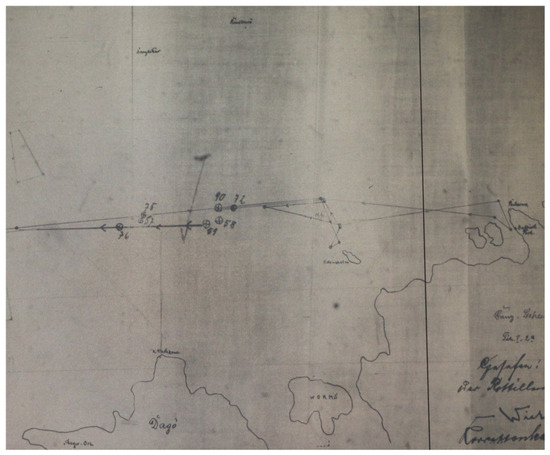
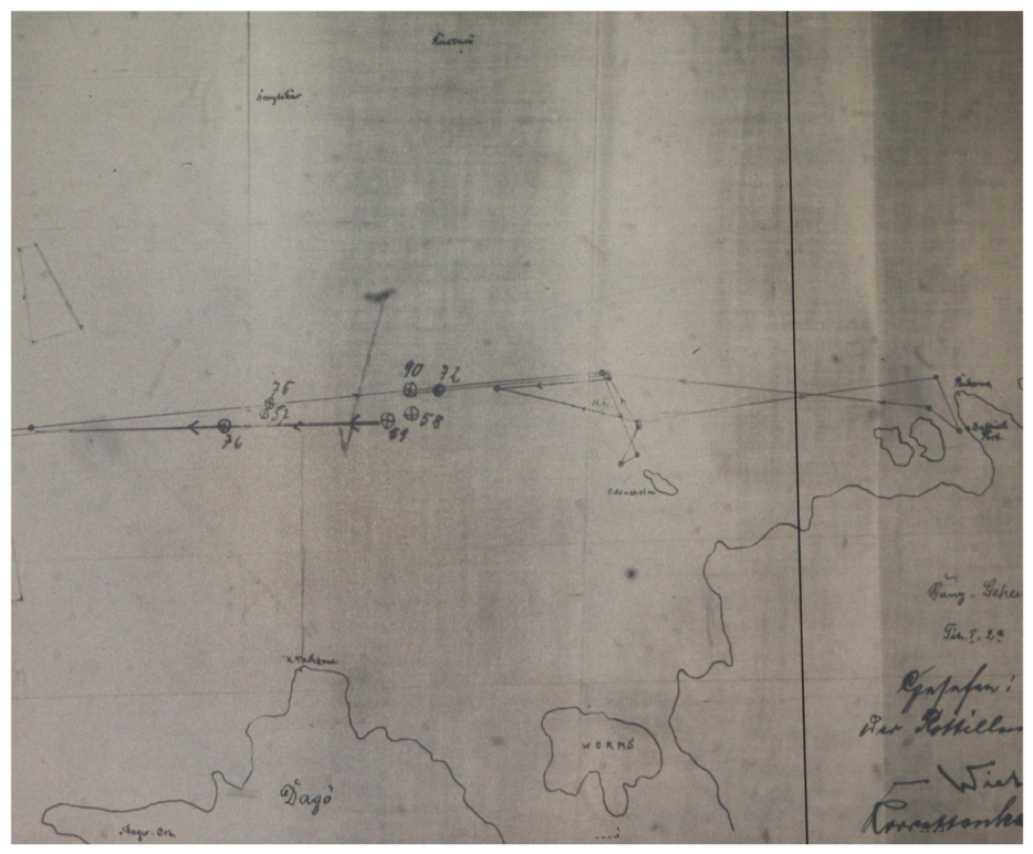
The sinking events were quite well documented in the surviving ship logs and reports. These included the coordinates of the sinkings and a map of the whole area with the locations marked on it (Figure 3). Thus, it was possible to compare the locations of the wrecks to the reported positions during the sinking. Obviously, the reported positions could not be considered as totally accurate because they were obtained by dead reckoning during long navigation using a map with unknown datum. Errors of a few minutes or nautical miles were expected. Still, the map and the coordinates proved to be surprisingly accurate. The pattern of the wreck locations matched closely the one drawn on the map back in 1916.
Figure 3.
The locations of the sinkings north of Dagö (Hiiumaa Island) from the war diaries [32].
2.2. Bearing Compass Binnacle
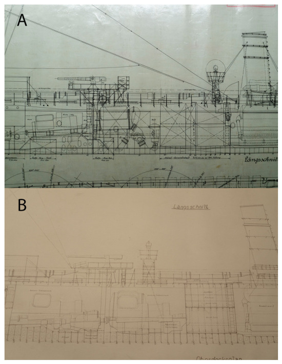
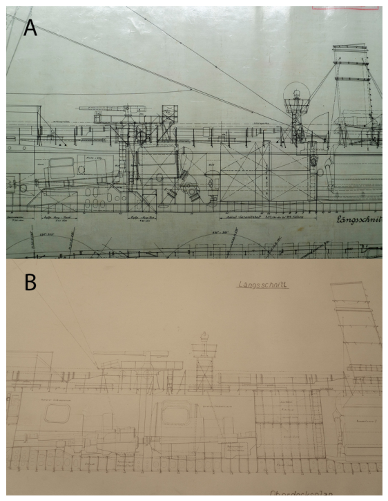
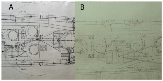
Although the V25 class ships were all the same class, they were built in different factories. S-ships like S57 were built by the Schichau shipyard in Elbing (today in Poland), and V-ships like V72 and V75 were built by AG Vulcan in Stettin (today Szczecin in Poland) and Hamburg [39]. The German Navy allowed for the shipyards to apply their experience and ideas within the framework set by them, which resulted in a slightly different size, displacement, and configuration of the ships. One of the most distinctive, easily noticeable differences that the S- and V-ships had was the location of the bearing compass binnacle on the deck. V-ships had the bearing compass right behind the aftmost funnel and in front of the second torpedo launcher. The S-ships had the same compass binnacle after the second torpedo launcher in front of the second gun (Figure 4). Thus, finding the location of the bearing compass binnacle would indicate if the ship was a V- or S-ship.
Figure 4.
Location of the bearing compass binnacle on (A) V-ships and (B) S-ships [40,41] (Ivar Treffner, 2025).
2.3. Ventilators
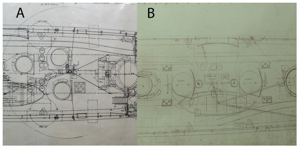
Although in Gröner’s book [42] the ventilators of the V67-84 drawing face the stern, discerning the V-ship from the S-ship with bow-facing ventilators, this is not supported by the original ship drawings. Both drawings show forward-facing ventilators. However, the V-ships had one extra ventilator next to the bearing compass binnacle on the port side (Figure 5), and between the funnels, the V-ship had three ventilators versus two on the S-ships. Also, the shape of the air intake of the ventilators is different: S-ships had a slightly curved air intake versus a straight one on the V-ships.
Figure 5.
Difference in the ventilator locations on (A) V- and (B) S-ships [40,41] (Ivar Treffner, 2025).
2.4. The Stern
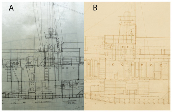
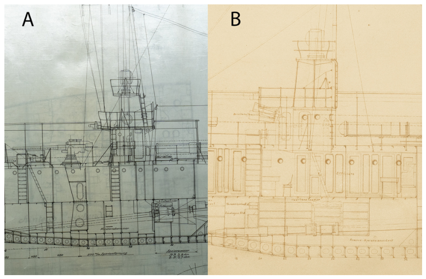
Behind the stern mast is a superstructure on top of which a searchlight is installed. That structure housed a spare steering wheel and a compass. Although the purpose of the superstructure was the same, the layout and the shape of the wheelhouse was significantly different (Figure 6). For example, the starboard side of the structure on the S-type ships shows an illuminator and two doors towards the stern. The V-type ships had a door, an oval, and a regular round illuminator behind it.
Figure 6.
Difference in the spare wheel cabin on (A) V- and (B) S-ships [40,41] (Ivar Treffner, 2025).
Another difference is in the location of sternmost pollards. On S-ships, the pollards are right behind the stern gun line, but on V-ships, the pollards are noticeably closer to the stern, and they are on an elevated platform (Figure 6A).
The stern itself is much sharper on S-ships, whereas V-ships have a rounder transom.
2.5. The Bow
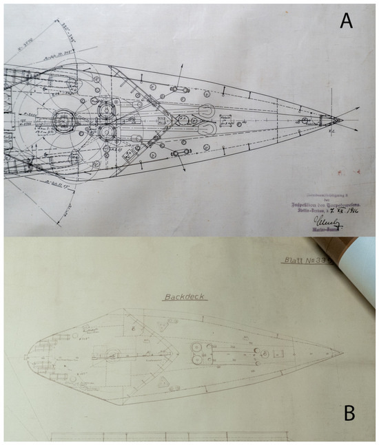
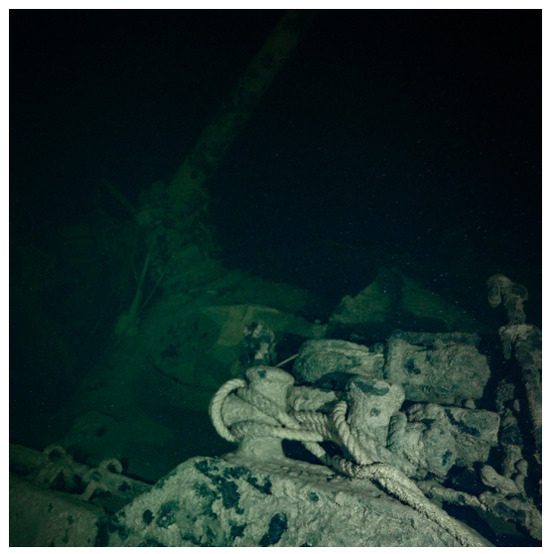
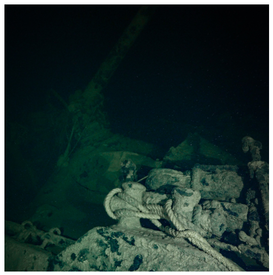
Both types had significantly different hawsepipes and winch systems. The hawsepipes differed by the shape and the location. The winch system was located much closer to the bow on S-type ships, while on V-type ships, it was located right in front of the bow gun. The hawsepipes were roughly in the same location as the winches on the S-type (Figure 7). There is also a difference in the illuminators in the bow. The S-type had four illuminators in the forecastle starting from the hawsepipe towards the stern, while the V-type had only two, on both sides of the hawsepipe.
Figure 7.
Difference in the bow on (A) V- and (B) S-ships [40,41] (Ivar Treffner, 2025).
Although there are other smaller structural differences between the ship types, these have been omitted here because either these do not show up on the underwater material or have either been destroyed or unobservable because of being under the sediment.
2.6. Damage from the Mines and the Sinking Event
As each sinking event was unique and rather well documented in the war diaries, it may be possible to compare the damage observed underwater to the damage documented during the sinking. Out of these three ships, none sank on its own; all of them had to be scuttled, adding to the mine damage. For example, if it is recorded that a ship broke in half before sinking but the wreck is intact, it is a warning sign that this may not be the ship in question. The damage recorded and the damage observed will be discussed in detail in Section 4.
3. The Survey
The research of the wrecks consisted of two parts: archival and literature research and the fieldwork. Archival research in the Freiburg Military Archives in Germany was conducted only after the wrecks were surveyed due to time and budget constraints.
As the museum does not own a working class ROV or a suitable platform for deploying such equipment and renting these would have been well outside the budget of the museum, it was decided to use diving as the preferred method for the survey. In addition, the museum applied for a grant from the Estonian Environmental Investment Centre to cover the fuel costs for the museum’s research vessel and personnel costs. The application was successful, and the funds were granted. The depths of the wrecks (bottom depths between 95 and 101 m) meant that technical diving was needed. Because at the time the museum had only one archaeologist capable of deep technical closed-circuit rebreather (CCR) diving, outside help was needed. The Badewanne research team, an international group of voluntary technical divers, was asked to help with this research.
The fieldwork had three main goals: to identify the wreck, to document the wrecks by video and photography as much as possible, and to visually assess the condition and integrity of the wrecks from the perspective of environmental danger. Obviously, visual assessment is not the preferred method for assessing potential PPWs or, in fact, any wreck. Remote sensing has become an indispensable tool, and the advantages of photogrammetry and high-resolution MBES modelling in archaeological surveys have been discussed and demonstrated multiple times recently [43,44,45,46]. Ideally, the assessment would include high-resolution MBES imaging integrated with complete photogrammetry of the wreck and overlaid with original vessel drawings [47]. In addition to remote sensing, metal thickness measurements to check the level of corrosion [48] and bottom sediment sampling for oil residue analysis [37] should be carried out at the very least. However, this project had only limited resources available, so not all desired methods could be applied. One of the biggest constraints in addition to budget was time. Badewanne divers are volunteers, thus participating in their own free time, so the project had to happen within a maximum of two consecutive weeks. The weather in the Baltic Sea is a major factor when planning any offshore operations. The wind speeds and wave heights that would be of no consequence in the ocean can be unacceptable in the Baltic Sea. For example, both the museum and Badewanne limit the wind speed at 5 m/s and wave height less than one meter for demanding technical dives. Out in the open sea, calm weather rarely lasts more than 2–3 days in a row. Another time factor is the bottom time: as a rule, the planned total dive time is 180 min max because this is when the diver’s central nervous system’s (CNS) toxicity clock reaches 100% when using a partial pressure of oxygen of 1.3 ATA in the CCR’s breathing loop without air breaks. Depending on the helium content of the diluent gas mix used, the effective working time at the bottom of 95–100 m would be around 15–20 min to stay inside the desired 180 min of total dive time. So, considering the limited bottom time and the time available for the project, it was decided that each of the wrecks would be visited once but dived twice by different teams on the same day. This would leave time for a follow-up dive if the first dive was not successful. On the other hand, this meant that there was not enough time for shooting material for photogrammetry or for taking metal thickness measurements or samples of the sediment, hence the decision to use only visual assessment.
The divers were divided into teams of two or three, depending on the availability of the divers. There was a maximum of seven divers available, but the actual number available on a specific day varied as not all divers were able to stay the full two weeks. Thus, each wreck was dived by two teams. The first team’s main task was to locate the wreck if it was not visible from the descent line and put a line to the wreck. The secondary task, if time allowed, was to take photos and visually inspect the wreck. The second team’s task was to shoot video of the wreck, with two main goals: to identify specific elements that would help to identify the wreck and to record the condition of the wreck, concentrating mainly on the damage (cracks, holes, etc.) to the wreck and the location of the damage. This would later help to assess the potential conditions of the fuel tanks.
The sequence in which the wrecks were dived was determined by the distance to the wreck, the depth, and the availability of side-scan sonar (SSS) images, selecting the one with the highest probability of success as the first. Out of three wrecks, two had SSS images, but the deepest one only had a low-accuracy MBES image.
A total of four dives were conducted between 15 July and 25 July 2025. The total combined dive time was almost 16 h, with around 2.5 h of bottom time.
4. Results
4.1. Wreck 1
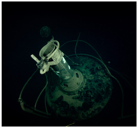
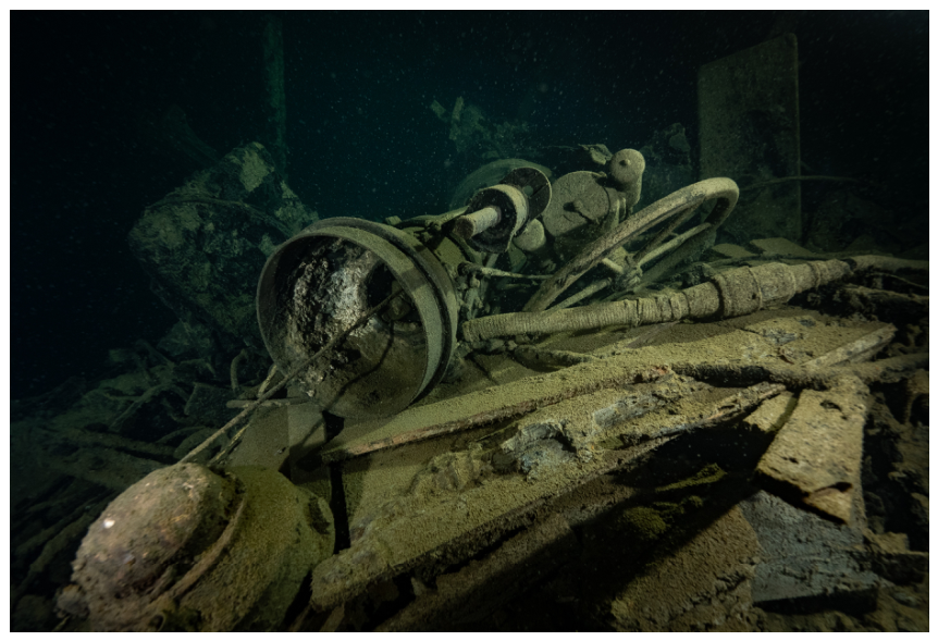
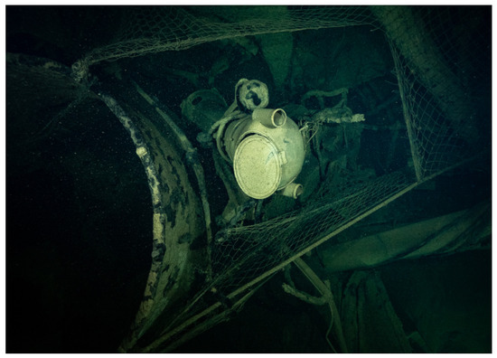
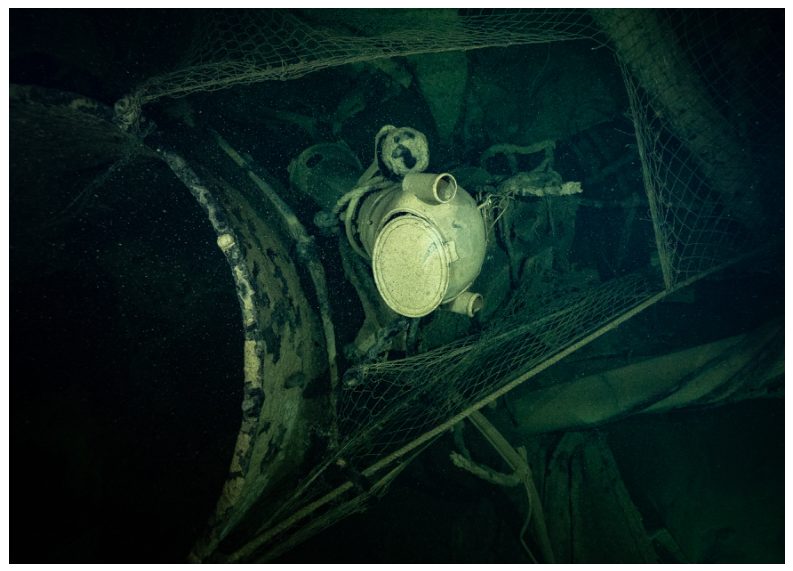
The first wreck surveyed was believed to be V72 considering the location of the wreck. The two dives took place on 15 July 2025. The depths on the wreck were between 94 and 97 m. The wreck sits on its keel and is in one piece, but the stern has sunk into the sediment from about mid-ship. The identity of the wreck as V72 was confirmed by the location of the bearing compass binnacle behind the second funnel and in front of the central torpedo launcher (Figure 8). Also, there was a ventilator in front of the bearing compass binnacle, and the ventilator intake was straight like on V-ships. The location of the winches and the hawsepipes in the bow correspond to the locations on V-ships. Furthermore, the mine struck the ship in the stern, possibly near the propellers [32]. The ship began to sink stern first. V77 tried to tow the sinking vessel, but the towing proved unsuccessful, so it was decided to abandon ship. To scuttle the vessel, V77 used its 10.5 mm guns and fired some shots at the sinking vessel [32]. Although no clear artillery damage was observed on the wreck, it is possible that it is in the part sunken into the sediment.
Figure 8.
Bearing compass binnacle on V72 (Ivar Treffner, 2025).
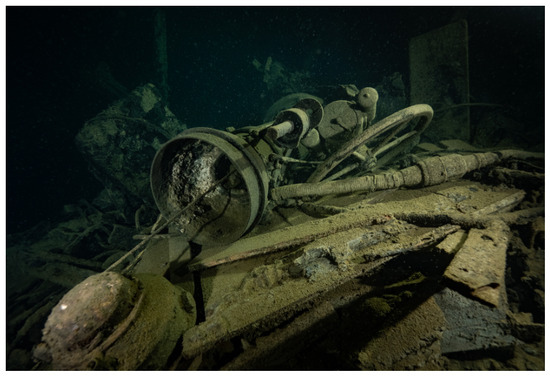
The port side of the bridge had collapsed, but it was impossible to say if this was because of natural degradation or was it damaged by a fishing trawl (Figure 9). Also, the platform behind the forward gun has collapsed. More clearly visible damage is right in the bow on the starboard side where the side of the hull has bent in.
Figure 9.
The collapsed bridge (Ivar Treffner, 2025).
In general, the visible part of the hull seemed to be in a relatively good state without major holes or cracks. Even the crane behind the bridge used for launching the lifeboats is still standing upright. The catastrophic collapse of the wreck was not considered imminent, but further research (at least metal thickness measurements) is needed to validate this assessment. It must be recognised that the assessment here and on the other two wrecks was conducted by visual observation, so it has major limitations. However, it took into consideration the structural damage, amount of corrosion damage (holes, cracks, etc.), and deformations observed.
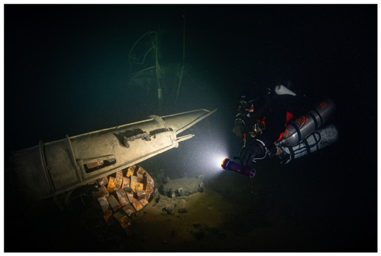
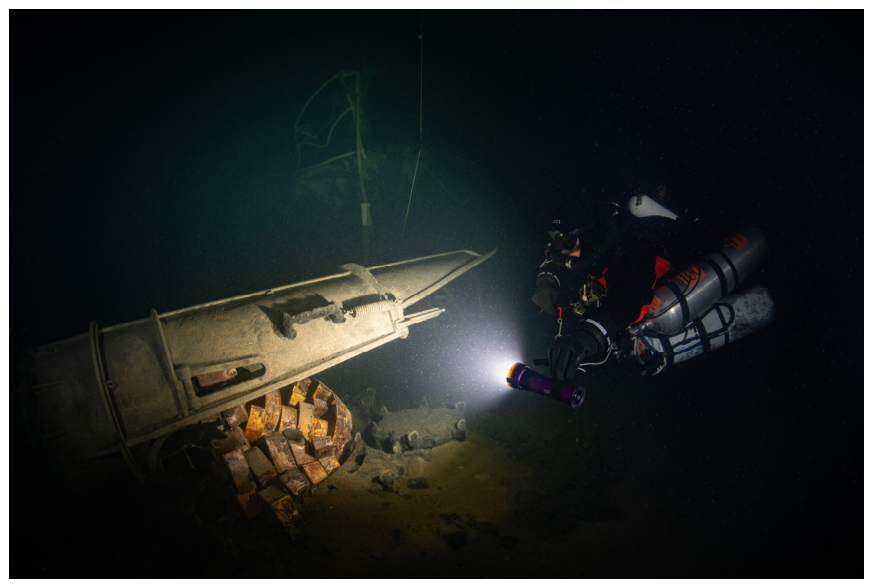
The only remains of a fishing trawl (also referred as ghost nets) were observed caught around the bow cannon. Commercial trawling can have a major impact on the integrity and preservation of wrecks [49]. This is well illustrated in Estonian waters, where commercial fishing is a historically important activity, and most of the wrecks within commercial fishing areas are either damaged by or covered with old fishing gear. A small quantity of unexploded ordnances (UXOs) was noted: on the deck in front of the bridge, some shells were observed, and the starboard side tube of the central torpedo launcher contained a torpedo. However, the metal casing of the torpedo head had completely disintegrated, leaving only packages of explosives lying on the bottom in a heap shaped like a torpedo head (Figure 10). This phenomenon has not been observed by the authors before and was not also observed on other X Torpedo boat flotilla wrecks.
Figure 10.
The explosive packages from the torpedo head with the bearing compass binnacle in the background (Harri Laakso, 2025).
4.2. Wreck 2
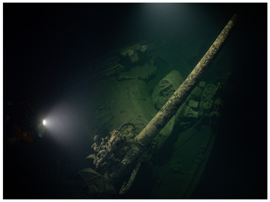
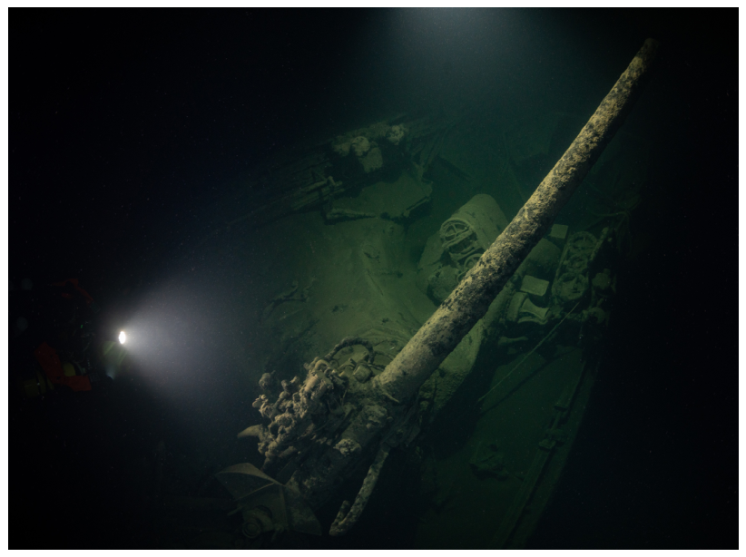
The second wreck was dived on 17 July 2025. The wreck lies at 94 m. Again, two teams dived the wreck. According to the geographical position of the wreck and the relative location towards another X torpedo boat flotilla wreck, it was believed to be the wreck of V75. This was also supported by the German map of the sinkings. The wreck has broken into three parts. The bow part has broken off at about frame 139 and the main part of the wreck at about frame 131, though the deformations extend 4–5 m towards the stern. The bow (Figure 11) is lying on the port side, and the main part is inverted with a slight list to port. The two parts lie only a few meters apart, and the section between frames 139 and 131 has disintegrated. It is where the munitions chamber was housed, which could have ignited, explaining the missing section of the ship. The port side torpedo launcher with a torpedo still in it (Figure 12) is still in original location, with a chain that was used for steering the retractable bow rudder hanging over it.
Figure 11.
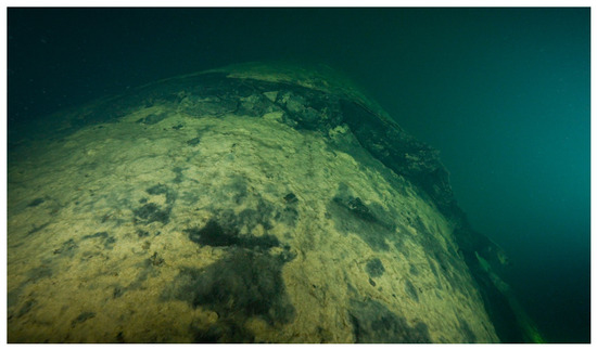
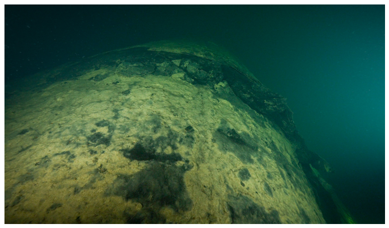
The bow of S57 (Ivar Treffner, 2025).
Figure 12.
A torpedo in the bow torpedo launcher (Ivar Treffner, 2025).
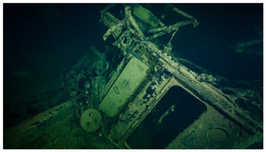
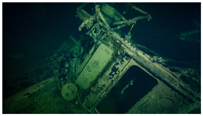
A big crack (Figure 13) that runs from the top of the starboard side to the keel was observed in about the middle of the main hull section. The main hull section has sunk into the sediment towards the stern. Because of this, it was not possible to verify the exact break-off point of the stern part, which is sticking out of the bottom upright behind the main hull section. The first identifiable feature of the stern part is the first stern cannon. Whatever has survived of the stern part towards the bow has sunk into the sediment. There are a lot of fishing trawl remains at the intersection of the main hull section and stern part and on the stern part itself. The elements of the ship are scattered around the area of the break-off. Thus, for the identification of the wreck, the original location of the bearing compass binnacle could not be established. The stand and the compass have been pulled against the second funnel and lie on the bottom under a fishing trawl together with one of the ventilators. This means that the location of the ventilator cannot also be used for identification. However, after reviewing the video and checking it against the drawings, it was clear that the original identification of the wreck as V75 was wrong. First, the superstructure housing the spare wheel in the stern is from an S-type vessel with an illuminator and two doors on the starboard side (Figure 14). Secondly, the ventilator found on the bottom has the distinct curved intake of an S-type ship’s ventilator (Figure 15). And thirdly, the winch system and the hawsepipes in the bow correspond to an S-type ship (Figure 11). The bow also has at least three illuminators (the original location of the fourth illuminator is at the break-off point, thus destroyed) starting from the hawsehole like in S-ships.
Figure 13.
The crack in the hull (Ivar Treffner, 2025).
Figure 14.
Spare wheelhouse in the stern of the wreck corresponding to S-ships (Ivar Treffner, 2025).
Figure 15.
The ventilator with a curved air intake and a bearing compass (Ivar Treffner, 2025).
According to the war diaries, S57 was damaged by a powerful explosion onboard V75 while departing with the crew of V75. The ship lost steam, the main turbines stopped, and the electrical power was lost [32]. Soon after that, there was a strong explosion under the bridge of S57, most likely from a mine. Although the ship was still afloat, it was decided not to tow the ship, as there were reports from watch officers about a possible hostile submarine in the area. S57 was sunk by a torpedo. It is not clear if it was a single torpedo or more. The damage to the wreck would suggest that it was hit with two torpedoes: one in the bow and the other somewhere in the last third of the ship. Thus, this wreck is, in fact, S57, not V75.
The overall structural condition of the three parts was considered good, with the main visual damage to the wreck originating from the mine and torpedo hits together with some damage from the fishing trawls.
4.3. Wreck 3
The first dive on the third wreck, initially expected to be S57, was carried out on 23 July 2025. This wreck was dived last because it was the deepest (max 101 m) of the three wrecks, and there was no side-scan sonar image available of the wreck. Although there was an attempt to scan the wreck with the museum’s aging sonar, it did not provide any meaningful image at this depth. For planning purposes, the divers had only a low-resolution MBES image, which showed two larger sections of the wreck lying almost parallel to each other and a third, smaller section a bit further out of the two main sections. From the image, it was impossible to establish which section was the bow and which was the stern. Because for the assessment both main parts needed to be dived, it was decided that one team would dive one part and the other would try to locate and survey the second part. As the third part was comparatively small and further from the main sections, it was decided that neither team would look for it. The first team dived the stern part, which was upright and had sunken into the sediment towards the bow from the central torpedo launcher. There is significant damage to the stern part after the stern gun: the deck has collapsed (Figure 16). The divers did not see the other bigger section of the wreck, nor did they find the bearing compass binnacle, which should have been between the central torpedo launcher and the bow-most stern cannon on an S-ship (Figure 17). The central torpedo launcher is partly visible from the sediment. On the bottom next to the torpedo launcher lie the second funnel and a searchlight. While exploring the debris field, the third smaller section was found, which turned out to be the bridge that has been detached from the main hull. It had toppled over and was lying on its side. Next to it sticking out of the bottom were the remains of the bearing compass binnacle and the compass case, but it was impossible to establish where their original location had been. Unfortunately, after the first team surfaced, the dive had to be cancelled, as the weather was worsening and the boat had suffered a minor technical problem. For safety, it was decided to return to the port.
Figure 16.
Collapsed stern deck on the wreck (Harri Laakso, 2025).
Figure 17.
The stern torpedo launcher and the gun (Harri Laakso, 2025).
The second dive to the wreck was conducted on 25th July 2025. Since it was the end of the two scheduled weeks, only one dive team was available. Luckily, the descent line was right next to the second main part of the wreck, which was the bow section lying on the starboard side. At the port torpedo launcher, the bow is less than a meter above the seafloor, but it rises towards the stern. The stern section was only 3–4 m from the bow section (Figure 18), so the team managed to survey both sections. What remained visible from the bow section appeared to be in one piece without any major holes or cracks. The bow part has been broken off right abaft the bridge at the second boiler room. No ghost nets were observed on the wreck. There were some UXOs behind the central gun platform. At least one of the tubes of the central torpedo launcher is empty, while the other tube has sunken into the sediment.
Figure 18.
Two parts of the wreck side by side (Ivar Treffner, 2025).
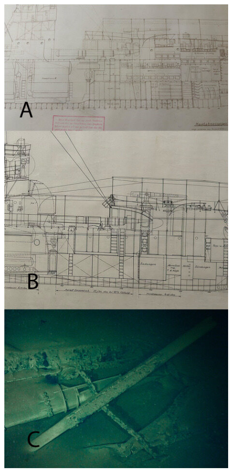
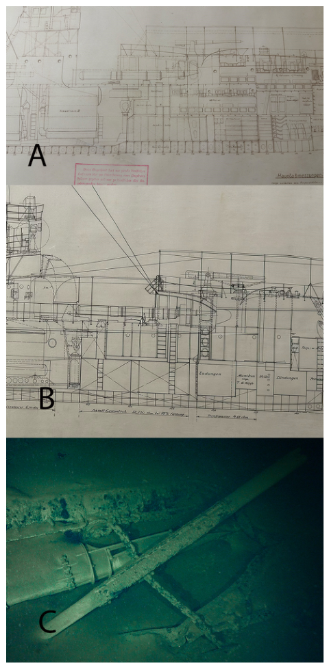
As the wreck is quite badly damaged, a big section from the middle is missing and most of the bow part sunken into the sediment, so there was not a lot to use for the identification. However, there are some elements that identify this as a V75. One is the pollard on the port side next to the stern gun (Figure 19): it sits further to the stern than on S-ships and is on an elevated platform characteristic to V-ships. Right in the stern on the port side, a block was observed, which on S-ships was on the starboard side. Also, the stern itself was much rounder than on S-ships, which had a very sharp stern. Another observed characteristic to V-ships is the shape of the opening in the side of the ship under the forecastle to allow the torpedo tube to be turned over the board. The shape differs on V- and S-ships (Figure 20).
Figure 19.
The pollard on a raised platform characteristic to V-ships (Ivar Treffner, 2025).
Figure 20.
The difference of the opening on (A) S-ships and (B) V-ships, with (C) showing the opening on the wreck [40,41] (Ivar Treffner, 2026).
V75 struck a mine right abaft the bridge [32]. The second and third boiler room were flooded, and the main turbines and the steering were not functional. As the ship was not yet sinking it was decided to tow the ship. However, the situation worsened during towing, and it was decided to abandon the ship. S57 took aboard the crew who had set charges in the stern turbine compartment. However, the explosion was not powerful enough to sink the ship. S57 went back and installed a new set of explosives. A second and much more powerful explosion happened some moments later mid-ship [32]. This is consistent with the damage observed on the wreck: the wreck is broken in two behind the bridge, and there is extensive damage in the stern and possibly a section of the ship missing from the middle.
5. Assessing the Potential Risk to the Environment
Although the Baltic Sea preserves the wrecks well, it does not mean that the wrecks do not deteriorate. The corrosion rate is never universal. Factors like temperature, time, depth, currents, oxygen content, salinity, microbiological activity, layout of the vessel, quality of the material, and others influence the rate of corrosion [8,50,51,52,53]. Regardless, all wrecks will collapse at some point. Measuring hull metal thickness and comparing the results to the original metal thickness could give a rough indication of the structural stability of a wreck. Although it is unlikely that even in case of a complete collapse all oil would be released at once [17], the potential environmental threat in this paper is illustrated through the maximum possible amount (worst-case scenario) of oil still on board, regardless of the oil release scenario.
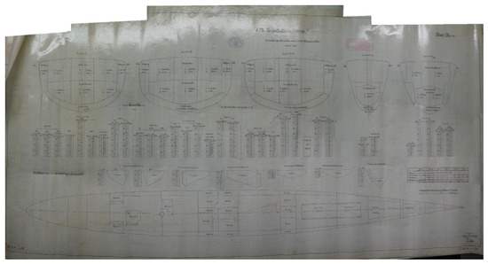
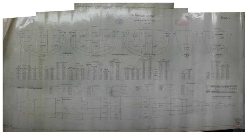
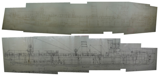
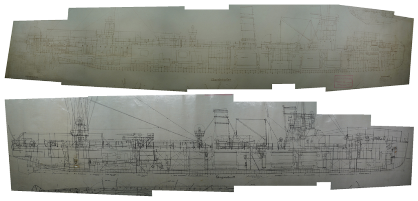
There are different data about the fuel capacities of the V- and S-ships. Gröner [41] reports that V72 had a fuel capacity of 308 tons, V75 306 tons, and S57 305 tons. The original ship drawings for V67-82 [54,55] found in the Kriegsmarine Archives in Freiburg state that the 100% fuel level was 347.46 m3, and the 95% level (which would have been the level to which the bunkers were filled) was 330.34 m3 (Figure 21). The authors could not find any such drawings or data in the archives about S-ships. However, comparing the S- and V-ship drawings displaying the bunker layout, they are almost the same (Figure 22). And a few cubic meters difference is negligible in case of estimating the overall environmental danger. Without knowing the density (also called specific gravity) of oil used in the ships, it is not possible to convert the cubic meters to tons. Thus, it stands to reason to use the closest likely value that can be found. A study conducted in the UK [56] discovered that in 1914 the specific gravity of heavy fuel oils used by the Admiralty ranged between 0.825 and 0.96, with the “ordinary fuel oil” having a specific gravity of 0.888. Considering this, the tons reported by Gröner can be considered as adequate. This also confirms the assumption made from the ship plans that the fuel capacity of the S-ships is the same as for V-ships.
Figure 21.
The fuel bunkers and capacities of V-ships [54].
Figure 22.
The fuel bunker layout on S-ships (above) and V-ships (below) [40,41].
Of course, it is clear that the ships did not sink with full bunkers. Currently, it is even unknown how much fuel they had on board when the flotilla left Libau. However, it stands to reason that the ships were fuelled before going on an operation. Also, for the sake of prudency, 95% full bunkers should be estimated at the time of departure. The range of S57 was 1960 nautical miles at the speed of 20 knots. V72 and V75 had a range of 1810 nautical miles at the same speed [41]. This means that S57 could sail about 6 nautical miles with one cubic meter of fuel and V72 and V75 about 5.5 nautical miles. The authors recognise that these calculations are extremely basic and limited, and the real-life consumption during this operation could have been different, but the aim of this is not to calculate the exact amount of oil on board during the sinking but to understand the rough possible amount that could still be a threat to the environment.
5.1. V75
Comparing the damage observed on the wreck to the original ship plans of V67-V82, it can be assumed that the fuel bunkers in the middle of the ship are destroyed. During the sinking, the bulkhead between the first boiler room and forward fuel bunkers broke down. Furthermore, it was reported that there was a fire in the first boiler room as the oil from the damaged bunkers ignited [32]. Only the bunkers on the bow could possibly be undamaged. The capacity of the bow bunkers at 95% was 52.12 m3 [54], but it is hardly likely that the bunkers would have been full. It is impossible to estimate the remaining quantity of oil in those bunkers because the oil was most likely used simultaneously from all bunkers to maintain trim and heel. However, if the bunkers were full when the ship sank, in the worst-case scenario, roughly 52 m3 of fuel could have remained on the wreck. V75 had sailed about 180 nautical miles before sinking, so the average fuel consumption would have been ca 33 m3 if consuming one cubic meter of fuel for every 5.5 nautical miles. That would be 10% of the total capacity. Thus, in case the fuel was consumed evenly from the bunkers, the forward bunkers could still hold 47 m3 of fuel.
5.2. S57
Without a high-resolution MBES or photogrammetric model, it is difficult to estimate the exact damaged areas. The break in the bow is easy to identify, but the exact location of the crack in the hull and the break in the stern are more difficult. The bow fuel bunkers extend from frame 121 to 132 [41]. As the main part starts at about frame 131 but the visual damage extends further, it is highly likely that the bottom fuel bunker was damaged during the sinking and does not contain any fuel. However, there were three bunkers on top of the bottom fuel tank. Unfortunately, the exact data of each bunker’s capacity from S-ships are currently unavailable, so the data from V-ships are used. Admittedly, there are some differences in bunker construction. For example, the bow bunkers on V-ships are located slightly towards the stern, between frames 114 and 127 [40]. This difference cannot be very large though, as the overall fuel capacity of the ships is almost the same. So, out of about 52 m3 (at 95% capacity) of fuel stored in the bow bunkers, about 11 m3 [54] was stored in the bottom bunker, which is likely now empty. There were three bunkers above the bottom bunker, and out of these three, only the first one extends to the damaged area, so this bunker (ca 13 m3) most likely does not contain any oil. The two remaining bunkers held about 28 m3 combined, and they may be intact.
Because both the main part of the hull and the stern part have sunk into the sediment, it is not possible to identify the exact break-off point at the stern. The abovementioned crack in the hull is believed to be somewhere in the area of the second boiler room, thus not affecting any fuel bunkers. The area between the first and second boiler rooms where the next set of fuel bunkers are located seems undamaged. Those bunkers had a combined fuel capacity of 75 m3 [54], which could still be in the wreck. The stern has most likely broken off somewhere under the central torpedo launcher. This means that the fuel bunkers in that area are most likely destroyed. Thus, in the worst-case scenario, there may still be about 103 m3 of fuel oil on the wreck. S57 had also sailed a similar distance as V75 before sinking. Consuming about 1 cubic meter of fuel per 6 nautical miles, it had consumed roughly 30 m3 of fuel, which again translates to about 1/10 of the full capacity. In case the fuel was used evenly from the bunkers, the remaining quantity could be about 93 m3.
5.3. V72
As the wreck seems to be intact and this is supported by the report of the sinking, no major visible damage was observed on the part of the wreck above the sediment, so there is reason to believe that the fuel bunkers are also intact. Since the V-ships had a fuel capacity of about 330 m3 at 95% fill level, this should be taken as the baseline. For the other two wrecks, it was assumed for the sake of prudency that the remaining bunkers were full, as it was not possible to determine how much and from which bunkers oil was used. As V72′s bunkers are believed to be intact, it is expected that all the fuel on board during the sinking is still on board. Thus, it does not matter which bunkers are full and which are not: only the fuel used during sailing should be deducted from the overall capacity. As V72 sank on its way back, it had covered a much longer distance than S57 and V75: about 300 nautical miles. At 5.5 nautical miles per cubic meter of fuel, it would have used about 55 m3 of fuel. This would mean that in the worst-case scenario, the wreck could still contain about 275 m3 of fuel.
6. Conclusions
The preliminary survey carried showed that these wrecks can still pose a threat to the environment. Although the calculations made above are hypothetical and further research is needed to validate these calculations, it is highly likely that the wrecks still contain at least some amount of oil. It should also be understood that these wrecks have been underwater for more than 100 years; their structure weakens and metal corrodes with every passing year. At one point, the hulls of the wrecks will become (if they are not already) too brittle to install tapping valves for oil removal. This would substantially complicate any potential oil removal operation and increase the costs. Further research including photogrammetry, high-resolution MBES, and metal thickness measurements should be carried out as soon as possible to answer this concern.
The need for a possible invasive mitigation measure illustrates well the conflict between cultural preservation and environmental protection. Intervening with a wreck will permanently alter its physical authenticity and may even result in the destruction of the wreck. At what point does the need to protect the environment become more important than preserving the heritage? There is no universal answer. This can only be assessed case by case, taking into consideration the possible direct damage done to nature, the costs of clean-up activities, the probability of success of the remediation operation, and the long-term socio-economic costs that are often forgotten in this context. It is clear that the environment takes precedence on a larger scale of things. The wrecks will disappear sooner or later, and today’s technology offers a possibility to digitally preserve those wrecks for future generations. So, the main question would be how to (cost) effectively mitigate the risks posed by PPWs and how to do it considerately.
Wrecks sunk during armed conflicts are most likely also the final resting place for at least some of the sailors or passengers. These wrecks represent a memorial or a tombstone to the people that perished on board. Naval vessels are state vessels, and although over the years there have been many discussions about the ownership of sunken state vessels [57,58,59], the prevailing view seems to be that the state vessel wreck belongs to the flag state. This would mean that the flag state could be considered responsible for the risk mitigation activities. Good examples in this matter are the USA and UK, who have taken steps to remediate their PPWs in foreign waters [60,61]. It is important to remember that none of the PPWs in Estonian waters were Estonian vessels: they all sailed under foreign flags. At the very least, prior to any invasive activities, the flag state should be consulted, especially if there were casualties during the sinking. However, the ownership of Imperial German Navy vessels is rather ambiguous. Although Germany claims legal continuity with the German Reich [62], the state has not expressed the ownership of all their state vessels like, for example, the United States or United Kingdom. However, there are at least two cases where Germany has claimed to be a lawful owner of a German state vessel sunk in foreign waters: Graf Spee in Uruguay and Blücher in Norway [63]. Thus, the question about state responsibility and the Coastal State’s right to protect its environment by managing the wreck may get tangled in lengthy legal discussions and red tape, delaying any time-critical activities needed.
The management of PPWs is a complex matter often hindered by the lack of resources. It is a problem that will not go away by itself. Thus, the responsible states should accept the problem and acknowledge that in most cases the remediation is a much cheaper option than the clean-up operation after a spill. It should be recognised that cooperation among all Baltic Sea states is needed to tackle the problem. However, with rising awareness in this matter among the policy makers, scientists, and public, there is a good chance for more permanent and long-term solutions.
Author Contributions
All authors contributed to the research and survey of the wrecks. I.T. led the fieldwork as a responsible archaeologist and a diver, J.P. participated as a diver, and P.L. provided surface support. All authors contributed to the archival research, with I.T. and P.L. carrying out the research in the Freiburg archives for ship plans, and J.P. carried out the archival research into war diaries. I.T. wrote the main manuscript, with P.L. and J.P. providing historical background. They also reviewed and accepted the final manuscript. All authors have read and agreed to the published version of the manuscript.
Funding
The fieldwork was carried out with the grant RES.4.07.25-0036 from the Estonian Environmental Investment Centre and with permit 51596 issued by the Estonian National Heritage Board.
Data Availability Statement
The original contributions presented in this study are included in the article. Further inquiries can be directed to the corresponding author.
Conflicts of Interest
The authors declare no conflict of interest.
References
- Brennan, M.L. The Archaeology of Oil Tanker Shipwrecks and Their Potential to Pollute. Heritage 2026, 9, 3. [Google Scholar] [CrossRef] [Scilit]
- Brennan, M. Potentially Polluting Wrecks: An Introduction. In Threats to Our Ocean Heritage: Potentially Polluting Wrecks; Brennan, Ed.; Springer Nature: Cham, Switzerland, 2024. [Google Scholar]
- Brown, W.M. The Royal Navy’s Fuel Supplies. Ph.D. Dissertation, King’s College London, University of London, London, UK, 2003. [Google Scholar]
- Dahl, E.J. Naval Innovation. From Coal to Oil. In Joint Force Quarterly. 2000. Available online: https://www.researchgate.net/publication/235048025_Naval_Innovation_From_Coal_to_Oil (accessed on 21 July 2026).
- Kelanic, R.A. The petroleum paradox: Oil, coercive vulnerability, and great power behaviour. Secur. Stud. 2016, 25, 181–213. [Google Scholar] [CrossRef] [Scilit]
- Masetti, G.; Orsini, F. Environmental Risks Monitoring of Shipwrecks in Italian Seas. Int. Hydrogr. Rev. 2009, 490, 51–60. [Google Scholar]
- Girin, M. European experience in response to potentially polluting shipwrecks. Mar. Technol. Soc. J. 2004, 38, 21–25. [Google Scholar] [CrossRef] [Scilit]
- Monfils, R. The global risk of marine pollution from WWII shipwrecks: Examples from the Seven Seas. In Proceedings of the 2005 International Oil Spill Conference, Miami Beach, FL, USA, 15–19 May 2005. [Google Scholar]
- Nanda, V.P. The Torrey Canyon disaster: Some legal aspects. Denv. LJ 1967, 44, 400. [Google Scholar]
- Hill, P.G.; Skelhorn, M.; Leather, S. Assessing the environmental risk posed by a legacy tanker wreck: A case study of the RFA War Mehtar. Environ. Res. Commun. 2022, 4, 055005. [Google Scholar] [CrossRef] [Scilit]
- Gilbert, T.; Nawadra, S.; Tafileichig, A.; Yinug, L. Response to an oil spill from a sunken WWII oil tanker In Yap State, Micronesia. Int. Oil Spill Conf. Proc. 2003, 2003, 175–182. [Google Scholar] [CrossRef] [Scilit]
- NOAA. Screening Level Risk Assessment Package Bloody Marsh. 2013. Available online: https://nmssanctuaries.blob.core.windows.net/sanctuaries-prod/media/archive/protect/ppw/pdfs/bloody_marsh.pdf (accessed on 21 July 2026).
- Brennan, M.L.; Delgado, J.P.; Jozsef, A.; Marx, D.E.; Bierwagen, M. Site formation processes and pollution risk mitigation of World War II oil tanker shipwrecks: Coimbra and Munger T. Ball. J. Marit. Archaeol. 2023, 18, 321–335. [Google Scholar] [CrossRef] [Scilit]
- Symons, L.; Michel, J.; Delgado, J.; Reich, D.; McCay, D.F.; Etkin, D.S.; Helton, D. The Remediation of Underwater Legacy Environmental Threats (RULET) risk assessment for potentially polluting shipwrecks in US waters. Int. Oil Spill Conf. Proc. 2014, 2014, 783–793. [Google Scholar] [CrossRef] [Scilit]
- Landquist, H.; Rosén, L.; Lindhe, A.; Hassellöv, I.M. VRAKA—A probabilistic risk assessment method for potentially polluting shipwrecks. Front. Environ. Sci. 2016, 4, 49. [Google Scholar] [CrossRef] [Scilit]
- Directorate-General for Environment; Civil Protection Unit. DEEPP Project. Development of European Guidelines for Potentially Polluting Shipwrecks. 2007. Available online: https://www.academia.edu/144631326/DEvelopment_of_European_guidelines_for_Potentially_Polluting_shipwrecks (accessed on 21 July 2026).
- Goodsir, F.; Lonsdale, J.A.; Mitchell, P.J.; Suehring, R.; Farcas, A.; Whomersley, P.; Brant, J.L.; Clarke, C.; Kirby, M.F.; Skelhorn, M.; et al. A standardised approach to the environmental risk assessment of potentially polluting wrecks. Mar. Pollut. Bull. 2019, 142, 290–302. [Google Scholar] [CrossRef] [Scilit] [PubMed]
- Lloyd’s Register Foundation. Potentially Polluting Wrecks: Protecting People and Planet. Insights from the Project Tangaroa Coalition. 2025. Available online: https://www.project-tangaroa.org/wp-content/uploads/2025/11/LRF-PPW-Report.pdf (accessed on 21 July 2026).
- Hac, B. Polluting wrecks in the Baltic Sea. In Threats to Our Ocean Heritage: Potentially Polluting Wrecks; Springer Nature: Cham, Switzerland, 2024. [Google Scholar]
- HELCOM. Thematic Assessment on Hazardous Submerged Objects in the Baltic Sea. Potentially Polluting Shipwrecks in the Baltic Sea. 2025. Available online: https://helcom.fi/wp-content/uploads/2025/06/Thematic-assessment-on-hazardous-submerged-objects-in-the-Baltic-Sea-potentially-polluting-shipwrecks.pdf (accessed on 21 July 2026).
- Lindgren, J.F.; Åberg, F.; Johansson, J.R. Polluting shipwrecks in Swedish waters: Investigations, risk assessment methodology and oil removal operations. In Proceedings of the International Oil Spill Conference Proceedings, New Orleans, LA, USA, 10–14 May 2021; Volume 2021. [Google Scholar]
- Treffner, I. 20. Sajandil Uppunud Vrakkide Keskkonnaohtlikkuse Analüüs. 2020. Available online: https://kliimaministeerium.ee/sites/default/files/documents/2023-04/2020_vrakkide_keskkonnaohtlikkuse_analuus.pdf (accessed on 21 July 2026).
- Treffner, I. 2016. a. ülevaate uuendamine ja vraki keskkonnaohtlikkuse kindlakstegemine. Report in the Estonian Ministry of Climate Archives, Tallinn, Estonia, 14 April 2021.
- Peremees, K. Hävitaja S31 Vraki Keskkonnaohtlikkuse Hindamine. Unpublished Report in the Estonian National Heritage Board Archives. 2023. Available online: https://register.muinas.ee/ftp/Arheoloogiliste%20uuringute%20aruanded/UT-631_Aallveeuuring_2023_PeremeesK_vrakk-31179_veekogu-Liivilaht.pdf (accessed on 21 July 2026).
- Harjula, M. Itämeri 1914–1921. Itämeren Laivastot Maailmansodassa Sekä Venäjän Vallankumouksissa Ja Sisällissodassa; Books on Demand: Norderstedt, Germany, 2010. [Google Scholar]
- Goncharov, L.G.; Denisov, B.A. Ispolzovanie min v mirovuju imperialisticheskuju voinu 1914–1918 gg In Voenmorizdat: Moskva-Leningrad, NKVMF SSSR; 1949.
- Kireev, I.A. Tralenie v Baltijskom more v vojnu 1914–1917 gg In Voenmorizdat: Moskva-Leningrad, NKVMF SSSR; 1939.
- von Gagern, E. Der Krieg in Der Ostsee, Dritter Band; E.S. Mittler & Sohn: Frankfurt, Germany, 1964. [Google Scholar]
- Kriegstagebuch des Befehlshabers der Aufklarungsschiffe in der östlichen Ostsee. PG 62568, National Archives Microfilm Publication T1022, roll 234.
- Ü, V. Kui mürtsusid kahurid Paldiski lahes. Kaitse Kodu!, 44/45, Tallinn, Estonia, 1931.
- Kriegstagebuch X. Torpedoboots flottille. PG62108, PG62109, National Archives Microfilm Publication T1022, roll 91.
- Kriegstagebuch 20. Torpedoboots halbflottille. PG62286, National Archives Microfilm Publication T1022, roll 140.
- Krigstagebuch 19. Torpedoboots halbflottille. PG62275, National Archives Microfilm Publication T1022, roll 137.
- Flinkman, J.; Polkko, J. Fog of War, The First World War in the Gulf of Finland; John Nurmisen Säätiö: Helsinki, Finland, 2024. [Google Scholar]
- Liddell, A.; Skelhorn, M. Deriving Archaeological Information from Potentially-Polluting Wrecks. In Bridging the Gap in Maritime Archaeology: Working with Professional and Public Communities; Bell, Ed.; Archaeopress Publishing: Oxford, UK, 2018. [Google Scholar]
- Rogowska, J.; Kudłak, B.; Tsakovski, S.; Gałuszka, A.; Bajger-Nowak, G.; Simeonov, V.; Konieczka, P.; Wolska, L.; Namieśnik, J. Surface sediments pollution due to shipwreck s/s “Stuttgart”: A multidisciplinary approach. Stoch. Environ. Res. Risk Assess. 2015, 29, 1797–1807. [Google Scholar] [CrossRef] [Scilit]
- Szpiech, A.; Bojke, A.; Littwin, M.; Dzendrowska, A.; Duljas, E.; Flasińska, A.; Szczepańska, K.; Dziarkowski, T.; Dembska, G.; Pazikowska-Sapota, G.; et al. Baltic Sea shipwrecks as a source of hazardous pollution. PeerJ Anal. Chem. 2024, 6, e31. [Google Scholar] [CrossRef] [Scilit]
- Willa, R.; Szpak, A. Toxic Ticking Time-Bomb in the Baltic Sea and Threats to Poland’s Security. Pol. Political Sci. Yearb. 2023, 1, 187–204. [Google Scholar] [CrossRef] [Scilit]
- Fock, H. Z-vor! Internationale Entwicklung Und Kriegseinsätze Von Zerstörern Und Torpedobooten 1914 Bis 1939; Koehler: Hamburg, Germany, 2001. [Google Scholar]
- Bundesarchiv. RM/3/21922; S.M. Torpedoboote “V67-82”; Längschitt/Obere Ansicht: Freiburg, Germany, 1916.
- Bundesarchiv. RM/3/14221; S.M. torpedoboote S.53-S.66; Längsschnitt/Oberdecksplan: Freiburg, Germany, 1915.
- Gröner, E. Die Deutchen Kriegsschiffe 1815–1945. Band 2; Bernard & Graefe Verlag: Koblenz, Germany, 1983. [Google Scholar]
- McCarthy, J.; Benjamin, J.; Winton, T.; van Duivenvoorde, W. The Rise of 3D in Maritime Archaeology. In 3D Recording and Interpretation for Maritime Archaeology; McCarthy, J., Benjamin, J., Winton, T., van Duivenvoorde, W., Eds.; Coastal Research Library; Springer: Cham, Switzerland, 2019; p. 31. [Google Scholar] [CrossRef] [Scilit]
- Rubio, S.S.; Romero, A.S.; Andreo, F.C.; Bethencourt, M. Comparison between the Employment of a Multibeam Echosounder on an Unmanned Surface Vehicle and Traditional Photogrammetry as Techniques for Documentation and Monitoring of Shallow-Water Cultural Heritage Sites: A Case Study in the Bay of Algeciras. J. Mar. Sci. Eng. 2023, 11, 1339. [Google Scholar] [CrossRef] [Scilit]
- McKinnon, J.; Yamafune, K. Using Photogrammetry and Deviation Analysis to Conduct Quantitative Monitoring Surveys of WWII Sites in the Pacific. J. Marit. Archaeol. 2024, 19, 657–694. [Google Scholar] [CrossRef] [Scilit]
- Janowski, L.; Pydyn, A.; Popek, M.; Tysiqc, A. Non-invasive investigation of a submerged medieval harbour, a case study from Puck Lagoon. J. Archaeol. Sci. Rep. 2024, 58, 104717. [Google Scholar] [CrossRef] [Scilit]
- Lawrence, M.; Leather, S.; Burnay, S. Assessment Methodologies for Potentially Polluting Wrecks: The Need for a Common Approach. In Threats to Our Ocean Heritage: Potentially Polluting Wrecks; Brennan, Ed.; Springer Nature: Cham, Switzerland, 2024. [Google Scholar]
- Glover, R. Corrosion Processes of Steel-Hulled Potentially Polluting Wrecks. In Threats to Our Ocean Heritage: Potentially Polluting Wrecks; Brennan, Ed.; Springer Nature: Cham, Switzerland, 2024. [Google Scholar]
- Majcher, J.; Quinn, R.; Andersen, G.N.; Gregory, D. Wreck Sites as Systems Disrupted by Trawling. In Threats to Our Ocean Heritage: Bottom Trawling; Jarvis, Ed.; Springer Nature: Cham, Switzerland, 2024. [Google Scholar]
- Etkin, D.S.; Van Rooij, H.; French-McCay, D. Risk assessment modeling approach for the prioritization of oil removal operations from sunken wrecks. In Effects of Oil on Wildlife; Interspill: Tallinn, Estonia, 2009. [Google Scholar]
- Melchers, R.E. Progress in developing realistic corrosion models. Struct. Infrastruct. Eng. 2018, 14, 843–853. [Google Scholar] [CrossRef] [Scilit]
- De Baere, K.; Van Haelst, S.; Chaves, I.; Luyckx, D.; Van Den Bergh, K.; Verbeken, K.; De Meyer, E.; Verhasselt, K.; Meskens, R.; Potters, G. The influence of concretion on the long-term corrosion rate of steel shipwrecks in the Belgian North Sea. Corros. Eng. Sci. Technol. 2021, 56, 71–80. [Google Scholar] [CrossRef] [Scilit]
- Tørnes, J.A.; Novik, G.P. Evaluating the environmental impact of leaking WW2 shipwrecks: A closer look at the VRAKA and AmuCad decision support tools. Marit. Pollut. Bull. 2025, 215, 117930. [Google Scholar] [CrossRef] [Scilit] [PubMed]
- Bundesarchiv. RM/3/19792; S.M. Torpedoboote “V67-82.” Inhalte der Heizölbunker und Wasserzellen. Freiburg, Germany, 1916.
- Bundesarchiv. RM/3/21924; S.M. Torpedoboote “V67-82.” Zwischendeck und Stauplan. Freiburg, Germany, 1916.
- Wessex Archaeology. Historic Wreck Research. Desk-Based Fuel Oil Study. Salisbury, UK, 2018. Report Ref: 107080.117. Unpublished report prepared for the UK Ministry of Defence.
- Dromgoole, S. 2001 UNESCO convention on the protection of the underwater cultural heritage. Int. J. Mar. Coast. Law. 2003, 18, 59–108. [Google Scholar] [CrossRef] [Scilit]
- Forrest, C. Culturally and Environmentally Sensitive Sunken Warships. Austl. NZ Mar. LJ 2012, 26, 80–88. [Google Scholar]
- Tuckett, C. Sunk in Battle, But the War is Not Over: Who Owns the Moskva? Int. Law Stud. 2025, 106, 65–84. [Google Scholar]
- Albertson, P. Potentially polluting wrecks warrant further dialog. Mar. Technol. Soc. J. 2004, 38, 15–16. [Google Scholar] [CrossRef] [Scilit]
- Hill, P.G.; Skelhorn, M.; Goodsir, F. Managing Potentially Polluting Wrecks in the United Kingdom. In Threats to Our Ocean Heritage: Potentially Polluting Wrecks; Brennan, Ed.; Springer Nature: Cham, Switzerland, 2024. [Google Scholar]
- Bundesverfassungsgericht. Order of the Second Senate of 31 July 1973. 1973. Available online: https://www.bundesverfassungsgericht.de/SharedDocs/Entscheidungen/EN/1973/07/rs19730731_2bvf000173en.html (accessed on 27 July 2026).
- Jessen, H. Sunken Warships: Perspectives on Ownership, Continued Sovereign State Immunity and State Responsibility. In Wrecks as Environmental Risks: Legal Perspectives; Solvang, Ed.; Marius Press: Carnforth, UK, 2019; Volume 522. [Google Scholar]
Disclaimer/Publisher’s Note: The statements, opinions and data contained in all publications are solely those of the individual author(s) and contributor(s) and not of MDPI and/or the editor(s). MDPI and/or the editor(s) disclaim responsibility for any injury to people or property resulting from any ideas, methods, instructions or products referred to in the content. |
© 2026 by the authors. Licensee MDPI, Basel, Switzerland. This article is an open access article distributed under the terms and conditions of the Creative Commons Attribution (CC BY) license.