


Abstract
Today, the preservation of architectural heritage extends even to works that were never built. This study presents digital reconstructions of three buildings designed by Károly Kós (1883–1977) for the Budapest Zoo but never realized—the Weather Station, the Lecture Hall, and the Director’s Residence—based on archival design documents preserved in the Budapest City Archives. The reconstruction employs the authors’ source classification system (S1–S5) and a three-level certainty framework (exact–inferred–hypothetical), applying a methodology originally developed for existing or demolished buildings to buildings that never existed. A comparative analysis of the three case studies shows that the difficulty of archive-based reconstruction is determined not by the quantity of surviving plans, but by their information content and the geometric complexity of the building: most interpretive decisions were prompted by the absence of facade drawings, while, unexpectedly, the mechanical engineering drawings proved particularly valuable in defining the building’s massing. The paradata documentation, recorded in decision tables, makes the reconstruction logic transparent and enables applying this method to other never-realized heritage projects based on archival sources.
1. Introduction
Today, architectural heritage includes works that were never realized. Unbuilt buildings—whether rejected competition entries, projects abandoned due to financial or political constraints, or designs that remained in the drawer after a client decision—have long constituted a particular and largely marginalized category within architectural history research. Studying them not only deepens understanding of designers’ creative thinking, but also contributes to alternative urban history and a broader interpretation of cultural heritage. Although these designs never took physical form, their documentation provides authentic evidence of an era’s architectural ambitions, technological possibilities, and aesthetic values.
This article retains the term reconstruction in its extended digital heritage sense, following the CoVHer framework, which defines it as “a process aimed at the digital representation of a state that no longer exists or has never physically existed” [1]. This broader usage, which encompasses the digitally mediated interpretation of unbuilt architectural intention, is now well established in the peer-reviewed literature [2,3] and need not be replaced with longer periphrastic alternatives in each instance.
Over the past two decades, digital reconstruction has become one of the fastest-developing fields in cultural heritage research. The application of 3D modeling, BIM technology, augmented and virtual reality, and artificial intelligence has enabled the production of credible digital reconstructions of never-built, lost, and fragmentarily preserved buildings [2,4,5]. Several frameworks guide these reconstructions —including the London Charter [6] and the Seville Principles [7]—which emphasize scholarly transparency, paradata documentation, and the explicit visualization of uncertainty.
The literature’s methodological emphasis, however, leans predominantly toward buildings that once existed but were subsequently demolished or altered; in such cases, documentary drawings are generally supplemented by photographs, written descriptions, and—crucially for 3D reconstruction—physical remains. Never-built buildings represent a methodologically distinct situation. Their reconstruction relies almost exclusively on archival design documentation, meaning that the interpretive process and the uncertainty it entails play a substantially greater role [6]. This difference is also reflected in the reconstruction’s purpose: the digital model of a never-built building is not the restoration of a former reality, but rather an interpretation of an architectural intention that was conceived but never materialized. Despite the appearance of methodologically rigorous studies in this area in recent years, systematic, comparative, case-study-based investigation of unexecuted architectural heritage remains an underdeveloped research field.
Károly Kós (1883–1977) was one of the most significant Hungarian architects and artists of the first half of the twentieth century: an architect, graphic artist, and writer who synthesized Transylvanian folk traditions with the formal vocabulary of Art Nouveau in a uniquely original manner, and whose body of work constitutes a defining chapter in Hungarian National Romanticism [7]. He participated in the design and construction of the Budapest Zoo—together with Dezső Zrumeczky—between 1908 and 1910 [8]. The resulting ensemble, with its cohesive Art Nouveau–vernacular character, is an outstanding example of early twentieth-century zoological architecture in Europe. However, the ensemble was never fully realized: several buildings designed by Kós—including the Weather Station, the Lecture Hall, and the Director’s Residence—were never built [9]. The Budapest City Archives have preserved their design documentation [10].
The present study has a dual aim. First, it produces three-dimensional digital models of three never-built buildings by Károly Kós for the Budapest Zoo, based on surviving archival documentation. Second, by comparing the findings from the three case studies, it identifies the methodological decision points characteristic of archive-based reconstruction of never-built buildings, the interpretive potential of different source types, and possible frameworks for classifying levels of certainty. The buildings under investigation originate from the same designer, the same period, and a unified functional and formal context, allowing comparison of reconstruction challenges without differences attributable to stylistic, chronological, or authorial divergences. The research builds on an earlier study presenting a BIM-based digital reconstruction methodology [11], which the present work adapts to the specific challenges of never-built buildings and validates through comparative case studies.
The article is structured as follows: Section 2 reviews the related literature (digital reconstruction of never-built buildings, archive-based 3D modeling, Károly Kós, and zoological architecture of the period); Section 3 presents the research methodology (archival sources, case selection, source typology, analogy hierarchy, Level of Certainty, and technical background); Section 4 describes the three case studies in detail; and Section 5 summarises the findings and outlines possible directions for further research.
2. Background and Related Works
The conceptual framework connecting digital reconstruction and the heritage of the Budapest Zoo is formed by two parallel strands of literature: the methodology of digital modeling for never-built and archive-based buildings on the one hand, and the history of the ensemble’s creation and the context of its designers’ work on the other. Together, these two strands constitute the interpretive framework within which the findings of the present research are situated.
2.1. Digital Reconstruction of Never-Built Buildings
Never-built buildings occupy a distinctive place in the conceptual framework of architectural heritage. In Wilson’s words: “the built environment we inhabit is just the residue of a much greater imaginative world that never saw the light of day, evoking what might have been or still could be—the unbuilt, the lost” [12]. This observation reflects the dual cultural status of never-built buildings: they are simultaneously heritage and absence, documented intention and unmaterialised reality. Di Mascio et al. point out that never-built buildings constitute a methodologically distinct category within the literature on digital reconstruction, one that must be sharply differentiated from research on buildings that once existed but have since been destroyed [6]: in the latter case, photographs, written descriptions, and even physical remains may support the modeling process, whereas the reconstruction of never-built buildings relies almost exclusively on archival design documentation as its material foundation. This simultaneously narrows the range of available information and, in a specific sense, clarifies the interpretive framework: the sole authoritative source is the drawing that records the designer’s intention. Spallone and Capaldi observe, however, that these archival materials can sometimes be surprisingly rich—in the case of competition or execution-stage drawings, documentation may survive that extends to interior finishes and building services details [13].
The most methodologically refined case studies in the digital reconstruction of never-built buildings demonstrate the complexity of the task across different historical periods and archival conditions.
Systematic case studies demonstrate that the degree to which never-built buildings can be reconstructed depends on the internal consistency of the available documentation—not merely on the quantity of surviving drawings. Where the source basis comprises well-structured, complete drawing sets—such as Palladio’s Villa Mocenigo drawings, Ledoux’s plans for the ideal city of Chaux, or Carlo Mollino’s competition entry—reconstruction can be carried out in an almost algorithmic manner: the interpretive space is narrow, and the justification of decisions rests primarily on a careful reading of the drawing sheets [13,14]. Leonardo da Vinci’s centrally planned church sketches in Manuscript B do not meet this ideal condition: the fragmentary, experimental drawings can be integrated into a credible 3D model through parametric modeling logic, but this is possible only when the modeler participates in the reconstruction of the designer’s geometric thinking, not merely in the digitization of the drawings [15]. A philological source hierarchy has proven a particularly valuable methodological tool: in Spallone and Capaldi’s Mollino reconstruction, a six-level classification links each model element to its underlying document, making the model as a whole traceable back to its source [13]. The common lesson of these approaches is that the “decomposition” of drawings—the analytical uncovering of their geometric, structural, and spatial logic—is itself a cognitive process, whose results emerge before modeling begins, in the phase of source criticism.
The explicit visualization of uncertainty arising from uneven source material is a critical methodological question, to which the literature offers divergent approaches. The most direct tool is spatial color-coding: Webb and Brown marked evidence-based and merely inferred model elements on a green-to-red scale in their reconstruction of Lutyens’s Liverpool Cathedral. This solution makes the reconstruction’s evidentiary grounding legible at a glance [5]. By contrast, Zhao and Hohman’s reconstruction of Sant’Elia’s Futurist designs employs analogical gap-filling drawn from stylistic analysis of the contemporary Futurist movement. At the same time, feedback-based refinement of the model—including input gathered from student groups—incorporates the audience into the interpretive process [16]. Mokhtarimousavi et al.’s generative geometric analysis of the Kahn–Tyng City Tower project offers the counter-example: where documentation of the evidence base is subordinated to formal-analytical processing, the methodological transparency of the reconstruction suffers [17]. All three case studies confirm the foundational principle stated by Di Mascio et al.: the scholarly value of a digital reconstruction derives not from its visual elaboration, but from ensuring that the model is “not products but instruments for further research and heritage conservation”—that is, that every decision can be retrieved, critiqued, and revised [6].
One of the most critical methodological questions in reconstructing never-built buildings concerns the management and transparent documentation of uncertainty. In accordance with the principles of the London Charter, digital reconstruction must clearly distinguish between evidence-based and hypothetical elements, and render different probability levels visible [18]. Apollonio et al. developed an eight-level scale for this purpose, classifying individual reconstruction decisions according to the precision of their source correspondence and the degree of certainty [14]; Spallone and Capaldi applied a Level of Reliability (LOR) system—measuring the completeness of available documentation—to the BIM model [13]. These approaches complement each other: the former assesses the quality of the evidence underlying individual decisions, while the latter evaluates the completeness of source types and quantities. Barceló and Fallavollita emphasize that a shared, transparent methodology requires documentation and open publication that comply with FAIR data principles—the model must function as a scholarly statement that can be searched, critiqued, and further developed, not a closed product [3].
In recent years, generative artificial intelligence (AI) has also emerged in the study of unexecuted architectural heritage as a new tool for hypothetical reconstruction. According to the conceptual framework of Merino Gómez et al., historically unfinished facades—such as those of San Lorenzo in Florence or San Petronio in Bologna—represent three types of absence (Imperfecta, Nuda, and Perfecta dilata). The researchers used the DALL-E Outpainting algorithm to complete these ‘architectural stumps’ virtually. The method’s novelty lay in its use of minimal textual prompts. Rather than directing the AI with stylistic keywords, the algorithm generated the never-built details exclusively from patterns in the existing archival and visual fragments through a diffusion process. The study’s critical finding is that the objectivity of AI-based reconstruction is directly proportional to the density of available visual sources; where sources are scarce, the algorithm tends towards ‘estrangement’, producing results that are aesthetically coherent but historically speculative in terms of stylistic history [19].
2.2. Workflow of Archive-Based 3D Reconstruction
Di Mascio et al. describe the general workflow of archive-based 3D reconstruction in four interrelated phases [6]. The first phase is data collection and source analysis: identifying and critically evaluating available archival documents—drawings, sections, elevation drawings, competition descriptions, contemporary photographs, and potentially analogies from the architect’s other works—to produce a hierarchically ordered source inventory. The second phase is the 3D digital reconstruction itself, during which the researcher must continually make decisions: interpret contradictions in the drawings, fill data gaps, and justify analogical solutions. The third phase applies the model as a scholarly tool—comparative analysis, spatial visualization, lighting simulation, virtual presentation, or educational use. The fourth, often underestimated phase is dissemination: the documented, verifiable publication of the reconstruction’s results and the underlying decision-making process, in a form accessible to other researchers. This four-step framework operates not linearly but cyclically: contradictions that emerge during the interpretive and modeling work feed back into the source analysis phase, potentially necessitating new archival research.
The classification of archival documents is one of the most thoroughly developed areas of reconstruction methodology, where the proposed systems reflect different emphases. Spallone and Capaldi’s philological source hierarchy organizes source types along a dimension of geometric data richness—from floor plans and sections, through competition descriptions, to analogous building examples—and traces every element of the BIM model back to its underlying document: this approach prioritizes the retrospective verifiability of research decisions [13]. Apollonio’s Critical Digital Model (CDM) method likewise draws on data directly extractable from sources. However, it emphasizes geometric fidelity and the placement of evidence on an eight-level scale, rather than mapping the completeness of the document chain [14]. The Scientific Reference Model (SRM), developed by Lutteroth et al., offers a comparatively lower threshold of entry: it focuses on institutional shareability and open publication rather than an exhaustiveness requirement, making it applicable in educational and broader research community contexts [20]. The common conclusion of all three systems is identical: the scholarly quality of a model is determined not by its aesthetic elaboration but by the transparency of its source traceability.
Regarding the documentation of reconstruction decisions—mandated by both the London Charter [4] and the Seville Principles [5]—the literature uses approaches that differ in level of detail and institutional ambition. Apollonio et al. apply individual decision tables for each model, in which each reconstructed element is assigned to an eight-level certainty scale, and every entry can be traced back to its underlying source—this is the most comprehensive approach, but also the one that demands the greatest documentation effort [14]. Barceló and Fallavollita propose a shift in emphasis: external accessibility rather than internal detail is the primary criterion—through the application of FAIR data principles, the model becomes “a scholarly statement that can be critiqued and further developed”, with all decision logic appearing in publicly citable form [3]. Lutteroth et al. reconcile these two demands through institutional infrastructure: models, sources, paradata documentation, and researcher attribution are published together in a publicly accessible repository, thereby ensuring the verifiability and direct reusability of the work [20]. Underlying these different emphases is a shared insight: paradata is not the end product of reconstruction but an integral component—its incompleteness reduces the model’s scholarly validity.
The literature on reconstructing never-built buildings employs a range of software environments. Webb and Brown used SketchUp, emphasizing that the choice of software must be justified and its limitations disclosed [2]; Zhao and Hohman applied Rhinoceros with a VR visualization system [9]; Vaienti et al. implemented a parametric modeling logic [15]. Lutteroth et al. report in detail on the application of ArchiCAD in an educational and research context: the methodology they developed incorporates IFC-standard data exchange and open publication, with models published alongside a source inventory equipped with naming conventions [20]. Visualizing uncertainty is a software-independent question: Webb and Brown used a color-coded model [5], while Lutteroth et al. developed a custom scale [20] that merits comparison with Apollonio’s eight-level system [14]. Another important consideration is that the choice of software affects the modeling accuracy of certain building elements—such as openings, complex roof structures, and classical moldings—and that, where built-in library elements do not cover the required detail, the enforced compromises must be recorded in the paradata documentation [20].
Following this review of the cases and principles underpinning the methodological framework, the following subsections present the specific subject context of the present research—the design and construction process of the Budapest Zoo.
2.3. The Old (First) Budapest Zoo
The idea of founding a zoo in Budapest (at that time: Pest), formulated in the late 1850s, fitted into a broader wave of European institutional history that had begun in the second half of the eighteenth century and gathered momentum throughout the nineteenth century; yet while the primary purpose of most contemporary foreign zoos was entertainment and revenue generation, the founders of the Pest institution set primarily scientific and educational goals.
The idea of establishing a zoo in Pest emerged in the late 1850s [21]. The city designated a site slightly beyond Pest’s boundaries for the future zoo. The area now occupied by Városliget (City Park)—since engulfed by the expanding city—came into being at the end of the eighteenth century through the draining and afforestation of formerly marshy terrain. Its name at the time derived from this: Stadtwäldchen, meaning the “city’s little forest”. This increasingly popular recreational destination was connected to the city by a tree-lined promenade on either side. In the first third of the nineteenth century, the site was redesigned according to the plans of Heinrich Nebbien—a German-born horticulturalist, landscape designer, and agrarian reformer: a lake with an island was created where the marsh had been, paths were laid out, and a variety of trees were planted.
The Organizing Subcommittee, established in 1863 to found the zoo, chose the larger, more spacious northwestern section from among the two areas of Városliget offered. Members corresponded with the directors of several European zoos and sought their expert advice in preparing the institution. Finally, on 22 August 1865, the Pest Zoo Company was established. The city of Pest leased the approximately 32-hectare site in Városliget to the company for thirty years at a symbolic annual rent of one gold coin [21].
The garden plan for the zoo—as well as the renovation plans for Városliget—was prepared by head gardener Ármin Pecz, drawing expressly on the ideas of Gustav Jäger, Director of the Vienna Zoo. Pecz’s garden retained the public-park character of Városliget, following the tradition of the eighteenth- and nineteenth-century English landscape garden: winding paths, picturesquely positioned groups of trees, an artificial lake with an island, a small cascade, and a folly ruin known as Owl Castle [22].
Architects Antal Szkalnitzky and Henrik Koch prepared the plans and budget for the zoo’s buildings [21]. Barely six months after construction began, on 9 August 1866, the first Pest Zoo opened with great ceremony [23]. At its opening, 8–10 buildings housed the animals; the garden also accommodated a restaurant, a music pavilion, two refreshment halls, a farm building, and a machine house. Architecturally, these were Romantic-style buildings with pointed gables and decorative fretwork timber inserts. The scale of the enterprise is reflected in an artificial lake with a concrete bed within the zoo grounds, with its water supply provided by a steam engine.
The animal houses were fairly small and temporary, partly because the company did not yet have large animals such as lions, giraffes, elephants, or hippopotamuses, and partly because of the need for rapid, inexpensive construction.
As the century drew to a close, the zoo’s condition gradually deteriorated: the hastily constructed, small animal houses quickly became obsolete and fell into disrepair, while an increasing number of entertainment functions foreign to the institution’s original character—circuses, showpeople, night entertainment venues—took hold on the site [22]. By the early 1900s, the building stock and the park had deteriorated completely, the animal collection had dwindled, and the Society for the Acclimatization of Animals and Plants, which maintained the garden, had gone bankrupt. For these reasons, the city took ownership of the institution in 1907. This event marked the end of the old Pest Zoo and, at the same time, the start of its reconstruction.
2.4. The Construction and Conception of the New Budapest Zoo
The Zoo Construction Committee established following the municipal takeover entrusted the actual direction of the work to four individuals: Tivadar Bódy (Mayor of the City of Budapest), as President of the Committee, coordinated, organised, and oversaw all operations; the new zoological and scientific programme was compiled by Adolf Lendl (zoologist, later Director-General of the Municipal Zoo and Botanical Garden); the supervision of construction and technical works was undertaken by Kornél Neuschlosz (architect, art historian, and archaeologist); while Aladár Kovách was entrusted with “representing the general wishes of the wider public” [24] (p. 4, authors’ trans.). Their work was supported by ten further members of the municipal committee. The visionaries of the new zoo began with a clean slate: the old animal houses were demolished with few exceptions, as they had proved unsuitable for modern animal keeping, and the goal was set to create an entirely new institution worthy of the capital [22].
In preparation for the works, the inner leadership undertook a study trip to Germany. The most important and influential functional-technical model they encountered —first the committee, later the architects—was the new institution opened in 1907 by Hamburg animal trader and circus director Carl Hagenbeck: the Tierpark Hagenbeck in Stellingen. Hagenbeck’s concept represented a radical break with the traditional bar-and-cage mode of presentation common to nineteenth-century zoos: rather than separating animals from visitors with bars, he used concealed moats and dry ditches, arranging the animals in artificial rock formations and panoramic landscape scenes that united multiple species in a single spectacle, so that visitors could observe the animals as if living freely in their natural habitat. This “panorama” principle—or the principle of creating the illusion of “free nature”—consisted in the fact that from a single vantage point, multiple groups of animals separated by ditches were simultaneously visible against a continuous, artificially constructed landscape backdrop. This ambition was one of the most influential zoo innovations of the early twentieth century. It transformed zoo design across virtually the entire continent during the first decades of the century.
According to sources, Hagenbeck’s concept also directly influenced the design of the new zoo in Pest. Adolf Lendl’s 1909 text, in connection with the plan for the large rocky mountains, states: “in other places too we are designing high rocky hills, as we saw such at the Stellingen zoo” and regarding the placement of large felids: “the largest cats... shall again be placed in the open air in the Stellingen manner... in spacious moat-encircled sloped enclosures bounded by high rock walls at the rear” [8] (p. 14, authors’ trans.). The presentation of mountain goats and mouflons similarly followed the Stellingen model: “Asian and African species of wild goat and mouflon will clamber along the ridges to leap from them, as we saw at the Stellingen zoo. Visitors cannot see the bars or fences among the blocks of stone and shrubs, and the animals appear surprisingly as if living in free nature” [24] (p. 14, authors’ trans.).
While the mode of presenting animals was borrowed from the Hagenbeck institution, the Hamburg municipal zoo served as the landscaping model. Adolf Lendl’s 1909 programmatic text recalls the Hamburg zoo’s landscaping in the following terms: “We observed the benefit of this, indeed, at the Hamburg municipal zoo... on the gently rolling terrain, groups of a few trees and shrubs are placed with such ease among the animals’ small houses... that the distance almost extends and the perspective widens before the viewer” [24] (p. 6, authors’ trans.). “When my friend Councilor Bódy and architect Neuschlosz and I studied this manner of arrangement on the spot, the question of how to remedy the difficulties of our own zoo resolved itself before us” [8] (p. 6, authors’ trans.)—namely, the significant reduction of the Budapest zoo’s area and the proximity of a railway line. The available site had shrunk to about two-thirds of its former extent after the separation of the Amusement Park, the Metropolitan Grand Circus, and the Gundel Restaurant; accordingly, the designers sought to enrich the visual experience by creating level changes—an artificial ridge and rock formations. This solution also helped screen out smoke from the adjacent railway line [22].
However, visits to foreign zoos did not yield exclusively positive examples, and Lendl also offered criticisms [8]. The Berlin Zoo may also be identified as a further model for the new Pest zoo, appearing in the sources as a functional precedent for at least two building types. In connection with the house for insectivores and rodents, Lendl notes that “the finest model for such a building was seen at the Berlin zoo” [24] (p. 10, authors’ trans.); the Pheasant House was similarly designed expressly based on the corresponding building at the Berlin Zoo [10]. Beyond these, the text mentions the Stuttgart Zoo primarily in relation to animal husbandry and hybridization experience, without using it as a model for individual buildings [8].
The purpose of the study trip was to establish the conceptual basis and to clarify the fundamental questions of site modeling, arrangement, and visitor circulation routes. Drawing on experience gained abroad, the committee developed the concept for the new zoo, which was published as a supplement to the Budapest Official Gazette—illustrated with plans and images—on 5 June 1908, and again in a refined variant on 18 May 1909 [24].
The technical department responsible for developing the new zoo included Gyula Végh, the city’s architect-engineer, who oversaw the site’s layout and landscaping [8]. He designed the road network and the two artificial rocky mountains, transformed the lake, and carried out the artistic elaboration of the entire terrain (see Figure 1) [22,25]. In addition, Gyula Végh directed and supervised the technical department’s operations as lead designer. The technical department also included architect Kornél Neuschlosz, who, in addition to serving as construction supervisor (in contemporary terms: client’s technical inspector), also designed the interior architectural layout of the main gate, the house for pachyderms (today: Elephant House), and the aquarium [25]. Keresztély Ilsemann, the capital’s respected director of horticulture, was not a building designer but oversaw the garden’s botanical and horticultural development, including the plant arrangement within the palm house. Gyula Végh presumably also designed the palm house building itself. Its model was the palm house in Frankfurt [24].
Figure 1.
The planned site plan of the Budapest Zoo [8]. The Hungarian labels on the original map read: “A terület beosztása és parkozása”—layout and landscaping of the area; “Tervezte: Végh Gyula építész, székesfővárosi mérnök”—designed by: Gyula Végh, architect, city engineer.
2.5. The Architects Who Defined the Zoo’s Architecture: Károly Kós and Dezső Zrumeczky
Károly Kós (1883–1977) and Dezső Zrumeczky (1883–1917) designed most of the animal houses—seventeen in total. Ten of the buildings they designed are still standing today [22]. For their work, Adolf Lendl provided the zoological, functional, and scientific program for each building, which “the structural engineers broadly resolved, and our architects then reworked and cast in artistic form” [25] (p. 10, authors’ trans.). Beyond this, however, the architects had free rein in the design. During the four-year reconstruction process lasting from 1908 to 1912, Kós and Zrumeczky designed and supervised the construction of the zoo buildings between 1908 and 1910 [26]. The two young architects were selected not through an open competition but by direct commission. The 1912 retrospective article in Magyar Építőművészet (Hungarian Architectural Art) states: “It was these two young architects—perhaps still barely more than boys at the time—whom the council of the capital city invited to assist in the design work of the technical office operating under the direction of Technical Councilor Gyula Végh. We can see the mark of their hands on all of the zoo’s design work. Moreover, the capital did well when it sought the help of young, inexperienced, but Hungarian and artistic hands. And let them work as they pleased” [25] (p. 13, authors’ trans.).
Károly Kós and Dezső Zrumeczky met at the Faculty of Architecture of the Budapest Technical University, where they were classmates and both graduated with engineering degrees in 1907. Their acquaintance extended beyond a professional relationship; they were friends before receiving the zoo commission [26]. Their architectural output at the time of the commission was naturally limited—it could not yet have been substantial—yet it was nonetheless promising; young as they were, they were already known in professional circles. After completing his degree, Kós prepared a design for an aristocratic manor house in the office of Móric Pogány, which won first prize in a competition of the Hungarian Society of Engineers and Architects (1907). He subsequently worked in the studio of Géza Maróti on the plans for the Hungarian Pavilion in Venice and the National Theatre of Mexico (1908). He prepared his first built design in the winter of 1907–1908: the house in Brétfű (today Bretea, Romania), for his own family [27]. The journal A Ház (The House), edited by Béla Málnai, published Kós’s plans and writings, along with those of his classmates, on several occasions between 1908 and 1911. Here he published the design for the Roman Catholic church in Zebegény, prepared jointly with Béla Jánszky, and the Reformed parsonage in Óbuda (a district of Budapest), designed jointly with Dezső Zrumeczky. The latter commission had been received by Zrumeczky and was shared with Kós. At the time, Zrumeczky worked in the office of Kornél Neuschlosz, curator of the Reformed congregation. As mentioned above, Neuschlosz was also the engineer of the Zoo Construction Committee. After the successful parsonage design in Óbuda, he recommended Zrumeczky and Kós to design the Zoo buildings. The zoo commission naturally preceded Kós’s later, defining works. Dezső Zrumeczky’s promising career was cut short by illness; he died at 33 [26].
After completing his degree, Kós undertook an extended study trip to Kalotaszeg (in present-day Romania) with Zrumeczky, during which they collected and studied elements of Transylvanian folk architecture. This, however, was not Kós’s first encounter with Transylvanian vernacular architecture. Born in Temesvár (today Timișoara, Romania), “he had already traveled through the villages of Kalotaszeg in the summer of 1900, before his final year of secondary school, making drawings in a small notebook of the landscape and the buildings that harmonized with it—farmhouses and churches” [27] (p. 32, authors’ trans.). His journey at that time formed part of the ethnographic survey movement initiated at the end of the century, which extended beyond a focus on architectural values. Among the outcomes of the “discovery” of Transylvanian vernacular architecture, mention should be made of József Huszka’s pattern album Magyar díszítő Styl (Hungarian Decorative Style), published in 1885, which documented a wide range of flat ornamental motifs, from woodcarving and embroidery to architectural decoration. In the same year, 1885, at the National General Exhibition held in Városliget—the City Park that also housed the zoo—fifteen authentically furnished peasant rooms representing different regions and ethnicities were displayed in one of its pavilions. More than a decade later, Városliget again served as the setting—during the Millennial National Exhibition—for the Ethnographic Village, which operated as an early open-air museum. Dezső Malonyai’s series A magyar nép művészete (The Art of the Hungarian People), published in 1907, similarly attests to this growing interest in Hungarian vernacular architecture. It is therefore clear that the Transylvanian formal vocabulary that inspired the design of the new zoo buildings did not draw solely from the 1908 Kalotaszeg study trip; the appearance of the zoo buildings had in fact been prepared by a process spanning several decades [27].
The commission offered the two architects an excellent opportunity to represent the formal vocabulary and decorative elements of Transylvanian vernacular architecture on pavilions set in a parkland environment. For the zoo’s animal buildings, the criteria and requirements differed from those for conventional architectural commissions, affording greater freedom in formal design. The formal borrowings in the zoo buildings can be traced from building to building. The mass and tower of the Bird House evoke a church [28]; the Carnivores House recalls the village hall or school of a Transylvanian village [29]; the Kangaroo House gives the impression of a rural communal building [30]; the Deer and Roe Deer House bears the characteristics of a prosperous Transylvanian farmhouse [31]; while the Bison and Buffalo House [32] presents itself as a medieval, fortress-like manor [10,26]. The Pheasant House [33] simultaneously reflects the vernacular ecclesiastical architecture of Transylvania and the enclosed, intimate spatial quality of the farmyard. Alongside the use of the Kalotaszeg vernacular formal vocabulary, certain buildings were designed with an architecture adapted to the geographic origins of the animal species in question. As Adolf Lendl states in his 1909 description accompanying the designs, the main building of the poultry yard [34] was conceived by “our designing architects as a Székely house”, in which a rural family would live and farm [8] (p. 2, authors’ trans.). In his 1912 appreciation, Dénes Györgyi wrote that the new buildings had brought to the capital an atmosphere hitherto encountered only in the leafy highland villages of Hungary [25,35]. The success was not long in coming; visitors took to their hearts “these strange houses, these buildings with their tall roofs, slender towers, and whitewashed walls”, whose atmosphere evoked “something we had seen before somewhere in the mountains, in small leafy villages where Hungarians live” [25] (p. 2, authors’ trans.).
2.6. In Parallel with European Trends: The European Study Trip of Kós and Zrumeczky
Kós’s formal language, rooted in the Transylvanian vernacular tradition, and his turn towards folk architectural heritage were not isolated Hungarian phenomena but were embedded in the contemporary European regionalist movement. Numerous European regions during the period sought to derive a style that expressed local identity from vernacular architectural tradition. Kós held that folk art is founded on medieval art, and national art on folk art [36].
Alongside regionalism and Transylvanian architecture that preserved medieval traditions, the Arts and Crafts movement also shaped Kós’s architecture and worldview. Kós saw Walter Crane’s exhibition in Kolozsvár (Cluj) in 1898, during his final year of secondary school, and recalls its impact in several later writings [37]. Through the artistic philosophies of Crane and John Ruskin, Kós’s thinking took a similar direction: in Transylvania, he found a ‘pure’ and autochthonous architectural model rooted in its origins. However, while Arts and Crafts ideology leaned toward urban applied art and craft practice, Kós instead pursued authentic knowledge embedded in folk culture.
Beyond the above, a third defining element in Kós’s worldview and art was Finland’s influence. A formative experience of Kós’s youth was the Finnish Pavilion at the 1900 Paris World Exhibition. Just as Kós and Zrumeczky sought and found the foundations of their architectural language in Transylvania, so Saarinen, Gesellius, and Lindgren sought and found—and subsequently reinterpreted—the foundations of the Finnish national style in Karelia [35]. The Fiatalok (eng: Young Ones) movement, founded in 1906 and featuring Kós as a central figure, took contemporary Finnish National Romantic architecture—naming Lars Sonck explicitly—as its model for creating a modern Hungarian national architecture. The ideological choices of the two Hungarian architects can thus be placed in parallel with contemporary Finnish aspirations. In both cases, a “pristine” rural tradition remote from the capital became the source of a modern national architectural language.
Following the study trip abroad undertaken by the leadership of the Zoo Construction Committee, as described above, Kós and Zrumeczky also undertook a similar, but architecturally focused, study tour before commencing the design work, during which they visited several European zoos. Kós recalled their study trip to European zoos as follows: “First of all, this was a specialized task, and one had to learn how to make a zoo. The city then sent us to Germany, Austria, and France to visit zoos and exchange experiences... There, we learned how to keep animals and how to build with wood and stone so the animals would feel reasonably comfortable. Thus, we came back and sat down and did it.” [38] (authors’ trans.).
Based on this literature review, it can be established that the archive-based digital reconstruction of never-built buildings constitutes a methodologically autonomous research field, whose principal challenges are the management of interpretive uncertainty, the consistent hierarchization of source types, and the transparent documentation of the decision-making process. The study of Károly Kós’s unrealized zoo buildings represents a hitherto unprocessed but scientifically valuable heritage corpus, for which the designer’s other documented works provide an exceptionally rich analogical base. Together, these two factors enable the present research to yield not only individual reconstruction results but also generalizable methodological insights.
3. Materials and Methods
This section describes the research’s methodological framework across four interconnected dimensions: the rationale for selecting the three case-study buildings, the typology and hierarchy of the archival sources employed, the classification of elements by certainty, and the technical workflow of the BIM-based reconstruction process. Together, these components form the analytical infrastructure that grounds and clarifies the interpretive decisions documented in Section 4.
3.1. Selected Buildings
A methodological premise of the present research is that it does not examine independent, never-built buildings in isolation, but rather analyses a coherent group within the zoo design corpus produced by Károly Kós and Dezső Zrumeczky for the Budapest Zoo and Botanic Gardens. The primary rationale for this selection is that the objects under study share the same architect, design period (1908–1910), functional setting, and architectural approach. This follows the logic of multiple-case-study research, where the aim is what Yin terms literal replication [39]. The underlying principle is that examining cases in similar contexts reduces the influence of extraneous variables—such as differences in style, period, or designer sensibility—so that any variations encountered during reconstruction can be attributed primarily to the characteristics of the surviving archival source material rather than to those confounding factors.
In digital architectural heritage research, this strategy is known as homogeneous sampling, which enables the construction of a controlled environment for testing modeling rules and interpretive logics [15]. By focusing on a well-defined group that represents a homogeneous historical and architectural context, observed differences can be traced directly to the phenomenon under investigation—the fragmentary nature and varying information density of the surviving documentary evidence [14]. The Budapest Zoo buildings were designed as components of a single, coherent design program [8,24,25], providing an ideal scientific basis for applying the critical digital model methodology [40]. This framework allows the interpretive problems arising from differential levels of documentation and the modeling decisions that follow from them to be systematically compared, revealing how the quality of archival data shapes the veracity and the uncertainty profile of the virtual reconstruction [41].
The buildings included in the research are listed in Table 1.
Table 1.
Zoo buildings selected for modeling.
The three buildings vary considerably in scale and programmatic complexity, ranging from a small pavilion to a multi-story building. However, size homogeneity was not the sampling criterion; the cases were selected based on shared authorship, commission, site, and archival fate—characteristics directly relevant to the research questions of workflow comparability and uncertainty documentation.
3.2. Archival Sources
Because the sources used in digital reconstructions are heterogeneous, different studies [4,14,42,43,44] group them differently. The present research applies a classification system established in an earlier publication by the authors [45], which categorizes sources according to their type and level of detail as follows:
- S1—complete architectural documentation
- S2—partial or incomplete architectural documentation
- S3—visual sources
- S4—textual and descriptive sources
- S5—other sources
The primary sources for the digital reconstructions were the architectural drawings of Károly Kós’s zoo buildings, preserved in the Budapest City Archives [10]. The examined material consisted mainly of architectural base drawings—floor plans, elevations, and sections—as well as perspective representations and sketches (S1, S2, S3). In certain cases, written descriptions related to the zoo were also employed (S4), providing information on the geometric or functional configuration of individual buildings. The information content and level of detail varied by building. In the present research, archival sources were not used in isolation but were cross-referenced and critically evaluated against one another. Accordingly, whenever the architectural documentation surviving for a specific building did not furnish sufficient information, supplementary sources—including written descriptions, other buildings by Károly Kós, and, where warranted, comparable architectural examples of the period—were also incorporated. Section 4 discusses in detail how these sources were applied in the individual case studies and the conclusions drawn.
A key methodological principle of the present research is that the analogies applied during reconstruction did not substitute for surviving drawings but were invoked only when primary sources (plans, descriptions) failed to provide sufficient information to determine an architectural detail or geometric solution unambiguously. In the process referred to in digital heritage conservation as critical interpretation [6], analogous buildings served as a stylistic “rulebook” for the model’s geometric definition. The selection of analogous buildings was in every case governed by predetermined criteria following a hierarchy of scientific evidence [14], in the following strict order of preference:
- Level 1: known details of the same building, or alternative design variants of it;
- Level 2: other zoo buildings by Károly Kós;
- Level 3: works by Károly Kós from a comparable period;
- Level 4: buildings of similar function from the same era.
3.3. Technical Background of the Reconstruction Methodology
An earlier study by the authors describes the general workflow of BIM-based digital reconstruction from archival drawings and the methodological underpinning of uncertainty management and documentation in detail [11]. The present research builds on that methodological foundation; this section summarizes the methodology and highlights workflows and methodological specifics directly relevant to the present case studies, or that diverge from the previously described approach.
The geometry of building elements was determined primarily from the dimensions marked on the drawings; when explicit dimensioning was absent–as in the case of the Lecture Hall– geometric dimensions were derived from the known scale of the plan sheet: the scanned drawings—provided as TIFF files at their original physical dimensions—were imported directly into Archicad at their true scale, so that a 1:200 sheet was reproduced at 1:200 within the modeling environment, enabling geometric measurements to be read directly from the imported image.
The models were produced in Archicad 29 (Graphisoft SE, Budapest, Hungary). A Building Information Modeling (BIM) environment was chosen over mesh-based or polygon modeling tools because BIM’s object-based, parametric structure allows each architectural element to be treated as a discrete, semantically enriched entity—a prerequisite for attaching reconstruction metadata at the element level, and for directly addressing the paradata requirements of the London Charter [18]. The parametric object model enables documenting interpretive decisions at the level of individual building elements: each wall, opening, or structural component can carry an associated Pset_Paradata data structure at the IfcBuildingElement level, recording its certainty classification, supporting source reference, and decision rationale. The semantically structured relationship between geometric elements and their attributes supports the model’s reproducibility and scholarly reusability as a research instrument, in line with FAIR data principles [3]—an information richness that distinguishes BIM from general 3D modeling in the reconstruction context, as Apollonio et al. have demonstrated [14].
Archicad was selected specifically because its native IFC support and built-in Property Manager collectively enable the implementation of this paradata framework: the custom Level_of_Certainty property (see Section 3.4) can be assigned per element, mapped to IFC property sets for long-term interoperability, and visualized directly in the model environment without post-processing. A further practical consideration is that Archicad enjoys broad institutional adoption in Hungarian and Central European architectural education and practice, ensuring that the methodology and models produced in this study are directly reproducible and transferable within the regional research and teaching context.
The modeling was built on the parametric building elements included in the software’s standard toolkit (walls, slabs, roofs, openings). Given the formal vocabulary of Kós’s National Romantic and vernacular revival architecture, it was frequently necessary to modify default objects or to create bespoke model elements: carved column details, beam ends, and ornamental features were modeled using Morph elements and solid-body operations, while door and window types characteristic of the period were handled through adaptation of built-in library elements, supplemented where necessary by custom geometry. This hybrid approach—combining parametric elements with Morph geometry for historically specific ornamental features—is also reported by Lutteroth et al. [21] and is consistent with the recommendations in the Handbook of Digital 3D Reconstruction of Historical Architecture [2].
The modeling process did not proceed linearly. During the reconstruction of each building, the 3D model was continuously revised through critical analysis of source materials. Cross-referencing different drawings, identifying gaps in the surviving documentation, and, on several occasions, comparative studies with analogous buildings necessitated revising previously completed model elements. The model is therefore best understood not as a straightforward three-dimensional transcription of the drawings but as the outcome of an iterative interpretive process.
After completing all three models, the reconstructions were submitted to Anthony Gall (Óbuda University), a leading specialist on the architectural legacy of Károly Kós and author of the most comprehensive monograph on his oeuvre [46,47,48,49], for expert review. His review constituted an independent scholarly validation step, assessing the architectural plausibility and historical consistency of each model against his expert knowledge of the Kós corpus. The case studies for each building (Section 4) show the expert’s comments during the modeling process, as well as any changes or analogies he may have suggested. This external validation is recorded here not only as a methodological step, but also as internal decision logic documented in the paradata tables.
The primary objective of the modeling was not to create a photorealistic rendering but to produce a model representing each building’s geometric, spatial, and functional characteristics as accurately as possible, based on available historical sources. Accordingly, the models were produced in monochromatic, untextured form; visualizations were rendered in Twinmotion (Epic Games, Cary, NC, USA). This deliberate methodological decision rests on the principles of the London Charter and the Seville Principles, both of which caution against creating “pseudo-realism” or the “illusion of reality” when sources do not provide adequate evidence for surface textures, colors, or material use [18,50]. By omitting materiality, the research focuses exclusively on geometric and spatial relationships authentically derivable from archival and supplementary sources, directing the viewer’s attention to source-based form generation rather than implying a decorative outcome unsupported by evidence [2,43].
A terminological and epistemological distinction fundamental to this research must be stated explicitly. The models produced here are not digital transcriptions of the surviving drawings but reconstructions of the buildings as they would plausibly have been constructed. Wherever the surviving drawings contain structural impossibilities, the modeling team applied pragmatic corrections that an on-site contractor would necessarily have implemented. These corrections are recorded in the decision tables under the designation structural inference. They are explicitly distinguished from gap-filling decisions (where the source is entirely silent) and direct reading decisions (where the source is unambiguous, and the element is classified as exact). The resulting models are therefore best characterized as representations of the buildings as consequently executed—an interpretation of what Kós’s designs would most plausibly have become had they been built—rather than purely literal transcriptions of the paper drawings. This distinction is acknowledged as an irreducible source of interpretive uncertainty and is documented in each relevant row of the decision tables.
3.4. Level of Certainty: Framework and Visualization
For determining the certainty level of individual model elements, the present research adopts the three-level classification framework developed in the authors’ earlier publication [11]. This framework, embedded within an IFC-standard-compatible Pset_Paradata data structure, defines three certainty categories recordable at the IfcBuildingElement level: exact, inferred, and hypothetical. The classification does not address whether a given building element physically existed, but rather the quality and directness of the source (evidence) on which the reconstruction decision is based.
- The exact category designates those elements whose geometry, dimensions, or placement can be read directly from the archival drawings. This includes all walls, openings, roof surfaces, and structural elements unambiguously defined by surviving floor plans, elevations, or sections.
- The inferred category includes elements for which archival documentation is available, but whose three-dimensional form or details cannot be established directly from the drawings and must be inferred geometrically, structurally, or functionally. A typical instance is a non-depicted elevation whose form is inferred from the surviving floor plan, or a missing detail reconstructed from symmetry and adjacent elements visible in the drawing.
- The hypothetical category includes elements for which neither a direct source nor an inference from archival documentation is available; the reconstruction decision rests on analysis of other buildings or expert judgment. In the present research, this category is closely linked to the analogy hierarchy presented in Section 3.2: the four levels of proximity of the analogous source form a ranked-evidence hierarchy within the hypothetical category, which the paradata documentation records for each decision.
To systematically record Level of Certainty within the 3D model, a custom property was created in Archicad 29’s built-in Property Manager (Options → Element Attributes → Property Manager). A dedicated property group named PARADATA was created, containing a single Option Set property, Level_of_Certainty, with three permissible values: Exact, Inferred, and Hypothetical. The property was made available for all relevant element categories (wall, slab, roof, column, beam, opening, etc.). This lets each building element carry its certainty classification directly in the model, queryable via schedules and exportable alongside geometric data. The data structure is compatible with the IFC Pset_Paradata concept and can be mapped to an IFC property set upon export.
Once the Level_of_Certainty property has been assigned to individual elements, the three certainty levels are visualized using a diverging color scale derived from the ColorBrewer RdYlBu palette [51]: blue (HEX code: #2166AC) for Exact, amber (HEX code: #F4A82E) for Inferred, and red (HEX code: #D73027) for Hypothetical. Diverging palettes are designed for ordered data that ranges from one pole through a neutral midpoint to the other, making them semantically appropriate for a certainty spectrum. The selected scheme also avoids the red–green combination inaccessible to users with the most common form of color vision deficiency (deuteranopia). This false-color visualization method for model elements is similar to the approach Webb and Brown used in their digital reconstruction of a never-built cathedral [5] and is recommended by Apollonio et al. for hypothetical reconstructions at an urban scale [44].
The color-coded visualization was produced using Archicad’s built-in Graphic Override function (View → Graphic Overrides): three override rules were defined, each targeting one value of the Level_of_Certainty property and applying the corresponding surface color. The rules were combined into a single Graphic Override Combination, which can be toggled on or off in any view without affecting the model geometry or material assignments. The application of this visualization to the individual building models is discussed in Section 4.
The context of the present research differs in several respects from Horkai’s pilot project [11], where the reconstruction concerned existing or demolished buildings that had previously been constructed, and all model elements would, in principle, have fallen within the exact category. For never-built buildings, the surviving plans are necessarily more fragmentary: rarely are all views, decorative elements, and details documented. Consequently, the proportion of inferred and hypothetical elements could be substantially higher, and the three-level classification carries considerably greater analytical force: it makes it possible, both visually and in terms of data structure, to distinguish which parts are certain (Exact), which are derived (Inferred), and which are speculative (Hypothetical). The specific decisions for each building are contained in the decision tables in Section 4.
3.5. Summary of the Research Methodology
The present research adopts a multiple case study design, selecting three unbuilt zoo buildings by Károly Kós as a homogeneous sample because of their shared authorship, design program, period, and archival status. The primary sources are the surviving architectural drawings held at the Budapest City Archives (HU BFL XV.17.d.328) and Kós Károly Archive, supplemented by written sources. Where documentary evidence has not directly determined an element’s geometry, reconstruction decisions are guided by a four-level Analogy Hierarchy—proceeding from known details of the same building and alternative design variants, through other zoo buildings by Kós, to comparable works from the same period, and finally to buildings of similar function from the same era. Each building element is assigned one of three certainty levels—Exact, Inferred, or Hypothetical—recorded in a dedicated Level_of_Certainty property within a Pset_Paradata data structure at the IfcBuildingElement level, compatible with IFC export standards. The models were produced in Archicad 29 using a BIM-based workflow; Level of Certainty is visualized through Graphic Override rules, color-coding elements in blue, amber, and red, respectively. The methodology is summarised in Figure 2.
Figure 2.
Overview of the research methodology, from archival sources through the analogy hierarchy and certainty classification to 3D modeling and final outputs. Archival drawings: Budapest City Archives (Budapest Főváros Levéltára, HU BFL), shelfmark XV.17.d.328. Source: Authors.
4. Application of the Reconstruction Framework: Case Studies
The following section presents, for each building referenced in Table 1, the architectural description, the archival drawings available for reconstruction, the uncertainties and decisions managed during modeling, any modeling simplifications applied, and the completed 3D model. For each of the three buildings, the final model is also visualized using the three-tier Level of Certainty color scheme, allowing the spatial distribution of documentary confidence to be read directly from the model geometry. In addition, the archival drawings used for modeling are paired with corresponding model views rendered from identical points, so that the degree of agreement or divergence between source material and reconstruction outcome can be assessed.
4.1. Weather Station
4.1.1. Architectural Description
The purpose of the Weather Station was most likely the housing and public display of meteorological and/or timekeeping instruments for visitors. The inscription “mágnes” (eng: magnet/compass) on the floor plan suggests that the structure may also have accommodated a compass or magnetically operated device. The building is small—approximately 1.30 × 1.15 m externally—and is a single-cell space articulated at its corners by four corner columns. The usable interior is approximately 0.90 × 0.90 m clear, which unambiguously excludes any occupancy function: the interior serves solely to house instruments.
The building’s massing is divided into two clearly distinct zones. The lower mass is a base of natural stone, from which a timber-framed upper mass with solid side walls rises. The upper mass carries a clock set within a framed opening. This upper, slightly recessed zone is lighter in character: its sides display carved wooden panels bearing floral-geometric motifs that recall folk ornamental patterns. At the junction of the two zones, a horizontal timber element runs around the entire perimeter, forming a marked boundary between the lower and upper parts of the superstructure. The roof is a hipped gable roof, a characteristic formal element of Kós’s architecture, directly traceable to the roof forms of Székely vernacular building. The hatching on the roof surfaces suggests shingles or a similar natural-material covering. The overall composition is markedly vertical: the low stone base, the two-stage upper mass, and the steep roof together create a strong vertical emphasis in a pavilion barely over four meters tall.
4.1.2. Sources Underpinning the Reconstruction
A single 1:50 drawing (execution design level) has survived for the Weather Station (Figure 3), including a floor plan and three elevation views. The blueprint lacks a date; the Archive [10] dates its creation to 1912. The drawing also marks the principal dimensions, allowing the building’s geometric measurements to be read off directly. Although no section is available, the building’s simple, axially symmetrical configuration, together with the three elevation views, provides sufficient information to reconstruct the massing, roof geometry, and elevation treatment. Based on the surviving documentation, the building’s external appearance can be established with a high Level of Certainty. Hence, the reconstruction required interpretive decisions primarily for finer structural and detailing questions.
Figure 3.
Drawings of the Weather Station (source: Budapest City Archives, HU_BFL_XV_17_d_328_KT_szor_1/34). The Hungarian labels on the original plan read: “A székesfővárosi állatkert építése. Időjelző Házikó terve. Méret = 1:50”—Construction works of capital Zoo. Plans of the Weather Station. Scale: 1:50; “mágnes”—magnet.
No other plans or plan variations for the building have survived. Given that the surviving plans are execution-level drawings, it can be assumed that preliminary sketches—and possibly even permit-level plans—were prepared beforehand.
As general context, the Squirrel House, designed by Károly Kós [52], served as an orienting analogy for the reconstruction: its character—massing, roof form, and the general direction of material use—shows an affinity with the Weather Station. No specific dimensions or details were directly adopted; the analogous building does not replace individual reconstruction decisions but helps interpret the designer’s intentions.
4.1.3. Modeling Uncertainties and Decisions
Table 2 summarises the uncertainties encountered during the reconstruction of the Weather Station, the decisions taken in response, their source-based justifications, the level of the Analogy Hierarchy drawn upon where direct documentation was absent, and the Level of Certainty assigned to each decision.
Table 2.
Handling of modeling situations—Weather Station.
4.1.4. Results of the Reconstructions
In Figure 4, the model elements are color-coded according to the three-level certainty classification described in Section 3.4. The Weather Station model is predominantly blue, reflecting the relatively complete surviving documentation. The only inferred elements are one side wall and the roof, due to the absence of a side facade, where reconstruction relied on the plan itself.
Figure 4.
3D model of the Weather Station with elements color-coded by Level of Certainty (blue: exact; amber: inferred; red: hypothetical; source: Authors).
Figure 5 presents a comparison between the archival drawing and the corresponding outputs of the 3D model, shown at matching orientation, given the fact that the archival documentation of the Weather Station is both comprehensive and free of internal contradictions, resulting in a model whose facades closely match the surviving drawings—a correspondence reflected in the predominance of Exact-level elements in its certainty classification (see Figure 4).
Figure 5.
Archival elevations (top) vs. reconstructed geometry (bottom) of the Weather Station (source: Budapest City Archives, HU_BFL_XV_17_d_328_KT_szor_1/34 and Authors).
Anthony Gall, upon reviewing the completed model, confirmed that no changes were necessary.
Figure 6 shows the final reconstruction, integrating all documented, inferred, and analogically established elements into a unified architectural model.
Figure 6.
Visualizations of the Weather Station (source: Authors).
4.2. Lecture Hall
4.2.1. Architectural Description
The Lecture Hall is not a single-function pavilion, but a representative public building intended to serve the zoo’s educational and administrative purposes.
Two main functional units are clearly distinguished on the floor plan. The larger, left-hand section accommodates a spacious lecture hall, toilets, and a cloakroom; the smaller right-hand wing houses a laboratory, ticket office, and wardrobe; an entrance lobby and a study connect the two units. The floor plan outlines a continuous, asymmetrically massed building of roughly Z-shaped configuration.
On the main elevation, the volumetric composition is emphatic: the left-hand, taller mass under a steeper-pitched roof contains the lecture hall, whose roof space is punctuated by a horizontally arranged row of rectangular windows. To the right of this taller mass is a lower, more restrained wing whose different roof height immediately communicates the functional subdivision. The main elevation’s compositional focal point is the central entrance portal: a gateway with a semicircular head set within a projecting surround. This entrance zone dominates the building and, together with the fence, evokes the atmosphere of a village rectory or manor house.
The roof form of the massing is complex: above the lecture hall rises a steep, tall pitched roof whose pitch angle and proportions closely follow the roof character recurrent across Kós’s other zoo buildings. The smaller wing is terminated by a lower roof with a different pitch, and at the junction of the two roofs a short transitional roof surface perpendicular to the ridge direction forms.
The drawing’s schematic character limits the detailed identification of material use on the elevations. The hatching suggests the roof is probably shingled; the wall surfaces appear in solid, rendered execution, while the portal suggests dressed stonework or brick detailing. The building was probably conceived as a more urbane public structure, with the vernacular-folk character expressed primarily in the roof forms and the proportions of the portal.
4.2.2. Sources Underpinning the Reconstruction
A single sketch drawing at 1:200 scale (concept design level) has survived for this building (Figure 7), containing a ground-floor plan, one elevation view, and a perspective drawing. The blueprint lacks a date; the Archive [10] dates its creation between 1908–1910. The drawing contains no dimensions; however, the known sheet scale allows the principal geometric measurements to be approximately determined. The floor plan clearly illustrates the room layout and its functional relationships. At the same time, the elevation view and perspective representation provide important information on the building’s massing, the interrelationship of the roof forms, and the character of the elevations. The absence of further elevations, sections, and detail drawings meant that the building’s complete spatial configuration had to be interpreted at several points.
Figure 7.
Drawings of the Lecture Hall (source: Budapest City Archives, HU_BFL_XV_17_d_328_KT_szor_1/20). The Hungarian labels on the original plan read: “Állat- és növénykert építkezése. Előadó térem és felvételi helyiségek. Vázlatterv 1:200”—Construction works of zoological and botanical gardens. Lecture Hall. Concept design 1:200; “előadó terem”—lecture hall; “WC”—WC; “előtér”—lobby; “ruhatár”—coatroom; “dolgozó”—office; “előszoba”—entryway; “garderobe”—wardrobe; “laboratórium”—laboratory; “jegy”—ticket.
No other plans or plan variations for the building have survived. Because the surviving plans are only at the concept design level, the project may never have progressed to the next design phase.
During the reconstruction, in addition to the surviving drawings, Károly Kós’s realized works employing comparable architectural solutions—principally the Reformed Community Hall at Nagybacon [53]—served as comparative sources for interpreting missing architectural details and formal solutions.
4.2.3. Modeling Uncertainties and Decisions
Table 3 summarises the uncertainties encountered during the reconstruction of the Lecture Hall, the decisions taken in response, their source-based justifications, the level of the Analogy Hierarchy drawn upon where direct documentation was absent, and the Level of Certainty assigned to each decision.
Table 3.
Handling of modeling situations—Lecture Hall.
4.2.4. Results of the Reconstructions
In Figure 8, the model elements are color-coded according to the three-level certainty classification described in Section 3.4. The building’s two principal masses display markedly different certainty profiles. The left-hand mass is predominantly assigned the Exact level, reflecting its systematic documentation in the surviving orthographic drawings. In contrast, the right-hand mass is classified throughout as Inferred: contradictions between the extant elevation drawings and the three-dimensional perspective sketch required interpretive modifications to both its massing and facade articulation, so no element in this part of the building could be anchored to a single unambiguous archival source. With respect to openings, only those of the main facade are classified as Exact, their positions and dimensions being directly legible from the plans; all other openings, for which no equivalent documentary evidence survives, carry the Inferred classification. The rear facade windows of the main mass constitute the sole Hypothetical elements, as no archival source documents their configuration. The chimneys, which required departure from the original plan representations because they are structurally implausible, are similarly classified as Inferred.
Figure 8.
3D model of the Lecture Hall with elements color-coded by Level of Certainty (blue: exact; amber: inferred; red: hypothetical; source: Authors).
Figure 9 presents a direct comparison between the archival drawing and the corresponding 3D model output, shown in matching orientation. In contrast to the Weather Station, the archival record of the Lecture Hall is marked by internal contradictions and significant gaps—conflicting representations of the roof and chimneys, absent side and rear elevations, and structurally unfeasible chimney positions—so that the visible divergences between the surviving drawings and the modeled facades directly reflect the interpretive decisions and analogical reasoning that account for the predominance of Inferred-level elements in its Level of Certainty classification.
Figure 9.
Archival elevation and 3D (top) vs. reconstructed geometry (bottom) of the Lecture Hall (source: Budapest City Archives, HU_BFL_XV_17_d_328_KT_szor_1/20 and Authors).
Anthony Gall, upon reviewing the completed model, confirmed that no changes were necessary.
Figure 10 shows the final reconstruction, integrating all documented, inferred, and analogically established elements into a unified architectural model.
Figure 10.
Visualizations of the Lecture Hall (source: Authors).
4.3. Director’s Residence
4.3.1. Architectural Description
The ground floor primarily accommodates communal and administrative functions: the directorial offices and the ticket office are grouped around the entrance lobby. The room arrangement is divided into two wings: the left, wider side contains the representative directorial spaces; the right, slightly narrower wing houses the service and circulation functions (staircase, servants’ room, clerical office). The first floor is residential in character: children’s room, bedroom, bathroom, dining room, kitchen, pantry, and veranda together form a self-contained residential unit with its own internal circulation on the upper level. The basement contains the boiler room.
The building’s volumetric composition is markedly asymmetric. The left-hand mass is a steeply roofed, two-story residential wing of powerful proportions; rising to the right of this principal mass is the building’s most distinctive element: a tall, square-plan tower with an exceptionally steep, slender roof form. The tower’s upper zone carries an open arcade running around its perimeter. This tower form is one of Kós’s most characteristic formal gestures, drawing on the tradition of Transylvanian market-town towers and recurring in several other realized works throughout his oeuvre. The lower mass to the right of the tower contains the servants’ room and the toilet.
4.3.2. Sources Underpinning the Reconstruction
Two drawings from different disciplines have survived for the Director’s Residence (Figure 11). The blueprints lack a date; the Archive [10] contains no information on this matter either. The first is an execution-level architectural drawing containing a dimensioned ground-floor plan, a structural floor plan above the ground floor, and one elevation view. The second is the drawing of the central low-pressure hot-water heating system, depicting the plans of the basement, ground floor, and first floor. Although this was prepared primarily as a mechanical services document, it provides detailed information on the building’s spatial organization, vertical structural system, and room connections. Combining the two drawings enabled verification and refinement of the plan system and reconstruction of the first-floor and basement layouts.
Figure 11.
Drawings of the Director’s Residence (source: Budapest City Archives, HU_BFL_XV_17_d_328_KT_szor_1/35). The Hungarian labels on the original plan read: “A székesfővárosi állat és növénykert építése. Igazgatósági lak. Központi alacsony nyomású melegvíz fűtés terve. Lépték 1:100”—Construction works of zoological and botanical gardens. Director’s Residence. Plans of the Central Low-Pressure Hot-Water Heating System. Scale 1:100.
No other plans or plan variations for the building have survived. Because the surviving plans are execution-level drawings, preliminary sketches—and possibly even permit-level plans—were likely prepared beforehand, and the implementation process halted before construction began.
The available documentation, however, contains only a single elevation view; no sections or further elevations have survived. Consequently, determining the complete three-dimensional massing, the interrelationship of the roof forms, and several elevation details required interpretation. During the reconstruction, works by Károly Kós from the zoo (Bird House [28] and Pheasant House [33]) and other buildings from a comparable period—principally the Székely National Museum in Sepsiszentgyörgy [54] and the residential buildings for the Public Works Estate in Marosvásárhely [55]—served as comparative sources. These analogies did not replace the surviving drawings but helped inform the interpretation of missing architectural details and formal solutions.
4.3.3. Modeling Uncertainties and Decisions
Table 4 summarises the uncertainties encountered during the reconstruction of the Director’s Residence, the decisions taken in response, their source-based justifications, the level of the Analogy Hierarchy drawn upon where direct documentation was absent, and the Level of Certainty assigned to each decision.
Table 4.
Handling of modeling situations—Director’s Residence.
4.3.4. Results of the Reconstructions
In Figure 12, the model elements are color-coded according to the three-level certainty classification described in Section 3.4. Of the three reconstructed buildings, this structure exhibits the most complex certainty distribution, a consequence of the severe incompleteness of its archival record: only the front elevation and the floor plans have survived, with no side or rear elevations extant. The Exact classification is accordingly confined to elements directly legible from those sources—the articulation and proportions of the front facade and the overall massing derivable from the floor plans. The bulk of the building’s surface carries the Inferred classification: the side and rear elevation openings were reconstructed with positions derived from the floor plans and opening character determined by stylistic analogy with the front elevation and comparable works by Kós (Analogy Hierarchy Levels 2–3); further inferred decisions include the resolution of a contradiction between the front elevation and the first-floor plan regarding the veranda opening—resolved in favour of the floor plan as the more practically reliable source—the structural arrangement of the double columns on the terrace, and the extent of the plinth zone, established on functional grounds (Analogy Level 1) and entrance steps to the rear tower, added on structural and functional grounds. The Hypothetical classification is reserved for elements where no direct documentary basis exists, and reconstruction required analogical reasoning beyond the immediate building: the asymmetric roof treatment of the rear two-story mass, modeled after the Székely National Museum on the recommendation of the expert reviewer (Analogy Level 3); the tower elevations, resolved by analogy with the residential buildings of the Marosvásárhely Public Works Estate, likewise following expert review (Analogy Level 3); a dormer window on the rear elevation inferred geometrically from its presence on the front elevation (Analogy Level 1).
Figure 12.
3D model of the Director’s Residence with elements color-coded by Level of Certainty (blue: exact; amber: inferred; red: hypothetical; source: Authors).
Figure 13 presents a direct comparison between the archival front elevation and the corresponding view of the 3D model, shown in matching orientation. Because the front facade is the only elevation preserved in the archival record and its documentation is largely complete and internally consistent, the modeled facade closely corresponds to the source drawing. The sole exception is the veranda opening, which is absent from the elevation but present on the first-floor plan; as the floor plan was judged the more practically reliable source, this element is classified as Inferred, and its visible presence on the front facade represents the only departure from the Exact level on this face.
Figure 13.
Archival elevation (left) vs. reconstructed geometry (right) of the Director’s Residence (source: Budapest City Archives, HU_BFL_XV_17_d_328_KT_szor_1/35 and Authors).
Anthony Gall, upon reviewing the completed model, advised that the rear roof configuration be modeled after the Székely National Museum and the tower after the residential buildings of the Marosvásárhely Public Works Estate.
Figure 14 shows the final reconstruction, integrating all documented, inferred, and analogically established elements into a unified architectural model.
Figure 14.
Visualizations of the Director’s Residence (source: Authors).
4.4. Presumed Locations of the Selected Buildings Within the Zoo
The exact planned locations of the three buildings within the zoo cannot be precisely identified. The seven surviving archival site plans (source: Budapest City Archives, XV.17.d.328 KT szov 1/6-1, 1/6-2, 1/6-4, 1/6-5, 1/6-10, 1/6-12, 1/6-13) show broadly similar but in detail varying versions of the zoo’s layout. Only one of them carries a date: 22 April 1914. On another, colored site plan (source: Budapest City Archives, XV.17.d.328 KT szov 1/6-13), the buildings are identified by letters and numbers, with a key provided on the drawing sheet. The list—enumerating 22 animal houses and 14 further buildings—does not include the Weather Station, the Director’s Residence, or the Lecture Hall. This plan does, however, show a Music Pavilion on the south-western shore of the lake—a building that also belongs to the category of unrealized buildings. On another plan, countersigned by the site supervision of the zoo’s construction, the same Music Pavilion appears on the south-western shore of the lake, aligned with the restaurant’s axis; on a third site plan, it stands with a modified footprint on the plot behind the Museum of Fine Arts. This example, together with the varying execution and differing graphic techniques of the surviving drawings, indicates that the site plans were produced at different times, reflecting successive stages of the evolving design concept. One plan, dated by its draftsman to 1912 (source: Budapest City Archives, XV.17.d.328 KT szov 1/6-10), is also reproduced in a study by Perczel [35]. On this otherwise unlabelled plan, Perczel identifies 32 buildings, including the Music Pavilion, but does not attempt to locate the three further unrealized buildings. The surviving site plans therefore provide no information about the intended positions of the buildings under discussion. For these reasons, the planned locations of the three modeled buildings can only be inferred.
The Weather Station could have stood at any point along the path network running through the zoo, presumably at a path junction or a small open space. Pavilions of a comparable or only slightly larger footprint—including the confectionery stall and the refreshments pavilion—also existed along these routes.
The archival plans of the modeled Lecture Hall show it attached to the zoo’s perimeter fence, with one facade along the street line. One of its functions—the reception and ticketing area—is indicated by the label “jegy” (eng: ticket) inscribed on a small room at the corner of the building, identifying it as a point of sale for entrance tickets. The building could therefore only have stood in connection with an entrance. Its other function, the lecture hall, was served by a separate street-facing entrance. The south wing of the zoo’s realized main gate is similar in layout: an L-shaped structure combining a small ticket booth, a large hall, and ancillary spaces including a sanitary block, a corridor, and service rooms. The planned building must therefore be located near the main entrance.
The archival plans of the Director’s Residence indicate that its ground floor would have accommodated administrative offices, while the upper floor was intended as the director’s family apartment. In his 1909 guide, Adolf Lendl writes: “…the other building, on the narrowest part of the garden, also facing the outer road, will be the administration and officers’ quarters building” [8] (p. 14, authors’ trans.). The “narrowest part of the garden” corresponds to the curve of the existing Állatkerti körút. On one surviving site plan, a building at this location is labeled “Administratio”, which can be identified with the administrative function. The floor plan of this building—a large-footprint, expanded rectangular structure drawn to the plot boundary—does not match the floor plan preserved in the architectural drawings; however, when mirrored along its shorter axis, the two correspond. Lendl refers to officers’ quarters within the building [8]; the enlarged version visible on the site plan may have been intended to accommodate not only the director but other senior staff as well. It is therefore reasonable to conclude that the modeled Director’s Residence stood here, to the north of the main entrance, in a prominent and central position.
Figure 15 shows the inferred positions of the three buildings, reconstructed from the archival site plans, architectural plans and written documents, in relation to the planned layout of the Budapest Zoo [8].
Figure 15.
Presumed locations of the three unbuilt buildings designed by Károly Kós for the Budapest Zoo, based on archival site plan; red: Weather Station; blue: Lecture Hall; yellow: Director’s Residence [8]. The Hungarian labels on the original map read: “A terület beosztása és parkozása”—layout and landscaping of the area; “Tervezte: Végh Gyula építész, székesfővárosi mérnök”—designed by: Gyula Végh, architect, city engineer.
4.5. The Presumed Reason for the Non-Completion of the Buildings
According to the surviving plans, in addition to the buildings discussed here, the previously mentioned Music Pavilion also remained on the drawing board, though a simpler version was built near the entrance (see Section 4.4). The sources do not explicitly state why the three buildings included in this study were not realized, and at this stage of the research, available documentation does not allow further detail. Lendl’s 1909 description mentions that the Budapest City Council first approved 1,212,000 Crowns, which it later increased to 3,000,000 Crowns. He also notes that the construction “became extremely expensive” [8] (authors’ trans.). Györgyi’s 1912 account reports a final total of nearly 4,000,000 Crowns [25]. Given this threefold budget overrun, it is reasonable to attribute the failure to complete the buildings in question to a lack of funds: as ancillary structures—a Weather Station, a Lecture Hall, and a Director’s Residence—they would have been logical candidates for deferral once expenditure on the primary animal houses had exhausted the available budget.
4.6. Lessons Learned
4.6.1. Typology of Missing Information
The comparative analysis of the three case studies reveals that gaps in the surviving archival material did not manifest randomly but followed well-defined patterns. The most frequently occurring deficiency was the undocumented character of the side and rear elevations: only one building retained all its elevations (Weather Station); the remaining two preserved only the main elevation, while the formal treatment of the other sides—the arrangement of openings, the junctions of roof forms, and the details of the plinth and cornice—required reconstruction decisions. Also characteristic was the complete absence of sections, which would have made interior height relationships, structural junctions, and roof-space configuration visible; reconstruction could be accomplished only through geometric inference. Decorative elements—ornamental wood carvings, ridge-end features, and ornamental elevation details—remained poorly documented in all three cases, necessitating stylistic analogy throughout.
4.6.2. Characteristic Types of Reconstruction Decision
Four decision types consistently recurred in managing uncertainty: geometric inference, functional inference, structural inference, and stylistic analogy.
Geometric inference—the application of dimensions and proportions readable from the floor plan, the symmetrical transfer of a known elevation to a missing side, or the indirect determination of roof pitch—resolved the greatest number of uncertainties and appeared in virtually all three case studies. Functional inference was applicable where the building’s intended use unambiguously determined the spatial organizational logic: the positioning of entrances, the arrangement of openings, and vertical circulation routes. Structural inference proved indispensable at roof structural junctions—particularly in correcting chimney positions, where placement as indicated on the drawings would have landed on a hip rafter, in a valley, or close to the ridge, necessitating pragmatic adjustments. Stylistic analogy—drawing on the realized buildings of Károly Kós—provided an evidence-based frame when neither plan documentation nor geometric logic yielded an unambiguous answer.
4.6.3. Evaluation of Source Types
The reconstructive value of the different source types did not manifest uniformly across the three case studies. Floor plans in all three cases provided sufficient information to determine the basic massing; however, in many instances, elevations could be used to read height relationships, the precise positioning of openings, and the building’s depth dimension. The absence of sections required substantial interpretation on several occasions, as sections carry information—roof pitch angle, interior heights, structural junctions—that neither floor plans nor analogies can reliably substitute. The absence of elevations was the source type that generated the greatest interpretive demand, as the side and rear elevations of two buildings had to be reconstructed entirely from other sources.
The case of the Director’s Residence is of particular methodological interest: the mechanical services drawing—prepared primarily for the documentation of the central hot-water heating system—became one of the most valuable sources for the reconstruction, since the first-floor and basement plans are contained exclusively in this document, with no independent architectural drawings surviving for either level. This aligns well with the perspective highlighted by Di Mascio et al.: in the digital reconstruction process, every archival document is a potential piece of evidence, regardless of the professional or administrative purpose for which it was originally produced [6].
Károly Kós’s realized buildings provided reliable stylistic reference for certain formal details. This observation aligns with the so-called philological reconstruction approach developed by Spallone and Capaldi, whose sixth—most interpretively demanding—level is precisely the stylistic hypothesis grounded in analogous works and period parallels [13]. In the present research, however, the application of analogies proceeded according to a pre-established hierarchy [14]: preferring other details of the same building first, then other zoo works by Kós, then works from a comparable period—thereby ensuring that stylistic inference does not become an unconstrained space of individual judgment but a documented and reproducible decision-making process.
In summary: for the buildings examined, reconstruction difficulty depended not on the number of surviving drawings but on their information content and the building’s geometric complexity. The great majority of reconstruction decisions could be derived from each building’s surviving corpus of drawings; only a limited number required analogy from other works by Kós or from parallels in contemporary zoo architecture. This reinforces the methodological advantage of studying a cohesive group of buildings [39]: the shared designer, shared period, and shared archival context create a controlled framework for tracking differences between cases and enable more precise identification of the factors underlying interpretive decisions.
5. Conclusions and Summary
This study digitally reconstructed three zoo buildings designed by Károly Kós for the Budapest Zoo and Botanic Gardens but never realized—the Weather Station, the Lecture Hall, and the Director’s Residence—based on archival design documentation preserved in the Budapest City Archives (BFL). The three buildings represented a visually unprocessed segment of Hungary’s Art Nouveau and vernacular-inspired architectural heritage: for the first time, the surviving drawings now make it possible to study, in three-dimensional form, the unified architectural vision that Kós embedded in the zoo’s planned but unrealized structures.
The methodological contribution of this research is at least as significant as the reconstructive result itself. The three-tier certainty framework—exact, inferred, hypothetical—previously developed by the authors was applied here for the first time to the reconstruction of never-built structures, where the nature of uncertainty differs structurally from that encountered with demolished or altered buildings: there is no physical remnant, no post-construction photographic record; the evidence base consists solely of the drawings and the inferences derivable from them. The case studies confirmed that the exact category remains valid in this context—it denotes an epistemological rather than an ontological status—and that the reliability of decisions directly readable from the source is not diminished by the fact that the building itself was never constructed. The four-level evidence hierarchy established for applying stylistic analogies, together with the per-building decision tables, ensures that every interpretive step of the reconstruction is traceable in documented form, thereby satisfying the transparency and paradata requirements of the London Charter.
The empirical investigation reinforces a broader finding: the difficulty of an archive-based reconstruction depends not on the number of surviving drawings but on their information content and the building’s geometric complexity. In this research, the absence of elevations drove most interpretive decisions; sections and—unexpectedly—engineering documentation proved the most valuable supplementary sources. The latter was particularly decisive for the director’s residence, where the upper-story and basement floor plans appeared only in the heating system drawings. This observation highlights that, in digital reconstruction, every archival document constitutes potential evidence, regardless of its original purpose.
The methodological framework applied in this study—the source qualification system, the evidence hierarchy, the three-tier certainty framework, and the decision tables—is not confined to the Kós corpus but is transferable to the study of other never-realized architectural heritage. The framework is especially promising when archival design material is heterogeneous—comprising documents from different disciplines, varying levels of detail, and varying states of preservation—and when reconstructive decisions must be explicitly justified to an academic audience, heritage protection authorities, or the broader public. In response to the demand for a shared, transparent methodology, this research offers a documentation structure that supports not only model production but also scholarly evaluation and reuse. The application of multiple case study logic confirmed that an investigation focused on a coherent group of buildings—same architect, same period, same archival context—provides a methodologically more disciplined framework than the isolated reconstruction of individual buildings: differences between the cases are traceable, and the factors underlying interpretive decisions can be identified with greater precision.
However, it is important to acknowledge the method’s limitations. This research is organized around a single architect, a single institution, and a single archival corpus; its generalisability depends on the richness and internal coherence of the available documentation. When the analogy base is narrower—for example, with less well-documented architects or when reliable contemporary architectural parallels cannot be identified—the proportion of hypothetical decisions may be substantially higher, reinforcing the model’s interpretive character. The research therefore offers not a single canonical reconstruction but a transparently documented, academically contestable interpretation—which, in digital heritage research, constitutes the primary criterion of scholarly authenticity.
A long-term extension of this research could shift from individual building reconstructions to the spatial ensemble as a unified architectural context. By producing even lower-LOD massing models of the zoo’s surviving pavilions and integrating the unrealized designs among them, the designers’ original unified architectural vision could be reconstructed. This approach could create a never-realized virtual “street view” in which the built and unbuilt elements together demonstrate the integrity of the planned ensemble.
The reconstruction presented in this study also provides a methodological framework for integrating innovative technologies in the future. One promising direction for continued research is using generative artificial intelligence (AI) for visual completion, which could open new avenues for interpreting architectural designs whose source material survives only in fragmentary or sketch form. Such a future investigation would enable a comparative analysis between the manually produced, expert-interpretation-based model and AI-generated, purely visually context-driven variants, further refining the uncertainty models applied in digital heritage research.
Author Contributions
Conceptualization, methodology, data curation, analysis: A.H.; writing—original draft preparation: A.H. (Section 1, Section 2.1, Section 2.2, Section 3 and Section 4, and Section 5) and V.R. (Section 2.3, Section 2.4, Section 2.5 and Section 2.6); writing—review and editing: A.H. and V.R.; modeling and visualization: M.V.; modeling supervision: A.H. and V.R.; funding acquisition: A.H. The authors used an AI-assisted tool (SciSpace AI research assistant, PubGenius Inc., Milpitas, CA, USA) to prepare Figure 2. The authors reviewed and verified the content and take full responsibility for the integrity of the published work. All authors have read and agreed to the published version of the manuscript.
Funding
This research (Project No. 2025-2.1.1-EKÖP-2025-00019-FK-135) has been implemented with the support provided by the Ministry of Culture and Innovation of Hungary from the National Research, Development and Innovation Fund, financed under the 2025-2.1.1-EKÖP University Research Scholarship Program (EKÖP) funding scheme.
Data Availability Statement
The archival drawings analyzed in this study are publicly accessible through the Kós Károly Virtual Archive of the Budapest City Archives at https://kos.bparchiv.hu/en (accessed on 16 November 2026). Negotiations are currently underway with the Budapest City Archives (BFL) to deposit the three-dimensional models produced in this study in the archival collection, where they will be publicly accessible. The models will also be made available through the Kós Károly Virtual Archive. Until these arrangements are finalized, the corresponding author will make the models available upon reasonable request.
Acknowledgments
The authors wish to thank Anthony Gall for reviewing the completed 3D models and providing valuable expert feedback, which significantly enhanced the scholarly rigor of this study.
Conflicts of Interest
The authors declare no conflicts of interest.
References
- Fallavollita, F.; Foschi, R.; Apollonio, F.I.; Cazzaro, I. Terminological Study for Scientific Hypothetical 3D Reconstruction. Heritage 2024, 7, 4755–4767. [Google Scholar] [CrossRef] [Scilit]
- Münster, S.; Apollonio, F.; Bluemel, I.; Fallavollita, F.; Foschi, R.; Grellert, M.; Ioannides, M.; Jahn, P.; Kurdiovsky, R.; Kuroczyński, P.; et al. Handbook of Digital 3D Reconstruction of Historical Architecture; Springer: Cham, Switzerland, 2024. [Google Scholar] [CrossRef] [Scilit]
- Barceló, J.A.; Fallavollita, F. Towards a shared and transparent methodology for hypothetical virtual reconstructions: Selected case studies. Virtual Archaeol. Rev. 2025, 16, 1–7. [Google Scholar] [CrossRef] [Scilit]
- Rodriguez-Garcia, B.; Guillen-Sanz, H.; Checa, D.; Bustillo, A. A systematic review of virtual 3D reconstructions of Cultural Heritage in immersive Virtual Reality. Multimed. Tools Appl. 2024, 83, 89743–89793. [Google Scholar] [CrossRef] [Scilit]
- Webb, N.; Brown, A. Digital re-analysis of lost architecture and the particular case of Lutyens׳ Liverpool Metropolitan Cathedral. Front. Archit. Res. 2016, 5, 265–275. [Google Scholar] [CrossRef] [Scilit]
- Di Mascio, D.; Chiuini, M.; Fillwalk, J.; Pauwels, P. 3D Digital Reconstructions of Lost Buildings—A first critical framing. In Proceedings of the 34th eCAADe Conference, Oulu, Finland, 22–26 August 2016; pp. 511–520. [Google Scholar] [CrossRef] [Scilit]
- Budapest City Archives. Kós Károly Virtual Archive—Biography. Available online: https://kos.bparchiv.hu/en/biography (accessed on 2 May 2026).
- Lendl, A. Az új állatkert. Magy. Építőművészet 1909, VII, 1–16. [Google Scholar]
- Budapest City Archives. Kós Károly Virtual Archive—Unrealized buildings (Budapest Zoo and Botanic Gardens). Available online: https://kos.bparchiv.hu/index%2ephp/en/topics/unrealised-buildings-budapest-zoo-and-botanic-gardens (accessed on 6 August 2026).
- Budapest City Archives. Kós Károly Virtual Archive. Available online: https://kos.bparchiv.hu/en (accessed on 25 July 2026).
- Horkai, A. From Archives to 3D Models: Managing Uncertainty with Paradata in Virtual Heritage. Heritage 2025, 8, 441. [Google Scholar] [CrossRef] [Scilit]
- Wilson, R. Fighting the banalities of the built. In Fantasy Architecture, 1500–2036; Bingham, N., Carolin, C., Cook, P., Wilson, R., Eds.; Hayward Gallery Publishing: London, UK, 2004; pp. 18–23. [Google Scholar]
- Spallone, R.; Capaldi, F. 3D Modelling for Valorizing 20th Century Architectural Archives: The Case of the Unbuilt Project for a Theatre in Cagliari by Carlo Mollino. Int. Arch. Photogramm. Remote Sens. Spat. Inf. Sci. 2019, XLII-2/W15, 1111–1118. [Google Scholar] [CrossRef] [Scilit]
- Apollonio, F.; Fallavollita, F.; Giovannini, E.; Corso, S.; Foschi, R. The reconstruction of drawn architecture. Stud. Digit. Herit. 2017, 1, 380. [Google Scholar] [CrossRef] [Scilit]
- Vaienti, B.; Apollonio, F.I.; Gaiani, M. Analysis of Leonardo da Vinci’s Architecture through Parametric Modeling: A Method for the Digital Reconstruction of the Centrally Planned Churches Depicted in Ms. B. Heritage 2020, 3, 1124–1147. [Google Scholar] [CrossRef] [Scilit]
- Zhao, W.; Hohman, A. Resurrecting Antonio Sant’Elia’s futurist vision: A journey through digital modeling and virtual reality. Digit. Appl. Archaeol. Cult. Herit. 2025, 39, e00473. [Google Scholar] [CrossRef] [Scilit]
- Mokhtarimousavi, A.; Kleiss, M.; Alani, M.; Dai, S. Revisiting the City Tower Project: Geometric Principles and Structural Morphology in the Works of Louis I. Kahn and Anne Tyng. arXiv 2025. [Google Scholar] [CrossRef] [Scilit]
- Denard, H. The London Charter for the Computer-Based Visualisation of Cultural Heritage; King’s College London: London, UK, 2009. [Google Scholar]
- Merino Gómez, E.; Andrés, F.M.; Reviriego Vasallo, P. Arquitecturas Inconclusas: Una Perspectiva desde la Inteligencia Artificial. Rev. EGA 2023, 28, 254–267. [Google Scholar] [CrossRef] [Scilit]
- Lutteroth, J.; Kuroczyński, P.; Bajena, I.P. Digital 3D reconstructions of synagogues for an innovative approach on Jewish architectural heritage in East Central Europe. Virtual Archaeol. Rev. 2025, 16, 144–160. [Google Scholar] [CrossRef] [Scilit]
- Sisa, J. Az első pesti Állatkert. Művészettörténeti Értesítő 1982, 31, 72–76. [Google Scholar]
- Lampert, R. A Fővárosi Állat- és Növénykert műemléki felújítása. Műemlékvédelem 1999, 43, 278–285. [Google Scholar]
- Anghi, C. Állatkertről Állatkertre; Natura: Budapest, Hungary, 1978; p. 238. [Google Scholar]
- Lendl, A. Milyen lesz az állatkertünk. Fővárosi Közlöny 1909. Évi Melléklete, 1909.
- Györgyi, D. Az állatkertről. Magy. Építőművészet 1912, X, 1–44. [Google Scholar]
- Fabó, B. Séta adventkor a faluban, emlékezés Kós Károly születésnapján (1883. december 16.). Budapesti Levéltári Mozaikok 2020. [Google Scholar] [CrossRef] [Scilit]
- Simon, M. Kolozsvártól Sztánáig. In Kós Károly Műhelye; Götz, E., Ed.; Műcsarnok Nonprofit Kft.: Budapest, Hungary, 2024. [Google Scholar]
- Budapest City Archives. Kós Károly Virtual Archive—Bird House (Budapest Zoo and Botanic Gardens). Available online: https://kos.bparchiv.hu/en/node/16 (accessed on 6 August 2026).
- Budapest City Archives. Kós Károly Virtual Archive—Carnivores House (Budapest Zoo and Botanic Gardens). Available online: https://kos.bparchiv.hu/en/topics/carnivores-house-budapest-zoo-and-botanic-gardens (accessed on 8 August 2026).
- Budapest City Archives. Kós Károly Virtual Archive—Kangaroo House (Budapest Municipal Zoological and Botanic Gardens). Available online: https://kos.bparchiv.hu/en/topics/kangaroo-house-budapest-municipal-zoological-and-botanical-gardens (accessed on 4 August 2026).
- Budapest City Archives. Kós Károly Virtual Archive—Deer House (Budapest Municipal Zoological and Botanic Gardens). Available online: https://kos.bparchiv.hu/en/topics/deer-house-budapest-municipal-zoological-and-botanical-gardens (accessed on 4 August 2026).
- Budapest City Archives. Kós Károly Virtual Archive—Bison and Buffalo House (Budapest Zoo and Botanic Gardens). Available online: https://kos.bparchiv.hu/en/topics/bison-and-buffalo-house-budapest-zoo-and-botanic-gardens (accessed on 10 August 2026).
- Budapest City Archives. Kós Károly Virtual Archive—Pheasant House (Budapest Municipal Zoological and Botanic Gardens). Available online: https://kos.bparchiv.hu/en/topics/pheasant-house-budapest-municipal-zoological-and-botanical-gardens (accessed on 3 August 2026).
- Budapest City Archives. Kós Károly Virtual Archive—Poultry Yard (Budapest Zoo and Botanic Gardens). Available online: https://kos.bparchiv.hu/en/topics/poultry-yard-budapest-zoo-and-botanic-gardens (accessed on 7 August 2026).
- Perczel, O. A budapesti Állatkert építésének története. In “Napkeletről Jöttem Nagy Palotás Rakott Városba Kerültem.” Kós Károly Világa 1907–1914; Fabó, B., Gall, A., Eds.; Budapest Főváros Levéltára: Budapest, Hungary, 2014; pp. 70–91. [Google Scholar]
- de Montety, H. Károly Kós. Henri Godbarge. Hung. Stud. 2024, 37, 283–292. [Google Scholar] [CrossRef] [Scilit]
- Kós, K. Walter Crane. Kolozsvári emlék. Pásztortűz Erdélyi Irod. És Művészeti Folyóirat 1924, X, 53–54. [Google Scholar]
- Kós, K. Bercsényi 28-30: Kollégiumi Lapok; Épitőipari és Közlekedési Műszaki Egyetem KISZ bizottsága: Budapest, Hungary, 1978. [Google Scholar]
- Yin, R.K. Case Study Research and Applications: Design and Methods, 6th ed.; SAGE: Los Angeles, CA, USA, 2018. [Google Scholar]
- Apollonio, F.; Fallavollita, F.; Foschi, R. Reconstruction of S. Margherita Project of 1685 as designed by Agostino Barelli. Virtual Archaeol. Rev. 2025, 16, 32–43. [Google Scholar] [CrossRef] [Scilit]
- Spallone, R. Reconstruction, modeling, animation and digital fabrication of ‘architectures on paper’. Two ideal houses by Carlo Mollino. SCIRES-IT Sci. Res. Inf. Technol. 2015, 5, 101–114. [Google Scholar] [CrossRef] [Scilit]
- Rodríguez-Gonzálvez, P.; Guerra Campo, Á.; Muñoz-Nieto, Á.; Sánchez-Aparicio, L.; González-Aguilera, D. Diachronic Reconstruction and Visualization of Lost Cultural Heritage Sites. ISPRS Int. J. Geo-Inf. 2019, 8, 61. [Google Scholar] [CrossRef] [Scilit]
- Apollonio, F.; Giovannini, E. A paradata documentation methodology for the Uncertainty Visualization in digital reconstruction of CH artifacts. SCIRES-IT Sci. Res. Inf. Technol. 2015, 5, 1–24. [Google Scholar] [CrossRef] [Scilit]
- Apollonio, F.I.; Fallavollita, F.; Foschi, R.; Smurra, R. Multi-Feature Uncertainty Analysis for Urban-Scale Hypothetical 3D Reconstructions: Piazza delle Erbe Case Study. Heritage 2024, 7, 476–498. [Google Scholar] [CrossRef] [Scilit]
- Horkai, A. A Descriptive Framework for Archival-Source-Based 3D Architectural Modeling. In Proceedings of the 2026 IEEE 4th Conference on Information Technology and Data Science (CITDS), Debrecen, Hungary, 27–28 August 2026; pp. 173–178. [Google Scholar] [CrossRef] [Scilit]
- Anthony, G. Kós Károly Műhelye—Tanulmány És Adattár; Mundus Magyar Egyetemi Kiadó Kft.: Budapest, Hungary, 2002. [Google Scholar]
- Fabó, B.; Anthony, G. Károly Kós. The Early Years (1907–1914); Budapest Főváros Levéltára: Budapest, Hungary, 2013.
- Fabó, B.; Anthony, G. Kós Károly Világa (1907–1914); Budapest Főváros Levéltára: Budapest, Hungary, 2014.
- Anthony, G. Kós Károly; Holnap Kiadó: Budapest, Hungary, 2019. [Google Scholar]
- Bendicho, V.M. International Guidelines for Virtual Archaeology: The Seville Principles. In Good Practice in Archaeological Diagnostics; Springer: Cham, Switzerland, 2013; pp. 269–283. [Google Scholar] [CrossRef] [Scilit]
- Harrower, M.; Brewer, C.A. ColorBrewer.org: An Online Tool for Selecting Colour Schemes for Maps. Cartogr. J. 2003, 40, 27–37. [Google Scholar] [CrossRef] [Scilit]
- Budapest City Archives. Kós Károly Virtual Archive—Squirrel House (Budapest Zoo and Botanic Gardens). Available online: https://kos.bparchiv.hu/en/topics/squirrel-house-budapest-zoo-and-botanic-gardens (accessed on 26 August 2026).
- Budapest City Archives. Kós Károly Virtual Archive—Református Community Hall (Nagybacon). Available online: https://kos.bparchiv.hu/en/topics/reformatus-community-hall-nagybacon (accessed on 26 August 2026).
- Budapest City Archives. Kós Károly Virtual Archive—Székely National Museum, Sepsiszentgyörgy. Available online: https://kos.bparchiv.hu/en/topics/szekely-national-museum-sepsiszentgyorgy (accessed on 26 August 2026).
- Budapest City Archives. Kós Károly Virtual Archive—2 Residential Buildings for the Public Works Estate in Marosvásárhely. Available online: https://kos.bparchiv.hu/en/topics/2-residential-buildings-public-works-estate-marosvasarhely (accessed on 26 August 2026).
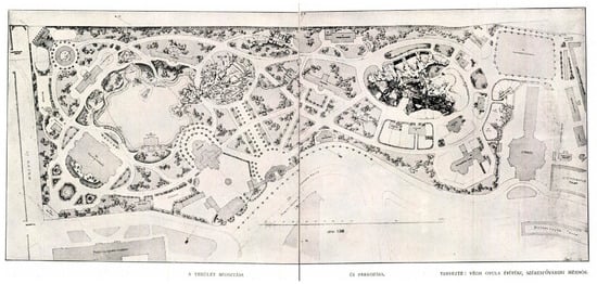
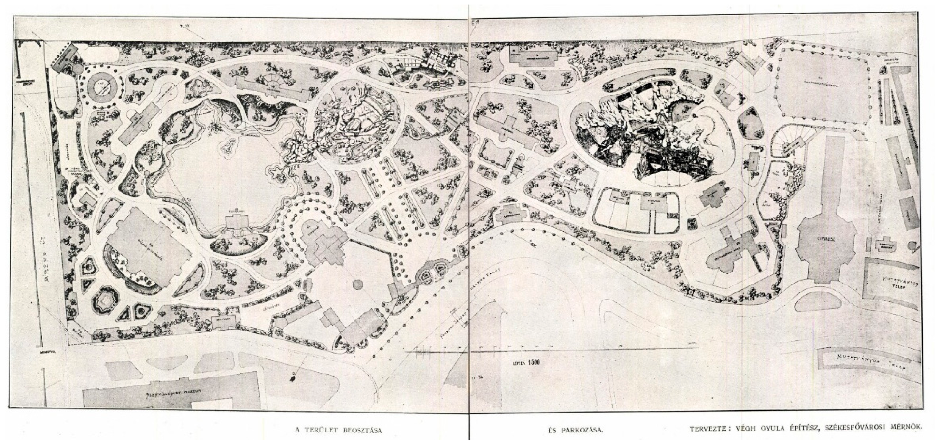
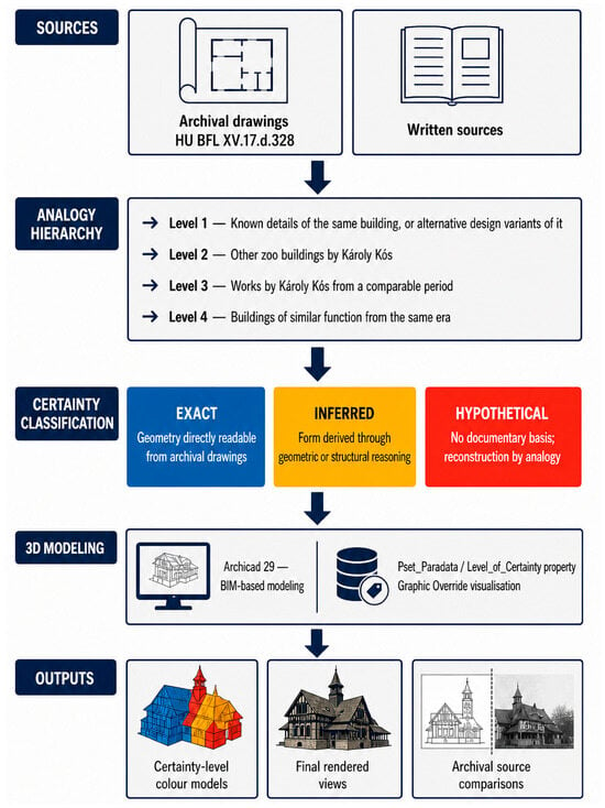
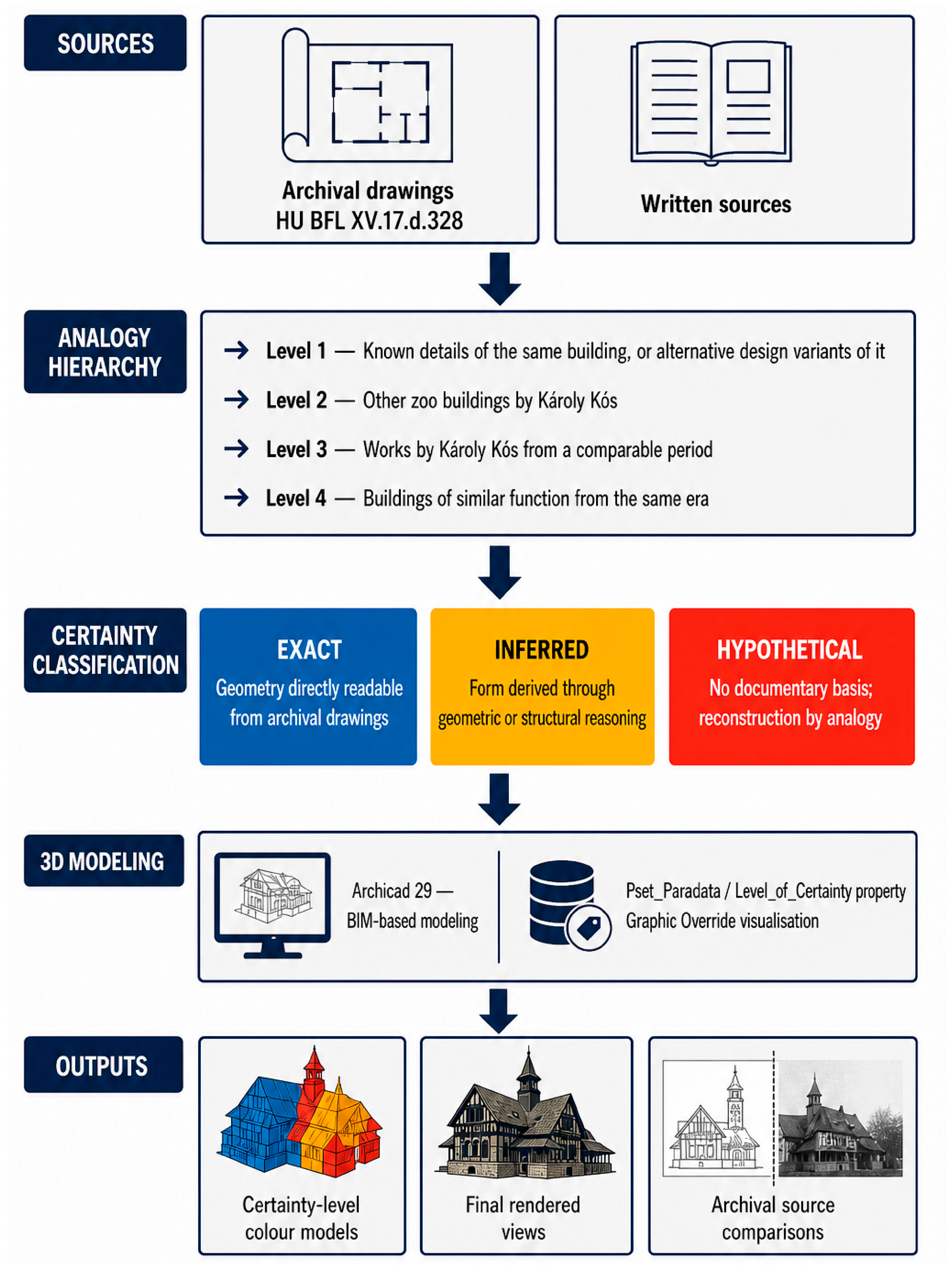
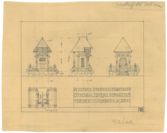
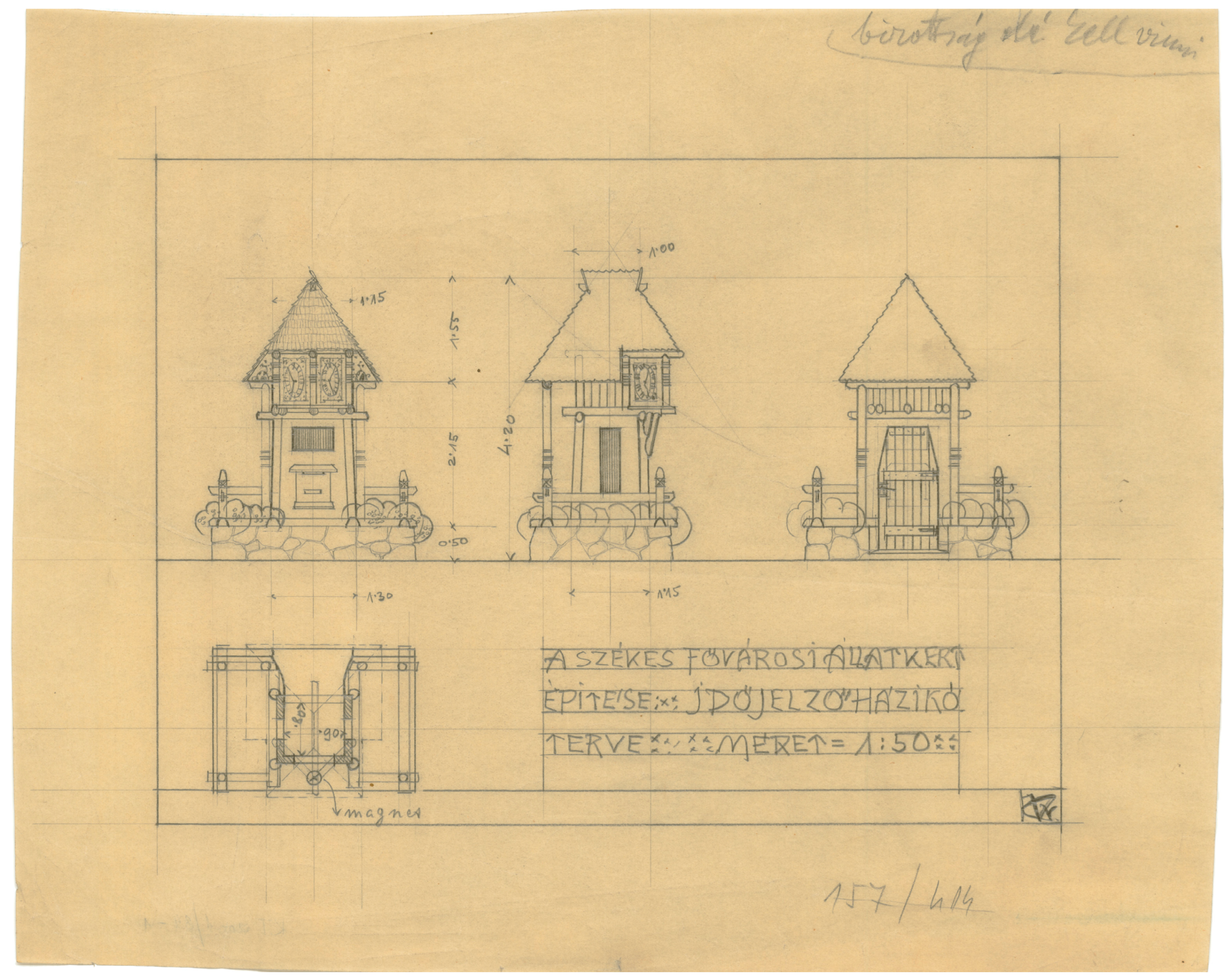
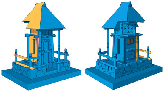
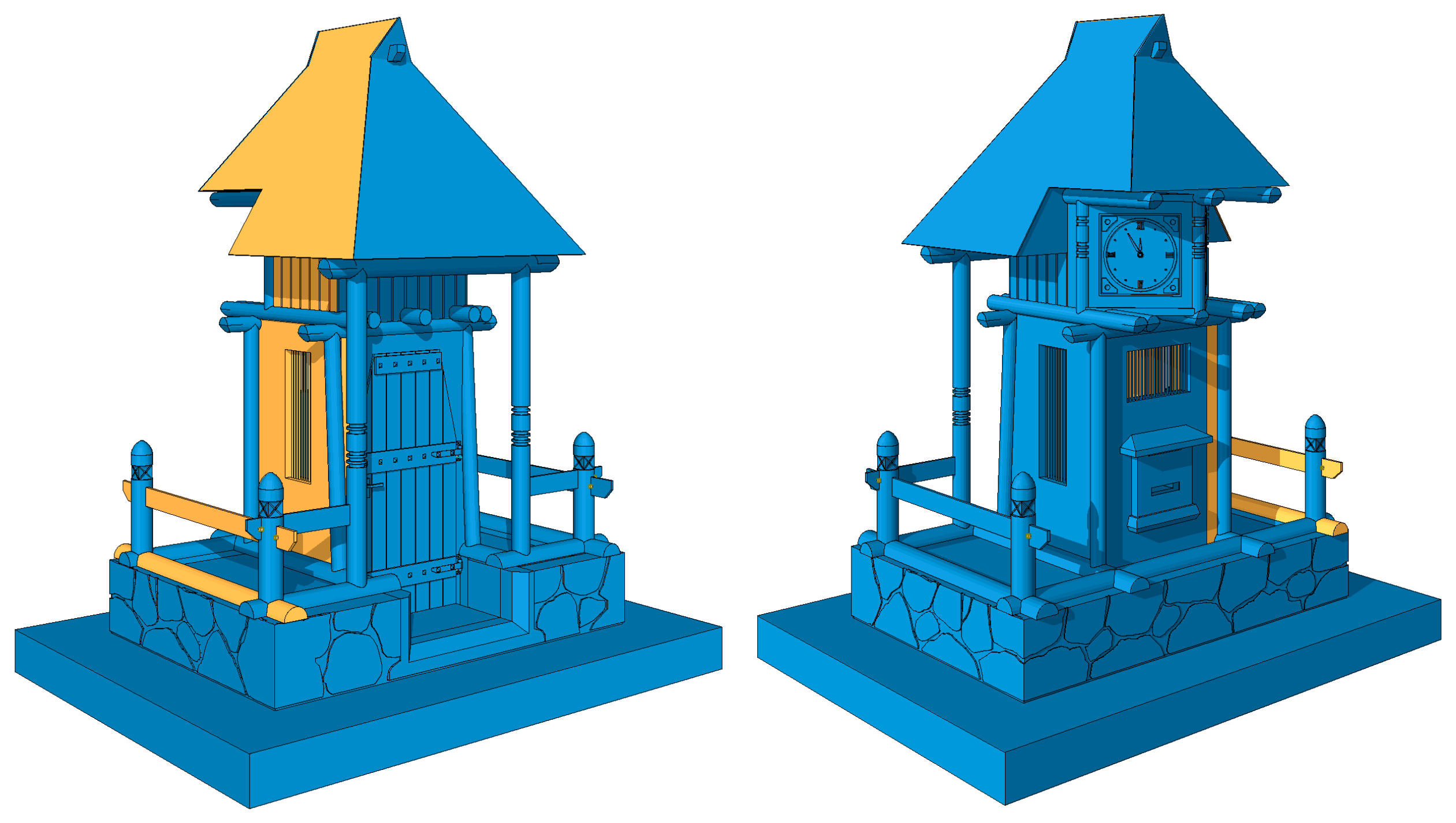
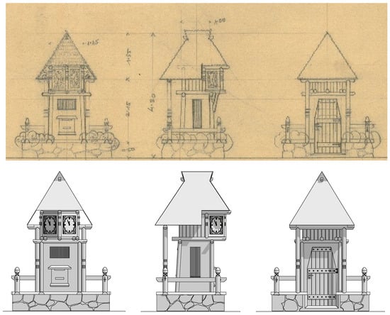
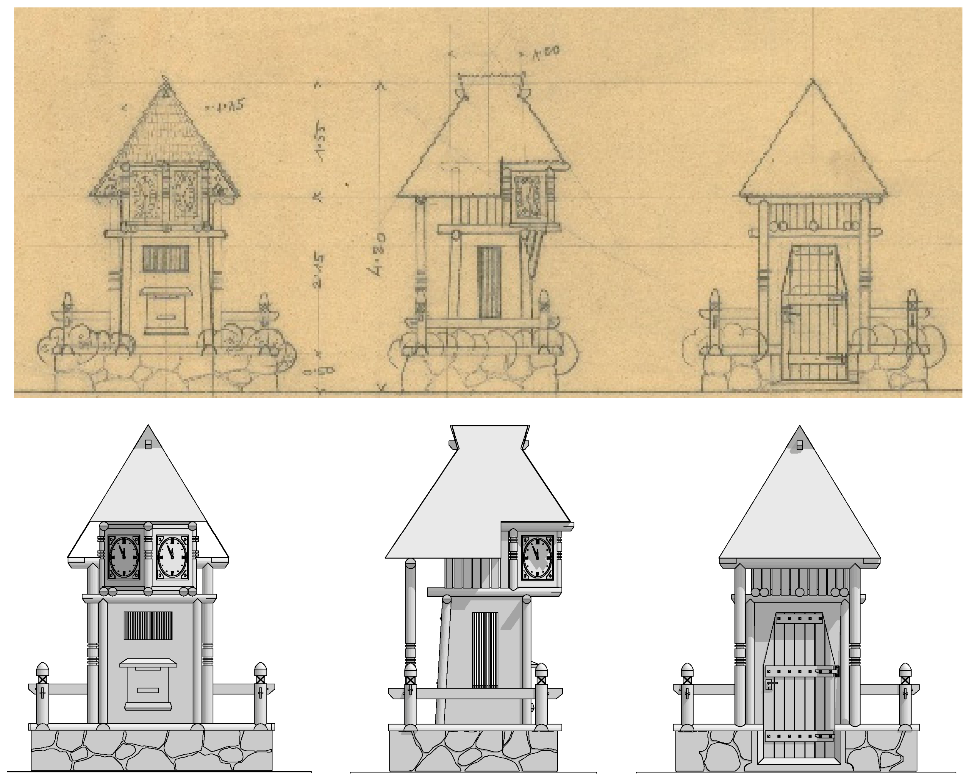
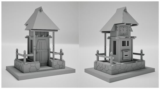
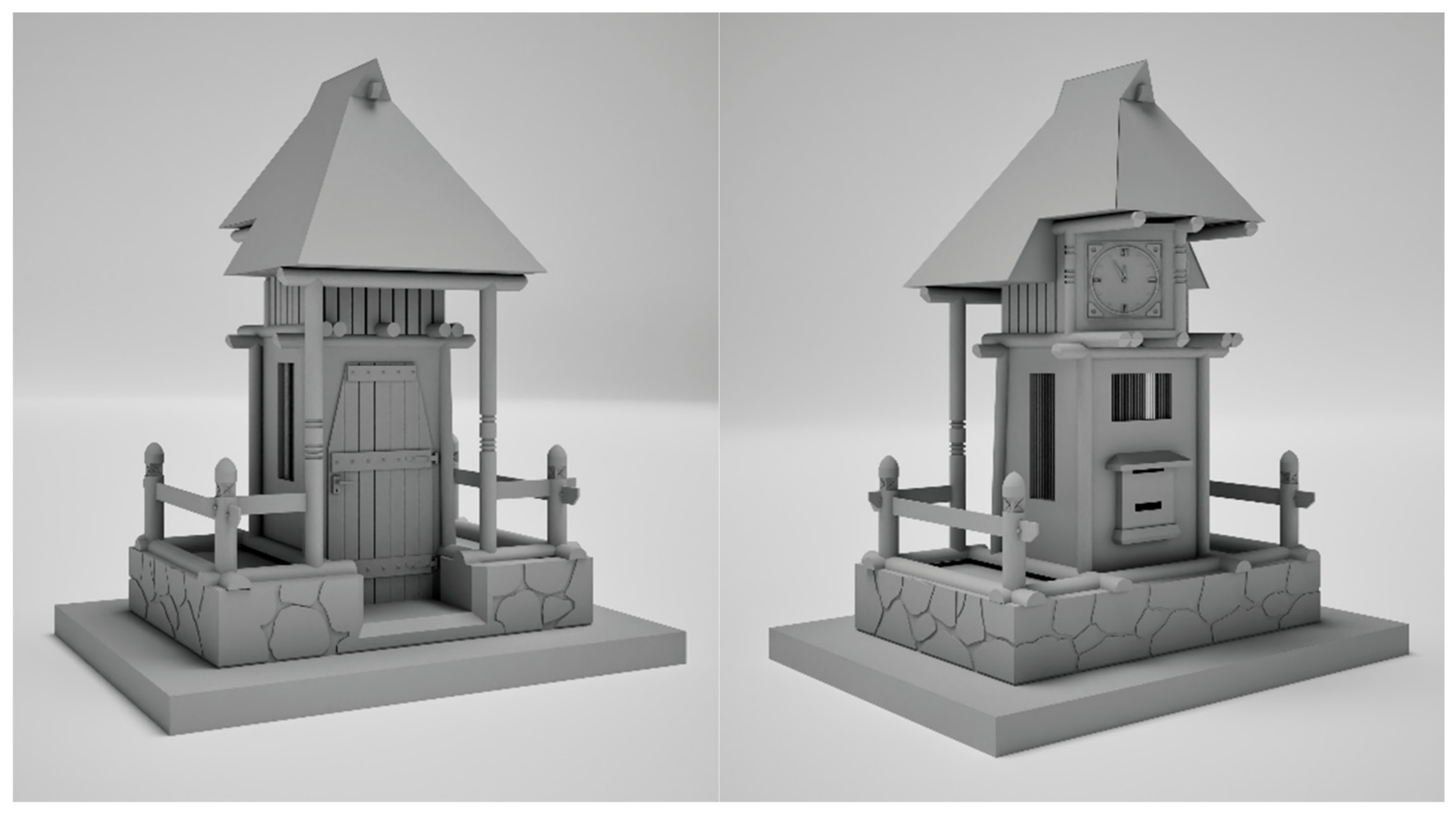
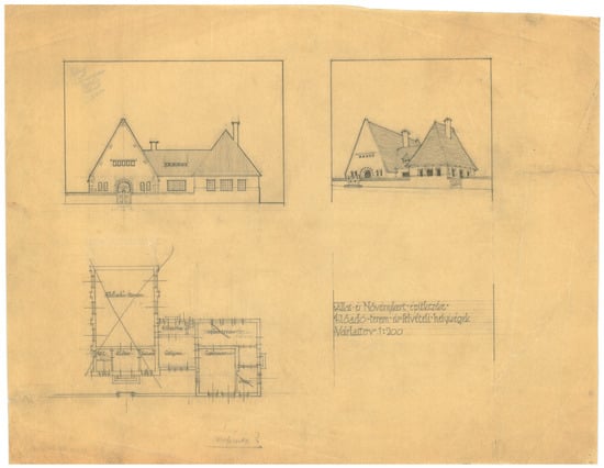
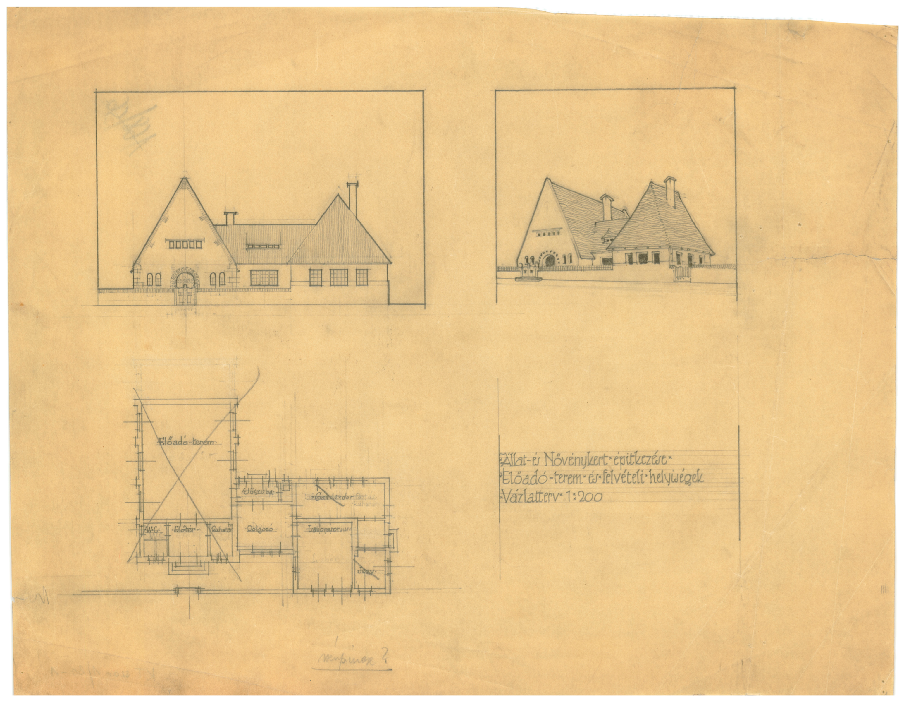
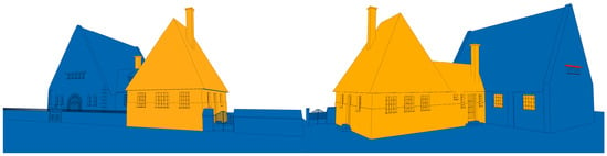
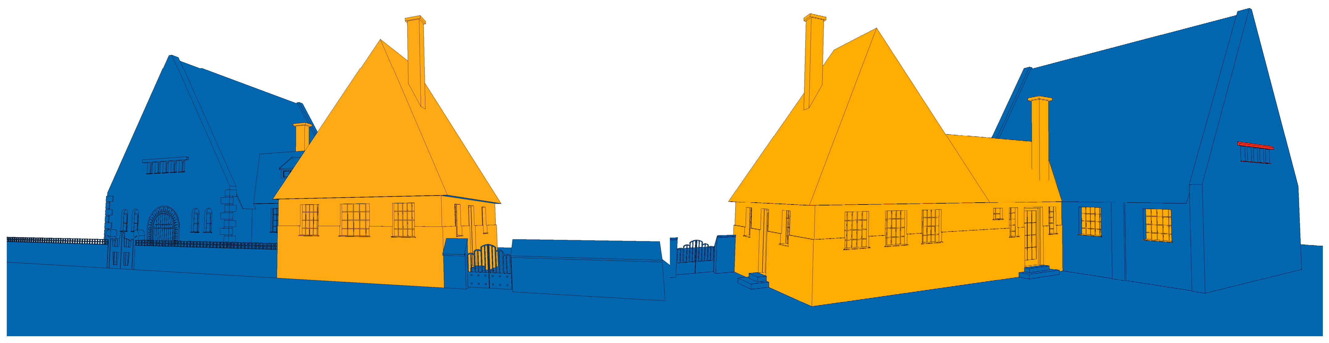
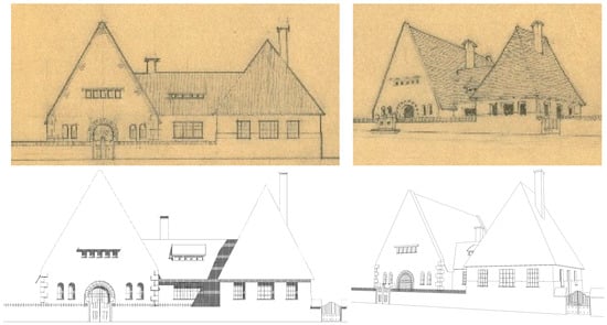
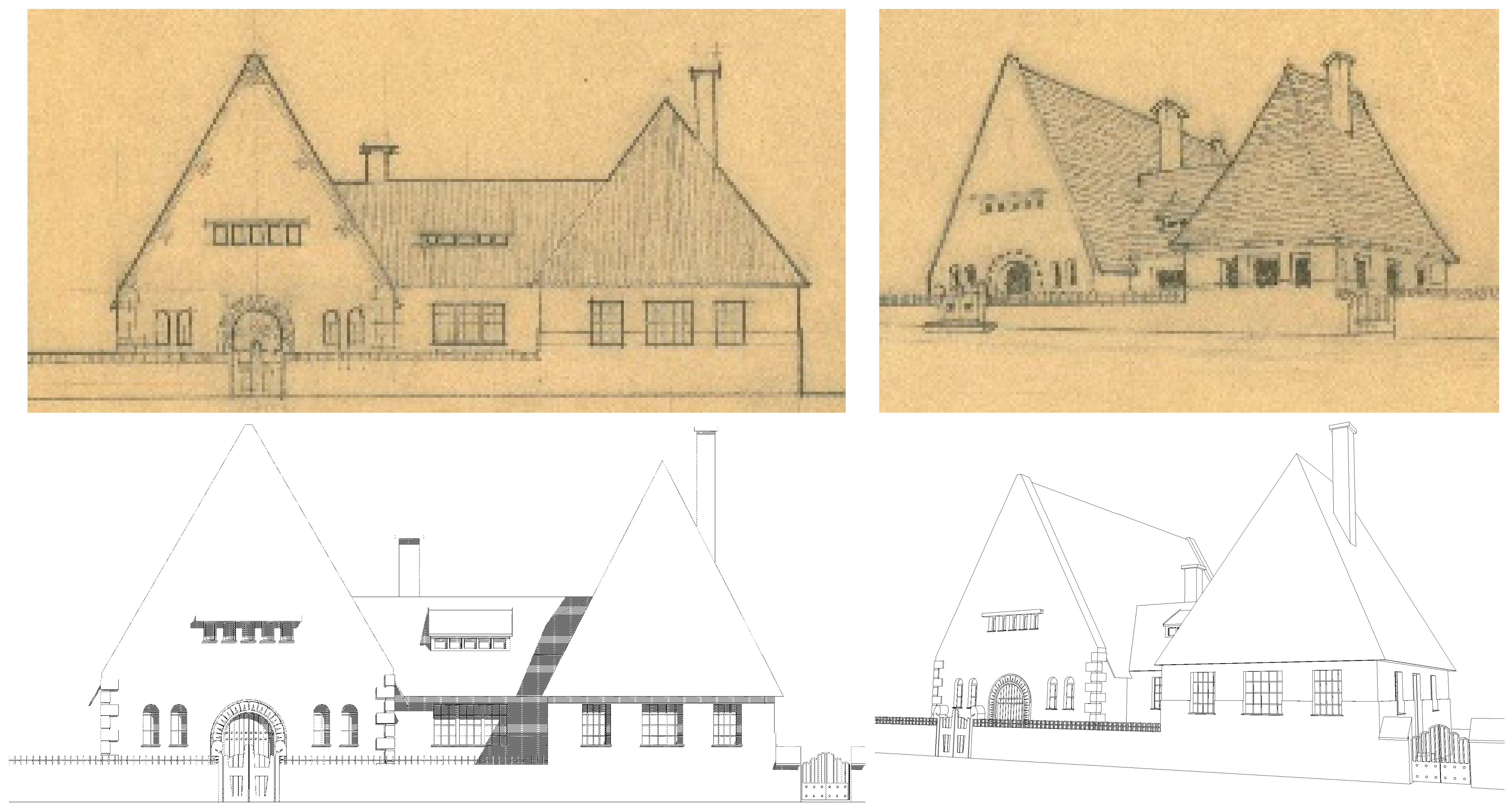
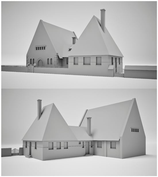
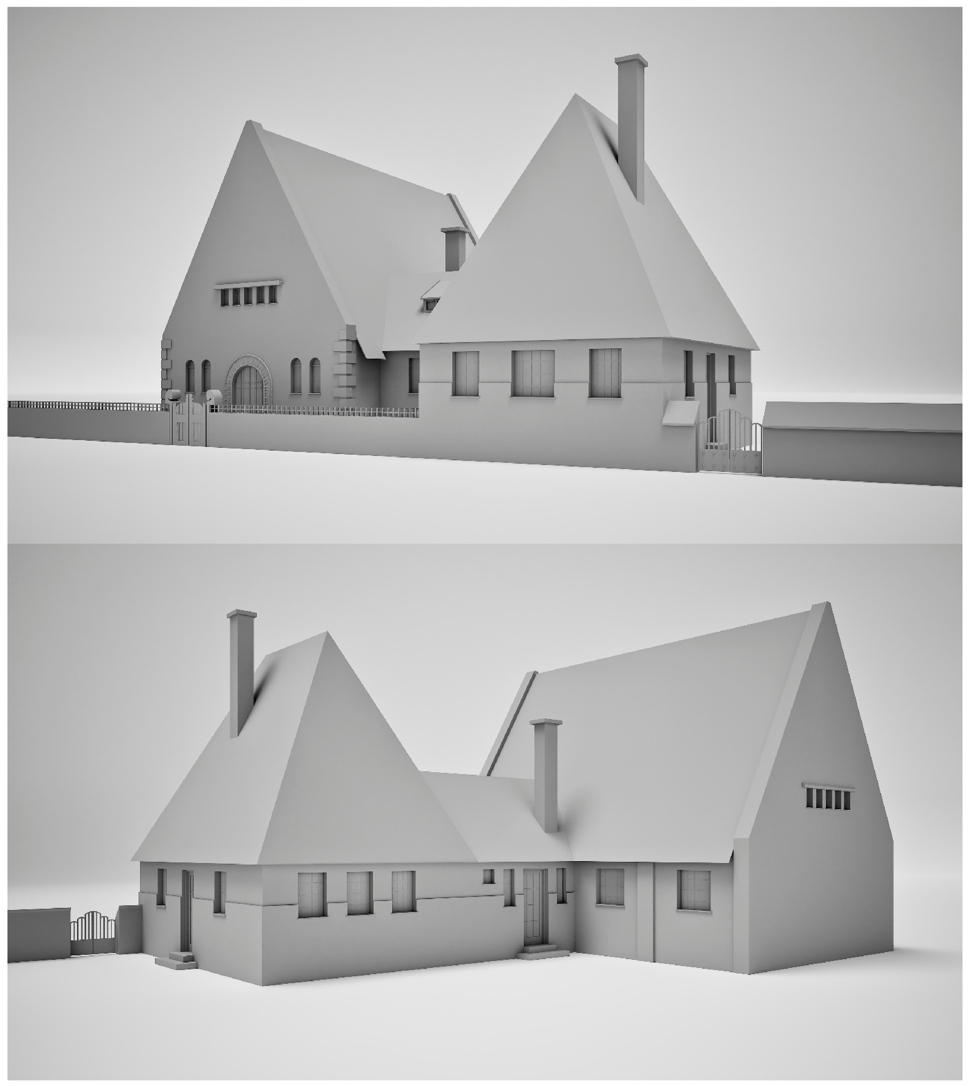
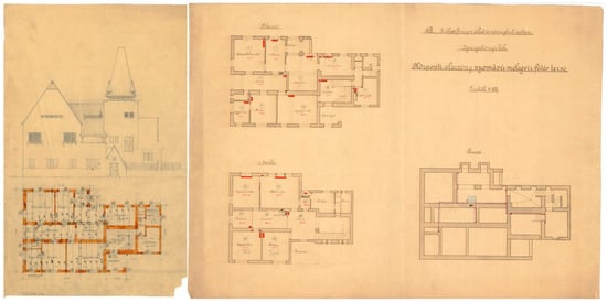
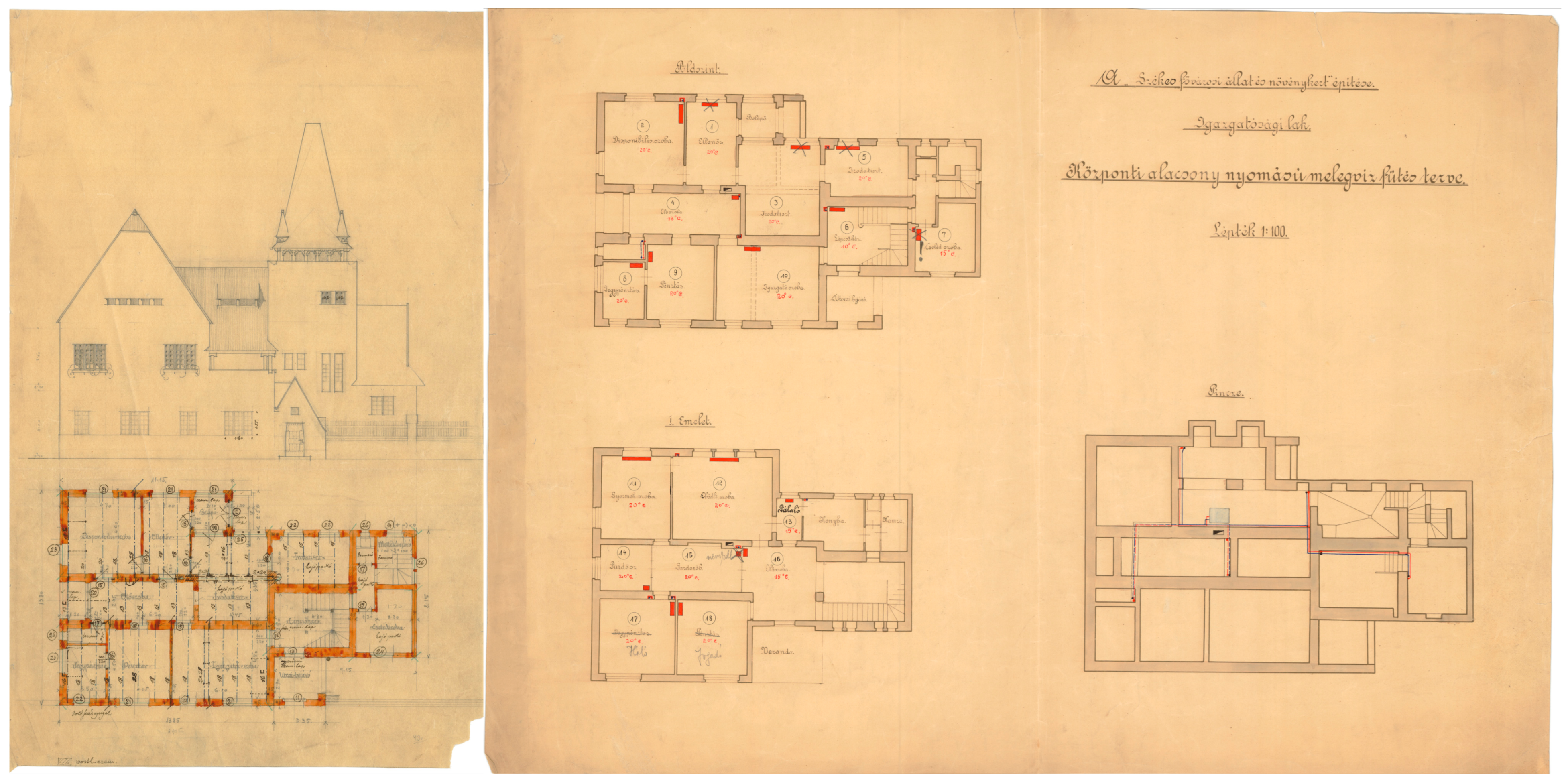
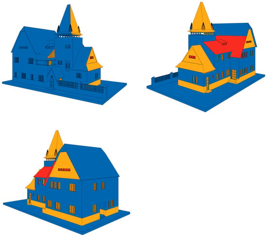
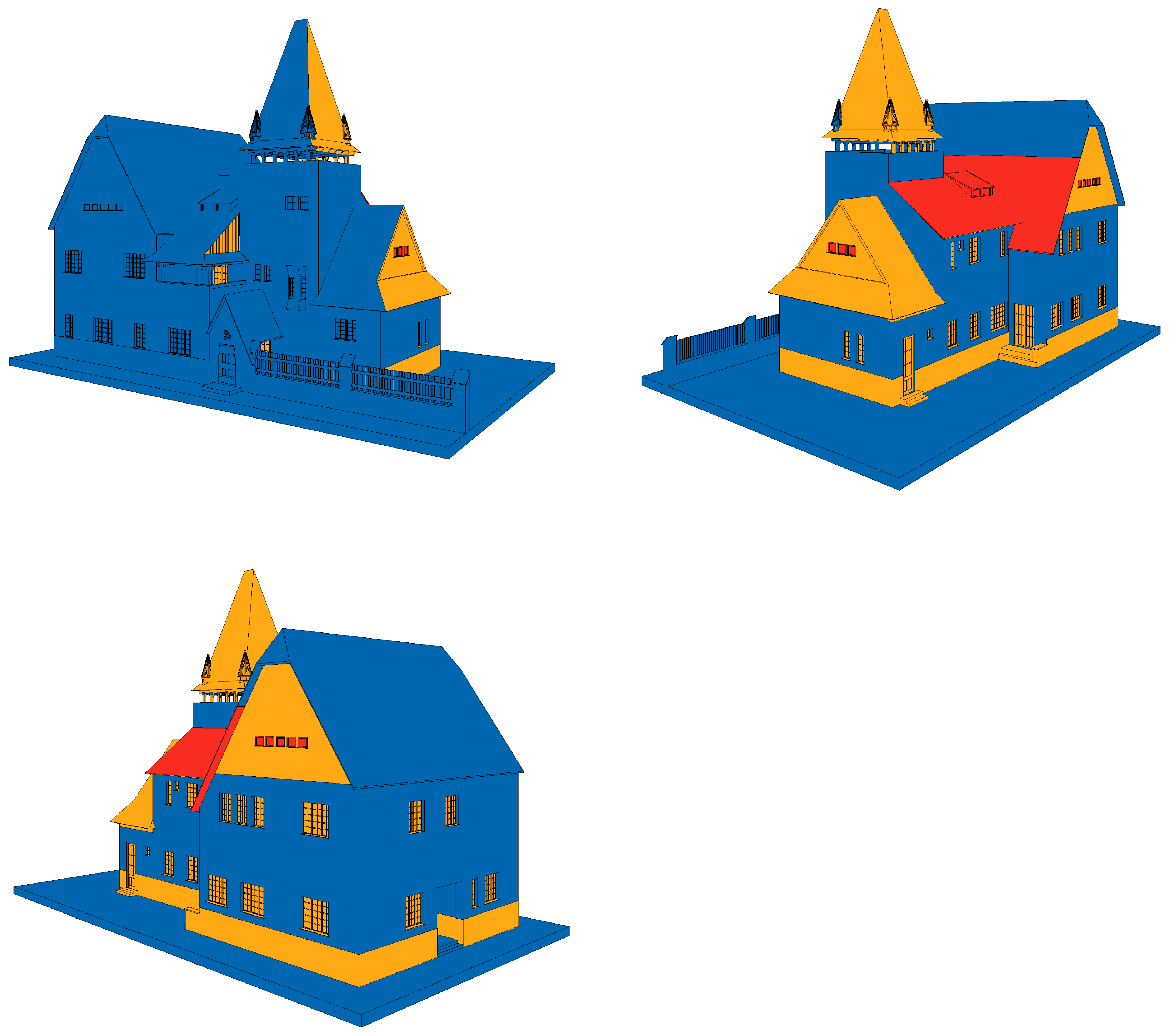
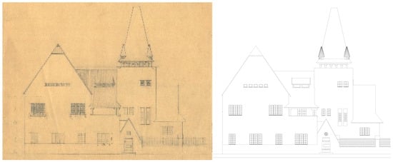
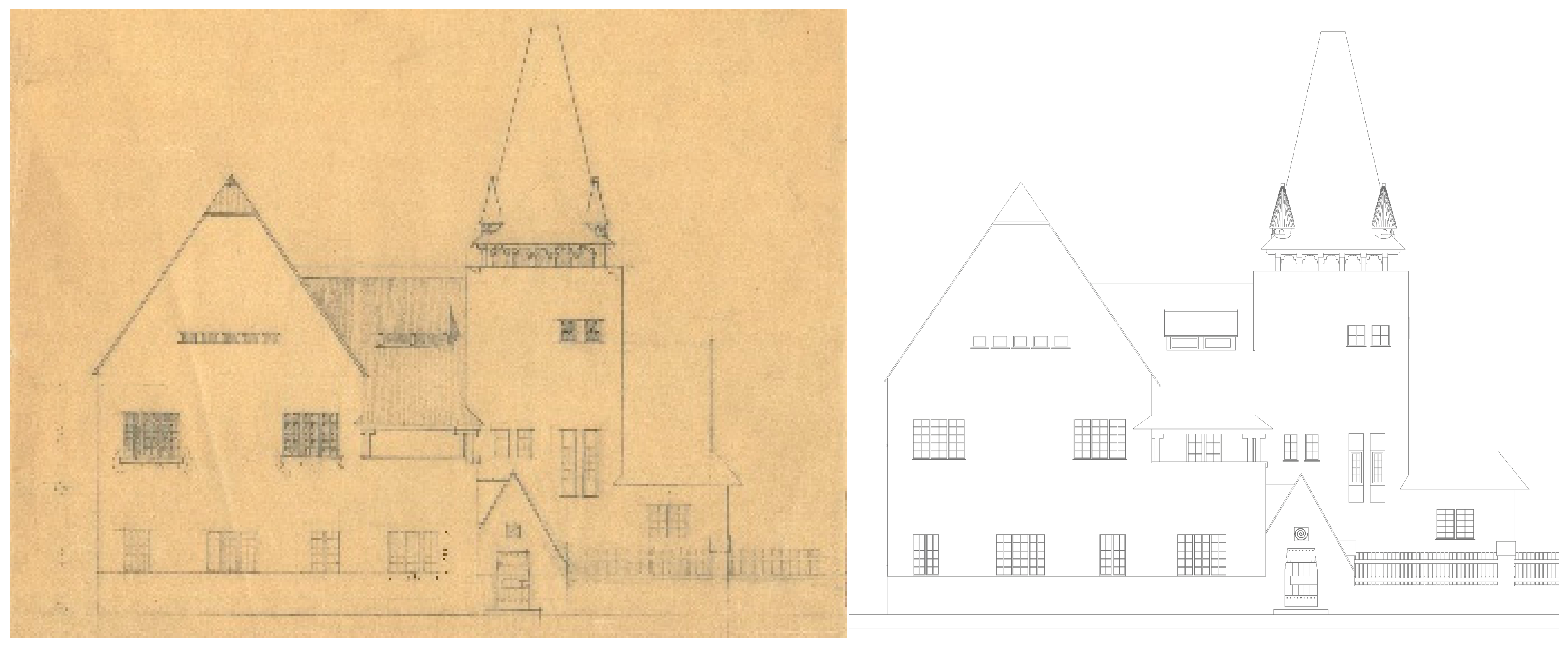
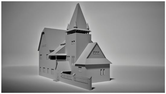
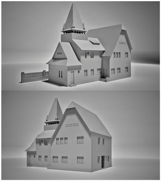
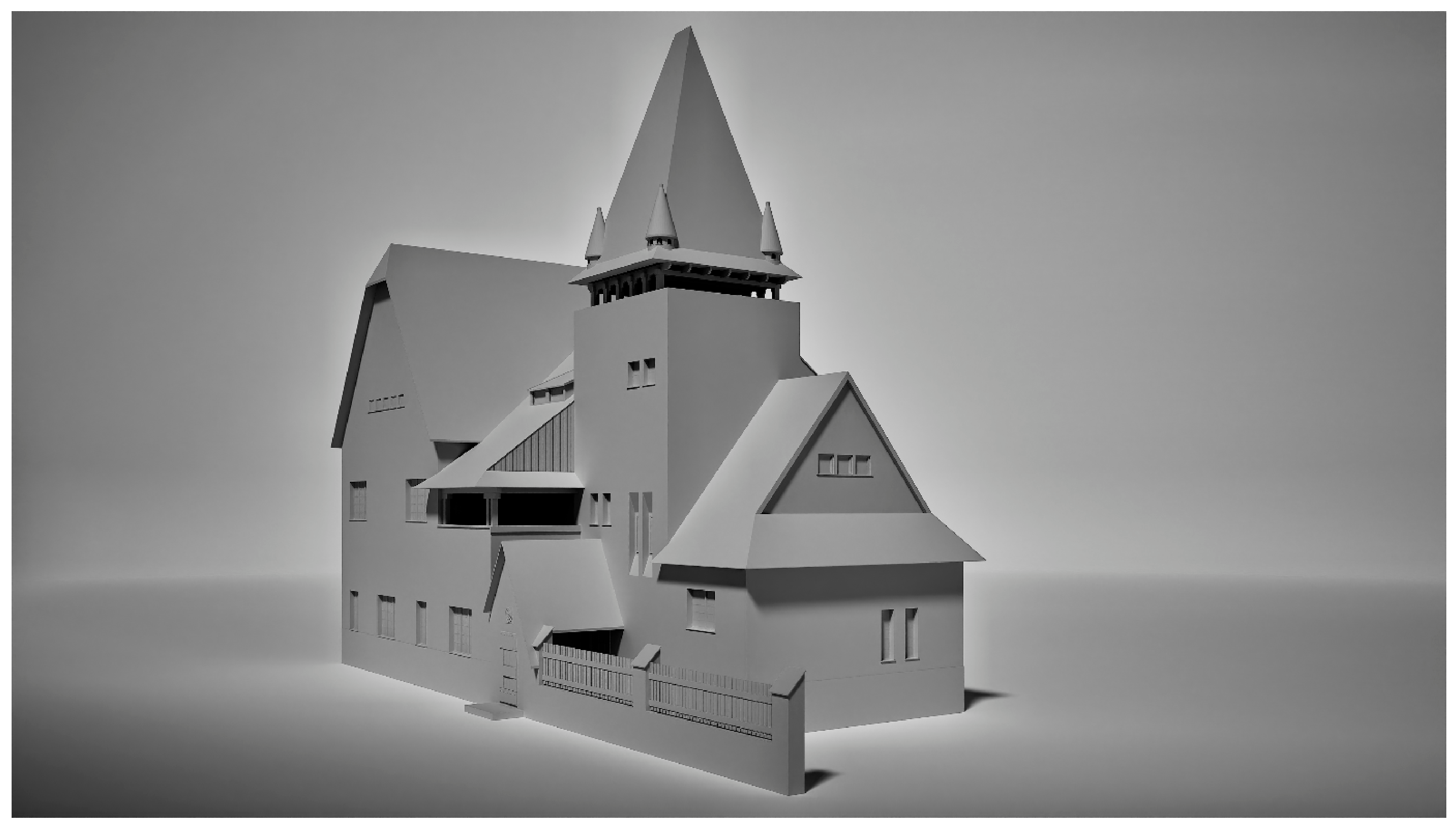
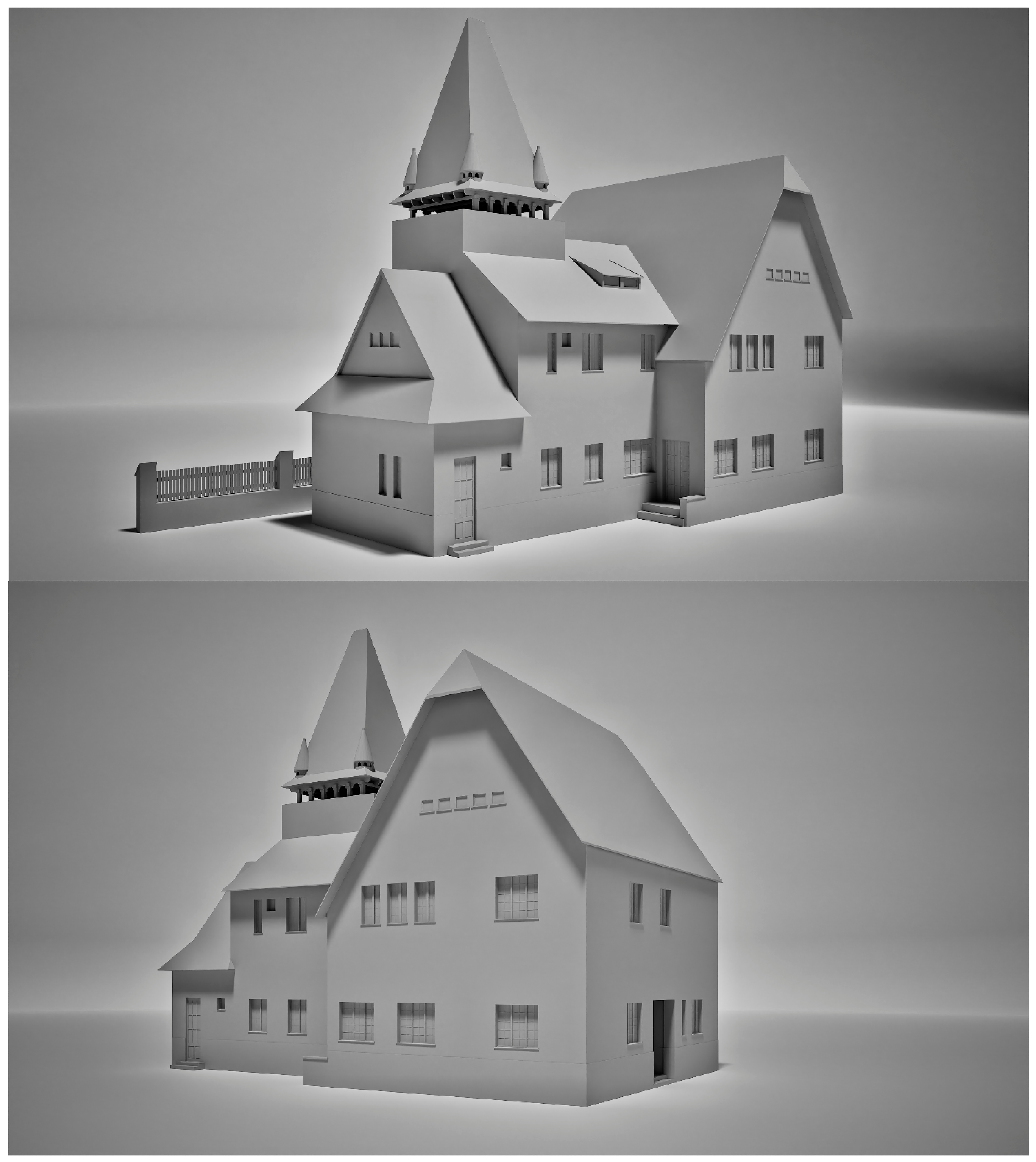
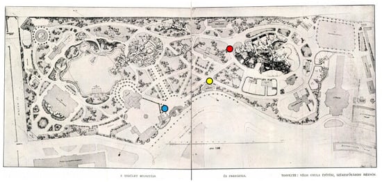
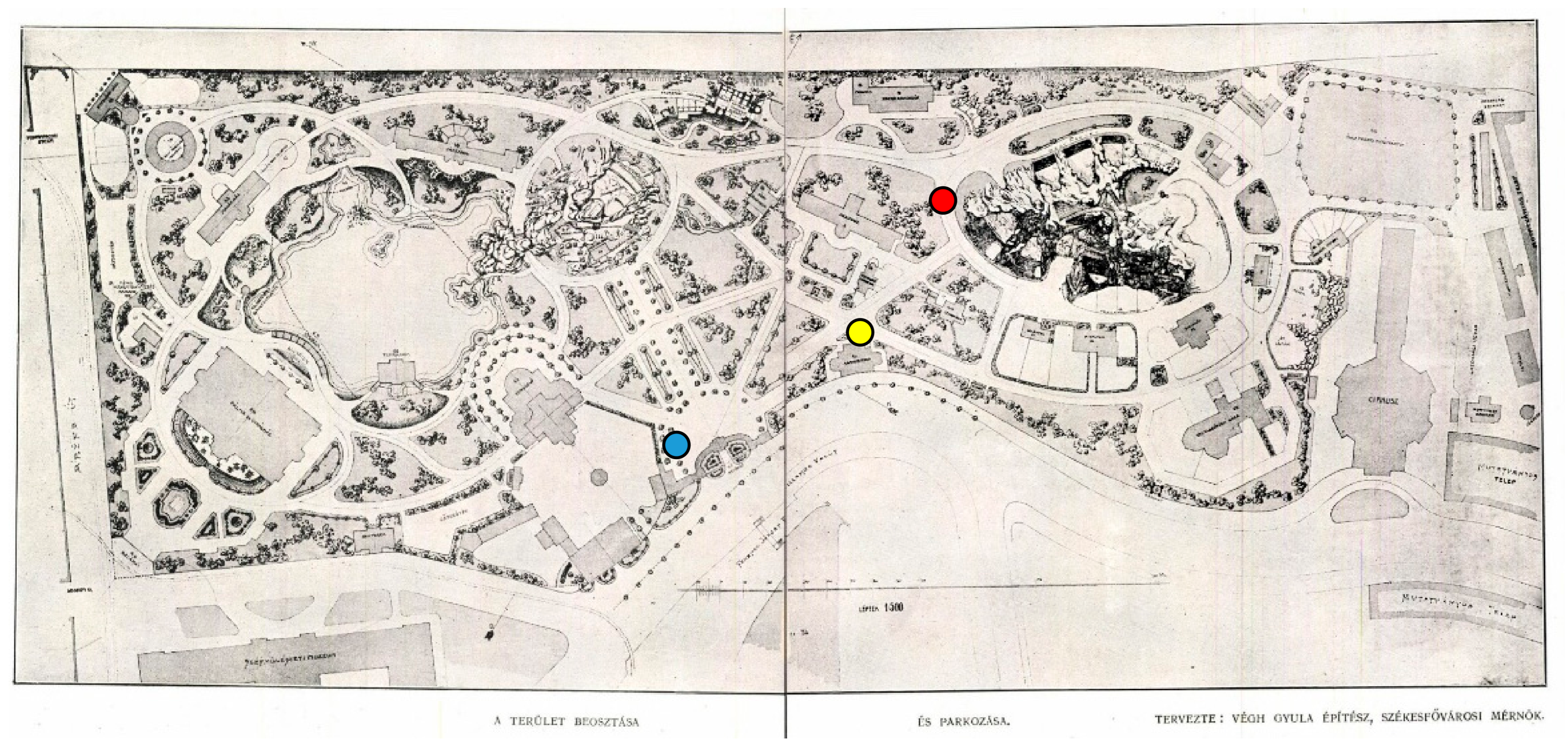

Disclaimer/Publisher’s Note: The statements, opinions and data contained in all publications are solely those of the individual author(s) and contributor(s) and not of MDPI and/or the editor(s). MDPI and/or the editor(s) disclaim responsibility for any injury to people or property resulting from any ideas, methods, instructions or products referred to in the content. |
© 2026 by the authors. Licensee MDPI, Basel, Switzerland. This article is an open access article distributed under the terms and conditions of the Creative Commons Attribution (CC BY) license.