


Abstract
This study addresses the critical need for accurate and efficient large-scale urban fire spread path prediction in dense urban areas by proposing a new gravitational framework-based theory. Its core innovation is the “characteristic attractive force” model, which mechanistically quantifies fire spread as a dynamic interaction between buildings, integrating factors like spacing, height, area and density effects to predict trajectories from the initially ignited building. This study adopts a GIS-based rapid prediction framework that circumvents the dependence on complex physical parameters. It utilizes high-precision spatial data and optimized algorithms to streamline prediction processes while retaining favorable prediction accuracy. Validated on two real-world clusters, the proposed approach enables effective visualization of dynamic propagation trajectories and pathway spectra that characterize the detailed propagation routes and ignition sequences. Notably, the framework achieves exceptional efficiency, completing predictions for large clusters in tens of seconds per scenario, making it suitable for real-time risk assessment. Overall, this work advances urban fire modeling with an innovative, efficient, and practical tool to support fire safety engineering and emergency management decision-making.
1. Introduction
With the rapid development of the global economy and the accelerating urbanization process, urban disasters have become increasingly prominent. Given that the hazards of urban building fires present as complex, multi-dimensional, and mutually exacerbating impacts, their damage to life safety, property values, and social systems is marked by a blend of suddenness and persistence, and researchers have reached a consensus that fire stands as one of the foremost threats to cities [1,2,3,4,5,6]. Consequently, scientifically sound and effective urban regional fire management, coupled with rational assessments of fire spread situations in building clusters, has emerged as a critical approach to preventing and controlling urban building cluster fires and implementing proactive preventive measures.
Urban fires, with their escalating frequency and destructive potential amid rapid urbanization and dense architectural development, have emerged as a critical threat to urban safety and sustainable development. So, the prediction of urban building fire spread paths is crucial for ensuring urban safety. Taking this as its starting point, this paper endeavors to develop a novel theory and methodology for predicting large-scale urban fire spread paths, one that is well-suited to analyzing fire evolution trends and optimizing rescue strategies through scenario-based preparedness.
Firstly, given that large-scale urban fire spreading—characterized by unpredictability, rapid propagation, and cascading impacts—poses unprecedented challenges to emergency response systems, urban infrastructure resilience, and public life safety, existing prediction methods have significant limitations. Traditional fire spread prediction models, which often focus on single-building dynamics or localized combustion processes, struggle to capture the complex interactions between multiple structures, environmental factors, and urban spatial patterns—limiting their effectiveness in forecasting large-scale fire paths. So, as fire dynamics theories advance and technological innovations progress, the current theoretical research has slowly moved toward intricate complex physical models for large-scale urban fire predictions [7,8,9,10].
However, most of the current theoretical models for large-scale urban fire predictions are constructed based on simple physical principles or empirical formulas, making it difficult to accurately depict the real process of fire spread in complex urban environments. On one hand, in terms of considering building structures, many models treat buildings as isolated individuals, ignoring the mutual influences between buildings through flying sparks, thermal radiation, and thermal convection. For example, in densely populated urban areas, flying sparks generated by a burning building may cross a certain distance and ignite adjacent buildings, triggering large-scale fire spread, but traditional models often fail to effectively simulate this critical phenomenon.
On the other hand, in terms of data acquisition and processing, current models also have shortcomings. Urban building fires involve massive amounts of data, including building structure information, internal combustible distribution, and the status of firefighting facilities. However, obtaining complete and accurate data poses challenges. Meanwhile, untimely data updates are also a common issue. Cities are in a state of continuous construction and renovation, and changes in building usage occur from time to time. However, most of the current theoretical models fail to incorporate this latest information in a timely manner, resulting in a disconnect between the prediction of actual fire spread paths and reality. In addition, the inconsistent data formats from different sources and the uneven data quality increase the difficulty of data integration and effective utilization, further restricting the effectiveness of prediction models.
Furthermore, there are other numerical achievements that have been accumulated in the research on urban fire spread paths. Numerical simulation methods, with the help of technologies such as Computational Fluid Dynamics (CFD), can relatively accurately simulate physical phenomena in the fire process, such as heat transfer, smoke flow, and combustion reactions [11,12,13,14,15]. For example, FDS (Fire Dynamics Simulator) software is widely used to simulate building fire scenarios. By solving the Navier–Stokes equations and other equations, it can intuitively present the spread process of fire inside buildings. In the simulation of some simple building structures and specific scenarios, this method can provide relatively accurate fire development trends, including changes in temperature fields and velocity fields. However, when dealing with large-scale urban areas with complex structures and diverse functions, numerical simulation shows significant shortcomings. The layout of buildings in cities is intricate, there are various interaction mechanisms between different buildings, and the physical and chemical reactions involved in the fire process are highly nonlinear, which leads to an exponential growth in the amount of simulation calculations, and high computing costs. At the same time, the uncertainty of input parameters (such as the thermal physical properties of building materials and the distribution of internal combustibles) also greatly affects the accuracy and reliability of simulation results.
Thus, the experimental research method obtains first-hand data by building physical fire experimental platforms or conducting scaled-down model experiments to directly observe the fire spread phenomenon [16,17,18]. Early building fire experiments mostly focused on the fire development in a single building. In recent years, with the deepening of the systematic understanding of urban fires, some studies have begun to pay attention to the fire spread between building clusters. For example, some foreign research institutions have built experimental sites containing multiple buildings to simulate the process of fire spreading between buildings through flying sparks, thermal radiation, and thermal convection under different spacings and layouts. Experimental research can truly reflect the actual development of fires, and the obtained data is crucial for verifying and improving numerical models. However, limited by experimental conditions (such as site scale, repeatability, and safety factors), it is difficult to comprehensively simulate all situations of fire spread in complex urban environments. Moreover, the experimental cost is high, the cycle is long, and there are difficulties in large-scale promotion.
In addition, data-driven prediction methods have gradually emerged with the rise of big data and artificial intelligence technologies [19,20,21,22,23,24]. Machine learning algorithms, such as neural networks and decision trees, can learn from massive amounts of historical fire data (including fire occurrence time, location, building characteristics, environmental conditions, fire spread range, etc.), explore the potential laws therein, and then establish prediction models. Some studies use deep learning models combined with Geographic Information System (GIS) data to predict the fire spread paths in specific urban areas. In cases where the data is abundant and the laws are obvious, it shows high prediction accuracy. However, this type of method is highly dependent on the quality and quantity of data. In practice, urban fire data has problems such as incompleteness, inaccuracy, and untimely updates, which will seriously affect the model performance. Furthermore, the interpretability of the data-driven method is poor, making it difficult to deeply reveal the physical mechanism of fire spread, and its generalization ability is insufficient when facing new and complex fire scenarios.
Herein, we add a structured comparative table (Table 1) in the latter part of the Introduction. This table classifies mainstream fire prediction approaches into five categories: physical/CFD models, empirical models, static GIS statistical models, data-driven intelligent models, and network-based fire spread models. Uniform comparison metrics cover the core physical basis, applicable spatial scale, computational speed, mechanistic interpretability, data dependency and real-time emergency suitability. We summarize the strengths and inherent drawbacks of each method, with a separate row dedicated to the proposed GIS framework built on the characteristic attractive force theory. The table visually demonstrates its balanced merits in physical interpretability, large-scale applicability and computational efficiency, explicitly distinguishing the novelty and core contributions of this work against existing technical paradigms.
Table 1.
Comprehensive comparison of mainstream urban building cluster fire spread prediction methods.
Against this backdrop, we propose a new theory model for large-scale urban fire spread path prediction, which is inspired by the law of universal gravitation. The developed theory model can govern the interaction for fire spread development between two buildings. Its content is as follows: Any two buildings exert a characteristic attractive force on each other along the line connecting their centers for fire spread development between two buildings. The magnitude of this characteristic attractive force is proportional to the value of their combustion energies and inversely proportional to the square of the distance between them. In contrast to current theory models, which often lack the ability to generalize across diverse urban contexts due to their heavy reliance on specific datasets, and physical models that demand excessive computational power (this often makes them impractical for large-scale, time-sensitive scenarios such as emergency response), the proposed model delivers a more reliable and practical solution. It achieves this by effectively capturing core fire spread mechanisms while maintaining computational efficiency, thereby enabling accurate simulation of fire spread dynamics, from densely packed downtown areas to suburban neighborhoods with varied building typologies.
In addition, another advantage of this study is in its creative GIS-based modeling technology; it creates a lightweight model of urban building clusters with the aid of the developed theory model for urban fire spread path predictions, avoiding the heavy modeling work needed for large-scale urban areas. This simplifies the pre-processing stage of fire spread path prediction and lowers the demand for computational resources, enabling near-real-time simulations that traditional data-heavy models cannot achieve. This efficiency is vital for urban planners and emergency management agencies as it allows for quick creation of fire spread scenarios and evacuation plans in critical situations.
Finally, the practical utility of this theory model and simulation strategy are further substantiated through validation involving fire predictions of real-world urban building clusters in Nanjing, China. Case studies and validation results confirm its capability to effectively simulate fire dynamics while maintaining low computational overhead. By offering a practical tool for large-scale urban fire spread path prediction, this research contributes to advancing urban disaster management practices.
2. Materials and Methods
2.1. Characteristic Attractive Force Model for Fire Spread Between Two Buildings
In this study, we propose a novel theoretical model for predicting the spread paths of large-scale urban fires, with its core conceptual framework drawing inspiration from Newton’s law of universal gravitation. As shown in Equation (1), this newly developed model is specifically designed to quantify and govern the intricate interactive mechanisms underlying fire spread between two adjacent buildings, thereby establishing a rigorous theoretical foundation for simulating the dynamic propagation trajectories of fires within complex urban built environments.
In Equation (1), K is the characteristic attractive force for fire spread development between two buildings with number i and j, which represents the possibility that a burning building can spread fire to another building. and are the combustion energies of the two buildings. is the distance between two buildings with number i and j. C is the characteristic attractive force constant.
In Equation (1), the combustion energy of the building Q can be computed based on the heat release rate during its burning process, as shown in the following Equation (2).
However, the heat release rate of the whole building during its burning process is difficult to compute and monitor in the real fire disaster. Herein, the combustion energy of the building can be evaluated based on the fire load density q, floor area a and number of floors f.
The reason for choosing Equation (3) is that the fire load density q, floor area a and number of floors f can be easily obtained from previous experience or the GIS. For instance, the fire load density q of the common building is usually chosen as the range between 300 MJ/m2 and 1200 MJ/m2, and the fire load density q of the residential building is about 800 MJ/m2. So, herein, the fire load density q of the residential building is chosen as 800 MJ/m2 [25]. Additionally, the floor area a and number of floors f of each building can be directly obtained from the GIS.
Meanwhile, the formula form of the proposed model is inspired by Newton’s law of universal gravitation.
where represents the magnitude of the gravitational force between the two objects. G is the gravitational constant, with a value of approximately . and denote the masses of the two objects, respectively. r is the distance between the centers of mass of the two objects.
Herein, it is our bold conjecture that the characteristic attractive force K shown in Equation (1) is equal to gravitational force F shown in Equation (4), which can be mathematically expressed as follows:
where and are the masses of the two buildings with number i and j.
In addition, the mass per square meter of the building can be evaluated as 1800~2500 Kg/m2. Herein, is chosen as 2000 Kg/m2. Then, we obtain the characteristic attractive force constant C by using the following Equation (6).
Herein, since and are chosen as 800 MJ/m2 and 2000 Kg/m2, we can obtain the value C based on Equation (7).
The fundamental propositions of this theoretical model can be elaborated as follows: In the context of urban fire scenarios, any two buildings will generate a unique “fire spread attraction” along the straight line connecting their geometric centers—a force that serves as the primary driver for the cross-building propagation of combustion. The magnitude of this characteristic attraction is determined by two critical factors:
It exhibits a positive proportional relationship with the product of the combustion energy values of the two buildings. Here, combustion energy is defined as a comprehensive metric encompassing not only the total calorific value of combustible materials within each building (such as structural components, interior furnishings, decorative fabrics, and stored goods) but also the thermal conductivity and flame-retardant properties of the building envelope, which collectively influence the intensity and sustainability of combustion.
It demonstrates an inverse proportional relationship with the square of the straight-line distance between the geometric centers of the two buildings. This implies that as the distance between structures decreases, the intensity of the “fire spread attraction” increases exponentially, thereby elevating both the probability and rate of cross-building fire propagation.
By translating the complex, multi-factorial process of urban fire spread into a quantifiable force-based relationship, this model paves the way for integrating geographic information system (GIS) data and the simplified modeling technology to achieve high-precision predictions of fire spread paths across large urban building clusters.
2.2. GIS-Based Rapid Prediction Framework of Large-Scale Urban Fire Spread Paths
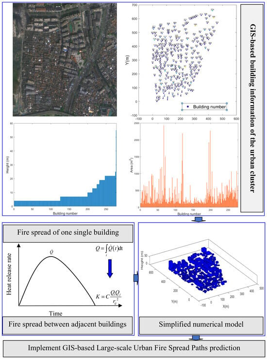
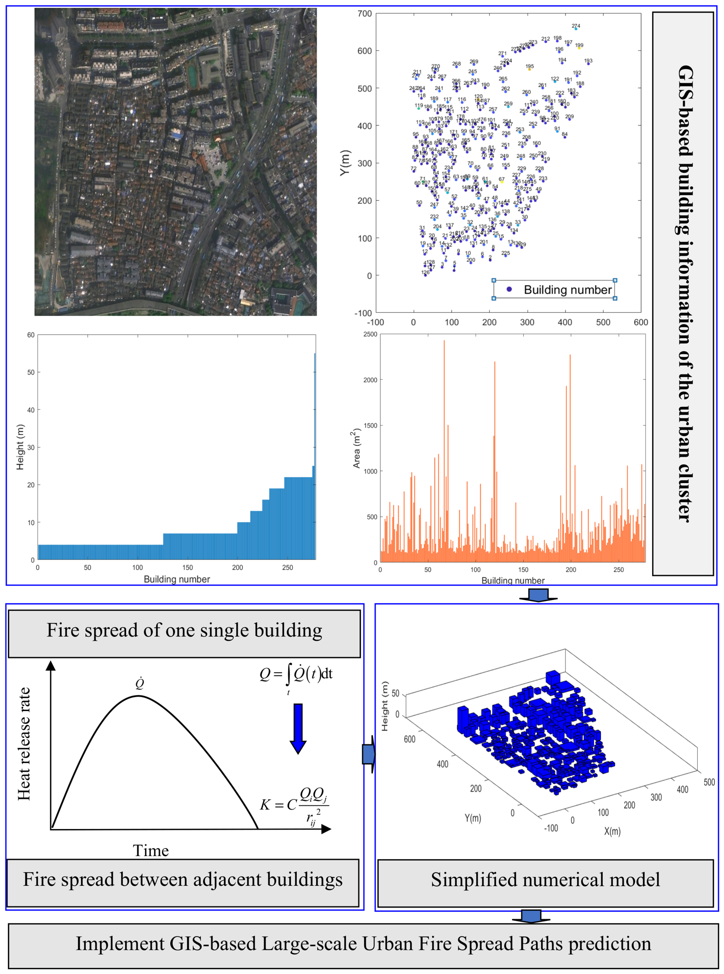
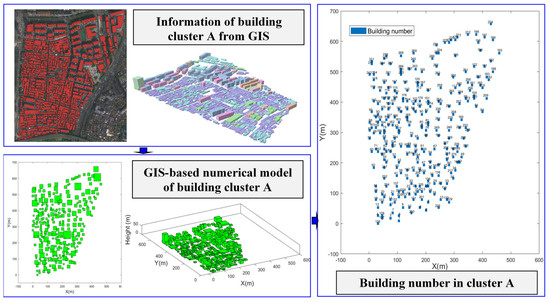
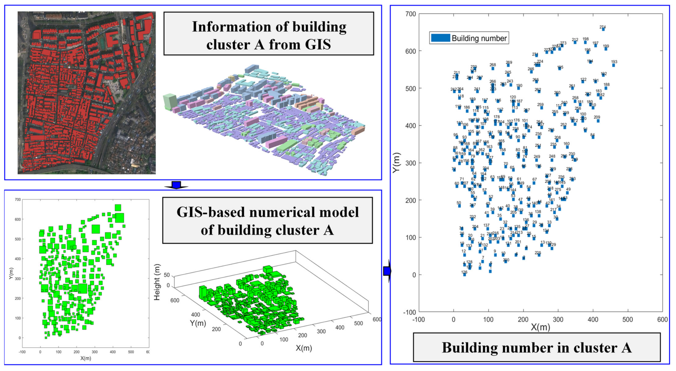
To achieve the high-efficiency prediction of large-scale urban fire spread paths, a lightweight simplified modeling methodology is implemented for the large-scale building cluster. As illustrated in Figure 1, each building is digitally represented through three fundamental parameters: geographical coordinate information , floor area , and vertical height . These critical attributes, which form the cornerstone for predicting fire evolution processes, can be conveniently obtained from the GIS.
Figure 1.
Scheme of new theory modeling and numerical framework for predicting urban fire spread paths.
This streamlined data architecture effectively reduces computational burdens while retaining the essential spatial and dimensional parameters required for in-depth fire dynamics analysis. Furthermore, a geometric simplification strategy is adopted to simplify the portrayal of building footprints in the visualization of fire spread simulation results, which is used to reduce the computational cost. Herein, each building is simplified into a cuboid structure. In other words, all structures are modeled as square-shaped entities in urban fire path prediction. This modeling simplification strategy not only expedites the rendering procedure in dynamic simulation contexts but also guarantees consistency between the computational framework and the visualized results. Through the separation of intricate architectural geometric details from the fire spread model, this methodology effectively achieves an equilibrium between simulation precision and computational performance, thus making it applicable to real-time analytical tasks in large-scale urban fire situations.
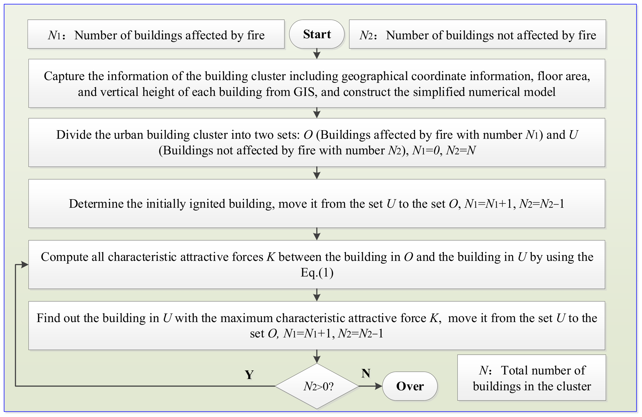
In the implementation of the proposed prediction framework, the fire spread pathways within urban building clusters are modeled in a stepwise manner, commencing with the initial ignition of a single structure. To systematically characterize the dynamic spread process, the entire urban building cluster is divided into two distinct sets: set O, which comprises buildings that have already caught fire, and set U, which includes buildings that remain unaffected by fire.
Subsequently, the identification of the next potential fire-affected building within set U is determined through computing the maximum characteristic attractive force K between the building in O and the building in U by using Equation (1). The established characteristic attractive force model integrates key influencing factors such as the building separation distance and energy released by the building fire, thereby quantifying the likelihood of fire spread between adjacent buildings.
Through the continuous iterative update of sets U and O—whereby buildings identified as at-risk are transferred from U to O based on the calculated K values—the fire spread paths are dynamically predicted. This incremental expansion mechanism enables the reproduction of fire evolution from the initial ignition of individual buildings to the sequential spread to neighboring buildings, ultimately facilitating the modeling of large-scale conflagration formation in urban environments.
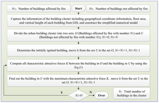
Finally, the flow chart of the large-scale urban fire spread path prediction framework is illustrated in Figure 2. This framework integrates the simplified building cluster modeling technology with the established characteristic attractive force model for fire spread development between two buildings, enabling rapid large-scale urban fire spread path prediction. As such, the proposed prediction framework not only enhances our mechanistic understanding of inter-building fire interactions but also provides actionable insights for optimizing urban fire prevention strategies and emergency response planning.
Figure 2.
Flow chart of the large-scale urban fire spread path prediction framework.
3. Results
To fully validate the generalization capability of the proposed fire spread prediction framework, two typical real-world building clusters (cluster A and cluster B) were selected from actual urban built-up areas of Nanjing, China. These two cases represent the typical spatial features of residential and commercial building groups in eastern Chinese cities, covering differentiated urban construction densities and architectural layout patterns to form complementary and comprehensive verification scenarios.
The two clusters exhibit distinct spatial characteristics, which are deliberately chosen to test the performance of the proposed method under diverse urban environments. (1) Cluster A represents a typical high-density urban core scenario, with an average building density of 0.8 buildings per 1000 m2. It is characterized by a compact building distribution, narrow inter-building spacing, and a mixed layout of high-rise and mid-rise buildings, reflecting the intensive aggregation features of downtown urban areas. (2) By contrast, cluster B corresponds to a medium-density suburban urban scenario, with an average building density of 0.6 buildings per 1000 m2. It features a relatively loose building arrangement, wider inter-building distances, and is dominated by mid-rise residential buildings, which is representative of newly built urban suburban zones. The combination of high-density and medium-density urban scenarios enables a more systematic and credible validation of the proposed theoretical model and simulation framework.
3.1. Case I
3.1.1. GIS-Based Modeling of Building Cluster A in Case I
In Case I, the geographic information of building cluster A, visualized in Figure 3, is derived from high-precision GIS spatial databases, ensuring comprehensive and accurate representation of the urban built environment. Specific details include building attribute data collected via GIS vectorization, such as geographical coordinate information, building height, and floor area. Spatial layout characteristics are quantified using GIS spatial analysis tools, revealing building spacing and an average density of 0.8 buildings per 1000 m2. According to the obtained geographic information, the numerical model for building cluster A is established and highlighted in Figure 3 by using the established GIS digital molding strategy. The strategy converts raw GIS data into a structured numerical framework, transforming building footprints into square entities with attribute tags (e.g., area, height) and quantifying spatial relationships (e.g., adjacency, distance between buildings) via GIS topology analysis, ensuring urban structural complexity is accurately translated into model parameters. Herein, all GIS spatial data adopted in this study uniformly adopts the WGS84 geographic coordinate reference system.
Figure 3.
Numerical simulation Case I of the possible fire in building cluster A.
To facilitate quantitative analysis of fire spread patterns and result visualization, building cluster A is systematically numbered in Figure 3, with logic tied closely to GIS spatial organization. Numbering is assigned in ascending order of building height from the lowest to the highest, which are labeled on spatial coordinates in the GIS system. These numbered buildings function as fundamental units for tracing fire spread trajectories, with the model documenting key metrics such as the propagation paths from the fire-originating building to adjacent structures, and their subsequent expansion to the large-scale building cluster.
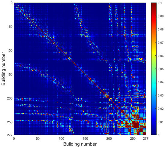
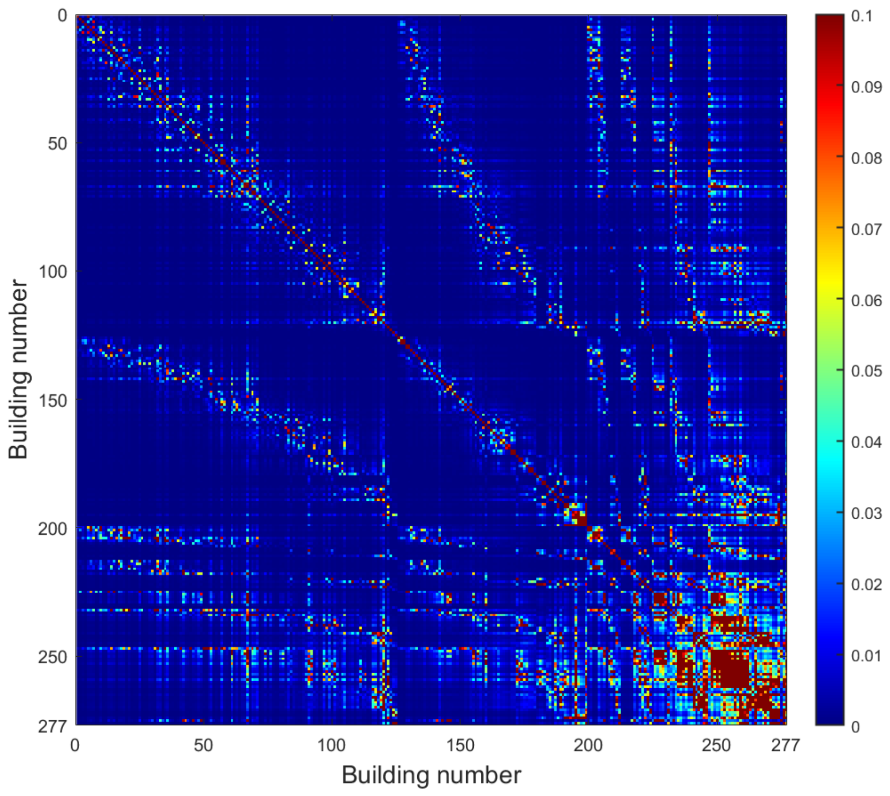
Figure 4 illustrates the characteristic attractive force driving fire spread between two buildings in cluster A by using the established theory model, defined as a comprehensive mechanism encompassing physical and environmental factors that govern inter-building fire spread. In fact, the developed characteristic attractive force model for fire spread between two buildings can provide a graph, which enables the quantification of the possibility of fire spreading from one building to other structures after a fire breaks out in that building. This is the main contribution of the study.
Figure 4.
Characteristic attractive force for fire spread development between two buildings in cluster A.
3.1.2. GIS-Based Fire Spread Path Prediction of Building Cluster A in Case I
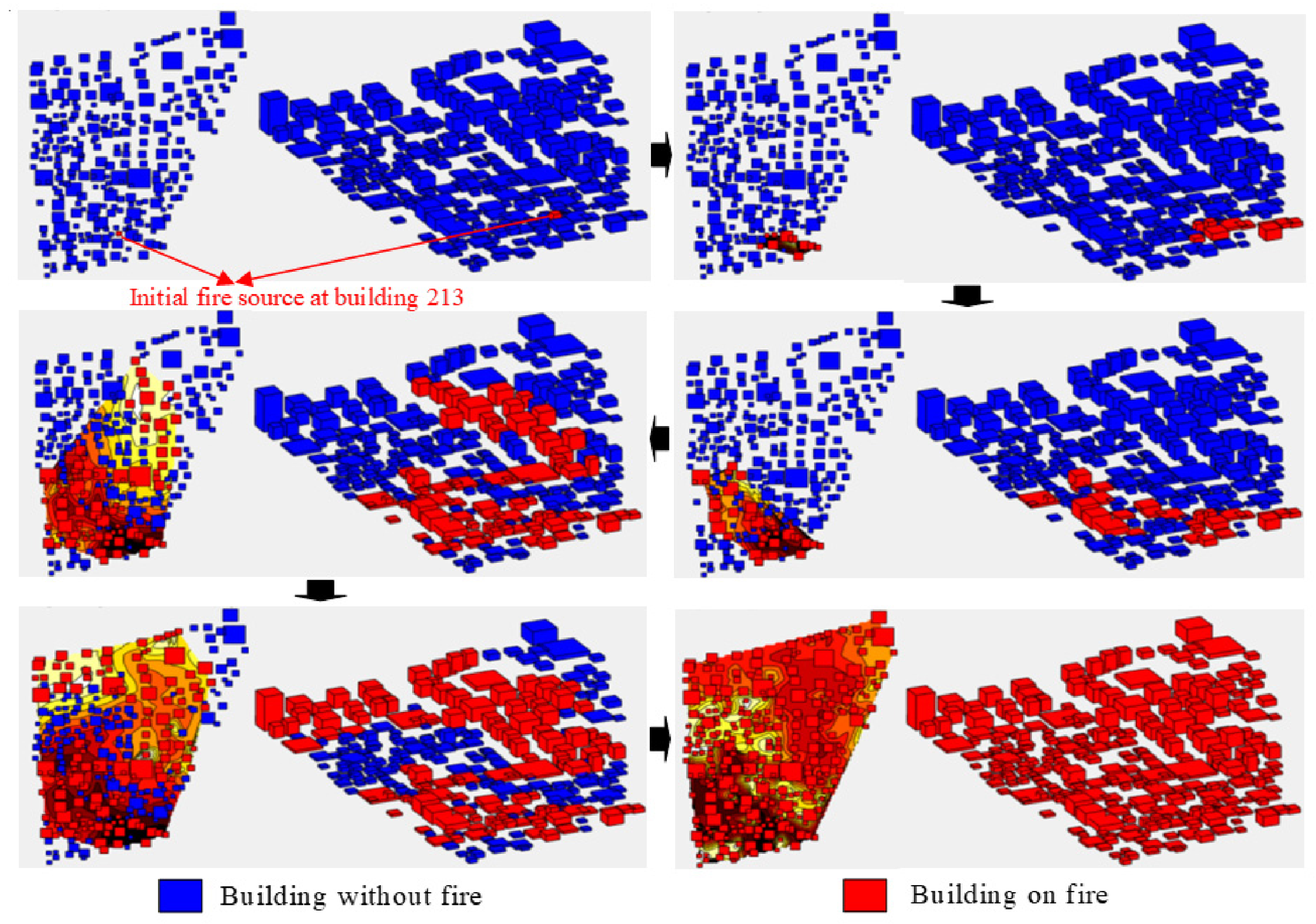
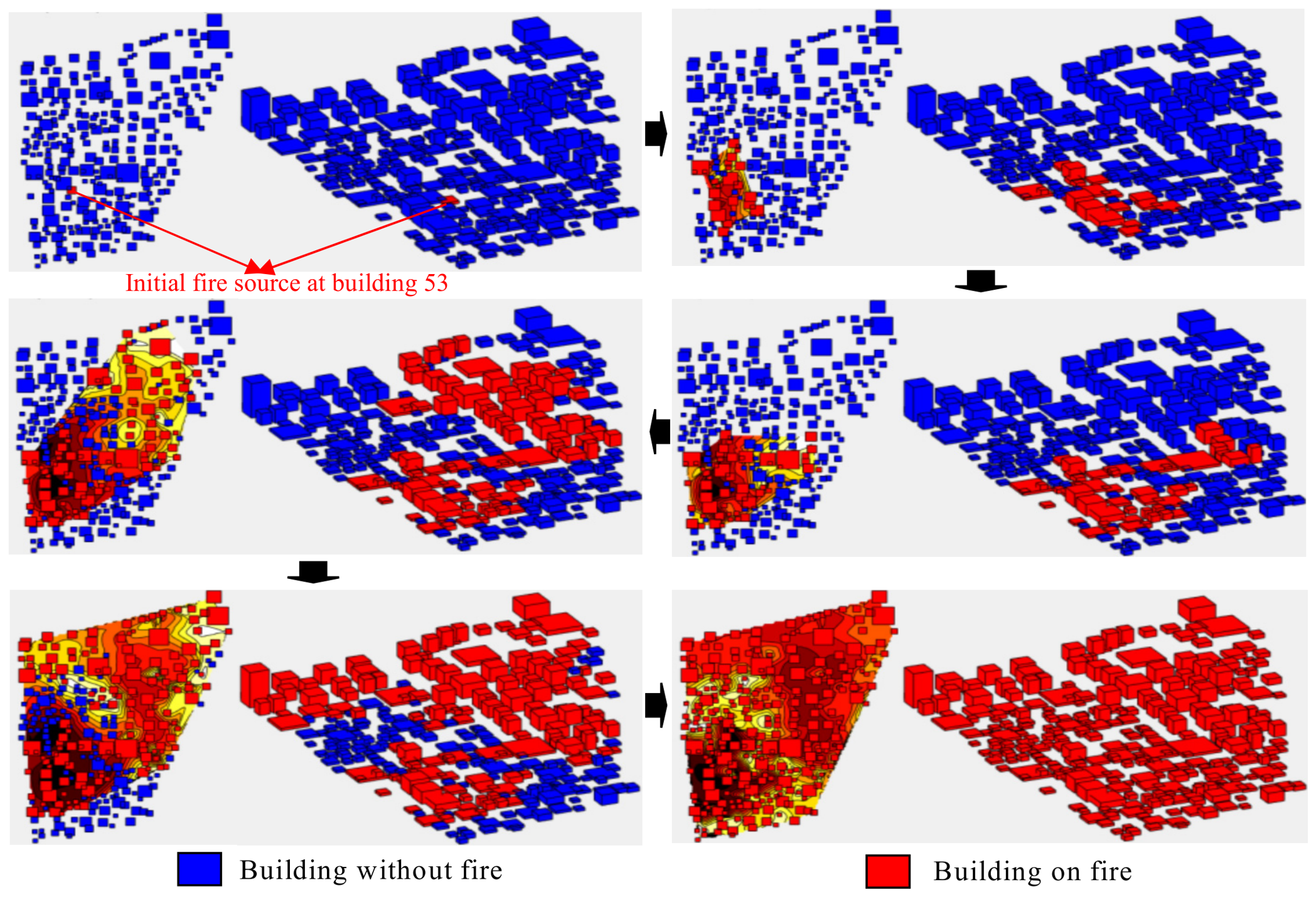
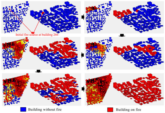
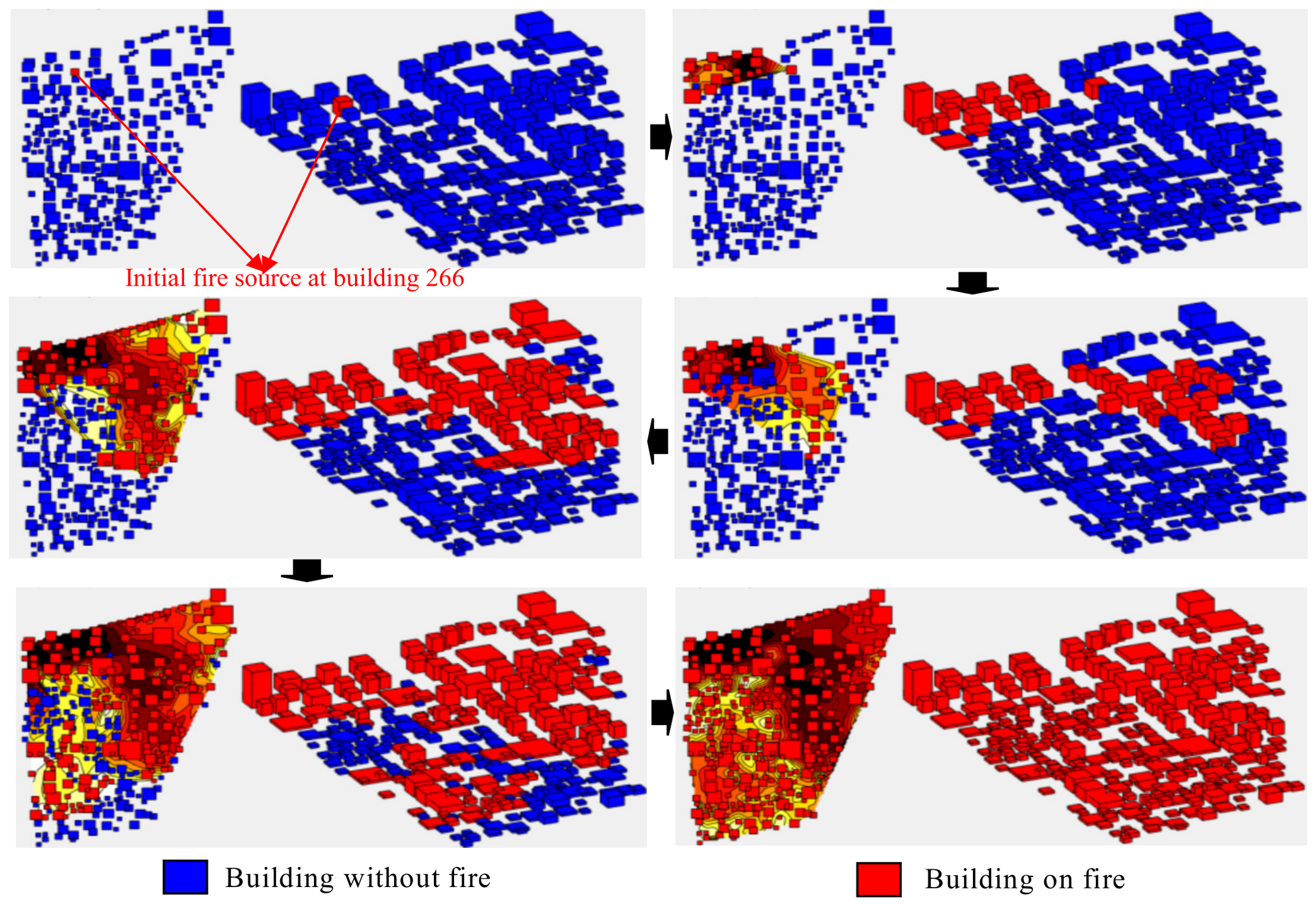
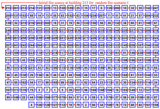
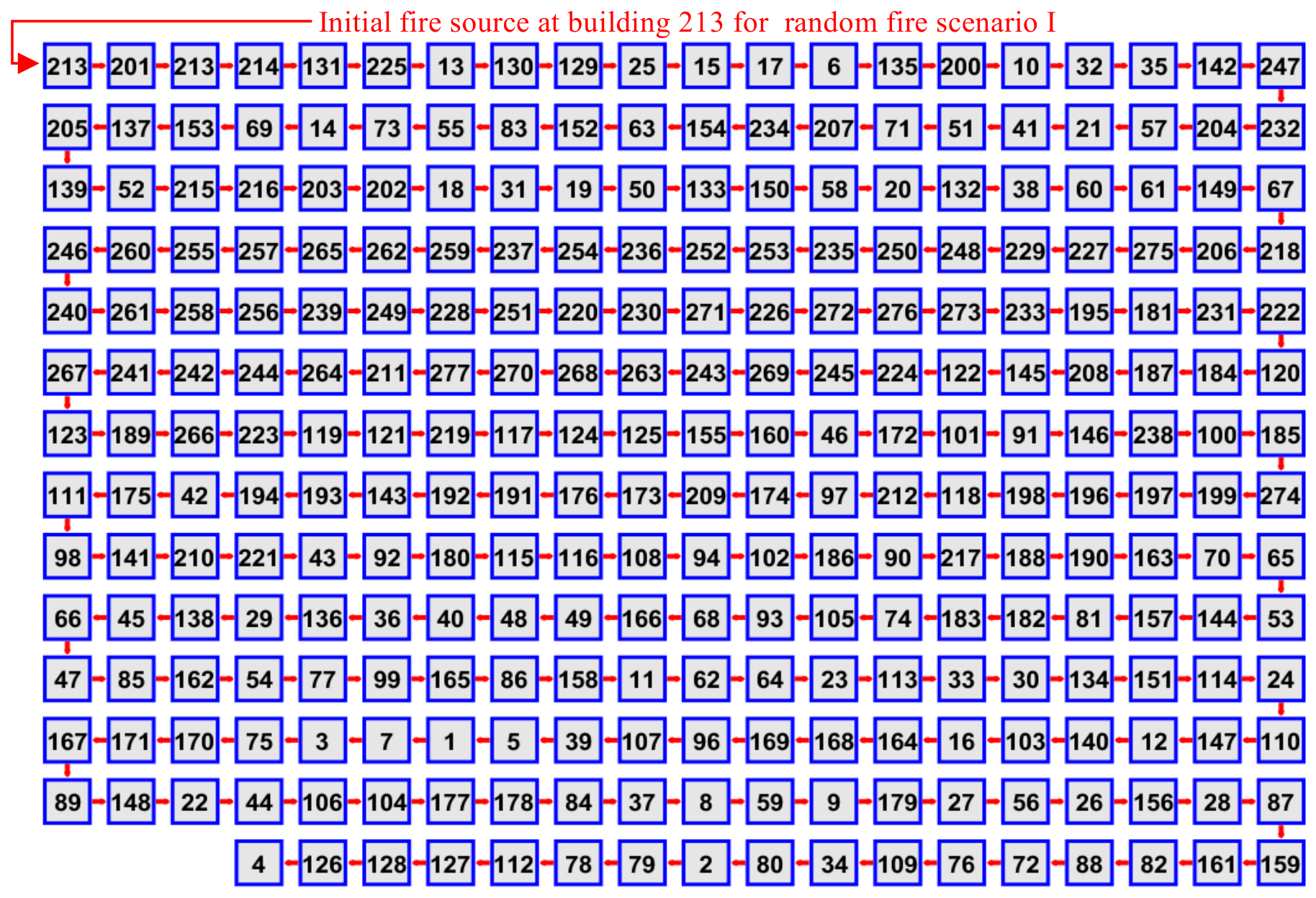
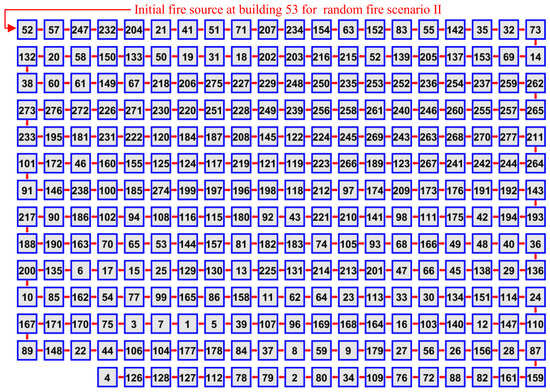
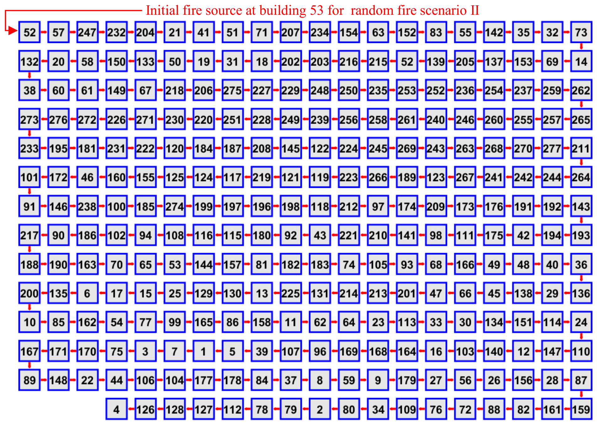
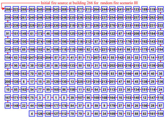
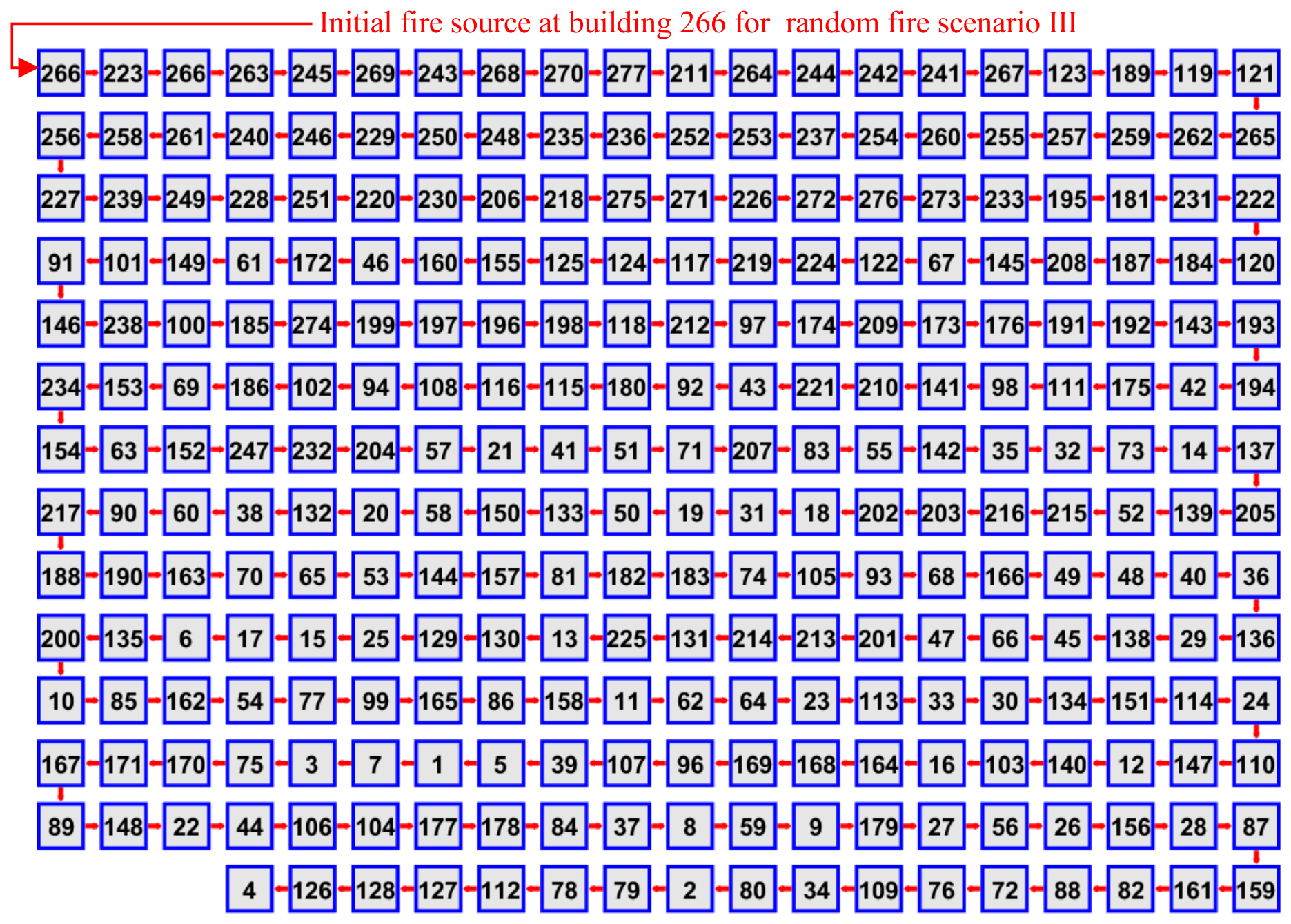
According to the established GIS-based rapid prediction framework of large-scale urban fire spreading paths with the aid of the developed theory model, three fire scenarios with different fire source buildings are analyzed. Figure 5, Figure 6, and Figure 7 present the predictions of urban fire spread paths within building cluster A for random fire scenario I (with the initial fire source at building 213), random fire scenario II (with the initial fire source at building 53), and random fire scenario III (with the initial fire source at building 266), respectively. Figure 8, Figure 9, and Figure 10 respectively illustrate the fire pathway spectra of cluster A under the corresponding random fire scenario I, random fire scenario II, and random fire scenario III, with each spectrum structured in accordance with the sequential order of inter-building fire spread—traversing from the fire source building to the entire building cluster.
Figure 5.
Prediction of the urban fire spread path in building cluster A under random fire scenario I.
Figure 6.
Prediction of the urban fire spread path in building cluster A under random fire scenario II.
Figure 7.
Prediction of the urban fire spread path in building cluster A under random fire scenario III.
Figure 8.
Fire pathway spectrum of building cluster A under random fire scenario I with initial fire source at building 213.
Figure 9.
Fire pathway spectrum of building cluster A under random fire scenario II with initial fire source at building 53.
Figure 10.
Fire pathway spectrum of building cluster A under random fire scenario III with initial fire source at building 266.
The results show that the developed theory and prediction framework can visually map the dynamic spread trajectories of fire across the urban building cluster, where the model simulates how fire spread from the initial ignition point through adjacent structures, capturing key transitions such as the order of building ignition, building density on path divergence, and the formation of critical spread corridors that connect high-risk zones within the cluster. Meanwhile, the developed theory and prediction framework can also provide a comprehensive quantitative and qualitative overview of the possible fire spread routes, including primary paths that show the most probable propagation directions, secondary paths indicating less likely but still feasible spread routes influenced, and color-coded annotations that represent the sequential order of fire spread. It is thus clear that this case supports the proposed theory and prediction framework’s capability to comprehensively assess fire spread dynamics in the large-scale urban building cluster for risk mitigation and emergency planning.
3.2. Case II
3.2.1. GIS-Based Modeling of Building Cluster B in Case II
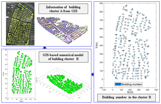
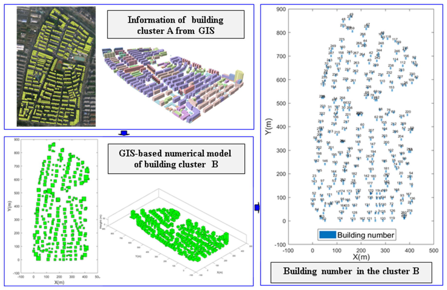
In Case II, the geographic information of building cluster B presented in Figure 11 is extracted from high-precision GIS spatial databases, serving as the second validation case to support the established theory and prediction framework. As illustrated in Figure 11, building attribute data acquired through GIS vectorization techniques—including geographical coordinate positions, structural heights, and floor areas—is also provided. Meanwhile, spatial layout features such as inter-building spacing and an average density of 0.6 buildings per 1000 square meters are quantified using GIS spatial analysis functionalities. By employing the developed GIS-based digital modeling method, a numerical model for building cluster B is established and showcased in Figure 11.
Figure 11.
Numerical simulation case of the possible fire in building cluster B.
Additionally, to support in-depth quantitative analysis of fire spread patterns and enhance result visualization clarity, building cluster B is systematically numbered in Figure 11 based on a logic closely integrated with GIS spatial organization rules. Following the same approach as cluster A in the above section, the numbering adheres to an ascending sequence according to building heights (from the shortest to the tallest) and is labeled in alignment with their respective spatial coordinates within the numerical model. This numbering system facilitates the description of specific fire spread paths—from the initial fire-originating building to adjacent structures, as well as the subsequent expansion of these paths throughout the entire large-scale building cluster.
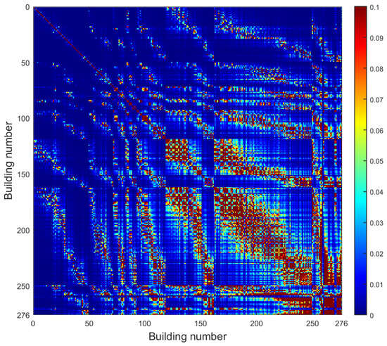
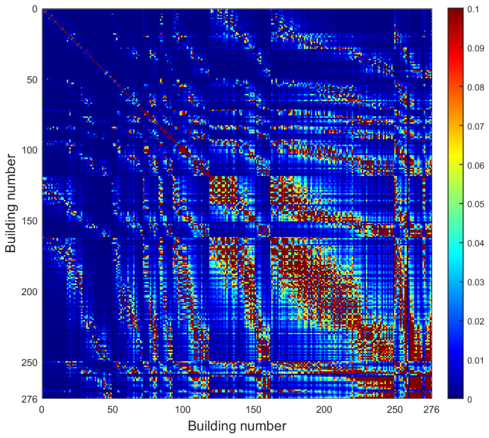
Similarly, Figure 12 illustrates the characteristic attractive force governing fire spread between two representative buildings in cluster B, derived using the same established theoretical model as applied in Case I. This force is defined as an integrated mechanism that incorporates physical factors regulating inter-building fire propagation within the cluster. Specifically, the developed characteristic attractive force model for inter-building fire spread in cluster B generates a quantifiable graph, which enables the precise calculation of the likelihood that fire will spread from an initial building to surrounding structures following ignition. This application of the model in a distinct urban building cluster B further validates its generalizability, representing a key contribution of the study to advancing fire spread path prediction strategies.
Figure 12.
Characteristic attractive force for fire spread development between two buildings in cluster B.
3.2.2. GIS-Based Fire Spread Path Prediction of Building Cluster B in Case II
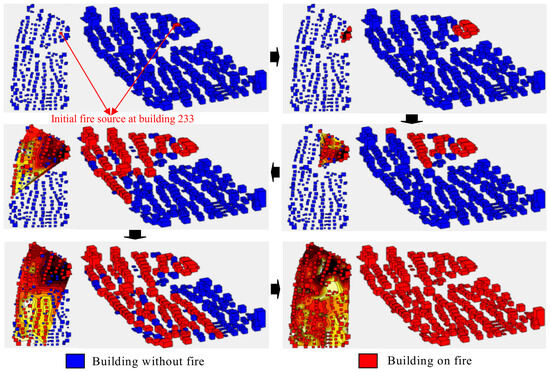
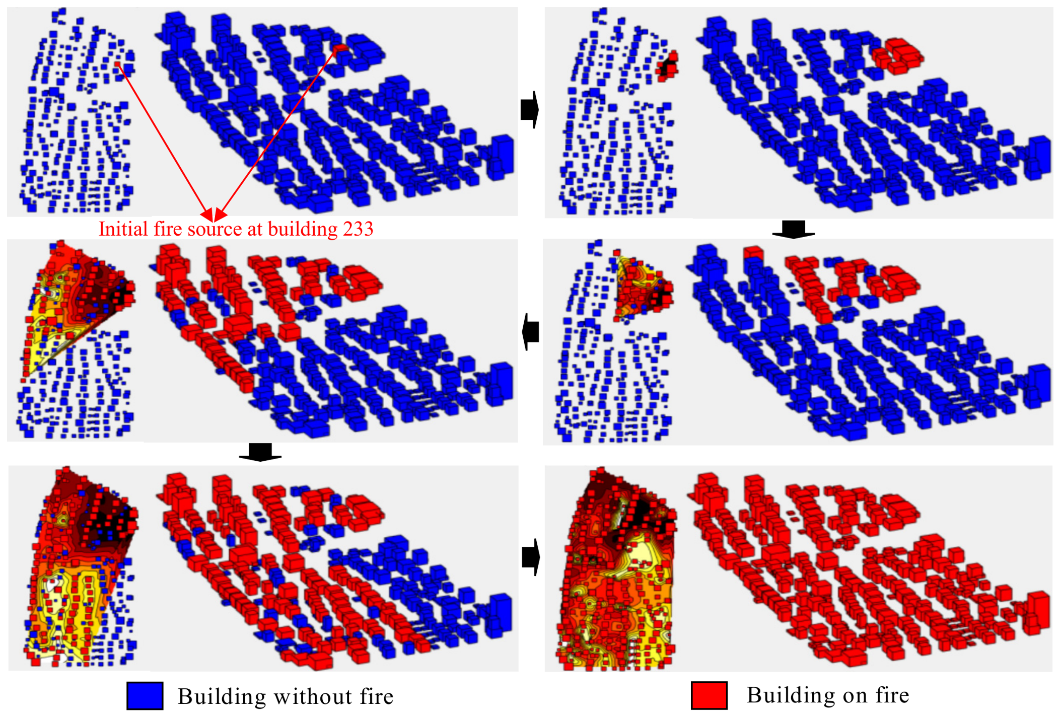
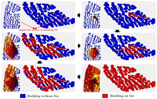
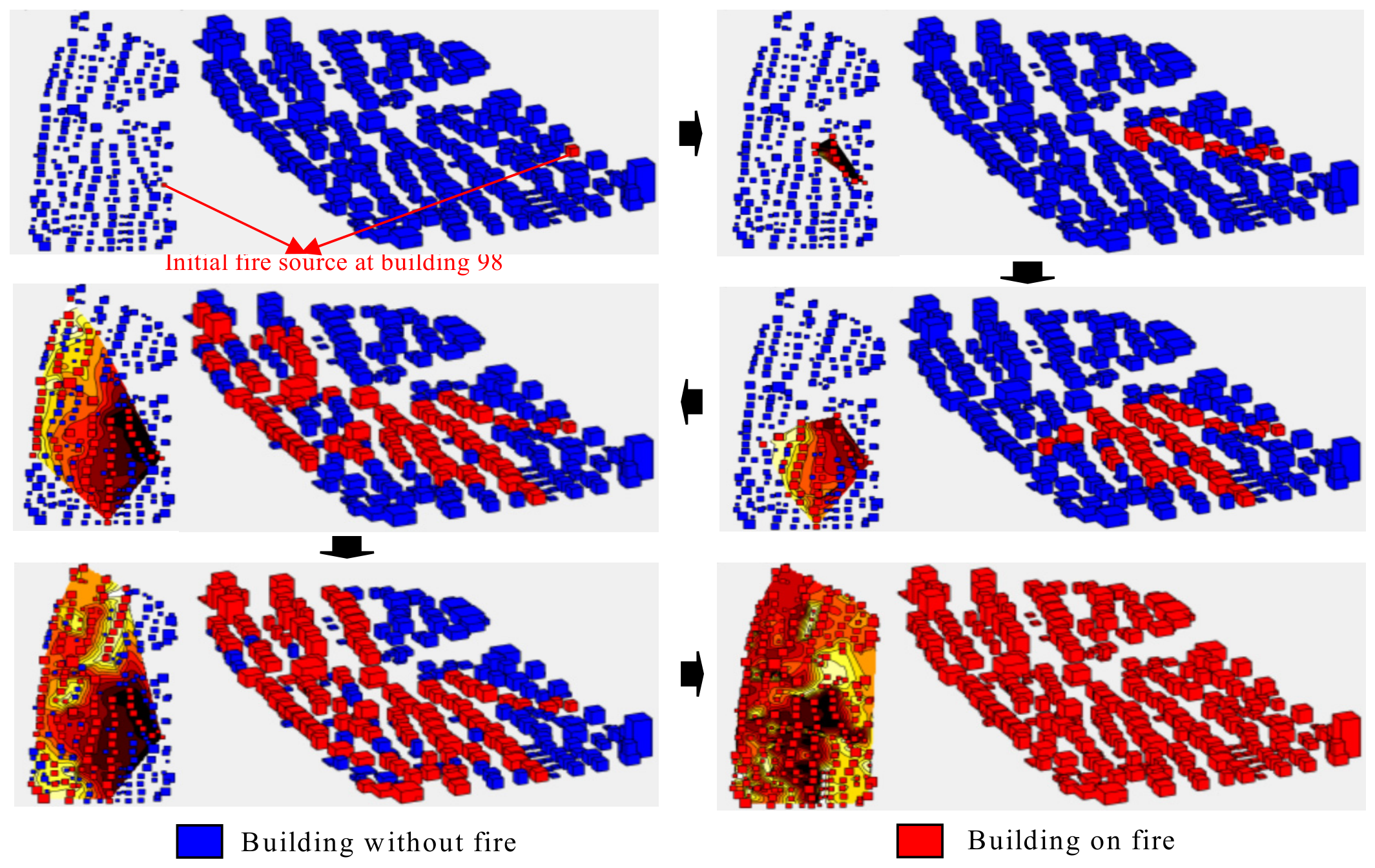
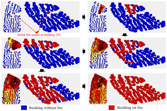
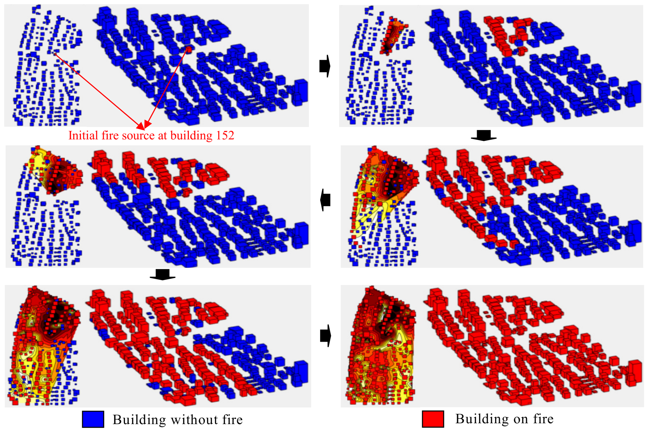
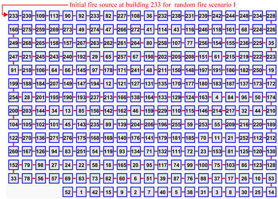
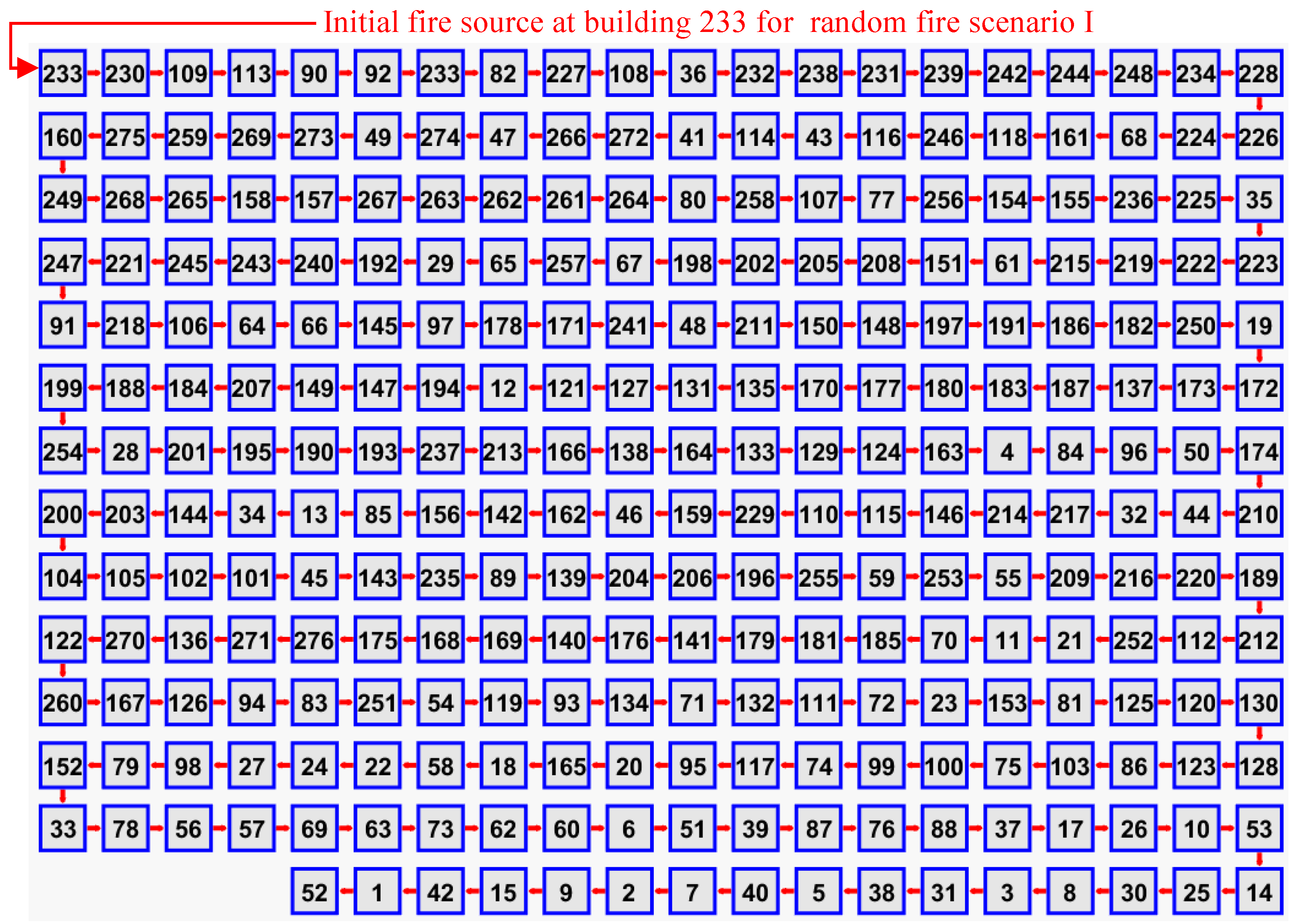
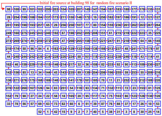
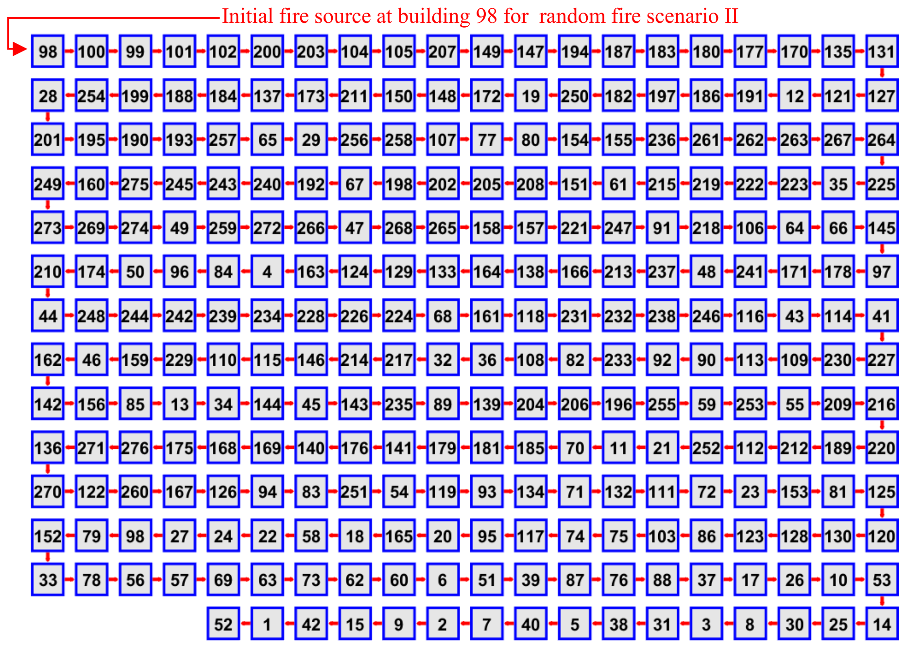
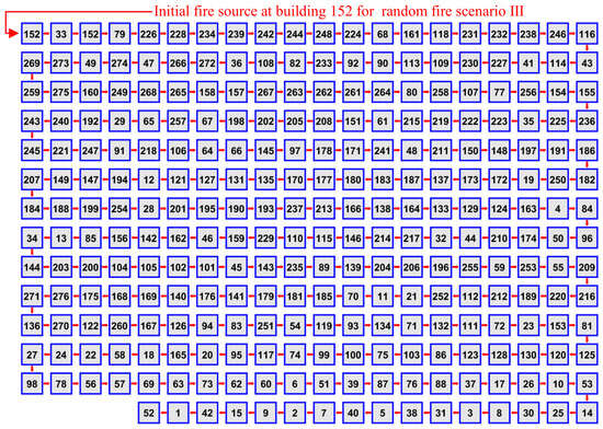
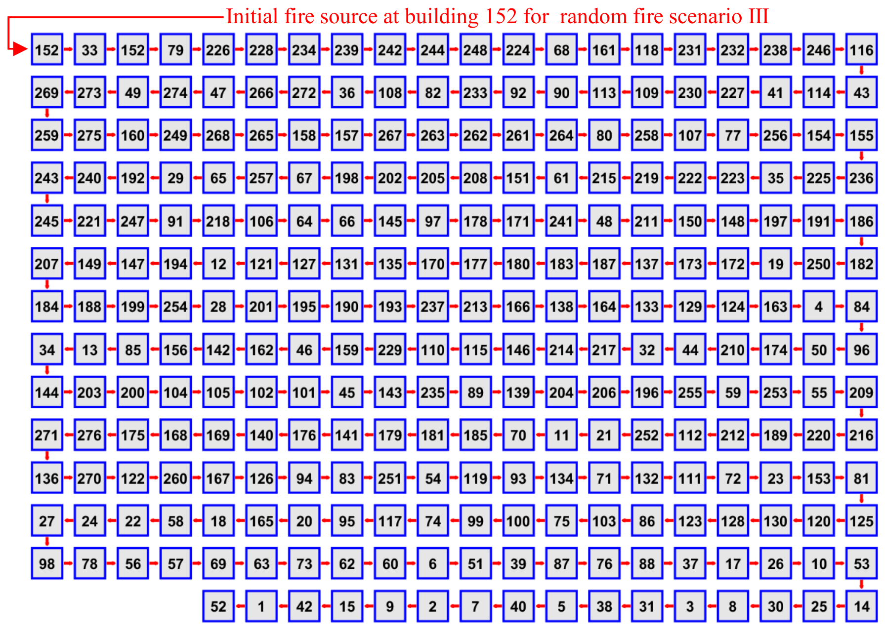
Similar to the above section, leveraging the established GIS-based rapid prediction framework for large-scale urban fire spread paths, coupled with the developed theoretical model, three distinct fire scenarios featuring different fire source buildings are analyzed for building cluster B. Figure 13, Figure 14, and Figure 15 present the predictions of urban fire spread paths within cluster B for random fire scenario I (with the initial fire source at building 233), random fire scenario II (with the initial fire source at building 98), and random fire scenario III (with the initial fire source at building 152), respectively. Correspondingly, Figure 16, Figure 17, and Figure 18 illustrate the fire pathway spectra of cluster B under these respective scenarios, with each spectrum organized according to the sequential order of inter-building fire spread—traversing from the fire source building to the entire cluster.
Figure 13.
Prediction of the urban fire spread path in building cluster B under random fire scenario I.
Figure 14.
Prediction of the urban fire spread path in building cluster B under random fire scenario II.
Figure 15.
Prediction of the urban fire spread path in building cluster B under random fire scenario III.
Figure 16.
Fire pathway spectrum of building cluster B under random fire scenario I with initial fire source at building 233.
Figure 17.
Fire pathway spectrum of building cluster B under random fire scenario II with initial fire source at building 98.
Figure 18.
Fire pathway spectrum of building cluster B under random fire scenario III with initial fire source at building 152.
The results demonstrate that the developed theory and prediction framework effectively visualizes the dynamic trajectories of fire spread across the urban building cluster. The model simulates fire propagation from the initial ignition point to adjacent structures, capturing key transition processes such as the sequence of building ignitions, the impact of building density on path divergence, and the formation of critical spread corridors connecting high-risk areas within the cluster. Additionally, the framework provides a comprehensive quantitative and qualitative summary of potential fire spread routes, including primary paths indicating the most probable propagation directions, secondary paths representing less likely yet feasible spread routes, and color-coded markers denoting the sequential order of fire spread. This case thus further validates the proposed theory and prediction framework’s ability to comprehensively evaluate fire spread dynamics in large-scale urban building clusters again, supporting their application in risk mitigation and emergency planning efforts.
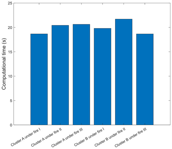
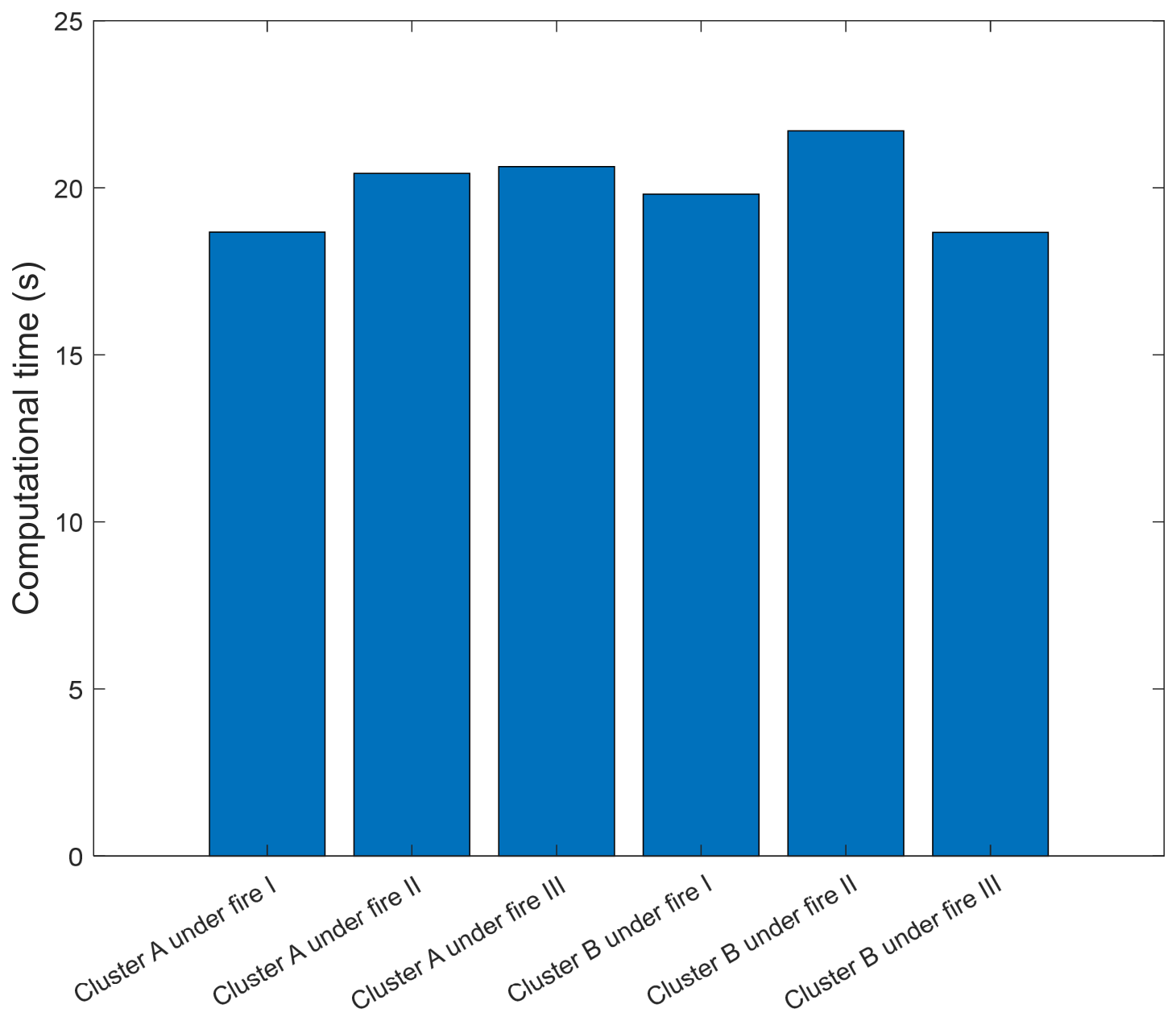
Figure 19 presents the computational time metrics for all cases analyzed in this study, providing a quantitative assessment of the efficiency of the established GIS-based fire spread prediction framework across different urban scenarios. The figure systematically compares the time required to complete fire spread path predictions for both building cluster A and building cluster B. The results reveal the exceptional efficiency of the developed prediction framework for large-scale building clusters comprising several hundred structures (e.g., cluster A with approximately 276 buildings and cluster B with around 277 buildings); the framework consistently completes full fire spread path predictions within a remarkably short time frame of 18–23 s per scenario. This rapid computation is achieved through the optimized integration of the established GIS-based modeling strategy and the streamlined characteristic attractive force model, which reduces complex urban structural data into structured numerical parameters without sacrificing prediction accuracy.
Figure 19.
Computational time of all cases in this study.
4. Validation
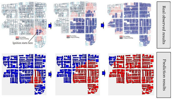
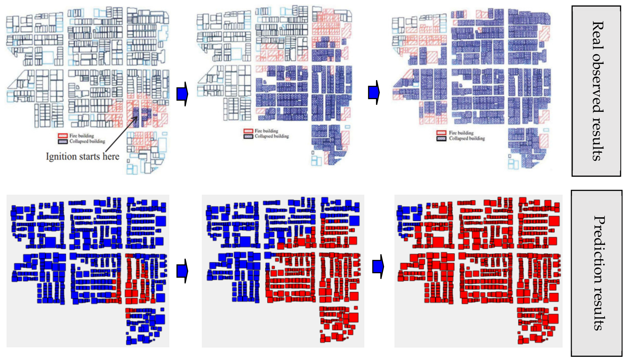
To verify the practical performance of the proposed theoretical model and urban fire prediction framework, this study centers on the comparison between predicted fire spread paths and field-measured results from a documented urban building cluster fire disaster in Kobe City, and the corresponding comparative outcomes are illustrated in Figure 20. Detailed background records of this urban fire case are provided in existing published studies [26,27]. This focused comparison of predicted fire spread paths against real measured data proves that the presented model and prediction framework can accurately reproduce core fire spread paths of real urban fire incidents. The comparative results verify the stability of the model in capturing complex fire evolution patterns and demonstrate its practical value for urban fire risk evaluation, emergency response scheme formulation and urban fire safety layout design.
Figure 20.
Comparison of predicted fire spread paths and measured results from a real urban building cluster fire disaster in Kobe City.
5. Conclusions
The main contributions of this study can be concluded as follows:
- (1)
- The proposed “characteristic attractive force” model within the gravitational framework introduces a novel mechanism for describing inter-building fire spread, conceptualizing fire spread as a dynamic interaction governed by integrated physical factors (e.g., building spacing and building combustion characteristics). This innovation transcends traditional empirical approaches by quantifying the “attractive force” driving fire spread, enabling a more mechanistic and interpretable representation of how fire spreads from initial ignited building to large-scale clusters.
- (2)
- The GIS-based rapid prediction framework eliminates the need for complex physical parameter inputs typically required in detailed fire dynamics simulations. By leveraging structured GIS spatial data (e.g., building coordinates, heights, and areas) and topology analysis, the framework streamlines input requirements while maintaining predictive accuracy, making it applicable to data-constrained urban environments and enhancing its practicality for real-world engineering applications.
- (3)
- The optimized integration of the gravitational theory model with GIS tools achieves exceptional computational efficiency. The framework consistently completes fire spread path predictions for clusters of several hundred buildings within several seconds per scenario. This efficiency enables rapid risk assessment and supports real-time decision-making for emergency planning and fire mitigation strategies in urban settings.
Finally, we systematically summarize the advantages, inherent limitations and applicable scope of the proposed method. This model mainly suits rapid calculation and real-time risk assessment of large-scale urban regional fires under conventional atmospheric environments, and it supports emergency early warning, fire risk zoning and pre-disaster rescue planning by capturing macroscopic fire propagation laws governed by building spatial layouts and total combustion energy. The current framework ignores wind fields, weather fluctuations, exterior building material characteristics, differentiated building usage types, road network layouts and firefighting response factors. These omitted variables only generate minor local deviations and cannot reverse the overall building ignition sequence and regional fire spread range, so the model maintains stable reliability for macroscopic regional fire risk evaluation. For subsequent research, we incorporate real historical fire incident data, wind field meteorological data, building material parameters and firefighting intervention conditions into the framework, and embed multi-factor correction coefficients into the characteristic attractive force formula. The upgraded model achieves stronger adaptability to complex urban environments and higher prediction precision, so it delivers more comprehensive technical support for urban large-scale fire safety governance.
Funding
The works described in this paper are financially supported by the National Program on Key R&D Project of China (2022YFE0210500).
Data Availability Statement
The data presented in this study are available on request from the corresponding author.
Conflicts of Interest
The author declares no conflicts of interest.
References
- Ding, Z.; Xu, S.; Xie, X.; Zheng, K.; Wang, D.; Fan, J.; Li, H.; Liao, L. A building information modeling-based fire emergency evacuation simulation system for large infrastructures. Reliab. Eng. Syst. Saf. 2024, 244, 109917. [Google Scholar] [CrossRef] [Scilit]
- Kim, Y.J.; Kim, H.; Ha, B.; Kim, W.T. Advanced fire emergency management based on potential fire risk assessment with informative digital twins. Autom. Constr. 2024, 167, 105722. [Google Scholar] [CrossRef] [Scilit]
- Stevens, S.; Rush, D. Urban fire spread modelling: A review of dynamic computational models and potential for application to informal settlement fires. Int. J. Disaster Risk Reduct. 2025, 124, 105528. [Google Scholar] [CrossRef] [Scilit]
- Cheng, L.; Li, S.; Ma, L.; Li, M.; Ma, X. Fire spread simulation using GIS: Aiming at urban natural gas pipeline. Saf. Sci. 2015, 75, 23–35. [Google Scholar] [CrossRef] [Scilit]
- Taylor, M.; Appleton, D.; Oakford, G.; Fielding, J. Population trends and fire prevention in Merseyside UK. Fire Technol. 2021, 57, 1783–1802. [Google Scholar] [CrossRef] [Scilit]
- Ceyhan, E.; Ertuğay, K.; Düzgün, Ş. Exploratory and inferential methods for spatio-temporal analysis of residential fire clustering in urban areas. Fire Saf. J. 2013, 58, 226–239. [Google Scholar] [CrossRef] [Scilit]
- Elumalai, V.; Godwyn-Paulson, P.; Logesh, N.; Muthusankar, G.; Lakshumanan, C.; Jonathan, M.P. Burning urban cities of South Africa due to civil turmoil 2021: Socio-economic and environmental consequences. Cities 2022, 124, 103612. [Google Scholar] [CrossRef] [Scilit]
- Ma, J.; Xiao, C. Large-scale fire spread model for traditional Chinese building communities. J. Build. Eng. 2023, 67, 105899. [Google Scholar] [CrossRef] [Scilit]
- Nishino, T.; Kagiya, K. A multi-layer zone model including flame spread over linings for simulation of room-corner fire behavior in timber-lined rooms. Fire Saf. J. 2019, 110, 102906. [Google Scholar] [CrossRef] [Scilit]
- Ba, R.; Deng, Q.; Liu, Y.; Yang, R.; Zhang, H. Multi-hazard disaster scenario method and emergency management for urban resilience by integrating experiment–simulation–field data. J. Saf. Sci. Resil. 2021, 2, 77–89. [Google Scholar] [CrossRef] [Scilit]
- Ji, W.; Richter, F.; Gollner, M.J.; Deng, S. Autonomous kinetic modeling of biomass pyrolysis using chemical reaction neural networks. Combust. Flame 2022, 240, 111992. [Google Scholar] [CrossRef] [Scilit]
- Baalisampang, T.; Saliba, E.; Salehi, F.; Garaniya, V.; Chen, L. Optimisation of smoke extraction system in fire scenarios using CFD modelling. Process Saf. Environ. Prot. 2021, 149, 508–517. [Google Scholar] [CrossRef] [Scilit]
- Zhang, F.; Shi, L.; Liu, S.; Shi, J.; Zhang, J. CFD-based framework for fire risk assessment of contiguous wood-frame villages in the western Hunan region. J. Build. Eng. 2022, 54, 104607. [Google Scholar] [CrossRef] [Scilit]
- Sun, B.; Li, Y.; Zhang, Y.; Guo, T. Multi-source heterogeneous data fusion prediction technique for the utility tunnel fire detection. Reliab. Eng. Syst. Saf. 2024, 248, 110154. [Google Scholar] [CrossRef] [Scilit]
- Chow, W.K. Performance-based approach to determining fire safety provisions for buildings in the Asia-Oceania regions. Build. Environ. 2015, 91, 127–137. [Google Scholar] [CrossRef] [Scilit]
- Cicione, A.; Walls, R.S.; Kahanji, C. Experimental study of fire spread between multiple full scale informal settlement dwellings. Fire Saf. J. 2019, 105, 19–27. [Google Scholar] [CrossRef] [Scilit]
- Konishi, T.; Kikugawa, H.; Iwata, Y.; Koseki, H.; Sagae, K.; Ito, A.; Kato, K. Aerial firefighting against urban fire: Mock-up house experiments of fire suppression by helicopters. Fire Saf. J. 2008, 43, 363–375. [Google Scholar] [CrossRef] [Scilit]
- Peng, M.; Shi, L.; He, K.; Yang, H.; Cong, W.; Cheng, X.; Richard, Y. Experimental study on fire plume characteristics in a subway carriage with doors. Fire Technol. 2020, 56, 401–423. [Google Scholar] [CrossRef] [Scilit]
- Di Giuseppe, F.; McNorton, J.; Lombardi, A.; Wetterhall, F. Global data-driven prediction of fire activity. Nat. Commun. 2025, 16, 2918. [Google Scholar] [CrossRef] [Scilit] [PubMed]
- Sun, B. Physical model and multiple moth-flame optimization fusion temperature field prediction in large-space building fires. Int. J. Therm. Sci. 2025, 214, 109892. [Google Scholar] [CrossRef] [Scilit]
- Zhou, Y.; Lin, P.; Wang, N. A deep neural network approach for regional-scale 30-day accumulated urban fire occurrence forecast. Fire Saf. J. 2025, 152, 104331. [Google Scholar] [CrossRef] [Scilit]
- Sun, B.; Guo, T. Wavelet neural network and whale optimization fusion fire temperature prognosis in large-space buildings. J. Clean. Prod. 2025, 513, 145751. [Google Scholar] [CrossRef] [Scilit]
- Zhang, C.Y.; Zhao, R.; Wang, N.; Nie, X. A novel historical data-based method for predicting firefighters demand in urban fires. Fire Saf. J. 2024, 147, 104200. [Google Scholar] [CrossRef] [Scilit]
- Cui, S.; Wang, N.; Zhao, E.; Zhang, J.; Zhang, C. Assessing urban fire risk: An ensemble learning approach based on scenarios and cases. Int. J. Disaster Risk Reduct. 2024, 114, 104941. [Google Scholar] [CrossRef] [Scilit]
- Sun, B. Geographic information system-based urban community fire danger evaluation method fusing evidential reasoning and intelligent optimization. Reliab. Eng. Syst. Saf. 2025, 268, 112039. [Google Scholar] [CrossRef] [Scilit]
- Sun, B.; Chen, L.; Guo, T. GIS-based large-scale urban fire situation spread probability model and simulation technique. Int. J. Disaster Risk Reduct. 2025, 129, 105779. [Google Scholar] [CrossRef] [Scilit]
- Rafi, M.M.; Aziz, T.; Lodi, S.H. A suggested model for mass fire spread. Sustain. Resilient Infrastruct. 2020, 5, 214–231. [Google Scholar] [CrossRef] [Scilit]

Disclaimer/Publisher’s Note: The statements, opinions and data contained in all publications are solely those of the individual author(s) and contributor(s) and not of MDPI and/or the editor(s). MDPI and/or the editor(s) disclaim responsibility for any injury to people or property resulting from any ideas, methods, instructions or products referred to in the content. |
© 2026 by the author. Licensee MDPI, Basel, Switzerland. This article is an open access article distributed under the terms and conditions of the Creative Commons Attribution (CC BY) license.