Next Issue
Volume 9, April
Previous Issue
Volume 9, February


Urban Sci., Volume 9, Issue 3 (March 2025) – 35 articles

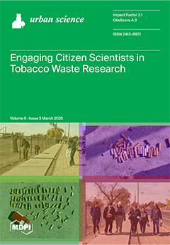
Cover Story (view full-size image): Inappropriately discarded tobacco product waste (TPW) poses significant environmental and health risks by contaminating ecosystems. Addressing the public’s role in tobacco waste cleanup, this study evaluates the operational usability and acceptability of two TPW collection protocols implemented by citizen scientists in California’s Central Valley. Our findings highlight the potential of adaptable methodologies that not only engage the public in meaningful scientific participation but also empower local communities. This collaborative approach serves as a model for integrating public participation into research, demonstrating how citizen scientists can contribute to driving local tobacco control efforts to safeguard community and environmental health. View this paper
  • Issues are regarded as officially published after their release is announced to the table of contents alert mailing list.
  • You may sign up for e-mail alerts to receive table of contents of newly released issues.
  • PDF is the official format for papers published in both, html and pdf forms. To view the papers in pdf format, click on the "PDF Full-text" link, and use the free Adobe Reader to open them.
Order results
Result details
Select all
Export citation of selected articles as:
23 pages, 1859 KiB  
Article
How Do Territorial Relationships Determine the Provision of Ecosystem Services? A Focus on Italian Metropolitan Regions in Light of Von Thünen’s Theorem
by Davide Marino, Antonio Barone, Angelo Marucci, Silvia Pili and Margherita Palmieri
Urban Sci. 2025, 9(3), 87; https://doi.org/10.3390/urbansci9030087 - 20 Mar 2025
Viewed by 308
Abstract
This study aims to explore the relationship between the provision of ecosystem services (ESs) and other territorial characteristics. Taking Italian Metropolitan Regions (MRs) as case studies, the gradient of specialization providing a set of ESs in different territorial contexts is examined using the [...] Read more.
This study aims to explore the relationship between the provision of ecosystem services (ESs) and other territorial characteristics. Taking Italian Metropolitan Regions (MRs) as case studies, the gradient of specialization providing a set of ESs in different territorial contexts is examined using the National Strategy for Internal Areas (SNAI) territorial classification. The main objective of this research is to understand whether there is a spatial pattern of location of different ESs within metropolitan SNAI areas. Inspired by Von Thünen’s spatial economic theories, this study explores how proximity to urban centers influences land use and ES specialization. Through land use analysis and the calculation of a SI, we evaluate patterns in ES supply, based on a benefit transfer approach. The results show that the MRs provide about EUR 14.6 billion per year in benefits, equivalent to 15% of the national wealth in environmental goods and services. At the SNAI area scale, internal areas have the highest average economic values per hectare, while the central areas have lower economic values. This trend is confirmed by the calculation of the specialization index (SI) in line with Von Thünen’s theorem as follows: central areas are specialized in the provision of bundles of ESs related to intensive land use (e.g., food production), while the peripheral areas are specialized in the supply of regulation ESs related to more natural areas. The findings underline significant policy implications for metropolitan planning, stressing the need for the balanced management of ESs to address urban demands and enhance resilience. This research contributes to understanding the spatial dynamics of ES supply, offering a basis for tailored interventions in metropolitan and national contexts. Full article
Show Figures

Figure 1

20 pages, 1373 KiB  
Review
Food Security and Circular Cities: Paradigmatic Shifts, Geographical and Temporal Scales, and Participatory Governance Support to Facilitate Transitions Towards ‘Urban Sustainability’
by Sandrine Simon
Urban Sci. 2025, 9(3), 86; https://doi.org/10.3390/urbansci9030086 - 18 Mar 2025
Viewed by 278
Abstract
This article explores how the principles of circularity, applied to urban food systems, could contribute to catalysing a transition towards more sustainable cities, working on the premise that food security is a key pillar of urban resilience. In order to do so, it [...] Read more.
This article explores how the principles of circularity, applied to urban food systems, could contribute to catalysing a transition towards more sustainable cities, working on the premise that food security is a key pillar of urban resilience. In order to do so, it critically examines (i) circularity in the context of urban regeneration and why focusing on food could help to understand the sociopolitical and ecological dimensions of circularity; (ii) the geographical and temporal scales of urban circularity; and (iii) how ‘barometers of circularity’ could be built and integrated into participatory urban governance processes to support urban ecological transformations. Full article
Show Figures

Figure 1

34 pages, 3872 KiB  
Article
Assessment of the Effectiveness of Green Infrastructure Interventions to Enhance the Ecosystem Services in Developing Countries
by Diego Paredes Méndez, Modesto Pérez-Sánchez, Francisco Javier Sánchez-Romero and Oscar E. Coronado-Hernández
Urban Sci. 2025, 9(3), 85; https://doi.org/10.3390/urbansci9030085 - 17 Mar 2025
Viewed by 575
Abstract
Cities face complex challenges, including climate change, population growth, urbanization, natural hazards, pollution, biodiversity degradation, and inadequate public services. Hydro-meteorological hazards such as floods, landslides, droughts, and heat waves are among the most significant risks, with floods often causing severe impacts and loss [...] Read more.
Cities face complex challenges, including climate change, population growth, urbanization, natural hazards, pollution, biodiversity degradation, and inadequate public services. Hydro-meteorological hazards such as floods, landslides, droughts, and heat waves are among the most significant risks, with floods often causing severe impacts and loss of life. Traditional responses, typically hard engineering infrastructures, dominate mitigation efforts. However, green infrastructures (GIs) offer sustainable, cost-effective solutions with added benefits, enhancing ecosystem services and societal well-being. Despite their effectiveness, GI implementation is slow, particularly in developing countries, due to the complex construction, operation, and maintenance processes, alongside knowledge gaps. This study proposes an assessment framework to evaluate GI performance in mitigating hydro-meteorological hazards. By integrating hydrologic–hydraulic modeling, the framework analyzes baseline and post-intervention conditions, offering valuable insights into hazard reduction and cost-effectiveness. Key indicators for assessing GIs include runoff volume reduction, peak flow reduction, flood node mitigation, and increased time to peak flow. Studies show that GIs can achieve reductions of 30–90%. This framework aims to advance the adoption of GIs by providing practical tools to assess and monitor its performance in hazard management. Full article
Show Figures

Figure 1

20 pages, 7368 KiB  
Article
Dynamics of Changes in Spatial Patterns of Built-Up Areas in Two Metropolitan Areas of Grand Lomé and Greater Accra (West Africa)
by Adjowa Yéwa Tossoukpe, Jaiye Dukiya, Fousseni Folega, Michael Thiel and Appollonia Aimiosino Okhimamhe
Urban Sci. 2025, 9(3), 84; https://doi.org/10.3390/urbansci9030084 - 16 Mar 2025
Viewed by 323
Abstract
Urbanization and population growth in West Africa have significantly altered land use and land cover (LULC), raising environmental concerns. This study examines urban land use patterns in the District Autonome du Grand Lomé (DAGL) and Greater Accra Metropolitan Area (GAMA) from 1986 to [...] Read more.
Urbanization and population growth in West Africa have significantly altered land use and land cover (LULC), raising environmental concerns. This study examines urban land use patterns in the District Autonome du Grand Lomé (DAGL) and Greater Accra Metropolitan Area (GAMA) from 1986 to 2023 and from 1991 to 2023, respectively, using geospatial techniques and the Google Earth Engine (GEE). Previous research has overlooked the complexity of land use patterns and the directional analysis of urban expansion, which are vital for understanding urbanization drivers. This study addresses these gaps by comparing the two metropolitan areas, revealing a dramatic decline in verdant landscapes, with forested areas in DAGL decreasing from 24% in 1986 to 3% by 2023, and from 34% in 1991 to 2% in GAMA. Grasslands also diminished significantly, while built-up areas expanded from 18% to 62% in DAGL and from 10% to 70% in GAMA. The Urban Expansion Intensity Index (UEII) indicates rapid urban growth, with DAGL at 1.19% and GAMA at 1.88%. Directional analyses reveal that urban expansion predominantly occurs toward the northwest in DAGL and both northeast and northwest in GAMA, highlighting the need for effective urban planning and land management to preserve natural landscapes amidst ongoing urbanization challenges. Full article
Show Figures

Figure 1

19 pages, 2968 KiB  
Article
Urban Networks and Tourism Development: Analyzing the Relationship Between Globalization and World Cities (GaWC) Rankings and Travel and Tourism Development Index (TTDI)
by Petra Vašaničová
Urban Sci. 2025, 9(3), 83; https://doi.org/10.3390/urbansci9030083 - 14 Mar 2025
Viewed by 395
Abstract
Tourism is a key component of many global cities, contributing to their development. This paper examines the relationship between the Travel and Tourism Development Index (TTDI) and the Presence of Global Cities (PGC). Using linear regression models, we analyzed this relationship across different [...] Read more.
Tourism is a key component of many global cities, contributing to their development. This paper examines the relationship between the Travel and Tourism Development Index (TTDI) and the Presence of Global Cities (PGC). Using linear regression models, we analyzed this relationship across different regions and income groups based on a sample of 119 countries, focusing on how variations in PGC are associated with changes in TTDI scores. We analyzed data and results from 2019 (pre-COVID-19), 2021 (during COVID-19), and 2024 (post-COVID-19). The analysis revealed a consistent positive relationship between the PGC and the TTDI across these years, suggesting that countries with higher PGC levels generally achieve higher TTDI scores, emphasizing the important role of global city performance in tourism development. Moreover, the results indicated that while the relationship between global city performance and tourism development is stable over time, it varies across regions and income groups. These findings underscore the importance of global city performance in boosting tourism development and competitiveness, offering valuable insights for policymakers and guiding future research. Full article
Show Figures

Figure 1

21 pages, 2587 KiB  
Review
Soil–Plant Indicators for Assessing Nutrient Cycling and Ecosystem Functionality in Urban Forestry
by Cristina Macci, Francesca Vannucchi, Andrea Scartazza, Grazia Masciandaro, Serena Doni and Eleonora Peruzzi
Urban Sci. 2025, 9(3), 82; https://doi.org/10.3390/urbansci9030082 - 13 Mar 2025
Viewed by 879
Abstract
Nature-based solutions (NbS) are multidimensional, resource-efficient, and sustainable growth approaches to cope with current challenges, including biodiversity and carbon loss, pollution, climate change and land degradation. Amongst NbS, urban forestry is an important tool to enhance environmental resilience and sustainability, providing useful ecosystem [...] Read more.
Nature-based solutions (NbS) are multidimensional, resource-efficient, and sustainable growth approaches to cope with current challenges, including biodiversity and carbon loss, pollution, climate change and land degradation. Amongst NbS, urban forestry is an important tool to enhance environmental resilience and sustainability, providing useful ecosystem services for human well-being. In this context, using suitable soil and plant indicators allows us to evaluate the efficiency of urban forestry in sustaining ecosystem functionality. Effective indicators should be sensitive to environmental changes and representative of ecological processes. Many studies focus on the selection of soil or plant indicators. The prior investigations considered soil–plant interaction and the related complex heterarchical and bidirectional effects involving plant strategy and soil biota. The choice and the use of indicators related to the soil–plant system could be an innovative strategy to better assess the following: (1) the ability of soil to support healthy plants and their ability to improve air quality; (2) the effect of urban forestry on ecological processes, in particular carbon and nutrient cycles. This review investigates the suitability of soil–plant system indicators related to nutrient cycles, e.g., ecological stoichiometry, enzyme activity and stoichiometry, and carbon and nitrogen stable isotopes, as valuable tools for planning and evaluating the effectiveness of urban forestry interventions. Full article
Show Figures

Figure 1

21 pages, 2863 KiB  
Article
Impact of COVID-19 Restrictions and Traffic Intensity on Urban Stormwater Quality in Denver, Colorado
by Khaled A. Sabbagh, Pablo Garcia-Chevesich and John E. McCray
Urban Sci. 2025, 9(3), 81; https://doi.org/10.3390/urbansci9030081 - 12 Mar 2025
Viewed by 933
Abstract
Urban stormwater may contain pollutants from different traffic vehicular sources including brake and tire wear, exhaust emissions, and atmospheric deposition. In this research, we took advantage of COVID-19 restrictions to evaluate the effects of historically low vehicular circulation on stormwater quality (metal concentrations [...] Read more.
Urban stormwater may contain pollutants from different traffic vehicular sources including brake and tire wear, exhaust emissions, and atmospheric deposition. In this research, we took advantage of COVID-19 restrictions to evaluate the effects of historically low vehicular circulation on stormwater quality (metal concentrations and mass loads) generated from an urban watershed in Denver (Colorado). The analysis was performed at different hydrograph stages, i.e., first flush, peak flow, and recession stages during and after the imposition of the COVID-19 restrictions. Metal concentrations were compared with the maximum contaminant levels (MCLs) defined by the US Environmental Protection Agency (EPA) for drinking water as an indicator of water quality degradation. The results indicate that the Fe and Mn levels were constantly above the MCLs in stormwater, while then level of Pb occasionally surpassed the limits. Additionally, the highest pollutant mass loads generally occurred during peak flow conditions. Importantly, there was a clear effect of COVID-19 restrictions, suggesting that more stormwater pollution occurred after the restrictions were lifted, as a result of more vehicles circulating. Considering local climate, the mass loads of Fe, Mn, and Pb (the pollutants of concern) were estimated to be 0.4489, 0.0772, and 0.00032 MT/year, respectively, which are similar to loads reported in the literature for cities with similar climates and development levels. Full article
Show Figures

Figure 1

17 pages, 7603 KiB  
Article
Towards Environmental Sustainability: Wastewater Management and Sewer Networks for Protecting Groundwater in Rural Settlements
by Tamás Mester, György Szabó, Emőke Kiss and Dániel Balla
Urban Sci. 2025, 9(3), 80; https://doi.org/10.3390/urbansci9030080 - 12 Mar 2025
Viewed by 458
Abstract
Sewer networks are essential in supporting the sustainable development of rural settlements. However, many municipalities face difficulties due to inadequate or missing sanitation systems. Thus, the contamination of municipal water supplies has become a pressing issue. In the present study, the process of [...] Read more.
Sewer networks are essential in supporting the sustainable development of rural settlements. However, many municipalities face difficulties due to inadequate or missing sanitation systems. Thus, the contamination of municipal water supplies has become a pressing issue. In the present study, the process of the sewer network establishment and its impacts on groundwater was assessed in the case of a Hungarian settlement. It was found that, following the realization of wastewater agglomeration in 2015, 85% of households in the municipality were connected by 2023. Results indicate that uninsulated septic tanks used before the sewer system resulted in a high rate of sewage leakage. 3D models using RockWorks software show a groundwater dome of more than 1 m in the vicinity of the septic tank. The discharge had a significant impact on groundwater quality; high NH4+ concentrations (>90 mg/L) within the vicinity of the tank and above the limit value (0.5 mg/L) in the total area were detected. Na+ and NO3 concentrations above the contamination limit also reflect the severe impact of wastewater discharge. Significant positive changes in groundwater quality have been detected following sewerage. Our results highlight the importance of similar investments and draw attention to the positive changes that can be achieved. However, a very significant decrease in water levels was detected both in the vicinity of the septic tank and at the municipal level, which, in addition to precipitation patterns, is mainly attributable to the cessation of sewage outflow. Between 2013 and 2022, the average groundwater level declined by 3.8 m in the settlement. Therefore, long-term monitoring of the investment is essential. Full article
(This article belongs to the Special Issue Rural–Urban Transformation and Regional Development)
Show Figures

Figure 1

22 pages, 4647 KiB  
Article
Urban Regeneration: From Design to Social Innovation—Does Organizational Aesthetics Matter?
by Alessandra Ricciardelli, Paola Amoruso and Felicia Di Liddo
Urban Sci. 2025, 9(3), 79; https://doi.org/10.3390/urbansci9030079 - 11 Mar 2025
Viewed by 794
Abstract
Urban renewal is essential for achieving Sustainable Development Goals (SDGs), addressing climate change, resource management, and social sustainability. Effective strategies must integrate physical infrastructure (“hardware”) with cultural and social dynamics (“software”) to foster resilience and inclusivity. This paper proposes an organizational aesthetics framework, [...] Read more.
Urban renewal is essential for achieving Sustainable Development Goals (SDGs), addressing climate change, resource management, and social sustainability. Effective strategies must integrate physical infrastructure (“hardware”) with cultural and social dynamics (“software”) to foster resilience and inclusivity. This paper proposes an organizational aesthetics framework, highlighting how cultural aesthetics drive social innovation, participatory urbanism, and community well-being in urban regeneration. By embedding aesthetics into renewal processes, cities can enhance place identity, cohesion, and economic vitality while promoting sustainability. A bibliometric analysis maps research trends and emerging discourse, identifying key themes in aesthetics and urban governance. The findings underscore aesthetics’ growing significance in policy and planning, offering insights for urban designers, policymakers, and administrators. This research advances an interdisciplinary model integrating aesthetics with sustainable urban governance, ensuring that cities evolve functionally and culturally. The paper provides a structured approach to enhancing urban design, policy frameworks, and inclusive regeneration strategies for socially and environmentally enriched cities. Full article
Show Figures

Figure 1

26 pages, 24249 KiB  
Article
Evaluation of Spectral Indices and Global Thresholding Methods for the Automatic Extraction of Built-Up Areas: An Application to a Semi-Arid Climate Using Landsat 8 Imagery
by Yassine Harrak, Ahmed Rachid and Rahim Aguejdad
Urban Sci. 2025, 9(3), 78; https://doi.org/10.3390/urbansci9030078 - 11 Mar 2025
Viewed by 741
Abstract
The rapid expansion of built-up areas (BUAs) requires effective spatial and temporal monitoring, being a crucial practice for urban land use planning, resource allocation, and environmental studies, and spectral indices (SIs) can provide efficiency and reliability in automating the process of BUAs extraction. [...] Read more.
The rapid expansion of built-up areas (BUAs) requires effective spatial and temporal monitoring, being a crucial practice for urban land use planning, resource allocation, and environmental studies, and spectral indices (SIs) can provide efficiency and reliability in automating the process of BUAs extraction. This paper explores the use of nine spectral indices and sixteen thresholding methods for the automatic mapping of BUAs using Landsat 8 imagery from a semi-arid climate in Morocco during spring and summer. These indices are the Normalized Difference Built-Up Index (NDBI), the Vis-red-NIR Built-Up Index (VrNIR-BI), the Perpendicular Impervious Surface Index (PISI), the Combinational Biophysical Composition Index (CBCI), the Normalized Built-up Area Index (NBAI), the Built-Up Index (BUI), the Enhanced Normalized Difference Impervious Surfaces Index (ENDISI) and the Built-up Land Features Extraction Index (BLFEI). Results show that BLFEI, SWIRED, and BUI maintain high separability between built-up and each of the other land cover types across both seasons, as evaluated via the Spectral Discrimination Index (SDI). The lowest SDI values for all three indices were observed for bare soil against BUAs, with BLFEI recording 1.21 in the wet season and 1.05 in the dry season, SWIRED yielding 1.22 and 1.08, and BUI showing 1.21 and 1.08, demonstrating their robustness in distinguishing BUAs from other land covers under varying phenological and soil moisture conditions. These indices reached overall accuracies of 93.97%, 93.39% and 92.81%, respectively, in wet conditions, and 91.57%, 89.17% and 89.67%, respectively, in dry conditions. The assessment of thresholding methods reveals that the Minimum method resulted in the highest accuracies for these indices in wet conditions, where bimodal medium peaked histograms were observed, whereas the use of Li, Huang, Shanbhag, Otsu, K-means, or IsoData was found to be the most effective under dry conditions, where more peaked histograms were observed. Full article
Show Figures

Figure 1

18 pages, 3839 KiB  
Article
Optimization of the Route Price Valuation Method for Commercial Land with Multiple Street Frontages—A Case Study of Quanzhou
by Jiaxuan Chen, Xiao Teng, Zhenjiang Shen, Chen Chen and Fang Wu
Urban Sci. 2025, 9(3), 77; https://doi.org/10.3390/urbansci9030077 - 8 Mar 2025
Viewed by 496
Abstract
The purpose of this paper is to analyze different valuation methods for commercial land with multiple street frontages to formulate a valuation method with the route price of main street frontage and sub-street frontage as the main valuation indicators. This paper is based [...] Read more.
The purpose of this paper is to analyze different valuation methods for commercial land with multiple street frontages to formulate a valuation method with the route price of main street frontage and sub-street frontage as the main valuation indicators. This paper is based on the route price valuation method of Quanzhou and Japan, through comparing and analyzing the valuation indicators and calculation formulas, it can be found that the differences between the two valuation methods for commercial land with multiple street frontages exist. In the case of Quanzhou, the valuation method only corrects the main street frontage route price, while the valuation method in Japan corrects the route price of each street frontage separately. As a result, according to the results of the comparative analysis, the current valuation method in Quanzhou is adjusted, and a valuation method is proposed that takes the route price of the main street frontage and sub-street frontage as the main valuation indicators. First, this research identifies the valuation indicators and calculation formulas related to multiple street frontages based on the documents related to the route price valuation methods of Quanzhou and Japan in order to clarify the current valuation methods and provide the foundation for the subsequent comparative analyses. Secondly, the comparative analysis of the different valuation methods for commercial land with multiple street frontages is based on the valuation indicators and calculation formulas. Among them, the current valuation method in Quanzhou corrects the main street frontage route price through the street frontage situation correction coefficient, whereas the valuation method in Japan corrects the route price of the main street frontage and sub-street frontage (side and back). Finally, according to the results of the comparative analysis and based on the current valuation method in Quanzhou, a valuation method is proposed with the route price of the main street frontage and sub-street frontage as the main valuation indicators. Full article
Show Figures

Figure 1

23 pages, 7629 KiB  
Article
Humans, Climate Change, or Both Causing Land-Use Change? An Assessment with NASA’s SEDAC Datasets, GIS, and Remote Sensing Techniques
by Alen Raad and Joseph D. White
Urban Sci. 2025, 9(3), 76; https://doi.org/10.3390/urbansci9030076 - 7 Mar 2025
Viewed by 549
Abstract
Land-Cover and Land-Use Change (LCLUC) is a dynamic process affected by the combination and mutual interaction of climatic and socioeconomic drivers. Field studies and surveys, which are typically time- and resource-consuming, have been employed by researchers to better understand LCLUC drivers. However, remotely [...] Read more.
Land-Cover and Land-Use Change (LCLUC) is a dynamic process affected by the combination and mutual interaction of climatic and socioeconomic drivers. Field studies and surveys, which are typically time- and resource-consuming, have been employed by researchers to better understand LCLUC drivers. However, remotely sensed data may provide the same trustworthy outcomes with less time and expense. This study aimed to assess the relationship between LCLUC and changes in socioeconomic and climatic factors in the Dallas-Fort Worth (DFW) metropolitan area, Texas, USA, between 2000 and 2020. The LCLU, socioeconomic, and climatic data were obtained from the National Land Cover Database of Multi-Resolution Land Characteristics Consortium, NASA’s Socioeconomic Data and Applications Center (SEDAC), and the global climate and weather data website (WorldClim), respectively. Change detection calculated from these data was used to analyze spatial and statistical relationships between LCLUC and changes in socioeconomic and climatic factors. Results showed that LCLUC was significantly predicted by population change, housing and transportation, household and disability change, socioeconomic status change, monthly average minimum temperature change, and monthly mean precipitation change. While socioeconomic factors played a predominant role in driving LCLUC in this study, the influence of climatic factors should not be overlooked, particularly in regions where climate sensitivity is more pronounced, such as arid or transitional zones. These findings highlight the importance of considering regional variability when assessing LCLUC drivers. Full article
Show Figures

Figure 1

40 pages, 12394 KiB  
Article
Simulative Modeling of Psychologically Acceptable Architectural and Urban Environments Combining Biomimicry Approach and Concept of Architectural/Urban Genotype as Unifying Theories
by Kęstutis Zaleckis, Indrė Gražulevičiūtė-Vileniškė and Gediminas Viliūnas
Urban Sci. 2025, 9(3), 75; https://doi.org/10.3390/urbansci9030075 - 7 Mar 2025
Viewed by 585
Abstract
This research explores the integration of biomimicry and architectural/urban genotype concepts to model psychologically acceptable environments. Drawing on foundational psychological theories—Gestalt, Attention Restoration, Prospect-Refuge, and Environmental Psychology—this study examines the private–public interface at the various urban resolutions, encompassing land plots, buildings, and urban [...] Read more.
This research explores the integration of biomimicry and architectural/urban genotype concepts to model psychologically acceptable environments. Drawing on foundational psychological theories—Gestalt, Attention Restoration, Prospect-Refuge, and Environmental Psychology—this study examines the private–public interface at the various urban resolutions, encompassing land plots, buildings, and urban structures. Biomimicry serves as a unifying framework, linking these theories with principles derived from natural systems to create sustainable and psychologically beneficial designs. The methodology incorporates simulative modeling, employing space syntax and isovist analysis to quantify key spatial features such as proximity, complexity, and refuge. This study evaluates traditional historical architectures from diverse cultural contexts, such as Islamic medina, Medieval European town, and modernist urbanism, to identify patterns of spatial organization that balance human psychological needs and ecological sustainability. Findings highlight the fractal and hierarchical nature of spatial structures and the importance of integrating human-scale, culturally relevant designs into modern urban planning. By establishing a replicable framework, this research aims to bridge theoretical and practical gaps in environmental psychology, biomimicry, and urban design, paving the way for resilient and adaptive environments that harmonize ecological and human well-being. Full article
Show Figures

Figure 1

19 pages, 6712 KiB  
Article
Designing for Climate Adaptation: A Case Study Integrating Nature-Based Solutions with Urban Infrastructure
by Juan Sádaba, Arantzazu Luzarraga and Sara Lenzi
Urban Sci. 2025, 9(3), 74; https://doi.org/10.3390/urbansci9030074 - 7 Mar 2025
Cited by 2 | Viewed by 1095
Abstract
Urban public space faces increasing challenges due to the accelerating impacts of climate change, necessitating a paradigm shift in how cities adapt their built environments. This paper presents a case study on integrating Nature-based Solutions(NbSs) with urban infrastructure, focusing on the design and [...] Read more.
Urban public space faces increasing challenges due to the accelerating impacts of climate change, necessitating a paradigm shift in how cities adapt their built environments. This paper presents a case study on integrating Nature-based Solutions(NbSs) with urban infrastructure, focusing on the design and development of Urban Oasis, a modular and multi-sensory urban furniture system. Urban Oasis functions as a climate adaptation tool, incorporating rain gardens to manage stormwater, mitigate urban heat island effects, and enhance biodiversity while integrating smart features such as climate sensors, irrigation systems, lighting, speakers, and electric vehicle chargers. Through a practice-based design methodology, the study explores how transdisciplinary collaboration can inform the development of adaptive, resilient, and equitable urban interventions. The findings demonstrate the potential of NbS-integrated urban infrastructure to address the complexities of climate adaptation while enhancing social, ecological, and technological resilience. The results, validated through an integrated design checklist, contribute to ongoing discussions on urban design frameworks, emphasizing a multi-layered and systemic approach that intertwines architecture, social innovation, multi-species design, and sensory engagement to reimagine public space for future climate resilience. Full article
Show Figures

Figure 1

29 pages, 5094 KiB  
Article
The Impact of Geometric Modifications and the Signal Plan Optimization of Intersections in an Urban Area
by Veronika Harantová and Kristína Ovary Bulková
Urban Sci. 2025, 9(3), 73; https://doi.org/10.3390/urbansci9030073 - 6 Mar 2025
Viewed by 456
Abstract
The aim of this research is to analyze new proposals for the organization of traffic in the intersection model with rational solutions to increase its performance. The intersection represents a traffic node on a major European corridor and can be classified as highly [...] Read more.
The aim of this research is to analyze new proposals for the organization of traffic in the intersection model with rational solutions to increase its performance. The intersection represents a traffic node on a major European corridor and can be classified as highly loaded with frequent traffic jams. The signal-controlled intersection does not currently provide a suitable solution for traffic jams. Using Aimsun version 8 software, a detailed model of the intersection was developed, where the current situation and nine alternative scenarios (an optimization of the signal plan, an addition of a fourth signal phase, a widening of the connecting lane and the construction of an overpass) were tested. The simulation results were compared with the results of calculations according to the applicable technical regulations. The performance was evaluated based on delay time, travel time, queue length, and vehicle speed. The results showed that the overpass is the most effective solution, significantly reducing delay times and improving traffic flow. While other solutions offered local improvements, the overpass provided the most significant overall performance increase. Full article
Show Figures

Figure 1

32 pages, 7667 KiB  
Review
Digital Technology and AI for Smart Sustainable Cities in the Global South: A Critical Review of Literature and Case Studies
by Dillip Kumar Das
Urban Sci. 2025, 9(3), 72; https://doi.org/10.3390/urbansci9030072 - 5 Mar 2025
Viewed by 1768
Abstract
Many countries across the Global South strive to align their urban development with sustainability goals. Consequently, the notion of smart sustainable cities has emerged, integrating the ideas of smart cities and sustainability. The region faces diverse challenges, including rapid population growth and financial [...] Read more.
Many countries across the Global South strive to align their urban development with sustainability goals. Consequently, the notion of smart sustainable cities has emerged, integrating the ideas of smart cities and sustainability. The region faces diverse challenges, including rapid population growth and financial constraints. Infrastructural deficiencies, especially in digital infrastructure and AI adoption, add to these challenges. Therefore, exploring digital technologies and AI is essential for developing smart, sustainable cities in the Global South. This paper examined both the potential and barriers to digital technologies and AI. It also explored policy implications and proposes a framework for smart sustainable cities. A qualitative methodological approach is used, including a systematic literature review and case studies. The study demonstrates how various urban challenges can be addressed with digital technologies and AI, alongside the barriers to their adoption. The study proposes a conceptual framework with three key pillars: adopting digital technologies and AI as the pivotal element, overcoming barriers, and identifying application areas to transform cities into smart sustainable cities. Moreover, the paper discusses policy implications and suggests future directions for research. Full article
Show Figures

Figure 1

24 pages, 55152 KiB  
Article
Japan’s Urban-Environmental Exposures: A Tripartite Analysis of City Shrinkage, SAR-Based Deep Learning Versus Forward Modeling in Inundation Mapping, and Future Flood Schemes
by Mohammadreza Safabakhshpachehkenari, Hideki Tsubomatsu and Hideyuki Tonooka
Urban Sci. 2025, 9(3), 71; https://doi.org/10.3390/urbansci9030071 - 5 Mar 2025
Viewed by 598
Abstract
This study investigates how urban decline and intensifying flood hazards interact to threaten Japan’s urban environments, focusing on three main dimensions. First, a fine-scale analysis of spatial shrinkage was conducted using transition potential maps generated with a maximum entropy classifier. This approach enabled [...] Read more.
This study investigates how urban decline and intensifying flood hazards interact to threaten Japan’s urban environments, focusing on three main dimensions. First, a fine-scale analysis of spatial shrinkage was conducted using transition potential maps generated with a maximum entropy classifier. This approach enabled the identification of neighborhoods at high risk of future abandonment, revealing that peripheral districts, such as Hirakue-cho and Shimoirino-cho, are especially susceptible due to their distance from central amenities. Second, this study analyzed the 2019 Naka River flood induced by Typhoon Hagibis, evaluating water detection performance through both a U-Net-based deep learning model applied to Sentinel-1 SAR imagery in ArcGIS Pro and the DioVISTA Flood Simulator. While the SAR-based approach excelled in achieving high accuracy with a score of 0.81, the simulation-based method demonstrated higher sensitivity, emphasizing its effectiveness in flagging potential flood zones. Third, forward-looking scenarios under Representative Concentration Pathways (RCP) 2.6 and RCP 8.5 climate trajectories were modeled to capture the potential scope of future flood impacts. The primary signal is that flooding impacts 3.2 km2 of buildings and leaves 11 of 82 evacuation sites vulnerable in the worst-case scenario. Japan’s proven disaster expertise can still jolt adaptation toward greater flexibility. Adaptive frameworks utilizing real-time and predictive insights powered by remote sensing, GIS, and machine intelligence form the core of proactive decision-making. By prioritizing the repositioning of decaying suburbs as disaster prevention hubs, steadily advancing hard and soft measures to deployment, supported by the reliability of DioVISTA as a flood simulator, and fueling participatory, citizen-led ties within a community, resilience shifts from a reactive shield to a living ecosystem, aiming for zero victims. Full article
(This article belongs to the Special Issue Advances in Urban Spatial Analysis, Modeling and Simulation)
Show Figures

Figure 1

18 pages, 50001 KiB  
Article
Unveiling Urban Flood Vulnerability: A Machine Learning Approach for Mapping High Risk Zones in Tetouan City, Northern Morocco
by Oussama Mekkaoui, Moad Morarech, Tarik Bouramtane, Laurent Barbiero, Maryem Hamidi, Hamza Akka and Rania Prya Muthusamy Rengasamy
Urban Sci. 2025, 9(3), 70; https://doi.org/10.3390/urbansci9030070 - 4 Mar 2025
Viewed by 798
Abstract
This study examines urban flood vulnerability in Tetouan city, Northern Morocco, using four machine learning models—Classification and Regression Tree (CART), Support Vector Machine (SVM), Logistic Regression (LR), and Factorial Discriminant Analysis (FDA)—to identify and map flood-prone areas. The primary goal is to enhance [...] Read more.
This study examines urban flood vulnerability in Tetouan city, Northern Morocco, using four machine learning models—Classification and Regression Tree (CART), Support Vector Machine (SVM), Logistic Regression (LR), and Factorial Discriminant Analysis (FDA)—to identify and map flood-prone areas. The primary goal is to enhance flood prevention efforts and minimize losses by determining the most vulnerable zones. The analysis highlights consistent flood risk along the Martil River and eastern plains, areas characterized by low-lying topography, dense drainage, proximity to canals, and recent urban development. Despite some spatial variation among the models, all consistently indicate low and very high vulnerability zones, with FDA identifying the highest proportion of very high risk areas (58%), followed by CART, SVM, and LR (39%, 38%, and 37%, respectively). In terms of model accuracy, SVM and LR outperform others, demonstrating their effectiveness in flood risk delineation. The findings offer valuable insights for urban planners and decision-makers in flood risk management, contributing to more informed resource allocation in Tetouan-Martil and potentially guiding similar strategies in comparable regions globally. Full article
Show Figures

Figure 1

27 pages, 3240 KiB  
Article
The Impact of Recent Policies on the Transformation of Local Participatory Urban Planning in Saudi Arabia
by Fouad Alasiri, Marcin Dąbrowski, Roberto Rocco and Claudiu Forgaci
Urban Sci. 2025, 9(3), 69; https://doi.org/10.3390/urbansci9030069 - 4 Mar 2025
Viewed by 866
Abstract
This paper examines the impact of recent policies on the transformation of local participatory urban planning in Saudi Arabia since the implementation of Vision 2030 in 2016, highlighting both its potential and challenges. It analyzes the shift from centralized to localized planning at [...] Read more.
This paper examines the impact of recent policies on the transformation of local participatory urban planning in Saudi Arabia since the implementation of Vision 2030 in 2016, highlighting both its potential and challenges. It analyzes the shift from centralized to localized planning at the municipal level and its effects, including increased opportunities for public participation through workshops and digital platforms, as well as the persistence of challenges such as limited public influence on final decisions and inadequate transparency in planning processes. Using a comprehensive literature review, policy document analysis, semi-structured interviews with 20 Saudi urban planners, and a survey of 453 participants, this study reveals significant governance changes. These changes include increased municipal autonomy and the establishment of regional development authorities, which have provided opportunities for local participatory planning. However, the findings also highlight concerns regarding the exclusion of marginalized communities, displacement caused by mega projects, and limited transparency in decision-making processes. While initiatives such as ‘Your Voice Is Heard’, including ‘Balady’ and ‘Istitlaa’, have facilitated a modest degree of public participation, bureaucratic barriers, regulatory complexities, and centralized control continue to hinder the full realization of local participatory planning goals. This study concludes that although policies have improved inclusivity, sustainability, and efficiency, addressing broader ethical concerns and governance challenges is essential for the transformative potential of Vision 2030 to be fully realized in reshaping urban governance in Saudi Arabia. Full article
Show Figures

Figure 1

14 pages, 6700 KiB  
Article
Creating Smellscapes with Plants: A Landscape Architectural Framework
by Victoria Linn Lygum and Jieling Xiao
Urban Sci. 2025, 9(3), 68; https://doi.org/10.3390/urbansci9030068 - 4 Mar 2025
Viewed by 632
Abstract
This article suggests a landscape architectural framework that purposefully integrates plant scents into the design of urban green spaces. The framework is relevant in the planning and design of urban greening with the aim of enhancing biodiversity and creating a more human-centered environment [...] Read more.
This article suggests a landscape architectural framework that purposefully integrates plant scents into the design of urban green spaces. The framework is relevant in the planning and design of urban greening with the aim of enhancing biodiversity and creating a more human-centered environment to provide good living conditions and health benefits for city dwellers. A drawing–interview method is used to understand how plant scent is used in landscape design practice by examining two real-life projects. Reflecting on the opportunities and challenges of using plant scent in urban spaces, this article introduces a framework that focuses on the connections between the nature of plant scents, human access to it via design, and the perception and effect of it. This framework can be used to incorporate plant scent as part of a multisensory design responding to both the physical, social and cultural context of a space. Full article
Show Figures

Figure 1

26 pages, 15590 KiB  
Article
Technical and Policy Analysis: Time Series of Land Subsidence for the Evaluation of the Jakarta Groundwater-Free Zone
by Joko Widodo, Edy Trihatmoko, Nugraheni Setyaningrum, Yuta Izumi, Rendi Handika, Mohammad Ardha, Rahmat Arief, Shinichi Sobue, Nurlinda Nurlinda, Pulung Arya Pranantya, Jovi Rauhillah Wiranu and Muhammad Rokhis Khomarudin
Urban Sci. 2025, 9(3), 67; https://doi.org/10.3390/urbansci9030067 - 4 Mar 2025
Viewed by 1175
Abstract
Jakarta faces a critical challenge of extensive land subsidence, ranking prominently globally. This research employs a combined technical and policy evaluation approach to analyze the issue, incorporating sustainability considerations to assess the efficacy of Governor Regulation of Jakarta Number 93 of 2021, focusing [...] Read more.
Jakarta faces a critical challenge of extensive land subsidence, ranking prominently globally. This research employs a combined technical and policy evaluation approach to analyze the issue, incorporating sustainability considerations to assess the efficacy of Governor Regulation of Jakarta Number 93 of 2021, focusing on how the groundwater-free zone relates to land subsidence in the city. We processed 81 ALOS-2 PALSAR-2 synthetic aperture radar (SAR) data using persistent scatterer interferometric synthetic aperture radar (PS-InSAR) with HH polarization from 2017 to 2022 and ground truthing with 255 global positioning system (GPS) real-time kinematic (RTK) validation points. Our findings reveal a significant misalignment in the designated groundwater-free zone in the central part of Jakarta. At the same time, severe land subsidence primarily affects northern and northwestern Jakarta, with an average land subsidence rate of 5–6 cm/year. We strongly advocate for a thorough evaluation to rectify and redefine the boundaries of groundwater-free zones, improve regulatory frameworks, and effectively address land subsidence mitigation in the study area. The impact of domestic water needs on land subsidence highlights the urgency of action. Based on a combination of land subsidence velocity rates and domestic water demand, we have classified the cities in Jakarta into three levels of recommendations for groundwater-free zones. The cities are ranked in order of priority from highest to lowest: (1) West Jakarta, (2) North Jakarta, (3) South Jakarta, (4) East Jakarta, and (5) Central Jakarta, which holds the lowest priority. Full article
Show Figures

Figure 1

18 pages, 11674 KiB  
Article
Environmental Performance of Existing Cities and Green Infrastructures—Two Case Studies Compared: Reggio Calabria and Enna, Italy
by Celestina Fazia
Urban Sci. 2025, 9(3), 66; https://doi.org/10.3390/urbansci9030066 - 28 Feb 2025
Viewed by 442
Abstract
There is growing awareness that there is a link between climate change and human influence and that human activities contribute to the warming of the atmosphere. The research identifies two ways to prepare cities to meet the challenges: the first is to optimize [...] Read more.
There is growing awareness that there is a link between climate change and human influence and that human activities contribute to the warming of the atmosphere. The research identifies two ways to prepare cities to meet the challenges: the first is to optimize the way the urban organism functions by containing CO2 emissions and consumption of nonrenewable resources by indicating strategies to regenerate the existing city according to an ecosystem approach; the second is to preserve the natural areas of the peri-urban area through graded forms of protection and enhancement by curbing the settlement thrusts of the existing city. The article illustrates two case studies for comparison (Reggio Calabria and Enna) chosen in the context of two Italian regions. Both have urban planning laws that provide for new urban planning instruments sensitive to these aspects. The two case studies were selected because of the similarity of their physical characteristics and the types of agricultural production affecting large areas of land, which has been partially compressed over the years. The respective regional regulations provide solutions to increase protection while allowing for better sustainable use and enhancement. Full article
Show Figures

Figure 1

17 pages, 1445 KiB  
Article
From Trade Fairs to Urban Development: Exploring Destination Loyalty and City Branding Through the Thessaloniki International Fair
by Dimitris Kourkouridis and Asimenia Salepaki
Urban Sci. 2025, 9(3), 65; https://doi.org/10.3390/urbansci9030065 - 27 Feb 2025
Viewed by 414
Abstract
This study examines how participation in the Thessaloniki International Fair (T.I.F.) influences exhibitors’ satisfaction and loyalty toward the host city of Thessaloniki. It investigates factors such as event organization, logistical support, business networking opportunities, and exhibitors’ interactions with local infrastructure and services. Using [...] Read more.
This study examines how participation in the Thessaloniki International Fair (T.I.F.) influences exhibitors’ satisfaction and loyalty toward the host city of Thessaloniki. It investigates factors such as event organization, logistical support, business networking opportunities, and exhibitors’ interactions with local infrastructure and services. Using social exchange theory (S.E.T.) as a framework, this research investigates how positive exchanges, including cultural experiences, local hospitality, and professional interactions at the fair, drive destination loyalty. A mixed-methods approach was used, combining quantitative surveys and qualitative interviews with German exhibitors, to capture comprehensive insights into the factors shaping their perceptions. Results indicate high satisfaction with Thessaloniki’s cultural and culinary offerings, with local hospitality emerging as a significant factor in fostering emotional connections and loyalty intentions. However, transportation and accessibility were identified as areas for improvement, as these logistical issues detract from the overall experience and impose perceived ‘costs’ within the exchange. The findings highlight these factors’ roles in shaping destination loyalty and offer actionable recommendations for improving exhibitor experiences. The findings emphasize the broader implications for urban development, highlighting how trade fairs can serve as catalysts for city branding and infrastructural improvements, thereby strengthening Thessaloniki’s position in the competitive M.I.C.E. tourism sector. Full article
Show Figures

Figure 1

19 pages, 3945 KiB  
Article
Partnerships and Community Building as Collaborative Assistance: Insights on Goal Presence, Hierarchy, and Integration from Urban Park Plans
by Elizabeth E. Perry, Ellie A. Schiappa and Allison McCurdy
Urban Sci. 2025, 9(3), 64; https://doi.org/10.3390/urbansci9030064 - 27 Feb 2025
Viewed by 441
Abstract
Urban parks provide areas for human wellbeing and green space benefits in densely populated landscapes but cannot accomplish all their goals in isolation. They require assistance from collaborations to address challenges. The need for these collaborations is often codified in planning documents. We [...] Read more.
Urban parks provide areas for human wellbeing and green space benefits in densely populated landscapes but cannot accomplish all their goals in isolation. They require assistance from collaborations to address challenges. The need for these collaborations is often codified in planning documents. We assisted Rock Creek Park (National Park Service, Washington, D.C.) in their considerations of where to place “partnerships” in their strategic plan by sourcing and summarizing goal topics, hierarchies, and relationships from peer park plans. Using textual coding and network analysis approaches, we examined strategic planning documents from park system entities across the 20 largest urban areas in the United States. We found that, topically, Rock Creek Park’s five initial strategic planning goal topics—safety, access, stewardship, community engagement, and employee engagement—were common and both inward and outward-facing goals. Hierarchically, “partnerships” was routinely considered as a primary goal (a stand-alone topic) and as an integrated secondary goal (supportive within other topics). Additionally, we identified “community building” as an important, outward facing “assistance” goal, differentiated from “partnerships” in audience and encompassing how a park shows up for the urban community and demonstrates its value to the region. We discuss these findings toward urban park planning processes. Full article
Show Figures

Figure 1

17 pages, 1784 KiB  
Article
Empowering Urban Tourism Resilience Through Online Heritage Visibility: Bucharest Case Study
by Ana-Irina Lequeux-Dincă, Aurel Gheorghilaş and Elena-Alina Tudor
Urban Sci. 2025, 9(3), 63; https://doi.org/10.3390/urbansci9030063 - 27 Feb 2025
Viewed by 642
Abstract
Urban tourism resilience has become an important issue in light of the recent COVID-19 crisis, and heritage tourism represents an opportunity to recover from recent losses and develop resilient, sustainable planning for this sector. Important cities in CEE countries, such as Bucharest, are [...] Read more.
Urban tourism resilience has become an important issue in light of the recent COVID-19 crisis, and heritage tourism represents an opportunity to recover from recent losses and develop resilient, sustainable planning for this sector. Important cities in CEE countries, such as Bucharest, are particularly affected, as in their case, the recent recovery in tourism overlaps with efforts to promote a positive image to replace identity labels associated with their communist past. In this context, online digital exposure to cultural heritage is of significant interest for resilient, sustainable tourism planning. Analyzing the most frequently online-promoted objectives through a mixed-methods approach, this study is an innovative empirical attempt to statistically uncover the online projected image of Bucharest. The main results show that despite the intended image projection, the Romanian capital’s communist heritage remains one of its most important landmarks, especially for international tourists. Other essential features that influence the frequent promotion of heritage objectives that represent the Romanian national culture include the representativeness of the monuments or institutions (e.g., museums) and their accessibility (i.e., their location in the center of Bucharest or close to local attractions). These results are important for the strategic planning of urban tourism in the region. Full article
(This article belongs to the Special Issue The Study of Urban Geography and City Planning)
Show Figures

Figure 1

28 pages, 4582 KiB  
Article
Using Geospatial Information Tools to Plan Green Infrastructures in Response to Climate Changes: Examples from Bucharest, Romania and Chisinau, Moldova
by Alexandru-Ionuț Petrișor, Eugeniu Braguța, Andrian Țugulea, Antonio-Valentin Tache, Olga Harea, Vladimir Mogîldea, Oana-Cătălina Popescu, Diana Andronovici and Iurie Bejan
Urban Sci. 2025, 9(3), 62; https://doi.org/10.3390/urbansci9030062 - 26 Feb 2025
Cited by 1 | Viewed by 456
Abstract
Provided that, if made in a sustainable way, urban planning contributes to urban sustainability and to the welfare of urban populations, comparative applied planning studies have a societal relevance in addition to the scientific one. Nevertheless, while theoretical urban studies, including those comparative, [...] Read more.
Provided that, if made in a sustainable way, urban planning contributes to urban sustainability and to the welfare of urban populations, comparative applied planning studies have a societal relevance in addition to the scientific one. Nevertheless, while theoretical urban studies, including those comparative, are relatively well represented, there is a scarcity of comparative studies based on planning practices. Our study fills in this gap comparing Bucharest (Romania) and Chisinau (Moldova) by their experience in planning for the green infrastructure using geospatial technologies and data-driven approaches. The methodology integrates data-based comparisons between the two cities (wherever possible) and qualitative approaches. The results of the comparison indicate that in Bucharest, a proposal for a green infrastructure network could be drafted, provided the availability of scientific results from several projects and institutions. However, a similar proposal could not be drafted for Chisinau due to lacking data. The comparison sustains the initial goal, demonstrating the usefulness of using data and scientific results in planning. At the same time, the results show that countries that share many things can have different approaches to planning. Our study opens new avenues for future research, including the extension to different topics and more diverse countries compared. Full article
Show Figures

Figure 1

12 pages, 230 KiB  
Article
Climate Change and Health Risk Perception in the Community: A Study in the Jakarta Metropolitan Area
by Dewi Susanna, Hasmah Abdullah, Herdianti and Rafi Aflah Fadlirahman
Urban Sci. 2025, 9(3), 61; https://doi.org/10.3390/urbansci9030061 - 26 Feb 2025
Viewed by 665
Abstract
(1) Introduction: Indonesia is vulnerable to climate change’s impact. To adapt better, a study about community knowledge, attitudes, and behavior toward climate change is needed. This research aims to determine the perception of the health impacts caused and how urban communities (in the [...] Read more.
(1) Introduction: Indonesia is vulnerable to climate change’s impact. To adapt better, a study about community knowledge, attitudes, and behavior toward climate change is needed. This research aims to determine the perception of the health impacts caused and how urban communities (in the Jakarta area) respond to climate change, using a cross-sectional study to see the relationship between knowledge and attitudes towards behavior related to climate change. (2) Methods: This study used descriptive, analytical, observational, and quantitative methods with a cross-sectional design. In addition, the procedures were conducted in the Jakarta metropolitan area using a Google Form platform distributed through social media. Univariate, bivariate, and multivariate analyses were performed using IBM SPSS Statistics 22 software. (3) Results: The results showed that attitudes had a significant association with behavior toward climate change. Respondents had good knowledge of climate change but had negative attitudes and bad behavior. In addition, the impacts felt by the community were increasing heat waves, air pollution, and worsening health conditions. Most respondents were confident and believed that Indonesia could withstand these impacts. (4) Conclusions: Respondents in this study showed good knowledge of climate change and had a positive attitude towards adaptation and mitigation of climate change impacts. However, this is not reflected in their behavior because they predominantly show poor results. The government should be able to encourage changes in people’s behavior so that they are better prepared to deal with the impacts of climate change. Full article
24 pages, 1299 KiB  
Article
In the Face of Climate Change: Perceptions of Interconnections Between Community Resilience and Community Sustainability
by Felix N. Fernando, Meg Maloney and Lauren Tappel
Urban Sci. 2025, 9(3), 60; https://doi.org/10.3390/urbansci9030060 - 25 Feb 2025
Viewed by 464
Abstract
Community resilience and community sustainability have increasingly become popular topics of research separately and together. The aim of this article is to elucidate the perceived interconnections between community sustainability and community resilience using Dayton, OH, as a case study. This article largely examines [...] Read more.
Community resilience and community sustainability have increasingly become popular topics of research separately and together. The aim of this article is to elucidate the perceived interconnections between community sustainability and community resilience using Dayton, OH, as a case study. This article largely examines the perceived interconnections between climate change mitigation and climate adaptation initiatives within sustainability and the three-class typology of resilience (basic, adaptive, and transformative). A two-pronged data collection effort designed using the Community Capitals Framework was carried out to recruit a broad group of participants. A multi-chain referral sampling process (and subsequent snowball sampling) was initiated subsequently. The data were gathered through semi-structured interviews with 75 participants. The interviews were analyzed using a three-tiered deductive structural coding approach. The findings elucidate the multifaceted and multi-dynamic nature of interconnections between community sustainability and resilience. Compared to literature that contends one concept to be a sub-concept of the other (resilience as a sub-concept of sustainability and vice versa), the findings of this study demonstrate that the interconnections between community sustainability and resilience are layered and complex. Some level of resilience was perceived as necessary for community sustainability. The implications of the findings on creating integrated sustainability and resilience strategies are discussed. Full article
Show Figures

Figure 1

16 pages, 1409 KiB  
Article
How Might Socio-Economic Aspects Impact the Settlement Patterns of Haitians and Jamaicans in U.S. Cities? Focus on New York and Miami Metropolitan Areas
by Ivan N. Alov and Marko D. Petrović
Urban Sci. 2025, 9(3), 59; https://doi.org/10.3390/urbansci9030059 - 24 Feb 2025
Viewed by 620
Abstract
The topic of the mosaic patterns of the settlement of ethnic minorities in US cities has been studied in depth. Many works proceed from the optics of studying inequality, which, in the American context, is often explained by overlapping patterns of ethnoracial discrimination. [...] Read more.
The topic of the mosaic patterns of the settlement of ethnic minorities in US cities has been studied in depth. Many works proceed from the optics of studying inequality, which, in the American context, is often explained by overlapping patterns of ethnoracial discrimination. In this regard, groups at the intersection of inequality patterns are of great interest—for example, non-white immigrants and their descendants. This article analyzes the settlement of two such groups—Haitians and Jamaicans—at the state, county, and census tract levels in the two main population centers for the following two groups: New York and Miami metropolitan areas. The authors pose the question of whether Haitians and Jamaicans fundamentally differ from African Americans in terms of settlement patterns and socio-economic status. It is established that these two population groups are highly concentrated on a nationwide scale (in the states of Florida and New York) and in some counties (comprising metropolitan areas of New York and Miami). The authors carried out a spatial correlation (LISA) analysis to identify areas of concentration of Haitians and Jamaicans in the two above-mentioned metropolitan areas. Three distinct Haitian areas, three mixed Haitian/Jamaican, and one distinct Jamaican area are found in New York. In the Miami metropolitan area, three mixed Haitian/Jamaican areas are identified, as well as one Haitian area. Calculation of the Darden–Kamel Composite Socio-Economic Index was used to assess the socio-economic status of these areas and to compare it with that in the areas of concentration of African Americans. The analysis revealed that the areas of concentration of Haitians and Jamaicans are relatively disadvantaged in their socio-economic status, but to a lesser extent than those of African Americans. The study also established the following pattern: in the New York metropolitan area, the higher socio-economic status is a feature of the mixed Haitian/Jamaican areas of concentration in the central city, while in Miami, the higher socio-economic status is observed in the Jamaican areas in the suburbs. Beyond these empirical findings, this article offers a contextual perspective on inequality among non-white migrant groups as they settle near established African American communities. The novelty of our approach to the research problem relates to the idea that communities of African Americans, Haitians, and Jamaicans are quite variable in time and space—in particular, due to the non-simultaneous settlement of these groups in the metropolitan areas under consideration. Our most important conclusion is the discovery of the relationship between the stage of the beginning of the integration of the groups considered into urban communities and their socio-economic status at that moment. The later the group began integration, the fewer discriminatory practices it had to face, which led to a higher socio-economic status. Full article
Show Figures

Figure 1

20 pages, 41056 KiB  
Article
Assessing Pedestrian Network Continuity: Insights from Panama City’s Context
by Jorge Quijada-Alarcón, Roberto Rodríguez-Rodríguez, Anshell Maylin, Marcelo Adames, Jaffet Zeballos, Analissa Icaza and Angelino Harris
Urban Sci. 2025, 9(3), 58; https://doi.org/10.3390/urbansci9030058 - 23 Feb 2025
Cited by 1 | Viewed by 568
Abstract
This study evaluates pedestrian continuity in Panama City, analyzing disruptions and the spatial relationship between crossings and transit stations. Using GIS and field validation, pedestrian networks were assessed based on their continuity, defined by well-maintained sidewalks and marked crossings, and discontinuities, caused by [...] Read more.
This study evaluates pedestrian continuity in Panama City, analyzing disruptions and the spatial relationship between crossings and transit stations. Using GIS and field validation, pedestrian networks were assessed based on their continuity, defined by well-maintained sidewalks and marked crossings, and discontinuities, caused by absent sidewalks, commercial infrastructure, service stations, and unmarked crossings. Two urban zones with contrasting layouts were analyzed: Zone A, characterized by a regular grid structure, and Zone B, marked by irregular planning. Results indicate that 67.55% of the study network maintains pedestrian continuity. Additionally, 46.79% of the measured distances between bus stops and formal pedestrian crossings exceed 100 m. The average length of continuous paths is 73.37 m in Zone A and 45.60 m in Zone B. Encroachments by businesses are the primary cause of fragmentation, and the study reflects an important impact of car-oriented urban infrastructures on discontinuities, such as service stations. These stations cause average disruptions of 34.69 m per station in Zone B and 27.56 m in Zone A. The research highlights the need for urban planning strategies to ensure pedestrian continuity, particularly in fragmented urban grids, and underscores the importance of an in-depth consideration of continuity in pedestrian network characterization studies. Full article
(This article belongs to the Special Issue The Study of Urban Geography and City Planning)
Show Figures

Figure 1

Previous Issue
Next Issue
Back to TopTop