Next Issue
Volume 9, May
Previous Issue
Volume 9, March


Urban Sci., Volume 9, Issue 4 (April 2025) – 48 articles

Cover Story (view full-size image):
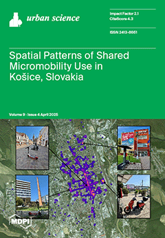
 Urban Science (ISSN 2413-8851) is an international, scientific, peer-reviewed, open access journal that provides an advanced forum for the exchange of ideas, methods, and information concerning life in urban areas. It publishes high-quality original articles, reviews, research notes, short communications, etc. The primary aim of this journal is to encourage scientists to publish their theoretical and empirical research relating to urban development, planning, expansion, living conditions and well-being, and sustainability. Therefore, the journal has no restrictions on the length of manuscripts, provided that the text is concise and comprehensive. Full experimental details must be provided in order for the results to be reproduced.
  • Issues are regarded as officially published after their release is announced to the table of contents alert mailing list.
  • You may sign up for e-mail alerts to receive table of contents of newly released issues.
  • PDF is the official format for papers published in both, html and pdf forms. To view the papers in pdf format, click on the "PDF Full-text" link, and use the free Adobe Reader to open them.
Order results
Result details
Select all
Export citation of selected articles as:
20 pages, 3368 KiB  
Article
The Role of Public Events as a Tool for Economic Recovery in an Urban Environment
by David Dyason, Wenyue Ruan, Tim Baird and Peter Fieger
Urban Sci. 2025, 9(4), 135; https://doi.org/10.3390/urbansci9040135 - 21 Apr 2025
Viewed by 314
Abstract
This study investigates the effects of events in the New Zealand city of Christchurch’s Central Business District (CBD) on pedestrian movements over the period from 2018 to 2020. Christchurch represents an ideal example of how contemporary urban design and marketing techniques can be [...] Read more.
This study investigates the effects of events in the New Zealand city of Christchurch’s Central Business District (CBD) on pedestrian movements over the period from 2018 to 2020. Christchurch represents an ideal example of how contemporary urban design and marketing techniques can be combined to attract people to places that have been negatively affected by a natural disaster. Events played an integral part of the regeneration efforts to attract pedestrians and support economic recovery. Through analysing hourly pedestrian movements in the rebuilt and revitalised parts of the city, results show that public events contribute positively to pedestrian volumes; however, the result is not statistically significant. Common cause, rather than entertainment events, draw larger pedestrian volumes, reflecting a stronger preference for events that contribute to social coherence after the disruptive event. Pedestrian visitations during the summer months, holidays, and from Thursday to Saturday have a positive effect on pedestrian volume and even non-event days draw pedestrians to the CBD, a likely result from the regeneration narrative and personal experience associated with the renewed CBD. This research shows how the importance of temporal effects challenges the role of events as a stand-alone tool designed to drive economic recovery within a revitalised urban environment. Full article
Show Figures

Figure 1

22 pages, 2455 KiB  
Hypothesis
Working Paper Identification of Sustainable Growth Regions Through Innovation on NUTS-3
by Felix Weinel and Marcelo Cajias
Urban Sci. 2025, 9(4), 134; https://doi.org/10.3390/urbansci9040134 - 21 Apr 2025
Viewed by 154
Abstract
This study investigates the role of innovation in shaping economic growth across the heterogeneous landscape of the European Union (EU). Through a detailed analysis at the NUTS-3 level, it identifies regions characterized by sustained and above-average growth, thereby providing new insights into the [...] Read more.
This study investigates the role of innovation in shaping economic growth across the heterogeneous landscape of the European Union (EU). Through a detailed analysis at the NUTS-3 level, it identifies regions characterized by sustained and above-average growth, thereby providing new insights into the mechanisms through which innovation contributes to regional economic resilience and long-term prosperity. Our methodology employs panel data from the EU27 Member States and the United Kingdom (UK), spanning the period from 2002 to 2022, allowing a more comprehensive understanding of the determinants of regional growth, including Gross Value Added (GVA) across various industries, the unemployment rate, and inflation. Furthermore, the role of innovation as a pivotal force driving economic progress is underscored. The analysis reveals significant differentiation within the cluster, supporting the assumption that innovation plays a crucial role in driving robust and, most notably, sustainable economic growth in a region. The findings further highlight that regions with an industry structure closely resembling the sample average are significantly influenced by innovation. From this, it can be deduced that innovation is a key driver of sustainable growth, especially in regions with the necessary infrastructure, skilled labour, and industry diversification to effectively harness innovative activities. Full article
Show Figures

Figure 1

39 pages, 12240 KiB  
Article
Socio-Spatial Adaptation and Resilient Urban Systems: Refugee-Driven Transformation in Zaatari Syrian Refugee Camp, Jordan
by Majd Al-Homoud and Ola Samarah
Urban Sci. 2025, 9(4), 133; https://doi.org/10.3390/urbansci9040133 - 21 Apr 2025
Viewed by 519
Abstract
The Zaatari Camp in Jordan exemplifies how Syrian refugees transform a planned grid settlement into an organic urban environment through socio-spatial adaptation, reflecting their cultural identity and territorial practices. This study investigates the camp’s morphological evolution, analyzing how refugees reconfigure public and private [...] Read more.
The Zaatari Camp in Jordan exemplifies how Syrian refugees transform a planned grid settlement into an organic urban environment through socio-spatial adaptation, reflecting their cultural identity and territorial practices. This study investigates the camp’s morphological evolution, analyzing how refugees reconfigure public and private spaces to prioritize privacy, security, and community cohesion. Using qualitative methods—including archival maps, photographs, and field observations—the research reveals how formal public areas are repurposed into private shelter extensions, creating zones of influence that mirror traditional Arab-Islamic urban patterns. Key elements such as mosques, markets, and hierarchical street networks emerge as cultural anchors, shaped by refugees’ prior urban experiences. However, this organic growth introduces challenges, such as blocked streets and undefined spaces, which hinder safety and service delivery, underscoring tensions between informal urbanization and structured planning. The findings advocate urban resilience and participatory planning frameworks that integrate socio-cultural values, emphasizing defensible boundaries, interdependence, and adaptable design. Refugees’ territorial behaviors—such as creating diagonal streets and expanding shelters—highlight their agency in reshaping urban systems, challenging conventional top-down approaches. This research focuses on land-use dynamics, sustainable cities, and adaptive urban systems in crisis contexts. By bridging gaps between displacement studies and urban theory, the study offers insights into fostering social inclusion and equitable infrastructure in transient settlements. Future research directions, including comparative analyses of refugee camps and cognitive mapping, aim to deepen understanding of socio-spatial resilience. Ultimately, this work contributes to global dialogues on informal urbanization and culturally responsive design, advocating for policies that align with the Sustainable Development Goals to rebuild cohesive, resilient urban environments in displacement settings. Full article
Show Figures

Figure 1

36 pages, 5494 KiB  
Article
Building the Smart City of Tomorrow: A Bibliometric Analysis of Artificial Intelligence in Urbanization
by Erik Karger, Aristide Rothweiler, Tim Brée and Frederik Ahlemann
Urban Sci. 2025, 9(4), 132; https://doi.org/10.3390/urbansci9040132 - 17 Apr 2025
Cited by 1 | Viewed by 911
Abstract
Urbanization is a global trend that continues to grow, leading to an increasing number of people to live in cities. This rapid expansion creates challenges such as traffic congestion, environmental pollution, and the need to ensure high living standards for all residents. To [...] Read more.
Urbanization is a global trend that continues to grow, leading to an increasing number of people to live in cities. This rapid expansion creates challenges such as traffic congestion, environmental pollution, and the need to ensure high living standards for all residents. To address these challenges, many cities adopt digital technologies to become smarter, more efficient, and more sustainable. Among these technologies, artificial intelligence (AI) has gained significant attention in recent years due to its transformative potential. In the context of smart cities, AI offers innovative solutions across various domains, including mobility, waste management, and energy optimization. Due to its multidisciplinary nature and rapid advancements, research on AI in smart cities has grown significantly. A comprehensive approach is needed to understand its role in urban transformation and identify key research gaps. This paper aims to synthesize existing knowledge on AI in smart cities, providing valuable insights for both researchers and practitioners. We define the scope of AI-related research by analyzing scientific literature and offer three main contributions. First, we provide a holistic overview of the field by conducting a bibliometric analysis to map the status and structure of existing knowledge. Second, we identify major research themes through co-citation clustering. Third, we outline a future research agenda by analyzing the most recent and influential journal articles. Our findings have both theoretical and practical implications for a wide range of disciplines, including computer science, energy, transportation, and security. Furthermore, our results can facilitate collaboration by identifying leading researchers and institutions, highlight critical research gaps, and foster discussions on the benefits and challenges of AI-driven smart city solutions. Full article
Show Figures

Figure 1

20 pages, 4306 KiB  
Article
Exploring Pro-Environmental Behaviors and Health-Oriented Mindsets in Urban Slum Upgrading Projects: A Case Study of Surakarta City, Indonesia
by Solli Murtyas, Kusumaningdyah Nurul Handayani, Kojiro Sho and Aya Hagishima
Urban Sci. 2025, 9(4), 131; https://doi.org/10.3390/urbansci9040131 - 17 Apr 2025
Viewed by 431
Abstract
Rapid urbanization has led to significant demographic shifts and environmental challenges worldwide, with a growing portion of the urban population living in slums. This study investigates the impact of an urban slum upgrading program on pro-environmental behaviors and health-oriented mindsets among residents in [...] Read more.
Rapid urbanization has led to significant demographic shifts and environmental challenges worldwide, with a growing portion of the urban population living in slums. This study investigates the impact of an urban slum upgrading program on pro-environmental behaviors and health-oriented mindsets among residents in Surakarta City, Indonesia. Specifically, it aims to reveal how pro-environmental behaviors, house satisfaction, health-oriented behaviors, and sustainability beliefs manifest within this unique socio-cultural setting. A representative survey was conducted among 327 residents of newly renovated urban slum housing. Additionally, cluster analysis with the Silhouette method was performed to identify distinct demographic and social ‘personalities’ characterized by pro-environmental and health-oriented mindsets within the heterogeneous population across three observed districts. The findings show that while strong beliefs in sustainability are common, there is a gap in translating these beliefs into action, as evidenced by low engagement with recycling and waste-burning avoidance. Furthermore, four clusters with unique profiles emerged: (1) residents dissatisfied with housing but proactive in sustainability (23.3%); (2) health-focused residents satisfied with housing but less engaged in sustainability (5.8%); (3) residents content with housing but low on health awareness and moderate in sustainability beliefs (46.8%); and (4) residents with strong sustainability beliefs but minimal pro-environmental actions (24.1%). This study offers valuable insights for policymakers to guide urban slum upgrading programs with targeted interventions addressing the unique characteristics among the residents. These findings are vital for creating a sustainable urban environment and preventing upgraded areas from reverting to slum conditions. Full article
Show Figures

Figure 1

20 pages, 6782 KiB  
Article
Validating Pedestrian Infrastructure Data: How Well Do Street-View Imagery Audits Compare to Government Field Data?
by Sajad Askari, Devon Snyder, Chu Li, Michael Saugstad, Jon E. Froehlich and Yochai Eisenberg
Urban Sci. 2025, 9(4), 130; https://doi.org/10.3390/urbansci9040130 - 17 Apr 2025
Viewed by 398
Abstract
Data on pedestrian infrastructure is essential for improving the mobility environment and for planning efficiency. Although governmental agencies are responsible for capturing data on pedestrian infrastructure mostly by field audits, most have not completed such audits. In recent years, virtual auditing based on [...] Read more.
Data on pedestrian infrastructure is essential for improving the mobility environment and for planning efficiency. Although governmental agencies are responsible for capturing data on pedestrian infrastructure mostly by field audits, most have not completed such audits. In recent years, virtual auditing based on street view imagery (SVI), specifically through geo-crowdsourcing platforms, offers a more inclusive approach to pedestrian movement planning, but concerns about the quality and reliability of opensource geospatial data pose barriers to use by governments. Limited research has compared opensource data in relation to traditional government approaches. In this study, we compare pedestrian infrastructure data from an opensource virtual sidewalk audit platform (Project Sidewalk) with government data. We focus on neighborhoods with diverse walkability and income levels in the city of Seattle, Washington and in DuPage County, Illinois. Our analysis shows that Project Sidewalk data can be a reliable alternative to government data for most pedestrian infrastructure features. The agreement for different features ranges from 75% for pedestrian signals to complete agreement (100%) for missing sidewalks. However, variations in measuring the severity of barriers challenges dataset comparisons. Full article
Show Figures

Figure 1

23 pages, 9245 KiB  
Article
Busy Urban Soundscape Underwater: Acoustic Indicators vs. Hydrophone Data
by Kamil Monastyrski, Grzegorz Chrobak, Rengin Aslanoğlu, Jacob Wilkerson and Jan K. Kazak
Urban Sci. 2025, 9(4), 129; https://doi.org/10.3390/urbansci9040129 - 17 Apr 2025
Viewed by 290
Abstract
Urban noise pollution extends into aquatic environments, influencing underwater ecosystems. This study examines the effectiveness of acoustic indicators in characterizing urban underwater soundscapes using hydrophone recordings. Three indices, the Acoustic Complexity Index (ACI), Acoustic Diversity Index (ADI), and Normalized Difference Soundscape Index (NDSI), [...] Read more.
Urban noise pollution extends into aquatic environments, influencing underwater ecosystems. This study examines the effectiveness of acoustic indicators in characterizing urban underwater soundscapes using hydrophone recordings. Three indices, the Acoustic Complexity Index (ACI), Acoustic Diversity Index (ADI), and Normalized Difference Soundscape Index (NDSI), were analyzed to assess their ability to distinguish anthropogenic and natural acoustic sources. The results indicate that the ACI tracks urban noise fluctuations, particularly from vehicles and trams, while the ADI primarily reflects transient environmental interferences. The NDSI, while designed to differentiate biophony from anthropogenic noise, proves unreliable in urban underwater settings, often misclassifying noise sources. These findings highlight the limitations of traditional acoustic indices in urban aquatic environments and emphasize the need for refined methods to improve hydrophone data interpretation. Thus, this study aims to understand the acoustic indicators’ interactions with underwater urban noise, which is crucial for enhancing environmental monitoring and noise mitigation strategies. Full article
(This article belongs to the Collection Urban Acoustic Environments)
Show Figures

Figure 1

17 pages, 983 KiB  
Article
Public Perceptions of Urban Green Spaces: Effects on Physical and Mental Health
by Regina Veckalne, Asomkhodja Saidkhodjaev and Tatjana Tambovceva
Urban Sci. 2025, 9(4), 128; https://doi.org/10.3390/urbansci9040128 - 17 Apr 2025
Viewed by 582
Abstract
Urban green spaces are essential for promoting public health by encouraging physical activity, reducing stress, and enhancing overall well-being. However, the perception and utilization of these spaces vary based on socio-demographic factors and urban planning characteristics. This study investigates public perception of urban [...] Read more.
Urban green spaces are essential for promoting public health by encouraging physical activity, reducing stress, and enhancing overall well-being. However, the perception and utilization of these spaces vary based on socio-demographic factors and urban planning characteristics. This study investigates public perception of urban green spaces and their perceived health benefits, emphasizing their psychological, physical, and social impacts. The study involved 240 respondents who assessed the availability and quality of green spaces as well as the social and psychological aspects of their use. The survey was analyzed using Partial Least Squares Structural Equation Modeling (PLS-SEM). The results showed that environmental awareness (β = 0.404, p < 0.001) and social interaction (β = 0.391, p < 0.001) are significant predictors of the frequency of visiting green spaces, while their availability and quality do not have a significant impact. These findings highlight the critical role of environmental education and community awareness initiatives in maximizing the health benefits derived from urban green spaces. Frequency of use is positively associated with both mental (β = 0.272, p = 0.002) and physical health (β = 0.409, p < 0.001). Surprisingly, social interaction demonstrates a negative impact on mental health (β = −0.166, p = 0.002), which requires further study. The obtained results highlight the need for an integrated approach to studying the relationship between the urban environment and population health. Full article
Show Figures

Figure 1

15 pages, 1197 KiB  
Article
Sources and Use of Bicycle Traffic Data in Research and Urban Mobility Management
by Emilia Teresa Skupień and Szymon Fierek
Urban Sci. 2025, 9(4), 127; https://doi.org/10.3390/urbansci9040127 - 17 Apr 2025
Viewed by 319
Abstract
Understanding cycling mobility is essential for developing sustainable urban transport policies. However, variations in data collection methods and a lack of standardized approaches hinder comprehensive analysis and evidence-based decision-making. This study examines how cycling data are gathered across different cities, the insights they [...] Read more.
Understanding cycling mobility is essential for developing sustainable urban transport policies. However, variations in data collection methods and a lack of standardized approaches hinder comprehensive analysis and evidence-based decision-making. This study examines how cycling data are gathered across different cities, the insights they provide, and how existing methods can be improved. The scientific literature and policy guidelines are examined, combined with an empirical study analyzing data collection practices in several Polish cities. This paper reveals inconsistencies in data collection techniques, including differences in sensor-based tracking, manual counting, and survey methodologies. Moreover, while some cities employ advanced technologies such as automated counters, others rely on fragmented or irregular data sources. This study highlights best practices observed in international research and policy recommendations, which could guide the refinement of cycling data collection strategies. By identifying common gaps and challenges, recommendations for improving data standardization, integration, and accessibility are proposed. The results contribute to a better understanding of how cities can enhance their cycling data frameworks to support sustainable mobility planning and policy development. Full article
Show Figures

Figure 1

20 pages, 1830 KiB  
Article
Identifying Priority Areas for Planning Urban Green Infrastructure: A Fuzzy Artificial Intelligence-Based Framework
by Leonardo Massato Nicacio Nomura, Adriano Bressane, Vitoria Valente Monteiro, Inara Vilas Boas de Oliveira, Graziele Ruas, Rogério Galante Negri and Alexandre Marco da Silva
Urban Sci. 2025, 9(4), 126; https://doi.org/10.3390/urbansci9040126 - 16 Apr 2025
Viewed by 429
Abstract
Urban green infrastructure (UGI) plays a key role in fostering sustainability, resilience, and ecological balance in cities. However, the task of identifying priority areas for UGI implementation remains complex due to the multifactorial nature of urban systems and prevailing uncertainties. This study proposes [...] Read more.
Urban green infrastructure (UGI) plays a key role in fostering sustainability, resilience, and ecological balance in cities. However, the task of identifying priority areas for UGI implementation remains complex due to the multifactorial nature of urban systems and prevailing uncertainties. This study proposes a fuzzy inference system (FIS)-based framework composed of seven interconnected modules designed to assess diverse criteria, including flood vulnerability, water quality, habitat connectivity, vegetation condition, and social vulnerability. The model was applied in the urban watersheds of São José dos Campos, Brazil, a municipality recognized for its smart city initiatives and urban environmental complexity. Through the integration of multi-criteria spatial data, the framework effectively prioritized urban areas, highlighting critical zones for extreme event mitigation, water quality preservation, habitat conservation, and recreational space provision. The case study demonstrated that São José dos Campos, with an 11.73% urbanized area and 737,310 inhabitants, benefits from targeted UGI typologies, including sustainable drainage systems and green public spaces, aligning infrastructure interventions with specific spatial demands. Notably, the expert validation process involving 18 multidisciplinary specialists confirmed the model’s relevance and coherence, with the majority classifying the outcomes as “highly coherent”. The system’s modular structure, use of triangular membership functions, and incorporation of the gamma operator allow for adaptable prioritization across different planning horizons. By offering a transparent, expert-validated, and data-driven approach, the proposed method advances evidence-based decision-making and equips planners with a practical tool for UGI implementation in dynamic urban contexts. Full article
(This article belongs to the Special Issue Sustainable Urbanization, Regional Planning and Development)
Show Figures

Figure 1

19 pages, 3171 KiB  
Article
Constraints to Energy Transition in Metropolitan Areas: Solar Potential, Land Use, and Mineral Consumption in the Metropolitan Area of Madrid
by Ibai de Juan, Carmen Hidalgo-Giralt and Antonio Palacios-García
Urban Sci. 2025, 9(4), 125; https://doi.org/10.3390/urbansci9040125 - 15 Apr 2025
Viewed by 345
Abstract
Amidst the backdrop of the fossil fuel energy crisis, the development of renewable energy sources is experiencing an unprecedented acceleration in Spain and focusing in metropolitan areas. This study investigates the potential for photovoltaic energy development in Spanish metropolitan areas, specifically Madrid and [...] Read more.
Amidst the backdrop of the fossil fuel energy crisis, the development of renewable energy sources is experiencing an unprecedented acceleration in Spain and focusing in metropolitan areas. This study investigates the potential for photovoltaic energy development in Spanish metropolitan areas, specifically Madrid and its surrounding region. Recognizing the inherent challenges of land use and material scarcity associated with this development, the research aims to quantify the achievable photovoltaic capacity with less environmental impact for the region, along with the corresponding land occupation and material consumption requirements. A Material Flow Analysis (MFA) methodology is employed to project these parameters to 2050. The analysis estimates a potential production capacity of 32,163 GWh/year, representing 79.46% of the projected electricity consumption in 2050 (and 41.32% of final energy consumption). This capacity would necessitate the utilization of 32,169 hectares of land (4.01% of the regional area), and 7139 hectares of rooftop space. Critically, 48% of the suitable land is agricultural land, 9% forest, 38% grassland and scrubland and 5% corresponds to other land uses. highlighting potential land-use competition. Furthermore, the study extrapolates the material requirements to a global scale, estimating the percentage of global mineral reserves required for a comparable energy transition. The analysis yields an estimate of 0.66% for aluminum, 14.49% for copper, and 33.13% for silver. These findings provide crucial insights into the material and geographical constraints impacting the feasibility of urban energy transitions. Full article
Show Figures

Figure 1

18 pages, 2777 KiB  
Article
Green Empowerment: Citizens’ Willingness to Contribute to the Nature Restoration Law’s Implementation in Urban Areas
by Ulrike Pröbstl-Haider, Alice Wanner and Meike Jungnickel
Urban Sci. 2025, 9(4), 124; https://doi.org/10.3390/urbansci9040124 - 14 Apr 2025
Viewed by 311
Abstract
Fulfilling the requirements of the EU’s Nature Restoration Law in urban areas will require not only planning and administrative action but also citizen engagement. The paper at hand analyzes citizens’ willingness to change the urban environment in a study consisting of a pan-European [...] Read more.
Fulfilling the requirements of the EU’s Nature Restoration Law in urban areas will require not only planning and administrative action but also citizen engagement. The paper at hand analyzes citizens’ willingness to change the urban environment in a study consisting of a pan-European survey with an integrated choice experiment. The majority of the 7045 respondents would support a rapid urban greening process and are willing to contribute to its financing. The latent class analysis reveals four different classes with different interests and willingness to engage: Class 1 supports the development of green areas and nature-based solutions in general and under nearly any conditions; Class 2 is sensitive to costs and accessibility disruption. For Class 3, participation will increase their interest and willingness to pay. Only Class 4 (8.6% of sample respondents) is against or disinterested in the development of urban greening. The findings demonstrate that the European goals are strongly supported by the majority of urban residents and highlight a significant interest in their implementation, to which they are also willing to contribute. These findings should encourage local initiatives and the local administration to implement the process of urban greening and the goals of the nature restauration law in a more ambitious manner. Full article
Show Figures

Figure 1

17 pages, 1185 KiB  
Article
Understanding Trust in the Smart City Through Focus Groups in Hong Kong
by Calvin Ming Tsun Lai, Alistair Cole and Dionysios Stivas
Urban Sci. 2025, 9(4), 123; https://doi.org/10.3390/urbansci9040123 - 14 Apr 2025
Viewed by 441
Abstract
This paper examines the role of focus groups in mixed-methods research, focusing on trust dynamics within the smart city. It takes the Asian metropolis of Hong Kong as its empirical case. It successfully validates focus groups as a research method across three dimensions. [...] Read more.
This paper examines the role of focus groups in mixed-methods research, focusing on trust dynamics within the smart city. It takes the Asian metropolis of Hong Kong as its empirical case. It successfully validates focus groups as a research method across three dimensions. Firstly, focus groups facilitate the comparison of in-depth discussions across various demographic groups; secondly, focus groups enable collective deliberation to uncover hidden relationships; and, thirdly, when correctly employed, focus groups can bridge qualitative (interviews) and quantitative (surveys) research to enhance triangulation. In this study, the findings of focus groups substantiate the data trust paradox identified in previous surveys and interviews: high public support for technology in a low-trust environment, with explicit privacy concerns related to data management. The focus group results reinforce distinct insights in relation to birth origins and political identities, reconfirming differential trust among demographic groups. This paper demonstrates tailored focus groups as an effective approach to unraveling the trust dynamics in smart city strategies. Full article
Show Figures

Figure 1

28 pages, 2422 KiB  
Article
Proximity Features: A Random Forest Approach to the Influence of the Built Environment on Local Travel Behavior
by Manuel Benito-Moreno, José Carpio-Pinedo and Patxi J. Lamíquiz-Daudén
Urban Sci. 2025, 9(4), 122; https://doi.org/10.3390/urbansci9040122 - 14 Apr 2025
Viewed by 470
Abstract
Recent European policies fostering sustainable mobility target urban proximity as a core strategy for a modal shift towards low-carbon modes. Urban proximity, as a characteristic of the built environment, can be studied as a sub-thread of a broad and complex body of literature [...] Read more.
Recent European policies fostering sustainable mobility target urban proximity as a core strategy for a modal shift towards low-carbon modes. Urban proximity, as a characteristic of the built environment, can be studied as a sub-thread of a broad and complex body of literature which associates urban factors such as density or land use mix with observed travel behavior, so as to address their relative influence on the latter. Building on this previous knowledge, the present work addresses the importance of a diverse set of factors on local travel modal choice between walking and other modes, according to the 2018 Household Mobility Survey of the Metropolitan Region of Madrid, and a large variety of demographic and built environment characteristics. The work proposes to address this importance through a workflow on a set of Machine Learning models, filtering different distance thresholds and purposes of the trips, going through a strict feature selection process, and executing under different schema definitions. The resulting models are inspected for accuracy, feature importance, and composition. Results suggest that even small changes in distance thresholds exert a great impact on all models; sociodemographic variables are slightly more important in most models, yet building age, along with other street layout factors, pervasively obtain fairly accurate predictions too. Full article
Show Figures

Figure 1

22 pages, 1786 KiB  
Article
Development Coordination of Chinese Megacities Using the Node–Place–Value Model: A Case Study of Changsha
by Kaidi Zhu, Wenxuan Chen and Yunan Zhang
Urban Sci. 2025, 9(4), 121; https://doi.org/10.3390/urbansci9040121 - 14 Apr 2025
Viewed by 248
Abstract
With the acceleration of urbanization, urban regeneration has become a critical strategy for megacities to address spatial fragmentation and inefficient resource allocation. However, the mismatch between transportation nodes and land development potential remains a key barrier to sustainable urban renewal. This research takes [...] Read more.
With the acceleration of urbanization, urban regeneration has become a critical strategy for megacities to address spatial fragmentation and inefficient resource allocation. However, the mismatch between transportation nodes and land development potential remains a key barrier to sustainable urban renewal. This research takes the urban renewal areas in Changsha as a typical case. Based on the “Node–Place–Value” (NPV) model, a multi-dimensional evaluation system was constructed. Through multiple empirical analysis methods such as spatial data analysis, field research, and economic indicator evaluation, this study deeply explores how this evaluation system provides a theoretical and data basis for detailed planning and further provides guidance for meeting the needs of urban renewal. Through the empirical analysis of the urban renewal areas in Changsha, this study quantifies the matching relationship among transportation nodes, land use, and economic value and reveals the current imbalance issues of these elements in the areas. For example, there is a common mismatch between the functions of transportation nodes and the potential of land development. Specifically, the land use in transportation hub areas fails to fully utilize their transportation advantages, resulting in the waste of transportation resources and low economic benefits. The results reveal significant imbalances in the following areas: Transportation–Land Mismatch: High-accessibility areas (e.g., Martyrs’ Park and Railway Station ) exhibit underdeveloped land use and low economic conversion efficiency. Peripheral Lag: Remote areas (e.g., Wang Xin and Sunshine 100 ) lack both transportation infrastructure and land development potential, leading to resource waste. Value Dimension Impact: The added “value” dimension highlights thatareas with cultural assets (e.g., Martyrs’ Park) achieve higher comprehensive scores despite spatial constraints. The findings of this study not only provide a scientific basis for urban renewal in Changsha but also offer crucial theoretical support and practical references for other megacities in China to address similar issues and achieve sustainable development. Full article
Show Figures

Figure 1

19 pages, 4576 KiB  
Article
3-30-300 Benchmark: An Evaluation of Tree Visibility, Canopy Cover, and Green Space Access in Nagpur, India
by Shruti Ashish Lahoti, Manu Thomas, Prajakta Pimpalshende, Shalini Dhyani, Mesfin Sahle, Pankaj Kumar and Osamu Saito
Urban Sci. 2025, 9(4), 120; https://doi.org/10.3390/urbansci9040120 - 10 Apr 2025
Viewed by 574
Abstract
Urban green spaces (UGSs) are vital in enhancing environmental quality, social well-being, and climate resilience, yet their distribution and accessibility remain uneven in many rapidly urbanizing cities. The 3–30–300 rule offers a structured guideline with which to assess urban greenness, emphasizing tree visibility, [...] Read more.
Urban green spaces (UGSs) are vital in enhancing environmental quality, social well-being, and climate resilience, yet their distribution and accessibility remain uneven in many rapidly urbanizing cities. The 3–30–300 rule offers a structured guideline with which to assess urban greenness, emphasizing tree visibility, canopy cover, and green space proximity. However, its applicability in dense and resource-constrained urban environments has not been sufficiently examined. This study evaluates the feasibility of the 3–30–300 rule in Nagpur, India, using survey-based visibility assessments, NDVI-derived vegetation cover analysis, and QGIS-based accessibility evaluation. The study also introduces the Urban Greenness Exposure Index (UGEI), a composite metric that refines greenness assessment by capturing intra-zone variations beyond broad classifications. The findings reveal significant variations in urban greenness exposure across Nagpur’s ten municipal zones. Low-greenness zones report the highest tree visibility deprivation (below two trees), limited canopy cover (~7%), and restricted green space access (over 80% of residents lacking access within 300 m). The correlation analysis shows that higher canopy cover does not necessarily correspond to better visibility or accessibility, highlighting the need for integrated planning strategies. The study concludes that applying the 3–30–300 rule in high-density Indian cities requires localized adaptations, such as incentivizing street tree planting, integrating vertical greenery, and repurposing vacant lots for public parks. The UGEI framework offers a practical tool for identifying priority zones and guiding equitable greening interventions, based on insights drawn from the Nagpur case study. Full article
Show Figures

Figure 1

17 pages, 1295 KiB  
Article
Energy, Urbanisation and Carbon Footprint: Evidence from Western Balkan Countries
by Saša Obradović, Sergej Gričar, Štefan Bojnec and Nemanja Lojanica
Urban Sci. 2025, 9(4), 119; https://doi.org/10.3390/urbansci9040119 - 10 Apr 2025
Viewed by 332
Abstract
The role of carbon emissions in the worsening of global warming and other climate change implications has been well recognised. This study empirically investigates the effect of economic growth, urbanisation, and energy consumption on carbon emissions using panel cointegration tests and pooled mean [...] Read more.
The role of carbon emissions in the worsening of global warming and other climate change implications has been well recognised. This study empirically investigates the effect of economic growth, urbanisation, and energy consumption on carbon emissions using panel cointegration tests and pooled mean group autoregressive distributed lag (PMG-ARDL) techniques. The research is based on panel data from Western Balkan countries spanning 2001 to 2022. Urbanisation is incorporated into the model to determine its significance in the dynamic relationship among economic growth, energy consumption, and carbon emissions. The inclusion of urbanisation in the Western Balkans context is particularly novel because of its acceleration in this region. The findings suggest that energy consumption, economic growth, and urbanisation significantly affect environmental quality in the long run. In contrast, it has been demonstrated that only economic growth significantly impacts the environment in the short run. Subsequent investigations have revealed that environmental distortion is a long-term consequence of energy consumption, urbanisation, and economic expansion in the examined nations. These countries must prioritise enhancing energy efficiency, urban planning, and pollution mitigation measures while ensuring that economic growth remains unhindered. Full article
(This article belongs to the Special Issue Sustainable Energy Management and Planning in Urban Areas)
Show Figures

Figure 1

25 pages, 2338 KiB  
Systematic Review
From Adversity to Advantage: A Systematic Literature Review on Regional Economic Resilience
by Mantas Rimidis and Mindaugas Butkus
Urban Sci. 2025, 9(4), 118; https://doi.org/10.3390/urbansci9040118 - 9 Apr 2025
Viewed by 794
Abstract
Recent years have been exceptionally turbulent due to various crises such as COVID-19, wars, and natural disasters. We conduct a systematic literature review to address the current state of the regional economic resilience literature, a topic regaining significance amid recent global crises. Considering [...] Read more.
Recent years have been exceptionally turbulent due to various crises such as COVID-19, wars, and natural disasters. We conduct a systematic literature review to address the current state of the regional economic resilience literature, a topic regaining significance amid recent global crises. Considering the findings, we not only conduct the most up-to-date analysis of resilience types but also innovate previous research by collecting and processing data on the spatial and income features of regions, providing statistics about shock coverage, and sharing insights into region types. Additionally, we supplement the systematic literature analysis methodology by experimenting with large language models and defining new search strategies. The results show that most of the literature covers European countries, while that covering all other countries is far behind. Empirical coverage comes from high- and upper-middle-income countries (~97% of research), highlighting the lack of analysis on lower-middle- and low-income countries. This brings into question the applicability of regional resilience policies worldwide. The latest papers still mainly analyze the Great Recession, the most covered shock in the regional economic resilience literature. Not all authors have turned their attention to more recent crises. Finally, we believe future research should focus more on compound resilience—how regional economies cope with cascading or simultaneous shocks. Full article
(This article belongs to the Special Issue Sustainable Urbanization, Regional Planning and Development)
Show Figures

Figure 1

37 pages, 1386 KiB  
Review
How “Rational” Is Urban Public Corruption?
by Cameron Elliott Gordon
Urban Sci. 2025, 9(4), 117; https://doi.org/10.3390/urbansci9040117 - 8 Apr 2025
Viewed by 578
Abstract
This article reviews the literature on both (a) the general theory of public corruption and its evolution over time; and (b) the history of urban public corruption during the modern period into the present. In addition, this article conducts a historical narrative form [...] Read more.
This article reviews the literature on both (a) the general theory of public corruption and its evolution over time; and (b) the history of urban public corruption during the modern period into the present. In addition, this article conducts a historical narrative form of representation to structure the historical facts, synthesizing chronologically disparate elements into a synchronic unity, with the focus of the narrative on “urban public corruption”, both empirically (i.e., how its manifestation changed over time in particular times and places) and conceptually (i.e., how the ideas about these manifestations altered with the passage of time). The period considered is mainly from the onset of the Industrial Revolution in the mid-18th century, up to the present time, with a major focus on contemporary developments. This review illustrates that the extraction of rents has always been a key feature of urban corruption. Nonetheless, not all extraction is alike institutionally and historically. The analysis presented here indicates that the modern notion of corruptions has been the product of a long evolution which, no doubt, is not over. The present idea is of corruption as a technocratic one of a “coherent, discrete referent” based on rational choice theory, which can be applied to define acts as corrupt regardless of social context. This is found to be not applicable in all times and places. Defining what constitutes a “corrupt” act varies considerably across cultures, across times, between nations and cities, and sometimes even within them. This article closes with a template about possible behavioral spheres of urban corruption, incorporating overlaps and gaps between “rational”, “maximizing”, and “atomistic” motivations. The conclusion is that the current consensual “rational choice” understandings only apply to those acts which incorporate all three aspects, with variants drawn from “behavioral” economics expanding applicability somewhat, but still leaving out a great deal of city corruption on the ground which is much more social and institutional than present understandings allow for. Full article
Show Figures

Figure 1

19 pages, 9734 KiB  
Article
A Life Cycle Assessment of HDPE Plastic Milk Bottle Waste Within Concrete Composites and Their Potential in Residential Building and Construction Applications
by Robert Haigh
Urban Sci. 2025, 9(4), 116; https://doi.org/10.3390/urbansci9040116 - 7 Apr 2025
Viewed by 422
Abstract
Plastic waste management remains a significant global challenge, with limited recycling opportunities contributing to its status as one of the highest waste producers. In Australia, the recovery rate for plastic waste is 12.5%, resulting in a high percentage of plastics being landfilled. Common [...] Read more.
Plastic waste management remains a significant global challenge, with limited recycling opportunities contributing to its status as one of the highest waste producers. In Australia, the recovery rate for plastic waste is 12.5%, resulting in a high percentage of plastics being landfilled. Common disposal methods, such as incineration and landfilling, are environmentally damaging, with incineration emitting harmful gases and landfilling causing contamination. Recycling, while preferable, faces difficulties due to contamination and infrastructure challenges. However, alternative solutions, such as integrating waste plastic into concrete, present an opportunity to both reduce plastic waste and enhance the economic value of recycled materials. This study evaluates the potential of waste plastic milk bottles (PMBs) in residential concrete by assessing their mechanical strength, environmental impact, and variability in greenhouse gas (GHG) emissions. This study demonstrated that replacing up to 10% of cement with silica fume-modified plastic milk bottle (SFPMB) waste granules maintained comparable compressive strength to traditional concrete. The addition of metakaolin to the SFPMB mix design (SFMKPMB) further improved the material’s strength by 28%. Life cycle assessment (LCA) results revealed reductions in global warming potential (GWP), human toxicity potential (HTP), and fossil depletion potential (FDP), with SFMKPMB showing the greatest environmental savings. A Monte Carlo simulation evaluated variability factors, revealing that additional transportation and energy requirements increased GHG emissions, though the SFMKPMB mix ultimately resulted in the lowest overall material GHG emissions. This study demonstrates the complexity of assessing “green” materials and highlights how material variability and energy use can influence the sustainability of waste-derived composites. Despite challenges, incorporating waste plastics into concrete offers a promising strategy for mitigating landfill waste and reducing environmental impacts, especially as renewable energy adoption increases. Full article
Show Figures

Figure 1

32 pages, 11278 KiB  
Article
Urban Microclimates in a Warming World: Land Surface Temperature (LST) Trends Across Ten Major Cities on Seven Continents
by Yiğitalp Kara and Veli Yavuz
Urban Sci. 2025, 9(4), 115; https://doi.org/10.3390/urbansci9040115 - 5 Apr 2025
Viewed by 572
Abstract
Understanding microclimatic changes driven by urbanization is critical in the context of global warming and climate change. This study investigates the land surface temperature (LST), the normalized difference vegetation index (NDVI), and changes in land use types for 10 major cities across seven [...] Read more.
Understanding microclimatic changes driven by urbanization is critical in the context of global warming and climate change. This study investigates the land surface temperature (LST), the normalized difference vegetation index (NDVI), and changes in land use types for 10 major cities across seven continents between 2001 and 2021. Utilizing MODIS satellite data processed on the Google Earth Engine (GEE) platform, the analysis focused on yearly median values to examine variations in LST during the day and night, as well as temperature dynamics across different land types, including vegetation and bare land. The global mean LST trend from 2001 to 2021, derived from Terra MODIS MOD11A2 data, was found to be 0.025 °C/year. The analysis of daytime and nighttime (nocturnal) land surface temperature (LST) trends across the ten cities examined in this study reveals notable variations, with most cities exhibiting an increasing trend in LST within urban mosaics. Airports exhibited a mean daytime land surface temperature (LST) that was 2.5 °C higher than surrounding areas, while industrial zones demonstrated an even greater temperature disparity, with an average increase of 2.81 °C. In contrast, cold spots characterized by dense vegetation showed a notable cooling effect, with LST differences reaching −3.7 °C. Similarly, proximity to water bodies contributed to temperature mitigation, as areas near significant water sources recorded lower daytime LST differences, averaging −4.09 °C. A strong negative correlation was found between NDVI and LST, underscoring the cooling effect of vegetation through evapotranspiration and shading. This study provides a comprehensive global perspective on the commonalities of urban temperature dynamics in cities across diverse geographical regions and climates, contributing to a deeper understanding of how urbanization and land use changes influence surface temperatures and climate change. Full article
Show Figures

Figure 1

32 pages, 5442 KiB  
Article
Assessment of the Risk to Human Health and Pollution Levels Due to the Presence of Metal(loid)s in Sediments, Water, and Fishes in Urban Rivers in the State of Mato Grosso do Sul, Brazil
by Melina Ribeiro Fernandes, Elaine Silva de Pádua Melo, Marta Aratuza Pereira Ancel, Rita de Cássia Avellaneda Guimarães, Priscila Aiko Hiane, Karine de Cássia Freitas Geilow, Danielle Bogo, Paula Fabiana Saldanha Tschinkel, Ana Carla Gomes Rosa, Cláudia Stela de Araújo Medeiros, Rodrigo Juliano Oliveira, Marcelo Luiz Brandão Vilela, Diego Azevedo Zoccal Garcia and Valter Aragão do Nascimento
Urban Sci. 2025, 9(4), 114; https://doi.org/10.3390/urbansci9040114 - 5 Apr 2025
Viewed by 422
Abstract
This study aimed to assess the pollution levels, sources, ecological risk, and human health risks of metal(loid)s in water, sediment, and muscle tissue of Prochilodus lineatus and Pimelodus maculatus from rivers in the state of Mato Grosso do Sul, Brazil. The metal(loid)s content [...] Read more.
This study aimed to assess the pollution levels, sources, ecological risk, and human health risks of metal(loid)s in water, sediment, and muscle tissue of Prochilodus lineatus and Pimelodus maculatus from rivers in the state of Mato Grosso do Sul, Brazil. The metal(loid)s content in river sediment, water, and fish tissue were determined by inductively coupled plasma optical emission spectrometry. Sediment pollution assessment was carried out by geo-accumulation index, contamination factor, enrichment factor, and pollution load index. There were significant differences in concentration values for Al, As, Cd, Co, Cr, Cu, Mo, Ni, Pb, and Hg. There was greater tendency for the elements Cu, Ni, Cu, N, Co, As, Hg, Al, and Co in the waters of the Anhanduí River in 2020 and Cr and Pb in 2021. The concentrations of As, Cd, Co, Cr, and Hg in the waters of the Anhanduí River are above the permitted limit values for heavy metal ions in drinking water established by the WHO. The concentrations of heavy metals in the sediments of rivers are above the limit set by Conama/Brazil and other countries. The sediments were very highly contaminated by Cd and Mo, and with moderate contamination of Pb. All sediments of rivers showed a decline in site quality, which indicates that it is polluted. Sediments were classified with severe enrichment by Cd and Mo. The content of Al was the highest in P. lineatus and P. maculatus in relation to other elements analyzed. There was also the presence of elements such as Cr, Cu, Cd, Hg, Ni, As, Pb, Mo, and Co in the tissues of the fish species. Therefore, the contamination of these rivers is a concern due to human consumption of fish, since there is a carcinogenic risk related mainly to As and Cd. Full article
Show Figures

Figure 1

25 pages, 3579 KiB  
Article
Energy Consumption in Mexican Homes: Using a Reference Building as a Launchpad for Achieving Nearly Zero Energy
by Carlos A. Espino-Reyes, Naghelli Ortega-Avila, Jorge Lucero-Álvarez and Norma A. Rodríguez-Muñoz
Urban Sci. 2025, 9(4), 113; https://doi.org/10.3390/urbansci9040113 - 4 Apr 2025
Viewed by 292
Abstract
The residential sector accounts for over a third of the world’s energy use. Even though this ratio is lower in Mexico, there is a pressing housing deficit, especially regarding low-cost homes. This research aimed to create a reference building (RB) to understand the [...] Read more.
The residential sector accounts for over a third of the world’s energy use. Even though this ratio is lower in Mexico, there is a pressing housing deficit, especially regarding low-cost homes. This research aimed to create a reference building (RB) to understand the current energy consumption of multi-family buildings across different climatic zones. The aim was to assess their energy performance and promote reduced energy requirements as a guideline for designing and constructing affordable, low-energy, or zero-energy buildings. The present work conducts a diagnosis of the current energy consumption of multi-family buildings in eight cities in Mexico. First, a reference building was developed to represent typical Mexican building geometry and construction practices, and then the building’s fixed and variable energy requirements were simulated. Finally, a comparison was made between the energy requirement and the data reported by the national energy survey. Therefore, it was possible to generate a reference building from national data sources complying with national regulations, where materials, occupant behavior, and equipment were chosen to help represent the building’s thermal behavior. Domestic water heating was identified as a driver of variable energy requirements in all cities. In contrast, the simulated heating and cooling requirements were directly linked to the city’s climate. Electricity bills tended to mostly correspond with the results that excluded the use of heating systems. Lastly, while comparing LPG (Liquified Petroleum Gas) consumption was challenging due to the unavailability of national data, LPG requirements were closely estimated for temperate cities. The definition of a reference building is an important step towards developing nZEB in Mexico, as these buildings are valuable tools that can contribute to the energy evaluation of specific types of buildings. This characteristic makes them convenient for revising a building code or setting new national energy policy goals. Full article
Show Figures

Figure 1

17 pages, 24696 KiB  
Article
Energy Transition and Heritage in Anthropocene Era—Proposal for a Methodological Analysis at Local Scale
by Belén Pérez-Pérez and Eva Chacón-Linares
Urban Sci. 2025, 9(4), 112; https://doi.org/10.3390/urbansci9040112 - 4 Apr 2025
Viewed by 431
Abstract
In the Anthropocene era, climate change highlights the need to abandon the centralized energy generation model using large installations located far from consumption centers, and to move towards an urban energy transition based on decentralized self-consumption models—both individual and collective—and local energy communities. [...] Read more.
In the Anthropocene era, climate change highlights the need to abandon the centralized energy generation model using large installations located far from consumption centers, and to move towards an urban energy transition based on decentralized self-consumption models—both individual and collective—and local energy communities. These approaches reduce emissions and external dependency, strengthening resilience, urban sustainability, and promoting energy justice and citizen participation. This work aims to develop a model for integrating photovoltaic solar systems in urban centers of high heritage value, combining the protection of cultural legacy with climate change adaptation strategies. A methodology is designed to integrate solar energy into urban areas while respecting cultural heritage in the most reasonable way possible. The proposed methodology consists of carrying out a characterization of the municipalities under study, considering legal, demographic, energy, and heritage aspects. Next, a territorial zoning is proposed that differentiates between protected and unprotected areas in each municipality. Visibility maps are developed to assess the impact of the installations by sector from the main visual consumption points, facilitating differentiated decisions to protect the most sensitive environments. In addition, specific measures are proposed, such as locating the installations in non-visible areas and using materials and techniques adapted to the construction typology, to preserve areas of higher cultural value and to implement energy communities and collective self-consumption outside culturally protected zones. This methodology is applied to two urban areas in the province of Jaén (South of Andalusia): Alcalá la Real and Cazorla, which, due to their different characteristics, demonstrate its versatility and adaptability. It is concluded that the transition toward decentralized models is an effective way to adapt cities to climate change, reinforcing social cohesion, contributing to the fight against energy vulnerability, and protecting historical heritage. Full article
Show Figures

Figure 1

18 pages, 6451 KiB  
Article
Social Network Analysis Reveals Spatiotemporal Patterns of Green Space Recreational Walking Between Workdays and Rest Days
by Jiali Zhang and Zhaocheng Bai
Urban Sci. 2025, 9(4), 111; https://doi.org/10.3390/urbansci9040111 - 4 Apr 2025
Viewed by 425
Abstract
Growing concerns about the negative impacts of high-density built environments on residents’ physical and mental health have made optimizing recreational walking networks in green spaces a crucial issue for improving urban public health service efficiency. While previous studies have largely focused on static [...] Read more.
Growing concerns about the negative impacts of high-density built environments on residents’ physical and mental health have made optimizing recreational walking networks in green spaces a crucial issue for improving urban public health service efficiency. While previous studies have largely focused on static accessibility measures, these methods cannot capture actual human recreational behaviors and temporal variations in green space usage. Our research introduces a novel social network analysis methodology using GPS trajectory data from Shanghai’s Inner Ring Area to construct and compare recreational walking networks during workdays and rest days, revealing dynamic spatiotemporal patterns that traditional methods miss. Key findings include: (1) At the node level, green spaces of different sizes play differentiated roles in the network, with large-scale spaces serving as destination hubs while pocket green spaces function as critical connecting points; (2) At the regional level, workday networks show more dispersed spatial distribution patterns with higher modularity, while rest day networks form high-density clusters in the central urban area; (3) At the overall network level, rest day networks demonstrate higher density and diversity, reflecting residents’ expanded spatial activity range and diverse recreational preferences. Green space management should focus on the social value of urban green networks. These findings provide theoretical and methodological support for transitioning from “static equity” to “dynamic justice” in green space system planning, contributing to the development of more inclusive and resilient urban green space networks. Full article
(This article belongs to the Special Issue Assessing Urban Ecological Environment Protection)
Show Figures

Figure 1

22 pages, 1839 KiB  
Article
The Spatial Impact of PM2.5 Pollution on Economic Growth from 2012 to 2022: Evidence from Satellite and Provincial-Level Data in Thailand
by Thanakhom Srisaringkarn and Kentaka Aruga
Urban Sci. 2025, 9(4), 110; https://doi.org/10.3390/urbansci9040110 - 3 Apr 2025
Viewed by 579
Abstract
This study examines the spatial relationship of PM2.5 concentrations across provinces in Thailand and explores the relationship between socio-economic factors and PM2.5 levels from 2012 to 2022. The study results indicate that PM2.5 pollution in Thailand is spatially clustered, meaning [...] Read more.
This study examines the spatial relationship of PM2.5 concentrations across provinces in Thailand and explores the relationship between socio-economic factors and PM2.5 levels from 2012 to 2022. The study results indicate that PM2.5 pollution in Thailand is spatially clustered, meaning that PM2.5 spills over into nearby provinces and is not confined to a single area. The factors that positively affect PM2.5 concentrations include population density and energy consumption per capita, while industrial density has a negative effect on PM2.5 levels. Additionally, an Environmental Kuznets Curve (EKC) analysis found that the Gross Provincial Product (GPP) per capita has a U-shaped relationship with the PM2.5 concentration. In the initial stage of economic growth, as the GPP per capita increases, PM2.5 concentrations gradually decrease. However, once income reaches USD 56,715 and the economy becomes significantly large, further increases in GPP per capita lead to rising PM2.5 concentrations. In other words, during the early phase of economic development, PM2.5 pollution does not intensify significantly. However, once Thailand’s economy reaches a certain scale, continued economic expansion exacerbates PM2.5 pollution, leading to greater economic and social consequences. The study highlights the importance of integrated collaboration among various organizations in mitigating the widespread impacts of PM2.5 pollution. Full article
Show Figures

Figure 1

18 pages, 299 KiB  
Article
Quality of Life Determinants in Spain’s Smart Rural Areas During the Pandemic: A Better Alternative to Urban Living
by Víctor-Raúl López-Ruiz, José-Luis Alfaro-Navarro, Domingo Nevado-Peña, Nuria Huete-Alcocer and Adriana Grigorescu
Urban Sci. 2025, 9(4), 109; https://doi.org/10.3390/urbansci9040109 - 3 Apr 2025
Viewed by 1022
Abstract
In the context of widespread rural depopulation, recent global developments have sparked shifts in lifestyle preferences, underscoring the often-overlooked benefits of rural living. These changes have prompted many people to consider relocating to rural areas for improved quality of life and more tranquility. [...] Read more.
In the context of widespread rural depopulation, recent global developments have sparked shifts in lifestyle preferences, underscoring the often-overlooked benefits of rural living. These changes have prompted many people to consider relocating to rural areas for improved quality of life and more tranquility. This study explores the differences in quality of life between rural and urban environments, analyzing key factors that impact individuals’ perceived well-being within a broader societal context. Focusing on Spain, our research aims to identify the diverse elements influencing social happiness. Using data from a national survey on quality of life for 908 participants, we compared the perspectives of rural and urban residents during the pandemic, revealing a clear attraction effect toward rural areas. Our findings reveal a significant trend toward relocating to rural areas, but only those with good connectivity (smart rural areas). To effectively address rural depopulation and promote these regions, it is crucial to invest in comprehensive connectivity enhancements, including technological advancements, improved infrastructure, and wider availability of services. Methodologically, a comparative analysis approach was applied, using an analysis of variance (ANOVA) to identify differences and regression techniques to determine the influence of various factors on habitat happiness, understood as quality of life in social terms. Full article
15 pages, 405 KiB  
Article
The Reciprocal Relationship Between Neighborhood Social Cohesion and Leisure-Time Physical Activity for Older Adults
by Chia-Yuan Yu
Urban Sci. 2025, 9(4), 108; https://doi.org/10.3390/urbansci9040108 - 3 Apr 2025
Viewed by 299
Abstract
This study examines reciprocal relationships between neighborhood social cohesion and leisure-time physical activity among older adults (65 years and older) and compares the findings with those of the general adult population (18 years and older). Using data from the 2021 National Health Interview [...] Read more.
This study examines reciprocal relationships between neighborhood social cohesion and leisure-time physical activity among older adults (65 years and older) and compares the findings with those of the general adult population (18 years and older). Using data from the 2021 National Health Interview Survey (NHIS) (N = 7714 older adults and 34,412 general adults), a cross-sectional analysis was conducted with structural equation modeling in Mplus 7.31. Results indicate that older adults engage in significantly less leisure-time physical activity but report higher neighborhood social cohesion than the general adult population. Notably, the relationship between light or moderate leisure-time physical activity and neighborhood social cohesion was observed only among older adults. These findings highlight the value of creating group programs that simultaneously foster social cohesion and encourage physical activity as an effective strategy for promoting well-being in older adults. Full article
Show Figures

Figure 1

23 pages, 44800 KiB  
Article
Revealing Spatial Patterns of Dockless Shared Micromobility: A Case Study of Košice, Slovakia
by Štefan Gábor, Ladislav Novotný and Loránt Pregi
Urban Sci. 2025, 9(4), 107; https://doi.org/10.3390/urbansci9040107 - 1 Apr 2025
Viewed by 324
Abstract
Air pollution, largely driven by car traffic, poses significant challenges in many cities, including Košice, Slovakia. As the city explores micromobility as a part of its smart city initiatives and sustainable alternative to individual car use, understanding its spatial dynamics becomes essential. Despite [...] Read more.
Air pollution, largely driven by car traffic, poses significant challenges in many cities, including Košice, Slovakia. As the city explores micromobility as a part of its smart city initiatives and sustainable alternative to individual car use, understanding its spatial dynamics becomes essential. Despite the growing adoption of shared micromobility systems, research on their spatial patterns in Central Europe is still limited. This study analyzes over 900,000 trips made between 2019 and 2022 using bicycles, e-bikes, e-scooters, and e-mopeds in Košice’s dockless system. Using spatial analysis, we identified key hubs near public transport stops, pedestrian zones, and universities, highlighting how micromobility addresses the first/last mile transport challenge. A notable shift from bicycles to e-scooters was observed, enabling wider adoption in areas with fragmented terrain and neighborhoods farther from the city center. Our findings show a significant demand for shared micromobility, indicating its potential to reduce urban car dependency and support smart and sustainable urban transport. However, winter months remain a challenge, with high smog levels but near-zero demand for shared micromobility. Full article
Show Figures

Figure 1

30 pages, 3111 KiB  
Review
Harnessing Mobile Technology for Flood Disaster Readiness and Response: A Comprehensive Review of Mobile Applications on the Google Play Store
by Nuwani Kangana, Nayomi Kankanamge, Chathura De Silva, Rifat Mahamood, Daneesha Ranasinghe and Ashantha Goonetilleke
Urban Sci. 2025, 9(4), 106; https://doi.org/10.3390/urbansci9040106 - 1 Apr 2025
Viewed by 966
Abstract
The increasing frequency and severity of disasters in urban areas demand sustainable, smart disaster management strategies to leverage technological advancements. This study provides a comprehensive review of mobile apps for disaster awareness available in the Google Play Store, with a particular emphasis on [...] Read more.
The increasing frequency and severity of disasters in urban areas demand sustainable, smart disaster management strategies to leverage technological advancements. This study provides a comprehensive review of mobile apps for disaster awareness available in the Google Play Store, with a particular emphasis on addressing flood disaster readiness and response. Mobile apps have become indispensable tools for disseminating immediate notifications, facilitating emergency communication, and coordinating response activities. A total of 77 mobile apps in the Google Play Store were identified and evaluated using a systematic search. The evaluation criteria included user ratings, download counts, and key crisis management functionalities such as real-time alerts, emergency contact directories, preparedness checklists, and user reporting capabilities. The findings emphasised the following: (a) the importance of integrating cutting-edge technologies, i.e., AI and IoT, to enhance functionality, accuracy, and capacity in mobile applications; (b) the use of crowdsourcing as a valuable mechanism for enriching inclusive and responsible data; (c) enabling timely updates and fostering community engagement; and (d) establishing agency engagements, gamified elements, and real-time reciprocal communication tools, i.e., push-to-talk features to ensure the long-term sustainability of mobile apps. By incorporating these insights, disaster management apps can significantly enhance community resilience and improve the effectiveness of responding to natural disasters in this digital age. Full article
Show Figures

Figure 1

Previous Issue
Next Issue
Back to TopTop