Next Issue
Volume 13, November
Previous Issue
Volume 13, September


Climate, Volume 13, Issue 10 (October 2025) – 19 articles

Cover Story (view full-size image): 
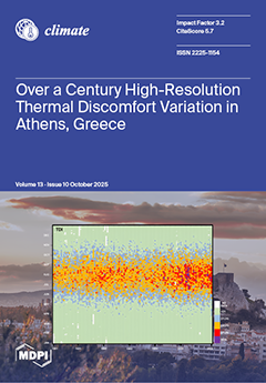
This study examines the temporal variation of thermal discomfort in Athens, Greece, by integrating one of the oldest meteorological datasets (1901–2024) for an urban Mediterranean environment with three bioclimatic indices. The extensive temporal coverage, coupled with a high-resolution hourly dataset, enables a robust analysis of both long-term climate trends and short-term thermal extremes, offering an evidence-based perspective that complements and extends existing temperature-based climate research. The results reveal a sharp increase in the frequency, intensity, and duration of heat stress since the 1980s, peaking in the early 21st century, underscoring the growing vulnerability of urban populations and the urgent need for climate adaptation and public health strategies in Mediterranean cities. View this paper
  • Issues are regarded as officially published after their release is announced to the table of contents alert mailing list.
  • You may sign up for e-mail alerts to receive table of contents of newly released issues.
  • PDF is the official format for papers published in both, html and pdf forms. To view the papers in pdf format, click on the "PDF Full-text" link, and use the free Adobe Reader to open them.
Order results
Result details
Section
Select all
Export citation of selected articles as:
28 pages, 5701 KB  
Article
Temperature and Pressure Observations by Tommaso Temanza from 1751 to 1769 in Venice, Italy
by Dario Camuffo, Antonio della Valle and Francesca Becherini
Climate 2025, 13(10), 217; https://doi.org/10.3390/cli13100217 - 18 Oct 2025
Viewed by 373
Abstract
The study aims to recover, interpret, and analyze the daily meteorological observations made in Venice by Tommaso Temanza from 1751 to 1769. These records are relevant because they provide direct information about the climate of the Little Ice Age. Temanza used a barometer, [...] Read more.
The study aims to recover, interpret, and analyze the daily meteorological observations made in Venice by Tommaso Temanza from 1751 to 1769. These records are relevant because they provide direct information about the climate of the Little Ice Age. Temanza used a barometer, an air thermometer of Amontons’ type, and an additional mercury thermometer, i.e., Réaumur’s thermometer. These early instruments are presented and discussed in this study. The barometer readings needed standard corrections, which were unknown at that time. The scale of the air thermometer was arbitrary, and temperatures were measured in inches of mercury. For the Amontons thermometer, Temanza missed the calibration points and used a particular scale with the zero-point in the middle of the range. He gave two contradictory explanations for this choice, both of which are discussed in this paper. In the 18th century, the use of a singular value to represent the average temperature, called “Temperate”, was promoted by Michieli du Crest in Geneva and Toaldo in Padua. This work reconstructs the unknown scale, using contemporary observations by Giovanni Poleni and Giuseppe Toaldo in Padua (30 km west of Venice) and snowfall reported in the weather notes to determine the temperature point at 0 °C. A discussion is made about the calibration, validation, and conversion of readings from the original to modern units of pressure and temperature, i.e., hPa and °C, respectively. The recovered record of Venice is presented in comparison with Padua, Bologna, and Milan. The paper provides and analyzes the new dataset, and improves knowledge about the climate, history of science, instruments, and observations made in the mid-18th century. Full article
Show Figures

Figure 1

11 pages, 3639 KB  
Article
Sensitivity of Peru’s Economic Growth Rate to Regional Climate Variability
by Mark R. Jury
Climate 2025, 13(10), 216; https://doi.org/10.3390/cli13100216 - 17 Oct 2025
Viewed by 575
Abstract
The macro-economic growth rate of Peru is analyzed for sensitivity to climatic conditions. Year-on-year fluctuations in the inflation-adjusted gross domestic product (GDP) per capita over the period 1970–2024 are subjected to correlation and composite statistical methods. Upturns relate to cool east Pacific La [...] Read more.
The macro-economic growth rate of Peru is analyzed for sensitivity to climatic conditions. Year-on-year fluctuations in the inflation-adjusted gross domestic product (GDP) per capita over the period 1970–2024 are subjected to correlation and composite statistical methods. Upturns relate to cool east Pacific La Niña, downturns with warm El Niño. Composites are analyzed by subtracting upper and lower terciles, representing a difference of ~USD 40 B at current value. These reveal how the regional climate exerts a partial influence among external factors. During the austral summer with southeasterly winds over the east Pacific, sea temperatures undergo a 2.5 °C cooling. Consequently, atmospheric subsidence draws humid air from the Amazon toward the Peruvian highlands, improving crop production. Dry weather along the coast sustains transportation networks and urban infrastructure, ensuring good economic performance over the year. The opposing influence of El Niño is built into the statistics. A multi-variate algorithm is developed to predict changes in the Peru growth rate. Austral summer winds and subsurface temperatures over the tropical east Pacific account for a modest 23% of year-on-year variance. Although external factors and the varied landscape weaken macro-economic links with climate, our predictors significantly improve on traditional indices: SOI and Nino3. Adaptive measures are suggested to take advantage of Southern Oscillation’s influence on Peru’s economy. Full article
(This article belongs to the Section Climate and Economics)
Show Figures

Figure 1

15 pages, 8138 KB  
Article
Winds over the Red Sea and NE African Summer Climate
by Mark R. Jury
Climate 2025, 13(10), 215; https://doi.org/10.3390/cli13100215 - 17 Oct 2025
Viewed by 381
Abstract
This study analyzes winds over the Red Sea (17 N, 39.5 E) and consequences for the northeast African climate in early summer (May–July). As the Indian SW monsoon commences, NNW winds > 6 m/s are channeled over the Red Sea between 2000 m [...] Read more.
This study analyzes winds over the Red Sea (17 N, 39.5 E) and consequences for the northeast African climate in early summer (May–July). As the Indian SW monsoon commences, NNW winds > 6 m/s are channeled over the Red Sea between 2000 m highlands, forming a low-level jet. Although sea surface temperatures of 30C instill evaporation of 8 mm/day and surface humidity of 20 g/kg, the air mass above the marine layer is dry and dusty (6 g/kg, 100 µg/m3). Land–sea temperature gradients drive afternoon sea breezes and orographic rainfall (~4 mm/day) that accumulate soil moisture in support of short-cycle crops such as teff. Statistical analyses of satellite and reanalysis datasets are employed to reveal the mesoscale structure and temporal response of NE African climate to marine winds via air chemistry data alongside the meteorological elements. The annual cycle of dewpoint temperature often declines from 12C to 4C during the Indian SW monsoon onset, followed by dusty NNW winds over the Red Sea. Consequences of a 14 m/s wind surge in June 2015 are documented via analysis of satellite and meteorological products. Moist convection was stunted, according to Cloudsat reflectivity, creating a dry-east/moist-west gradient over NE Africa (13–14.5 N, 38.5–40 E). Diurnal cycles are studied via hourly data and reveal little change for advected dust and moisture but large amplitude for local heat fluxes. Inter-annual fluctuations of early summer rainfall depend on airflows from the Red Sea in response to regional gradients in air pressure and temperature and the SW monsoon over the Arabian Sea. Lag correlation suggests that stronger NNW winds herald the onset of Pacific El Nino. Full article
Show Figures

Figure 1

12 pages, 5317 KB  
Article
Interaction of Tropical Easterly Jets over North Africa
by Mark R. Jury
Climate 2025, 13(10), 214; https://doi.org/10.3390/cli13100214 - 17 Oct 2025
Viewed by 333
Abstract
The objective of this study is to determine how easterly jets and associated convections interact over tropical North Africa during the Jul–Sep season, using reanalysis and satellite datasets for 1990–2024. Four indices are formed to describe mid- and upper-level zonal winds, and moist [...] Read more.
The objective of this study is to determine how easterly jets and associated convections interact over tropical North Africa during the Jul–Sep season, using reanalysis and satellite datasets for 1990–2024. Four indices are formed to describe mid- and upper-level zonal winds, and moist convection over the Sahel and India. Time-space regression identifies the large-scale features modulating the easterly jets. Cumulative departures are analyzed and ranked to form composites in east wind/convective phases and weak wind/subsident phases. The upper-level tropical easterly jet accelerates over the Arabian Sea during and after Pacific La Nina and the cool-west Indian Ocean dipole, and shows four year cycling aligned with thermocline oscillations. The mid-level Africa easterly jet strengthens during Atlantic Nino conditions that enhance the Sahel’s convection in the Jul–Sep season. Both jets accelerate when convection spreads west of India, whereas brief spells of decoupling suppress North African crop yields. The case of 15–20 August 2018 is analyzed, when a surge of Indian monsoon convection and tropical easterly jet penetrated the Sahel, leading to widespread uplift and rainfall. Full article
Show Figures

Figure 1

15 pages, 202 KB  
Article
Regulation of Health Professionals’ Work as a Climate Mitigation Strategy: Opportunities, Responsibilities, and Challenges
by Paul Gregory and Zubin Austin
Climate 2025, 13(10), 213; https://doi.org/10.3390/cli13100213 - 14 Oct 2025
Viewed by 561
Abstract
Background: The climate impacts of health professionals’ work are significant. The potential role and opportunities for regulators of health professionals’ work to drive behavioural and practice change have not been adequately explored in the literature. The objective of this research was to examine [...] Read more.
Background: The climate impacts of health professionals’ work are significant. The potential role and opportunities for regulators of health professionals’ work to drive behavioural and practice change have not been adequately explored in the literature. The objective of this research was to examine regulators’ perspectives on the potential role of health professions’ regulatory bodies in advancing the adoption of climate-conscious professional practice. Methods: Semi-structured interviews with 19 regulators overseeing the practice of health professionals in medicine, nursing, pharmacy, and dentistry in Canada were undertaken. Constant comparative data analysis using nVivo v15 was undertaken to identify common themes. The COREQ framework was applied to ensure the quality of the research processes used. Results: Participants highlighted their belief that there are only limited opportunities for health professions’ regulators to lead climate-positive practice change, despite their personal beliefs in the importance of the topic. The use of educational approaches, rather than legal or regulatory tools, was emphasized. Concerns were raised regarding regulatory overreach, practitioner blowback, and practical/logistical considerations. Coalition building across different facets of a profession (including educational institutions, unions, workplaces, and professional/advocacy groups) was identified as potentially most impactful. Conclusions: Previous research had highlighted practitioners’ beliefs that regulators had significant legal and practice-directed levers that could drive behavioural change towards more climate-friendly health care work. This research has highlighted regulators’ discomfort with assuming a legalistic role. Instead, they favoured persuasive techniques such as education and coalition building that may nudge, rather than compel, practitioners towards more climate-friendly practice. Full article
(This article belongs to the Topic Energy, Environment and Climate Policy Analysis)
22 pages, 7794 KB  
Article
Contemporary Tendencies in Snow Cover, Winter Precipitation, and Winter Air Temperatures in the Mountain Regions of Bulgaria
by Dimitar Nikolov and Cvetan Dimitrov
Climate 2025, 13(10), 212; https://doi.org/10.3390/cli13100212 - 11 Oct 2025
Viewed by 484
Abstract
Snow is an essential meteorological variable and an indicator of the changing climate. Its variations, particularly in snow depth and snow water equivalent, result mainly from changes in winter precipitation and air temperature. Recently, these conditions have been thoroughly investigated worldwide, revealing a [...] Read more.
Snow is an essential meteorological variable and an indicator of the changing climate. Its variations, particularly in snow depth and snow water equivalent, result mainly from changes in winter precipitation and air temperature. Recently, these conditions have been thoroughly investigated worldwide, revealing a general prevailing decline in precipitation and increasing tendencies in air temperatures. However, no systematic or up-to-date studies for Bulgaria exist. The main goal of the current project is to fill this national knowledge gap in the snow conditions in our mountains. For that purpose, we used 31 stations with altitudes ranging from 527 to 2925 m a.s.l. for the period between 1961 and 2020, covering two significant reference climatic periods. We extracted data about snow cover maximums, mean air temperatures, and precipitation amounts for the whole winter season in mountainous regions from October to April; however, we mainly present the results for the three winter months: December, January, and February. Most of the stations do not demonstrate any significant trends for snow depth maximums, except for the three lower stations in central west Bulgaria, which show significant increases. On the opposite end of the scale, two of the highest stations demonstrated notable decreases. The time series for the precipitation amounts are also predominantly indefinite. Significant decreasing trends can be found at the highest three alpine stations. The change in the mean seasonal air temperature is predominantly positive—17 of the stations show positive trends, and for 12, the increases are significant. The altitude of the strongest seasonal temperature rise lies between 1000 and 1700 m. Finally, due to the obvious nonlinearity of some of the time series, we decided to check for change points and a nonlinear approach to fit the data. This analysis demonstrates general changes in the investigated characteristics from the beginning of the 1970s to the middle of the 1980s. Full article
Show Figures

Figure 1

23 pages, 7551 KB  
Article
Development of Automatic Labels for Cold Front Detection in South America: A 2009 Case Study for Deep Learning Applications
by Dejanira Ferreira Braz, Luana Albertani Pampuch, Michelle Simões Reboita, Tercio Ambrizzi and Tristan Pryer
Climate 2025, 13(10), 211; https://doi.org/10.3390/cli13100211 - 8 Oct 2025
Viewed by 421
Abstract
Deep learning models for atmospheric pattern recognition require spatially consistent training labels that align precisely with input meteorological fields. This study introduces an automatic cold front detection method using the ERA5 reanalysis dataset from the European Centre for Medium-Range Weather Forecasts (ECMWF) at [...] Read more.
Deep learning models for atmospheric pattern recognition require spatially consistent training labels that align precisely with input meteorological fields. This study introduces an automatic cold front detection method using the ERA5 reanalysis dataset from the European Centre for Medium-Range Weather Forecasts (ECMWF) at 850 hPa, specifically designed to generate physically consistent labels for machine learning applications. The approach combines the Thermal Front Parameter (TFP) with temperature advection (AdvT), applying optimized thresholds (TFP < 5 × 10⁻¹¹ K m−2; AdvT < −1 × 10⁻⁴ K s−1), morphological filtering, and polynomial smoothing. Comparison against 1426 manual charts from 2009 revealed systematic spatial displacement, with mean offsets of ~502 km. Although pixel-level overlap was low, with Intersection over Union (IoU) = 0.013 and Dice coefficient (Dice) = 0.034, spatial concordance exceeded 99%, confirming both methods identify the same synoptic systems. The automatic method detects 58% more fronts over the South Atlantic and 44% fewer over the Andes compared to manual charts. Seasonal variability shows maximum activity in austral winter (31.3%) and minimum in summer (20.1%). This is the first automatic front detection system calibrated for South America that maintains direct correspondence between training labels and reanalysis input fields, addressing the spatial misalignment problem that limits deep learning applications in atmospheric sciences. Full article
(This article belongs to the Special Issue Meteorological Forecasting and Modeling in Climatology)
Show Figures

Figure 1

46 pages, 3804 KB  
Article
High-Resolution Temporal Variation of Thermal Discomfort Indices in the Eastern Mediterranean City of Athens, Greece, Since the Beginning of the 20th Century (1901–2024)
by Basil E. Psiloglou, Nikolas Gkinis and Christos Giannakopoulos
Climate 2025, 13(10), 210; https://doi.org/10.3390/cli13100210 - 6 Oct 2025
Viewed by 779
Abstract
This study analyzes more than a century of hourly meteorological data (1901–2024) from the Thissio station in central Athens, Greece, to assess the long-term changes in human thermal discomfort. Three simple and widely used bioclimatic indices, Thom’s Discomfort Index (TDI), Humidex (HMDX), and [...] Read more.
This study analyzes more than a century of hourly meteorological data (1901–2024) from the Thissio station in central Athens, Greece, to assess the long-term changes in human thermal discomfort. Three simple and widely used bioclimatic indices, Thom’s Discomfort Index (TDI), Humidex (HMDX), and Heat Index (HI), were calculated to capture the combined effects of air temperature and humidity. The results show a marked increase in the frequency, intensity, and duration of thermal discomfort since the 1980s, with a strong acceleration after 2000. The number of days with severe or dangerous heat stress has more than doubled compared with the mid-20th century, and periods of high discomfort now extend from June to September. The maximum values of HMDX and HI have exceeded critical health thresholds, highlighting increasing risks for the urban population. These findings demonstrate how rising temperature and humidity amplify heat stress in a Mediterranean city and emphasize the need for adaptation strategies in urban planning and public health to reduce vulnerability to extreme heat. Full article
Show Figures

Figure 1

34 pages, 2116 KB  
Review
Building Climate Resilient Fisheries and Aquaculture in Bangladesh: A Review of Impacts and Adaptation Strategies
by Mohammad Mahfujul Haque, Md. Naim Mahmud, A. K. Shakur Ahammad, Md. Mehedi Alam, Alif Layla Bablee, Neaz A. Hasan, Abul Bashar and Md. Mahmudul Hasan
Climate 2025, 13(10), 209; https://doi.org/10.3390/cli13100209 - 4 Oct 2025
Viewed by 2194
Abstract
This study examines the impacts of climate change on fisheries and aquaculture in Bangladesh, one of the most climate-vulnerable countries in the world. The fisheries and aquaculture sectors contribute significantly to the national GDP and support the livelihoods of 12% of the total [...] Read more.
This study examines the impacts of climate change on fisheries and aquaculture in Bangladesh, one of the most climate-vulnerable countries in the world. The fisheries and aquaculture sectors contribute significantly to the national GDP and support the livelihoods of 12% of the total population. Using a Critical Literature Review (CLR) approach, peer-reviewed articles, government reports, and official datasets published between 2006 and 2025 were reviewed across databases such as Scopus, Web of Science, FAO, and the Bangladesh Department of Fisheries (DoF). The analysis identifies major climate drivers, including rising temperature, erratic rainfall, salinity intrusion, sea-level rise, floods, droughts, cyclones, and extreme events, and reviews their differentiated impacts on key components of the sector: inland capture fisheries, marine fisheries, and aquaculture systems. For inland capture fisheries, the review highlights habitat degradation, biodiversity loss, and disrupted fish migration and breeding cycles. In aquaculture, particularly in coastal systems, this study reviews the challenges posed by disease outbreaks, water quality deterioration, and disruptions in seed supply, affecting species such as carp, tilapia, pangasius, and shrimp. Coastal aquaculture is also particularly vulnerable to cyclones, tidal surges, and saline water intrusion, with documented economic losses from events such as Cyclones Yaas, Bulbul, Amphan, and Remal. The study synthesizes key findings related to climate-resilient aquaculture practices, monitoring frameworks, ecosystem-based approaches, and community-based adaptation strategies. It underscores the need for targeted interventions, especially in coastal areas facing increasing salinity levels and frequent storms. This study calls for collective action through policy interventions, research and development, and the promotion of climate-smart technologies to enhance resilience and sustain fisheries and aquaculture in the context of a rapidly changing climate. Full article
(This article belongs to the Collection Adaptation and Mitigation Practices and Frameworks)
Show Figures

Figure 1

30 pages, 3428 KB  
Review
Tropical Fungi and LULUCF: Synergies for Climate Mitigation Through Nature-Based Culture (NbC)
by Retno Prayudyaningsih, Maman Turjaman, Margaretta Christita, Neo Endra Lelana, Ragil Setio Budi Irianto, Sarjiya Antonius, Safinah Surya Hakim, Asri Insiana Putri, Henti Hendalastuti Rachmat, Virni Budi Arifanti, Wahyu Catur Adinugroho, Said Fahmi, Rinaldi Imanuddin, Sri Suharti, Ulfah Karmila Sari, Asep Hidayat, Sona Suhartana, Tien Wahyuni, Sisva Silsigia, Tsuyoshi Kato, Ricksy Prematuri, Ahmad Faizal, Kae Miyazawa and Mitsuru Osakiadd Show full author list remove Hide full author list
Climate 2025, 13(10), 208; https://doi.org/10.3390/cli13100208 - 2 Oct 2025
Viewed by 1237
Abstract
Fungi in tropical ecosystems remain an understudied yet critical component of climate change mitigation, particularly within the Land Use, Land-Use Change, and Forestry (LULUCF) sector. This review highlights their dual role in reducing greenhouse gas (GHG) emissions by regulating carbon dioxide (CO2 [...] Read more.
Fungi in tropical ecosystems remain an understudied yet critical component of climate change mitigation, particularly within the Land Use, Land-Use Change, and Forestry (LULUCF) sector. This review highlights their dual role in reducing greenhouse gas (GHG) emissions by regulating carbon dioxide (CO2), methane (CH4), and nitrous oxides (N2O) while enhancing long-term carbon sequestration. Mycorrhizal fungi are pivotal in maintaining soil integrity, facilitating nutrient cycling, and amplifying carbon storage capacity through symbiotic mechanisms. We synthesize how fungal symbiotic systems under LULUCF shape ecosystem networks and note that, in pristine ecosystems, these networks are resilient. We introduce the concept of Nature-based Culture (NbC) to describe symbiotic self-cultures sustaining ecosystem stability, biodiversity, and carbon sequestration. Case studies demonstrate how the NbC concept is applied in reforestation strategies such as AeroHydro Culture (AHC), the Integrated Mangrove Sowing System (IMSS), and the 4N approach (No Plastic, No Burning, No Chemical Fertilizer, Native Species). These approaches leverage mycorrhizal networks to improve restoration outcomes in peatlands, mangroves, and semi-arid regions while minimizing land disturbance and chemical inputs. Therefore, by bridging fungal ecology with LULUCF policy, this review advocates for a paradigm shift in forest management that integrates fungal symbioses to strengthen carbon storage, ecosystem resilience, and human well-being. Full article
(This article belongs to the Special Issue Forest Ecosystems under Climate Change)
Show Figures

Figure 1

14 pages, 21399 KB  
Article
Temporal Variability of Major Stratospheric Sudden Warmings in CMIP5 Climate Change Scenarios
by Víctor Manuel Chávez-Pérez, Juan A. Añel, Citlalli Almaguer-Gómez and Laura de la Torre
Climate 2025, 13(10), 207; https://doi.org/10.3390/cli13100207 - 2 Oct 2025
Viewed by 520
Abstract
Major stratospheric sudden warmings are key processes in the coupling between the stratosphere and the troposphere, exerting a direct influence on mid-latitude climate variability. This study evaluates projected changes in the frequency of these phenomena during the 2006–2100 period using six high-top general [...] Read more.
Major stratospheric sudden warmings are key processes in the coupling between the stratosphere and the troposphere, exerting a direct influence on mid-latitude climate variability. This study evaluates projected changes in the frequency of these phenomena during the 2006–2100 period using six high-top general circulation models from the CMIP5 project under the Representative Concentration Pathway scenarios 2.6, 4.5, and 8.5. The analysis combines the full future period with a moving-window approach of 27 and 48 years, compared against both the satellite-era (1979–2005) and extended historical (1958–2005) periods. This methodology reveals that model responses are highly heterogeneous, with alternating periods of significant increases and decreases in event frequency, partially modulated by internal variability. The magnitude and statistical significance of the projected changes strongly depend on the chosen historical reference period, and most models tend to reproduce displacement-type polar vortex events preferentially over split-type events. These results indicate that assessments based solely on multi-model means or long aggregated periods may mask subperiods with robust signals, although some of these may arise by chance given the 5% significance threshold. This underscores the need for temporally resolved analyses to improve the understanding of stratospheric variability and its potential impact on climate predictability. Full article
(This article belongs to the Section Climate and Environment)
Show Figures

Figure 1

21 pages, 3572 KB  
Article
Enhancing Climate Modeling over the Upper Blue Nile Basin Using RegCM5-MOLOCH
by Eatemad Keshta, Doaa Amin, Ashraf M. ElMoustafa and Mohamed A. Gad
Climate 2025, 13(10), 206; https://doi.org/10.3390/cli13100206 - 2 Oct 2025
Viewed by 524
Abstract
The Upper Blue Nile Basin (UBNB), which contributes about 60% to the annual Nile flow, plays a critical role in the Nile water management. However, its complex terrain and climate create significant challenges for accurate regional climate simulations, which are essential for climate [...] Read more.
The Upper Blue Nile Basin (UBNB), which contributes about 60% to the annual Nile flow, plays a critical role in the Nile water management. However, its complex terrain and climate create significant challenges for accurate regional climate simulations, which are essential for climate impact assessments. This study aims to address the challenges of climate simulation over the UBNB by enhancing the Regional Climate Model system (RegCM5) with its new non-hydrostatic dynamical core (MOLOCH) to simulate precipitation and temperature. The model is driven by ERA5 reanalysis for the period (2000–2009), and two scenarios are simulated using two different schemes of the Planetary Boundary Layer (PBL): Holtslag (Hol) and University of Washington (UW). The two scenarios, noted as (MOLOCH-Hol and MOLOCH-UW), are compared to the previously best-performing hydrostatic configuration. The MOLOCH-UW scenario showed the best precipitation performance relative to observations, with an accepted dry Bias% up to 22%, and a high annual cycle correlation >0.85. However, MOLOCH-Hol showed a very good performance only in the wet season with a wet bias of 4% and moderate correlation of ≈0.6. For temperature, MOLOCH-UW also outperformed, achieving the lowest cold/warm bias range of −2% to +3%, and high correlations of ≈0.9 through the year and the wet season. This study concluded that the MOLOCH-UW is the most reliable configuration for reproducing the climate variability over the UBNB. This developed configuration is a promising tool for the basin’s hydroclimate applications, such as dynamical downscaling of the seasonal forecasts and future climate change scenarios produced by global circulation models. Future improvements could be achieved through convective-permitting simulation at ≤4 km resolution, especially in the application of assessing the land use change impact. Full article
(This article belongs to the Section Climate Dynamics and Modelling)
Show Figures

Figure 1

24 pages, 22609 KB  
Article
Terrain-Based High-Resolution Microclimate Modeling for Cold-Air-Pool-Induced Frost Risk Assessment in Karst Depressions
by András Dobos, Réka Farkas and Endre Dobos
Climate 2025, 13(10), 205; https://doi.org/10.3390/cli13100205 - 30 Sep 2025
Viewed by 946
Abstract
Cold-air pooling (CAP) and frost risk represent significant climate-related hazards in karstic and agricultural environments, where local topography and surface cover strongly modulate microclimatic conditions. This study focuses on the Mohos sinkhole, Hungary’s cold pole, situated on the Bükk Plateau, to investigate the [...] Read more.
Cold-air pooling (CAP) and frost risk represent significant climate-related hazards in karstic and agricultural environments, where local topography and surface cover strongly modulate microclimatic conditions. This study focuses on the Mohos sinkhole, Hungary’s cold pole, situated on the Bükk Plateau, to investigate the formation, structure, and persistence of CAPs in a Central European karst depression. High-resolution terrain-based modeling was conducted using UAV-derived digital surface models combined with multiple GIS tools (Sky-View Factor, Wind Exposition Index, Cold Air Flow, and Diurnal Anisotropic Heat). These models were validated and enriched by multi-level temperature measurements and thermal imaging under various synoptic conditions. Results reveal that temperature inversions frequently form during clear, calm nights, leading to extreme near-surface cold accumulation within the sinkhole. Inversions may persist into the day due to topographic shading and density stratification. Vegetation and basin geometry influence radiative and turbulent fluxes, shaping the spatial extent and intensity of cold-air layers. The CAP is interpreted as part of a broader interconnected multi-sinkhole system. This integrated approach offers a transferable, cost-effective framework for terrain-driven frost hazard assessment, with direct relevance to precision agriculture, mesoscale model refinement, and site-specific climate adaptation in mountainous or frost-sensitive regions. Full article
(This article belongs to the Section Climate and Environment)
Show Figures

Figure 1

18 pages, 15842 KB  
Systematic Review
The Effects of Climate Change on Health: A Systematic Review from a One Health Perspective
by Indira A. Luza Eyzaguirre, Esley Lima de Sousa, Yago de Jesus Martins, Marcus E. B. Fernandes and Aldemir B. Oliveira-Filho
Climate 2025, 13(10), 204; https://doi.org/10.3390/cli13100204 - 29 Sep 2025
Viewed by 1749
Abstract
Climate change has been occurring due to global warming since the 1950s, causing impacts on natural and social systems, including health. This review article involves the One Health approach as a holistic approach that integrates environmental, human, and animal health, since there is [...] Read more.
Climate change has been occurring due to global warming since the 1950s, causing impacts on natural and social systems, including health. This review article involves the One Health approach as a holistic approach that integrates environmental, human, and animal health, since there is a significant gap in knowledge about the impacts of climate change on health. The questions that guide this research are as follows: What is the state of the art in studies on climate change and One Health? What are the main topics addressed in studies on climate change and One Health at a global level? The main objective is to conduct a systematic review of studies on climate change and its relationship with One Health to assess the main topics studied, involving climate change and health at a global level, and identify the gaps and challenges of these studies. The review demonstrated the exponential growth of studies that relate climate change to One Health, especially in the last three decades, with more records of studies that address infectious diseases such as arboviruses. Furthermore, studies on climate and its impact on mental health were detected, causing depression, anxiety, post-traumatic stress disorder (PTSD), solastalgia, and eco-anxiety, especially in vulnerable populations such as indigenous communities, women, children, family farmers, and the elderly. The One Health approach was shown to be restricted to health-related issues. Thus, theoretical and experimental studies are still needed to assess the real impact of climate change on the various axes involving human health and its relationship with anthropogenic activities, environmental health, and animal health. Full article
(This article belongs to the Special Issue Climate Impact on Human Health)
Show Figures

Graphical abstract

24 pages, 4911 KB  
Review
Hail Netting in Apple Orchards: Current Knowledge, Research Gaps, and Perspectives for Digital Agriculture
by Danielle Elis Garcia Furuya, Édson Luis Bolfe, Franco da Silveira, Jayme Garcia Arnal Barbedo, Tamires Lima da Silva, Luciana Alvim Santos Romani, Letícia Ferrari Castanheiro and Luciano Gebler
Climate 2025, 13(10), 203; https://doi.org/10.3390/cli13100203 - 28 Sep 2025
Viewed by 809
Abstract
Hailstorms are a major climatic threat to apple production, causing substantial economic losses in orchards worldwide. Anti-hail nets have been increasingly adopted to mitigate this risk, but the scientific literature on their effectiveness and future applications remains scattered, especially considering advances in digital [...] Read more.
Hailstorms are a major climatic threat to apple production, causing substantial economic losses in orchards worldwide. Anti-hail nets have been increasingly adopted to mitigate this risk, but the scientific literature on their effectiveness and future applications remains scattered, especially considering advances in digital agriculture. This study synthesizes current knowledge on the use of anti-hail nets in apple orchards through a systematic review and explores future perspectives involving digital technologies. A PRISMA-based review was conducted using three databases, revealing information regarding the studied countries, netting colors, and apple varieties, among others. A clear research gap was identified in integrating anti-hail nets with remote sensing and Artificial Intelligence (AI). This paper also analyzes studies from Vacaria, Brazil, a key apple-producing region and part of the Semear Digital project, highlighting local efforts to use hail netting in commercial orchards. Potential applications of AI algorithms and remote sensing are proposed for hail netting assessment, orchard monitoring, and decision-making support. These technologies can improve predictive modeling, quantify areas, and enhance precision management. Findings suggest combining traditional protective methods with technological innovations to strengthen orchard resilience in regions exposed to extreme weather. Full article
(This article belongs to the Special Issue Climate Risk in Agriculture, Analysis, Modeling and Applications)
Show Figures

Figure 1

28 pages, 10416 KB  
Article
One Country, Several Droughts: Characterisation, Evolution, and Trends in Meteorological Droughts in Spain Within the Context of Climate Change
by David Espín Sánchez and Jorge Olcina Cantos
Climate 2025, 13(10), 202; https://doi.org/10.3390/cli13100202 - 26 Sep 2025
Viewed by 1044
Abstract
In this paper, we analyse drought variability in Spain (1950–2024) using the Standardised Precipitation–Evapotranspiration Index (SPEI) at 6-, 12-, and 24-month scales. Using 43 long-record meteorological observatories (AEMET), we compute SPEI from quality-controlled (QC), homogenised series, and derive coherent drought regions via clustering [...] Read more.
In this paper, we analyse drought variability in Spain (1950–2024) using the Standardised Precipitation–Evapotranspiration Index (SPEI) at 6-, 12-, and 24-month scales. Using 43 long-record meteorological observatories (AEMET), we compute SPEI from quality-controlled (QC), homogenised series, and derive coherent drought regions via clustering and assess trends in the frequency, duration, and intensity of dry episodes (SPEI ≤ −1.5), including seasonality and statistical significance (p < 0.05). Short-term behaviour (SPEI-6) has become more complex in recent decades, with the emergence of a “Catalonia” type and stronger June–October deficits across the northern interior; Mediterranean coasts show smaller or non-significant changes. Long-term behaviour (SPEI-24) is more structural, with increasing persistence and duration over the north-eastern interior and Andalusia–La Mancha, consistent with multi-year drought. Overall, short and long scales converge on rising drought severity and persistence across interior Spain, supporting multi-scale monitoring and region-specific adaptation in agriculture, water resources, and forest management. Key figures are as follows: at 6 months—frequency 0.09/0.08 per decade (Centre–León/Catalonia), duration 0.59/0.50 months per decade, intensity −0.12 to −0.10 SPEI per decade; at 24 months—frequency 0.5 per decade (Cantabrian/NE interior), duration 0.8/0.7/0.4 months per decade (Andalusia–La Mancha/NE interior/Cabo de Gata–Almería), intensity −0.06 SPEI per decade; Mediterranean changes are smaller or non-significant. Full article
(This article belongs to the Section Weather, Events and Impacts)
Show Figures

Figure 1

22 pages, 4411 KB  
Article
Near-Surface Temperature Climate Change in the Caspian Region: A Study Using Meteorological Station Data, Reanalyses, and CMIP6 Models
by Ilya Serykh, Svetlana Krasheninnikova, Said Safarov, Elnur Safarov, Ebrahim Asadi Oskouei, Tatiana Gorbunova, Roman Gorbunov and Yashar Falamarzi
Climate 2025, 13(10), 201; https://doi.org/10.3390/cli13100201 - 25 Sep 2025
Viewed by 915
Abstract
The climatic variability of near-surface air temperature (NSAT) over the Caspian region (35–60° N; 40–65° E) was analyzed in this study. The analysis was based on a comparison of data from various sources: weather stations, NOAA OISSTv2 satellite-based data, atmospheric reanalyses ECMWF ERA5, [...] Read more.
The climatic variability of near-surface air temperature (NSAT) over the Caspian region (35–60° N; 40–65° E) was analyzed in this study. The analysis was based on a comparison of data from various sources: weather stations, NOAA OISSTv2 satellite-based data, atmospheric reanalyses ECMWF ERA5, NASA MERRA-2, and NCEP/NCAR, and the outputs from 33 Earth system models (ESMs) participating in the Coupled Model Intercomparison Project Phase 6 (CMIP6). CMIP6 models results from the historical and Shared Socioeconomic Pathways (SSPs) experiments were utilized. Over the period 1940–2023, NSAT exhibited variable changes across the Caspian region. Weather stations in the northwestern part of the region indicated NSAT increases of 0.9 ± 0.2 °C for 1985–2023. In the central-western part of the Caspian region, the increase in average NSAT between 1940–1969 and 1994–2023 was 1.4 °C with a spatial standard deviation of 0.3 °C. In the southern part of the Caspian region, the increase in average NSAT between 1986–2004 and 2005–2023 was 0.8 ± 0.1 °C. Importantly, all 33 CMIP6 models, as well as the ERA5 reanalysis, captured an average NSAT increase of approximately 1.3 ± 0.5 °C for the whole Caspian region between 1940–1969 and 1994–2023. From the ERA5 data, the increase in NSAT was more pronounced in the north (~1.6 °C) than in the central Caspian region, with the most significant warming observed in the mountainous regions of Iran (up to 3.0 °C). Under various CMIP6 SSPs scenarios (SSP1-2.6, SSP2-4.5, SSP3-7.0, and SSP5-8.5), projections indicate an increase in average NSAT across the study region. Comparing the periods 1994–2023 and 2070–2099, the projected NSAT increases are 1.7 ± 0.7 °C, 2.8 ± 0.8 °C, 4.0 ± 0.9 °C, and 5.2 ± 1.2 °C, respectively. For the earlier period of 2024–2053 relative to 1994–2023, the projected NSAT increases are 1.2 ± 0.4 °C, 1.3 ± 0.4 °C, 1.4 ± 0.4 °C, and 1.7 ± 0.5 °C. Notably, the projected increase in NSAT is slower over the Caspian Sea compared to the surrounding land areas. Full article
Show Figures

Figure 1

25 pages, 20264 KB  
Article
Assessing Urban Resilience Through Physically Based Hydrodynamic Modeling Under Future Development and Climate Scenarios: A Case Study of Northern Rangsit Area, Thailand
by Detchphol Chitwatkulsiri, Kim Neil Irvine, Lloyd Hock Chye Chua, Lihoun Teang, Ratchaphon Charoenpanuchart, Fa Likitswat and Alisa Sahavacharin
Climate 2025, 13(10), 200; https://doi.org/10.3390/cli13100200 - 24 Sep 2025
Viewed by 1020
Abstract
Urban flooding represents a growing concern on a global scale, particularly in regions characterized by rapid urbanization and increased climate variability. This study concentrates on the Rangsit area in Pathum Thani Province, Thailand, an urbanizing peri-urban area north of Bangkok and within the [...] Read more.
Urban flooding represents a growing concern on a global scale, particularly in regions characterized by rapid urbanization and increased climate variability. This study concentrates on the Rangsit area in Pathum Thani Province, Thailand, an urbanizing peri-urban area north of Bangkok and within the Chao Phraya River Basin where transitions in land use and the intensification of rainfall induced by climate change are elevating flood risks. A physically based hydrodynamic model was developed utilizing PCSWMM to assess current and future flood scenarios that considered future build-out plans and climate change scenarios. The model underwent calibration and validation using a continuous modeling approach that conservatively focused on wet year conditions, based on available rainfall and water level data. In assessing future scenarios, we considered land use projections based on regional development plans and climate projections downscaled under RCP4.5 and RCP8.5 pathways. Results indicate that both urban expansion and intensifying rainfall are likely to increase flood magnitudes, durations, and impacted areas, although in this rapidly developing peri-urban area, land use change was the most important driver. The findings suggest that a physically based modeling approach could support a smart-control framework that could effectively inform evidence-based urban planning and infrastructure investments. These insights are of paramount importance for flood-prone regions in Thailand and Southeast Asia, where dynamic modeling tools must underpin governance, climate adaptation, and risk communication. Furthermore, given the greater impact of future build-out on flood risk, as compared to climate change, there is an opportunity to effectively and proactively improve flood resilience through the implementation of integrated Nature-based Solution and hard engineering approaches, in combination with effective flood management policy. Full article
Show Figures

Figure 1

19 pages, 1442 KB  
Article
Benova and Cenova Models in the Homogenization of Climatic Time Series
by Peter Domonkos
Climate 2025, 13(10), 199; https://doi.org/10.3390/cli13100199 - 23 Sep 2025
Viewed by 611
Abstract
For the correct evaluation of climate trends and climate variability, it is important to remove non-climatic biases from the observed data. Such biases, referred to as inhomogeneities, occur for station relocations or changes in the instrumentation or instrument installation, among other reasons. Most [...] Read more.
For the correct evaluation of climate trends and climate variability, it is important to remove non-climatic biases from the observed data. Such biases, referred to as inhomogeneities, occur for station relocations or changes in the instrumentation or instrument installation, among other reasons. Most inhomogeneities are related to a sudden change (break) in the technical conditions of the climate observations. In long time series (>30 years), usually multiple breaks occur, and their joint impact on the long-term trends and variability is more important than their individual evaluation. Benova is the optimal method for the joint calculation of correction terms for removing inhomogeneity biases. Cenova is a modified, imperfect version of Benova, which, however, can also be used in discontinuous time series. In the homogenization of section means, the use of Benova should be preferred, while in homogenizing probability distribution, only Cenova can be applied. This study presents the Benova and Cenova methods, discusses their main properties and compares their efficiencies using the benchmark dataset of the Spanish MULTITEST project (2015–2017), which is the largest existing dataset of this kind so far. The root mean square error (RMSE) of the annual means and the mean absolute trend bias were calculated for the Benova and Cenova results. When the signal-to-noise ratio (SNR) is high, the errors in the Cenova results are higher, from 14% to 24%, while when the SNR is low, or concerted inhomogeneities in several time series occur, the advantage of Benova over Cenova might disappear. Full article
Show Figures

Figure 1

Previous Issue
Next Issue
Back to TopTop