

ISPRS Int. J. Geo-Inf., Volume 13, Issue 5 (May 2024) – 27 articles
Cover Story (view full-size image):
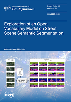
Using Grounded SAM as an example, we investigate the capability of an open vocabulary model in the semantic segmentation of images from complex urban street scenes, employing benchmark datasets. Results indicate strong performance in single-category segmentation but highlight difficulties in multi-category scenarios, particularly with categories bearing close textual or visual resemblances. Adjustments in textual prompts significantly improved detection accuracy, though challenges persisted in distinguishing between some visually similar objects. Comparative analysis with state-of-the-art models revealed Grounded SAM’s direct inference capability without further training. This study concludes that while the open vocabulary model marks a significant advancement, further consideration of prompted classes is essential in complex scenarios. View this paper
- Issues are regarded as officially published after their release is announced to the table of contents alert mailing list.
- You may sign up for e-mail alerts to receive table of contents of newly released issues.
- PDF is the official format for papers published in both, html and pdf forms. To view the papers in pdf format, click on the "PDF Full-text" link, and use the free Adobe Reader to open them.
Previous Issue
Next Issue