Skip to Content

ISPRS International Journal of Geo-Information, Volume 10, Issue 8

2021 August - 80 articles

Cover Story: 
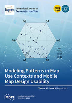
In our mobile society, mobile maps are increasingly used in varying map use situations. This has led to an increase in map use contexts, which can be leveraged for determining a suitable context-based map design. Our research sought to analyze combinations of map use contexts to identify relevant contextual factors that influence mobile map design usability. In an online survey with 50 participants, we assessed the usability of 27 map design variations (consisting of map-reading tasks, base map styles, and interactivity variants) and evaluated emerging user patterns of the collected data on usability and map use context. We found that the overall map design is critical in supporting map-reading activities. It was also possible to create archetypal representations of our participants and identify corresponding and suitable map design profiles. View this paper
  • Issues are regarded as officially published after their release is announced to the table of contents alert mailing list .
  • You may sign up for email alerts to receive table of contents of newly released issues.
  • PDF is the official format for papers published in both, html and pdf forms. To view the papers in pdf format, click on the "PDF Full-text" link, and use the free Adobe Reader to open them.

Articles (80)

  • Article
  • Open Access
4,697 Views
22 Pages

The danwei is a distinctive spatial unit in China, as a legacy of the Maoist era. In a danwei, state-owned enterprises supplied a full set of facilities, such that people’s daily activities did not often extend beyond their danweis. However, with the...

  • Article
  • Open Access
2 Citations
5,608 Views
24 Pages

Route maps, common in public transportation systems, refer to thematic maps drawn according to topological concepts. To simplify complex route information, a transport network is represented using primary graphic elements. First used in 1931 with top...

  • Article
  • Open Access
26 Citations
5,108 Views
21 Pages

Spatiotemporal Dynamic Analysis of A-Level Scenic Spots in Guizhou Province, China

  • Yuanhong Qiu,
  • Jian Yin,
  • Ting Zhang,
  • Yiming Du and
  • Bin Zhang

A-level scenic spots are a unique evaluation form of tourist attractions in China, which have an important impact on regional tourism development. Guizhou is a key tourist province in China. In recent years, the number of A-level scenic spots in Guiz...

  • Feature Paper
  • Article
  • Open Access
27 Citations
8,493 Views
22 Pages

With regard to the outpatient areas of a hospital, the smoothness of the route is now taken into consideration in the process of configuring the wayfinding system. As patients often spend time on ineffective wayfinding processes, and there is limited...

  • Article
  • Open Access
16 Citations
5,950 Views
19 Pages

Short distance travel and commute being inevitable, safe route planning in pandemics for micro-mobility, i.e., cycling and walking, is extremely important for the safety of oneself and others. Hence, we propose an application-based solution using COV...

  • Article
  • Open Access
19 Citations
6,375 Views
16 Pages

Geodiversity is the variety of natural elements that are excluded from biodiversity, such as: geological, geomorphological, and soil features including their properties, systems, and relationships. Geodiversity assessment measures these features, emp...

  • Article
  • Open Access
18 Citations
5,558 Views
24 Pages

Spaces are continuous realms where human beings freely navigate, such as from indoor to outdoor and optionally to another indoor space. However, currently available data models to represent space for navigation do not entirely reflect this continuity...

  • Article
  • Open Access
6 Citations
5,011 Views
22 Pages

The gradual institutionalization of public participation increasingly compels local authorities to partially share their power over the transformation of urban areas. The smooth running of a participatory session is based on selecting the appropriate...

  • Article
  • Open Access
45 Citations
12,066 Views
25 Pages

Architectural survey methods using terrestrial 3D laser scanning and digital photogrammetry prove capable of registering a building with a level of accuracy far superior to traditional methods, minimizing errors, and reducing fieldwork. Current devel...

  • Article
  • Open Access
6 Citations
3,538 Views
13 Pages

How to keep the fidelity of the digital elevation model (DEM) data is a crucial problem in the current watermarking research, as the watermarked DEM data need to preserve their accuracy. We proposed a zero watermarking method for the triangulated irr...

  • Article
  • Open Access
10 Citations
10,067 Views
17 Pages

Improving the Creation of Hot Spot Policing Patrol Routes: Comparing Cognitive Heuristic Performance to an Automated Spatial Computation Approach

  • Spencer P. Chainey,
  • Jhonata A. S. Matias,
  • Francisco Carlos F. Nunes Junior,
  • Ticiana L. Coelho da Silva,
  • José Antônio F. de Macêdo,
  • Regis P. Magalhães,
  • José F. de Queiroz Neto and
  • Wellington C. P. Silva

Hot spot policing involves the deployment of police patrols to places where high levels of crime have previously concentrated. The creation of patrol routes in these hot spots is mainly a manual process that involves using the results from an analysi...

  • Article
  • Open Access
21 Citations
5,551 Views
22 Pages

Recent technological advancements in geomatics and mobile sensing have led to various urban big data, such as Tencent street view (TSV) photographs; yet, the urban objects in the big dataset have hitherto been inadequately exploited. This paper aims...

  • Article
  • Open Access
14 Citations
14,035 Views
24 Pages

Recently, due to Web 2.0 and neocartography, heat maps have become a popular map type for quick reading. Heat maps are graphical representations of geographic data density in the form of raster maps, elaborated by applying kernel density estimation w...

  • Article
  • Open Access
12 Citations
6,584 Views
17 Pages

To ensure agricultural sustainability and desirable environmental outcomes, stakeholders need systems-based model-driven decision support tools. The objective of this study was to develop a global scale web-based geospatial crop modeling application...

  • Review
  • Open Access
22 Citations
8,784 Views
17 Pages

Designing or expanding a bicycle-sharing system (BSS) involves addressing the infrastructure’s location of the bicycle stations. Station location is an essential factor for designing and implementing a new system or for its operation. In a complex sp...

  • Article
  • Open Access
7 Citations
3,402 Views
16 Pages

Deep Fusion of DOM and DSM Features for Benggang Discovery

  • Shengyu Shen,
  • Jiasheng Chen,
  • Shaoyi Zhang,
  • Dongbing Cheng,
  • Zhigang Wang and
  • Tong Zhang

Benggang is a typical erosional landform in southern and southeastern China. Since benggang poses significant risks to local ecological environments and economic infrastructure, it is vital to accurately detect benggang-eroded areas. Relying only on...

  • Article
  • Open Access
2 Citations
3,554 Views
22 Pages

Predicting user activity intensity is crucial for various applications. However, existing studies have two main problems. First, as user activity intensity is nonstationary and nonlinear, traditional methods can hardly fit the nonlinear spatio-tempor...

  • Article
  • Open Access
5 Citations
4,279 Views
15 Pages

Heavy rain causes the highest drop in travel speeds compared with light and moderate rain because it can easily induce flooding on road surfaces, which can continue to hinder urban transportation even after the rainfall is over. However, very few stu...

  • Article
  • Open Access
20 Citations
8,619 Views
19 Pages

The principal aim of this paper is to present the capabilities of newly developed GIS tools for measurement analysis of urban spatial layouts, using the square grid method. The study of urban morphology and metrology is a multistage process, which in...

  • Article
  • Open Access
53 Citations
8,456 Views
21 Pages

Precise measuring of urban façade color is necessary for urban color planning. The existing manual methods of measuring building façade color are limited by time and labor costs and hardly carried out on a city scale. These methods also make it chall...

  • Article
  • Open Access
1 Citations
3,323 Views
25 Pages

The installation of closed-circuit television monitors (CCTV) has rapidly increased in number ever since the 11 September attacks. With the advantages of direct visual inspection, CCTV systems are widely used on various occasions that require instant...

  • Article
  • Open Access
7 Citations
4,156 Views
24 Pages

DeepDBSCAN: Deep Density-Based Clustering for Geo-Tagged Photos

  • Jang You Park,
  • Dong June Ryu,
  • Kwang Woo Nam,
  • Insung Jang,
  • Minseok Jang and
  • Yonsik Lee

Density-based clustering algorithms have been the most commonly used algorithms for discovering regions and points of interest in cities using global positioning system (GPS) information in geo-tagged photos. However, users sometimes find more specif...

  • Article
  • Open Access
19 Citations
3,713 Views
22 Pages

Vehicle detection in aerial images is a challenging task. The complexity of the background information and the redundancy of the detection area are the main obstacles that limit the successful operation of vehicle detection based on anchors in very-h...

  • Article
  • Open Access
9 Citations
3,586 Views
16 Pages

Studying population prediction under micro-spatiotemporal granularity is of great significance for modern and refined urban traffic management and emergency response to disasters. Existing population studies are mostly based on census and statistical...

  • Article
  • Open Access
17 Citations
4,494 Views
20 Pages

Data-driven urban human activity mining has become a hot topic of urban dynamic modeling and analysis. Semantic activity chain modeling with activity purpose provides scientific methodological support for the analysis and decision-making of human beh...

  • Article
  • Open Access
12 Citations
4,005 Views
27 Pages

A Fully Automatic, Interpretable and Adaptive Machine Learning Approach to Map Burned Area from Remote Sensing

  • Daniela Stroppiana,
  • Gloria Bordogna,
  • Matteo Sali,
  • Mirco Boschetti,
  • Giovanna Sona and
  • Pietro Alessandro Brivio

The paper proposes a fully automatic algorithm approach to map burned areas from remote sensing characterized by human interpretable mapping criteria and explainable results. This approach is partially knowledge-driven and partially data-driven. It e...

  • Article
  • Open Access
8 Citations
5,429 Views
21 Pages

Spatial Distribution Assessment of Terrorist Attack Types Based on I-MLKNN Model

  • Ruifang Zhao,
  • Xiaolan Xie,
  • Xun Zhang,
  • Min Jin and
  • Mengmeng Hao

Terrorist attacks are harmful to lives and property and seriously affect the stability of the international community and economic development. Exploring the regularity of terrorist attacks and building a model for assessing the risk of terrorist att...

  • Article
  • Open Access
7 Citations
6,130 Views
19 Pages

Spatial Analysis of Gunshot Reports on Twitter in Mexico City

  • Enrique García-Tejeda,
  • Gustavo Fondevila and
  • Oscar S. Siordia

The quarantine and stay-at-home measures implemented by most governments significantly impacted the volume and distribution of crime, and already, a body of literature exists that focuses on the effects of lockdown on crime. However, the effects of l...

  • Feature Paper
  • Article
  • Open Access
41 Citations
7,522 Views
25 Pages

Leveraging Spatio-Temporal Graphs and Knowledge Graphs: Perspectives in the Field of Maritime Transportation

  • Géraldine Del Mondo,
  • Peng Peng,
  • Jérôme Gensel,
  • Christophe Claramunt and
  • Feng Lu

This paper introduces a prospective study of the potential of spatio-temporal graphs (ST-graphs) and knowledge graphs (K-graphs) for the modelling of geographical phenomena. While the integration of time within GIS has long been a domain of major int...

  • Article
  • Open Access
16 Citations
5,768 Views
22 Pages

China has entered an era of rapid high-speed railway (HSR) development and the spatial structure of urban agglomerations will evolve in parallel with the development and evolution of the spatial structure of the HSR network. In this study, we explore...

  • Article
  • Open Access
24 Citations
6,940 Views
20 Pages

The rapid expansion of cities brings in new challenges for the urban firefighting security, while the increasing fire frequency poses serious threats to the life, property, and safety of individuals living in cities. Firefighting in cities is a chall...

  • Article
  • Open Access
44 Citations
7,953 Views
22 Pages

Urban Overheating Assessment through Prediction of Surface Temperatures: A Case Study of Karachi, Pakistan

  • Bilal Aslam,
  • Ahsen Maqsoom,
  • Nauman Khalid,
  • Fahim Ullah and
  • Samad Sepasgozar

Global climate has been radically affected by the urbanization process in recent years. Karachi, Pakistan’s economic hub, is also showing signs of swift urbanization. Owing to the construction of infrastructure projects under the China-Pakistan Econo...

  • Article
  • Open Access
45 Citations
11,320 Views
28 Pages

Whose Urban Green? Mapping and Classifying Public and Private Green Spaces in Padua for Spatial Planning Policies

  • Guglielmo Pristeri,
  • Francesca Peroni,
  • Salvatore Eugenio Pappalardo,
  • Daniele Codato,
  • Antonio Masi and
  • Massimo De Marchi

The rising environmental issues on contemporary cities urgently calls for sustainable planning policies. Implementation of nature-based solutions, ecosystem services, and green infrastructures associated to green spaces management is at present of pa...

  • Article
  • Open Access
7 Citations
3,512 Views
18 Pages

Many people in the world do not have enough physical activities to maintain good health, which has recently become a threat to public health. In addition to individual genetic and social factors, we considered the geographical environment of the city...

  • Article
  • Open Access
20 Citations
4,505 Views
19 Pages

DEM-Based UAV Flight Planning for 3D Mapping of Geosites: The Case of Olympus Tectonic Window, Lesvos, Greece

  • Ermioni-Eirini Papadopoulou,
  • Christos Vasilakos,
  • Nikolaos Zouros and
  • Nikolaos Soulakellis

Geosites are an important part of geoheritage, thus their detailed mapping is crucial for their management, protection and promotion processes. However, there is no specific approach to three-dimensional (3D) mapping of geosites and a full investigat...

  • Article
  • Open Access
2 Citations
4,007 Views
17 Pages

A Methodological Proposal for the Analysis of Lighting the House Building Façades

  • Hugo Castro Noblejas,
  • Juan Francisco Sortino Barrionuevo,
  • Darío Gumiel Muñoz and
  • Matías Francisco Mérida Rodríguez

Natural lighting is a fundamental element in the habitability of dwellings. However, it is still difficult to calculate its effect on the façades of the buildings in detail, due to the morphological complexity of the property itself, as well as the e...

  • Article
  • Open Access
3 Citations
3,812 Views
25 Pages

Fast Geo-Location Method Based on Panoramic Skyline in Hilly Area

  • Zhibin Pan,
  • Jin Tang,
  • Tardi Tjahjadi and
  • Fan Guo

Localization method based on skyline for visual geo-location is an important auxiliary localization method that does not use a satellite positioning system. Due to the computational complexity, existing panoramic skyline localization methods determin...

  • Review
  • Open Access
60 Citations
8,570 Views
15 Pages

Spatial accessibility provides significant policy implications, describing the spatial disparity of access and supporting the decision-making process for placing additional infrastructure at adequate locations. Several previous reviews have covered s...

  • Article
  • Open Access
57 Citations
6,743 Views
16 Pages

Improving Urban Land Cover Classification with Combined Use of Sentinel-2 and Sentinel-1 Imagery

  • Bin Hu,
  • Yongyang Xu,
  • Xiao Huang,
  • Qimin Cheng,
  • Qing Ding,
  • Linze Bai and
  • Yan Li

Accurate land cover mapping is important for urban planning and management. Remote sensing data have been widely applied for urban land cover mapping. However, obtaining land cover classification via optical remote sensing data alone is difficult due...

  • Article
  • Open Access
4 Citations
5,567 Views
18 Pages

This study applies the principles of measuring micro-place crime concentration and the spatial dispersion of crime increase to the geographic unit of cities in Brazil. We identify that a small number of cities account for a large cumulative proportio...

  • Article
  • Open Access
5 Citations
3,197 Views
29 Pages

Time-Series-Based Queries on Stable Transportation Networks Equipped with Sensors

  • Erik Bollen,
  • Rik Hendrix,
  • Bart Kuijpers and
  • Alejandro Vaisman

In this paper, we propose a formalism to query transportation networks that are equipped with sensors that produce time-series data. The core of the proposed query mechanism is a logic-based language that is capable to return time, value, and time-se...

  • Article
  • Open Access
36 Citations
4,822 Views
14 Pages

A Novel Urban Tourism Path Planning Approach Based on a Multiobjective Genetic Algorithm

  • Mohamed A. Damos,
  • Jun Zhu,
  • Weilian Li,
  • Abubakr Hassan and
  • Elhadi Khalifa

One of the most important variables that leads to effective individual and group tours is the tourism route planning approach, which enables tourists to engage with tourism with ease, speed, and safety. However, current methods of designing tourist r...

  • Article
  • Open Access
15 Citations
5,270 Views
22 Pages

Modeling Patterns in Map Use Contexts and Mobile Map Design Usability

  • Mona Bartling,
  • Clemens R. Havas,
  • Stefan Wegenkittl,
  • Tumasch Reichenbacher and
  • Bernd Resch

Mobile map applications are increasingly used in various aspects of our lives, leading to an increase in different map use situations and, therefore, map use contexts. Several empirical usability studies have identified how map design is associated w...

  • Article
  • Open Access
19 Citations
9,416 Views
36 Pages

Analysing the Impact of Large Data Imports in OpenStreetMap

  • Raphael Witt,
  • Lukas Loos and
  • Alexander Zipf

OpenStreetMap (OSM) is a global mapping project which generates free geographical information through a community of volunteers. OSM is used in a variety of applications and for research purposes. However, it is also possible to import external data...

  • Article
  • Open Access
11 Citations
4,201 Views
15 Pages

SPPD: A Novel Reassembly Method for 3D Terracotta Warrior Fragments Based on Fracture Surface Information

  • Wenmin Yao,
  • Tong Chu,
  • Wenlong Tang,
  • Jingyu Wang,
  • Xin Cao,
  • Fengjun Zhao,
  • Kang Li,
  • Guohua Geng and
  • Mingquan Zhou

As one of China′s most precious cultural relics, the excavation and protection of the Terracotta Warriors pose significant challenges to archaeologists. A fairly common situation in the excavation is that the Terracotta Warriors are mostly found in t...

  • Article
  • Open Access
5 Citations
4,257 Views
19 Pages

As communication technology and smartphones develop, many indoor positioning applications based on Bluetooth low energy (BLE) beacons have emerged. However, in a complex BLE network, it can be challenging to select the optimal reference beacon, and a...

  • Article
  • Open Access
1 Citations
4,685 Views
22 Pages

This paper measures the cultural consumption patterns of expatriates in Shanghai by applying a geo-information approach to data derived from social media. In order to reveal the geographical characteristics, the paper zooms in on the level of city di...

  • Article
  • Open Access
14 Citations
5,770 Views
22 Pages

Actual evapotranspiration (ETa) has been insufficiently investigated in Greece. This study aimed to estimate annual ETa by empirical methods (Turc, modified Turc, and Coutagne) for the Peloponnese, Greece, a Mediterranean testbed, between 2016–2019,...

  • Article
  • Open Access
16 Citations
4,404 Views
19 Pages

Domain Adaptation for Semantic Segmentation of Historical Panchromatic Orthomosaics in Central Africa

  • Nicholus Mboga,
  • Stefano D’Aronco,
  • Tais Grippa,
  • Charlotte Pelletier,
  • Stefanos Georganos,
  • Sabine Vanhuysse,
  • Eléonore Wolff,
  • Benoît Smets,
  • Olivier Dewitte and
  • Jan Dirk Wegner
  • + 1 author

Multitemporal environmental and urban studies are essential to guide policy making to ultimately improve human wellbeing in the Global South. Land-cover products derived from historical aerial orthomosaics acquired decades ago can provide important e...

of 2

Get Alerted

Add your email address to receive forthcoming issues of this journal.

XFacebookLinkedIn
ISPRS Int. J. Geo-Inf. - ISSN 2220-9964