


Featured Application
This work provides guidance that can be applied to the development of high-quality 3D digital models of soil and other specimens of scientific interest, including rocks, minerals, fossils, and biological materials.
Abstract
Three-dimensional (3D) modeling of soil monoliths presents an opportunity for overcoming persistent challenges in soil science education, such as limited access to field sites and experimental learning. Such technologies have been used to widen the scope of STEM education by expanding methods of teaching into a more accessible, digital space, but this has not resulted in changes in soil science education. This study summarizes the literature on the well-established approach of photogrammetry for building 3D models that experts of soil and other STEM fields may not be familiar with, including terminologies, file formats, and software, and their use with soil monoliths, with a focus on the technical parameters that influence model parameters—namely, lighting conditions, image overlap, reference targets, camera resolution, and software configurations. A case study is included to illustrate the practical implementation and suggestions of the discussed parameter settings for 3D modeling. Scaniverse offers a free, easy-to-use option for rendering complete 3D models. The findings further offer actionable guidance for educators seeking to integrate high-quality digital soil monoliths into classroom and remote learning environments. Using digital soil monoliths in virtual soil judging competitions would expand the pedagogical utility of extended reality technologies in soil science curricula.
1. Introduction
The role of soil and soil educators in the functioning of our agroecosystems, communities, and human well-being worldwide is underrecognized [1,2]. Rapid urbanization and digitization, coupled with the lack of soil science content within primary and secondary school curricula, have contributed to a growing disconnect between society and soils [3], which might offer a potential explanation for declining soil connectivity among younger generations [4].
A survey assessing the state of soil science within higher education institutions across Europe in 2020–2021 revealed that a dedicated soil science department was only hosted by 16% of responding institutions [5]. Of 3500 accredited undergraduate colleges and universities in the United States and its territories, 92 institutions offered degree programs that fulfilled soil science preparatory requirements set by the U.S. Office of Personnel Management [6]. While Canada reports relatively stable enrollments [7], soil science education remains vulnerable without proactive measures to sustain and expand program availability.
Declining enrollment numbers in soil science degree programs have led to reduced faculty positions, diminished funding, and limited course offerings, which collectively restrict access to high-quality teaching resources [2,8]. Economic recession, budget cuts to higher education, and limited access to land grants further constrain the feasibility of maintaining soil science departments [9]. Accessibility barriers to faculty and resources underscore the urgent need for innovative, scalable teaching tools, especially digital ones that can democratize access to soil science education and maintain/improve engagement among diverse learning environments [10].
Efforts to enhance student awareness of the global significance of soils and to address persistent challenges of low engagement have led to the introduction of diverse activities and curriculum modifications across primary and post-secondary education [11,12]. Notable examples include the “Dig It” Smithsonian Soils Exhibition, on display from July 2008 through January 2010 (Smithsonian Institute, https://forces.si.edu/soils/ accessed on 10 February 2026), which provided an interactive, educational experience that prioritized delivering foundational introductory concepts of soils, tailored to children and young people [13]. Initiatives such as the U.S. Department of Agriculture’s “Soil Your Undies Challenge,” launched in 2018 through collaborations between Oregon farmers and local Soil and Water Conservation Districts, have sought to promote engagement with soil health through experiential learning [14]. This challenge has subsequently been integrated into 4-H programs and middle school curricula as a supplemental educational tool. Organizations such as the Young and Early Career Scientists Working Group of the International Union of Soil Sciences have sought to mitigate structural and demographic barriers to participation by providing mentorship, project funding, and scholarships [15]. Such initiatives also enhance the educational value of learned content.
However, soil science has characteristics that are both necessary and complex, requiring researchers, educators, and soil scientists to engage more directly with subject matter vital to their proper understanding of the discipline [16]. For example, aspects of soil composition, including the shape, size, and arrangement of soil particles and voids within soils, which are collectively referred to as soil structure, cannot be adequately understood in terms of functionality through basic laboratory studies [17].
Soil judging contests exemplify the value of experiential learning in soil science education when interactive teaching methods are deployed. Sponsored by organizations such as 4H, Future Farmers of America (FFA), the Soil Science Society of America (SSSA), and the American Society of Agronomy (ASA), these regional and national competitions provide students with opportunities to describe, classify, and interpret soils in real-world field settings [18]. Through this process, students also develop problem-solving, teamwork, and critical thinking skills [19,20]. Hands-on approaches consistently demonstrate the pedagogical value of fieldwork compared to classroom-only instruction and reinforce the importance of field-based learning in developing practical competencies in soil science, as well as improving engagement within the discipline.
Hands-on education, often described as active learning, is considered the most effective approach for teaching soil science because it immerses students in real-world contexts rather than traditional classroom settings [21]. Research consistently shows that experiential learning fosters positive shifts in environmental attitudes, knowledge, and behaviors [22,23]. Historically, direct observation of soil aggregates, horizons, and structure in the field formed the foundation of soil science education, as these tactile experiences were essential for developing terminology, concepts, and techniques specific to the discipline [16]. This reliance on hands-on examples underscores the pedagogical challenge of teaching soils without physical interaction.
Soil monoliths, which are extracted columns of soil collected from various subsurface regions during fieldwork, are widely used as teaching tools in laboratories and museums for explanatory analysis and visual observation [4,24]. These specimens allow students to examine morphological characteristics that define regional soils [25]. Similarly, knowledge of soil concepts, including land use suitability, soil formation processes, and environmental and anthropogenic history, is inferred using in-depth analysis and characterization of soil monoliths [26]. By bringing physical examples of fieldwork into controlled settings, monoliths help replicate the tactile and visual experiences essential for understanding soil properties. However, access to land and physical specimens is increasingly limited for many institutions. This situation can create barriers to hands-on learning, reduce opportunities for students to engage in soil science education at the post-secondary level, and ultimately reduce enrollment [11].
The effectiveness of field-based learning is difficult to replicate in remote settings. For example, during the COVID-19 pandemic, students participating in soil judging contests virtually demonstrated lower learning gains in identifying soil properties such as structure, texture, and color compared to in-person participants [27]. Simply emailing soil profile photographs to coaches proved insufficient, as static images lack the depth, texture, spatial context, and interactive elements that make hands-on learning effective [18]. Unlike two-dimensional photographs, extended reality technologies and high-resolution 3D models offer immersive, manipulable representations of soils, enabling learners to rotate, zoom, and explore profiles from multiple angles. These capabilities replicate critical aspects of tactile observation and spatial reasoning, bridging gaps in accessibility and engagement when traditional fieldwork is not feasible. By leveraging extended-reality (XR) tools, educators can provide experiences that approximate the complexity and interactivity of field-based learning rather than relying on passive visual aids.
As soil science education continues to evolve, accessible and comprehensive syntheses of emerging research and teaching approaches are needed to support effective blended learning environments. Without such efforts, soil science risks becoming increasingly inaccessible while facing ongoing challenges in maintaining educational quality. Recent advances in digital technologies, particularly XR applications, have created new opportunities for enhancing soil science and other STEM education [28,29]. Blending traditional teaching methods in STEM education with advancing digital approaches to primary and secondary learning provides unique, alternative methods of viewing soils. A scoping review of both the preliminary use of and value in interdisciplinary technological approaches to soil science education, including a case study, however, has yet to enter primary literature. By synthesizing knowledge that is currently dispersed across multiple disciplines, this study provides educators and other stakeholders of soil science with comprehensive guidelines that bring together concepts and technologies that may be familiar individually but have not been treated systematically.
This study was designed to (1) review foundational components of soil science education and identify shortcomings in current instructional approaches; (2) analyze the efficacy and usability of extended reality technologies in soil science learning environments; and (3) present a case study demonstrating the development and application of a digital soil monolith.
2. Usability of Extended Reality Technologies in Education
The advent of extended reality technologies has enabled educators and researchers to overcome the former constraints imposed upon soil science, including weather, lab availability, and regional location. Extended reality is a broad term referring to immersive technologies that combine elements of the physical and digital worlds. It has three subsets: augmented reality, mixed reality, and virtual reality (Table 1). Each subset uniquely merges aspects of physical and digital reality to create a form of extended reality usable across academic and scientific settings. Within soil science education, extended reality can provide in-depth access to vital instructional materials, such as soil monoliths, that are currently unavailable for viewing across schools or even outside of the laboratory. Therefore, having a basic understanding of how each technology combines worlds is necessary when determining which technologies to use for teaching and learning.
Table 1.
Definitions, required hardware, and distinguishing features of immersive technologies relevant to soil science education.
Extended reality (XR) technologies create multisensory experiences and interactions for users beyond typical real-world constraints, making it a useful tool for increasing the quality of education, understanding, and engagement in various subjects [34,35]. Those include, but are not limited to, the automotive industry, construction, health and safety industries, entertainment, education, and research [36]. Extended reality technology has been used by soil science researchers and educators to enhance and, in some cases, supplement in-person educational activities, such as field experiments and soil judging contests. For example, the Agronomy Department at Purdue University utilized a combination of 360° photographs of selected areas, aerial drone images, illustrated and annotated maps of soil properties, and informational pop-ups in the form of written narrative to create augmented-reality experiences for students using mobile devices [37]. Digital simulations of wetland environments and bodies of water were made possible using virtual reality (VR) applications for Android phones, which could then be fixed into a VR headset, allowing viewers to engage and be immersed in the environment [38].
Extended reality-based educational content formats expose students to realistic scenarios in which learned content is applicable to real-world situations. Although not a perfect substitute for field-study and in-person work, extended reality provides a meaningful alternative that stimulates students’ cognitive function and critical thinking skills in ways that traditional lecture and textbook readings often do not [12,38,39,40]. These technologies provide scalable solutions for institutions that face logistical barriers to fieldwork, thereby expanding access to experimental learning in soil science.
3. Creating, Viewing, and Using 3D Models
A 3D virtual model is a programmatic generation process in which specific programs or applications execute code blocks within a digital file to produce the desired model. The models can be displayed using any subset of extended reality when applied to soil science education. There are two types of 3D digital files, proprietary and neutral, which are responsible for storing information about a 3D model. Using plain formats that the computer can easily process, such as plain text or binary data (Table 2), 3D digital files encode for two or more of the following features of a digital model: (1) model geometry, (2) surface texture, (3) scene details, and (4) animation [41].
Table 2.
Commonly used 3D file formats are used for storing digital soil monolith models, including their compatibility, advantages, and limitations.
The characteristics of a 3D model that are encoded into file types vary depending on both the selected format and the qualities of the model (Table 3). Therefore, when selecting a file format to create or export the model into, it is essential to have a clear understanding of how the model will be utilized within that format. During these early stages of 3D model creation, it is also important to consider what features are being implemented into the model and how the creation of the model will impact the appearance of such features. Several applications are designed to aid digital design manufacturers in creating a complete virtual environment or digital 3D model (Table 3). However, there are specific considerations to be taken into account when obtaining images and input information for these programs, such as image quality, lighting, and reference points. Each program utilizes image input and specific coding designs to orient images in a way that enables them to accurately complete the model. The most accurate and visually coherent models are produced when there is a higher number of reference points surrounding the object, enabling the software to place them correctly within a 3D space and/or fill in missing areas appropriately.
Table 3.
Software programs with photogrammetry-related capabilities, commonly used in rendering complete 3D models and summarizing their characteristics.
4. Case Study
4.1. Significance, Rationale, and Objectives
This case study seeks to explore and test the efficacy of 3D technology and photogrammetry techniques for creating high-quality digital models of soil monoliths using accessible platforms, especially Agisoft Metashape Standard (Version 2.2.1) and Scaniverse (Version 5.2.8). The advancement of photogrammetry has opened new possibilities for generating realistic 3D models across disciplines, yet the practical implementation of these technologies in educational and research settings, particularly within soil science, remains underexplored. By systematically applying known factors such as lighting conditions, camera type, distance (close: approximately 30~50 cm from the object; far: approximately 1 m from the object), reference targets, and image overlap, which determine the quality of a 3D model, this study aims to present the optimal procedures for 3D model reconstructions of soil monoliths and demonstrate how low-cost, user-friendly photogrammetry solutions can deliver realistic, interactive models that replicate critical aspects of hands-on learning.
4.2. Study Material: Soil Monolith
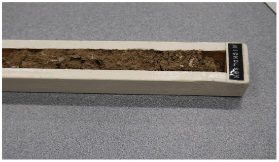
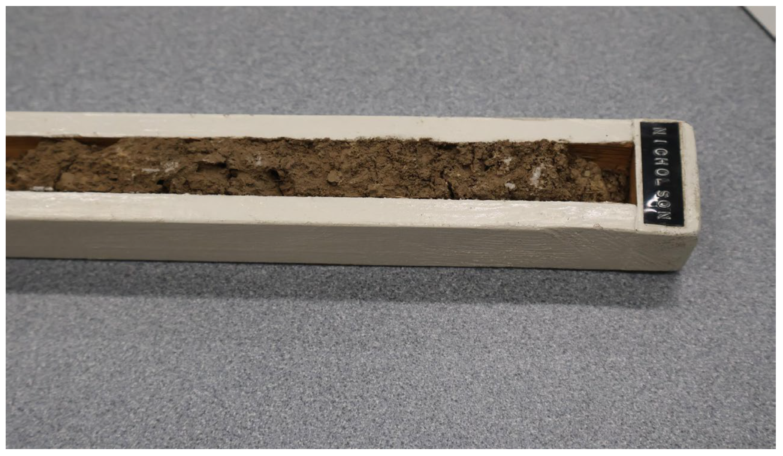
A preserved monolith of the Nicholson soil series was used in this study. The studied monolith is classified as a fine silty, mixed, active, mesic Oxyaquic Fragiudalf [48]. The outer frame dimensions were 3.7 cm in width, 2.5 cm in depth, and 109.5 cm in height. For imaging, the monolith was placed on a textured table alongside 26 printed reference targets to assist with image alignment, and a tape measure was used to provide scale (Figure 1).
Figure 1.
Image of the studied Nicholson soil series monolith.
4.2.1. Imaging Setup
LED overhead lights and a mobile incandescent spotlight were both used to evaluate the effects of controlled lighting variation on the model produced (Table 4). For each experiment, between 25 and 100 high-resolution images were captured using a Canon EOS R50 mirrorless camera (Canon Inc., Tokyo, Japan) equipped with a 24.2-megapixel APS-C CMOS sensor and a DIGIC X image processor or an iPhone 15 Pro (Apple Inc., Cupertino, CA, USA) equipped with the 48-megapixel main camera (24 mm, f/1.78 aperture) and a second-generation sensor-shift optical image stabilization system.
Table 4.
Experimental design layout for photo collection using varying photogrammetry methods, including lighting conditions, camera distance, photo count, and imaging tools.
Agisoft Metashape and Scaniverse were selected in this case study for their accessibility and capability to generate high-quality 3D models. Agisoft produced the highest quality 3D model of the software tested. Scaniverse also produced high-quality models, was at no cost to start building some models and is available on mobile devices. Its mobile platform eliminates the need for a single-lens camera or other specialized camera equipment, making it a more accessible option for users without dedicated imaging tools. Comparing the outputs from these applications allowed for evaluation of differences in model quality while also considering accessibility and ease of use.
Using the Align Photos function in Agisoft Metashape, selected images were imported into the program and reconfigured for construction as 3D models. The Align Photos function was used with the following settings: highest accuracy, generic pre-selection, and adaptive camera model fitting enabled. Key point and tie point limits were set to 60,000 and 40,000. Tie points are one of the metrics for determining the quality of 3D geometry reconstructions because they represent common features identified across multiple images. The alignment process was enhanced in scenarios with higher tie points but was typically completed within 30 s, resulting in a sparse point cloud. The bounding box was manually adjusted to fit the shape of the soil monolith.
Next, general and advanced settings within the Build Model function of Agisoft Metashape were adjusted to generate a skeletal outline of the model’s structure and shape, also known as a 3D mesh. General settings include source dataset to ‘Depth Maps’, surface type set to ‘Arbitrary (3D),’ quality set to ‘Ultra High,’ and face count set to ‘High,’ where face count determines the number of polygonal faces in the mesh, influencing the level of detail and overall resolution of the model. Advanced settings were applied for all models, including interpolation enabled, depth filtering set to Mild, and vertex color calculation enabled. The Close Holes tool was applied to fill any gaps in the mesh, and the Free-Form Selection tool was employed to remove extraneous parts of the mesh, such as the table surface beneath the monolith.
Once the mesh was finalized, surface texture and color were added to the model using default general settings within the Build Texture function. The ghosting filter and hole-filling tools were enabled under the advanced settings. Final models were cleaned and refined to improve visual clarity and presentation quality, ensuring accurate representation of soil features.
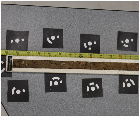
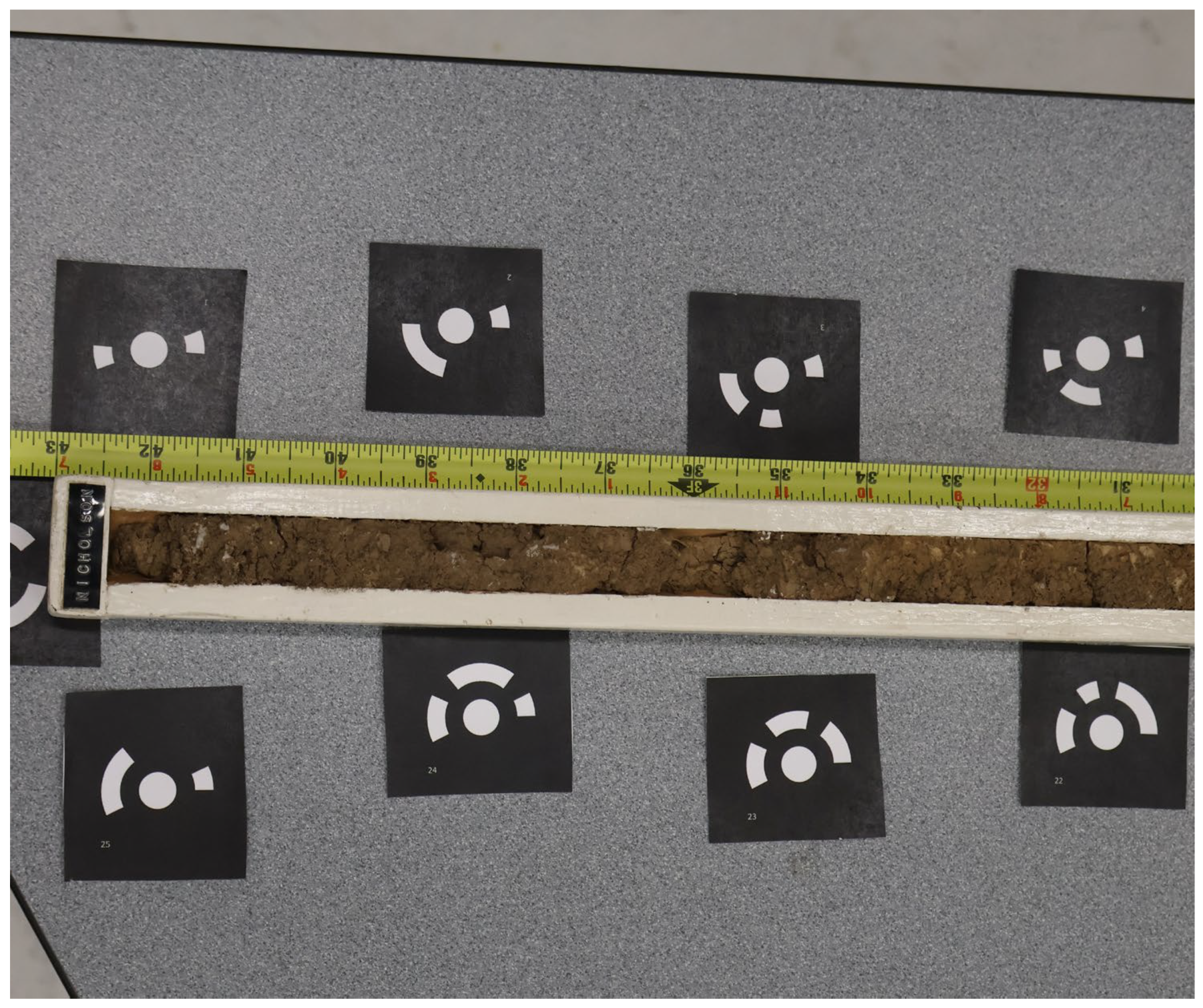
In close-range photogrammetry, accurate feature matching can remain challenging in soils with weak structural development, such as the soil monolith used in this study. Therefore, the use of coded reference targets can be beneficial as they provide distinct points across multiple images to support photo alignment. Coded reference targets were placed around the soil monolith to improve image alignment and feature matching during the photo alignment process (Figure 2). These targets provided distinct reference features that improved feature matching and image alignment across photographs, especially where the table/soil surface lacked defining features during close-range photogrammetry.
Figure 2.
Representative raw image of a soil monolith showing coded reference targets, a measurement scale, and the textured tabletop surface used during image acquisition.
4.2.2. Scaniverse Workflow and Implementation
Scaniverse is a mobile-based 3D scanning application developed by Toolbox AI (Niantic, Inc.) that offers fast Gaussian splatting and meshing techniques. The application offers a practical and low-cost approach for 3D model development using consumer mobile devices, making accessible for educational and research applications. Scaniverse includes multiple scanning modes based on object size, including Small Object, Medium Object, Large Object/Area. Available processing option include Speed, which uses Light Detection and Ranging (LiDAR) for rapid model generation (10 mm resolution); Area, which is optimized for scanning rooms and larger spaces using LiDAR data (5 mm resolution); and Detail, which employs photogrammetric reconstruction to capture fine surface texture and geometric detail.
For this case study, scans were completed using the Small Object mode and processed under detail settings to maximize texture fidelity and surface resolution. Data collection was performed using a photography studio for an ideal photogrammetry setting and through the use of video processing rather than images. Upon completing the scan, the model was exported as a mesh (Table 2) and imported into Agisoft Metashape for statistical analysis.
4.2.3. Soil Color Across Depths
Soil color accuracy of 3D models of the soil monolith was evaluated using a custom Python program (version 3.13.14) developed with OpenCV (version 4.11.0) and NumPy (version 2.2.6) libraries. Screenshots of each experiment’s 3D soil monolith model were uploaded into the program, and areas within each soil depth interval were manually selected with point and click. For each selected location, the program used a 10 × 10 pixel neighborhood surrounding each selected point. The RGB values from the selected area were averaged to reduce the effects of small color variations in the soil at each depth interval. The averaged RGB values were converted to HSV (Hue, Saturation, Value) and CIELAB (Commission Internationale de l’Éclairage Lightness [L], green-to-red [a], and blue-to-yellow [b]) color spaces and subsequently used to estimate corresponding Munsell hue, value, and chroma attributes. Estimated Munsell color parameters were recorded for each depth interval across all experiments. To evaluate color reproduction accuracy, the estimated Munsell values were compared with the soil color descriptions and reference Munsell color values reported for the corresponding horizons on the Official Soil Series Descriptions website (https://soilseries.sc.egov.usda.gov/osdname.aspx, access on 3 March 2026). Agreement between estimated and reference values was used as an indicator of the extent to which the 3D models preserved the color characteristics of the original soil monolith. Interactive 3D soil monolith models representing all eight image-acquisition experiments were made publicly available through a Sketchfab (Sketchfab, Inc., New York, NY, USA) collection. In addition, the Python code used for image-based color sampling and color metric extraction has been deposited in a public GitHub (GitHub, Inc., San Francisco, CA, USA) repository. Details regarding access to the Sketchfab models and GitHub repository are provided in the Data Availability Statement.
4.3. Results and Discussion
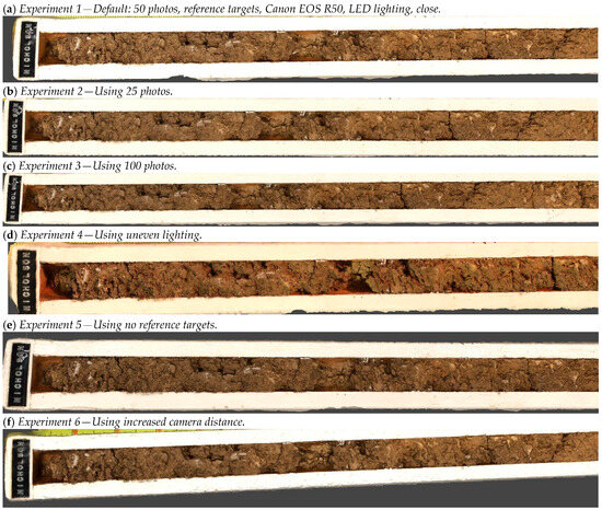
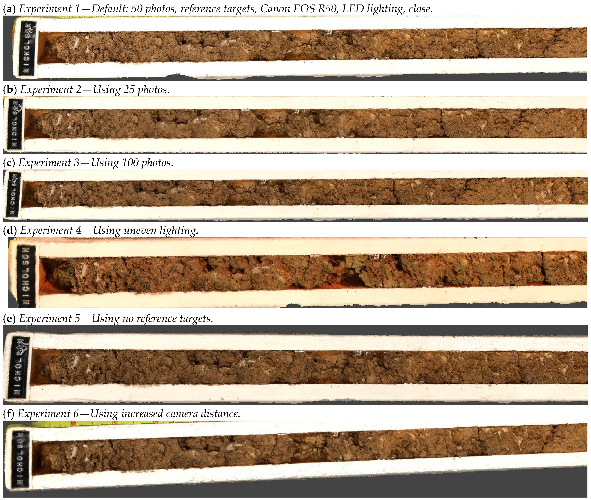
The impact of variations in lighting strength and source on the quality of the output model was evaluated using tie point data available after the image alignment process was completed (Experiments 1 and 4 in Table 5; Figure 3a,d). Based on model statistics, the LED-illuminated models using a 50-megapixel dataset yielded an average of 105,000 tie points, indicating strong feature matching. In contrast, uneven lighting from an incandescent spotlight introduced shadows that reduced the face count to 20,250,376 and tie point counts to 91,884 (average tie point multiplicity: 2.8). Although more indicators may help to determine the model quality accurately, the results suggest that shadows made it harder for the software to match features across images. These findings align with previous research emphasizing the importance of uniform lighting in photogrammetry [49].
Table 5.
Model statistics are used for evaluating the quality of a three-dimensional model.
Figure 3.
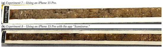
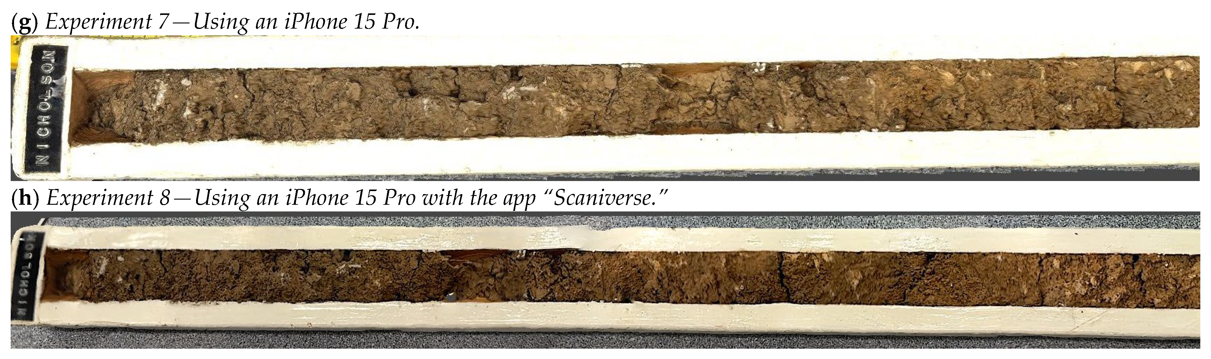
Screenshots of 3-dimensional soil monoliths showing experimental results with variations in setup.
A total of 26 coded targets were placed around soil monolith to serve as visual anchors for image alignment during photogrammetric reconstruction. Previous studies have reported that coded targets can enhance the identification of corresponding points among overlapping images and reconstruction accuracy, when objects contain few distinctive surface features [50,51]. However, the artificial reference targets were found to be unnecessary for this case study (Table 5). The scale, table texture, and soil texture provided enough distinctive features for Agisoft to detect and match tie points across images, facilitating feature matching and the image alignment process.
Camera distance and the imaging device also influenced reconstruction quality. Images captured at greater distances produced higher tie point counts, but the face count was greatly reduced, which resulted in blurred textures and less detailed meshes, as the software struggled to extract sufficient surface detail (Experiments 1 and 6 in Table 5; Figure 3a,f). High-resolution imaging with the Canon EOS R50 yielded models with higher face counts compared to those generated from iPhone 15 Pro images (Experiments 1 and 7 in Table 5; Figure 3a,g). While Scaniverse produced the lowest face count (141,091), it delivered the highest texture resolution (8K) compared to Agisoft’s 4K (Figure 3h) output, highlighting trade-offs between mesh complexity and texture quality. Except for the deepest soil horizon of the 3D model from Experiment 7, the 3D models generally preserved color statistics by depth, supporting their potential use in virtual soil judging contests (Table 6). Capturing images close to the object is necessary for detailed texture and color representation; however, excessively close images without mixing images from multiple distances (far and close) can hinder photogrammetric stitching, even with reference targets, as the software struggles to contextualize image positions within the monolith. While these results provide useful insights into key photogrammetry techniques, this study is limited by the use of a single Nicholson series soil monolith. As a result, the proposed guidelines for developing 3D soil monoliths for teaching purposes should not be generalized across all soil types or monolith structures, as model reconstruction outcomes may vary considerably. In addition, model quality was evaluated solely by using metrics available within Agisoft Metashape, including tie point count, face count, and texture resolution. Other photogrammetry software platforms may offer additional diagnostic metrics, such as reprojection error, color accuracy, and ground control point accuracy, that were not accessible in this study due to limitations of the free version of the software.
Table 6.
Comparison of soil color across depths using experimental three-dimensional models for evaluating color accuracy in soil judging applications.
The overall results indicate that high-quality 3D reconstructions of soil monoliths can be achieved when appropriate photogrammetry practices are applied. Based on observations, LED lighting combined with a dataset of at least 50 images—captured from a mix of close and moderate distances using a high-resolution camera—produces the most detailed models for soil monoliths of similar dimensions. Additional tools, such as a backdrop and a rotating platform/turntable, may further improve image consistency and model quality [52]. These recommendations provide practical guidance for creating accurate, visually detailed models that can enhance soil science education. Beyond soil monoliths, these methods can be adapted for other scientific specimens such as rocks, minerals, fossils, and biological mounts. For soil judging contests, high-resolution 3D models offer opportunities to transition from in-person formats to virtual formats, expanding participation and networking potential.
Exporting models is not available in the free version of Agisoft Metashape. However, this function became accessible during the trial, which allowed models to be exported using OBJ, FBX, STL, PLY, GLB, USDZ, and other file formats. Scaniverse, however, allowed 3D models to be exported in its free version using the same file formats. Thus, overall, the use of Scaniverse is the most economical and practical option for soil science educators for the development of 3D soil monoliths.
The case study presented in this paper provides an introductory framework for the accessible creation of 3D models for educators and researchers with limited backgrounds in computer science or 3D modeling. The findings demonstrate multiple factors that could potentially influence model quality and clarity. Factors include, image resolution and completeness, uniform lighting, use of reference targets, and application setting. Results from the case study also suggest that Scaniverse is one of the most effective tools for implementing XR-based educational resources into soil science curricula without requiring multiple software packages or extensive prior expertise in 3D reconstruction and visualization (Table 3 and Table 6). Collectively, these findings highlight practical considerations for developing high-quality digital soil representations and provide a foundation for the broader adoption of 3D and XR technologies in soil science education, research, and outreach.
5. Conclusions
Three-dimensional (3D) visualization tools have received increasing attention as potential resources for STEM education; however, practical examples and implementation workflows for soil science education remain limited. This study reviewed currently available technologies relevant to soil science and presented a case study demonstrating the development and evaluation of 3D soil monolith models using photogrammetry and mobile-based scanning approaches. The objective was not to assess educational outcomes directly, but rather to provide soil science educators, researchers, and students with an accessible method for creating digital soil representations using commercially available and low-cost technologies.
The case study demonstrated that high-quality 3D soil monolith reconstructions can be made using a high-resolution camera under uniform LED lighting conditions, with approximately 50 or more overlapping images collected from close-range distances (30–50 cm) around the object (i.e., soil monolith) with a textured tabletop or possibly reference targets. Under these conditions, the resulting models exhibited greater geometric detail, improved texture quality, and soil color characteristics that closely matched the Munsell color ranges reported in the official soil series description. Reliable image alignment and reconstruction were achieved using the natural features provided by the soil monolith, measurement scale, and textured tabletop surface, although additional reference targets may be beneficial for objects with fewer distinctive visual features. It should be noted that the optimal imaging configuration identified in this study was based on a single soil monolith and may vary depending on monolith dimensions, soil morphology, surface characteristics, and imaging conditions.
Among the approaches evaluated, Scaniverse provided a particularly accessible solution for producing complete 3D soil monolith models using a smartphone without requiring specialized cameras, extensive photogrammetry expertise, or multiple software packages. These characteristics make Scaniverse a practical entry point for educators and students interested in incorporating 3D modeling into soil science curricula.
The results demonstrate the feasibility of developing educational 3D soil monolith models using accessible technologies, but future research should investigate how XR technologies and digital soil monoliths influence student engagement, knowledge acquisition, and participation in activities such as soil judging contests. More broadly, the workflow presented here may support the creation of digital collections of soils and other natural science specimens while lowering barriers to the adoption of interactive 3D visualization technologies in education, research, and outreach.
Author Contributions
Conceptualization, K.M.; methodology, C.M.P., K.M., J.C. and H.S.; software, J.C.; validation, K.M.; formal analysis, J.C.; investigation, C.M.P., K.M. and J.C.; resources, K.M. and D.H.M.; data curation, K.M. and J.C.; writing—original draft preparation, C.M.P., K.M. and J.C.; writing—review and editing, T.K., C.S., D.H.M., Y.T. and L.E.B.; visualization, J.C.; supervision, K.M.; project administration, K.M.; funding acquisition, K.M., C.S. and L.E.B. All authors have read and agreed to the published version of the manuscript.
Funding
Katsutoshi Mizuta reports that financial support was provided by the National Institute of Food and Agriculture. Katsutoshi Mizuta reports that financial support, administrative support, and equipment, drugs, or supplies were provided by the University of Kentucky. L.E. Babcock reports that financial support was provided by the U.S. Department of the Interior. C. Shepard reports that financial support was provided by the National Institute of Food and Agriculture. C. Shepard reports that financial support was provided by the National Science Foundation. C., Pierson reports that equipment, drugs, or supplies were provided by Ohio Wesleyan University. Katsutoshi Mizuta reports that equipment, drugs, or supplies were provided by the University of Kentucky College of Fine Arts. If there are other authors, they declare that they have no known competing financial interests or personal relationships that could have appeared to influence the work reported in this paper. This research was funded by the National Institute of Food and Agriculture (Multistate Project S1090) Program under (7008110) and by the University of Kentucky Office of the Provost AI/ML Hub IMPACT Award, both awarded to K. Mizuta, as well as by the Save America’s Treasures Program, administered by the National Park Service, U.S. Department of the Interior under Grant Number P25AP01904-00, awarded to L. E. Babcock. Any opinions, findings, and conclusions or recommendations expressed in this material are those of the authors and do not necessarily reflect the views of the Department of the Interior.
Data Availability Statement
The interactive 3D soil monolith models generated under the eight experimental image-acquisition settings are publicly available through Sketchfab at [https://sketchfab.com/toshi.m] (accessed on 16 September 2026). The Jupyter notebook used to sample image regions and calculate RGB, HSV, and CIELAB-derived color metrics is available through GitHub at [https://github.com/toshimzt/soil-monolith-color-analysis] (accessed on 16 September 2026). Original image data will be made available upon reasonable request.
Acknowledgments
The authors thank John Kriger and Nathan Rowley of Ohio Wesleyan University for providing materials and support during the preliminary stages of model development. The authors also thank Ross E. Binkley for assistance with preliminary image data collection. In addition, the authors express their sincere appreciation to Carey Gough, Paula C. Tackett, Forest J. Kelley, Chad Eby, and the School of Art and Visual Studies at the University of Kentucky for providing access to photography studio facilities used for image data collection. During the preparation of this manuscript, the authors used GPT 5 (OpenAI) in Copilot (2.20260623.37.0) for the purposes of proofreading. The authors have reviewed and edited the output and take full responsibility for the content of this publication.
Conflicts of Interest
The authors declare no conflicts of interest.
Abbreviations
The following abbreviations are used in this manuscript:
| AR | Augmented reality |
| LiDAR | Light detection and ranging |
| 3D | Three-dimensional |
| XR | Extended reality |
| VR | Virtual reality |
References
- Friedrichsen, C.N.; Mizuta, K.; Wulfhorst, J.D. Advancing the Intersection of Soil and Well-Being Systems Science. Soil Secur. 2022, 6, 100036. [Google Scholar] [CrossRef] [Scilit]
- Brevik, E.; Muggler, C.C.; Field, D.; Hannam, J.; Uchida, Y. Soil Science Education—A Multi-national Look at Current Perspectives. Nat. Sci. Educ. 2022, 51, e20077. [Google Scholar] [CrossRef] [Scilit]
- Margenot, A.J.; Alldritt, K.; Southard, S.; O’Geen, A. Integrating Soil Science into Primary School Curricula: Students Promote Soil Science Education with Dig It! The Secrets of Soil. Soil Sci. Soc. Am. J. 2016, 80, 831–838. [Google Scholar] [CrossRef] [Scilit]
- Richer-de-Forges, A.C.; Lowe, D.J.; Minasny, B.; Adamo, P.; Amato, M.; Ceddia, M.B.; dos Anjos, L.H.C.; Chang, S.X.; Chen, S.; Chen, Z.-S.; et al. Chapter Five—A Review of the World’s Soil Museums and Exhibitions. In Advances in Agronomy; Sparks, D.L., Ed.; Academic Press: Cambridge, MA, USA, 2021; Volume 166, pp. 277–304. [Google Scholar]
- Villa, A.; Fahlbeck, E.; Barron, J. Assessment of Soil Science in European Higher Education to Meet Growing Soil Awareness Needs. Eur. J. Soil Sci. 2025, 76, e70112. [Google Scholar] [CrossRef] [Scilit]
- Brevik, E.C.; Dolliver, H.; Edinger-Marshall, S.; Itkin, D.; Johnson-Maynard, J.; Liles, G.; Mbila, M.; Moorberg, C.; Sanchez-de Leon, Y.; Steffan, J.J.; et al. Undergraduate Degrees That Train Students for Soil Science Careers at Universities in the USA and Its Territories. Soil Sci. Soc. Am. J. 2020, 84, 1797–1807. [Google Scholar] [CrossRef] [Scilit]
- Diochon, A.; Basiliko, N.; Yates, T.; Olson, E.; Masse, J.; Amiro, B.; Kumaragamage, D. Profiling Undergraduate Soil Science Education in Canada: Status and Projected Trends. Can. J. Soil Sci. 2016, 97, 122–132. [Google Scholar] [CrossRef] [Scilit]
- Baveye, P.; Allaire, S.; Tandarich, J.; Bryant, R. Whither Goes Soil Science in the United States and Canada? Soil Sci. 2006, 171, 501–518. [Google Scholar] [CrossRef] [Scilit]
- Havlin, J.; Balster, N.; Chapman, S.; Ferris, D.; Thompson, T.; Smith, T. Trends in Soil Science Education and Employment. Soil Sci. Soc. Am. J. 2010, 74, 1429–1432. [Google Scholar] [CrossRef] [Scilit]
- Duffy, M.L.; Barnes, L.Y.; Wirz, C.D.; Ranganathan, M.; Freilich, M.A.; Freese, L.M.; Lalk, E.; Wilcots, J. Factors Influencing Underrepresented Geoscientists’ Decisions to Accept or Decline Faculty Job Offers in the US. Commun. Earth Environ. 2025, 6, 65. [Google Scholar] [CrossRef] [Scilit]
- Hartemink, A.E.; Balks, M.R.; Chen, Z.-S.; Drohan, P.; Field, D.J.; Krasilnikov, P.; Lowe, D.J.; Rabenhorst, M.; van Rees, K.; Schad, P.; et al. The Joy of Teaching Soil Science. Geoderma 2014, 217–218, 1–9. [Google Scholar] [CrossRef] [Scilit]
- Charzyński, P.; Urbańska, M.; Franco Capra, G.; Ganga, A.; Holmes, P.; Szulczewski, M.; Baatar, U.-O.; Boularbah, A.; Bresilla, B.; Cacovean, H.; et al. A Global Perspective on Soil Science Education at Third Educational Level; Knowledge, Practice, Skills and Challenges. Geoderma 2022, 425, 116053. [Google Scholar] [CrossRef] [Scilit]
- Drohan, P.J.; Havlin, J.L.; Megonigal, J.P.; Cheng, H.H. The “Dig It!” Smithsonian Soils Exhibition: Lessons Learned and Goals for the Future. Soil Sci. Soc. Am. J. 2010, 74, 697–705. [Google Scholar] [CrossRef] [Scilit]
- Dyer, M. Developing Middle School Youth’s Understanding of Soil Health through Supplementary Activities and the USDA “Soil Your Undies” Challenge; Virginia Tech: Blacksburg, VA, USA, 2024. [Google Scholar]
- Cerón-González, A.; Ng, H.; Ivelic-Saez, J.; Vega-Aguilar, A.; Agbor, D.T.; Pacci, S.; Glina, B. Securing the Future of Soil Science: Addressing Global Demographic Barriers to Engage Youth and Accelerate Early Careers. Geoderma 2025, 455, 117220. [Google Scholar] [CrossRef] [Scilit]
- Churchman, G.J. The Philosophical Status of Soil Science. Geoderma 2010, 157, 214–221. [Google Scholar] [CrossRef] [Scilit]
- Letey, J. The Study of Soil Structure—Science or Art. Aust. J. Soil Res. 1991, 29, 699–707. [Google Scholar] [CrossRef] [Scilit]
- Bhandari, A.B.; Chumbley, S.; Turner, B. Assessing Student and Coach Learning Experiences with Virtual Collegiate Soil Judging Contest during COVID-19 Pandemic. Educ. Sci. 2023, 13, 717. [Google Scholar] [CrossRef] [Scilit]
- Rees, G.L.; Johnson, D.K. Impact of a National Collegiate Soil Judging Competition on Student Learning and Attitudes. Nat. Sci. Educ. 2020, 49, e20007. [Google Scholar] [CrossRef] [Scilit]
- Al-Ismaily, S.; Kacimov, A.; Al-Mayhai, A.; Al-Busaidi, H.; Blackburn, D.; Al-Shukaili, A.; Al-Maktoumi, A. The “Soil Skills” Pedagogical Approach Conjugated with Soil Judging Contests. Span. J. Soil Sci. 2023, 13, 12081. [Google Scholar] [CrossRef] [Scilit]
- Field, D.J.; Koppi, A.J.; Jarrett, L.E.; Abbott, L.K.; Cattle, S.R.; Grant, C.D.; McBratney, A.B.; Menzies, N.W.; Weatherley, A.J. Soil Science Teaching Principles. Geoderma 2011, 167–168, 9–14. [Google Scholar] [CrossRef] [Scilit]
- Wise, R.C. Outdoor Versus Indoor Learning in Elementary School Science. Ph.D. Thesis, The Pennsylvania State University, University Park, PA, USA, 1970. [Google Scholar]
- Mooney, S.J. A Simple Group Work Approach for Effective Field Work: A Soil Sciences Case Study. J. Geosci. Educ. 2006, 54, 74–79. [Google Scholar] [CrossRef] [Scilit]
- Lawrie, R.; Enman, B. Using Monoliths to Communicate Soil Information. In Proceedings of the 19th World Congress of Soil Science: Soil Solutions for a Changing World; Gilkes, R.J., Prakongkep, N., Eds.; ASSSI: Brisbane, Australia, 2010. [Google Scholar]
- Nnah, M.; Ezekiel, P.; Okole, P. Soil Monoliths Collection for Soil Museum Establishment in Federal College of Education (Technical), Omoku, Rivers State, Nigeria. Int. J. Agric. Earth Sci. 2023, 9, 15–24. [Google Scholar] [CrossRef] [Scilit]
- Allaire, S.A.; Bochove, E.V. Collecting Large Soil Monoliths. Can. J. Soil Sci. 2006, 86, 885–896. [Google Scholar] [CrossRef] [Scilit]
- Owen, R.K.; Anderson, A.; Bhandari, A.; Clark, K.; Davis, M.; Dere, A.; Jelinski, N.; Moorberg, C.; Osterloh, K.; Presley, D.; et al. Evaluating Student Attitudes and Learning at Remote Collegiate Soil Judging Events. Nat. Sci. Educ. 2021, 50, e20065. [Google Scholar] [CrossRef] [Scilit]
- Whitman, T.; Tredinnick, R. Soil:Micro—A Free Data-Based Virtual Reality Experience of Soil at a Microbial Scale. Pedobiologia 2025, 110, 151039. [Google Scholar] [CrossRef] [Scilit]
- Krzic, M.; Strivelli, R.A.; Holmes, E.; Grand, S.; Dyanatkar, S.; Lavkulich, L.M.; Crowley, C. Virtual Soil Monoliths: Blending Traditional and Web-Based Educational Approaches. Nat. Sci. Educ. 2013, 42, 1–8. [Google Scholar] [CrossRef] [Scilit]
- Berryman, D.R. Augmented Reality: A Review. Med. Ref. Serv. Q. 2012, 31, 212–218. [Google Scholar] [CrossRef] [Scilit] [PubMed]
- Britannica Editors. Virtual Reality (VR). In Britannica 2026; Encyclopædia Britannica, Inc.: Chicago, IL, USA, 2026. [Google Scholar]
- Rokhsaritalemi, S.; Sadeghi-Niaraki, A.; Choi, S.-M. A Review on Mixed Reality: Current Trends, Challenges and Prospects. Appl. Sci. 2020, 10, 636. [Google Scholar] [CrossRef] [Scilit]
- Claydon, M. Alternative Realities: From Augmented Reality to Mobile Mixed Reality. Master’s Thesis, University of Tampere, Tampere, Finland, 2015. [Google Scholar]
- Pregowska, A.; Osial, M.; Gajda, A. What Will the Education of the Future Look like? How Have Metaverse and Extended Reality Affected the Higher Education Systems? Metaverse Basic Appl. Res. 2024, 3, 57. [Google Scholar] [CrossRef] [Scilit]
- Ricci, M.; Mosca, N.; Rafik, M.; Di Summa, M. How Extended Reality Is Shaping Smart Cities: A Systematic Literature Review. Appl. Sci. 2026, 16, 679. [Google Scholar] [CrossRef] [Scilit]
- Adriana Cárdenas-Robledo, L.; Hernández-Uribe, Ó.; Reta, C.; Antonio Cantoral-Ceballos, J. Extended Reality Applications in Industry 4.0.—A Systematic Literature Review. Telemat. Inform. 2022, 73, 101863. [Google Scholar] [CrossRef] [Scilit]
- Schulze, D.G.; Rahmani, S.R.; Minai, J.O.; Johnston, C.T.; Fulk-Bringman, S.S.; Scott, J.R.; Kong, N.N.; Li, Y.S.; Mashtare, M.L., Jr. Virtualizing Soil Science Field Trips. Nat. Sci. Educ. 2021, 50, e20046. [Google Scholar] [CrossRef] [Scilit]
- Lo, S.-C.; Tsai, H.-H. Design of 3D Virtual Reality in the Metaverse for Environmental Conservation Education Based on Cognitive Theory. Sensors 2022, 22, 8329. [Google Scholar] [CrossRef] [Scilit] [PubMed]
- Jacobs, W.; Eelkema, M.; Limburg, H.; Winterwerp, J.C. A New Radiometric Instrument for in Situ Measurements of Physical Sediment Properties. Mar. Freshw. Res. 2009, 60, 727–736. [Google Scholar] [CrossRef] [Scilit]
- Gilford, J.; Falconer, R.E.; Wade, R.; Scott-Brown, K.C. 3D Visualisation and Artistic Imagery to Enhance Interest in ‘Hidden Environments’—New Approaches to Soil Science. Eur. J. Eng. Educ. 2014, 39, 467–482. [Google Scholar] [CrossRef] [Scilit]
- Mchenry, K.; Bajcsy, P. An Overview of 3D Data Content, File Formats and Viewers. Natl. Cent. Supercomput. Appl. 2008, isda08-002, 1–21. [Google Scholar]
- Adobe A Guide to 3D File Types. Available online: https://www.adobe.com/products/substance3d/discover/3d-files-formats.html (accessed on 20 September 2025).
- Kelly, R.; Chakravorty, D. The 10 Most Popular 3D File Formats. All3DP. 2023. Available online: https://all3dp.com/2/most-common-3d-file-formats-model/ (accessed on 1 September 2025).
- Houston, B. glTF vs FBX: Which Format Should I Use? Available online: https://www.threekit.com/blog/gltf-vs-fbx-which-format-should-i-use (accessed on 1 September 2025).
- McClements, D.; Lichtig, A. STL vs. OBJ: What Are the Differences? Available online: https://www.xometry.com/resources/3d-printing/stl-vs-obj/ (accessed on 10 September 2025).
- Library of Congress Polygon File Format (PLY) Family. Available online: https://www.loc.gov/preservation/digital/formats/fdd/fdd000501.shtml (accessed on 28 June 2026).
- Schechter, S. What Is a USD File: 3D Collaboration & Storage Format|3D Cloud. Available online: https://3dcloud.com/usd-files/ (accessed on 28 June 2026).
- Soil Survey Staff USDA-NRCS Official Soil Series Description. Available online: https://soilseries.sc.egov.usda.gov/osdlist.aspx (accessed on 21 September 2025).
- Douglass, M.; Lin, S.; Chodoronek, M. The Application of 3D Photogrammetry for In-Field Documentation of Archaeological Features. Adv. Archaeol. Pract. 2015, 3, 136–152. [Google Scholar] [CrossRef] [Scilit]
- Maas, H.-G.; Hampel, U. Photogrammetric Techniques in Civil Engineering Material Testing and Structure Monitoring. Available online: https://www.ingentaconnect.com/content/asprs/pers/2006/00000072/00000001/art00003;jsessionid=fgealqsd4fopo.x-ic-live-02 (accessed on 28 June 2026).
- Zou, J.; Meng, L. Design of a New Coded Target with Large Coding Capacity for Close—Range Photogrammetry and Research on Recognition Algorithm. IEEE Access 2020, 8, 220285–220292. [Google Scholar] [CrossRef] [Scilit]
- Teamaa, S.H.; AL-Baghdadi, J.A.A.; Abd, F.M. Evaluating The Approaches of the 3D Models Generation of a Soil Surface: A Review Study. J. Tech. 2023, 5, 143–157. [Google Scholar] [CrossRef] [Scilit]

Disclaimer/Publisher’s Note: The statements, opinions and data contained in all publications are solely those of the individual author(s) and contributor(s) and not of MDPI and/or the editor(s). MDPI and/or the editor(s) disclaim responsibility for any injury to people or property resulting from any ideas, methods, instructions or products referred to in the content. |
© 2026 by the authors. Licensee MDPI, Basel, Switzerland. This article is an open access article distributed under the terms and conditions of the Creative Commons Attribution (CC BY) license.