Article

GIS-Based Sliding Surface Reconstruction for Rapid Landslide Volume Estimation

1
School of Transportation Engineering, Nanjing Tech University, Nanjing 211816, China
2
State Key Laboratory of Intelligent Construction and Healthy Operation and Maintenance of Deep Underground Engineering, Xuzhou 221116, China
*
Author to whom correspondence should be addressed.
Geosciences 2026, 16(5), 205; https://doi.org/10.3390/geosciences16050205

Submission received: 11 April 2026 / Revised: 19 May 2026 / Accepted: 20 May 2026 / Published: 21 May 2026
(This article belongs to the Section Natural Hazards)

Abstract

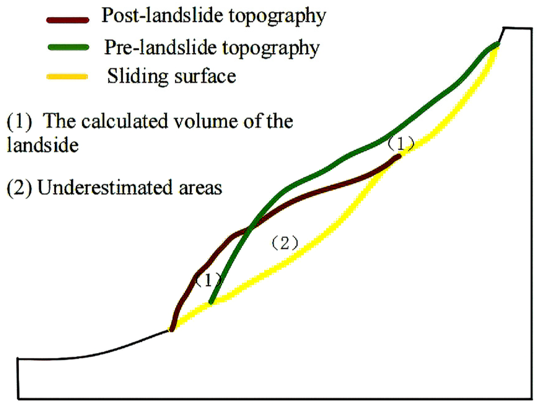
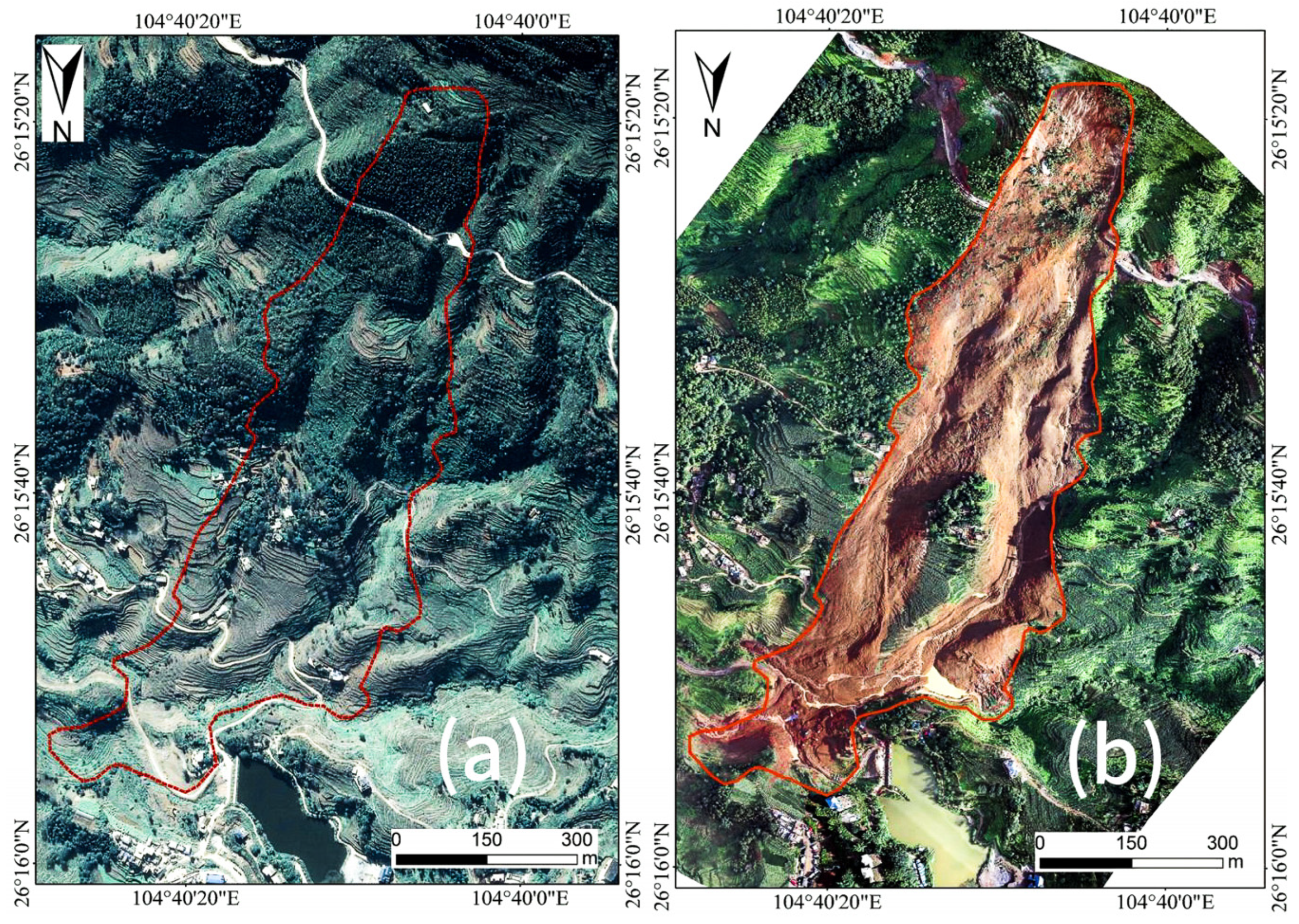
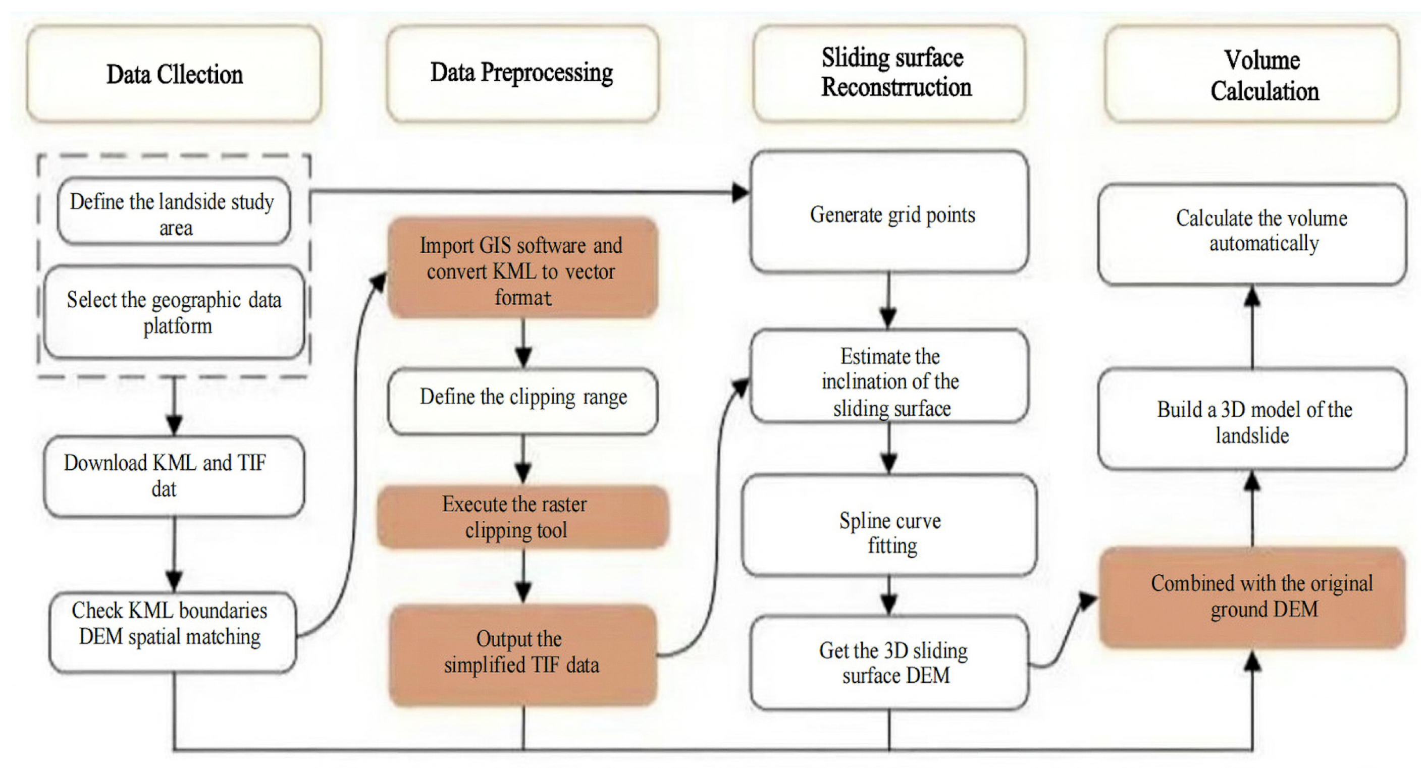
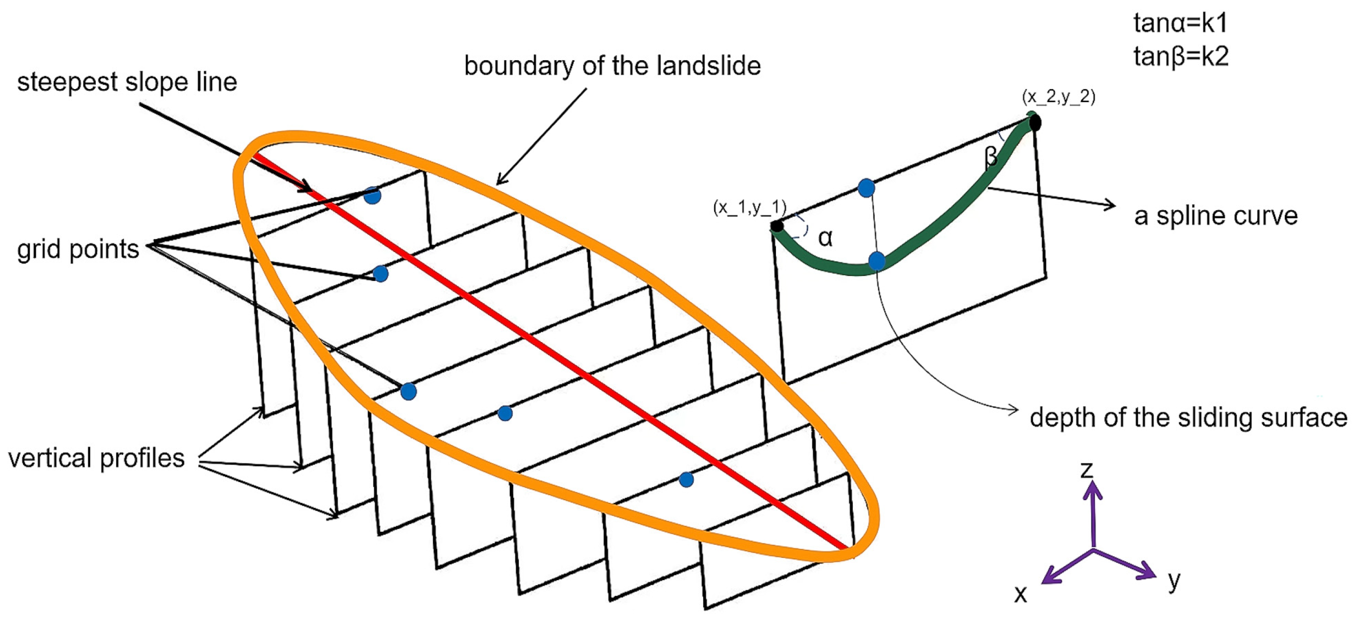
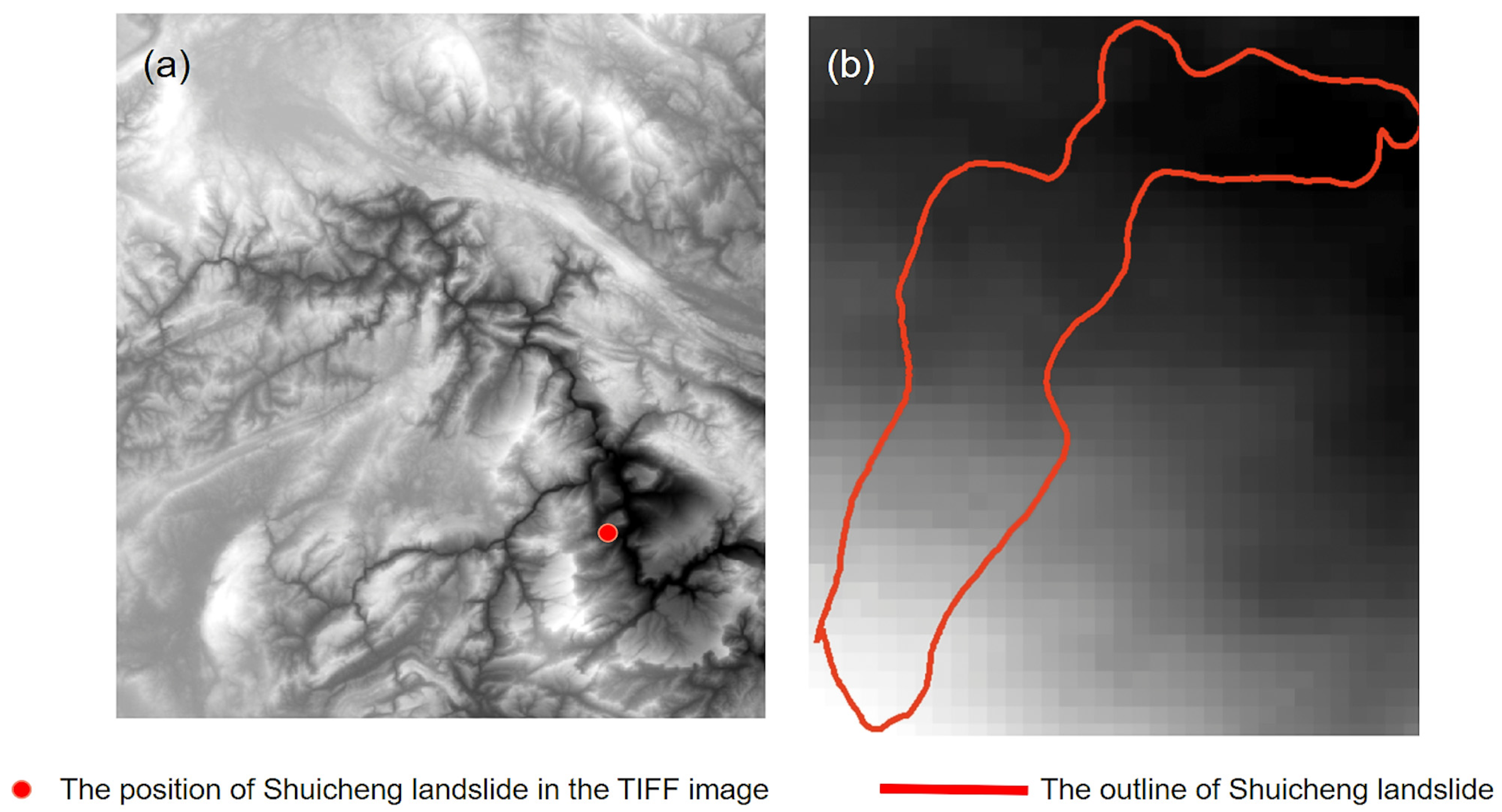
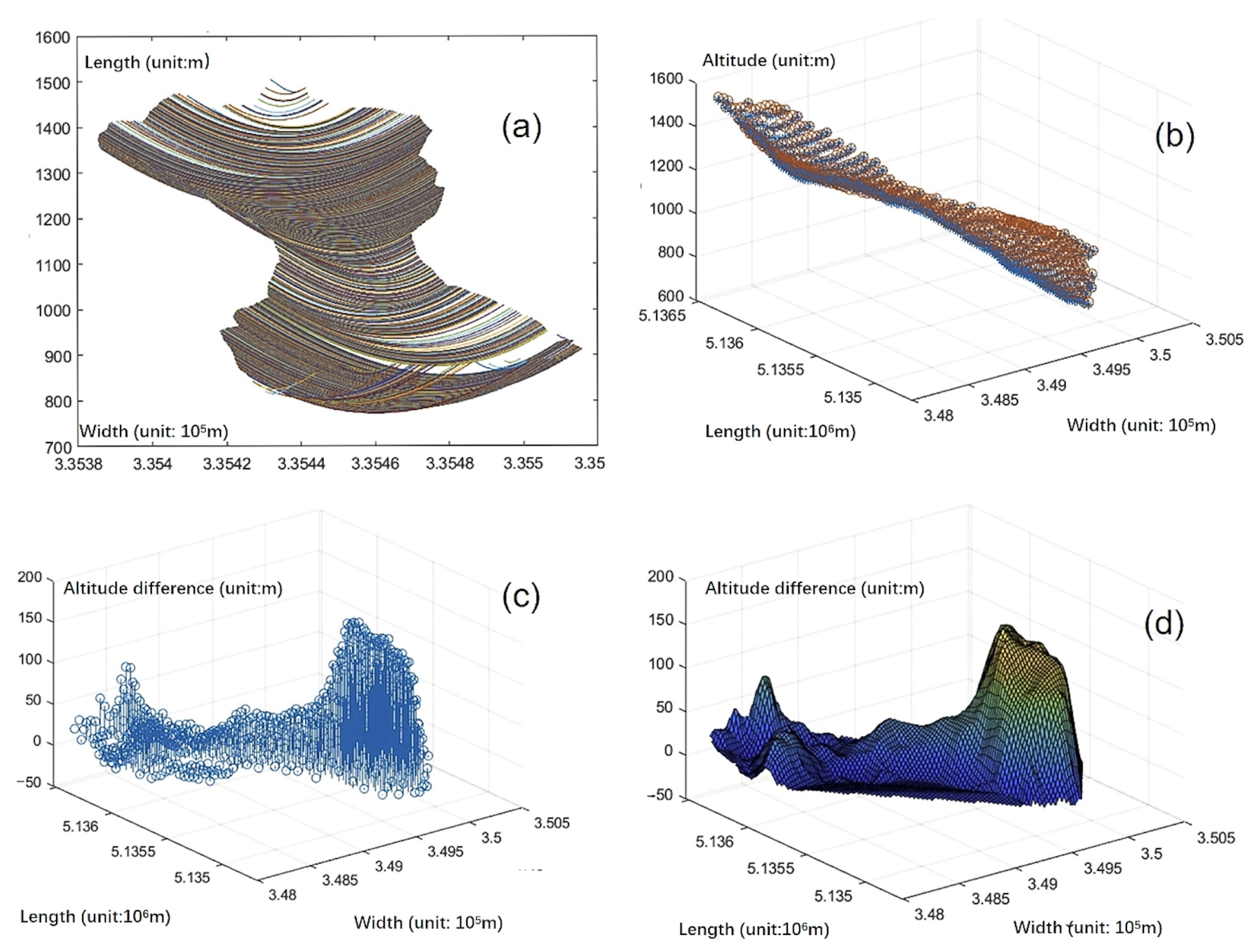
Landslides cause significant casualties and economic losses worldwide each year, creating an urgent demand for rapid and reliable volume estimation during emergency response. Conventional approaches often involve trade-offs among accuracy, efficiency, and data availability, particularly when pre-event topographic data are unavailable. This study proposes a novel GIS-based method for rapid landslide volume estimation through sliding surface reconstruction. By integrating open-source geospatial data (post-landslide Digital Elevation Model and landslide boundary KML) with spline interpolation and spatial analysis, the method reconstructs the subsurface sliding surface and calculates volume by comparing this surface with the post-landslide DEM. Applied to the 2019 Shuicheng landslide (Guizhou Province, China), the method yielded a volume estimate of 1.58 × 10⁶ m3, which deviates by only ~5% from official survey data. The entire workflow can be completed within approximately one hour, demonstrating high efficiency, low operational cost, and acceptable accuracy for rapid post-disaster assessment during the critical “golden 72 h”.
Keywords: landslide volume; sliding surface reconstruction; Digital Elevation Model (DEM); emergency response landslide volume; sliding surface reconstruction; Digital Elevation Model (DEM); emergency response