Skip Content
You are currently on the new version of our website. Access the old version .

Geosciences, Volume 13, Issue 6

2023 June - 36 articles

Cover Story: 
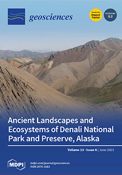
Alaska’s Denali National Park and Preserve contains a remarkable geologic record that spans much of the last billion years of Earth’s history. Sedimentary strata of the Cantwell basin represent approximately 10 million years of geologic time in the latest Cretaceous period and have been found to contain one of the most important assemblages of high-latitude dinosaur trackways in North America. In this study, we interpret the evolution of the ancient landscapes that were once home to these species from the sedimentary record. The resulting stratigraphic framework provides context for the emerging paleontological and paleoclimatic datasets from the Cantwell basin, and demonstrates links between basin evolution and regional geologic processes related to the tectonic assembly of southern Alaska. View this paper
  • Issues are regarded as officially published after their release is announced to the table of contents alert mailing list .
  • You may sign up for email alerts to receive table of contents of newly released issues.
  • PDF is the official format for papers published in both, html and pdf forms. To view the papers in pdf format, click on the "PDF Full-text" link, and use the free Adobe Reader to open them.

Articles (36)

  • Article
  • Open Access
11 Citations
2,717 Views
15 Pages

Concentration of Trace Elements in Cryoconites of Mountain and Polar Regions of the World

  • Evgeny Abakumov,
  • Rustam Tembotov,
  • Vyacheslav Polyakov,
  • Mikhail Ivanov,
  • Bulat Mavlyudov,
  • Ivan Kushnov,
  • Timur Nizamutdinov,
  • Rositsa Yaneva and
  • Miglena Zhiyanski

The surface of mountain glaciers is a place of accumulation of various biogenic organomineral and mineral compounds. As a result of intensive mass deglaciation of glaciers due to climate change and anthropogenic activity, this material can significan...

  • Article
  • Open Access
13 Citations
5,588 Views
22 Pages

Volumetric fracture intensity (P32) is a parameter that plays a major role in the mechanical and hydraulic behaviour of rock masses. While methods such as Ground Penetrating Radar (GPR) are available to map the 3D geometrical characteristics of the f...

  • Article
  • Open Access
3 Citations
2,340 Views
17 Pages

Micromorphological Characteristics of Soils in the Chernevaya Taiga (Western Siberia, Russia)

  • Evgeny Abakumov,
  • Timur Nizamutdinov,
  • Alla Lapidus,
  • Georgy Istigechev and
  • Sergey Loiko

The Chernevaya taiga is a unique ecosystem formed under the influence of a complex of geogenic and bioclimatic factors located in the foothill border of the southeastern part of Western Siberia. The combination of local climatic conditions and the co...

  • Article
  • Open Access
7 Citations
4,494 Views
12 Pages

Geological and Climatic Factors Affecting the Correlation between Electrical Resistivity and SPT N-Value in Sandy Soils of Phuket, Thailand

  • Avirut Puttiwongrak,
  • Solina Keo,
  • Sakanann Vann,
  • Tanwa Arpornthip,
  • Thongchai Suteerasak and
  • Piti Sukontasukkul

Understanding the technical properties of the subsurface soil is essential for carrying out any building project correctly. In sandy soils in Phuket, Thailand, a correlation between electrical resistivity and the SPT N-value should be established in...

  • Article
  • Open Access
10 Citations
4,289 Views
34 Pages

Water Erosion Risk Assessment for Conservation Planning in the East Hararghe Zone, Ethiopia

  • Gezahegn Weldu Woldemariam,
  • Kalid Hassen Yasin and
  • Anteneh Derribew Iguala

Water erosion is accelerating soil loss rates in the East Hararghe Zone due to inappropriate human activities and their complex and intertwined interactions with natural factors, particularly in sensitive agroecosystems that lack soil and water conse...

  • Article
  • Open Access
9 Citations
3,258 Views
16 Pages

Methane Concentration Forecasting Based on Sentinel-5P Products and Recurrent Neural Networks

  • Theofani Psomouli,
  • Ioannis Kansizoglou and
  • Antonios Gasteratos

The increase in the concentration of geological gas emissions in the atmosphere and particularly the increase of methane is considered by the majority of the scientific community as the main cause of global climate change. The main reasons that place...

  • Article
  • Open Access
10 Citations
2,672 Views
20 Pages

The aim of this study was to delimit potential rockfall propagation zones based on simulated 2 m resolution rockfall trajectories using Rockyfor3D for block volume scenarios ranging from 0.05–30 m3, with explicit inclusion of the barrier effect...

  • Article
  • Open Access
3,837 Views
41 Pages

The Cantwell Formation of the central Alaska Range provides a robust archive of high-latitude, Late Cretaceous depositional systems and paleo-floral/faunal assemblages. Our stratigraphic analysis defines two mappable members. The lower member (1500&n...

  • Article
  • Open Access
3 Citations
2,550 Views
12 Pages

Low-energy rockfall catch fences are designed to protect infrastructure such as railways and roads wherein the kinetic energy of falling rocks is less than 100 kJ. The typical design consists of a double-twisted steel wire mesh supported by ground po...

  • Article
  • Open Access
15 Citations
9,592 Views
34 Pages

Detecting and Predicting Archaeological Sites Using Remote Sensing and Machine Learning—Application to the Saruq Al-Hadid Site, Dubai, UAE

  • Haïfa Ben-Romdhane,
  • Diana Francis,
  • Charfeddine Cherif,
  • Kosmas Pavlopoulos,
  • Hosni Ghedira and
  • Steven Griffiths

In this paper, the feasibility of satellite remote sensing in detecting and predicting locations of buried objects in the archaeological site of Saruq Al-Hadid, United Arab Emirates (UAE) was investigated. Satellite-borne synthetic aperture radar (SA...

  • Article
  • Open Access
5 Citations
9,078 Views
20 Pages

Landmines and explosive remnants of war are still present in the Western Balkans and remain a deadly legacy of the hostilities at the end of the 20th century. Over the years, several incidents have occurred in Bosnia and Herzegovina, in Serbia, and i...

  • Article
  • Open Access
6 Citations
6,931 Views
17 Pages

Integrated Schumann Resonance Intensity as an Indicator of the Global Thunderstorm Activity

  • Masashi Hayakawa,
  • Yuriy P. Galuk and
  • Alexander P. Nickolaenko

This paper addresses the accuracy of estimates for the contemporary level of global thunderstorm activity found from the synchronous records of integrated Schumann resonance (SR) intensity at two high-latitude observatories in the Northern and Southe...

  • Article
  • Open Access
2 Citations
2,325 Views
19 Pages

In the Willcox Groundwater Basin (WGB), increasing rates of agricultural groundwater withdrawal have led to significant regional groundwater level decline, threatening the basin’s long-term water resource security. Updated characterization of t...

  • Article
  • Open Access
3,080 Views
20 Pages

Characterization of Gold of the Murcielago Fluvial Placer (Central Honduras) and Its Possible Primary Sources

  • Sabrina Nazzareni,
  • Simona Alunno,
  • Federica Zaccarini,
  • Michele Mattioli,
  • Alessandro Murroni,
  • Alessandro Di Michele and
  • Alberto Renzulli

The Murcielago gold placer is located in the Lepaguare Valley, Olancho Department (Central Honduras). The placer mineralogy includes silicates (quartz, garnets, amphibole, Ca-pyroxene, micas, epidote, and tourmaline); calcite; and in the heavy fracti...

  • Article
  • Open Access
1 Citations
2,242 Views
16 Pages

This paper reports the results of dynamic centrifuge tests carried out on sandy models alternatively equipped with vertical or horizontal drains. The main aim of the experimentation was to investigate the use of horizontal drains to mitigate the liqu...

  • Article
  • Open Access
4 Citations
2,167 Views
20 Pages

Today, concepts within the Global Geodetic Observing System (GGOS) aim a Terrestrial Reference System (TRS) with 1 mm accuracy and long-term stability of 0.1 mm/year. GETRIS (Geodesy and Time Reference In Space) is a concept that aims to realize a re...

  • Review
  • Open Access
14 Citations
13,561 Views
38 Pages

Direct shear (DS) is a common geotechnical laboratory test used to determine strength and deformation properties of rock discontinuities, such as normal and shear stiffness, peak and residual shear strength, and dilation. These are used as inputs for...

  • Article
  • Open Access
5 Citations
5,753 Views
34 Pages

Large Earthquakes in Subduction Zones around the Polar Regions as a Possible Reason for Rapid Climate Warming in the Arctic and Glacier Collapse in West Antarctica

  • Leopold I. Lobkovsky,
  • Alexey A. Baranov,
  • Igor A. Garagash,
  • Mukamay M. Ramazanov,
  • Irina S. Vladimirova,
  • Yurii V. Gabsatarov,
  • Dmitry A. Alekseev and
  • Igor P. Semiletov

A correlation is observed between changes in the level of Earth’s seismic activity and increments of the atmospheric methane concentration over the past 40 years. Trigger mechanisms are proposed for methane emissions and glacier collapse in pol...

  • Article
  • Open Access
3 Citations
2,434 Views
25 Pages

One of the most extensively studied topics in dozens of studies is the alteration process of ilmenite, the formation of leucoxene, and the presence of some impurity oxides: SiO2 and Al2O3. The altered Egyptian black sand ilmenite grains of relatively...

  • Article
  • Open Access
9 Citations
2,027 Views
14 Pages

Field measurements in subduction regions have revealed the presence of non-seismic pre-earthquake signals such as electromagnetic or acoustic emission, gas liberation, changes in Earth’s surface temperature, changes at the ionospheric level, or...

  • Article
  • Open Access
3 Citations
2,953 Views
17 Pages

Geochemical Behavior of Lanthanides and Actinides in an Old Uranium Mine, Portugal

  • Andrés Cardenas,
  • Maria I. Dias,
  • Catarina Diamantino,
  • Edgar Carvalho,
  • Dulce Russo and
  • Rosa Marques

New insights about the geochemical behavior of actinides and lanthanides in an old uranium mine are provided for the first time in this work. Fifteen samples (water, soil, and sediments) were collected inside and outside the Quinta do Bispo old mine...

  • Article
  • Open Access
4 Citations
1,970 Views
21 Pages

The values of the physical–mechanical properties of any soil are affected by uncertainties both due to experimental measurements and the impossibility of knowing them, in detail, at every point of the spatial domain. Accordingly, this work focu...

  • Article
  • Open Access
9 Citations
2,132 Views
14 Pages

The Arctic zone of West Siberia (Yamal and Gydan peninsulas) is an area with continuous permafrost and tabular ground ice close to the surface, active thermodenudation, and related landforms: retrogressive thaw slumps (RTS); in Russian referred to as...

  • Article
  • Open Access
2 Citations
2,897 Views
13 Pages

Radionuclide Transport Simulations Supporting Proposed Borehole Waste Disposal in Israel

  • Katherine Carol Swager,
  • Suzanne Michelle Bourret,
  • Gilles Y. Bussod,
  • Noa Balaban,
  • Hakim Boukhalfa,
  • Ran Calvo,
  • Ofra Klein-BenDavid,
  • Dolan Lucero,
  • Itay J. Reznik and
  • Philip H. Stauffer
  • + 1 author

A scientific collaboration between the U.S. and Israel is underway to assess the suitability of a potential site for subsurface radioactive waste disposal in the Negev Desert, Israel. The Negev Desert has several favorable attributes for geologic dis...

  • Article
  • Open Access
8 Citations
6,235 Views
21 Pages

Sea Caves and Other Landforms of the Coastal Scenery on Gozo Island (Malta): Inventory and New Data on Their Formation

  • Stefano Furlani,
  • Fabrizio Antonioli,
  • Emanuele Colica,
  • Sebastiano D’Amico,
  • Stefano Devoto,
  • Pietro Grego and
  • Timmy Gambin

Sea caves are a type of cave formed primarily by the wave action of the sea. The coastal scenery of the Gozitan coast is very interesting in that sea caves and other coastal landforms, such as sea arches, develop at the sea level. We mapped seventy-n...

  • Article
  • Open Access
1 Citations
2,687 Views
20 Pages

Pliocene (?)—early Pleistocene shallow marine deposits, varying from gravel to sand to clay, characterize the southernmost sector of the Valdichiana Basin, between Orte and Città della Pieve, across Tuscany, Umbria and Latium (Central It...

  • Article
  • Open Access
8 Citations
2,510 Views
19 Pages

Analysis of Dispersivity in Marine Clays of Cartagena de Indias, Colombia

  • Cristian Acuña,
  • Juan Betancur,
  • Jair Arrieta Baldovino,
  • Guilliam Barboza and
  • Manuel Saba

This study assessed the dispersivity of soils extracted from the northern region of Cartagena de Indias (Colombia) using the pinhole test, crumb test, and chemical–microstructural analyses. Dispersive soils are susceptible to erosive phenomena...

  • Article
  • Open Access
6 Citations
4,435 Views
15 Pages

Honeycomb weathering is a common phenomenon found on various rock surfaces all around the world. However, honeycomb formation mechanisms are still poorly understood. In this study, we propose a model describing moisture transport within the sandstone...

  • Article
  • Open Access
8 Citations
6,548 Views
25 Pages

Factors Contributing to the Long-Term Sea Level Trends in the Iberian Peninsula and the Balearic and Canary Islands

  • Manuel Vargas-Yáñez,
  • Elena Tel,
  • Marta Marcos,
  • Francina Moya,
  • Enrique Ballesteros,
  • Cristina Alonso and
  • M. Carmen García-Martínez

We present an attempt to estimate the long-term changes in Relative Sea Level (RSL), in addition to the different factors contributing to such trends on a local and regional scale, using a statistical linear model. The time series analysis correspond...

  • Article
  • Open Access
4 Citations
2,791 Views
20 Pages

Cenozoic Clastic Deposits in the Thermaikos Basin in Northern Greece and Their Reservoir Potential

  • Georgios Makrodimitras,
  • Anastasios Nikitas,
  • Dimitrios Ktenas,
  • Angelos G. Maravelis,
  • Niki Marina Rokana,
  • Nikolaos Pasadakis,
  • Efthimios Tartaras and
  • Aristofanis Stefatos

The Epanomi gas field discovery during the 1980s at the eastern fringe of the Thermaikos Basin in Northern Greece proved the existence of an active petroleum system in the area. Seismic and drilling exploration programs in the area provide data to st...

  • Article
  • Open Access
2 Citations
1,883 Views
16 Pages

Paleoclimate studies of loess in China have focused mostly on the time series of a single borehole or profile. However, research on loess strata and regional paleoenvironmental patterns could facilitate a deeper understanding of loess as a paleoenvir...

  • Case Report
  • Open Access
1 Citations
2,066 Views
18 Pages

Geoscience disciplines play a pivotal role in the assessment of the conservation state of Cultural Heritage to orient the subsequent restoration interventions. In this report, we exemplify the potential of petrographic and thermographic analyses for...

  • Article
  • Open Access
4 Citations
2,770 Views
30 Pages

Deep Neural Networks for the Estimation of Masonry Structures Failures under Rockfalls

  • Olga Mavrouli,
  • Athanasia D. Skentou,
  • Josep Maria Carbonell,
  • Markos Z. Tsoukalas,
  • M. Amparo Núñez-Andrés and
  • Panagiotis G. Asteris

Although the principal aim of the rockfall management is to prevent rock boulders from reaching the buildings instead of the buildings resisting the boulder impacts, there usually exists a residual risk that has to be assessed, even when structural p...

  • Article
  • Open Access
2 Citations
2,406 Views
12 Pages

Due to their genesis, volcanic rocks present some singularities that make their geotechnical characteristics significantly different from other more common types of massifs, such as sedimentary and metamorphic rocks. The formation mechanisms of volca...

  • Article
  • Open Access
6 Citations
4,257 Views
22 Pages

The Portofino Conglomerate (Eastern Liguria, Northern Italy): Provenance, Age and Geodynamic Implications

  • Federico Mantovani,
  • Franco Marco Elter,
  • Enrico Pandeli,
  • Antonino Briguglio and
  • Michele Piazza

The Portofino Conglomerate (PC) cropping out in the Eastern Liguria is an approximately 500 m thick, very gently folded succession mainly composed of poorly bedded and mostly matrix-supported conglomerates. It stratigraphically rests on the Helmintho...

  • Article
  • Open Access
6 Citations
1,660 Views
15 Pages

Backstress Influence on the Formation Stress Field in Hydraulic Fracturing Experiments

  • Elena V. Novikova,
  • Mariia A. Trimonova,
  • Sergey B. Turuntaev,
  • Evgeny V. Zenchenko and
  • Petr E. Zenchenko

This work presents an analysis of data obtained through unique laboratory experiments on hydraulic fracturing. In the experiments, sufficiently large artificial samples were used to model a reservoir. Thus, it was possible to simulate several wells s...

Get Alerted

Add your email address to receive forthcoming issues of this journal.

XFacebookLinkedIn
Geosciences - ISSN 2076-3263