


Abstract
To address the complex influencing factors, divergent stakeholder demands, and the challenge of quantitative comparison in alignment selection for highway expansion and reconstruction, we systematically reviewed the relevant factors. These factors were classified into four categories—economy, technology, safety, and environment—and comprise 16 subfactors in total. The symmetry of the route selection process is disrupted by the varying priorities of different stakeholders, leading to asymmetric evaluations of the alternatives. Using the G30 Lianhuo Expressway Jingqing section expansion and reconstruction project as a case study, we applied the Analytic Hierarchy Process (AHP) combined with expert judgment to derive weights for each factor. The results indicate that environmental factors carry substantial weight, reflecting increased awareness of environmental protection in contemporary projects. We then developed a comparative model based on the Technique for Order Preference by Similarity to Ideal Solution (TOPSIS). Applying this model to alignment alternatives between the Jingjiadian and Huachacun sections indicates that Option 4 is the preferred alignment. Overall, the AHP–TOPSIS composite evaluation framework effectively integrates expert knowledge with objective quantitative analysis. It enables the scientific ranking of alternatives and provides decision support for alignment selection in mountainous highways and other linear engineering projects.
1. Introduction
With the vigorous implementation of national strategies such as the Western Development, the Belt and Road Initiative, and the new era’s “Transportation Power” strategy, the construction environment of highways has shifted from the plains of central and eastern China to mountainous regions. The complex and variable topography and harsh geological conditions of mountain areas, combined with the linear nature of highways, bring both positive economic impacts to the surrounding areas and potential ecological and social disruptions to local communities. In this context, the selection of highway routes has become increasingly complex and critical [1].
Currently, a large amount of research has been conducted on the influencing factors of route selection both domestically and internationally. Liu et al. [2] combined SBAS-InSAR (Small Baseline Subset Interferometric Synthetic Aperture Radar) technology to effectively identify potential landslide hazard zones along mountain roads, providing a scientific basis for accurate route selection in mountainous regions. Yuan et al. [3] conducted a systematic study based on the types and distribution patterns of debris flows and proposed corresponding route selection strategies. Li et al. [4] proposed a standard for the selection of horizontal alignments for desert highways based on the Fluent Eulerian multiphase model. Additionally, researchers have carried out extensive studies and engineering applications on natural disasters [5], environmentally sensitive areas [6], and carbon emissions [7].
Fuzzy set theory has been widely applied in decision-making models [8,9,10,11,12,13,14,15,16]. Recent studies demonstrate its applicability across a wide range of fields. Representative application domains include social science [17], differential equations [18], site selection [19], biomathematical modeling [20], manufacturing design [21], inventory planning [22], discrete-system modeling [23], arms-race modeling [24], and edge computing. In decision-making contexts, several approaches are widely used internationally, including the discrete element method [25], the SF-AHP (Spherical Fuzzy Analytic Hierarchy Process) [26], the Kano model [27], a simplified AHP (Analytic Hierarchy Process) variant [28,29], a hybrid fuzzy SWARA–COPRAS (Step-wise Weight Assessment Ratio Analysis–Complex Proportional Assessment) framework [30], and integrated AHP–COPRAS (Analytic Hierarchy Process Complex Proportional Assessment) and AHP–ARAS (Analytic Hierarchy Process Additive Ratio Assessment) methods [31]. In domestic studies, genetic algorithms [32], cloud models, and cumulative prospect theory [33] are commonly applied to route-selection problems.
Most of the above studies focus on specific engineering cases and have significant regional limitations. Furthermore, many studies concentrate on a single indicator or a few indicators, without considering all the influencing factors in mountainous highway route selection, making their conclusions less applicable. Additionally, many analysis methods rely heavily on expert judgment or theoretical research, which introduces considerable uncertainty and ambiguity in the decision-making process. Solely relying on expert opinions often obscures the complexity of systems composed of multiple factors, failing to integrate scientific decision-making with expert experience. In terms of decision-making models, the Analytic Hierarchy Process (AHP) has gained the widest application due to its ability to provide quantifiable results. For example, Wang et al. [34] applied AHP in the evaluation system for parking management levels, Jiang et al. [35] combined AHP and fuzzy comprehensive evaluation methods for the qualitative assessment of shield tunneling adaptability, and Tao et al. [36] used AHP to assess factors affecting the safety of the Internet of Vehicles, providing a more accurate reflection of the current risk situation in the context of vehicle networks.
To address the limitations of previous studies, this paper examines the entire construction process of mountainous highways and systematically develops a comprehensive evaluation system covering multiple dimensions of alignment selection factors. Furthermore, a scientific decision-making model for alignment selection is developed by integrating the Analytic Hierarchy Process (AHP) with the Technique for Order Preference by Similarity to Ideal Solution (TOPSIS) [37], thereby combining expert judgment with objective data. Finally, the proposed model is validated through a case study based on a route comparison from the G30 Lianhuo Expressway Jingqing-section expansion and reconstruction project. The paper is organized as follows: establishment of the evaluation system, development of the decision-making model, and empirical case analysis. The aim is to propose a method that integrates experiential knowledge with scientific decision-making for alignment selection in mountainous highways. This approach improves the systematic rigor of the alignment selection process and enhances the reliability of the resulting conclusions.
2. Influencing Factors for Mountainous Highway Route Selection
Mountainous regions are characterized by complex topography, highly variable microclimates, and the presence of unfavorable geological conditions, along with rich natural ecosystems. Moreover, land resources in these regions are limited, with residential buildings and farmland distributed in accordance with the terrain. Therefore, the alignment of highways in mountainous areas is influenced by numerous factors. During construction and operation, these factors can be categorized into four types: economic factors, technical factors, safety factors, and environmental factors.
2.1. Economic Factors
Thanks to the nation’s proactive fiscal policies, China’s high-grade highway network has experienced rapid development over the past 40 years. However, as the investment models in the highway sector evolve, the contradiction between low traffic volumes and the large investment scale of mountainous highways has become increasingly prominent. Stakeholders tend to favor routes with lower investment requirements, but such routes often exacerbate negative impacts on other influencing factors, creating an inherently challenging trade-off.
The lifecycle economic cost of mountainous highways primarily includes construction costs, operation costs, land acquisition costs, and housing demolition and relocation costs. Due to differences in investment and revenue models, the emphasis placed on each type of cost varies among stakeholders. Therefore, it is essential to evaluate the economic feasibility and investment return of route options.
2.2. Technical Factors
Technical factors encompass six main aspects: geometric alignment, construction difficulty of structures, impact on major control factors, geological conditions, construction schedule, and the difficulty of constructing temporary facilities.
Geometric alignment primarily involves the selection and combination of horizontal and vertical design parameters. The construction difficulty of structures, particularly major ones, significantly affects the investment scale and construction complexity. Major control factors include environmentally protected areas, cultural heritage sites, large industrial and mining enterprises, and densely populated residential areas, which determine the general alignment of the route. Geological conditions refer to the interaction between the route and unfavorable geological formations, which greatly influence project safety and costs. The construction schedule is a key concern for stakeholders and local governments, as it impacts project timelines and loan interest costs. Construction of temporary facilities involves challenges in selecting locations for temporary setups, indirectly increasing material transportation costs.
2.3. Safety Factors
Safety factors primarily include construction safety during the building phase, traffic safety during the operation phase, and the societal stability impacts brought about by the project. Highway construction inevitably affects local infrastructure, landscapes, residential life, and various resources. Therefore, route selection must involve detailed investigations, comprehensive social data collection, and consideration of socio-cultural aspects, such as ethnic characteristics and cultural heritage.
2.4. Environmental Factors
Environmental factors mainly involve groundwater, noise and vibration, and biodiversity. Mountainous regions are rich in water resources and host diverse ecosystems of wildlife and vegetation. As a linear infrastructure, highway construction inevitably impacts these resources to varying degrees.
Highway alignment selection in mountainous areas results from a dynamic balance among four key factors: economic, technical, safety, and environmental considerations. Achieving an overall optimal outcome requires integrating operational safety, ecological protection, and social stability while controlling investment levels and ensuring technical feasibility.
3. Weight Analysis of Route Selection Influencing Factors
The AHP is a decision-making method that decomposes elements related to decision-making into levels such as objectives, criteria, and alternatives, and then conducts both qualitative and quantitative analysis. The impact degree of each factor at each hierarchical level on the outcome is quantified. Using this method, the importance of influencing factors for route selection can be clearly and explicitly demonstrated, which is crucial for ensuring the scientificity and timeliness of decision-making.
3.1. Determining the Comparison Scale
The application of AHP to solve complex decision problems generally proceeds in three steps: first, a structured hierarchical model of the problem is established; second, preference analysis is conducted, the hierarchical weight coefficients are calculated, and pairwise comparisons are made; and third, a comprehensive analysis is carried out, followed by the calculation of the overall weight coefficients. The assignment criteria for the pairwise comparisons are listed in Table 1.
Table 1.
Relative Importance Scale.
3.2. Constructing the Comparison Judgment Matrix
A hierarchical structure model with upper-level elements as the benchmark for lower-level elements is created, and a judgment matrix D is constructed:
where represents the relative importance between elements and ; and , , …, represent the importance of each element in the lower-level compared to the goal. The comparison ratio is expressed as .
The eigenvalue problem is solved, and after normalization, the resulting values represent the ranking weights of the factors.
(1) Multiply the elements in each row of the judgment matrix [D] to obtain the product of the elements in each row, denoted as [Mi]:
(2) Compute the nth root of [Mi]:
(3) Normalize :
(4) The maximum eigenvalue is given by
3.3. Consistency Test of the Judgment Matrix
To ensure that the judgment results align more closely with actual engineering situations and to eliminate errors introduced by the personal knowledge and experience of the judgment matrix creator, a consistency test formula is established:
where represents the consistency index of the judgment matrix, and (as shown in Table 2) represents the average random consistency index.
Table 2.
Average Random Consistency Index.
4. Analysis of Influencing Factors in Highway Route Selection
To better illustrate the factors influencing highway route selection in mountainous areas, this study uses the G30 Lianhuo Expressway Jingqing section expansion project as an example. The project is located in Anding District, Dingxi City, and Yuzhong County, Lanzhou City, Gansu Province, situated in the Longxi Loess Plateau. The terrain is characterized by eroded and accumulated loess ridges, gullies, and erosional river valleys, with fragmented topography, dense distribution of loess landslides, collapses, and sinkholes. The overall topography slopes from south to north and belongs to the Yellow River basin. The total route length is 70.169 km, with bridges and tunnels accounting for 26.5% of the length. Along the route, there are multiple critical control points, including provincial-level cultural protection areas, the Lanzhou-Chongqing Railway, the Longhai Railway, the Baoji-Lanzhou High-Speed Rail, ultra-high voltage transmission lines (750 kV), densely populated urban areas, and dam-like embankments. This project exemplifies the fragile ecological environment and scarce corridor resources typical of highway construction in mountainous regions.
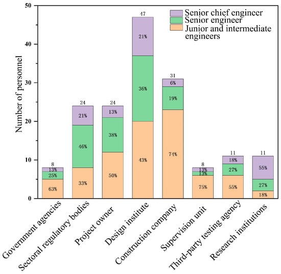
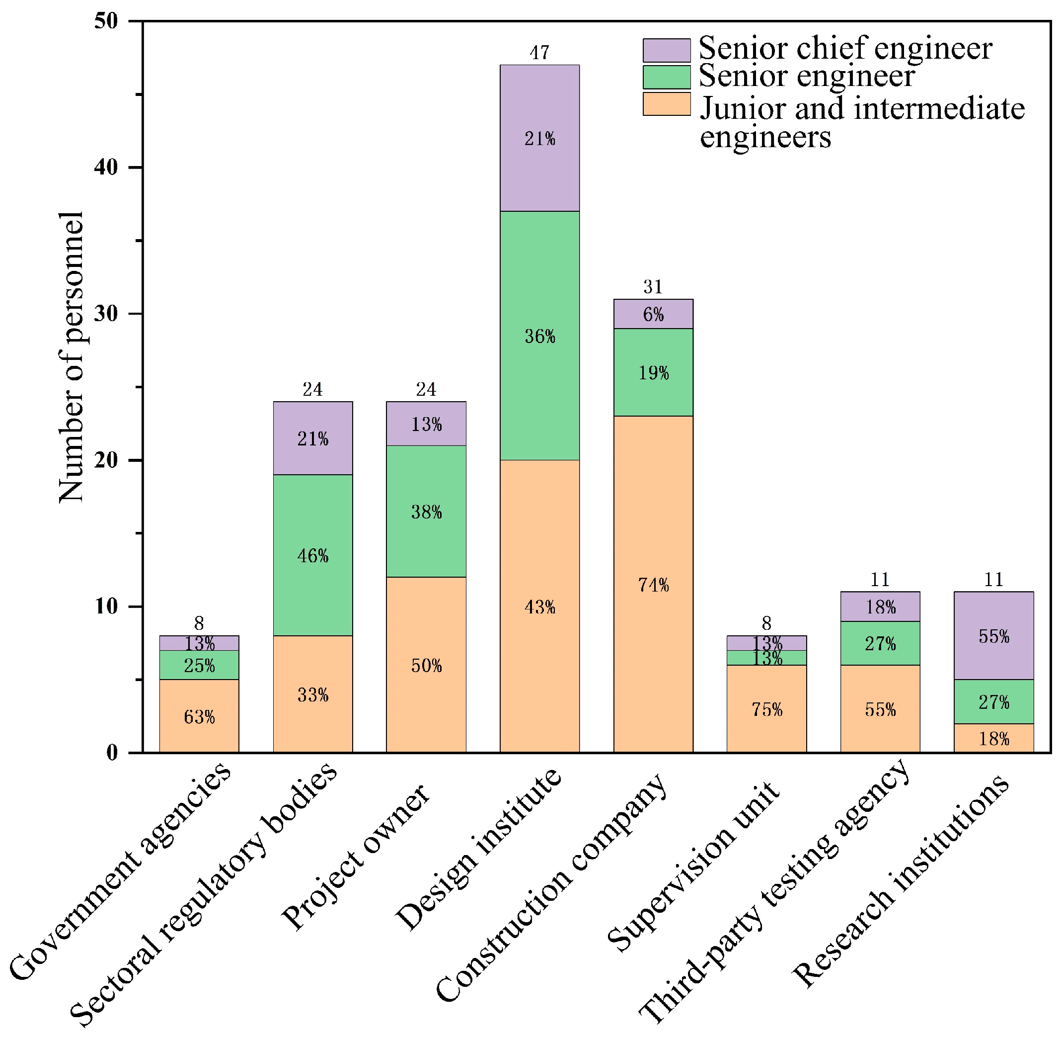
This study develops a systematic framework of influencing factors for alignment selection in mountainous highways. The procedure is summarized as follows: First, based on a review of domestic and international literature and the project team’s preliminary research, we initially identified more than 20 potential influencing factors across four dimensions: economic, technical, safety, and environmental. Second, factor selection employed expert questionnaires with quantitative scoring. We invited 164 experts from local government, industry regulators, project owners, design and construction firms, engineering consultants, supervision and testing agencies, and research institutions (expert composition is shown in Figure 1). Experts rated each factor’s importance on a five-point Likert scale (1 = very unimportant; 5 = very important). To ensure informed judgments, all experts received project background materials prior to scoring. After data collection, we computed each factor’s mean importance score and coefficient of variation (CV). We retained factors that met both criteria: mean score ≥ 4.0 and CV ≤ 0.25, to ensure statistical significance and expert consensus. Finally, applying these criteria, we selected the top 16 factors by importance and incorporated them into the evaluation system. The initial list also included factors such as climate adaptability, future traffic-demand uncertainty, and connectivity with existing transport networks. However, these factors received mean scores below the retention threshold (3.7, 3.5, and 3.8, respectively), and several exhibited higher CVs, indicating lower consensus or reduced relative importance in the present project context. Consequently, these factors were excluded from the final evaluation system. This procedure ensures that the selected factors are representative and that the selection process is transparent and repeatable.
Figure 1.
Composition of the Evaluation Expert Group.
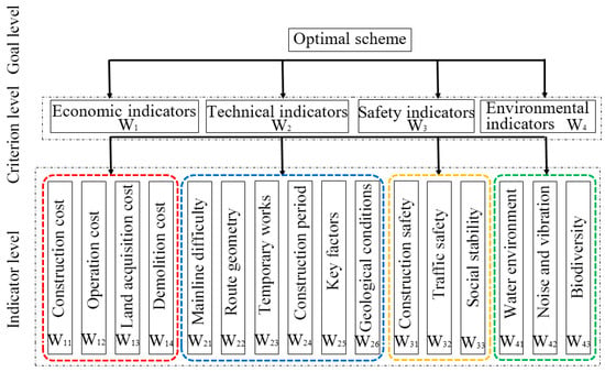
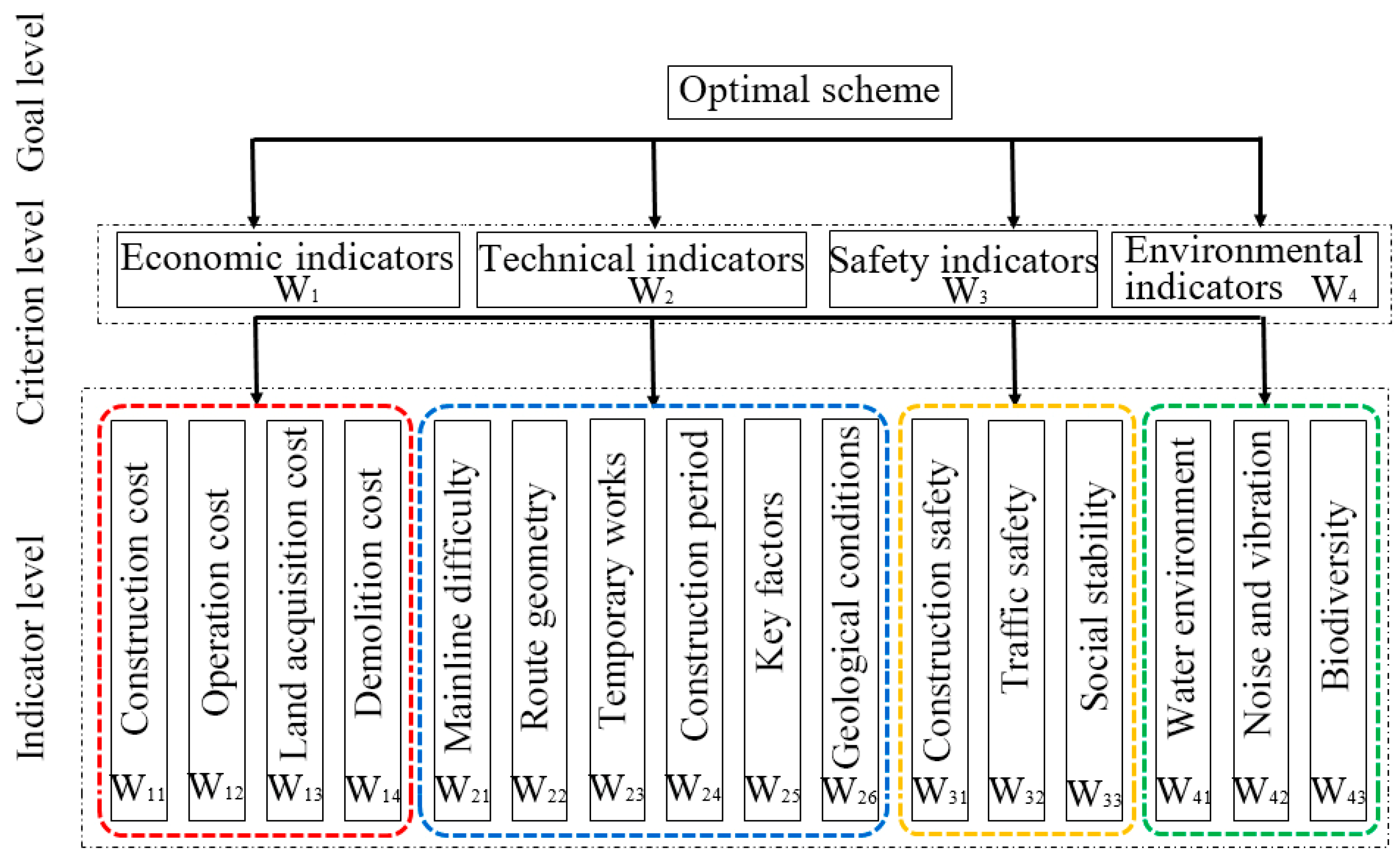
Based on experience from similar projects, the importance of influencing factors is determined, constructing a comprehensive selection (O) system for comparison objects. The economic indicators (W1) include construction cost (W11), operational cost (W12), land acquisition cost (W13), and house demolition and resettlement cost (W14). The technical indicators (W2) comprise mainline construction difficulty (W21), geometric conditions of the route (W22), difficulty of temporary facility construction (W23), construction period (W24), major control factors (W25), and geological conditions (W26). Safety indicators (W3) include safety during construction (W31), traffic safety during operation (W32), and impact on social stability (W33). Environmental indicators (W4) involve water environment (W41), noise and vibration (W42), and biodiversity (W43). As shown in Figure 2, this system consists of 4 dimensions and 16 influencing factors. The author team, in collaboration with the expert group, jointly established the O–W and W–X judgment matrices.
Figure 2.
Hierarchical Framework of Evaluation Indicators.
4.1. Establishment of the O-W Judgment Matrix
The O-W judgment matrix established based on the aforementioned method is shown in Table 3. According to Equations (2)–(7), the consistency index is determined to be 0.003, which is less than 0.1, thus satisfying the consistency requirement.
Table 3.
O-W Judgment Matrix.
4.2. Establishment of the W-X Judgment Matrix
Based on the previously mentioned content, the W-X judgment matrix can be established. The judgment matrices for economic indicators, technical indicators, safety indicators, and environmental indicators are shown in Table 4, Table 5, Table 6 and Table 7, respectively. Among these, the consistency index for the judgment matrices are as follows: 0.004 for economic indicators, 0.05 for technical indicators, 0.02 for safety indicators, and 0.004 for environmental indicators. Therefore, it can be concluded that the established W-X judgment matrices satisfy the consistency requirement.
Table 4.
W-X judgment matrix (1).
Table 5.
W-X judgment matrix (2).
Table 6.
W-X judgment matrix (3).
Table 7.
W-X judgment matrix (4).
After calculation, the final overall ranking of all evaluation criteria at the indicator level is presented in Table 8, providing a comprehensive assessment of the relative importance of each factor.
Table 8.
Overall Ranking of Hierarchical Weights.
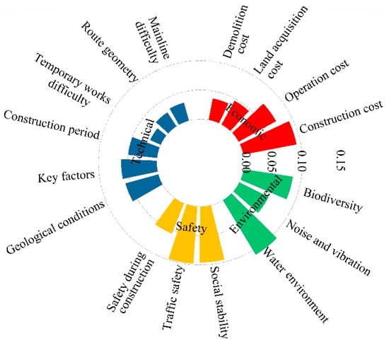
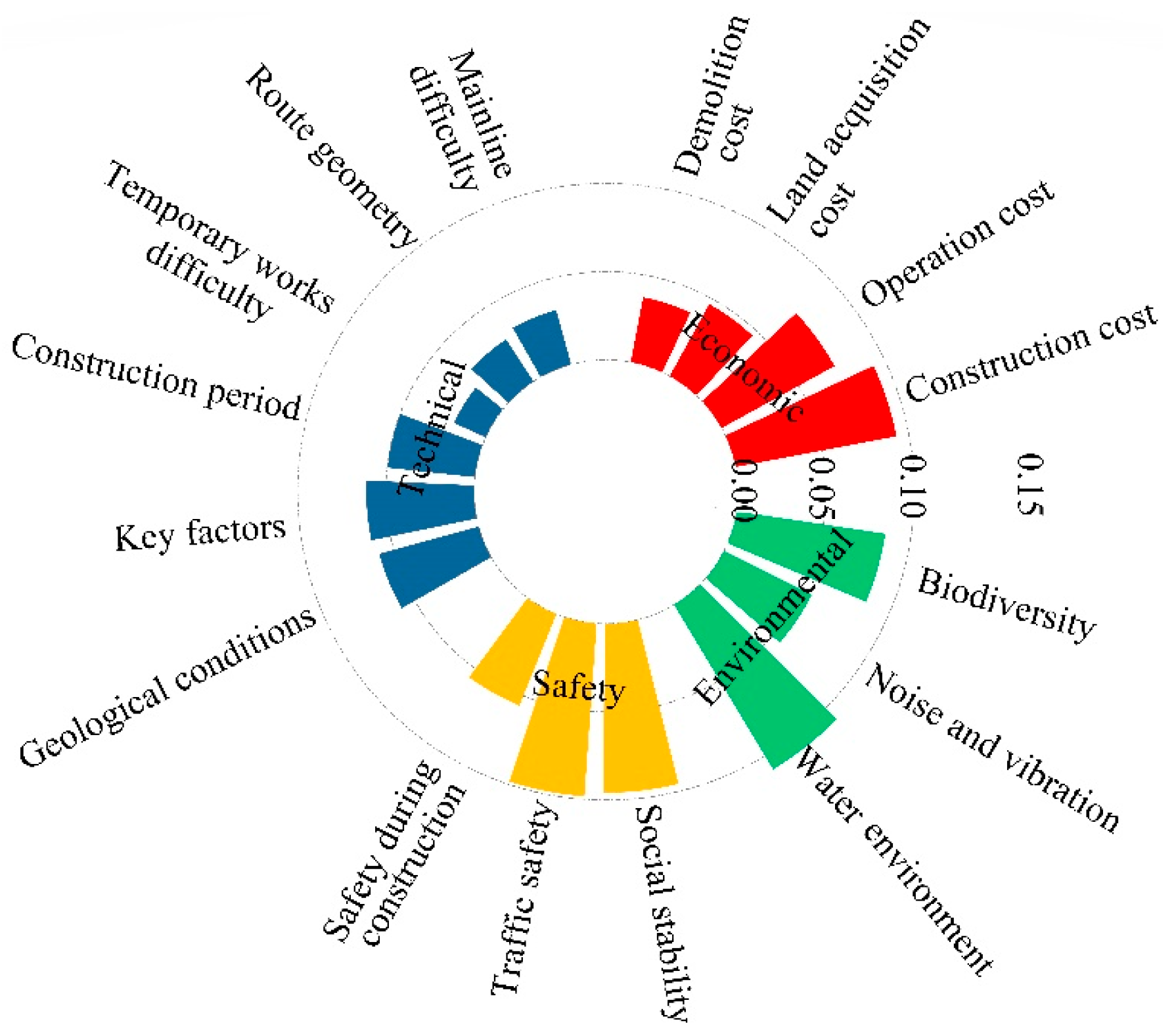
The results from Table 8 are reorganized into Figure 3. From Table 8 and Figure 3, it can be observed that, among the economic indicators, construction cost holds the highest comprehensive weight. In practical project implementation, construction cost is significantly higher than the other three cost components, playing a decisive role in determining whether a project proceeds, aligning with intuitive perceptions of project construction. Regarding technical indicators, evaluators place equal emphasis on major controlling factors and geological conditions. For safety indicators, evaluators prioritize driving safety and social stability significantly more than safety during the construction phase, which reflects the growing confidence in China’s increasingly mature construction experience and the success of exemplary projects in recent years. For environmental indicators, the comprehensive weights of the three influencing factors are relatively high on average, with particular emphasis on water resources. This highlights the gradually increasing environmental awareness among transportation professionals in China.
Figure 3.
Comprehensive weight summary chart.
5. Route Selection Optimization Model
Among multi-criteria decision-making methods, TOPSIS standardizes the evaluation process and simplifies computation through vector normalization and Euclidean distance calculations, in contrast to ELECTRE [38,39], which is effective for screening but limited in ranking capability; VIKOR [40], which emphasizes compromise solutions for group negotiation; and PROMETHEE [41], which relies on preference functions and exhibits relatively complex interpretability. To provide a more scientific and objective description of the route selection process, the TOPSIS method is employed to optimize the route scheme, taking into account the aforementioned influencing factors. TOPSIS determines the ranking of evaluation objects by comparing the distance between each object and the constructed positive and negative ideal solutions, and then assesses the relative superiority of each option.
5.1. Establishment of the Initial Evaluation Matrix
Let , ,⋯, represent the m evaluation objects in the scheme set A = {, ,⋯, }. Each evaluation object is associated with a set of influencing factors , ,⋯, , where X = {, ,⋯, }. The corresponding evaluation indicators are denoted as , ,⋯, (where i = 1, 2,⋯, m; j = 1, 2,⋯, n), with representing the j-th influencing factor of the i-th evaluation object.
5.2. Establishment of the Standardized Decision Matrix
Since different influencing factors in the evaluation objects have their own independent dimensions and units, it is necessary to process these factors to eliminate their adverse effects. The calculation of each influencing factor in the matrix is as follows:
(1) For influencing factors where a larger value indicates better performance:
(2) For influencing factors where a smaller value indicates better performance:
5.3. Establishment of the Weighted Standardized Decision Matrix
The weighted standardized decision matrix C is obtained by multiplying each column of the matrix B by the corresponding indicator weights determined by the AHP, and is expressed as
5.4. Calculation of Evaluation Object’s Closeness
The ideal solution is calculated using the following formula:
where and represent the positive and negative ideal solutions, respectively; and represent the beneficial and detrimental influencing factor sets, respectively.
where and represent the distances between the evaluation objects and the positive and negative ideal solutions, respectively.
6. Case Study
6.1. Alternative Route Selection
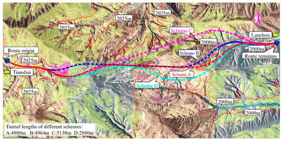
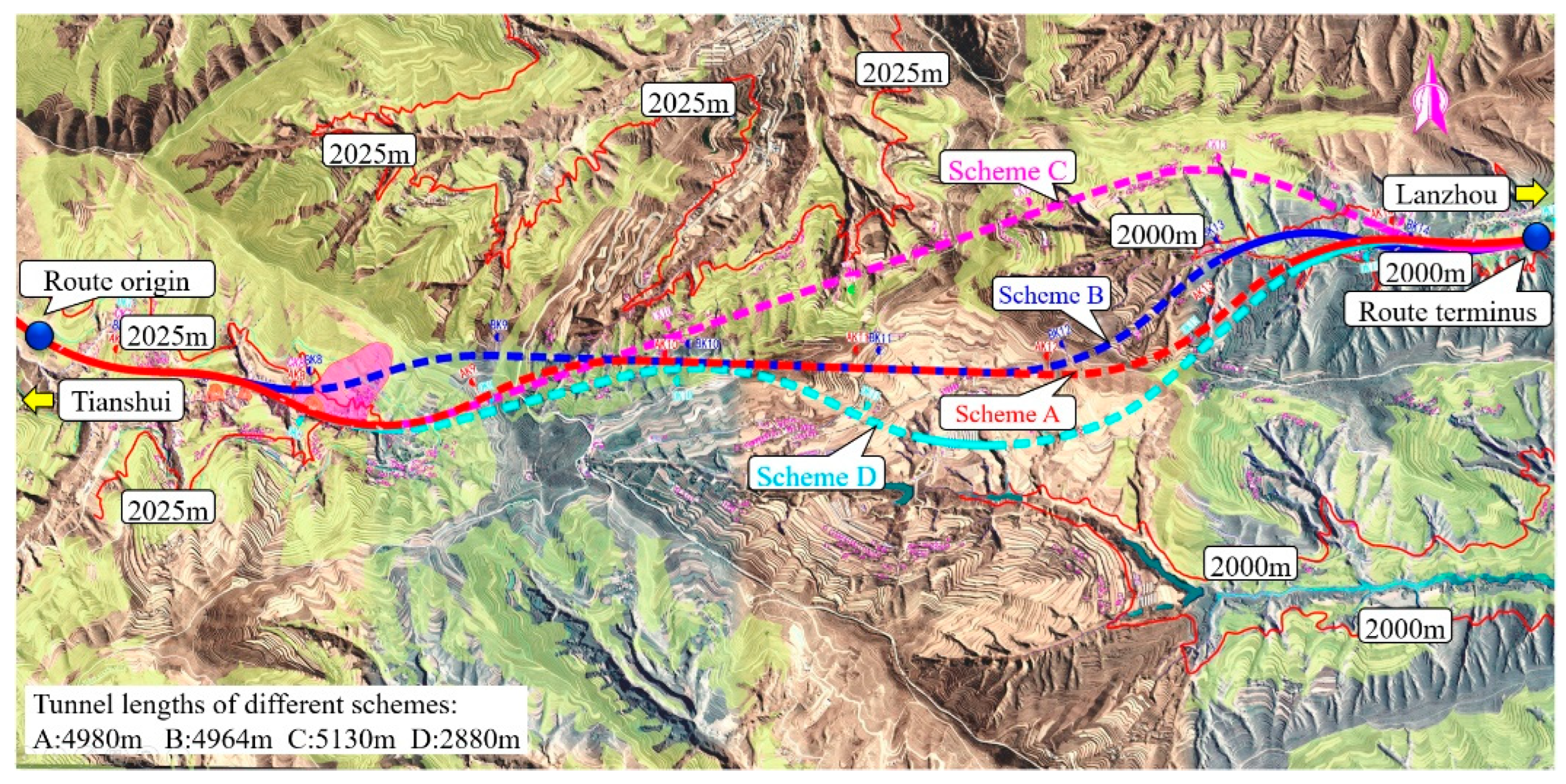
The route for the G30 Lianhuo Expressway Jingqing Section expansion and reconstruction, from Jingjiadian to Huachacun, is planned along the Yuhe Gou Terraced Plateau. It includes a particularly long tunnel crossing the Dongshan to Huajian Gou terraces of Dingxi. The entire route is located within an eroded accumulation loess ridge and a gully landform area, where the terrain is fragmented, and landslides, collapses, and loess sinkholes are densely distributed on both sides of the valley. This area belongs to the typical Longxi Loess Plateau geomorphology with complex engineering geological conditions. Route planning is affected by unfavorable geological conditions, construction costs, demolitions, and basic farmland, among other factors. Four alternative routes are set for comparison, as shown in Figure 4. The main technical indicators and project quantities for each scheme are summarized in Table 9.
Figure 4.
Comparative Diagram of Route Alternatives.
Table 9.
Key Technical Indicators and Project Quantities.
6.2. Initial Evaluation Matrix
Based on the comprehensive expert surveys, the initial evaluation matrix was established, as shown in Table 10. The economic indicators in the table are given in units of 100 million yuan, with the value of W12 representing the total operating cost for a 100-year design service life. The values of W21–W43 were obtained by asking 164 experts to rate each factor on a 0–1 scale according to its influence coefficient. For each factor, the highest and lowest ratings were excluded, and the mean value was then calculated.
Table 10.
Comprehensive Evaluation Index System for Each Alternative.
6.3. Standardized Decision Matrix
(1) Standardized Decision Matrix for Each Indicator
Based on Equation (8), the standardized evaluation matrices for economic, technical, safety, and environmental indicators are constructed as follows:
Using Equations (9) and (10), the weighted standardized decision matrix is obtained:
In the economic, technical, and environmental indicators, all factors belong to cost-type expenses, while safety performance is a positive factor. According to Equation (12), the positive ideal solution and negative ideal solution are determined as follows:
Using Equation (13), the distances of each scheme from the positive and negative ideal solutions are as follows:
Economic indicators:
Technical indicators:
Safety indicators
Environmental indicators:
Using Equation (14), the closeness coefficient of each scheme to the positive ideal solution is as follows:
The calculation results indicate that Scheme 1 is the most optimal in terms of economic indicators, Scheme 3 shows significant advantages in the selection of technical indicators, and Scheme 4 is superior in both safety and environmental indicators.
(2) Comprehensive Evaluation
The results indicate that Alternative 1 performs best with respect to economic indicators, Alternative 3 is optimal in terms of technical indicators, and Alternative 4 achieves the highest performance in safety and environmental indicators. To identify the overall optimal alternative, the corresponding weights of each indicator are incorporated into the evaluation.
The comprehensive evaluation result vector F is calculated as follows:
where E is the evaluation matrix composed of the closeness coefficients of each scheme to the positive ideal solution, and W is the weight matrix calculated using the analytic hierarchy process, given by
The comprehensive weight is
The composite score F is calculated by aggregating the performance of each alternative across all criteria, weighted by their respective criteria weights. The value of F represents the degree of proximity of an alternative to the ideal solution, with higher values indicating closer alignment to the ideal state. Accordingly, Alternative 4 is identified as the preferred option. Accordingly, the alternatives are ranked as follows: Alternative 4 > Alternative 1 > Alternative 3 > Alternative 2.
(3) Robustness analysis of the model
To verify model robustness, we assigned equal weights (0.25) to each of the four dimensions, thereby treating all dimensions as equally important [42,43,44,45]. The equal-weight scheme was applied to the decision matrix derived from each alternative’s proximity to the positive ideal solution, yielding new composite scores:
The sensitivity analysis aims to assess the model’s response to changes in dimensional weights. Specifically, we computed the Pearson correlation coefficient between the composite scores produced by the AHP–TOPSIS model under the original and the equal-weight schemes. The score vectors from the two weighting schemes were compared elementwise, and Pearson’s r was estimated for the paired scores. In addition, we evaluated rank stability by comparing the ordering of alternatives under the two weight schemes. The results are as follows: Pearson’s r = 0.991; Spearman’s ρ = 1.00; and the percentage of identical rankings = 100%. Therefore, under the tested equal-weight perturbation, the AHP–TOPSIS model demonstrates high robustness in both score consistency and ranking stability.
The AHP–TOPSIS model developed here establishes a formal “symmetrization” decision-making framework. First, using AHP to elicit expert weights, the model identifies and quantifies inherent asymmetric contradictions in mountainous-highway alignment selection—for example, differing weights among economic, technical, safety, and environmental criteria and divergent priorities across stakeholder groups. This process transforms subjective and heterogeneous demands into an objective, comparable weighting scheme. Subsequently, TOPSIS—owing to its symmetric, bidirectional treatment of ideal and anti-ideal solutions—constructs a balanced mathematical evaluation space. TOPSIS measures each alternative’s distance to the positive (ideal) and negative (anti-ideal) solutions, and then identifies the “optimal equilibrium”—the alternative that best reconciles the asymmetric weights produced by AHP. Thus, the framework embeds real-world asymmetries within a mathematically symmetric evaluation process, converting asymmetric inputs into symmetric, comparable outputs. This transformation improves the balance, transparency, and interpretability of complex engineering decisions. One limitation of this study is that the AHP–TOPSIS model has not yet been applied to additional route alternatives to further evaluate its effectiveness. In addition, the model’s performance in comprehensive optimization across other application domains remains to be validated.
7. Conclusions
This study addresses the decision-making problem of alignment selection for mountainous highways by systematically analyzing influencing factors, constructing an evaluation system, and investigating optimization methods for alignment selection. The main contributions and conclusions are summarized as follows:
(1) Based on the characteristics of mountainous highway construction, sixteen key factors influencing alignment selection were identified across four dimensions: economy, technology, safety, and environment. A comprehensive evaluation index system for alignment selection was established, providing a structured foundation for subsequent quantitative decision-making.
(2) An expert panel representing all major project stakeholders was formed, and the Analytic Hierarchy Process (AHP) was applied to evaluate the relative importance of each influencing factor. The results indicate that water resource protection and construction cost are the primary factors of concern for stakeholders, highlighting the dual importance of ecological constraints and economic feasibility in mountainous highway construction.
(3) Based on a route comparison between the Jingjiadian and Huachacun sections, the Technique for Order Preference by Similarity to Ideal Solution (TOPSIS) was applied to comprehensively evaluate four alignment alternatives. The resulting overall superiority scores were 0.56, 0.39, 0.41, and 0.66, respectively. These results indicate that Option 4 is the optimal choice, thereby validating the applicability and practical feasibility of the proposed model in real engineering projects.
(4) The AHP–TOPSIS comprehensive optimization model developed in this study integrates expert knowledge to achieve an objective and scientific decision-making process involving multiple factors and alternatives. The model effectively overcomes the limitations of traditional alignment selection methods, which rely heavily on subjective judgment and lack decision transparency.
Overall, this study proposes a systematic decision-making framework for mountainous highway alignment selection by integrating a comprehensive evaluation system with a composite decision-making method. This framework enhances both the scientific rigor of the selection process and the interpretability of the results. The model not only supports the ranking of alternatives but also identifies key influencing factors, thereby providing a quantitative tool for project pre-feasibility studies and multi-objective trade-offs. The proposed approach can be applied to alignment selection decisions for similar linear engineering projects, such as mountainous highways and railways, particularly in environmentally sensitive, geologically complex, and multi-objective constrained scenarios. In future research, integrating technologies such as GIS and BIM could enable dynamic data integration and three-dimensional visualization for alignment analysis, further improving the timeliness and accuracy of decision support.
Author Contributions
Conceptualization, Z.Z.; formal analysis, Z.Z. and S.W.; methodology, Z.Z. and S.W.; software, Z.Z. and H.L.; supervision, J.Z.; validation, Z.Z. and H.L.; writing—original draft, Z.Z.; writing—review and editing, S.W. and J.Z. All authors have read and agreed to the published version of the manuscript.
Funding
This research was supported by the Science and Technology Project of Gansu Provincial Department of Transport (2024-48).
Data Availability Statement
The original contributions presented in this study are included in the article. Further inquiries can be directed to the corresponding author.
Acknowledgments
We are very grateful to the academic editors and reviewers for their valuable suggestions.
Conflicts of Interest
Authors Jian Zhang, Zhigang Zeng, and Haikuo Liu are employed by Gansu Provincial Transportation Planning Survey and Design Institute Co., Ltd. Author Sende Wang declares no conflicts of interest. The remaining authors declare that the research was conducted in the absence of any commercial or financial relationships that could be construed as a potential conflict of interest.
References
- Guo, J. Research on route selection design of highway engineering routes based on new concepts. Eng. Des. 2017, 1, 197–234. [Google Scholar]
- Liu, P.Y.; Chang, M.; Wu, B.B.; Luo, C.B.; Zhou, C. Route selection of landslide prone area in Wenchuan section of Chengdu Wenchuan expressway based on SBAS-InSAR. Earth Sci. 2022, 47, 2048–2057. [Google Scholar]
- Yuan, D.; Zhang, G.Z.; Wang, D.; Mao, B.Y.; You, Y.; Liu, J.F. Analysis on development characteristics of debris flow and route selection countermeasures along the traffic lines in mountain areas of Western China. Geol. Bull. Chin. 2023, 42, 743–752. [Google Scholar]
- Li, L.Y.; Tao, Z.Z.; Yin, W.H.; Liu, Z.B.; Ni, G.Y. Study on Horizontal Curve Radius in Wind-drift Sand Response Rule for Desert Highway. J. Highw. Transp. Res. Dev. 2024, 41, 54–61. [Google Scholar]
- Wang, Y.F.; Wang, T.; Wang, Z.; Xu, L.X. Considerations on route selection and bridge design of expressway in mountainous area. Highway 2022, 67, 42–45. [Google Scholar]
- Liang, H.; Heng, J.M. Flexible Remote Sensing Route Selection Model of Expressway in Natural Reserve Based on Tree Structure Simulation. J. Shijiazhuang Tiedao Univ. (Nat. Sci. Ed.) 2023, 36, 99–104. [Google Scholar]
- Liu, J.W. Thoughts on railway route selection from the perspective of dual carbon economy. Railw. Stand. Des. 2023, 68, 48–54. [Google Scholar]
- Zadeh, L.A. Fuzzy sets. Inf. Control 1965, 8, 338–353. [Google Scholar] [CrossRef] [Scilit]
- Zadeh, L.A. The concept of a linguistic variable and its application to approximate reasoning—I. Inf. Sci. 1975, 8, 199–249. [Google Scholar] [CrossRef] [Scilit]
- Dubois, D.; Prade, H. Fuzzy Sets and Systems: Theory and Applications; Academic Press: Cambridge, MA, USA, 1980. [Google Scholar]
- Zimmermann, H.J. Fuzzy Set Theory—And Its Applications; Springer: Berlin/Heidelberg, Germany, 1991. [Google Scholar]
- Kosko, B. Neural Networks and Fuzzy Systems: A Dynamical Systems Approach to Machine Intelligence; Prentice Hall: Englewood Cliffs, NJ, USA, 1992. [Google Scholar]
- Klir, G.J.; Yuan, B. Fuzzy Sets and Fuzzy Logic; Prentice Hall: Englewood Cliffs, NJ, USA, 1995. [Google Scholar]
- Ross, T.J. Fuzzy Logic with Engineering Applications; John Wiley & Sons: Hoboken, NJ, USA, 2005. [Google Scholar] [CrossRef] [Scilit]
- Chen, S.; Piao, L.; Zang, X.; Luo, Q.; Li, J.; Yang, J.; Rong, J. Analyzing differences of highway lane-changing behavior using vehicle trajectory data. Phys. A Stat. Mech. Its Appl. 2023, 624, 128980. [Google Scholar] [CrossRef] [Scilit]
- Zheng, Y.; Yao, Z.; Xu, Y.; Qu, X.; Ran, B. Lane management for mixed traffic flow on roadways considering the car-following behaviors of human-driven vehicles to follow connected and automated vehicles. Phys. A Stat. Mech. Its Appl. 2024, 635, 129503. [Google Scholar] [CrossRef] [Scilit]
- Adhikari, D.; Gazi, K.H.; Sobczak, A.; Giri, B.C.; Salahshour, S.; Mondal, S.P. Ranking of different states in india based on sustainable women empowerment using mcdm methodology under uncertain environment. J. Uncertain Syst. 2024, 17, 2450010. [Google Scholar] [CrossRef] [Scilit]
- Singh, P.; Gazi, K.H.; Rahaman, M.; Salahshour, S.; Mondal, S.P. A fuzzy fractional power series approximation and taylor expansion for solving fuzzy fractional differential equation. Decis. Anal. J. 2024, 10, 100402. [Google Scholar] [CrossRef] [Scilit]
- Gazi, K.H.; Momena, A.F.; Salahshour, S.; Mondal, S.P.; Ghosh, A. Synergistic strategy of sustainable hospital site selection in saudi arabia using spherical fuzzy mcdm methodology. J. Uncertain Syst. 2024, 17, 2450004. [Google Scholar] [CrossRef] [Scilit]
- Singh, P.; Gor, B.; Gazi, K.H.; Mukherjee, S.; Mahata, A.; Mondal, S.P. Analysis and interpretation of malaria disease model in crisp and fuzzy environment. Results Control Optim. 2023, 12, 100257. [Google Scholar] [CrossRef] [Scilit]
- Momena, A.F. Solution strategy for sustainable additive manufacturing design problem using pythagorean fuzzy mcgdm methodology. Complex Intell. Syst. 2024, 10, 3513–3539. [Google Scholar] [CrossRef] [Scilit]
- Rahaman, M.; Mondal, S.P.; Alam, S.; De, S.K.; Ahmadian, A. Study of a fuzzy production inventory model with deterioration under marxian principle. Int. J. Fuzzy Syst. 2022, 24, 2092–2106. [Google Scholar] [CrossRef] [Scilit]
- Alamin, A.; Rahaman, M.; Mondal, S.P.; Chatterjee, B.; Alam, S. Discrete system insights of logistic quota harvesting model: A fuzzy difference equation approach. J. Uncertain Syst. 2022, 15, 211–224. [Google Scholar] [CrossRef] [Scilit]
- Tudu, S.; Mondal, S.P.; Alam, S. Different solution strategy for solving type-2 fuzzy system of differential equations with application in arms race model. Int. J. Appl. Comput. Math. 2021, 7, 177. [Google Scholar] [CrossRef] [Scilit]
- Pushak, Y.; Hare, W.; Lucet, Y. Multiple-path selection for new highway alignments using discrete algorithms. Eur. J. Oper. Res. 2015, 248, 415–427. [Google Scholar] [CrossRef] [Scilit]
- Moslem, S.; Pilla, F. Planning location of parcel lockers using group Analytic Hierarchy Process in Spherical Fuzzy environment. Transp. Res. Interdiscip. Perspect. 2024, 24, 101024. [Google Scholar] [CrossRef] [Scilit]
- Singh, R.; Avikal, S.; Rashmi, R.; Ram, M. A Kano model, AHP and TOPSIS based approach for selecting the best mobile phone under a fuzzy environment. Int. J. Qual. Reliab. Manag. 2020, 37, 837–851. [Google Scholar] [CrossRef] [Scilit]
- Abastante, F.; Corrente, S.; Greco, S.; Ishizaka, A.; Lami, I.M. A new parsimonious AHP methodology: Assigning priorities to many objects by comparing pairwise few reference objects. Expert Syst. Appl. 2019, 127, 109–120. [Google Scholar] [CrossRef] [Scilit]
- Saaty, T.L. How to make a decision: The analytic hierarchy process. Eur. J. Oper. Res. 1990, 48, 9–26. [Google Scholar] [CrossRef] [Scilit]
- Ansari, Z.N.; Kant, R.; Shankar, R. Evaluation and ranking of solutions to mitigate sustainable remanufacturing supply chain risks: A hybrid fuzzy SWARA-fuzzy COPRAS framework approach. Int. J. Sustain. Eng. 2020, 1, 473–494. [Google Scholar] [CrossRef] [Scilit]
- Goswami, S.; Mitra, S. Selecting the best mobile model by applying AHP-COPRAS and AHP-ARAS decision making methodology. Int. J. Data Netw. Sci. 2020, 4, 27–42. [Google Scholar] [CrossRef] [Scilit]
- Zhu, L.P.; Zhang, G.Y.; Zhang, Z.Q. Automatic highway alignment selection and safety evaluation method based on genetic algorithm. Sci. Technol. Eng. 2023, 23, 12672–12678. [Google Scholar]
- Bao, T.T.; Lian, F.; Yang, Z.Z. Research review of shipping management. J. Traffic Transp. Eng. 2020, 20, 55–69. [Google Scholar]
- Wang, G.J.; Lü, W.H.; Fu, S.Y.; Ge, J.L. Evaluation of on-street parking management level in commercial district based on analytic hierarchy process. Sci. Technol. Eng. 2020, 20, 8810–8816. [Google Scholar]
- Jiang, W.; Yang, L.; Shi, Q.; Zhang, M.J.; Zhang, J.M.; Shang, Y.J. Adaptability evaluation of shield tunneling based on analytic hierarchy process and fuzzy synthetic evaluation method. Sci. Technol. Eng. 2021, 21, 358–365. [Google Scholar]
- Tao, L.; Yang, J.; Yang, Y.; Yu, T.; Chen, C.Y. Security risk assessment method of Internet of Vehicles. Sci. Technol. Eng. 2022, 22, 11113–11119. [Google Scholar]
- Hwang, C.-L.; Yoon, K. Methods for multiple attribute decision making. Lect. Notes Econ. Math. Syst. 1981, 186, 58–191. [Google Scholar] [CrossRef] [Scilit]
- Zhou, F.; Chen, T.Y. A synergetic intuitionistic fuzzy model combining AHP, entropy, and ELECTRE for data fabric solution selection. Artif. Intell. Rev. 2025, 58, 137. [Google Scholar] [CrossRef] [Scilit]
- Akram, M.; Zahid, K.; Kahraman, C. A new ELECTRE-based decision-making framework with spherical fuzzy information for the implementation of autonomous vehicles project in Istanbul. Knowl.-Based Syst. 2024, 283, 111207. [Google Scholar] [CrossRef] [Scilit]
- Rani, P.; Mishra, A.R.; Pardasani, K.R.; Mardani, A.; Liao, H.; Streimikiene, D. A novel VIKOR approach based on entropy and divergence measure of Pythagorean fuzzy sets to evaluate renewable energy technologies in India. J. Clean. Prod. 2019, 238, 117936. [Google Scholar] [CrossRef] [Scilit]
- Liang, D.; Fu, Y.; Garg, H. A novel robustness PROMETHEE method by learning interactive criteria and historical information for blockchain technology-enhanced supplier selection. Expert Syst. Appl. 2024, 235, 121107. [Google Scholar] [CrossRef] [Scilit]
- Kabassi, K. Application of multi-criteria decision-making models for the evaluation cultural websites: A framework for comparative analysis. Information 2021, 12, 407. [Google Scholar] [CrossRef] [Scilit]
- Markatos, D.N.; Malefaki, S.; Pantelakis, S.G. Sensitivity analysis of a hybrid MCDM model for sustainability assessment—An example from the aviation industry. Aerospace 2023, 10, 385. [Google Scholar] [CrossRef] [Scilit]
- Malefaki, S.; Markatos, D.; Filippatos, A.; Pantelakis, S. A comparative analysis of multi-criteria decision-making methods and normalization techniques in holistic sustainability assessment for engineering applications. Aerospace 2025, 12, 100. [Google Scholar] [CrossRef] [Scilit]
- Hani, H.M.; Nour El Din, M.M.; Khalifa, A.; Elalfy, E. Sensitivity analysis for multi-criteria decision analysis framework for site selection of aquifer recharge with reclaimed water. Sustainability 2023, 15, 5399, Erratum in Sustainability 2023, 15, 10570. [Google Scholar] [CrossRef] [Scilit]

Disclaimer/Publisher’s Note: The statements, opinions and data contained in all publications are solely those of the individual author(s) and contributor(s) and not of MDPI and/or the editor(s). MDPI and/or the editor(s) disclaim responsibility for any injury to people or property resulting from any ideas, methods, instructions or products referred to in the content. |
© 2026 by the authors. Licensee MDPI, Basel, Switzerland. This article is an open access article distributed under the terms and conditions of the Creative Commons Attribution (CC BY) license.