Next Issue
Volume 9, September
Previous Issue
Volume 9, July


Land, Volume 9, Issue 8 (August 2020) – 42 articles

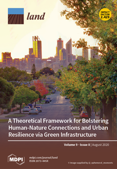
Cover Story (view full-size image): We are currently gripped by the twin urban crises of anthropogenic climate change and declining human health as global populations continue to increase and urban center structures rapidly densify. These crises have morphed and emerged rapidly, and require an immediate and intentional multi-level response. The opportunities for intervention are assessed and presented through the framework of the established Human–Nature Connection Theory and the Urban Resilience Theory, with particular emphasis placed on Green Infrastructure assets for the contemplation and consideration of urban land managers around the world. It is hoped that intervention can change the adverse trajectory of these crises as we plan for, and move beyond, the 21st Century. View this paper
  • Issues are regarded as officially published after their release is announced to the table of contents alert mailing list.
  • You may sign up for e-mail alerts to receive table of contents of newly released issues.
  • PDF is the official format for papers published in both, html and pdf forms. To view the papers in pdf format, click on the "PDF Full-text" link, and use the free Adobe Reader to open them.
Order results
Result details
Section
Select all
Export citation of selected articles as:
29 pages, 4689 KiB  
Article
Processes of Forest Cover Change since 1958 in the Coffee-Producing Areas of Southwest Ethiopia
by Tola Gemechu Ango, Kristoffer Hylander and Lowe Börjeson
Land 2020, 9(8), 278; https://doi.org/10.3390/land9080278 - 18 Aug 2020
Cited by 20 | Viewed by 5568
Abstract
We investigated the spatial relations of ecological and social processes to point at how state policies, population density, migration dynamics, topography, and socio-economic values of ‘forest coffee’ together shaped forest cover changes since 1958 in southwest Ethiopia. We used data from aerial photos, [...] Read more.
We investigated the spatial relations of ecological and social processes to point at how state policies, population density, migration dynamics, topography, and socio-economic values of ‘forest coffee’ together shaped forest cover changes since 1958 in southwest Ethiopia. We used data from aerial photos, Landsat images, digital elevation models, participatory field mapping, interviews, and population censuses. We analyzed population, land cover, and topographic roughness (slope) data at the ‘sub-district’ level, based on a classification of the 30 lowest administrative units of one district into the coffee forest area (n = 17), and highland forest area (n = 13). For state forest sites (n = 6) of the district, we evaluated land cover and slope data. Forest cover declined by 25% between 1973 and 2010, but the changes varied spatially and temporally. Losses of forest cover were significantly higher in highland areas (74%) as compared to coffee areas (14%) and state forest sites (2%), and lower in areas with steeper slopes both in coffee and highland areas. Both in coffee and highland areas, forest cover also declined during 1958–1973. People moved to and converted forests in relatively low population density areas. Altitudinal migration from coffee areas to highland areas contributed to deforestation displacement due to forest maintenance for shade coffee production in coffee areas and forest conversions for annual crop production in highland areas. The most rapid loss of forest cover occurred during 1973–1985, followed by 2001–2010, which overlapped with the implementations of major land and forest policies that created conditions for more deforestation. Our findings highlight how crop ecology and migration have shaped spatial variations of forest cover change across different altitudinal zones whilst development, land, and forest policies and programs have driven the temporal variations of deforestation. Understanding the mechanisms of deforestation and forest maintenance simultaneously and their linkages is necessary for better biodiversity conservation and forest landscape management. Full article
Show Figures

Figure 1

17 pages, 1540 KiB  
Article
Smallholder Agricultural Investment and Productivity under Contract Farming and Customary Tenure System: A Malawian Perspective
by Emmanuel Olatunbosun Benjamin
Land 2020, 9(8), 277; https://doi.org/10.3390/land9080277 - 18 Aug 2020
Cited by 14 | Viewed by 4799
Abstract
Land tenure security, especially customary residence systems, is found to influence the agricultural investment decision-making and productivity of smallholder farmers across sub-Saharan Africa. However, as country-specific customary residence systems and farming models evolve over time, their impact on food security and livelihood remains [...] Read more.
Land tenure security, especially customary residence systems, is found to influence the agricultural investment decision-making and productivity of smallholder farmers across sub-Saharan Africa. However, as country-specific customary residence systems and farming models evolve over time, their impact on food security and livelihood remains unclear. This study investigates the impact of customary residence systems on both agricultural investment (in tea shrubs and agroforestry) and productivity among contracted smallholder tea outgrowers in Southern Malawi. A survey of 228 farmers was conducted in 2018, and a linear probability and ordinary least squared (OLS) models were used for the analysis. The results suggest that matrilocal residence practices positively influence agricultural investment. The study concluded that despite the dominance of matrilineal-matrilocal systems in Southern Malawi, there is a need for policy to address gender gaps in the region because women are still vulnerable and insecure even in these assumed women-friendly customary systems. It is recommended that future research explores other prevailing tenure security systems. Full article
(This article belongs to the Special Issue Land, Women, Youths, and Land Tools or Methods)
Show Figures

Figure 1

22 pages, 2661 KiB  
Article
New Indicators of Spatial Chaos in the Context of the Need for Retrofitting Suburbs
by Dorota Mantey and Wojciech Pokojski
Land 2020, 9(8), 276; https://doi.org/10.3390/land9080276 - 18 Aug 2020
Cited by 13 | Viewed by 3214
Abstract
The article is dedicated to the phenomenon of spatial chaos in the suburban areas of Polish cities, which, due to uncontrolled scattering of buildings (urban sprawl), require urgent retrofitting. These activities should contribute to the gradual densification of buildings and the more frequent [...] Read more.
The article is dedicated to the phenomenon of spatial chaos in the suburban areas of Polish cities, which, due to uncontrolled scattering of buildings (urban sprawl), require urgent retrofitting. These activities should contribute to the gradual densification of buildings and the more frequent functioning of suburbanites in the local environment, close to the place of residence. The authors claim that the retrofitting of suburbs can be accomplished by impacting two dimensions of spatial chaos: limited pedestrian mobility around the place of residence (walkability) and low access to basic services. The article proposes a set of ten indicators and a synthetic index of spatial chaos that allow measuring the level of disorder in particular suburbs, and therefore on a smaller scale than a municipality, and at the same time refer to the features of the living environment typical of Polish suburbs. These indicators are a direct reference to the abovementioned dimensions of suburban spatial chaos and allow to estimate the degree of compactness of suburban settlements in its functional aspect. The research proved that the more sprawl-like features, the higher the level of spatial disorder. Full article
(This article belongs to the Special Issue Conditions, Effects and Costs of Spatial Chaos)
Show Figures

Graphical abstract

43 pages, 7705 KiB  
Article
Degradation of Coastlines under the Pressure of Urbanization and Tourism: Evidence on the Change of Land Systems from Europe, Asia and Africa
by Alexandru-Ionuţ Petrişor, Walid Hamma, Huu Duy Nguyen, Giovanni Randazzo, Anselme Muzirafuti, Mari-Isabella Stan, Van Truong Tran, Roxana Aştefănoaiei, Quang-Thanh Bui, Dragoş-Florian Vintilă, Quang Hai Truong, Cristina Lixăndroiu, Diana-Doina Ţenea, Igor Sîrodoev and Ioan Ianoş
Land 2020, 9(8), 275; https://doi.org/10.3390/land9080275 - 17 Aug 2020
Cited by 63 | Viewed by 8257
Abstract
The importance of studying coastal areas is justified by their resources, ecosystem services, and key role played in socio-economic development. Coastal landscapes are subject to increasing demands and pressures, requiring in-depth analyses for finding appropriate tools or policies for a sustainable landscape management. [...] Read more.
The importance of studying coastal areas is justified by their resources, ecosystem services, and key role played in socio-economic development. Coastal landscapes are subject to increasing demands and pressures, requiring in-depth analyses for finding appropriate tools or policies for a sustainable landscape management. The present study addresses this issue globally, based on case studies from three continents: Romania (Europe), Algeria (Africa), and Vietnam (Asia), focusing on the anthropogenic pressure resulting from land use/land cover change or urban sprawl, taking into account the role of socioeconomic and political factors. The methodology consisted of producing maps and computing and analyzing indicators, correlating geospatial and socio-economic data in a synergistic manner to explore the changes of landscapes, and identify the specific driving forces. The findings show that the pressure of urbanization and tourism on coastal areas increased, while the drivers and impacts vary. Urbanization is due to derogatory planning in Romania and Algeria, and different national and local goals in Vietnam. The two drivers determine local exemptions from the national regulations, made for profit. In addition to the need for developing and enforcing policies for stopping the degradation and restoring the ecosystems, the findings underline the importance of international cooperation in policy development. Full article
Show Figures

Graphical abstract

19 pages, 5064 KiB  
Article
Observed Vegetation Greening and Its Relationships with Cropland Changes and Climate in China
by Yuzhen Zhang, Shunlin Liang and Zhiqiang Xiao
Land 2020, 9(8), 274; https://doi.org/10.3390/land9080274 - 16 Aug 2020
Cited by 7 | Viewed by 3128
Abstract
Chinese croplands have changed considerably over the past decades, but their impacts on the environment remain underexplored. Meanwhile, understanding the contributions of human activities to vegetation greenness has been attracting more attention but still needs to be improved. To address both issues, this [...] Read more.
Chinese croplands have changed considerably over the past decades, but their impacts on the environment remain underexplored. Meanwhile, understanding the contributions of human activities to vegetation greenness has been attracting more attention but still needs to be improved. To address both issues, this study explored vegetation greening and its relationships with Chinese cropland changes and climate. Greenness trends were first identified from the normalized difference vegetation index and leaf area index from 1982–2015 using three trend detection algorithms. Boosted regression trees were then performed to explore underlying relationships between vegetation greening and cropland and climate predictors. The results showed the widespread greening in Chinese croplands but large discrepancies in greenness trends characterized by different metrics. Annual greenness trends in most Chinese croplands were more likely nonlinearly associated with climate compared with cropland changes, while cropland percentage only predominantly contributed to vegetation greening in the Sichuan Basin and its surrounding regions with leaf area index data and, in the Northeast China Plain, with vegetation index data. Results highlight both the differences in vegetation greenness using different indicators and further impacts on the nonlinear relationships with cropland and climate, which have been largely ignored in previous studies. Full article
Show Figures

Figure 1

24 pages, 3485 KiB  
Article
Land-Use Dynamics in Transport-Impacted Urban Fabric: A Case Study of Martin–Vrútky, Slovakia
by Jana Nozdrovická, Ivo Dostál, František Petrovič, Imrich Jakab, Marek Havlíček, Hana Skokanová, Vladimír Falťan and Peter Mederly
Land 2020, 9(8), 273; https://doi.org/10.3390/land9080273 - 15 Aug 2020
Cited by 11 | Viewed by 2830
Abstract
The paper evaluates landscape development, land-use changes, and transport infrastructure variations in the city of Martin and the town of Vrútky, Slovakia, over the past 70 years. It focuses on analyses of the landscape structures characterizing the study area in several time periods [...] Read more.
The paper evaluates landscape development, land-use changes, and transport infrastructure variations in the city of Martin and the town of Vrútky, Slovakia, over the past 70 years. It focuses on analyses of the landscape structures characterizing the study area in several time periods (1949, 1970, 1993, 2003); the past conditions are then compared with the relevant current structure (2018). Special attention is paid to the evolution of the landscape elements forming the transport infrastructure. The development and progressive changes in traffic intensities are presented in view of the resulting impact on the formation of the landscape structure. The research data confirm the importance of transport as a force determining landscape changes, and they indicate that while railroad accessibility embodied a crucial factor up to the 1970s, the more recent decades were characterized by a gradual shift to road transport. Full article
(This article belongs to the Special Issue Cities' Spatial Structure and Drivers of its Transformation)
Show Figures

Figure 1

18 pages, 3623 KiB  
Article
Evaluation of the Completeness of Spatial Data Infrastructure in the Context of Cadastral Data Sharing
by Agnieszka Trystuła, Małgorzata Dudzińska and Ryszard Źróbek
Land 2020, 9(8), 272; https://doi.org/10.3390/land9080272 - 14 Aug 2020
Cited by 8 | Viewed by 3085
Abstract
The idea behind the Infrastructure for Spatial Information in Europe (INSPIRE) project was to provide EU citizens with access to various types of information, including environmental protection and spatial management data. These resources can be viewed (Web Map Service—WMS) and downloaded (Web Feature [...] Read more.
The idea behind the Infrastructure for Spatial Information in Europe (INSPIRE) project was to provide EU citizens with access to various types of information, including environmental protection and spatial management data. These resources can be viewed (Web Map Service—WMS) and downloaded (Web Feature Service—WFS) online. Cadastral datasets represent one of the 34 spatial data themes in the spatial data infrastructure (SDI). The functionality of the SDI has not yet been fully achieved due to the failure of the WMS and WFS network services. The aim of this article was to assess the completeness of the SDI containing cadastral datasets. The present study has practical implications. The proposed diagnostic tool supports an assessment of the completeness of SDI resources in seven diagnostic groups (technical and legal identifiers, the cadastral information profile, the WMS network service, the WFS network service, source cadastral databases, data validity, and WMS and WFS standardization). The developed assessment methodology enables the identification of websites that publish cadastral data through INSPIRE network services, as well as problematic websites, and it has high development potential. The results of the assessment should be used in the ongoing construction of the SDI. They can also be used to improve the quality of network services and their availability for end users. Full article
(This article belongs to the Special Issue Land, Innovation, and Social Good)
Show Figures

Figure 1

17 pages, 7325 KiB  
Article
A Deep Neural Networks Approach for Augmenting Samples of Land Cover Classification
by Chuanpeng Zhao and Yaohuan Huang
Land 2020, 9(8), 271; https://doi.org/10.3390/land9080271 - 13 Aug 2020
Cited by 1 | Viewed by 2432
Abstract
Land cover is one of key indicators for modeling ecological, environmental, and climatic processes, which changes frequently due to natural factors and anthropogenic activities. The changes demand various samples for updating land cover maps, although in reality the number of samples is always [...] Read more.
Land cover is one of key indicators for modeling ecological, environmental, and climatic processes, which changes frequently due to natural factors and anthropogenic activities. The changes demand various samples for updating land cover maps, although in reality the number of samples is always insufficient. Sample augment methods can fill this gap, but these methods still face difficulties, especially for high-resolution remote sensing data. The difficulties include the following: (1) excessive human involvement, which is mostly caused by human interpretation, even by active learning-based methods; (2) large variations of segmented land cover objects, which affects the generalization to unseen areas especially for proposed methods that are validated in small study areas. To solve these problems, we proposed a sample augment method incorporating the deep neural networks using a Gaofen-2 image. To avoid error accumulation, the neural network-based sample augment (NNSA) framework employs non-iterative procedure, and augments from 184 image objects with labels to 75,112 samples. The overall accuracy (OA) of NNSA is 20% higher than that of label propagation (LP) in reference to expert interpreted results; the LP has an OA of 61.16%. The accuracy decreases by approximately 10% in the coastal validation area, which has different characteristics from the inland samples. We also compared the iterative and non-iterative strategies without external information added. The results of the validation area containing original samples show that non-iterative methods have a higher OA and a lower sample imbalance. The NNSA method that augments sample size with higher accuracy can benefit the update of land cover information. Full article
Show Figures

Figure 1

15 pages, 5568 KiB  
Article
Spatially Explicit Reconstruction of Anthropogenic Grassland Cover Change in China from 1700 to 2000
by Fan Yang, Fanneng He and Shicheng Li
Land 2020, 9(8), 270; https://doi.org/10.3390/land9080270 - 12 Aug 2020
Cited by 6 | Viewed by 2519
Abstract
Long-term anthropogenic land use and land cover changes (LULCCs) are regarded as an important component of past global change. The past 300 years have witnessed dramatic changes in LULCC in China, and this has resulted in the large-scale conversion of natural vegetation to [...] Read more.
Long-term anthropogenic land use and land cover changes (LULCCs) are regarded as an important component of past global change. The past 300 years have witnessed dramatic changes in LULCC in China, and this has resulted in the large-scale conversion of natural vegetation to agricultural landscapes. Studies of past LULCC in China have mainly focused on cropland and forest; however, estimates of grassland cover remain rare due to the scarcity of grassland-related historical documents. Based on a qualitative analysis of trends in grassland cover in China and their driving forces, we devised different reconstruction methods for grassland cover in eastern and western China and then developed a 10 km database of grassland cover in China for the past 300 years. The grassland area in western China decreased from 295.54 × 10⁶ ha in 1700 to 269.78 × 10⁶ ha in 2000 due to the increase in population and cropland, especially in northeastern China (Heilongjiang, Jilin, and Liaoning), Gan-Ning, and Xinjiang. In eastern China, grassland is degraded secondary vegetation characterized by shrub grassland and meadow grassland, which is scattered in the hills and mountains; its area increased from 7.30 × 10⁶ ha in 1700 to 16.43 × 10⁶ ha in 1950 due to the increase in the degraded land caused by deforestation. Full article
(This article belongs to the Section Land Systems and Global Change)
Show Figures

Figure 1

12 pages, 4560 KiB  
Article
Unraveling Misunderstandings about Desertification: The Paradoxical Case of the Tabernas-Sorbas Basin in Southeast Spain
by Jaime Martínez-Valderrama, Emilio Guirado and Fernando T. Maestre
Land 2020, 9(8), 269; https://doi.org/10.3390/land9080269 - 11 Aug 2020
Cited by 15 | Viewed by 8034
Abstract
From its origins, the concept of desertification has been controversial. The prevailing confusion between two desertification visions, one that considers it as the expansion of deserts and another that emphasizes its anthropogenic component, has been transferred to society. Here we illustrate misunderstandings about [...] Read more.
From its origins, the concept of desertification has been controversial. The prevailing confusion between two desertification visions, one that considers it as the expansion of deserts and another that emphasizes its anthropogenic component, has been transferred to society. Here we illustrate misunderstandings about desertification using a very illustrative case from the Tabernas-Sorbas Basin (Almeria, Spain), where striking badlands that are often used as an image of desertification coexist with an intensive olive agriculture that is irreversibly deteriorating the only oasis in continental Europe (Los Molinos spring). The olive tree is a traditional Mediterranean dryland crop and until the 1950s only about 200 ha were irrigated in this area. However, the profitability of the crop has caused irrigation to expand to 4400 ha in the last two decades. The process of intensification has been reinforced giving way to super-intensive irrigation, which involves going from 210 to 1550 trees/ha, which in a few years already occupies more than 1500 ha. The effects on the water balance of the aquifer feeding these crops have been severe, and the flow of the Los Molinos spring has gone from more than 40 L/s for the period 1970–2000 to the current 7.28 L/s. Unraveling the mechanisms of land degradation and its main drivers are the first step to propose management actions to achieve a more sustainable use of resources and to combat desertification. Full article
(This article belongs to the Special Issue Landscape Transformation and Changes in Land Use Intensity)
Show Figures

Figure 1

13 pages, 4605 KiB  
Article
Mapping Landscape Potential for Supporting Green Infrastructure: The Case of a Watershed in Turkey
by Derya Gülçin and Kemal Tuluhan Yılmaz
Land 2020, 9(8), 268; https://doi.org/10.3390/land9080268 - 11 Aug 2020
Cited by 1 | Viewed by 2913
Abstract
Green infrastructure (GI) is a strategic planning approach that can contribute to solutions for ecological, social, and environmental problems. GI also aims to conserve natural and semi-natural landscapes and enhance ecological networks. Within the scope of spatial planning, urban and rural landscape units [...] Read more.
Green infrastructure (GI) is a strategic planning approach that can contribute to solutions for ecological, social, and environmental problems. GI also aims to conserve natural and semi-natural landscapes and enhance ecological networks. Within the scope of spatial planning, urban and rural landscape units can be integrated through GI planning. In this study, we propose a method to calculate the landscape potential and map GI in the lower Büyük Menderes River Basin, Turkey. We used landscape character assessment (LCA) to identify the landscape typology, which was one of the key steps for determining the landscape potential. Three thematic maps were produced and overlaid in ArcMap 10.7. A map showing the spatial distributions of 71 landscape types was created by means of LCA. Then, the landscape types were assessed according to defined criteria, and finally, GI of the study area was mapped. This study found that high-quality landscape types were located in the middle, northern, and eastern parts of the lower Büyük Menderes River Basin, rather than in the protected areas. Moreover, 68 of the 71 landscape types were present in the GI map. The findings show the necessity of including the landscape potential concept in conservation strategies. Thus, this paper provides a reference guideline for mapping GI as a contributor to nature conservation and spatial planning strategies. Full article
Show Figures

Figure 1

25 pages, 2591 KiB  
Article
Diversification of Livestock-Keeping Smallholders in Mountainous Rural Regions of Azerbaijan and Georgia
by Regina Neudert, Naiba Allahverdiyeva, Niyaz Mammadov, Alexandre Didebulidze and Volker Beckmann
Land 2020, 9(8), 267; https://doi.org/10.3390/land9080267 - 10 Aug 2020
Cited by 7 | Viewed by 3710
Abstract
Diversified livelihoods combining farming, livestock keeping and non-farm income are characteristic of many rural households worldwide. For the Central Asian and Caucasian region, livestock keeping is especially important in terms of land use and socio-cultural heritage. We contribute to the literature with data [...] Read more.
Diversified livelihoods combining farming, livestock keeping and non-farm income are characteristic of many rural households worldwide. For the Central Asian and Caucasian region, livestock keeping is especially important in terms of land use and socio-cultural heritage. We contribute to the literature with data from the under-researched Caucasus region and investigate: (i) the extent of diversification in smallholder households; (ii) the role of livestock keeping in diversification; (iii) the influence of household-specific and location-specific variables and diversification on household income. Based on a dataset of 303 households, we calculate contribution margins for the main agricultural activities, household income, and diversification indices and analyze the influence of diversification, asset and location variables on household income with a regression model. Household income is generally diversified and a combination of four income sources (crops, livestock, poultry/bees and social benefits) was the most frequent. The econometric analysis shows that higher household incomes are positively correlated with higher household land and livestock assets, the presence of non-farm work and social benefit income sources and with an increasing specialization as measured by the diversification index. For enhancing rural household incomes and slowing down rural-urban migration, the development of non-farm job opportunities is recommended. Full article
Show Figures

Figure 1

14 pages, 3177 KiB  
Communication
Absent Voices: Women and Youth in Communal Land Governance. Reflections on Methods and Process from Exploratory Research in West and East Africa
by Stefanie Lemke and Priscilla Claeys
Land 2020, 9(8), 266; https://doi.org/10.3390/land9080266 - 10 Aug 2020
Cited by 6 | Viewed by 4476
Abstract
An increasing number of African States are recognizing customary land tenure. Yet, there is a lack of research on how community rights are recognized in legal and policy frameworks, how they are implemented in practice, and how to include marginalized groups. In 2018–2019, [...] Read more.
An increasing number of African States are recognizing customary land tenure. Yet, there is a lack of research on how community rights are recognized in legal and policy frameworks, how they are implemented in practice, and how to include marginalized groups. In 2018–2019, we engaged in collaborative exploratory research on governing natural resources for food sovereignty with social movement networks, human rights lawyers and academics in West and East Africa. In this article, we reflect on the process and methods applied to identify research gaps and partners (i.e., two field visits and regional participatory workshops in Mali and Uganda), with a view to share lessons learned. In current debates on the recognition and protection of collective rights to land and resources, we found there is a need for more clarity and documentation, with customary land being privatized and norms rapidly changing. Further, the voices of women and youth are lacking in communal land governance. This process led to collaborative research with peasant and pastoralist organizations in Kenya, Tanzania, Mali and Guinea, with the aim to achieve greater self-determination and participation of women and youth in communal land governance, through capacity building, participatory research, horizontal dialogues and action for social change. Full article
(This article belongs to the Special Issue Land, Women, Youths, and Land Tools or Methods)
Show Figures

Figure 1

19 pages, 4205 KiB  
Article
Spatio-Temporal Dynamics of Landscape Connectivity and Ecological Network Construction in Long Yangxia Basin at the Upper Yellow River
by Fangning Shi, Shiliang Liu, Yi An, Yongxiu Sun, Shuang Zhao, Yixuan Liu and Mingqi Li
Land 2020, 9(8), 265; https://doi.org/10.3390/land9080265 - 10 Aug 2020
Cited by 33 | Viewed by 4650
Abstract
Analyzing multi-scale changes in landscape connectivity is an important way to study landscape ecological processes and also an important method to maintain regional biodiversity. In this study, graph-based connectivity was used to analyze the dynamics of the connectivity of natural habitats in the [...] Read more.
Analyzing multi-scale changes in landscape connectivity is an important way to study landscape ecological processes and also an important method to maintain regional biodiversity. In this study, graph-based connectivity was used to analyze the dynamics of the connectivity of natural habitats in the Long Yangxia basin of upper Yellow River valley from 1995 to 2015. We used the core areas of the nature reserves as the source regions to construct ecological networks under different thresholds, so as to identify key areas that can maintain overall landscape connectivity. The results showed that, from 1995 to 2015, the landscape connectivity in the study area increased for the first 10 years, and, since 2005, has declined. On a spatial scale, we found that both the connectivity of the ecological network and the length of the corridor increased with landscape resistance. Our analysis demonstrates the importance of the natural habitat in the southern part of the study area where connectivity was higher, as well as the sensitivity of connectivity of the northern area to human activities. Both large and medium patches contribute greatly to the overall landscape connectivity, while attention needs to be paid to the protection and management of small patches as they played “stepping stone” roles in maintaining and improving landscape connectivity. The proportions of landscape types that served as corridors, listed in order of their contribution to connectivity, were grassland, forestland, wetland and cultivated land. This suggests that, in addition to focusing on the protection of grassland and forest land, the reasonable planning and utilization of wetland and cultivated land will also have an impact on landscape connectivity. In addition, the protection of and improvement in habitats in the Sanjiangyuan Nature Reserve is of great significance to enhance landscape connectivity. Our study provides a scientific basis to support and improve regional landscape connectivity and biodiversity conservation over the next decade. Full article
(This article belongs to the Special Issue Dynamic Landscape Connectivity)
Show Figures

Figure 1

16 pages, 9470 KiB  
Article
Cultural Memories and Sense of Place in Historic Urban Landscapes: The Case of Masrah Al Salam, the Demolished Theatre Context in Alexandria, Egypt
by Fatmaelzahraa Hussein, John Stephens and Reena Tiwari
Land 2020, 9(8), 264; https://doi.org/10.3390/land9080264 - 7 Aug 2020
Cited by 19 | Viewed by 5655
Abstract
Historic urban landscapes (HULs) are composed of layers of history and memories that are embedded in physical monuments, buildings, and memorials. Physical built fabric stores both personal and cultural memory through long association with communities. Rapid changes due to demolition and redevelopment change [...] Read more.
Historic urban landscapes (HULs) are composed of layers of history and memories that are embedded in physical monuments, buildings, and memorials. Physical built fabric stores both personal and cultural memory through long association with communities. Rapid changes due to demolition and redevelopment change the nature of these places and, in turn, affect these memory storages. This paper investigates whether historical city inhabitants consider cultural memories important when managing their HULs. It further explores the effectiveness of cultural memory in creating a sense of place and enhancing the quality of life for inhabitants. The context of the demolished theatre ‘Masrah Al Salam’ in Alexandria, Egypt, was studied after city inhabitants angrily protested the theatre’s removal, indicating a strong community attachment to this lost place. A qualitative methodological approach to this study was applied by conducting on-site, semi-structured, face-to-face interviews supplemented by comments gathered from the Facebook group ‘Alexandria’s Spirit’. The QSR NVivo12 program was used as a qualitative tool for data management, analysis, and mapping intangible elements contributing to an assembly of cultural memories of this place. The study demonstrated the importance of cultural memory associated with urban elements such as iconic heritage buildings that create a sense of place and enhance the identity of our urban environments. Full article
(This article belongs to the Special Issue Cultural Landscapes)
Show Figures

Figure 1

26 pages, 8979 KiB  
Review
A Scientometrics Review on Farmland Abandonment Research
by Yingqian Huang, Fengqin Li and Hualin Xie
Land 2020, 9(8), 263; https://doi.org/10.3390/land9080263 - 5 Aug 2020
Cited by 25 | Viewed by 4089
Abstract
Using the Web of Science database, 1498 research articles published between 1900 and 2019 on the subject of farmland abandonment were retrieved. With the help of the SciMAT tool, a theme strategic diagram, overlay map and evolution map represented by keywords were constructed, [...] Read more.
Using the Web of Science database, 1498 research articles published between 1900 and 2019 on the subject of farmland abandonment were retrieved. With the help of the SciMAT tool, a theme strategic diagram, overlay map and evolution map represented by keywords were constructed, and the strategic coordinate analysis and data flow analysis methods were used to analyze the research themes, evolutionary states and paths of farmland abandonment in different research time periods. The results show the following: (1) Research on farmland abandonment has rapidly grown in the past ten years, the development of studies on farmland abandonment has become more mature, and the research topics and content have tended to solidify; (2) The research topics of studies on farmland abandonment are mostly centered on forests, patterns, landscapes, land use changes, climate change, etc. The research topics have had strong continuity and few new research hotspots; (3) The study of the ecological environment effect of farmland abandonment is the basic research direction in the field of farmland abandonment and will continue to become a research hotspot; (4) Farmland abandonment has become an important part of the research on land use change and ecosystem processes; (5) The driving force of farmland abandonment includes natural, social and economic factors, among which the socioeconomic factors are the most important driving force, and will continue to be a research hotspot. Finally, this study concludes that the research directions on farmland abandonment in future should strengthen the quantitative assessment of environmental effects of farmland abandonment, information extraction and multiscale simulation monitoring, trend prediction and risk assessment. Full article
(This article belongs to the Section Land Systems and Global Change)
Show Figures

Figure 1

19 pages, 2437 KiB  
Article
Entrepreneurs and Territorial Diversity: Success and Failure in Andalusia 2007–2015
by Eugenio Cejudo García, José Antonio Cañete Pérez, Francisco Navarro Valverde and Noelia Ruiz Moya
Land 2020, 9(8), 262; https://doi.org/10.3390/land9080262 - 5 Aug 2020
Cited by 8 | Viewed by 3195
Abstract
Rural Europe today cannot be understood without considering the impact of the EU’s Liaisons Entre Actions de Developpement de l’Economie Rurale (LEADER) rural development programme. Although in general it has had a positive impact, research has also revealed spatial and social disparities in [...] Read more.
Rural Europe today cannot be understood without considering the impact of the EU’s Liaisons Entre Actions de Developpement de l’Economie Rurale (LEADER) rural development programme. Although in general it has had a positive impact, research has also revealed spatial and social disparities in the distribution of funds. Our primary source was the files for all the LEADER projects processed in Andalusia between 2007 and 2015. In addition to successfully executed projects, we also focused on “unfunded” projects, those in which, although promoters had initiated the application procedure, a grant was never ultimately obtained. Project failure must be studied so as to avoid biased findings. We then classified these projects within the different types of rural area and analysed the behaviour of the different promoters in these areas. Relevant findings include: project success or failure varies according to the different types of rural area, as does the behaviour of the different promoters; the degree of rurality can hinder project success; young and female entrepreneurs were more likely to fail; the type of promoter is strongly influenced by the distance to cities in that companies and Individual Entrepreneurs tend to invest in periurban spaces, while public sector promoters such as Local Councils are more prominent in remote rural areas. Full article
Show Figures

Figure 1

15 pages, 2352 KiB  
Article
Determination of Farmers’ Willingness to Pay for Sustainable Agricultural Land Use in the GAP-Harran Plain of Turkey
by Mustafa Hakkı Aydoğdu, Mehmet Reşit Sevinç, Mehmet Cançelik, Hatice Parlakçı Doğan and Zeliha Şahin
Land 2020, 9(8), 261; https://doi.org/10.3390/land9080261 - 5 Aug 2020
Cited by 14 | Viewed by 4007
Abstract
There is a risk of salinity and degradation in soil structure due to excessive irrigation in the GAP-Harran Plain. The purpose of the research is to determine farmers’ willingness to pay (WTP) for applications of sustainable agricultural land usage practices to avoid salinization [...] Read more.
There is a risk of salinity and degradation in soil structure due to excessive irrigation in the GAP-Harran Plain. The purpose of the research is to determine farmers’ willingness to pay (WTP) for applications of sustainable agricultural land usage practices to avoid salinization in soil based on irrigation problems related to the demands of the farmers’, their needs, and which factors affect their willingness to accept payment. The basic material of the research was obtained through face-to-face questionnaires from farmers who were selected by a method of simple random sampling in 2018. Heckman’s two-stage model was used in the analysis of the data in Stata. According to the results obtained from the research, 27.85% of the participants indicated WTP and the average amount was USD 16.2/hectare. The average WTP is calculated as USD 4.43/hectare for all participants and 735.38 thousand USD/year for the whole plain. The agricultural income, household size, farming experience, land amount, non-agricultural income, education level, working in the non-agricultural sector, and membership of farmers’ union were determined as statistically effective factors. It is necessary to raise the awareness of farmers through extension services. As awareness increases, both WTP and the adoption of applications will increase. The results supply useful data for people working on this subject for the planning and implementation of sustainable usage of resources in Turkey and to regions with similar socio–economic characteristics. This study is the first of its kind in GAP-Harran, Turkey. Full article
Show Figures

Figure 1

30 pages, 457 KiB  
Review
Measuring Multifunctional Agricultural Landscapes
by Bingjie Song, Guy M. Robinson and Douglas K. Bardsley
Land 2020, 9(8), 260; https://doi.org/10.3390/land9080260 - 3 Aug 2020
Cited by 29 | Viewed by 8223
Abstract
Multifunctional agriculture (MFA) has attracted increased attention from academics and policymakers in recent years. Academic researchers have utilised various approaches to assess and measure the multifunctionality of agriculture and rural landscapes. This paper outlines the nature of MFA and key supporting policies, before [...] Read more.
Multifunctional agriculture (MFA) has attracted increased attention from academics and policymakers in recent years. Academic researchers have utilised various approaches to assess and measure the multifunctionality of agriculture and rural landscapes. This paper outlines the nature of MFA and key supporting policies, before reviewing the applied research approaches, drawing primarily from the European Union and China where specific policies on MFA have been implemented to support rural development and promote sustainable rural communities. Four distinct types of valuation of modern MFA are recognised: economic, biophysical, socio-cultural, and holistic. Following a search of both the recent and older MFA literature, evaluations of the strengths and weaknesses of quantitative, qualitative, and mixed methods applications are provided using examples from a range of recent studies. The review illustrates the diversity of approaches to measure MFA. While noting that many studies operate at a landscape scale, the challenge remains that the lack of commonality in the research approaches applied means it is difficult to provide effective comparisons between studies or to compare findings. A future research agenda will need to emphasise the need for more consideration of the roles of MFA research to support decision-makers, especially policy makers, but also farmers who largely make decisions for individual farms but, if considered collectively, can transform production systems at a landscape scale. Full article
19 pages, 769 KiB  
Article
When Peace and Quiet Is Not Enough: Place-Shaping and the Role of Leaders in Sustainability and Quality of Life in Rural Estonia and Latvia
by Joanna Storie, Edith Chenault, Mart Külvik and Simon Bell
Land 2020, 9(8), 259; https://doi.org/10.3390/land9080259 - 2 Aug 2020
Cited by 3 | Viewed by 3560
Abstract
Estonian and Latvian rural inhabitants enjoy many factors enhancing the quality of life, such as the peace and quiet of the countryside, fresh food and rural activities. However, these benefits are insufficient to overcome poor employment prospects in rural areas. Place-shaping practices have [...] Read more.
Estonian and Latvian rural inhabitants enjoy many factors enhancing the quality of life, such as the peace and quiet of the countryside, fresh food and rural activities. However, these benefits are insufficient to overcome poor employment prospects in rural areas. Place-shaping practices have transformative powers that are instrumental in achieving sustainable change in communities. The process of reappreciating local landscapes creates memories of positive associations with symbolic meaning; it helps inhabitants to strengthen their sense of place identity and re-grounds their appreciation into a specific local context. Sustainable rural futures require conditions where inhabitants feel listened to and that are responsive to their needs. They also require inspirational leaders to facilitate change and create networks of opportunities, linking inhabitants to the outside world and resources. Leaders may play an important role of re-positioning local communities for the future, creating new experiences or new opportunities, which further feeds re-appreciation of place and enhances quality of life. In order to understand the main issues of the rural areas, two villages with active rural projects in Estonia and Latvia were selected to analyse the role that leaders play in the development of the area and the barriers to a more sustainable approach. Full article
(This article belongs to the Special Issue Rural Landscapes - Challenges and Solutions to Landscape Governance)
Show Figures

Figure 1

18 pages, 4134 KiB  
Article
Bentonite-Based Organic Amendment Enriches Microbial Activity in Agricultural Soils
by Rahul Datta, Jiri Holatko, Oldrich Latal, Tereza Hammerschmiedt, Jakub Elbl, Vaclav Pecina, Antonin Kintl, Ludmila Balakova, Maja Radziemska, Tivadar Baltazar, Petr Skarpa, Subhan Danish, Muhammad Zafar-ul-Hye, Tomas Vyhnanek and Martin Brtnicky
Land 2020, 9(8), 258; https://doi.org/10.3390/land9080258 - 1 Aug 2020
Cited by 11 | Viewed by 3976
Abstract
Bentonite-based organic amendments may have the potential to enhance soil microbial properties. The experiment was carried out from 2014 to 2017 comprising four treatments: NPK fertilizer (nitrogen, phosphorus and potassium mineral fertilizer as a control), NPK + cattle manure, NPK + bentonite, and [...] Read more.
Bentonite-based organic amendments may have the potential to enhance soil microbial properties. The experiment was carried out from 2014 to 2017 comprising four treatments: NPK fertilizer (nitrogen, phosphorus and potassium mineral fertilizer as a control), NPK + cattle manure, NPK + bentonite, and NPK + combination of manure with bentonite (MB) to verify this hypothesis. The effect of treatments on seven different soil microbial properties was measured: dehydrogenase activity (DHA), bacterial phospholipid fatty acid content, fungal phospholipid fatty acid content, microbial biomass carbon (Cmic), 16S rDNA, 18S rDNA, and ammonia-oxidizing bacteria in soil. The results showed that solely bentonite treatment increases the bacterial and fungal biomass, which was further confirmed by the increased 16S rDNA and 18s rDNA gene copy numbers. The only significantly decreased values upon treatment with solely bentonite were recorded for DHA and Cmic. The ammonia-oxidizing bacteria population increased with the sole application of bentonite and reached its maximum value when bentonite was applied with manure. The MB treatment showed the highest value for all seven measured properties. In summary, the application of bentonite solely might increase or decrease the soil activity, but its addition, along with manure, always promotes an abundance of soil microorganisms and their activity. The co-application of bentonite with manure altered the soil microbial properties in a 3-year field experiment in favor of increased microbial biomass, which is beneficial for agriculture and environment and reveals the potential for the restoration of polluted lands. Full article
(This article belongs to the Special Issue Restoring Degraded Lands to Attain UN-SDGs)
Show Figures

Figure 1

20 pages, 898 KiB  
Article
Hybrid Decision-Making Evaluation for Future Scenarios of Cultural Ecosystem Services
by Li-Pei Peng and Wei-Ming Wang
Land 2020, 9(8), 257; https://doi.org/10.3390/land9080257 - 1 Aug 2020
Cited by 4 | Viewed by 2813
Abstract
In the face of rapid urbanization and globalization, the continual loss of rural landscapes is occurring globally because of declining rural industries, abandoned farmlands and aging local populations. These problems highlight the versatility and diverse values of cultural ecosystem services (CES) to provide [...] Read more.
In the face of rapid urbanization and globalization, the continual loss of rural landscapes is occurring globally because of declining rural industries, abandoned farmlands and aging local populations. These problems highlight the versatility and diverse values of cultural ecosystem services (CES) to provide feasible responses for rural landscapes. To utilize CES and ensure the sustainability of rural landscapes in Taiwan, this study combined multiple-criteria decision analysis (MCDA) and a development evaluation structure that can effectively address interdependent factors for practical application. This study presents the importance of different evaluation compositions with clear weights. The results indicated that the “global technotopia” scenario is the highest priority, followed by the “Satoyama–Satoumi renaissance” scenario, and the other two. Full article
(This article belongs to the Section Landscape Ecology)
Show Figures

Figure 1

19 pages, 2612 KiB  
Article
Tree Roots Anchoring and Binding Soil: Reducing Landslide Risk in Indonesian Agroforestry
by Kurniatun Hairiah, Widianto Widianto, Didik Suprayogo and Meine Van Noordwijk
Land 2020, 9(8), 256; https://doi.org/10.3390/land9080256 - 1 Aug 2020
Cited by 55 | Viewed by 13578
Abstract
Tree root systems stabilize hillslopes and riverbanks, reducing landslide risk, but related data for the humid tropics are scarce. We tested fractal allometry hypotheses on differences in the vertical and horizontal distribution of roots of trees commonly found in agroforestry systems and on [...] Read more.
Tree root systems stabilize hillslopes and riverbanks, reducing landslide risk, but related data for the humid tropics are scarce. We tested fractal allometry hypotheses on differences in the vertical and horizontal distribution of roots of trees commonly found in agroforestry systems and on shear strength of soil in relation to root length density in the topsoil. Proximal roots of 685 trees (55 species; 4–20 cm stem diameter at breast height, dbh) were observed across six landscapes in Indonesia. The Index of Root Anchoring (IRA) and the Index of Root Binding (IRB) were calculated as ΣDv2/dbh2 and as ΣDh2/dbh2, respectively, where Dv and Dh are the diameters of vertical (angle > 45°) and horizontal (angle < 45°) proximal roots. High IRA values (>1.0) were observed in coffee and several common shade trees. Common fruit trees in coffee agroforestry had low medium values, indicating modest ‘soil anchoring’. Where root length density (Lrv) in the topsoil is less than 10 km m−3 shear strength largely depends on texture; for Lrv > 10 shear strength was >1.5 kg m−2 at the texture tested. In conclusion, a mix of tree species with deep roots and grasses with intense fine roots provides the highest hillslope and riverbank stability. Full article
(This article belongs to the Special Issue Agroforestry-Based Ecosystem Services)
Show Figures

Figure 1

26 pages, 13675 KiB  
Article
30 Years of Land Cover Change in Connecticut, USA: A Case Study of Long-Term Research, Dissemination of Results, and Their Use in Land Use Planning and Natural Resource Conservation
by Chester Arnold, Emily Wilson, James Hurd and Daniel Civco
Land 2020, 9(8), 255; https://doi.org/10.3390/land9080255 - 31 Jul 2020
Cited by 25 | Viewed by 6191
Abstract
Remotely sensed land cover data can be a tremendous resource to land use decision makers, yet there is often a disconnect between the worlds of remote sensing and local government. The Connecticut’s Changing Landscape project is focused on bridging this gap. The project [...] Read more.
Remotely sensed land cover data can be a tremendous resource to land use decision makers, yet there is often a disconnect between the worlds of remote sensing and local government. The Connecticut’s Changing Landscape project is focused on bridging this gap. The project analyzes changes to the state’s landscape using Landsat-derived 30-m land cover and cross-correlation analysis. It includes seven dates spanning 30 years, from 1985 to 2015. During this period an additional 4.7 percent of the state was converted to development-related land covers, with corresponding losses to forest and agricultural land. New development was for the most part in attenuated patterns rather than concentrated near existing developed areas. Additional land cover analyses were conducted of agricultural areas, riparian corridors, core forest, and watershed imperviousness, to more closely examine issues of sustainability. Particular care is taken to make research findings accessible, understandable, and usable for the public through traditional outreach methods, and increasingly through internet mapping technology. As a result, the project has become a widely used resource informing the work of state, regional and local governments, nonprofit organizations, and researchers. A more concerted effort to integrate research and outreach is needed to ensure that land cover research has an impact on issues of land use and sustainability. Full article
(This article belongs to the Special Issue Monitoring Land Cover Change: Towards Sustainability)
Show Figures

Figure 1

26 pages, 4458 KiB  
Article
Rururban Partnerships: Urban Accessibility and Its Influence on the Stabilization of the Population in Rural Territories (Extremadura, Spain)
by José Luis Gurría Gascón and Ana Nieto Masot
Land 2020, 9(8), 254; https://doi.org/10.3390/land9080254 - 30 Jul 2020
Cited by 9 | Viewed by 3473
Abstract
The process of population concentration in cities is a worldwide phenomenon—not yet finished—which has led to a widespread rural exodus and abandonment of rural areas. In Spain it occurred very abruptly from 1960, leaving numerous population centers abandoned in the northern half of [...] Read more.
The process of population concentration in cities is a worldwide phenomenon—not yet finished—which has led to a widespread rural exodus and abandonment of rural areas. In Spain it occurred very abruptly from 1960, leaving numerous population centers abandoned in the northern half of the country. It is the so-called “empty Spain”. This problem has recently transcended from the local to the European level and has become part of all political agendas such as “the fight against the demographic challenge”, which the European Commission will finance in the next programming period 2021–2027. However, retaining the population in rural areas is a very complex problem that is difficult to solve. The aim of this article is to show that a polycentric system of towns, well distributed throughout the territory—as happens in Extremadura—has sufficient capacity to stabilize the population in the rural environment and is a viable and global alternative to the demographic challenge through the rururban partnerships and the integrated territorial investments. This article studies, as an empirical reality and demonstration effect, the autonomous community of Extremadura, an inland region bordering Portugal, in the southwest of the Iberian Peninsula, which has no abandoned nucleus and still maintains 50% of its population in rural areas, compared to a national average of less than 20%. Full article
Show Figures

Figure 1

18 pages, 1307 KiB  
Article
Research on Urban and Rural Coordination Development and Its Driving Force Based on the Space-time Evolvement Taking Guangdong Province as an Example
by Daizhong Tang, Baorui Li, Yuan Qiu and Linlin Zhao
Land 2020, 9(8), 253; https://doi.org/10.3390/land9080253 - 30 Jul 2020
Cited by 12 | Viewed by 3604
Abstract
Based on the background of the change in the urban–rural relationship in Guangdong Province, this paper constructs an analysis framework of urban and rural coordination development. Using the data of 19 administrative units above prefecture level in Guangdong Province, this paper studies the [...] Read more.
Based on the background of the change in the urban–rural relationship in Guangdong Province, this paper constructs an analysis framework of urban and rural coordination development. Using the data of 19 administrative units above prefecture level in Guangdong Province, this paper studies the space–time evolution of urban and rural coordination development during 2000–2015 through Principal Component Analysis (PCA) and Exploratory Spatial Data Analysis (ESDA) and explores the influencing factors and driving forces behind it. It is found that there is club convergence in the urban and rural coordination development in Guangdong Province. This kind of convergence is reflected in the findings that the east bank of the Pearl River estuary is the best area for the urban and rural coordination development where Guangzhou, Dongguan, Shenzhen is the core and the level of urban and rural coordination development in the east, west and north of Guangdong Province is relatively low, which also reflects a geographical polarization feature. Based on the analysis of the factors that promote the urban and rural coordination development in the main years of 2000–2015, it can be concluded that location, economic development and urbanization level are the most important driving forces, followed by industrial structure. This research can be used as a decision-making reference for urban and rural coordination development and new countryside construction in China in the New Era. Full article
(This article belongs to the Section Urban Contexts and Urban-Rural Interactions)
Show Figures

Figure 1

20 pages, 618 KiB  
Article
A Theoretical Framework for Bolstering Human-Nature Connections and Urban Resilience via Green Infrastructure
by Jackie Parker and Greg D. Simpson
Land 2020, 9(8), 252; https://doi.org/10.3390/land9080252 - 29 Jul 2020
Cited by 34 | Viewed by 11342
Abstract
Demand for resources and changing structures of human settlements arising from population growth are impacting via the twin crises of anthropogenic climate change and declining human health. Informed by documentary research, this article explores how Urban Resilience Theory (URT) and Human-Nature Connection Theory [...] Read more.
Demand for resources and changing structures of human settlements arising from population growth are impacting via the twin crises of anthropogenic climate change and declining human health. Informed by documentary research, this article explores how Urban Resilience Theory (URT) and Human-Nature Connection Theory (HNCT) can inform urban development that leverages urban green infrastructure (UGI) to mitigate and meditate these two crises. The findings of this article are that UGI can be the foundation for action to reduce the severity and impact of those crises and progress inclusive and sustainable community planning and urban development. In summary, the URT promotes improvement in policy and planning frameworks, risk reduction techniques, adaptation strategies, disaster recovery mechanisms, environmentally sustainable alternatives to fossil fuel energy, the building of social capital, and integration of ecologically sustainable UGI. Further, the HNCT advocates pro-environmental behaviors to increase the amount and accessibility of quality remnant and restored UGI to realize the human health benefits provided by nature, while simultaneously enhancing the ecological diversity and health of indigenous ecosystems. The synthesis of this article postulates that realizing the combined potential of URT and HNCT is essential to deliver healthy urban settlements that accommodate projected urban population growth towards the end of the 21st-century. Full article
(This article belongs to the Special Issue Urban Ecosystem Services)
Show Figures

Figure 1

29 pages, 3250 KiB  
Article
People-Centric Nature-Based Land Restoration through Agroforestry: A Typology
by Meine van Noordwijk, Vincent Gitz, Peter A. Minang, Sonya Dewi, Beria Leimona, Lalisa Duguma, Nathanaël Pingault and Alexandre Meybeck
Land 2020, 9(8), 251; https://doi.org/10.3390/land9080251 - 29 Jul 2020
Cited by 39 | Viewed by 9333
Abstract
Restoration depends on purpose and context. At the core it entails innovation to halt ongoing and reverse past degradation. It aims for increased functionality, not necessarily recovering past system states. Location-specific interventions in social-ecological systems reducing proximate pressures, need to synergize with transforming [...] Read more.
Restoration depends on purpose and context. At the core it entails innovation to halt ongoing and reverse past degradation. It aims for increased functionality, not necessarily recovering past system states. Location-specific interventions in social-ecological systems reducing proximate pressures, need to synergize with transforming generic drivers of unsustainable land use. After reviewing pantropical international research on forests, trees, and agroforestry, we developed an options-by-context typology. Four intensities of land restoration interact: R.I. Ecological intensification within a land use system, R.II. Recovery/regeneration, within a local social-ecological system, R.III. Reparation/recuperation, requiring a national policy context, R.IV. Remediation, requiring international support and investment. Relevant interventions start from core values of human identity while addressing five potential bottlenecks: Rights, Know-how, Markets (inputs, outputs, credit), Local Ecosystem Services (including water, agrobiodiversity, micro/mesoclimate) and Teleconnections (global climate change, biodiversity). Six stages of forest transition (from closed old-growth forest to open-field agriculture and re-treed (peri)urban landscapes) can contextualize interventions, with six special places: water towers, riparian zone and wetlands, peat landscapes, small islands and mangroves, transport infrastructure, and mining scars. The typology can help to link knowledge with action in people-centric restoration in which external stakeholders coinvest, reflecting shared responsibility for historical degradation and benefits from environmental stewardship. Full article
(This article belongs to the Special Issue Agroforestry-Based Ecosystem Services)
Show Figures

Graphical abstract

17 pages, 5806 KiB  
Article
Analyzing Macro-Level Ecological Change and Micro-Level Farmer Behavior in Manas River Basin, China
by Na Liao, Xinchen Gu, Yuejian Wang, Hailiang Xu and Zili Fan
Land 2020, 9(8), 250; https://doi.org/10.3390/land9080250 - 29 Jul 2020
Cited by 15 | Viewed by 3128
Abstract
Environmental degradation is closely related to unreasonable land use behaviors by farmers. In this study, participatory rural assessment (PRA) is used to conduct a detailed survey of farmers and plots and to collect relevant natural and social statistics. The accuracy of remote sensing [...] Read more.
Environmental degradation is closely related to unreasonable land use behaviors by farmers. In this study, participatory rural assessment (PRA) is used to conduct a detailed survey of farmers and plots and to collect relevant natural and social statistics. The accuracy of remote sensing data is verified by comparative analysis, and the change in status of various land use types in each research period is reflected by the change in the dynamic degree and change in range. We examine how farmers’ attitudes and behaviors affect environmental degradation, using a sample of 403 farmers in China’s Manas River Basin. Due to age, education, income and other differences, farmers’ land use behaviors, as well as their attitude toward and feelings about environmental degradation, vary greatly. We found that most farmers considered the environment to be very important to their lives and crop production, but nearly 21% did not know the causes of environmental degradation and nearly 8% did not consider the environmental impacts of their crop production activities. A new model for oasis expansion—land integration—is presented here. This model can increase the area of cultivated land, reduce cultivated land fragmentation, save irrigation water, improve the field microclimate and form a good ecological cycle. Through land transfer, ecological compensation and ecological protection incentives, the government should guide farmers’ land use behaviors toward cooperation with the river basin’s ecological protection and land use planning. Full article
Show Figures

Figure 1

19 pages, 922 KiB  
Article
Benefits and Constraints of the Agricultural Land Acquisition for Urbanization for Household Gender Equality in Affected Rural Communes: A Case Study in Huong Thuy Town, Thua Thien Hue Province, Vietnam
by Nhung Pham Thi, Martin Kappas and Daniel Wyss
Land 2020, 9(8), 249; https://doi.org/10.3390/land9080249 - 28 Jul 2020
Cited by 8 | Viewed by 4678
Abstract
The Vietnamese Government has implemented agricultural land acquisition for urbanization (ALAFU) since 2010 which has caused a high level of social-economic transition in the country. In this paper, we applied the gender and development approach to discover how ALAFU has influenced the household [...] Read more.
The Vietnamese Government has implemented agricultural land acquisition for urbanization (ALAFU) since 2010 which has caused a high level of social-economic transition in the country. In this paper, we applied the gender and development approach to discover how ALAFU has influenced the household gender equality in affected areas in Thua Thien Hue province, Vietnam. The data for this paper was mainly collected from two household group surveys, four group discussions, and six key informant interviews. Group 1 covers 50 affected households whose agricultural land was acquired for urbanization, while Group 2 consists of 50 households whose agricultural land was not taken away. The findings reveal that ALAFU has led to reduced access to agricultural land for group 1, but has contributed to an increase of economic status for women in both groups by creating non-farming job opportunities with a good income. However, most of their new jobs are still informal, contain potential risks, and the unpaid care work burden is heavy. Moreover, although the rate of women participating in household decision making has increased, the quality of participation is limited. Their participation in social activities and vocational training courses has improved insignificantly. Therefore, if the Government continues to promote ALAFU, they should take structural gender inequalities into account to achieve their sustainable development goals. Full article
(This article belongs to the Special Issue Land, Women, Youths, and Land Tools or Methods)
Show Figures

Figure 1

Previous Issue
Next Issue
Back to TopTop