Next Issue
Volume 7, December
Previous Issue
Volume 7, June


Land, Volume 7, Issue 3 (September 2018) – 33 articles

Cover Story (view full-size image): 
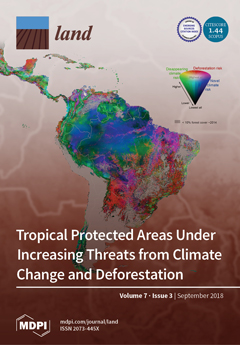
Tropical deforestation is a familiar battle for conservationists; however, habitat loss from climate change presents an additional challenge. We analyzed the combination of these two risks to biodiversity in the humid tropical forest biome using future climate metrics and deforestation projections. We found forests were exposed to different combinations of threats, which should be considered when designing conservation measures. For example, forests exposed to the highest combined threats should be prioritized for investments that reduce deforestation and increase climate resiliency. Forests exposed to low deforestation risk but high climate risk should be prioritized for increasing protected area size and connectivity to enable species migration. Considering the climate change and deforestation threats to biodiversity may help conservationists to devise more effective conservation measures. View this [...] Read more.
  • Issues are regarded as officially published after their release is announced to the table of contents alert mailing list.
  • You may sign up for e-mail alerts to receive table of contents of newly released issues.
  • PDF is the official format for papers published in both, html and pdf forms. To view the papers in pdf format, click on the "PDF Full-text" link, and use the free Adobe Reader to open them.
Order results
Result details
Section
Select all
Export citation of selected articles as:
13 pages, 930 KiB  
Article
The Role of Tourism in the Ecosystem Services Framework
by Josep Pueyo-Ros
Land 2018, 7(3), 111; https://doi.org/10.3390/land7030111 - 18 Sep 2018
Cited by 32 | Viewed by 8212
Abstract
The Ecosystem Services Framework (ESF) is a powerful tool for understanding the relationship between nature and society, and tourism is an important expression of this. However, the scientific literature focusing on the relationship between tourism and the ESF is limited. Hence, there is [...] Read more.
The Ecosystem Services Framework (ESF) is a powerful tool for understanding the relationship between nature and society, and tourism is an important expression of this. However, the scientific literature focusing on the relationship between tourism and the ESF is limited. Hence, there is a need to bring the tourism research community and the ESF together, not only as a cultural service but as an economic sector that consumes natural resources. This paper aims to do this by analyzing discourse on tourism in institutional reports produced by the ESF. Additionally, how the tourism research community has approached the ESF is analyzed by reviewing the literature that has used it and literature addressing nature-based tourism. The results suggest a “schizophrenic” approach to tourism, which is defined as either a cultural ES (nonmaterial) or as a nature-based industry (consumptive). Moreover, a disconnect has been found between tourism research and the ESF. The tourism research community may not feel comfortable with the inaccurate definition of tourism in the ESF and may prefer to use freer terms. However, the aforementioned community should integrate the ESF within their studies on natural resources. At the same time, the ESF should be more accurate in using tourism-related concepts. Full article
Show Figures

Figure 1

22 pages, 2410 KiB  
Article
The Actors, Rules and Regulations Linked to Export Horticulture Production and Access to Land and Water as Common Pool Resources in Laikipia County, Northwest Mount Kenya
by Mariah Ngutu, Salome Bukachi, Charles Owuor Olungah, Boniface Kiteme, Fabian Kaeser and Tobias Haller
Land 2018, 7(3), 110; https://doi.org/10.3390/land7030110 - 17 Sep 2018
Cited by 6 | Viewed by 5061
Abstract
Agriculture is the backbone of Kenya’s economy, supporting up to 80% of rural livelihoods. Kenya’s export horticulture is currently the leading agriculture subsector in Kenya and is regarded as an agro-industrial food system based on the economies of scale, producing for mass markets [...] Read more.
Agriculture is the backbone of Kenya’s economy, supporting up to 80% of rural livelihoods. Kenya’s export horticulture is currently the leading agriculture subsector in Kenya and is regarded as an agro-industrial food system based on the economies of scale, producing for mass markets outside of the production area. Much of the food consumed from Kenya’s export horticulture sector has undergone multiple transformations and been subject to a host of formal and informal institutions (rules, regulations, standards, norms and values). Kenya’s export horticulture production, driven by rising global demands, has expanded beyond the ‘traditional’ mountainous high yielding areas into arid and semi-arid (ASALs) zones such as Laikipia County, Northwest of Mount Kenya. An anthropological study of export horticulture viewed as an agro-industrial food system in Laikipia County was carried out utilizing the new institutionalism theory in anthropology to explore the actors, rules and regulations linked to export horticulture production and access to common pool resources. The study employed qualitative data collection methods to collect data over an extended field work period of eight months. The data from 40 in-depth interviews complemented by unstructured observations, four focus group discussions and five key informant interviews was transcribed, coded and analyzed thematically based on the grounded theory approach. This paper, therefore, presents findings from the qualitative case study on the actors as well as the rules and regulations (the institutional settings) of export horticulture production and access to common pool resources from an emic perspective of the involved actors. The formal and informal rules and regulations which form the institutional setting in this food system are viewed as changing and defining the operations of the food system’s access and management of common pool resources, namely water and land. With the agro-industrial food system competing with local food systems such as agro-pastoralism and small holder agriculture for these scarce resources in a semi-arid zone, there is potential for conflict and reduced production, as well as overall benefits to the different actors in the study area. Full article
Show Figures

Figure 1

19 pages, 75478 KiB  
Article
Modelling Farm Growth and Its Impact on Agricultural Land Use: A Country Scale Application of an Agent-Based Model
by Veronique Beckers, Jeroen Beckers, Matthias Vanmaercke, Etienne Van Hecke, Anton Van Rompaey and Nicolas Dendoncker
Land 2018, 7(3), 109; https://doi.org/10.3390/land7030109 - 15 Sep 2018
Cited by 22 | Viewed by 7481
Abstract
The ongoing economic pressure on farmers has resulted in lower gross margins, lower income, and a continuous decrease in the number of farmers in large parts of the world. Most remaining farmers upscale their activities by taking over the land of their former [...] Read more.
The ongoing economic pressure on farmers has resulted in lower gross margins, lower income, and a continuous decrease in the number of farmers in large parts of the world. Most remaining farmers upscale their activities by taking over the land of their former competitors, resulting in a decrease in agricultural employment and an increase in average farm size, accompanied by specialisation and new management techniques. Understanding these significant trends and their impact on the land use and environment requires a deeper knowledge of the mechanisms involved and the impacts of different policy measures. These processes are ideally represented through agent-based modelling. Currently, agent-based models are rarely for larger regions. This paper presents ADAM (Agricultural Dynamics through Agent-based Modelling), using it for the case study of Belgium. ADAM was created to obtain insights in past and current agricultural trends and to explore possible effects of policy measures. ADAM simulates the evolution of a farmer population and their farms at a fine scale on the country level. It produces yearly outputs on the number of farms, their size, and the type of farming activity on every parcel. Results show that ADAM is capable of adequately modelling a farmer population according to past trends and that it can be used to explore the results of a business-as-usual scenario, therefore showing the possibility of creating agent-based models for larger scale real-world applications. Full article
Show Figures

Figure 1

19 pages, 2425 KiB  
Article
Analyses of Land Cover Change Trajectories Leading to Tropical Forest Loss: Illustrated for the West Kutai and Mahakam Ulu Districts, East Kalimantan, Indonesia
by Carina Van der Laan, Arif Budiman, Judith A. Verstegen, Stefan C. Dekker, Wiwin Effendy, André P. C. Faaij, Arif Data Kusuma and Pita A. Verweij
Land 2018, 7(3), 108; https://doi.org/10.3390/land7030108 - 13 Sep 2018
Cited by 17 | Viewed by 6420
Abstract
In Indonesia, land cover change for agriculture and mining is threatening tropical forests, biodiversity and ecosystem services. However, land cover change is highly dynamic and complex and varies over time and space. In this study, we combined Landsat-based land cover (change) mapping, pixel-to-pixel [...] Read more.
In Indonesia, land cover change for agriculture and mining is threatening tropical forests, biodiversity and ecosystem services. However, land cover change is highly dynamic and complex and varies over time and space. In this study, we combined Landsat-based land cover (change) mapping, pixel-to-pixel cross tabulations and expert knowledge to analyze land cover change and forest loss in the West Kutai and Mahakam Ulu districts in East Kalimantan from 1990–2009. We found that about one-third of the study area changed in 1990–2009 and that the different types of land cover changes in the study area increased and involved more diverse and characteristic trajectories in 2000–2009, compared to 1990–2000. Degradation to more open forest types was dominant, and forest was mostly lost due to trajectories that involved deforestation to grasslands and shrubs (~17%), and to a lesser extent due to trajectories from forest to mining and agriculture (11%). Trajectories from forest to small-scale mixed cropland and smallholder rubber occurred more frequently than trajectories to large-scale oil palm or pulpwood plantations; however, the latter increased over time. About 11% of total land cover change involved multiple-step trajectories and thus “intermediate” land cover types. The combined trajectory analysis in this paper thus contributes to a more comprehensive analysis of land cover change and the drivers of forest loss, which is essential to improve future land cover projections and to support spatial planning. Full article
Show Figures

Figure 1

15 pages, 12220 KiB  
Article
From Town to Countryside: Middle-Byzantine Bath-Houses in Eastern Crete and Their Changing Functions
by Natalia Poulou and Anastasios Tantsis
Land 2018, 7(3), 107; https://doi.org/10.3390/land7030107 - 12 Sep 2018
Cited by 3 | Viewed by 4517
Abstract
The article examines the context of a recently discovered double bath-house complex in Loutres, a site near Mochlos on the north shore of eastern Crete. The excavators explore the broader questions posed by the finding, in connection to both its immediate surroundings and [...] Read more.
The article examines the context of a recently discovered double bath-house complex in Loutres, a site near Mochlos on the north shore of eastern Crete. The excavators explore the broader questions posed by the finding, in connection to both its immediate surroundings and its wider periphery. Its relation to the site’s geography, a ravine on the shore, forms the starting point to address issues regarding its original use as well as its later transformations. The enquiry leads into considering similar structures with different fates in the area and the connotations regarding their relationship to both the landscape and the settlements to which they belonged. The article goes on to discuss the general issues of the historic context of medieval Crete concerning both the archaeology and the information from the sources. It seems that long-held concepts about the abandonment of seaside settlements due to the so-called “Arab threat” are no longer valid. On the contrary, archaeology proves the continuity of the settlements of eastern Crete, both in Loutres and elsewhere. Moreover, the later use of the bath-houses in the area provides evidence for social changes after the 13th century impacting on both the landscape and its settlements. Full article
Show Figures

Figure 1

18 pages, 7197 KiB  
Article
Temporal and Spatial Analysis of Flood Occurrences in the Drainage Basin of Pinios River (Thessaly, Central Greece)
by George D. Bathrellos, Hariklia D. Skilodimou, Konstantinos Soukis and Efterpi Koskeridou
Land 2018, 7(3), 106; https://doi.org/10.3390/land7030106 - 11 Sep 2018
Cited by 54 | Viewed by 7565
Abstract
Historic data and old topographic maps include information on historical floods and paleo-floods. This paper aims at identifying the flood hazard by using historic data in the drainage basin of Pinios (Peneus) River, in Thessaly, central Greece. For this purpose, a catalogue of [...] Read more.
Historic data and old topographic maps include information on historical floods and paleo-floods. This paper aims at identifying the flood hazard by using historic data in the drainage basin of Pinios (Peneus) River, in Thessaly, central Greece. For this purpose, a catalogue of historical flood events that occurred between 1979 and 2010 and old topographic maps of 1881 were used. Moreover, geomorphic parameters such as elevation, slope, aspect and slope curvature were taken into account. The data were combined with the Geographical Information System to analyze the temporal and spatial distribution of flood events. The results show that a total number of 146 flood events were recorded in the study area. The number of flood events reaches its maximum value in the year 1994, while October contains the most flood events. The flood occurrences increased during the period 1990–2010. The flooded area reaches its maximum value in the year 1987, and November is the month with the most records. The type of damages with the most records is for rural land use. Regarding the class of damages, no human casualties were recorded during the studied period. The annual and monthly distribution of the very high category reaches the maximum values, respectively, in the year 2005 and in June. The analysis of the spatial distribution of the floods proves that most of the occurrences are recorded in the southern part of the study area. There is a certain amount of clustering of flood events in the areas of former marshes and lakes along with the lowest and flattest parts of the study area. These areas are located in the central, southern, south-eastern and coastal part of the study area and create favorable conditions for flooding. The proposed method estimates the localization of sites prone to flood, and it may be used for flood hazard assessment mapping and for flood risk management. Full article
(This article belongs to the Special Issue Land Use Planning for Natural Hazards)
Show Figures

Graphical abstract

14 pages, 2488 KiB  
Article
Criteria to Confirm Models that Simulate Deforestation and Carbon Disturbance
by Robert Gilmore Pontius
Land 2018, 7(3), 105; https://doi.org/10.3390/land7030105 - 10 Sep 2018
Cited by 9 | Viewed by 4328
Abstract
The Verified Carbon Standard (VCS) recommends the Figure of Merit (FOM) as a possible metric to confirm models that simulate deforestation baselines for Reducing Emissions from Deforestation and forest Degradation (REDD). The FOM ranges from 0% to 100%, where larger FOMs indicate more-accurate [...] Read more.
The Verified Carbon Standard (VCS) recommends the Figure of Merit (FOM) as a possible metric to confirm models that simulate deforestation baselines for Reducing Emissions from Deforestation and forest Degradation (REDD). The FOM ranges from 0% to 100%, where larger FOMs indicate more-accurate simulations. VCS requires that simulation models achieve a FOM greater than or equal to the percentage deforestation during the calibration period. This article analyses FOM’s mathematical properties and illustrates FOM’s empirical behavior by comparing various models that simulate deforestation and the resulting carbon disturbance in Bolivia during 2010–2014. The Total Operating Characteristic frames FOM’s mathematical properties as a function of the quantity and allocation of simulated deforestation. A leaf graph shows how deforestation’s quantity can be more influential than its allocation when simulating carbon disturbance. Results expose how current versions of the VCS methodologies could conceivably permit models that are less accurate than a random allocation of deforestation, while simultaneously prohibit models that are accurate concerning carbon disturbance. Conclusions give specific recommendations to improve the next version of the VCS methodology concerning three concepts: the simulated deforestation quantity, the required minimum FOM, and the simulated carbon disturbance. Full article
Show Figures

Figure 1

16 pages, 7204 KiB  
Article
Watery Entanglements in the Cypriot Hinterland
by Louise Steel
Land 2018, 7(3), 104; https://doi.org/10.3390/land7030104 - 05 Sep 2018
Cited by 10 | Viewed by 5450
Abstract
This paper examines how water shaped people’s interaction with the landscape in Cyprus during the Bronze Age. The theoretical approach is drawn from the new materialisms, effectively a ‘turn to matter’, which emphasises the very materiality of the world and challenges the privileged [...] Read more.
This paper examines how water shaped people’s interaction with the landscape in Cyprus during the Bronze Age. The theoretical approach is drawn from the new materialisms, effectively a ‘turn to matter’, which emphasises the very materiality of the world and challenges the privileged position of human agents over the rest of the environment. The paper specifically moves away from more traditional approaches to landscape archaeology, such as central place theory and more recently network theory, which serve to separate and distance people from the physical world they live in, and indeed are a part of; instead, it focuses on an approach that embeds humans, and the social/material worlds they create, as part of the environment, exploring human interactions within the landscape as assemblages, or entanglements of matter. It specifically emphasises the materiality and agency of water and how this shaped people’s engagement with, and movement through, their landscape. The aim is to encourage archaeologists to engage with the materiality of things, to better understand how people and other matter co-create the material (including social) world. Full article
Show Figures

Figure 1

18 pages, 8086 KiB  
Article
An Experimental Framework for Integrating Citizen and Community Science into Land Cover, Land Use, and Land Change Detection Processes in a National Mapping Agency
by Ana-Maria Olteanu-Raimond, Laurence Jolivet, Marie-Dominque Van Damme, Timothée Royer, Ludovic Fraval, Linda See, Tobias Sturn, Mathias Karner, Inian Moorthy and Steffen Fritz
Land 2018, 7(3), 103; https://doi.org/10.3390/land7030103 - 04 Sep 2018
Cited by 9 | Viewed by 4891
Abstract
Accurate and up-to-date information on land use and land cover (LULC) is needed to develop policies on reducing soil sealing through increased urbanization as well as to meet climate targets. More detailed information about building function is also required but is currently lacking. [...] Read more.
Accurate and up-to-date information on land use and land cover (LULC) is needed to develop policies on reducing soil sealing through increased urbanization as well as to meet climate targets. More detailed information about building function is also required but is currently lacking. To improve these datasets, the national mapping agency of France, Institut de l’Information Géographique et Foréstière (IGN France), has developed a strategy for updating their LULC database on a update cycle every three years and building information on a continuous cycle using web, mobile, and wiki applications. Developed as part of the LandSense project and eventually tapping into the LandSense federated authentication system, this paper outlines the data collection campaigns, the key concepts that have driven the system architecture, and a description of the technologies developed for this solution. The campaigns have only just begun, so there are only preliminary results to date. Thus far, feedback on the web and mobile applications has been positive, but still requires a further demonstration of feasibility. Full article
Show Figures

Figure 1

20 pages, 3480 KiB  
Article
Residents’ Perception of Informal Green Space—A Case Study of Ichikawa City, Japan
by Minseo Kim, Christoph D. D. Rupprecht and Katsunori Furuya
Land 2018, 7(3), 102; https://doi.org/10.3390/land7030102 - 04 Sep 2018
Cited by 30 | Viewed by 9581
Abstract
Urban green space (UGS) has been proven to be essential for improving the health of residents. Local governments thus need to provide attractive UGS to enhance residents’ wellbeing. However, cities face spatial and finanical limitations in creating and managing UGS. As a result, [...] Read more.
Urban green space (UGS) has been proven to be essential for improving the health of residents. Local governments thus need to provide attractive UGS to enhance residents’ wellbeing. However, cities face spatial and finanical limitations in creating and managing UGS. As a result, greening plans often fail or are postponed indefinitely. To evaluate whether informal urban green space (IGS) can supplement existing UGS, we conducted a questionnaire survey of 567 residents in Ichikawa (Japan), a city currently providing only 3.43 m2 green space per capita. In particular, we analyzed how residents’ existing green space activities affect IGS perception, as it may be difficult to recognize IGS as greenery because it is not an officially recognized space for recreation. Results show that residents took a favorable stance towards IGS, but perception differs depending on their green environment exposure. Residents who are frequently exposed to green environments in their daily lives highly recognized the environmental improvement aspects of IGS and significantly perceived spatial accessibility as an advantage of IGS. Willingness to participate in conservation activities of UGS was linked with a likelihood of recognizing IGS as UGS. Our results encourage understanding IGS as supplementary green space taking into account the attitude of residents to UGS, and contribute to introducing the IGS discourse into green space planning. Full article
(This article belongs to the Special Issue Landscape Urbanism and Green Infrastructure)
Show Figures

Figure 1

29 pages, 24209 KiB  
Article
A Differentiated Spatial Assessment of Urban Ecosystem Services Based on Land Use Data in Halle, Germany
by Janis Arnold, Janina Kleemann and Christine Fürst
Land 2018, 7(3), 101; https://doi.org/10.3390/land7030101 - 30 Aug 2018
Cited by 20 | Viewed by 7558
Abstract
Urban ecosystem services (ES) contribute to the compensation of negative effects caused by cities by means of, for example, reducing air pollution and providing cooling effects during the summer time. In this study, an approach is described that combines the regional biotope and [...] Read more.
Urban ecosystem services (ES) contribute to the compensation of negative effects caused by cities by means of, for example, reducing air pollution and providing cooling effects during the summer time. In this study, an approach is described that combines the regional biotope and land use data set, hemeroby and the accessibility of open space in order to assess the provision of urban ES. Hemeroby expresses the degree of naturalness of land use types and, therefore, provides a differentiated assessment of urban ES. Assessment of the local capacity to provide urban ES was conducted with a spatially explicit modeling approach in the city of Halle (Saale) in Germany. The following urban ES were assessed: (a) global climate regulation, (b) local climate regulation, (c) air pollution control, (d) water cycle regulation, (e) food production, (f) nature experience and (g) leisure activities. We identified areas with high and low capacity of ES in the urban context. For instance, the central parts of Halle had very low or no capacity to provide ES due to highly compact building styles and soil sealing. In contrast, peri-urban areas had particularly high capacities. The potential provision of regulating services was spatially limited due to the location of land use types that provide these services. Full article
Show Figures

Figure 1

17 pages, 4913 KiB  
Article
The Usage and Perception of Pedestrian and Cycling Streets on Residents’ Well-being in Kalamaria, Greece
by Thomas Panagopoulos, Stilianos Tampakis, Paraskevi Karanikola, Aikaterini Karipidou-Kanari and Apostolos Kantartzis
Land 2018, 7(3), 100; https://doi.org/10.3390/land7030100 - 30 Aug 2018
Cited by 14 | Viewed by 5517
Abstract
Pedestrian zones are public spaces intended for the continued and safe mobility of pedestrians and people with disabilities, and they provide multiple benefits to urban areas. They counterbalance the densely built-up areas, decrease atmospheric pollution, increase available green or social space, increase walking [...] Read more.
Pedestrian zones are public spaces intended for the continued and safe mobility of pedestrians and people with disabilities, and they provide multiple benefits to urban areas. They counterbalance the densely built-up areas, decrease atmospheric pollution, increase available green or social space, increase walking and cycling rates, and facilitate active play for children. Done properly, pedestrianization may also increase local business sales. Greece boasts open public spaces and the pedestrianization of common roads. The economic crisis that Greece has been experiencing since 2008 has led people to give up their vehicles and use the pedestrian streets more frequently. The purpose of this paper was to investigate residents’ perceptions and satisfaction rates concerning the pedestrian streets of Kalamaria, Greece, and evaluate their importance for residents’ well-being. Following a random sampling method, 400 residents were interviewed. A two-step cluster analysis was conducted. The survey showed that the urban residents visited pedestrian zones in Kalamaria at least once a week, and the visits lasted 46–60 min. The improvement of urban landscape aesthetics and people’s health and well-being were evaluated as important functions of pedestrian zones. The results also indicate that residents were not satisfied with their quality of life and the existing green infrastructures of the pedestrian streets, even though they have a positive disposition toward the construction or transformation of pedestrian streets. The residents expressed their unwillingness to pay more public taxes for the construction and maintenance of pedestrian and cycling streets. The safety and convenience of the mobility of residents were the most important advantages of the pedestrian streets. Meanwhile, overspill parking and difficulties with finding parking spaces were the main disadvantages for the residents. Local authorities can use the results of the present survey to manage the city’s green infrastructure and use this information in the urban planning framework. Full article
(This article belongs to the Special Issue Landscape Urbanism and Green Infrastructure)
Show Figures

Figure 1

12 pages, 1791 KiB  
Article
Land Use Changes in Iberian Peninsula 1990–2012
by David Fernández-Nogueira and Eduardo Corbelle-Rico
Land 2018, 7(3), 99; https://doi.org/10.3390/land7030099 - 20 Aug 2018
Cited by 21 | Viewed by 8760
Abstract
This work aims to provide a comprehensive, wall-to-wall analysis of land use/cover changes in the continental areas of Portugal and Spain between 1990 and 2012. This overall objective is developed into two main research questions: (1) Whether differences between the extent and prevalence [...] Read more.
This work aims to provide a comprehensive, wall-to-wall analysis of land use/cover changes in the continental areas of Portugal and Spain between 1990 and 2012. This overall objective is developed into two main research questions: (1) Whether differences between the extent and prevalence of changes exist between both countries and (2) which are the hotspots of change (areas where a given land use/cover transition dominates the landscape) in each country. We used Corine Land Cover in three different points in time (1990, 2000, 2012) to explore eight characteristic land cover transitions and carried out a cluster analysis at LAU2 level (municipalities in Spain, parishes in Portugal) that allowed to identify the areas in which each transition was dominant. The main findings include the decline of agricultural area and the increase of urbanized and artificial covers in both countries, but different trends followed by forest cover, with an increase in Spain and a decrease in Portugal. At the same time, the spatial analysis provided an overview of the main gradients of change related to tensions between agricultural intensification–extensification, on the one hand, and deforestation–afforestation, on the other. Full article
Show Figures

Graphical abstract

21 pages, 1585 KiB  
Article
Land Grabbing in Europe? Socio-Cultural Externalities of Large-Scale Land Acquisitions in East Germany
by Ramona Bunkus and Insa Theesfeld
Land 2018, 7(3), 98; https://doi.org/10.3390/land7030098 - 20 Aug 2018
Cited by 30 | Viewed by 8998
Abstract
Recently, we witnessed an immense increase in international land transactions in the Global South, a phenomenon slowly expanding in northern industrialized countries, too. Even though in Europe agriculture plays a decreasing economic role for rural livelihoods, the increases in land transactions by non-local, [...] Read more.
Recently, we witnessed an immense increase in international land transactions in the Global South, a phenomenon slowly expanding in northern industrialized countries, too. Even though in Europe agriculture plays a decreasing economic role for rural livelihoods, the increases in land transactions by non-local, non-agricultural investors pervades rural life. Nevertheless, the underlying processes are not yet well understood. Large-scale land acquisitions describe such purchases and leases in a neutral way, while ‘land grabbing’ expresses negative consequences for rural people. We investigate whether and under which conditions the term land grabbing is justified for the phenomenon observed in Europe. We propose six socio-cultural criteria that scholars should consider to come to an initial classification: legal irregularities, non-residence of new owners, centralization in decision-making structures, treating land as an investment object, concentration of decision-power, and limited access to land markets. We supplement our findings with empirical material from East Germany, where such land acquisition processes occur. Our paper contributes to the ongoing discussion about agricultural structural change in Europe, which is intensified by increasing land prices and a new distribution of landownership but likewise strongly intertwined with rural development. Full article
Show Figures

Figure 1

17 pages, 2182 KiB  
Article
Firewood Collection in South Africa: Adaptive Behavior in Social-Ecological Models
by Ulfia A. Lenfers, Julius Weyl and Thomas Clemen
Land 2018, 7(3), 97; https://doi.org/10.3390/land7030097 - 15 Aug 2018
Cited by 21 | Viewed by 6335
Abstract
Due to the fact that the South Africa’s savanna landscapes are under changing conditions, the previously sustainable firewood collection system in rural areas has become a social-ecological factor in questions about landscape management. While the resilience of savannas in national parks such as [...] Read more.
Due to the fact that the South Africa’s savanna landscapes are under changing conditions, the previously sustainable firewood collection system in rural areas has become a social-ecological factor in questions about landscape management. While the resilience of savannas in national parks such as Kruger National Park (KNP) in South Africa has been widely acknowledged in ecosystem management, the resilience of woody vegetation outside protected areas has been underappreciated. Collecting wood is the dominant source of energy for rural households, and there is an urgent need for land management to find sustainable solutions for this complex social-ecological system. However, the firewood collection scenario is only one example, and stands for all “human-ecosystem service” interactions under the topic of over-utilization, e.g., fishery, grazing, harvesting. Agent-based modeling combined with goal-oriented action planning (GOAP) can provide fresh insights into the relationship between individual needs of humans and changes in land use. At the same time, this modeling approach includes adaptive behavior under changing conditions. A firewood collection scenario was selected for a proof-of-concept comprising households, collectors, ecosystem services and firewood sites. Our results have shown that, even when it is predictable what a single human agent will do, massive up-scaling is needed in order to understand the whole complexity of social-ecological systems. Under changing conditions, such as climate and an increasing population, fair distribution of natural goods become an important issue. Full article
Show Figures

Figure 1

13 pages, 492 KiB  
Perspective
Fairness and Transparency Are Required for the Inclusion of Privately Protected Areas in Publicly Accessible Conservation Databases
by Hayley S. Clements, Matthew J. Selinske, Carla L. Archibald, Benjamin Cooke, James A. Fitzsimons, Julie E. Groce, Nooshin Torabi and Mathew J. Hardy
Land 2018, 7(3), 96; https://doi.org/10.3390/land7030096 - 13 Aug 2018
Cited by 23 | Viewed by 6901
Abstract
There is a growing recognition of the contribution that privately-owned land makes to conservation efforts, and governments are increasingly counting privately protected areas (PPAs) towards their international conservation commitments. The public availability of spatial data on countries’ conservation estates is important for broad-scale [...] Read more.
There is a growing recognition of the contribution that privately-owned land makes to conservation efforts, and governments are increasingly counting privately protected areas (PPAs) towards their international conservation commitments. The public availability of spatial data on countries’ conservation estates is important for broad-scale conservation planning and monitoring and for evaluating progress towards targets. Yet there has been limited consideration of how PPA data is reported to national and international protected area databases, particularly whether such reporting is transparent and fair (i.e., equitable) to the landholders involved. Here we consider PPA reporting procedures from three countries with high numbers of PPAs—Australia, South Africa, and the United States—illustrating the diversity within and between countries regarding what data is reported and the transparency with which it is reported. Noting a potential tension between landholder preferences for privacy and security of their property information and the benefit of sharing this information for broader conservation efforts, we identify the need to consider equity in PPA reporting processes. Unpacking potential considerations and tensions into distributional, procedural, and recognitional dimensions of equity, we propose a series of broad principles to foster transparent and fair reporting. Our approach for navigating the complexity and context-dependency of equity considerations will help strengthen PPA reporting and facilitate the transparent integration of PPAs into broader conservation efforts. Full article
(This article belongs to the Special Issue Biodiversity and Protected Areas)
Show Figures

Figure 1

16 pages, 3429 KiB  
Article
From Contrary to Complementary Models: Central Places and Gateways in the South-Eastern Provence (Arles and Marseille)
by Gregor Utz
Land 2018, 7(3), 95; https://doi.org/10.3390/land7030095 - 13 Aug 2018
Cited by 2 | Viewed by 5143
Abstract
This paper applies the concepts of gateways and centrality, formerly opposing approaches to spatial planning, by now a powerful merged tool for archaeologists, to understand the dynamics of the evolution of cities and settlements in a long-term perspective. The samples are the two [...] Read more.
This paper applies the concepts of gateways and centrality, formerly opposing approaches to spatial planning, by now a powerful merged tool for archaeologists, to understand the dynamics of the evolution of cities and settlements in a long-term perspective. The samples are the two main port cities in South-Eastern Provence (France), Marseille and Arles. By means of several archaeological markers it will be shown how natural landscapes and political control influenced the fate of the economic development of both cities in Greco-Roman times. Therefore, this study focuses on the aspects of trade and administration encompassing the functionality of the ports as trans-shipment centers, the impact of political interference as well as the supply and exchange of long distance and local/regional products. Within this research framework, Marseille emerged as a static gateway for its service area with a distinct perspective on Mediterranean trade. Arles, however, was the main gateway for the whole Rhône corridor in Roman times due to its strategic location in an area characterized by a variety of landscapes and the promotion of politics as a port of the annona. The data presented here aim to reject the frequently used narrative of an ongoing competition between Arles and Marseille in favor of a more nuanced picture of economic interactions and overlapping trading networks. Full article
Show Figures

Figure 1

16 pages, 8088 KiB  
Article
Central Place and Liminal Landscape in the Territory of Populonia
by Giorgia Maria Francesca Di Paola
Land 2018, 7(3), 94; https://doi.org/10.3390/land7030094 - 03 Aug 2018
Cited by 5 | Viewed by 5041
Abstract
This article aims to outline new data on the urbanization of Populonia starting from its foundation, with particular reference to the results of archaeological surveys carried out by the University of Siena since the 1980s. The landscape archaeology approach has allowed us to [...] Read more.
This article aims to outline new data on the urbanization of Populonia starting from its foundation, with particular reference to the results of archaeological surveys carried out by the University of Siena since the 1980s. The landscape archaeology approach has allowed us to reconstruct the Etruscan city’s organization of settlements as well as its management of resources. In addition, this investigative tool has proven the most effective method to detect both places of economic or ideological centrality and specific liminal landscapes in the territory of Populonia. The urban development of the Etruscan city represents an anomalous case for several reasons that are mainly dependent on its shape, which required unconventional choices in the organization and management of its territory and natural resources. Our research leads us to suggest that the Etruscan city’s acropolis seems to have played the role of central place starting right from the establishment of the city. Within some of the new acquisitions coming from my PhD research we have to consider the feature of the hilltop fortresses system and the detection of a “liminal landscape” in the northeastern stretch of the territory between Populonia and Volterra. This particular part of the landscape had been a sacred district with a strong peripheral character and possibly close connections to the central place thanks to the significant availability of natural resources. Full article
Show Figures

Figure 1

12 pages, 4113 KiB  
Article
Setting and Implementing Standards for Management of Wild Tigers
by M. K. S. Pasha, Nigel Dudley, Sue Stolton, Michael Baltzer, Barney Long, Sugoto Roy, Michael Belecky, Rajesh Gopal and S. P. Yadav
Land 2018, 7(3), 93; https://doi.org/10.3390/land7030093 - 31 Jul 2018
Cited by 6 | Viewed by 5152
Abstract
Tiger numbers have collapsed so dramatically that conservationists are adopting a strategy of securing populations in priority conservation landscapes. This includes improving management effectiveness in these sites. The Conservation Assured|Tiger Standards (CA|TS) are designed to help ensure effectiveness and provide a benchmark against [...] Read more.
Tiger numbers have collapsed so dramatically that conservationists are adopting a strategy of securing populations in priority conservation landscapes. This includes improving management effectiveness in these sites. The Conservation Assured|Tiger Standards (CA|TS) are designed to help ensure effectiveness and provide a benchmark against which to measure progress. CA|TS is a distillation of best practice and a roadmap to management effectiveness, linking management to expert-driven standards covering all aspects of management, including those which are tiger-specific (monitoring, maintenance of prey, control of poaching). Sites are audited against a set of standards and if met, are accredited as CA|TS Approved. We describe CA|TS in the context of tiger conservation, describe the evolution and philosophy of the system and consider its application across the tiger range, before drawing on lessons learned from 5 years of development. Important benefits include the independence of CA|TS from existing governmental or NGO institutions, the emphasis on regional governance and the existence of active support groups. Conversely, the participatory approach has slowed implementation. CA|TS remains more attractive to well managed sites than to sites that are struggling, although building capacity in the latter is its key aim. The close connections between people working on tiger conservation make some aspects of independent assessment challenging. Finally, if CA|TS is to succeed in its long term aims, it needs to go hand in hand with secure and adequate funding to increase management capacity in many tiger conservation areas. Full article
(This article belongs to the Special Issue Biodiversity and Protected Areas)
Show Figures

Figure 1

17 pages, 10691 KiB  
Article
Estimation of Forest Area and Canopy Cover Based on Visual Interpretation of Satellite Images in Ethiopia
by Zerihun Asrat, Habitamu Taddese, Hans Ole Ørka, Terje Gobakken, Ingunn Burud and Erik Næsset
Land 2018, 7(3), 92; https://doi.org/10.3390/land7030092 - 30 Jul 2018
Cited by 12 | Viewed by 5543
Abstract
Forests, particularly in the tropics, are suffering from deforestation and forest degradations. The estimation of forest area and canopy cover is an essential part of the establishment of a measurement, reporting, and verification (MRV) system that is needed for monitoring carbon stocks and [...] Read more.
Forests, particularly in the tropics, are suffering from deforestation and forest degradations. The estimation of forest area and canopy cover is an essential part of the establishment of a measurement, reporting, and verification (MRV) system that is needed for monitoring carbon stocks and the associated greenhouse gas emissions and removals. Information about forest area and canopy cover might be obtained by visual image interpretation as an alternative to expensive fieldwork. The objectives of this study were to evaluate different types of satellite images for forest area and canopy cover estimation though visual image interpretation, and assess the influence of sample sizes on the estimates. Seven sites in Ethiopia with different vegetation systems were subjectively identified, and visual interpretations were carried out in a systematical design. Bootstrapping was applied to evaluate the effects of sample sizes. The results showed that high-resolution satellite images (≤5 m) (PlanetScope and RapidEye) images produced very similar estimates, while coarser resolution imagery (10 m, Sentinel-2) estimates were dependent on forest conditions. Estimates based on Sentinel-2 images varied significantly from the two other types of images in sites with denser forest cover. The estimates from PlanetScope and RapidEye were less sensitive to changes in sample size. Full article
Show Figures

Figure 1

25 pages, 5327 KiB  
Review
An Overview of the Impacts of Land Use Land Cover Changes (1980–2014) on Urban Water Security of Kolkata
by Subham Mukherjee, Wiebke Bebermeier and Brigitta Schütt
Land 2018, 7(3), 91; https://doi.org/10.3390/land7030091 - 30 Jul 2018
Cited by 48 | Viewed by 11412
Abstract
Urban Water Security is essential in urban planning to manage cities’ water infrastructures and strengthen their water stress resilience and adaptive capacities. Decision making, governance and socio-economic factors play important roles in achieving Urban Water Security. Kolkata is a growing megacity in a [...] Read more.
Urban Water Security is essential in urban planning to manage cities’ water infrastructures and strengthen their water stress resilience and adaptive capacities. Decision making, governance and socio-economic factors play important roles in achieving Urban Water Security. Kolkata is a growing megacity in a developing country, which is facing rising pressures on water-environmental provisions due to the rapid population growth and urbanization and resultant governance and infrastructural issues. This review focusses on Kolkata, which is facing critical water issues, as a case study. The study presents an overview of the urban water (in)security and its dimensions in Kolkata city, such as water consumption and distribution in the city along with the changing land use-land cover of the city area, based on the results obtained from the satellite data-based land use-land cover classification, available literature, and documents from public institutions. Full article
Show Figures

Figure 1

14 pages, 1974 KiB  
Article
Tropical Protected Areas Under Increasing Threats from Climate Change and Deforestation
by Karyn Tabor, Jennifer Hewson, Hsin Tien, Mariano González-Roglich, David Hole and John W. Williams
Land 2018, 7(3), 90; https://doi.org/10.3390/land7030090 - 28 Jul 2018
Cited by 25 | Viewed by 8424
Abstract
Identifying protected areas most susceptible to climate change and deforestation represents critical information for determining conservation investments. Development of effective landscape interventions is required to ensure the preservation and protection of these areas essential to ecosystem service provision, provide high biodiversity value, and [...] Read more.
Identifying protected areas most susceptible to climate change and deforestation represents critical information for determining conservation investments. Development of effective landscape interventions is required to ensure the preservation and protection of these areas essential to ecosystem service provision, provide high biodiversity value, and serve a critical habitat connectivity role. We identified vulnerable protected areas in the humid tropical forest biome using climate metrics for 2050 and future deforestation risk for 2024 modeled from historical deforestation and global drivers of deforestation. Results show distinct continental and regional patterns of combined threats to protected areas. Eleven Mha (2%) of global humid tropical protected area was exposed to the highest combined threats and should be prioritized for investments in landscape interventions focused on adaptation to climate stressors. Global tropical protected area exposed to the lowest deforestation risk but highest climate risks totaled 135 Mha (26%). Thirty-five percent of South America’s protected area fell into this risk category and should be prioritized for increasing protected area size and connectivity to facilitate species movement. Global humid tropical protected area exposed to a combination of the lowest deforestation and lowest climate risks totaled 89 Mha (17%), and were disproportionately located in Africa (34%) and Asia (17%), indicating opportunities for low-risk conservation investments for improved connectivity to these potential climate refugia. This type of biome-scale, protected area analysis, combining both climate change and deforestation threats, is critical to informing policies and landscape interventions to maximize investments for environmental conservation and increase ecosystem resilience to climate change. Full article
(This article belongs to the Special Issue Biodiversity and Protected Areas)
Show Figures

Figure 1

12 pages, 321 KiB  
Article
Landscape and Hunting. The Economy of the Eschatia
by Christy Constantakopoulou
Land 2018, 7(3), 89; https://doi.org/10.3390/land7030089 - 26 Jul 2018
Cited by 4 | Viewed by 5349
Abstract
This paper explores the place of ancient Greek hunting within the Greek landscape and environment, with particular reference to the eschatia, the marginal, uncultivated (or marginally cultivated) land. It is part of a bigger project on the social history of hunting in [...] Read more.
This paper explores the place of ancient Greek hunting within the Greek landscape and environment, with particular reference to the eschatia, the marginal, uncultivated (or marginally cultivated) land. It is part of a bigger project on the social history of hunting in archaic and classical Greece, where emphasis is placed on the economic and dietary contribution of hunting for Greek communities. Hunting has attracted scholarly attention, mostly as a result of the role that hunting narratives play in Greek mythology, and the importance of hunting scenes in Greek art. Rather than talking about the role of hunting in rites of passage, I would like to explore the relationships of different social classes to hunting (which is understood here to include all forms of capturing animals on land, including trapping and snaring). The ‘un-central’ landscape of the eschatia appears to be an important locus for hunting practices, and therefore, a productive landscape. Hunting in the eschatia was opportunistic, required minimum effort in terms of crossing distances, allowed access to game that could be profitable in the market, and made the transport of game easier to manage. Full article
19 pages, 9154 KiB  
Article
Modelling Land Sharing and Land Sparing Relationship with Rural Population in the Cerrado
by João Pompeu, Luciana Soler and Jean Ometto
Land 2018, 7(3), 88; https://doi.org/10.3390/land7030088 - 21 Jul 2018
Cited by 4 | Viewed by 4646
Abstract
Agricultural expansion and intensification enabled growth of food production but resulted in serious environmental changes. In light of that, debates concerning sustainability in agriculture arises on scientific literature. Land sharing and land sparing are two opposite models for framing agricultural sustainability. The first [...] Read more.
Agricultural expansion and intensification enabled growth of food production but resulted in serious environmental changes. In light of that, debates concerning sustainability in agriculture arises on scientific literature. Land sharing and land sparing are two opposite models for framing agricultural sustainability. The first aims to integrate agricultural activities with biodiversity conservation by means of enhancing the quality of the agricultural matrix in the landscape towards a wildlife friendly matrix. The other model aims to spare natural habitats from agriculture for conservation. This work aimed to explore spatial evidences of land sharing/sparing and its relationship with rural population in the Brazilian Cerrado. A Land Sharing/Sparing Index based on TerraClass Cerrado map was proposed. Spatial analysis based on Global and Local Moran statistics and Geographically Weighted Regression were made in order to explore the influence of local rural population on the probability of spatial land sharing/sparing clusters occurrence. Spatial patterns of land sharing were found in the Cerrado and a positive association with rural population was found in some regions, such as in its northern portion. Land use policies should consider regional infrastructural and participative governance potentialities. The results suggests possible areas where joint agricultural activities and human presence may be favourable for biodiversity conservation. Full article
(This article belongs to the Special Issue Land Use and Food Systems Interactions in South America)
Show Figures

Figure 1

16 pages, 887 KiB  
Article
Needs Assessment in Land Administration: The Potential of the Nominal Group Technique
by Serene Ho, Valérie Pattyn, Bruno Broucker and Joep Crompvoets
Land 2018, 7(3), 87; https://doi.org/10.3390/land7030087 - 20 Jul 2018
Cited by 6 | Viewed by 4445
Abstract
This paper introduces the Nominal Group Technique (NGT) for conducting needs assessments in land administration projects. Understanding the local context of what citizens, communities and organisations need remains a complex challenge yet fundamental to the success of land administration projects. To date, key [...] Read more.
This paper introduces the Nominal Group Technique (NGT) for conducting needs assessments in land administration projects. Understanding the local context of what citizens, communities and organisations need remains a complex challenge yet fundamental to the success of land administration projects. To date, key methods of understanding and identifying local needs have been qualitative in nature with various strengths and limitations. For land administration, it is also important for empirical methods to attend to power imbalances amongst participants that are a hallmark and driver of land tenure security. Although NGT has hardly been used in the domain of land administration, based on our experience of employing the method in a research project in East Africa, we argue that it presents a valuable addition to needs assessment strategies. We provide a broad outline of the method before providing a detailed description of how we employed the method. We discuss the opportunities and challenges that NGT offers, arguing that it is a time and resource efficient way of engaging communities in a participatory and equitable process which facilitates the co-production of valid and reliable knowledge on needs, and consensus on how these needs should be prioritised. Full article
Show Figures

Figure 1

18 pages, 989 KiB  
Article
The Relative Concentration of Interaction—A Proposal for an Integrated Understanding of Centrality and Central Places
by Daniel Knitter and Oliver Nakoinz
Land 2018, 7(3), 86; https://doi.org/10.3390/land7030086 - 20 Jul 2018
Cited by 11 | Viewed by 6034
Abstract
The importance of a place can be assessed via an analysis of its centrality. However, although central place research has a long history, there is no generally accepted theoretical base, leading to continuous debates about the core elements of centrality and those features [...] Read more.
The importance of a place can be assessed via an analysis of its centrality. However, although central place research has a long history, there is no generally accepted theoretical base, leading to continuous debates about the core elements of centrality and those features that ultimately constitute the centrality of a place. We propose a generalized definition that understands centrality as the relative concentration of interaction. Using this definition, we are able to integrate various social, cultural, and natural aspects in the analysis of a central place and its landscape setting. We present a semi-quantitative method to assess the actual and potential centrality and that enables us (a) to draw conclusions about the type and characteristics of central places, (b) to investigate their development throughout time, and (c) to compare them to each other. We sketch the application of the method using two exemplary sites: the Iron Age site Heuneburg and the Roman palace Felix Romuliana Full article
Show Figures

Figure 1

18 pages, 5869 KiB  
Article
Physical and Anthropogenic Factors Related to Landslide Activity in the Northern Peloponnese, Greece
by Hariklia D. Skilodimou, George D. Bathrellos, Efterpi Koskeridou, Konstantinos Soukis and Dimitrios Rozos
Land 2018, 7(3), 85; https://doi.org/10.3390/land7030085 - 19 Jul 2018
Cited by 85 | Viewed by 5409
Abstract
The geological, geomorphic conditions of a mountainous environment along with precipitation and human activities influence landslide occurrences. In many cases, their relation to landslide events is not well defined. The scope of the present study is to identify the influence of physical and [...] Read more.
The geological, geomorphic conditions of a mountainous environment along with precipitation and human activities influence landslide occurrences. In many cases, their relation to landslide events is not well defined. The scope of the present study is to identify the influence of physical and anthropogenic factors in landslide activity. The study area is a mountainous part of the northern Peloponnesus in southern Greece. The existing landslides, lithology, slope angle, rainfall, two types of road network (highway-provincial roads and rural roads) along with land use of the study area are taken into consideration. Each physical and anthropogenic factor is further divided into sub-categories. Statistical analysis of landslide frequency and density, as well as frequency and density ratios, are applied and combined with a geographic information system (GIS) to evaluate the collected data and determine the relationship between physical and anthropogenic factors and landslide activity. The results prove that Plio-Pleistocene fine-grained sediments and flysch, relatively steep slopes (15°–30°) and a rise in the amount of rainfall increase landslide frequency and density. Additionally, Plio-Pleistocene fine-grained sediments and flysch, as well as schist chert formations, moderate (5°–15°) and relatively steep slopes (15°–30°), along with the amount of rainfall of >700 mm are strongly associated with landslide occurrences. The frequency and magnitude of landslides increase in close proximity to roads. Their maximum values are observed within the 50 m buffer zone. This corresponds to a 100 m wide zone along with any type of road corridors, increasing landslide occurrences. In addition, a buffer zone of 75 m or 150 m wide zone along highway and provincial roads, as well as a buffer zone of 100 m or 200 m wide zones along rural roads, are strongly correlated with landslide events. The extensive cultivated land of the study area is strongly related to landslide activity. By contrast, urban areas are poorly related to landslides, because most of them are located in the northern coastal part of the study area where landslides are limited. The results provide information on physical and anthropogenic factors characterizing landslide events in the study area. The applied methodology rapidly estimates areas prone to landslides and it may be utilized for landslide hazard assessment mapping as well as for new and existing land use planning projects. Full article
(This article belongs to the Special Issue Land Use Planning for Natural Hazards)
Show Figures

Graphical abstract

34 pages, 5733 KiB  
Article
Indicators for Measuring Spatial Justice and Land Tenure Security for Poor and Low Income Urban Dwellers
by Ernest Uwayezu and Walter T. De Vries
Land 2018, 7(3), 84; https://doi.org/10.3390/land7030084 - 17 Jul 2018
Cited by 27 | Viewed by 7038
Abstract
There exist various indicators that measure land tenure security for urbanites. Most of those indicators measure the degree to which land titling promotes the security of tenure. Based on the reviewed literature, it is admitted that land titling is not a panacea to [...] Read more.
There exist various indicators that measure land tenure security for urbanites. Most of those indicators measure the degree to which land titling promotes the security of tenure. Based on the reviewed literature, it is admitted that land titling is not a panacea to land tenure security. Measuring the degree of land tenure security should not rely only on the legalisation of landownership. This paper makes a meta-analysis and conceptual modelling to connect spatial justice and land tenure security. It discusses the potential of inclusive urban development grounded on the claim that spatial justice enhances land tenure security. A comprehensive framework of indicators which can measure the degree of land tenure security from a spatial justice lens is thereafter derived. The meta-analysis and conceptual modelling were coupled with research synthesis to perform an in-depth review and qualitative content analysis of the literature on concepts of spatial justice, land tenure security, and urban (re)development processes. This study proposes 60 indicators which measure the degree of spatial justice and land tenure security along a continuum of spatial justice and land tenure security. Those indicators provide a more holistic approach for measuring land tenure security from a spatial justice lens than the separated sets of existing indicators. Full article
Show Figures

Figure 1

14 pages, 490 KiB  
Article
The Changing Uses of Cadastral Information: A User-Driven Case Study
by Pauliina Krigsholm, Kirsikka Riekkinen and Pirjo Ståhle
Land 2018, 7(3), 83; https://doi.org/10.3390/land7030083 - 16 Jul 2018
Cited by 25 | Viewed by 6268
Abstract
Cadastral information and land administration systems are central to effective land markets, land use and sustainable development. This paper focuses on one aspect of land administration dynamism: the changing uses of cadastral information. We follow a qualitative approach and offer an overview of [...] Read more.
Cadastral information and land administration systems are central to effective land markets, land use and sustainable development. This paper focuses on one aspect of land administration dynamism: the changing uses of cadastral information. We follow a qualitative approach and offer an overview of why, how, and in what form user groups use cadastre and land register data in Finland. We then explore different user groups’ perceptions of emerging changes and discuss their implications for the future land administration system. We identify six major changes that potentially have such implications: the streamlining of environmental permit procedures, the integration of public services, three-dimensional land use planning, tightening banking regulations, digital services, and e-government, and coordination among public data agencies. The paper addresses the relatively unexplored customer side of cadastral information and reiterates the need for an interoperable, accurate and reliable land administration system. Full article
Show Figures

Figure 1

18 pages, 4053 KiB  
Article
Model Based Regional Estimates of Soil Organic Carbon Sequestration and Greenhouse Gas Mitigation Potentials from Rice Croplands in Bangladesh
by Khadiza Begum, Matthias Kuhnert, Jagadeesh Yeluripati, Stephen Ogle, William Parton, Md Abdul Kader and Pete Smith
Land 2018, 7(3), 82; https://doi.org/10.3390/land7030082 - 05 Jul 2018
Cited by 22 | Viewed by 6821
Abstract
Rice (Oryza sativa L.) is cultivated as a major crop in most Asian countries and its production is expected to increase to meet the demands of a growing population. This is expected to increase greenhouse gas (GHG) emissions from paddy rice ecosystems, [...] Read more.
Rice (Oryza sativa L.) is cultivated as a major crop in most Asian countries and its production is expected to increase to meet the demands of a growing population. This is expected to increase greenhouse gas (GHG) emissions from paddy rice ecosystems, unless mitigation measures are in place. It is therefore important to assess GHG mitigation potential whilst maintaining yield. Using the process-based ecosystem model DayCent, a spatial analysis was carried out in a rice harvested area in Bangladesh for the period 1996 to 2015, considering the impacts on soil organic carbon (SOC) sequestration, GHG emissions and yield under various mitigation options. An integrated management (IM, a best management practice) considering reduced water, tillage with residue management, reduced mineral nitrogen fertilizer and manure, led to a net offset by, on average, −2.43 t carbon dioxide equivalent (CO2-eq.) ha−1 year−1 (GHG removal) and a reduction in yield-scaled emissions intensity by −0.55 to −0.65 t CO2-eq. t−1 yield. Under integrated management, it is possible to increase SOC stocks on average by 1.7% per year in rice paddies in Bangladesh, which is nearly 4 times the rate of change targeted by the “4 per mille” initiative arising from the Paris Climate Agreement. Full article
Show Figures

Figure 1

Previous Issue
Next Issue
Back to TopTop