


Abstract
Rural settlements serve as the core spatial carriers of rural living space, and their spatial evolution and functional transformation reflect the dynamic restructuring of human–land relationships. In karst mountainous areas, complex topography, fragmented land resources, and uneven distribution of public facilities significantly influence settlement patterns and residents’ living spaces. This study aims to quantify the relationship between settlement clustering characteristics and living-space demand and to construct a spatially explicit framework for rural settlement restructuring from a living-space perspective. Taking the Qixingguan District of Bijie City, Guizhou Province—a representative karst mountainous area in Southwest China—as a case study, we develop an integrated analytical framework encompassing spatial identification, demand measurement, and zoning optimization. Settlement clusters were identified using the Nearest Neighbor Index and Kernel Density Analysis, while accessibility to essential services—including education, healthcare, and shopping—was quantified via a Gaussian-based two-step floating catchment area method. Living-space demand was further assessed by integrating accessibility gradients with residential conditions, and restructuring types were classified based on the Living Space Index and the distance from settlements to town centers. The results indicate that (1) rural settlements in Qixingguan District exhibit significant clustering, with high-density zones concentrated around urban peripheries and along transportation corridors; (2) accessibility to living services follows a distance-decay pattern modulated by transportation networks, forming hotspots in suburban and town-center areas and cold spots in peripheral karst mountainous areas; and (3) based on the comprehensive assessment, settlements are categorized into four types—urbanizing villages, central villages, preserved villages, and relocation villages—with corresponding targeted spatial restructuring strategies proposed. This study advances the geographical understanding of rural settlement restructuring in karst mountainous areas and provides empirical evidence for optimizing human–land relationships and promoting more equitable and sustainable spatial development in mountainous regions.
1. Introduction
As the core of rural life, rural settlements embody the dynamic interactions of human–land relationships through their spatial evolution, functional transformation, and layout optimization, serving as a vital vehicle for rural revitalization [1]. Globally, alongside the advancement of industrialization, urbanization, and agricultural modernization, rural settlements are undergoing profound transformations, characterized by the reshaping of population distribution, production modes, and social structures [2]. In China, rapid industrialization and urbanization have further intensified this process, significantly altering the rural spatial pattern, functional structure, and ecological environment [3]. Rural settlements are not only critical spatial entities for sustaining rural livelihoods and cultural continuity but also key nodes for achieving rural revitalization and optimizing territorial spatial planning. However, some rural areas still face challenges such as the weakening of core functions, inefficient land use, and settlement hollowing, leading to fragmented spatial structures and a low quality of life [4]. With population migration and changes in production systems, the heterogeneity and complexity of rural space are increasing [5], posing severe challenges to its self-regulation and adaptive capacity [6]. The reshaping of socio-economic structures profoundly influences land use patterns and spatial allocation, driving trends such as industrial agglomeration, concentrated residence of farmers, and intensive resource utilization [7]. Consequently, how to optimize settlement space in tandem with rural socio-economic transformation to achieve intensive land use and functional enhancement has become a pivotal issue in improving the quality of life for rural residents and promoting sustainable rural development.
Research on rural settlement restructuring has attracted increasing attention in the international literature, with a growing body of work integrating both theoretical and empirical perspectives [8]. Existing studies have extensively examined the evolutionary mechanisms, spatial configurations, and functional transformation of rural settlements, emphasizing the interaction between socioeconomic dynamics and spatial morphology within regional development processes [9,10]. With the advancement of Geographic Information Systems (GIS) and spatial analytical techniques, research has increasingly incorporated multi-source data and quantitative approaches, enabling more systematic analyses of rural spatial restructuring [11]. Meanwhile, a growing body of literature has explored the impacts of population mobility, socio-economic transformation, policy interventions, and changes in employment structure on rural settlement dynamics [12,13,14,15].
Domestic research on the spatial restructuring of rural settlements in China has traversed several evolutionary phases, characterized by the continuous enrichment and refinement of both its thematic foci and methodological arsenal [16]. The inaugural phase was chiefly preoccupied with rural residential loci and their spatiotemporal pattern dynamics. The post-reform era witnessed a substantive reorientation of scholarly emphasis toward morphological adaptations of settlements engendered by sweeping economic transitions [17]. In the contemporary epoch, galvanized by the twin imperatives of rural revitalization and territorial spatial governance, academic endeavor has converged on deciphering the underlying mechanisms [18], typological models, and regulatory pathways informing settlement restructuring [19]. Salient research streams have crystallized around issues such as the regeneration of “hollowed villages” [20], rehabilitation suitability assessment [21], livelihood regime shifts [22], and transportation corridor-induced spatial optimization [23]. A discernible trend involves the deliberate incorporation of socioeconomic determinants—including quotidian habitus [24], activity-travel radii [25], and functional interdependencies—into analytical schemata. Leveraging technological synergies between GIS applications [26] and network analytics [27], scholars are pioneering integrated restructuring models that synthesize “production–living–ecological” functionalities [28], thereby furnishing a substantive conceptual repository for the optimization of rural spatial systems.
Despite these advances, existing research still exhibits limitations in linking spatial structural analysis with residents’ actual living needs. In particular, insufficient attention has been paid to the mismatch between public service provision and the spatial organization of daily activities, especially in mountainous and ecologically fragile regions where accessibility constraints and topographic fragmentation intensify spatial inequality [29,30,31,32].
To address this gap, the “living space perspective” is introduced as an analytical lens that focuses on the coupling between spatial structure and residents’ daily activity spaces [33,34]. This perspective provides a more integrated framework for understanding rural settlement differentiation and offers a basis for developing targeted optimization strategies [35]. However, its application in rural settlement restructuring, particularly in karst mountainous areas, remains limited and requires further empirical exploration.
Therefore, this paper selects Qixingguan District of Bijie City, Guizhou Province, a typical karst mountainous region, as a case study. An analytical framework for rural settlement reconstruction based on “spatial identification–demand measurement–zoning optimization” has been constructed. This region is characterized by fragmented topography, ecological vulnerability, dispersed rural settlements, and significant outmigration. There is a clear misalignment between public service provision and the spatial needs of daily life, providing a representative context for examining the “space–demand” coupling relationship. The objectives of this study are as follows: (1) To identify the spatial agglomeration patterns of rural settlements. (2) To measure public service accessibility and evaluate the Living Space Index. (3) To develop a classification system for rural settlements and propose differentiated optimization strategies. Understanding these spatial patterns can also provide insights for rural planning, offering a basis for guiding infrastructure allocation, settlement arrangement, and resource management in practice. This research aims to provide practical reference for achieving equitable and sustainable rural spatial governance in karst regions and other ecologically fragile areas.
2. Materials and Methods
2.1. Study Area
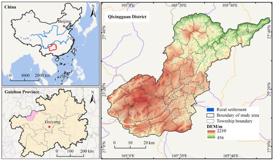
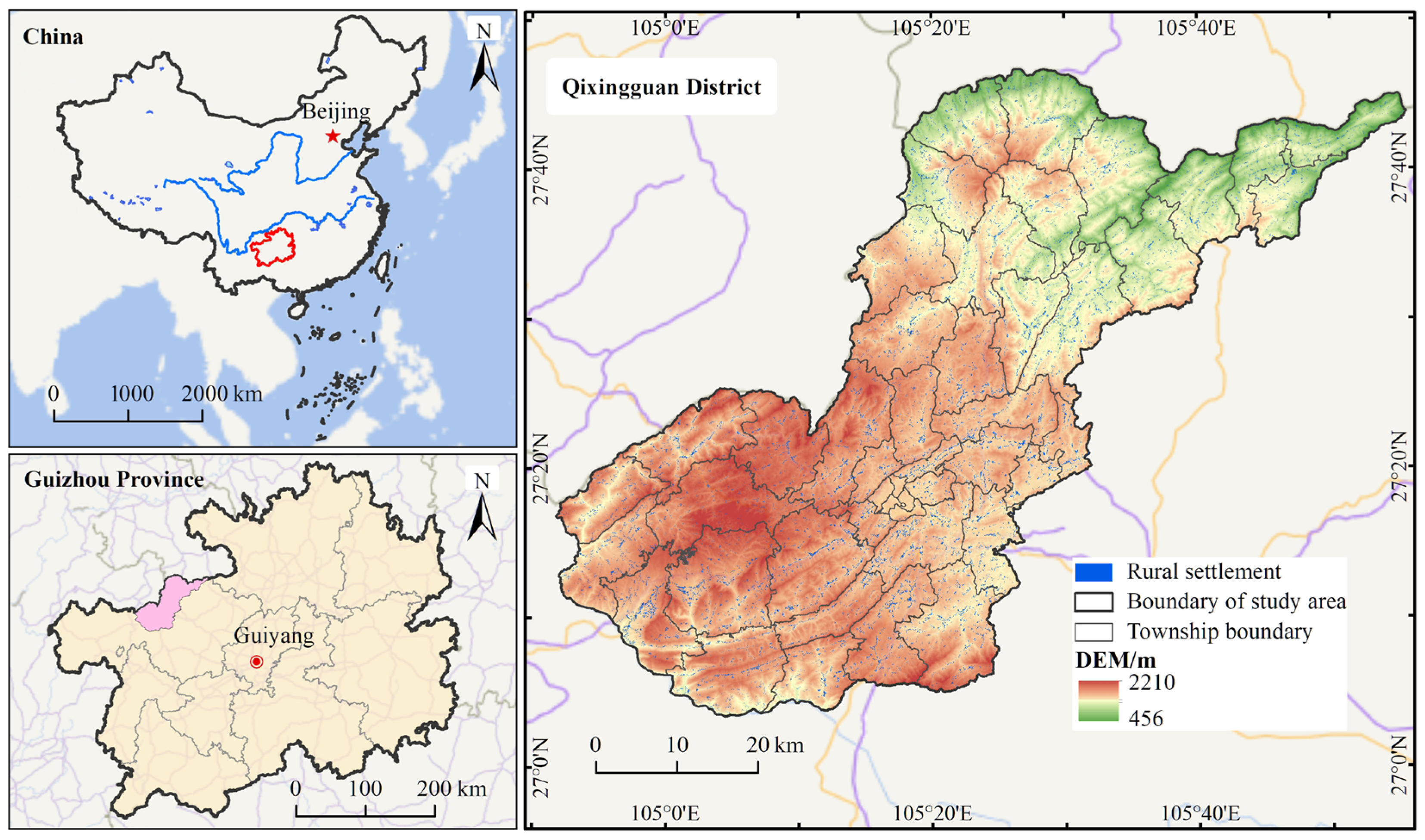
Situated in northwestern Guizhou Province, Qixingguan District represents a quintessential area of concentrated karst landforms, characterized by prominent topographic undulation where mountains and hills constitute over 85% of its total area (Figure 1). The region experiences a mild and humid climate, classified as a subtropical humid monsoon type, with an average annual temperature of approximately 14.7 °C and annual precipitation ranging from 1100 to 1300 mm “https://www.bjqixingguan.gov.cn/zjqxg/ (accessed on 20 September 2025)”. The complex terrain and fragile ecosystem impose significant constraints on land resources, resulting in fragmented arable land and a rural settlement pattern heavily conditioned by the physical geography. These characteristics are widely shared by karst mountainous regions in southwestern China, highlighting the representativeness of Qixingguan District as a typical case. In recent years, driven by the dual forces of new-type urbanization and rural revitalization, Qixingguan has witnessed substantial changes in the number and spatial configuration of its rural settlements. Out-migration and settlement hollowing have emerged in remote mountainous areas, whereas settlements adjacent to urban centers, towns, and major transportation corridors have exhibited a trend of agglomeration and expansion. The typicality and representativeness of this region render it an ideal case for investigating the spatial restructuring of rural settlements within the Karst Mountains.
Figure 1.
Location Map of Qixingguan District, Guizhou Province, China.
2.2. Research Methods
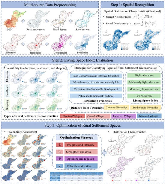
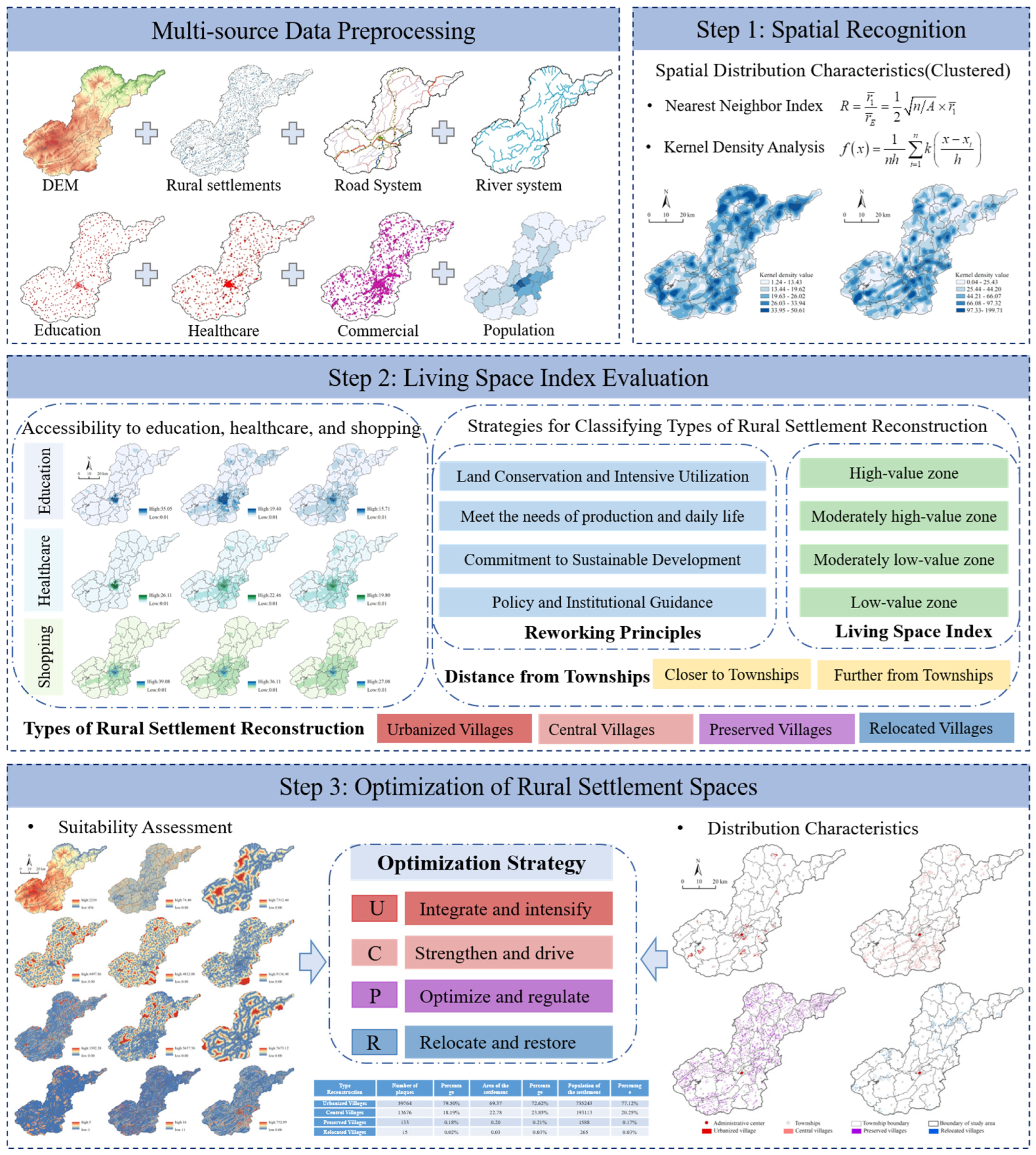
This research constructs an analytical framework for rural settlement restructuring, comprising three integrated components: “Spatial Identification, Demand Measurement, and Zoning Optimization” (Figure 2). The Spatial Identification module is designed to characterize the spatial distribution patterns and agglomeration features of rural settlements, thereby establishing a foundational understanding of the rural spatial structure. The Living Space Demand Measurement module proceeds from the perspective of residents’ behavioral needs. It comprehensively quantifies the accessibility of essential public services—such as education, healthcare, and commerce—alongside the scale of settlement residence. This process yields a composite “Living Space Index” that reflects disparities in living convenience. Consequently, this module enables the identification of spatial gradients in living space quality and informs the subsequent classification of settlement types. Building upon this foundation, the Zoning Optimization module synthesizes the Living Space Index, locational conditions, and topographic constraints to propose differentiated restructuring strategies. These strategies encompass agglomeration and enhancement, functional strengthening, classified management, and relocation and consolidation. Together, they form an optimized pathway for rural settlements tailored to the context of the Karst Mountains. This framework concurrently addresses residents’ behavioral demands and spatial process effects, providing systematic methodological support for the classified remediation and sustainable development of rural settlements in mountainous regions.
Figure 2.
Research framework.
2.2.1. Nearest Neighbor Index
The Nearest Neighbor Index (NNI) is employed to quantify the mutual proximity of rural settlements and to identify their spatial distribution pattern [36]. The pattern is classified as random when R = 1, uniform (or dispersed) when R > 1, and clustered when R < 1. It is calculated using the following formula:
where denotes the mean observed nearest neighbor distance between settlements, represents the expected mean nearest neighbor distance under a theoretical random distribution, A is the total area of the study region, and n is the number of rural settlements in the study area.
2.2.2. Kernel Density Analysis
Kernel Density Analysis is used to identify the spatial clustering degree of research objects [37]. This study mainly uses it to identify the kernel density values of rural settlement patches and rural settlement areas. The larger the value, the higher the distribution probability, indicating that rural settlements are more densely distributed. The calculation formula is
where is the kernel density estimate at spatial location x; k is the kernel function; (x − xi) represents the distance from the estimated point x to the event xi; n is the number of sample points, h is the search bandwidth.
2.2.3. Spatial Autocorrelation
- (1)
- Global Spatial Autocorrelation
Spatial autocorrelation analysis is often used to reflect the degree of association of natural or social elements in space [38]. This study selects the global Moran’s I index to identify the spatial clustering relationship of rural settlement education space, medical space, and consumption space. The value range is [−1, 1]. When I > 0, it indicates a positive spatial correlation; when I < 0, it indicates a negative spatial correlation; when I = 0, it indicates no significant spatial relationship. The calculation formula is
where n is the number of various rural living space facility points; wij is the spatial weight matrix, when i and j are adjacent, Wij = 1, otherwise Wij = 0; xi, xj are the observed values of various living spaces i, j; represents the mean of each living space.
- (2)
- Local Spatial Autocorrelation
To further explore the specific locations of high and low value clusters of rural living space, it is necessary to analyze the clustering characteristics of rural settlement living space, providing data support for the spatial optimization and reconstruction of rural settlements. Getis–Ord Gi* can detect cold spots and hot spots of rural living space [39], that is, identify low-value clusters and high-value clusters of rural living space. The calculation formula is
where d represents the distance, represents the spatial weight matrix of various rural living space facility points in Qixingguan District based on distance rules, is the j-th rural living space facility point. On this basis, the Z-score is used to monitor the significance level of the Gi* value, expressed as
where and represent the mathematical expectation and coefficient of variation of , respectively. If the Z value is positive, it indicates that the values within a certain range around the rural living space facility point i are higher than the mean, belonging to the hot spot area; if the Z value is negative, it indicates that the values within a certain range around the rural living space facility point i are lower than the mean, belonging to the cold spot area.
2.2.4. Gaussian Two-Step Floating Catchment Area Method
The general Two-Step Floating Catchment Area (2SFCA) model does not account for spatial heterogeneity within the search radius (d0). In reality, settlements closer to a service facility typically enjoy better access, following a distance-decay pattern [40]. The Gaussian Two-Step Floating Catchment Area (Ga2SFCA) method incorporates a Gaussian function within the search radius to characterize this distance decay. This adjustment eliminates the assumption of equal accessibility within the radius and better reflects the cumulative nature of spatial opportunities [41], thereby providing a more precise measurement of the convenience level for each rural settlement. Consequently, this study employs the Ga2SFCA method to calculate the accessibility of educational, medical, and commercial services. The specific procedure is as follows.
Step 1: For each settlement (k) within the search radius (d0) from the living facility point j, assign weights using the Gaussian equation, then sum the weighted settlement population with j as the center to obtain the total potential demand quantity of j, and then divide the service scale of the living facility by the demand quantity to calculate the supply–demand ratio Rj:
where d0 is the search radius, that is, the effective service radius of the living facility; dkj is the spatial distance (shortest time) from k to j; Dk is the demand scale (population quantity) of settlement k; Sj is the supply scale (service capacity) of living facility point j. G(dkj,d0) is the Gaussian equation considering spatial distance decay. The calculation formula is
Step 2: For settlement i, search all living facilities within the service threshold range (d0), and similarly assign weights to the supply–demand ratio (Rl) of each living facility l found using the Gaussian equation and sum them up to obtain the living facility connectivity of settlement i:
where the larger the value, the higher the quality of living services enjoyed and the smaller the temporal and spatial obstacles of rural settlement living services within the d0 range; Rl is the supply–demand ratio of living facility l within the spatial domain of settlement i; dij is the distance impedance between settlement i and living facility j, which can be determined using the GIS network analysis O-D cost matrix.
The time thresholds were determined based on network analysis using the existing road system in Qixingguan District. By calculating the shortest travel time from each rural settlement to educational, healthcare, and commercial facilities, the average minimum travel times were obtained (i.e., t0 = 105 min for education and healthcare, and t0 =45 min for shopping). Based on these baseline values, multiple time impedance thresholds were set for comparison, while also considering mountainous transportation conditions and field survey findings. Accordingly, the time thresholds were set as 45, 105, and 180 min for education and healthcare accessibility, and 30, 85, and 150 min for shopping accessibility.
2.2.5. Living Space Index Indicator System
Basic public service facilities in rural areas—such as education, healthcare, and commerce—serve as crucial indicators for measuring the convenience of rural life and the accessibility of social resources. Their spatial distribution and accessibility exhibit significant variations, thereby providing a foundation for assessing rural development and settlement optimization [42]. When selecting indicators to characterize the rural living space, this study integrates the conceptual essence of “living space” and draws upon relevant research, including the works of Liu Yaolin [43]. Guided by the principles of scientific rigor, relevance, and data availability, the selection process is comprehensively aligned with the actual needs of residents. By incorporating multi-dimensional demands (e.g., schooling, medical care, consumption) alongside the core element of residential scale, this system aims to holistically represent the living space of rural settlements in the Qixingguan District (Table 1).
Table 1.
Rural Settlement Living Space Indicator System.
The Living Space Index (LSI) is calculated as the weighted sum of standardized indicators [36], expressed as follows:
where Xij represents the standardized value of indicator j for unit i (derived based on the entropy weighting method), m denotes the total number of indicators, Wj is the weight assigned to indicator j, and Ti refers to the Living Space Index of rural settlements for unit i.
2.3. Data Sources
This study focuses on Qixingguan District, Bijie City, as the research area. To analyze the spatial restructuring of rural settlements, multiple types of data were utilized. Rural settlement parcels were extracted from the 1:10,000 land-use vector data for Qixingguan District in 2023, providing detailed information on settlement boundaries. Administrative division data covering the national, provincial (Guizhou), and district levels were obtained from the National Earth System Science Data Center “http://www.geodata.cn/ (accessed on 5 November 2023)”, ensuring a consistent framework for spatial analysis.
Topographic features were represented using 30-m resolution DEM digital elevation data and river network data sourced from the Geospatial Data Cloud platform “http://www.gscloud.cn/ (accessed on 16 April 2024)”, which allow for accurate simulation of terrain and hydrological constraints. Road transportation network data were derived from the National Geographical Conditions Census, providing fundamental information for accessibility and connectivity analyses.
To assess the spatial accessibility of public services, geographic coordinates were collected for 841 educational facilities, 820 healthcare facilities, and 52,919 commercial facilities. These data were obtained via the Baidu Map Coordinate Picker System “http://api.map.baidu.com/ (accessed on 13 October 2023)” and converted into vector format using ArcGIS 10.7. Population data were sourced from the Key Data Bulletin of the Seventh National Population Census for Qixingguan District, while socioeconomic indicators were obtained from the Qixingguan District Statistical Yearbook (2023) and the Statistical Bulletin on National Economic and Social Development of Qixingguan District, Bijie City (2023). Overall, these datasets provide a solid foundation for comprehensive spatial analyses and support the research objectives of this study on the spatial restructuring of rural settlements in Qixingguan District.
3. Results
3.1. Spatial Distribution Characteristics of Rural Settlements
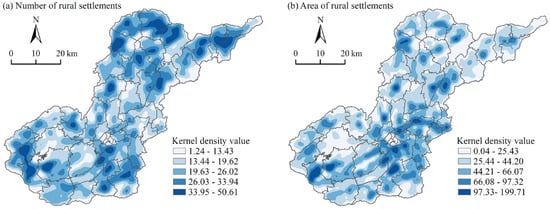
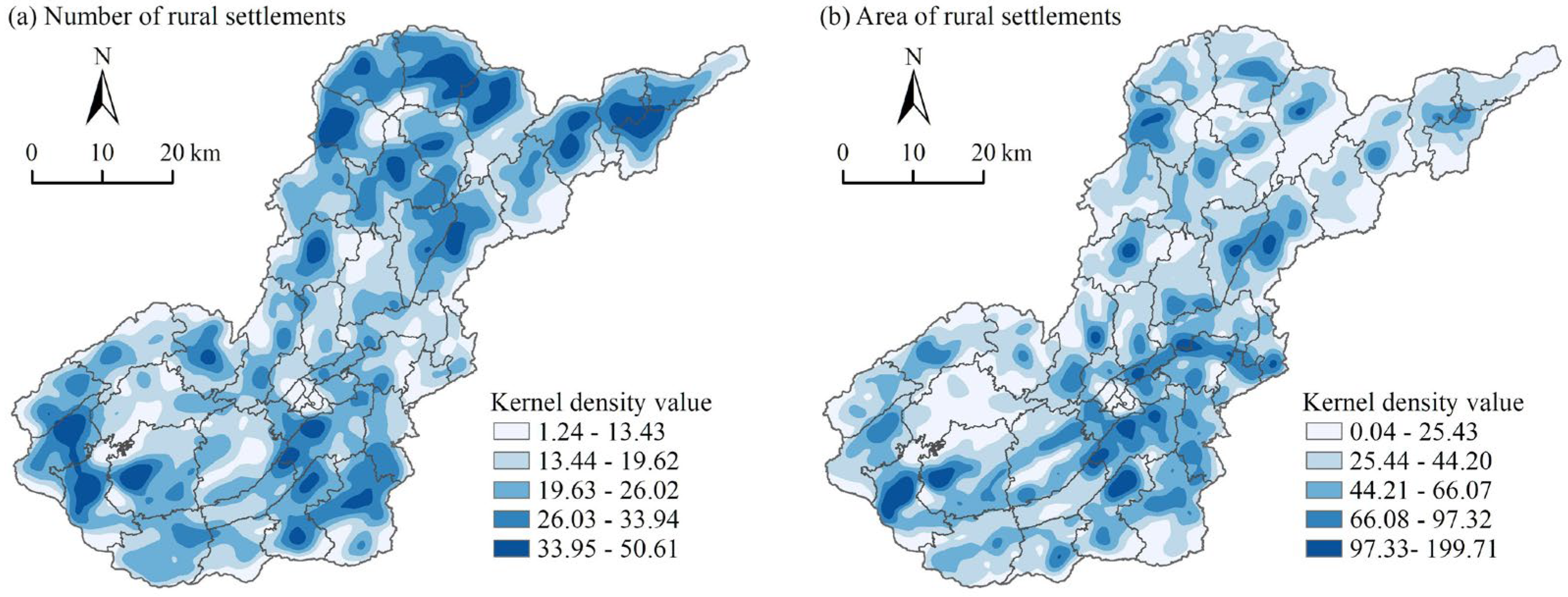
The Nearest Neighbor Index yielded a result of R = 0.37 (p < 0.01) for rural settlements in Qixingguan District, indicating a statistically significant clustered distribution pattern. Further kernel density analysis reveals an overall spatial structure characterized by “widespread dispersion with localized concentrations” (Figure 3). In terms of numerical density, high-density areas are primarily located in the northeastern townships of Datun, Longchangying, and Qingshuipu, as well as in the southwestern towns of Yangjiawan and Fangzhu. These areas generally exhibit relatively gentle terrain and better connectivity, which facilitate settlement concentration. In contrast, central and parts of southwestern townships exhibit notably low numerical density, suggesting constraints imposed by terrain fragmentation and limited land suitability. Regarding the distribution of area density, high-density zones are concentrated in Guanyinqiao Subdistrict and Yachi Town near the district government seat, southwestern Yangjiawan Town, and the border area between eastern Xiaojichang Town and Cengtai Town. This pattern highlights the influence of administrative centers and infrastructure investment in promoting the expansion and agglomeration of settlements. Conversely, the Yindi and Yejiao township areas are identified as low area-density zones, reflecting weaker development momentum and limited resource attraction. Synthesizing the patterns of quantity and scale distribution reveals that while the northeastern region contains a large number of settlements, their individual sizes are generally small. In comparison, the central urban area and its western periphery possess significant locational advantages. Facilitated by better transportation connectivity and employment opportunities, these areas have fostered a settlement pattern featuring larger individual sizes and a more clustered morphology. The observed spatial pattern reflects a coupling between settlement distribution and living space needs, which is central to understanding rural restructuring from a living space perspective.
Figure 3.
Kernel density distributions of rural settlement clusters in Qixingguan District. (a) Kernel density of settlement count; (b) Kernel density of settlement area.
3.2. Characteristics of Living Space Distribution
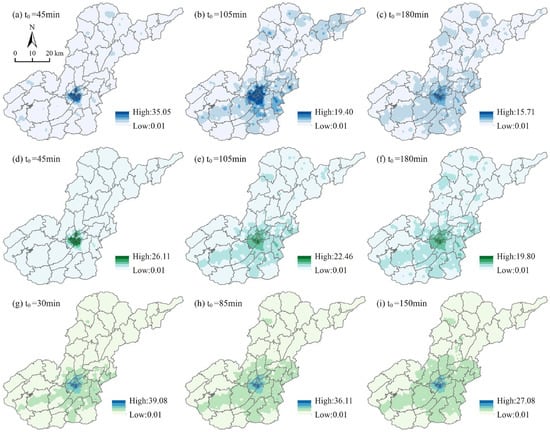
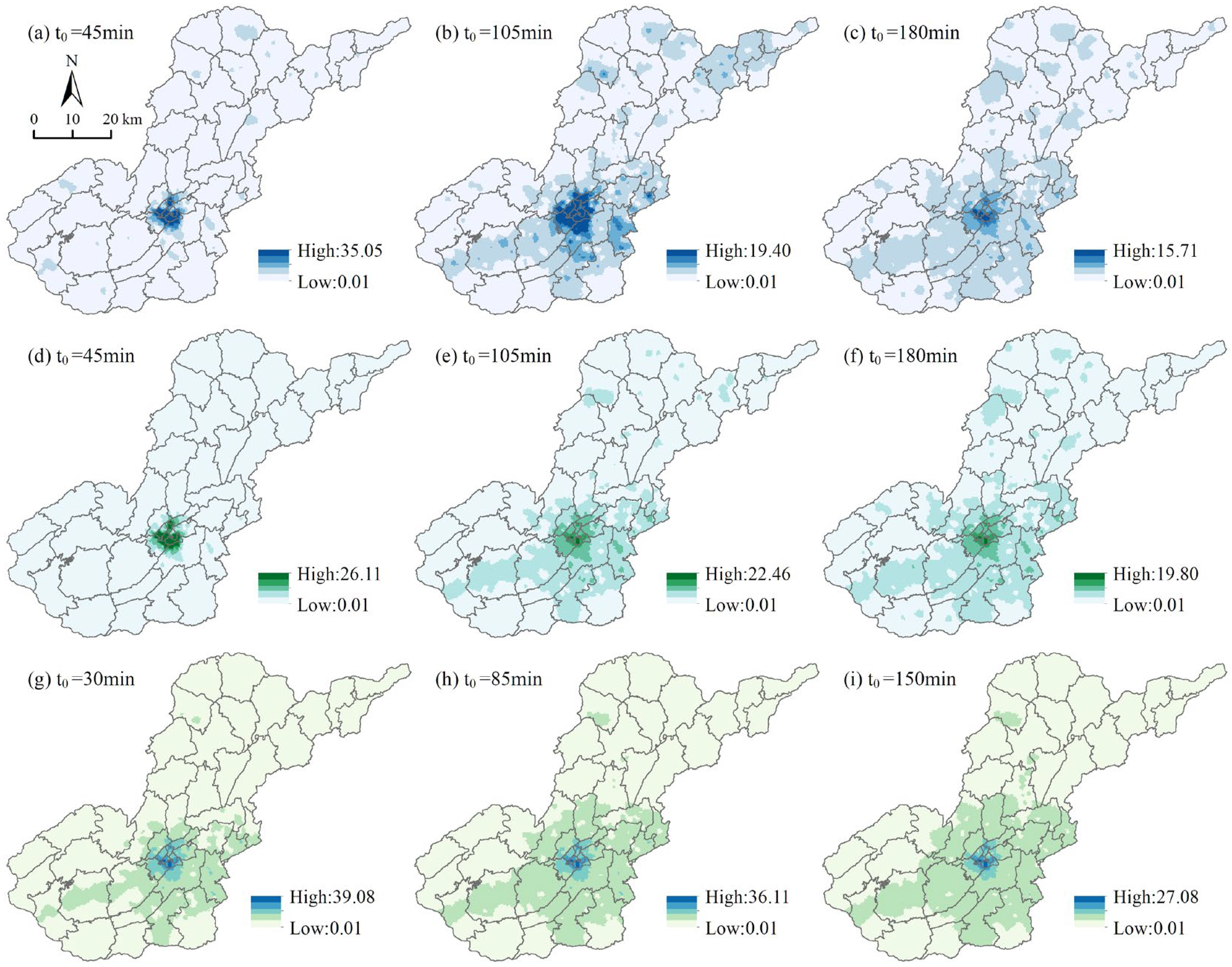
The accessibility of educational, healthcare, and commercial services for rural settlements in Qixingguan District exhibits a generalized spatial configuration of “central agglomeration and peripheral attenuation.” However, the spatial distribution of each service category presents distinctive patterns (Figure 4). High accessibility zones for education and healthcare are predominantly concentrated within the core urban areas, notably Shixi Subdistrict, Haizi Subdistrict, and Yachi Town. The pronounced agglomeration of public service infrastructure in these zones results in the encompassing rural settlements accounting for less than 1% of the district’s total in terms of number, spatial extent, and population. This indicates a strong concentration of high-quality public resources within a limited spatial range, forming a typical “core dominance” structure. Commercial accessibility similarly demonstrates marked centrality, with its high-value zones largely located in Shixi Subdistrict, Hongshan Subdistrict, and Biyang Subdistrict. Settlements within these zones constitute a mere 2.12% of all rural settlements, revealing a distinct spatial pattern dominated by urban commercial radiation. In contrast, extensive low-accessibility belts characterize the peripheral hilly and mountainous townships. The low-accessibility zone for education encompasses approximately 79.5% of rural settlements, while the corresponding figures for healthcare and commerce are 70.26% and 71.58%, respectively. These zones are primarily distributed in townships such as Lishu, Zhuchang, and Salaxi, which maintain weaker functional linkages with the central urban area. This spatial pattern typifies an overlap of inadequate service provision and transportation constraints. Overall, this core–periphery gradient structure reflects a high degree of spatial inequity in the provision of fundamental public services. It underscores a significant resource-absorption effect exerted by the urban core, while simultaneously highlighting the substantial spatial impediments hindering the enhancement of service accessibility within the peripheral rural system.
Figure 4.
Spatial distributions of public service accessibility in Qixingguan District. (a–c) Educational accessibility (time thresholds: 45 min, 105 min, 180 min); (d–f) medical accessibility (time thresholds: 45 min, 105 min, 180 min); (g–i) shopping accessibility (time thresholds: 30 min, 85 min, 150 min).
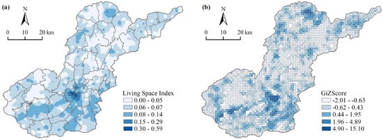
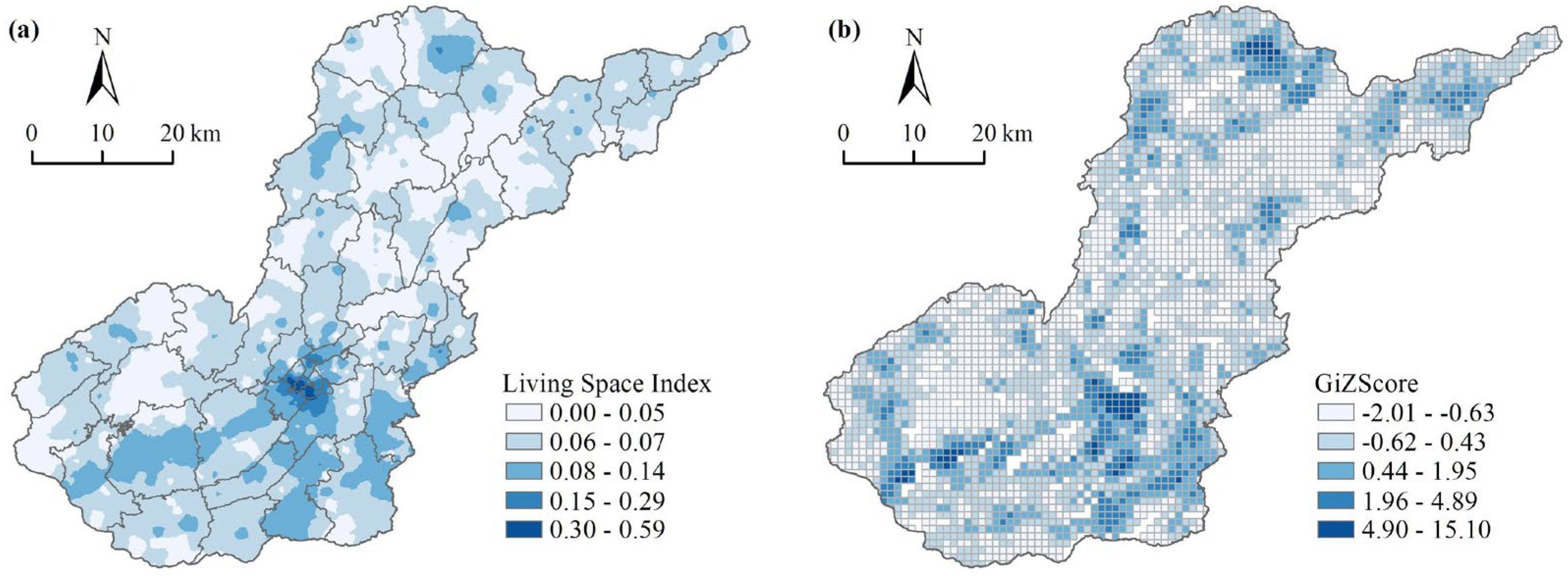
The living space pattern of rural settlements in Qixingguan District exhibits pronounced spatial heterogeneity, demonstrating a strong orientation toward the central urban area and major towns (Figure 5). Regions including the central urban core and its periphery—such as Yachi Town, Salaxi Town in the southwest, Yangjiawan Town, and Shengji Town in the north—generally register higher Living Space Index (LSI) values. However, the rural settlements within these zones are relatively limited in number, spatial extent, and population size. In contrast, areas including Yejiao Township and Fangzhu Town in the northwest, as well as Yanzikou Town and Tuanjie Township in the north, constitute low-LSI zones. These areas contain a significantly higher share of the district’s rural settlements, accounting for 41.38%, 46.55%, and 47.41% of the total number, area, and population, respectively. Characterized by relatively deficient infrastructure and public service resources, these low-LSI zones face constraints in residents’ daily living convenience, highlighting an imbalance in resource allocation and developmental levels between urban and rural areas. Further analysis based on cold/hot spot identification reveals an interspersed spatial distribution of living convenience. Hot spots are primarily concentrated in and around the central urban area—for instance, in Sanbanqiao Subdistrict, the central-northern part of Yachi Town, and southwestern towns like Salaxi and Yangjiawan—where residents enjoy superior living conditions. Conversely, cold spots are sporadically distributed across northwestern Yejiao Township, central Bazhai Town, and other peripheral townships, indicating lower convenience levels. This pattern reflects the disparities in socio-economic development and infrastructure provision across different regions within the district. Overall, this core–periphery gradient structure reflects a high degree of spatial inequity in the provision of fundamental public services. More importantly, it reveals a structural mismatch between the spatial distribution of rural settlements and the allocation of public service resources.
Figure 5.
Spatial patterns of rural settlement living space in Qixingguan District. (a) Spatial distribution of the living space index; (b) Hotspot and coldspot patterns of living space.
3.3. Classification of Rural Settlement Spatial Restructuring Types
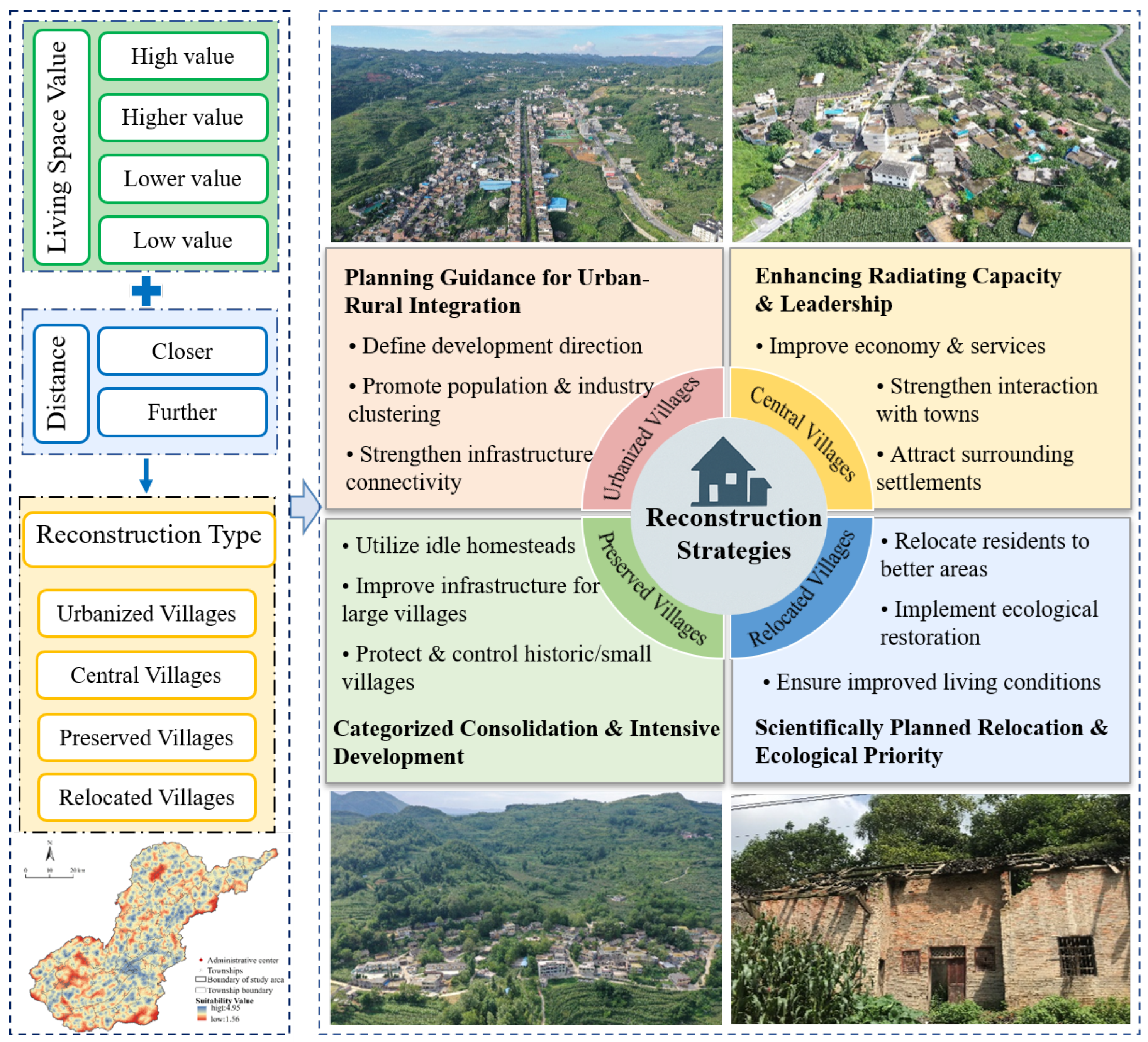
Based on the Living Space Index (LSI) of rural settlements in Qixingguan District, this study employed the natural breaks classification method to categorize them into four tiers. These tiers were then further refined by incorporating the spatial distance between settlements and their respective township centers to delineate specific settlement types. Distance to town centers and the LSI were selected as the two key indicators because they directly reflect residents’ life convenience and the radiation capacity of urban centers, thereby providing a clear and policy-relevant basis for settlement optimization. Specifically, settlements characterized by a high LSI and close proximity to a township center are classified as “Urbanized Villages”. Settlements with a high LSI but located far from township centers, as well as those with a medium LSI and relatively close to township centers, are defined as “Central Villages”. Settlements exhibiting a low LSI yet situated near township centers are categorized as “Preserved Villages”. Conversely, settlements with both a low LSI and significant remoteness from township centers are identified as “Relocated Villages”.
The results (Table 2) demonstrate a distinct spatial differentiation pattern in the restructuring types of rural settlements in Qixingguan District. Preserved Villages occupy the highest areal proportion (55.62%), representing the most extensive settlement type in the region. However, their prevalence does not necessarily indicate development advantage; rather, it reflects a widespread condition of moderate accessibility but limited functional upgrading capacity. Urbanized Villages and Central Villages together account for approximately one-third of the total area and accommodate a population of over 310,000. Their relatively high LSI values and favorable proximity to town centers indicate stronger integration into regional socio-economic networks, making them key nodes for population concentration and service provision. In contrast, Relocated Villages comprise the smallest areal share (7.67%), predominantly distributed in remote areas characterized by fragmented terrain and poor accessibility, where living space quality is notably inferior. These villages constitute primary targets for relocation and focused governance interventions. Overall, the four settlement types display clear gradients in spatial carrying capacity, public service accessibility, and population agglomeration, providing a solid basis for implementing spatially differentiated and categorized restructuring strategies.
Table 2.
Statistics on the size of different reconfiguration types of rural settlements.
3.4. Spatial Restructuring Strategies for Rural Settlements
- Restructuring Strategy for Urbanized Villages
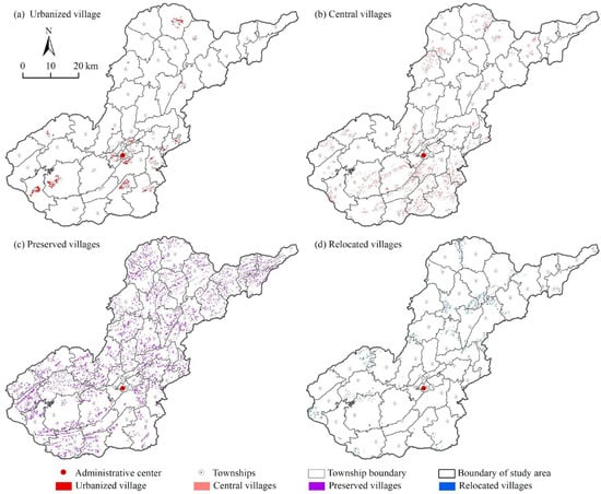
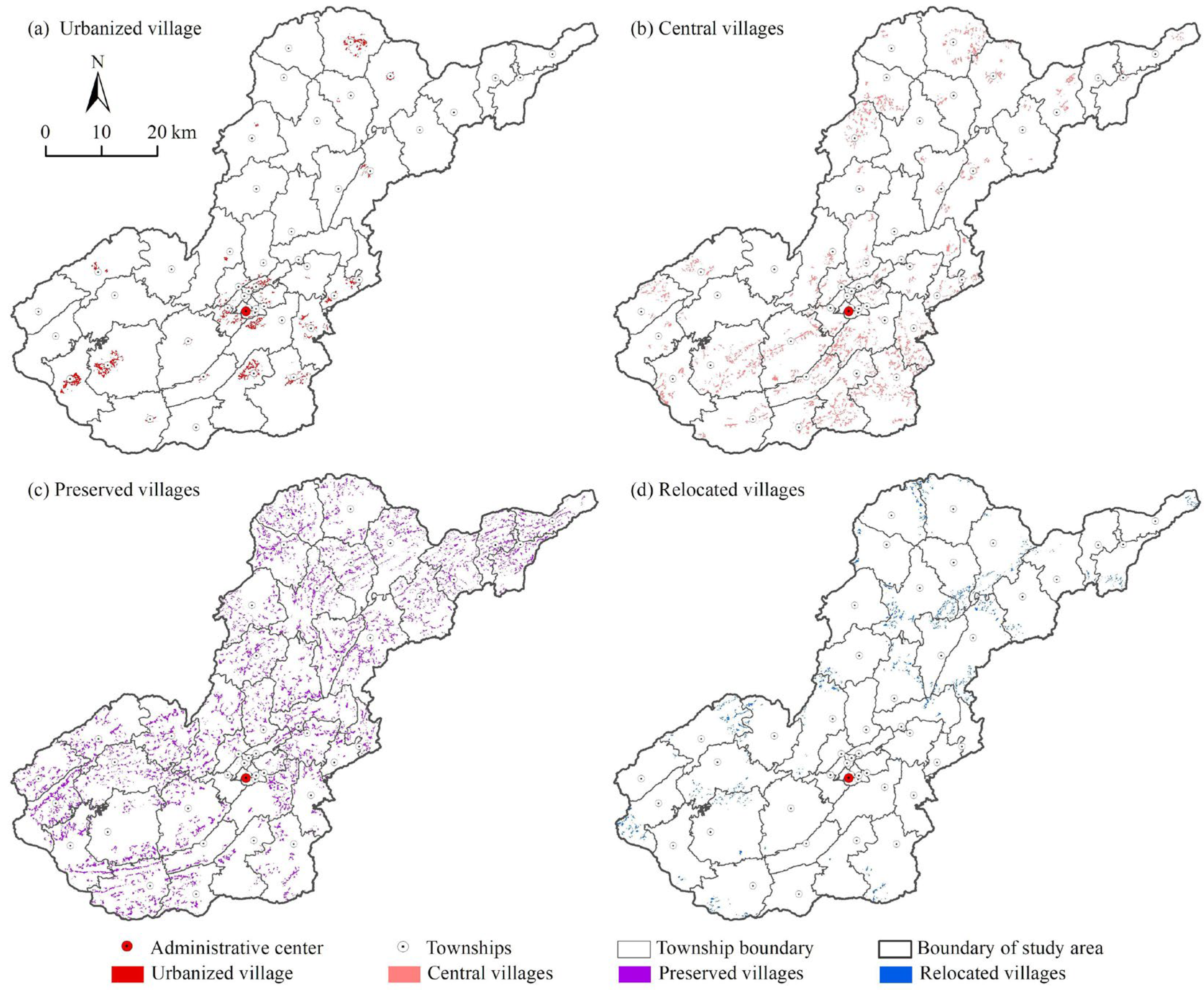
Urbanized Villages serve as critical nodes for urban–rural integrated development in Qixingguan District (Figure 6a). Characterized by favorable living space, convenient transportation, and well-developed infrastructure, they are significantly influenced by urban radiation effects and can function as reserve areas for future urban expansion. These settlements are primarily distributed around the central urban area, including Guanyinqiao Subdistrict, Sanbanqiao Subdistrict, the central-northern part of Yachi Town, Salaxi Town in the southwest, Yangjiawan Town, and Shengji Town in the northeast. Their well-established transportation networks enable rapid integration into the urban development system, positioning them as vital platforms for resource sharing and economic synergy between urban and rural areas. Therefore, the restructuring of Urbanized Villages should prioritize planning guidance to define development directions, scientifically allocate population and industries, promote orderly settlement expansion, and foster urban–rural integration and coordinated regional economic development.
Figure 6.
Spatial Distribution of Reconstruction Types in Rural Settlements.
- 2.
- Restructuring Strategy for Central Villages
Central Villages constitute the core carriers of rural development within the district, exerting a strong attraction on surrounding settlements, particularly those of the relocation type (Figure 6b). Besides being distributed on the periphery of Urbanizing Villages, Central Villages are also widely located in areas such as Zhuchang Town, Qianxi Township, Chahe Town, and Lishu Town, as well as Dayin Town, Linkou Town, Tiankan Township, and Longchangying Town. These areas feature high settlement concentration and relatively flat terrain, indicating good development potential. Central Villages should focus on enhancing their radiating and driving capacities. By strengthening economic vitality and improving infrastructure and public services, they can increase their influence on surrounding settlements, fostering a virtuous cycle of complementary advantages and coordinated development. Simultaneously, efforts should be made to deepen their integration with towns to achieve resource sharing and interactive urban–rural development.
- 3.
- Restructuring Strategy for Preserved Villages
Preserved Villages represent the most widespread settlement type in Qixingguan District (Figure 6c). They exhibit lower living space conditions and are typically located in transitional zones between Central Villages and Relocated Villages. Although influenced by the radiation from surrounding settlements and possessing basic transportation infrastructure, their independent development capacity remains relatively limited. During the restructuring process, it is essential to fully utilize idle or abandoned homestead resources, control disorderly settlement expansion, and improve intensive land use efficiency. For larger settlements with a substantial permanent population, priority should be given to improving infrastructure to meet residents’ needs and enhance their quality of life. For smaller, sparsely populated settlements, development scale should be reasonably controlled to avoid resource wastage, and guidance should be provided for gradual migration to neighboring Urbanizing Villages or Central Villages. For traditional villages with historical and cultural value, emphasis should be placed on protecting their spatial form, implementing protective construction, and preserving historical, cultural, and ethnic characteristics.
- 4.
- Restructuring Strategy for Relocated Villages
Relocated Villages represent a settlement type facing specific challenges in Qixingguan District, characterized by the poorest living space conditions (Figure 6d). They are primarily located in remote mountainous areas, such as the western part of Fangzhu Town, the border area between Qingchang Town and Yuhui Town, the southern part of Yanzikou Town, and the northern part of Bazhai Town. Constrained by natural conditions, inconvenient transportation, and scarce public service resources, these settlements are limited in number but possess favorable ecological environments. They are suitable for relocation and integration into Central Villages or Preserved Villages. The restructuring of Relocated Villages should adhere to the principles of scientific planning and rational relocation, ensuring residents are relocated to areas with better development conditions and living environments. Concurrently, emphasis must be placed on ecological protection. Measures such as ecological reclamation and afforestation should be implemented to restore the natural environment, laying the foundation for the sustainable development of the original relocation areas.
4. Discussion
4.1. Analysis the Analytical Framework for Rural Settlement Restructuring from a Living Space Perspective and Its Methodological Contributions
This research, grounded in the perspective of living space, constructs an analytical framework for rural settlement restructuring tailored to the context of the Karst Mountains. Distinct from conventional studies that predominantly focus on geographical constraints [44] or singular socio-economic factors [29], this research emphasizes the interaction between residents’ daily behavioral demands and settlement spatial patterns, thereby achieving an integrated analysis of spatial structure and human behavioral mechanisms. The framework highlights the subjective and dynamic nature of living space, incorporating residents’ daily activities, social connections, and spatial configurations into a unified analytical system. This advances the study of rural settlements from a “description of spatial forms” towards an “interpretation of living processes.”
Methodologically, the research synthetically employs the Gaussian Two-Step Floating Catchment Area method, kernel density estimation, and spatial autocorrelation analysis. Compared to the potential accessibility model proposed by Li [45] and the comprehensive accessibility framework by Geurs [46], this study further incorporates factors such as travel destination preference and functional attractiveness. This addresses the oversight of individual behavioral differences inherent in traditional accessibility analyses. Furthermore, in contrast to international scholars like Campbell [47] and Páez [48], whose work emphasizes micro-scale modeling, this research achieves the integrated application of living space elements and accessibility analysis at the county scale, demonstrating strong regional adaptability and operational feasibility.
Moreover, the proposed framework exhibits high replicability and data compatibility. It can not only reveal the spatial characteristics and distribution of living services in rural settlements across different geomorphological regions but can also be flexibly adapted by adjusting its indicator system based on data availability, facilitating its application in other topographically complex areas. Overall, this framework provides methodological support for shifting the research paradigm from “material space optimization” to “living quality enhancement” and offers a more universally applicable research pathway for rural spatial governance.
4.2. Novel Insights into Living Space Patterns and Their Implications for Rural Planning
The findings reveal significant spatial heterogeneity in the living space of rural settlements in Qixingguan District, shaped by the combined effects of topographic constraints, transportation conditions, and the distribution of public services. Settlements located in core towns and along major transportation corridors exhibit markedly higher Living Space Index (LSI) values, whereas those in peripheral mountainous areas suffer from notably inferior living space quality. However, unlike most studies that rely on single-factor explanations based solely on physical geography or socio-economic conditions, this research achieves a multidimensional comprehensive analysis by introducing the “Living Space Index”. From the perspective of “resident living experience”, it uncovers a new mechanism underlying rural spatial differentiation. This outcome extends the research framework of Li [49] and Qin [50] concerning the coupling of “production–living–ecological” functions, demonstrating that living space is not merely an outcome of functional differentiation in rural settlements but also a key driver in their restructuring process. Furthermore, while the living space of settlements in Qixingguan District presents a “core-agglomeration and peripheral-decay” spatial pattern—broadly consistent with Yang’s [51] findings in southwestern hilly regions—this study further identifies the imbalance in transportation networks and the allocation of facilities such as education and healthcare as the primary causes of this gradient pattern.
At the level of planning practice, the Living Space Index serves as a crucial quantitative tool for the classification and optimized restructuring of rural settlements. By integrating living space quality with proximity to township centers, this study categorizes rural settlements into four types: Urbanized Villages, Central Villages, Preserved Villages, and Relocated Villages. This corresponds to the spatial restructuring pathway of “spatial identification–demand measurement–zoning optimization” (Figure 7). This methodological framework can support initiatives such as comprehensive territorial consolidation, rural revitalization, and human settlement improvement, providing quantitative backing for precisely identifying key remediation areas and optimizing infrastructure layout. Additionally, this approach demonstrates potential for enhancing settlement functions, promoting socio-economic integration, and incorporating ecological protection considerations into rural planning strategies.
Figure 7.
Analytical Framework for Rural Settlement Reconstruction in Qixingguan District.
4.3. Research Limitations and Future Perspectives
This study, grounded in a living space perspective, has established an integrated analytical framework for rural settlement restructuring in the Karst Mountains. By examining the relationship between the accessibility of residents’ daily life needs and their spatial proximity to township centers, it has identified distinct development pathways—namely Urbanized Villages, Central Villages, Preserved Villages, and Relocated Villages. This provides a novel research approach for constructing a more service-oriented and human-centered rural spatial governance system.
Future research could build upon this foundation by further incorporating dynamic data and behavioral perspectives. It must be acknowledged that this study is constrained by data temporality. Relying on a single time period’s data, it captures a static snapshot of the current living space condition but falls short of adequately revealing its dynamic evolutionary process. Future work should integrate multi-temporal remote sensing data with socio-survey information to construct models of living space evolution over time. Such an approach would facilitate the identification of settlement functional transformation trends and enhance the understanding of residents’ adaptive behaviors [52] from a dynamic perspective, thereby supplementing the temporal characteristics often absent in static analyses. Furthermore, the restructuring of rural settlements requires the strengthening of multi-scalar linkages and the application of scenario-based planning tools. The evolution of local settlements is influenced not only by local conditions but also by the interplay of broader-scale factors such as regional labor markets, transportation networks, and policy incentives. Integrating spatial network models, land-use simulation methods, and collaborative planning with governmental bodies could advance the transformation of the analytical framework proposed in this study. This would contribute to the development of operational, adaptable, and continuously monitorable planning and governance solutions for the Karst Mountains and potentially broader regions.
5. Conclusions
This study, adopting living space as its analytical entry point, comprehensively examines the spatial distribution characteristics and differentiation patterns of rural settlements in Qixingguan District. It constructs a living space-oriented modesl for rural settlement restructuring and proposes corresponding optimization pathways. By integrating public service accessibility and the residential scale of settlements into a unified analytical framework, the research achieves a systematic synthesis that progresses from describing spatial patterns to explicating the mechanisms of living processes. This provides a novel perspective for the categorized restructuring of rural settlements in mountainous areas.
The results indicate that rural settlements in Qixingguan District exhibit a significantly clustered spatial pattern, predominantly concentrated around the central urban area and in the southwestern region. This reflects the agglomeration effect exerted by the urban core on surrounding townships. The accessibility of educational, medical, and commercial services displays a concentric pattern radiating from the central urban area. However, the spatial distribution varies across service types and gradually diminishes with increasing travel-time impedance, resulting in markedly insufficient service accessibility in peripheral zones. Analysis based on the Living Space Index reveals pronounced spatial disparities in settlement convenience. The overall pattern is oriented toward the central urban area, with hotspots forming multinuclear agglomerations and coldspots creating contiguous interstitial zones. This reflects the dynamic interplay among residents’ daily activities, social connections, and spatial configurations.
Based on the Living Space Index and proximity to township centers, this study further classifies rural settlements into four types: Urbanized Villages, Central Villages, Preserved Villages, and Relocated Villages, proposing differentiated restructuring strategies accordingly. Urbanized Villages and Central Villages, benefiting from superior location and well-developed public services, are suitable for guiding population and industrial agglomeration, thereby strengthening their radiating and driving effects on surrounding settlements. Preserved Villages should focus on optimizing land use and improving infrastructure while concurrently protecting traditional villages of historical and cultural value. Relocated Villages require scientifically planned relocation and ecological protection, integrating them into more suitable settlement systems to enhance living conditions and safeguard the ecological environment.
In summary, this study not only elucidates the spatial distribution of rural settlements and disparities in public service provision within Qixingguan District but also proposes actionable pathways for categorized restructuring. It provides theoretical and methodological support for promoting urban–rural integration, optimizing resource allocation, and fostering coordinated regional development. The findings offer a scientific basis for formulating precise and effective rural development policies and implementing rural revitalization strategies. Simultaneously, they provide an analytical framework and practical guidance that can be referenced for rural planning and management in similar Karst Mountains.
Author Contributions
Conceptualization, Q.Z.; methodology, Q.Z. and H.P.; software, H.P.; validation, X.Z. (Xiaowen Zhou) and J.S.; formal analysis, X.Z. (Xiaowen Zhou) and H.P.; investigation, Q.Z.; resources, X.Z. (Xuesong Zhang); data curation, J.S.; writing—original draft preparation, Q.Z.; writing—review and editing, X.Z. (Xiaowen Zhou) and J.S.; visualization, Q.Z.; supervision, X.Z. (Xiaowen Zhou); project administration, X.Z. (Xuesong Zhang) and J.S.; funding acquisition, X.Z. (Xuesong Zhang) and J.S. All authors have read and agreed to the published version of the manuscript.
Funding
This research was funded by the Basic Research and Operational Self Determined Research Fund of Central China Normal University (Grant No. CCNUKJC2024009), the National Natural Science Foundation of China (42361028).
Data Availability Statement
The raw data supporting the conclusions of this article will be made available by the authors on request.
Conflicts of Interest
The authors declare no conflicts of interest.
References
- Long, H.; Tu, S. Rural restructuring: Theory, approach and research prospect. Acta Geogr. Sin. 2017, 72, 563–576. [Google Scholar]
- Yang, R.; Pan, Y.; Xu, Q. Space diversification process and evolution mechanism of typical village in the suburbs of guangzhou: A case study of beicun. J. Geogr. Sci. 2020, 30, 1155–1178. [Google Scholar] [CrossRef] [Scilit]
- Yu, L.; Li, Y.; Chen, M.; Yang, L.; Tang, F.; Zhang, Y. Agroecosystem transformation and its driving factors in karst mountainous areas of southwest China: The case of puding county, guizhou province. Ecol. Inform. 2024, 80, 102529. [Google Scholar] [CrossRef] [Scilit]
- Lou, R.; Wang, D. Rural settlement optimization for ecologically sensitive area evaluations based on geo-proximity and the soil–water conservation capacity. Land 2024, 13, 1071. [Google Scholar] [CrossRef] [Scilit]
- Long, H.; Liu, Y.; Zhang, X.; Qiao, J.; Chen, A. Recent progress in agricultural geography and rural development research. Acta Geogr. Sin. 2014, 69, 1145–1158. [Google Scholar]
- Li, Y.; Yan, J.; Liu, Y. The cognition and path analysis of rural revitalization theory based on rural resilience. Acta Geogr. Sin. 2019, 74, 2001–2010. [Google Scholar]
- Long, H. Land consolidation and rural spatial restructuring. Acta Geogr. Sin. 2013, 68, 1019–1028. [Google Scholar]
- Woods, M. Rural geography: Blurring boundaries and making connections. Prog. Hum. Geogr. 2009, 33, 849–858. [Google Scholar] [CrossRef] [Scilit]
- Sevenant, M.; Antrop, M. Settlement models, land use and visibility in rural landscapes: Two case studies in greece. Landsc. Urban Plan. 2007, 80, 362–374. [Google Scholar] [CrossRef] [Scilit]
- Zou, Y.; Rao, Y.; Luo, F.; Yi, C.; Du, P.; Liu, H.; Wu, P.; Song, Y.; Zhou, Y. Evolution of rural settlements and its influencing mechanism in the farming-pastoral ecotone of inner mongolia from a production-living-ecology perspective. Habitat Int. 2024, 151, 103137. [Google Scholar] [CrossRef] [Scilit]
- Polat, H.E.; Olgun, M. Analysis of the rural dwellings at new residential areas in the southeastern anatolia, turkey. Build. Environ. 2004, 39, 1505–1515. [Google Scholar] [CrossRef] [Scilit]
- Stockdale, A. The diverse geographies of rural gentrification in scotland. J. Rural Stud. 2010, 26, 31–40. [Google Scholar] [CrossRef] [Scilit]
- Geng, B.; Tian, Y.; Zhang, L.; Chen, B. Evolution and its driving forces of rural settlements along the roadsides in the northeast of jianghan plain, China. Land Use Policy 2023, 129, 106658. [Google Scholar] [CrossRef] [Scilit]
- Currit, N.; Easterling, W.E. Globalization and population drivers of rural-urban land-use change in chihuahua, mexico. Land Use Policy 2009, 26, 535–544. [Google Scholar] [CrossRef] [Scilit]
- Nelson, P.B. Rural restructuring in the american west: Land use, family and class discourses. J. Rural Stud. 2001, 17, 395–407. [Google Scholar] [CrossRef] [Scilit]
- Li, S.; Yang, R.; Long, H.; Lin, Y.; Ge, Y. Rural spatial restructuring in suburbs under capital intervention: Spatial construction based on nature. Habitat Int. 2024, 150, 103112. [Google Scholar] [CrossRef] [Scilit]
- Sheng, S.; Lian, H. The spatial pattern evolution of rural settlements and multi-scenario simulations since the initiation of the reform and opening up policy in China. Land 2023, 12, 1763. [Google Scholar] [CrossRef] [Scilit]
- Sun, P.; Ge, D.; Yuan, Z.; Lu, Y. Rural revitalization mechanism based on spatial governance in China: A perspective on development rights. Habitat Int. 2024, 147, 103068. [Google Scholar] [CrossRef] [Scilit]
- Yang, L.; Ou, C.; Wang, Z.; Du, Z.; Yao, X.; Du, Z. Unveiling patterns and drivers of long-term rural settlement changes from the urban-rural gradient perspective: A case study of the beijing-tianjin-hebei region in China. Habitat Int. 2025, 156, 103300. [Google Scholar] [CrossRef] [Scilit]
- Wen, Q.; Li, J.; Ding, J.; Wang, J. Evolutionary process and mechanism of population hollowing out in rural villages in the farming-pastoral ecotone of northern China: A case study of yanchi county, ningxia. Land Use Policy 2023, 125, 106506. [Google Scholar] [CrossRef] [Scilit]
- Yang, H.; Xu, Y.; Zhou, K.; Wang, L.; Xu, L. Evaluation of suitability, adaptability, and reserve potential of construction land on the qinghai-tibet plateau. J. Geogr. Sci. 2024, 34, 41–61. [Google Scholar] [CrossRef] [Scilit]
- Zhong, F.; Liu, Y.; Ma, Y.; Li, Y.; He, M. The government’s impact on the transformation of rural livelihoods in agropastoral regions: A quantitative analysis of farmers’ perceptions of public services in inner mongolia, China. Land Use Policy 2025, 157, 107642. [Google Scholar] [CrossRef] [Scilit]
- He, Y.; Tang, C.; Zhou, G. The new model of the spatial structure of rural settlements: RROD. Geogr. Res. 2014, 33, 1716–1727. [Google Scholar]
- Custodio, H.M.; Hadjikakou, M.; Bryan, B.A. A review of socioeconomic indicators of sustainability and wellbeing building on the social foundations framework. Ecol. Econ. 2023, 203, 107608. [Google Scholar] [CrossRef] [Scilit]
- Tian, Y.; Kong, X.; Liu, Y.; Wang, H. Restructuring rural settlements based on an analysis of inter-village social connections: A case in hubei province, central China. Habitat Int. 2016, 57, 121–131. [Google Scholar] [CrossRef] [Scilit]
- Yin, J.; Wang, D.; Li, H.; Li, Y.; Shang, Y. Spatial optimization of rural settlements in ecologically fragile regions based on a multi-agent model: Evidence from different types of towns. Environ. Impact Assess. Rev. 2024, 106, 107547. [Google Scholar] [CrossRef] [Scilit]
- Zhou, J.; Jiang, Y.; Niu, S.; Li, L.; Li, W.; Zhang, Y.; Liu, D. Spatial optimization of rural settlements in a small watershed based on social network analysis. Netw. Spat. Econ. 2023, 23, 799–823. [Google Scholar] [CrossRef] [Scilit]
- Zou, Y.; Yi, C.; Rao, Y.; Luo, F.; Lv, C.; Wu, P. Identify optimization type of rural settlements based on “production–living–ecological” functions and vitality: A case study of a town in northern China. Land 2023, 12, 1905. [Google Scholar] [CrossRef] [Scilit]
- Li, H.; Yuan, Y.; Zhang, X.; Li, Z.; Wang, Y.; Hu, X. Evolution and transformation mechanism of the spatial structure of rural settlements from the perspective of long-term economic and social change: A case study of the sunan region, China. J. Rural Stud. 2022, 93, 234–243. [Google Scholar] [CrossRef] [Scilit]
- Zang, Y.; Hu, S.; Liu, Y. Rural transformation and its links to farmland use transition: Theoretical insights and empirical evidence from jiangsu, China. Habitat Int. 2024, 149, 103094. [Google Scholar] [CrossRef] [Scilit]
- Xie, Y.; Yang, L.; Ma, L.; Zhang, Y.; Ren, X.; Li, Y.; Zhou, L.; Wu, X. Diversity evolution pattern of rural settlements and its driving mechanism transition: A case study in southwest China’s karst mountains. J. Rural Stud. 2026, 123, 104052. [Google Scholar] [CrossRef] [Scilit]
- Zou, Y.; Du, P.; Liu, Y.; Luo, Z.; Liu, H.; Luo, F.; Yi, C.; Wu, P.; Song, Y. Evolution of rural settlements and its mechanism under the influence of a-class scenic spots in karst region: A case study of guizhou province in southwestern China. Habitat Int. 2025, 164, 103504. [Google Scholar] [CrossRef] [Scilit]
- Shen, Y.; Chai, Y.; Kwan, M. Space–time fixity and flexibility of daily activities and the built environment: A case study of different types of communities in beijing suburbs. J. Transp. Geogr. 2015, 47, 90–99. [Google Scholar] [CrossRef] [Scilit]
- Zhan, L.; Wang, S.; Xie, S.; Zhang, Q.; Qu, Y. Spatial path to achieve urban-rural integration development − analytical framework for coupling the linkage and coordination of urban-rural system functions. Habitat Int. 2023, 142, 102953. [Google Scholar] [CrossRef] [Scilit]
- Liu, D.; Li, F.; Qiu, M.; Zhang, Y.; Zhao, X.; He, J. An integrated framework for measuring sustainable rural development towards the SDGs. Land Use Policy 2024, 147, 107339. [Google Scholar] [CrossRef] [Scilit]
- Zou, Q.; Sun, J.; Yang, D.; Wei, Z. Spatial distribution characteristics and influencing factors of typical chinese villages: Based on the investigation of four types villages. Sci. Geogr. Sin. 2023, 43, 638–648. [Google Scholar] [CrossRef]
- Li, G.; Jin, F.; Chen, Y.; Jiao, J.; Liu, S. Location characteristics and differentiation mechanism of logistics nodes and logistics enterprises based on points of interest (POI): A case study of beijing. J. Geogr. Sci. 2017, 27, 879–896. [Google Scholar] [CrossRef] [Scilit]
- Yang, R.; Zhang, X.; Xu, Q. Spatial distribution characteristics and influencing factors of agricultural specialized villages in guangdong province, China. Chin. Geogr. Sci. 2022, 32, 1013–1034. [Google Scholar] [CrossRef] [Scilit]
- Wang, X.; Li, X. Characteristics and influencing factors of the key villages of rural tourism in China. Acta Geogr. Sin. 2022, 77, 900–917. [Google Scholar]
- Tong, D.; Sun, Y.; Xie, M. Evaluation of green space accessibility based on improved gaussian two-step floating catchment area method: A case study of shenzhen city, China. Prog. Geogr. 2021, 40, 1113–1126. [Google Scholar] [CrossRef] [Scilit]
- Fu, L.; Wang, Y.; Zeng, B. Spatial accessibility of medical facilities in beibei district based on modified two-step floating catchment area method. J. Geo-Inf. Sci. 2019, 21, 1565–1575. [Google Scholar]
- Yu, Z.; Yuan, D.; Zhao, P.; Lyu, D.; Zhao, Z. The role of small towns in rural villagers’ use of public services in China: Evidence from a national-level survey. J. Rural Stud. 2023, 100, 103011. [Google Scholar] [CrossRef] [Scilit]
- Liu, Y.; Fan, J.; Kong, X.; Liu, Y. Zoning and mode of rural residential land consolidation based on accessibility to production and living facilities. Trans. Chin. Soc. Agric. Eng. 2015, 31, 247–254. [Google Scholar]
- Bi, G.; Yang, Q. Spatial reconstruction of rural settlements based on multidimensional suitability: A case study of pingba village, China. Land 2022, 11, 1299. [Google Scholar] [CrossRef] [Scilit]
- Li, C.; Zhou, Q.; Ma, K.; Fang, J.; Yang, W. Research on traffic accessibility and transportation integration level of chang-zhu-tan city group in China. J. Geogr. Inf. Syst. 2019, 11, 715–726. [Google Scholar] [CrossRef]
- Geurs, K.T.; van Wee, B. Accessibility evaluation of land-use and transport strategies: Review and research directions. J. Transp. Geogr. 2004, 12, 127–140. [Google Scholar] [CrossRef] [Scilit]
- Campbell, K.B.; Rising, J.A.; Klopp, J.M.; Mbilo, J.M. Accessibility across transport modes and residential developments in nairobi. J. Transp. Geogr. 2019, 74, 77–90. [Google Scholar] [CrossRef] [Scilit]
- Páez, A.; Scott, D.M.; Morency, C. Measuring accessibility: Positive and normative implementations of various accessibility indicators. J. Transp. Geogr. 2012, 25, 141–153. [Google Scholar] [CrossRef] [Scilit]
- Li, J.; Sun, W.; Li, M.; Meng, L. Coupling coordination degree of production, living and ecological spaces and its influencing factors in the yellow river basin. J. Clean. Prod. 2021, 298, 126803. [Google Scholar] [CrossRef] [Scilit]
- Qin, Y.; Wang, L.; Yu, M.; Meng, X.; Fan, Y.; Huang, Z.; Luo, E.; Pijanowski, B. The spatio-temporal evolution and transformation mode of human settlement quality from the perspective of “production-living-ecological” spaces—A case study of jilin province. Habitat Int. 2024, 145, 103021. [Google Scholar] [CrossRef] [Scilit]
- Yang, Z.; Yang, D.; Geng, J.; Tian, F. Evaluation of suitability and spatial distribution of rural settlements in the karst mountainous area of China. Land 2022, 11, 2101. [Google Scholar] [CrossRef] [Scilit]
- Wu, Z.; Zeng, T.; Chen, H.; Zhang, X.; Yang, J.; Jin, S. Rural transformation in the hilly and mountainous region of southern China: Livelihood trajectory and cross-scale effects. Habitat Int. 2024, 144, 103011. [Google Scholar] [CrossRef] [Scilit]

Disclaimer/Publisher’s Note: The statements, opinions and data contained in all publications are solely those of the individual author(s) and contributor(s) and not of MDPI and/or the editor(s). MDPI and/or the editor(s) disclaim responsibility for any injury to people or property resulting from any ideas, methods, instructions or products referred to in the content. |
© 2026 by the authors. Licensee MDPI, Basel, Switzerland. This article is an open access article distributed under the terms and conditions of the Creative Commons Attribution (CC BY) license.