Next Issue
Volume 14, October
Previous Issue
Volume 14, August


Land, Volume 14, Issue 9 (September 2025) – 230 articles

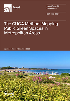
Cover Story (view full-size image): Proximity and access to Public Urban Green Spaces (PUGS) are vital for sustainable cities yet reliably mapping them remains a challenge—especially in metropolitan areas, where multiple local administrations and inconsistent datasets complicate the task. The CUGA Method offers a transparent workflow that integrates open-access data and applies spatial and functional filters to accurately identify PUGS. Validated in the Dublin Region, CUGA outperforms both original and administrative datasets—in accuracy, coverage, and impact—providing a transferable tool for urban planning, policy evaluation, and monitoring progress toward SDG 11.7. View this paper
  • Issues are regarded as officially published after their release is announced to the table of contents alert mailing list.
  • You may sign up for e-mail alerts to receive table of contents of newly released issues.
  • PDF is the official format for papers published in both, html and pdf forms. To view the papers in pdf format, click on the "PDF Full-text" link, and use the free Adobe Reader to open them.
Order results
Result details
Section
Select all
Export citation of selected articles as:
20 pages, 2995 KB  
Article
Deciphering the Spatial Code: Identification and Optimization of Ecological Security Pattern—A Case Study of Jiangsu Province, China
by Hao Meng, Zhoukai Gong, Chang Qian, Xiaofeng Zhao, Qianming Liu, Xinguo Bu and Chunzhu Shen
Land 2025, 14(9), 1928; https://doi.org/10.3390/land14091928 - 22 Sep 2025
Viewed by 492
Abstract
Optimizing Ecological security patterns (ESPs) is critical for advancing territorial spatial restoration and fostering sustainable regional development. While research on ESPs’ construction has grown significantly, key challenges persist, particularly in the accurate identification of priority conservation areas and the integration of socioeconomic development [...] Read more.
Optimizing Ecological security patterns (ESPs) is critical for advancing territorial spatial restoration and fostering sustainable regional development. While research on ESPs’ construction has grown significantly, key challenges persist, particularly in the accurate identification of priority conservation areas and the integration of socioeconomic development with ecological conservation. To address these challenges, this study selects Jiangsu Province as a representative case. We move beyond single-factor assessments by combining ecosystem service importance evaluation with a multi-factor ecological sensitivity analysis (including water pollution, soil erosion, air pollution, and anthropogenic pressure). A comprehensive ecological resistance surface is then developed, incorporating both natural and anthropogenic disturbance factors, to evaluate spatial patterns of ecological security. Utilizing the Minimum Cumulative Resistance (MCR) model, we delineate ecological corridors and ultimately construct the ESPs by synthesizing ecological sources and corridors. Key results include: Jiangsu’s ESPs comprises 33 ecological patches (total area: 14,622.46 km2, 13.71% of the study region), predominantly composed of water bodies, wetlands, and cultivated land. Thirteen ecological corridors (total length: 1920.38 km) primarily traverse cultivated land, construction land, and water bodies. The optimized ESPs strategy termed “Two Cores, Two Barriers, Three Belts, Multiple Corridors” offers a concrete spatial blueprint. The findings provide effective scientific reference for assessing and managing regional ecological security trends. Full article
Show Figures

Figure 1

24 pages, 3498 KB  
Article
User Perceptions of Text Mining in Peri-Rural Landscapes and Topic Modeling of Icheon City in the Seoul Metropolitan Region
by Doeun Kim, Junho Park and Yonghoon Son
Land 2025, 14(9), 1927; https://doi.org/10.3390/land14091927 - 22 Sep 2025
Viewed by 514
Abstract
The purpose of this study is to explore and analyse user perceptions of peri-rural landscapes in the Seoul metropolitan region, using Icheon City as a case study. While the multifunctionality of peri-rural areas—providing ecological, cultural, and socioeconomic benefits—is increasingly recognised, the perceptual and [...] Read more.
The purpose of this study is to explore and analyse user perceptions of peri-rural landscapes in the Seoul metropolitan region, using Icheon City as a case study. While the multifunctionality of peri-rural areas—providing ecological, cultural, and socioeconomic benefits—is increasingly recognised, the perceptual and experiential dimensions remain underexplored in South Korea. To address this gap, 10,578 Naver Blog posts were collected and refined, resulting in 8078 valid entries. Methodologically, this study introduces an innovative approach by integrating centrality analysis with latent Dirichlet allocation (LDA) topic modeling of user-generated content, supported by a bespoke dictionary of 170 local landscape resources. This combined framework allows simultaneous examination of structural associations and thematic narratives within user perceptions. The results indicate that resources such as Seolbong Urban Park, Seolbong Mountain, and the Cornus Fruit (sansuyu) Villages function as symbolic hubs in the perceptual network, while thematic clusters capture multi-dimensional concerns spanning leisure, ecology, culture, suburbanization, and real estate. Synthesised together, these findings demonstrate that user perceptions construct peri-rural landscapes not as isolated sites, but as spatially cohesive and thematically interconnected systems that mediate between urban and rural domains. Overall, this study contributes to metropolitan planning discourse by highlighting perceptual dimensions alongside functional and ecological dimensions. It shows that users cognitively construct peri-rural landscapes as systems that are both spatially cohesive and thematically interconnected, and that function as spaces that link urban and rural areas. Crucially, this study provides a replicable framework for using user-generated content to inform the planning and management of peri-rural landscapes in metropolitan areas. Full article
Show Figures

Figure 1

28 pages, 5260 KB  
Article
Modeling Urban Green Access: Combining Zone-Based Proximity and Demand-Weighted Metrics in a Medium-Sized U.S. City
by Yifanzi Zhu, Qiuyi Yang, Shuying Guo, Yuhan Wen, Xinyi Wang and Rui Wang
Land 2025, 14(9), 1926; https://doi.org/10.3390/land14091926 - 22 Sep 2025
Viewed by 441
Abstract
Urban green space (UGS) accessibility is a cornerstone of equitable and sustainable city planning. However, existing studies focus on large metropolitan areas and rely on limited spatial models that overlook the complexity of urban morphology and socio-demographic diversity. This study shifts the focus [...] Read more.
Urban green space (UGS) accessibility is a cornerstone of equitable and sustainable city planning. However, existing studies focus on large metropolitan areas and rely on limited spatial models that overlook the complexity of urban morphology and socio-demographic diversity. This study shifts the focus to East Lansing, a medium-sized U.S. city that exhibits neither the spatial concentration of major metropolises nor the uniformity of small towns, thereby offering a distinctive context to examine urban green space equity. To this end, we develop a composite accessibility index by integrating four complementary spatial models: Euclidean distance, gravity-based access, two-step floating catchment area (2SFCA), and zone-based analysis. Utilizing high-resolution spatial, demographic, and environmental datasets, the study applies both Ordinary Least Squares (OLS) and Geographically Weighted Regression (GWR) to uncover global patterns and local variations in accessibility determinants. The results reveal pronounced neighborhood-level disparities, with variables such as green coverage, park provision, and commercial density emerging as significant but spatially uneven predictors. The composite index yields a more robust and equitable representation of UGS accessibility than any individual model. This multi-model, spatially explicit framework contributes to methodological advances in accessibility assessment and offers actionable insights for place-based urban greening strategies. Full article
Show Figures

Figure 1

25 pages, 1509 KB  
Article
Unpacking the Dynamics of Heritage-Led Regeneration: A Structural Equation Modeling Approach for Traditional Villages of Hebei, China
by Yang Yang, Nur Farhana Azmi, Hazwan Ariff Hakimi and Liyue Pan
Land 2025, 14(9), 1925; https://doi.org/10.3390/land14091925 - 22 Sep 2025
Viewed by 852
Abstract
Unlike widely examined urban settings, heritage-led rural regeneration remains an urgent yet insufficiently explored challenge. Grounded in stimulus–response theory, this study examines how heritage capacity influences the regeneration of traditional villages in Hebei Province, China. Drawing on community-building theory, heritage capacity (stimulus) is [...] Read more.
Unlike widely examined urban settings, heritage-led rural regeneration remains an urgent yet insufficiently explored challenge. Grounded in stimulus–response theory, this study examines how heritage capacity influences the regeneration of traditional villages in Hebei Province, China. Drawing on community-building theory, heritage capacity (stimulus) is conceptualized through five dimensions: Public Participation, Media Platform Construction, Adaptive Reuse, Heritage Industry Development, and Landscape Maintenance. Village regeneration (response) is evaluated across economic, social, and environmental dimensions. Using PLS-SEM analysis of questionnaire data and expert consultations, the study shows that regeneration outcomes arise from an integrated system in which tangible and intangible capacities reinforce each other. It further highlights that the most effective strategy combines priority investment with strategic repositioning. For economic sustainability, Adaptive Reuse and Media Platform Construction serve as immediate drivers, while Heritage Industry Development and Landscape Maintenance provide long-term foundations. For social sustainability, Public Participation and Media Platform Construction act as key enablers by strengthening social connections. For environmental sustainability, Adaptive Reuse offers the most direct benefits, whereas Landscape Maintenance and Public Participation contribute gradual but essential outcomes. This study offers practical guidance for the regeneration of Hebei’s villages, proposing a scalable model for sustainable rural development that has broad implications for similar historical regions worldwide. Full article
Show Figures

Figure 1

19 pages, 5655 KB  
Article
Educational Accessibility as an Element of Sustainable Urban Transformation: The Case of Poland in the Context of Legislative Reform
by Konrad Podawca, Agata Pawłat-Zawrzykraj and Marek Ogryzek
Land 2025, 14(9), 1924; https://doi.org/10.3390/land14091924 - 21 Sep 2025
Viewed by 432
Abstract
Access to schools is crucial in determining an area’s functioning and development, especially regarding housing development. This article presents an analysis of the spatial accessibility of educational services in the city. In Poland, municipalities applied standards for the accessibility of schools in the [...] Read more.
Access to schools is crucial in determining an area’s functioning and development, especially regarding housing development. This article presents an analysis of the spatial accessibility of educational services in the city. In Poland, municipalities applied standards for the accessibility of schools in the 1980s and 1990s. In 2023, amendments to the Law on Planning and Spatial Development (The Act of 7 July 2023 amending the Act on Spatial Planning and Development and certain other Acts) reintroduced the obligation to consider the accessibility of education services in the planning documents of municipalities and established the applicable distances. This article presents a method for assessing the level of accessibility of primary schools using spatial–statistical indicators, with the city of Płock as an example. The analysis allowed us to present the spatial differentiation of the level of fulfilment and the level of fulfilment of needs according to the new planning guidelines. We deepened the analysis grounded in the 15-Min City concept to validate the findings, benchmarking the results against international frameworks and recognised good practices. Similar analysis can support local authorities of other municipalities in the spatial planning decision-making process. The authors formulated the following research questions: What criteria can be applied to evaluate the performance of existing educational facilities and determine optimal locations for new schools in planning educational services? Do time-based (15 min) benchmarks reveal different patterns than distance-only thresholds? The example of Płock shows the weaknesses of applying unified urban standards in areas with diverse types of spatial development and the need to modify them. To deepen the verification of the observed discrepancies, the study was extended to include an analysis based on the concept of the 15-Min City. The results revealed even greater disparities in accessibility, highlighting a strong contrast between central and peripheral districts. These findings remain consistent with the conclusions of international studies. Meanwhile, the applicable regulations in Poland provide relatively liberal accessibility thresholds. It may lead to an increase in the distance between residential development and educational facilities and other key elements of urban social infrastructure, thereby distancing national urban planning practices from the European principles of compact, 15 min, and sustainable cities. Full article
Show Figures

Figure 1

20 pages, 757 KB  
Article
Inter-Firm Land Optimization and the Advancement of New Quality Productive Forces—Empirical Evidence Based on Micro-Enterprise Data
by Yanzhi Liu, Jian Cheng and Cheng Li
Land 2025, 14(9), 1923; https://doi.org/10.3390/land14091923 - 21 Sep 2025
Viewed by 440
Abstract
In the context of advancing new quality productive forces (NQP), the optimization of factor allocation is of critical importance. This study empirically examines how inter-firm land allocation affects the development of NQP and explores the moderating roles of labor, capital, and data factors [...] Read more.
In the context of advancing new quality productive forces (NQP), the optimization of factor allocation is of critical importance. This study empirically examines how inter-firm land allocation affects the development of NQP and explores the moderating roles of labor, capital, and data factors from a perspective of factor synergy. Combining theoretical analysis with empirical investigation, the findings are as follows: (1) optimizing land allocation across firms significantly enhances the level of urban NQP, and this result remains robust after accounting for endogeneity and a series of robustness checks; (2) capital expansion and the scaling of data resources substantially reinforce the positive effect of land allocation on NQP, whereas the interregional mobility of labor—particularly high-skilled workers—exerts a negative moderating influence. The results suggest that policymakers should promote the rational allocation of land resources while leveraging the synergistic effects of labor, capital, and data to accelerate the development of NQP at the local level. Full article
Show Figures

Figure 1

25 pages, 1321 KB  
Article
The Role of Capital Assets in the Success and Failure of Water Allocation Reform Arrangements: A Case Study of Joint Ventures in South Africa
by Fenji Materechera-Mitochi, Matthew Weaver, Elizabeth A. Mack and Oghenekaro Nelson Odume
Land 2025, 14(9), 1922; https://doi.org/10.3390/land14091922 - 21 Sep 2025
Viewed by 492
Abstract
Joint ventures (JVs) are an example of a government facilitated arrangement geared towards water allocation reform (WAR) designed to improve the lives of emerging farmers through participation in the agricultural economy in South Africa and other emerging countries around the world with segregated [...] Read more.
Joint ventures (JVs) are an example of a government facilitated arrangement geared towards water allocation reform (WAR) designed to improve the lives of emerging farmers through participation in the agricultural economy in South Africa and other emerging countries around the world with segregated agricultural sectors. This paper will qualitatively analyse semi-structured, in-depth interviews with emerging farmers and key institutional actors to investigate the extent that JVs produced perceptible socio-economic benefits for emerging farmers in the Eastern Cape, South Africa. Socio-economic benefits are operationalised across five types of capital assets (human, natural, financial physical, social). The paper posits that an analysis of the socio-economic benefits derived from emerging farmers in JVs can be useful for informing the governance and institutional arrangements geared towards accelerating equity imperatives. The findings of the analysis, which is conducted using a sustainable livelihoods framework (SLF), reveal that factors such as level of education, formal training in agriculture, and power differentials within the partnership arrangements determine whether JVs produce tangible benefits for emerging farmers. This paper recommends the SLF be used in conjunction with concepts, tools, and modes of analysis used in other fields to address differential conditions, assets, and strategies of differentiated groups. Full article
(This article belongs to the Section Water, Energy, Land and Food (WELF) Nexus)
Show Figures

Figure 1

49 pages, 31316 KB  
Article
Identifying and Prioritising Public Space Demands in Historic Districts: Perspectives from Tourists and Local Residents in Yangzhou
by Jizhou Chen, Xiaobin Li, Jialing Chen, Lijun Xu, Hao Feng and Rong Zhu
Land 2025, 14(9), 1921; https://doi.org/10.3390/land14091921 - 20 Sep 2025
Viewed by 657
Abstract
With the ongoing advancement of urban renewal and cultural tourism, public spaces within historic cultural districts face dual challenges of structural complexity and diverse user demands. There is an urgent need to establish a scientific, user-oriented evaluation system to enhance spatial quality and [...] Read more.
With the ongoing advancement of urban renewal and cultural tourism, public spaces within historic cultural districts face dual challenges of structural complexity and diverse user demands. There is an urgent need to establish a scientific, user-oriented evaluation system to enhance spatial quality and user satisfaction. This study takes the Nanhesha Historic and Cultural Quarter in Yangzhou as a case study, focusing on two primary user groups: tourists and local residents. Employing semi-structured interviews and grounded theory, it distils a demand evaluation framework comprising four dimensions—spatial structure, environmental perception, socio-cultural aspects, and facility systems—with a total of 21 indicators. Subsequently, employing the Delphi method, experts were invited to refine the indicators through two rounds of deliberation. The Kano model was then applied to classify the demand attributes of different groups, identifying five common demands and sixteen differentiated demands. These were categorised into three sensitivity levels. Further integrating the Satisfaction Increment Index (SII), Dissatisfaction Decrement Index (DDI), and sensitivity values, a two-dimensional prioritisation model was constructed. This yielded a unified three-tier priority system alongside independent ranking frameworks for each user group. Findings reveal that visitors prioritise immediate experiential attributes such as spatial accessibility, appropriate scale, and environmental cleanliness, whereas residents favour long-term usage-oriented aspects including cultural expression, convenient facilities, and climate adaptability. This research not only enriches the theoretical framework for studying public space perception in historic cultural districts but also provides actionable evaluation criteria and practical pathways for multi-stakeholder spatial optimisation design. It offers guidance for the high-quality, refined development of public spaces within historic quarters. Full article
Show Figures

Figure 1

24 pages, 11825 KB  
Article
Explainable AI-Driven Integration of Water–Energy–Food Nexus into Supply–Demand Networks
by Lei Cao, Haonan Zhang, Xueliang Yang, Chaoyu Zhang, Chengbin Xi, Yunlu Zhang and Zhaowu Yu
Land 2025, 14(9), 1920; https://doi.org/10.3390/land14091920 - 20 Sep 2025
Viewed by 485
Abstract
The supply–demand network facilitates regional sustainable development by optimizing resource flows and allocation within the Water–Energy–Food system. However, few studies have constructed such networks from a Water–Energy–Food Nexus (WEF Nexus) supply–demand perspective, and the key driving factors influencing network formation, along with their [...] Read more.
The supply–demand network facilitates regional sustainable development by optimizing resource flows and allocation within the Water–Energy–Food system. However, few studies have constructed such networks from a Water–Energy–Food Nexus (WEF Nexus) supply–demand perspective, and the key driving factors influencing network formation, along with their underlying mechanisms, remain poorly understood. To bridge this gap, we propose a new framework for constructing WEF Nexus supply–demand networks via explainable artificial intelligence (EAI). Taking the Bohai Rim urban agglomeration as an example, we identified the key factors affecting the long-term supply and demand of the WEF Nexus and their mechanisms using the XGBoost-SHAP model. By quantifying the magnitude and direction of these factors’ influences, we constructed supply–demand networks and further developed optimization strategies that consider complex factor interactions and distinct thresholds. Key findings include: (1) Identification of 114 stable supply sources and 128 chronic deficit sources, forming 472 high-efficiency and 296 standard supply–demand corridors, with 6 major supply potential zones delineated. (2) Precipitation, vegetation coverage, human activity intensity, cropland distribution, and temperature emerged as primary determinants in descending order of importance. (3) Synergistic analysis revealed significant negative interactions between human activity and precipitation/vegetation, but positive correlation with temperature, with distinct nonlinear thresholds across zones. Based on these findings, we proposed a differentiated optimization strategy. Our study constructs a supply–demand network from the perspective of the WEF Nexus and highlights the importance of threshold effects and interactions among key factors in the construction and optimization of the network. The research results are also applicable to other urban agglomerations facing similar challenges. Full article
(This article belongs to the Section Landscape Ecology)
Show Figures

Figure 1

28 pages, 6123 KB  
Article
Evaluating Future Water Resource Risks in the Driftless Midwest from Climate and Land Use Change
by Sagarika Rath, Sam Arden, Tassia Mattos Brighneti, Sam Moore and Raghavan Srinivasan
Land 2025, 14(9), 1919; https://doi.org/10.3390/land14091919 - 20 Sep 2025
Viewed by 686
Abstract
Assessing the impacts of future changes in rainfall, temperature, and land use on streamflow and nutrient loads is critical for long-term watershed management, particularly in the unglaciated Driftless Area with steep slopes, erodible soils, and karst geology. This study evaluates the Kickapoo watershed [...] Read more.
Assessing the impacts of future changes in rainfall, temperature, and land use on streamflow and nutrient loads is critical for long-term watershed management, particularly in the unglaciated Driftless Area with steep slopes, erodible soils, and karst geology. This study evaluates the Kickapoo watershed in southwestern Wisconsin to examine how projected climate change and cropland expansion may affect hydrology during the mid- (post-2050) and late century (post-2070). Climate projections suggest temperature increase, wetter springs, and drier summers over the century. Annual average streamflow is projected to decline by 5–40% relative to 2000–2020, primarily due to a 5–15% reduction in groundwater discharge. While land use changes from prairie to cropland had a limited additional impact on streamflow, it increased annual average total phosphorus (TP) by 5.67–10.08%, total nitrogen (TN) by 1.08–2.34%, and sediment by 3.11–6.07%, frequently exceeding total maximum daily load (TMDL) thresholds in comparison to the climate change scenario. These findings suggest that although land use changes exacerbate nutrient and sediment pollution, climate change remains the dominant driver of hydrologic alteration in this watershed. Instead, converting 18% (~290 km2) of cropland to grassland could enhance baseflow (0.84–14%), and reduce TP (30–45%), TN (3–5%), sediment (80–90%), and meeting TMDL 90% of the time. These findings underscore the importance of nature-based solutions, such as prairie restoration, supporting adaptive management to reduce nutrient load, sustaining low flows, and strengthening hydrologic resilience, that support key Sustainable Development Goals. This approach offers valuable insights for other unglaciated watersheds globally. Full article
(This article belongs to the Special Issue Integrating Climate, Land, and Water Systems)
Show Figures

Figure 1

25 pages, 4355 KB  
Article
Soil–Atmosphere GHG Fluxes in Cacao Agroecosystems on São Tomé Island, Central Africa: Toward Climate-Smart Practices
by Armando Sterling, Yerson D. Suárez-Córdoba, Francesca del Bove Orlandi and Carlos H. Rodríguez-León
Land 2025, 14(9), 1918; https://doi.org/10.3390/land14091918 - 20 Sep 2025
Viewed by 506
Abstract
This study evaluated soil–atmosphere greenhouse gas (GHG) fluxes—including carbon dioxide (CO2), methane (CH4), and nitrous oxide (N2O)—in cacao agroecosystems on São Tomé Island, Central Africa. The field campaign was conducted between April and May 2025, coinciding with [...] Read more.
This study evaluated soil–atmosphere greenhouse gas (GHG) fluxes—including carbon dioxide (CO2), methane (CH4), and nitrous oxide (N2O)—in cacao agroecosystems on São Tomé Island, Central Africa. The field campaign was conducted between April and May 2025, coinciding with the transition from the short rainy season to the onset of the dry period. The sampling design comprised two system types (biodiverse and conventional), two crop development stages (growing and productive), and two climatic zones (wet and dry). Gas fluxes were measured using the static chamber method and analyzed in relation to climatic, topographic, and edaphic variables. CO2 fluxes were the dominant contributor to total emissions, accounting for approximately 97.4% of the global warming potential (GWP), while CH4 and N2O together contributed less than 3%. The highest CO2 emissions occurred in conventional systems during the growing stage in the wet zone (125.5 ± 11.41 mg C m−2 h−1). CH4 generally acted as a sink, particularly in conventional systems in the dry zone (−12.58 ± 2.35 μg C m−2 h−1), although net emissions were detected in biodiverse systems in the wet zone (5.08 ± 1.50 μg C m−2 h−1). The highest N2O fluxes were observed in conventional growing systems (32.28 ± 5.76 μg N m−2 h−1). GHG dynamics were mainly regulated by climatic factors—such as air temperature, relative humidity, and precipitation—and by key edaphic properties, including soil pH, soil organic carbon, soil temperature, and clay content. Projected GWP values ranged from 9.05 ± 2.77 to 40.9 ± 6.23 Mg CO2-eq ha−1 year−1, with the highest values recorded in conventional systems in the growing stage. Overall, our findings underscore the potential of biodiversity-based agroforestry as a climate-smart practice to mitigate net GHG emissions in tropical cacao landscapes. Full article
Show Figures

Figure 1

31 pages, 4719 KB  
Article
Preserving Coastal Heritage: A Review of Climate Adaptation Strategies on Ilha de Moçambique (Mozambique)
by Cristiana Valente Monteiro, Francesca Dal Cin, Luís Lage and Sérgio Barreiros Proença
Land 2025, 14(9), 1917; https://doi.org/10.3390/land14091917 - 20 Sep 2025
Viewed by 458
Abstract
Ilha de Moçambique is an island off the northern coast of Mozambique, covering an area of 1.5 km2. Recognized as a UNESCO World Heritage Site since 1991, the island is currently under threat due to the increasing frequency and intensity of [...] Read more.
Ilha de Moçambique is an island off the northern coast of Mozambique, covering an area of 1.5 km2. Recognized as a UNESCO World Heritage Site since 1991, the island is currently under threat due to the increasing frequency and intensity of extreme weather events caused by climate change. Cyclonic events and pluvial floods have led to the progressive degradation of buildings and are compromising the integrity of the site. Furthermore, the island’s economic and social vulnerability is also worsening. The article aims to critically review the strategic planning approaches adopted for climate adaptation on Ilha de Moçambique. The objective is to identify and assess the planning instruments implemented to protect coastal urban heritage in light of contemporary challenges. Methodologically, a literature review is conducted based on the analysis of a collection of plans dedicated to adapting to climate change and heritage preservation. The results reveal that current planning approaches remain fragmented and insufficient, reducing their practical impact. There is a notable absence of planning instruments specifically designed to integrate cultural heritage preservation with urban climate adaptation. In conclusion, although some initiatives are underway, significant gaps persist in the strategic planning framework, underscoring the urgent need for inclusive integrated and adaptive measures to safeguard the island’s urban heritage and community in the long term. Full article
(This article belongs to the Special Issue Climate Adaptation Planning in Urban Areas)
Show Figures

Figure 1

54 pages, 13041 KB  
Article
Territorial Rebalancing from an Axiological Perspective: A Reaction Capacity Index of Sicily’s Inner Areas
by Maria Rosa Trovato and Ludovica Nasca
Land 2025, 14(9), 1916; https://doi.org/10.3390/land14091916 - 19 Sep 2025
Viewed by 525
Abstract
The marginalisation of the inner areas due to increased social, material, economic and infrastructural vulnerability is a growing phenomenon affecting many countries today. Although, specific policies, measures, and funding have recently been proposed to address this issue, they have been slow to produce [...] Read more.
The marginalisation of the inner areas due to increased social, material, economic and infrastructural vulnerability is a growing phenomenon affecting many countries today. Although, specific policies, measures, and funding have recently been proposed to address this issue, they have been slow to produce the expected results. Those responsible for decision-makers regarding the prospect of territorial rebalancing need support in identifying the residual value of these marginal areas. This will help them recognise where and how this value can be emphasised in an integrated, long-term redevelopment process. Based on an axiological perspective of territorial capital forms, the research project has developed a “Geo-referenced Value-based Knowledge Model” using Multi-attribute Value Theory (MAVT). It plays a key role in estimating the Reaction Capability Index (IRCI) of Sicily’s “inner areas”. The results demonstrate the reaction capability of the municipalities in these areas. As a measure of the overall endowment of territorial capital, the IRCI index can help decision-makers National Strategy Inner Areas (NSIA), promote the efficient use of resources, and encourage the effective implementation of policies aimed at rebalancing the territory. Full article
Show Figures

Figure 1

24 pages, 2570 KB  
Article
Spatiotemporal Evolution and Influencing Factors of A-Level Garden-Type Scenic Areas in Jiangsu Province, China
by Lin Zhou, Yingyuqing Yin, Xue Liu, Xianjing Xiao and Peiling He
Land 2025, 14(9), 1915; https://doi.org/10.3390/land14091915 - 19 Sep 2025
Viewed by 420
Abstract
Garden-type scenic areas, as integrated carriers of cultural and natural resources, not only reflect the regional socio-economic development level but also embody the historical process of interaction between human cultural activities and the natural environment. As a major economic and cultural province in [...] Read more.
Garden-type scenic areas, as integrated carriers of cultural and natural resources, not only reflect the regional socio-economic development level but also embody the historical process of interaction between human cultural activities and the natural environment. As a major economic and cultural province in eastern China, Jiangsu features A-level garden-type scenic areas that are representative in terms of quantity, quality, and typology. This study constructs an analytical indicator system for assessing the spatial distribution patterns of garden-type scenic areas. Using GIS-based methods such as kernel density estimation, nearest neighbor index, and the geographic detector model, it systematically investigates the spatial characteristics of A-level garden-type scenic areas in Jiangsu Province. The results show a significant spatial clustering pattern, with high-density clusters mainly located in southern Jiangsu and around economically developed cities. Further exploration of influencing factors reveals that natural resource endowments, economic development levels, transportation accessibility, historical and cultural heritage, and policy support are the main determinants shaping the distribution patterns. The findings offer theoretical insights and practical guidance for optimizing garden-type scenic areas planning and promoting coordinated regional tourism development in Jiangsu. Full article
Show Figures

Figure 1

23 pages, 699 KB  
Article
Who Is Most Responsible for the Mitigation of Climate Change? An Intercultural Study in Central Europe, Central Asia, and the Middle East
by Anna Kwiatkowska, Magdalena Mosanya, Patrycja Uram, Dilbar Urazbayeva, Baxtigul Nurullayeva, Vita Mikuličiūtė, Rūta Sargautytė and Konstantin Karpinskij
Land 2025, 14(9), 1914; https://doi.org/10.3390/land14091914 - 19 Sep 2025
Viewed by 444
Abstract
Researchers observed that even if one’s environmental concern was high, people would delegate others to take responsibility for climate change mitigation and undertake sustainable actions. In this study, we explored how citizens of different countries in Central Europe, Central Asia, and the Middle [...] Read more.
Researchers observed that even if one’s environmental concern was high, people would delegate others to take responsibility for climate change mitigation and undertake sustainable actions. In this study, we explored how citizens of different countries in Central Europe, Central Asia, and the Middle East perceived responsibility for mitigating and reducing climate change consequences of various collective and individual agents. Also, we asked about the role of cultural values, environmental worldviews, and beliefs in the intractability of climate change in the prediction of the responsibility distribution. The total sample consisted of n = 1267 participants from Belarus, Lithuania, Poland, the United Arab Emirates, and Uzbekistan. We created the list of 11 collective and individual entities as accountable for mitigation and sustainable activities. We used the Collindex scale to measure collectivistic and individualistic values, the NEP scale to measure anthropocentric and ecocentric worldviews, and two questions concerning the intractability beliefs. Results showed that participants attributed more responsibility to collective agents than to individuals across countries. The predictors’ patterns indicated that ecocentric worldviews consistently increased perceived responsibility of both collective and individual actors, whereas anthropocentrism reduced the attribution of collectives’ responsibility. Collectivistic values appeared to foster greater expectations of individuals. Also, differences between national samples were observed. Full article
Show Figures

Figure 1

19 pages, 7584 KB  
Article
Coupling Coordination of Built-Up Land Intensity and Green Land-Use Efficiency in Hainan Island Based on Multi-Source Heterogeneous Data Fusion
by Man Jiao and Boqun Li
Land 2025, 14(9), 1913; https://doi.org/10.3390/land14091913 - 19 Sep 2025
Viewed by 467
Abstract
Aligning urban land development intensity with green land-use efficiency (GLUE) is crucial for fostering high-quality regional growth. This study aims to examine the coupling and coordination between built-up land intensity (BUI) and GLUE by utilizing multi-source heterogeneous data for Hainan Island (2017, 2020). [...] Read more.
Aligning urban land development intensity with green land-use efficiency (GLUE) is crucial for fostering high-quality regional growth. This study aims to examine the coupling and coordination between built-up land intensity (BUI) and GLUE by utilizing multi-source heterogeneous data for Hainan Island (2017, 2020). A coupling coordination degree model and Geographical Detector are applied to quantify BUI, GLUE, and their coupling coordination, while also identifying the underlying driving factors. The results reveal the following: (i) Following the Free Trade Port initiative, BUI increased by 15.8%, while GLUE grew by 4.9%; (ii) The BUI–GLUE system is still in an adjustment phase, with 94% of jurisdictions showing low coordination; (iii) The primary drivers of coupling have shifted from economic fundamentals to policy and institutional guidance, with their interactions demonstrating significant synergies. These findings suggest that policy-induced land expansion may outpace improvements in GLUE, potentially leading to an imbalance in the land system. This paper introduces an innovative Driver–Response–Feedback and Production–Living–Ecological (DRF–PLE) framework and develops a transferable diagnostic tool for evaluating land-use system sustainability in rapidly urbanizing regions. Full article
Show Figures

Figure 1

14 pages, 2561 KB  
Article
First Evidence of Roman Gold Mining Obtained by Luminescence Dating of Sediments in Les Guilleteres D’All (Cerdanya, Girona, Eastern Pyrenees)
by Jorge Sanjurjo-Sánchez, Jordi Morera Camprubí and Oriol Olesti Vila
Land 2025, 14(9), 1912; https://doi.org/10.3390/land14091912 - 19 Sep 2025
Viewed by 507
Abstract
In recent years, evidence of gold mining during the Roman period has been found by archaeologists in the Cerdanya region (Girona, Catalonia). In this region, Les Guilleteres d’All has been described as a mining complex because of the erosive features observed in the [...] Read more.
In recent years, evidence of gold mining during the Roman period has been found by archaeologists in the Cerdanya region (Girona, Catalonia). In this region, Les Guilleteres d’All has been described as a mining complex because of the erosive features observed in the landscape; surveys have identified hydraulic mining opencast structures named chantier-cirques and chantier-ravins. The latter are smaller, but both require a water reservoir, specifically a water retention facility, to supply water flow. One of these buried water reservoirs has been excavated, revealing an enlarged area with a dam constructed from stone blocks. Two pottery sherds were found within the sediment layers deposited on the bottom of the reservoir—one dated to the 1st–2nd c. AD and the other to the Bronze Age—indicating that the reservoir was filled during historical times and the nearby presence of settlements from these periods. Optically Stimulated Luminescence (OSL) dating was performed on two waterlain sediment layers deposited at the bottom deposited at the reservoir. The obtained ages, dating to 2nd–4th c. AD, correspond to the final phase or abandonment of mining activities. Hence, these ages provide the first evidence of mining activities in Les Guilleteres during Roman times. Full article
(This article belongs to the Section Landscape Archaeology)
Show Figures

Figure 1

28 pages, 5626 KB  
Review
An Ecogeomorphological Approach to Land-Use Planning and Natural Hazard Risk Mitigation: A Literature Review
by Zhiyi Zhang, Jakub Tyc and Michael Hensel
Land 2025, 14(9), 1911; https://doi.org/10.3390/land14091911 - 19 Sep 2025
Viewed by 649
Abstract
The overarching topic of this article is land-use planning (LUP) for risk mitigation of natural hazards. In this context, landslides are one of the most destructive natural hazards, resulting in significant negative impacts on humans, ecosystems, and environments. This study presents a semi-systematic [...] Read more.
The overarching topic of this article is land-use planning (LUP) for risk mitigation of natural hazards. In this context, landslides are one of the most destructive natural hazards, resulting in significant negative impacts on humans, ecosystems, and environments. This study presents a semi-systematic review of emerging ecogeomorphological principles for LUP to advance the mitigation of landslide risks. By integrating ecological and geomorphological systems, an ecogeomorphological approach offers a novel perspective for tackling landslide risk mitigation. This includes accounting for factors such as water flow accumulation, fractional vegetation cover, and soil erosion, using computational methods, applying artificial intelligence (AI) to process and predict risk, and integrating the internet of things (IoT) to real-time environmental data. We primarily explore the role of ecogeomorphology in fostering sustainable and risk-aware LUP, as well as how landslide research can be applied within LUP to strengthen broader management frameworks. The study reveals much evidence of ecogeomorphological factors in LUP, emphasising the integration of ecology, geomorphology, and hydrology for effective landslide mitigation. With the ongoing shift from traditional to emerging methodologies in risk management, our review addresses the existing research gap by proposing an up-to-date ecogeomorphological framework for practice. Full article
Show Figures

Figure 1

18 pages, 4356 KB  
Article
Tacit Sustainability in the Countryside: Cultural and Ecological Layers of Lithuanian Heritage Homestead
by Indraja Raudonikyte and Indre Grazuleviciute-Vileniske
Land 2025, 14(9), 1910; https://doi.org/10.3390/land14091910 - 19 Sep 2025
Viewed by 404
Abstract
This research is an in-depth qualitative case study of a historic homestead in the town of Čekiškė, located in Lithuania, through the lens of sustainability aesthetics and cultural ecology. The research addresses a gap in the literature where aesthetic expressions of sustainability are [...] Read more.
This research is an in-depth qualitative case study of a historic homestead in the town of Čekiškė, located in Lithuania, through the lens of sustainability aesthetics and cultural ecology. The research addresses a gap in the literature where aesthetic expressions of sustainability are predominantly examined in urban settings, while rural hybrid environments, intertwining urban and traditional features, remain underexplored. The homestead, with architectural and landscape features dating back to the early 20th century, was studied across four temporal stages: the interwar period (1922–1946), the early Soviet period (1946–1976), late Soviet to post-independence (1976–2021), and the period of a proposed vision for its sustainable development (2025 and beyond). The theoretical framework developed and applied in this research combines four complementary approaches: (1) the cultural ecology model by J. Steward, (2) environmental ethics trends (egocentrism, homocentrism, biocentrism, ecocentrism), (3) the principles of biophilic design, and (4) the ecological aesthetics framework by M. DeKay. Data collection included continuous qualitative in-depth on-site observations, analysis of the relevant literature sources, archival documents and photographs, and the recording of information in photographs and drawings. The findings reveal nuanced and evolving aesthetic expressions of sustainability tied to cultural practices, land use, ownership attitudes, and environmental perception. While earlier periods of development of the analyzed homestead reflected utilitarian and homocentric relations with the environment, later stages showed increased detachment from ecological sensitivity, resulting in the degradation of both material and intangible heritage; future perspectives of the homestead being transformed into a private museum, actualizing heritage through sustainability aesthetics, were also presented. The study highlights the role of tacit knowledge and lived experience in shaping hybrid sustainable aesthetics and provides insights for design and landscape planning in rural and small town heritage contexts. The research reveals that sustainability aesthetics in rural hybrid spaces is shaped by a confluence of environmental adaptation, socio-cultural transitions, and embedded values. It argues for a more context-sensitive and historically aware approach to sustainability discourse, particularly in heritage conservation and rural development. Full article
(This article belongs to the Section Land Planning and Landscape Architecture)
Show Figures

Figure 1

23 pages, 2133 KB  
Review
Managing Boreal Birch Forests for Climate Change Mitigation
by Alvyra Slepetiene, Olgirda Belova, Kateryna Fastovetska, Lucian Dinca and Gabriel Murariu
Land 2025, 14(9), 1909; https://doi.org/10.3390/land14091909 - 18 Sep 2025
Cited by 1 | Viewed by 575
Abstract
Boreal birch forests, dominated by Betula pendula and Betula pubescens, are significant components of Northern European and North American landscapes. These forests play a vital role in climate change mitigation by sequestering carbon and enhancing ecosystem resilience. This study aims to evaluate global [...] Read more.
Boreal birch forests, dominated by Betula pendula and Betula pubescens, are significant components of Northern European and North American landscapes. These forests play a vital role in climate change mitigation by sequestering carbon and enhancing ecosystem resilience. This study aims to evaluate global scientific research trends concerning the management of boreal birch forests, with an emphasis on climate adaptation. We conducted a two-phase study: first, a bibliometric analysis of 287 peer-reviewed publications from 1978 to 2024 sourced from the Web of Science and Scopus databases; and second, a qualitative literature review based on refined selection criteria guided by the PRISMA framework. The analysis revealed that most research originates from Finland, Canada, Sweden, and the USA. Our findings were categorized into four thematic areas: management issues, abiotic and biotic drivers of forest dynamics, climate adaptation strategies, and current management practices. Furthermore, the results indicate an increasing research focus on climate-smart silviculture, biodiversity-oriented thinning, and mixed-species forestry. The review highlights significant management challenges and identifies knowledge gaps, particularly in genetic diversity, soil biota, and socio-economic dimensions. We conclude that adaptive, multifunctional management of boreal birch forests is essential for sustaining their ecological and economic roles in a changing climate. Full article
(This article belongs to the Special Issue Species Vulnerability and Habitat Loss (Third Edition))
Show Figures

Figure 1

15 pages, 3119 KB  
Article
Economic Valuation of the Public Health Impacts of Wetland Degradation: The Case of Lake Cuitzeo (Mexico)
by Rafael Trueba-Regalado, José A. Albaladejo-García, Arturo Chacón-Torres, Carlos F. Ortiz-Paniagua and José M. Martínez-Paz
Land 2025, 14(9), 1908; https://doi.org/10.3390/land14091908 - 18 Sep 2025
Viewed by 402
Abstract
In recent decades there has been a deterioration of wetlands with severe implications for human health, particularly through its effects on food, water, and climate security. Thus, there is an increasing interest in addressing the adverse effects of wetland degradation, particularly in relation [...] Read more.
In recent decades there has been a deterioration of wetlands with severe implications for human health, particularly through its effects on food, water, and climate security. Thus, there is an increasing interest in addressing the adverse effects of wetland degradation, particularly in relation to public health. Despite the necessity to comprehend the economic value associated with wetland degradation, there is still a paucity of research on the subject in many areas of the world, such as Latin American countries. The objective of this work is to determine the economic impacts of wetland degradation through its health impacts on local communities to achieve sustainable wetland management. To this end, a contingent valuation method has been applied selecting Lake Cuitzeo (Mexico) as an emblematic case study where there is a process of ecological degradation that has a negative impact on both the well-being and health of the population. Based on contingent valuation surveys of the population, respondents were directly asked to express their willingness to accept (WTA) by considering changes in well-being resulting from the loss of a benefit or their willingness to pay (WTP) for the improvement of goods/services. The findings indicated a willingness to accept economic compensation of 47.86 USD/household/month for health-related damages and a willingness to pay 2.77 USD/household/month for the environmental management measures to improve lake conditions. In addition, a multivariate analysis was carried out to determine the influence of socio-economic and environmental factors on the economic valuation exercise. The results can serve as a guide for policymakers in the implementation of socially accepted measures to solve the environmental and public health problems in degraded water bodies. Full article
(This article belongs to the Special Issue Valuing Non-Market Benefits of Nature Conservation and Restoration)
Show Figures

Figure 1

18 pages, 11615 KB  
Article
Spatiotemporal Variations and Driving Forces of Ecosystem Service Value: A Case Study of the Yellow River Basin
by Wensheng Yu, Lijie Wei, Zhenxing Jin, Yuzhen Lin and Chengxin Wang
Land 2025, 14(9), 1907; https://doi.org/10.3390/land14091907 - 18 Sep 2025
Viewed by 453
Abstract
Accurate assessment of ecosystem service value (ESV) is crucial for sustainable environmental management, especially in regions with high ecological sensitivity and significant socioeconomic importance. This study focuses on the Yellow River Basin and integrates the land-use transition matrix, equivalent factor method, ecosystem service [...] Read more.
Accurate assessment of ecosystem service value (ESV) is crucial for sustainable environmental management, especially in regions with high ecological sensitivity and significant socioeconomic importance. This study focuses on the Yellow River Basin and integrates the land-use transition matrix, equivalent factor method, ecosystem service trade-off and synergy analysis, and the optimized parameters geographical detector to analyze the spatiotemporal evolution and driving mechanisms of ESV from 2000 to 2023. The results show that (1) cropland and grassland are the main land-use types in the Yellow River Basin, and during rapid urbanization, the expansion of construction land mainly comes at the expense of cropland and grassland. (2) the total ESV in the basin has steadily increased, with grassland as the primary contributor among land types; regulating services, particularly hydrological regulation, are the core ecosystem services in terms of supply, regulation, support, and cultural functions. (3) High-ESV areas in the eastern and central parts of the basin have expanded over time, exhibiting a spatial pattern of higher values in the west and lower in the east, distributed mainly along the river, with clustering effects gradually weakening. (4) Ecosystem services demonstrated predominantly synergistic relationships, suggesting potential for integrated ecosystem management. (5) Population density, DEM, mean annual temperature, and slope are the dominant factors influencing spatial variation in ESV, with the combined effects of topography and climate significantly enhancing the explanation of ESV heterogeneity. This study deepens the understanding of the evolutionary mechanisms of ecosystem services in the Yellow River Basin and provides scientific support and decision-making references for regional ecological compensation mechanisms, optimized land resource allocation, and watershed ecosystem management. Full article
Show Figures

Figure 1

25 pages, 4649 KB  
Article
Risk Governance of Centralized Farmers’ Residence Policy in Rural-Urban Integration: A Case Study of Shanghai L Town
by Xinran Xu, Qiong Li, Zhiyan Liao and Xi Yu
Land 2025, 14(9), 1906; https://doi.org/10.3390/land14091906 - 18 Sep 2025
Viewed by 469
Abstract
Amid China’s rural–urban integration and rural revitalization, the Centralized Residence of Farmers Policy (CRFP) emerges as a pivotal tool to optimize rural spatial structure and land-use efficiency, yet its implementation risks—particularly risk coupling effects—remain underexplored. This study addresses this gap by constructing a [...] Read more.
Amid China’s rural–urban integration and rural revitalization, the Centralized Residence of Farmers Policy (CRFP) emerges as a pivotal tool to optimize rural spatial structure and land-use efficiency, yet its implementation risks—particularly risk coupling effects—remain underexplored. This study addresses this gap by constructing a holistic risk assessment framework and empirically examining CRFP in L Town, Shanghai; it employs a multi-method approach, integrating the Delphi method, Analytic Hierarchy Process (AHP), and Cumulative Impact Model (CIM) to develop and validate a comprehensive risk assessment framework. This framework evaluates five key dimensions: policy content, implementation subjects, resource guarantees, target groups, and environmental adaptation. Empirical analysis of relocated farming households in L town reveals that the overall risk level of CRFP implementation falls within the moderate-risk range. Key identified risk factors identified include public opinion control, clarity of implementation standards, communication feedback accessibility, reliability of information resources, and effectiveness of implementation strategies. Based on these findings, the study proposes several risk mitigation strategies: aligning policies with local realities to promote high-quality social development, fostering collaborative digital governance through multi-stakeholder engagement, ensuring law-based policy formulation with transparent and supervised processes, enhancing public input through effective interest communication mechanisms, improving information dissemination with inclusive public participation, and adopting flexible implementation strategies. This research addresses fragmentation issues in the existing literature with a unified indicator system and provides actionable solutions that offer significant theoretical and practical value for advancing rural revitalization in the context of urban–rural integration. Full article
Show Figures

Figure 1

25 pages, 7806 KB  
Article
Dynamic Growth of “Pioneer Trees” as a Basis for Recreational Revitalization of Old Urban Landfills: A Case Study of Zgierz, Central Poland
by Andrzej Długoński, Justyna Marchewka, Zuzanna Tomporowska and Joanna Nieczuja-Dwojacka
Land 2025, 14(9), 1905; https://doi.org/10.3390/land14091905 - 18 Sep 2025
Viewed by 562
Abstract
Urban tree biodiversity represents a valuable natural resource. However, some fast-growing tree species with limited esthetic value play an important ecological role by colonizing degraded areas, such as closed landfills. Our observations indicate that trees like Betula pendula (Roth), Acer negundo (L.), and [...] Read more.
Urban tree biodiversity represents a valuable natural resource. However, some fast-growing tree species with limited esthetic value play an important ecological role by colonizing degraded areas, such as closed landfills. Our observations indicate that trees like Betula pendula (Roth), Acer negundo (L.), and Populus tremula (L.) reached the size of adult trees in less than 30 years after the landfill’s closure in the 1990s, forming a nature area similar to a natural forest. A resident survey conducted among the inhabitants of Zgierz confirmed that the lack of space provides opportunities for various forms of recreation. The example analyzed indicates a trend that can be replicated in other cities with minimal human intervention and low financial costs for landfill reclamation. The case study presents an ecological approach to managing degraded sites, where nature determines the quality of the soil environment by eliminating pollutants from the residential surroundings. Furthermore, the research framework provides a basis for developing future models for cleaning up urban landfill sites and promoting placemaking. This pilot study shows a model for old landfills in Europe with well-developed spontaneous vegetation that can be transformed into recreation and sports facilities in the urban areas with industrial past times. Full article
Show Figures

Figure 1

17 pages, 696 KB  
Article
Newcomers in Remote Rural Areas and Their Impact on the Local Community—The Case of Poland
by Jerzy Bański
Land 2025, 14(9), 1904; https://doi.org/10.3390/land14091904 - 18 Sep 2025
Viewed by 471
Abstract
The phenomenon of counterurbanization, understood as the migration of urban residents to rural areas beyond the suburbanization zone, includes both permanent relocation to the countryside and seasonal migration. The aim of the study is to identify the relationship between newcomers or people temporarily [...] Read more.
The phenomenon of counterurbanization, understood as the migration of urban residents to rural areas beyond the suburbanization zone, includes both permanent relocation to the countryside and seasonal migration. The aim of the study is to identify the relationship between newcomers or people temporarily staying in rural areas and their permanent residents, with particular emphasis on the impact of the former group on the local community. The research was conducted in 2023 in 18 villages from different regions of Poland. It was assumed that the villages studied were located outside the zones of strong influence of large urban centers, including outside metropolitan areas. Surveys and in-depth interviews were conducted aimed at both permanent residents of the villages living there from birth and newcomers. The group of newcomers was divided into two categories—new residents who settled in the village in the last few years and owners of second homes who stay in the village temporarily. It can be generally stated that the newcomers from the city, when organizing their life in the countryside, are more active and more frequently initiate contact with the permanent residents than this takes place in the opposite direction. The purpose of the contact is to acquire information, useful for settling down or maintaining the estate, as well as for daily functioning in the countryside. The interactions between the representatives of the two groups considered are usually short-lived and momentary, and they take place usually in the central square of the village, in the street, or in a shop. Conversations concern daily life in the village and private matters. Encounters at home or in other places, which might be conducive to deeper exchange of knowledge and experiences and which might establish conditions for undertaking joint initiatives, are much rarer. Full article
Show Figures

Figure 1

21 pages, 7619 KB  
Article
The Impact of Ecological Restoration Measures on Carbon Storage: Spatio-Temporal Dynamics and Driving Mechanisms in Karst Desertification Control
by Shui Li, Pingping Yang, Changxin Yang, Haoru Zhang and Xiong Gao
Land 2025, 14(9), 1903; https://doi.org/10.3390/land14091903 - 18 Sep 2025
Viewed by 466
Abstract
Karst landscapes, characterized by ecological constraints such as thin soil layers, severe rock desertification, and fragile habitats, require a clear understanding of the mechanisms regulating carbon storage and the impacts of ecological restoration measures. However, current research lacks detailed insights into the specific [...] Read more.
Karst landscapes, characterized by ecological constraints such as thin soil layers, severe rock desertification, and fragile habitats, require a clear understanding of the mechanisms regulating carbon storage and the impacts of ecological restoration measures. However, current research lacks detailed insights into the specific effects of ecological restoration measures. This study integrates multi-source remote sensing data and adjusts InVEST model parameters to systematically reveal the spatiotemporal evolution of carbon storage and its driving mechanisms in typical karst plateau regions of southwest China under ecological restoration measures. The results indicate: (1) From 2000 to 2020, the carbon stock in the study area increased by 6.09% overall. However, from 2020 to 2025, due to the rapid conversion of forest land into building land and grassland, the carbon stock decreased sharply by 7.69%. (2) Severe rock desertification constrains carbon stock, and afforestation provides significantly higher long-term carbon sink benefits. (3) The spatial heterogeneity of carbon storage is primarily influenced by the combined effects of natural factors (rock desertification, elevation, NDVI) and human factors (POP). Based on the research findings, it is recommended that measures to promote close forests be prioritized in karst regions to protect and restore forest ecosystems. At the same time, local habitat improvement and the establishment of ecological compensation mechanisms should be implemented, and the expansion of building land should be strictly controlled to enhance the stability of ecosystems and their carbon sink functions. These research findings provide a solid scientific basis for enhancing and precisely regulating the carbon sink capacity of fragile karst ecosystems, and are of great significance for formulating scientifically sound and reasonable ecological protection policies. Full article
(This article belongs to the Section Land – Observation and Monitoring)
Show Figures

Figure 1

22 pages, 13432 KB  
Article
The Importance of Undiscovered Green Islands in Urban Areas: The Example of Central-Eastern European Cemeteries (Berlin and Warsaw) in the Opinions of City Dwellers
by Andrzej Długoński, Justyna Marchewka, Joanna Nieczuja-Dwojacka and Kaja Makuch
Land 2025, 14(9), 1902; https://doi.org/10.3390/land14091902 - 18 Sep 2025
Viewed by 527
Abstract
The effects of climate change are facing extreme drought during the summer period in the cities of Central Europe due to insufficient and limited green infrastructure surfaces, especially in the centers of some built-up capitals (Berlin, Warsaw). As young people shape the future [...] Read more.
The effects of climate change are facing extreme drought during the summer period in the cities of Central Europe due to insufficient and limited green infrastructure surfaces, especially in the centers of some built-up capitals (Berlin, Warsaw). As young people shape the future of our planet, young students from Poland and Germany were asked to fill out a survey on how unused spaces of cemeteries as reservoirs of green (a forgotten and often overlooked element of green infrastructure) can serve as a recreation benefit in the age of climate change. The results indicated that the German (the tradition of the cemetery as a park garden) and Polish examples provide many valuable clues, such as biodiversity, passive recreation, and care for elderly people who need more peace and quiet rather than having it in the bustling spaces of cities. Reassessment guidelines for greenery managers balance the challenging city conditions during climate change, especially heat waves, due to cemeteries’ underutilized natural and recreational functions. The future directions may be valuable for other regions of Europe and the World, especially since various scientific spheres now consider the El Niño and La Niña phenomena as globally interdisciplinary research collaborations. Full article
(This article belongs to the Special Issue Climate Adaptation Planning in Urban Areas)
Show Figures

Figure 1

18 pages, 81615 KB  
Article
Experiments of Network Literacy for Urban Designers: Bridging Information Design and Spatial Morphology
by Dario Rodighiero
Land 2025, 14(9), 1901; https://doi.org/10.3390/land14091901 - 17 Sep 2025
Viewed by 607
Abstract
Urban morphology has long been studied through typologies, spatial configurations, and historical change, yet cities are not static artifacts but dynamic environments continually reshaped by people, infrastructures, and politics. This article brings Actor–Network Theory (ANT) into dialogue with Aldo Rossi’s notion of the [...] Read more.
Urban morphology has long been studied through typologies, spatial configurations, and historical change, yet cities are not static artifacts but dynamic environments continually reshaped by people, infrastructures, and politics. This article brings Actor–Network Theory (ANT) into dialogue with Aldo Rossi’s notion of the locus to rethink urban design as both enduring form and relational process. Building on Manuel Lima’s taxonomy, the study develops a methodological workflow that translates street networks into visualizations, pairing embeddings with topographic maps to highlight structural patterns. Applied to a comparative set of cities, the analysis distinguishes three broad morphological tendencies—archetypal, geometrical, and relational—each reflecting different logics of urban organization. The results show how scale and connectivity condition the interpretability of embeddings, revealing both alignments and divergences between cartographic and topological representations. Beyond empirical findings, the article frames network literacy as a meeting ground for design theory, science and technology studies, and information visualization. It concludes by proposing that advancing urban morphology today requires not only new computational tools but also sustained interdisciplinary collaboration across design, urban studies, and data science. Full article
(This article belongs to the Special Issue Urban Morphology: A Perspective from Space (Second Edition))
Show Figures

Figure 1

14 pages, 1296 KB  
Essay
Visual Quantification, Spatial Distribution and Combination Association of Tourist Attractions in Qingdao Based on Social Media Images
by Xiaomeng Ji, Simeng Zhang and Jia Liu
Land 2025, 14(9), 1900; https://doi.org/10.3390/land14091900 - 17 Sep 2025
Viewed by 395
Abstract
Focusing on the deficiencies of traditional tourism attraction survey methods in terms of accuracy, efficiency, and large-scale visual representation, this study selects Qingdao as the research case, collects tourism image data from the Weibo platform, applies a deep learning model to identify the [...] Read more.
Focusing on the deficiencies of traditional tourism attraction survey methods in terms of accuracy, efficiency, and large-scale visual representation, this study selects Qingdao as the research case, collects tourism image data from the Weibo platform, applies a deep learning model to identify the visual elements of tourism images, and employs kernel density analysis and Apriori association analysis to clarify further the distribution characteristics and associated features of tourist attractions. Its core objective is to systematically reveal the visual composition, spatial distribution patterns, and related features of tourist attractions in the case study area by identifying and extracting tourist attraction elements from images, thereby providing a decision-making basis for effectively identifying tourism demands and their spatial distribution characteristics, as well as for tourism spatial planning. The findings are as follows: Buildings, sea, and other elements are the main components of tourist attractions in Qingdao. Regarding spatial distribution, tourist attractions in Qingdao exhibit the spatial characteristic of “distributed around the bay and converging towards the sea”, with a certain circular structure and multi-level core distribution pattern. Regarding associated features, tourist attractions in Qingdao form combinations centered on buildings, sea, and signs—such as building-centric, sea-centric, cityscape-centric, and sign-centric combinations—around elements including buildings, sea, and signs. The contribution and significance of this study lie in providing technical support for resolving the contradiction between traditional tourist attraction survey methods and precise demands, offering a scientific basis for decision-making in tourism spatial layout planning, and opening up a new path for the intelligent and refined development of tourism resources using massive visual data. Full article
Show Figures

Figure 1

26 pages, 7819 KB  
Article
From Clustered to Networked: Multi-Dimensional and Multi-Scale Performance Evaluation of Polycentric Urban Structure Evolution in Shenzhen, China
by Lipeng Duan, Zhihui Gu, Yan Zhang and Yongxu Chen
Land 2025, 14(9), 1899; https://doi.org/10.3390/land14091899 - 17 Sep 2025
Viewed by 527
Abstract
Polycentric urban structures are increasingly advocated to enhance economic efficiency, promote spatial equity, and support environmental sustainability. However, their roles in shaping urban performance remain insufficiently understood, particularly regarding the contributions of clustered and networked patterns to performance across different dimensions and scales. [...] Read more.
Polycentric urban structures are increasingly advocated to enhance economic efficiency, promote spatial equity, and support environmental sustainability. However, their roles in shaping urban performance remain insufficiently understood, particularly regarding the contributions of clustered and networked patterns to performance across different dimensions and scales. This study adopts a longitudinal framework that distinguishes the evolutionary stages of polycentric urban structures and evaluates multi-dimensional, multi-scale performance, taking Shenzhen, China as a case study. The results show that Shenzhen’s polycentric structure evolved nonlinearly in its clustered pattern and linearly in its networked characteristics, with steady improvements in spatial and economic performance contrasting with the inverted U-shaped trajectory in social performance. Clustered and networked polycentric structures contribute differently: improvements in spatial performance are driven by multiple indicators, major economic indicators (at constant prices) increase with strengthened networked characteristics, and social performance benefits from clustered patterns only when public service provision is coordinated. This research provides new evidence for the co-evolution of polycentric structures and urban performance, suggesting that the effectiveness of polycentric development lies not in choosing between clustered and networked forms, but in strategically integrating them—optimizing scale–distance coordination among centers to enhance the clustered pattern, while differentiating center functions to strengthen networked characteristics. Full article
Show Figures

Figure 1

Previous Issue
Next Issue
Back to TopTop