Next Issue
Volume 12, July
Previous Issue
Volume 12, May


Water, Volume 12, Issue 6 (June 2020) – 328 articles

Cover Story (view full-size image): 
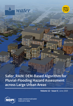
Due to the increase in extreme precipitation events and high concentration of the population and assets, the assessment of the vulnerability of urban areas to pluvial flooding under current and future climate and land-use scenarios is of paramount importance. Detailed hydrologic–hydraulic numerical modeling is resource intensive and, therefore, scarcely suitable for performing consistent hazard assessments across large urban settlements. Toward this aim, within the framework of the EIT Climate-KIC-founded research project SaferPLACES and based on the increasing availability of high-resolution DEMs (digital elevation models), we developed a fast-processing DEM-based algorithm accounting for spatially distributed rainfall and infiltration processes. The applications to two case studies in Northern Italy highlight the potential and limitations of the algorithm in identifying pluvial flood hazard hotspots. [...] Read more.
  • Issues are regarded as officially published after their release is announced to the table of contents alert mailing list.
  • You may sign up for e-mail alerts to receive table of contents of newly released issues.
  • PDF is the official format for papers published in both, html and pdf forms. To view the papers in pdf format, click on the "PDF Full-text" link, and use the free Adobe Reader to open them.
Order results
Result details
Section
Select all
Export citation of selected articles as:
17 pages, 300 KiB  
Article
What Can We Learn from Planning Instruments in Flood Prevention? Comparative Illustration to Highlight the Challenges of Governance in Europe
by Mathilde Gralepois
Water 2020, 12(6), 1841; https://doi.org/10.3390/w12061841 - 26 Jun 2020
Cited by 11 | Viewed by 2872
Abstract
Studying the selection of planning instruments in flood prevention can be critical to gain a better understanding of governance. This choice is underestimated in the flood management literature. This paper fills a knowledge gap in flood management governance by examining the rationales for [...] Read more.
Studying the selection of planning instruments in flood prevention can be critical to gain a better understanding of governance. This choice is underestimated in the flood management literature. This paper fills a knowledge gap in flood management governance by examining the rationales for the choice of instruments. The study is grounded on a comparative illustration of planning instruments in flood prevention in three European countries: England, France and the Netherlands. Flood prevention through spatial planning is a specific example, as the implementation of the Floods Directive has reactivated the role of spatial planning in urban agglomerations. The choice of instruments is never neutral. In the field of flood management, alignment among strategies is supposed to lead to resilience. Instruments should be aligned and coherent. Is that the case? The article explains the challenges of governance configured by a conflict between the spatial planning policy steered by local authorities and the risk prevention policy led by national authorities. This model is further complicated by the tension between the preference for legal, technical or scientific instruments, and the difference in professional culture between planning and prevention. The selection of instrument shows that if their conflicts are exacerbated to debates on variables or parameters, it is because there is no political agreement on the balance between development and security. Full article
(This article belongs to the Special Issue Flood Risk Governance for More Resilience)
23 pages, 4850 KiB  
Article
A Process-Based, Fully Distributed Soil Erosion and Sediment Transport Model for WRF-Hydro
by Dongxiao Yin, Z. George Xue, David J. Gochis, Wei Yu, Mirce Morales and Arezoo Rafieeinasab
Water 2020, 12(6), 1840; https://doi.org/10.3390/w12061840 - 26 Jun 2020
Cited by 11 | Viewed by 4456
Abstract
A soil erosion and sediment transport model (WRF-Hydro-Sed) is introduced to WRF-Hydro. As a process-based, fully distributed soil erosion model, WRF-Hydro-Sed accounts for both overland and channel processes. Model performance is evaluated using observed rain gauge, streamflow, and sediment concentration data during rainfall [...] Read more.
A soil erosion and sediment transport model (WRF-Hydro-Sed) is introduced to WRF-Hydro. As a process-based, fully distributed soil erosion model, WRF-Hydro-Sed accounts for both overland and channel processes. Model performance is evaluated using observed rain gauge, streamflow, and sediment concentration data during rainfall events in the Goodwin Creek Experimental Watershed in Mississippi, USA. Both streamflow and sediment yield can be calibrated and validated successfully at a watershed scale during rainfall events. Further discussion reveals the model’s uncertainty and the applicability of calibrated hydro- and sediment parameters to different events. While an intensive calibration over multiple events can improve the model’s performance to a certain degree compared with single event-based calibration, it might not be an optimal strategy to carry out considering the tremendous computational resources needed. Full article
(This article belongs to the Special Issue Modeling of Soil Erosion and Sediment Transport)
Show Figures

Figure 1

15 pages, 2439 KiB  
Article
How Different Are Manometric, Gravimetric, and Automated Volumetric BMP Results?
by Corrado Amodeo, Sasha D. Hafner, Rúben Teixeira Franco, Hassen Benbelkacem, Paul Moretti, Rémy Bayard and Pierre Buffière
Water 2020, 12(6), 1839; https://doi.org/10.3390/w12061839 - 26 Jun 2020
Cited by 11 | Viewed by 3770
Abstract
The objectives of this study were to: (1) quantify differences in biochemical methane potential (BMP) measured using three measurement methods, including two popular methods (a commercial automated system (AMPTS II) and manual manometric) and one newer method (gravimetric), and (2) assess the importance [...] Read more.
The objectives of this study were to: (1) quantify differences in biochemical methane potential (BMP) measured using three measurement methods, including two popular methods (a commercial automated system (AMPTS II) and manual manometric) and one newer method (gravimetric), and (2) assess the importance of the mixing position in the measurement sequence. Powdered microcrystalline cellulose was used as the substrate in simultaneous tests. All methods gave similar results (<8% difference in the mean BMP) and were reasonably accurate (recovery of 80–86% of the theoretical maximum BMP). Manometric BMP values were consistently lower than gravimetric by 4–5%. Precision was lower for the automated method (relative standard deviation (RSD) of about 7%) than for the manual methods (RSD about 1–3%). Mixing after biogas measurement resulted in 3% higher BMP for both manual methods than mixing before, due to the lower measured CH4 production from blanks. This effect may be linked to a fraction of CH4 that remains dissolved or even as attached bubbles, and suggests that mixing before measurement is preferable. The automated volumetric and gravimetric methods (mode 2) gave very similar mean BMP values (1% different). However, kinetic analysis showed that methane production was faster with the automated volumetric method. This could come from an error in the estimation of the CH4 production rate for the automated method, or an increase in the degradation rate due to better mixing. Both automatic volumetric and manual gravimetric measurements met current validation criteria for mean cellulose BMP, but the RSD from the automated system exceeded the limit. Full article
Show Figures

Figure 1

16 pages, 5653 KiB  
Article
Development of an Electrochemical Ceramic Membrane Bioreactor for the Removal of PPCPs from Wastewater
by Kangquan Qi, Mei Chen, Ruobin Dai, Qiang Li, Miaoju Lai and Zhiwei Wang
Water 2020, 12(6), 1838; https://doi.org/10.3390/w12061838 - 26 Jun 2020
Cited by 14 | Viewed by 3059
Abstract
The removal of pharmaceutical and personal care products (PPCPs) from water and wastewater is of great significance for eco-system safety. In this study, an electrochemical ceramic membrane bioreactor (ECMBR) was developed for removing seven groups (24 kinds in total) of PPCPs from real [...] Read more.
The removal of pharmaceutical and personal care products (PPCPs) from water and wastewater is of great significance for eco-system safety. In this study, an electrochemical ceramic membrane bioreactor (ECMBR) was developed for removing seven groups (24 kinds in total) of PPCPs from real wastewater. In the presence of an electric field (2 V/cm), the ECMBR could enhance the removal efficiencies for most targeted PPCPs without having adverse impacts on conventional pollutant removal and membrane filtration. The ECMBR achieved higher removal efficiencies for fluoroquinolones (82.8%), β-blockers (24.6%), and sulfonamides (41.0%) compared to the control (CMBR) (52.9%, 4.6%, and 36.4%). For trimethoprim, ECMBR also significantly increased the removal to 66.5% compared to 15.6% in CMBR. Furthermore, the exertion of an electric field did not cause significant changes in microbial communities, suggesting that the enhanced removal of PPCPs should be attributed to the electrochemical oxidation of the built-in electrodes in the ECMBR. Full article
(This article belongs to the Special Issue Advanced Technologies for Sustainable Water Treatment)
Show Figures

Figure 1

19 pages, 7453 KiB  
Article
Multi-Biomarker Assessment in Common Carp (Cyprinus carpio, Linnaeus 1758) Liver after Acute Chlorpyrifos Exposure
by Stela Stoyanova, Elenka Georgieva, Iliana Velcheva, Ilia Iliev, Tonka Vasileva, Veselin Bivolarski, Stoil Tomov, Krisztián Nyeste, László Antal and Vesela Yancheva
Water 2020, 12(6), 1837; https://doi.org/10.3390/w12061837 - 26 Jun 2020
Cited by 20 | Viewed by 3890
Abstract
The excessive use of pesticides at different stages of crop production can pose a great danger to the aquatic environment, and particularly to fish. The purpose of the present work was to assess the negative effects of chlorpyrifos (CPF) on the liver histological [...] Read more.
The excessive use of pesticides at different stages of crop production can pose a great danger to the aquatic environment, and particularly to fish. The purpose of the present work was to assess the negative effects of chlorpyrifos (CPF) on the liver histological architecture and the activities of marker enzymes in common carp (Cyprinus carpio Linnaeus, 1758), by applying a multi-biomarker technique. The tested insecticide is categorized as a priority pollutant in surface waters in terms of Directive 2013/39/EU. The carps were exposed to different and environmentally relevant CPF concentrations for 72 h (a short-term acute experiment). The results showed that the tested insecticide alters the liver histological structure, causing degenerative lesions, such as granular and vacuolar degeneration; necrobiotic alterations and necrosis, as well as changes in the circulatory system. In addition, CPF induces changes in the enzymatic activity of lactate dehydrogenase (LDH), aspartate aminotransferase (ASAT), alanine aminotransferase (ALAT), cholinesterase (ChE), glutathione peroxidase (GPx) and catalase (CAT). The results from such experimental set ups could be successfully used in the legislation related to the protection of water bodies from contamination, in areas with intensive application of plant protection products used in agricultural practices, and also in implementing the Water Frame Directive by using multi-biomarker approaches. Full article
(This article belongs to the Section Water Quality and Contamination)
Show Figures

Figure 1

15 pages, 2292 KiB  
Article
Direct Membrane Filtration for Wastewater Treatment Using an Intermittent Rotating Hollow Fiber Module
by Ignacio Ruigómez, Enrique González, Luis Rodríguez-Gómez and Luisa Vera
Water 2020, 12(6), 1836; https://doi.org/10.3390/w12061836 - 26 Jun 2020
Cited by 7 | Viewed by 2740
Abstract
Direct membrane filtration of municipal wastewater has attracted a considerable interest in recent years. Preventing severe membrane fouling is a crucial issue in the process development. This paper aims to assess the effectiveness of a rotating hollow fiber module in enhancing fouling control. [...] Read more.
Direct membrane filtration of municipal wastewater has attracted a considerable interest in recent years. Preventing severe membrane fouling is a crucial issue in the process development. This paper aims to assess the effectiveness of a rotating hollow fiber module in enhancing fouling control. The effect of rotation speed, intermittence and permeate flux was studied in short-term tests at lab-scale. A combined filtration model considering residual fouling, intermediate pore blocking and cake filtration was used to analyze the effect of the shear induced by rotation. Results showed a significant flux improvement by increasing rotation shear stress and showed a nearly linear correlation between the threshold flux (ranged between 12 and 32 L·h−1·m−2) and the rotation speed. A proper rotation intermittence (10/15 on/off) was found, which may maintain a fouling control comparable to that achieved for continuous rotation. For a given energy demand, the optimal operating conditions involve high speeds (≥180 rev·min−1) with low to moderate intermittences. Analyzing the relative contribution of the different feedwater fractions on membrane fouling, colloidal particles and macromolecules were found to be the main contributors. Full article
(This article belongs to the Special Issue Membrane Technologies and Water Treatment)
Show Figures

Figure 1

19 pages, 679 KiB  
Article
Agricultural Water Allocation under Cyclical Scarcity: The Role of Priority Water Rights
by José A. Gómez-Limón, Carlos Gutiérrez-Martín and Nazaret M. Montilla-López
Water 2020, 12(6), 1835; https://doi.org/10.3390/w12061835 - 26 Jun 2020
Cited by 26 | Viewed by 4078
Abstract
Water is becoming an increasingly scarce resource worldwide, suggesting that water rationing methods should be revised to improve water allocation efficiency, especially during cyclical scarcity events (droughts). The proportional rule is the most widely used rationing method to allocate water in cases of [...] Read more.
Water is becoming an increasingly scarce resource worldwide, suggesting that water rationing methods should be revised to improve water allocation efficiency, especially during cyclical scarcity events (droughts). The proportional rule is the most widely used rationing method to allocate water in cases of water scarcity. However, this method fails to achieve Pareto-efficient allocation arrangements. Economic theory and international experience demonstrate that implementing security-differentiated water rights could improve allocative efficiency during cyclical scarcity periods. Moreover, it has been proven that this kind of priority rights regime is an efficient instrument to share risks related to water supply reliability, and can thus be considered as an adaptation measure to climate change. This evidence has enabled the development of an operational proposal for the implementation of security-differentiated water rights in the irrigation sector in Spain, as an alternative to the current rights based on the proportional rule. This proposal draws on the Australian case study, which is the most successful experience worldwide. Nevertheless, the insights obtained from the analysis performed and the proposal for reforming the water rights regime are applicable to any country with a mature water economy. Full article
(This article belongs to the Special Issue Institutions and Economics of Water Scarcity and Droughts)
Show Figures

Figure 1

21 pages, 9397 KiB  
Article
Large Scale Flood Risk Mapping in Data Scarce Environments: An Application for Romania
by Raffaele Albano, Caterina Samela, Iulia Crăciun, Salvatore Manfreda, Jan Adamowski, Aurelia Sole, Åke Sivertun and Alexandru Ozunu
Water 2020, 12(6), 1834; https://doi.org/10.3390/w12061834 - 26 Jun 2020
Cited by 17 | Viewed by 4957
Abstract
Large-scale flood risk assessment is essential in supporting national and global policies, emergency operations and land-use management. The present study proposes a cost-efficient method for the large-scale mapping of direct economic flood damage in data-scarce environments. The proposed framework consists of three main [...] Read more.
Large-scale flood risk assessment is essential in supporting national and global policies, emergency operations and land-use management. The present study proposes a cost-efficient method for the large-scale mapping of direct economic flood damage in data-scarce environments. The proposed framework consists of three main stages: (i) deriving a water depth map through a geomorphic method based on a supervised linear binary classification; (ii) generating an exposure land-use map developed from multi-spectral Landsat 8 satellite images using a machine-learning classification algorithm; and (iii) performing a flood damage assessment using a GIS tool, based on the vulnerability (depth–damage) curves method. The proposed integrated method was applied over the entire country of Romania (including minor order basins) for a 100-year return time at 30-m resolution. The results showed how the description of flood risk may especially benefit from the ability of the proposed cost-efficient model to carry out large-scale analyses in data-scarce environments. This approach may help in performing and updating risk assessments and management, taking into account the temporal and spatial changes in hazard, exposure, and vulnerability. Full article
Show Figures

Figure 1

10 pages, 796 KiB  
Article
Investigation of Pathogenic Bacterial Transport by Waterbirds: A Case Study of Flooded and Non-Flooded Rice Systems in Mississippi
by Alexandra G. Firth, Beth H. Baker, John P. Brooks, Renotta Smith, Raymond B. Iglay and J. Brian Davis
Water 2020, 12(6), 1833; https://doi.org/10.3390/w12061833 - 26 Jun 2020
Cited by 1 | Viewed by 2535
Abstract
Waterbirds may facilitate pathogen transport in rice fields from autumn to winter. This study investigated pathogen dynamics in two types of rice fields, those considered conventionally managed and a low-external-input-sustainable-agriculture (LEISA) rice system in the Mississippi Alluvial Valley, winter 2017–2018. In each system, [...] Read more.
Waterbirds may facilitate pathogen transport in rice fields from autumn to winter. This study investigated pathogen dynamics in two types of rice fields, those considered conventionally managed and a low-external-input-sustainable-agriculture (LEISA) rice system in the Mississippi Alluvial Valley, winter 2017–2018. In each system, fields were (1) left unflooded or (2) flooded from November to March. Fecal indicator and pathogenic bacteria (enterococci, Clostridium perfringens, Escherichia coli, Salmonella spp., and Campylobacter spp.) were quantified in soil before and after winter flooding, and bird fecal matter estimated on both farm types. Water samples were tested for enterococci, C. perfringens and E. coli before fields were drained. The LEISA flooded fields had greater detections of C. perfringens in the soil than conventional non-flooded fields. There was an observed decreasing trend of C. perfringens detection associated with lower bird abundances among treatment groups. All observed pathogen levels in both systems were below EPA standards. Results suggest that long-term waterbird stopovers can influence pathogen indicators in soil, but not at levels to threaten human and environmental health standards. Future studies should focus on long-term monitoring of pathogen introduction in rice fields that harbor wintering waterfowl or other waterbirds. Full article
(This article belongs to the Section Water Quality and Contamination)
Show Figures

Figure 1

15 pages, 2238 KiB  
Article
Nitrogen Removal Efficiency and Microbial Community Analysis of a High-Efficiency Honeycomb Fixed-Bed Bioreactor
by Jie Xu, Chao Zhu, Yi Liu, Guanghui Lv, Changyan Tian and Hongrui Ma
Water 2020, 12(6), 1832; https://doi.org/10.3390/w12061832 - 26 Jun 2020
Cited by 3 | Viewed by 2381
Abstract
Based on the concept of microbial community multi-processing in integrated spatial bacterial succession (ISBS), this study constructs a highly efficient cellular fixed-bed bioreactor that follows the growth of biological flora in the wastewater treatment process. The reactor is organically partitioned based on synergistic [...] Read more.
Based on the concept of microbial community multi-processing in integrated spatial bacterial succession (ISBS), this study constructs a highly efficient cellular fixed-bed bioreactor that follows the growth of biological flora in the wastewater treatment process. The reactor is organically partitioned based on synergistic laws and in accordance with environmental and microbial metabolic changes, and sewage is subjected to unitized and specialized biological treatment under direct current conditions. The results show that the ISBS reactor exhibits stable nitrogen removal performance under a low-carbon source. Compared with traditional sewage biochemical treatment technology, the microbial concentration is increased by 2–3 times and even up to 12 times, and the ammonia nitrogen removal rate is maintained at 99%. The removal rate reaches 90% (hydraulic retention time of 14 h). High-throughput sequencing analysis based on 16S rDNA reveals the microbial community structure succession at different depths of the same section of the reactor. The microbial community is rich under the influence of environmental factors and exhibits different responses. The intervals vary. An analysis of the microbial community function explains why the ISBS reactor has high nitrogen removal efficiency. Full article
(This article belongs to the Section Wastewater Treatment and Reuse)
Show Figures

Figure 1

17 pages, 317 KiB  
Review
Existing Empirical Kinetic Models in Biochemical Methane Potential (BMP) Testing, Their Selection and Numerical Solution
by Yehor Pererva, Charles D. Miller and Ronald C. Sims
Water 2020, 12(6), 1831; https://doi.org/10.3390/w12061831 - 26 Jun 2020
Cited by 31 | Viewed by 3851
Abstract
Biochemical Methane Potential (BMP) tests are a crucial part of feasibility studies to estimate energy recovery opportunities from organic wastes and wastewater. Despite the large number of publications dedicated to BMP testing and numerous attempts to standardize procedures, there is no “one size [...] Read more.
Biochemical Methane Potential (BMP) tests are a crucial part of feasibility studies to estimate energy recovery opportunities from organic wastes and wastewater. Despite the large number of publications dedicated to BMP testing and numerous attempts to standardize procedures, there is no “one size fits all” mathematical model to describe biomethane formation kinetic precisely. Importantly, the kinetics models are utilized for treatability estimation and modeling processes for the purpose of scale-up. A numerical computation approach is a widely used method to determine model coefficients, as a replacement for the previously used linearization approach. However, it requires more information for each model and some range of coefficients to iterate through. This study considers existing empirical models used to describe biomethane formation process in BMP testing, clarifies model nomenclature, presents equations usable for numerical computation of kinetic parameters as piece-wise defined functions, defines the limits for model coefficients, and collects and analyzes criteria to evaluate and compare model goodness of fit. Full article
33 pages, 5322 KiB  
Article
Spatial and Seasonal Variations of C, Nutrient, and Metal Concentration in Thermokarst Lakes of Western Siberia Across a Permafrost Gradient
by Rinat M. Manasypov, Artem G. Lim, Ivan V. Kriсkov, Liudmila S. Shirokova, Sergey N. Vorobyev, Sergey N. Kirpotin and Oleg S. Pokrovsky
Water 2020, 12(6), 1830; https://doi.org/10.3390/w12061830 - 26 Jun 2020
Cited by 24 | Viewed by 2925
Abstract
Thermokarst lakes and ponds formed due to thawing of frozen peat in high-latitude lowlands are very dynamic and environmentally important aquatic systems that play a key role in controlling C emission to atmosphere and organic carbon (OC), nutrient, and metal lateral export to [...] Read more.
Thermokarst lakes and ponds formed due to thawing of frozen peat in high-latitude lowlands are very dynamic and environmentally important aquatic systems that play a key role in controlling C emission to atmosphere and organic carbon (OC), nutrient, and metal lateral export to rivers and streams. However, despite the importance of thermokarst lakes in assessing biogeochemical functioning of permafrost peatlands in response to climate warming and permafrost thaw, spatial (lake size, permafrost zone) and temporal (seasonal) variations in thermokarst lake hydrochemistry remain very poorly studied. Here, we used unprecedented spatial coverage (isolated, sporadic, discontinuous, and continuous permafrost zone of the western Siberia Lowland) of 67 lakes ranging in size from 102 to 105 m2 for sampling during three main hydrological periods of the year: spring flood, summer baseflow, and autumn time before ice-on. We demonstrate a systematic, all-season decrease in the concentration of dissolved OC (DOC) and an increase in SO4, N-NO3, and some metal (Mn, Co, Cu, Mo, Sr, U, Sb) concentration with an increase in lake surface area, depending on the type of the permafrost zone. These features are interpreted as a combination of (i) OC and organically bound metal leaching from peat at the lake shore, via abrasion and delivery of these compounds by suprapermafrost flow, and (ii) deep groundwater feeding of large lakes (especially visible in the continuous permafrost zone). Analyses of lake water chemical composition across the permafrost gradient allowed a first-order empirical prediction of lake hydrochemical changes in the case of climate warming and permafrost thaw, employing a substituting space for time scenario. The permafrost boundary shift northward may decrease the concentrations and pools of dissolved inorganic carbon (DIC), Li, B, Mg, K, Ca, Sr, Ba, Ni, Cu, As, Rb, Mo, Sr, Y, Zr, rare Earth elements (REEs), Th, and U by a factor of 2–5 in the continuous permafrost zone, but increase the concentrations of CH4, DOC, NH4, Cd, Sb, and Pb by a factor of 2–3. In contrast, the shift of the sporadic to isolated zone may produce a 2–5-fold decrease in CH4, DOC, NH4, Al, P, Ti, Cr, Ni, Ga, Zr, Nb, Cs, REEs, Hf, Th, and U. The exact magnitude of this response will, however, be strongly seasonally dependent, with the largest effects observable during baseflow seasons. Full article
Show Figures

Figure 1

23 pages, 2624 KiB  
Article
Salinity Management in the Murray–Darling Basin, Australia
by Barry Hart, Glen Walker, Asitha Katupitiya and Jane Doolan
Water 2020, 12(6), 1829; https://doi.org/10.3390/w12061829 - 26 Jun 2020
Cited by 21 | Viewed by 8691
Abstract
The southern Murray–Darling Basin (MDB) is particularly vulnerable to salinity problems. Much of the Basin’s landscape and underlying groundwater is naturally saline with groundwater not being suitable for human or irrigation use. Since European settlement in the early 1800s, two actions—the clearance of [...] Read more.
The southern Murray–Darling Basin (MDB) is particularly vulnerable to salinity problems. Much of the Basin’s landscape and underlying groundwater is naturally saline with groundwater not being suitable for human or irrigation use. Since European settlement in the early 1800s, two actions—the clearance of deep-rooted native vegetation for dryland agriculture and the development of irrigation systems on the Riverine Plains and Mallee region—have resulted in more water now entering the groundwater systems, resulting in mobilization of the salt to the land surface and to rivers. While salinity has been a known issue since the 1960s, it was only in the mid-1980s that was recognized as one of the most significant environmental and economic challenges facing the MDB. Concerted and cooperative action since 1988 by the Commonwealth and Basin state governments under a salinity management approach implemented over the past 30 years has resulted in salinity now being largely under control, but still requiring on-going active management into the future. The approach has involved the development of three consecutive salinity strategies governing actions from 1988 to 2000, from 2001 to 2015, and the most recent from 2016 to 2030. The basis of the approach and all three strategies is an innovative, world-leading salinity management framework consisting of: An agreed salinity target; joint works and measures to reduce salt entering the rivers; and an agreed accountability and governance system consisting of a system of salinity credits to offset debits, a robust and agreed method to quantify the credits and debits, and a salinity register to keep track of credits and debits. This paper first provides background to the salinity issue in the MDB, then reviews the three salinity management strategies, the various actions that have been implemented through these strategies to control salinity, and the role of the recent Basin Plan in salinity management. We then discuss the future of salinity in the MDB given that climate change is forecast to lead to a hotter, drier and more variable climate (particularly more frequent droughts), and that increased salt loads to the River Murray are predicted to come from the lower reaches of the Mallee region. Finally, we identify the key success factors of the program. Full article
(This article belongs to the Special Issue Salinization of Water Resources: Ongoing and Future Trends)
Show Figures

Figure 1

22 pages, 2670 KiB  
Article
Modelling the Effects of Changes in Forest Cover and Climate on Hydrology of Headwater Catchments in South-Central Chile
by Guillermo Barrientos, Albert Herrero, Andrés Iroumé, Oscar Mardones and Ramon J. Batalla
Water 2020, 12(6), 1828; https://doi.org/10.3390/w12061828 - 26 Jun 2020
Cited by 10 | Viewed by 3314
Abstract
This study analyses the changes in the runoff of forested experimental catchments in south-central Chile, to determine to what extent observed trends can be attributed to effects of intensive forestry and/or climate change. For this, we applied the distributed TETIS® model to [...] Read more.
This study analyses the changes in the runoff of forested experimental catchments in south-central Chile, to determine to what extent observed trends can be attributed to effects of intensive forestry and/or climate change. For this, we applied the distributed TETIS® model to eight catchments (7.1−413.6 ha) representative of the land uses and forestry activities in this geographical area. Rainfall and runoff data collected between 2008 and 2015 were used for modelling calibration and validation. Simulation of three land uses (current cover, partial harvest and native forest) and 25 combinations of climatic scenarios (percentage increases or decreases of up to 20% of rainfall and evapotranspiration relative to the no-change scenario applied to input series) were used in each calibration. We found that changes in land use and climate had contrasting effects on runoff. Smaller catchments affected by the driest climatic scenarios experienced higher runoff when the forest cover was lower than under full forest cover (plantations or native forests). In contrast, larger catchments under all climatic scenarios yielded higher runoff below the full forest cover than under partial harvest and native forest. This suggests that runoff can be influenced, to a great extent, by rainfall decrease and evapotranspiration increase, with the model predicting up to a 60% decrease in runoff yield for the dry’s climatic scenario. This study proves to be relevant to inform ongoing discussions related to forest management in Chile, and is intended to minimize the impact of forest cover on runoff yield under uncertain climatic scenarios. Full article
(This article belongs to the Section Hydrology)
Show Figures

Figure 1

27 pages, 18043 KiB  
Article
Towards Sustainable River Management of the Dutch Rhine River
by Hendrik Havinga
Water 2020, 12(6), 1827; https://doi.org/10.3390/w12061827 - 26 Jun 2020
Cited by 18 | Viewed by 7232
Abstract
Two thousand years of human interventions has heavily modified the Dutch Rhine river. Situated in a densely populated and developed delta, the river and its infrastructure fulfil important societal functions: safety against flooding, inland waterways, nature, freshwater supply, and agriculture. Programs to improve [...] Read more.
Two thousand years of human interventions has heavily modified the Dutch Rhine river. Situated in a densely populated and developed delta, the river and its infrastructure fulfil important societal functions: safety against flooding, inland waterways, nature, freshwater supply, and agriculture. Programs to improve individual functions increasingly lead to conflicts with other functions and therefore call for an integrated approach. This paper reviews the history of the Dutch Rhine and documents the sectoral improvement programs in recent decades, explaining adverse effects such as the large-scale bed degradation at rates of up to 4 cm per year. The lessons from the past are used to propose avenues for future integrated and sustainable river training and river management, arguing that mitigating adverse effects while maintaining societal functions requires a combination of recurrent sediment management measures and extensive structural measures that may change the layout of the river system. Full article
(This article belongs to the Special Issue Studies on River Training)
Show Figures

Figure 1

19 pages, 1622 KiB  
Article
Prediction of Children’s Blood Lead Levels from Exposure to Lead in Schools’ Drinking Water—A Case Study in Tennessee, USA
by Dave DeSimone, Donya Sharafoddinzadeh and Maryam Salehi
Water 2020, 12(6), 1826; https://doi.org/10.3390/w12061826 - 26 Jun 2020
Cited by 8 | Viewed by 3558
Abstract
Lead (Pb) exposure can delay children’s mental development and cause behavioral disorders and IQ deficits. With children spending a significant portion of their time at schools, it is critical to investigate the lead concentration in schools’ drinking water to prevent children’s exposure. The [...] Read more.
Lead (Pb) exposure can delay children’s mental development and cause behavioral disorders and IQ deficits. With children spending a significant portion of their time at schools, it is critical to investigate the lead concentration in schools’ drinking water to prevent children’s exposure. The objectives of this work were to predict students’ geometric mean (GM) blood lead levels (BLLs), the fractions of at-risk students (those with BLLs > 5 μg/dL), and the total number of at-risk students in one Tennessee school district. School drinking water lead concentration data collected in 2019 were input into the Integrated Exposure Uptake Biokinetic (IEUBK) model and the Bowers’ model to predict BLLs for elementary school students and secondary school students, respectively. Sensitivity analyses were conducted for both models. Drinking water concentrations were qualitatively compared with data collected in 2017. Two scenarios were evaluated for each model to provide upper and median estimates. The weighted GM BLL upper and median estimates for elementary school students were 2.35 μg/dL and 0.99 μg/dL, respectively. This equated to an upper estimate of 1300 elementary school students (5.8%) and a median estimate of 140 elementary school students (0.6%) being at risk of elevated BLLs. Similarly, the weighted GM BLL upper and median estimates for secondary school students were 2.99 μg/dL and 1.53 μg/dL, respectively, and equated to an upper estimate of 6900 secondary school students (13.6%) and a median estimate of 300 secondary school students (0.6%) being at risk of elevated BLLs. Drinking water remediation efforts are recommended for schools exhibiting water lead concentrations greater than 15 μg/L. Site-specific soil lead concentration data are recommended since the IEUBK was deemed sensitive to soil lead concentrations. For this reason, soil lead remediation may have a greater impact on lowering children’s BLLs than drinking water lead remediation. Remediation efforts are especially vital at elementary schools to reduce the population’s baseline BLL and thus the BLL projected by Bowers’ model. Full article
(This article belongs to the Special Issue Water Quality in Buildings)
Show Figures

Figure 1

10 pages, 1784 KiB  
Article
Image Segmentation Methods for Flood Monitoring System
by Nur Atirah Muhadi, Ahmad Fikri Abdullah, Siti Khairunniza Bejo, Muhammad Razif Mahadi and Ana Mijic
Water 2020, 12(6), 1825; https://doi.org/10.3390/w12061825 - 26 Jun 2020
Cited by 26 | Viewed by 5690
Abstract
Flood disasters are considered annual disasters in Malaysia due to their consistent occurrence. They are among the most dangerous disasters in the country. Lack of data during flood events is the main constraint to improving flood monitoring systems. With the rapid development of [...] Read more.
Flood disasters are considered annual disasters in Malaysia due to their consistent occurrence. They are among the most dangerous disasters in the country. Lack of data during flood events is the main constraint to improving flood monitoring systems. With the rapid development of information technology, flood monitoring systems using a computer vision approach have gained attention over the last decade. Computer vision requires an image segmentation technique to understand the content of the image and to facilitate analysis. Various segmentation algorithms have been developed to improve results. This paper presents a comparative study of image segmentation techniques used in extracting water information from digital images. The segmentation methods were evaluated visually and statistically. To evaluate the segmentation methods statistically, the dice similarity coefficient and the Jaccard index were calculated to measure the similarity between the segmentation results and the ground truth images. Based on the experimental results, the hybrid technique obtained the highest values among the three methods, yielding an average of 97.70% for the dice score and 95.51% for the Jaccard index. Therefore, we concluded that the hybrid technique is a promising segmentation method compared to the others in extracting water features from digital images. Full article
Show Figures

Figure 1

19 pages, 12064 KiB  
Article
The Ecosystem Resilience Concept Applied to Hydrogeological Systems: A General Approach
by África de la Hera-Portillo, Julio López-Gutiérrez, Pedro Zorrilla-Miras, Beatriz Mayor and Elena López-Gunn
Water 2020, 12(6), 1824; https://doi.org/10.3390/w12061824 - 25 Jun 2020
Cited by 9 | Viewed by 3153
Abstract
We have witnessed the great changes that hydrogeological systems are facing in the last decades: rivers that have dried up; wetlands that have disappeared, leaving their buckets converted into farmland; and aquifers that have been intensively exploited for years, among others. Humans have [...] Read more.
We have witnessed the great changes that hydrogeological systems are facing in the last decades: rivers that have dried up; wetlands that have disappeared, leaving their buckets converted into farmland; and aquifers that have been intensively exploited for years, among others. Humans have caused the most part of these results that can be worsened by climate change, with delayed effects on groundwater quantity and quality. The consequences are negatively impacting ecosystems and dependent societies. The concept of resilience has not been extensively used in the hydrogeological research, and it can be a very useful concept that can improve the understanding and management of these systems. The aim of this work is to briefly discuss the role of resilience in the context of freshwater systems affected by either climate or anthropic actions as a way to increase our understanding of how anticipating negative changes (transitions) may contribute to improving the management of the system and preserving the services that it provides. First, the article presents the basic concepts applied to hydrogeological systems from the ecosystem’s resilience approach. Second, the factors controlling for hydrogeological systems’ responses to different impacts are commented upon. Third, a case study is analyzed and discussed. Finally, the useful implications of the concept are discussed. Full article
Show Figures

Graphical abstract

21 pages, 6659 KiB  
Article
Assessing the Fish Stock Status in Lake Trichonis: A Hydroacoustic Approach
by Triantafyllia-Maria Perivolioti, Jaroslava Frouzova, Michal Tušer and Dimitra Bobori
Water 2020, 12(6), 1823; https://doi.org/10.3390/w12061823 - 25 Jun 2020
Cited by 5 | Viewed by 3035
Abstract
Fish stock monitoring is an important element for the sustainable management of inland water resources. A scarcity of data and the lack of systematic monitoring for Lake Trichonis precludes an up-to-date assessment. To assess the current status of pelagic fish stock, a hydroacousting [...] Read more.
Fish stock monitoring is an important element for the sustainable management of inland water resources. A scarcity of data and the lack of systematic monitoring for Lake Trichonis precludes an up-to-date assessment. To assess the current status of pelagic fish stock, a hydroacousting survey was conducted for the first time in Lake Trichonis, Greece. In October 2019, the lake was acoustically surveyed with two, horizontally and vertically mounted, 120 kHz transducers during day and night. A decreasing gradient in pelagic fish density from the western to the eastern shores of the lake was observed. Fish density was significantly higher in the intermediate layers of the water column, in the eastern region, compared to the western region. The lake appears to host primarily communities of small-sized fish (TL: 0–5 cm), whereas larger fish (TL: 5–50 cm) are a small minority of the total fish stock. The overall average estimated fish length was approximately 2.4 cm. The adoption of routine inland fish stock monitoring through hydroacoustic methods could be a promising step in the effort to improve the understanding of unique inland water ecosystems with minimum impact on endemic species, as well as to mitigate human impact and achieve long-term sustainable management. Full article
(This article belongs to the Special Issue Ecology and Conservation of Freshwater Fishes Biodiversity)
Show Figures

Figure 1

18 pages, 6145 KiB  
Article
Prediction of Chlorophyll-a Concentrations in the Nakdong River Using Machine Learning Methods
by Yuna Shin, Taekgeun Kim, Seoksu Hong, Seulbi Lee, EunJi Lee, SeungWoo Hong, ChangSik Lee, TaeYeon Kim, Man Sik Park, Jungsu Park and Tae-Young Heo
Water 2020, 12(6), 1822; https://doi.org/10.3390/w12061822 - 25 Jun 2020
Cited by 51 | Viewed by 5099
Abstract
Many studies have attempted to predict chlorophyll-a concentrations using multiple regression models and validating them with a hold-out technique. In this study commonly used machine learning models, such as Support Vector Regression, Bagging, Random Forest, Extreme Gradient Boosting (XGBoost), Recurrent Neural Network [...] Read more.
Many studies have attempted to predict chlorophyll-a concentrations using multiple regression models and validating them with a hold-out technique. In this study commonly used machine learning models, such as Support Vector Regression, Bagging, Random Forest, Extreme Gradient Boosting (XGBoost), Recurrent Neural Network (RNN), and Long–Short-Term Memory (LSTM), are used to build a new model to predict chlorophyll-a concentrations in the Nakdong River, Korea. We employed 1–step ahead recursive prediction to reflect the characteristics of the time series data. In order to increase the prediction accuracy, the model construction was based on forward variable selection. The fitted models were validated by means of cumulative learning and rolling window learning, as opposed to the hold–out technique. The best results were obtained when the chlorophyll-a concentration was predicted by combining the RNN model with the rolling window learning method. The results suggest that the selection of explanatory variables and 1–step ahead recursive prediction in the machine learning model are important processes for improving its prediction performance. Full article
Show Figures

Figure 1

19 pages, 1141 KiB  
Article
Analysing Irrigation Farmers’ Preferences for Local Governance Using a Discrete Choice Experiment in India and Pakistan
by Michael Burton, Bethany Cooper and Lin Crase
Water 2020, 12(6), 1821; https://doi.org/10.3390/w12061821 - 25 Jun 2020
Cited by 9 | Viewed by 3493
Abstract
This paper reports the results of an investigation into the preferences of irrigation farmers for different payment apparatus for irrigation fees. We also report the results of a study that queried farmers’ preferred model for water governance at a local level. The results [...] Read more.
This paper reports the results of an investigation into the preferences of irrigation farmers for different payment apparatus for irrigation fees. We also report the results of a study that queried farmers’ preferred model for water governance at a local level. The results and analysis thus make an important contribution to the debate about how participatory irrigation might operate more effectively, especially in India and Pakistan. The rationale for this study is that aligning the payment mechanisms and local water governance more closely with farmer preferences is likely to reduce the barriers to accepting participatory irrigation and the requirement to pay water charges. To the knowledge of the authors, no other study has specifically addressed this issue by seeking direct feedback from farmers. Full article
Show Figures

Figure 1

24 pages, 2261 KiB  
Article
Conserving Mekong Megafishes: Current Status and Critical Threats in Cambodia
by Teresa Campbell, Kakada Pin, Peng Bun Ngor and Zeb Hogan
Water 2020, 12(6), 1820; https://doi.org/10.3390/w12061820 - 25 Jun 2020
Cited by 21 | Viewed by 6112
Abstract
Megafishes are important to people and ecosystems worldwide. These fishes attain a maximum body weight of ≥30 kg. Global population declines highlight the need for more information about megafishes’ conservation status to inform management and conservation. The northern Cambodian Mekong River and its [...] Read more.
Megafishes are important to people and ecosystems worldwide. These fishes attain a maximum body weight of ≥30 kg. Global population declines highlight the need for more information about megafishes’ conservation status to inform management and conservation. The northern Cambodian Mekong River and its major tributaries are considered one of the last refugia for Mekong megafishes. We collected data on population abundance and body size trends for eight megafishes in this region to better understand their conservation statuses. Data were collected in June 2018 using a local ecological knowledge survey of 96 fishers in 12 villages. Fishers reported that, over 20 years, most megafishes changed from common to uncommon, rare, or locally extirpated. The most common and rarest species had mean last capture dates of 4.5 and 95 months before the survey, respectively. All species had declined greatly in body size. Maximum body weights reported by fishers ranged from 11–88% of their recorded maxima. Fishers identified 10 threats to megafishes, seven of which were types of illegal fishing. Electrofishing was the most prevalent. Results confirm that Mekong megafishes are severely endangered. Species Conservation Strategies should be developed and must address pervasive illegal fishing activities, alongside habitat degradation and blocked migrations, to recover declining populations. Full article
Show Figures

Figure 1

6 pages, 186 KiB  
Editorial
Advances in Hydrologic Forecasts and Water Resources Management
by Fi-John Chang and Shenglian Guo
Water 2020, 12(6), 1819; https://doi.org/10.3390/w12061819 - 24 Jun 2020
Cited by 23 | Viewed by 3619
Abstract
The impacts of climate change on water resources management as well as the increasing severe natural disasters over the last decades have caught global attention. Reliable and accurate hydrological forecasts are essential for efficient water resources management and the mitigation of natural disasters. [...] Read more.
The impacts of climate change on water resources management as well as the increasing severe natural disasters over the last decades have caught global attention. Reliable and accurate hydrological forecasts are essential for efficient water resources management and the mitigation of natural disasters. While the notorious nonlinear hydrological processes make accurate forecasts a very challenging task, it requires advanced techniques to build accurate forecast models and reliable management systems. One of the newest techniques for modelling complex systems is artificial intelligence (AI). AI can replicate the way humans learn and has the great capability to efficiently extract crucial information from large amounts of data to solve complex problems. The fourteen research papers published in this Special Issue contribute significantly to the uncertainty assessment of operational hydrologic forecasting under changing environmental conditions and the promotion of water resources management by using the latest advanced techniques, such as AI techniques. The fourteen contributions across four major research areas: (1) machine learning approaches to hydrologic forecasting; (2) uncertainty analysis and assessment on hydrological modelling under changing environments; (3) AI techniques for optimizing multi-objective reservoir operation; and (4) adaption strategies of extreme hydrological events for hazard mitigation. The papers published in this issue can not only advance water sciences but can also support policy makers toward more sustainable and effective water resources management. Full article
(This article belongs to the Special Issue Advances in Hydrologic Forecasts and Water Resources Management )
22 pages, 8274 KiB  
Article
Applied Strategy to Characterize the Energy Improvement Using PATs in a Water Supply System
by Luis E. Camilo Rosado, P. Amparo López-Jiménez, Francisco-Javier Sánchez-Romero, Pilar Conejos Fuertes and Modesto Pérez-Sánchez
Water 2020, 12(6), 1818; https://doi.org/10.3390/w12061818 - 24 Jun 2020
Cited by 15 | Viewed by 2580
Abstract
Sustainable development has been an idea raised in recent years. The results are related to the improvement and the use of new technologies to maximize efficiency in water management. However, energy consumption has been increasing as a consequence of new management and uses [...] Read more.
Sustainable development has been an idea raised in recent years. The results are related to the improvement and the use of new technologies to maximize efficiency in water management. However, energy consumption has been increasing as a consequence of new management and uses of water. Especially in pressurized water distribution systems, the use of pressure reduction valves (PRVs) increases the water usage efficiency but it decreases the energy consumption efficiency, since the valves dissipate energy that could be recovered. This research presents a proposal of a recovery system based on the installation of pumps used as turbines (PATs). These machines are located in different points of the high-pressure water distribution system in the Valencia Metropolitan System (Spain). An annual estimate of the theoretical recoverable energy as well as the “ideal” pump for each point were proposed. The theoretical recovered energy value was 847,301 kWh/year for a specific analyzed point. Besides, the characteristic curves of the PATs from a selected point were determined, estimating an improvement in the sustainable indexes. The calculus of these green parameters showed that the implementation of this solution caused a reduction in consumed energy of 1.50 kWh/m3. Full article
(This article belongs to the Special Issue Hydraulic Dynamic Calculation and Simulation)
Show Figures

Figure 1

21 pages, 5513 KiB  
Article
Impact of Permafrost Thaw and Climate Warming on Riverine Export Fluxes of Carbon, Nutrients and Metals in Western Siberia
by Oleg S. Pokrovsky, Rinat M. Manasypov, Sergey G. Kopysov, Ivan V. Krickov, Liudmila S. Shirokova, Sergey V. Loiko, Artem G. Lim, Larisa G. Kolesnichenko, Sergey N. Vorobyev and Sergey N. Kirpotin
Water 2020, 12(6), 1817; https://doi.org/10.3390/w12061817 - 24 Jun 2020
Cited by 47 | Viewed by 4229
Abstract
The assessment of riverine fluxes of carbon, nutrients, and metals in surface waters of permafrost-affected regions is crucially important for constraining adequate models of ecosystem functioning under various climate change scenarios. In this regard, the largest permafrost peatland territory on the Earth, the [...] Read more.
The assessment of riverine fluxes of carbon, nutrients, and metals in surface waters of permafrost-affected regions is crucially important for constraining adequate models of ecosystem functioning under various climate change scenarios. In this regard, the largest permafrost peatland territory on the Earth, the Western Siberian Lowland (WSL) presents a unique opportunity of studying possible future changes in biogeochemical cycles because it lies within a south–north gradient of climate, vegetation, and permafrost that ranges from the permafrost-free boreal to the Arctic tundra with continuous permafrost at otherwise similar relief and bedrocks. By applying a “substituting space for time” scenario, the WSL south-north gradient may serve as a model for future changes due to permafrost boundary shift and climate warming. Here we measured export fluxes (yields) of dissolved organic carbon (DOC), major cations, macro- and micro- nutrients, and trace elements in 32 rivers, draining the WSL across a latitudinal transect from the permafrost-free to the continuous permafrost zone. We aimed at quantifying the impact of climate warming (water temperature rise and permafrost boundary shift) on DOC, nutrient and metal in rivers using a “substituting space for time” approach. We demonstrate that, contrary to common expectations, the climate warming and permafrost thaw in the WSL will likely decrease the riverine export of organic C and many elements. Based on the latitudinal pattern of riverine export, in the case of a northward shift in the permafrost zones, the DOC, P, N, Si, Fe, divalent heavy metals, trivalent and tetravalent hydrolysates are likely to decrease the yields by a factor of 2–5. The DIC, Ca, SO4, Sr, Ba, Mo, and U are likely to increase their yields by a factor of 2–3. Moreover, B, Li, K, Rb, Cs, N-NO3, Mg, Zn, As, Sb, Rb, and Cs may be weakly affected by the permafrost boundary migration (change of yield by a factor of 1.5 to 2.0). We conclude that modeling of C and element cycle in the Arctic and subarctic should be region-specific and that neglecting huge areas of permafrost peatlands might produce sizeable bias in our predictions of climate change impact. Full article
Show Figures

Figure 1

19 pages, 2609 KiB  
Article
Analysis of the Performance of Bank Filtration for Water Supply in Arid Climates: Case Study in Egypt
by Ahmed Abdelrady, Saroj Sharma, Ahmed Sefelnasr, Mustafa El-Rawy and Maria Kennedy
Water 2020, 12(6), 1816; https://doi.org/10.3390/w12061816 - 24 Jun 2020
Cited by 13 | Viewed by 3273
Abstract
Bank filtration (BF) is acknowledged as a sustainable and effective technique to provide drinking water of adequate quality; it has been known for a long time in Europe. However, this technique is site-specific and therefore its application in developing countries with different hydrologic [...] Read more.
Bank filtration (BF) is acknowledged as a sustainable and effective technique to provide drinking water of adequate quality; it has been known for a long time in Europe. However, this technique is site-specific and therefore its application in developing countries with different hydrologic and environment conditions remains limited. In this research, a 3-discipline study was performed to evaluate the feasibility of the application of this technique in Aswan City (Egypt). Firstly, a hydrological model was developed to identify key environmental factors that influence the effectiveness of BF, and to formulate plans for the design and management of the BF system. Secondly, water samples were collected for one year (January 2017 to December 2017) from the water sources and monitoring wells to characterize the bank-filtrate quality. Lastly, an economic study was conducted to compare the capital and operating costs of BF and the existing treatment techniques. The results demonstrated that there is high potential for application of BF under such hydrological and environmental conditions. However, there are some aspects that could restrict the BF efficacy and must therefore be considered during the design process. These include the following: (i) Over-pumping practices can reduce travel time, and thus decrease the efficiency of treatment; (ii) Locating the wells near the surface water systems (<50 m) decreases the travel time to the limit (<10 days), and thus could restrict the treatment capacity. In such case, a low pumping rate must be applied; (iii) the consequences of lowering the surface water level can be regulated through the continuous operation of the wells. Furthermore, laboratory analysis indicated that BF is capable of producing high quality drinking water. However, an increase in organic matter (i.e., humics) concentration was observed in the pumped water, which increases the risk of trihalomethanes being produced if post-chlorination is implemented. The economic study ultimately demonstrated that BF is an economic and sustainable technique for implementation in Aswan City to address the demand for potable water. Full article
Show Figures

Figure 1

20 pages, 6454 KiB  
Article
The Trend in the Risk of Flash Flood Hazards with Regional Development in the Guanshan River Basin, China
by Ningyue Chen, Yanjun Zhang, Jinjin Wu, Wenxun Dong, Yixuan Zou and Xin Xu
Water 2020, 12(6), 1815; https://doi.org/10.3390/w12061815 - 24 Jun 2020
Cited by 5 | Viewed by 2245
Abstract
The economic development of China’s mountainous areas has been rapid, but the impact of flash floods is often ignored during regional development planning. Therefore, a method needed to be developed to simulate flash flood disasters and analyze the trends in flash flood disasters [...] Read more.
The economic development of China’s mountainous areas has been rapid, but the impact of flash floods is often ignored during regional development planning. Therefore, a method needed to be developed to simulate flash flood disasters and analyze the trends in flash flood disasters with regional development. Taking Guanshan River Basin as the research area, we combined the digital elevation model (DEM) with the inflow hydrograph, using the topography-based hydrological model (TOPMODEL). Verified by historical flash flood disasters, the watershed model was built based on the finite volume conservation flood routing model (FLO-2D). Then, we simulated the hazard distribution of flash flood disasters, developed a risk status assessment factor (RSAF) for flash flood disasters and calculated the increased ratio from 2003 to 2018. The results show that in 2003, the total hazard area of flash flood disasters affecting human settlements was 61,121 m2, which increased to 118,404 m2 in 2018. Since 2003, with the development of the regional economy, more residents moved to risk and extreme risk zones; thus, the risk of flash flood disasters also increased. Due to the significant damage caused by the flash flood on 5 August 2012, some of the local residents moved away from the high risk and extreme risk zones, indicating that the risk trend of flash flood hazard was consistent with the regional development of Guanshan River. We provide suggestions for regional economic development planning; the risk assessment for flash flood disasters must be considered to ensure the stable development of the regional economy, and using the RSAF would be efficient. Full article
(This article belongs to the Section Hydrology)
Show Figures

Figure 1

27 pages, 15300 KiB  
Article
Discharge Flow Rate for the Initiation of Jet Flow in Sky-Jump Spillways
by Raffaella Pellegrino, Miguel Ángel Toledo and Víctor Aragoncillo
Water 2020, 12(6), 1814; https://doi.org/10.3390/w12061814 - 24 Jun 2020
Cited by 3 | Viewed by 3619
Abstract
The sky-jump spillway is an economical and effective solution to return water to a river, eventually complemented by a pre-excavated basin. However, an inappropriate design could endanger spillways and even the dam itself. For the design of a sky-jump it is necessary to [...] Read more.
The sky-jump spillway is an economical and effective solution to return water to a river, eventually complemented by a pre-excavated basin. However, an inappropriate design could endanger spillways and even the dam itself. For the design of a sky-jump it is necessary to evaluate the position and dimensions of the potential pre-excavated basin based on the characteristics of the water flow to be evacuated and the geometric configuration of the sky-jump. The jump of the water jet occurs when a certain flow rate is reached. This flow rate for the initiation of the jet flow determines the position of the impact area closest to the spillway. We propose a new formula for the determination of the flow rate for the initiation of the jet flow, which incorporates as a novelty the influence of the curvature of the flip bucket. A methodology for the direct determination of the flow rate for the initiation of the jet flow is also presented. The new formula and methodology, based on experimental laboratory work and numerical modeling, will support the designer to choose the energy dissipation way, in the riverbed or inside the flip bucket, for low and frequent discharge flows. Full article
(This article belongs to the Special Issue Dam Safety. Overtopping and Geostructural Risks)
Show Figures

Figure 1

19 pages, 2304 KiB  
Article
Floating Ice Transport Conditions at the Cross-Sections Between Pier Columns in Open Ice-Water Two-Phase Flow Canals
by Xiangpeng Mu, Juan Bao and Yunfei Chen
Water 2020, 12(6), 1813; https://doi.org/10.3390/w12061813 - 24 Jun 2020
Cited by 2 | Viewed by 2073
Abstract
Floating ice is easy to jam at the cross-sections contracted by bridge pier, gate pier, etc., in ice-water two-phase flow canals. To solve the problem, the critical hydraulic conditions of floating ice transport at the cross-sections between pier columns were explored in this [...] Read more.
Floating ice is easy to jam at the cross-sections contracted by bridge pier, gate pier, etc., in ice-water two-phase flow canals. To solve the problem, the critical hydraulic conditions of floating ice transport at the cross-sections between pier columns were explored in this study. Based on the generalized physical model of the cross-sections between pier columns of water transfer canals, the movement and transport characteristics of floating ice in front of the pier columns were studied under different hydraulic conditions and ice conditions, and the critical hydraulic conditions necessary for floating ice to pass through the cross-sections between pier columns were analyzed. Moreover, dimensional analysis and regression analysis were carried out in order to establish an empirical equation for calculating the critical water flow Fr (Froude number) for the floating ice to be transported through the cross-sections between pier columns, thus providing a basis for the ice jam risk assessment and hydraulic regulation of ice-water two-phase flow canals, as well as control of the emergent ice drainage of canals during freezing periods. Full article
Show Figures

Figure 1

23 pages, 2452 KiB  
Article
A Modified ABCD Model with Temperature-Dependent Parameters for Cold Regions: Application to Reconstruct the Changing Runoff in the Headwater Catchment of the Golmud River, China
by Xiaoshu Wang, Bing Gao and Xusheng Wang
Water 2020, 12(6), 1812; https://doi.org/10.3390/w12061812 - 24 Jun 2020
Cited by 11 | Viewed by 3374
Abstract
The runoff changes due to global warming in hydrological basins in the Qinghai–Tibetan Plateau (QTP) have received worldwide attention. The headwater catchment of the Golmud River, located in the northern QTP, is the main source of water resources for the Golmud city in [...] Read more.
The runoff changes due to global warming in hydrological basins in the Qinghai–Tibetan Plateau (QTP) have received worldwide attention. The headwater catchment of the Golmud River, located in the northern QTP, is the main source of water resources for the Golmud city in an arid region but has been poorly known for the hydroclimatological behaviors. In this study, a widely-used hydrological model, the ABCD model (Thomas, H.A., Washington, DC, USA), is modified by incorporating temperature-dependent hydrological processes and groundwater evapotranspiration in cold regions with a few additional parameters. The new model is used to reconstruct the monthly runoff in the past decades for the headwater catchment of the Golmud River and performs better than other comparable models. As indicated, the annual snowmelt runoff increased with the increasing air temperature and became more concentrated in April than in May. The frozen soil degradation could increase the hydraulic conductivity of soils and lead to a rise in cold season runoff. The groundwater level in the Golmud city was positively correlated to the annual runoff in the headwater catchment of the Golmud River, indicating that an increase of the groundwater level could be triggered by the rising trend in the streamflow of the Golmud River. This study suggests a useful hydrological model for the groundwater management in the Golmud city. Full article
(This article belongs to the Section Hydrology)
Show Figures

Figure 1

Previous Issue
Next Issue
Back to TopTop