


Highlights
What are the main findings?
- A semi-empirical (SE) algorithm is developed to retrieve PWV from MTG-I1/FCI NIR bands, achieving a relative error ≤ 0.10 and outperforming MODIS PWV (MOD05).
- The SE algorithm shows greater adaptability to systematic radiometric discrepancies, while correction of the reflectance discrepancy reduces the absolute and relative errors of the RTM-based retrievals by 41% and 47%, respectively, yielding an accuracy comparable to that of the SE retrievals.
What are the implications of the main findings?
- The proposed implementation supports reliable PWV retrieval from geostationary satellite NIR observations when systematic radiometric discrepancies are present.
- The MTG-I1/FCI PWV product significantly enhances temporal resolution over polar-orbiting satellites, enabling improved real-time weather monitoring and tracking.
Abstract
Accurately tracking the spatial and temporal variations of water vapor is indispensable for weather forecasting and climate adaptation, yet remains challenging due to the sparse coverage and discontinuity of ground-based observations. Satellite remote sensing, particularly from geostationary satellites like Meteosat Third Generation Imager-1 (MTG-I1), offers continuous, high-resolution data. To the best of our knowledge, MTG-I1 is the first geostationary satellite equipped with a near-infrared (NIR) spectral band specifically designed for detecting water vapor. To address the lack of precipitable water vapor (PWV) data derived from the Flexible Combined Imager (FCI) onboard MTG-I1, a novel semi-empirical (SE) algorithm optimized for PWV retrieval is proposed. Validation against ground-based PWV measurements using an initial test set and a temporally independent test set yielded relative errors of no more than 0.10, indicating stable retrieval performance outside the model-development period. The FCI-derived PWV retrievals were also more accurate than the corresponding MODIS PWV data. Compared to the traditional radiative transfer model (RTM)-based retrieval method, the SE method shows greater adaptability to systematic differences between the observed and RTM-simulated FCI reflectance. After correcting for radiometric degradation, the RTM-based algorithm achieves a 41% reduction in absolute error and a 47% reduction in relative error, bringing its accuracy in line with the SE algorithm. Overall, the proposed SE algorithm demonstrates superior robustness and adaptability, and can provide more reliable remote sensing PWV data to support weather forecasting and climate research.
1. Introduction
Water vapor is an indispensable and dynamic part of Earth’s atmosphere, exerting significant influence on both climate systems and weather processes. Functioning as a major greenhouse gas, it is crucial to the regulation of global temperatures [1]. In the absence of this greenhouse effect, the planet’s average temperature would be substantially lower, posing serious challenges to ecosystems and human societies. Moreover, water vapor is a key driver of extreme weather events [2,3,4,5]. Phenomena such as torrential rainfall, typhoons, floods, and droughts are strongly linked to the concentration, distribution, and variability of atmospheric moisture. The condensation of water vapor releases latent heat, which fuels atmospheric circulation and influences the development and intensity of weather systems. Consequently, accurate monitoring of its spatiotemporal distribution is vital for the forecasting and mitigation of extreme weather events.
These vital roles underscore the necessity of accurately observing atmospheric water vapor across time and space. Atmospheric water vapor exhibits significant spatiotemporal variability [6], posing challenges for traditional ground-based observations. Limited by sparse spatial coverage and discontinuous data, ground stations struggle to comprehensively capture the dynamic changes in atmospheric water vapor. In contrast, satellite remote sensing provides a powerful solution for large-scale, continuous water vapor monitoring. Satellites provide global data coverage, particularly in remote regions where ground stations are sparse or absent. Consequently, satellite-based water vapor retrieval is a critical scientific tool, supporting climate change adaptation and extreme weather management while offering substantial scientific and practical value.
Numerous meteorological and environmental satellites equipped with near-infrared (NIR) water vapor detection capabilities have been launched globally, providing critical precipitable water vapor (PWV) data for worldwide water vapor monitoring [7,8,9]. Notable examples include the Meteosat Third Generation Imager-1 (MTG-I1) operated by Europe, the Terra and Aqua satellites from the United States, and China’s FY-3 satellite. To the best of our knowledge, MTG-I1 is the first and currently only geostationary satellite with NIR water vapor absorption (WVA) bands. With their high orbital altitude and broad coverage, geostationary satellites like MTG-I1 enable continuous observation of fixed regions, offering superior temporal resolution compared to polar-orbiting satellites like Terra. For comparison, while polar-orbiting satellites provide global coverage, their revisit cycles range from hours to days. In contrast, MTG-I1 achieves minute-level temporal resolution, essential for real-time tracking of water vapor dynamics, monitoring weather system development, and improving short-term forecast accuracy.
However, there is a lack of available MTG-I1 water vapor data. Developing an efficient and precise retrieval algorithm tailored for MTG-I1 could provide more reliable data support for meteorology, climatology, and disaster warning applications, thereby maximizing the satellite’s operational potential. Existing NIR PWV retrieval methods can generally be divided into radiative transfer model (RTM)-based methods and semi-empirical (SE) methods. RTM-based methods establish the relationship between water vapor absorption transmittance and PWV through radiative transfer simulations. Their retrieval accuracy depends on the assumed atmospheric conditions, spectral response functions, and sensor radiometric characteristics. Therefore, systematic retrieval errors may occur when the actual sensor radiometric response differs from that assumed in the simulations.
In contrast, SE methods establish the transmittance–PWV relationship directly from matched satellite observations and ground-based PWV measurements. Consequently, the radiometric state represented by the satellite observations during model development is incorporated into the fitted coefficients, enabling the SE method to better accommodate existing systematic radiometric discrepancies [10]. For example, Xie et al. constructed 25 radiometric-degradation scenarios by assigning five different decay coefficients to the NIR water vapor absorption band and its adjacent reference band. The results showed that radiometric degradation altered the fitted coefficients of the SE model, but did not reduce the retrieval accuracy when the model was reconstructed using observations acquired under the corresponding sensor response state. This conclusion was further supported by mathematical derivation [10].
The SE method adopted in this study is not newly proposed. Similar methods have previously been applied to NIR observations from other satellite sensors and evaluated using multi-season and long-term datasets, demonstrating their applicability under different seasonal, atmospheric water vapor, and geographic conditions [10,11]. The primary objective of this study is to adapt the established SE method to the spectral characteristics of the MTG-I1/FCI 0.865 and 0.914 μm bands, evaluate the potential of FCI observations for PWV retrieval, and provide technical support for the development of an FCI-derived PWV product.
The structure of this study is organized as follows. Section 2 outlines the satellite and ground-based datasets utilized, Section 3 systematically introduces the water vapor retrieval methodology, Section 4 evaluates the retrieval outcomes, Section 5 compares the results of the SE and RTM-based PWV retrieval algorithms, and Section 6 summarizes the key findings.
2. Data
2.1. MTG/FCI Data
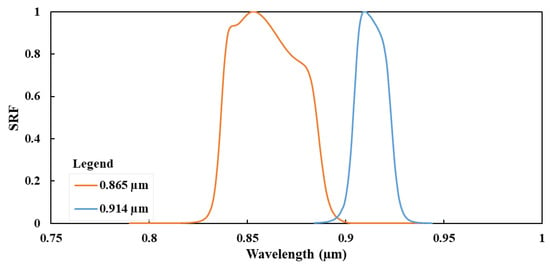
The Meteosat Third Generation Imager-1 (MTG-I1) satellite is the first of the third-generation meteorological satellites operated by Europe. MTG-I1 plays a central role in the European meteorological satellite system, with the primary objective of improving extreme weather warning capabilities through high-precision observations and providing essential data for climate research [12]. The satellite’s main payload, the Flexible Combined Imager (FCI), features 16 bands covering visible and infrared ranges, greatly enhancing its imaging performance. The spectral response function (SRF) of the two NIR bands used for PWV retrieval is shown in Figure 1.
Figure 1.
The NIR bands of MTG-I1/FCI utilized for PWV retrieval.
FCI achieves spatial resolutions of up to 500 m in the visible bands, 1 km in the NIR bands, and 1–2 km in the IR bands. With its rapid scanning capabilities, FCI completes a full-disk scan of the Earth every 10 min. It can also perform targeted scans over Europe every 2.5 min, enabling high-frequency, minute-level monitoring [13]. This high temporal resolution facilitates real-time tracking of storm development and cloud dynamics, significantly enhancing the accuracy of short-term weather forecasts. The dataset used in this study spans the observation period from 13 September 2024 to 30 January 2025 and is freely available via the ICARE (Interactions between the Climate, Atmosphere, and Radiation Environment) satellite data center in France. Although the FCI observations used in this study do not cover a complete annual cycle, the matched AERONET sites are distributed across both the Northern and Southern Hemispheres. Therefore, the dataset includes mainly autumn-to-winter conditions in the Northern Hemisphere and spring-to-summer conditions in the Southern Hemisphere, rather than being restricted entirely to autumn–winter conditions.
2.2. AERONET PWV Data
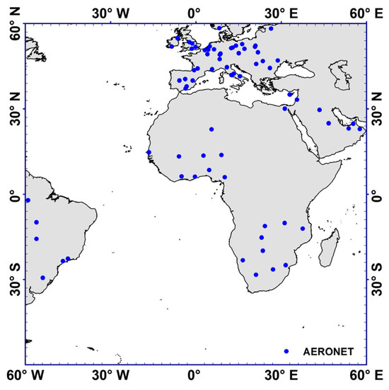
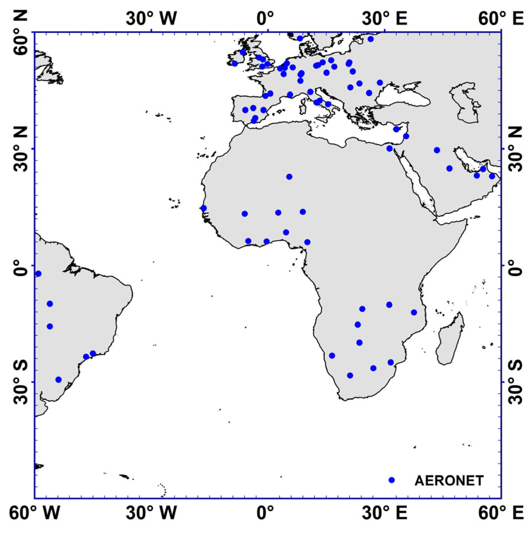
AERONET (AErosol RObotic NETwork) is an international aerosol observation system [14]. It can continuously obtain high-precision aerosol and PWV data. The network follows a rigorous quality control protocol to ensure the accuracy and long-term stability of PWV data [15]. AERONET PWV data have become a highly reliable reference dataset for validating satellite-derived PWV data, and are widely used to systematically assess spatial representativeness and temporal continuity errors in satellite data [16,17,18]. In this work, ground-based PWV data derived from 75 AERONET sites, whose spatial distribution is shown in Figure 2, are spatiotemporally matched with MTG-I1/FCI observations to develop a SE PWV retrieval algorithm for MTG-I1/FCI. Additionally, AERONET data are used to assess the precision of MTG-I1/FCI PWV data. All AERONET sites used in this study are located over land. Accordingly, the model development and validation performed here focus exclusively on PWV retrieval over clear-sky land regions.
Figure 2.
The location of 75 AERONET sites utilized. Each solid blue dot represents an AERONET site.
2.3. MODIS PWV Data
The Moderate Resolution Imaging Spectroradiometer (MODIS) onboard the Terra and Aqua satellites has five NIR bands (1.24, 0.940, 0.936, 0.905 and 0.865 µm) that are used for retrieving PWV. The MODIS PWV data developed by NASA using these bands (i.e., MOD05 and MYD05) stand out as one of the most commonly utilized remote PWV datasets [19]. In this work, MODIS PWV data, validated against AERONET observations, are used as a reference to assess the precision of MTG-I1/FCI PWV data. By comparing the statistical metrics of MODIS and MTG-I1/FCI PWV data relative to AERONET observations, the precision of MTG-I1/FCI PWV data is indirectly evaluated.
3. Method
3.1. Cloud Mask
Because NIR radiation cannot effectively penetrate clouds, the FCI 0.865 and 0.914 μm bands can only be used for PWV retrieval under clear-sky conditions. An official MTG-I1/FCI cloud mask product was not available from the ICARE data portal for the study period. Therefore, a custom cloud-screening method was applied using threshold tests based on the 0.47 and 1.38 μm bands together with local spatial-variance checks. Relatively strict thresholds were adopted to minimize the inclusion of cloud-contaminated pixels. The specific cloud-screening criteria are as follows:
- (1)
- For any pixel, if the reflectance of the band at 0.47 µm exceeds 0.4 or the reflectance of the band at 1.38 µm exceeds 0.02, the pixel is classified as a cloud pixel [20].
- (2)
- For any pixel, if the variance of the reflectance of the band at 0.47 μm exceeds 0.005 or the variance of the reflectance of the band at 1.38 μm exceeds 0.003 within a 3 × 3 pixel window centered on it, all pixels within the 3 × 3 window are classified as cloud pixels [11,20].
Although relatively strict thresholds were used, no cloud-detection method can completely remove all thin-cloud and cloud-edge pixels. Residual cloud contamination may alter the NIR reflectance ratio and lead to an overestimation of the water vapor absorption transmittance calculated using Equation (2), thereby causing an underestimation of the retrieved PWV.
3.2. PWV Retrieval
Previous studies have demonstrated a strong correlation between the natural logarithm of water vapor absorption transmittance (WVAT) of near-infrared bands () and the slant column water vapor content () along the sun–land–satellite path [11,21]:
Building upon this relationship, we develop a PWV retrieval model specifically designed for MTG-I1/FCI. To achieve this, a spatiotemporal match is performed between MTG-I1/FCI observations under clear-sky land conditions and corresponding AERONET PWV measurements. The mean of AERONET PWV values collected within a ±5 min window of MTG-I1 observation are paired with the average of valid MTG-I1/FCI data across a 10 × 10 km2 area centered on the AERONET site. The FCI-related variables used in the matching process include the reflectance of the bands at 0.865 and 0.914 µm, along with the sun zenith angle () and satellite zenith angle ().
For sensors equipped with only one NIR water vapor absorption band, PWV retrieval commonly assumes that, in the absence of water vapor absorption, the top-of-atmosphere reflectance of the absorption band is approximately equal to that of a nearby non-absorption reference band. This approximation has been adopted for sensors such as DPC, PSAC, and POLDER [11,21,22]. For FCI, the 0.865 μm band is used as the reference band for the 0.914 μm water vapor absorption band. Accordingly, the water vapor absorption transmittance at 0.914 μm can be estimated using Equation (2) [10]:
This approximation is most applicable to clear-sky land surfaces with sufficiently high reflectance. Differences in vegetation spectra, soil reflectance, and the spectral dependence of aerosol scattering may cause the reflectance of the two bands to differ even in the absence of water vapor absorption, thereby introducing uncertainty into the estimated transmittance. Such uncertainty may be more pronounced over surfaces with low reflectance. Therefore, the retrieval method used in this study is primarily intended for clear-sky land regions with sufficiently high NIR reflectance [11,21]. The relationship between and PWV () is described by Equation (3).
Following the spatiotemporal matching of MTG-I1/FCI observations and AERONET data, the matched results are utilized as inputs to compute the corresponding and for each matched pair. Subsequently, a regression model between and can be established. During operational retrieval, the model is utilized to retrieve PWV.
3.3. Validation of MTG-I1/FCI PWV Data
AERONET PWV data are utilized to validate MTG-I1/FCI PWV data. A spatiotemporal matching approach is adopted to align AERONET and FCI PWV data: the temporal mean of AERONET PWV measurements collected within a ±5 min window of MTG-I1/FCI observation are matched with the spatial average of valid FCI PWV retrievals across a 10 × 10 km2 area centered on AERONET station [23]. Three statistical metrics are utilized, including mean bias (MB), relative error (RE) and root mean square error (RMSE). The validation samples are divided into two test sets. Test Set 1 consists of the 30% of matched samples from Dataset A that were withheld from model development. Test Set 2 consists of all matched samples from Dataset B and is temporally independent of the model-development dataset. Neither test set was used to determine the regression coefficients of the SE model.
4. Results
4.1. MTG-I1/FCI PWV Retrieval Model
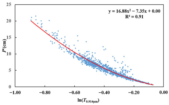
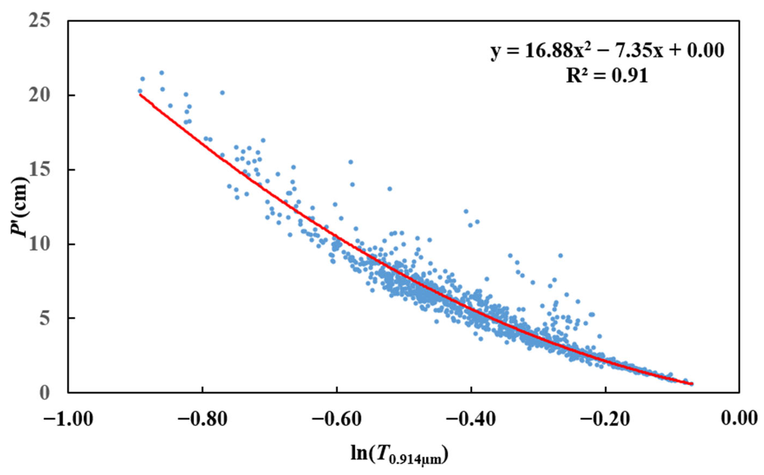
The FCI observations collected at hourly intervals from 13 September 2024 to 29 January 2025 were utilized. The observations were divided into two temporally distinct datasets. Dataset A covers 13 September to 30 November 2024, and contains 1579 matched FCI–AERONET samples. Of these samples, 70% (1105 samples) were used to establish the SE regression model, while the remaining 30% were withheld from model development and used exclusively as Test Set 1. Dataset B covers 1 December 2024 to 29 January 2025. None of the samples in Dataset B were used for model fitting or regression-coefficient determination. Instead, all matched samples from Dataset B were used exclusively as the temporally independent Test Set 2. This data-partitioning strategy ensures that there is no overlap between the samples used for model development and those used for validation. The relationship between and , derived from the 1105 training samples, is shown in Figure 3.
Figure 3.
The matching results between and .
Analysis of these results reveals a strong correlation between and , with a coefficient of determination (R2) greater than 0.9. Their relationship can be expressed by Equation (4).
By integrating Equations (2)–(4), the final MTG-I1/FCI PWV retrieval model is formulated, as presented in Equation (5).
4.2. Spatial Distribution of MTG-I1/FCI PWV Data
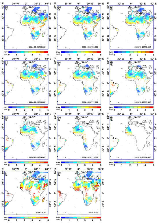
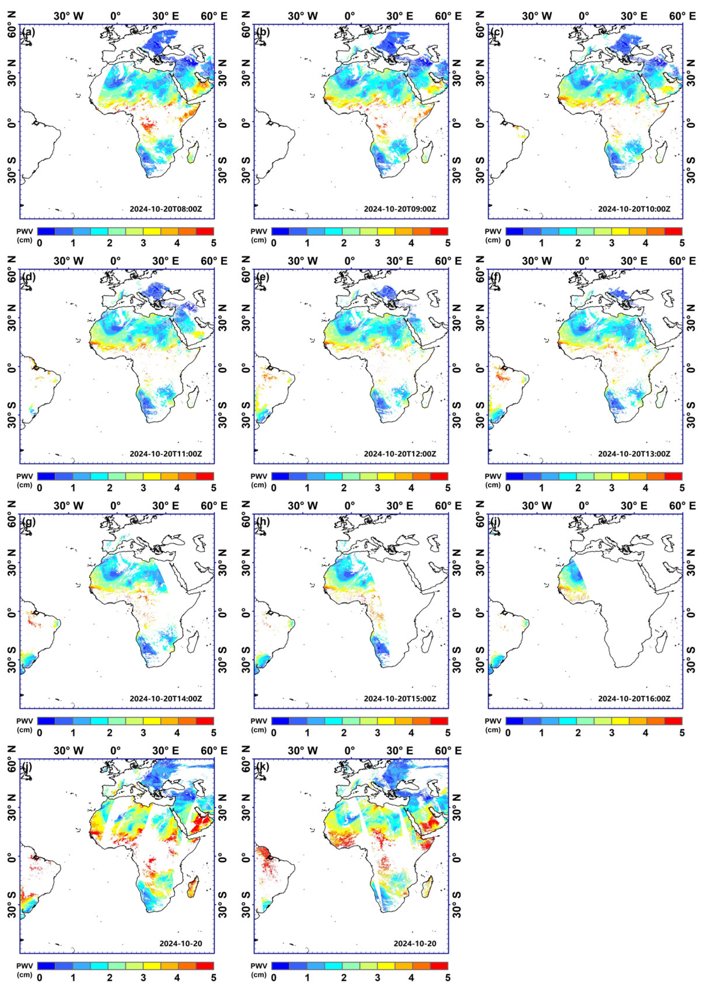
Figure 4 presents a representative single-day example to qualitatively illustrate the spatial distribution and temporal continuity of the FCI-derived PWV data, as well as their overall spatial consistency with the corresponding MODIS PWV observations. As illustrated in Figure 4, the MTG-I1/FCI PWV data demonstrate excellent spatial continuity, consistent with the generally uniform nature of atmospheric water vapor distribution. Compared with the MODIS PWV data, the two datasets exhibit highly similar spatial distribution patterns. However, the MODIS PWV values are overall higher than those of the MTG-I1/FCI PWV data. Although previous studies have shown that MODIS PWV data tend to significantly overestimate water vapor [23,24], we are currently unable to conclude from this comparison whether the MTG-I1/FCI PWV data contain a notable systematic bias. Because a single-day spatial comparison is insufficient to determine whether either dataset contains a systematic bias, this issue is further evaluated using ground-based AERONET observations in Section 4.3. Owing to the higher temporal resolution of MTG-I1/FCI, the derived PWV data provide enhanced temporal coverage for tracking dynamic changes in atmospheric water vapor. The single-day example in Figure 4 is intended for qualitative visualization rather than for quantitative evaluation of retrieval accuracy or robustness.
Figure 4.
The spatial distributions of FCI PWV data and MODIS PWV data on 20 October 2024. Subfigures (a–i) represent FCI PWV data from 8:00 to 16:00, and subfigures (j,k) represents MODIS PWV data derived from Terra and Aqua.
4.3. Validation Results of MTG-I1/FCI PWV Data
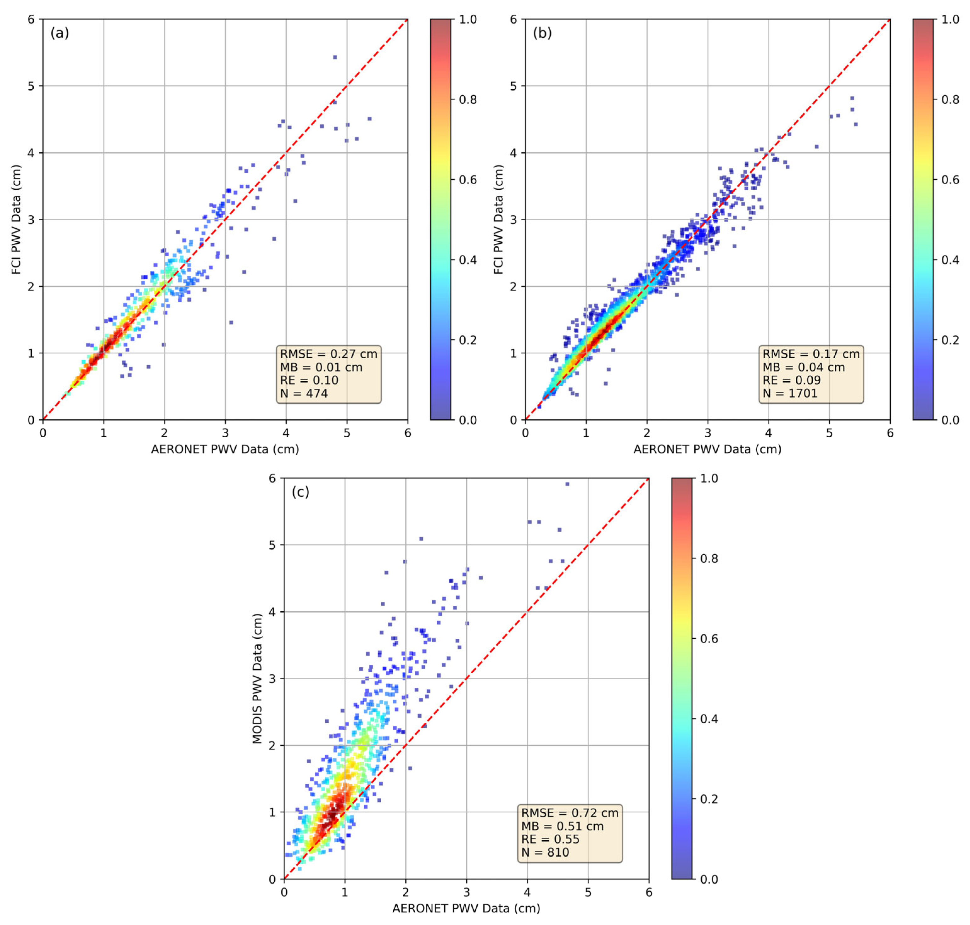
The accuracy of the FCI-specific PWV retrieval model was evaluated using two test sets that were not involved in regression-coefficient determination. Test Set 1 consists of the 30% of matched samples from Dataset A that were withheld from model development. Test Set 2 consists of matched samples from Dataset B, covering 1 December 2024 to 29 January 2025, and is temporally independent of the model-development dataset. Because Test Set 2 was acquired during a different time period and was completely excluded from model development, it provides an independent assessment of the temporal stability of the FCI-specific retrieval relationship.
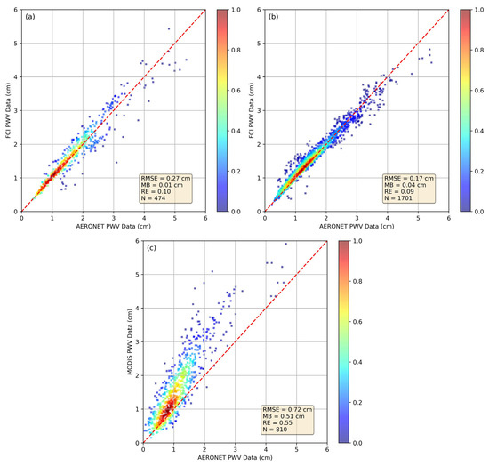
The validation results for the two test sets are presented in Figure 5. The statistical metrics obtained for Test Set 2 are comparable to those obtained for Test Set 1. This consistency indicates that the FCI-specific model maintains stable retrieval performance when applied to observations acquired outside the model-development period. Furthermore, when compared to MODIS PWV data for the same period, the FCI PWV data demonstrate superior accuracy. One should be aware that MODIS PWV data exhibit systematic error [23,24]. For example, Wang et al. reported a relative error of approximately 30% for global MODIS PWV observations in 2022 [22]. The relative error of 0.55 obtained for the 2025 MODIS observations in this study is higher than that reported for the 2022 global dataset. This difference may partly reflect temporal changes in the radiometric response of the MODIS NIR bands. Differences in sample distribution, geographic coverage, observation conditions, and spatiotemporal matching procedures may also contribute to the different error magnitudes.
Figure 5.
The validation results of MTG-I1/FCI PWV data and MODIS PWV data. (a) Test Set 1. (b) Test Set 2. (c) MODIS PWV data corresponding to Test Set 2.
Given that MODIS PWV data are among the most widely used remote sensing PWV products currently available [25,26,27], and that the relative error of PWV retrievals from near-infrared bands typically ranges from 0.10 to 0.30 [23], the MTG-I1/FCI PWV data, with a relative error ranging from 0.09 to 0.10, achieve a high level of accuracy, placing them among the most accurate remote sensing PWV datasets worldwide. In addition, the validation results do not show a substantial number of anomalously underestimated FCI PWV values, suggesting that residual cloud contamination does not exert a dominant influence on the overall statistical results.
5. Discussion
In addition to the SE method, an RTM-based method was implemented for comparison. The Second Simulation of a Satellite Signal in the Solar Spectrum–Vector model (6SV) was used with its default atmospheric profile, and aerosol effects were not considered. The spectral response function of the FCI 0.914 μm band was incorporated to calculate band-integrated water vapor absorption transmittance for PWV values from 0 to 8 cm at intervals of 0.1 cm and for the solar and satellite zenith angles corresponding to each FCI pixel. Both the SE and RTM-based methods use the same observed FCI data, the same geometric inputs, and the same definition of observed water vapor absorption transmittance. The essential difference is how the transmittance–PWV relationship is established: it is fitted directly from matched FCI–AERONET observations in the SE method and calculated with 6SV in the RTM-based method. The RTM-based retrieval consists of the following steps [7,19]:
For each pixel, the observed water vapor absorption transmittance is calculated using Equation (2).
The solar and satellite zenith angles of the pixel are used in 6SV to calculate the 0.914 μm water vapor absorption transmittance for PWV values from 0 to 8 cm at intervals of 0.1 cm.
The observed transmittance is then linearly interpolated within the simulated transmittance–PWV relationship to retrieve PWV.
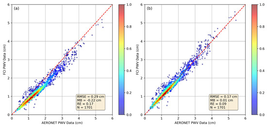
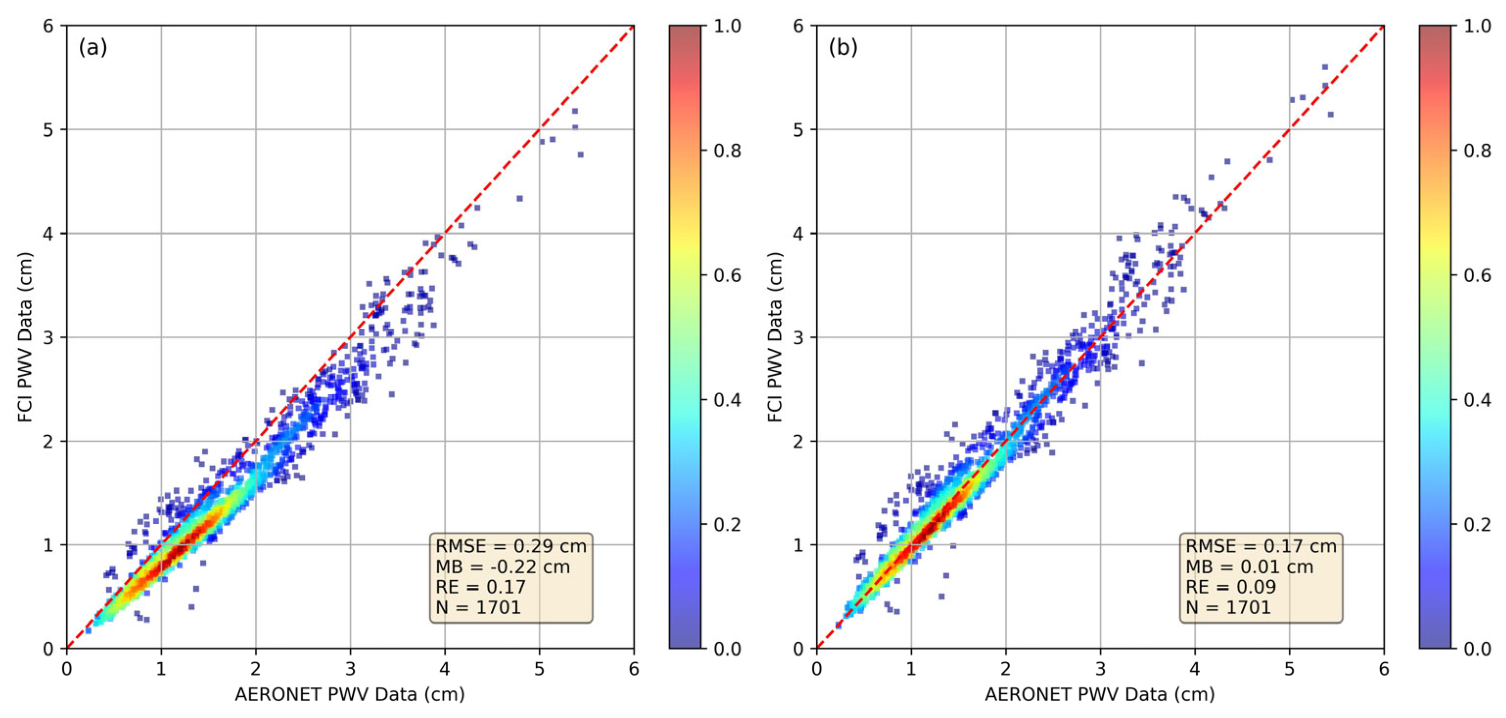
The RTM-based validation results are shown in Figure 6a. Compared with the SE results in Figure 5b, the uncorrected RTM-based retrievals exhibit a clear systematic underestimation (MB = −0.22 cm) and lower accuracy. This result indicates that the RTM-based method is sensitive to inconsistencies between the actual radiometric response represented by the FCI observations and the radiometric state assumed in the 6SV calculations.
Figure 6.
The validation results of MTG-I1/FCI PWV data developed using the RTM-based algorithm corresponding to Test Set 2. (a) Data M1. (b) Data M2.
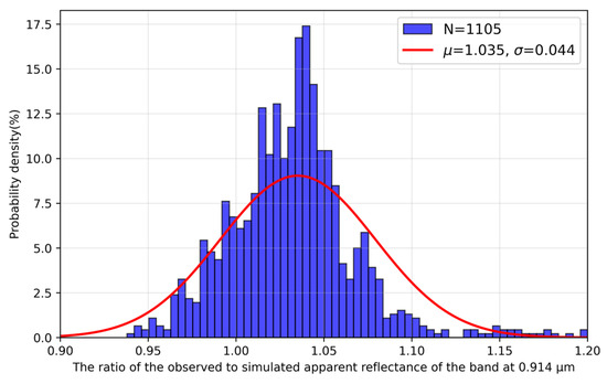
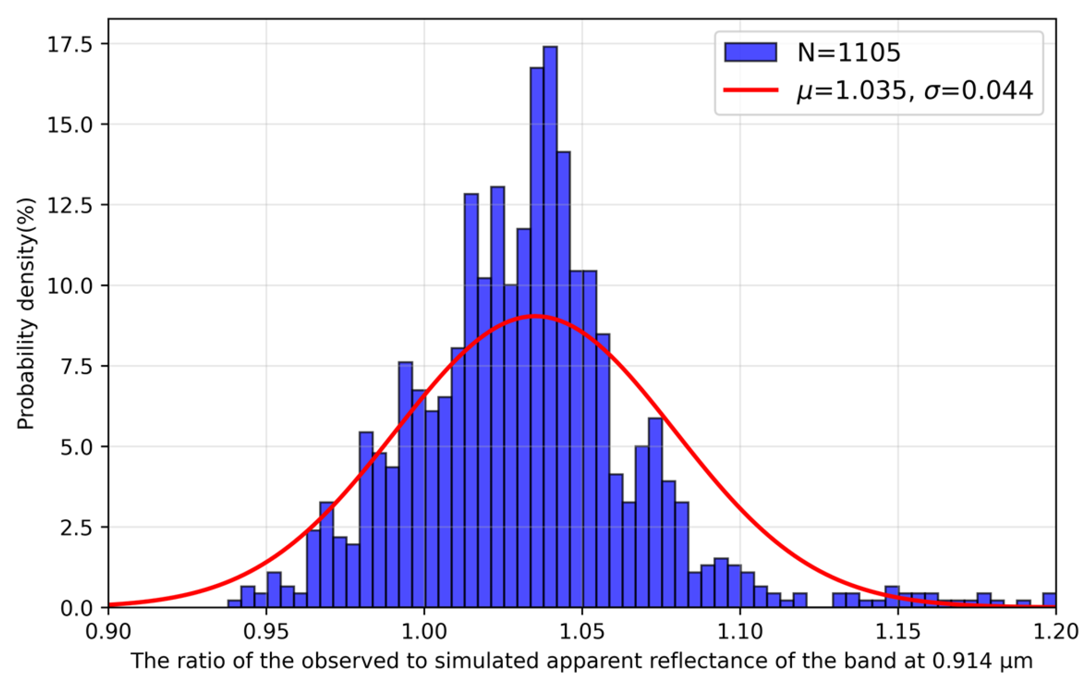
To investigate the systematic underestimation, the 0.914 μm water vapor absorption transmittance corresponding to the 1105 model-development samples was calculated, and the apparent reflectance at 0.914 μm was simulated by multiplying this transmittance by the apparent reflectance at 0.865 μm. Figure 7 shows the probability distribution of the measured-to-simulated 0.914 μm apparent-reflectance ratio. The mean ratio is 1.035 ± 0.044, indicating a systematic radiometric discrepancy between the observations and the RTM simulations. Without independent calibration evidence, this discrepancy cannot be attributed exclusively to sensor degradation. Potential contributors include sensor degradation or calibration bias, limitations in the 6SV simulations, the assumption of no aerosol contribution, surface reflectance variability, and possible spectral-response-function mismatches. Regardless of its source, the discrepancy increases the transmittance estimated from Equation (2) relative to that assumed in the RTM simulation and is consistent with the PWV underestimation in Figure 6a.
Figure 7.
The probability distribution of the ratio of the measured to simulated apparent reflectance of the band at 0.914 µm.
Using the measured-to-simulated reflectance ratio, the water vapor absorption transmittance can be adjusted according to Equation (6). This correction is intended to quantify the influence of the observed systematic reflectance discrepancy on the RTM-based PWV retrieval; it should not be interpreted as an independent radiometric calibration of FCI.
The RTM-based retrievals before and after correction of the systematic reflectance discrepancy are referred to as Data M1 and Data M2, respectively, and are shown in Figure 6a,b. Data M2 has substantially higher accuracy than Data M1 and shows no significant systematic bias (MB = 0.01 cm), whereas Data M1 has a clear negative bias (MB = −0.22 cm). Relative to Data M1, the absolute and relative errors of Data M2 decrease by 41% and 47%, respectively. The accuracy of Data M2 is comparable to that of the SE retrievals, while the uncorrected Data M1 is less accurate. These results demonstrate that the systematic radiometric discrepancy has a substantial influence on the RTM-based retrieval. The SE relationship, by contrast, is established directly under the radiometric state represented by the observations during model development. Thus, its advantage is more accurately described as adaptability to the existing sensor radiometric state rather than permanent or intrinsic immunity to subsequent degradation. If the sensor response changes substantially after model development, the SE coefficients should be updated using newly matched observations.
6. Conclusions
This study successfully developed a semi-empirical PWV retrieval algorithm for the NIR bands of MTG-I1/FCI. The proposed algorithm offers a key technical solution for obtaining high-precision atmospheric water vapor data. It demonstrates outstanding retrieval performance, achieving a relative error of no more than 0.10, which significantly exceeds the accuracy levels of MODIS PWV data. Comparative analysis shows that, unlike the traditional RTM-based PWV retrieval algorithm, the SE algorithm is more robust and practical in the face of a systematic radiometric discrepancy between the observed and simulated FCI reflectance. Further investigation reveals that applying a reflectance correction mechanism significantly improves the accuracy of the RTM-based algorithm—reducing absolute and relative errors by 41% and 47%, respectively. Because the SE relationship is fitted directly from actual FCI observations and matched ground-based PWV measurements, the radiometric state represented during model development is incorporated into the coefficients, enabling the method to accommodate existing systematic radiometric discrepancies. This adaptability should not be interpreted as permanent immunity to later sensor changes; the coefficients may require updating if the sensor response changes substantially. This robustness, coupled with its computational efficiency and operational applicability, makes the semi-empirical algorithm the preferred solution for retrieving PWV from MTG-I1/FCI data. Overall, this study provides technical support for the efficient generation of MTG-I1/FCI PWV products.
Author Contributions
Conceptualization, Y.X., S.W., L.Z. and Z.L.; methodology, Y.X., M.O. and C.C.; validation, Y.X., M.O. and C.C.; writing—original draft preparation, Y.X., M.O. and C.C. All authors have read and agreed to the published version of the manuscript.
Funding
This research was funded by Open Fund of State Key Laboratory of Remote Sensing Science, grant number OFSLRSS202322; and National Natural Science Foundation of China, grant number 42301463.
Data Availability Statement
The MTG-I1/FCI data used for PWV retrieval can be obtained from the ICARE website (i.e., https://www.icare.univ-lille.fr, accessed on 3 March 2025), the AERONET PWV data can be obtained from the AERONET website (i.e., https://aeronet.gsfc.nasa.gov, accessed on 15 May 2025), and the MODIS PWV data can be obtained from the LAADS DAAC website (i.e., https://ladsweb.modaps.eosdis.nasa.gov, accessed on 3 March 2025).
Acknowledgments
The authors thank AERONET, ICARE and NASA for providing the ground-based PWV data, MTG-I1 data and MODIS data, respectively.
Conflicts of Interest
The authors declare no conflicts of interest.
References
- Schneider, T.; O’Gorman, P.A.; Levine, X.J. Water Vapor and the Dynamics of Climate Changes. Rev. Geophys. 2010, 48, RG3001. [Google Scholar] [CrossRef] [Scilit]
- Zhang, Z.W.; Chen, J.J.; Li, Y.Y.; Fu, X.X.; Ding, Y.M. Impact of Atmospheric River and Local Topography on “21.7” Extremely Heavy Rainfall in Henan Province, China. Atmos. Res. 2024, 310, 107634. [Google Scholar] [CrossRef] [Scilit]
- Huang, L.; Lu, D.; Chen, F.; Zhang, H.; Zhu, G.; Liu, L. A Deep Learning-Based Approach for Directly Retrieving GNSS Precipitable Water Vapor and Its Application in Typhoon Monitoring. IEEE Trans. Geosci. Remote Sens. 2024, 62, 1–12. [Google Scholar] [CrossRef] [Scilit]
- Huang, L.; Mo, Z.; Xie, S.; Liu, L.; Chen, J.; Kang, C.; Wang, S. Spatiotemporal characteristics of GNSS-derived precipitable water vapor during heavy rainfall events in Guilin, China. Satell. Navig. 2021, 2, 13. [Google Scholar] [CrossRef] [Scilit]
- Zhao, Q.; Sun, T.; Guo, H.; Li, Z.; Chang, L.; Yin, J.; Yao, Y. Two-step method of surface-based high-precision PET retrieval. Atmos. Res. 2024, 304, 107406. [Google Scholar] [CrossRef] [Scilit]
- Yu, C.; Zhang, H.D.; Gong, Y.; Hu, N.; Chen, T.; Wang, M.; Zhang, F.H.; He, L. Analysis of Extreme Rain and Snow Weather Dynamic and Water Vapor Conditions in Northeast China from 17 to 19 November 2020. Atmosphere 2022, 13, 1213. [Google Scholar] [CrossRef] [Scilit]
- Wang, L.; Hu, X.Q.; Xu, N.; Chen, L. Water Vapor Retrievals from Near-infrared Channels of the Advanced Medium Resolution Spectral Imager Instrument onboard the Fengyun-3D Satellite. Adv. Atmos. Sci. 2021, 38, 1351–1366. [Google Scholar] [CrossRef] [Scilit]
- Xie, Y.Q.; Zhu, Q.Y.; Zhu, S.F.; Hou, W.Z.; Zhang, L.G.; Lei, X.F.; Zhang, M.M.; Li, Y.D.; Liu, Z.H.; Wen, Y.; et al. Radiometric Calibration of the Near-Infrared Bands of GF-5-02/DPC for Water Vapor Retrieval. Remote Sens. 2024, 16, 1806. [Google Scholar] [CrossRef] [Scilit]
- He, J.; Liu, Z.Z. Water Vapor Retrieval From MODIS NIR Channels Using Ground-Based GPS Data. IEEE Trans. Geosci. Remote Sens. 2020, 58, 3726–3737. [Google Scholar] [CrossRef] [Scilit]
- Xie, Y.Q.; Zhang, M.M.; Wang, Z.J.; Wen, Y.; Zhang, L.G.; Li, Y.D.; Hou, W.Z.; Liu, Z.H.; Hong, J.; Lei, X.F.; et al. Performance of the Semi-Empirical Precipitable Water Vapor Retrieval Algorithm Developed for Polarized Scanning Atmospheric Corrector (PSAC) in the Presence of Sensor Decay. IEEE Trans. Geosci. Remote Sens. 2023, 61, 1–11. [Google Scholar] [CrossRef] [Scilit]
- Xie, Y.Q.; Hou, W.Z.; Li, Z.Q.; Zhu, S.F.; Liu, Z.H.; Hong, J.; Ma, Y.; Fan, C.; Guang, J.; Yang, B.Y.; et al. Columnar Water Vapor Retrieval by Using Data from the Polarized Scanning Atmospheric Corrector (PSAC) Onboard HJ-2 A/B Satellites. Remote Sens. 2022, 14, 1376. [Google Scholar] [CrossRef] [Scilit]
- Holmlund, K.; Grandell, J.; Schmetz, J.; Stuhlmann, R.; Bojkov, B.; Munro, R.; Lekouara, M.; Coppens, D.; Viticchie, B.; August, T.; et al. Meteosat Third Generation (MTG): Continuation and Innovation of Observations from Geostationary Orbit. Bull. Am. Meteorol. Soc. 2021, 102, E990–E1015. [Google Scholar] [CrossRef] [Scilit]
- Lavigne, H.; Ruddick, K. The potential use of geostationary MTG/FCI to retrieve chlorophyll-a concentration at high temporal resolution for the open oceans. Int. J. Remote Sens. 2018, 39, 2399–2420. [Google Scholar] [CrossRef] [Scilit]
- Holben, B.N.; Eck, T.F.; Slutsker, I.; Tanre, D.; Buis, J.P.; Setzer, A.; Vermote, E.; Reagan, J.A.; Kaufman, Y.J.; Nakajima, T.; et al. AERONET—A federated instrument network and data archive for aerosol characterization. Remote Sens. Environ. 1998, 66, 1–16. [Google Scholar] [CrossRef] [Scilit]
- Giles, D.M.; Sinyuk, A.; Sorokin, M.G.; Schafer, J.S.; Smirnov, A.; Slutsker, I.; Eck, T.F.; Holben, B.N.; Lewis, J.R.; Campbell, J.R.; et al. Advancements in the Aerosol Robotic Network (AERONET) Version 3 database—Automated near-real-time quality control algorithm with improved cloud screening for Sun photometer aerosol optical depth (AOD) measurements. Atmos. Meas. Tech. 2019, 12, 169–209. [Google Scholar] [CrossRef] [Scilit]
- Gong, S.Q.; Hagan, D.F.T.; Wu, X.Y.; Wang, G.J. Spatio-temporal analysis of precipitable water vapour over northwest china utilizing MERSI/FY-3A products. Int. J. Remote Sens. 2018, 39, 3094–3110. [Google Scholar] [CrossRef] [Scilit]
- Vijayakumar, K.; Devara, P.C.S.; Giles, D.M.; Holben, B.N.; Rao, S.V.B.; Jayasankar, C.K. Validation of satellite and model aerosol optical depth and precipitable water vapour observations with AERONET data over Pune, India. Int. J. Remote Sens. 2018, 39, 7643–7663. [Google Scholar] [CrossRef] [Scilit]
- Martins, V.S.; Lyapustin, A.; Wang, Y.J.; Giles, D.M.; Smirnov, A.; Slutsker, I.; Korkin, S. Global validation of columnar water vapor derived from EOS MODIS-MAIAC algorithm against the ground-based AERONET observations. Atmos. Res. 2019, 225, 181–192. [Google Scholar] [CrossRef] [Scilit]
- Gao, B.C.; Kaufman, Y.J. Water vapor retrievals using moderate resolution Imaging spectroradiometer (MODIS) near-infrared channels. J. Geophys. Res.-Atmos. 2003, 108, 4389. [Google Scholar] [CrossRef] [Scilit]
- Yang, L.; Hu, X.; Wang, H.; He, X.; Liu, P.; Xu, N.; Yang, Z.; Zhang, P. Preliminary test of quantitative capability in aerosol retrieval over land from MERSI-II onboard FY-3D. Natl. Remote Sens. Bull. 2022, 26, 923–940. [Google Scholar] [CrossRef] [Scilit]
- Bouffies, S.; Breon, F.M.; Tanre, D.; Dubuisson, P. Atmospheric water vapor estimate by a differential absorption technique with the polarisation and directionality of the Earth reflectances (POLDER) instrument. J. Geophys. Res.-Atmos. 1997, 102, 3831–3841. [Google Scholar] [CrossRef] [Scilit]
- Wang, C.; Shi, Z.; Xie, Y.; Luo, D.; Li, Z.; Wang, D.; Chen, X. Precipitable Water Vapor Retrieval Based on DPC Onboard GaoFen-5 (02) Satellite. Remote Sens. 2023, 15, 94. [Google Scholar] [CrossRef] [Scilit]
- Xie, Y.Q.; Li, Z.Q.; Hou, W.Z.; Guang, J.; Ma, Y.; Wang, Y.Y.; Wang, S.H.; Yang, D. Validation of FY-3D MERSI-2 Precipitable Water Vapor (PWV) Datasets Using Ground-Based PWV Data from AERONET. Remote Sens. 2021, 13, 3246. [Google Scholar] [CrossRef] [Scilit]
- Bright, J.M.; Gueymard, C.A.; Killinger, S.; Lingfors, D.; Sun, X.X.; Wang, P.; Engerer, N.A. Climatic and Global Validation of Daily MODIS Precipitable Water Data at AERONET Sites for Clear-sky Irradiance Modelling. In Proceedings of the 12th International Conference on Solar Energy for Buildings and Industry (ISES EuroSun), Fachhochschule Ostschweiz, Hochschule Technik Rapperswil, Rapperswil, Switzerland, 10–13 September 2018; pp. 1490–1501. [Google Scholar]
- He, J.; Liu, Z.Z. Comparison of Satellite-Derived Precipitable Water Vapor Through Near-Infrared Remote Sensing Channels. IEEE Trans. Geosci. Remote Sens. 2019, 57, 10252–10262. [Google Scholar] [CrossRef]
- Khaniani, A.S.; Nikraftar, Z.; Zakeri, S. Evaluation of MODIS Near-IR water vapor product over Iran using ground-based GPS measurements. Atmos. Res. 2020, 231, 104657. [Google Scholar] [CrossRef] [Scilit]
- Zhang, B.; Yao, Y.B. Precipitable water vapor fusion based on a generalized regression neural network. J. Geod. 2021, 95, 36. [Google Scholar] [CrossRef] [Scilit]
Disclaimer/Publisher’s Note: The statements, opinions and data contained in all publications are solely those of the individual author(s) and contributor(s) and not of MDPI and/or the editor(s). MDPI and/or the editor(s) disclaim responsibility for any injury to people or property resulting from any ideas, methods, instructions or products referred to in the content. |
© 2026 by the authors. Licensee MDPI, Basel, Switzerland. This article is an open access article distributed under the terms and conditions of the Creative Commons Attribution (CC BY) license.