Article

Monitoring Drought through the Lens of Landsat: Drying of Rivers during the California Droughts
1
Hydrometeorology and Remote Sensing Laboratory, School of Civil Engineering and Environmental Science, University of Oklahoma, Norman, OK 73019, USA
2
Department of Biology, University of Oklahoma, Norman, OK 73019, USA
3
Department of Geography & Environmental Sustainability, University of Oklahoma, Norman, OK 73019, USA
*
Author to whom correspondence should be addressed.
Remote Sens. 2021, 13(17), 3423; https://doi.org/10.3390/rs13173423
Submission received: 29 June 2021 / Revised: 20 August 2021 / Accepted: 26 August 2021 / Published: 28 August 2021
(This article belongs to the Special Issue Remote Sensing Applications for Water Scarcity Assessment)

Abstract

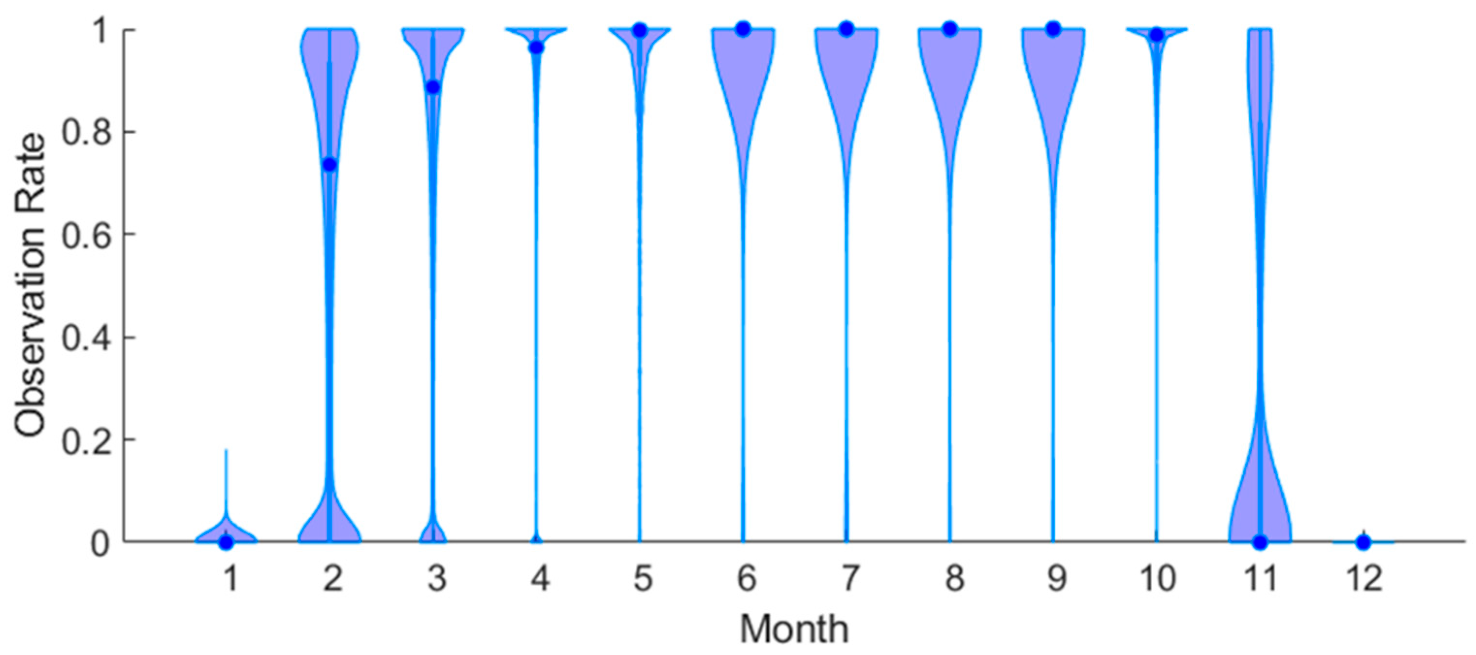
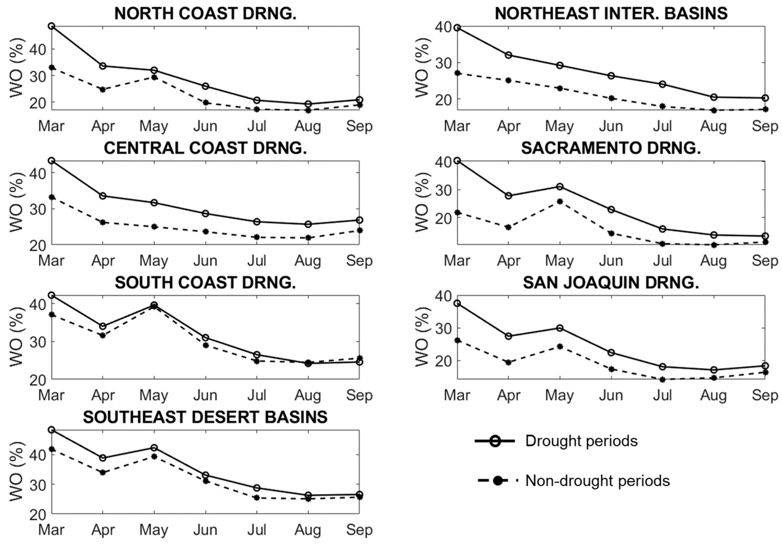
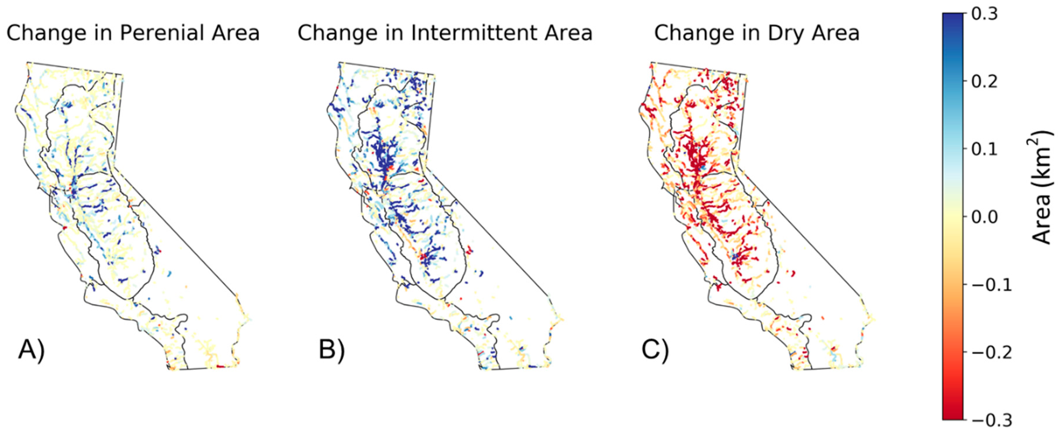
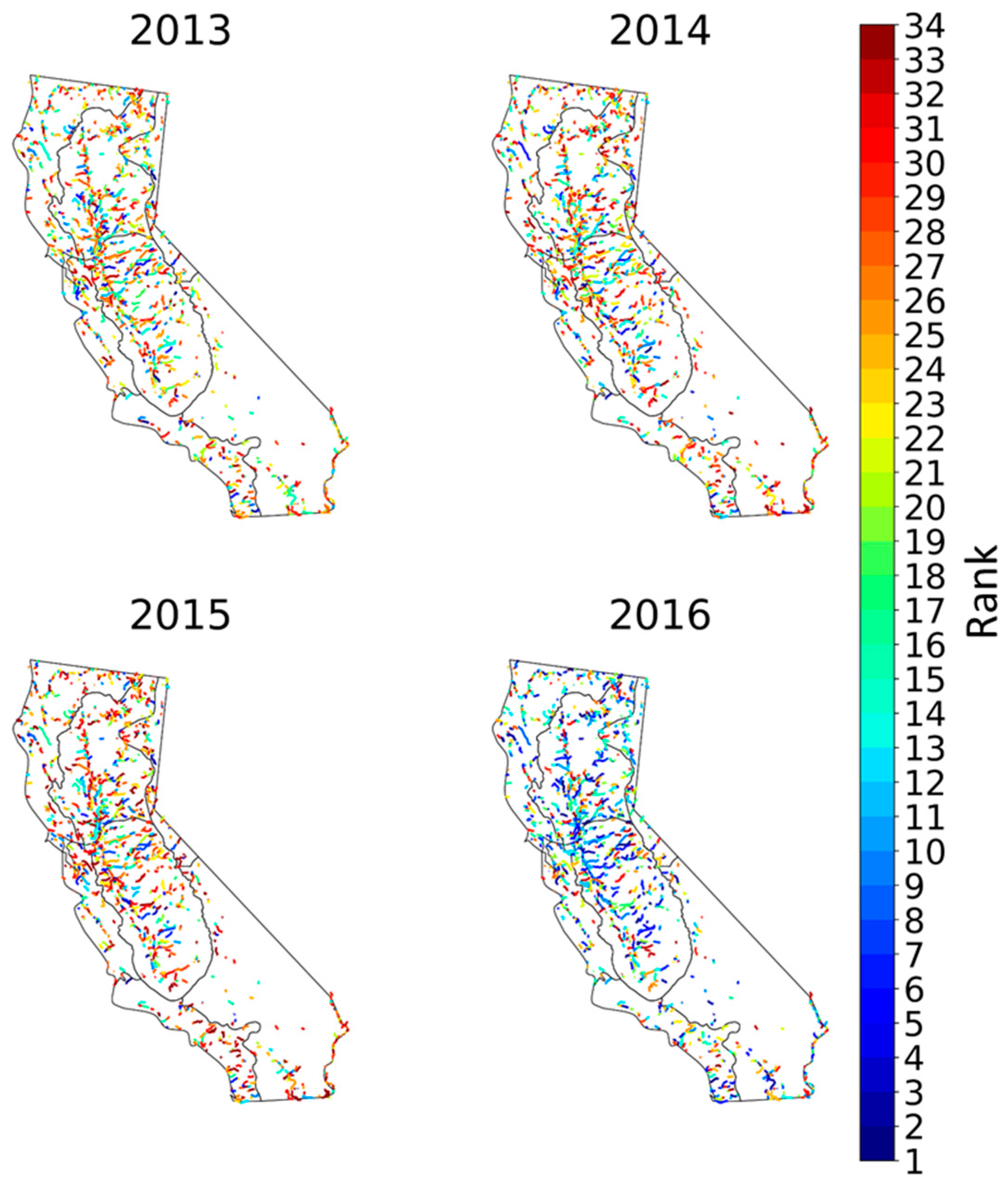
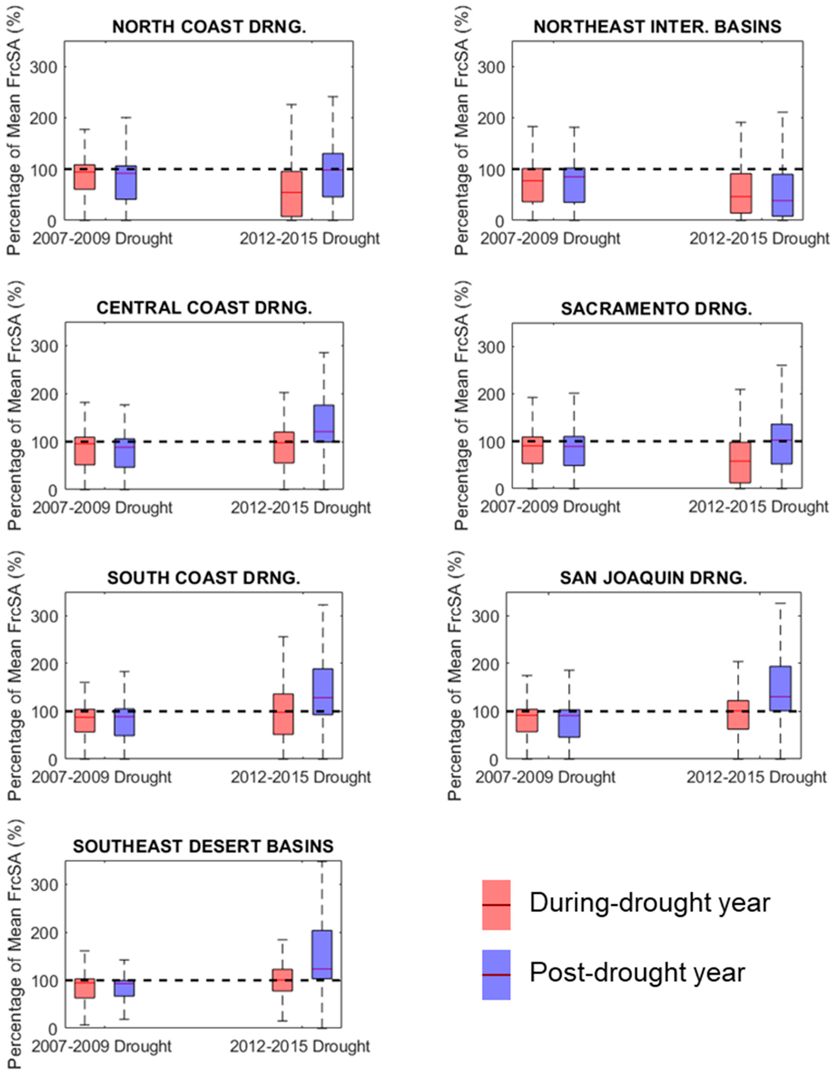
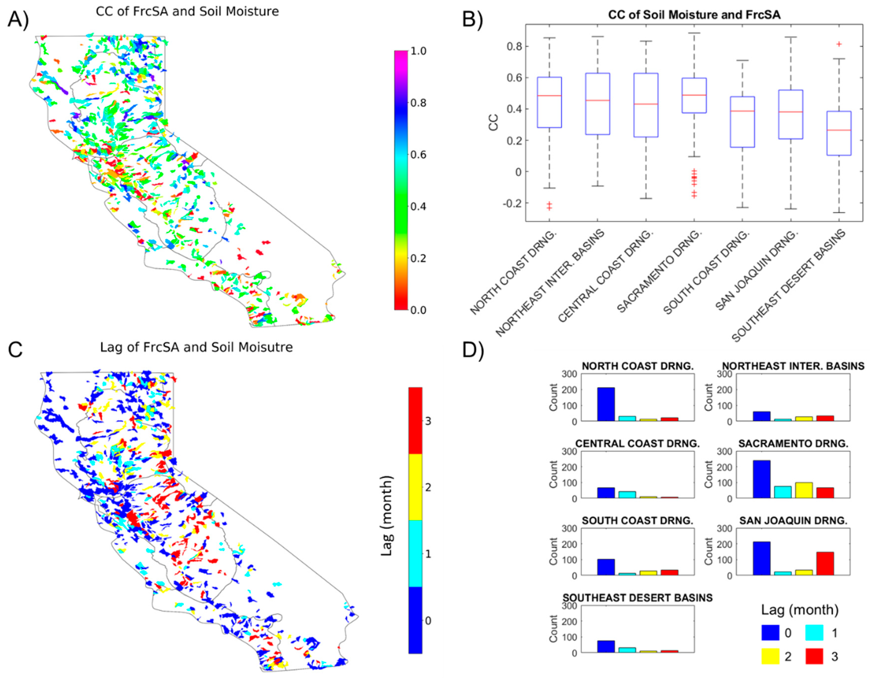
Water scarcity during severe droughts has profound hydrological and ecological impacts on rivers. However, the drying dynamics of river surface extent during droughts remains largely understudied. Satellite remote sensing enables surveys and analyses of rivers at fine spatial resolution by providing an alternative to in-situ observations. This study investigates the seasonal drying dynamics of river extent in California where severe droughts have been occurring more frequently in recent decades. Our methods combine the use of Landsat-based Global Surface Water (GSW) and global river bankful width databases. As an indirect comparison, we examine the monthly fractional river extent (FrcSA) in 2071 river reaches and its correlation with streamflow at co-located USGS gauges. We place the extreme 2012–2015 drought into a broader context of multi-decadal river extent history and illustrate the extraordinary change between during- and post-drought periods. In addition to river extent dynamics, we perform statistical analyses to relate FrcSA with the hydroclimatic variables obtained from the National Land Data Assimilation System (NLDAS) model simulation. Results show that Landsat provides consistent observation over 90% of area in rivers from March to October and is suitable for monitoring seasonal river drying in California. FrcSA reaches fair (>0.5) correlation with streamflow except for dry and mountainous areas. During the 2012–2015 drought, 332 river reaches experienced their lowest annual mean FrcSA in the 34 years of Landsat history. At a monthly scale, FrcSA is better correlated with soil water in more humid areas. At a yearly scale, summer mean FrcSA is increasingly sensitive to winter precipitation in a drier climate; and the elasticity is also reduced with deeper ground water table. Overall, our study demonstrates the detectability of Landsat on the river surface extent in an arid region with complex terrain. River extent in catchments of deficient water storage is likely subject to higher percent drop in a future climate with longer, more frequent droughts.
Keywords: drought; Landsat; river surface extent; seasonal drying; NLDAS drought; Landsat; river surface extent; seasonal drying; NLDAS