Article

A Spatiotemporal Wildfire Risk Prediction Framework Integrating Density-Based Clustering and GTWR-RFR


by
Shaofeng Xie
,
Huashun Xiao
*,
Gui Zhang
and
Haizhou Xu
School of Advanced Interdisciplinary Studies, Central South University of Forestry and Technology, Changsha 410004, China
*
Author to whom correspondence should be addressed.
Forests 2025, 16(11), 1632; https://doi.org/10.3390/f16111632
Submission received: 15 September 2025 / Revised: 19 October 2025 / Accepted: 22 October 2025 / Published: 26 October 2025
(This article belongs to the Special Issue Ecological Monitoring and Forest Fire Prevention)

Abstract

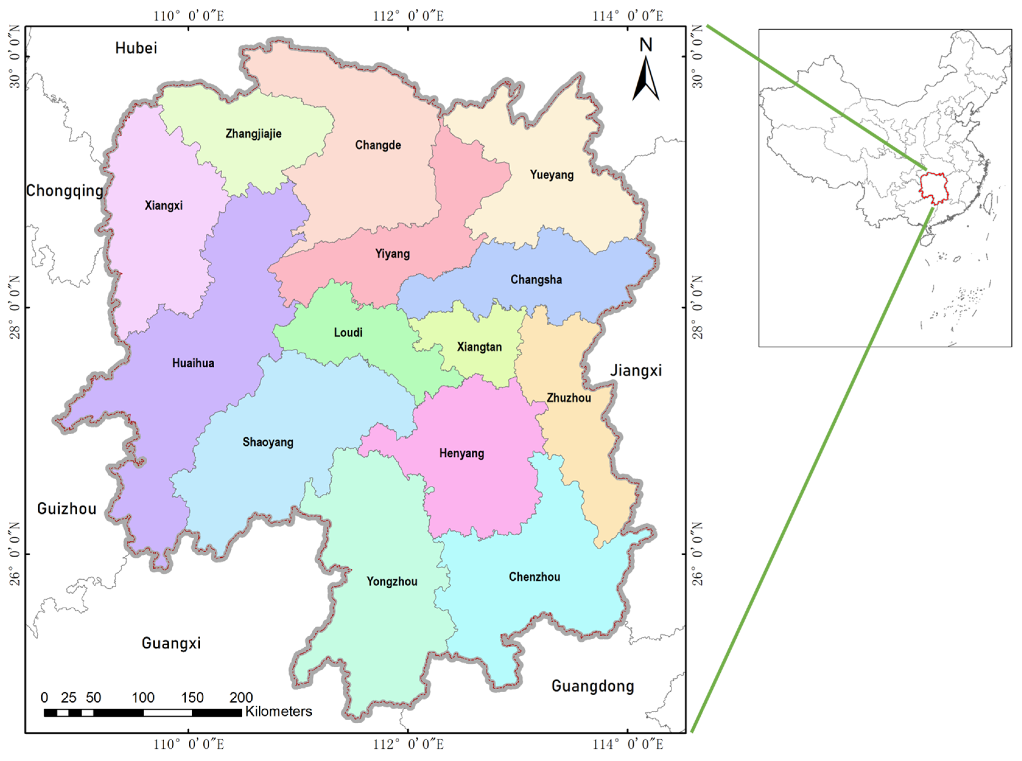
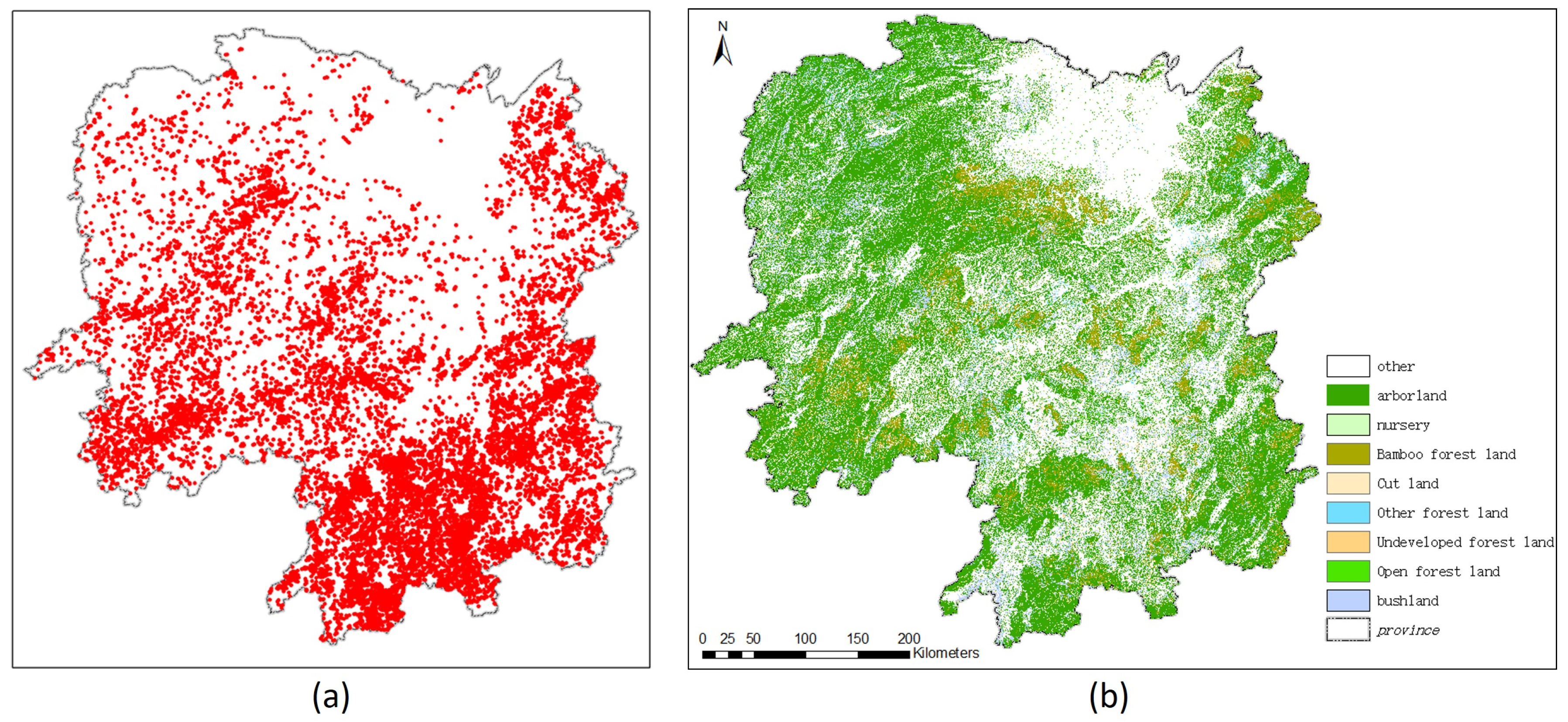
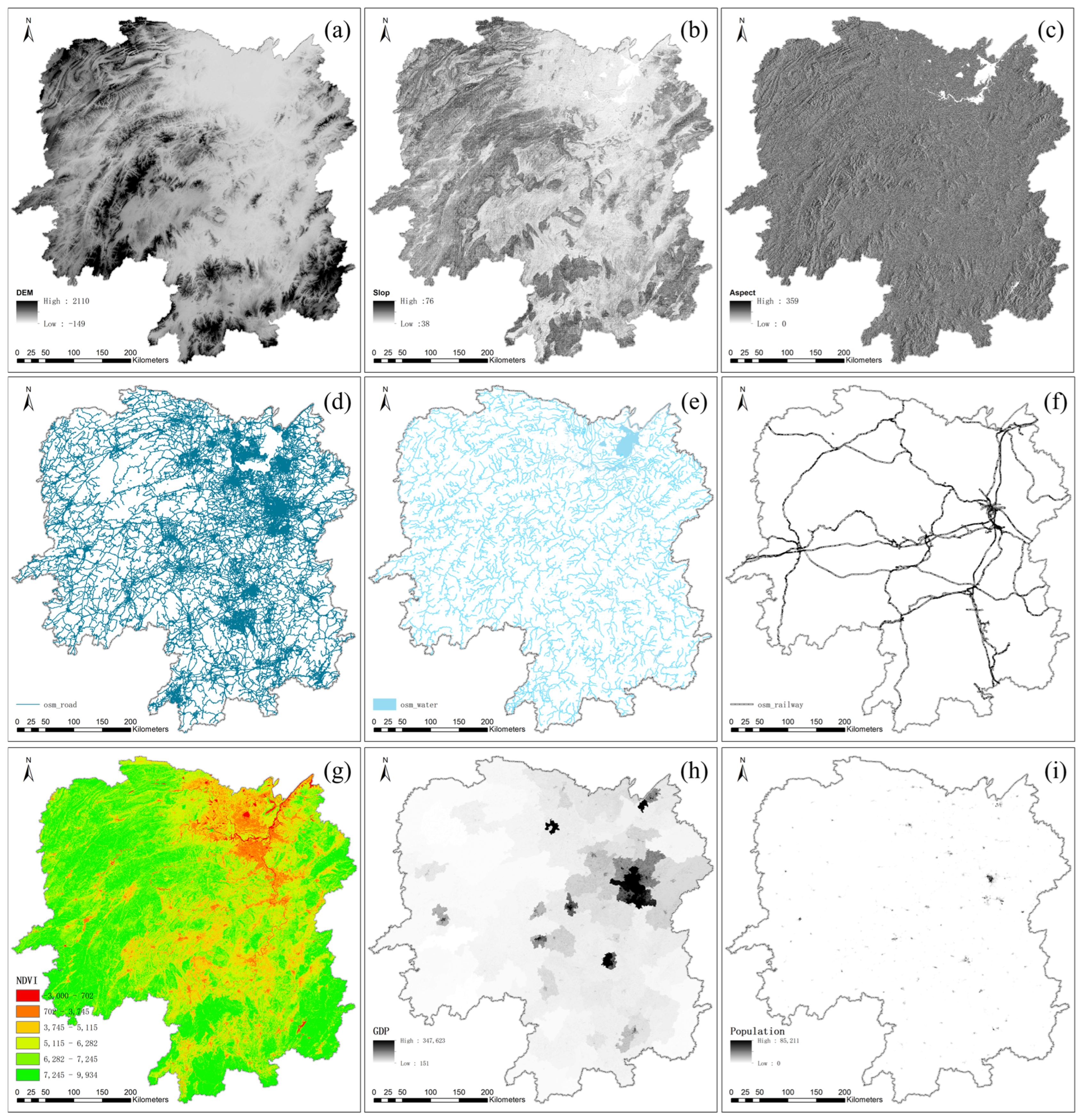
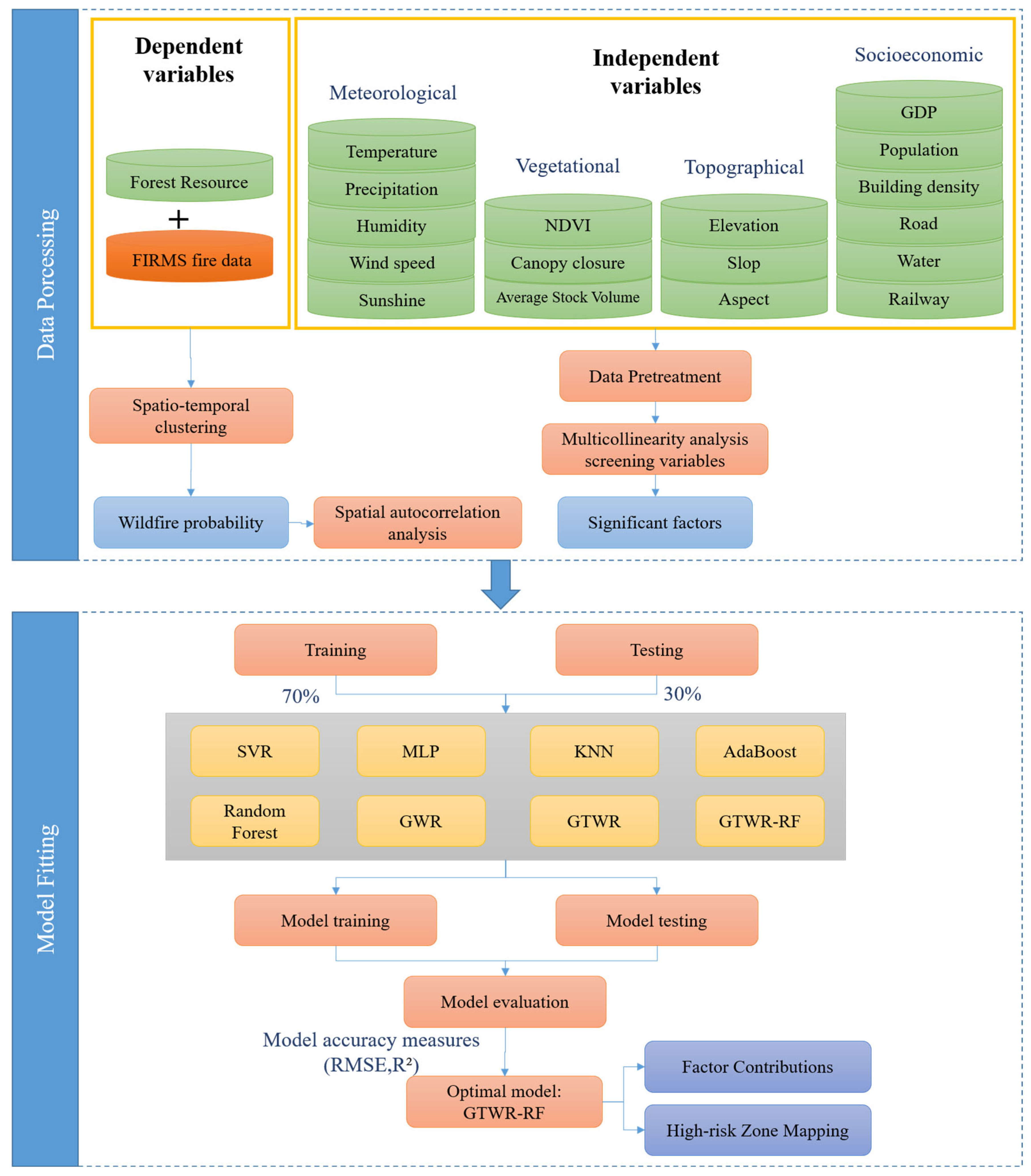
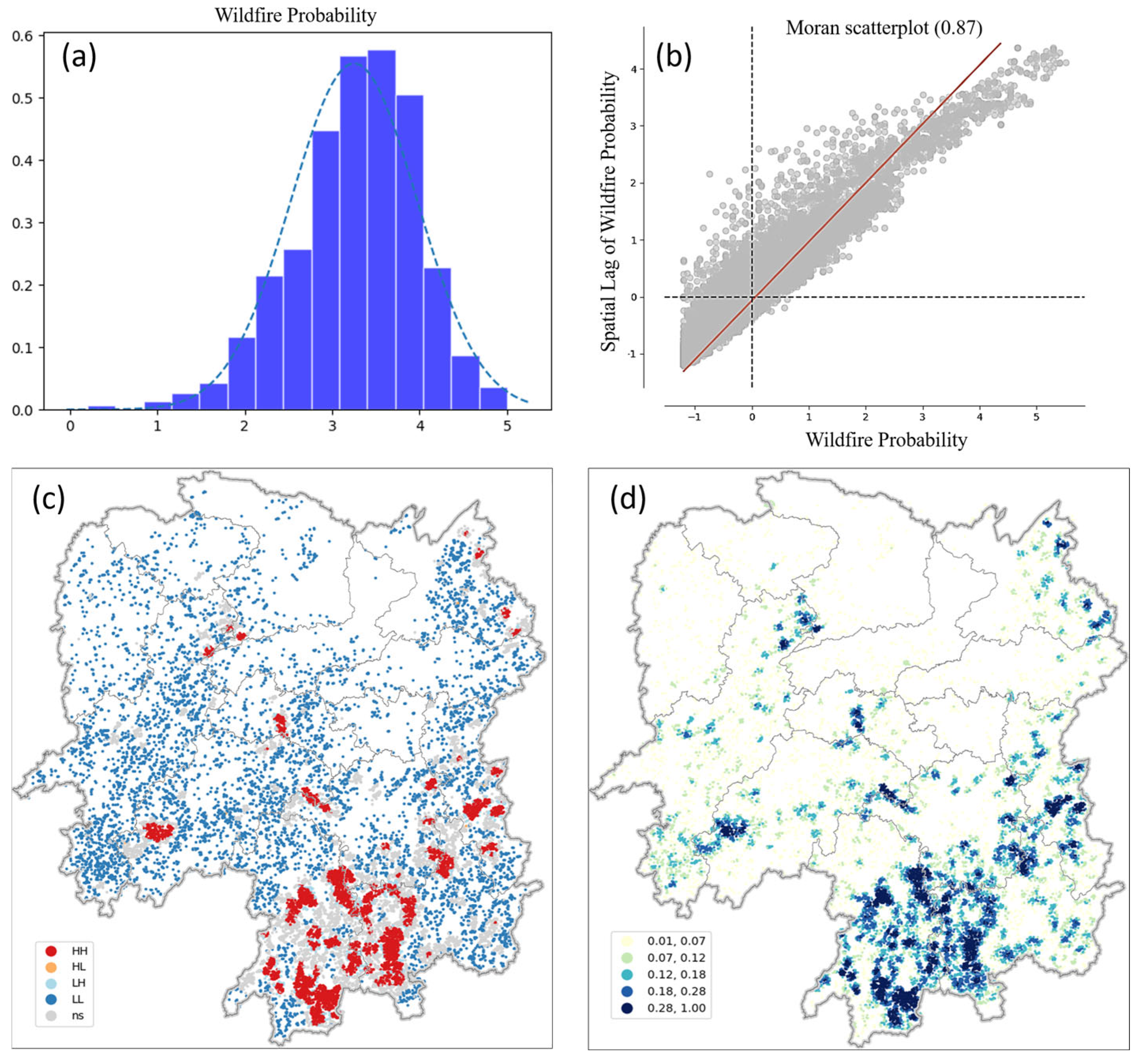
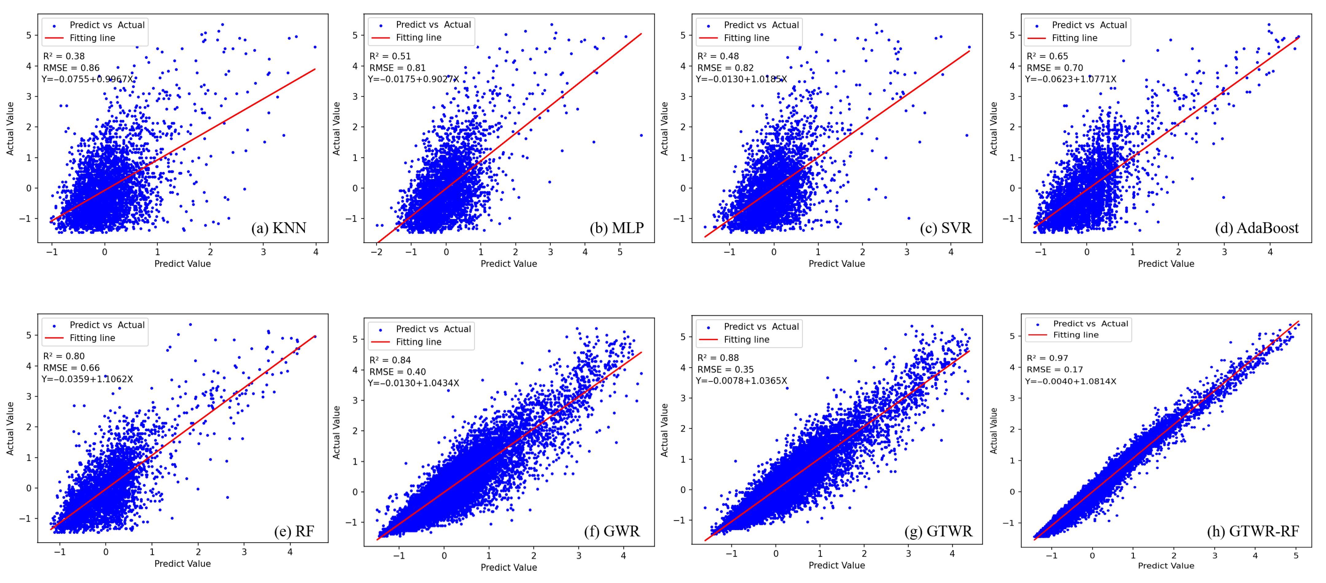
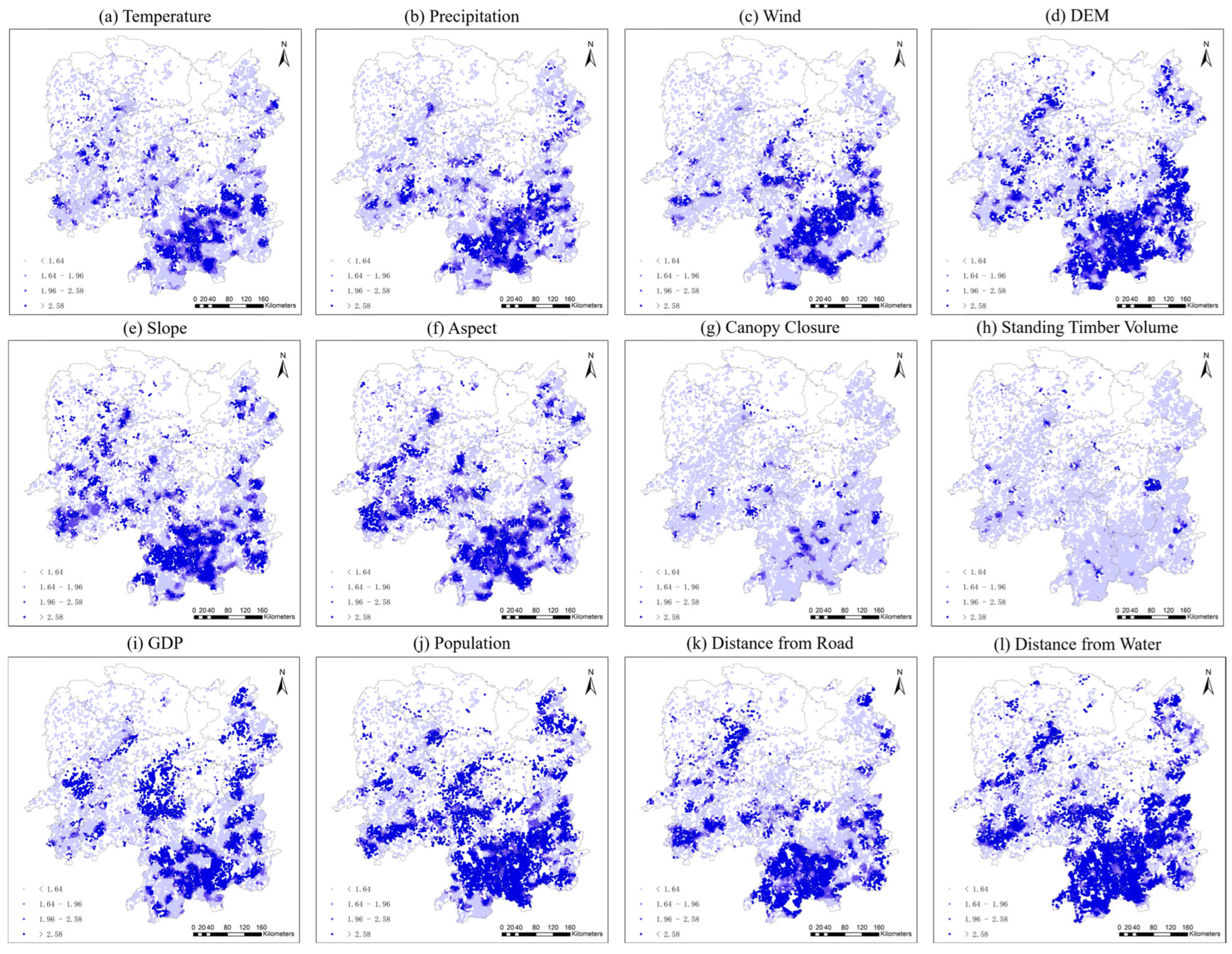
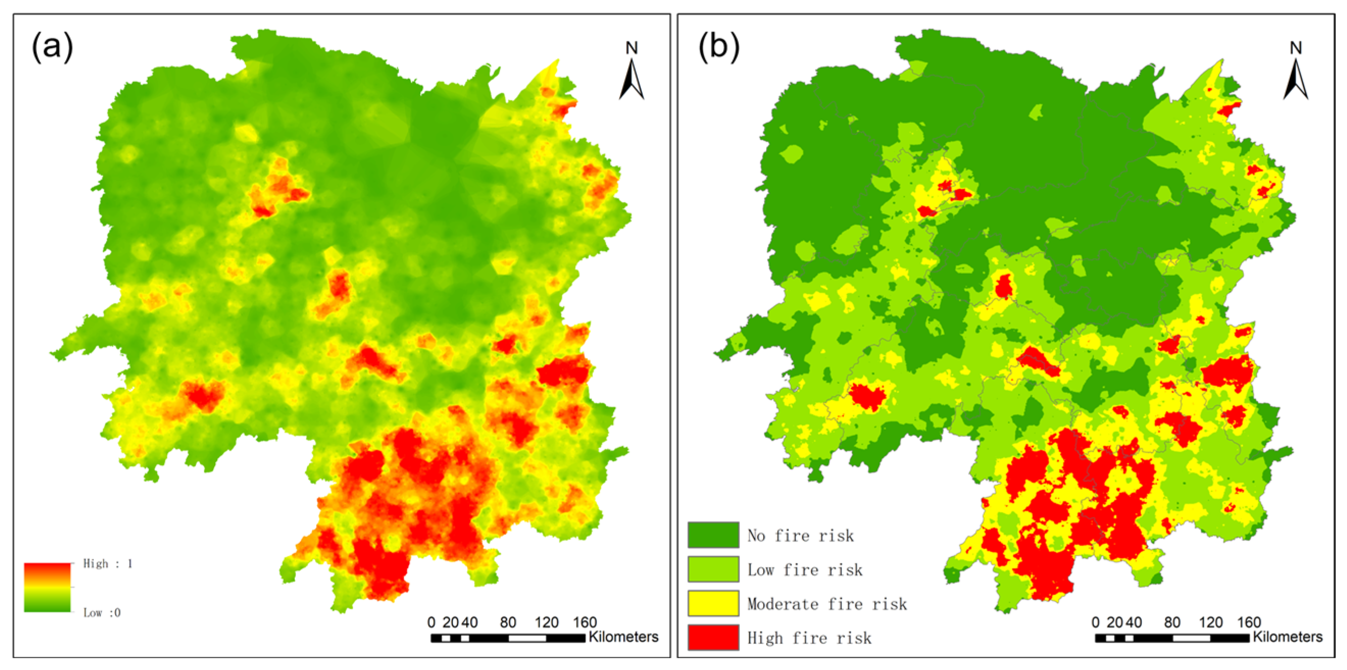
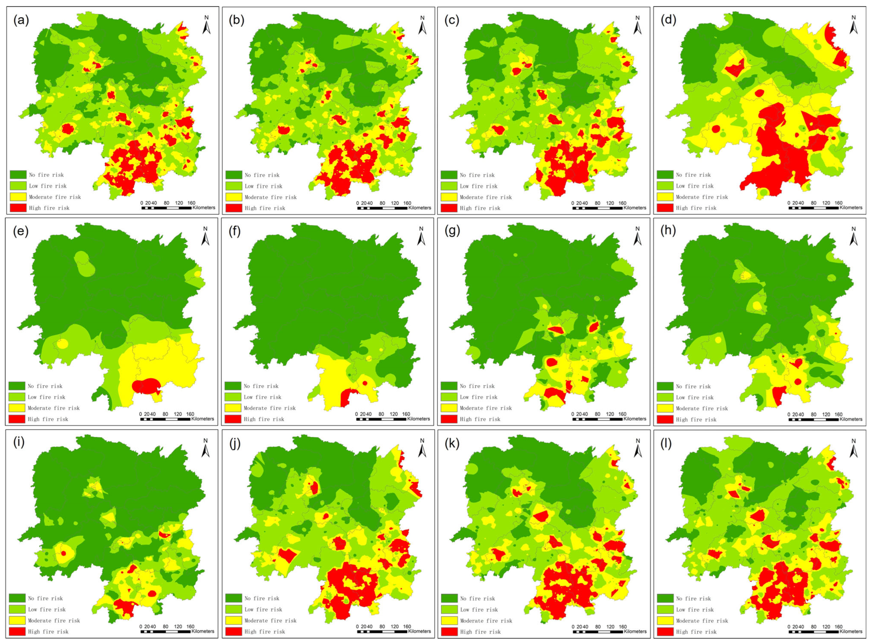
Accurate wildfire prediction and identification of key environmental drivers are critical for effective wildfire management. We propose a spatiotemporally adaptive framework integrating ST-DBSCAN clustering with GTWR-RFR. In this hybrid model, Random Forest captures local nonlinear relationships, while GTWR assigns adaptive spatiotemporal weights to refine predictions. Using historical wildfire records from Hunan Province, China, we first derived wildfire occurrence probabilities via ST-DBSCAN, avoiding the need for artificial non-fire samples. We then benchmarked GTWR-RFR against seven models, finding that our approach achieved the highest accuracy (R2 = 0.969; RMSE = 0.1743). The framework effectively captures spatiotemporal heterogeneity and quantifies dynamic impacts of environmental drivers. Key contributing drivers include DEM, GDP, population density, and distance to roads and water bodies. Risk maps reveal that central and southern Hunan are at high risk during winter and early spring. Our approach enhances both predictive performance and interpretability, offering a replicable methodology for data-driven wildfire risk assessment.
Keywords: wildfire risk prediction; spatiotemporal non-stationarity; GTWR-RFR; ST-DBSCAN; environmental drivers wildfire risk prediction; spatiotemporal non-stationarity; GTWR-RFR; ST-DBSCAN; environmental drivers