


Abstract
Habitat loss and fragmentation threaten forest-dependent ungulates in subtropical mountain systems, yet integrative assessments linking habitat quality and landscape configuration remain limited. Here, we evaluated habitat suitability and identified core habitat patches for the endangered black muntjac (Muntiacus crinifrons) in Tongboshan National Nature Reserve using an Analytic Hierarchy Process–Habitat Suitability Index (AHP–HSI) framework integrated with camera-trap validation and landscape pattern analysis. Vegetation-related indicators (NDVI and vegetation type) were the dominant suitability drivers, and highly suitable habitats accounted for 62.9% of the reserve (8646.97 ha), forming three major forest blocks with low disturbance levels. Camera-trap detections (n = 58) showed strong concordance with model predictions (98.28% within moderately suitable or higher classes). Landscape metrics revealed contrasting spatial configurations between overall high-suitability habitats and optimal core patches, indicating that demographic source areas are embedded within fragmented peripheral mosaics. Medium patches and forested ridges may function as potential stepping stones and corridors facilitating movement across habitat clusters. These findings highlight the importance of maintaining functional connectivity and mitigating edge disturbances in buffer and experimental zones to ensure long-term population persistence and effective protected-area management for forest ungulates.
1. Introduction
Habitat loss, degradation, and fragmentation driven by accelerating climate change and intensifying human activities have become primary forces restructuring biodiversity patterns at regional to global scales [1]. Beyond reducing the overall extent of suitable environments, these processes alter landscape configuration and connectivity, constrain dispersal and gene flow, and ultimately elevate extinction risk. Understanding how habitat quality and spatial structure jointly influence species persistence has therefore become a central topic in conservation biology and landscape ecology.
Habitat suitability assessment provides an effective framework for identifying priority conservation areas and supporting spatial planning. By integrating environmental predictors with species-specific ecological requirements, suitability models delineate potential distribution areas and quantify spatial variation in habitat quality [2]. For rare or disturbance-sensitive taxa characterized by small populations and incomplete ecological information, fine-scale suitability assessments are particularly valuable as they inform reserve zoning, highlight priority protection areas, and guide ecological corridor placement [3].
Among commonly applied approaches, the Analytic Hierarchy Process (AHP) combined with Habitat Suitability Index (HSI) modeling has received increasing attention for endangered and data-limited species [4,5,6]. AHP incorporates expert ecological knowledge into transparent hierarchical weighting schemes, while GIS-based HSI mapping translates weight structures into spatially explicit habitat surfaces [7,8]. This approach has been applied to multiple flagship or umbrella species, including the Asian elephant (Elephas maximus) [9], Amur tiger (Panthera tigris altaica) [10], giant panda (Ailuropoda melanoleuca) [11], Reeve’s muntjac (Muntiacus reevesi) [12], and Siberian crane (Grus leucogeranus) [13]. However, most studies primarily emphasize spatial patterns of suitability and comparatively less attention is given to landscape configuration (e.g., fragmentation, patch geometry, and connectivity), despite these attributes being critical for long-term population viability and movement ecology.
The black muntjac (Muntiacus crinifrons) is a rare forest ungulate endemic to China and classified as a national first-class protected species. It is currently listed as Vulnerable (VU) on the IUCN Red List, largely due to its restricted distribution, small population size, and sensitivity to habitat disturbance [14]. The species mainly inhabits mid-subtropical montane forests in southeastern China, particularly evergreen broad-leaved and mixed conifer–broadleaf forests. Its cryptic behavior, small home range, and dependence on intact forest structure make it especially vulnerable to fragmentation associated with road development, forest degradation, and expanding human activities [15,16]. Despite recent progress, integrative and site-specific suitability evaluations that link habitat quality to landscape pattern remain scarce across the species’ range, particularly in northeastern Jiangxi Province.
Tongboshan National Nature Reserve represents a key habitat area for M. crinifrons in Jiangxi Province and constitutes an important regional biodiversity hotspot. Camera-trap surveys have confirmed the presence of a relatively stable population within the reserve [17]. However, increasing anthropogenic pressures along reserve margins raise concerns regarding fragmentation, connectivity loss, and the effectiveness of current zoning strategies [18]. These challenges highlight the need for an integrative assessment that simultaneously considers habitat suitability and landscape configuration to support evidence-based conservation planning.
In this study, we developed an AHP–HSI model to evaluate habitat suitability for M. crinifrons in Tongboshan National Nature Reserve by integrating remote sensing data, GIS analysis, expert knowledge, and camera-trap records. We further quantified fragmentation and connectivity metrics for highly suitable habitats to identify potential movement pathways and priority conservation areas. This research provides (i) an improved understanding of ecological and anthropogenic drivers shaping habitat suitability for a Vulnerable forest ungulate, and (ii) a spatially explicit assessment of landscape configuration relevant to reserve management, connectivity planning, and threatened species conservation.
2. Materials and Methods
2.1. Study Area
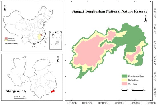
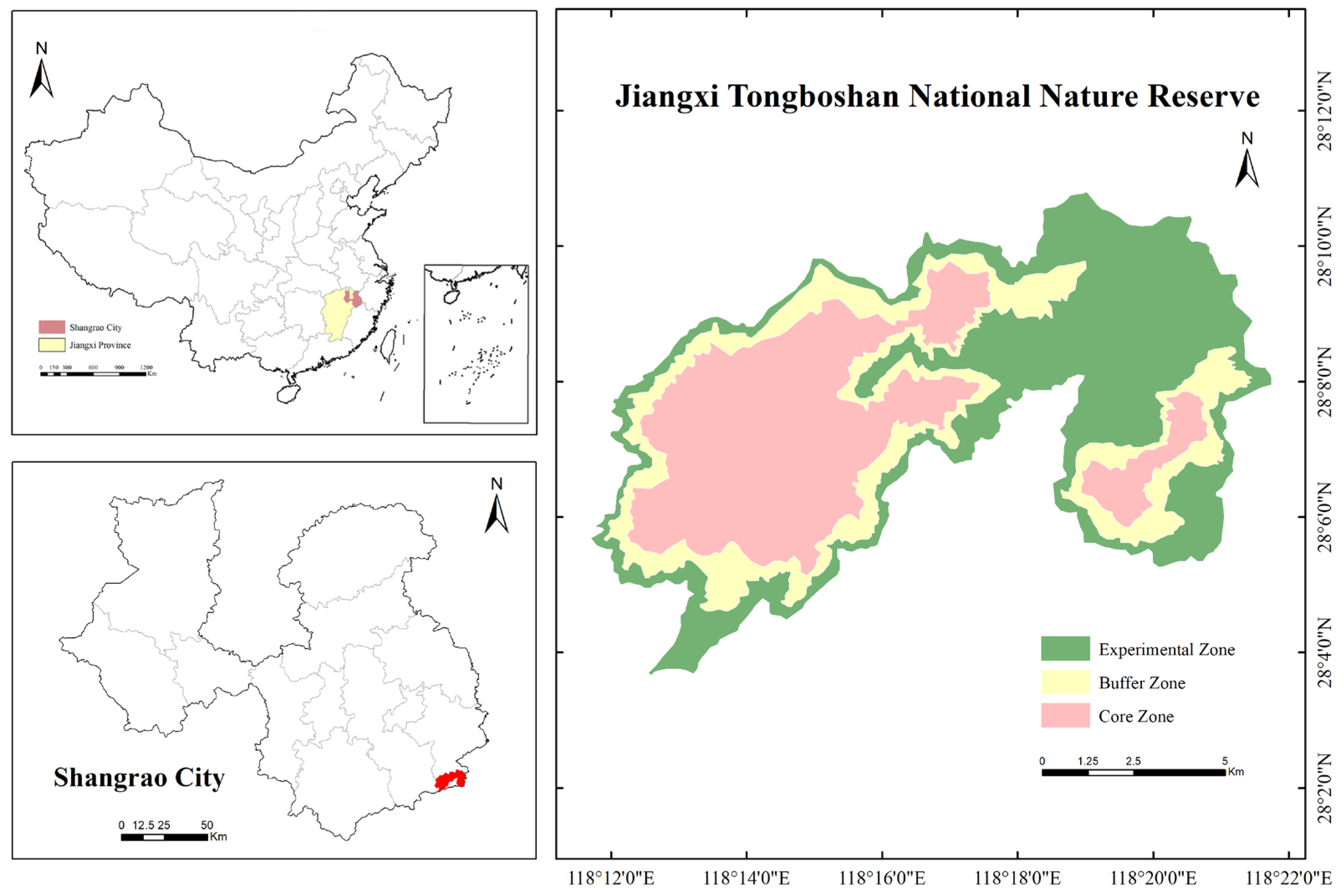
Tongboshan National Nature Reserve is located in Tongboshan Town, southern Guangfeng County, Shangrao City, Jiangxi Province, China, near the provincial junction of Jiangxi, Zhejiang, and Fujian. Geographically, the reserve lies between the eastern Wuyi Mountains and the southern foothills of the Xianxia Range [19], covering approximately 10,800 ha (118°11′42″–118°21′47″ E, 28°03′39″–28°10′45″ N; Figure 1). The region experiences a warm and humid subtropical monsoon climate, with mean annual temperatures ranging from 11.0 to 17.1 °C and annual precipitation between 1739.4 and 1892.7 mm, supporting dense evergreen broad-leaved forest and mixed montane forest communities with high structural complexity. Such vegetation physiognomy is typical of species-rich montane ecosystems and provides diversified niches for forest-dependent vertebrates.
Figure 1.
Geographical location of Tongboshan National Nature Reserve. The red area indicates the geographical location and boundary of the nature reserve within Shangrao City.
Tongboshan contains steep mountainous terrain and pronounced relief variation. Peaks frequently exceed 1000 m a.s.l. and slopes commonly range from 40° to 70°, generating strong environmental gradients and heterogeneous habitat mosaics. The reserve is recognized as a regional biodiversity hotspot in northeastern Jiangxi Province, harboring several nationally protected mammals, including the black muntjac, clouded leopard (Neofelis nebulosa), rhesus macaque (Macaca mulatta), large Indian civet (Viverra zibetha), Chinese goral (Naemorhedus griseus), and Asiatic golden cat (Pardofelis temminckii).
Despite legal protection, anthropogenic pressures have increased in recent years. Tourism development, land-use conversion, and infrastructure expansion have induced habitat fragmentation and connectivity loss along reserve margins. These pressures may disproportionately affect disturbance-sensitive forest ungulates such as the black muntjac. The coexistence of steep terrain, heterogeneous vegetation, and uneven disturbance regimes makes Tongboshan a suitable system for evaluating habitat suitability, fragmentation dynamics, and conservation priorities under modern disturbance conditions.
2.2. Analytical Framework and Research Workflow
The black muntjac is a cryptic and range-restricted forest ungulate of high conservation concern, making it an ideal indicator species for assessing habitat constraints and fragmentation patterns in montane forest ecosystems. To quantify habitat suitability and identify structurally important patches, we developed an integrated analytical framework combining Analytic Hierarchy Process (AHP), Habitat Suitability Index (HSI) modeling, and landscape pattern analysis. The workflow consisted of six sequential components:
- (1)
- selection of abiotic, biotic, and anthropogenic indicators;
- (2)
- spatial preprocessing and standardization of indicator layers;
- (3)
- derivation of indicator weights using AHP;
- (4)
- computation of HSI via weighted linear combination;
- (5)
- independent validation using infrared camera detections;
- (6)
- fragmentation and connectivity analysis based on suitable habitat classes.
This combined approach links expert-informed weighting and spatially explicit ecological evaluation, producing metrics relevant to conservation planning for forest ungulates.
2.3. Habitat Indicator System and Ecological Rationale
Indicator selection is foundational for habitat suitability analysis [20]. Based on previous studies on black muntjac ecology [21,22,23] and field knowledge, six indicators were selected and grouped into three dimensions: (i) abiotic factors—elevation and slope; (ii) biotic factors—vegetation type and NDVI; and (iii) anthropogenic disturbance factors—distance to roads and distance to residential areas.
These indicators collectively capture topographic constraints, vegetation structure and resource availability, and the intensity of human disturbance, which are major drivers of habitat selection in forest ungulates [24,25]. Each indicator was classified into five discrete suitability levels (1–5), as summarized in Table 1.
Table 1.
Habitat evaluation indicators and suitability scoring system for the black muntjac.
The interval thresholds for continuous variables (NDVI, distance to roads, and distance to settlements) were determined based on a combination of ecological relevance, empirical evidence from previous studies on forest ungulates, and the distribution characteristics of the raw data within the study area. Specifically, NDVI classes were defined to reflect gradients of vegetation cover and canopy density relevant to forage availability and concealment, while distance-based indicators were classified according to disturbance attenuation effects reported in ungulate habitat selection studies [26]. In addition, interval boundaries were adjusted to ensure reasonable sample representation across classes and to avoid extreme skewness in spatial distribution.
2.4. Spatial Data Processing and Normalization
Spatial data processing was conducted using ArcGIS 10.8 and ENVI 5.6. All datasets were projected to WGS 1984 and resampled to 30 m resolution (Table 2). Suitability surfaces were generated through two standardized steps: (1) ecological reclassification of raw values into five ordinal suitability classes; and (2) normalization to a continuous 0–1 scale to ensure comparability among indicators.
Table 2.
Spatial datasets used in habitat suitability modeling and their characteristics.
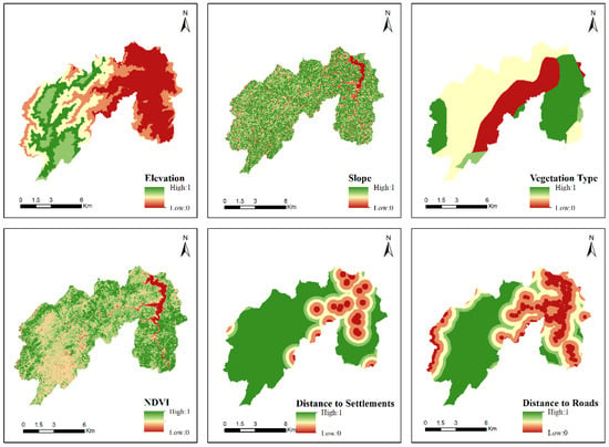
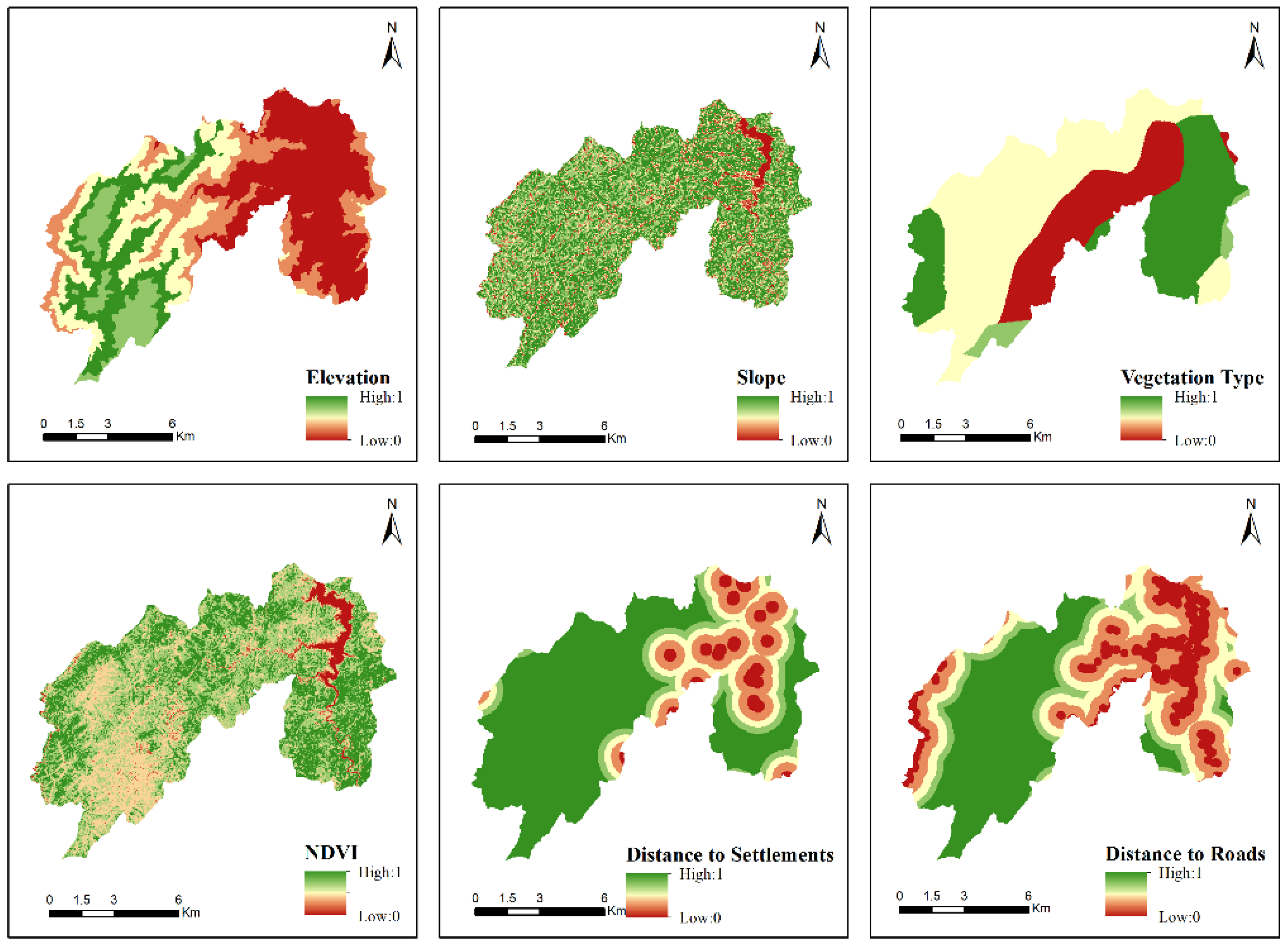
This transformation facilitated standardized comparisons across indicators and enabled integration using weighted linear combinations (Figure 2).
Figure 2.
Spatial distribution of standardized habitat evaluation indicators used for HSI modeling.
2.5. AHP-Based Weighting and Expert Judgement
The Analytic Hierarchy Process (AHP) is a multi-criteria decision-making approach that integrates expert judgment with quantitative analysis to derive indicator weights [27]. Five experts participated in pairwise comparisons (one author, three animal ecology specialists, and one reserve administrator). Judgments were anonymized and aggregated using the geometric mean method. Experts were not granted access to infrared camera detections or derived HSI outputs to ensure independent validation.
Pairwise comparisons followed the standard Saaty scale (1, 3, 5, 7, 9 and intermediate values), where larger numbers indicate stronger relative importance of one indicator over another [28].
Individual judgment matrices were aggregated into a group matrix using the geometric mean. Consistency was evaluated using the consistency index (CI) and consistency ratio (CR). The matrix was considered acceptable when CR < 0.1. The derived weights were then used in the HSI modeling step below.
For a matrix of order , the random consistency index was set to 1.24. The calculated values (, , ) indicate satisfactory consistency (), and the resulting weights were therefore considered reliable for subsequent modeling (Table 3 and Table 4).
Table 3.
Interpretation of consistency thresholds for AHP judgment matrices.
Table 4.
AHP judgment matrix and indicator weights for black muntjac habitat suitability assessment.
2.6. Habitat Suitability Index (HSI) Modeling
The Habitat Suitability Index (HSI) model was used to integrate weighted environmental and anthropogenic factors into a composite suitability score [28,29]. We computed the Habitat Suitability Index (HSI) for each raster cell using a weighted linear combination:
where is the weight of the indicator, and is the suitability score corresponding to that indicator.
The resulting HSI raster (0–1) was classified into five suitability levels (very unsuitable, unsuitable, moderately suitable, suitable, and highly suitable) using the Jenks natural breaks method [30].
2.7. Model Validation Using Infrared Camera Detections
Independent infrared camera monitoring data collected between July 2021 and August 2024 were used to validate model performance. After species identification, removal of duplicate records, and coordinate standardization, valid occurrence records were retained.
Occurrence points were overlaid on the habitat suitability map in ArcGIS. The number and proportion of occurrences falling into each suitability class were calculated to evaluate whether predicted suitable habitats captured observed occurrences.
2.8. Fragmentation and Connectivity Analysis
To quantify fragmentation and connectivity of high-quality habitats, areas classified as suitable (Level 4) and highly suitable (Level 5) were extracted from the HSI map and treated as potential high-suitability habitat [31]. Two scenarios were applied: Scenario 1: merge Level 4 and Level 5 to represent overall high-suitability habitat. Scenario 2: analyze Level 5 only to represent optimal habitat patches.
Landscape metrics included NP, LPI, ED, LSI, AREA_MN, ENN_MN, COHESION, and AI (Table 5), capturing patch quantity, dominance, shape complexity, and structural connectivity [32,33].
Table 5.
Landscape metrics used in fragmentation and connectivity analysis and their ecological significance.
3. Results
3.1. Spatial Patterns of Habitat Suitability
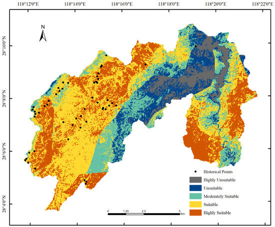
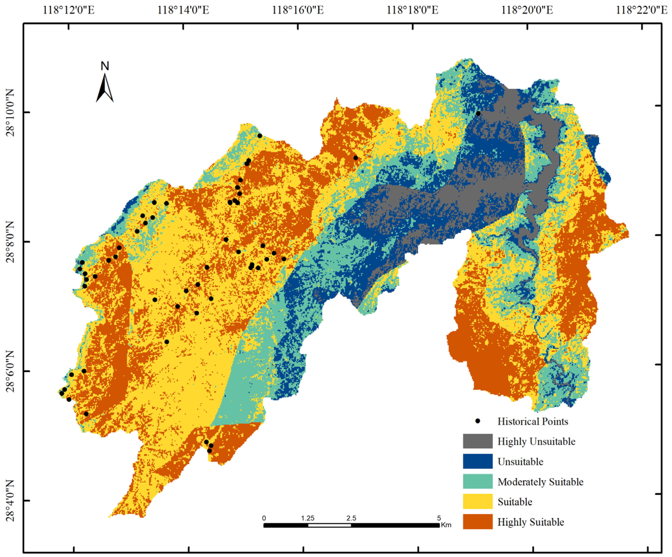
The HSI surface exhibited pronounced spatial heterogeneity in habitat suitability for the black muntjac across Tongboshan National Nature Reserve (Figure 3). Habitat suitability values ranged from 0 to 1, forming three distinct spatial clusters of high suitability in the southwestern, central–northern, and southeastern sectors of the reserve. Highly suitable habitats (Level 5) comprised 8646.97 ha (62.9% of the reserve) and were associated with moderate elevations and slopes, dense evergreen broad-leaved or mixed conifer–broadleaf forest cover, and high NDVI values. Human disturbance was comparatively low in these areas, facilitating the formation of continuous habitat blocks.
Figure 3.
Spatial distribution of habitat suitability for black muntjac in Tongboshan National Nature Reserve.
Moderately suitable habitats (Level 4) spanned 2435.78 ha (17.7%) and occurred primarily along transitional ecotones adjacent to highly suitable habitat, where vegetation structure and disturbance intensity displayed intermediate values. Low-suitability classes (Levels 1–2), collectively covering 19.4% of the reserve, were concentrated along river valleys, residential areas, and transportation corridors, particularly in the eastern and central interior zones. These areas exhibited lower vegetation greenness, altered forest structure, and elevated disturbance levels.
Overall, the spatial pattern indicates that black muntjac habitat suitability is jointly shaped by montane forest structure, topographic gradients, and heterogeneous anthropogenic disturbance regimes—key drivers influencing resource availability, concealment, and movement for forest-dependent ungulates.
3.2. Model Validation with Camera-Trap Records
Independent validation using camera-trap detections collected between 2021 and 2024 revealed strong spatial concordance between observed species occurrences and predicted suitability classes. Among the 58 validated detections, 98.28% fell within areas classified as moderately suitable or higher (Table 6). Specifically, 34.48% of detections occurred in highly suitable habitats and 51.73% in suitable habitats; only one record (1.72%) occurred in an unsuitable class and none in very unsuitable areas.
Table 6.
Infrared camera detections of black muntjac across habitat suitability classes.
This high degree of spatial overlap indicates that the AHP–HSI modeling framework effectively captures the realized habitat preferences of a cryptic forest ungulate and reliably delineates suitable habitat at the reserve scale, supporting its utility for reserve planning and conservation decision-making.
3.3. Fragmentation and Connectivity Characteristics of High-Suitability Habitats
Landscape pattern analysis revealed contrasting spatial configurations between overall high-suitability habitats (Levels 4 + 5) and highly suitable habitats alone (Level 5). When Levels 4 and 5 were combined, 360 patches were detected (Table 7). A high largest patch index (45.45%) and large mean patch size (18.60 ha) indicate the presence of broad contiguous habitat. Moderate edge density and shape complexity, coupled with high cohesion (99.59) and aggregation (94.74) and a short mean nearest-neighbor distance, reflect a structurally cohesive and well-connected habitat network at this suitability level.
Table 7.
Results of landscape pattern analysis.
In contrast, highly suitable habitats alone displayed pronounced fragmentation. A total of 935 patches were detected, and the LPI decreased sharply to 4.66%. Mean patch area declined to 2.87 ha, while ED (75.92) and LSI (40.24) increased substantially, indicating irregular patch shapes and reduced structural compactness. Aggregation (76.44) and cohesion (97.70) values also decreased, reflecting weakened spatial connectivity among optimal habitat patches.
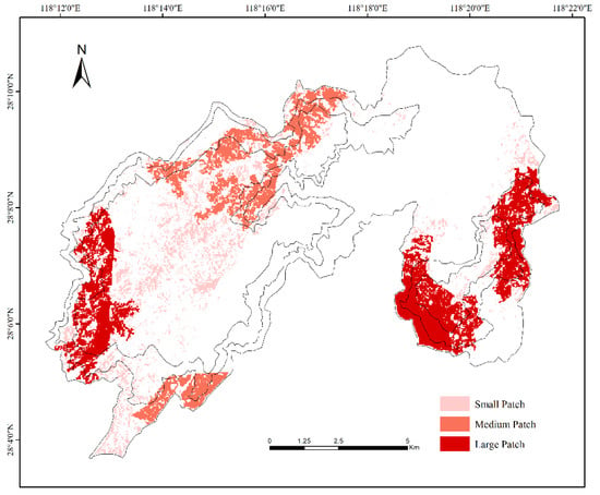
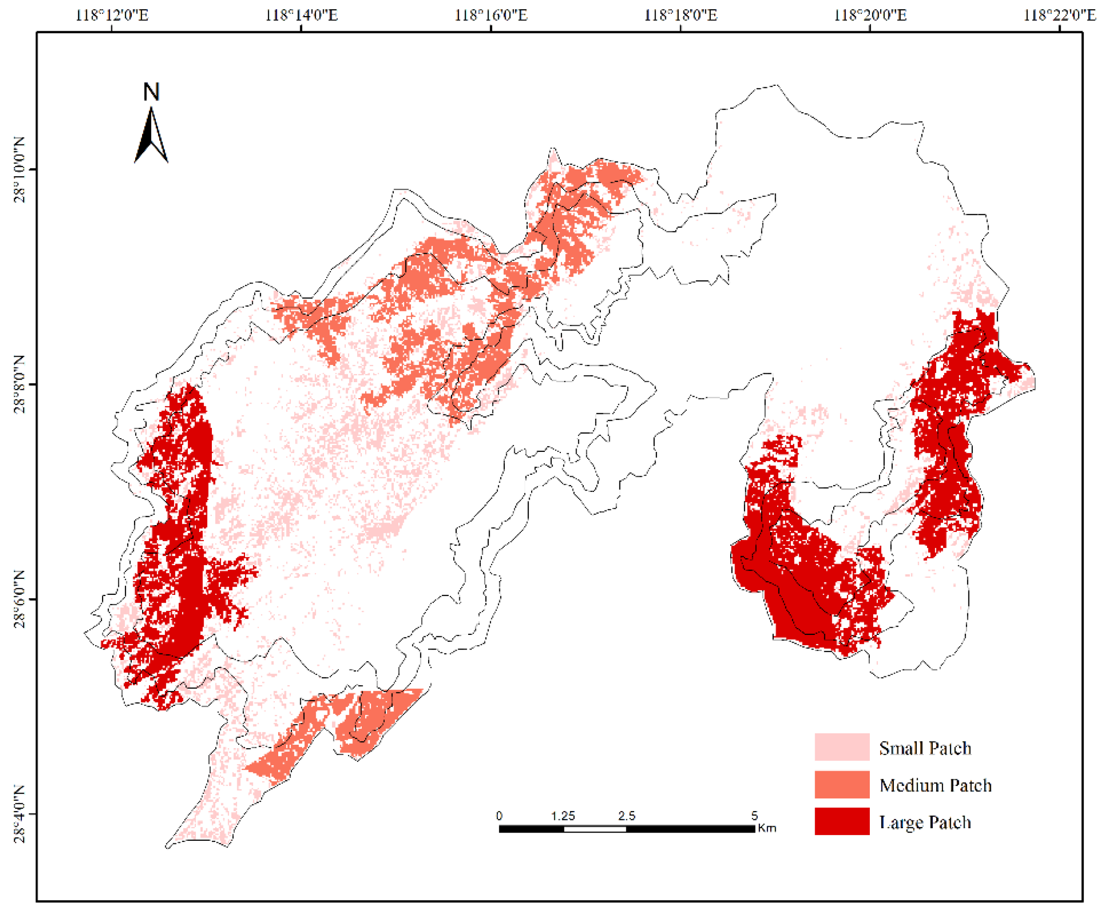
Patch size–frequency distribution further illustrated spatial heterogeneity, with highly suitable patches grouped into small (<30 ha), medium (30–300 ha), and large (>300 ha) size classes. Patch distribution exhibited a banded pattern extending from southwest to northeast (Figure 4). Large patches were concentrated within continuous forest blocks in southwestern and southeastern regions, whereas medium and small patches were more abundant along buffer zones and northern margins, forming dispersed habitat mosaics.
Figure 4.
Spatial distribution of core habitat patches for black muntjac.
Collectively, these metrics illustrate that Tongboshan hosts a mixture of continuous habitat and fragmented optimal patches. Such spatial patterning implies that both habitat quality and connectivity likely influence black muntjac persistence and movement, highlighting the importance of considering structural configuration alongside suitability in conservation planning.
4. Discussion
4.1. Vegetation as the Dominant Ecological Driver of Habitat Suitability
The AHP–HSI framework identified vegetation-related indicators as the primary determinants of habitat suitability for the black muntjac (Muntiacus crinifrons) in Tongboshan National Nature Reserve. NDVI received the highest weight (0.3883), followed by vegetation type (0.2487), highlighting the importance of vegetation productivity and structural complexity in shaping habitat quality. NDVI reflects canopy density and biomass, influencing forage availability and concealment for forest ungulates [34]. Vegetation type further reinforces that closed-canopy evergreen and mixed forests function as essential foraging and sheltering environments for muntjac species [35].
Highly suitable habitats were largely concentrated in the mountainous interior of the reserve, where dense vegetation cover, rugged terrain, and limited accessibility collectively reduce anthropogenic disturbance. Similar preferences for evergreen broad-leaved forests and conifer–broadleaf mixed forests have been reported in Qingliangfeng and Tianmu Mountain [18,35], suggesting that such forest communities represent core habitats for muntjac populations throughout southeastern China. These habitats provide multilayered canopy structure, year-round foliage, and buffered microclimates conducive to foraging efficiency and predator avoidance—mechanisms consistent with habitat selection theory in cervids [36,37].
Model performance was supported by high concordance between predicted suitability and infrared camera detections (98.28%), indicating that spatial patterns captured ecological requirements rather than purely statistical associations. The aggregated distribution observed mirrors behavioral tendencies of muntjac to avoid open, exposed, and disturbed landscapes.
4.2. Patch Cohesion, Fragmentation, and Connectivity Along Suitability Gradients
Marked differences in landscape configuration emerged across suitability classes. Highly suitable habitats formed fewer but larger and more cohesive patches with simple geometries and strong structural connectivity, likely functioning as demographic source areas essential for population persistence. In contrast, suitable habitats formed smaller and more fragmented patches with irregular geometries, corresponding to secondary or transitional vegetation types under moderate disturbance.
Such fragmentation gradients, from contiguous interior forests to peripheral mosaics, have been documented for other forest-dependent cervids such as red muntjac (Muntiacus vaginalis) and roe deer (Capreolus capreolus) [38,39]. These findings emphasize that patch cohesion and spatial continuity strongly influence movement, resource access, and survival strategies in mid-sized ungulates.
Despite overall habitat continuity in the reserve interior, internal fragmentation remains non-negligible. Large patches displayed low edge-to-area ratios and high interior stability, whereas medium and small patches showed increased isolation risk. Comparable nested patch structures have been observed in carnivores and omnivores such as Eurasian lynx (Lynx lynx) and Asiatic black bear (Ursus thibetanus), where core patches support reproduction while peripheral patches depend on functional corridors for dispersal [40,41].
At the reserve scale, Tongboshan exhibited a mixed spatial configuration composed of centralized core habitats and peripheral patch clusters. Compared with reserves such as Jiulongshan and Gutianshan, where habitat distributions are more elevation-driven or compact, Tongboshan demonstrates both high intrinsic habitat quality and elevated fragmentation risk along reserve margins [22]. This spatial pattern reflects complex interplay among vegetation, topography, and disturbance gradients, and underscores the importance of cross-scale analysis for understanding habitat diversity [42].
In this study, anthropogenic disturbance is conceptualized as a multi-scale process influencing habitat suitability through both landscape-level and local-scale mechanisms. At the landscape scale, disturbance is primarily manifested as habitat fragmentation and spatial reconfiguration, which alter patch size, cohesion, and connectivity. At the local scale, disturbance arises from chronic human pressures such as roads and settlements, increasing edge effects, accessibility, and avoidance behavior in forest-dependent ungulates.
Following the international conservation nomenclature proposed by Salafsky et al. [43,44], roads and settlements are defined as anthropogenic pressures, while their consequences for habitat structure, spatial continuity, and space use represent ecological impacts. In this context, the term “disturbance” is used as an integrative concept describing the cumulative and long-term effects of these pressures, rather than short-term perturbations sensu classical disturbance ecology. Clarifying this distinction allows a more mechanistic interpretation of how human activities regulate habitat configuration and space availability for black muntjac.
From a space-use perspective, the identification of suitable habitat extent and patch geometry is directly linked to the spatial management strategy of black muntjac. As a forest-dependent and disturbance-sensitive ungulate, black muntjac is characterized by relatively small home ranges, strong dependence on closed forest cover, and limited long-distance dispersal ability [45,46]. Individual space use is therefore constrained not only by habitat quality, but also by the size, shape, and spatial arrangement of suitable habitat patches. Large and cohesive patches are more likely to support stable individual or family-based space use and function as demographic source areas [47], whereas small or irregular patches are typically used intermittently or serve as transient or supplementary habitats.
In this context, analyzing both the extent of suitable habitats and their geometric configuration provides insight into how spatial structure may regulate population carrying capacity and movement potential. Fragmentation of optimal habitats reduces the effective area available for individual space use, increases edge exposure, and may limit the joint use of space among neighboring individuals, thereby constraining population growth [48,49]. Conversely, structurally connected medium-sized patches may facilitate short-distance movements and seasonal shifts in space use, contributing to functional connectivity at the landscape scale [50].
4.3. Implications for Species Conservation, Functional Connectivity, and Biodiversity Management
The habitat patterns identified provide direct implications for conservation planning. Large patches should be considered core conservation zones, as they are more likely to sustain long-term individual or family-level space use and provide sufficient continuous area to support stable population processes [51]. Enhancing connectivity, especially via forested ridges and valley corridors, would reduce demographic isolation and landscape resistance.
Disturbance sources along reserve borders, including road construction, tourism, and timber harvesting, contribute to fragmentation [52]. Mitigation strategies targeting buffer and experimental zones could reduce edge effects and maintain ecological function [53].
From a broader conservation perspective, priority should be given to the preservation of forest landscapes and the maintenance of structurally intact and functionally connected habitats in northeastern Jiangxi. Such landscape-level conservation is fundamental for sustaining ecological processes, reducing fragmentation, and supporting long-term biodiversity persistence in subtropical montane ecosystems [54].
Within this framework, the black muntjac can be regarded as a representative and indicator species of well-preserved forest habitats, given its strong dependence on closed canopy forests and sensitivity to disturbance [55,56]. Conservation strategies aimed at maintaining continuous forest cover, large habitat patches, and functional connectivity for black muntjac are therefore expected to simultaneously benefit a wide range of forest-associated species, including clouded leopard (Neofelis nebulosa), rhesus macaque (Macaca mulatta), and large Indian civet (Viverra zibetha). In this sense, black muntjac-oriented habitat management does not replace landscape conservation objectives but rather provides a practical entry point for implementing ecosystem-level protection strategies.
4.4. Model Uncertainty, Temporal Limitations, and Future Analytical Opportunities
The AHP–HSI framework incorporates expert-based weighting and therefore contains intrinsic subjectivity. Integrating data-driven weighting (e.g., entropy weighting, PCA) or species distribution models (e.g., MaxEnt) could enhance objectivity and enable multi-model cross-validation. In addition, the static design of the present model limits its capacity to reflect seasonal dynamics and interannual environmental fluctuations. Incorporating multi-temporal remote sensing, hydrological variables, and long-term camera-trap or telemetry data would enable development of dynamic habitat models that capture temporal habitat-use strategies and climate sensitivity.
Given ongoing global change, such advancements could support adaptive conservation strategies and strengthen habitat management for M. crinifrons and other forest ungulates in subtropical mountain systems.
5. Conclusions
This study integrated AHP and HSI modeling to evaluate habitat suitability for the endangered black muntjac (Muntiacus crinifrons) in Tongboshan National Nature Reserve. The high concordance between modeled suitability and independent camera-trap detections demonstrates that this framework is reliable for habitat assessment in data-limited forest ungulates.
Highly suitable habitats were primarily concentrated in densely forested and low-disturbance mountainous areas, whereas peripheral habitats were smaller, fragmented, and less connected. These landscape characteristics highlight the necessity of maintaining functional connectivity to ensure demographic stability, dispersal, and long-term population persistence.
Beyond providing new ecological insights into habitat selection of M. crinifrons, the results offer a practical basis for habitat-oriented conservation planning and biodiversity management in subtropical montane reserves. Medium-sized and transitional patches may serve as stepping stones for movement, and targeted mitigation of edge effects could alleviate fragmentation pressure along reserve margins.
The AHP–HSI framework presented here is transferable to other endangered or cryptic forest ungulates and may contribute to broader biodiversity conservation strategies across subtropical landscapes. Future research integrating dynamic environmental data, multi-temporal remote sensing, and animal movement information (e.g., camera traps or telemetry) will enable more adaptive and climate-sensitive conservation planning under ongoing global environmental change.
Author Contributions
Conceptualization, J.Y. and J.Z.; methodology, J.Y., F.L. and J.Z.; validation, J.Y., F.L., J.T. and R.Y.; formal analysis, J.Y., F.L., J.T. and R.Y.; investigation, J.Y., F.L., J.T. and R.Y.; resources, J.Y. and J.T.; data curation, J.Y., F.L. and R.Y.; writing—original draft preparation, J.Y., F.L. and J.Z.; writing—review and editing, J.Y., F.L. and J.Z.; visualization, J.Y.; supervision, J.Z.; project administration, J.Z.; funding acquisition, J.Z. All authors have read and agreed to the published version of the manuscript.
Funding
This research was funded by Genetic Differentiation of Black Muntjac across Geographic Populations and Habitat Prediction under Climate Change Scenarios, grant number DHYC-2025042; Scientific Research Startup Fund of East China University of Technology, grant number DHBK2019064; Social Science Fund Project of Jiangxi Province, grant number 22JL17D; and Investigation and Monitoring Project of Rare Animals such as Black Muntjac in Jiangxi Tongboshan National Nature Reserve, grant number H202400127.
Institutional Review Board Statement
Not applicable.
Data Availability Statement
The data presented in this study are available on request from the corresponding author.
Conflicts of Interest
The authors declare no conflicts of interest.
Abbreviations
The following abbreviations are used in this manuscript:
| AHP | Analytic Hierarchy Process |
| HSI | Habitat Suitability Index |
| NDVI | Normalized Difference Vegetation Index |
References
- Semper-Pascual, A.; Burton, C.; Baumann, M.; Decarre, J.; Gavier-Pizarro, G.; Gómez-Valencia, B.; Zelaya, P.V. How do habitat amount and habitat fragmentation drive time-delayed responses of biodiversity to land-use change? Proc. R. Soc. B Biol. Sci. 2021, 288, 20202466. [Google Scholar] [CrossRef] [Scilit]
- Na, X.; Zhou, H.; Zang, S.; Wu, C.; Li, W.; Li, M. Maximum entropy modeling for habitat suitability assessment of red-crowned crane. Ecol. Indic. 2018, 91, 439–446. [Google Scholar] [CrossRef] [Scilit]
- Aini, S.; Sood, A.M.; Saaban, S. Analysing elephant habitat parameters using GIS, remote sensing and analytic hierarchy process in Peninsular Malaysia. Pertanika J. Sci. Technol. 2015, 23, 37–50. [Google Scholar]
- Imam, E.; Tesfamichael, G.Y. Use of remote sensing, GIS and analytical hierarchy process (AHP) in wildlife habitat suitability analysis. Mater. Environ. Sci. 2013, 4, 460–467. [Google Scholar]
- Park, Y.-S.; Chang, M.-H.; Cha, J.-Y.; Cho, D.-G.; Kim, S.-H.; Lee, S.-W. A study on site selection for Reeve’s turtle (Mauremys reevesii) habitats using habitat suitability index. J. Korean Soc. Environ. Restor. Technol. 2015, 18, 109–118. [Google Scholar] [CrossRef] [Scilit]
- Sha, J.; Liu, X.; Wang, H.; Song, X.; Bao, M.; Yu, Q.; Wei, M. Status and habitat suitability evaluation: A case study of the typical temperate seagrass beds in the Bohai Sea, China. Mar. Environ. Res. 2025, 204, 106873. [Google Scholar] [CrossRef] [Scilit] [PubMed]
- Jian, J.; Jiang, H.; Jiang, Z.; Zhou, G.; Yu, S.; Peng, S.; Wang, J. Evaluating the habitat quality of giant panda (Ailuropoda melanoleuca) using habitat suitability index (HSI). Pol. J. Ecol. 2012, 60, 827–837. [Google Scholar]
- Vineetha, P.; Sarun, S.; Selvakumar, S.; Rajesh, R. Geospatial-based AHP analysis for habitat suitability of elephants and the effects of human–elephant conflict in a tropical forest of the Western Ghats, India. Eur. J. Wildl. Res. 2024, 70, 82. [Google Scholar] [CrossRef] [Scilit]
- Luan, X.; Qu, Y.; Li, D.; Liu, S.; Wang, X.; Wu, B.; Zhu, C. Habitat evaluation of wild Amur tiger (Panthera tigris altaica) and conservation priority setting in northeastern China. J. Environ. Manag. 2011, 92, 31–42. [Google Scholar] [CrossRef] [Scilit] [PubMed]
- He, H.; Yu, X.; Yu, H.; Ma, Z.; Luo, Y.; Liu, T.; Li, P. Suitable habitat evaluation and ecological security pattern optimization for the ecological restoration of giant panda habitat based on nonstationary factors and the MCR model. Ecol. Model. 2024, 494, 110760. [Google Scholar] [CrossRef] [Scilit]
- Zhang, J.; Li, Y.; Wang, Z.; Wang, G.; He, S.; Zheng, Y.; Li, C. Assessing habitat suitability and overlap for South China sika deer and sympatric ungulates. Ecologies 2025, 6, 41. [Google Scholar] [CrossRef] [Scilit]
- Zhu, Z.; Huai, W.; Yang, Z.; Li, D.; Wang, Y. Assessing habitat suitability and habitat fragmentation for endangered Siberian cranes in the Poyang Lake region, China. Ecol. Indic. 2021, 125, 107594. [Google Scholar] [CrossRef] [Scilit]
- Lu, R.; Hu, X.; Xiao, D.; Huang, Z.; Zhai, J. Research hotspot and trend analysis of Muntiacus crinifrons based on bibliometric analysis. Jiangxi Sci. 2024, 42, 187–193. (In Chinese) [Google Scholar] [CrossRef]
- Chen, Z.; Yu, Z.C.; Zhou, X. Study on Muntiacus crinifrons resources in Xianxialing Nature Reserve, Jiangshan. Anhui Agric. Sci. 2023, 51, 122–126. (In Chinese) [Google Scholar] [CrossRef]
- Lu, H.G.; Sheng, H.L. Status of the black muntjac, Muntiacus crinifrons, in eastern China. Mammal Rev. 1984, 14, 29–36. [Google Scholar] [CrossRef] [Scilit]
- Lu, R. Spatial Distribution and Habitat Landscape Pattern Evolution and Suitability Evaluation of Muntiacus crinifrons in Jiangxi Province. Master’s Thesis, East China University of Technology, Nanchang, China, 2024. (In Chinese) [Google Scholar] [CrossRef]
- Xu, W.; Yue, X.; Gao, P.; Xia, S. Potential ecological habitat of Muntiacus crinifrons within the National Nature Reserve of Mount Tianmu, Zhejiang Province. J. Zhejiang AF Univ. 2013, 30, 896–903. (In Chinese) [Google Scholar] [CrossRef]
- Qiu, L.; Ji, C.; Jie, Z.; Lin, X.; Lin, C.; Yang, G. Study on rare and endangered plants and key protected plants in Jiangxi Tongboshan National Nature Reserve. South China For. Sci. 2016, 44, 1–9. (In Chinese) [Google Scholar] [CrossRef]
- Li, M.; Chen, Q.; Han, L.; Wang, P.; Yang, J.; Wang, M.; Yang, W. Habitat suitability assessment of Marco Polo sheep in Taxkorgan Nature Reserve, Xinjiang. Acta Ecol. Sin. 2020, 40, 3549–3559. [Google Scholar]
- Zheng, X.; Bao, Y.; Ge, B.; Zheng, R. Seasonal changes in habitat use of black muntjac (Muntiacus crinifrons) in Zhejiang. Acta Theriol. Sin. 2006, 26, 201–207. (In Chinese) [Google Scholar]
- Yu, J.; Chen, X.; Yu, S.; Le, Z.; Shen, X.; Cao, M. Habitat assessment of black muntjac (Muntiacus crinifrons) in the Gutianshan National Nature Reserve based on MaxEnt modeling. Acta Theriol. Sin. 2020, 40, 143–151. (In Chinese) [Google Scholar] [CrossRef]
- Zhang, Z. Research on Coexistence Mechanisms of Sympatric Muntjac Species. Master’s Thesis, Nanchang University, Nanchang, China, 2024. (In Chinese) [Google Scholar] [CrossRef]
- Pickett, S.T.A.; White, P.S. (Eds.) The Ecology of Natural Disturbance and Patch Dynamics; Academic Press: Orlando, FL, USA, 1985. [Google Scholar]
- Amici, V.; Geri, F.; Battisti, C. An integrated method to create habitat suitability models for fragmented landscapes. J. Nat. Conserv. 2010, 18, 215–223. [Google Scholar] [CrossRef] [Scilit]
- Duflot, R.; Avon, C.; Roche, P.; Bergès, L. Combining habitat suitability models and spatial graphs for more effective landscape conservation planning: An applied methodological framework and a species case study. J. Nat. Conserv. 2018, 46, 38–47. [Google Scholar] [CrossRef] [Scilit]
- Saaty, T.L. The Analytic Hierarchy Process; McGraw-Hill: New York, NY, USA, 1980. [Google Scholar]
- Pearson, R.G.; Dawson, T.P.; Berry, P.M.; Harrison, P.A. Predicting species distributions from small numbers of occurrence records: A test case using cryptic geckos in Madagascar. Ecol. Model. 2002, 155, 261–273. [Google Scholar] [CrossRef] [Scilit]
- Guisan, A.; Zimmermann, N.E. Predictive habitat distribution models in ecology. Ecol. Model. 2000, 135, 147–186. [Google Scholar] [CrossRef] [Scilit]
- Wakeley, J.S. A method to create simplified versions of existing habitat suitability index (HSI) models. Environ. Manag. 1988, 12, 79–83. [Google Scholar] [CrossRef] [Scilit]
- Hirzel, A.H.; Hausser, J.; Chessel, D.; Perrin, N. Ecological-niche factor analysis: How to compute habitat-suitability maps without absence data? Ecol. Model. 2002, 157, 259–275. [Google Scholar] [CrossRef]
- O’Neill, R.V.; Krummel, J.R.; Gardner, R.H.; Sugihara, G.; Jackson, B.; DeAngelis, D.L.; Milne, B.T.; Turner, M.G.; Zygmunt, B.; Christensen, S.W.; et al. Indices of landscape pattern. Landsc. Ecol. 1988, 1, 153–162. [Google Scholar] [CrossRef] [Scilit]
- McGarigal, K.; Cushman, S.A.; Ene, E. FRAGSTATS v4: Spatial Pattern Analysis Program for Categorical and Continuous Maps; University of Massachusetts: Amherst, MA, USA, 2012. [Google Scholar]
- Turner, M.G. Landscape ecology: The effect of pattern on process. Annu. Rev. Ecol. Syst. 1989, 20, 171–197. [Google Scholar] [CrossRef]
- Pettorelli, N.; Ryan, S.; Mueller, T.; Bunnefeld, N.; Jędrzejewska, B.; Lima, M.; Kausrud, K. The normalized difference vegetation index (NDVI): Unforeseen successes in animal ecology. Clim. Res. 2011, 46, 15–27. [Google Scholar] [CrossRef] [Scilit]
- Hu, J. Potential Habitat Prediction and Coexistence Mechanisms of Black Muntjac and Small Muntjac in Qingliangfeng National Nature Reserve, Zhejiang Province. Master’s Thesis, China Jiliang University, Hangzhou, China, 2022. (In Chinese) [Google Scholar] [CrossRef]
- Gebert, C.; Verheyden-Tixier, H. Variations of diet composition of red deer (Cervus elaphus L.) in Europe. Mammal Rev. 2001, 31, 189–201. [Google Scholar] [CrossRef] [Scilit]
- Peterson, T.E. Factors Affecting Densities of White-Tailed Deer (Odocoileus virginianus) in Eastern Deciduous Forests: Roles of Surrounding Land Use, Forest Habitat Edge, and Invasive Shrubs. Master’s Thesis, Miami University, Oxford, OH, USA, 2018. [Google Scholar]
- Ito, T.Y.; Lhagvasuren, B.; Tsunekawa, A.; Shinoda, M.; Takatsuki, S.; Buuveibaatar, B.; Chimeddorj, B. Fragmentation of the habitat of wild ungulates by anthropogenic barriers in Mongolia. PLoS ONE 2013, 8, e56995. [Google Scholar] [CrossRef] [Scilit]
- Nezami, B.; Rahmani, M.; Faghihi, H.; Shams-Esfandabad, B. Habitat selection and identification of potential breeding habitats of red deer (Cervus elaphus maral) in Mazandaran Province. Environ. Interdiscip. Dev. 2024, 8, 108–121. [Google Scholar] [CrossRef]
- Hetherington, D.A.; Miller, D.R.; Macleod, C.D.; Gorman, M.L. A potential habitat network for the Eurasian lynx (Lynx lynx) in Scotland. Mammal Rev. 2008, 38, 285–303. [Google Scholar] [CrossRef] [Scilit]
- Monroy-Vilchis, O.; Castillo-Huitrón, N.M.; Zarco-González, M.M.; Rodríguez-Soto, C. Potential distribution of Ursus americanus in Mexico and its persistence: Implications for conservation. J. Nat. Conserv. 2016, 29, 62–68. [Google Scholar] [CrossRef] [Scilit]
- Cord, A.F.; Brauman, K.A.; Chaplin-Kramer, R.; Huth, A.; Ziv, G.; Seppelt, R. Priorities to advance monitoring of ecosystem services using earth observation. Trends Ecol. Evol. 2017, 32, 416–428. [Google Scholar] [CrossRef] [Scilit] [PubMed]
- Salafsky, N.; Salzer, D.; Stattersfield, A.J.; Hilton-Taylor, C.; Neugarten, R.; Butchart, S.H.M.; Collen, B.; Cox, N.; Master, L.L.; O’Connor, S.; et al. A standard lexicon for biodiversity conservation: Unified classifications of threats and actions. Conserv. Biol. 2008, 22, 897–911. [Google Scholar] [CrossRef] [Scilit]
- Salafsky, N.; Margoluis, R.; Redford, K.H.; Robinson, J.G. Classification of direct threats to the conservation of ecosystems and species 4.0. Conserv. Biol. 2025, 39, e14434. [Google Scholar] [CrossRef] [Scilit]
- Mcloughlin, P.D.; Ferguson, S.H. A hierarchical pattern of limiting factors helps explain variation in home range size. Ecoscience 2000, 7, 123–130. [Google Scholar] [CrossRef] [Scilit]
- Tufto, J.; Andersen, R.; Linnell, J.D.C. Habitat use and ecological correlates of home range size in a small cervid: The roe deer. J. Anim. Ecol. 1996, 65, 715–724. [Google Scholar] [CrossRef] [Scilit]
- Ripple, W.J.; Estes, J.A.; Beschta, R.L.; Wilmers, C.C.; Ritchie, E.G.; Hebblewhite, M.; Berger, J.; Elmhagen, B.; Letnic, M.; Nelson, M.P.; et al. Status and ecological effects of the world’s largest carnivores. Science 2014, 343, 1241484. [Google Scholar] [CrossRef] [Scilit]
- Taylor, P.D.; Fahrig, L.; Henein, K.; Merriam, G. Connectivity is a vital element of landscape structure. Oikos 1993, 68, 571–573. [Google Scholar] [CrossRef] [Scilit]
- With, K.A.; Crist, T.O. Critical thresholds in species’ responses to landscape structure. Ecology 1995, 76, 2446–2459. [Google Scholar] [CrossRef] [Scilit]
- Fahrig, L. Effects of habitat fragmentation on biodiversity. Annu. Rev. Ecol. Evol. Syst. 2003, 34, 487–515. [Google Scholar] [CrossRef] [Scilit]
- Andrén, H. Effects of habitat fragmentation on birds and mammals in landscapes with different proportions of suitable habitat: A review. Oikos 1994, 71, 355–366. [Google Scholar] [CrossRef] [Scilit]
- Ibisch, P.L.; Hoffmann, M.T.; Kreft, S.; Pe’er, G.; Kati, V.; Biber-Freudenberger, L.; DellaSala, D.A.; Vale, M.M.; Hobson, P.R.; Selva, N. A global map of roadless areas and their conservation status. Science 2016, 354, 1423–1427. [Google Scholar] [CrossRef] [Scilit] [PubMed]
- Hansen, A.J.; Rasker, R.; Maxwell, B.; Rotella, J.J.; Johnson, J.D.; Parmenter, A.W.; Langner, U.; Cohen, W.B.; Lawrenc, R.L.; Kraska, M.P.V. Ecological causes and consequences of demographic change in protected areas. BioScience 2011, 61, 723–737. [Google Scholar]
- Haddad, N.M.; Brudvig, L.A.; Clobert, J.; Davies, K.F.; Gonzalez, A.; Holt, R.D.; Lovejoy, T.E.; Sexton, J.O.; Austin, M.P.; Collins, C.D.; et al. Habitat fragmentation and its lasting impact on Earth’s ecosystems. Sci. Adv. 2015, 1, e1500052. [Google Scholar] [CrossRef] [Scilit]
- Cushman, S.A.; Landguth, E.L.; Flather, C.H. Evaluating population connectivity for species of conservation concern in the American Great Plains. Biodivers. Conserv. 2013, 22, 2583–2605. [Google Scholar] [CrossRef] [Scilit]
- Lambeck, R.J. Focal species: A multi-species umbrella for nature conservation. Conserv. Biol. 1997, 11, 849–856. [Google Scholar] [CrossRef] [Scilit]

Disclaimer/Publisher’s Note: The statements, opinions and data contained in all publications are solely those of the individual author(s) and contributor(s) and not of MDPI and/or the editor(s). MDPI and/or the editor(s) disclaim responsibility for any injury to people or property resulting from any ideas, methods, instructions or products referred to in the content. |
© 2026 by the authors. Licensee MDPI, Basel, Switzerland. This article is an open access article distributed under the terms and conditions of the Creative Commons Attribution (CC BY) license.