


Sustainability 2026, 18(1), 452; https://doi.org/10.3390/su18010452 - 2 Jan 2026
Viewed by 480
Abstract
►
Show Figures
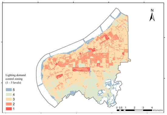
The Rocky Desertification area has high sensitivity and poor anti-interference ability in the ecosystem. It is challenging to achieve sustainable development in a rocky desertification area. Given this issue, the System Dynamics model, the Future Land Use Simulation (FlUS) model, the Integrated Valuation
[...] Read more.
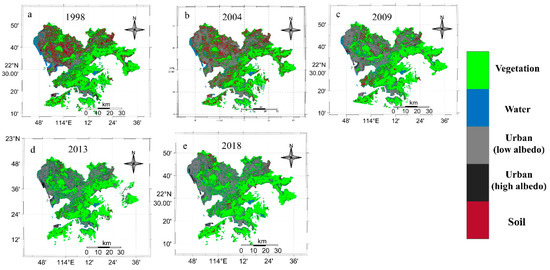
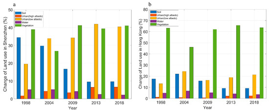
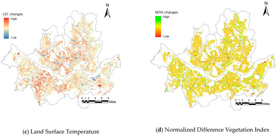
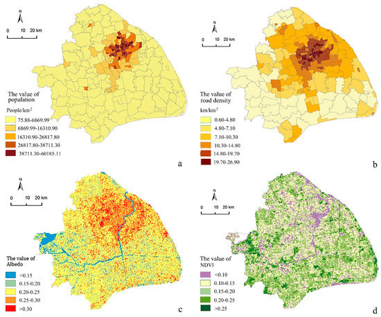
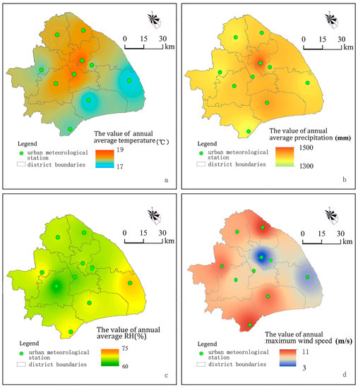
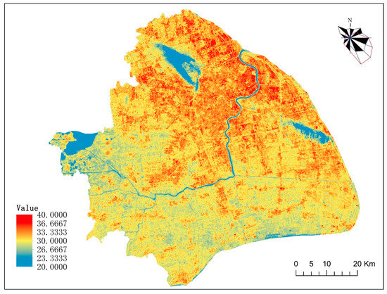
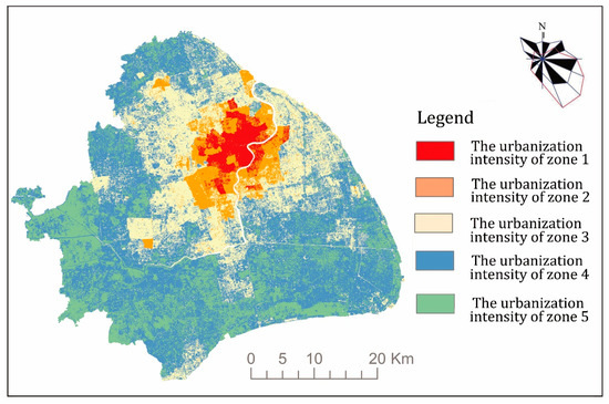
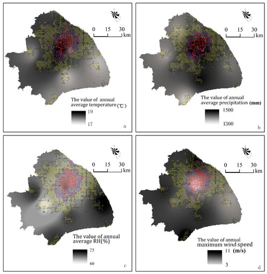
The Rocky Desertification area has high sensitivity and poor anti-interference ability in the ecosystem. It is challenging to achieve sustainable development in a rocky desertification area. Given this issue, the System Dynamics model, the Future Land Use Simulation (FlUS) model, the Integrated Valuation and Trade-offs of ESs (InVEST) model, and the Structural Equation Model (SEM) were integrated in this study to analyze future ecosystem service change in Wenshan Prefecture under SSP1-1.9, SSP2-4.5, and SSP5-8.5 scenarios. The following results are obtained. (1) The area of cultivated land, construction land, forest land, and grassland increased in SSP1-1.9; the area of forest land and grassland decreased in SSP2-4.5 scenario and SSP5-8.5 scenario. (2) The water supply (WS), carbon sequestration (CS), and soil conservation power (SDR) under the three different scenarios were improved compared with 2020. Among them, habitat quality (HQ) demonstrated a slight increase trend under the SSP1-1.9 scenario but decreased under the other two scenarios. (3) WS, CS, and HQ exhibited a tradeoff relationship in the three scenarios compared with 2020. (4) In the SSP1-1.9 and SSP2-4.5 scenarios, the synergistic relationships among CS, HQ, SDR, and WS were particularly detected in the northern, southern, and central parts of the study area. Additionally, climate change and vegetation-dominated ecological environment are the main driving mechanisms affecting ES changes. This paper summarizes the spatial differences in the change trend and synergistic tradeoff and lays a crucial scientific foundation for the ecological protection of karst landform areas.
Full article

Figure 1


