


Abstract
After major disasters, news media selectively construct the public record of what has been lost. This study examines that pattern by comparing an independently derived satellite-based inventory of damaged cultural heritage in Hatay, Türkiye, with a corpus of 79 Turkish-language online news reports published between February 2023 and February 2024. Under the primary retrieval protocol, only 16 of the 86 ARIA-export assets appeared directly in the coverage; with six further off-export or proximity-based cases, 22 reported assets entered the news in total. A targeted asset-name search then located 15 further reports, containing 17 additional direct references to damaged assets. Even on the most inclusive reading, in which every one of these references is treated as a previously uncounted and non-overlapping asset, at least 53 of the 86 assets (61.6%) remained outside the news record. The analysis also covers attribute salience, temporal patterns, and outlet concentration in the coverage. Drawing on first- and second-level agenda-setting theory, and treating gatekeeping and media-system conditions as contextual mechanisms, it defines visibility deficit as the measurable gap between independently documented damage and the damage that enters a defined news corpus. This gap need not imply deliberate suppression. It may follow from editorial priorities, limited access to sites, the availability of visual material, or the limited capacity of newsrooms to work with geospatial data. By attending to what stays outside the news agenda rather than only to differences in salience among covered items, the study identifies a structural boundary of agenda setting and extends agenda-setting research into measurable non-coverage after disaster.
1. Introduction
Disaster reporting does not transparently mirror what catastrophes destroy. News routines, editorial constraints, and gatekeeping decisions selectively shape which losses enter the public record and which remain unreported, even when the physical evidence of those losses is documented through other means. This selection has consequences beyond representation because news visibility may affect the conditions under which damaged assets receive public attention, institutional recognition, and advocacy; however, the present study does not test subsequent protection or recovery decisions. Disaster journalism tends to privilege losses that are immediately visible, dramatic, and human-centred (Pantti et al., 2012; Cottle, 2014), which may disadvantage less immediately legible forms of cultural-heritage loss. The compressed temporal arc of disaster coverage further narrows the window in which heritage losses can attract sustained attention (Houston et al., 2012). This study examines the gap between an independent satellite-derived proxy baseline and the damage represented in online news coverage. In this study, cultural heritage is approached not only as a category of physical damage, but also as a publicly mediated object of attention whose visibility may shape post-disaster recovery priorities.
Natural disasters (e.g., floods, erosion, earthquakes) threaten important architectural and natural heritage sites worldwide. Indeed, the earthquakes centred in Kahramanmaraş on 6 February 2023 and Hatay on 20 February 2023 affected 11 provinces in Türkiye. The loss of life and property was very high in all provinces. These losses hit Hatay’s central district, Antakya, hardest. Alongside Antakya’s loss of lives and property, its rich, centuries-old multicultural framework and historical cultural assets experienced significant damage. The earthquake impacted nearly all cultural heritage sites associated with various civilisations and ethnic groups within Antakya’s city centre. Most of these structures were either fully demolished or significantly damaged. Traditional Antakya houses, exemplifying civil architecture in the city centre, suffered extensive damage. The governor’s office, municipal buildings with administrative and commercial roles, Uzun Çarşı, and small tradesmen’s streets became unusable, disrupting daily life in the city centre (Varnacı Uzun & Somuncu, 2023).
The disaster unfolded on a scale that placed cultural heritage within an exceptionally crowded recovery agenda. More than 50,000 people died, an estimated 3.3 million were displaced, and more than 800,000 buildings were damaged or destroyed. The World Bank estimated direct physical damage in Türkiye at USD 34.2 billion and noted that recovery and reconstruction costs would be substantially higher (World Bank, 2023, 2024). Heritage protection therefore competed with housing, health services, infrastructure, livelihoods, and public safety for limited institutional and public attention.
The earthquakes affected four World Heritage Sites, 3715 officially recognised sites, and 7987 registered immovable cultural properties across the impacted provinces. Beyond these official figures, the damage extended to archaeological sites, rural and urban fabrics, cultural landscapes, and elements of intangible cultural heritage that also require preservation. The destruction partially or completely damaged monumental buildings and examples of civil architecture, resulting in major losses in both urban and rural cultural textures. As the International Council on Monuments and Sites (ICOMOS) Türkiye National Committee (ICOMOS Türkiye Milli Komitesi, 2023) notes, the collapse of structures built over archaeological layers also altered ground conditions in areas containing cultural assets and settlements. In total, 3752 of 8444 historical structures in 11 provinces were damaged or destroyed (Save the Legacy, n.d.). Save the Legacy (n.d.) emphasises that preserving this heritage is important not only for Türkiye’s cultural diversity but also for the region’s sustainable recovery and future. The international response also recognised the scale of cultural-heritage loss in the region: in its Türkiye Earthquakes Flash Appeal, the United Nations Development Programme (UNDP) identified the preservation of damaged cultural heritage in the affected provinces and particularly in Hatay as a distinct early-recovery priority alongside debris management, livelihoods restoration, and social protection (UNDP, 2023).
In a study conducted by Demir and Çilingiroğlu (2024), ARIA Damage Maps were used to analyse damage to cultural heritage across all provinces affected by the earthquake. ARIA (Advanced Rapid Imaging and Analysis) damage proxy maps are rapid geospatial products developed to indicate areas of likely earthquake-related surface change from pre- and post-event radar observations. They provide spatial evidence that can support rapid damage assessment, but they do not directly identify individual cultural assets or constitute engineering inspections of structural damage. The ARIA-based heritage damage mapping initiative was selected as a 2026 European Heritage Awards/Europa Nostra Awards winner, underscoring the broader relevance of combining citizen science, open data, and remote sensing for heritage protection (Europa Nostra, 2026).
The underlying ARIA damage proxy products were publicly released during the post-disaster period using Copernicus Sentinel-1 and ALOS-2 radar data (NASA, 2023). These products indicated areas of likely surface change; they did not, by themselves, identify individual cultural assets or constitute ground-truth structural assessments. The asset-level heritage inventory was produced later by matching the satellite-derived damage surface with verified heritage locations.
This study focuses on Hatay Province and examines the disconnect between ARIA damage maps and news reporting on cultural heritage damage after the 2023 earthquakes. By comparing satellite-based assessment with online news coverage, the study investigated how post-earthquake damage to cultural heritage was documented in the public sphere and to what extent reported damage reflected the broader damage landscape identified through ARIA maps. Hatay was selected because it contains cultural heritage from multiple civilisations, including the Ancient, Roman, Byzantine, and Ottoman periods, extending to the present day.
To address this problem, the article compares satellite-based damage assessment with online news coverage to examine how post-earthquake damage to cultural heritage entered the public record in Hatay. It focuses on the disconnect between ARIA damage maps and news reporting in terms of the visibility and reported severity of damage to cultural heritage assets. Methodologically, the study combines a k-means clustering of ARIA satellite damage data with a content analysis of online news coverage; the full procedure is described in Section 3. By treating satellite-derived damage maps as an external baseline, this study makes the absence of damaged heritage assets from the news agenda empirically observable. The article contributes to agenda-setting research by shifting attention from the salience of covered issues to the measurable absence of damaged heritage assets from the news agenda, thereby identifying a structural boundary at which documented objects fail to become media objects.
The study analyses the news coverage at two levels of agenda setting. At the first level, each named heritage asset is treated as a potential object of the news agenda, and the analysis records whether it appears in the corpus. At the second level, it treats the recurrent themes used to describe reported heritage damage as salient attributes. To test the sensitivity of the primary retrieval strategy, a targeted asset-name search was also conducted. The study does not infer effects on public opinion or the motives of individual journalists.
This study addresses four research questions:
- (a)
- To what extent does online news coverage of cultural heritage damage reflect the damage independently identified through satellite-based assessment after the 2023 Hatay earthquakes?
- (b)
- Which heritage assets entered the news agenda and which remained outside it, and what patterns emerge in the temporal distribution and outlet concentration of coverage?
- (c)
- How can visibility deficit be defined and operationalised as a corpus-specific construct within agenda-setting theory, and how does it differ from adjacent concepts such as agenda denial and symbolic annihilation?
- (d)
- What are the practical and theoretical implications of this disconnect for disaster journalism, agenda-setting research, and post-disaster heritage recovery?
Existing scholarship documents the physical vulnerability of cultural heritage and the selective character of disaster reporting, but rarely places a comprehensive external damage inventory alongside the news record. This study addresses that gap by treating non-entry into the media agenda as an observable empirical outcome. It does not assume that omission proves deliberate suppression, political intervention, journalistic neglect, or subsequent failure in recovery. Rather, it asks how much independently documented damage becomes visible through a defined retrieval protocol, how the damage that does appear is characterised, and which editorial, institutional, technical, and media-system conditions may help explain the resulting shortfall.
2. Theoretical and Contextual Framework
2.1. The Importance and Sustainability of Cultural Heritage Assets
Cultural heritage is not only a material inheritance from the past, but also a social resource through which communities sustain memory, identity, and belonging. It includes tangible elements such as monuments, historical buildings, archaeological sites, urban fabrics, and cultural landscapes, as well as intangible practices, values, and traditions (Díaz-Andreu, 2017; Smith, 2006). In this sense, heritage matters not simply because it preserves the past, but because it helps communities interpret the present and imagine continuity after rupture. This is particularly important in post-disaster settings, where the loss of heritage can deepen the social and psychological effects of physical destruction.
The growing attention to heritage in international cultural policy reflects this wider function. Since the second half of the twentieth century, heritage has become increasingly central to debates over cultural identity, legal definition, tourism, and sustainable development (Blake, 2000; Bitušíková, 2021). Recognising cultural heritage as a resource for development and quality of life also means that its protection cannot be reduced to technical conservation alone (Gražulevičiūtė, 2006). Sustainable heritage management requires cooperation among public authorities, experts, local communities, and other stakeholders, especially when damaged sites need to be documented, stabilised, and prioritised under urgent conditions (Aas et al., 2005; Hribar et al., 2015; Li et al., 2020).
Aas et al. (2005) show how stakeholder collaboration changes whose interests enter heritage-management decisions; Hribar et al. (2015) connect cultural resources to local social and economic development; and Li et al. (2020), in a systematic review, demonstrate that community participation varies substantially in depth and influence.
For this reason, the sustainability of cultural heritage depends not only on preservation policies, but also on whether damaged assets become visible within public and institutional agendas. Sites that remain outside public attention may receive fewer opportunities for recognition or advocacy during recovery, even when they carry strong historical or community value. In disaster contexts, therefore, heritage visibility becomes a relevant dimension of heritage protection and advocacy. The present study builds on this point by examining how satellite-documented cultural heritage damage enters, or fails to enter, online news coverage after the 2023 Hatay earthquakes.
2.2. Cultural Heritage Assets and Natural Disasters
Cultural heritage assets sit at the intersection of multiple stress regimes. Climate change alters temperature, precipitation, atmospheric moisture, wind, sea level, and the occurrence of extreme events, with documented effects on the deterioration of heritage materials and structures (Sesana et al., 2021). Alongside these environmental pressures, cultural heritage is also exposed to human-induced hazards and anthropogenic pressures (Bonazza et al., 2018). Together, natural and anthropogenic forces create a layered threat profile that protective frameworks have struggled to address.
Among rapid-onset hazards, earthquakes are particularly destructive. They often trigger secondary disasters such as fires, landslides, and tsunamis, which compound the initial losses. Assessment and recovery in these conditions require a holistic approach that addresses both structural damage and cascading hazards (Bonazza et al., 2018, p. 102). Seismic activity can damage historic buildings irreparably, eroding both cultural and historical value, and the rebuilding of resilience in heritage-rich regions is a complex task that has to balance protection against authenticity (Parisi & Augenti, 2013). Recent decades offer painful examples: the 2003 Bam earthquake in Iran, the 2006 Prambanan earthquake in Indonesia, the 2002 Edinburgh Old Town fire, and many others (ISMEP, 2014, p. 17). The Mediterranean basin, in particular, combines high seismic risk with dense concentrations of cultural assets across countries such as Greece, Türkiye, and Italy, which makes earthquake protection a regional imperative rather than a national matter (Masini & Soldovieri, 2017, p. 2).
The institutional response to these risks remains uneven. Inadequate preparation and post-disaster reconstruction generate substantial costs (Taboroff, 2003, p. 234), and weak maintenance regimes increase the vulnerability of historical structures when events do occur (Ünal, 2014, p. 10). Strengthening interventions are too often retroactive, applied only after an earthquake has already happened, and emergency mechanisms understandably prioritise the protection of human life before turning attention to heritage. Bonazza et al. (2018, p. 43) identify preparedness and pre-event prevention as the main deficiencies in this area of risk.
Türkiye is a State Party to the 1972 World Heritage Convention (UNESCO, n.d.). The earthquake-affected provinces contain a dense and historically layered heritage landscape, including registered immovable cultural properties, archaeological sites, religious structures, and urban heritage areas. In Hatay, the official provincial inventory lists 150 archaeological sites, five natural sites (Antakya, Harbiye, Reyhanlı-Yenişehir, Kırıkhan-Gölbaşı, and Erzin-Başlamış), and one urban protected site in Antakya (Hatay Governorship, n.d.). The region also includes monumental structures such as mosques, madrasas, inns, baths, churches, and synagogues, as well as archaeological and urban sites. Antakya’s civil architecture and traditional market have long contributed to its cultural-tourism profile, and its heritage has broader cultural and diplomatic significance (Eyüpgiller, 2023).
After the earthquake, a 307-hectare area encompassing the parts of Antakya where urban cultural heritage is concentrated was declared a risky area under Article 2 of Law No. 6306 on the Transformation of Areas Under Disaster Risk, as published in the Official Gazette on 5 April 2023. The law establishes procedures and principles for the improvement, clearance, and renewal of areas and structures under disaster risk. Within this boundary lie many of Antakya’s principal structures from different periods and cultural traditions; St. Pierre Church and the Hatay Archaeology Museum are outside the designated area (Varnacı Uzun & Somuncu, 2023, p. 17). Following the earthquakes, the Ministry of Culture and Tourism established a Cultural Heritage Scientific Advisory Board and announced coordinated heritage-recovery work in Hatay involving the Directorate General of Cultural Heritage and Museums and the Directorate General of Foundations (Republic of Türkiye Ministry of Culture and Tourism, 2023). These institutional measures address the bureaucratic and conservation dimensions of recovery, while the remainder of this article focuses on the parallel communicative process through which damage is reported, narrated, and made visible to publics.
2.3. Media Visibility, Agenda Setting, Attribute Salience, and Gatekeeping
Agenda-setting theory provides the governing framework for this analysis. First-level agenda setting concerns which objects become salient; in this study, the relevant objects are named cultural heritage assets. Second-level agenda setting concerns the attributes through which salient objects are presented, including destruction, survival, restoration, protection, expert warning, and debris management. Attribute agenda setting overlaps with framing, but framing additionally concerns coherent interpretive packages involving problem definition, causal interpretation, moral evaluation, and treatment recommendation (Entman, 1993). Because the coding identifies dominant attributes rather than reconstructing complete frames or testing framing effects, framing is treated as an adjacent perspective rather than as a second governing framework.
Post-disaster recovery operates within a resource-scarce environment defined by competing urgencies. Humanitarian needs, infrastructure restoration, and public safety demands simultaneously vie for limited financial, logistical, and political attention. In this context, visibility, the degree to which a damaged asset is recognised and communicated to publics and decision-makers, may affect the conditions for recognition and advocacy. This proposition is theoretically grounded but is not directly tested here; the study measures visibility, not subsequent allocation or recovery decisions. For agenda-setting research, this raises a methodological issue: if media influence is usually examined through the issues that receive attention, post-disaster heritage damage also requires attention to what remains outside the news agenda. Satellite-derived damage maps make that absence observable by providing an external baseline against which news visibility can be assessed.
The disaster communication literature has long argued that catastrophic events are not transparently reported but are actively constructed through journalistic conventions, organisational routines, and culturally embedded narratives (Pantti et al., 2012). Within this constructivist framing, news media operate less as neutral mirrors of damage and more as selective amplifiers: only events, actors, and objects that fit established templates of newsworthiness enter the public record. For cultural heritage, this selectivity may be especially consequential when losses are less immediately visible or human-centred than the forms of suffering that dominate early disaster coverage. Coverage of catastrophes is also typically organised around a compressed temporal arc—intense initial attention followed by a sharp decline—that constrains the period during which heritage damage can attract sustained public engagement (Houston et al., 2012). These dynamics situate the present study within an established but still underdeveloped strand of scholarship at the intersection of disaster communication and heritage studies. Cottle (2014) argues that media do not merely report disasters but help constitute their public meaning by shaping which losses, actors, and forms of suffering become visible. The literature on media witnessing further underscores that mediated witnessing is necessarily selective and therefore produces an incomplete public record of events (Frosh & Pinchevski, 2009).
Two foundational theories from communication science illuminate this dynamic. Agenda-setting theory (M. E. McCombs & Shaw, 1972) holds that the prominence media give to issues influences their perceived importance on the public agenda. Issues receiving little or no coverage are therefore less available for media-driven salience effects, although non-coverage does not imply that they are absent from all institutional decision-making. Although the original formulation was developed in an electoral setting, subsequent research has extended agenda-setting effects to non-electoral domains, including environmental issues (Ader, 1995), foreign affairs and international risk perception (Wanta et al., 2004), and public health crises (Ogata Jones et al., 2006). Beyond the classic first-level formulation that emphasises which issues become salient, agenda-setting research has been extended through network agenda setting (NAS), which examines patterns of association among issues and attributes as they transfer from media to public agendas (Guo & McCombs, 2011; M. McCombs, 2014). The present study does not test a NAS model. It takes from this body of work the more basic insight that omission constrains the set of objects and relations available within a media agenda. Our focus here remains a logically prior question: which damaged heritage assets entered the news agenda, and which remained outside it? The relational maps that NAS research builds (Guo, 2012; Vu et al., 2014) rest on node sets whose completeness is rarely interrogated, and external baselines such as satellite-derived damage data offer one way to make that completeness empirically checkable for future network-level work.
The present study does not estimate a network agenda. It addresses a prior condition of any such network: the completeness of the node set. An external damage inventory makes it possible to identify documented objects that never become nodes in the media agenda and therefore cannot acquire attributes or relations within it.
Complementing this, gatekeeping theory (Shoemaker & Vos, 2009) describes the editorial process by which certain events are selected for coverage while others are filtered out, often according to perceived newsworthiness and other organisational or professional criteria. Together, these frameworks suggest that public awareness of post-disaster heritage damage depends not only on physical conditions but also on whether that damage passes through journalistic gatekeeping and enters the news agenda.
2.4. The Turkish Media System and Audience Orientation
Hallin and Mancini’s (2004) comparative framework shows that media–politics relations, market structures, journalistic professionalisation, and state intervention condition how news agendas are formed across media systems. Agenda-setting effects therefore do not unfold uniformly across media systems; they are shaped by the institutional, political, and economic configurations within which news organisations operate. The Turkish media system has often been described as polarised and politically constrained, with ownership concentration and press–party parallelism among its salient features (Akser & Baybars-Hawks, 2012; Yeşil, 2016; Yıldırım et al., 2021). In this context, Melek (2024) found significant network-agenda transfer among pro-government respondents but no significant effect among pro-opposition respondents, indicating that agenda-setting effects may be conditioned by political predispositions and media alignment. These system-level conditions provide relevant context for interpreting how sources and issues become visible in disaster reporting, but the present study does not test their causal effects.
Why these absences matter for publics has a psychological dimension as well. The need for orientation framework (Weaver, 1977; Matthes, 2006, 2008) explains variation in media reliance in terms of issue relevance and uncertainty. In a post-disaster context, publics without first-hand access to the damaged heritage landscape may therefore depend more heavily on mediated information to understand what has been lost. When coverage omits a large share of damaged assets, the range of objects available for such orientation is correspondingly narrowed. Recent work has begun integrating need for orientation into network-level agenda-setting research (Melek, 2025), and the asset-level absences documented in the present study provide a potential empirical anchor for extending that work beyond survey-only measures.
2.5. Visibility Deficit: Definition, Measurement, and Scope
Visibility deficit denotes the corpus-specific difference between an independently derived inventory of damaged heritage assets and the subset that enters a transparently delimited news record. Operationally, the primary deficit is calculated by comparing the number of assets in the ARIA-derived Hatay inventory with the number that can be identified and matched at the asset level in the primary news corpus. The measure is not presented as a census of all Turkish media content; its meaning depends on the stated platform, period, language, retrieval procedure, and inclusion criteria. The concept differs from agenda denial, which concerns strategic efforts to prevent an issue from reaching an agenda (Cobb & Ross, 1997), and from symbolic annihilation, which describes the patterned absence or trivialisation of social groups in representation (Tuchman, 1978). Visibility deficit does not require evidence of intent and is applied here to material and spatial objects. It identifies an outcome, measurable non-entry, while leaving the causes open to investigation.
Those causes may include routine editorial selection, restricted field access, insufficiently specific source information, visual availability, political and institutional influence, and technical capacity. The underlying ARIA products were openly accessible during the post-disaster period, but transforming them into asset-level journalistic evidence required locating appropriate datasets, interpreting geospatial outputs, matching them with verified heritage coordinates, and verifying the resulting classifications. Interview research on satellite-supported journalism in Türkiye identifies widespread reliance on open platforms such as NASA and Google Earth alongside limited institutional training and technical infrastructure (Karaduman et al., 2026). This supports a capacity constraint as one plausible agenda-building mechanism; it does not establish the capacities or decisions of the journalists represented in the present corpus.
The possible practical consequences require caution. A damaged structure that is absent from news coverage may be less likely to attract wider recognition or sustained advocacy during rapid debris removal and early recovery. Yet the present design does not trace site-specific stabilisation, funding, or demolition decisions and cannot demonstrate that media omission caused neglect. Visibility deficit therefore names the observed shortfall rather than a single causal process.
The hierarchy used in the analysis is therefore explicit: agenda setting provides the primary framework; attribute salience captures how covered damage is described; gatekeeping and media-system conditions identify possible selection mechanisms; need for orientation clarifies why inventory-level absences matter to audiences; and visibility deficit is the construct produced by the paired comparison of satellite-derived damage data and news coverage.
3. Materials and Methods
The study combines two datasets: an ARIA-derived inventory of damaged cultural heritage assets in Hatay and a corpus of Turkish-language online news reports. The asset-level comparison identifies which damaged sites entered the primary news agenda and compares the severity descriptions available in each source. A second-level content analysis examines the dominant attributes attached to heritage damage. A targeted asset-name search was subsequently conducted as a robustness check on the sensitivity of the primary retrieval protocol.
In this study, the ARIA damage map was used to determine the damage status of cultural heritage assets as presented in Demir and Çilingiroğlu (2024). We also used a content analysis method for online news to compare the damage status between satellite data and newspaper reports. The comparison was designed not only to document discrepancies between satellite data and news reports, but also to identify which damaged heritage assets entered the news agenda and which remained outside it.
Content analysis is a research method that systematically examines specific topics, themes, or patterns in texts, speeches, visual materials, and other communication tools. This method allows for both qualitative and quantitative analysis of data (Krippendorff, 2018). Neuendorf (2017) emphasises the importance of systematic coding, category construction, and reliability in content analysis.
In this design, the presence or absence of a named heritage asset is a low-inference coding decision, while the dominant thematic attribute of each article requires interpretive coding supported by a written category guide and coder discussion. The overall methodological workflow is summarized in Figure 1.
Figure 1.
Flowchart of the methodology.
3.1. Data Collection
The research used satellite-derived damage information to assess cultural heritage assets in Hatay after the earthquakes. The ARIA project, developed through the National Aeronautics and Space Administration’s (NASA) Jet Propulsion Laboratory (JPL) and the California Institute of Technology (Caltech), produces rapid geospatial damage-proxy products to support post-disaster assessment (NASA, 2023). ARIA damage maps use interferometric synthetic aperture radar (InSAR)-derived coherence changes from pre- and post-event radar observations to indicate areas of likely surface change. In simplified terms, radar backscatter and coherence patterns can change when buildings or the ground surface are altered by an earthquake, allowing areas of probable damage to be mapped. Technical details of the processing chain used for the heritage inventory are provided in Demir and Çilingiroğlu (2024) and are not reproduced here.
Satellite imagery provides a valuable perspective for post-disaster damage assessment. Interferometric synthetic aperture radar (InSAR) has been used to monitor geohazards affecting cultural heritage sites (Tapete & Cigna, 2017), while post-event satellite imagery has also been used to identify collapsed buildings after earthquakes (Ji et al., 2018). These applications illustrate the broader value of satellite-based observations for post-disaster assessment, while the present study relies specifically on the ARIA-derived classifications described above.
The present study uses the resulting asset-level classifications as an external proxy baseline and does not re-estimate the radar-processing model. Full technical details remain available in Demir and Çilingiroğlu (2024).
3.2. ARIA Damage Maps
The ARIA (Advanced Rapid Imaging and Analysis) team released damage proxy maps after the February 2023 Türkiye earthquakes, including products based on Copernicus Sentinel-1 and ALOS-2 radar observations (NASA, 2023). In the heritage-mapping procedure reported by Demir and Çilingiroğlu (2024), these pixel-based damage-proxy values were combined with verified heritage locations and subsequently clustered for asset-level interpretation. The clustered map used in the present study therefore derives from the ARIA damage-proxy surface rather than from a new radar-processing model estimated for this article.
ARIA damage proxy maps were publicly released after the February 2023 earthquakes using pre- and post-event radar observations, including Copernicus Sentinel-1 and ALOS-2 data (NASA, 2023). Radar coherence change can indicate areas likely to have experienced damage even where optical imagery or field access is limited. These maps are not direct engineering inspections; ARIA products identify probable surface change at the pixel level and require contextual and spatial validation before being assigned to individual cultural heritage assets.
Because ARIA damage maps are pixel-based and do not in themselves identify the cultural assets beneath the affected ground, the maps had to be cross-referenced with the locations of individual heritage sites. The location data were obtained through a citizen-generated dataset assembled in the immediate aftermath of the earthquake. A social-media call resulted in approximately fifty individuals participating in a WhatsApp group. Their backgrounds ranged from archaeology, architecture, and art history to cartography and space sciences, while technical experts helped organize the geospatial dataset (Demir & Çilingiroğlu, 2024). To ensure spatial accuracy before overlaying these pins onto the ARIA maps, each citizen-provided location was systematically verified against multiple established geospatial databases, including Google Maps, Bing Maps, Yandex Maps, and OpenStreetMap. These are continuously updated web-based mapping services; fixed version numbers are therefore not applicable.
The verified location dataset was then overlaid on the ARIA damage map and processed in Python 3.11 within a Google Colab environment. Following the procedure reported by Demir and Çilingiroğlu (2024), a k-means clustering algorithm was applied to the ARIA damage-proxy values with the number of clusters set to k = 3, where k denotes the number of groups into which the algorithm partitions the data. This produced three operational clusters: no detected damage, damaged or moderate damage (orange), and heavily damaged or high damage (red). Because the present study begins with the inventory of assets classified as damaged, the no-damage cluster falls outside the analytical sample. The asset-level comparison therefore retains the two damaged ARIA classes, labelled “Damaged” and “Heavily Damaged”. These classes are derived from radar-detected surface change and do not constitute engineering assessments of individual buildings. The clustered output was then matched, asset by asset, with the news-coverage dataset described in the next subsection.
The two retained ARIA classes support comparison with journalistic descriptions but do not make the two evidentiary systems equivalent. Media descriptions retain three categories, “Slightly Damaged”, “Heavily Damaged”, and “Completely Destroyed”, and the resulting severity comparison is interpreted as exploratory rather than as validation of either source.
3.3. Media Data Collection
To compile the media dataset, we conducted systematic Google searches covering the period from 7 February 2023 to 29 February 2024. Searches were conducted in a clean browser environment to reduce personalisation effects. We used Turkish keyword combinations such as “Hatay kültürel miras deprem” (“Hatay cultural heritage earthquake”), “Hatay tarihi yapılar deprem” (“Hatay historical structures earthquake”), “deprem sonrası kültürel miras varlıkları” (“cultural heritage assets after the earthquake”), “Hatay tarihi eserler deprem” (“Hatay historical monuments earthquake”), and “Antakya tarihi yapılar deprem” (“Antakya historical structures earthquake”). The search results were manually screened according to three exclusion criteria: duplicate syndications of the same wire report, opinion columns that did not address specific damage events, and articles in which heritage was mentioned only in passing or as background to a broader story without naming specific sites or describing their condition. After these exclusions, the final corpus consisted of 79 distinct online news articles.
Online news was selected because it provides timestamped, retrievable, cross-outlet material across the immediate and extended phases of disaster reporting; television broadcasts and print-only archives were outside the study’s comparable retrieval frame. Outlets were not selected in advance: publishers entered the corpus through the retrieval results. English renderings were used only to identify alternative names of Turkish heritage assets and outlets; foreign-language news was not included. Each item was opened, verified, and coded at the original publisher page rather than from a search-result snippet.
To assess sensitivity to search-engine-based discovery, a targeted robustness check was conducted across the inventory entries outside the primary matched set. Each asset was searched by its official name, known alternative names, district, and earthquake-related terms, and candidate items were verified at the publisher’s page against the same relevance criteria and source-verification procedure. This check identified 15 additional reports containing 17 direct asset-level references. Because the additional material was generated through a different, asset-specific retrieval protocol, it was not merged into the primary thematic, temporal, or outlet analyses. Instead, it is reported as a sensitivity analysis: even under the most inclusive assumption that all 17 references represented previously unidentified and non-overlapping assets, at least 53 of 86 assets would remain outside the expanded record. The supporting workbook documents the ARIA-export inventory, reported-asset comparison set, reconciliation notes, targeted-search article list, and additional direct asset-level references (Tables S1–S5).
The corpus was analysed through inductive manual coding by two researchers, following a consensus-based coding procedure rather than parallel independent coding with subsequent reliability testing (Hill et al., 2005; MacQueen et al., 1998; Schreier, 2012). In the open coding phase, the two coders jointly reviewed an initial sub-sample of the corpus to identify recurring thematic categories and to develop a written coding guide with explicit definitions and boundary criteria. The final mutually exclusive dominant-attribute scheme contained eleven categories: historical buildings destroyed/damaged; buildings that remained standing; precautions in debris removal/protection; government rescue, restoration, or reconstruction; protection of historical buildings; international cooperation and aid; cultural heritage assets under threat; expert opinion; smuggling of artefacts; revitalisation of Uzun Çarşı; and reopening of the Sokullu Mehmet Pasha Complex. The full corpus was then coded against this guide. Coding decisions on each article were reached through discussion: where the two coders differed on the assignment of a category, the disagreement was treated as a sign that the boundary criteria needed sharpening, the guide was revised accordingly, and the article was re-coded. This negotiated-agreement procedure was preferred over the parallel-coding-plus-coefficient model because the analytical interest of the present study lies less in fine-grained thematic distinctions within news content than in the asset-level question of which damaged heritage assets entered the news corpus and which did not. The latter is a comparatively low-inference judgement (mention vs. non-mention of a named site), which provides an additional layer of inter-coder verification beyond the thematic coding itself, since asset mentions could be cross-checked by name search across the corpus.
Named-site presence constitutes the first-level object analysis, while the dominant thematic categories correspond to second-level attribute salience. The unit of analysis was the online news page; embedded photographs and videos were not coded as separate content formats. Because the final category assignments were produced through joint deliberation, the coders did not generate independent sets of coding decisions from which a chance-corrected agreement coefficient could be calculated. Reporting Cohen’s κ or Krippendorff’s α after consensus would therefore misrepresent the coding design.
3.4. Asset-Level Matching of Satellite and Media Data
The two datasets were brought together at the level of individual cultural heritage assets. For each asset in the Hatay subset of the ARIA-derived inventory, we recorded its ARIA-derived severity class, either “Damaged” or “Heavily Damaged”, and then searched the news corpus for any mention of that asset. The search allowed for spelling variants in Turkish and English and for alternative names used in news reporting. When an asset was mentioned in at least one news article, the article’s qualitative description of damage was coded as “Slightly Damaged”, “Heavily Damaged”, or “Completely Destroyed”, depending on the wording used in the report. These categories were retained because they reflect the level of granularity available in journalistic descriptions, while the ARIA data were kept in their two operational severity classes. For descriptive comparison, the source labels were placed on a common ordinal crosswalk: Slightly Damaged < Damaged < Heavily Damaged < Completely Destroyed. A case was classified as divergent when the media and ARIA labels occupied different positions on this sequence. This crosswalk permits directional comparison but does not establish metric equivalence between radar-derived surface change and journalistic damage descriptions. This procedure produced an asset-level matrix in which each row contains the asset name, district, period, ARIA-derived severity, and reported severity, allowing descriptive directional comparison between the two sources. Assets present in the ARIA-derived inventory but absent from the news corpus were retained as non-reported assets and constitute the visibility deficit examined in Section 4. The ARIA-derived asset-level inventory used in this study comprises 86 damaged cultural heritage assets in Hatay after duplicate records were consolidated. This inventory was matched with the 79-article news corpus to identify which assets appeared in media coverage and which remained unreported.
A case entered the direct comparison only when the asset could be identified unambiguously and the report provided a sufficiently specific description of its post-earthquake condition. The resulting matrix compares two non-equivalent evidentiary systems and is interpreted descriptively. Of the 86 ARIA-export assets, 16 appeared directly in the news corpus, while 70 did not; together with six further off-export or proximity-based reported assets, 22 reported assets entered the news in total. These 70 assets constitute the primary, corpus-specific visibility deficit. The targeted asset-name search was treated as a sensitivity check rather than a replacement corpus.
4. Results
The comparison between ARIA-derived damage data and the online news corpus revealed a substantial visibility gap. ARIA maps identified 86 damaged cultural heritage assets in Hatay, whereas only 16 of these assets appeared directly in the online news coverage.
The targeted asset-name robustness check located 15 additional reports containing 17 direct asset references. Under the most inclusive assumption that every reference represented a previously unidentified and non-overlapping asset, at least 53 of the 86 assets (61.6%) would still remain outside the expanded news record.
Table 1 provides visual examples of selected cultural heritage assets before and after the earthquakes, using Google Earth imagery, to contextualise the ARIA-based damage assessment. The images are used for visual contextualisation and are separate from the ARIA-derived damage classification.
Table 1.
Pre- and Post-Earthquake Google Earth Imagery of Selected Cultural Heritage Assets in Hatay.
In a region such as Hatay, where heritage assets are densely embedded in a seismically exposed urban landscape, post-earthquake conservation requires coordinated planning, expert-supervised debris removal, temporary stabilisation, documentation of surviving fabric, and detailed damage assessment (ICOMOS Türkiye Milli Komitesi, 2023). These measures are particularly important for ensuring that original structural components are not lost during clearance and that restoration decisions are informed by documented damage.
In urban and archaeological site areas around Kurtuluş Street, the historical texture was heavily affected, and a significant portion of registered civil-architecture examples suffered severe damage. Following the 20 February 2023 earthquake in Hatay, reports indicated the demolition of the severely damaged Government House (Governor’s Office) building. The Chamber of Architects within TMMOB (Türk Mühendis ve Mimar Odaları Birliği, Union of Chambers of Turkish Engineers and Architects) reported that severely damaged buildings around Kurtuluş Street and registered examples of civil architecture had been demolished (TMMOB Mimarlar Odası, 2023). These losses affected elements of Antakya’s urban cultural heritage from multiple historical periods.
Asset-Level Visibility and Severity Correspondence
The central comparison juxtaposes two inventories: the heritage assets assigned a damage class in the satellite-derived baseline and the assets that could be identified and matched in the primary online news corpus. This design makes non-entry observable without assuming why it occurred. The measured shortfall may reflect editorial selection, access and verification constraints, visual availability, institutional source hierarchies, political conditions, or newsroom technical capacity; the present analysis does not isolate these mechanisms.
Online news coverage forms part of the public record after disasters, but its scope may remain selective under post-disaster conditions. Assets absent from the corpus may have been missed for multiple reasons, including access limitations, source specificity, editorial priorities, visual availability, or retrieval effects. Because the present study does not observe newsroom decision-making directly, these mechanisms are treated as plausible explanations rather than measured causes. The theoretical mechanisms behind this selectivity are addressed in the preceding section; the comparative analysis that follows examines its practical consequences in the Hatay case. From an agenda-setting perspective, the comparison juxtaposes two inventories: the damaged heritage assets identified through satellite imagery and the heritage assets that received online news coverage. The mismatch between these two inventories, including which assets appear in one but not the other and how reported severity diverges from satellite-indicated severity, constitutes the empirical core of the visibility deficit conceptualised here.
The comparison shows a substantial gap between the satellite-derived damage inventory and the news agenda. While ARIA maps identified 86 damaged cultural heritage assets in Hatay, only 16 of the 86 ARIA-documented cultural heritage assets appeared directly in the primary news corpus. Rather than claiming a directly comparable ratio with previous post-earthquake mapping studies, this finding identifies a less examined methodological gap: prior studies have generally validated remote-sensing outputs against aerial imagery, field assessment, or institutional records, whereas the present study compares such an external damage baseline with the news agenda. This discrepancy constitutes the empirical basis of the visibility deficit examined in Section 5.
Within the primary protocol, 16 of 86 ARIA-export assets could be identified directly in the news coverage. This is a corpus-specific estimate rather than a claim that no other online report existed. The targeted asset-name sensitivity check recovered additional material, but a substantial visibility deficit persisted even under the most inclusive interpretation. This persistence suggests that the finding is not solely an artefact of the original general-keyword retrieval strategy, although limitations associated with search-engine indexing cannot be entirely eliminated.
Figure 2 displays the clustered ARIA damage map for Hatay, with assets falling into the “Damaged” range shown in orange and those in the “Heavily Damaged” range in red. The locations of the cultural heritage assets identified through the citizen-generated dataset were then overlaid on this clustered map to determine the satellite-based damage status of each individual asset.
Figure 2.
Clustered ARIA damage map: orange, damaged; red, heavily damaged.
Online news was selected as the comparable media sample because its pages are timestamped, retrievable, and available across outlets throughout both the immediate and extended disaster periods. The review between 7 February 2023 and 29 February 2024 identified 79 eligible online news articles. Television broadcasts and print-only archives were outside this retrieval frame and are treated as excluded media domains rather than as evidence of absence.
Table 2 below compares historical structure names, construction dates, satellite data damage status, and news article damage status.
Table 2.
Damage Status of Historical Assets Based on Media Reports and Satellite/Remote-Sensing Assessment.
Under this descriptive ordinal crosswalk, the satellite/remote-sensing and media labels diverged for 15 of the 22 covered assets. In 11 cases, the media label occupied a higher position than the satellite-derived label, and in four cases it occupied a lower position; the remaining seven cases showed agreement. These counts describe correspondence between two operational classification systems and do not establish the accuracy of either source. The possible sources of divergence are considered in the Discussion.
Figure 3 compares satellite/remote-sensing and media-reported damage classifications for the cultural heritage assets with a satellite/remote-sensing value. In the broader ARIA-derived inventory, 86 cultural heritage assets in Hatay were identified as damaged, meaning that 70 damaged assets remained outside the primary news corpus.
Figure 3.
Media and satellite/remote-sensing damage comparison.
The primary asset-level deficit is therefore 70 of 86 assets within the original retrieval protocol. The targeted robustness check provides a more conservative boundary: even if all 17 additional asset references are treated as new and non-overlapping, 53 assets remain outside the expanded record. The visibility deficit should be read as a substantial and retrieval-sensitive shortfall, not as an exhaustive census of all heritage reporting in Türkiye.
Figure 4 presents the thematic distribution of the coded news corpus and ranks the categories according to the number of reports.
Figure 4.
Distribution of News Content According to Themes.
The analysis of the news reports revealed that most of the 79 articles reviewed during the study period dealt with the destruction or damage to cultural heritage assets as presented in Figure 4. The government institutions’ rescue, restoration, and reconstruction efforts emerged as the second most common theme. Subsequently, the media covered themes such as structures that remained standing and undamaged despite the earthquake and the necessary measures for debris removal and structure preservation. The initial reports from February 2023, when the earthquake occurred, only described the condition of the structures.
Destruction or damage was the dominant attribute in 34 of the 79 reports, followed by government rescue, restoration, or reconstruction activity (13). Other attributes included buildings that remained standing (7), precautions in debris work and building protection (6), general protection measures (5), expert opinion (4), international cooperation (3), artefact smuggling (2), revitalisation of Uzun Çarşı (2), reopening of the Sokullu Mehmet Pasha Complex (2), and assets under continuing threat (1). Because each article received one dominant category, this distribution describes attribute salience within the primary corpus rather than every theme that may have appeared in an article.
As shown in Figure 5, we also examined the monthly distribution of online news reports about the status of cultural heritage assets in Hatay after the earthquake.
Figure 5.
Number of News Articles by Month.
The media play a crucial role in informing and raising public awareness during debris-removal efforts involving cultural heritage assets. Figure 5 also shows that media interest gradually decreased after the first month of the earthquake. The review revealed minimal reporting on the status of cultural heritage assets in the subsequent months.
The sharp decline observed in Figure 5, from 39 reports in February 2023 to single-digit monthly counts within three months, corresponds closely to a pattern long described in disaster communication research. Downs’s (1972) “issue-attention cycle” describes how attention to public problems can surge after a triggering event and then decline even while the underlying problem remains unresolved. Houston et al. (2012), examining eleven major U.S. disasters, likewise found that natural-disaster coverage is comparatively short-lived and changes over time. Moeller’s (1999) account of “compassion fatigue” provides a complementary explanation for declining attention under repeated exposure to disaster narratives. In the Hatay case, the observed decline may also reflect editorial routines that prioritise emerging events over slow-burn recovery stories and the reduced availability of novel visual material after the initial disaster phase. The increase to 12 reports in February 2024 is temporally consistent with first-anniversary coverage, although the present study does not isolate anniversary effects as a causal mechanism. The implication for cultural heritage is that public attention was heavily concentrated in the early post-disaster period, while many damaged assets remained absent from the corpus as coverage declined.
Figure 6 presents the ten websites that contributed the largest number of articles, not the full outlet distribution. Anadolu Agency (AA), Türkiye’s state news agency, supplied 19 of the 79 reports, and trthaber.com, the online news service of the public broadcaster Turkish Radio and Television Corporation (TRT), supplied five. Cumhuriyet also contributed five, while the remaining high-volume sources comprised commercial mainstream outlets, politically differentiated newspapers, independent digital news sites, and a specialist archaeology outlet. This diversity matters, while the numerical prominence of state-affiliated sources makes institutional source hierarchies a relevant contextual consideration rather than a demonstrated causal mechanism.
Figure 6.
Ten websites with the highest number of articles in the primary 79-item corpus.
5. Discussion
The Hatay case demonstrates a boundary condition of agenda setting. The primary retrieval protocol identified 16 of the 86 ARIA-export assets directly in an independently derived inventory. The targeted sensitivity search recovered additional reports, but even the most inclusive estimate left at least 53 assets outside the expanded record. The central finding is therefore not a fixed percentage that can be generalised across contexts; it is that a large and measurable share of documented heritage damage failed to enter a delimited online news agenda. Visibility deficit captures that outcome without attributing it to a single cause.
The mismatch between the 86 ARIA-export inventory assets and the 16 that appeared directly in the news corpus (22 reported in total once off-export and proximity-based cases are included) points to a systematic gap between what is documentable about disaster damage and what entered this delimited online news record. A separate, exploratory finding concerns severity correspondence: the two classifications diverged for 15 of the 22 assets with a satellite/remote-sensing value. In post-disaster contexts, news media may do more than document loss; they may also help shape the conditions under which damaged assets become publicly recognised. The visibility a damaged asset receives may influence institutional urgency, advocacy pressure for stabilisation, and the symbolic recognition of loss around that asset. This proposition remains theoretical and is not directly tested in the present study.
Severity divergence should not be interpreted as evidence that one source was accurate and the other inaccurate. The two systems differ in what they observe and how they classify it. ARIA records radar-detected surface change at pixel level and, for the present comparison, contributes two retained damage classes, whereas news reports use three verbal categories that may draw on field observations, institutional statements, or later inspections (NASA, 2023; Demir & Çilingiroğlu, 2024). This unequal category structure creates an asymmetric comparison because “Completely Destroyed” has no direct ARIA equivalent. Divergence may also reflect pixel-to-asset matching, the spatial extent of complex heritage sites, differences in observation date, subsequent deterioration or intervention, and variation in journalistic terminology. The 11 media-higher and four media-lower cases should therefore be read as descriptive differences between two operational classification systems, not as evidence of systematic media exaggeration or satellite error.
The stakes here go beyond buildings as physical objects. Heritage sites can carry collective memory and local identity for communities (Smith, 2006), making their loss relevant not only as physical destruction but also as social and symbolic rupture. Daly and Rahmayati (2012) show that cultural and historical dimensions of recovery were insufficiently addressed in post-tsunami Aceh and argue that heritage places can serve as tangible anchors through which affected communities reorient themselves after disaster; their discussion includes local mosques and traditional housing. Antakya’s multi-confessional fabric—Islamic, Catholic, Orthodox, Armenian, and Jewish structures clustered within the same urban core—carried the city’s pluralist heritage as a connected landscape rather than as a list of separate monuments. Heritage can contribute to community resilience in disaster contexts (Jigyasu et al., 2013). Partial physical erasure combined with partial absence from the public record may therefore weaken recognition of this connected heritage landscape, although the present study does not measure community perceptions directly. In the Turkish media-system context, this plural heritage landscape also raises the question of how minority and non-majoritarian heritage elements become visible within institutional news hierarchies.
A practical consequence follows from this. Because satellite-derived assessment operates independently of editorial selection, it can sustain documentation of damaged assets even after media attention has moved on. This makes ARIA-type evidence potentially usable not only by state actors but also by community-led documentation projects, local heritage associations, and diaspora networks that have a stake in the affected landscape but limited access to official damage records. The crowdsourced location-pinning that underpinned the original ARIA-based mapping in Türkiye (Demir & Çilingiroğlu, 2024) is itself an example: residents, volunteers, and local experts contributed the spatial knowledge that turned satellite pixels into identified heritage assets. When made openly available, such evidence can supplement community-led documentation rather than functioning solely as a top-down technical resource.
The discrepancies documented here are consistent with gatekeeping dynamics in post-disaster journalism, but the present design cannot determine which specific mechanism produced each omission. In the immediate aftermath of catastrophe, editorial priorities typically centre on human survival, casualty counts, and humanitarian relief, which may leave less immediately visible forms of cultural loss with fewer opportunities to enter the news agenda. As coverage declines, these opportunities may narrow further. This interpretation is consistent with disaster-communication scholarship showing that media attention after catastrophes is selective and temporally uneven (Cottle, 2014; Pantti et al., 2012; Houston et al., 2012). In the present corpus, coverage was concentrated around a small subset of named heritage sites, while many other ARIA-documented assets were absent. Within the primary retrieval protocol, 16 of 86 damaged assets could be identified directly in the primary news corpus. Placing an independent proxy baseline alongside the news corpus makes this unevenness empirically traceable: the unreported majority emerges as an observable evidentiary shortfall rather than an assumed void.
The concentration of coverage in Anadolu Agency (19 of 79 reports) and trthaber.com (5 reports) should be interpreted within the institutional structure of the Turkish media system. Yıldırım et al. (2021) analyse Türkiye as a case of competitive authoritarianism and document press–party parallelism in campaign reporting, while Akser and Baybars-Hawks (2012) and Melek (2024) provide additional evidence of political and media polarisation. The present study does not directly trace news flows between outlets, so this concentration does not demonstrate intermedia agenda setting or political direction of specific heritage stories. It does, however, make institutional source hierarchies a plausible context for future investigation. The present data cannot distinguish routine gatekeeping from system-level source effects.
The present study cannot determine whether political actors promoted, delayed, or suppressed coverage of particular heritage sites, and political influence cannot be ruled out. What the data show is an institutional concentration that should be considered alongside routine news values, access constraints, and source hierarchies.
Recovery agendas are not simply mirrored by the media; news coverage is one of several arenas in which priorities become publicly legible. Absence from the news record may weaken the conditions for recognition, advocacy, and sustained attention, but the present study does not measure those downstream effects and cannot establish a causal link between non-coverage and site-specific recovery outcomes. The comparison nevertheless identifies an agenda-building problem: technically relevant evidence may be publicly available without entering routine journalistic knowledge. Whether this reflects newsroom capacity, access to usable outputs, source hierarchies, or editorial priorities remains open to further research.
The underlying ARIA products were publicly accessible, so the gap cannot be explained simply by formal data unavailability. Yet availability is not the same as journalistic usability. Producing an asset-level story requires finding the relevant damage layer, understanding what it measures, matching it with verified coordinates, and checking the result against additional evidence. Karaduman et al. (2026), drawing on interviews with 15 journalists in Türkiye, found that open platforms such as NASA and Google Earth were commonly used, but institutional training and technical infrastructure remained limited and many journalists learned through individual effort. This does not establish that the journalists in the Hatay corpus lacked these capacities. It identifies a plausible structural constraint and supports practical recommendations for newsroom training, collaboration with geospatial specialists, and verification protocols.
6. Conclusions
The four research questions can now be answered at distinct analytical levels. First, the primary retrieval protocol produced 79 reports and identified 16 of the 86 ARIA-export assets directly in the news corpus (22 reported in total, including six off-export or proximity-based cases), leaving 70 of the 86 outside the primary news record. The targeted robustness check confirmed that this gap is sensitive to the retrieval method; even under the most inclusive reading, at least 53 of the 86 assets remained outside the expanded news record. Second, coverage was concentrated in the first two months after the earthquake and around its first anniversary, with a small number of outlets, particularly AA and TRT Haber, accounting for a disproportionate share of the reporting. Third, visibility deficit is defined as a corpus-specific measure of documented objects that fail to enter a delimited news agenda; it is distinct from concepts that assume strategic intent or concern the representation of social groups. Fourth, the Hatay case shows that agenda-setting analysis can examine not only differences in salience among covered objects and attributes but also the measurable boundary at which documented objects fail to enter the media agenda altogether.
This study has shown that satellite-derived damage maps can be used as an external baseline for examining not only what enters the news agenda, but also what remains outside it. In the Hatay case, the comparison between ARIA damage maps and online news coverage revealed a substantial visibility deficit: only 16 of 86 satellite-identified damaged cultural heritage assets appeared in the news corpus, and reported severity diverged from satellite/remote-sensing assessment in several instances. The comparison demonstrates the value of an independent satellite-derived proxy baseline for assessing the completeness of a delimited news record, while also showing that divergence between satellite and media categories must be interpreted cautiously.
The findings have practical bearing for the actors who shape post-disaster recovery. Satellite-derived baselines may help reduce the risk that documentation and advocacy follow media salience rather than the broader damage landscape, particularly during early recovery; they may also support heritage professionals and conservationists in advocating for assets that fall outside conventional newsworthiness criteria, and offer local communities and diaspora networks a reference point that persists beyond the compressed news cycle. Realising this potential requires targeted training for journalists, partnerships between technical experts and newsrooms, and clearer protocols for incorporating geospatial evidence into routine disaster reporting.
The findings reported here come from a single case, Hatay province after the 2023 earthquakes, and from within a single media system. Applying the framework to other contexts therefore requires caution. Differences in regional media structures, the availability of comparable satellite-derived damage data, and the institutional configurations through which heritage decisions are made would all condition how the visibility deficit manifests elsewhere.
The study also acknowledges several limitations. Firstly, the scope of the media analysis was restricted to online news portals, potentially overlooking insights from traditional media platforms such as television and print media. A further limitation concerns the coding procedure: the thematic categorisation of the news corpus was conducted through consensus coding rather than parallel independent coding, and we therefore do not report a numerical inter-coder reliability coefficient. Second, the news corpus was assembled through Google rather than through systematic in-site searches of individual national outlets; this choice favoured cross-outlet breadth over within-outlet depth. While the asset-level matching that constitutes the core empirical operation of the study is a low-inference, traceable judgement, future replications using larger or more thematically heterogeneous corpora would benefit from a parallel-coding design with reported Krippendorff’s α or Cohen’s κ values. The reliance on publicly available satellite data may limit the resolution and immediacy of damage assessments. Future studies might benefit from utilising higher-resolution satellite imagery or integrating ground-truthing methods to verify satellite data accuracy and enhance the precision of damage evaluations. Future studies can contribute to the development of stronger strategies for the protection of cultural heritage by investigating the applicability of such methods in other disaster areas.
Search-engine discovery may also be affected by ranking, indexing, and outlet visibility. The targeted asset-name robustness check partly tests this sensitivity, yet it is not an exhaustive census of the web and was kept analytically separate because it used a different retrieval protocol. Embedded photographs and videos were not separately coded, although visual availability may influence whether an asset becomes news. Media damage descriptions were coded from Turkish-language source pages; non-specific wording may reflect the original report rather than translation. Finally, ARIA classes indicate probable radar-detected surface change and are not substitutes for engineering inspection or ground truth. As discussed above, differences between satellite and media categories may reflect the non-equivalence of the classification scales, pixel-to-asset matching, observation timing, source quality, terminology, or reporting imprecision; they should not be treated as proof that either source is intrinsically more accurate.
Theoretically, the study contributes to ongoing discussions in agenda-setting research by shifting analytical attention from the salience of issues that enter the news agenda to the measurable absence of independently documented objects from it. This shift complements first- and second-level agenda-setting research and the network agenda-setting tradition by introducing an external evidentiary baseline, in this case satellite-derived damage data, against which the limits of the news agenda can be empirically traced. The Hatay corpus itself shows concentration in a small number of outlets. In a media environment characterised by polarisation and press–party parallelism (Yıldırım et al., 2021; Melek, 2024), that concentration provides a context for examining structural unevenness in public attention at a granular, asset-by-asset level. For publics facing high uncertainty about losses they cannot observe directly, the need-for-orientation literature provides a basis for asking how inventory-level omissions constrain the information available for orientation (Weaver, 1977; Matthes, 2006, 2008). This also points to a direction in which network-level work integrating need for orientation (Melek, 2025) could be tested against evidence-based external baselines rather than survey-only designs.
An independent proxy baseline reveals documented objects that are absent from first-level object salience, second-level attribute analysis, and network relations alike. The Hatay case therefore marks a structural boundary of agenda setting: objects that never enter the media agenda remain unavailable to audiences seeking orientation through news.
Supplementary Materials
The following supporting information can be downloaded at: https://www.mdpi.com/article/10.3390/journalmedia7030174/s1, Table S1: ARIA-derived export inventory of 86 damaged cultural heritage assets in Hatay; Table S2: Reported cultural heritage assets used in the media/remote-sensing comparison (n = 22); Table S3: Reconciliation notes for the primary corpus and targeted robustness check; Table S4: Additional online news reports identified through the targeted asset-name search (n = 15); Table S5: Additional direct asset-level references identified through the targeted search (n = 17).
Author Contributions
Conceptualization, M.K. and N.D.; methodology, N.D. and Ç.Ç.; formal analysis, S.K., N.D. and Ç.Ç.; writing—original draft preparation, S.K.; writing—review and editing, N.D. and Ç.Ç.; project administration, M.K. All authors have read and agreed to the published version of the manuscript.
Funding
This research received no external funding.
Institutional Review Board Statement
Not applicable. This study relied solely on publicly available online news texts and satellite-based damage information and did not involve human participants or identifiable personal data.
Informed Consent Statement
Not applicable.
Data Availability Statement
The Supplementary Materials File provides the asset-level materials used to support the comparison between the ARIA-derived inventory and the online news corpus, including the targeted asset-name search audit used for the robustness check. Because the original news texts are copyrighted, the full article corpus cannot be redistributed. The publication dates and source URLs of the articles analysed in the primary corpus, as well as additional coding materials, are available from the corresponding author upon reasonable request for verification and replication purposes.
Acknowledgments
The authors acknowledge the efforts of the volunteers and local experts who contributed to post-earthquake cultural heritage documentation initiatives.
Conflicts of Interest
The authors declare no conflicts of interest.
Abbreviations
The following abbreviations are used in this manuscript:
| AA | Anadolu Agency |
| ALOS-2 | Advanced Land Observing Satellite-2 |
| ARIA | Advanced Rapid Imaging and Analysis |
| Caltech | California Institute of Technology |
| ICOMOS | International Council on Monuments and Sites |
| InSAR | Interferometric Synthetic Aperture Radar |
| ISMEP | Istanbul Seismic Risk Mitigation and Emergency Preparedness Project |
| JPL | Jet Propulsion Laboratory |
| NASA | National Aeronautics and Space Administration |
| TMMOB | Union of Chambers of Turkish Engineers and Architects |
| TRT | Turkish Radio and Television Corporation |
| UNDP | United Nations Development Programme |
| UNESCO | United Nations Educational, Scientific and Cultural Organization |
| U.S. | United States |
References
- Aas, C., Ladkin, A., & Fletcher, J. (2005). Stakeholder collaboration and heritage management. Annals of Tourism Research, 32(1), 28–48. [Google Scholar] [CrossRef] [Scilit]
- Ader, C. R. (1995). A longitudinal study of agenda setting for the issue of environmental pollution. Journalism & Mass Communication Quarterly, 72(2), 300–311. [Google Scholar] [CrossRef] [Scilit]
- Akser, M., & Baybars-Hawks, B. (2012). Media and democracy in Turkey: Toward a model of neoliberal media autocracy. Middle East Journal of Culture and Communication, 5(3), 302–321. [Google Scholar] [CrossRef] [Scilit]
- Bitušíková, A. (2021). Cultural heritage as a means of heritage tourism development. Muzeológia a Kultúrne Dedičstvo, 9(1), 81–95. [Google Scholar] [CrossRef] [Scilit]
- Blake, J. (2000). On defining the cultural heritage. The International and Comparative Law Quarterly, 49(1), 61–85. [Google Scholar] [CrossRef] [Scilit]
- Bonazza, A., Maxwell, I., Drdácký, M., Vintzileou, E., & Hanus, C. (2018). Safeguarding cultural heritage from natural and man-made disasters: A comparative analysis of risk management in the EU. Publications Office of the European Union. [Google Scholar] [CrossRef]
- Cobb, R. W., & Ross, M. H. (Eds.). (1997). Cultural strategies of agenda denial: Avoidance, attack, and redefinition. University Press of Kansas. [Google Scholar]
- Cottle, S. (2014). Rethinking media and disasters in a global age: What’s changed and why it matters. Media, War & Conflict, 7(1), 3–22. [Google Scholar] [CrossRef] [Scilit]
- Daly, P., & Rahmayati, Y. (2012). Cultural heritage and community recovery in post-tsunami Aceh. In P. Daly, R. M. Feener, & A. Reid (Eds.), From the ground up: Perspectives on post-tsunami and post-conflict Aceh (pp. 57–78). ISEAS Publishing. [Google Scholar] [CrossRef] [Scilit]
- Demir, N., & Çilingiroğlu, Ç. (2024). Assessing the impact of the Türkiye February 2023 earthquakes on cultural heritage sites: A multi-disciplinary approach utilizing ARIA maps and social media collaboration. The International Archives of the Photogrammetry, Remote Sensing and Spatial Information Sciences, XLVIII-1-2024, 117–122. [Google Scholar] [CrossRef] [Scilit]
- Díaz-Andreu, M. (2017). Heritage values and the public. Journal of Community Archaeology and Heritage, 4(1), 2–6. [Google Scholar] [CrossRef] [Scilit]
- Downs, A. (1972). Up and down with ecology: The “issue-attention cycle”. The Public Interest, 28, 38–50. [Google Scholar]
- Entman, R. M. (1993). Framing: Toward clarification of a fractured paradigm. Journal of Communication, 43(4), 51–58. [Google Scholar] [CrossRef] [Scilit]
- Europa Nostra. (2026, April 21). Assessing earthquake damage to cultural heritage sites. European Heritage Awards/Europa Nostra Awards. Available online: https://www.europeanheritageawards.eu/winners/assessing-earthquake-damage-to-cultural-heritage-sites/ (accessed on 27 April 2026).
- Eyüpgiller, K. K. (2023). Hatay ilindeki kültür varlığı yapıların 6 Şubat depremi sonrasındaki yapısal durumlarının tespiti. Available online: https://deprem.tubitak.gov.tr/assets/pdf/05_Sabah%20Oturumlar%C4%B1/SabahSalonG/OzetKontrolSabahG/G4-1002C-KemalKutg%C3%BCnEyy%C3%BCbagiller.pdf (accessed on 20 November 2023).
- Frosh, P., & Pinchevski, A. (Eds.). (2009). Media witnessing: Testimony in the age of mass communication. Palgrave Macmillan. [Google Scholar] [CrossRef] [Scilit]
- Gražulevičiūtė, I. (2006). Cultural heritage in the context of sustainable development. Environmental Research, Engineering and Management, 3(37), 74–79. [Google Scholar] [CrossRef] [Scilit]
- Guo, L. (2012). The application of social network analysis in agenda setting research: A methodological exploration. Journal of Broadcasting & Electronic Media, 56(4), 616–631. [Google Scholar] [CrossRef] [Scilit]
- Guo, L., & McCombs, M. (2011, May 26–30). Network agenda setting: A third level of media effects. Annual Conference of the International Communication Association, Boston, MA, USA. [Google Scholar]
- Hallin, D. C., & Mancini, P. (2004). Comparing media systems: Three models of media and politics. Cambridge University Press. [Google Scholar]
- Hatay Governorship. (n.d.). Arkeolojik doğal ve kentsel sit alanları [Archaeological, natural and urban protected sites]. Available online: https://www.hatay.gov.tr/arkeolojik-dogal-ve-kentsel-sit-alanlari (accessed on 12 August 2026).
- Hill, C. E., Knox, S., Thompson, B. J., Williams, E. N., Hess, S. A., & Ladany, N. (2005). Consensual qualitative research: An update. Journal of Counseling Psychology, 52(2), 196–205. [Google Scholar] [CrossRef] [Scilit]
- Houston, J. B., Pfefferbaum, B., & Rosenholtz, C. E. (2012). Disaster news: Framing and frame changing in coverage of major U.S. natural disasters, 2000–2010. Journalism & Mass Communication Quarterly, 89(4), 606–623. [Google Scholar] [CrossRef] [Scilit]
- Hribar, M. Š., Bole, D., & Pipan, P. (2015). Sustainable heritage management: Social, economic and other potentials of culture in local development. Procedia—Social and Behavioral Sciences, 188, 103–110. [Google Scholar] [CrossRef] [Scilit]
- ICOMOS Türkiye Milli Komitesi. (2023). Cultural heritage and the earthquake: Comments, evaluations and recommendations. Available online: https://www.icomos.org.tr/Dosyalar/ICOMOSTR_en0163926001711725536.pdf (accessed on 11 March 2024).
- ISMEP. (2014). Preservation of cultural heritage (Kültürel mirasın korunması). ISMEP Rehber Kitapları. Available online: https://www.ipkb.gov.tr/wp-content/uploads/2018/10/ISMEP6_KC3BCltC3BCrelMirasC4B1nKorunmasC4B1.pdf (accessed on 8 April 2024).
- Ji, M., Liu, L., & Buchroithner, M. (2018). Identifying collapsed buildings using post-earthquake satellite imagery and convolutional neural networks: A case study of the 2010 Haiti earthquake. Remote Sensing, 10(11), 1689. [Google Scholar] [CrossRef] [Scilit]
- Jigyasu, R., Murthy, M., Boccardi, G., Marrion, C. E., Douglas, D., King, J., O’Brien, G., Dolcemascolo, G., Kim, Y., Albrito, P., & Osihn, M. (2013, May 19–23). Heritage and resilience: Issues and opportunities for reducing disaster risks. 4th Session of the Global Platform for Disaster Risk Reduction, Geneva, Switzerland. [Google Scholar]
- Karaduman, M., Aciyan Şen, E. P., Karaduman, S., & Demir, N. (2026). Satellite technologies in data-driven journalism: Newsroom practices in Türkiye. Journal of Mehmet Akif Ersoy University Economics and Administrative Sciences Faculty, 13(1), 422–442. [Google Scholar] [CrossRef] [Scilit]
- Krippendorff, K. (2018). Content analysis: An introduction to its methodology (4th ed.). Sage Publications. [Google Scholar]
- Li, J., Krishnamurthy, S., Pereira Roders, A., & Van Wesemael, P. (2020). Community participation in cultural heritage management: A systematic literature review comparing Chinese and international practices. Cities, 96, 102476. [Google Scholar] [CrossRef] [Scilit]
- MacQueen, K. M., McLellan, E., Kay, K., & Milstein, B. (1998). Codebook development for team-based qualitative analysis. Cultural Anthropology Methods, 10(2), 31–36. [Google Scholar] [CrossRef] [Scilit]
- Masini, N., & Soldovieri, F. (2017). Cultural heritage sites and sustainable management strategies. In N. Masini, & F. Soldovieri (Eds.), Sensing the past: From artifact to historical site (pp. 1–19). Springer. [Google Scholar] [CrossRef] [Scilit]
- Matthes, J. (2006). The need for orientation towards news media: Revising and validating a classic concept. International Journal of Public Opinion Research, 18(4), 422–444. [Google Scholar] [CrossRef] [Scilit]
- Matthes, J. (2008). Need for orientation as a predictor of agenda-setting effects: Causal evidence from a two-wave panel study. International Journal of Public Opinion Research, 20(4), 440–453. [Google Scholar] [CrossRef] [Scilit]
- McCombs, M. (2014). Setting the agenda: The mass media and public opinion (2nd ed.). Polity Press. [Google Scholar]
- McCombs, M. E., & Shaw, D. L. (1972). The agenda-setting function of mass media. Public Opinion Quarterly, 36(2), 176–187. [Google Scholar] [CrossRef] [Scilit]
- Melek, G. (2024). Examining the role of political party predispositions and polarized media on network agenda setting: The case of Syrian refugees in Türkiye. Journalism & Mass Communication Quarterly, 101(2), 373–404. [Google Scholar] [CrossRef] [Scilit]
- Melek, G. (2025). Applicability of need for orientation scales in network agenda-setting: A methodological exploration. International Journal of Public Opinion Research, 37(3), edaf023. [Google Scholar] [CrossRef] [Scilit]
- Moeller, S. D. (1999). Compassion fatigue: How the media sell disease, famine, war and death. Routledge. [Google Scholar]
- NASA. (2023). Türkiye & Syria earthquakes 2023: Disaster activation and ARIA damage proxy products. NASA Applied Sciences Disasters Program. Available online: https://appliedsciences.nasa.gov/what-we-do/disasters/disasters-activations/turkiye-syria-earthquakes-2023 (accessed on 12 August 2026).
- Neuendorf, K. A. (2017). The content analysis guidebook (2nd ed.). Sage Publications. [Google Scholar]
- Ogata Jones, K., Denham, B. E., & Springston, J. K. (2006). Effects of mass and interpersonal communication on breast cancer screening: Advancing agenda-setting theory in health contexts. Journal of Applied Communication Research, 34(1), 94–113. [Google Scholar] [CrossRef] [Scilit]
- Pantti, M., Wahl-Jorgensen, K., & Cottle, S. (2012). Disasters and the media. Peter Lang. [Google Scholar]
- Parisi, F., & Augenti, N. (2013). Earthquake damages to cultural heritage constructions and simplified assessment of artworks. Engineering Failure Analysis, 34, 735–760. [Google Scholar] [CrossRef] [Scilit]
- Republic of Türkiye Ministry of Culture and Tourism. (2023, February 24). Deprem bölgesindeki kültür varlıkları için afet bölgesi kazı başkanlığı oluşturulacak. Available online: https://basin.ktb.gov.tr/TR-338440/deprem-bolgesindeki-kultur-varliklari-icin-afet-bolgesi-kazi-baskanligi-olusturulacak.html (accessed on 12 August 2026).
- Save the Legacy. (n.d.). Save the legacy. Available online: https://savethelegacy.org/save-the-legacy (accessed on 11 March 2024).
- Schreier, M. (2012). Qualitative content analysis in practice. Sage. [Google Scholar]
- Sesana, E., Gagnon, A. S., Ciantelli, C., Cassar, J. A., & Hughes, J. J. (2021). Climate change impacts on cultural heritage: A literature review. WIREs Climate Change, 12, e710. [Google Scholar] [CrossRef] [Scilit]
- Shoemaker, P. J., & Vos, T. P. (2009). Gatekeeping theory. Routledge. [Google Scholar]
- Smith, L. (2006). Uses of heritage. Routledge. [Google Scholar]
- Taboroff, J. (2003). Natural disasters and urban cultural heritage: A reassessment. In A. Kreimer, M. Arnold, & A. Carlin (Eds.), Building safer cities: The future of disaster risk (pp. 233–240). World Bank. [Google Scholar]
- Tapete, D., & Cigna, F. (2017). InSAR data for geohazard assessment in UNESCO World Heritage sites: State-of-the-art and perspectives in the Copernicus era. International Journal of Applied Earth Observation and Geoinformation, 63, 24–32. [Google Scholar] [CrossRef] [Scilit]
- TMMOB Mimarlar Odası. (2023). 6 Şubat 2023 depremleri tespit ve değerlendirme raporu. Available online: https://www.tmmob.org.tr/sites/default/files/mo06022023depremtespit.pdf (accessed on 12 August 2026).
- Tuchman, G. (1978). The symbolic annihilation of women by the mass media. In G. Tuchman, A. K. Daniels, & J. Benét (Eds.), Hearth and home: Images of women in the mass media (pp. 3–38). Oxford University Press. [Google Scholar]
- UNDP. (2023). Türkiye earthquakes flash appeal 2023: Recovery and reconstruction after the 2023 earthquakes in Türkiye. United Nations Development Programme. Available online: https://www.undp.org/sites/g/files/zskgke326/files/2023-02/UNDP%20T%C3%BCrkiye%20Earthquake%20Flash%20Appeal%20ENG.pdf (accessed on 21 February 2024).
- UNESCO. (n.d.). Türkiye. Available online: https://whc.unesco.org/en/statesparties/tr (accessed on 27 December 2023).
- Ünal, G. Z. (2014). Akademik değerlendirme. In Kültürel mirasın korunması (İSMEP Rehber Kitapları). İstanbul Valiliği. [Google Scholar]
- Varnacı Uzun, F., & Somuncu, M. (2023). Depremler sonrası Antakya kentsel kültürel mirası hakkında değerlendirme. Ankara Üniversitesi Çevrebilimleri Dergisi, 10(1), 9–23. [Google Scholar]
- Vu, H. T., Guo, L., & McCombs, M. E. (2014). Exploring “the world outside and the pictures in our heads”: A network agenda-setting study. Journalism & Mass Communication Quarterly, 91(4), 669–686. [Google Scholar] [CrossRef] [Scilit]
- Wanta, W., Golan, G., & Lee, C. (2004). Agenda setting and international news: Media influence on public perceptions of foreign nations. Journalism & Mass Communication Quarterly, 81(2), 364–377. [Google Scholar] [CrossRef] [Scilit]
- Weaver, D. H. (1977). Political issues and voter need for orientation. In D. L. Shaw, & M. E. McCombs (Eds.), The emergence of American political issues: The agenda-setting function of the press (pp. 107–119). West Publishing. [Google Scholar]
- World Bank. (2023, February 27). Earthquake damage in Türkiye estimated to exceed $34 billion: World Bank disaster assessment report. Available online: https://www.worldbank.org/en/news/press-release/2023/02/27/earthquake-damage-in-turkiye-estimated-to-exceed-34-billion-world-bank-disaster-assessment-report (accessed on 12 August 2026).
- World Bank. (2024, February 5). From earthquake devastation to resilient revival in Türkiye. Available online: https://www.worldbank.org/en/news/feature/2024/02/05/from-earthquake-devastation-to-resilient-revival-in-turkiye (accessed on 12 August 2026).
- Yeşil, B. (2016). Media in new Turkey: The origins of an authoritarian neoliberal state. University of Illinois Press. [Google Scholar]
- Yıldırım, K., Baruh, L., & Çarkoğlu, A. (2021). Dynamics of campaign reporting and press-party parallelism: Rise of competitive authoritarianism and the media system in Turkey. Political Communication, 38(3), 326–349. [Google Scholar] [CrossRef] [Scilit]
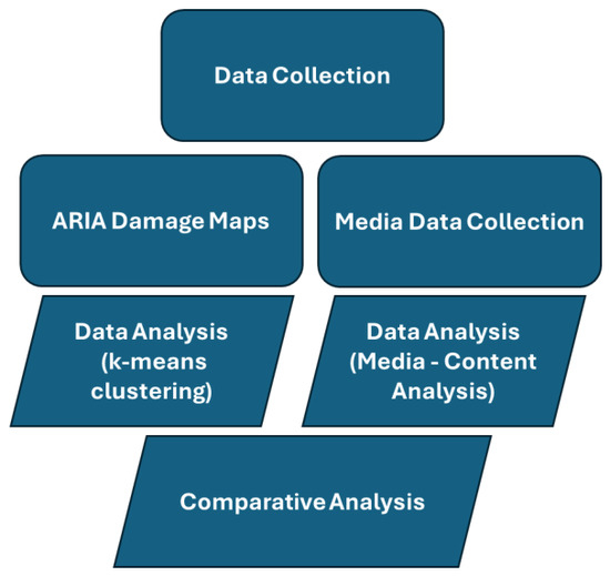
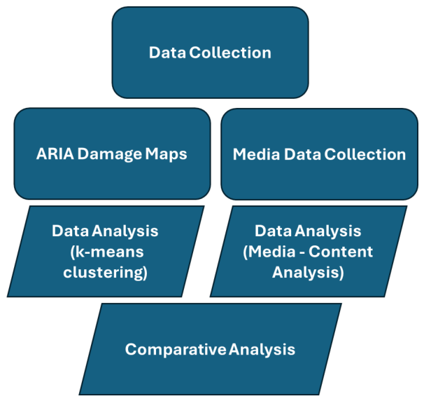
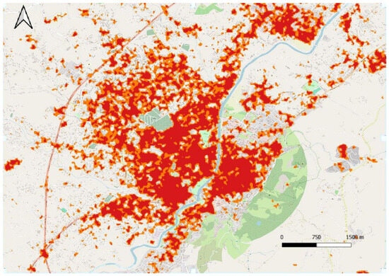
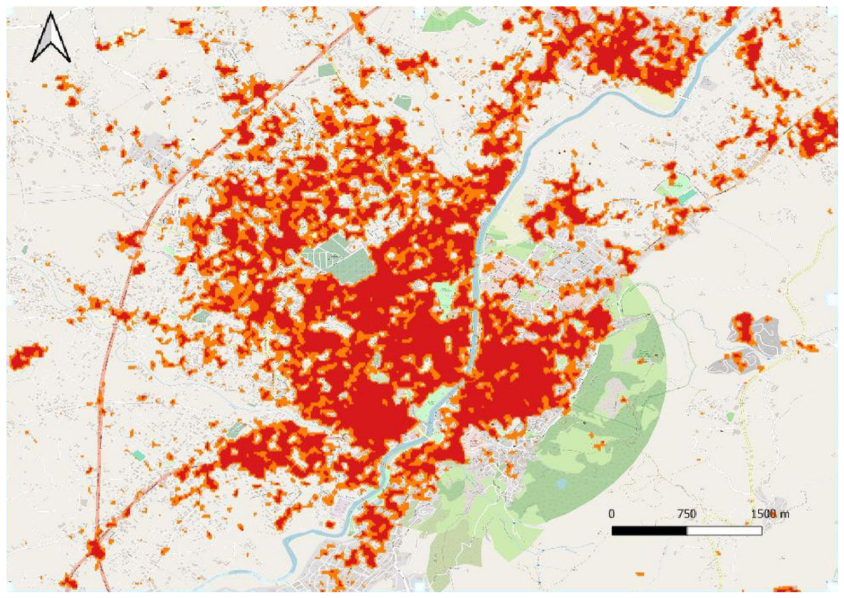
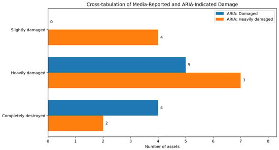
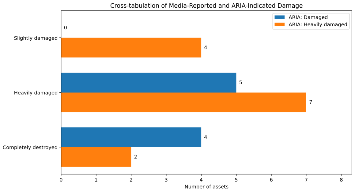
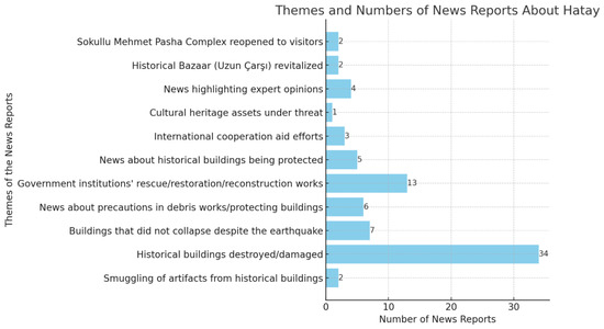
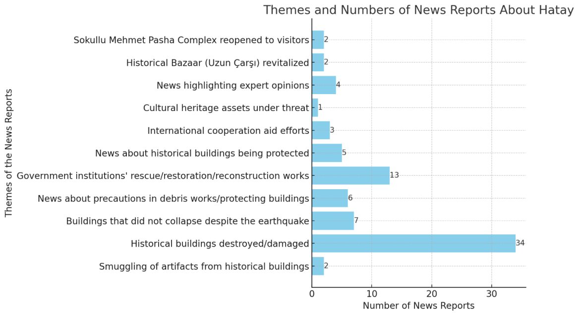
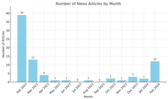
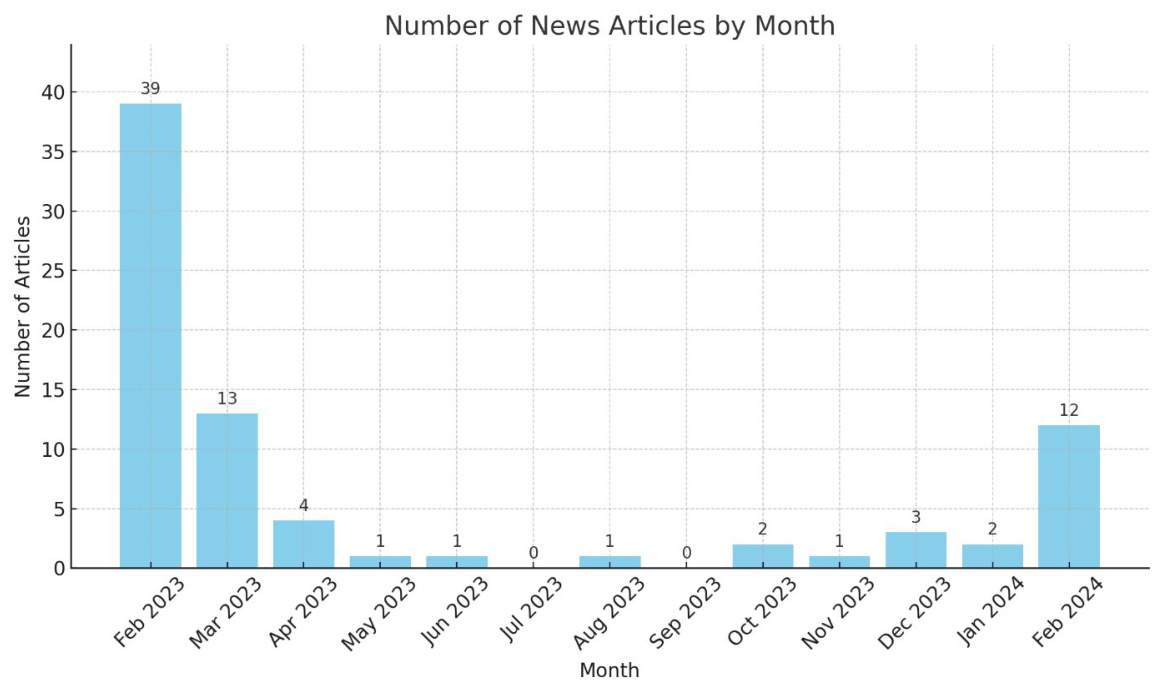
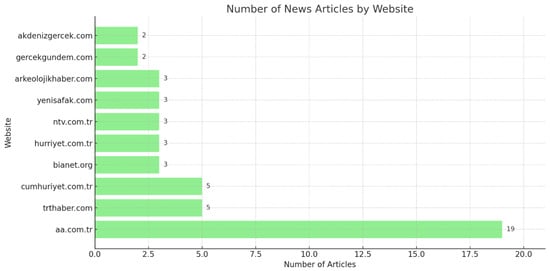
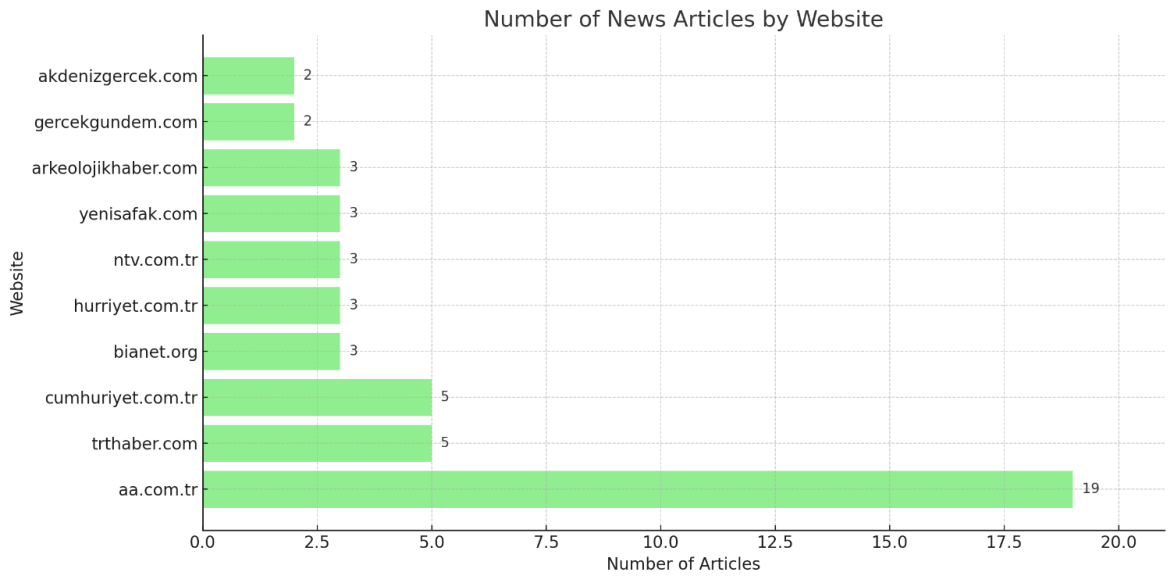

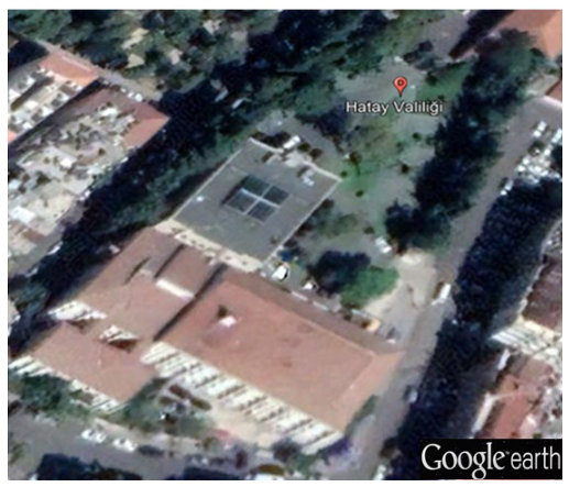
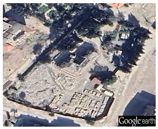
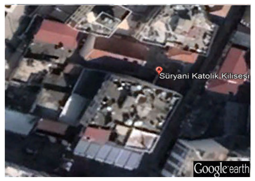
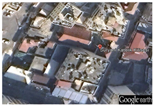
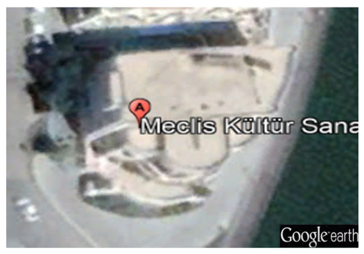
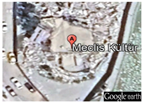
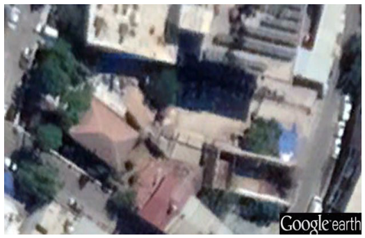
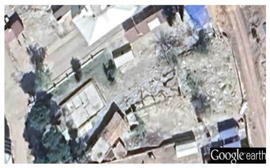
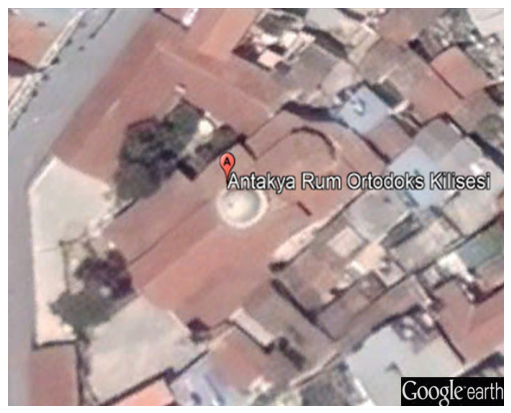
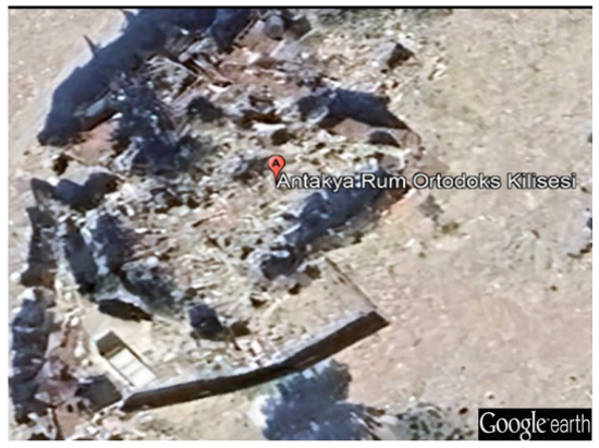
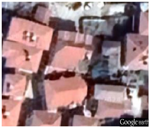
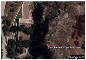
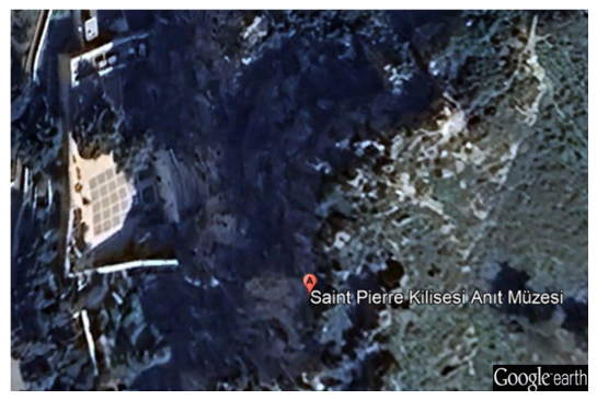
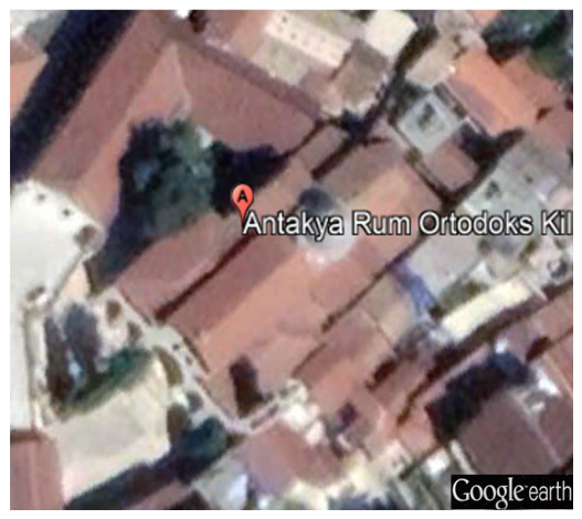
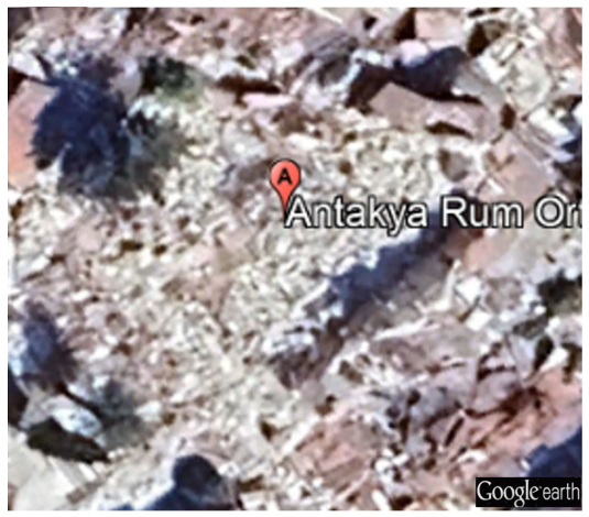
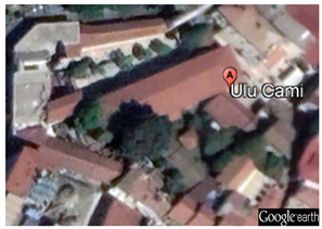
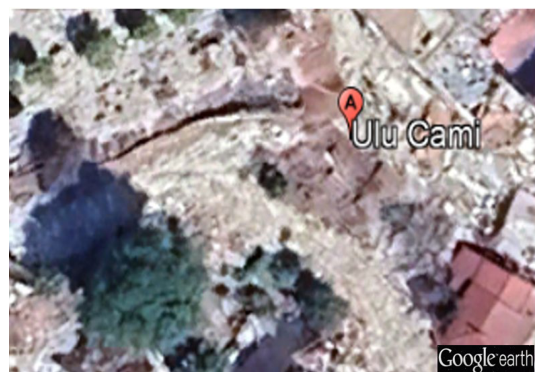
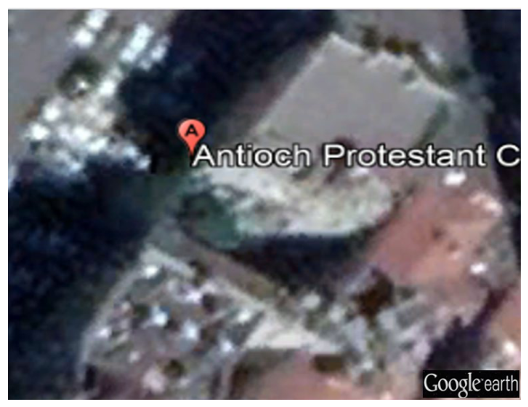
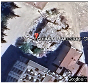
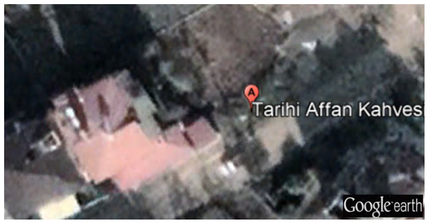
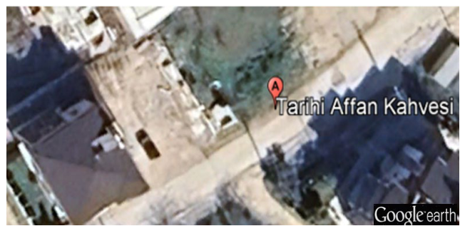
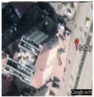
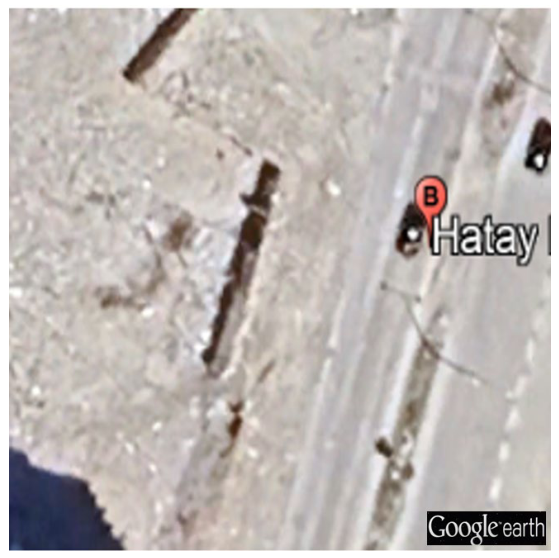
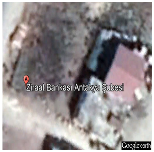
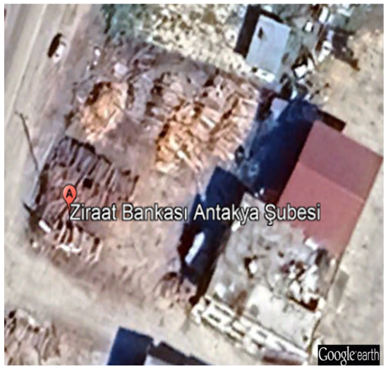
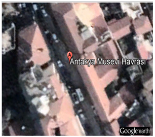
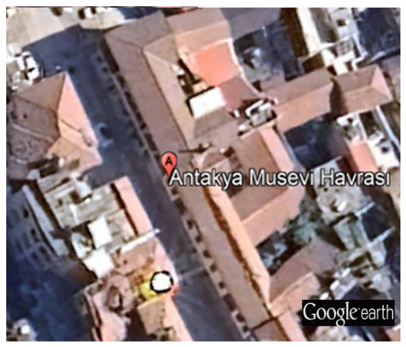
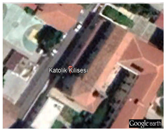
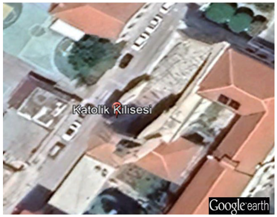
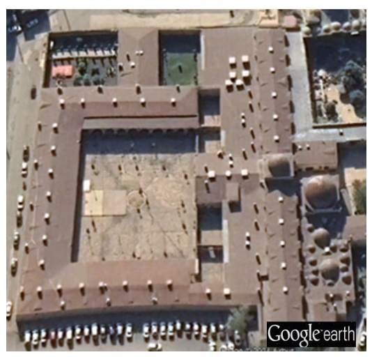
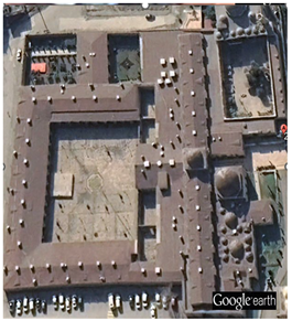
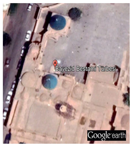
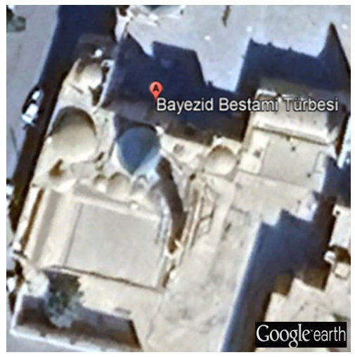
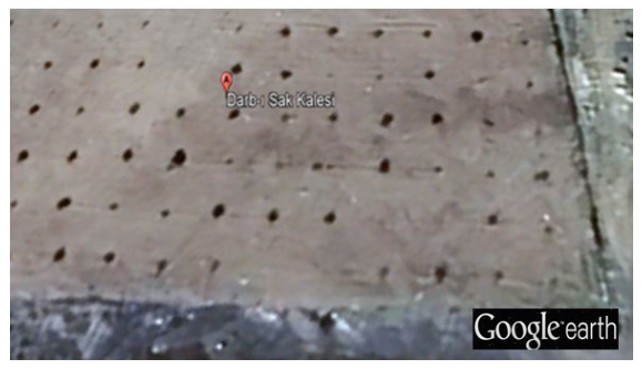
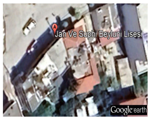
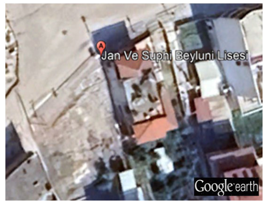
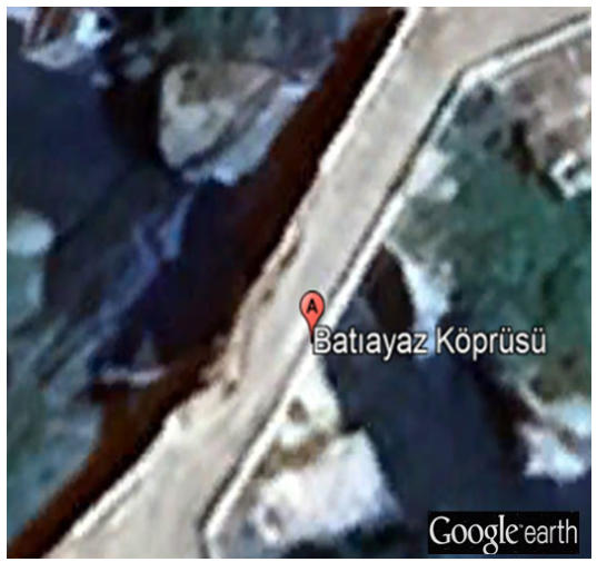
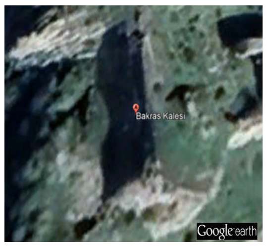
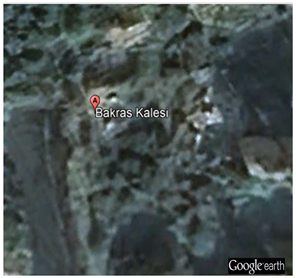
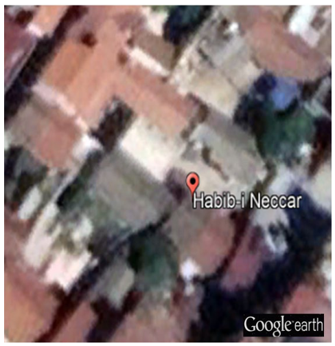
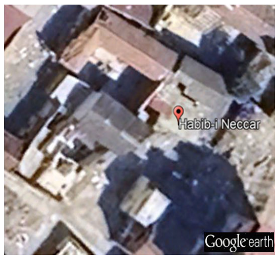
Disclaimer/Publisher’s Note: The statements, opinions and data contained in all publications are solely those of the individual author(s) and contributor(s) and not of MDPI and/or the editor(s). MDPI and/or the editor(s) disclaim responsibility for any injury to people or property resulting from any ideas, methods, instructions or products referred to in the content. |
© 2026 by the authors. Licensee MDPI, Basel, Switzerland. This article is an open access article distributed under the terms and conditions of the Creative Commons Attribution (CC BY) license.