


Abstract
This paper presents the design and preliminary field validation of a portable, low-cost Internet of Things (IoT) station for georeferenced soil nutrient profiling in agricultural environments. The proposed system integrates a digital RS-485 NPK soil sensor, an ESP32 microcontroller, and a SIM7000G GSM/GPS module to enable on-site acquisition and real-time transmission of nitrogen (N), phosphorus (P), and potassium (K) measurements using the MQTT protocol. Data are serialized in JSON format and transmitted to a ThingsBoard cloud platform for remote storage and visualization. The portable architecture supports manual spatial sampling across multiple locations without reliance on fixed infrastructure, making it suitable for small- and medium-scale agricultural contexts with limited connectivity. Preliminary testing in a controlled lemon plantation demonstrated stable GSM connectivity, successful geotagging, and consistent cloud-based visualization, with an average acquisition–transmission cycle of 30–45 s per measurement. Spatial heat maps generated from collected data illustrate the system’s capability for indicative nutrient mapping. Although laboratory-grade validation is ongoing, the results confirm the technical feasibility of integrating low-cost sensing, cellular communication, and georeferenced data acquisition into a compact IoT unit. The system establishes a foundation for future calibration, large-scale field validation, and decision-support applications in precision agriculture.
1. Introduction
Precision agriculture is increasingly based on timely and spatially resolved data to support informed decision-making related to soil health and fertilization practices [1,2,3]. Among the most critical parameters, soil nutrient concentrations—particularly nitrogen (N), phosphorus (P), and potassium (K)—play a central role in crop productivity and long-term sustainability. Conventional laboratory soil analysis methods, while accurate, are often time-consuming, costly, and impractical for frequent or large-scale sampling in heterogeneous agricultural fields [4,5,6]. Recent advances in low-cost Internet of Things (IoT) technologies have created new opportunities to complement traditional soil analysis approaches. Portable sensing systems that integrate soil sensors, microcontrollers, wireless communication, and geolocation capabilities can enable near real-time acquisition of spatially distributed soil data [7,8,9,10]. Such systems are particularly relevant for precision agriculture scenarios where nutrient variability occurs at small spatial scales and where rapid feedback is required to support site-specific management strategies. Several IoT-based solutions have been proposed for soil monitoring [11,12,13,14]; however, many existing implementations rely on fixed sensing nodes or local wireless infrastructure, limiting their flexibility for field sampling on-demand. In contrast, portable sensing stations capable of collecting georeferenced measurements across multiple locations can offer a more adaptable alternative, especially in small- and medium-scale farming contexts and in regions with limited network infrastructure.
In this context, this work-in-progress study presents a portable IoT sensing station designed to support on-site georeferenced soil nutrient profiling. The proposed system integrates a digital NPK soil sensor, an ESP32-based microcontroller, and a GSM/GPS communication module, enabling real-time data transmission using the MQTT protocol. Data are stored and visualized using an open-source IoT platform, thereby facilitating remote access and enabling future spatial analysis. The primary contribution of this work lies in the development and field validation of a portable, GSM-enabled IoT architecture specifically designed for georeferenced nutrient screening, bridging the gap between fixed-node soil monitoring systems and laboratory-based soil analysis workflows.
2. Materials and Methods
The proposed system was developed and evaluated as an engineering prototype intended for portable, indicative soil nutrient screening and georeferenced spatial profiling. The methodological focus of this study is the design, integration, and functional validation of the IoT architecture. The experimental workflow was structured to assess system operability, communication reliability, geolocation accuracy, and data visualization capabilities under representative field conditions.
2.1. Study Design and Field Deployment
This study follows an experimental field-based approach aimed at evaluating the performance and applicability of a portable IoT-enabled soil sensing system for georeferenced nutrient profiling. The experimental design focuses on in situ data acquisition across representative sampling points, enabling the analysis of spatial variability of soil macronutrients under real agricultural conditions.
Measurements were conducted through manual sampling at multiple locations within the study area, where the sensing probe was inserted directly into the soil. Each sampling point generated a georeferenced record consisting of nitrogen (N), phosphorus (P), potassium (K), timestamp, and geographic coordinates.
2.2. System Architecture
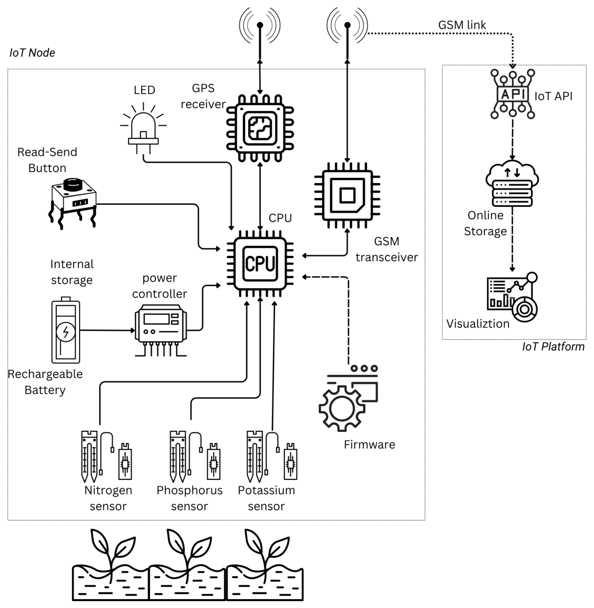
The proposed sensing platform is based on a modular IoT architecture composed of five functional layers: (i) soil sensing, (ii) data acquisition and preprocessing, (iii) geolocation, (iv) wireless communication, and (v) cloud-based data management and visualization. The proposed sensing platform is based on a modular IoT architecture composed of five functional layers: (i) soil sensing, (ii) data acquisition and preprocessing, (iii) geolocation, (iv) wireless communication, and (v) cloud-based data management and visualization.
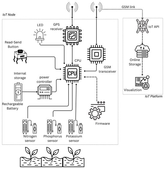
This architecture can be mapped to the conventional IoT reference model as follows: the sensing and acquisition modules correspond to the perception layer, the GSM-based communication module represents the network layer, and the cloud platform implements the application layer. A schematic representation of the system is shown in Figure 1.
Figure 1.
Functional Block Architecture of the Portable IoT Soil Sensing System.
2.3. Hardware Components
The sensing unit is built around an ESP32-WROOM-32 microcontroller (Espressif Systems, Shanghai, China), selected for its low-power operation and compatibility with embedded IoT applications. Soil nutrient measurements are obtained using a CWT digital NPK sensor (ComWinTop, Shenzhen, China), which operates via an RS485 interface (ComWinTop, Shenzhen, China) and provides ion-selective readings of nitrogen, phosphorus, and potassium.
For communication and positioning, the system integrates a SIM7000G module (SIMCom Wireless Solutions Limited, Shanghai, China), enabling GSM/GPRS data transmission and GNSS-based geolocation. GSM communication was selected to ensure operation in agricultural environments lacking Wi-Fi or local wireless infrastructure. Power is supplied by a rechargeable 3.7 V/2200 mAh lithium-ion battery (Electronica Steren, Ciudad de Mexico, Mexico). The entire assembly is enclosed in an IP-rated ABS housing to ensure mechanical robustness under field conditions.
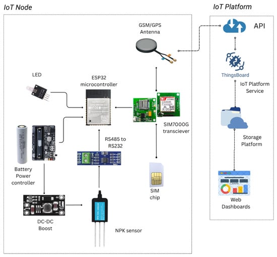
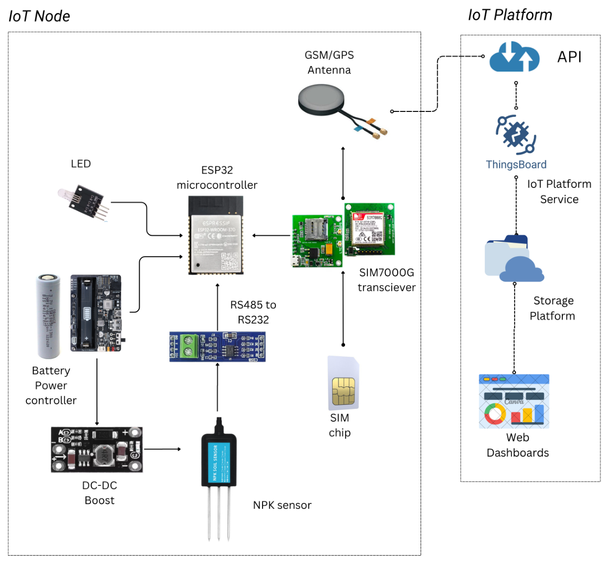
The hardware configuration prioritizes portability, modularity, and low-cost implementation to support accessibility in small- and medium-scale farming contexts. Figure 2 illustrates the physical wiring and interface of the main components within the sensing station.
Figure 2.
Hardware Layout and Selected Components.
2.4. Firmware and Data Acquisition Workflow
Firmware was developed in MicroPython (v1.25, George Robotics Limited, Cambridge, United Kingdom) and implements a user-triggered sampling routine. Upon insertion of the sensor probe into the soil and activation via a physical push-button, the ESP32 (Espressif Systems, Shanghai, China) performs the following sequence:
- Initiates RS-485 (ComWinTop, Shenzhen, China) communication with the NPK sensor.
- Retrieves nutrient concentration values (N, P, K).
- Acquires GPS coordinates and timestamp.
- Formats data into JSON structure.
- Publishes the data packet to a cloud server using the MQTT protocol over GSM.
Each acquisition–transmission cycle requires approximately 30–45 s, including sensor stabilization, GPS acquisition, and network transmission.
2.5. Cloud Integration and Data Visualization
Data packets are transmitted to a ThingsBoard Community Edition (CE) server via MQTT [15]. The platform stores telemetry variables including nutrient concentrations, geographic coordinates, and timestamps. Visualization dashboards were configured to display tabular summaries and geospatial maps of sampling points.
For exploratory spatial representation, nutrient heat maps were generated using interpolated surfaces derived from the collected GPS-referenced data. These visualizations are intended to illustrate spatial variability patterns rather than to provide agronomically calibrated nutrient prescriptions.
2.6. Field Testing Protocol
Preliminary validation was conducted in a controlled lemon plantation environment. The purpose of field testing was to verify:
- Reliable sensor data acquisition.
- Stable GSM connectivity.
- Correct geolocation tagging.
- Successful MQTT transmission.
- Proper cloud storage and visualization.
Sampling points were manually selected across the test area to simulate spatial exploration. At each location, the probe was inserted into the soil and a single acquisition cycle was performed. The resulting dataset was used to evaluate operational consistency and to demonstrate the system’s capability for georeferenced spatial profiling.
2.7. Validation Strategy and Limitations
The experimental evaluation was conducted under controlled and semi-controlled environmental conditions.The validation strategy adopted in this study focuses on system-level engineering performance, including hardware integration, communication reliability, energy operability, and data workflow completeness. Quantitative analytical validation against laboratory-grade soil testing methods, including calibration modeling and statistical error analysis, is reserved for future work.
3. Results
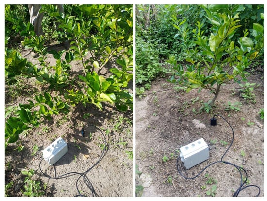
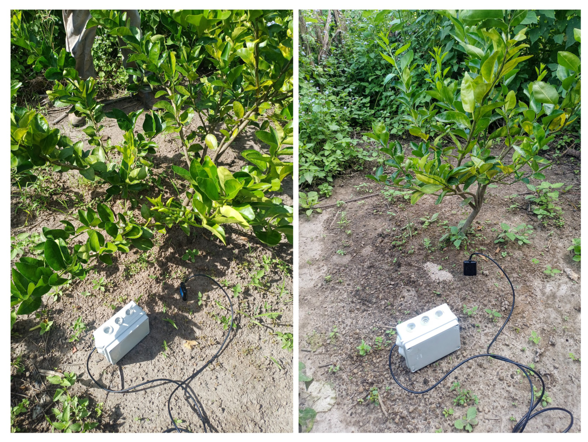
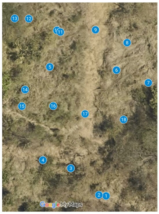
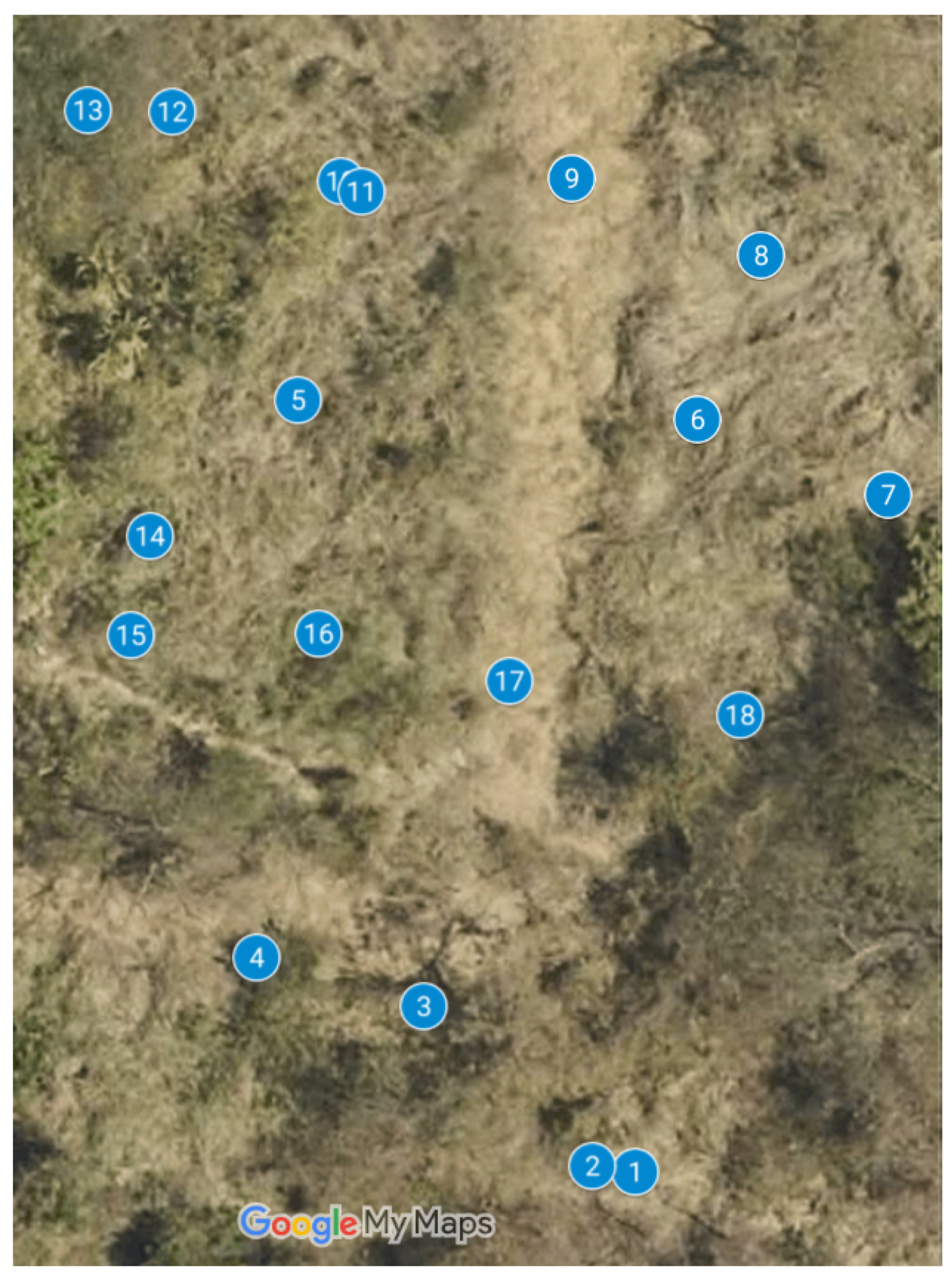
Following hardware integration and firmware implementation, the first prototype of the portable IoT sensing station was built and tested in a controlled lemon plantation, as shown in Figure 3. The aim of this testing phase was to verify system operation, including data acquisition, GSM-based transmission, and cloud visualization using the ThingsBoard platform. The test procedure simulated representative field usage scenarios in which the portable sensor probe was inserted at multiple locations within the test area (Figure 4). At each sampling point, the system recorded soil nutrient concentrations for nitrogen (N), phosphorus (P), and potassium (K), along with GPS coordinates. The collected data was transmitted wirelessly to the cloud platform in near-real-time.
Figure 3.
Field testing of the proposed IoT Station.
Figure 4.
Map showing the geolocation of the test points for the proposed Portable IoT Station; markers represent measurement points.
The average time per sampling cycle, including measurement, processing, and data transmission, ranged from 30 to 45 s. Each data packet successfully received by the server contained a timestamp, geographic coordinates, and the corresponding NPK values. During the tests, the GSM module maintained stable connectivity under urban GSM coverage conditions. The power system, based on a 3.7 V/2200 mAh lithium-ion battery, supported multiple acquisition cycles within a 30-min testing session without observable degradation in system performance.
Table 1 presents a sample of georeferenced soil nutrient measurements collected during the preliminary tests. The dataset illustrates spatial variation in nutrient values across sampled locations and demonstrates the system’s ability to associate each measurement with precise geographic coordinates. The NPK sensor used in the prototype is specified by the manufacturer with a nominal accuracy of ±5%. Variability in measured values was observed under certain soil moisture conditions during the testing.
Table 1.
Sample of georeferenced soil nutrient measurements collected during preliminary testing.
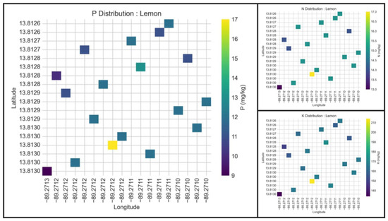
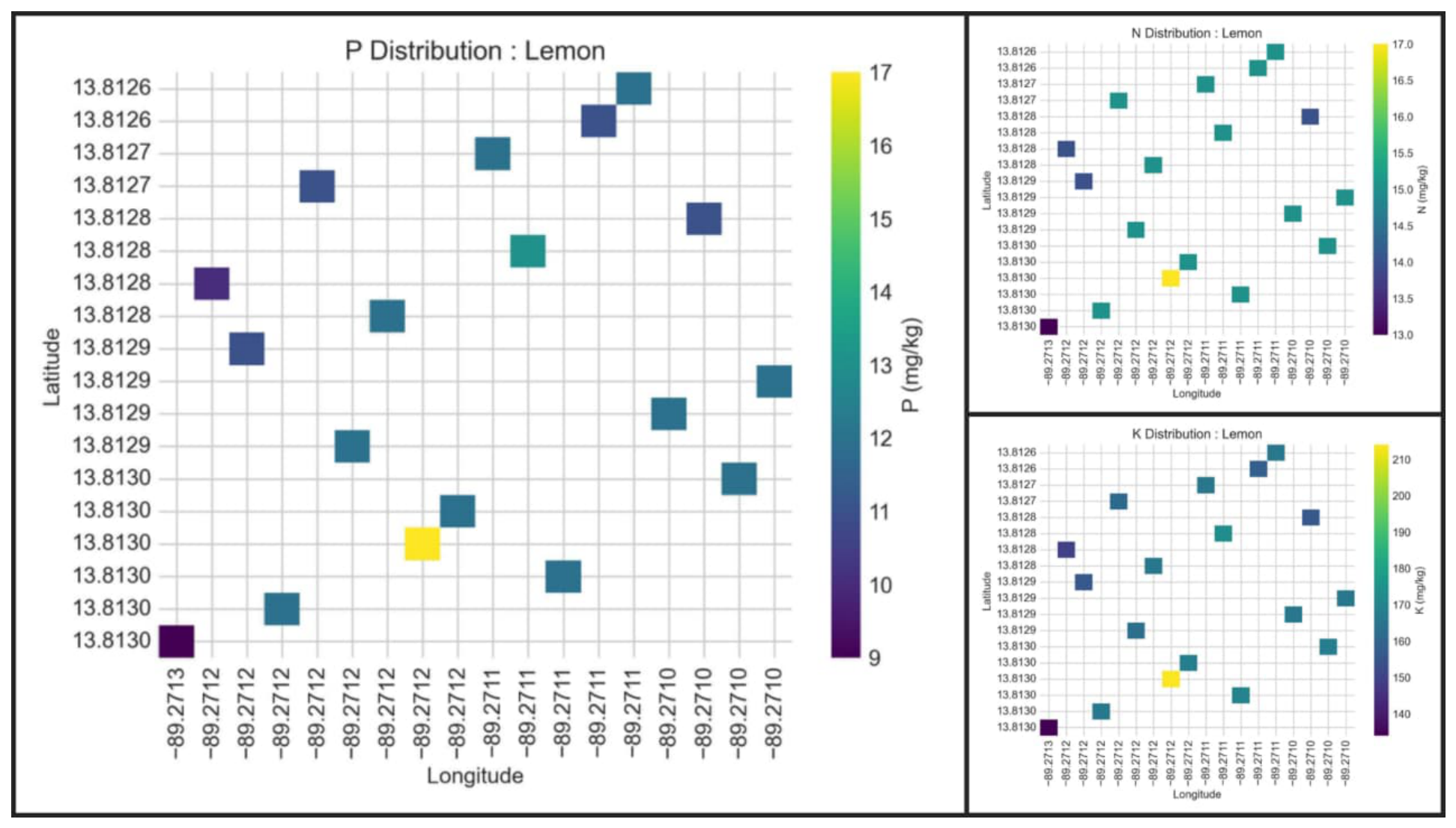
We used NPK data collected from the proposed system to create detailed heat maps that illustrate the spatial distribution of key nutrients—nitrogen (N), phosphorus (P), and potassium (K)—across the lemon tree; see Figure 5. Spatial distributions were generated using Python (v3.14) based data processing and visualization tools. Specifically, the libraries NumPy and Pandas were used for data handling and preprocessing, while Matplotlib (v3.10) was employed for visualization.
Figure 5.
Heatmaps of the spatial distribution of nutrients in lemon cultivation, based on data from the proposed system.
This preliminary evaluation confirms that the proposed design can perform nutrient measurement, geolocation tagging, and cloud integration effectively, setting a solid foundation for future large-scale field testing and data-driven soil mapping.
4. Discussion
The results of this work demonstrate the technical feasibility of a portable, low-cost IoT-based platform for acquiring georeferenced soil nutrient data. The successful integration of an RS-485 NPK sensor, an ESP32 microcontroller, a GSM/GPS module, and MQTT-based cloud communication demonstrates the robustness of the proposed architecture under representative field conditions. The system achieved stable cellular connectivity and reliable end-to-end transmission of geotagged nutrient measurements with an average acquisition–transmission cycle of 30–45 s per sampling point.
These results are consistent with previous studies on low-cost soil sensing systems, which report similar limitations under variable soil moisture conditions.
The intended use case of the proposed system is indicative nutrient screening and spatial profiling rather than laboratory-grade quantitative soil analysis. At its current stage of development, the system is designed to support rapid exploratory assessment of nutrient variability within agricultural plots. This enables farmers and researchers to identify zones of potential nutrient imbalance that may warrant further laboratory testing or targeted agronomic intervention.
The portability of the device represents a key operational advantage compared to fixed-node IoT monitoring systems. By enabling manual, location-aware sampling, the system supports flexible spatial exploration without requiring permanent infrastructure deployment. This characteristic is particularly relevant in small- and medium-scale farms and in regions with limited access to precision agriculture technologies or local wireless networks. The use of GSM connectivity further enhances applicability in resource-constrained environments by avoiding dependence on Wi-Fi or proprietary communication ecosystems.
Nevertheless, the current study does not include calibration against laboratory-standard soil chemical analysis methods. Although the manufacturer specifies a nominal accuracy of , sensor performance under varying soil compositions, moisture levels, and temperature conditions requires systematic validation. Therefore, the current contribution should be interpreted as a work-in-progress engineering study focused on architectural validation and functional integration. Comparative analysis with standardized soil testing procedures, error quantification, and calibration modeling constitute the next phase of this research and are essential steps toward quantitative agronomic deployment.
Also, while the selected NPK sensor is capable of measuring additional parameters such as soil moisture, temperature, and pH, this study focuses on nutrient profiling as a first step. The integration of additional parameters is considered part of future work.
5. Conclusions
This paper presented a design and implementation of a portable IoT sensing station to support georeferenced real-time nutrient profiling in agricultural soils. The proposed system integrated a soil-embedded NPK sensor, an ESP32-based controller, GSM connectivity (via SIM7000G), and a cloud dashboard for remote visualization using ThingsBoard. A preliminary prototype was successfully tested under pilot conditions, which confirmed effective data acquisition, transmission, and visualization of the values of nitrogen, phosphorus, and potassium. The results demonstrated that this low-cost modular architecture is technically viable for field deployment, particularly in small- and medium-scale farms in regions with limited access to precision agriculture tools. The use of JSON-based MQTT transmission enables scalable integration with IoT platforms and supports real-time soil monitoring workflows. In conclusion, the proposed low-cost IoT station successfully integrated soil sensing, geolocation, and cloud visualization of NPK. The preliminary field test confirmed the feasibility of real-time georeferenced data acquisition.
Future work will focus on (i) calibration against laboratory-grade reference methods, (ii) field deployment across various soil types and crops, (iii) integration of additional parameters such as pH, moisture, and temperature, and (iv) development of interpolation algorithms to generate nutrient heat maps. These improvements will enhance the system’s applicability as a decision-support tool for precision agriculture in resource-constrained environments.
Author Contributions
Conceptualization, O.F.-C., F.A. and C.P.; methodology, O.F.-C., F.A. and C.P.; software, F.A. and C.P.; validation, O.F.-C. and B.C.; formal analysis, O.F.-C., F.A. and C.P.; investigation, O.F.-C. and W.M.; resources, B.C. and W.M.; writing—original draft preparation, O.F.-C.; writing—review and editing, O.F.-C., F.A. and C.P.; visualization, C.P.; supervision, F.A. All authors have read and agreed to the published version of the manuscript.
Funding
This research received no external funding.
Institutional Review Board Statement
Not applicable.
Informed Consent Statement
Not applicable.
Data Availability Statement
Data are contained within the article.
Acknowledgments
The authors thank the Research Department at the Technological University of El Salvador for financial support.
Conflicts of Interest
The authors declare no conflicts of interest.
Abbreviations
The following abbreviations are used in this manuscript:
| IoT | Internet of Things |
| N | Nitrogen |
| P | Phosphorus |
| K | Potassium |
| NPK | Nitrogen–Phosphorus–Potassium |
| GSM | Global System for Mobile Communications |
| GPRS | General Packet Radio Service |
| GPS | Global Positioning System |
| MQTT | Message Queuing Telemetry Transport |
| JSON | JavaScript Object Notation |
| RS-485 | Recommended Standard 485 |
| IP | Ingress Protection |
| CE | Community Edition |
| GIS | Geographic Information System |
References
- Rani, S. Precision Agriculture for Sustainable Development: Concepts and Applications. In AI and Data Analytics in Precision Agriculture for Sustainable Development; Springer: Cham, Switzerland, 2025; pp. 1–9. [Google Scholar]
- Reis, M.J.; Serôdio, C. IoT Architecture for Smart Environments: Mechanisms, Approaches, and Applications. Future Internet 2026, 18, 182. [Google Scholar] [CrossRef] [Scilit]
- Obbo, A.; Ogot, B. IoT Adoption for Agricultural Transformation in Developing Countries: Challenges and Opportunities—A case of Uganda. VFAST Trans. Softw. Eng. 2026, 14, 318–334. [Google Scholar] [CrossRef] [Scilit]
- García-Meléndez, L.M.; Parada-Berrios, F.; Arias-de Linares, A.Y. Nutrición en plantas de moringa (Moringa oleífera Lam.) utilizando diferentes fuentes de nitrógeno, fósforo y potasio: Su influencia en el desarrollo y crecimiento en vivero. Rev. Agrociencia 2022, 6, 40–52. [Google Scholar]
- Azenzem, R.; Eddomairi, H. Internet of things (IoT) and artificial intelligence (AI) in agriculture: Applications for sustainable crop protection. In Food and Industry 5.0: Transforming the Food System for a Sustainable Future; Springer: Berlin/Heidelberg, Germany, 2025; pp. 73–86. [Google Scholar]
- Bhatt, P.D. Transforming Agriculture with IoT in Nepal: Opportunities and Challenges. J. Durgalaxmi 2025, 4, 297–310. [Google Scholar] [CrossRef] [Scilit]
- Flores-Cortez, O.O.; Arévalo, F.; Jimenez, C.P. Portable IoT-Based System for GIS Mapping of Urban Noise: A Case Study in Downtown San Salvador. In 2025 IEEE Conference on Technologies for Sustainability (SusTech); IEEE: Piscataway, NJ, USA, 2025; pp. 1–7. [Google Scholar]
- Aryal, A.; Sapkota, Y.; Lamichhane, B.; Shrestha, J. Applications of Internet of Things, Remote Sensing, and AI for Precision Agriculture and its Adoption Status in Nepal. J. Appl. Agric. Sci. Technol. 2026, 10, 170–196. [Google Scholar] [CrossRef] [Scilit]
- Moutsinas, I.; Kalkanof, A.; Mavridis, J.; Zafeiris, V.; Oikonomou, F.; Tziokas, G.; Themelis, K.; Kyriakou, K.; Theologou, C.; Serafeim, A.; et al. AgroNIT: Innovating precision agriculture. In 2022 Global Information Infrastructure and Networking Symposium (GIIS); IEEE: Piscataway, NJ, USA, 2022; pp. 6–12. [Google Scholar]
- Velamala, R.R.; Pant, P.K. PySNM: An open-source python package for automated Spatial interpolation and soil nutrient mapping for sustainable agriculture—A case study. Discov. Soil 2025, 2, 106. [Google Scholar] [CrossRef] [Scilit]
- Dinn, C.; Shakshuki, E.; Hassan, E. A Review of AIoT in Sustainable Agriculture: Advancing Soil Management with IoT Sensors. Procedia Comput. Sci. 2025, 265, 366–373. [Google Scholar] [CrossRef] [Scilit]
- Pyingkodi, M.; Parvathavarthini, S.; Palarimath, S.; Deepa, D.; Brindha, S.; Atchayaprakassh, K. Soil Sensing Using Internet of Things Technologies for Precision Agriculture. In Proceedings of the International Conference on Innovations in Cybersecurity and Data Science Proceedings of ICICDS; Springer: Berlin/Heidelberg, Germany, 2024; pp. 673–685. [Google Scholar]
- Nuralam, N.; Muzakki, R.F.; Kusumastuti, S.L.; Hariyanto, H. Development and Performance Testing of a PANI–GO Soil Conductivity Sensor. Telka-Telekomun. Elektron. Komputasi Kontrol 2026, 12, 118–125. [Google Scholar]
- Manisha, M.G.; Harshitha, K.; Harsini, G.; Janani, P. Smart Soil Analyzer: AI-Driven Soil Testing, Fertilizer & Crop Advisor. Res. Dig. Eng. Manag. Soc. Innov. 2026, 2, 152–160. [Google Scholar] [CrossRef] [Scilit]
- ThingsBoard Inc. ThingsBoard Open-Source IoT Platform. 2024. Available online: https://thingsboard.io/ (accessed on 29 July 2025).

Disclaimer/Publisher’s Note: The statements, opinions and data contained in all publications are solely those of the individual author(s) and contributor(s) and not of MDPI and/or the editor(s). MDPI and/or the editor(s) disclaim responsibility for any injury to people or property resulting from any ideas, methods, instructions or products referred to in the content. |
© 2026 by the authors. Licensee MDPI, Basel, Switzerland. This article is an open access article distributed under the terms and conditions of the Creative Commons Attribution (CC BY) license.