


Abstract
Traditional handicraft knowledge is not only embodied in final products and craft procedures but also embedded in the context formed by production spaces, tools, materials, practitioners, and their interrelationships. However, existing digital preservation practices often focus on individual objects or specific data types, making the spatial and semantic relationships among heterogeneous resources insufficiently represented and limiting public understanding of the broader context of craft practices. To address this issue, this paper proposes a digital resource organization and multi-terminal presentation framework. Using 3D point clouds as a unified spatial reference for the site, the framework links images, videos, interviews, craft records, and object-related materials to spatial locations through structured annotation, and visualizes relationships among practitioners, tools, materials, processes, and spaces through node-link representations. The Web-based viewer and CAVE immersive system access the same content dataset, enabling “input once, reuse across terminals”. User feedback suggests that the framework supports the integrated representation of spatial context, craft resources, and associated information within traditional handicraft sites, with relational visualization contributing to a more holistic understanding of craft practices. The framework provides a reusable workflow for organizing, linking, and presenting heterogeneous heritage resources in traditional handicraft transmission sites, offering digital support for a contextual understanding of craft practices.
1. Introduction
Traditional handicraft heritage is embodied not only in finished products or discrete procedural steps; its production and transmission are also rooted in specific sites and involve multiple elements, including tools, materials, craft processes, and practitioners [1,2]. Accordingly, understanding traditional handicrafts cannot be limited to the material objects themselves. Previous studies have likewise emphasized that heritage meanings are continually recognized and ascribed through processes of social identification, cultural practice, and interpretation [3,4]. This is particularly evident in traditional handicraft sites that retain active production functions, where these elements do not exist in isolation but jointly constitute the context in which craft practices take place. From a cognitive perspective, situated cognition theory further suggests that knowledge is not understood independently of its surroundings, but is formed through interactions among activities, tools, and the social environment [5,6]. Therefore, if digital presentation focuses only on finished products or isolated procedural steps without conveying their context and the relationships among relevant elements, the public may find it difficult to develop a holistic understanding of the craft practice.
Digital technologies have been widely applied to the documentation, analysis, and presentation of cultural heritage, including 3D scanning, photogrammetry, digital imaging, virtual reality, and augmented reality [7,8,9]. These methods can preserve the geometric form, visual characteristics, and associated narratives of heritage objects, while creating new possibilities for public access and research. Recent studies have further explored the integration of 3D models with textual, visual, and other heritage materials to strengthen connections among different types of information [10,11]. However, existing digital heritage practices are often developed around specific data types or presentation purposes, and the relationships among spatial objects, craft-related materials, and narrative information are not always organized within a unified structure. For traditional handicraft transmission sites, separately documenting architectural spaces, objects, or media resources makes it difficult to convey how different elements of craft practice are connected. This calls for an approach that uses the spatial environment as an organizational basis for integrating multiple resource types and supporting their continued presentation and use.
Accordingly, this study proposes a digital resource organization and multi-terminal presentation framework for traditional handicraft transmission sites. The framework uses the site itself as a common spatial reference to integrate spatial data with multiple types of heritage resources and to enable the reuse of the same content across different presentation environments. The framework is implemented through a case study of the Sanyi Tie-Dyeing Factory in Weishan, Yunnan, and is further applied to the Suzhou Xiangyun Ivory Carving Museum to examine its applicability across different traditional craft contexts.
2. Related Work
With advances in 3D acquisition and web-based 3D visualization technologies, 3D data have become an important medium for the digital documentation, analysis, and presentation of cultural heritage. Related work has focused not only on capturing the geometric characteristics of heritage objects, but also on integrating textual, visual, historical, and other forms of information with 3D space to support the organization and communication of heritage resources.
In the field of 3D heritage presentation, various online platforms have been developed for cultural heritage applications. The 3D Heritage Online Presenter (3DHOP) is an open-source framework designed for the online presentation of high-resolution 3D heritage content. Through multiresolution data management and interactive browsing, it enables high-resolution 3D models to be accessed in web environments and allows 3D content to be combined with multimedia information and interactive functions such as measurement [12]. For large-scale point-cloud datasets, Potree employs a hierarchical multiresolution data structure to support progressive loading and interactive visualization in standard web browsers, providing a technical basis for the online access and sharing of large 3D datasets [13]. These developments have expanded the ways in which 3D heritage data can be made accessible and communicated to wider audiences.
In addition to 3D visualization, researchers have explored spatially based approaches to organizing heterogeneous heritage information. Aïoli, developed by Abergel, De Luca, and colleagues, is a collaborative annotation and documentation platform based on reality-based 3D data. It associates annotations and related documentation with spatial locations on 3D objects and supports the collaborative recording and sharing of heterogeneous heritage information among specialists from different disciplines [14]. This work demonstrates the value of 3D space as an organizational reference: spatial location can serve not only to represent the geometry of heritage objects, but also as a basis for connecting information from different sources and in different formats.
Beyond 3D visualization and annotation platforms, digital heritage management systems have also addressed the structured organization and long-term management of heritage resources. The Arches Heritage Inventory and Management System, for example, uses structured resource models to organize heritage resources and associated information, supporting heritage institutions in resource inventory, data maintenance, and information sharing [15]. In China, an Arches-based heritage inventory system developed for the Dunhuang grottoes further explored the use of resource models and mapping functions for the organization, management, and visualization of grotto heritage information [16]. These systems demonstrate that digital heritage platforms can support not only the preservation and presentation of data, but also the continued management of heterogeneous heritage information.
Other projects have explored the use of particular places as an organizing basis for multiple forms of documentation. The Incomplete Niwa Archives project documents Japanese gardens through a range of media and recording methods, including architectural drawings, 3D scanning, photographs, video, audio recordings, and other materials, and brings these records together within a digital archive centered on the garden as a spatial subject [17]. This practice demonstrates that a 3D-recorded site can function not only as an object of documentation in itself, but also as a spatial reference through which different forms of cultural information can be brought together.
For intangible cultural heritage (ICH), different approaches to structured resource organization have also emerged. The Chinese Intangible Cultural Heritage Gene Database integrates multimedia ICH resources and constructs a knowledge graph based on specialized terminology and its knowledge network, organizing ICH knowledge through dimensions such as craftsmanship, color, and patterns [18]. Fan et al. developed CICHMKG, a multimodal knowledge graph based on China’s national-level ICH items, integrating textual attributes with representative images to support the structured representation and exploration of ICH information [19].
Overall, previous work has explored digital heritage resource organization from several perspectives, including 3D visualization, spatial annotation, heritage information management, place-based documentation, and ICH knowledge organization. These studies provide an important foundation for the present research. Traditional handicraft transmission sites, however, bring active production environments, ongoing craft practices, and heterogeneous documentary resources together within the same setting. Accordingly, this study focuses on how the physical site itself can serve as a common spatial reference for organizing these resources and supporting their continued use across different presentation environments.
3. Methodology
3.1. Research Design and Case Selection
This study adopts a research approach that combines framework development with case-based implementation. First, fieldwork at the Sanyi Tie-Dyeing Factory in Yunnan was conducted to collect spatial data of the site together with multimedia materials, including images, videos, and interviews, from which case-derived design requirements were identified. Second, a resource organization and multi-terminal presentation framework was developed using the 3D site as a common spatial reference, and prototype systems were implemented in both Web and CAVE environments. The core data structure and workflow were then applied to the Suzhou Xiangyun Ivory Carving Museum to examine the framework’s adaptability across different traditional craft contexts. Finally, a user survey based on the CAVE application, together with expert feedback, was used to collect responses concerning information organization, relationship representation, and presentation methods.
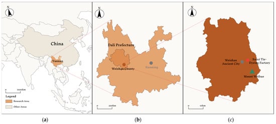
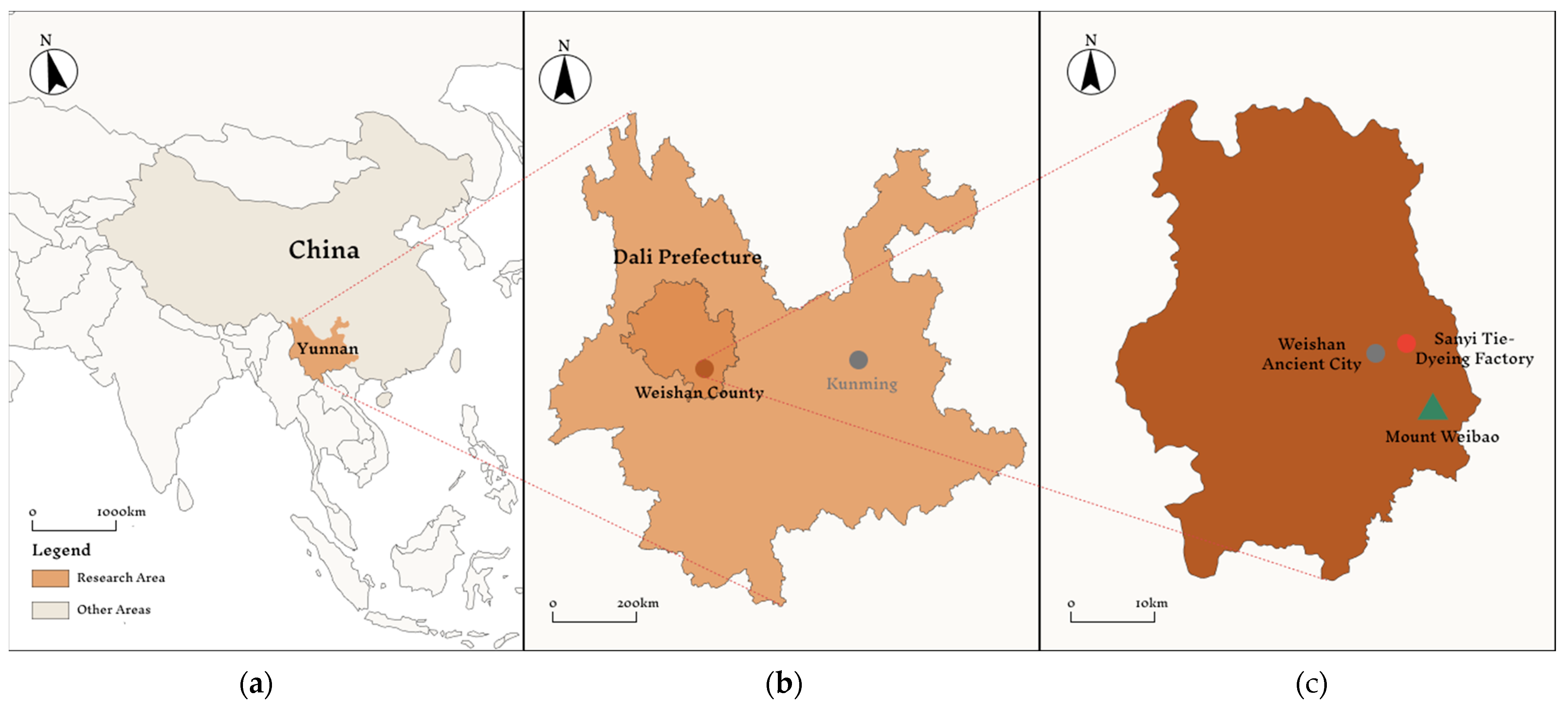
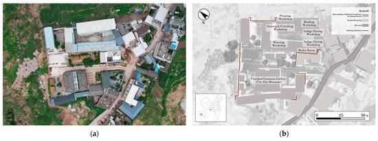
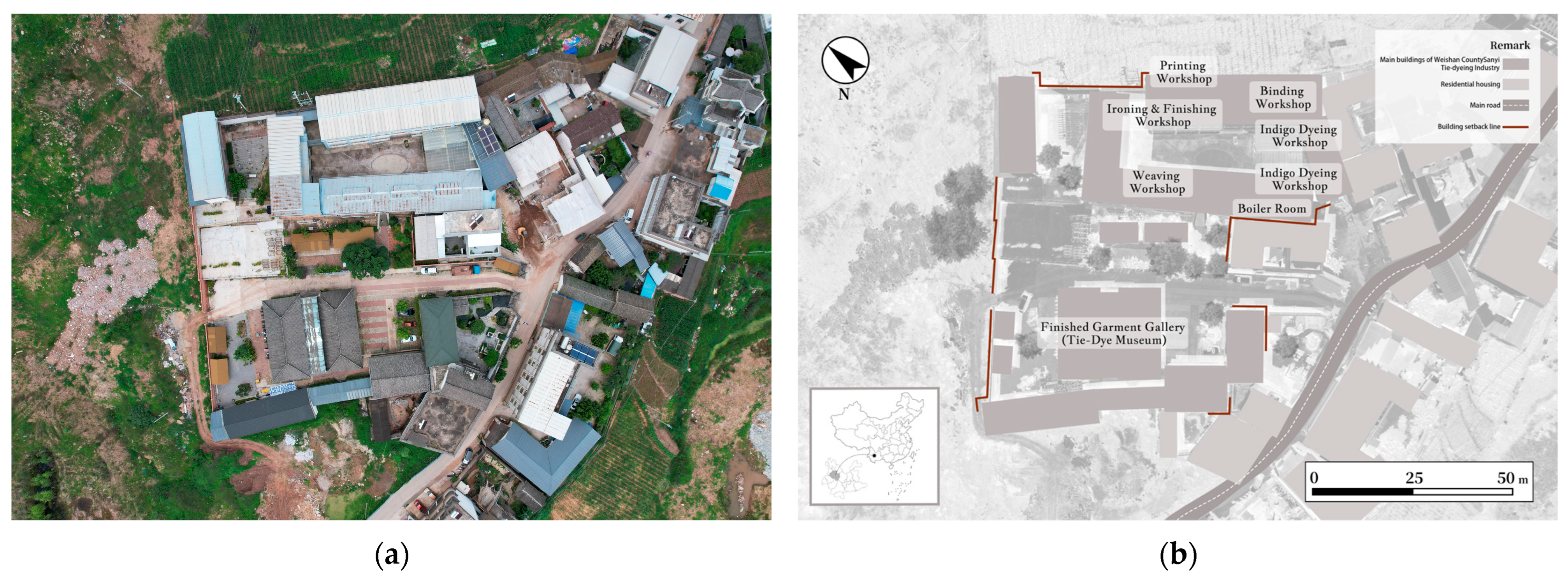
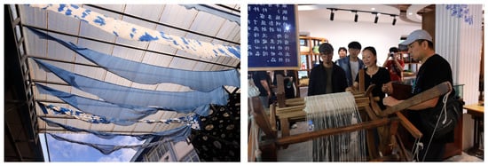
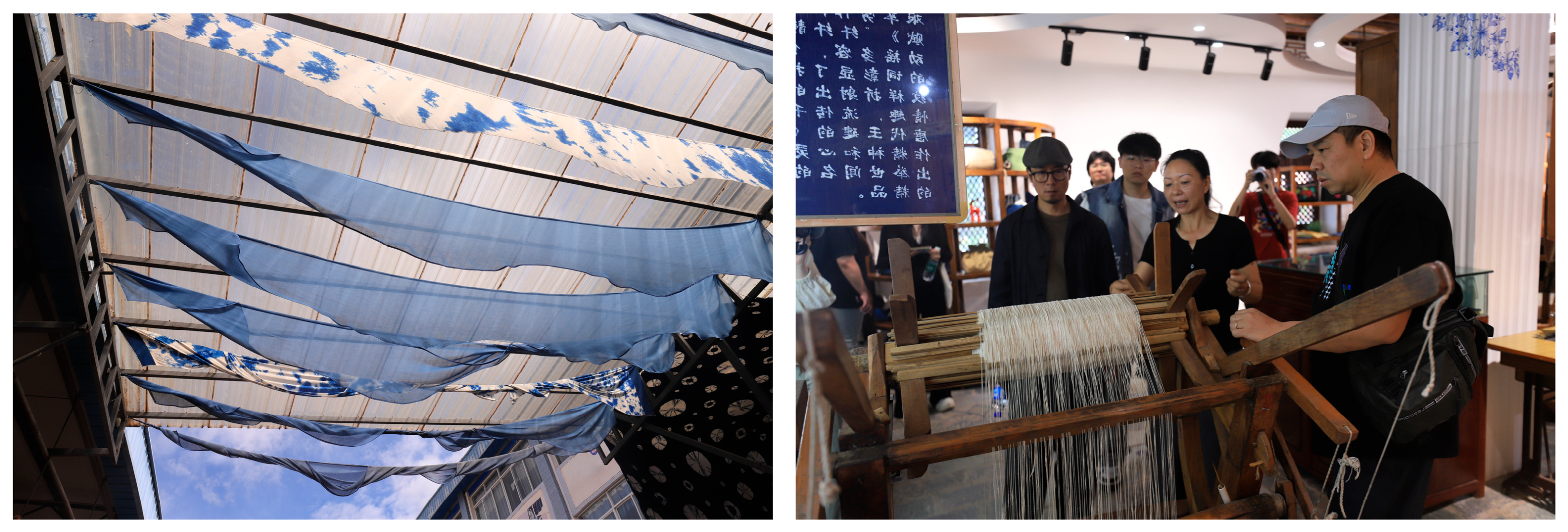
The Sanyi Tie-Dyeing Factory in Weishan County, Yunnan Province, was selected as the primary case study (Figure 1). Tie-dyeing is one of China’s oldest textile dyeing techniques. In 2006, “Bai Ethnic Tie-Dyeing Techniques” was inscribed on the first national-level ICH list, Weishan is one of the important areas in which this tradition continues to be practiced [20]. Founded in 1988, the Sanyi Tie-Dyeing Factory still maintains major stages of production, including weaving, binding and stitching, dyeing, ironing, and final product processing, and also contains a museum displaying plant dyes, historical materials, and finished tie-dyed products (Figure 2). The coexistence of production workshops, exhibition spaces, craft materials and tools, ongoing craft activities, interviews with practitioners, and historical records within a single site makes it a suitable case for examining the spatial organization of heterogeneous heritage resources, the representation of their relationships, and their reuse across multiple presentation environments.
Figure 1.
Location of the study area: (a) Yunnan Province within China; (b) Weishan County within Dali Prefecture, Yunnan Province; (c) Sanyi Tie-Dyeing Factory, Weishan Ancient City, and Mount Weibao within Weishan County.
Figure 2.
Factory site overview: (a) Drone aerial view. (b) Workshop layout.
3.2. Fieldwork, Data Collection, and Design Requirements
3.2.1. Fieldwork and Data Collection
The research team conducted preliminary site visits in Dali and the area around Weishan from 27 to 30 June 2025, and carried out formal data acquisition at the Sanyi Tie-Dyeing Factory on 1 July 2025 (Figure 3). The collected materials comprised spatial data and multimedia resources. The spatial data primarily consisted of 3D point clouds of the factory site, production workshops, and museum, while the multimedia resources included video interviews with factory managers and senior artisans, recordings of craft processes, images of plant dyes, documentation of tools and equipment, and historical photographs of the factory. After collection, the spatial data were preprocessed to establish a 3D spatial reference for the site, while the multimedia resources were screened and classified for subsequent resource organization, relationship representation, and multi-terminal presentation. The data categories, acquisition methods, and their respective roles within the framework are summarized in Table 1.
Figure 3.
Field investigation at Sanyi Tie-Dyeing Factory: research team attending an on-site guided introduction to the tie-dyeing process.
Table 1.
Data collected during fieldwork and their roles in the framework.
3.2.2. Case-Derived Design Requirements
The characteristics of the Sanyi Tie-Dyeing Factory as a production site resulted in three design requirements:
R1: Establish a continuous spatial reference at the site scale. The factory consists of multiple production workshops and a museum, with dense equipment distribution and complex spatial relationships. Craft activities are distributed across different functional areas. Therefore, the framework needs to use continuous 3D spatial documentation to represent the locations and relationships of different workshops and major production facilities.
R2: Organize heterogeneous resources and represent cross-spatial relationships. Craft-related materials are distributed across different media formats and spatial locations, and the relationships among resources cannot be fully represented by physical proximity alone. Therefore, the framework needs to provide a unified organization mechanism for different types of data while explicitly recording relationships among resources.
R3: Support the reuse of the same content across different terminals. Digital resources from traditional handicraft sites may serve different application scenarios, including remote access, on-site exhibitions, and immersive presentations. If each presentation terminal requires independent content preparation and maintenance, additional production costs may be introduced, and inconsistencies among different versions may occur. Therefore, the framework should separate resource organization from terminal presentation, allowing the same content dataset to be accessed and presented across different terminals after necessary interface and interaction adaptations.
3.3. Overall Framework
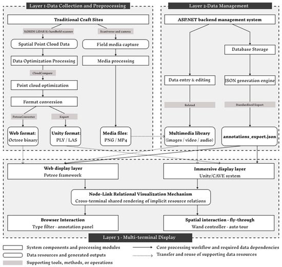
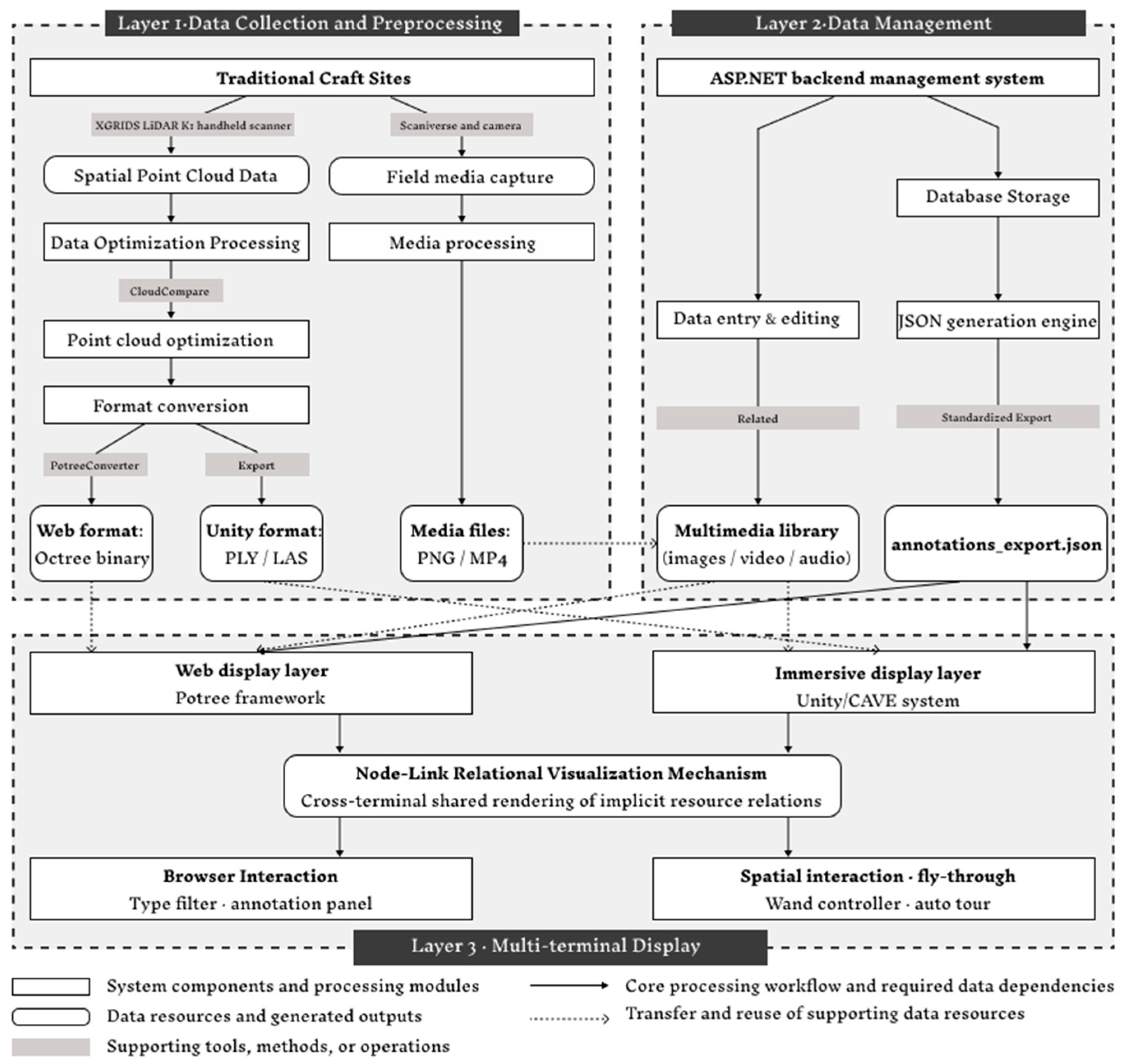
To address the three design requirements outlined above, this study developed a framework comprising three components: data preparation, resource organization, and multi-terminal presentation (Figure 4). The data preparation component applies appropriate representation and preprocessing methods to different types of resources; the resource organization component records resource attributes, spatial locations, media paths, and relationship information within a unified structure; and the presentation component uses the same data structure to generate interfaces and interactions adapted to the Web and CAVE environments.
Figure 4.
Overall architecture of the proposed multi-terminal digital preservation framework.
3.3.1. Digital Representation and Data Preparation
The Sanyi Tie-Dyeing Factory contains architectural and production spaces at the site scale, tools and equipment at the object scale, as well as craft processes and personal narratives that cannot be directly represented by geometric data. Therefore, a single digital representation method is insufficient to cover all types of information. This study adopts a layered representation strategy: point clouds are used to record the overall spatial structure of the site, textured models are used to supplement surface information of selected objects, and videos, interviews, and historical materials are used to document craft processes and related narratives.
According to the classification of heritage 3D modeling proposed by Radanović et al., reality-based models mainly include point clouds and textured meshes, whereas parametric models construct object-based representations through manual modeling and semantic definition [21]. For traditional handicraft sites such as the Sanyi Tie-Dyeing Factory, which contain multiple production spaces, complex equipment, and irregular spatial layouts, this study primarily aims to establish a continuous spatial reference and preserve the three-dimensional coordinates of the surveyed environment for subsequent spatial positioning and resource attachment, rather than constructing a complete architectural model. Therefore, point clouds were adopted as the fundamental representation at the site scale. Point clouds directly preserve spatial coordinate information acquired from reality-based recording and have been widely applied in the documentation of complex heritage environments [8,22].
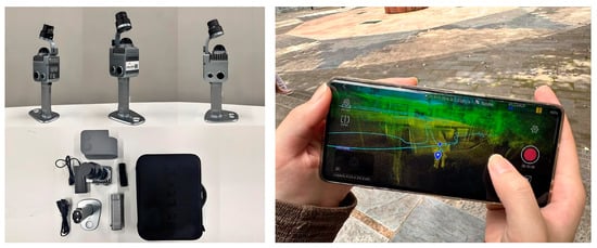
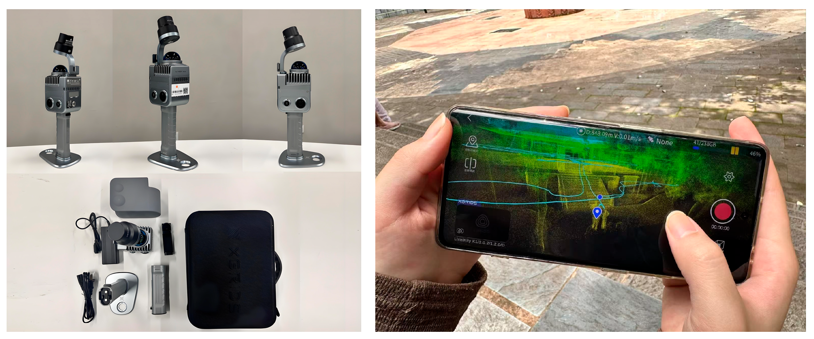
For data acquisition, we adopted the Lixel K1 handheld scanner (manufactured by XGRIDS, Shenzhen, China). The device integrates LiDAR and panoramic imaging modules to capture colored 3D point clouds [23] (Figure 5). Compared with conventional terrestrial scanning methods that require fixed scanning positions, sequential setup, and subsequent registration of multiple scan stations, handheld mobile scanning is more suitable for the conditions of this study, where the factory contains complex spatial layouts, constrained circulation areas, and limited fieldwork time. During acquisition, the device generated continuous point clouds through real-time positioning and automatic registration, while providing guidance on areas requiring additional scanning according to coverage conditions. This allowed researchers to conduct continuous recording across production spaces with different corridor widths, narrow areas between looms, and open drying areas.
Figure 5.
XGRIDS LiDAR K1 handheld scanner and the point cloud preview on the mobile application during field data collection.
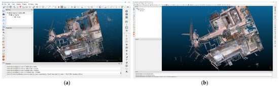
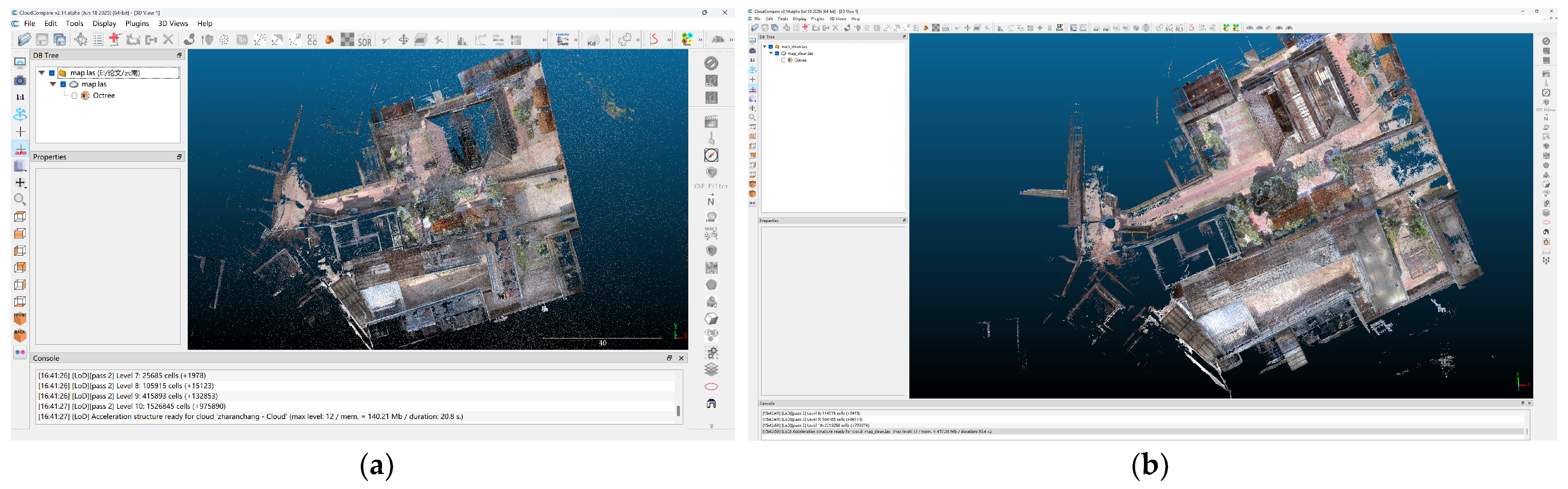
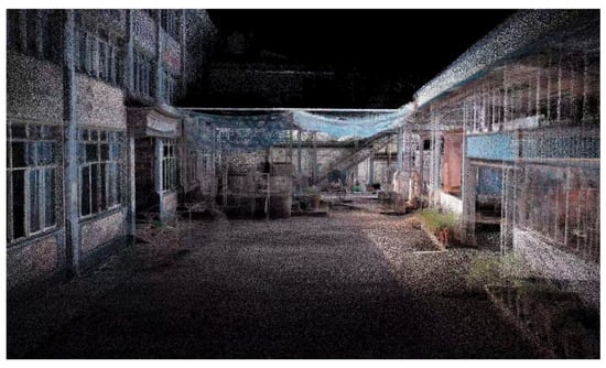
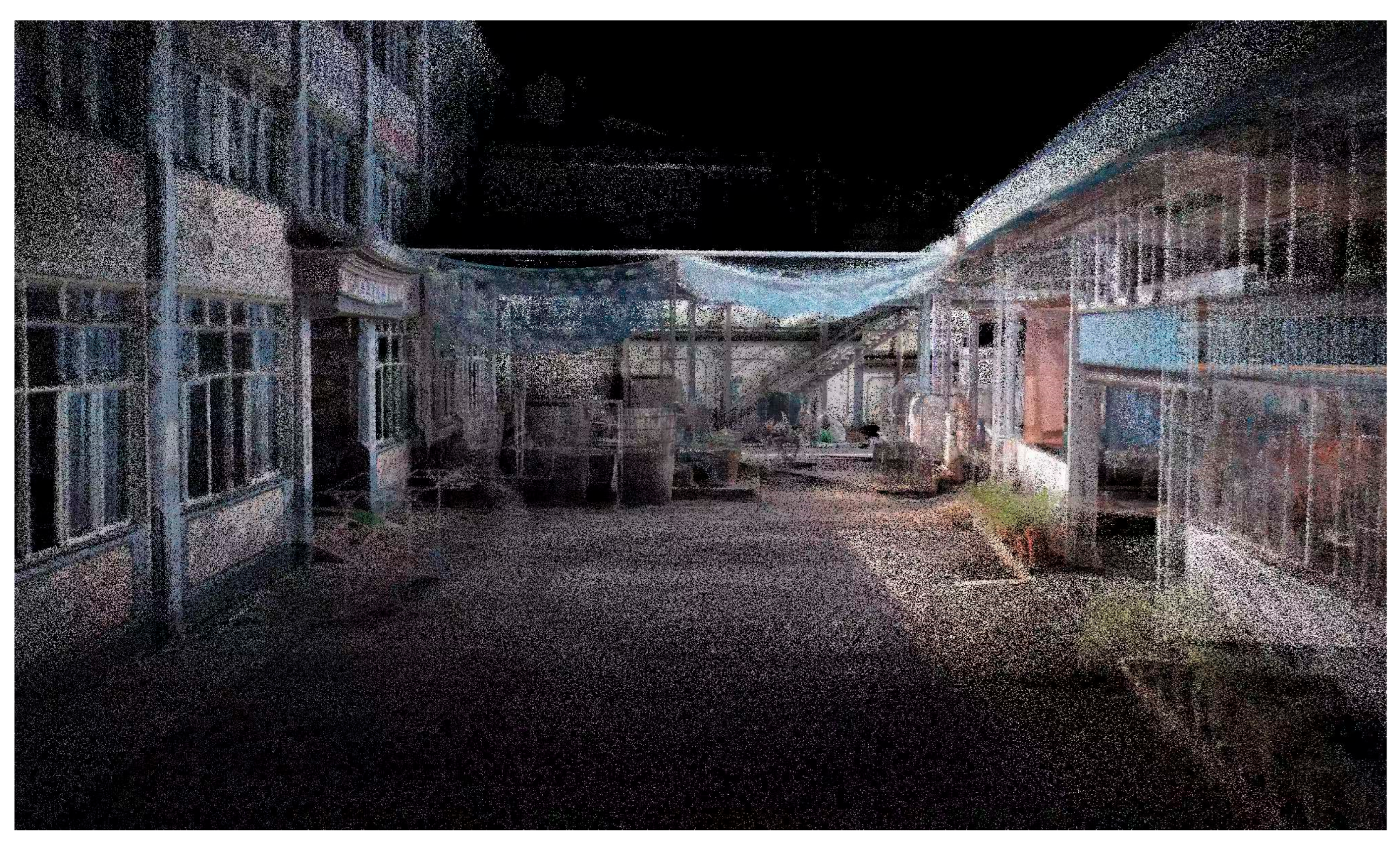
After acquiring the raw point-cloud data of the site, CloudCompare v2.14.alpha was used to perform spatial cropping, outlier removal, and voxel-based downsampling (Figure 6 and Figure 7). The processed data were then converted into two derived point-cloud formats: a hierarchical point-cloud structure suitable for loading in Potree-based web visualization and a PLY format suitable for reading in Unity. Although the two terminals use different derived point-cloud files, they share the same resource descriptions, spatial coordinates, and relationship data.
Figure 6.
Point cloud optimization in CloudCompare: (a) raw point cloud before processing; (b) optimized point cloud after cropping, noise removal, and voxel downsampling.
Figure 7.
Overview of the partial point cloud of Sanyi Tie-Dyeing Factory.
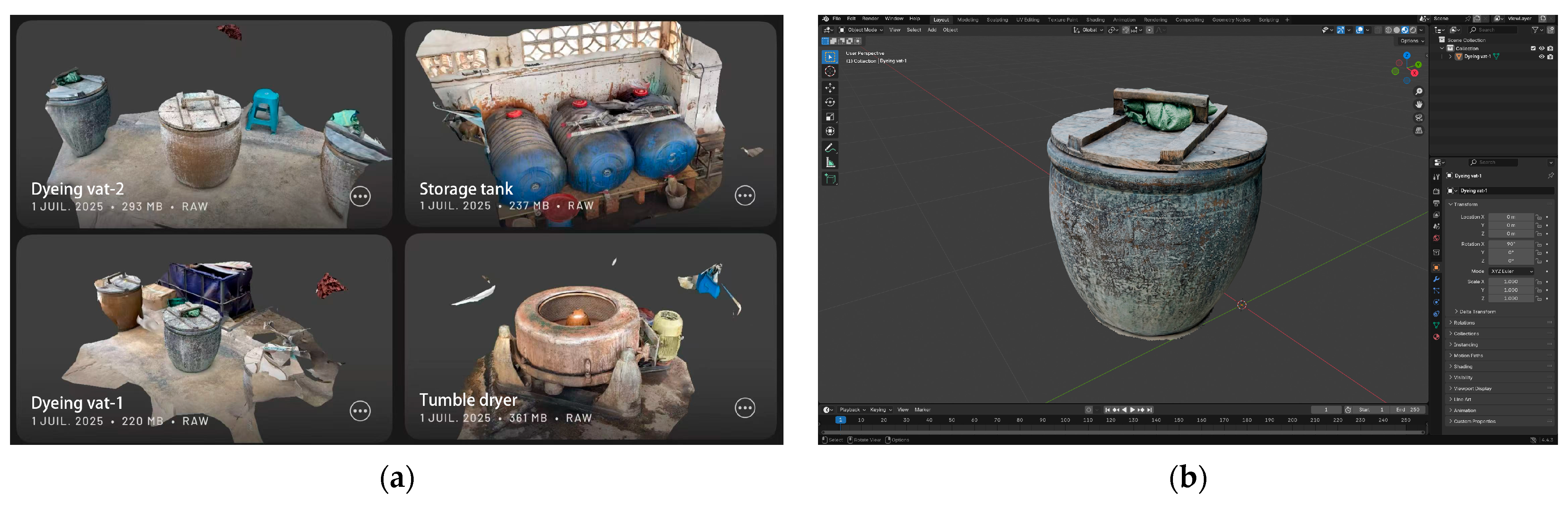
For objects such as dye vats, spin-dryers, dye sticks, and drying racks, surface textures, material conditions, and traces of use provide additional information for understanding craft processes. However, the scene-level point cloud mainly serves as a spatial reference and cannot provide continuous surface details. Therefore, we further employed a mobile 3D scanning method to acquire textured models of selected objects.
Close-range photogrammetry can generate high-quality object models, but it generally requires systematic multi-view image acquisition and subsequent reconstruction processing. Considering the limited fieldwork time in this study, some objects were only intended to supplement information regarding appearance and material conditions. Therefore, Scaniverse was adopted as a rapid method for on-site acquisition and textured model generation. Since these models were primarily used for visual supplementation rather than dimensional measurement or detailed geometric analysis, their main purpose was to provide information regarding object appearance, materials, and states of use.
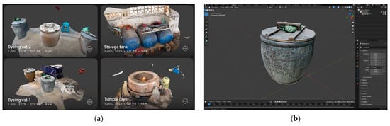
Some scanned models contained local incompleteness and required further mesh optimization, which could be performed through necessary cropping and refinement in 3D modeling software such as Blender (version 4.4.3, Figure 8). As we did not conduct accuracy evaluations of these mobile scanning models, they were used exclusively for visual supplementation and were not applied to dimensional measurement or geometric analysis.
Figure 8.
Object-level mesh scanning and refinement: (a) scanned mesh model of production tools; (b) model trimming in Blender.
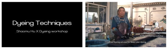
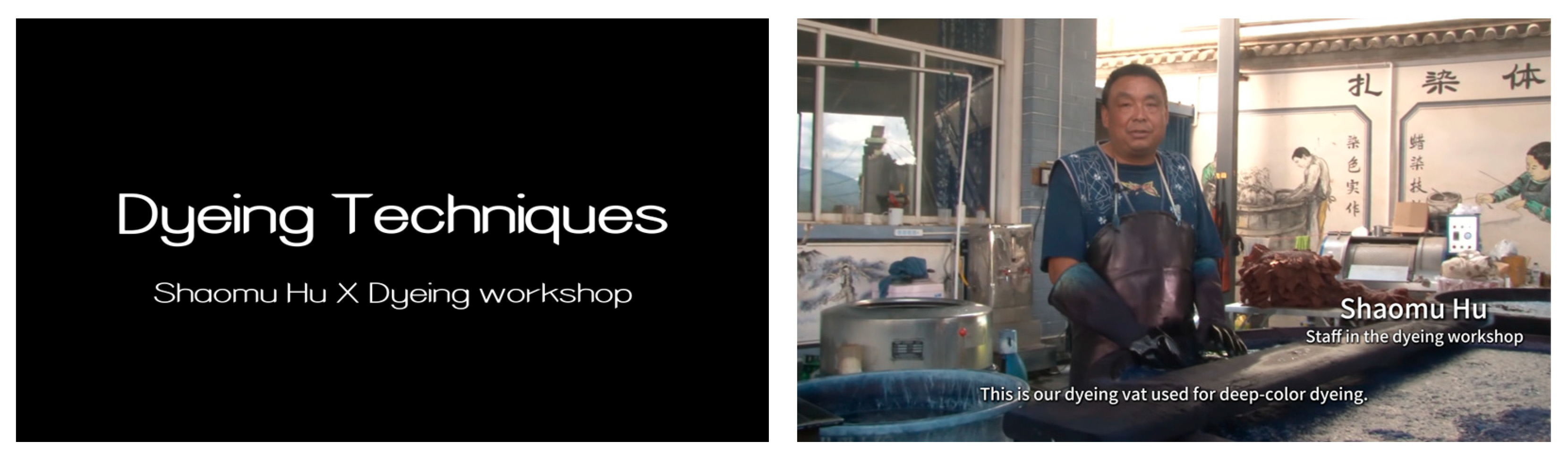
Images were organized into categories including materials, objects, historical records, and practitioners. Interview recordings and craft-process videos were further segmented by topic into approximately 30–120 s clips, allowing each segment to be associated with corresponding craft processes, practitioners, objects, or spatial nodes (Figure 9).
Figure 9.
Screenshot from the oral history interview video Stories of Hands-on Dyeing Demonstration by Hu Shaomu.
In this way, point clouds primarily answer “where resources are located,” images and object models supplement information about “what the objects are,” and videos and interviews document “how practices are carried out” along with related personal narratives. Under the unified spatial reference, different data types collectively provide the foundation for subsequent resource organization and presentation.
3.3.2. Resource Organization and Relationship Representation
After completing data preparation, this study further utilizes point-cloud annotation to establish a resource organization structure, in which resource attributes, spatial locations, and resource relationships are recorded within a unified data structure. This enables different types of materials to be managed and accessed within the same 3D environment.
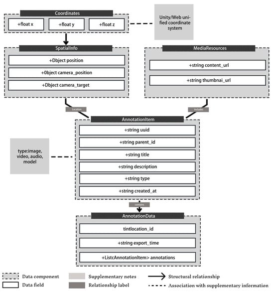
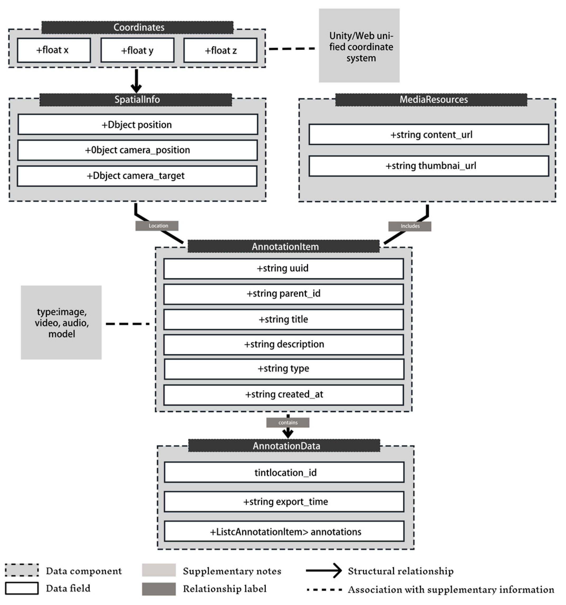
The resource information is organized based on the annotation structure of the Potree framework. Each annotation node contains basic information including a unique identifier, title, description, resource type, resource path, and spatial position. Among these fields, the resource type is used to distinguish different media formats, such as images, videos, audio, and 3D models; the resource path links the corresponding digital files; and the spatial position field records the 3D coordinates (x, y, z) of the annotation point within the point-cloud coordinate system. Combined with camera position and target point parameters, these spatial attributes enable scene localization and viewpoint transition after users select a node (Figure 10, Table 2). Through this approach, resource information is associated with specific spatial locations, allowing users not only to explore the 3D environment but also to access craft-related materials attached to particular locations.
Figure 10.
Schematic diagram of the JSON annotation data structure.
Table 2.
JSON semantic annotation data structure: field definitions and descriptions.
Beyond the basic annotation structure, this study further extends the data model by incorporating resource categories and relationship information to represent associations among different resources. First, the category field is introduced to classify resources, including tie-dyeing processes, plants and dyes, practitioners and artisans, historical photographs, and objects within the factory. This enables the filtering and browsing of resources by category. Second, the relations field records connections among related nodes, with relationships represented through the identifiers of target nodes. This extension allows users to navigate from one spatial node to other related resources, supporting place-based associative browsing.
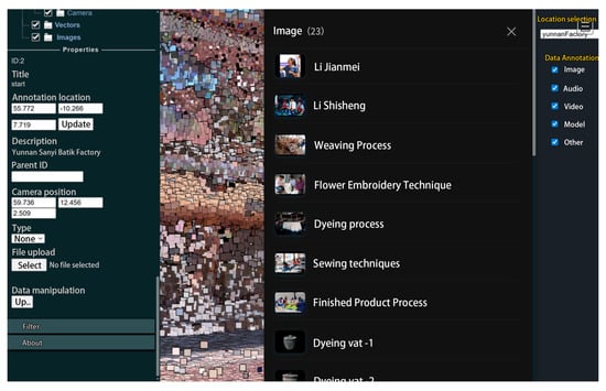
Based on this data structure, this study extends the Potree.js visualization framework to enable the reading of additional resource categories and relationship information, and implements resource classification display, multimedia access, and related-node visualization within the point-cloud environment (Figure 11). Compared with a conventional annotation-based browsing approach that only provides information attached to individual points, this extension enables users to further access related craft processes, materials, practitioners, and historical records starting from spatial locations, thereby enhancing the organization of information within the 3D environment.
Figure 11.
Annotation data entry interface.
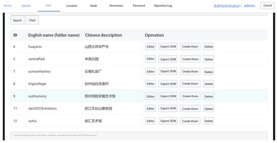
To support continuous resource updating and maintenance, this study further developed an ASP.NET-based backend management system (Figure 12). The system provides functions for resource entry, node editing, information maintenance, and JSON file export, allowing researchers to update resource content without directly modifying the front-end application. The structured data files generated by the backend management system can be accessed by different presentation terminals, supporting a workflow in which resources are organized once and reused across multiple presentation environments.
Figure 12.
Backend management system.
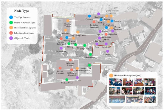
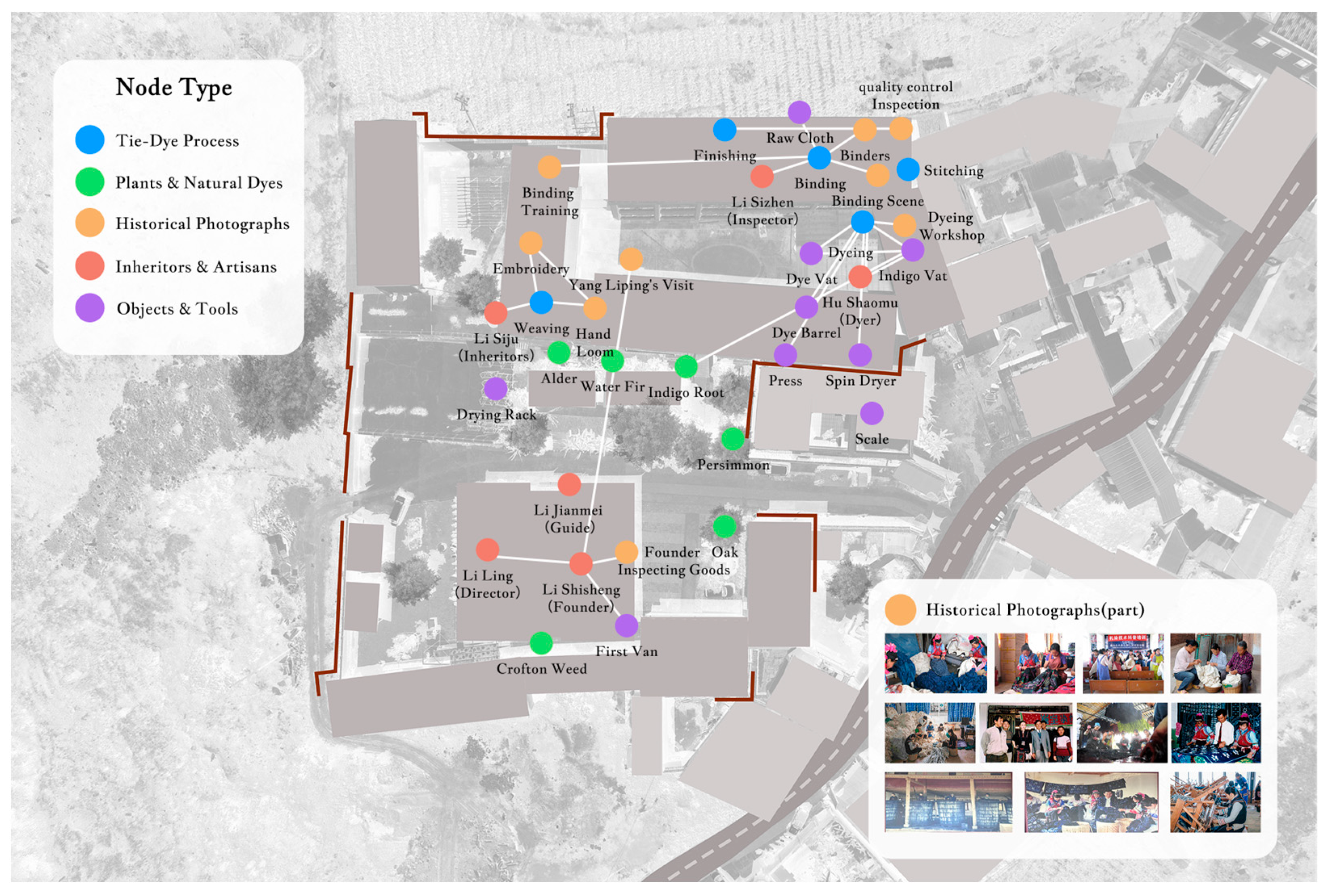
The digital archive constructed in this study for the Sanyi Tie-Dyeing Factory comprises 64 annotation points in total, of which 38 semantic nodes carry media resources (Table 3, Figure 13), revealing the interconnected network of related nodes.
Table 3.
Statistics of semantic nodes with media resources in the Sanyi Tie-Dyeing Factory archive.
Figure 13.
Aerial view of the semantic nodes and relational links embedded in the 3D scene of the Sanyi Tie-Dyeing Factory.
3.3.3. Multi-Terminal Presentation and Implementation
This study implemented a multi-terminal presentation system designed for different application scenarios, including a Web-based terminal for remote access and resource dissemination, and a CAVE immersive terminal for on-site experience and spatial perception. Both terminals share the same resource organization structure and map spatial data, media resources, and relationship information into their respective presentation environments through different parsing and rendering methods. This design enables the same digital resources to be reused across different terminals without requiring separate content preparation, while allowing each presentation environment to adopt interaction methods suited to its own characteristics.
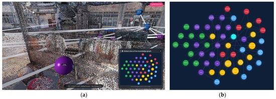
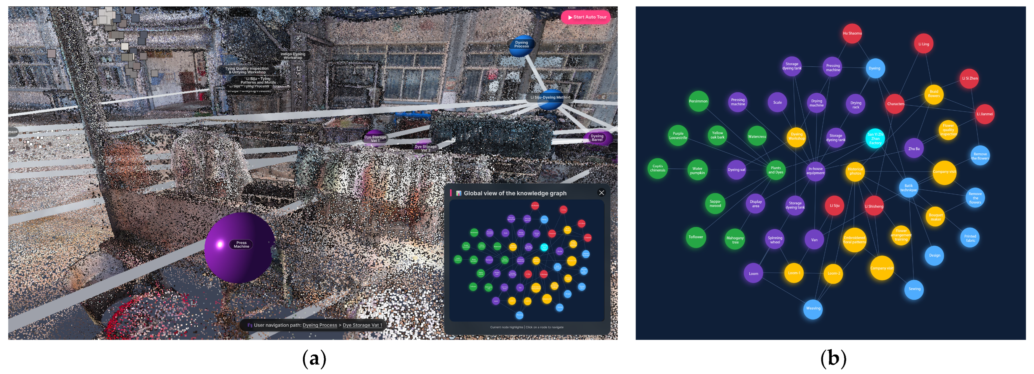
To enhance users’ understanding of the relationships among different resources, this study further implemented a node–link relationship visualization mechanism based on the annotated data. This mechanism transforms the connections recorded through the relations field among resource nodes into visible spatial relationships, allowing users to directly perceive associations among different resources while exploring the 3D scene. Unlike knowledge graphs designed for logical reasoning and inference, this mechanism primarily serves resource exploration and relationship understanding within heritage sites, expressing connections among resources through the combination of node categories, spatial locations, and relational links.
Within the 3D environment, resource nodes are embedded into the point-cloud scene and differentiated according to the category field. Spatial links are generated between nodes with recorded relationships, forming a relational network corresponding to the site context. For example, in the dyeing workshop, users can not only locate specific objects such as dye vats, but also observe their connections with dyeing processes, plant dyes, and related practitioner records. Since a 3D perspective is constrained by the current field of view, the Web-based terminal additionally provides a 2D relational navigation view to display the complete node connection structure. Implemented with D3.js (version 7.9.0), this view presents resource nodes and their relationships through a 2D layout and is linked with the 3D scene. When a user selects a node, the system simultaneously triggers 3D viewpoint positioning, node highlighting, and information panel display, allowing users to switch between the overall relational structure and specific spatial locations (Figure 14).
Figure 14.
Node–link relational visualization mechanism: (a) 3D scene-embedded graph; (b) 2D force-directed graph navigation.
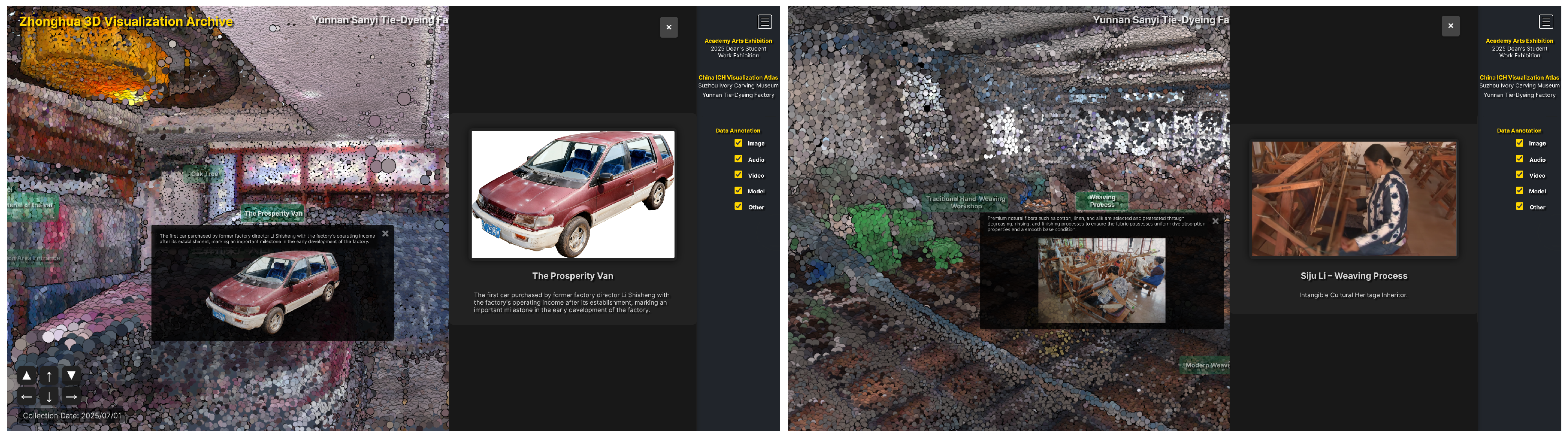
The Web-based terminal was developed based on the Potree framework to support point-cloud scene exploration, spatial annotation access, and multimedia resource retrieval. Compared with virtual tour platforms designed for non-professional users, such as 3DVista [24] and Krpano [25], through the Potree framework and WebGL technology, complex 3D scan data are transformed into lightweight resources that run smoothly on mobile devices or ordinary PC browsers, substantially lowering the technical barrier to public participation in ICH preservation. This mode breaks the constraint of physical space—not only providing “contactless” access for audiences who cannot visit the site in person, but also, through integrated interactive navigation and a multimedia narrative layer, transforming dry point cloud geometry into a tangible and engaging cultural asset (Figure 15). In the Web-based terminal, users can explore the overall factory environment through spatial navigation and access corresponding images, videos, audio recordings, and 3D models by selecting annotation nodes or related-resource links provided in the information panels of individual nodes (Figure 16).
Figure 15.
Web-based point cloud viewer with semantic annotation panel and multimedia content display.
Figure 16.
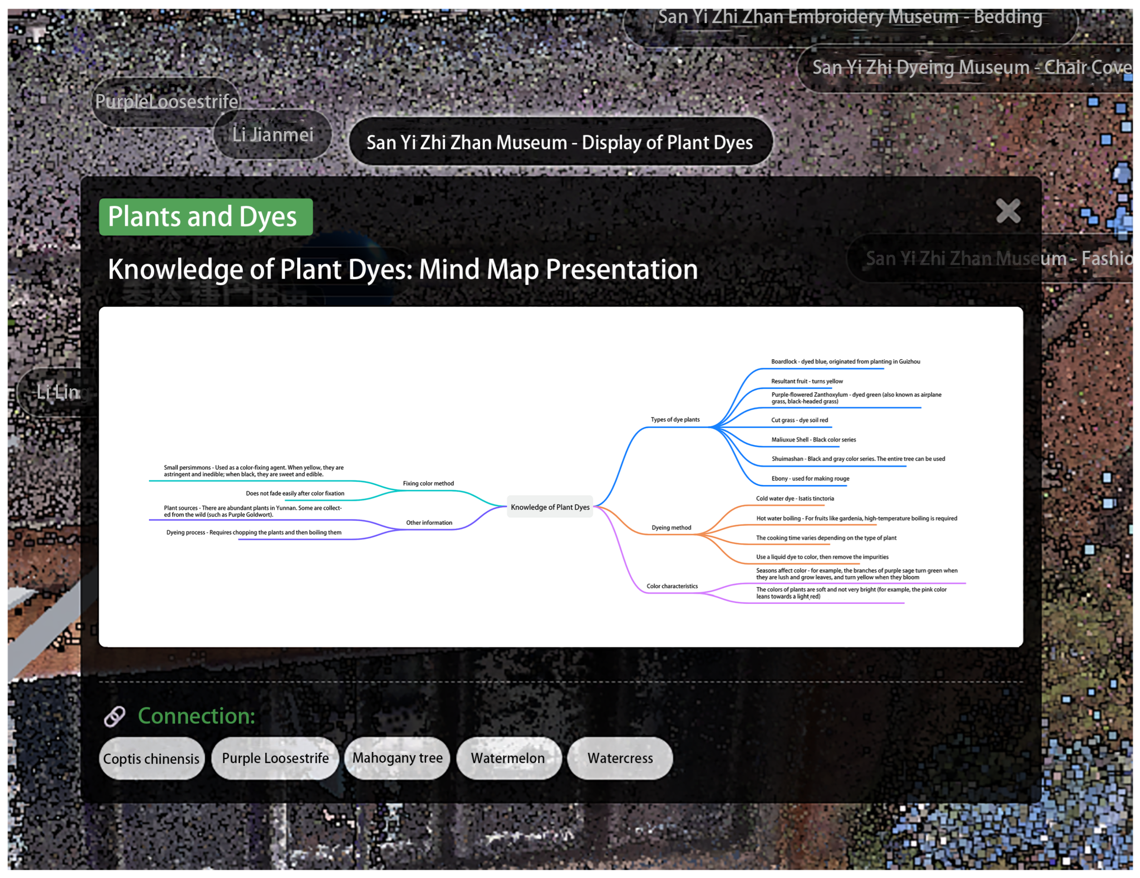
Web-end relation-jump list (pills shown at the bottom of an annotation pop-up).
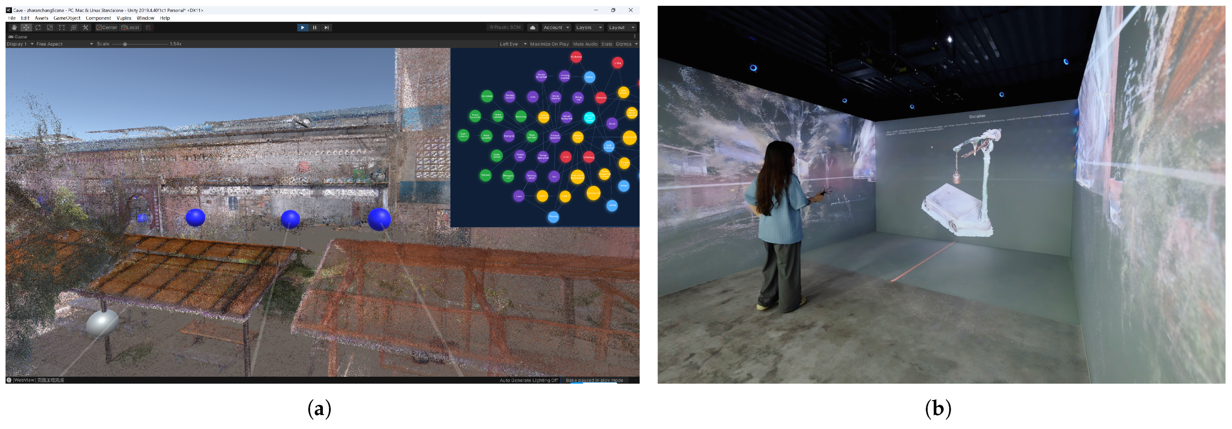
The CAVE terminal was developed based on the Unity platform (version 2019.4.40f1c1) to provide an immersive spatial experience. It reads the same resource description data as the Web-based terminal and generates corresponding presentation content according to spatial coordinates, viewpoint parameters, and media paths. Unlike the Web-based terminal, which emphasizes remote access and resource browsing, the CAVE terminal uses a large-scale display environment to enhance users’ perception of site scale, spatial layout, and resource relationships. Users can explore the production spaces within the immersive point-cloud environment and access craft-related materials, practitioner interviews, and object information attached to different spatial locations through interactive operations. Meanwhile, the relationship visualization mechanism is also extended to the CAVE environment, allowing connections among resource nodes to be presented within the immersive spatial context (Figure 17).
Figure 17.
Unity-based CAVE immersive visualization system: (a) embedded 3D semantic graph and force-directed navigation graph in Unity; (b) CAVE display of the point cloud scene of Sanyi Tie-Dyeing Factory.
Through the above implementation, the framework enables the transition from unified resource organization to multi-environment presentation. Based on the shared resource description structure, the Web-based and CAVE terminals adapt their interaction methods and presentation forms according to different application scenarios, thereby supporting the continued use and reuse of digital resources from traditional handicraft transmission sites.
4. User Perception Evaluation and Expert Feedback
To examine the application performance of the proposed framework in digital presentation of traditional handicrafts, this study conducted a user perception survey and combined expert feedback to analyze the framework’s presentation capability and application value. Since the Web-based and CAVE terminals share the same resource organization structure and presentation content, the CAVE immersive presentation was selected as the primary evaluation object to investigate how spatial presentation and resource relationship visualization mechanisms influence users’ understanding of information within traditional handicraft sites.
4.1. Evaluation Design
The user evaluation was conducted through a questionnaire survey. The evaluation material was based on the Unity-developed CAVE presentation system, which fully demonstrated the core functions of point-cloud scene exploration, spatial annotation, multimedia resource access, and node–link relationship visualization. To expand participant coverage, in addition to on-site experiences, the research team provided a recorded demonstration video of the system experience, allowing more participants to understand the complete presentation process before completing the questionnaire.
The questionnaire scale was developed based on previous studies related to digital heritage presentation, immersive experiences, and user interaction. It consisted of five evaluation dimensions and 15 Likert-scale items (1 = strongly disagree, 5 = strongly agree) (Table 4).
Table 4.
User perception questionnaire dimensions and items.
Dimension A, “Contextual Presence,” was used to evaluate the effectiveness of point-cloud scenes and spatial navigation in presenting the craft production environment, referring to studies on immersion and presence [9,26]. Dimension B, “Perception of Relationships and Meanings,” evaluated the role of node–link relationship visualization in supporting the understanding of connections among resources, based on heritage interpretation theories [27,28]. Dimension C, “Perception of Information Understanding and Cultural Cognition,” assessed the extent to which digital presentation supported users’ understanding of craft-related information, referring to situated cognition studies [5,6]. Dimension D, “Information Clarity,” evaluated the comprehensibility of information organization and interaction processes based on the usability definition of ISO 9241-11 [29]. Dimension E, “Interest and Intention,” assessed users’ willingness for further experience and dissemination based on the Technology Acceptance Model [30].
4.2. Participants
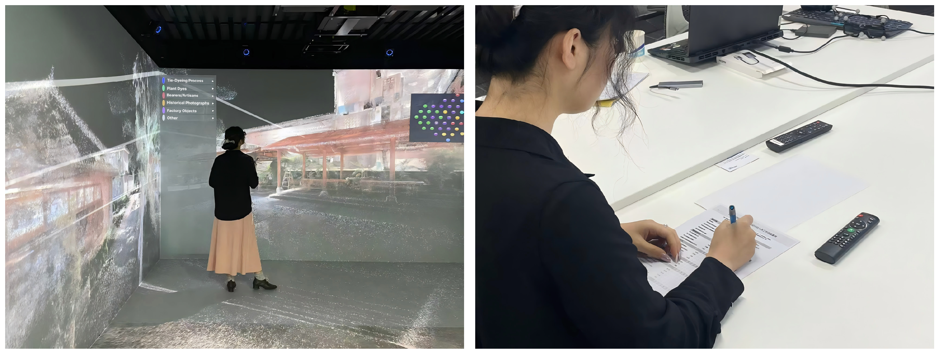
A total of 61 participants were recruited, and 60 valid questionnaires were collected, resulting in an effective response rate of 98.4%. Among the participants, 10 were university students, accounting for 16.7% of the total sample. These participants experienced the system in the laboratory environment through an on-site CAVE experience (Figure 18). To expand participant coverage, a recorded system demonstration was also provided, allowing participants from different backgrounds to understand the presentation process online and complete the questionnaire.
Figure 18.
Participants experiencing the Unity-based CAVE system and completing the user perception questionnaire in the laboratory environment.
The sample consisted of the general public (6.7%), cultural or design-related practitioners (50.0%), and intangible cultural heritage-related practitioners (26.7%). Most participants were aged between 18 and 35 years, accounting for 78.3% of the sample.
4.3. Reliability Analysis
To examine the internal consistency of the user perception scale, Cronbach’s α coefficient was calculated for each dimension and the overall questionnaire. The results are presented in Table 4. The overall questionnaire contained 15 items, with a Cronbach’s α value of 0.909, indicating good internal consistency (Table 5).
Table 5.
Internal consistency analysis of the user perception questionnaire.
Among the individual dimensions, Information Clarity (α = 0.808) and Interest and Intention (α = 0.729) demonstrated relatively high reliability. Perception of Information Understanding and Cultural Cognition (α = 0.695) was close to the commonly accepted threshold of 0.70. Although Contextual Presence (α = 0.597) and Perception of Relationships and Meanings (α = 0.616) showed relatively lower values, they remained within an acceptable range. Further analysis of the average inter-item correlations indicated that values across dimensions ranged from 0.32 to 0.58, consistent with commonly recommended ranges for short scales [31,32].
4.4. Descriptive Statistics
To analyze participants’ perceptions across different evaluation dimensions, this study calculated the mean scores of each dimension and used the midpoint value of 3 on the five-point Likert scale as the reference value. One-sample t-tests were conducted to examine whether the scores of each dimension significantly differed from the midpoint (Table 6).
Table 6.
Descriptive statistics and one-sample t-test results of user perception scores.
Participants showed positive evaluations across all dimensions, with mean scores exceeding 4.00 for each dimension. Among them, Perception of Relationships and Meanings received the highest score (M = 4.11, SD = 0.57), followed by Information Clarity (M = 4.07, SD = 0.76) and Perception of Information Understanding and Cultural Cognition (M = 4.05, SD = 0.64). Contextual Presence (M = 4.02, SD = 0.63) and Interest and Intention (M = 4.00, SD = 0.70) received slightly lower scores but remained at a high level overall.
The one-sample t-test results showed that scores for all five dimensions were significantly higher than the midpoint value of 3 (p < 0.001), indicating that participants generally recognized the effectiveness of the proposed framework in spatial experience, resource relationship representation, and information communication.
4.5. Expert Feedback
In addition to user perception evaluation, this study invited four experts from the fields of digital heritage, immersive technology, and design to review the framework design, system implementation, and user evaluation results, and collected their feedback and suggestions.
The experts considered that the primary value of the framework lies in its ability to organize multiple types of resources through 3D spatial references, allowing traditional handicraft knowledge to be presented within specific site contexts rather than as isolated media materials. They also recognized the potential value of this integrated approach.
Meanwhile, experts pointed out that the current workflow still requires relatively high costs for data acquisition and content production. In particular, 3D scanning, resource organization, and deployment of immersive presentation environments may create implementation barriers for small and medium-sized cultural institutions. Future work should further explore lightweight deployment approaches and expand user evaluations involving participants from different age groups and backgrounds to improve interaction design and overall user experience.
5. Discussion
5.1. From Digital Recording to Contextual Understanding
The user evaluation showed that Perception of Relationships and Meanings received the highest score among all dimensions (M = 4.11), indicating that participants positively perceived the presentation of relationships among different resources. Compared with presenting individual objects or isolated craft procedures, organizing dyes, tools, processes, practitioners, and production spaces within the same digital environment enabled users to move beyond fragmented information browsing toward a more integrated understanding of craft practices. This result suggests that, for digital presentation of traditional handicrafts, organizing relationships among spatial environments and resources is not only a data management strategy, but also a potential approach for supporting public understanding of craft knowledge.
In addition, the relatively high scores of Contextual Presence (M = 4.02) and Perception of Information Understanding and Cultural Cognition (M = 4.05) indicate that the 3D environment served not merely as a visual reproduction of the site, but also as a spatial reference for organizing multimedia information. By exploring the site environment, users could access related objects, craft processes, and practitioner records, thereby establishing connections between digital content and the real production context. Expert feedback further suggested that the value of the framework lies in transforming traditional handicraft information from scattered media resources into presentation content with spatial relationships and narrative structures, providing a possible approach for helping remote audiences understand craft contexts.
From an application perspective, the main contribution of the framework lies in providing a contextualized presentation approach for the public dissemination of traditional handicrafts. For general audiences, students, and non-professional users interested in traditional culture who may not have direct access to production sites, the framework reduces spatial barriers to engaging with traditional craft knowledge through Web-based and immersive presentation environments. Meanwhile, informal interactions with visitors during public exhibitions also suggested that combining spatial exploration, multimedia narratives, and relationship visualization may enhance non-professional users’ interest in and understanding of craft content.
5.2. Transferability of the Framework Across Different Craft Contexts
Beyond the Sanyi Tie-Dyeing Factory case, we further applied the proposed framework to the Suzhou Xiangyun Ivory Carving Museum to examine its applicability across different traditional handicraft contexts. The Suzhou Xiangyun Ivory Carving Museum is a municipal-level transmission base for the recognized ICH craft of “Su-style ivory carving”, with over a thousand items in its collection. The data collected included a point cloud of the museum, high-density mesh models of artifacts, and oral-history recordings and operation videos of bearer Ding Xuefang.
However, tie-dyeing and ivory carving differ significantly in terms of cultural characteristics, preservation requirements, and production processes. Tie-dyeing centers on plant-based dyeing techniques, with craft knowledge distributed among dye vats, plants, looms, and the stitching networks across villages; therefore, its contextual value lies in the relationships formed through the distribution and integration of multiple resources. In contrast, ivory carving focuses on fine carving practices, with knowledge embodied in carving techniques, manual force control, and polishing experience; its contextual value lies primarily in the transformation process from rough blanks to finished works.
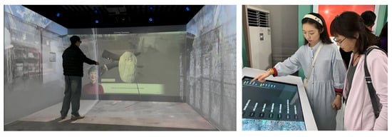
Situated learning research further emphasizes that knowledge acquisition is closely related to guidance from experienced practitioners, observation, and participation in specific practice processes [1,2,5]. Accordingly, the overall framework, including data acquisition, data management, and multi-terminal presentation design, was directly transferred to the ivory carving case. However, additional modules of “guided instruction” and “craft operation” were introduced in the CAVE presentation. Users could watch virtual human-guided demonstrations of carving procedures and interact with the system through controllers to experience specific ivory carving steps, thereby increasing the level of interaction.
Therefore, the proposed framework should be understood as a general workflow for traditional handicraft sites rather than a fixed presentation solution for a specific craft. Different craft types can adjust interaction methods and presentation priorities according to their own knowledge structures while maintaining the same resource organization foundation. Previously, the Web-based outcomes of both the Sanyi Tie-Dyeing Factory and the Suzhou ivory-carving museum were publicly exhibited at the 2025 World Design Capital Conference (WDCC) in Shanghai, demonstrating the potential of the framework for public dissemination scenarios (Figure 19).
Figure 19.
Craft interaction step in the Unity-based CAVE system at Suzhou Xiangyun Ivory Carving Museum and public exhibition at the 2025 World Design Capital Conference (WDCC), Shanghai.
5.3. Limitations and Future Work
The current framework still requires substantial human involvement in data acquisition and resource organization, including on-site scanning, multimedia collection, material screening, and the establishment of resource relationships. For small-scale intangible cultural heritage sites or grassroots cultural institutions, the complete implementation of this workflow may still involve technical and operational challenges. Future research could explore more lightweight approaches for digital documentation, such as integrating mobile scanning, automated resource organization, and intelligent-assisted annotation methods, to improve the efficiency of the overall workflow.
Beyond resource organization, the design of deeper user interactions and more engaging experiences remains an area for further exploration. The user evaluation conducted in this study mainly reflects participants’ perceptions of the presented content and organizational approaches, while the long-term effects of use among users with different ages and knowledge backgrounds require further investigation. Future work could incorporate gamified interactions, virtual character guidance, and richer interactive experiences to better support broader public engagement with digital heritage.
In addition, the current framework mainly incorporates images, videos, audio recordings, and 3D models as the primary resource types. Future studies may further integrate additional forms of data, such as real-time sensing information, detailed craft process records, and AI-assisted content generation, to support more dynamic and continuously updated approaches to digital heritage documentation.
Author Contributions
Conceptualization, Y.L. and R.W.; methodology, R.W. and Y.L.; software, Y.L.; validation, R.W. and Y.L.; investigation, Q.L. and R.W.; resources, Q.L.; data curation, Y.L. and R.W.; writing—original draft preparation, R.W. and Y.L.; writing—review and editing, R.W. and M.Y.; visualization, R.W., Y.L. and M.Y.; supervision, Q.L.; project administration, Q.L.; funding acquisition, Q.L. All authors have read and agreed to the published version of the manuscript.
Funding
This research was funded by the Open Research Project of the Key Laboratory of Digital Protection and Intelligent Development of Ethnic Cultural Resources of Yunnan Province (Yunnan Arts University), grant number 2024KYP601. The project title is “Research on Knowledge Graph Construction and Visual Interaction Design of Ethnic Cultural Resources”.
Institutional Review Board Statement
Ethical review and approval were waived for this study. The field investigation involved non-invasive observation and voluntary in-depth interviews with informed consent obtained from all participants. No personally identifiable information was collected beyond what participants explicitly agreed to share.
Informed Consent Statement
Informed consent was obtained from all subjects involved in the study.
Data Availability Statement
The data presented in this study are subject to access restrictions. The complete datasets, including raw high-density 3D point clouds and multimodal media resources, are not deposited in a public repository due to storage capacity limits, transmission bandwidth constraints for massive spatial data, and the ongoing nature of our institutional research. Access to specific data segments can be granted upon reasonable request to the authors.
Acknowledgments
The authors would like to thank the Sanyi Tie-Dyeing Factory in Weishan County, Yunnan, China, for providing access to the heritage site and supporting the field data collection. The authors also thank the Key Laboratory of Digital Protection and Intelligent Development of Ethnic Cultural Resources of Yunnan Province (Yunnan Arts University) for their collaboration in the field investigation. We sincerely thank four experts from Shanghai University and East China University of Science and Technology for their valuable feedback and constructive suggestions, which have contributed to the improvement of this study.
Conflicts of Interest
The authors declare no conflicts of interest.
References
- Marchand, T.H.J. Making knowledge: Explorations of the indissoluble relation between minds, bodies, and environment. J. R. Anthropol. Inst. 2010, 16, S1–S21. [Google Scholar] [CrossRef] [Scilit]
- O’Connor, E. Embodied knowledge: The experience of meaning and the struggle towards proficiency in glassblowing. Ethnography 2005, 6, 183–204. [Google Scholar] [CrossRef] [Scilit]
- Smith, L. Uses of Heritage; Routledge: London, UK, 2006; pp. 48–50. [Google Scholar] [CrossRef] [Scilit]
- Kirshenblatt-Gimblett, B. Intangible heritage as metacultural production. Mus. Int. 2004, 56, 52–65. [Google Scholar] [CrossRef] [Scilit]
- Brown, J.S.; Collins, A.; Duguid, P. Situated cognition and the culture of learning. Educ. Res. 1989, 18, 32–42. [Google Scholar] [CrossRef]
- Hutchins, E. How a cockpit remembers its speeds. Cogn. Sci. 1995, 19, 265–288. [Google Scholar] [CrossRef] [PubMed]
- Sylaiou, S.; Liarokapis, F.; Kotsakis, K.; Patias, P. Virtual museums, a survey and some issues for consideration. J. Cult. Herit. 2009, 10, 520–528. [Google Scholar] [CrossRef] [Scilit]
- Remondino, F. Heritage recording and 3D modeling with photogrammetry and 3D scanning. Remote Sens. 2011, 3, 1104–1138. [Google Scholar] [CrossRef] [Scilit]
- Bekele, M.K.; Pierdicca, R.; Frontoni, E.; Malinverni, E.S.; Gain, J. A survey of augmented, virtual, and mixed reality for cultural heritage. J. Comput. Cult. Herit. 2018, 11, 1–36. [Google Scholar] [CrossRef] [Scilit]
- Apollonio, F.I.; Basilissi, V.; Callieri, M.; Dellepiane, M.; Gaiani, M.; Ponchio, F.; Rizzo, F.; Rubino, A.R.; Scopigno, R.; Sobrà, G. A 3D-centered information system for the documentation of a complex restoration intervention. J. Cult. Herit. 2018, 29, 89–99. [Google Scholar] [CrossRef] [Scilit]
- Bruno, N.; Rechichi, F.; Achille, C.; Zerbi, A.; Roncella, R.; Fassi, F. Integration of historical GIS data in a HBIM system. Int. Arch. Photogramm. Remote Sens. Spat. Inf. Sci. 2020, XLIII-B4-2020, 427–434. [Google Scholar] [CrossRef] [Scilit]
- Potenziani, M.; Callieri, M.; Dellepiane, M.; Corsini, M.; Ponchio, F.; Scopigno, R. 3DHOP: 3D Heritage Online Presenter. Comput. Graph. 2015, 52, 129–141. [Google Scholar] [CrossRef] [Scilit]
- Schütz, M. Potree: Rendering Large Point Clouds in Web Browsers. Diploma Thesis, Technische Universität Wien, Vienna, Austria, 2015. [Google Scholar] [CrossRef]
- Abergel, V.; Manuel, A.; Pamart, A.; Cao, I.; De Luca, L. Aïoli: A reality-based 3D annotation cloud platform for the collaborative documentation of cultural heritage artefacts. Digit. Appl. Archaeol. Cult. Herit. 2023, 30, e00285. [Google Scholar] [CrossRef] [Scilit]
- Myers, D.; Dalgity, A.; Avramides, I. The Arches heritage inventory and management system: A platform for the heritage field. J. Cult. Herit. Manag. Sustain. Dev. 2016, 6, 213–224. [Google Scholar] [CrossRef] [Scilit]
- Wang, X.; Gong, Y.; Myers, D.; Wang, S. Arches Dunhuang: Heritage inventory system for conservation of grotto resources on the Gansu section of the Silk Road in China. Int. Arch. Photogramm. Remote Sens. Spat. Inf. Sci. 2021, XLVI-M-1-2021, 837–843. [Google Scholar] [CrossRef] [Scilit]
- Yamaguchi Center for Arts and Media (YCAM). Incomplete Niwa Archives. Available online: https://special.ycam.jp/niwa/2020/en/ (accessed on 6 August 2026).
- Chinese Intangible Cultural Heritage Gene Database [Zhongguo Feiwuzhi Wenhua Yichan Jiyin Shujuku]. Available online: https://db.traditionowlab.cn/ (accessed on 6 August 2026). (In Chinese)
- Fan, T.; Wang, H.; Hodel, T. CICHMKG: A large-scale and comprehensive Chinese intangible cultural heritage multimodal knowledge graph. Herit. Sci. 2023, 11, 115. [Google Scholar] [CrossRef] [Scilit]
- China Intangible Cultural Heritage Network. Bai Ethnic Tie-Dyeing Techniques [Baizu Zaran Jiyi]. Available online: https://www.ihchina.cn/project_details/14304.html (accessed on 1 May 2026). (In Chinese)
- Radanović, M.; Khoshelham, K.; Fraser, C.S. Geometric accuracy and semantic richness in heritage BIM: A review. Digit. Appl. Archaeol. Cult. Herit. 2020, 19, e00166. [Google Scholar] [CrossRef] [Scilit]
- Grilli, E.; Remondino, F. Classification of 3D digital heritage. Remote Sens. 2019, 11, 847. [Google Scholar] [CrossRef] [Scilit]
- XGRIDS. Lixel K1 Support and Downloads. Available online: https://www.xgrids.com/support/download?page=K1 (accessed on 6 August 2026).
- 3DVista. Virtual Tour Pro. Available online: https://www.3dvista.com/en/products/virtualtour/ (accessed on 6 August 2026).
- krpano. krpano Panorama Viewer. Available online: https://krpano.com/ (accessed on 6 August 2026).
- Witmer, B.G.; Singer, M.J. Measuring presence in virtual environments: A presence questionnaire. Presence Teleoperators Virtual Environ. 1998, 7, 225–240. [Google Scholar] [CrossRef] [Scilit]
- Moscardo, G. Mindful visitors: Heritage and tourism. Ann. Tour. Res. 1996, 23, 376–397. [Google Scholar] [CrossRef] [Scilit]
- Falk, J.H.; Storksdieck, M. Using the contextual model of learning to understand visitor learning from a science center exhibition. Sci. Educ. 2005, 89, 744–778. [Google Scholar] [CrossRef] [Scilit]
- ISO 9241-11:2018; Ergonomics of Human-System Interaction—Part 11: Usability: Definitions and Concepts. International Organization for Standardization (ISO): Geneva, Switzerland, 2018.
- Davis, F.D. Perceived usefulness, perceived ease of use, and user acceptance of information technology. MIS Q. 1989, 13, 319–340. [Google Scholar] [CrossRef] [Scilit] [PubMed]
- Briggs, S.R.; Cheek, J.M. The role of factor analysis in the development and evaluation of personality scales. J. Pers. 1986, 54, 106–148. [Google Scholar] [CrossRef] [Scilit]
- Clark, L.A.; Watson, D. Constructing validity: Basic issues in objective scale development. Psychol. Assess. 1995, 7, 309–319. [Google Scholar] [CrossRef]

Disclaimer/Publisher’s Note: The statements, opinions and data contained in all publications are solely those of the individual author(s) and contributor(s) and not of MDPI and/or the editor(s). MDPI and/or the editor(s) disclaim responsibility for any injury to people or property resulting from any ideas, methods, instructions or products referred to in the content. |
© 2026 by the authors. Licensee MDPI, Basel, Switzerland. This article is an open access article distributed under the terms and conditions of the Creative Commons Attribution (CC BY) license.