


Abstract
Unmanned aerial vehicles (UAVs) are becoming an important platform for precision agriculture, supporting both high-throughput sensing and active field operations such as spraying, monitoring, and phenotyping. However, unlike general UAV applications, agricultural environments impose distinctive challenges due to heterogeneous field structures, canopy occlusion, terrain variation, dynamic disturbances, and strong coupling between navigation performance and task quality. To address this gap, this review presents a systematic analysis of UAV navigation in agricultural environments from a system-level perspective. The review first summarizes the core technical components of agricultural UAV navigation, including sensing, localization, mapping, planning, and control. It then discusses how navigation requirements vary across representative scenarios such as open fields, orchards, and terraced farmland, and examines their roles in key applications including aerial mapping, field monitoring, precision spraying, and close-range orchard operations. In addition, datasets, simulation platforms, and evaluation protocols relevant to agricultural UAV navigation are reviewed. Finally, major challenges are identified, including scene heterogeneity, perception degradation, insufficient task-semantic integration, limited control robustness, and the lack of standardized benchmarks. Future research should move toward robust, task-aware, and modular navigation architectures that support reliable and scalable agricultural UAV deployment.
1. Introduction
With continued advances in productivity and agricultural technology, global population growth is placing increasing pressure on food security [1]. The world population is projected to exceed 9 billion by 2050 and may surpass 10 billion by the end of this century [1,2,3]. Under such pressure, agricultural systems must improve productivity under limited land, water, and labor resources, making agricultural automation and precision agriculture increasingly important for enhancing resource-use efficiency and production resilience [4,5,6]. Precision agriculture relies on continuous sensing, quantitative analysis, and data-driven decision-making to support refined crop and field management [7,8,9,10,11]. In parallel, rapid progress in automation, computer vision, and artificial intelligence [12,13,14,15,16,17,18,19,20,21,22,23,24,25,26,27] has accelerated the deployment of unmanned aerial vehicles (UAVs) as flexible platforms for aerial sensing and field operations across the agricultural production chain [28,29].
Because of their high maneuverability, low-altitude accessibility, and relatively low deployment cost, UAVs have been widely adopted not only in agriculture but also in forestry, geospatial applications, and urban remote sensing [30,31,32,33,34,35]. In these domains, UAVs support tasks such as object detection, mapping, search, and 3D modeling [30,34,36,37,38]. More broadly, practical UAV systems typically rely on onboard vision and related sensors to perceive the environment, support autonomous navigation, and enable task execution [28,39].
In recent years, UAV applications in agriculture have expanded from remote sensing tools to active operational platforms involved in agricultural production. In monitoring tasks, UAVs have been widely used for crop growth assessment, abiotic stress identification, biotic stress detection, and yield estimation, thereby supporting high-throughput phenotyping, breeding, and agricultural decision-making [40,41,42,43,44,45]. Beyond monitoring, UAVs have also progressed in active operations such as precision spraying. Representative studies have demonstrated UAV-based closed-loop workflows that integrate sensing, prescription generation, and spray control, highlighting the transition of UAVs from passive observation platforms to operational systems for agricultural intervention [46,47].
Despite this progress, agricultural UAV deployment remains less mature than UAV applications in non-agricultural domains such as urban mapping, inspection, and general remote sensing, because agricultural environments impose distinct task requirements, engineering constraints, and environmental disturbances [48,49,50]. Unlike many general UAV applications that focus primarily on observation or data acquisition, agricultural UAVs often require tight coupling between sensing, decision-making, and physical task execution. This is particularly evident in operations such as spraying, where payload variation, liquid sloshing, and wind disturbances increase dynamic uncertainty and control difficulty [51]. In addition, agricultural task quality is highly sensitive to flight altitude, speed, and path deviation, since these factors directly affect deposition uniformity, coverage quality, and drift risk [52]. Large-area operations under limited endurance further make coverage planning a key challenge [53], while near-ground flight in the presence of irregular field boundaries, vegetation occlusion, airflow, and dust places higher demands on perception robustness and flight stability [54].
Against this background, navigation is becoming a foundational capability for agricultural UAVs to move from being merely flyable and observable to being reliably task-executable. High-precision localization and trajectory tracking directly affect operational repeatability and spraying consistency, while autonomous agricultural operation further requires the integration of perception, planning, and control under complex environmental conditions [28,46,55,56]. More broadly, agricultural UAV systems are increasingly evolving toward a closed-loop precision-operation paradigm that links perception, decision-making, and execution [57].
Existing reviews have examined agricultural UAVs from multiple perspectives, but most remain focused on application-level themes such as remote sensing, crop monitoring, deep learning-based perception, or spraying systems [44,45,54]. Even broader reviews of agricultural UAVs often treat navigation as an auxiliary module rather than as a system-level problem involving the coordinated interaction of perception, localization, mapping, planning, control, and safety [48]. By contrast, the non-agricultural UAV literature contains a much richer body of work specifically dedicated to autonomous navigation [28]. Therefore, a systematic review of UAV navigation in agricultural environments from a system perspective is still lacking.
To address this gap, this paper presents a systematic review of UAV navigation in agricultural environments from a system perspective (Appendix A). The specific objectives are as follows:
- 1.
- to systematically review and classify the key technological components of UAV navigation in agricultural environments;
- 2.
- to analyze the applicability and development trends of different navigation technologies in relation to representative agricultural operational requirements;
- 3.
- to summarize the major challenges in current agricultural UAV navigation research and discuss possible future directions.
The remainder of this paper is organized as follows. Section 2 describes the key technologies for UAV navigation in agricultural environments. Section 3 discusses the applications of UAV navigation in agricultural environments. Section 4 reviews datasets, simulation platforms, and evaluation protocols for agricultural UAV navigation. Section 5 highlights key challenges and future perspectives. Section 6 concludes the paper.
To provide a system-level overview of the scope of this review, Figure 1 summarizes the hierarchical organization of agricultural UAV navigation, including the relationships among agricultural environments, perception, localization and mapping, planning, and representative task applications. This framework serves as a conceptual roadmap for the subsequent sections.
Figure 1.
Overview of the hierarchical framework of agricultural UAV navigation and its representative task applications.
4. Datasets, Simulation, and Evaluation Protocols
4.1. Data Fusion and Datasets
The core objective of multimodal data fusion in agricultural UAV navigation is to exploit sensor complementarity to improve localization, mapping, obstacle avoidance, and navigation robustness. In this context, fusion should be understood primarily as a navigation-oriented mechanism for enhancing state estimation, environmental perception, and real-time decision-making under occlusion, illumination variation, and GNSS degradation. According to the stage of information flow, fusion strategies are commonly categorized as early fusion, intermediate fusion, and late fusion [143], corresponding to input-level, feature-level, and decision-level fusion, respectively. Early fusion directly integrates multimodal inputs to strengthen cross-modal interaction. Zhao et al. [196] proposed LIF-Seg, a coarse-to-fine camera–LiDAR early fusion network for LiDAR image segmentation with offset correction for spatiotemporal misalignment. Although not developed specifically for UAVs, this paradigm is relevant to low-altitude agricultural UAV navigation, where RGB, LiDAR, and semantic segmentation can support obstacle recognition, risk understanding, and traversable-area segmentation. Intermediate fusion emphasizes feature alignment and joint optimization within a unified state-estimation framework, making it naturally compatible with tightly coupled odometry and SLAM. Zheng et al. [197] proposed FAST-LIVO2, which integrates IMU, LiDAR, and visual measurements through an efficient error-state iterated Kalman filter (ESIKF) for accurate and robust state estimation. Such approaches are particularly suitable for agricultural UAV navigation because they support continuous 6-DoF pose estimation and improved robustness when GNSS becomes unreliable. Late fusion combines independently estimated modality-specific outputs through weighting or consistency constraints, offering modularity and deployment flexibility. Ali et al. [198] proposed a modular late-fusion framework using camera, LiDAR, and radar data for target classification. Although developed in a UGV context, this paradigm is also applicable to embedded agricultural UAV systems by combining the all-weather robustness of radar with the semantic and geometric capabilities of vision and LiDAR for low-altitude risk recognition and obstacle-avoidance triggering. Overall, the significance of these three fusion paradigms lies not in fusion itself, but in their shared ability to improve navigation reliability in heterogeneous agricultural environments.
At the data level, the main bottleneck is no longer data scarcity, but the lack of high-quality, standardized, and reproducible datasets for navigation and sensor fusion. For agricultural UAV navigation, such datasets must support rigorous evaluation of localization accuracy, mapping consistency, and robustness across representative field conditions. Dataset construction should therefore provide: (1) strict time synchronization among visual, LiDAR, IMU, and GNSS data; (2) complete calibration, including intrinsic, extrinsic, and temporal parameters; (3) high-quality ground truth, such as RTK/INS, total station measurements, or high-definition maps and trajectories; (4) task-relevant metadata, including flight altitude and speed, crop type, row orientation, occlusion level, illumination, wind conditions, and radiometric settings; and (5) coverage of scenarios with different difficulty levels, such as plains, hills, and terraced fields, as well as weak-texture, repetitive-structure, and strong illumination-variation conditions. GrapeSLAM [199] provides UAV monocular visual data together with RTK/IMU trajectories for vineyard environments (Figure 14), making it suitable for visual SLAM, SfM, and orchard-navigation research. AgriLiRa4D [90], by contrast, contains 33 sequences of LiDAR, 4D radar, and IMU data across plains, hills, and terraced fields (Figure 15), providing a more systematic benchmark for multimodal SLAM and localization in agricultural UAV applications. Overall, these datasets show that future benchmarks should be designed not merely for multimodal sensing, but for navigation-oriented evaluation under representative agricultural disturbances and scene variability. However, current agricultural UAV navigation datasets still exhibit several important limitations. Most available datasets cover only a limited number of crop types, sensing configurations, or operating conditions, and many lack unified calibration standards, sufficiently accurate ground truth, explicit task annotations, or standardized evaluation splits. In addition, cross-dataset comparability remains weak because scenario definitions, sensor combinations, and reporting protocols are often inconsistent. As a result, although recent datasets have improved data availability, they still fall short of supporting fully standardized and reproducible benchmark evaluation for agricultural UAV navigation.
Figure 14.
GrapeSLAM dataset [199]: (a) side-view video collection; (b) front-view video collection; (c) UAV position and pose trajectories during flights.
Figure 15.
Visualization of the three representative farmland scenarios and their corresponding sensor data [90].
4.2. Simulation and Digital Twin
Simulation is a fundamental tool for validating safety, expanding data scale, and accelerating iteration in UAV navigation and control research. However, different platforms emphasize different aspects: control-loop and dynamic accuracy, ROS-based closed-loop multi-sensor integration, and high-fidelity perception with large-scale training often require different software ecosystems. In general, MATLAB is more suitable for flight dynamics and control-loop modeling [200,201], Gazebo is better suited to ROS-based closed-loop validation and multi-sensor integration [202], and Isaac Sim is more appropriate for high-fidelity perception simulation, synthetic data generation, and large-scale training [203]. In agricultural UAV applications, MATLAB is commonly used for flight control and autopilot or hardware-in-the-loop (HIL) validation [204,205]; Gazebo is frequently used for closed-loop testing of visual SLAM, autonomous navigation, trajectory tracking, and obstacle-avoidance logic [202,206]; and Isaac Sim is more suitable for high-fidelity validation and training of multirotor control and motion-planning algorithms [207,208]. Figure 16 presents a Gazebo-based workflow for click-and-fly navigation in unknown environments, including sensor configuration and ESDF/map visualization in Rviz [206], illustrating a closed-loop validation pipeline of simulation, mapping, planning, and execution.
Figure 16.
Example of UAV navigation in the Gazebo simulator [206]: (a) click-and-fly navigation in an unknown environment (blue: executed trajectory; red: planned global path); (b) UAV model and on-board sensors; (c) a 20 × 20 m world with obstacles and feature-rich textures; (d) visualization of global/local/ESDF maps in Rviz for closed-loop navigation.
Digital twins further extend simulation into an updatable virtual–physical interactive system, in which the environment, platform, and task states are continuously synchronized in virtual space, thereby supporting path planning, risk prediction, online validation, and model transfer. Wu et al. [209] combined digital twins with 3D A* planning to validate UAV navigation and obstacle-avoidance processes in a virtual campus environment. For agriculture, this paradigm is particularly suitable for geometry-sensitive close-range scenarios, such as orchard inter-row flight, greenhouse corridors, sloped or terraced fields, and multi-UAV collaborative field inspection, where it can be used to rapidly assess system-level trade-offs among planning strategy, safety margin, and operational efficiency. At the same time, the key to Sim2Real lies in reducing the gap between simulation and the real world. Recent UAV remote sensing studies have improved transferability through high-fidelity scene reconstruction and diversified rendering [210,211], thereby providing a more practical technical pathway for synthetic data generation, Sim2Real, and Sim2Real2Sim in agricultural navigation. However, even high-fidelity simulation cannot fully reproduce the complexity of real agricultural deployment, including wind-driven canopy motion, illumination variation, GNSS instability, spray interference, terrain irregularity, and communication uncertainty [212,213]. Therefore, simulation results should be interpreted primarily as a controllable pre-validation tool, whereas real-world field deployment remains essential for assessing robustness, transferability, and task-level reliability [214,215]. In this sense, the Sim-to-Real gap in agricultural UAV navigation lies not only in perception realism, but also in the mismatch between controlled virtual validation and long-duration operation under coupled environmental and task disturbances.
4.3. Evaluation Metrics
Since existing studies on agricultural UAV navigation are conducted under heterogeneous platforms, sensing configurations, task settings, and validation protocols, direct metric-level comparison across all methods is often difficult. Therefore, the purpose of this section is not to impose a single unified ranking, but to summarize the most commonly used and practically meaningful evaluation metrics in the literature, so as to provide a clearer analytical basis for interpreting reported results and to support future benchmark design and more standardized cross-study comparison. As summarized in Table 3, the evaluation of agricultural UAV navigation can be organized into six closely related categories: localization and mapping, trajectory tracking, control performance, mission efficiency, safety and robustness, and agronomic task quality. For localization and mapping, the most widely used metrics are absolute trajectory error (ATE) and relative pose error (RPE), which characterize global trajectory deviation and local drift, respectively, and are commonly used in SLAM, VIO, LIO, and fusion-based localization evaluation [216]. For trajectory tracking, representative metrics include RMSE/MAE and cross-track error, which reflect point-wise tracking deviation and lateral line-following quality in tasks such as waypoint following, spraying route tracking, and crop-row navigation [217]. For control performance, settling time and overshoot are commonly used to evaluate response speed and dynamic stability under disturbances, especially for PID-, sliding-mode-, ADRC-, and MPC-based controllers under wind disturbance or time-varying payload conditions [135]. At the mission level, path length and flight time provide compact measures of planning efficiency and operational cost, while success rate, collision rate, and minimum clearance are important for assessing navigation safety and robustness in cluttered or uncertain environments [218]. In addition, because agricultural UAVs are ultimately designed for field operations rather than navigation alone, agronomic task quality must also be considered. Typical indicators include coverage rate, miss rate, overlap rate, spray deposition density, deposition uniformity measured by coefficient of variation (CV), and drift loss, which help translate navigation and control performance into differences in actual operational quality.
Table 3.
Evaluation metrics for UAV navigation in agriculture, covering localization/mapping, tracking/control, mission efficiency, safety/robustness, and task-specific agronomic quality.
5. Discussion
5.1. Challenges
The high heterogeneity of agricultural environments makes it difficult to develop universally transferable UAV navigation solutions. Compared with general low-altitude scenarios, agricultural environments differ markedly in spatial structure, terrain variation, crop morphology, occlusion conditions, and task objectives [1,219]. Open fields emphasize large-area coverage and trajectory repeatability, orchards require canopy-proximal perception and stable flight in narrow corridors, and terraced or mountainous farmlands impose stricter demands on terrain adaptation and flight safety. This strong coupling among scenario, task, and navigation requirements means that existing methods often perform well only under specific conditions and are difficult to transfer reliably across crop types, seasons, and operational modes [124]. Therefore, the key challenge in agricultural UAV navigation is not the isolated performance of individual algorithms, but the lack of a systematic methodology that links environmental characteristics, task requirements, and navigation architecture selection. This also limits the scalability and real-world applicability of current navigation systems, since methods validated in one agricultural scenario often do not transfer reliably across different crops, terrains, and operational conditions.
Perception degradation and unstable localization remain central bottlenecks to robust autonomous navigation in agriculture. Agricultural environments commonly involve weak or repetitive textures, dynamic vegetation, severe illumination variation, GNSS occlusion, and disturbances from dust and airflow [220,221,222]. These factors jointly degrade visual localization, GNSS/RTK positioning, and low-altitude state estimation. More importantly, localization errors propagate beyond the state-estimation layer into mapping, replanning, trajectory control, and task execution, ultimately affecting spraying uniformity, phenotyping consistency, and revisit accuracy [223]. Although multi-sensor fusion improves robustness, its field deployment remains constrained by time synchronization, extrinsic calibration, payload, energy, and computational limitations. As a result, agricultural UAVs still lack localization solutions capable of reliable long-duration operation in complex environments.
Another major challenge is the disconnect between environmental representation, path planning, and agricultural task objectives in current navigation pipelines. Most existing studies still design navigation systems primarily around geometric traversability, collision avoidance, or path executability [224], whereas agricultural operations are more directly evaluated by outcome-oriented indicators such as spraying deposition consistency, stable canopy-relative distance, cross-temporal route reproducibility, and efficient revisiting of pest or disease hotspots [154,225]. Consequently, a geometrically feasible path is not necessarily optimal for agricultural operation. For example, a trajectory that satisfies obstacle-avoidance constraints may still be unsuitable for canopy-proximal variable spraying, while a globally complete coverage route may not support adaptive revisiting of hotspot regions. Overall, current agricultural UAV navigation remains largely geometry-driven, while task semantics such as crop rows, canopy boundaries, risk regions, and no-spray zones are still insufficiently incorporated. A truly closed-loop navigation framework oriented toward agricultural task quality has not yet been established.
Time-varying payloads, wind disturbances, and near-ground operating conditions further increase the robustness requirements of agricultural UAV control systems. During spraying, canopy-proximal inspection, and terrain-following tasks, liquid consumption, liquid sloshing, crosswind disturbances, and low-altitude aerodynamic effects all increase dynamic uncertainty, making conventional fixed-parameter control strategies prone to performance degradation [226,227]. Unlike general UAV missions, control in agricultural scenarios is not only concerned with flight stability, but also directly affects canopy-relative height maintenance, sensing geometry, and spraying-quality consistency [228]. Therefore, the challenge of agricultural UAV control lies in maintaining both state stability and task-output stability, which requires control objectives to extend beyond attitude and position regulation toward robust closed-loop control for operational quality.
Finally, the lack of standardized datasets, unified evaluation protocols, and task-oriented benchmarks limits the comparability and reproducibility of agricultural UAV navigation research. Although several navigation and multi-sensor datasets have emerged for agricultural scenarios, they still suffer from incomplete modality coverage, limited scenario diversity, insufficient ground truth, and scarce task annotations. More importantly, many studies rely on private datasets, heterogeneous platforms, and inconsistent evaluation metrics, making fair comparison across methods difficult [229]. Existing evaluations still focus mainly on localization error, path length, and success rate, while giving insufficient attention to agriculture-specific indicators such as spraying deposition uniformity, revisit consistency, and safety margins in canopy-proximal operations. As a result, the relationship between navigation performance and agricultural task outcomes remains unclear, slowing the transition of agricultural UAV navigation from algorithmic validation to engineering maturity.
5.2. Future Perspectives
Future development of agricultural UAV navigation should shift from single-scenario optimization to systematic architecture design that explicitly accounts for scenario differences. Given the substantial differences among open fields, orchards, and terraced farmlands in spatial structure, occlusion characteristics, and operational objectives, future research should no longer pursue a single universal solution. Instead, it should establish a navigation technology selection framework oriented toward environmental structure and task attributes, in which sensor configuration, localization strategy, map representation, planning method, and control architecture are co-designed. The key is not to identify one optimal algorithm for all scenarios, but to develop a modular navigation system that can be adaptively configured, rapidly deployed, and stably transferred according to the characteristics of agricultural environments.
Future research must also further develop multi-source robust perception and fault-tolerant localization mechanisms for complex agricultural environments. In addition, future agricultural UAV navigation should move toward lightweight, energy-aware, and edge-deployable architectures to support robust localization, planning, and inference under realistic onboard resource constraints [91,230]. At the methodological level, deeper integration of GNSS, vision, LiDAR, IMU, radar, and environmental sensing information is needed to improve the stability of state estimation under weak GNSS, dynamic occlusion, and low-texture conditions [231,232,233]. However, a major gap in current multi-sensor fusion research is that many methods are still developed and evaluated under relatively controlled conditions, while agricultural environments often involve asynchronous sensing, temporary sensor degradation, calibration drift, canopy motion induced by wind, dust or spray interference, and intermittent GNSS blockage. Future fusion frameworks should therefore move beyond accuracy-oriented integration toward uncertainty-aware, fault-aware, and recovery-oriented architectures that can support sensor reweighting, adaptive modality switching, and degradation under dynamic field conditions. At the system level, greater attention should be paid to engineering issues such as time synchronization, extrinsic calibration, fault detection, and switching under degraded operating conditions [234,235]. In particular, the localization system of agricultural UAVs should not focus solely on improving average accuracy, but should emphasize recoverability and robustness during long-duration operations and under complex disturbances. In other words, the goal should evolve from high-precision localization to high-reliability localization.
In perception and environmental modeling, future research may increasingly incorporate general-purpose visual foundation models, such as the DINO series [236,237,238,239] and the SAM series [240], to improve representation generalization and task transferability in agricultural scenarios. Compared with conventional data-driven approaches that depend heavily on task-specific annotations, these models offer potential advantages in weakly supervised representation learning, open-scene segmentation, cross-domain feature extraction, and few-shot adaptation. As a result, they may provide more transferable visual priors for crop-row extraction, canopy-boundary perception, obstacle recognition, traversable-area segmentation, and hotspot localization of disease symptoms. When combined with 3D reconstruction, dense depth estimation, or multi-view geometric modeling [241], they may further support 3D semantic mapping for structural understanding of agricultural environments, thereby improving the modeling of complex canopies, sloped terrain, and low-altitude traversable space. However, their deployment on agricultural UAV platforms still depends on addressing key challenges related to computational cost, real-time performance, cross-season generalization, and multimodal adaptation. Therefore, these models should be regarded as enhancement modules for high-level environmental understanding and task perception, rather than direct replacements for existing navigation pipelines.
Future navigation systems should also evolve toward task-semantic-driven and closed-loop decision-making. Agricultural UAV navigation should not remain limited to geometric maps and feasible paths, but should explicitly incorporate task semantics such as crop rows, canopy structures, pest and disease hotspots, prescription regions, and safety-risk zones into map representations, cost functions, and replanning logic, thereby forming a closed-loop chain of environmental understanding, task planning, and execution feedback. For typical applications such as spraying, monitoring, and phenotyping [242,243], this means that future systems must advance from simply being able to avoid obstacles and reach targets to being able to make optimal decisions around agricultural objectives, thereby unifying navigation performance with operational quality. Another important direction is the tighter integration of UAV navigation with agricultural decision-support systems. In future workflows, prescription maps, disease-risk maps, phenotyping priorities, and stress-monitoring outputs should not merely serve as offline references, but should directly inform route generation, sensing resolution allocation, revisiting strategy, and mission scheduling. Such integration would enable agricultural UAV navigation to evolve from reactive path execution toward decision-informed and agronomy-aware mission adaptation.
At the control level, agricultural UAVs need to evolve from conventional trajectory-tracking control toward intelligent control frameworks that integrate robustness with task adaptability. ADRC is particularly promising in agricultural scenarios [244,245], because it can estimate and compensate for total disturbances online through an extended state observer under model uncertainty, strong external disturbances, and significant parameter variation [246,247]. This makes it well suited for the complex uncertainties associated with spraying payload changes, wind disturbances, and low-altitude flight [248]. Further integration of ADRC with model predictive control, learning-based control, or multi-sensor state feedback may enable control architectures that jointly satisfy fast response, disturbance rejection, and task-output constraints [249,250]. More broadly, from a cybernetics perspective, agricultural UAV navigation should be understood as a closed-loop adaptive system spanning perception, decision-making, execution, and feedback. Its central challenge lies not only in the local performance of individual controllers, but also in the self-correcting and continuously optimizing capability of the overall system under dynamic conditions.
Future studies should also accelerate the development of standardized data, simulation, and evaluation benchmark systems for agricultural UAV navigation. This requires not only high-quality multimodal public datasets [229], but also unified calibration standards, real trajectory ground truth, representative task definitions, and cross-scenario evaluation protocols. Furthermore, evaluation frameworks should move beyond isolated navigation metrics toward joint assessment of localization accuracy, trajectory stability, task efficiency, safety margins, and agricultural operation quality, so that navigation performance can be interpreted in relation to spraying quality, phenotyping consistency, and disease revisit effectiveness. In particular, future benchmarks should explicitly evaluate robustness under dynamic agricultural conditions, such as wind-driven canopy motion, illumination variation, intermittent GNSS availability, sensor dropout, moving obstacles, and time-varying payloads during spraying. This is essential for narrowing the gap between algorithmic validation under idealized conditions and reliable deployment in real agricultural operations. In addition, reproducible test loops based on high-fidelity simulation, digital twins, and Sim-to-Real technologies [214,215] will provide an important foundation for advancing agricultural UAV navigation from laboratory validation to large-scale deployment.
6. Conclusions
This paper has systematically reviewed UAV navigation in agricultural environments from a system perspective, covering key technical components including perception, localization, mapping, planning, control, and data and evaluation frameworks. It has further analyzed the differences in navigation requirements and application patterns across representative scenarios such as open fields, orchards, and terraced farmlands. The review shows that agricultural UAV navigation is no longer a standalone problem of localization or path planning, but rather a comprehensive technical system deeply coupled with operational objectives, environmental structure, and system constraints. Its performance affects not only flight safety and trajectory stability, but also spraying quality, monitoring accuracy, phenotyping consistency, and revisit effectiveness. At present, the field still faces several critical challenges, including strong scenario heterogeneity, significant perception degradation, insufficient integration of task semantics, limited control robustness, and the lack of standardized benchmarks. In the future, agricultural UAV navigation should move beyond local optimization for individual scenarios toward systematic architecture design under the joint constraints of complex environments and agricultural tasks. Through the combined advancement of multi-source robust perception, task-semantic-driven decision-making, intelligent control, and standardized evaluation systems, agricultural UAVs can evolve from being merely flyable and observable to becoming highly reliable autonomous systems that are stable, interpretable, and scalable for real agricultural operations.
Author Contributions
Conceptualization, X.L. and H.W.; methodology, G.D., X.L. and H.W.; validation, G.D.; formal analysis, G.D.; investigation, G.D.; resources, X.L. and H.W.; data curation, G.D.; writing—original draft preparation, G.D.; writing—review and editing, X.L. and H.W.; visualization, G.D.; supervision, X.L. and H.W.; project administration, X.L. and H.W.; funding acquisition, X.L. and H.W. All authors have read and agreed to the published version of the manuscript.
Funding
This research received no external funding.
Data Availability Statement
No new data were created or analyzed in this study.
Acknowledgments
During the preparation of the English version of this manuscript, the authors used ChatGPT (OpenAI; GPT-5.4 Thinking) for limited language assistance, including translation support, grammar correction, wording refinement, and improvement of readability. This tool was used solely to improve the linguistic expression of the manuscript and was not used to generate scientific content, interpretations, or conclusions. The authors carefully reviewed and edited all AI-assisted output and take full responsibility for the final content of this publication.
Conflicts of Interest
The authors declare no conflicts of interest.
Appendix A. Review Methodology
This review adopted a structured literature-survey approach to synthesize research on UAV navigation in agricultural environments from a system perspective. Relevant studies were primarily collected from Web of Science, Scopus, IEEE Xplore, and Google Scholar. The search mainly focused on literature published from 2018 to 2026, while earlier seminal studies were retained when they were necessary to describe foundational methods or benchmark frameworks. Representative search terms included combinations of “UAV”, “drone”, “agriculture”, “navigation”, “localization”, “mapping”, “SLAM”, “path planning”, “trajectory tracking”, “obstacle avoidance”, and “spraying”, together with related terms such as “multimodal fusion”, “digital twin”, and “edge deployment”.
The collected literature was screened according to its relevance to agricultural UAV navigation and to the system-level scope of this review (Table A1). Studies were included when they addressed core navigation-related topics, such as sensing, localization, mapping, planning, control, datasets, simulation, or evaluation, in agricultural UAV scenarios or in closely related technical contexts with clear transferability. Studies were excluded when they focused only on general remote sensing analysis without clear navigation relevance, on non-UAV systems without transferable insight, or on papers lacking sufficient technical detail. The final literature set was then organized according to the main structure of this review, including key technologies, representative applications, and supporting datasets, simulation platforms, and evaluation protocols.
Table A1.
Inclusion and exclusion criteria for literature selection in this review.
References
- Wang, R.F.; Qu, H.R.; Su, W.H. From sensors to insights: Technological trends in image-based high-throughput plant phenotyping. Smart Agric. Technol. 2025, 12, 101257. [Google Scholar] [CrossRef] [Scilit]
- United Nations, Dept. of Economic. World Population Prospects: The 2002 Revision. Sex and Age; Number 222–223; United Nations Publications: New York, NY, USA, 2003. [Google Scholar]
- Pingali, P.L. Green revolution: Impacts, limits, and the path ahead. Proc. Natl. Acad. Sci. USA 2012, 109, 12302–12308. [Google Scholar] [CrossRef] [Scilit]
- Yao, M.; Huo, Y.; Tian, Q.; Zhao, J.; Liu, X.; Wang, R.; Xue, L.; Wang, H. FMRFT: Fusion mamba and DETR for query time sequence intersection fish tracking. Comput. Electron. Agric. 2025, 237, 110742. [Google Scholar] [CrossRef] [Scilit]
- Africa, S.; Ghanem, H. Report of the FAO Expert Meeting on How to Feed the World in 2050. In Economic and Social Report; Food and Agriculture Organization, The United Nations: Rome, Italy, 2009; pp. 1–23. [Google Scholar]
- Wang, R.F.; Su, W.H. The application of deep learning in the whole potato production Chain: A Comprehensive review. Agriculture 2024, 14, 1225. [Google Scholar] [CrossRef] [Scilit]
- Yang, Z.Y.; Xia, W.K.; Chu, H.Q.; Su, W.H.; Wang, R.F.; Wang, H. A comprehensive review of deep learning applications in cotton industry: From field monitoring to smart processing. Plants 2025, 14, 1481. [Google Scholar] [CrossRef] [Scilit] [PubMed]
- Saha, S.; Kucher, O.D.; Utkina, A.O.; Rebouh, N.Y. Precision agriculture for improving crop yield predictions: A literature review. Front. Agron. 2025, 7, 1566201. [Google Scholar] [CrossRef] [Scilit]
- Han, Y.S.; Zhao, S.L.; Chen, C.; Cui, K.; Hu, P.; Wang, R.F. SEAF-Net: A Sustainable and Lightweight Attention-Enhanced Detection Network for Underwater Fish Species Recognition. J. Mar. Sci. Eng. 2026, 14, 351. [Google Scholar] [CrossRef] [Scilit]
- Zhao, C.T.; Wang, R.F.; Tu, Y.H.; Pang, X.X.; Su, W.H. Automatic lettuce weed detection and classification based on optimized convolutional neural networks for robotic weed control. Agronomy 2024, 14, 2838. [Google Scholar] [CrossRef] [Scilit]
- Cui, K.; Zhu, R.; Wang, M.; Tang, W.; Larsen, G.D.; Pauca, V.P.; Alqahtani, S.; Yang, F.; Segurado, D.; Lutz, D.A.; et al. Detection and geographic localization of natural objects in the wild: A case study on palms. In Proceedings of the Thirty-Fourth International Joint Conference on Artificial Intelligence, Montreal, QC, Canada, 16–22 August 2025; pp. 9601–9609. [Google Scholar]
- Chu, Y.; Zhou, L.; Luo, G.; Kang, K.; Dong, S.; Han, Z.; Wu, L.; Meng, X.; Yang, C.; Guo, X.; et al. HorusEye: A self-supervised foundation model for generalizable X-ray tomography restoration. Nat. Comput. Sci. 2026, 6, 372–387. [Google Scholar] [CrossRef] [Scilit]
- Wang, R.F.; Tu, Y.H.; Li, X.C.; Chen, Z.Q.; Zhao, C.T.; Yang, C.; Su, W.H. An intelligent robot based on optimized yolov11l for weed control in lettuce. In Proceedings of the 2025 ASABE Annual International Meeting; American Society of Agricultural and Biological Engineers: Saint Joseph, MI, USA, 2025; p. 1. [Google Scholar]
- Xia, W.; Shu, J.; Sang, C.; Wang, K.; Wang, Y.; Sun, T.; Xu, X. The prediction of RNA-small-molecule ligand binding affinity based on geometric deep learning. Comput. Biol. Chem. 2025, 115, 108367. [Google Scholar] [CrossRef] [Scilit] [PubMed]
- Liu, S.; Liang, X.; Zhang, C.; Jia, Y. Multiscale characterization of pore damage evolution and mechanical response of rocks: Real-time computed tomography scanning and discrete element simulation. J. Rock Mech. Geotech. Eng. 2026. [Google Scholar] [CrossRef] [Scilit]
- Lv, J.; Wang, C.; Xie, L. Adaptive distributed observer design for nonlinear multiagent systems. Automatica 2026, 183, 112625. [Google Scholar] [CrossRef] [Scilit]
- Tan, L.; Li, C.; He, X.; Huang, T. Distributed output feedback leader-following consensus for nonlinear multiagent systems with time delay. Nonlinear Dyn. 2021, 105, 1673–1687. [Google Scholar] [CrossRef] [Scilit]
- Guan, A.; Zhou, S.; Gu, W.; Liu, H.; Gao, M.; Zhao, B.; Lv, H.; Chen, J. Region-Driven Two-Layer Refined Scheduling for Multi-stack-integrated Alkaline Electrolyzer in Wind-Hydrogen System. IEEE Trans. Smart Grid 2026. [Google Scholar] [CrossRef] [Scilit]
- Wang, Z.; Wang, R.; Wang, M.; Lai, T.; Zhang, M. Self-supervised transformer-based pre-training method with General Plant Infection dataset. In Proceedings of the Chinese Conference on Pattern Recognition and Computer Vision (PRCV); Springer: Singapore, 2024; pp. 189–202. [Google Scholar]
- Jiao, P.; Yan, P.; Zhang, J.; Zhao, Z.; Su, F.; Zhang, W. Mining User Features with Hyperbolic Representations for Diffusion Prediction. Neural Netw. 2026, 200, 108855. [Google Scholar] [CrossRef] [Scilit]
- Jiang, R.; Tong, S.; Wu, J.; Hu, H.; Zhang, R.; Wang, H.; Zhao, Y.; Zhu, W.; Li, S.; Zhang, X. A novel EEG artifact removal algorithm based on an advanced attention mechanism. Sci. Rep. 2025, 15, 19419. [Google Scholar] [CrossRef] [Scilit]
- Zhou, G.; Wang, R.F.; Cui, K. A Local Perspective-based Model for Overlapping Community Detection. In Proceedings of the 2025 IEEE International Conference on Systems, Man, and Cybernetics (SMC), Vienna, Austria, 5–8 October 2025; pp. 2965–2970. [Google Scholar]
- Chen, J.; Zhang, Q.; Han, P.; Zhang, Y.; Lu, Y.; Zheng, P. Energy-aware Scheduling of Workflow Applications Towards Schedule Length Optimization in Heterogeneous Distributed Embedded Systems. ACM Trans. Des. Autom. Electron. Syst. 2025, 31, 1–27. [Google Scholar] [CrossRef] [Scilit]
- Wang, R.F.; Tu, Y.H.; Chen, Z.Q.; Zhao, C.T.; Su, W.H. A Lettpoint-Yolov11l Based Intelligent Robot for Precision Intra-Row Weeds Control in Lettuce. 2025. Available online: https://ssrn.com/abstract=5162748 (accessed on 6 March 2026).
- Yang, D.; Wang, M.; Chen, Z.; Gao, H. A causal learning framework integrating LASSO and information theory for source localization in power system forced oscillations. Adv. Eng. Inform. 2026, 72, 104441. [Google Scholar] [CrossRef] [Scilit]
- Ma, F.; Chen, J.; Dai, Z.; Cai, F.; Hu, Y. Autonomous inverse modeling of complex groundwater systems via a physics-integrated large language model multi-agent framework. Water Res. 2026, 299, 125886. [Google Scholar] [CrossRef] [Scilit] [PubMed]
- Chen, Y.; Mao, J.; Wang, R.F. Joint Learning of Emotion and Singing Style for Enhanced Music Style Understanding. Sensors 2025, 25, 7575. [Google Scholar] [CrossRef] [Scilit] [PubMed]
- Katkuri, A.V.R.; Madan, H.; Khatri, N.; Abdul-Qawy, A.S.H.; Patnaik, K.S. Autonomous UAV navigation using deep learning-based computer vision frameworks: A systematic literature review. Array 2024, 23, 100361. [Google Scholar] [CrossRef] [Scilit]
- Sun, H.; Chu, H.Q.; Qin, Y.M.; Hu, P.; Wang, R.F. Empowering Smart Soybean Farming with Deep Learning: Progress, Challenges, and Future Perspectives. Agronomy 2025, 15, 1831. [Google Scholar] [CrossRef] [Scilit]
- Cui, K.; Tang, W.; Zhu, R.; Wang, M.; Larsen, G.D.; Pauca, V.P.; Alqahtani, S.; Yang, F.; Segurado, D.; Fine, P.; et al. Efficient localization and spatial distribution modeling of canopy palms using uav imagery. IEEE Trans. Geosci. Remote Sens. 2025, 63. [Google Scholar] [CrossRef] [Scilit]
- Cui, K.; Shao, Z.; Larsen, G.; Pauca, V.; Alqahtani, S.; Segurado, D.; Pinheiro, J.; Wang, M.; Lutz, D.; Plemmons, R.; et al. Palmprobnet: A probabilistic approach to understanding palm distributions in ecuadorian tropical forest via transfer learning. In Proceedings of the 2024 ACM Southeast Conference, Marietta, GA, USA, 18–20 April 2024; pp. 272–277. [Google Scholar]
- Rabie, A.B.; Elhag, M.; Subyani, A. Remote sensing, GIS, and machine learning in water resources management for arid agricultural regions: A review. Water 2025, 17, 3125. [Google Scholar] [CrossRef] [Scilit]
- Yang, S.; Cui, K.; Jia, Y.; Ding, Y.; Guan, R.; Ding, Y. Superpixel-Level Hypergraph Regularized Multi-View Clustering for Hyperspectral Images. IEEE J. Sel. Top. Appl. Earth Obs. Remote Sens. 2026, 19, 10473–10488. [Google Scholar] [CrossRef] [Scilit]
- Di, X.; Cui, K.; Wang, R.F. Toward efficient uav-based small object detection: A lightweight network with enhanced feature fusion. Remote Sens. 2025, 17, 2235. [Google Scholar] [CrossRef] [Scilit]
- Zhang, W.; Huang, Q.; Ma, M.; Jiang, Y.; Chen, Y.; Huang, Z.; Wu, W.; Cui, K.; Lian, R.; Wu, Z.; et al. Center-guided classifier for semantic segmentation of remote sensing images. IEEE Trans. Geosci. Remote Sens. 2026, 64, 4404916. [Google Scholar] [CrossRef] [Scilit]
- Cai, H.; Zhong, X.; Zhou, B. UAV-Based Collaborative Mapping Framework with Environmental Semantic Extraction. ISPRS Ann. Photogramm. Remote Sens. Spat. Inf. Sci. 2025, 10, 1–7. [Google Scholar] [CrossRef] [Scilit]
- Yang, L.; Hao, Y.; Xu, J.; Li, M. Multi-UAV collaborative target search method in unknown dynamic environment. Sensors 2024, 24, 7639. [Google Scholar] [CrossRef] [Scilit]
- Dong, L.; Lu, M.; Wu, Y.; Li, X.; Wu, Y.; Yuan, X. RIS-assisted energy-efficient UAV data collection method based on deep reinforcement learning. Mob. Netw. Appl. 2025, 30, 736–746. [Google Scholar] [CrossRef] [Scilit]
- Shekh, M.; Rani, S.; Datta, R. Review on design, development, and implementation of an unmanned aerial vehicle for various applications. Int. J. Intell. Robot. Appl. 2025, 9, 299–318. [Google Scholar] [CrossRef] [Scilit]
- Maimaitijiang, M.; Sagan, V.; Sidike, P.; Daloye, A.M.; Erkbol, H.; Fritschi, F.B. Crop monitoring using satellite/UAV data fusion and machine learning. Remote Sens. 2020, 12, 1357. [Google Scholar] [CrossRef] [Scilit]
- Gou, C.; Zafar, S.; Fatima, N.; Hasnain, Z.; Aslam, N.; Iqbal, N.; Abbas, S.; Li, H.; Li, J.; Chen, B.; et al. Machine and deep learning: Artificial intelligence application in biotic and abiotic stress management in plants. Front. Biosci.-Landmark 2024, 29, 20. [Google Scholar] [CrossRef] [Scilit] [PubMed]
- Duarte, A.; Borralho, N.; Cabral, P.; Caetano, M. Recent advances in forest insect pests and diseases monitoring using UAV-based data: A systematic review. Forests 2022, 13, 911. [Google Scholar] [CrossRef] [Scilit]
- Aldakn, H.; Dragonetti, G.; Khadra, R.; Abdelmoneim, A.A.A.; Derardja, B. UAV-Based Computer Vision Approach for Melon Fruit Detection and Yield Estimation. AgriEngineering 2026, 8, 53. [Google Scholar] [CrossRef] [Scilit]
- Zhu, H.; Lin, C.; Liu, G.; Wang, D.; Qin, S.; Li, A.; Xu, J.L.; He, Y. Intelligent agriculture: Deep learning in UAV-based remote sensing imagery for crop diseases and pests detection. Front. Plant Sci. 2024, 15, 1435016. [Google Scholar] [CrossRef] [Scilit]
- Wang, J.; Zhang, S.; Lizaga, I.; Zhang, Y.; Ge, X.; Zhang, Z.; Zhang, W.; Huang, Q.; Hu, Z. UAS-based remote sensing for agricultural Monitoring: Current status and perspectives. Comput. Electron. Agric. 2024, 227, 109501. [Google Scholar] [CrossRef] [Scilit]
- Wang, P.; Hanif, A.S.; Yu, S.H.; Lee, C.G.; Kang, Y.H.; Lee, D.H.; Han, X. Development of an autonomous drone spraying control system based on the coefficient of variation of spray distribution. Comput. Electron. Agric. 2024, 227, 109529. [Google Scholar] [CrossRef] [Scilit]
- Han, L.; Wang, Z.; He, M.; Liu, Y.; He, X. PWM offline variable application based on UAV remote sensing 3D prescription map. Artif. Intell. Agric. 2025, 15, 496–507. [Google Scholar] [CrossRef] [Scilit]
- Guebsi, R.; Mami, S.; Chokmani, K. Drones in precision agriculture: A comprehensive review of applications, technologies, and challenges. Drones 2024, 8, 686. [Google Scholar] [CrossRef] [Scilit]
- Li, R.; Cui, K.; Chan, R.H.; Plemmons, R.J. Classification of hyperspectral images using SVM with shape-adaptive reconstruction and smoothed total variation. In Proceedings of the IGARSS 2022-2022 IEEE International Geoscience and Remote Sensing Symposium, Kuala Lumpur, Malaysia, 17–22 July 2022; pp. 1368–1371. [Google Scholar]
- Shao, Z.; Wang, Y.; Wang, Q.; Jiang, T.; Du, Z.; Ye, H.; Zhuo, D.; Chen, Y.; Li, H. Flashsvd: Memory-efficient inference with streaming for low-rank models. In Proceedings of the AAAI Conference on Artificial Intelligence, Singapore, 22–25 January 2026; Volume 40, pp. 25278–25285. [Google Scholar]
- Kartal, M.R.; Ignatyev, D.; Zolotas, A. Comprehensive review of agriculture spraying UAVs challenges and advances: Modelling and control. Aeronaut. J. 2025, 129, 2859–2879. [Google Scholar] [CrossRef] [Scilit]
- Sassu, A.; Psiroukis, V.; Bettucci, F.; Ghiani, L.; Fountas, S.; Gambella, F. Unmanned aerial system plant protection products spraying performance evaluation on a vineyard. Precis. Agric. 2024, 25, 2082–2112. [Google Scholar] [CrossRef] [Scilit]
- Fu, H.; Li, Z.; Zhang, W.; Feng, Y.; Zhu, L.; Long, Y.; Li, J. Path Planning for Agricultural UAVs Based on Deep Reinforcement Learning and Energy Consumption Constraints. Agriculture 2025, 15, 943. [Google Scholar] [CrossRef] [Scilit]
- Talaeizadeh, A.; Sharifi, I.; Alasty, A.; Ghatrehsamani, S. Agricultural spraying drones: A comprehensive review. Smart Agric. Technol. 2025, 12, 101519. [Google Scholar] [CrossRef] [Scilit]
- Li, Z.; Sun, C.; Wang, H.; Wang, R.F. Hybrid optimization of phase masks: Integrating Non-Iterative methods with simulated annealing and validation via tomographic measurements. Symmetry 2025, 17, 530. [Google Scholar] [CrossRef] [Scilit]
- Zhou, G.; Wang, R.F. The heterogeneous network community detection model based on self-attention. Symmetry 2025, 17, 432. [Google Scholar] [CrossRef] [Scilit]
- Li, W.; Luo, Y.; Jiang, P.; Dong, X.; Tang, K.; Liang, Z.; Shi, Y. A sustainable crop protection through integrated technologies: UAV-based detection, real-time pesticide mixing, and adaptive spraying. Sci. Rep. 2025, 15, 35748. [Google Scholar] [CrossRef] [Scilit] [PubMed]
- Sarron, J.; Malézieux, É.; Sané, C.A.B.; Faye, É. Mango yield mapping at the orchard scale based on tree structure and land cover assessed by UAV. Remote Sens. 2018, 10, 1900. [Google Scholar] [CrossRef] [Scilit]
- Fang, X.; Gu, Z.; Zhu, Y. Quantification of agricultural terrace degradation in the loess plateau using UAV-based digital elevation model and imagery. Sustainability 2023, 15, 10800. [Google Scholar] [CrossRef] [Scilit]
- Ye, H.; Cao, J.; Yang, X.; Shao, S. Safety-critical Model Predictive Control for quadcopter UAV subject to wind disturbances and measurement errors in confined environments. Aerosp. Sci. Technol. 2026, 173, 111790. [Google Scholar] [CrossRef] [Scilit]
- Lateef, F.; Kas, M.; Ruichek, Y. From GPS to AI: A comprehensive review of Unmanned Aerial Vehicle (UAV) localization solutions. ISPRS J. Photogramm. Remote Sens. 2025, 230, 402–451. [Google Scholar] [CrossRef] [Scilit]
- Ariante, G.; Falco, P.; Del Core, G. Flight Altitude Estimation for Unmanned Aerial Vehicles Using GNSS-Barometer Data Fusion. In Proceedings of the AISEM Annual Conference on Sensors and Microsystems; Springer: Cham, Switzerland, 2025; pp. 393–398. [Google Scholar]
- Fan, Z.; Zhang, L.; Wang, X.; Shen, Y.; Deng, F. LiDAR, IMU, and camera fusion for simultaneous localization and mapping: A systematic review. Artif. Intell. Rev. 2025, 58, 174. [Google Scholar] [CrossRef] [Scilit]
- Cui, K.; Plemmons, R.J. Unsupervised classification of AVIRIS-NG hyperspectral images. In Proceedings of the 2021 11th Workshop on Hyperspectral Imaging and Signal Processing: Evolution in Remote Sensing (WHISPERS), Amsterdam, The Netherlands, 24–26 March 2021; pp. 1–5. [Google Scholar]
- Polk, S.L.; Cui, K.; Chan, A.H.; Coomes, D.A.; Plemmons, R.J.; Murphy, J.M. Unsupervised diffusion and volume maximization-based clustering of hyperspectral images. Remote Sens. 2023, 15, 1053. [Google Scholar] [CrossRef] [Scilit]
- Awan, M.A.; Dalveren, Y.; Kara, A.; Derawi, M. Advancing mmWave Altimetry for Unmanned Aerial Systems: A Signal Processing Framework for Optimized Waveform Design. Drones 2024, 8, 440. [Google Scholar] [CrossRef] [Scilit]
- Naveenkumar, G.; Suriyaprakash, M.; Prem Anand, T. Autonomous Drone Using Time-of-Flight Sensor for Collision Avoidance. In Intelligent Communication Technologies and Virtual Mobile Networks; Springer: Singapore, 2023; pp. 57–73. [Google Scholar]
- Oleynikova, H.; Lanegger, C.; Taylor, Z.; Pantic, M.; Millane, A.; Siegwart, R.; Nieto, J. An open-source system for vision-based micro-aerial vehicle mapping, planning, and flight in cluttered environments. J. Field Robot. 2020, 37, 642–666. [Google Scholar] [CrossRef] [Scilit]
- Qin, T.; Li, P.; Shen, S. Vins-mono: A robust and versatile monocular visual-inertial state estimator. IEEE Trans. Robot. 2018, 34, 1004–1020. [Google Scholar] [CrossRef] [Scilit]
- Lu, H.; Shen, H.; Tian, B.; Zhang, X.; Yang, Z.; Zong, Q. Flight in GPS-denied environment: Autonomous navigation system for micro-aerial vehicle. Aerosp. Sci. Technol. 2022, 124, 107521. [Google Scholar] [CrossRef] [Scilit]
- Gyagenda, N.; Hatilima, J.V.; Roth, H.; Zhmud, V. A review of GNSS-independent UAV navigation techniques. Robot. Auton. Syst. 2022, 152, 104069. [Google Scholar] [CrossRef] [Scilit]
- González-García, J.; Swenson, R.L.; Gómez-Espinosa, A. Real-time kinematics applied at unmanned aerial vehicles positioning for orthophotography in precision agriculture. Comput. Electron. Agric. 2020, 177, 105695. [Google Scholar] [CrossRef] [Scilit]
- Rabah, M.; Basiouny, M.; Ghanem, E.; Elhadary, A. Using RTK and VRS in direct geo-referencing of the UAV imagery. NRIAG J. Astron. Geophys. 2018, 7, 220–226. [Google Scholar] [CrossRef] [Scilit]
- Liu, W.; Song, D.; Wang, Z.; Fang, K. Comparative analysis between error-state and full-state error estimation for KF-based IMU/GNSS integration against IMU faults. Sensors 2019, 19, 4912. [Google Scholar] [CrossRef] [Scilit]
- Angelino, C.V.; Baraniello, V.R.; Cicala, L. UAV position and attitude estimation using IMU, GNSS and camera. In Proceedings of the 2012 15th International Conference on Information Fusion, Singapore, 9–12 July 2012; pp. 735–742. [Google Scholar]
- Bhatti, U.I. An improved sensor level integrity algorithm for GPS/INS integrated system. In Proceedings of the 19th International Technical Meeting of the Satellite Division of The Institute of Navigation (ION GNSS 2006), Fort Worth, TX, USA, 26–29 September 2006; pp. 3012–3023. [Google Scholar]
- Bareth, G.; Hütt, C. Evaluation of direct RTK-georeferenced UAV images for crop and pasture monitoring using polygon grids. J. Photogramm. Remote Sens. Geoinf. Sci. 2023, 91, 471–483. [Google Scholar] [CrossRef] [Scilit]
- Clédat, E.; Jospin, L.V.; Cucci, D.A.; Skaloud, J. Mapping quality prediction for RTK/PPK-equipped micro-drones operating in complex natural environment. ISPRS J. Photogramm. Remote Sens. 2020, 167, 24–38. [Google Scholar] [CrossRef] [Scilit]
- Martínez-Carricondo, P.; Agüera-Vega, F.; Carvajal-Ramírez, F. Accuracy assessment of RTK/PPK UAV-photogrammetry projects using differential corrections from multiple GNSS fixed base stations. Geocarto Int. 2023, 38, 2197507. [Google Scholar] [CrossRef] [Scilit]
- Tejero-Ruiz, D.; Montes-Grova, M.A.; Pérez-Grau, F.J.; Viguria, A.; Ollero, A. Autonomous UAV Pipeline Landing via Depth-LiDAR Fusion in GNSS-Denied Refineries. IEEE Robot. Autom. Lett. 2026, 11, 3692–3699. [Google Scholar] [CrossRef] [Scilit]
- Pereira, T.; Viegas, C.; Soares, S.; Ferreira, N. Visual and Visual–Inertial SLAM for UGV Navigation in Unstructured Natural Environments: A Survey of Challenges and Deep Learning Advances. Robotics 2026, 15, 35. [Google Scholar] [CrossRef] [Scilit]
- Yang, Y.; Huang, Y.; Yang, H.; Zhang, T.; Wang, Z.; Liu, X. Real-time terrain-following of an autonomous quadrotor by multi-sensor fusion and control. Appl. Sci. 2021, 11, 1065. [Google Scholar] [CrossRef] [Scilit]
- Luo, H.; Li, G.; Zou, D.; Li, K.; Li, X.; Yang, Z. UAV navigation with monocular visual inertial odometry under GNSS-denied environment. IEEE Trans. Geosci. Remote Sens. 2023, 61, 1001615. [Google Scholar] [CrossRef] [Scilit]
- Boche, S.; Jung, J.; Laina, S.B.; Leutenegger, S. Okvis2-x: Open keyframe-based visual-inertial slam configurable with dense depth or lidar, and gnss. IEEE Trans. Robot. 2025, 41, 6064–6083. [Google Scholar] [CrossRef] [Scilit]
- Leutenegger, S.; Furgale, P.; Rabaud, V.; Chli, M.; Konolige, K.; Siegwart, R. Keyframe-based visual-inertial slam using nonlinear optimization. In Proceedings of the Robotis Science and Systems (RSS) 2013, Berlin, Germany, 24–28 June 2013. [Google Scholar]
- Yang, C.; Gao, Z.; Fang, S.; Cui, H.; Yang, C.; Zheng, Y. Measurement-update-delayed-MSCKF driven reliable real-time PPP/INS/visual integration. IEEE Sens. J. 2026, 26, 5376–5386. [Google Scholar] [CrossRef] [Scilit]
- Whelan, T.; Johannsson, H.; Kaess, M.; Leonard, J.J.; McDonald, J. Robust real-time visual odometry for dense RGB-D mapping. In Proceedings of the 2013 IEEE International Conference on Robotics and Automation, Karlsruhe, Germany, 6–10 May 2013; pp. 5724–5731. [Google Scholar]
- Campos, C.; Elvira, R.; Rodríguez, J.J.G.; Montiel, J.M.; Tardós, J.D. Orb-slam3: An accurate open-source library for visual, visual–inertial, and multimap slam. IEEE Trans. Robot. 2021, 37, 1874–1890. [Google Scholar] [CrossRef] [Scilit]
- Xu, W.; Zhang, F. Fast-lio: A fast, robust lidar-inertial odometry package by tightly-coupled iterated kalman filter. IEEE Robot. Autom. Lett. 2021, 6, 3317–3324. [Google Scholar] [CrossRef] [Scilit]
- Zhan, Z.; Ming, Y.; Li, S.; Yuan, J. AgriLiRa4D: A Multi-Sensor UAV Dataset for Robust SLAM in Challenging Agricultural Fields. arXiv 2025, arXiv:2512.01753. [Google Scholar]
- Kühne, J.; Vogt, C.; Magno, M.; Benini, L. LEVIO: Lightweight Embedded Visual Inertial Odometry for Resource-Constrained Devices. IEEE Sens. J. 2025, 26, 5026–5036. [Google Scholar] [CrossRef] [Scilit]
- Cremona, J.; Comelli, R.; Pire, T. Experimental evaluation of visual-inertial odometry systems for arable farming. J. Field Robot. 2022, 39, 1121–1135. [Google Scholar] [CrossRef] [Scilit]
- Kühne, J.; Magno, M.; Benini, L. Low latency visual inertial odometry with on-sensor accelerated optical flow for resource-constrained UAVs. IEEE Sens. J. 2024, 25, 7838–7847. [Google Scholar] [CrossRef] [Scilit]
- Ranđelović, D.M.; Vorotović, G.; Bengin, A.; Petrović, P.N. Quadcopter altitude estimation using low-cost barometric, infrared, ultrasonic and LIDAR sensors. FME Trans. 2021, 49, 21–28. [Google Scholar] [CrossRef] [Scilit]
- Kim, S.; Park, J.; Bang, H. Enhanced Terrain-Referenced Navigation Through Adaptive Radar Altimeter Error Estimation with Monte Carlo Sampling. Int. J. Aeronaut. Space Sci. 2025, 26, 1954–1974. [Google Scholar] [CrossRef] [Scilit]
- Nex, F.; Remondino, F. UAV for 3D mapping applications: A review. Appl. Geomat. 2014, 6, 1–15. [Google Scholar] [CrossRef] [Scilit]
- Christiansen, M.P.; Laursen, M.S.; Jørgensen, R.N.; Skovsen, S.; Gislum, R. Designing and testing a UAV mapping system for agricultural field surveying. Sensors 2017, 17, 2703. [Google Scholar] [CrossRef] [Scilit]
- Sestras, P.; Badea, G.; Badea, A.C.; Salagean, T.; Oniga, V.E.; Rosca, S.; Bilasco, S.; Bruma, S.; Spalević, V.; Kader, S.; et al. A novel method for landslide deformation monitoring by fusing UAV photogrammetry and LiDAR data based on each sensor’s mapping advantage in regards to terrain feature. Eng. Geol. 2025, 346, 107890. [Google Scholar] [CrossRef] [Scilit]
- Geng, S.; Ning, Z.; Zhang, F.; Zhou, B. Epic: A lightweight lidar-based uav exploration framework for large-scale scenarios. IEEE Robot. Autom. Lett. 2025, 10, 5090–5097. [Google Scholar] [CrossRef] [Scilit]
- Jang, M.; Kim, D.; Lee, J. A Voxel-Based Optimal Path Planning Method for UAV Navigation in Smart Cities. ISPRS Int. J. Geo-Inf. 2025, 14, 457. [Google Scholar] [CrossRef] [Scilit]
- Merei, A.; Mcheick, H.; Ghaddar, A.; Rebaine, D. A survey on obstacle detection and avoidance methods for uavs. Drones 2025, 9, 203. [Google Scholar] [CrossRef] [Scilit]
- Hornung, A.; Wurm, K.M.; Bennewitz, M.; Stachniss, C.; Burgard, W. OctoMap: An efficient probabilistic 3D mapping framework based on octrees. Auton. Robot. 2013, 34, 189–206. [Google Scholar] [CrossRef] [Scilit]
- Chen, M.; Lu, Q.; Liu, X. Map-Change-Driven Closed-Loop Replanning for UAV Navigation in Unknown Indoor Environments. Drones 2026, 10, 168. [Google Scholar] [CrossRef] [Scilit]
- Oleynikova, H.; Taylor, Z.; Fehr, M.; Siegwart, R.; Nieto, J. Voxblox: Incremental 3d euclidean signed distance fields for on-board mav planning. In Proceedings of the 2017 IEEE/RSJ International Conference on Intelligent Robots and Systems (IROS), Vancouver, BC, Canada, 24–28 September 2017; pp. 1366–1373. [Google Scholar]
- Yuan, Q.; Wang, P.; Luo, W.; Zhou, Y.; Chen, H.; Meng, Z. Simultaneous localization and mapping system for agricultural yield estimation based on improved VINS-RGBD: A case study of a strawberry field. Agriculture 2024, 14, 784. [Google Scholar] [CrossRef] [Scilit]
- Han, L.; Gao, F.; Zhou, B.; Shen, S. Fiesta: Fast incremental euclidean distance fields for online motion planning of aerial robots. In Proceedings of the 2019 IEEE/RSJ International Conference on Intelligent Robots and Systems (IROS), Macau, China, 3–8 November 2019; pp. 4423–4430. [Google Scholar]
- Trenčanová, B.; Proença, V.; Bernardino, A. Development of semantic maps of vegetation cover from UAV images to support planning and management in fine-grained fire-prone landscapes. Remote Sens. 2022, 14, 1262. [Google Scholar] [CrossRef] [Scilit]
- Macario Barros, A.; Michel, M.; Moline, Y.; Corre, G.; Carrel, F. A comprehensive survey of visual slam algorithms. Robotics 2022, 11, 24. [Google Scholar] [CrossRef] [Scilit]
- Mur-Artal, R.; Tardós, J.D. Orb-slam2: An open-source slam system for monocular, stereo, and rgb-d cameras. IEEE Trans. Robot. 2017, 33, 1255–1262. [Google Scholar] [CrossRef] [Scilit]
- Izadi, S.; Kim, D.; Hilliges, O.; Molyneaux, D.; Newcombe, R.; Kohli, P.; Shotton, J.; Hodges, S.; Freeman, D.; Davison, A.; et al. Kinectfusion: Real-time 3d reconstruction and interaction using a moving depth camera. In Proceedings of the 24th Annual ACM Symposium on User Interface Software and Technology, Santa Barbara, CA, USA, 16–19 October 2011; pp. 559–568. [Google Scholar]
- Furukawa, Y.; Ponce, J. Accurate, dense, and robust multi-view stereopsis (pmvs). In Proceedings of the IEEE Computer Society Conference on Computer Vision and Pattern Recognition, Minneapolis, MN, USA, 17–22 June 2007; Volume 2. [Google Scholar]
- Engel, J.; Schöps, T.; Cremers, D. LSD-SLAM: Large-scale direct monocular SLAM. In Proceedings of the European Conference on Computer Vision; Springer: Cham, Switzerland, 2014; pp. 834–849. [Google Scholar]
- Rosinol, A.; Abate, M.; Chang, Y.; Carlone, L. Kimera: An open-source library for real-time metric-semantic localization and mapping. In Proceedings of the 2020 IEEE International Conference on Robotics and Automation (ICRA), Paris, France, 31 May–31 August 2020; pp. 1689–1696. [Google Scholar]
- Shan, T.; Englot, B. Lego-loam: Lightweight and ground-optimized lidar odometry and mapping on variable terrain. In Proceedings of the 2018 IEEE/RSJ International Conference on Intelligent Robots and Systems (IROS), Madrid, Spain, 1–5 October 2018; pp. 4758–4765. [Google Scholar]
- Balta, H.; Velagic, J.; Bosschaerts, W.; De Cubber, G.; Siciliano, B. Fast statistical outlier removal based method for large 3D point clouds of outdoor environments. IFAC-PapersOnLine 2018, 51, 348–353. [Google Scholar] [CrossRef] [Scilit]
- Lyu, W.; Ke, W.; Sheng, H.; Ma, X.; Zhang, H. Dynamic downsampling algorithm for 3D point cloud map based on voxel filtering. Appl. Sci. 2024, 14, 3160. [Google Scholar] [CrossRef] [Scilit]
- Liu, C.; Wang, H.; Feng, B.; Wang, C.; Lei, X.; Chang, J. Integrating Elevation Frequency Histogram and Multi-Feature Gaussian Mixture Model for Ground Filtering of UAV LiDAR Point Clouds in Densely Vegetated Areas. Remote Sens. 2025, 17, 3261. [Google Scholar] [CrossRef] [Scilit]
- Bescos, B.; Fácil, J.M.; Civera, J.; Neira, J. DynaSLAM: Tracking, mapping, and inpainting in dynamic scenes. IEEE Robot. Autom. Lett. 2018, 3, 4076–4083. [Google Scholar] [CrossRef] [Scilit]
- Tang, Y.; Miao, Y.; Barnawi, A.; Alzahrani, B.; Alotaibi, R.; Hwang, K. A joint global and local path planning optimization for UAV task scheduling towards crowd air monitoring. Comput. Netw. 2021, 193, 107913. [Google Scholar] [CrossRef] [Scilit]
- Basiri, A.; Mariani, V.; Silano, G.; Aatif, M.; Iannelli, L.; Glielmo, L. A survey on the application of path-planning algorithms for multi-rotor UAVs in precision agriculture. J. Navig. 2022, 75, 364–383. [Google Scholar] [CrossRef] [Scilit]
- Fu, H.; Li, Z.; Zhang, W.; Feng, Y.; Zhu, L.; Fang, X.; Li, J. Research on path planning of agricultural UAV based on improved deep reinforcement learning. Agronomy 2024, 14, 2669. [Google Scholar] [CrossRef] [Scilit]
- Li, J.; Sheng, H.; Zhang, J.; Zhang, H. Coverage path planning method for agricultural spraying UAV in arbitrary polygon area. Aerospace 2023, 10, 755. [Google Scholar] [CrossRef] [Scilit]
- Sheltami, T.; Ahmed, G.; Ghaleb, M.; Mahmoud, A. UAV Path Planning and Trajectory Optimization: A Comprehensive Survey. Arab. J. Sci. Eng. 2025, 51, 105–145. [Google Scholar] [CrossRef] [Scilit]
- Tsouros, D.C.; Bibi, S.; Sarigiannidis, P.G. A review on UAV-based applications for precision agriculture. Information 2019, 10, 349. [Google Scholar] [CrossRef] [Scilit]
- Huang, A.; Zhou, M.; Liu, M.; Pan, Y.; Guo, J.; Hu, Y. Adaptive Path Planning for Robotic Winter Jujube Harvesting Using an Improved RRT-Connect Algorithm. Agriculture 2025, 16, 47. [Google Scholar] [CrossRef] [Scilit]
- Garg, K.; Chandna, N.; Aggarwal, S.; Sehgal, C.; Gupta, A.; Rohilla, R. Autonomous uav navigation and mapping for accurate fruit detection and counting in controlled environments: Simulation and real-world validation. In Proceedings of the 2025 International Conference on Unmanned Aircraft Systems (ICUAS), Charlotte, NC, USA, 14–17 May 2025; pp. 243–248. [Google Scholar]
- Li, J.; Zhou, H.; Mai, Y.; Jia, Y.; Zhou, Z.; Wu, K.; Chen, H.; Lin, H.; Luo, M.; Shi, L. An autonomous obstacle avoidance and path planning method for fruit-picking UAV in orchard environments. Smart Agric. Technol. 2025, 10, 100752. [Google Scholar] [CrossRef] [Scilit]
- Dolgov, D.; Thrun, S.; Montemerlo, M.; Diebel, J. Path planning for autonomous driving in unknown environments. In Proceedings of the Experimental Robotics: The Eleventh International Symposium; Springer: Berlin/Heidelberg, Germany, 2009; pp. 55–64. [Google Scholar]
- Sautenkov, O.; Akhmetkazy, A.; Yaqoot, Y.; Mustafa, M.A.; Tadevosyan, G.; Lykov, A.; Tsetserukou, D. UAV-VLPA*: A vision-language-path-action system for optimal route generation on a large scales. arXiv 2025, arXiv:2503.02454. [Google Scholar]
- Jain, K.; Kashyap, A. Integrated RRT* and Dynamic Window Approach for UAV Obstacle Control. Aerotec. Missili Spaz. 2025, 105, 183–196. [Google Scholar] [CrossRef] [Scilit]
- Bhattacharya, A.; Rao, N.; Parikh, D.; Kunapuli, P.; Wu, Y.; Tao, Y.; Matni, N.; Kumar, V. Vision transformers for end-to-end vision-based quadrotor obstacle avoidance. In Proceedings of the 2025 IEEE International Conference on Robotics- and Automation (ICRA), Atlanta, GA, USA, 19-23 May 2025; pp. 1–8. [Google Scholar]
- Golroudbari, A.A.; Sabour, M.H. Recent advancements in deep learning applications and methods for autonomous navigation: A comprehensive review. arXiv 2023, arXiv:2302.11089. [Google Scholar] [CrossRef] [Scilit]
- Azar, A.T.; Koubaa, A.; Ali Mohamed, N.; Ibrahim, H.A.; Ibrahim, Z.F.; Kazim, M.; Ammar, A.; Benjdira, B.; Khamis, A.M.; Hameed, I.A.; et al. Drone deep reinforcement learning: A review. Electronics 2021, 10, 999. [Google Scholar] [CrossRef] [Scilit]
- Wang, C.; Wang, J.; Wei, C.; Zhu, Y.; Yin, D.; Li, J. Vision-based deep reinforcement learning of UAV-UGV collaborative landing policy using automatic curriculum. Drones 2023, 7, 676. [Google Scholar] [CrossRef] [Scilit]
- Meng, W.; Zhang, X.; Zhou, L.; Guo, H.; Hu, X. Advances in UAV path planning: A comprehensive review of methods, challenges, and future directions. Drones 2025, 9, 376. [Google Scholar] [CrossRef] [Scilit]
- Zhang, H.W.; Qin, Y.M.; Wu, A.Q.; Xi, X.; Hu, P.; Wang, R.F. Ground Mobile Robots for High-Throughput Plant Phenotyping: A Review from the Closed-Loop Perspective of Perception, Decision, and Action. Plants 2026, 15, 1218. [Google Scholar] [CrossRef] [Scilit]
- van Essen, R.; van Henten, E.; Kootstra, G. UAV-based path planning for efficient localization of non-uniformly distributed weeds using prior knowledge: A reinforcement-learning approach. Comput. Electron. Agric. 2025, 237, 110651. [Google Scholar] [CrossRef] [Scilit]
- Chen, Z.; Yin, J.; Farhan, S.M.; Liu, L.; Zhang, D.; Zhou, M.; Cheng, J. A comprehensive review of obstacle avoidance for autonomous agricultural machinery in multi-operational environment. Artif. Intell. Agric. 2025, 16, 139–163. [Google Scholar] [CrossRef] [Scilit]
- Xu, B.; Tao, A.; Thomas, H.; Zhang, J.; Barfoot, T.D. MakeWay: Object-Aware Costmaps for Proactive Indoor Navigation Using LiDAR. arXiv 2024, arXiv:2408.17034. [Google Scholar]
- Wang, R.F.; Qin, Y.M.; Zhao, Y.Y.; Xu, M.; Schardong, I.B.; Cui, K. RA-CottNet: A Real-Time High-Precision Deep Learning Model for Cotton Boll and Flower Recognition. AI 2025, 6, 235. [Google Scholar] [CrossRef] [Scilit]
- Sun, H.; Wang, R.F. BMDNet-YOLO: A Lightweight and Robust Model for High-Precision Real-Time Recognition of Blueberry Maturity. Horticulturae 2025, 11, 1202. [Google Scholar] [CrossRef] [Scilit]
- Huo, Y.; Wang, R.F.; Zhao, C.T.; Hu, P.; Wang, H. Research on Obtaining Pepper Phenotypic Parameters Based on Improved YOLOX Algorithm. AgriEngineering 2025, 7, 209. [Google Scholar] [CrossRef] [Scilit]
- Yang, Z.X.; Li, Y.; Wang, R.F.; Hu, P.; Su, W.H. Deep learning in multimodal fusion for sustainable plant care: A comprehensive review. Sustainability 2025, 17, 5255. [Google Scholar] [CrossRef] [Scilit]
- Zhou, X.; Chen, W.; Wei, X. Improved field obstacle detection algorithm based on YOLOv8. Agriculture 2024, 14, 2263. [Google Scholar] [CrossRef] [Scilit]
- Lu, Y.; Xue, Z.; Xia, G.S.; Zhang, L. A survey on vision-based UAV navigation. Geo-Spat. Inf. Sci. 2018, 21, 21–32. [Google Scholar] [CrossRef] [Scilit]
- Jarraya, I.; Al-Batati, A.; Kadri, M.B.; Abdelkader, M.; Ammar, A.; Boulila, W.; Koubaa, A. Gnss-denied unmanned aerial vehicle navigation: Analyzing computational complexity, sensor fusion, and localization methodologies. Satell. Navig. 2025, 6, 9. [Google Scholar] [CrossRef] [Scilit]
- Wang, R.F.; Xu, R.; Chee, P.W.; Wang, H.; Li, C. A review of visual navigation for agricultural robots in open fields and controlled environments. Comput. Electron. Agric. 2026, 248, 111754. [Google Scholar] [CrossRef] [Scilit]
- Anderson, P.; Wu, Q.; Teney, D.; Bruce, J.; Johnson, M.; Sünderhauf, N.; Reid, I.; Gould, S.; Van Den Hengel, A. Vision-and-language navigation: Interpreting visually-grounded navigation instructions in real environments. In Proceedings of the IEEE Conference on Computer Vision and Pattern Recognition, Salt Lake City, UT, USA, 18–22 June 2018; pp. 3674–3683. [Google Scholar]
- Li, T.; Huai, T.; Li, Z.; Gao, Y.; Li, H.; Zheng, X. SkyVLN: Vision-and-Language Navigation and NMPC Control for UAVs in Urban Environments. In Proceedings of the 2025 IEEE/RSJ International Conference on Intelligent Robots and Systems (IROS), Hangzhou, China, 19–25 October 2025; pp. 17199–17206. [Google Scholar]
- Saxena, P.; Raghuvanshi, N.; Goveas, N. Uav-vln: End-to-end vision language guided navigation for uavs. In Proceedings of the 2025 European Conference on Mobile Robots (ECMR), Padua, Italy, 2–5 September 2025; pp. 1–6. [Google Scholar]
- Wang, Q.; Ye, H.; Kim, J.; Ke, J.; Wang, Y.; Kuo, M.; Shao, Z.; Li, D.; Lin, Y.; Jiang, T.; et al. T2S-Bench & Structure-of-Thought: Benchmarking and Prompting Comprehensive Text-to-Structure Reasoning. arXiv 2026, arXiv:2603.03790. [Google Scholar]
- Bhattacharyya, T.; Anand, A.; Sundaravadivel, P.; Torbert, H.A. VisNAV: An Autonomous, Unified, Focus-assisted Navigation in UAVs for Agricultural Field Operations. In Proceedings of the Great Lakes Symposium on VLSI 2025, New Orleans, LA, USA, 30 June–2 July 2025; pp. 962–967. [Google Scholar]
- Lee, H.S.; Shin, B.S.; Thomasson, J.A.; Wang, T.; Zhang, Z.; Han, X. Development of multiple UAV collaborative driving systems for improving field phenotyping. Sensors 2022, 22, 1423. [Google Scholar] [CrossRef] [Scilit]
- Ju, C.; Son, H.I. Multiple UAV systems for agricultural applications: Control, implementation, and evaluation. Electronics 2018, 7, 162. [Google Scholar] [CrossRef] [Scilit]
- Xu, Y.; Xue, X.; Sun, Z.; Gu, W.; Cui, L.; Jin, Y.; Lan, Y. Joint path planning and scheduling for vehicle-assisted multiple Unmanned Aerial Systems plant protection operation. Comput. Electron. Agric. 2022, 200, 107221. [Google Scholar] [CrossRef] [Scilit]
- Huang, J.; Luo, Y.; Quan, Q.; Wang, B.; Xue, X.; Zhang, Y. An autonomous task assignment and decision-making method for coverage path planning of multiple pesticide spraying UAVs. Comput. Electron. Agric. 2023, 212, 108128. [Google Scholar] [CrossRef] [Scilit]
- Han, X.; Zhou, M.; Guo, C.; Ai, H.; Li, T.; Li, W.; Zhang, X.; Chen, Q.; Jiang, C.; Cheng, T.; et al. A fully convolutional neural network model combined with a Hough transform to extract crop breeding field plots from UAV images. Int. J. Appl. Earth Obs. Geoinf. 2024, 132, 104057. [Google Scholar] [CrossRef] [Scilit]
- Luna, I.; Lobo, A. Mapping crop planting quality in sugarcane from UAV imagery: A pilot study in Nicaragua. Remote Sens. 2016, 8, 500. [Google Scholar] [CrossRef] [Scilit]
- Xue, G.; Zhang, E.; An, G.; Du, J.; Yin, X.; Zhou, P.; Zhang, X. UAV-Based Coverage Path Planning for Unmanned Agricultural Vehicles. Sensors 2026, 26, 927. [Google Scholar] [CrossRef] [Scilit] [PubMed]
- Valente, J.; Sari, B.; Kooistra, L.; Kramer, H.; Mücher, S. Automated crop plant counting from very high-resolution aerial imagery. Precis. Agric. 2020, 21, 1366–1384. [Google Scholar] [CrossRef] [Scilit]
- Jia, Y.; Fu, K.; Lan, H.; Wang, X.; Su, Z. Maize tassel detection with CA-YOLO for UAV images in complex field environments. Comput. Electron. Agric. 2024, 217, 108562. [Google Scholar] [CrossRef] [Scilit]
- Peng, J.; Wang, D.; Zhu, W.; Yang, T.; Liu, Z.; Rezaei, E.E.; Li, J.; Sun, Z.; Xin, X. Combination of UAV and deep learning to estimate wheat yield at ripening stage: The potential of phenotypic features. Int. J. Appl. Earth Obs. Geoinf. 2023, 124, 103494. [Google Scholar] [CrossRef] [Scilit]
- Lu, X.; Shen, Y.; Xie, J.; Yang, X.; Shu, Q.; Chen, S.; Shen, Z.; Cen, H. Phenotyping of panicle number and shape in rice breeding materials based on unmanned aerial vehicle imagery. Plant Phenomics 2024, 6, 0265. [Google Scholar] [CrossRef] [Scilit]
- Zhu, W.; Sun, Z.; Huang, Y.; Yang, T.; Li, J.; Zhu, K.; Zhang, J.; Yang, B.; Shao, C.; Peng, J.; et al. Optimization of multi-source UAV RS agro-monitoring schemes designed for field-scale crop phenotyping. Precis. Agric. 2021, 22, 1768–1802. [Google Scholar] [CrossRef] [Scilit]
- Zhang, Z.; Li, Z.; Yang, M.; Cui, J.; Shao, Y.; Ding, Y.; Yang, W.; Qiao, W.; Song, P. An autonomous navigation method for field phenotyping robot based on ground-air collaboration. Artif. Intell. Agric. 2025, 15, 610–621. [Google Scholar] [CrossRef] [Scilit]
- Polk, S.L.; Chan, A.H.; Cui, K.; Plemmons, R.J.; Coomes, D.A.; Murphy, J.M. Unsupervised detection of ash dieback disease (Hymenoscyphus fraxineus) using diffusion-based hyperspectral image clustering. In Proceedings of the IGARSS 2022-2022 IEEE International Geoscience and Remote Sensing Symposium, Kuala Lumpur, Malaysia, 17–22 July 2022; pp. 2287–2290. [Google Scholar]
- Cui, K.; Li, R.; Polk, S.L.; Lin, Y.; Zhang, H.; Murphy, J.M.; Plemmons, R.J.; Chan, R.H. Superpixel-based and spatially regularized diffusion learning for unsupervised hyperspectral image clustering. IEEE Trans. Geosci. Remote Sens. 2024, 62, 1–18. [Google Scholar] [CrossRef] [Scilit]
- Mali, S.S.; Scobie, M.; Baillie, J.; Plant, C.; Shammi, S.; Das, A. Integrating UAV-based multispectral and thermal infrared imageries with machine learning for predicting water stress in winter wheat. Precis. Agric. 2025, 26, 44. [Google Scholar] [CrossRef] [Scilit]
- Luo, Z.; Deng, M.; Tang, M.; Liu, R.; Feng, S.; Zhang, C.; Zheng, Z. Estimating soil profile salinity under vegetation cover based on UAV multi-source remote sensing. Sci. Rep. 2025, 15, 2713. [Google Scholar] [CrossRef] [Scilit] [PubMed]
- Logavitool, G.; Horanont, T.; Thapa, A.; Intarat, K.; Wuttiwong, K.O. Field-scale detection of Bacterial Leaf Blight in rice based on UAV multispectral imaging and deep learning frameworks. PLoS ONE 2025, 20, e0314535. [Google Scholar] [CrossRef] [Scilit]
- van Essen, R.; van Henten, E.; Kooistra, L.; Kootstra, G. Adaptive path planning for efficient object search by UAVs in agricultural fields. Smart Agric. Technol. 2025, 12, 101075. [Google Scholar] [CrossRef] [Scilit]
- Wen, S.; Zhang, Q.; Deng, J.; Lan, Y.; Yin, X.; Shan, J. Design and experiment of a variable spray system for unmanned aerial vehicles based on PID and PWM control. Appl. Sci. 2018, 8, 2482. [Google Scholar] [CrossRef] [Scilit]
- Liu, X.; Liu, Y.; Chen, X.; Wan, Y.; Gao, D.; Cao, P. LiDAR-assisted UAV variable-rate spraying system. Agriculture 2025, 15, 1782. [Google Scholar] [CrossRef] [Scilit]
- Yang, X.; Hu, X.; Ye, H.; Liu, W.; Shen, H. Fraction-order MRAC method based fault tolerant control for plant protection UAV with actuator failure and uncertainty. Int. J. Control. Autom. Syst. 2023, 21, 2623–2633. [Google Scholar] [CrossRef] [Scilit]
- Ijaz, S.; Shi, Y.; Khan, Y.A.; Khodaverdian, M.; Javaid, U. Robust adaptive control law design for enhanced stability of agriculture UAV used for pesticide spraying. Aerosp. Sci. Technol. 2024, 155, 109676. [Google Scholar] [CrossRef] [Scilit]
- Zhang, Z.; Zhang, H. Fractional-order sliding mode with active disturbance rejection control for UAVs. Appl. Sci. 2025, 15, 556. [Google Scholar] [CrossRef] [Scilit]
- Du, B. A precision spraying mission assignment and path planning performed by multi-quadcopters. In Proceedings of the 2017 2nd International Conference on Electrical, Control and Automation Engineering (ECAE 2017); Atlantis Press: Dordrecht, The Netherlands, 2017; pp. 233–237. [Google Scholar]
- Chen, P.; Ma, H.; Cui, Z.; Li, Z.; Wu, J.; Liao, J.; Liu, H.; Wang, Y.; Lan, Y. Field study of UAV variable-rate spraying method for orchards based on canopy volume. Agriculture 2025, 15, 1374. [Google Scholar] [CrossRef] [Scilit]
- Zhao, H.; Yang, S.; Li, W.; Feng, H.; Jiang, S.; Liu, W.; Li, J.; Zheng, Y.; Zhang, S. Orchard variable-rate spraying method integrating GNSS and wind-excited audio-conducted leaf area density. Front. Plant Sci. 2025, 16, 1621080. [Google Scholar] [CrossRef] [Scilit] [PubMed]
- Sun, G.; Wang, X.; Ding, Y.; Lu, W.; Sun, Y. Remote measurement of apple orchard canopy information using unmanned aerial vehicle photogrammetry. Agronomy 2019, 9, 774. [Google Scholar] [CrossRef] [Scilit]
- Mahmud, M.S.; He, L.; Heinemann, P.; Choi, D.; Zhu, H. Unmanned aerial vehicle based tree canopy characteristics measurement for precision spray applications. Smart Agric. Technol. 2023, 4, 100153. [Google Scholar] [CrossRef] [Scilit]
- Yu, J.; Zhang, Y.; Song, Z.; Jiang, D.; Guo, Y.; Liu, Y.; Chang, Q. Estimating leaf area index in apple orchard by UAV multispectral images with spectral and texture information. Remote Sens. 2024, 16, 3237. [Google Scholar] [CrossRef] [Scilit]
- Santos, T.T.; de Souza, K.X.; Neto, J.C.; Koenigkan, L.V.; Moreira, A.S.; Ternes, S. Multiple orange detection and tracking with 3-D fruit relocalization and neural-net based yield regression in commercial sweet orange orchards. Comput. Electron. Agric. 2024, 224, 109199. [Google Scholar] [CrossRef] [Scilit]
- Wei, P.; Ragbir, P.; Vougioukas, S.G.; Kong, Z. Vision-based navigation of unmanned aerial vehicles in orchards: An imitation learning approach. Comput. Electron. Agric. 2025, 238, 110802. [Google Scholar] [CrossRef] [Scilit]
- Zhou, H.; Wang, J.; Chen, Y.; Hu, L.; Li, Z.; Xie, F.; He, J.; Wang, P. Neural network-based SLAM/GNSS fusion localization algorithm for agricultural robots in orchard GNSS-degraded or denied environments. Agriculture 2025, 15, 1612. [Google Scholar] [CrossRef] [Scilit]
- Osco, L.P.; De Arruda, M.d.S.; Junior, J.M.; Da Silva, N.B.; Ramos, A.P.M.; Moryia, É.A.S.; Imai, N.N.; Pereira, D.R.; Creste, J.E.; Matsubara, E.T.; et al. A convolutional neural network approach for counting and geolocating citrus-trees in UAV multispectral imagery. ISPRS J. Photogramm. Remote Sens. 2020, 160, 97–106. [Google Scholar] [CrossRef] [Scilit]
- Zhang, W.; Peng, X.; Bai, T.; Wang, H.; Takata, D.; Guo, W. A UAV-based single-lens stereoscopic photography method for phenotyping the architecture traits of orchard trees. Remote Sens. 2024, 16, 1570. [Google Scholar] [CrossRef] [Scilit]
- Yuan, W.; Hua, W.; Heinemann, P.H.; He, L. UAV photogrammetry-based apple orchard blossom density estimation and mapping. Horticulturae 2023, 9, 266. [Google Scholar] [CrossRef] [Scilit]
- Wang, K.; Pan, Y.; Magistri, F.; Kooistra, L.; Stachniss, C.; Wang, W.; Valente, J. UAV-based monocular 3D panoptic mapping for fruit shape completion in orchard. ISPRS J. Photogramm. Remote Sens. 2026, 231, 608–621. [Google Scholar] [CrossRef] [Scilit]
- Zhenyu, C.; Hanjie, D.; Yuanyuan, G.; Changyuan, Z.; Xiu, W.; Wei, Z. Research on an orchard row centreline multipoint autonomous navigation method based on LiDAR. Artif. Intell. Agric. 2025, 15, 221–231. [Google Scholar] [CrossRef] [Scilit]
- Chandel, A.K.; Khot, L.R.; Stöckle, C.O.; Kalcsits, L.; Mantle, S.; Rathnayake, A.P.; Peters, T.R. Canopy Transpiration Mapping in an Apple Orchard Using High-Resolution Airborne Spectral and Thermal Imagery with Weather Data. AgriEngineering 2025, 7, 154. [Google Scholar] [CrossRef] [Scilit]
- Ye, N.; Mai, W.; Qin, F.; Yuan, S.; Liu, B.; Li, Z.; Liu, C.; Wan, F.; Qian, W.; Wu, Z.; et al. Early detection of Citrus Huanglongbing by UAV remote sensing based on MGA-UNet. Front. Plant Sci. 2025, 16, 1503645. [Google Scholar] [CrossRef] [Scilit]
- Bakas, K.; Saddik, A.; Dliou, A.; Hssaisoune, M.; El Hachemy, S.; Ait-Ichou, H.; El Hafyani, M.; Labbaci, A.; Bouchaou, L. UAV-Based Citrus Tree Segmentation, Counting and Yield Estimation Using Lightweight Deep Learning Approaches. Smart Agric. Technol. 2025, 12, 101618. [Google Scholar] [CrossRef] [Scilit]
- Choi, S.; Han, X.; Chang, E.; Jeong, H. LiDAR-IMU Sensor Fusion-Based SLAM for Enhanced Autonomous Navigation in Orchards. Agriculture 2025, 15, 1899. [Google Scholar] [CrossRef] [Scilit]
- Xia, Y.; Lei, X.; Pan, J.; Chen, L.; Zhang, Z.; Lyu, X. Research on orchard navigation method based on fusion of 3D SLAM and point cloud positioning. Front. Plant Sci. 2023, 14, 1207742. [Google Scholar] [CrossRef] [Scilit]
- Zhao, L.; Zhou, H.; Zhu, X.; Song, X.; Li, H.; Tao, W. Lif-seg: Lidar and camera image fusion for 3d lidar semantic segmentation. IEEE Trans. Multimed. 2023, 26, 1158–1168. [Google Scholar] [CrossRef] [Scilit]
- Zheng, C.; Xu, W.; Zou, Z.; Hua, T.; Yuan, C.; He, D.; Zhou, B.; Liu, Z.; Lin, J.; Zhu, F.; et al. Fast-livo2: Fast, direct lidar–inertial–visual odometry. IEEE Trans. Robot. 2024, 41, 326–346. [Google Scholar] [CrossRef] [Scilit]
- Ali, A.; Tawfik, M.M.; Saafan, M.M. Cross-dataset late fusion of Camera–LiDAR and radar models for object detection. Sci. Rep. 2026, 16, 879. [Google Scholar] [CrossRef] [Scilit] [PubMed]
- Wang, K.; Vélez, S.; Kooistra, L.; Wang, W.; Valente, J. GrapeSLAM: UAV-based monocular visual dataset for SLAM, SfM and 3D reconstruction with trajectories under challenging illumination conditions. Data Brief 2025, 60, 111495. [Google Scholar] [CrossRef] [Scilit] [PubMed]
- Fan, Y. Flight control system simulation for quadcopter unmanned aerial vehicle (UAV) based on Matlab Simulink. Proc. J. Phys. Conf. Ser. 2022, 2283, 012011. [Google Scholar] [CrossRef] [Scilit]
- Hussain, S.R.; Sajid, S.; Eswar, D. Autonomous LiDAR-guided dynamic altitude profiling for real-time UAV navigation in structured environments. Int. J. Inf. Technol. 2026, 1–12. [Google Scholar] [CrossRef] [Scilit]
- Tosun, D.C. Drone Simulation, Mapping and Navigation via ROS. In Proceedings of the International Symposium on Unmanned Systems and The Defense Industry; Springer: Cham, Switzerland, 2021; pp. 179–188. [Google Scholar]
- Senthil Kumar, S.S.; Chhaya, H.; Ramos, H.; Longmire, M.A.; Paquet, J.; Brink, K. Enabling Autonomous Navigation With Radar-Only Perception in GPS-Denied Environments. In Proceedings of the AIAA SCITECH 2026 Forum, Orlando, FL, USA, 12–16 January; p. 1070.
- von Eichel-Streiber, J.; Weber, C.; Altenburg, J. Design and Implementation of an Autopilot for an UAV. In Proceedings of the International Conference on Computer Aided Systems Theory; Springer: Cham, Switzerland, 2019; pp. 3–10. [Google Scholar]
- Dai, X.; Ke, C.; Quan, Q.; Cai, K.Y. RFlySim: Automatic test platform for UAV autopilot systems with FPGA-based hardware-in-the-loop simulations. Aerosp. Sci. Technol. 2021, 114, 106727. [Google Scholar] [CrossRef] [Scilit]
- Chen, S.; Zhou, W.; Yang, A.S.; Chen, H.; Li, B.; Wen, C.Y. An end-to-end UAV simulation platform for visual SLAM and navigation. Aerospace 2022, 9, 48. [Google Scholar] [CrossRef] [Scilit]
- Jacinto, M.; Pinto, J.; Patrikar, J.; Keller, J.; Cunha, R.; Scherer, S.; Pascoal, A. Pegasus simulator: An isaac sim framework for multiple aerial vehicles simulation. In Proceedings of the 2024 International Conference on Unmanned Aircraft Systems (ICUAS), Crete, Greece, 4–7 June 2024; pp. 917–922. [Google Scholar]
- Xu, B.; Gao, F.; Yu, C.; Zhang, R.; Wu, Y.; Wang, Y. Omnidrones: An efficient and flexible platform for reinforcement learning in drone control. IEEE Robot. Autom. Lett. 2024, 9, 2838–2844. [Google Scholar] [CrossRef] [Scilit]
- Wu, R.; Lu, K.; Pan, K.; Yu, J.; Niu, M.; Zhang, L. Digital Twin Based Unmanned Aerial Vehicle Navigation System: A Proof of Concept. In Proceedings of the International Conference on Autonomous Unmanned Systems; Springer: Singapore, 2024; pp. 506–516. [Google Scholar]
- Liao, F.; Liu, Y.; Xu, W.; Wang, X.; Liu, G.; Yang, K.; Li, J. Bridging the Sim2Real Gap in UAV Remote Sensing: A High-Fidelity Synthetic Data Framework for Vehicle Detection. Remote Sens. 2026, 18, 361. [Google Scholar] [CrossRef] [Scilit]
- Jiang, T.; Wang, Y.; Ye, H.; Shao, Z.; Sun, J.; Zhang, J.; Chen, Z.; Zhang, J.; Chen, Y.; Li, H. SADA: Stability-guided Adaptive Diffusion Acceleration. In Proceedings of the International Conference on Machine Learning, Vancouver, BC, Canada, 13–19 July 2025; pp. 27649–27669. [Google Scholar]
- Guo, Q.; Li, L.; Yu, R.; Zhang, Z.; Huang, H. Simulation-to-Reality transfer learning with UAV-based imagery for forest inventory attribute prediction. Comput. Electron. Agric. 2026, 241, 111262. [Google Scholar] [CrossRef] [Scilit]
- Ali, A.M.; Gupta, A.; Hashim, H.A. Deep reinforcement learning for sim-to-real policy transfer of VTOL-UAVs offshore docking operations. Appl. Soft Comput. 2024, 162, 111843. [Google Scholar] [CrossRef] [Scilit]
- Li, Z.; Xu, R.; Li, C.; Fu, L. Visual navigation and crop mapping of a phenotyping robot MARS-PhenoBot in simulation. Smart Agric. Technol. 2025, 11, 100910. [Google Scholar] [CrossRef] [Scilit]
- Liu, D.; Li, Z.; Wu, Z.; Li, C. Digital Twin/MARS-CycleGAN: Enhancing Sim-to-Real Crop/Row Detection for MARS Phenotyping Robot Using Synthetic Images. J. Field Robot. 2025, 42, 625–640. [Google Scholar] [CrossRef] [Scilit]
- Sturm, J.; Engelhard, N.; Endres, F.; Burgard, W.; Cremers, D. A benchmark for the evaluation of RGB-D SLAM systems. In Proceedings of the 2012 IEEE/RSJ International Conference on Intelligent Robots and Systems, Vilamoura-Algarve, Portugal, 7–12 October 2012; pp. 573–580. [Google Scholar]
- Fraundorfer, F.; Scaramuzza, D. Visual odometry: Part ii: Matching, robustness, optimization, and applications. IEEE Robot. Autom. Mag. 2012, 19, 78–90. [Google Scholar] [CrossRef] [Scilit]
- Darlan, D.; Ajani, O.S.; Paul, A.; Mallipeddi, R. A multi-objective benchmark for UAV path planning with baseline results. Swarm Evol. Comput. 2025, 96, 101968. [Google Scholar] [CrossRef] [Scilit]
- Qin, Y.M.; Tu, Y.H.; Li, T.; Ni, Y.; Wang, R.F.; Wang, H. Deep Learning for sustainable agriculture: A systematic review on applications in lettuce cultivation. Sustainability 2025, 17, 3190. [Google Scholar] [CrossRef] [Scilit]
- Wang, R.F.; Xu, M.; Bauer, M.; Schardong, I.; Ma, X.; Chee, P.; Cui, K. Cott-ADNet: Lightweight Real-Time Cotton Boll and Flower Detection Under Field Conditions. In Proceedings of the IEEE/CVF Winter Conference on Applications of Computer Vision, Tucson, AZ, USA, 6–10 March 2026; pp. 500–509. [Google Scholar]
- Han, S.; Wang, H. Application of Deep Learning Technology in Monitoring Plant Attribute Changes. Sustainability 2025, 17, 7602. [Google Scholar] [CrossRef] [Scilit]
- Wu, A.Q.; Li, K.L.; Song, Z.Y.; Lou, X.; Hu, P.; Yang, W.; Wang, R.F. Deep learning for sustainable aquaculture: Opportunities and challenges. Sustainability 2025, 17, 5084. [Google Scholar] [CrossRef] [Scilit]
- Delavarpour, N.; Koparan, C.; Nowatzki, J.; Bajwa, S.; Sun, X. A technical study on UAV characteristics for precision agriculture applications and associated practical challenges. Remote Sens. 2021, 13, 1204. [Google Scholar] [CrossRef] [Scilit]
- Adão, T.; Hruška, J.; Pádua, L.; Bessa, J.; Peres, E.; Morais, R.; Sousa, J.J. Hyperspectral imaging: A review on UAV-based sensors, data processing and applications for agriculture and forestry. Remote Sens. 2017, 9, 1110. [Google Scholar] [CrossRef] [Scilit]
- Wang, Z.; Zhang, H.W.; Dai, Y.Q.; Cui, K.; Wang, H.; Chee, P.W.; Wang, R.F. Resource-efficient cotton network: A lightweight deep learning framework for cotton disease and pest classification. Plants 2025, 14, 2082. [Google Scholar] [CrossRef] [Scilit] [PubMed]
- Chen, H.; Lan, Y.; Fritz, B.K.; Hoffmann, W.C.; Liu, S. Review of agricultural spraying technologies for plant protection using unmanned aerial vehicle (UAV). Int. J. Agric. Biol. Eng. 2021, 14, 38–49. [Google Scholar] [CrossRef] [Scilit]
- Faiçal, B.S.; Freitas, H.; Gomes, P.H.; Mano, L.Y.; Pessin, G.; de Carvalho, A.C.; Krishnamachari, B.; Ueyama, J. An adaptive approach for UAV-based pesticide spraying in dynamic environments. Comput. Electron. Agric. 2017, 138, 210–223. [Google Scholar] [CrossRef] [Scilit]
- Hanif, A.S.; Han, X.; Yu, S.H. Independent control spraying system for UAV-based precise variable sprayer: A review. Drones 2022, 6, 383. [Google Scholar] [CrossRef] [Scilit]
- Zhang, H.W.; Wang, R.F.; Wang, Z.; Su, W.H. DLCPD-25: A Large-Scale and Diverse Dataset for Crop Disease and Pest Recognition. Sensors 2025, 25, 7098. [Google Scholar] [CrossRef] [Scilit]
- Tao, J.; Wang, Z.; Wu, J.; Li, Y.; Fukuda, T.; Zhang, J. EF-YOLO: Detecting Small Targets in Early-Stage Agricultural Fires via UAV-Based Remote Sensing. Remote Sens. 2026, 18, 1119. [Google Scholar] [CrossRef] [Scilit]
- Xin, Z.; Liu, Y.; Xing, J.; Huang, J.; Bian, J.; Zhang, Y. A novel multimodal fusion sensing-based channel prediction method for UAV communications. IEEE Internet Things J. 2024, 12, 3948–3960. [Google Scholar] [CrossRef] [Scilit]
- Tang, Z.; Wu, Z.; Li, M.; Wen, J.; Zhang, B.; Xu, Y.; Li, J. Adaptive Fine-Grained Fusion Network for Multimodal UAV Object Detection. IEEE Trans. Image Process. 2026, 35, 1870–1882. [Google Scholar] [CrossRef] [Scilit]
- Xin, Z.; Liu, Y.; Xing, J.; Huang, J.; Bian, J.; Bai, Z.; Wang, C. Multimodal Fusion-Based Channel Prediction and Characterization for mmWave UAV A2G Communications. IEEE Trans. Commun. 2026, 74, 5089–5104. [Google Scholar] [CrossRef] [Scilit]
- Puchalski, R.; Giernacki, W. UAV fault detection methods, state-of-the-art. Drones 2022, 6, 330. [Google Scholar] [CrossRef] [Scilit]
- Freeman, P.; Pandita, R.; Srivastava, N.; Balas, G.J. Model-based and data-driven fault detection performance for a small UAV. IEEE/ASME Trans. Mechatron. 2013, 18, 1300–1309. [Google Scholar] [CrossRef] [Scilit]
- Caron, M.; Touvron, H.; Misra, I.; Jégou, H.; Mairal, J.; Bojanowski, P.; Joulin, A. Emerging properties in self-supervised vision transformers. In Proceedings of the IEEE/CVF International Conference on Computer Vision, Montreal, QC, Canada, 11–17 October 2021; pp. 9650–9660. [Google Scholar]
- Oquab, M.; Darcet, T.; Moutakanni, T.; Vo, H.; Szafraniec, M.; Khalidov, V.; Fernandez, P.; Haziza, D.; Massa, F.; El-Nouby, A.; et al. Dinov2: Learning robust visual features without supervision. arXiv 2023, arXiv:2304.07193. [Google Scholar]
- Siméoni, O.; Vo, H.V.; Seitzer, M.; Baldassarre, F.; Oquab, M.; Jose, C.; Khalidov, V.; Szafraniec, M.; Yi, S.; Ramamonjisoa, M.; et al. Dinov3. arXiv 2025, arXiv:2508.10104. [Google Scholar]
- Wang, R.F.; Petti, D.; Chen, Y.; Li, C. DINOv3 Visual Representations for Blueberry Perception Toward Robotic Harvesting. arXiv 2026, arXiv:2603.02419. [Google Scholar] [CrossRef] [Scilit]
- Carion, N.; Gustafson, L.; Hu, Y.T.; Debnath, S.; Hu, R.; Suris, D.; Ryali, C.; Alwala, K.V.; Khedr, H.; Huang, A.; et al. Sam 3: Segment anything with concepts. arXiv 2025, arXiv:2511.16719. [Google Scholar] [CrossRef] [Scilit]
- Yao, M.; Huo, Y.; Ran, Y.; Tian, Q.; Wang, R.; Wang, H. Neural Radiance Field-based Visual Rendering: A Comprehensive Review. IEEE Trans. Vis. Comput. Graph. 2026, 1–20. [Google Scholar] [CrossRef] [Scilit] [PubMed]
- Zhu, R.; Cui, K.; Tang, W.; Wang, R.F.; Alqahtani, S.; Lutz, D.; Yang, F.; Fine, P.; Karubian, J.; Plemmons, R.; et al. From Orthomosaics to Raw UAV Imagery: Enhancing Palm Detection and Crown-Center Localization. arXiv 2025, arXiv:2509.12400. [Google Scholar] [CrossRef] [Scilit]
- Sun, H.; Xi, X.; Wu, A.Q.; Wang, R.F. ToRLNet: A Lightweight Deep Learning Model for Tomato Detection and Quality Assessment Across Ripeness Stages. Horticulturae 2025, 11, 1334. [Google Scholar] [CrossRef] [Scilit]
- Tan, L.; Liang, S.; Su, H.; Qin, Z.; Li, L.; Huo, J. Research on amphibious multi-rotor UAV out-of-water control based on ADRC. Appl. Sci. 2023, 13, 4900. [Google Scholar] [CrossRef] [Scilit]
- Tu, Y.H.; Wang, R.F.; Su, W.H. Active disturbance rejection control—New trends in agricultural cybernetics in the future: A comprehensive review. Machines 2025, 13, 111. [Google Scholar] [CrossRef] [Scilit]
- Zhang, S.; Xue, X.; Chen, C.; Sun, Z.; Sun, T. Development of a low-cost quadrotor UAV based on ADRC for agricultural remote sensing. Int. J. Agric. Biol. Eng. 2019, 12, 82–87. [Google Scholar] [CrossRef] [Scilit]
- Niu, T.; Xiong, H.; Zhao, S. Based on ADRC UAV longitudinal pitching Angle control research. In Proceedings of the 2016 IEEE Information Technology, Networking, Electronic and Automation Control Conference, Chongqing, China, 20–22 May 2016; pp. 21–25. [Google Scholar]
- Semenišin, M.; Steponavičius, D.; Kemzūraitė, A.; Savickas, D. Optimizing UAV spraying for sustainability: Different system spray drift control and adjuvant performance. Sustainability 2025, 17, 2083. [Google Scholar] [CrossRef] [Scilit]
- Khadraoui, S.; Fareh, R.; Baziyad, M.; Elbeltagy, M.B.; Bettayeb, M. A comprehensive review and applications of active disturbance rejection control for unmanned aerial vehicles. IEEE Access 2024, 12, 185851–185868. [Google Scholar] [CrossRef] [Scilit]
- Lotufo, M.A.; Colangelo, L.; Perez-Montenegro, C.; Canuto, E.; Novara, C. UAV quadrotor attitude control: An ADRC-EMC combined approach. Control Eng. Pract. 2019, 84, 13–22. [Google Scholar] [CrossRef] [Scilit]
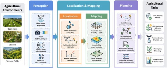
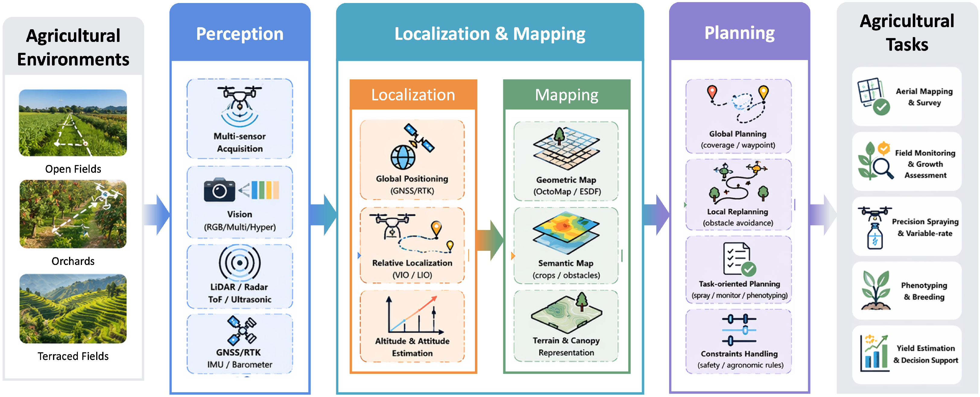
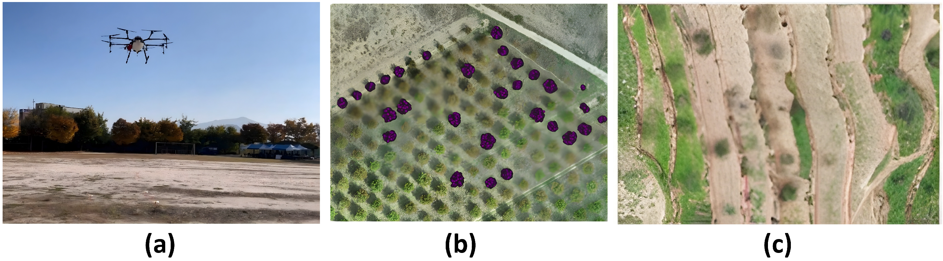
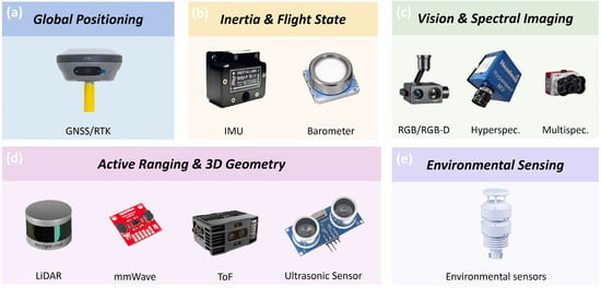
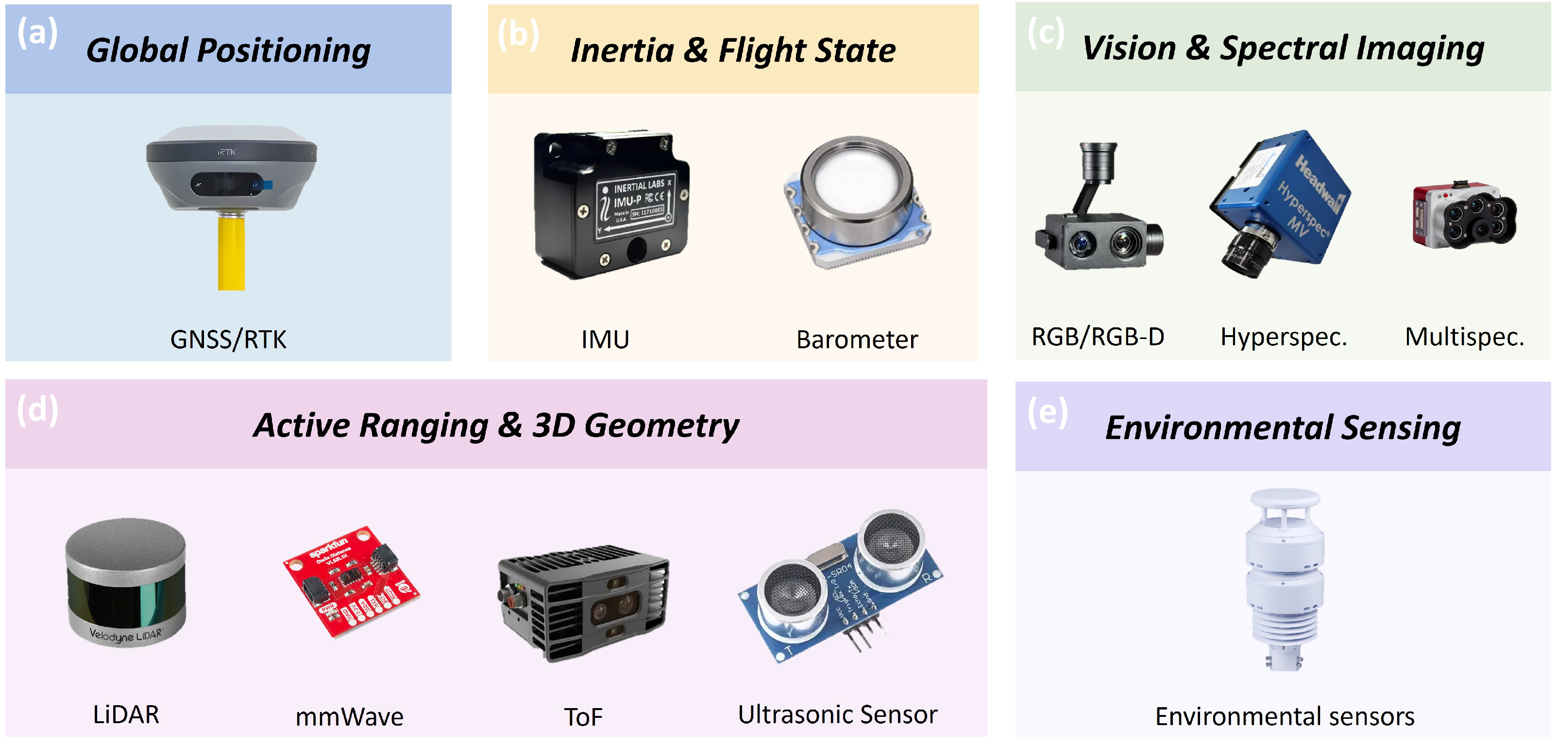
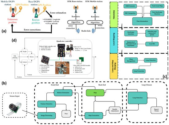
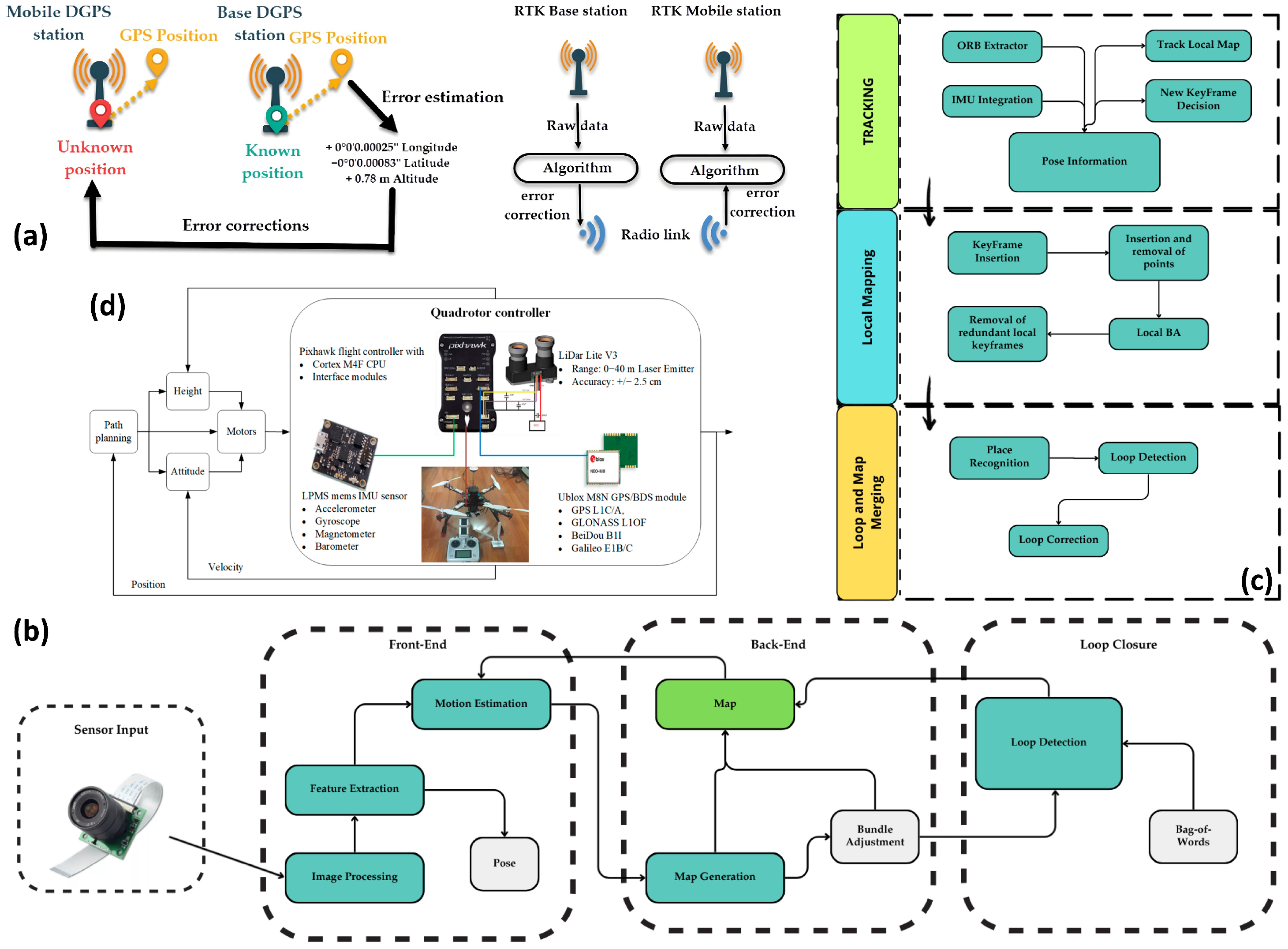
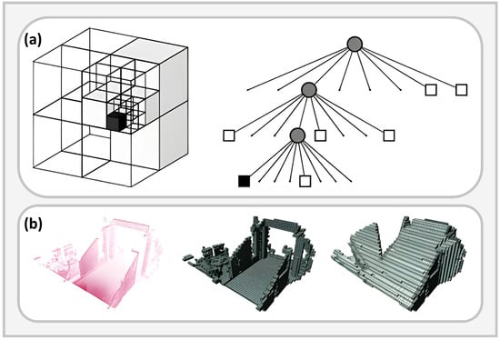
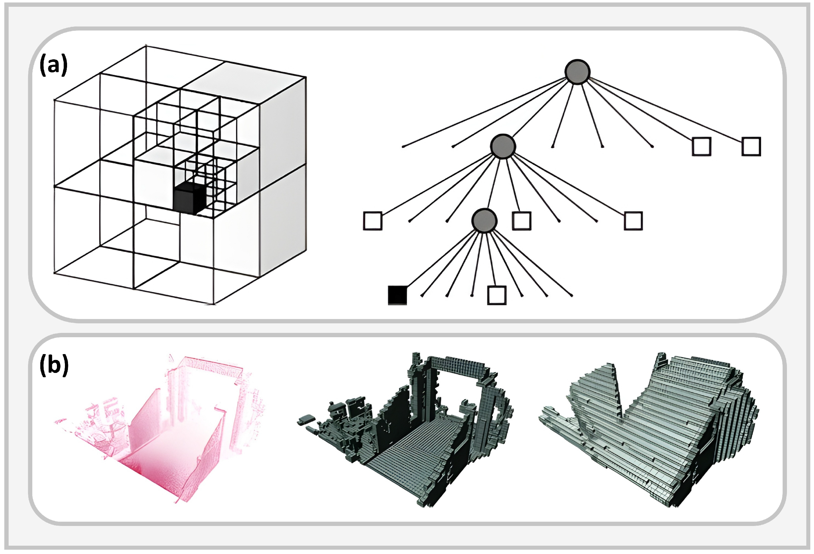
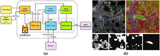
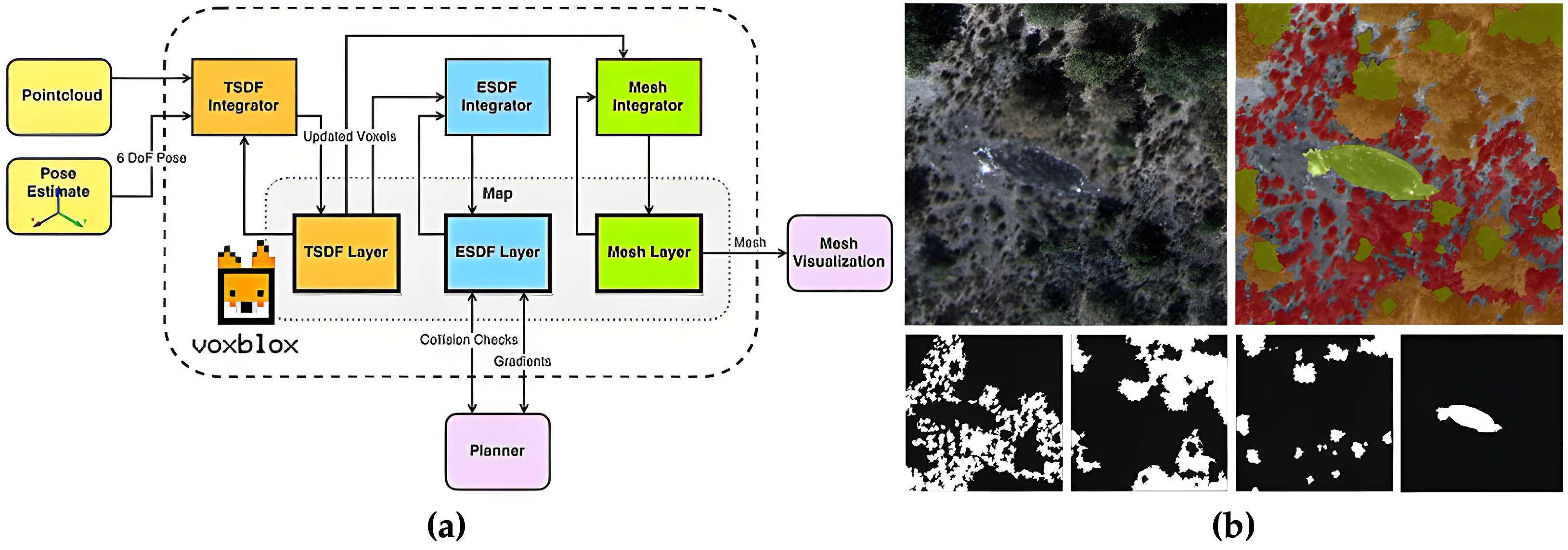
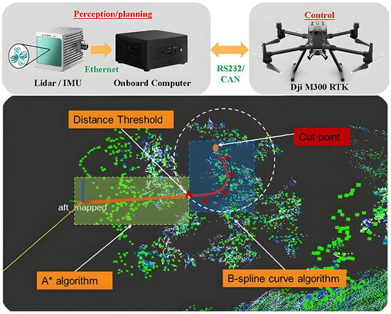
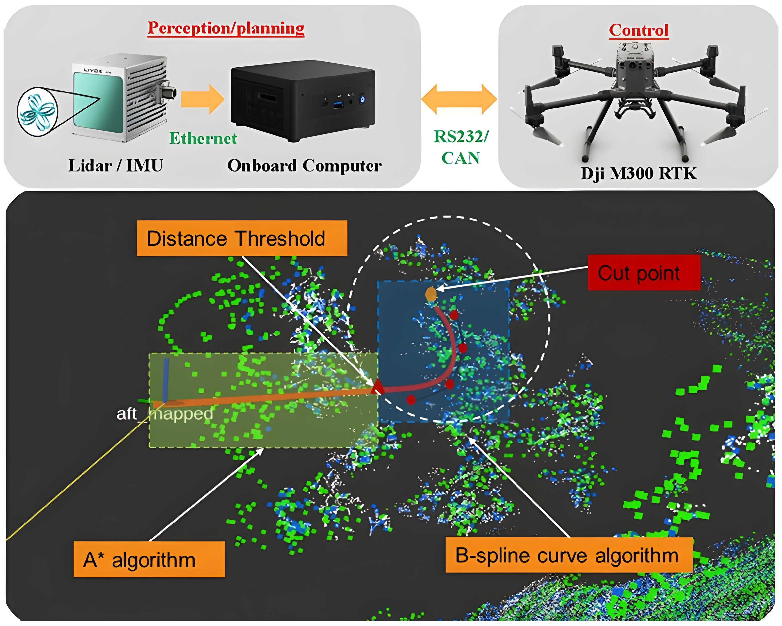
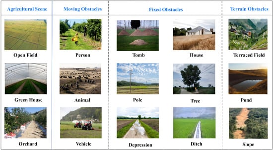
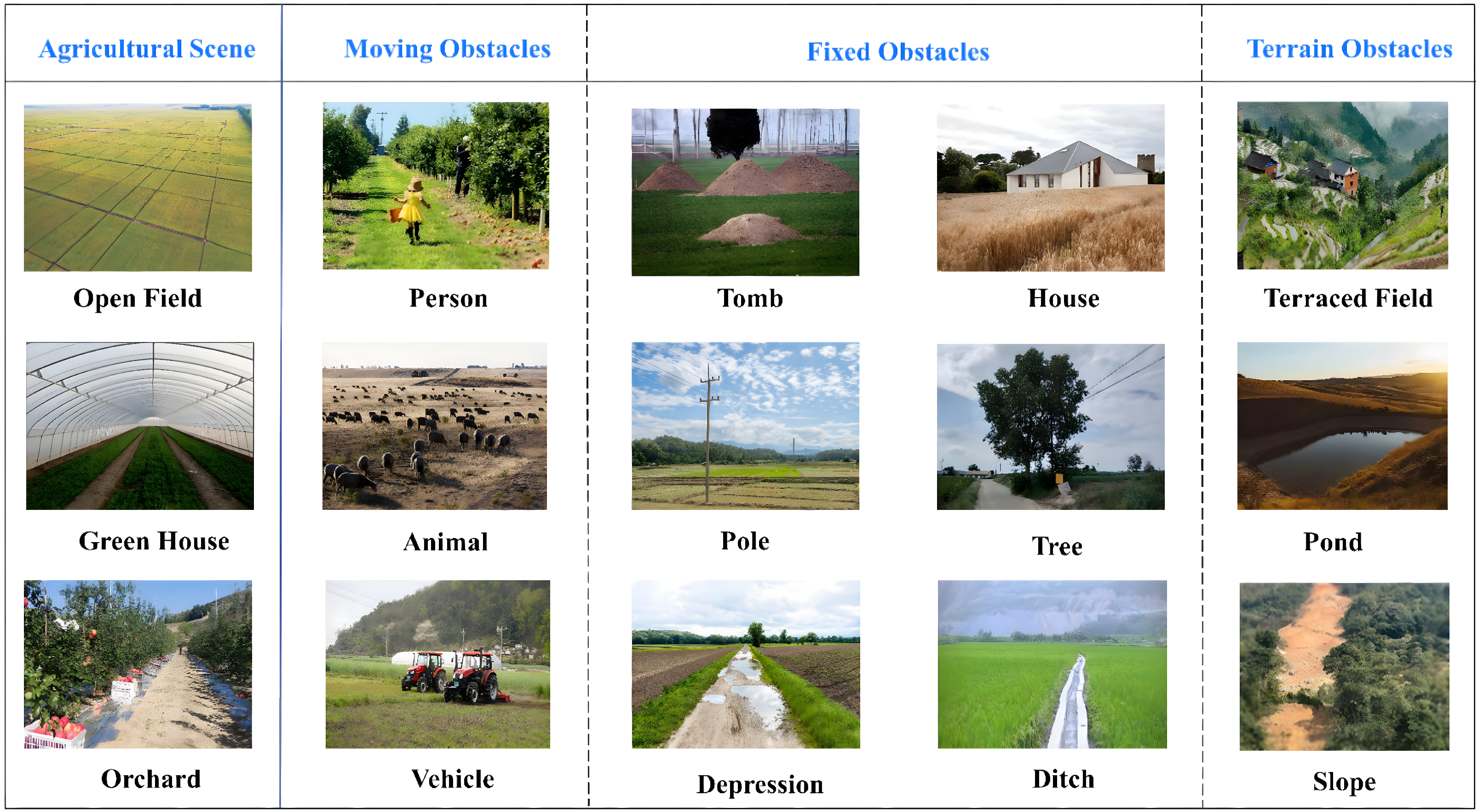
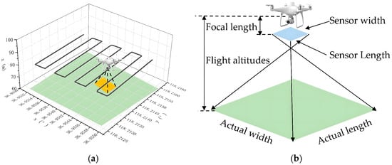
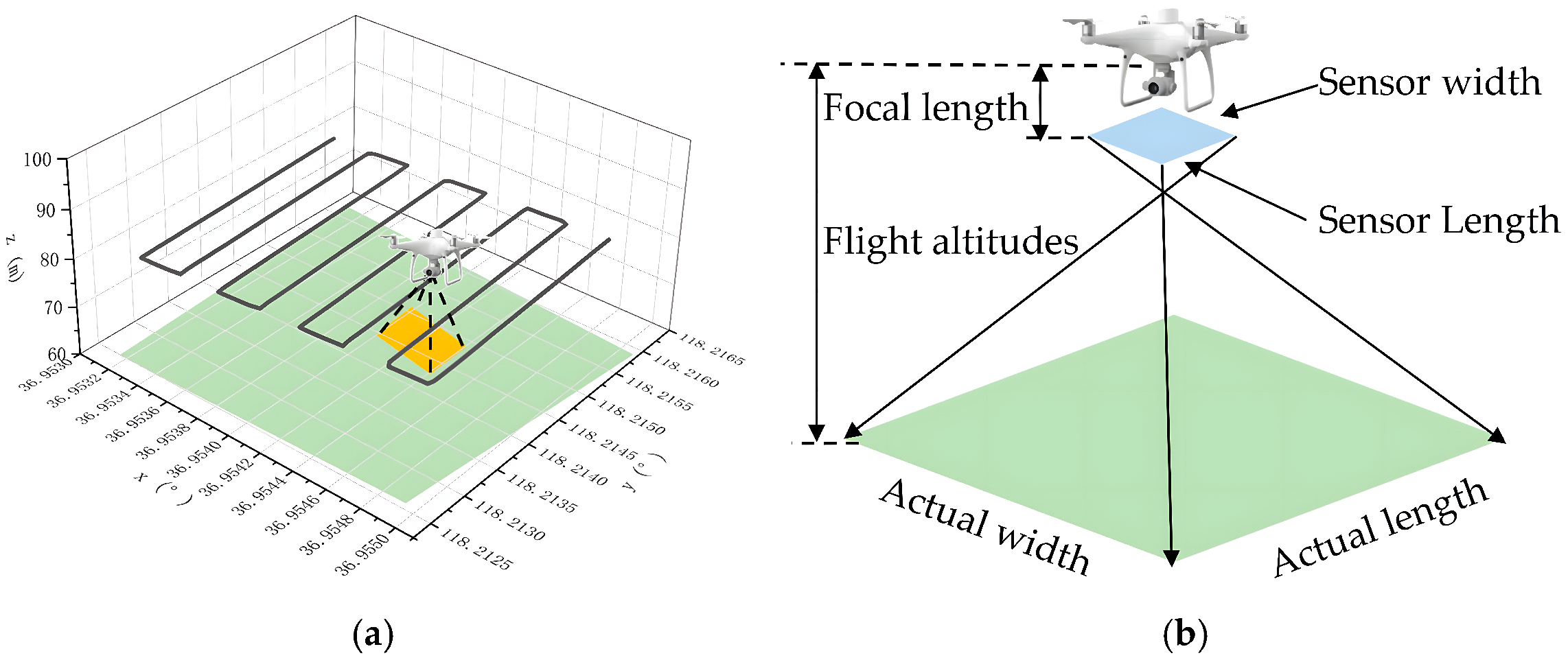
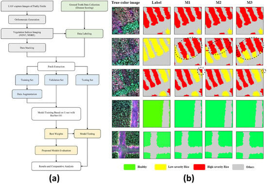
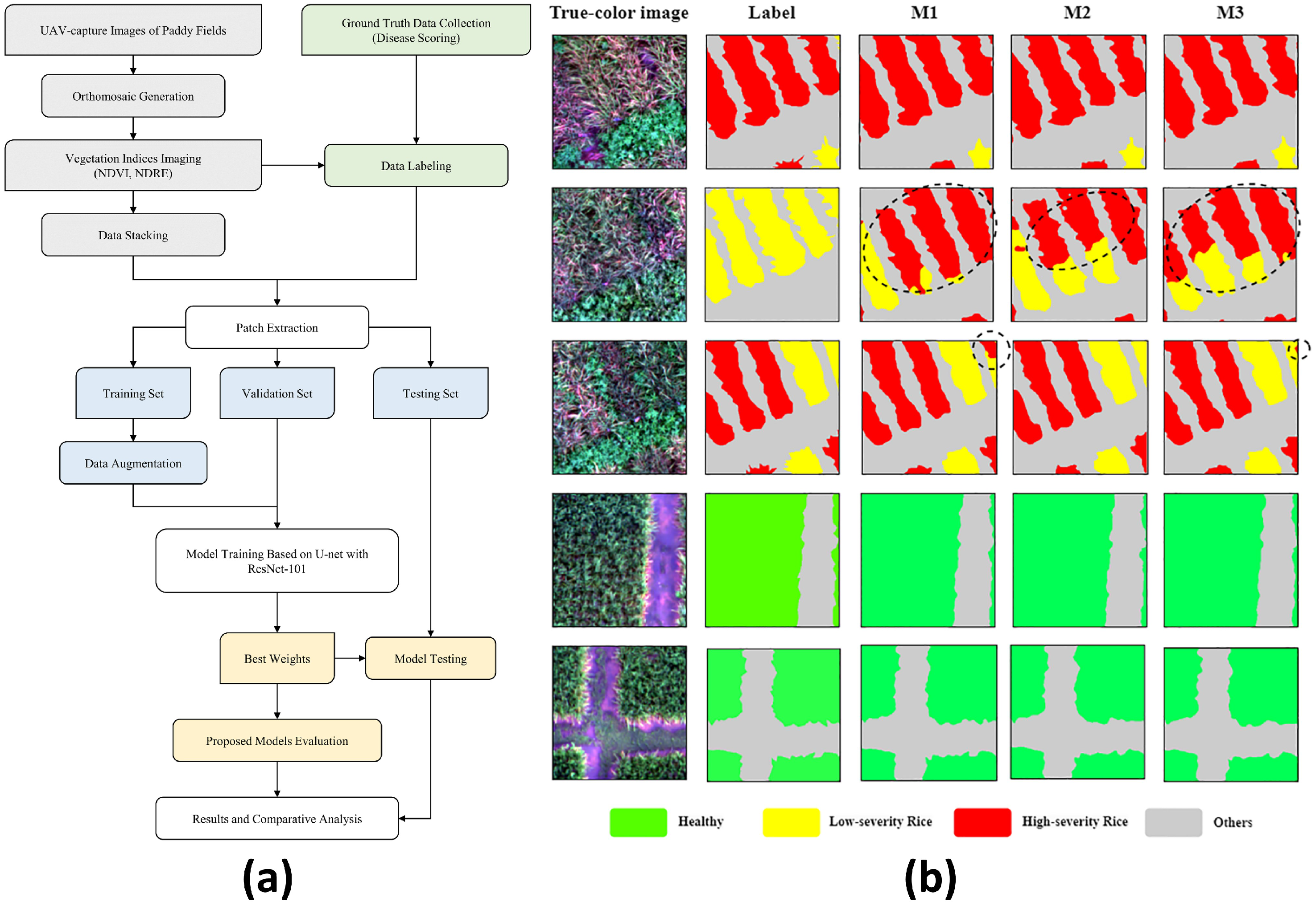
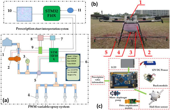
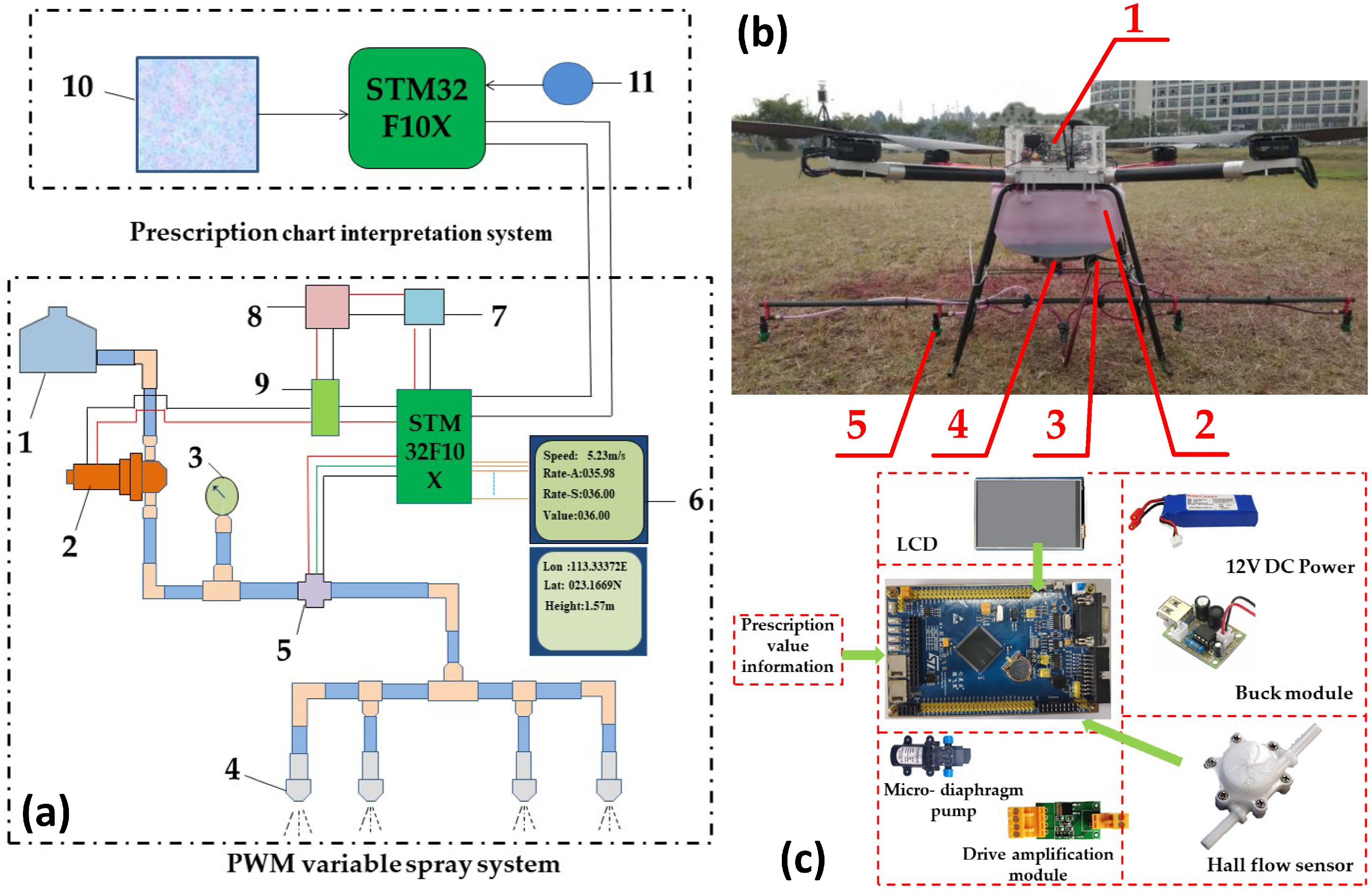
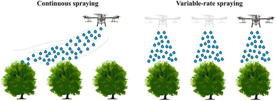
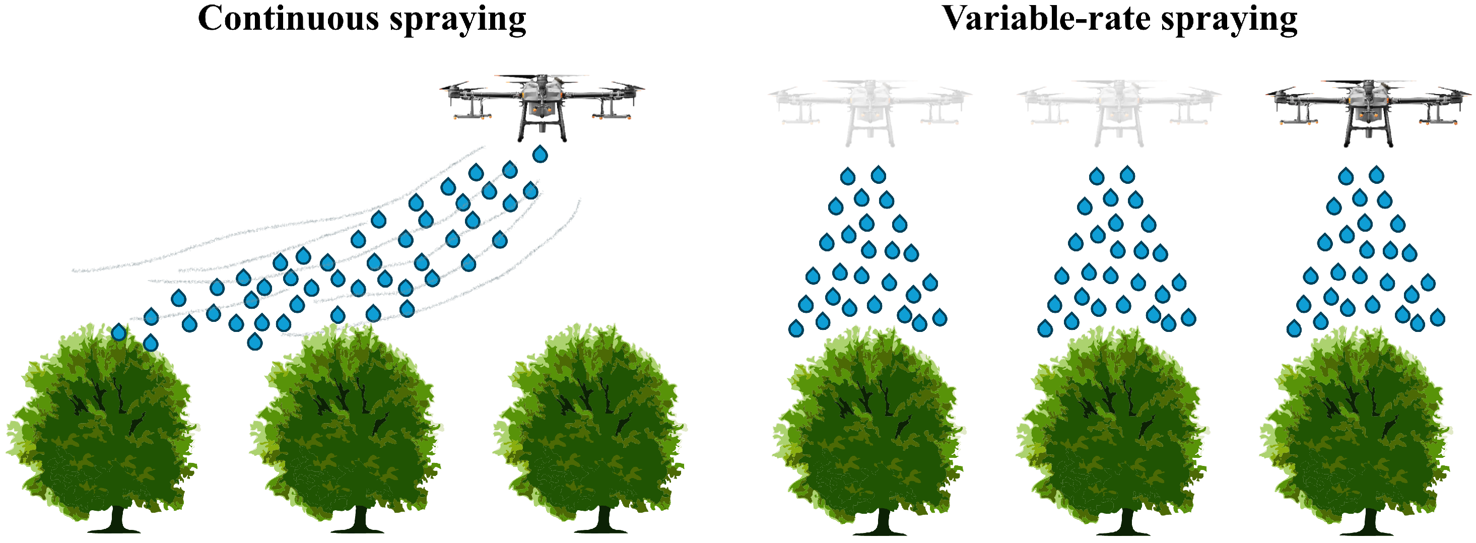
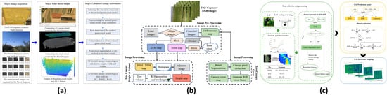
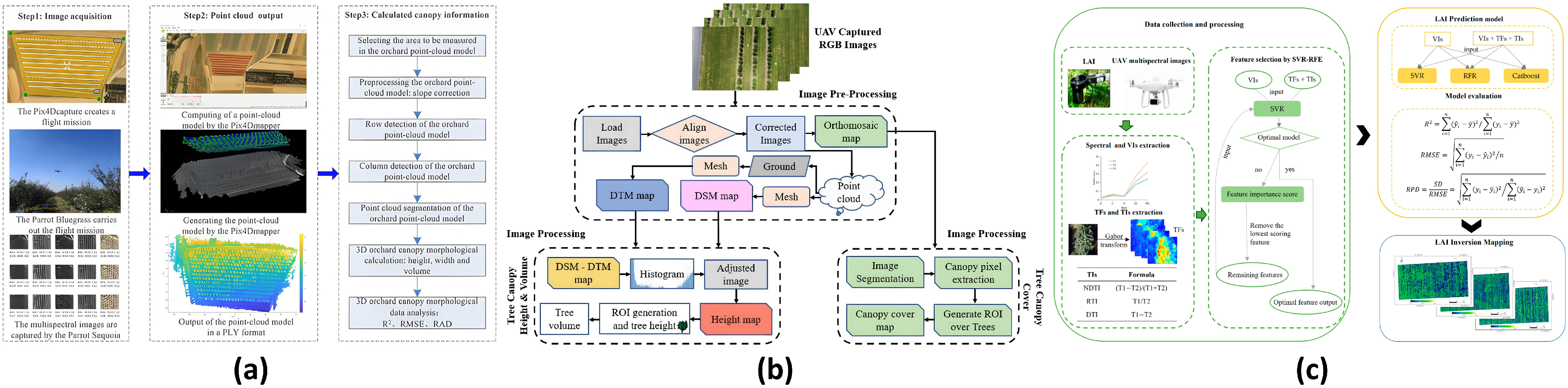
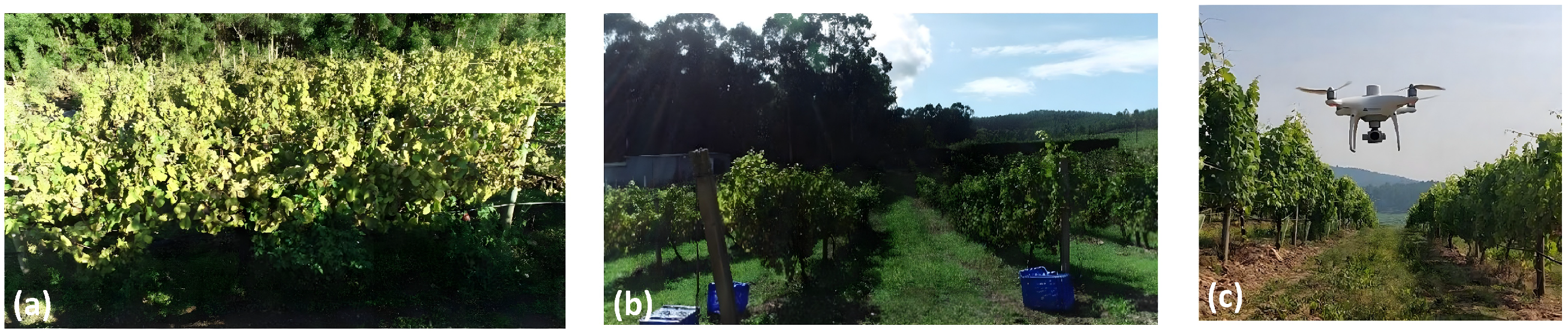
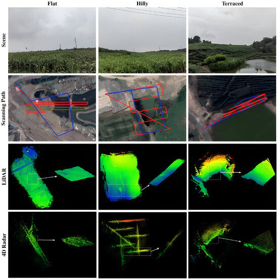
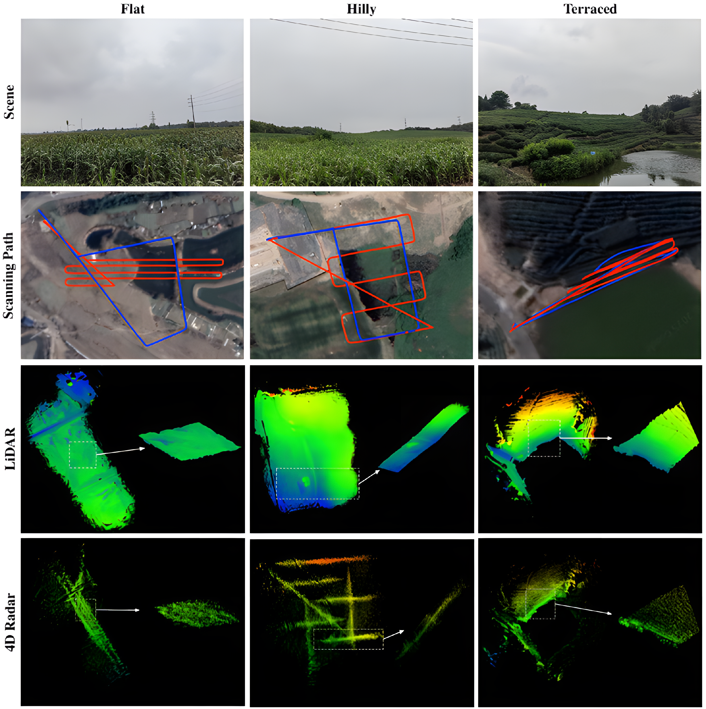
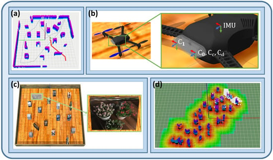
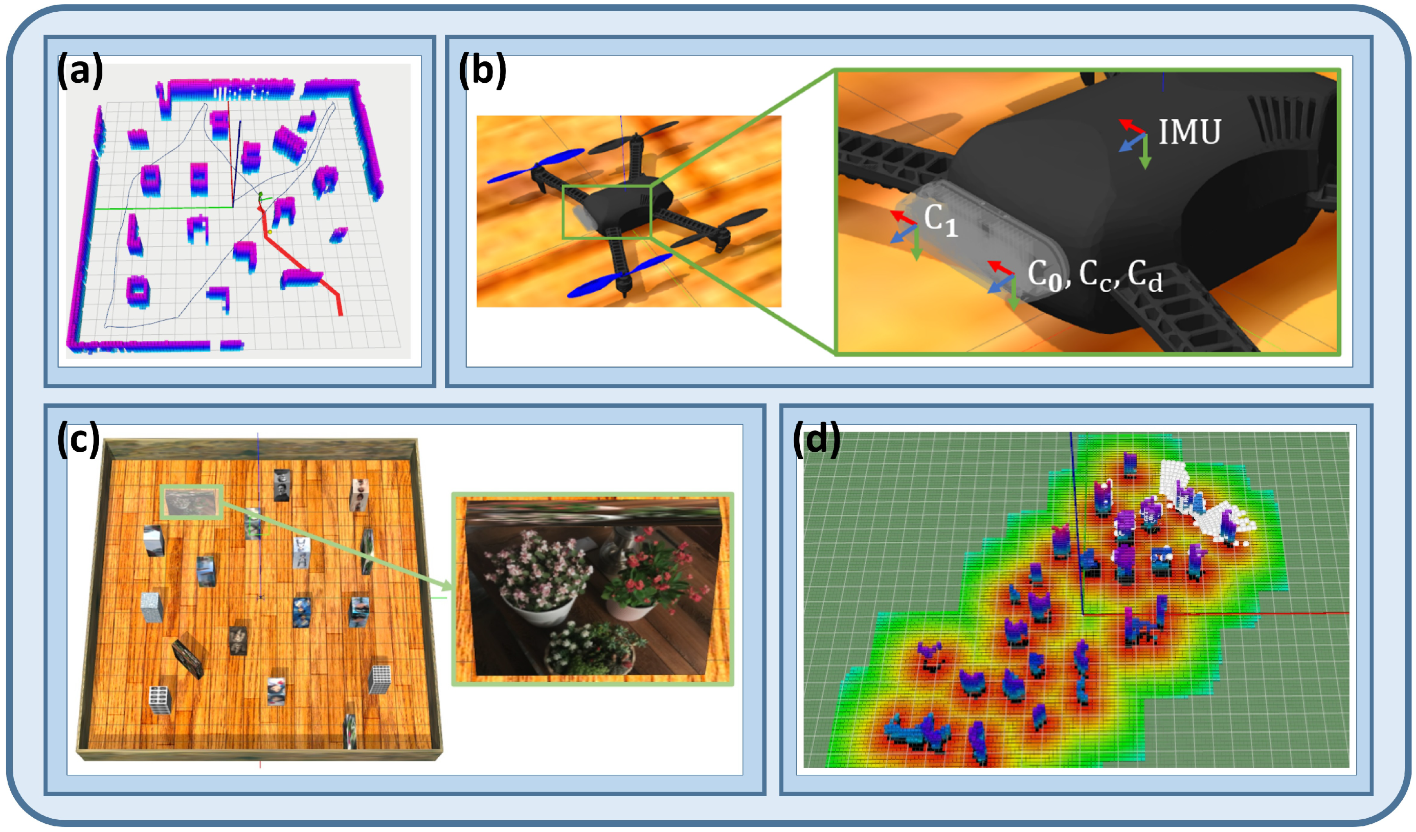

Disclaimer/Publisher’s Note: The statements, opinions and data contained in all publications are solely those of the individual author(s) and contributor(s) and not of MDPI and/or the editor(s). MDPI and/or the editor(s) disclaim responsibility for any injury to people or property resulting from any ideas, methods, instructions or products referred to in the content. |
© 2026 by the authors. Licensee MDPI, Basel, Switzerland. This article is an open access article distributed under the terms and conditions of the Creative Commons Attribution (CC BY) license.