You are currently viewing a new version of our website. To view the old version click .

ISPRS International Journal of Geo-Information, Volume 14, Issue 2

February 2025 - 55 articles

Cover Story: 
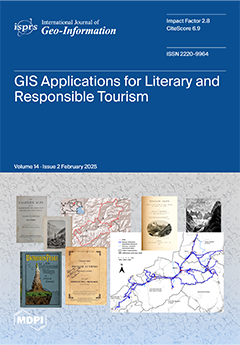
In this article, we propose a semi-automatic method in a GIS environment for the design of soft mobility itineraries starting from a geodataset of historical literary quotations of places and landscapes of a region. We have taken as a case study some travel reports from the 19th century in the Dolomite valleys of Fiemme and Fassa (Italy). The point layer of literary quotations was integrated with the linear layer of forest roads and footpaths and with the point layer of bus stops to identify possible soft mobility itineraries to promote cultural and responsible tourism. The result of the implemented procedure is a GIS of walking routes that minimizes the distances and travel times to reach the places described by travelers of the past, using local buses as a means of support. The software employed in this study are QGIS and GRASS. View this paper
  • Issues are regarded as officially published after their release is announced to the table of contents alert mailing list .
  • You may sign up for email alerts to receive table of contents of newly released issues.
  • PDF is the official format for papers published in both, html and pdf forms. To view the papers in pdf format, click on the "PDF Full-text" link, and use the free Adobe Reader to open them.

Articles (55)

  • Article
  • Open Access
1 Citations
1,562 Views
28 Pages

Geographic features in maps consist of a mixture of points, polylines, and polygons, generally including POIs, roads, buildings, and other geographic features. Due to the differing dimensionality of these various types of geographic data, traditional...

  • Article
  • Open Access
2,462 Views
18 Pages

4SIM: A Novel Description Model for the Ternary Spatial Relation “Between” of Buildings

  • Hanxue Zhang,
  • Xianyong Gong,
  • Chengyi Liu,
  • Fang Wu,
  • Yue Qiu,
  • Andong Wang and
  • Yuyang Qi

Natural language spatial relations are often ambiguous and polysemic. They are also pluralistic and subjective in nature. Their descriptive methods are crucial but difficult in cartography, geographic information science, and map generalization. &ldq...

  • Article
  • Open Access
2 Citations
1,384 Views
18 Pages

China’s rapid industrialization and urbanization have led to significant and imbalanced CO2 emissions, putting pressure on achieving sustainable development goals. This study analyzed the CO2 emissions of 31 major cities in China from different...

  • Article
  • Open Access
3 Citations
1,843 Views
19 Pages

Outdoor jogging plays a critical role in active mobility and transport-related physical activity (TPA), contributing to both urban health and sustainability. While existing studies have primarily focused on jogging participation volumes through surve...

  • Article
  • Open Access
1 Citations
1,553 Views
16 Pages

The paper presents research on investigating the possible impact of spatial characteristics of a certain location on its investment potential, in a general sense. By applying multi-criteria decision analysis with the AHP method, a model for the inves...

  • Article
  • Open Access
5 Citations
2,793 Views
25 Pages

The extraction of disaster geospatial intelligence (DGI) from social media data with spatiotemporal attributes plays a crucial role in real-time disaster monitoring and emergency decision-making. However, conventional machine learning approaches stru...

  • Article
  • Open Access
3 Citations
12,151 Views
37 Pages

Development of a Fifteen-Minute City Index Using Walkability Scores and Age-Classified Population: The Case of Pasig City, Metro Manila, Philippines

  • Carlo Angelo R. Mañago,
  • Marielle G. Nasalita,
  • Cesar V. Saveron,
  • Ynah Andrea D. Sunga and
  • Alexis Richard C. Claridades

The 15-min city (FMC) is a people-oriented urban development strategy that aims to provide a higher quality of life by manifesting the people’s right to the city. This study proposes an FMC index that measures how close a specific area is to ac...

  • Article
  • Open Access
1 Citations
4,879 Views
13 Pages

Evaluating Digital Map Utilization and Interpretation Skills of Students

  • Hiroyuki Yamauchi,
  • Jiali Song,
  • Takashi Oguchi,
  • Takuro Ogura and
  • Kotaro Iizuka

In recent years, secondary schools and university departments related to geography have begun to teach various topics using Geographic Information Systems (GIS). In particular, WebGIS, available online without installing additional software, is recog...

  • Article
  • Open Access
4 Citations
1,668 Views
21 Pages

Strategies for Glacier Retreat Communication with 3D Geovisualization and Open Data Sharing

  • Federica Gaspari,
  • Federico Barbieri,
  • Rebecca Fascia,
  • Francesco Ioli,
  • Livio Pinto and
  • Federica Migliaccio

Images of melting ice have become powerful symbols of climate change, attracting both public attention and scientific interest. This research uses web technologies to document and communicate the ongoing retreat of the Belvedere Glacier in the Italia...

of 6

Get Alerted

Add your email address to receive forthcoming issues of this journal.

XFacebookLinkedIn
ISPRS Int. J. Geo-Inf. - ISSN 2220-9964