


Abstract
Rapid and accurate calculation of lightning-induced electric fields in complex terrain is essential for lightning protection and electromagnetic compatibility analysis. Although conventional full-wave numerical methods such as the finite element method can achieve high-fidelity results, they are computationally expensive and inefficient for large-scale or repetitive engineering analysis. To enable efficient and reliable computation of lightning-induced electrostatic fields over complex terrain, this paper proposes a fast computational framework that integrates multi-level conformal mapping with a multi-objective optimization strategy based on the Non-Dominated Sorting Genetic Algorithm II (NSGA-II). In the proposed method, irregular terrain boundaries are transformed into analytically tractable domains using multi-level conformal mapping, while the critical mapping parameter is reformulated as a dual-objective optimization problem that simultaneously minimizes the maximum local error and the mean global error. Unlike traditional approaches that rely on empirical tuning or exhaustive traversal of mapping parameters, the proposed framework establishes a closed-loop adaptive optimization process that generates a Pareto-optimal solution set, enabling flexible trade-off selection according to practical accuracy requirements. The method is validated against high-fidelity finite element simulations for representative terrain profiles. The results demonstrate that the proposed approach achieves comparable maximum-error performance while reducing mean error and significantly improving parameter-optimization efficiency relative to exhaustive search methods. The proposed framework provides an adaptive and efficient computational solution for preliminary assessment of lightning-induced electric fields in complex terrain environments, and lays a foundation for future extensions toward more realistic multi-dimensional and transient analyses. The improvements in computational accuracy and efficiency offer significant practical value for rapid lightning protection assessment in large-scale complex terrain engineering, enabling parametric analysis and scheme comparison during the preliminary engineering design stage with sufficient reliability.
1. Introduction
Against the backdrop of rapid social advancement, the potential threats posed by lightning incidents to public safety and various industries have become increasingly prominent. These incidents can not only cause direct casualties but also severely impact power systems, communication facilities, radar antennas, and other electronic information systems, leading to direct or indirect economic losses [1,2].
Undulating terrain significantly alters the distribution of electric fields, leading to a substantial increase in the complexity of boundary conditions for field calculations. Electrostatic field computation typically employs two major categories of methods: analytical and numerical [3,4,5]. Traditional numerical methods such as the finite element method (FEM), method of moments (MoM), and finite-difference time-domain (FDTD) offer high accuracy but are often hindered by substantial computational resource consumption and low efficiency, making them unsuitable for rapid prediction requirements in engineering practice [6,7]. Although analytical methods significantly improve computational efficiency compared to numerical approaches, the charge simulation method struggles to adapt to complex terrain boundaries. The method of images, with its simple principles and fast solution capability, cannot be directly applied to asymmetric boundaries [8,9]. To break through the solution bottleneck imposed by complex geometric boundaries, the conformal mapping method has been introduced into the field of electric field calculation. Its core advantage lies in transforming complex geometric boundaries into regular domains (e.g., the upper half-plane, unit circle) via analytical transformation, providing an effective approach for solving electric field problems over complex terrain [10,11,12].
At present, the Schwarz–Christoffel (S-C) transformation is a typical application of conformal mapping in this field, with multiple application modes developed, including hybrid analytical–numerical methods, multi-level mapping strategies, and dynamic mapping methods [13,14,15]. In the S-C framework, the unknown pre-vertices and turning parameters are typically solved using Newton-type iterative methods [16,17]. Alternative numerical schemes have also been developed; for instance, Wan et al. employed an improved symmetric successive over-relaxation (SSOR) iterative method to enhance the efficiency of numerical conformal mapping [18]. While effective for standard polygonal boundaries, these methods are sensitive to initial guesses and become computationally expensive for complex or dynamically varying geometries.
To overcome these limitations, researchers have introduced optimization techniques into the parameter determination process. Ramakrishnan et al. employed the Levenberg–Marquardt algorithm to address the nonlinear coordinate matching problem between the Z-plane and W-plane in S-C transformations [19], improving numerical stability. Zhao et al. introduced genetic algorithms into the study of surface electromagnetic wave regulation, achieving adaptive mapping between time-varying boundaries and canonical domains [20,21,22]. These optimization-based approaches have expanded the applicability of conformal mapping to more complex boundary configurations. However, most of these studies treat parameter optimization as a single-objective problem, typically minimizing the maximum error, without addressing the inherent trade-off between local and global accuracy.
Beyond traditional S-C transformations, recent advances have introduced multi-level conformal mapping strategies based on fractional linear transformations to handle arbitrarily complex terrain boundaries [23]. In this new framework, the mapping accuracy is critically dependent on a single key parameter M—a departure from the pre-vertex parameters in S-C transformations. However, determining the optimal M under varying terrain topographies presents a distinct challenge: a solution that minimizes local extremum error may compromise global average accuracy, and vice versa. This inherent trade-off between local and global accuracy is not well addressed by existing optimization approaches, most of which treat parameter optimization as a single-objective problem.
To address the aforementioned research gaps, this paper proposes a fast calculation framework for lightning electrostatic fields over complex terrain that integrates multi-level fractional linear mapping (FLM) with the NSGA-II. The terrain adaptability of conformal mapping is enhanced via the intelligent optimization of the FLM parameters, achieving a balanced trade-off between calculation accuracy and efficiency. The main contributions of this paper are as follows:
- A bi-objective optimization model for FLM parameters is proposed, with the maximum local error and global average error as the optimization objectives. The NSGA-II is employed to generate a Pareto optimal parameter set, enabling the adaptive selection of parameters under the trade-off of calculation accuracy.
- A closed-loop optimization mechanism is established to realize automatic matching from terrain features to mapping parameters, which avoids the empirical dependence and exhaustive computational cost of traditional methods and provides an engineering practical solution for electric field calculation over complex terrain.
- Validation experiments on multiple types of complex terrain demonstrate that the proposed method significantly improves the calculation accuracy and efficiency while retaining the terrain adaptability of the multi-level conformal mapping framework, thus providing key technical support for the engineering application of this framework.
2. The Integrated NSGA-II and Conformal Mapping Framework
2.1. Conformal Mapping Algorithm
Given a single-valued analytic function defined in the complex plane, where , a mapping process is required to transform a set of points from the complex z-plane to another plane w, forming a new set of points M. Let and , where x and y represent the horizontal and vertical coordinates in the z-plane, respectively, and u and v represent the corresponding coordinates in the w-plane. The coordinates of points in the z-plane can be transformed one-to-one to coordinates in the w-plane through a specific transformation. If the function is analytic in the region and constitutes a bijective mapping within , then is referred to as a conformal mapping over the region .
2.1.1. Mapping Relationship from Complex Boundaries to Closed Contour Spaces
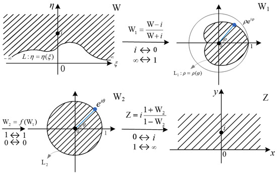
To address the transformation of complex boundaries into simple ones, the uniqueness theorem of fractional linear mapping—a fundamental type of conformal mapping—can be employed to establish precise relationships between lines and circles. Specifically, a straight line can be transformed into a circle via fractional linear mapping, while an undulating curve can first be mapped into a closed curve approximating a circle. Subsequently, transforming such closed curves into circles enables the mapping of undulating curves to straight lines. The process described above can be summarized in the following three steps [24]:
- Transformation from the W-plane to the -plane using a conformal mapping function.
- Transformation from the -plane to the -plane by solving an integral equation.
- Transformation from the -plane to the Z-plane using the inverse of the conformal mapping function.
The mapping schematic diagram is shown in Figure 1. Through these steps, the mapping from the W-plane to the Z-plane is achieved, effectively transforming complex boundaries into simplified ones.
Figure 1.
Schematic illustration of the multi-step fractional linear mapping procedure for complex terrain. The procedure transforms the original irregular domain in the W-plane (complex plane of the original terrain) into a flattened smooth standard upper half-plane in the Z-plane (target complex plane), via two intermediate circular-domain mappings in the -plane and -plane. Solid black lines L, and dashed line represent the boundaries of the corresponding domains. The shaded area with slashes denotes the computational domain of interest throughout the mapping. Solid black dots mark the key corresponding points of each mapping step (e.g., , ). Blue lines and dots illustrate the one-to-one boundary point correspondence and the angular (argument) mapping relationship between the irregular boundary in the -plane and the standard unit circle boundary in the -plane, under the transformation .
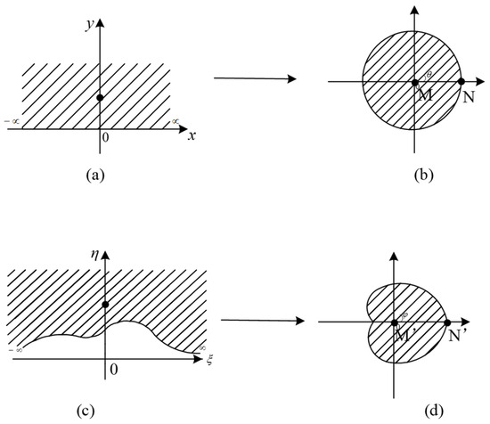
To map a complex boundary to a closed contour, it is essential to first determine three sets of points and their corresponding images, ensuring the fractional linear mapping is unique and well-defined. The relationships between the three specified point sets and their images are as follows [25]:
- The infinite boundaries on the real axis in Figure 2a and the irregular boundary in Figure 2c correspond to point N in Figure 2b and point in Figure 2d, respectively.Figure 2. Illustration of the fractional linear mapping from the z-plane to the w-plane (Equation (1)). (a) Standard upper half-plane in the z-plane, shaded area denotes the computational domain, solid dot is reference point M; (b) Mapped unit circle domain in the w-plane, arrow indicates mapping direction, shaded area is the mapped domain, N is the corresponding point of , is the boundary argument; (c) Irregular upper half-plane with complex terrain, shaded area denotes the computational domain, solid dot is reference point ; (d) Mapped irregular closed contour domain, arrow indicates mapping direction, shaded area is the mapped domain, is the corresponding point of , is the boundary argument.
The fractional linear mapping function is given by Equation (1), and the corresponding transformation diagram is shown in Figure 2.
In Equation (1), M represents the fractional linear mapping parameter, which varies with changes in the mountain profile.
2.1.2. Mapping Relationship from Closed Contour Space to Unit Circle
When the correspondence between an interior point and a boundary point in the domain, as well as their respective images in the unit circle, is established, the functional relationship can be determined based on Cauchy’s integral theorem.
The mapping formula for an interior point in the space is defined as follows: Let z be an interior point in the closed contour plane, and be a point in the unit circle plane. The mapping function transforming the closed contour to the unit circle is denoted as . Applying the functional relationship , the logarithm of yields . The function transforming the closed contour to the unit circle is expressed as follows [26]:
2.1.3. Mapping Relationship from Unit Circle to Simplified Boundary
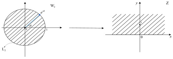
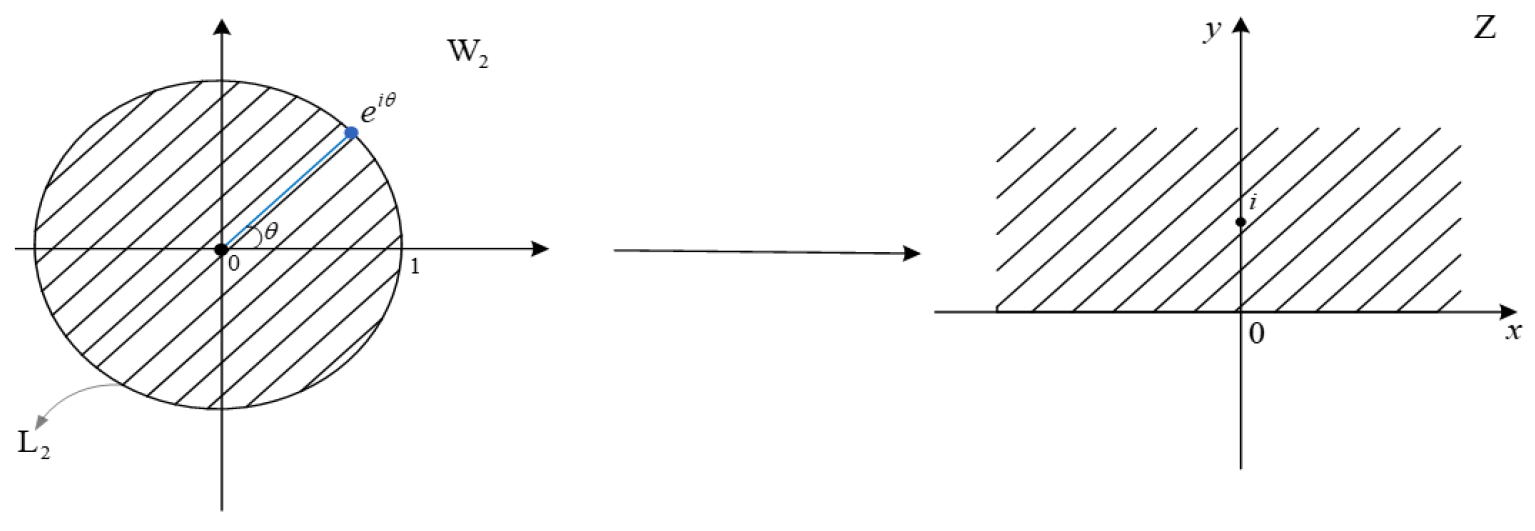
After successfully resolving the transformation between the closed contour and the unit circle through the solution of integral equations, the next step involves mapping the unit circle in the -plane back to the x-axis in the Z-plane using the inverse function of the conformal mapping, as illustrated in Figure 3.
Figure 3.
Inverse conformal mapping from the unit circle in the -plane to the standard upper half-plane in the Z-plane. The -plane and Z-plane denote the complex planes of the unit circle domain and the target standard domain, respectively; the shaded area with slashes represents the computational domain of interest; the solid black line denotes the boundary of the unit circle; the blue line and dot indicate the boundary point on the unit circle and its argument (corresponding to Equation (2)); the arrow indicates the direction of the inverse conformal mapping, which maps the unit circle boundary to the real axis x of the Z-plane, and the origin of the -plane to the reference point i in the Z-plane.
By applying the inverse transformation of the conformal mapping function, the boundary of the circle can be precisely mapped onto the x-axis of the Z-plane. In this process, the specific point at , in the -plane corresponds to the point at infinity (the ∞ point) in the Z-plane, while the point at in the -plane maps to the point in the Z-plane. Based on these relationships, the correspondence between the circular boundary in the -plane and the x-axis in the Z-plane is established.
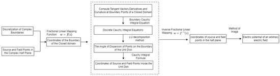
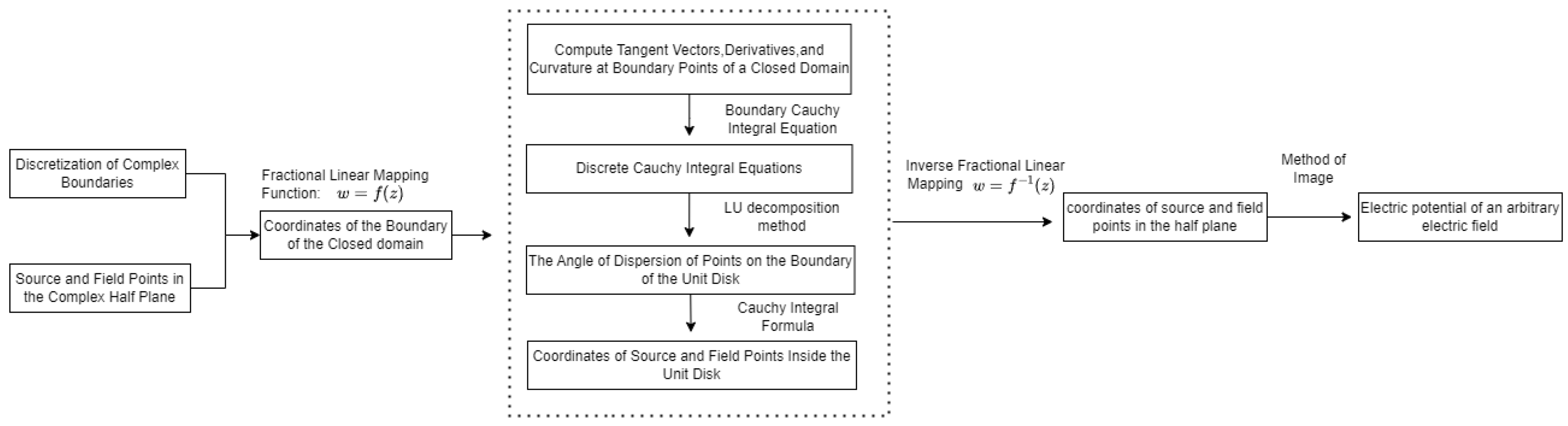
Through the aforementioned steps, the complex boundary in the W-plane can be successfully transformed into a simple boundary in the Z-plane, and the point mapping relationship between the two planes can be established. By means of analytical equations and precise calculation of the conformal mapping function, arbitrarily complex boundary shapes can be simplified into easily manageable simple boundaries. Further combining this with the method of images enables the solution of the electric field distribution above space under arbitrarily complex mountainous terrain conditions. The computational flowchart is illustrated in Figure 4.
Figure 4.
Flowchart for electrostatic field calculation based on the fractional conformal mapping algorithm and the method of images.
2.2. Integrated NSGA-II and Conformal Mapping Framework
NSGA-II was proposed by Deb et al. [27,28]. The accuracy of the conformal mapping-based electric field calculation critically depends on the parameter M in the fractional linear transformation (Equation (1)), which is highly sensitive to the specific geometry of the mountainous terrain. Manually calibrating M for each new terrain profile is time-consuming and relies heavily on expert experience, severely limiting the method’s efficiency and generalizability. To overcome this, we propose an automated optimization framework that integrates the NSGA-II with the conformal mapping procedure.
2.2.1. System Overview and Workflow
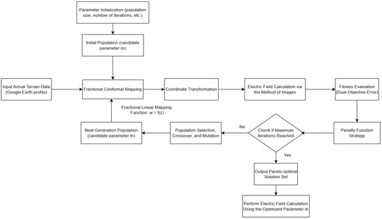
The proposed framework establishes a closed-loop system, where NSGA-II iteratively proposes candidate M values and the conformal mapping module evaluates their performance. Figure 5 illustrates this integrated workflow, which operates in three key phases:
Figure 5.
Architecture of the NSGA-II-based multi-level conformal mapping optimization framework.
- Initialization phase: Define the optimization problem and algorithm parameters.
- Iterative optimization phase: The core loop where candidate parameters are evaluated and evolved.
- Solution output phase: Extraction and validation of the optimal parameter.
The core idea is to formulate the parameter search as a dual-objective optimization problem, aiming to simultaneously minimize both the maximum local error and the mean global error of the calculated electric field, thereby ensuring both accuracy and robustness.
2.2.2. Implementation of the NSGA-II Optimization
NSGA-II is fully implemented with explicit parameter settings and rigorous convergence criteria to ensure reproducibility and reliability. The algorithm optimizes the key parameter M of the fractional linear mapping, with detailed configurations as follows.
Optimization Variables and Objectives
The decision variable is the scaling parameter M of the fractional linear mapping, constrained within the range . This range is determined according to the terrain elevation scale, mapping characteristics, and extensive preliminary tests to cover all effective mapping parameters for typical 2D terrain profiles. Two objective functions are defined based on the relative voltage error between the conformal mapping results and high-accuracy COMSOL simulations:
where denotes the reference electric field from COMSOL finite element simulations, and is the electric field calculated by the proposed conformal mapping method. The two conflicting objectives are
with N being the number of sampling points uniformly distributed in the computational domain .
Core NSGA-II Parameter Settings
All algorithmic parameters are explicitly defined for full reproducibility:
- Population size: (sufficient to maintain diversity without excessive computation);
- Number of objective functions: ;
- Number of decision variables: (only parameter M);
- Selection strategy: Binary tournament selection with a tournament size of , ensuring balanced selection pressure;
- Crossover operation: Simulated Binary Crossover (SBX) with crossover probability and distribution index (favoring offspring close to parents for stable convergence);
- Mutation operation: Polynomial mutation with mutation probability and distribution index (introducing moderate randomness to avoid local optima);
- Elite preservation mechanism: The best 50 individuals are selected from the parent population (100 individuals) based on non-dominated sorting and crowding distance. Meanwhile, the best 50 individuals are selected from the offspring population (100 individuals) using the same criteria. These two parts are directly combined to form the next generation’s population of 100 individuals. This strategy retains high-quality solutions from both parents and offspring, ensuring evolutionary efficiency and stability.
Penalty Function and Constraint Handling
To exclude invalid and low-performance solutions, a penalty mechanism is implemented: individuals with maximum local error or mean global error are assigned the lowest dominance rank during sorting. This accelerates convergence toward feasible solutions that meet practical engineering error requirements. The thresholds (20% for maximum local error and 10% for mean global error) are selected based on practical engineering requirements for lightning electrostatic field assessment, beyond which the calculation results lack engineering reliability.
Termination Criterion
The optimization adopts a convergence-based termination criterion to ensure the algorithm fully evolves: the iteration stops when the relative change in the Pareto front (quantified by the average Euclidean distance between consecutive generations’ Pareto solutions) is less than for 10 consecutive generations. If convergence is not achieved within a maximum of 100 generations, the algorithm terminates to avoid redundant computation. The convergence threshold () and consecutive generation limit (10 generations) are chosen to ensure stable convergence of the Pareto front while avoiding unnecessary computational cost. This criterion balances convergence reliability and computational efficiency, ensuring the final Pareto-optimal set is stable and not affected by premature termination.
Random Initialization and Sensitivity Analysis
The initial population is generated uniformly at random within . To ensure full reproducibility, a fixed random seed (rng(1)) is employed in all experiments, which standardizes all stochastic operations, including initialization, selection, crossover, and mutation.
To further substantiate the low sensitivity to random initialization, Table 1 presents the optimal M values and corresponding objective functions obtained from four distinct random seeds. It can be observed that the maximum relative deviation of M is approximately 3.6% (ranging from 4474 to 4638), and the deviations of (maximum local error) and (mean global error) are less than 2.6% and 2.2%, respectively. Specifically, varies between 8.13% and 8.34%, while varies between 3.23% and 3.30%. These minor fluctuations confirm the stability and reproducibility of the proposed optimization framework.
Table 1.
Sensitivity analysis of random initialization (four independent seeds).
2.2.3. Validation Benchmark and Error Metric
To validate the proposed algorithm, a reliable benchmark for the electric field distribution over complex terrain is established based on real topographic data and high-fidelity finite element simulations, with detailed implementation steps as follows.
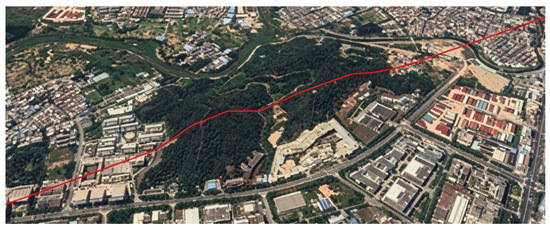
First, a real mountainous region in Guanzhou, China, is selected, and a 2D vertical cross-section is extracted using Google Earth Pro v7.3.6 following a standardized procedure:
- A 3000 m horizontal east–west transect (from m to m) is drawn across the mountainous area;
- The elevation profile of the transect is exported with a sampling interval of 10 m, generating discrete coordinate points ;
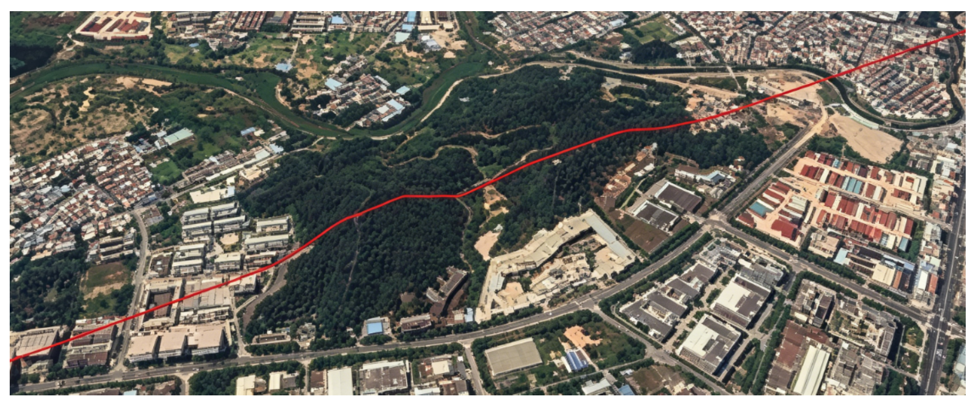
- The discrete points are fitted into a smooth continuous terrain profile using cubic spline interpolation, which serves as the boundary for conformal mapping, as shown in Figure 6.Figure 6. Vertical cross-section of real undulating mountain terrain.The red line indicates the extracted terrain profile (mountain contour).
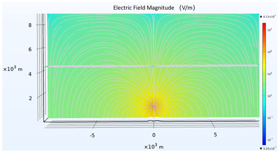
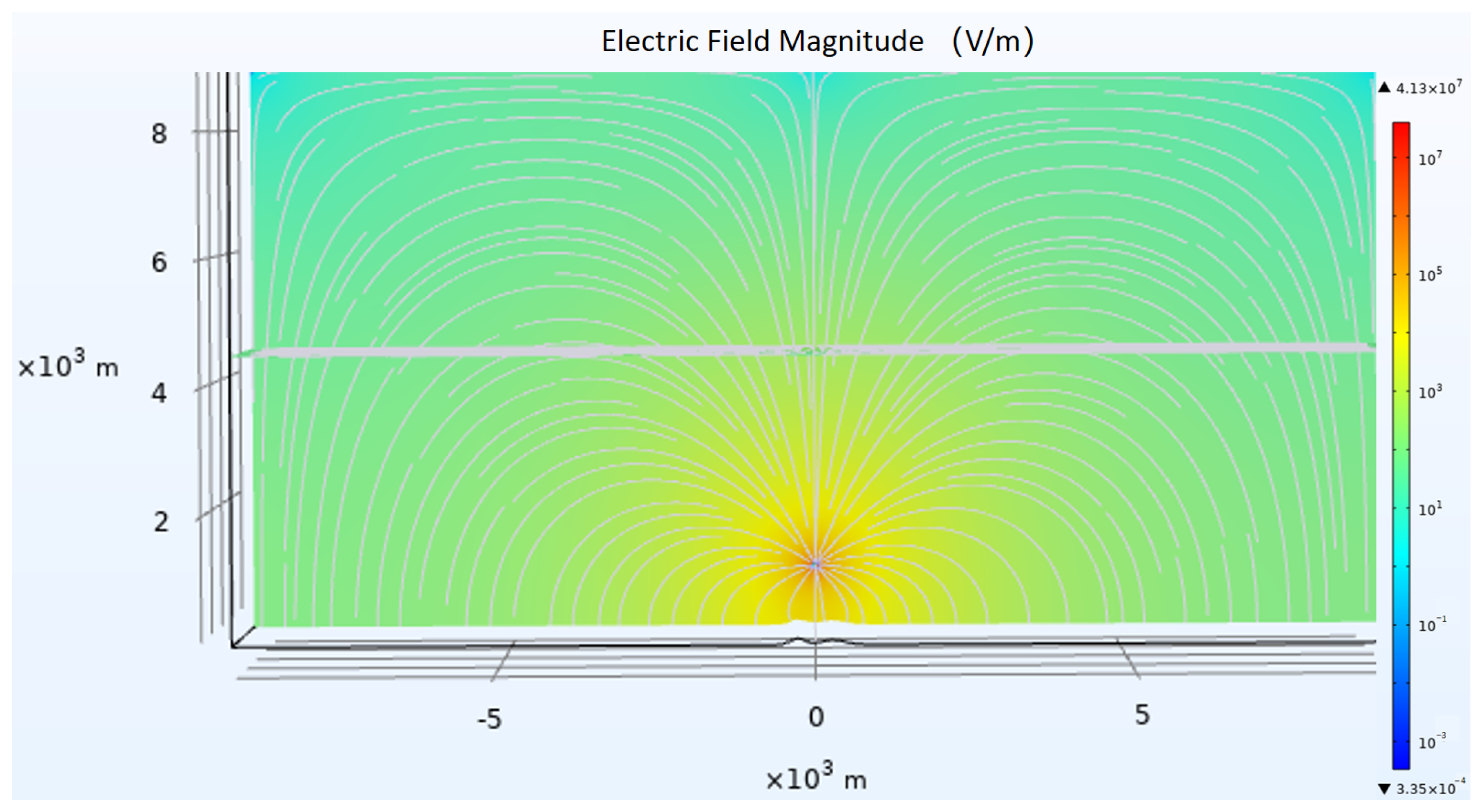
A point charge with a magnitude of is placed at m (1000 m above the terrain profile) to simulate the lightning leader channel. A high-accuracy reference electric field distribution in the computational domain is then simulated using COMSOL Multiphysics 6.0 (AC/DC module, electrostatic field interface), with a refined mesh (5 m for near-terrain regions, 20 m for far-field regions) to ensure simulation accuracy. The simulated reference electric field distribution is presented in Figure 7.
Figure 7.
Electric field magnitude distribution from COMSOL simulation. The contour plot shows the spatial distribution of the electrostatic field (V/m). The grey line represents the field profile along the terrain, and the triangle (▲) and inverted triangle (▼) indicate the upper and lower bounds of the field magnitude.
This reference electric field serves as a benchmark for optimizing the conformal mapping parameter M, rather than as a substitute for the proposed method in practical applications. The performance of the NSGA-II optimized conformal mapping is evaluated by comparing its results against this COMSOL benchmark, using the error metric defined in Equation (3).
The complete flowchart of the electrostatic field calculation based on the NSGA-II optimized multi-level conformal mapping algorithm is shown in Figure 5, which illustrates the closed-loop optimization process.
3. Simulation Results and Comparative Analysis
3.1. Comparison of Pareto-Optimal Fronts
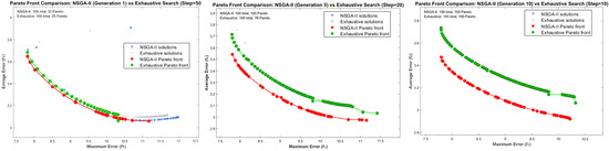
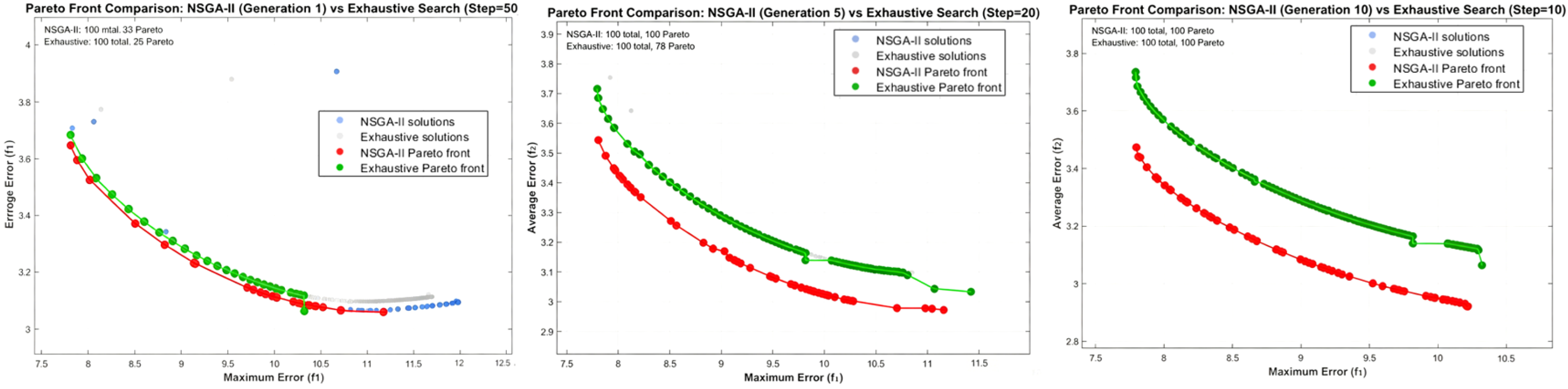
To validate the optimization performance of the NSGA-II, the traditional exhaustive search method was first employed as a benchmark. The key mapping parameter M was traversed within the interval [100, 11,000] using step sizes of 10, 20, and 50. The corresponding maximum and average errors of the electric field calculation for each parameter set were recorded. Non-dominated solutions were filtered to plot the Pareto fronts. Figure 8 presents a comparative analysis of the Pareto fronts obtained by the NSGA-II multi-level conformal mapping algorithm (at the 1st, 5th, and 10th generations) and those from the exhaustive search method (using step sizes of 50, 20, and 10). Specifically, for comparable levels of maximum error, the Pareto front generated by the NSGA-II achieves an average error reduction of approximately 5% compared to that obtained via exhaustive search. This quantitative improvement, albeit moderate, consistently demonstrates the enhanced accuracy of the NSGA-II-optimized solutions and effectively validates the algorithm’s capability in efficiently approximating the global Pareto-optimal front.
Figure 8.
Comparison of Pareto fronts obtained by the NSGA-II multi-level conformal mapping algorithm and the exhaustive search method. The plot compares the Pareto fronts obtained by the NSGA-II (at the 1st, 5th, and 10th generations) with those from the exhaustive search method (using step sizes of 10, 20, and 50). The results show that the NSGA-II achieves a 5% reduction in mean error under the same level of maximum error constraint, demonstrating a consistent and quantifiable improvement over the traditional method.
3.2. Comparative Analysis of Optimization Efficiency
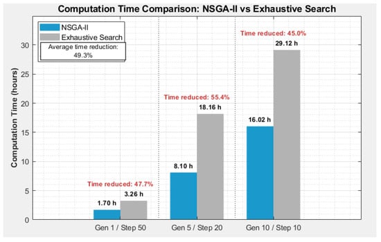
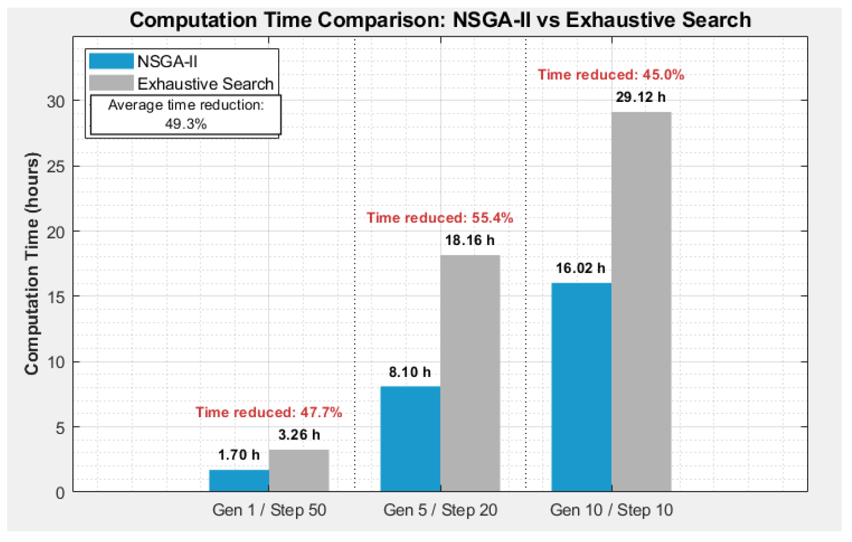
Figure 9 presents a comparison of the computational time consumed by the two methods to achieve Pareto fronts of similar accuracy. The results show that compared to the exhaustive search, the NSGA-II completes the optimization search in significantly less time, improving computational efficiency by an average of 49.3%. This indicates that while the reduction in maximum error is limited—a constraint inherent to the theoretical nature of the fractional linear mapping itself—the proposed method achieves a measurable reduction in mean error (approximately 5%) alongside a substantial gain in optimization efficiency. It thus successfully addresses the core bottleneck of traditional methods that rely on exhaustive search and are prohibitively time-consuming.
Figure 9.
Computation time efficiency comparison between the NSGA-II and the exhaustive search method. The plot compares the total time consumed to obtain the Pareto fronts shown in Figure 8. The NSGA-II (across its 1st, 5th, and 10th generations) achieves its results significantly faster than the exhaustive search method (with step sizes of 50, 20, and 10), demonstrating a marked improvement in optimization efficiency.
3.3. Verification of Electric Field Calculation Based on Optimized Parameters
To thoroughly evaluate the practical effects of different trade-off solutions within the Pareto set, three representative solutions were selected from the optimal set obtained by the NSGA-II:
- The solution corresponding to the minimum maximum error;
- A compromise solution balancing both objectives;
- The solution corresponding to the minimum average error.
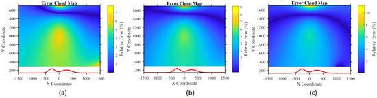
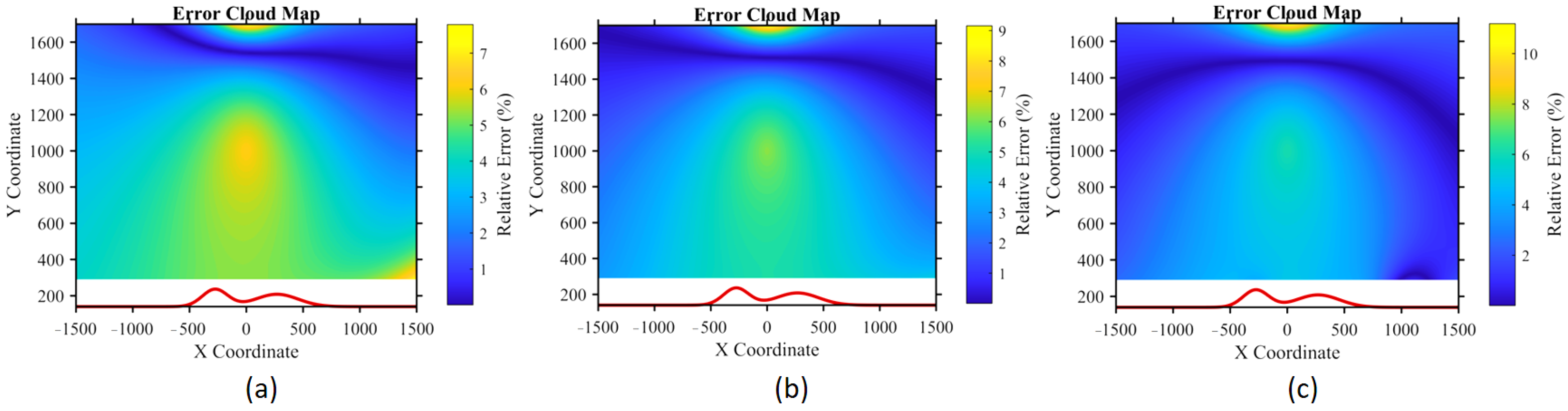
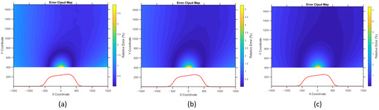
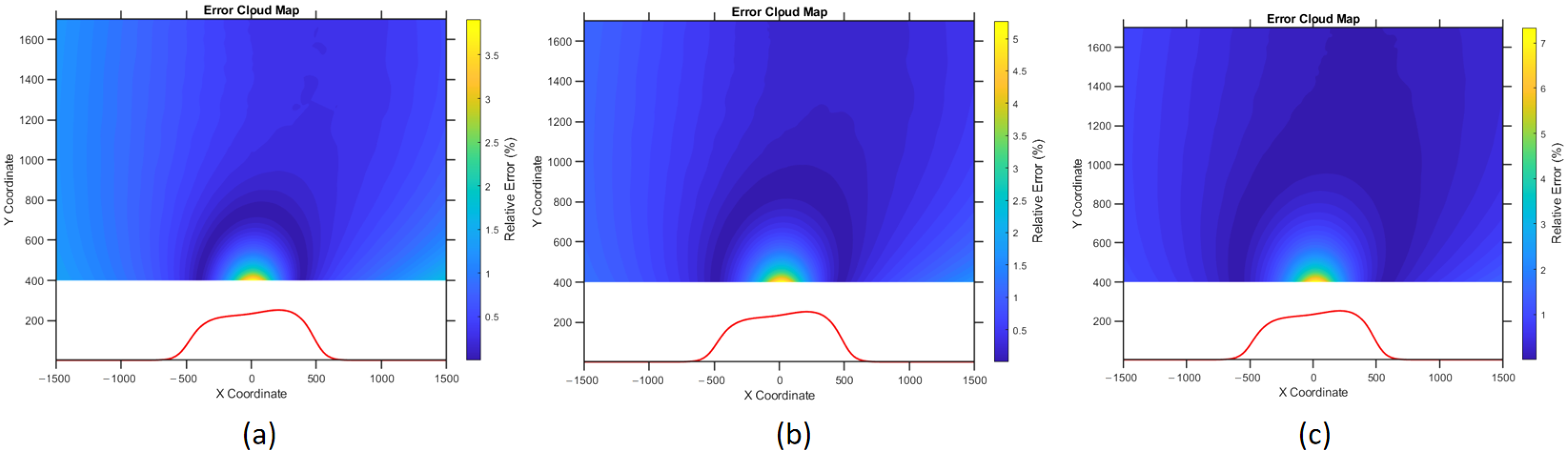
Using the optimal parameters M corresponding to these three solutions, the complete conformal mapping and electric field calculation were performed, and the error contour maps between these results and the high-fidelity COMSOL simulation results are plotted, as shown in Figure 10.
Figure 10.
Relative error contour maps of the electric field calculation results for three representative Pareto-optimal solutions: (a) minimum maximum error solution, (b) balanced trade-off solution, (c) minimum mean error solution.
Analysis of the error contour maps reveals distinct characteristics associated with each selected solution:
- The minimum maximum error solution prioritizes the suppression of localized extreme errors, thus offering enhanced reliability in high-risk areas.
- The balanced error solution achieves a practical trade-off between peak and mean error, providing a robust all-round performance.
- The minimum average error solution optimizes global accuracy, ensuring the best overall field consistency.
Together, these results visually demonstrate the practical value of the dual-objective optimization framework adopted in this study. The obtained Pareto-optimal set supplies a decision space that allows users to flexibly select the final mapping parameter according to specific engineering priorities—whether emphasizing risk control (minimizing worst-case error) or pursuing full-field accuracy (minimizing average error).
3.4. Robustness Verification for Different Terrain Configurations
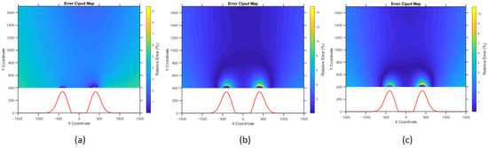
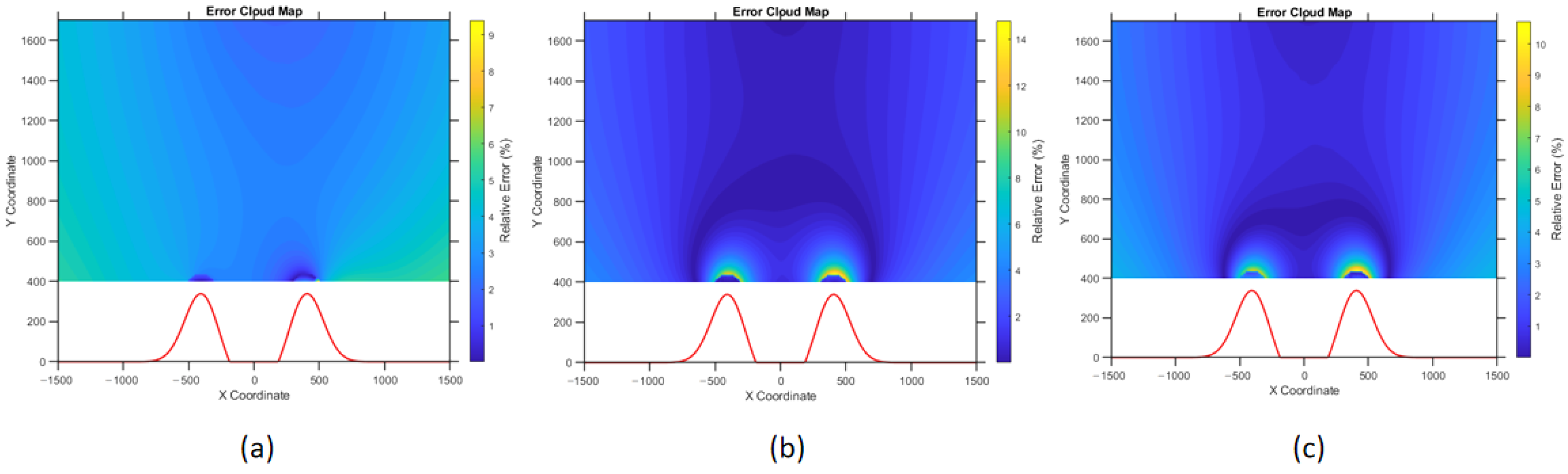
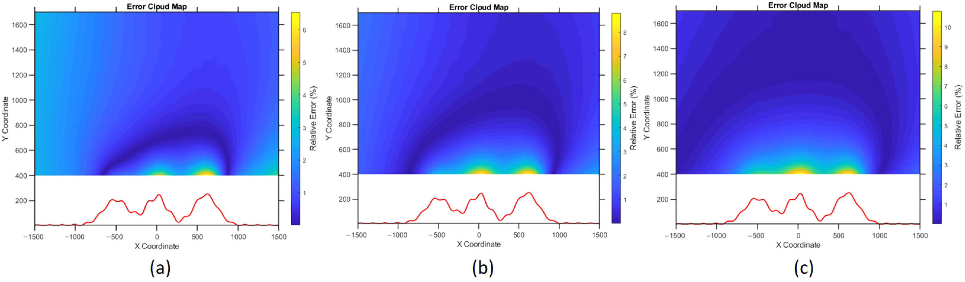
To further validate the robustness and generalization ability of the proposed method across diverse terrain geometries, additional verification experiments are conducted on three typical complex terrain configurations with distinct morphological characteristics: scarp slope terrain, double-peak terrain, and multi-peak terrain. For each terrain, three representative parameter schemes, corresponding to different optimization objectives, are adopted to perform conformal mapping and electric field calculation. The relative error contour maps compared with the high-fidelity COMSOL simulation results are presented in Figure 11, Figure 12 and Figure 13.
Figure 11.
Relative error contour maps for scarp slope terrain under three representative Pareto-optimal solutions: (a) minimum maximum error, (b) balanced trade-off, (c) minimum mean error.
Figure 12.
Relative error contour maps for double-peak terrain under three representative Pareto-optimal solutions: (a) minimum maximum error, (b) balanced trade-off, (c) minimum mean error.
Figure 13.
Relative error contour maps for multi-peak terrain under three representative Pareto-optimal solutions: (a) minimum maximum error, (b) balanced trade-off, (c) minimum mean error.
The calculation accuracy is affected by the complexity of the terrain. With the increase in terrain irregularity, the maximum relative error tends to rise moderately. Nevertheless, the proposed method maintains stable and reliable performance across different terrain types, which verifies its good robustness and adaptability to complex boundary conditions.
It should be clearly clarified that the robustness verification in this work is focused on the terrain adaptability of the proposed method, covering typical 2D smooth terrain profiles with different morphological characteristics (scarp slope, double-peak, and multi-peak terrain). The verified robustness dimensions include the following:
- Stability of optimization results under different terrain undulation degrees;
- Consistency of error control performance for symmetric and asymmetric 2D terrain;
- Convergence stability of the NSGA-II framework for different boundary conditions.
The following scenarios are outside the scope of the present verification:
- 3D terrain with complex spatial undulations;
- Transient electromagnetic field calculation of lightning discharges;
- Stochastic lightning strike scenarios with random leader propagation paths;
- Extreme terrain with discontinuous or sharp broken boundaries.
These scenarios are limited by the inherent mathematical properties of FLM, and will be explored in future work through extended methods.
3.5. Sensitivity Analysis
To further verify the generality and stability of the proposed method, the sensitivity to the charge position, sampling density, and computational domain are briefly discussed. When the charge position varies within common ranges used in lightning leader simulation, the calculation error remains stable, without obvious fluctuation. As the sampling density increases, the calculation result converges rapidly, and excessive sampling does not significantly improve accuracy but increases computation burden. When the computational domain is expanded beyond a certain size, the electric field distribution tends to be consistent, indicating that the selected domain in this study is sufficiently large to eliminate boundary effects. These results confirm that the proposed method has low sensitivity to common parameter variations and that the conclusions are general and reliable.
4. Discussion
This paper has developed a rapid and adaptive electric field computation model by integrating the NSGA-II multi-objective genetic algorithm with a multi-level conformal mapping framework. The study addresses the critical need for both efficiency and accuracy in calculating lightning-induced electric fields over complex terrain. While traditional numerical methods (e.g., finite elements) offer high accuracy, their substantial computational cost limits practical engineering utility. Existing conformal mapping approaches improve speed but depend on empirical or exhaustive traversal for parameter tuning, which is inefficient and lacks adaptability.
The proposed method resolves the key bottleneck of adaptive parameter selection for FLM. By formulating the search for the optimal mapping parameter M as a dual-objective optimization problem—simultaneously minimizing the maximum local error and the mean global error—the algorithm automatically identifies a Pareto-optimal set of solutions without manual intervention. The experimental results demonstrate that the method reduces the mean calculation error by approximately 5% compared to traditional traversal-based tuning, while maintaining comparable maximum-error performance. This limited improvement in maximum local error is an inherent theoretical constraint of FLM, which prioritizes efficient geometric adaptability for closing complex smooth terrain boundaries over extreme local error suppression—a trade-off necessary for the engineering applicability of conformal mapping in unstructured topographic scenarios. Moreover, the optimization process is 49.3% faster on average than exhaustive search, and the synergistic gain of moderate precision enhancement and substantial efficiency leap exhibits distinct practical engineering value under specific safety-critical and large-scale application conditions.
4.1. Practical Engineering Implications of the Synergistic Improvements
Although the proposed method is limited to electrostatic analysis and two-dimensional terrain modeling, it still provides notable engineering value in the preliminary stage of lightning protection design. The 5% reduction in mean global error and 49.3% improvement in computational efficiency help shorten the design cycle and improve the reliability of electric field distribution prediction. For large-scale engineering projects such as lightning protection design in mountainous transmission corridors, the efficiency improvement significantly reduces the time consumption of traditional exhaustive search and enables rapid parametric analysis. For precision-sensitive scenarios such as electronic equipment workshops, the error reduction helps weaken the cumulative deviation of field prediction and reduces the risk of unreasonable layout of lightning protection devices. In addition, the Pareto front obtained by the dual-objective framework provides a flexible decision-making basis for engineers, which can balance the relationship between computational efficiency and prediction accuracy according to the actual demand of the project. Overall, the proposed method is suitable for rapid analysis and auxiliary decision making in the preliminary design stage of lightning protection, and provides a feasible and efficient tool for scenarios within the scope of electrostatic and two-dimensional conditions.
4.2. Limitations and Critical Analysis of Engineering Applicability
It should be emphasized that the proposed method is developed based on FLM, which is mathematically defined only in the 2D complex plane. Therefore, the restriction to electrostatic field analysis and 2D terrain representation is an inherent theoretical property of FLM, rather than a limitation of the proposed algorithm.
Strict 3D conformal mapping exists only for a few simple symmetric structures (e.g., spheres), and standard fractional linear mapping cannot be directly extended to general 3D terrains. For complex and asymmetric 3D landforms such as ridges, valleys, and randomly undulating surfaces, such an extension is mathematically infeasible within the FLM framework. Only for symmetric terrains can quasi-conformal mapping be considered as a potential extension, which allows local angle distortion but minimizes global deformation energy [29].
In addition, the proposed method only calculates the electrostatic field component, which is suitable for preliminary lightning protection assessment but cannot capture transient electromagnetic effects. The deterministic model also does not involve the stochastic characteristics of lightning propagation, which limits its application in quantitative lightning risk assessment.
4.3. Future Extension Steps for Realistic Engineering Applications
For future extensions, feasible directions are proposed as follows:
- For symmetric terrain scenarios, quasi-conformal mapping can be introduced to extend the framework to approximate 3D cases, with appropriate distortion control.
- For realistic engineering applications, automatic extraction of 2D terrain profiles from DEM data can be integrated to improve modeling efficiency.
- The proposed method can be used as a fast preconditioning module to accelerate the convergence of traditional transient electromagnetic simulation methods.
- Field measurement data of lightning-induced electric fields will be used for experimental validation to further improve engineering reliability.
5. Conclusions
This paper has developed an adaptive and efficient electric field computation framework for lightning protection over complex terrain by integrating the NSGA-II multi-objective genetic algorithm with a multi-level fractional linear conformal mapping method. The core contribution is reformulating the selection of the mapping parameter M as a dual-objective optimization problem that simultaneously minimizes the maximum local error and the mean global error, thereby eliminating the need for empirical tuning or exhaustive traversal.
The experimental results demonstrate that the proposed method reduces the mean global error by approximately 5% and improves parameter optimization efficiency by an average of 49.3% compared to traditional exhaustive search, while maintaining comparable maximum local error performance. The framework exhibits stable accuracy across multiple terrain profiles, including scarp slope, double-peak, and multi-peak terrain, confirming its robustness and adaptability.
Due to the inherent mathematical properties of fractional linear mapping, the method is limited to 2D electrostatic field analysis and cannot be directly extended to general 3D terrains or transient electromagnetic simulations. Nevertheless, it provides a practical and efficient tool for preliminary lightning protection design in complex mountainous terrain, offering a flexible Pareto-based decision space for engineers. Future work will focus on integrating DEM data for automated profile extraction, accelerating transient simulations via preconditioning, and validating the framework with field measurement data.
Author Contributions
X.W. conceived the study and developed the integrated NSGA-II-conformal mapping framework. X.S. conducted the numerical simulations and data analysis. T.H. and X.C. contributed to the theoretical formulation of the conformal mapping algorithm and the design of validation cases. R.L. assisted with data interpretation and manuscript preparation. All authors reviewed and approved the final manuscript.
Funding
This work was supported by the National Natural Science Foundation of China (No. 52177161).
Institutional Review Board Statement
Not applicable. This study did not involve humans or animals.
Informed Consent Statement
Not applicable. This study did not involve humans.
Data Availability Statement
The data are available from the corresponding author on reasonable request.
Conflicts of Interest
Author Xiaojian Wang is affiliated with both Southwest Jiaotong University and the China Power Hua Chuang Electricity Technology Research Co., Ltd. Author Tianlei He is employed by the China Power Hua Chuang Electricity Technology Research Co., Ltd. The remaining authors declare that the research was conducted in the absence of any commercial or financial relationships that could be construed as potential conflicts of interest. The funders had no role in the design of the study; in the collection, analyses, or interpretation of data; in the writing of the manuscript; or in the decision to publish the results.
Abbreviations
The following abbreviations are used in this manuscript:
| NSGA-II | Non-dominated Sorting Genetic Algorithm II |
| FEM | Finite element method |
| MoM | Method of moments |
| FDTD | Finite-difference time-domain |
| SSOR | Symmetric successive over-relaxation |
| COMSOL | COMSOL Multiphysics (simulation software) |
| 2D | Two-dimensional |
| 3D | Three-dimensional |
| FLM | Fractional linear mapping |
| S-C | Schwarz–Christoffel |
| EMC | Electromagnetic compatibility |
| PEEC | Partial element equivalent circuit |
| DEM | Digital elevation model |
References
- Xu, X. Lightning Disaster and Its Monitoring and Forecasting. Meteorology 2004, 30, 17–21. [Google Scholar]
- Albrecht, R.I.; Goodman, S.J.; Buechler, D.E.; Blakeslee, R.J.; Christian, H.J. Where Are the Lightning Hotspots on Earth? Bull. Am. Meteorol. Soc. 2016, 97, 2051–2068. [Google Scholar] [CrossRef] [Scilit]
- Huang, R.; Lai, J.; Yin, W.; Deng, H.; Ma, X.; Luo, Z.; He, K.; Chen, W.; Dong, T. Efficiently solving large-scale electrostatic lightning problems by integrating characteristic basis functions into boundary element method. Electr. Power Syst. Res. 2024, 235, 110843. [Google Scholar] [CrossRef] [Scilit]
- Vargas, A.M. Finite Difference Method for Solving Fractional Differential Equations at Irregular Meshes. Math. Comput. Simul. 2022, 193, 204–216. [Google Scholar] [CrossRef] [Scilit]
- Kythe, P.K. An Introduction to Boundary Element Methods, 1st ed.; CRC Press: Boca Raton, FL, USA, 1995. [Google Scholar] [CrossRef] [Scilit]
- Lu, Y. Application of Topological Finite Element Method in Electromagnetic Field Problems. Master’s Thesis, Guangxi University, Nanning, China, 2006. [Google Scholar]
- Sun, J.; Xu, B. Finite Element Method and Its Application in Modern Mechanical Engineering. Technol. Enterp. 2015, 12, 184. [Google Scholar]
- Sun, X.; Lyu, Y.; Wang, Y.; Wu, D. Convergence of the Method of Fundamental Solutions with Numerical Conformal Mapping for Exterior Problems. J. Shaanxi Univ. Technol. 2021, 37, 86–92. [Google Scholar]
- Inoue, T. An Application to Numerical Dirichlet Problems of Unbounded Domains by the Charge Simulation Method for Numerical Conformal Mappings. IEEJ Trans. Electron. Inf. Syst. 1997, 117, 727–731. [Google Scholar] [CrossRef] [Scilit]
- Zhang, J.; Miao, Y.; Liu, X. Conformal Mapping Method Based on Curvilinear Coordinates for Complex Electromagnetic Boundaries. J. Xi’an Jiaotong Univ. 2016, 50, 43–47. [Google Scholar]
- Wang, X. Research on the Application of Complex Analytic Conformal Mapping in Electromagnetic Engineering. Ph.D. Thesis, Xidian University, Xi’an, China, 2011. [Google Scholar]
- Chen, J.-T.; Tsai, M.-H.; Liu, C.-S. Conformal Mapping and Bipolar Coordinate for Eccentric Laplace Problems. Comput. Appl. Eng. Educ. 2009, 17, 314–322. [Google Scholar] [CrossRef] [Scilit]
- Harsha, N.R.S.; Garner, A.L. Applying conformal mapping to derive analytical solutions of space-charge-limited current density for various geometries. IEEE Trans. Electron Devices 2021, 68, 264–270. [Google Scholar] [CrossRef] [Scilit]
- Wang, W.; Ma, W.; Wang, Q.; Ren, H. Conformal mapping for multiple terminals. Sci. Rep. 2016, 6, 36918. [Google Scholar] [CrossRef] [Scilit] [PubMed]
- O’Connell, T.C.; Krein, P.T. A Schwarz–Christoffel-based analytical method for electric machine field analysis. IEEE Trans. Energy Convers. 2009, 24, 565–577. [Google Scholar] [CrossRef] [Scilit]
- Lévy, B.; Petitjean, S.; Ray, N.; Maillot, J. Least squares conformal maps for automatic texture atlas generation. ACM Trans. Graph. 2002, 21, 362–371. [Google Scholar] [CrossRef] [Scilit]
- Driscoll, T.A.; Trefethen, L.N. Schwarz-Christoffel Mapping; Cambridge University Press: Cambridge, UK, 2002. [Google Scholar] [CrossRef] [Scilit]
- Wan, P.; Lyu, Y.; Wang, Y.; Tang, S. Numerical conformal mapping calculation method based on improved SSOR iteration method. Softw. Guide 2021, 20, 97–102. [Google Scholar]
- Ramakrishnan, K.; Zarko, D.; Hanic, A.; Mastinu, G. Improved method for field analysis of surface permanent magnet machines using Schwarz–Christoffel transformation. IET Electr. Power Appl. 2017, 11, 1067–1075. [Google Scholar] [CrossRef] [Scilit]
- Zhao, X.; Deng, H.; Gao, X.; Ma, X.; Dong, T. Controlling Electromagnetic Surface Waves with Conformal Transformation Optics. Commun. Phys. 2023, 6, 201. [Google Scholar] [CrossRef] [Scilit]
- Ji, Y.; Möller, M.; Yu, Y.; Zhu, C. Boundary Parameter Matching for Isogeometric Analysis Using Schwarz–Christoffel Mapping. Eng. Comput. 2024, 40, 3929–3947. [Google Scholar] [CrossRef] [Scilit]
- Li, Y.; Wang, Z.; Wang, K.; Yuan, J.; Xin, G.; Shi, X. A Modeling Method of Reverse Biased Electric Field for JBS Diodes Based on Schwarz-Christoffel Transformation. IEEE Trans. Comput.-Aided Design Integr. Circuits Syst. 2025, 44, 2832–2835. [Google Scholar] [CrossRef] [Scilit]
- Guo, N.; Li, R.; Cao, X.; Liang, Y.; Lei, Q.; Cai, S.; Zhou, J.; Xu, Y.; Wen, W. Fast calculation of electrostatic fields based on conformal mapping. Eng. Anal. Bound. Elem. 2025, 176, 106257. [Google Scholar] [CrossRef] [Scilit]
- Carroll, T. Simply connected domains, the Riemann mapping theorem and conformal mapping. In Geometric Function Theory; Springer Undergraduate Mathematics Series; Springer: Cham, Switzerland, 2024. [Google Scholar] [CrossRef] [Scilit]
- Gakhov, F.D. Kraevye Zadachi (Boundary Value Problems); Nauka: Moscow, Russia, 1977. [Google Scholar]
- Li, R.; Guo, N.; Cai, S.; Cao, X. From 2D conformal mapping to 3D electrostatic modeling: A regularized integral equation approach. Phys. Scr. 2025, 100, 065202. [Google Scholar] [CrossRef] [Scilit]
- Sindhya; Miettinen, K.; Deb, K. A Hybrid Framework for Evolutionary Multi-Objective Optimization. IEEE Trans. Evol. Comput. 2013, 17, 495–511. [Google Scholar] [CrossRef] [Scilit]
- Goh, C.K.; Tan, K.C. An Investigation on Noisy Environments in Evolutionary Multiobjective Optimization. IEEE Trans. Evol. Comput. 2007, 11, 354–381. [Google Scholar] [CrossRef] [Scilit]
- Zhang, D.; Choi, G.P.T.; Zhang, J.; Lui, L.M. A Unifying Framework for n-Dimensional Quasi-Conformal Mappings. SIAM J. Imaging Sci. 2022, 15, 960–988. [Google Scholar] [CrossRef] [Scilit]

Disclaimer/Publisher’s Note: The statements, opinions and data contained in all publications are solely those of the individual author(s) and contributor(s) and not of MDPI and/or the editor(s). MDPI and/or the editor(s) disclaim responsibility for any injury to people or property resulting from any ideas, methods, instructions or products referred to in the content. |
© 2026 by the authors. Licensee MDPI, Basel, Switzerland. This article is an open access article distributed under the terms and conditions of the Creative Commons Attribution (CC BY) license.