


Abstract
Municipal solid waste (MSW) generation is a global problem affecting the environment and public health. The current landfill’s useful life is reaching its end, making new site selection a priority to guarantee proper MSW management. This research evaluated the suitability of the metropolitan area of the municipalities of Chihuahua, Aldama, and Aquiles Serdan, using Spatial Decision Support Systems (SDSS) integrated with Multi-criteria Decision-making (MCDM) and hierarchical analysis, and Geographic Information Systems (GIS) to determine potential sites for new Metropolitan landfill development in a semi-arid region. Results showed that 44.7% of the areas studied present a high suitability level, while 29.52% corresponds to a very high suitability level. These areas are located mainly in the north and center zones of the Chihuahua and Aldama municipalities, with some isolated areas in Aquiles Serdan. The key selection criteria were airport distance, land slope, and proximity to the intermunicipal boundary, which enabled the identification of sites with lower environmental impact and greater technical and economic feasibility. This study demonstrates that SDSS and GIS are efficient tools for identifying potential landfill sites. The results highlight the importance of integrating technical, environmental, and social criteria into MSW management planning to achieve sustainable, efficient management in the region.
1. Introduction
Municipal solid waste (MSW) management represents a critical environmental challenge in rapidly urbanizing regions worldwide. As population growth, urban expansion, and consumption patterns intensify, the generation of solid waste continues to increase significantly. Globally, annual MSW generation reached 2.01 billion tons in 2016 and is expected to reach 3.4 billion tons by 2050. This sustained growth has positioned waste management as a worldwide concern [1,2].
Inadequate waste disposal practices contribute to environmental degradation, including soil and groundwater contamination, air pollution, and the aggravation of public health risks [3,4]. Consequently, there is an urgent need to develop efficient MSW management systems that can address the inherent complexity of this issue, which is characterized by uncertainty, multiple objectives, and subjective decision-making [5].
Among the available management strategies, landfill disposal remains the most widely used method due to its relative economic feasibility compared to alternatives such as incineration or composting [6]. However, identifying suitable landfill sites is a complex challenge, particularly in developed urban areas, where land availability is limited and environmental constraints are significant [7]. Landfill siting requires the integration of diverse, including social, technical, environmental, regulatory, and economic criteria, all of which interact within a spatial context and often involve conflicting priorities [8,9].
To address this complexity, Spatial Decision Support Systems (SDSS) and Multi-Criteria Decision-Making (MCDM) approaches have become widely used tools for the landfill site selection process. These methodologies, when integrated with Geographic Information Systems (GIS), enable the evaluation and spatial analysis of multiple criteria, supporting more informed and transparent decision-making processes [10,11,12,13,14,15]. Among these approaches, the Analytic Hierarchy Process (AHP) is used for decomposing complex spatial decision problems into hierarchical structures and assigning relative weights through pairwise comparisons based on expert judgment [16]. Previous studies have shown the robustness of GIS-based AHP models in balancing technical, environmental, and social considerations for landfill siting [17,18,19].
Recent advances have focused on addressing uncertainty and improving decision-making accuracy through the integration of advanced techniques such as fuzzy logic and hybrid frameworks, including neutrosophic sets [20,21,22]. Additionally, studies have highlighted the incorporation of geotechnical and geological analysis into GIS-based models for minimizing environmental risks and enhancing site suitability assessments [23,24]. Despite these advances, many studies still lack systematic validation procedures to assess the predictive performance of suitability models, limiting their reliability for decision-making.
In Mexico, MSW management continues to pose significant challenges. According to the Secretaría de Medio Ambiente y Recursos Naturales (SEMARNAT) [25], approximately 102,895 tons of waste are generated daily, of which only 83.93% is collected and 78.54% reaches final disposal sites, while recycling accounts for less than 10% of total waste. Historical trends show a substantial increase in waste generation associated with population growth, rising from 3 million tons in the 1950s to over 40 million tons in recent decades [26]. Although the number of landfills has increased, ensuring compliance with environmental regulations remains a persistent challenge [27].
The regulatory framework for landfill siting in Mexico is established by the Official Mexican Standard NOM-083-SEMARNAT-2003 [28], which sets environmental and technical criteria, including minimum distances from urban areas, protected natural areas, water bodies, and infrastructure, among others. However, the application of these criteria requires spatial analysis tools capable of integrating regulatory, environmental, and socio-territorial variables in a coherent and systematic framework.
Recent studies conducted in Mexican metropolitan areas, such as Monterrey, Nayarit, and Mexico City, have demonstrated the usefulness of GIS-based MCDM approaches for landfill siting for contrasting territorial suitability with the protection of local aquifers and managing the pressures of rapid urban expansion [29,30,31].
Nevertheless, these methods must be adapted to the specific conditions and characteristics of each region, particularly in arid and semi-arid environments, where water scarcity, fragile soils, and dispersed urban growth impose additional constraints [32]. Despite their relevance, integrated and validated models remain limited, particularly in northern Mexico [33].
In the state of Chihuahua, these challenges are particularly pronounced. Of its 67 municipalities, only 22 have landfills, and a significant proportion lacks adequate MSW management infrastructure. In the metropolitan area of Chihuahua, approximately 1000 tons of MSW are generated daily, with a composition dominated by organic materials, plastics, and paper [34]. Although a portion of this waste is collected and managed, the current landfill is approaching the end of its operational life, underscoring the urgent need to identify suitable alternatives for final disposal.
Furthermore, the Chihuahua-Aldama-Aquiles Serdán metropolitan area presents distinctive characteristics, including an arid climate, complex topography, and an accelerated conurbation process that pressures territorial reserves, all of which intensify the difficulty of landfill site selection. Together, intensify the complexity of landfill site selection and underscore the need for robust, spatially explicit, and validated decision-support tools.
Given these conditions, there is a need for spatial decision frameworks capable of integrating regulatory criteria, environmental variables, and expert knowledge within a comprehensive territorial analysis. In this context, the present study proposes an integrated spatial decision-support approach that combines regulatory Boolean screening with an AHP-based multicriteria suitability model within a GIS environment. The methodology incorporates 21 environmental, infrastructural, and regulatory criteria derived from NOM-083-SEMARNAT-2003, expert knowledge, and regional spatial data to evaluate potential landfill sites in the Chihuahua metropolitan area.
In addition, the predictive performance of the suitability model is evaluated using the Receiver Operating Characteristic (ROC) curve analysis and the Area Under the Curve (AUC), providing a quantitative measure of the model’s discriminatory capacity. By integrating expert-based weighting and spatial validation within a GIS framework, this study contributes to the development of a methodology for landfill site selection in rapidly urbanizing regions and provides decision-support tools for sustainable MSW management.
2. Materials and Methods
2.1. Study Area
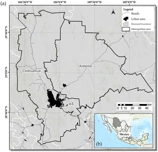
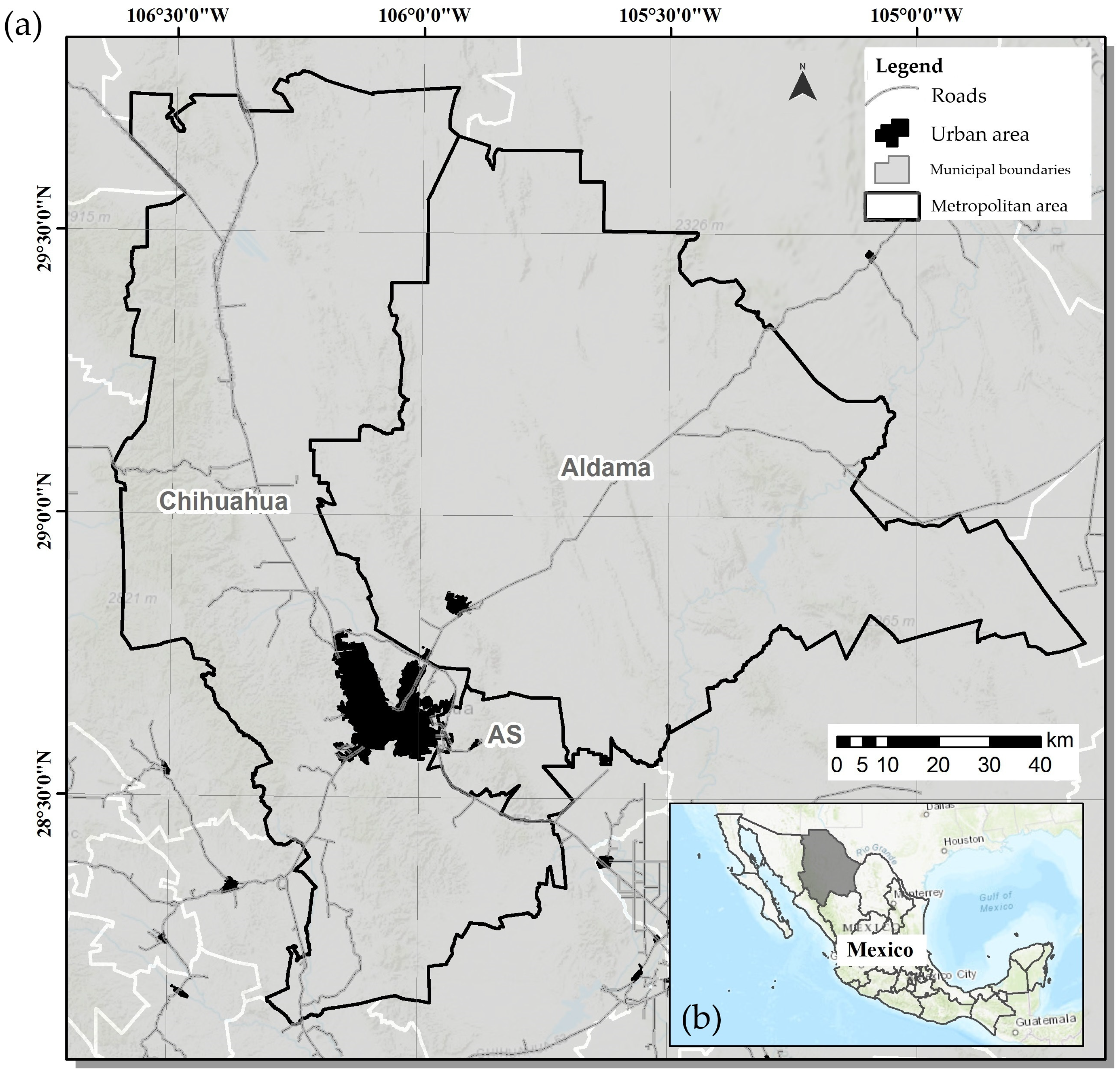
The study area comprises the municipalities of Chihuahua, Aldama, and Aquiles Serdan, with populations of 937,674, 26,047, and 24,344 inhabitants, respectively, for a total population of 988,065 (Figure 1). The municipalities cover land areas of 836,792.78 ha in Chihuahua, 920,246.39 ha in Aldama, and 49,354.87 ha in Aquiles Serdán. The Instituto Nacional de Estadística y Geografía (INEGI), the Consejo Nacional de Población (CONAPO), and the Secretaría de Desarrollo Agrario, Territorial y Urbano (SEDATU) recognize the municipalities of Chihuahua, Aldama, and Aquiles Serdán as part of the metropolitan area designated “ZM Chihuahua 0801” [35].
Figure 1.
Study area location. (a) The Chihuahua Metropolitan Area (0801) in northern Mexico, including the municipalities of Chihuahua, Aldama, and Aquiles Serdán (AS). The black polygon represents the metropolitan boundary, while the dark shaded area indicates the main urban zone. (b) Regional location of the State of Chihuahua within Mexico.
According to CONAPO [36], population projections for the study area indicate that by 2030, the municipality of Aldama will reach 28,581 inhabitants, Aquiles Serdán will reach 19,383 inhabitants, and Chihuahua will reach 1,028,134 inhabitants. Together, the three municipalities that comprise the Chihuahua metropolitan area (ZM Chihuahua 0801) are projected to reach a total population of 1,076,098 by 2030.
2.2. Literature Review
The Official Mexican Standard NOM-083-SEMARNAT-2003 was reviewed to identify the regulatory and technical criteria relevant to landfill site selection. The main minimum requirements established by NOM-083-SEMARNAT-2003 for site selection are summarized below [28]:
- When a site or landfill is intended to be located less than 13 km from the center of the airport or airfield providing service to the public, the chosen distance will be determined through an aviation safety analysis.
- Landfills should not be located within protected natural areas, except for the sites provided in the protected natural area management plans.
- In towns with over 2500 inhabitants, the site limit must be at a minimum distance of 500 m counted from the limit of the existing urban layout or provided in the urban development plan.
- It must not be in zones with marshlands, mangals, estuaries, swamps, flood plains, river plains, aquifer recharge areas, archeological areas, nor above caverns, nor faults, nor fractures.
- The site, landfill, must be located outside of flood areas with a 100-year return period. In the event of non-compliance with the above, it must be demonstrated that there will be no flow obstruction in the flood area, no possibility of landslides, and no erosion affecting the physical stability of the works comprising the final disposal site.
- The landfill location, minimum distance with respect to surface bodies of water such as rivers, lakes, and lagoons must be 500 m.
- The location between the site and the landfill limit and any water extraction well for domestic, industrial, irrigation, and livestock uses, both in operation and abandoned, must be 100 m in 500 m.
Inter-municipal considerations were also included, as the purpose of the new landfill is to provide MSW management for the Aldama and Aquiles Serdan municipalities, both under a conurbation process. In addition to this inter-municipal criterion, other criteria are based on the local/regional expert knowledge, relevant international literature [37,38], the availability of georeferenced data, Urban Development Plans of Chihuahua and Aldama, and the Local Ecological Planning Program of the Municipality of Chihuahua.
2.3. Spatial Datasets and Preprocessing
A total of 21 criteria were compiled from NOM-083-SEMARNAT-2003, expert knowledge, and supporting planning instruments. These criteria constituted the full set of variables considered in the study (Table 1).
Table 1.
Criteria for landfill site suitability analysis.
From this full set, 15 criteria representing non-negotiable regulatory or physical constraints were used in the Boolean screening model (Table 2).
Table 2.
Criteria included in the Boolean landfill suitability model.
The selected criteria were available in different formats (vector or raster) and at different spatial scales. Prior to the multi-criteria analysis, all layers were standardized to a common raster format with a 15 m × 15 m cell size using ArcMap 10.5© (ESRI, Redlands, CA, USA; https://www.esri.com/en-us/home, accessed on 22 May 2025). The selected resolution was defined based on the original spatial scale and level of detail of the DEM [46]. All spatial data were projected into a common coordinate reference system (UTM Zone 13N, WGS84 datum) to ensure geometric consistency across layers.
In this study, two complementary spatial modeling approaches were applied: a Boolean screening model and a non-Boolean suitability model. The Boolean model served as an initial regulatory filter to exclude areas that do not comply with the minimum requirements established in NOM-083-SEMARNAT-2003. This approach ensures that only locations meeting mandatory legal and environmental restrictions are considered. Subsequently, a non-Boolean suitability model was implemented to evaluate the relative suitability of the remaining areas using a graded scale. This second approach allows the integration and weighting of multiple criteria using a multi-criteria decision-making framework, thereby enabling the identification of the most technically feasible locations for landfill development within the applicable regulatory constraints.
2.4. Criteria Standardization
To standardize the criteria, 15 criteria were selected and standardized according to the requirements established in NOM-083-SEMARNAT-2003 (Table 2). These criteria were simplified into two categories: either they meet the minimum distance requirement, or they do not (Boolean). Similarly, for the slope (grade), a maximum slope angle was determined to represent the compliance status. After that, logical conjunction operations were performed with the 15 layers pixel to pixel, resulting in a binary model: either it complies, or does not comply with the criteria of all layers. Finally, a modification was made to the airport layer to relax the criteria, as the official standard states that it is possible to have a site at a distance less than 13 km, provided an aviation safety analysis is conducted and included in the environmental impact statement.
In the non-Boolean (suitability) method, all criteria were standardized on a 1 to 5 scale based on the framework proposed by FAO (1976) [47]. In accordance with NOM-083-SEMARNAT-2003, each criterion was assigned a suitability score ranging from 1 (least adequate) to 5 (most adequate) for landfill development (Table 3). The suitability levels assigned in this study were Very Low (1), Low (2), Moderate (3), High (4), and Very High (5), as described in Table 4.
Table 3.
Standardization of criteria affecting landfill development site suitability, integrated into the non-Boolean model, with the most suitable levels set below the levels specified in NOM-083-SEMARNAT-2003.
Table 4.
Definition of suitability levels for landfill development sites.
2.5. Criteria Weighing
For the non-Boolean suitability model, the criteria were integrated within a GIS-based multi-criteria decision-making (MCDM-GIS) framework. This approach enables the combined analysis of spatial and non-spatial information, thereby supporting decision-making through the incorporation of expert knowledge and the relative importance of multiple criteria. Accordingly, criterion weights were assigned to reflect their contribution to landfill site suitability.
Criterion weights were calculated using the AHP approach. AHP is a well-established decision-making approach for evaluating and selecting sites with determined potential. Enables decision-makers to overcome difficulties in determining the relative importance of weighing in complex multi-criteria problems, this mathematical analysis reduces the problem’s complexity to a series of pairwise comparisons. AHP also allows consideration of both qualitative and quantitative data in this decision-making. Therefore, a decision hierarchy was constructed to break down the complex decision problem. Within each level of the hierarchy, a pair-comparison matrix was constructed, allowing decision-makers to evaluate different elements by comparing each pair of possible criteria and their level of importance as far as possible.
The pairwise comparison process involved eight experts with professional experience in environmental management, land use planning, hydrology, geotechnics, geomatics, and government representatives. Their expertise ensured that the evaluation of the criteria reflected technical, regulatory, and spatial considerations relevant to the selection of the landfill site. Individual opinions were systematically collected and then aggregated to construct the final comparison matrices used in the AHP analysis.
Criterion weight was determined by classifying its importance and suitability. Pair comparison evaluation was conducted through expert judgment. The comparison of several criteria may be performed using a 9-point scale defined by Saaty [16], as shown in Table 5 [16,17,18]. The importance of criteria used a scale with values from the 9-point set (1/9, 1/8, 1/7, 1/6, 1/5, 1/4, 1/3, 1/2, 1, 2, 3, 4, 5, 6, 7, 8, 9), ranged from the minimum value 1/9, representing the least important, through 1 representing the same importance, to 9 for the greatest importance. The comparison matrix was a square matrix in which points were entered above and below the diagonal, with the diagonal entries set to 1.
Table 5.
Values used in pair comparison to evaluate new landfill site suitability.
The consistency of the experts’ judgments was evaluated using the consistency index (CI) and the consistency ratio (CR), following the methodology proposed by Saaty. The consistency ratio was obtained by comparing the CI with the corresponding random index (RI) according to the size of the matrix, and values close to or below the acceptable threshold were considered indicative of reliable judgments. This procedure ensured the methodological soundness and internal consistency of the weighting process applied in the suitability analysis.
Once weights were determined, they were used with their corresponding standardized criteria as input for final decision map generation.
2.6. Final Decision Map Generation
The derived weights and standardized criteria were processed using the “Weighted Overlay” tool in ArcGIS 10.5, which combines multiple criteria according to their assigned weights to produce a suitability map. This approach has been widely used in previous studies for selecting potential landfill development sites around the world [48,49,50,51] and in Mexico [27,30].
2.7. Comparison with Predefined Sites
Together with the Dirección de Obras Públicas of the Municipal Government of Chihuahua, 28 potential landfill sites were preselected and evaluated using the weighted suitability model for the municipalities of Chihuahua, Aldama, and Aquiles Serdan. The comparison was conducted in ArcGIS 10.5 by overlaying the preselected sites with the suitability map generated from criteria derived from NOM-083-SEMARNAT-2003.
To quantitatively assess the predictive performance of the Weighted Sum Model, a Receiver Operating Characteristic (ROC) curve analysis was conducted using the ArcSDM Tool 10 (Spatial Data Modeller extension), specifically the “Calculate ROC Curves and AUC Values” function. The suitability raster served as the predictor variable, and the technically evaluated candidate sites were used as reference data. The Area Under the Curve (AUC) was calculated as an indicator of the model’s discriminative capacity.
Due to municipal restrictions associated with private land tenure, the exact geographic coordinates of the candidate sites cannot be publicly disclosed; however, the validation analysis was performed using official spatial information provided by the municipal authority.
3. Results
3.1. Boolean Suitability Model
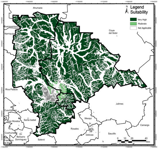
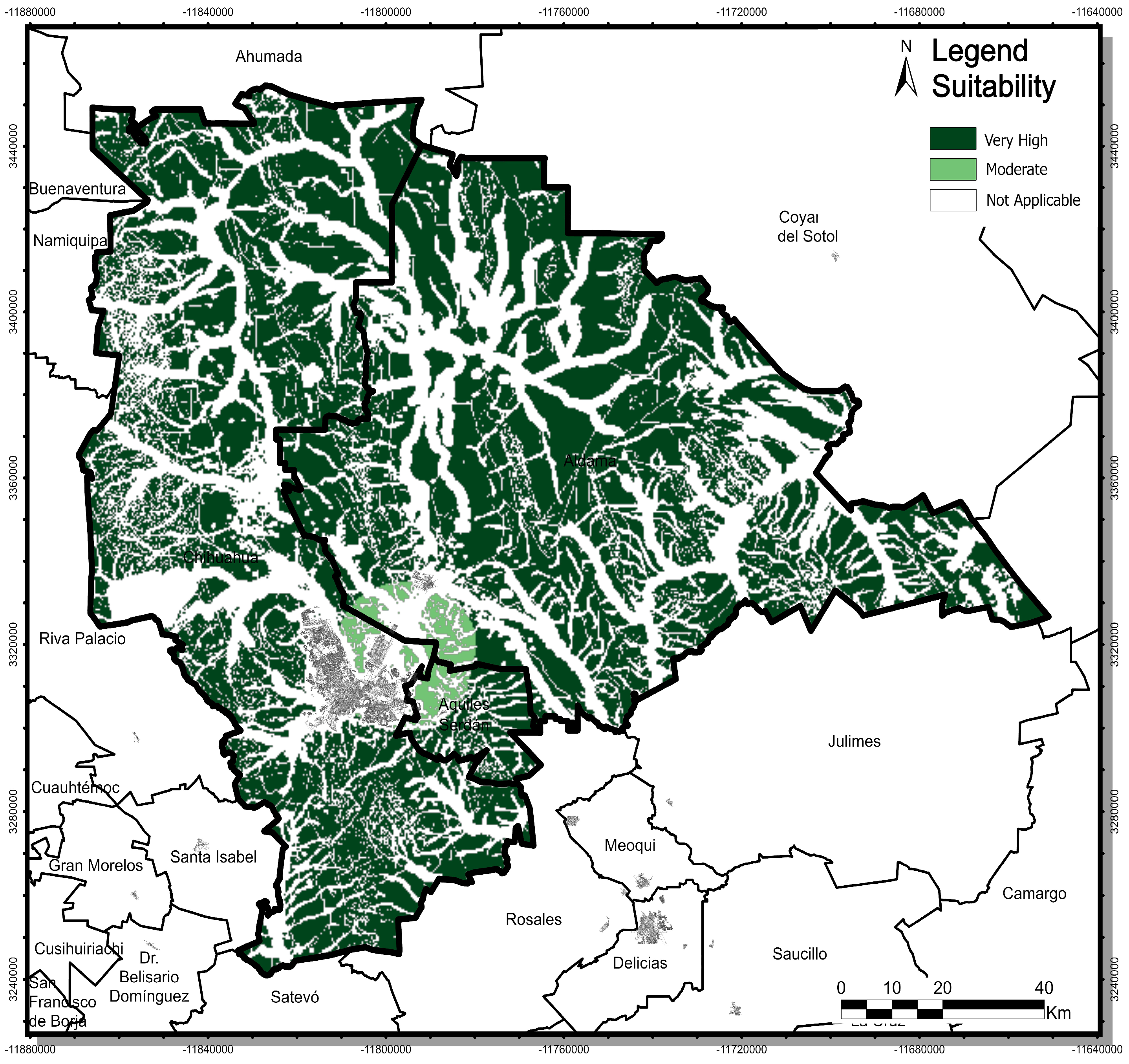
The model obtained using fifteen criteria for landfill development and after modifying the airport distance criterion, the model was defined only as very high suitability zones, moderately suitability zones, and non-suitability zones or not applicable zones (Figure 2).
Figure 2.
Multi-criteria Boolean model with airport modification (green colors indicate criteria compliance).
3.2. Non-Boolean Suitability Model
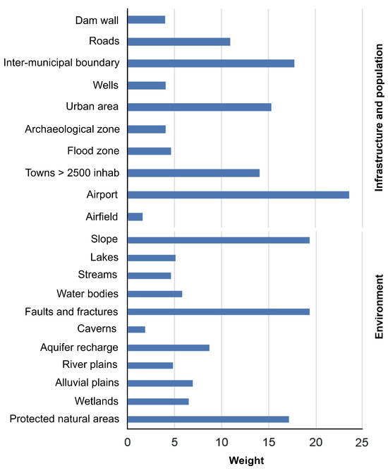
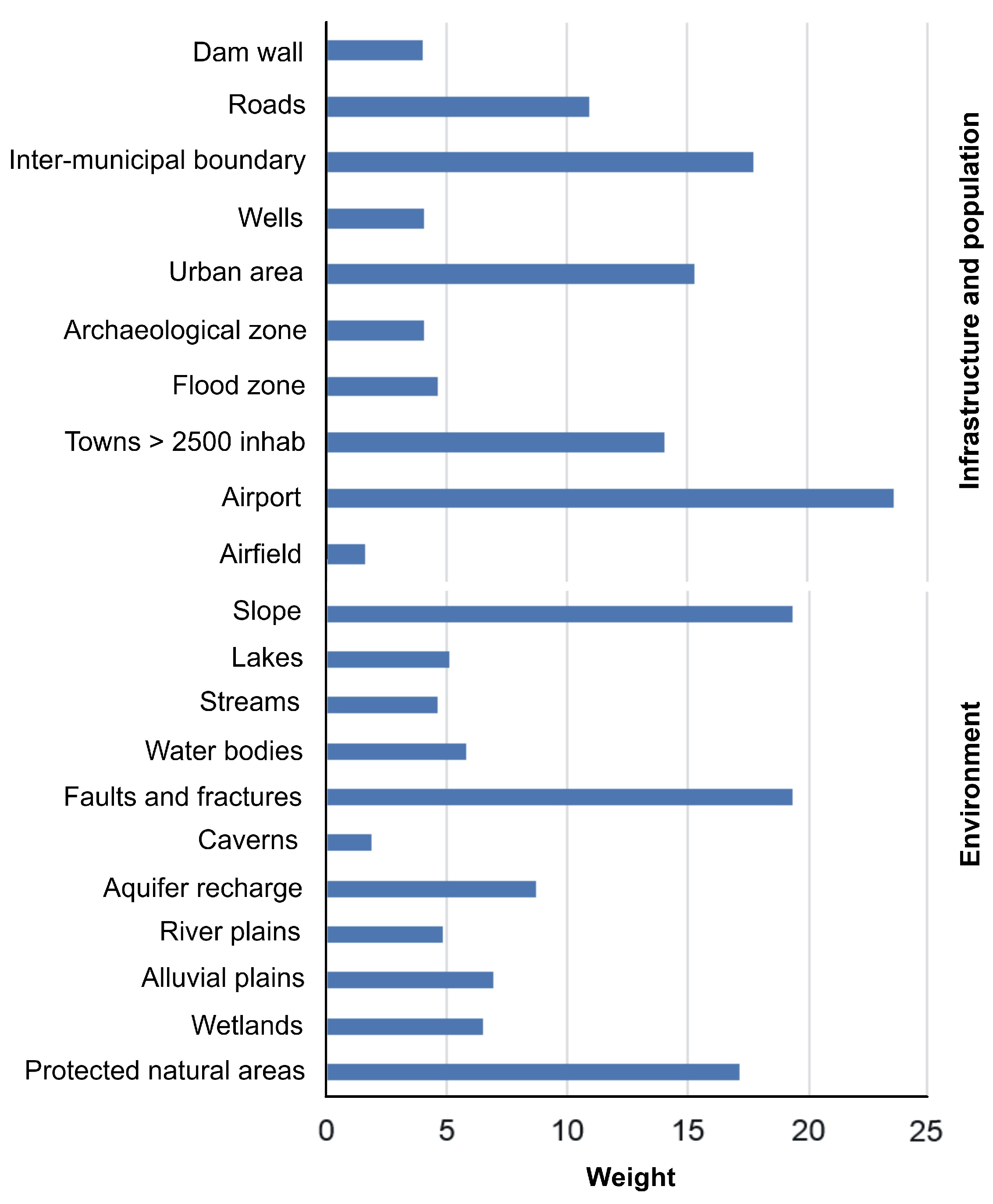
Regarding the non-Boolean (suitability) model, the expert pair comparisons are shown in Table 6 and Table 7. The weighting scheme indicates that the airport distance was the most influential criterion, followed by land slope, faults and fractures, and the inter-municipal boundary (Figure 3). This prioritization reflects regulatory and operational considerations according to NOM-083-SEMARNAT-2003 [28].
Table 6.
Matrix of pair comparison for infrastructure and population criteria affecting landfill development (CR = 0.098).
Table 7.
Matrix of pair comparison for physical environment criteria affecting landfill development. (CR = 0.171).
Figure 3.
Weights obtained from pair comparison under the AHP approach.
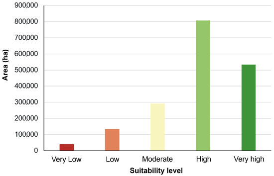
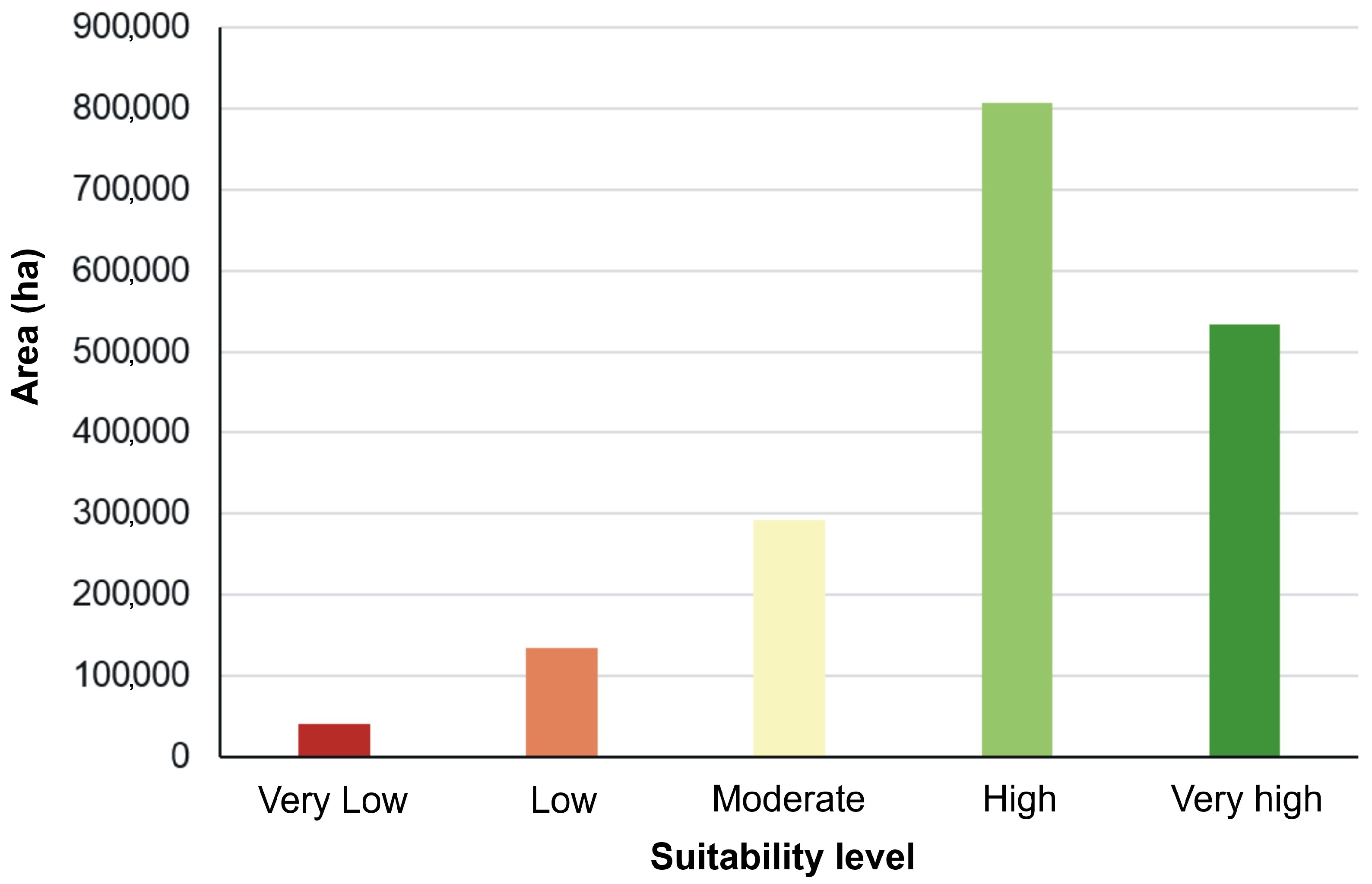
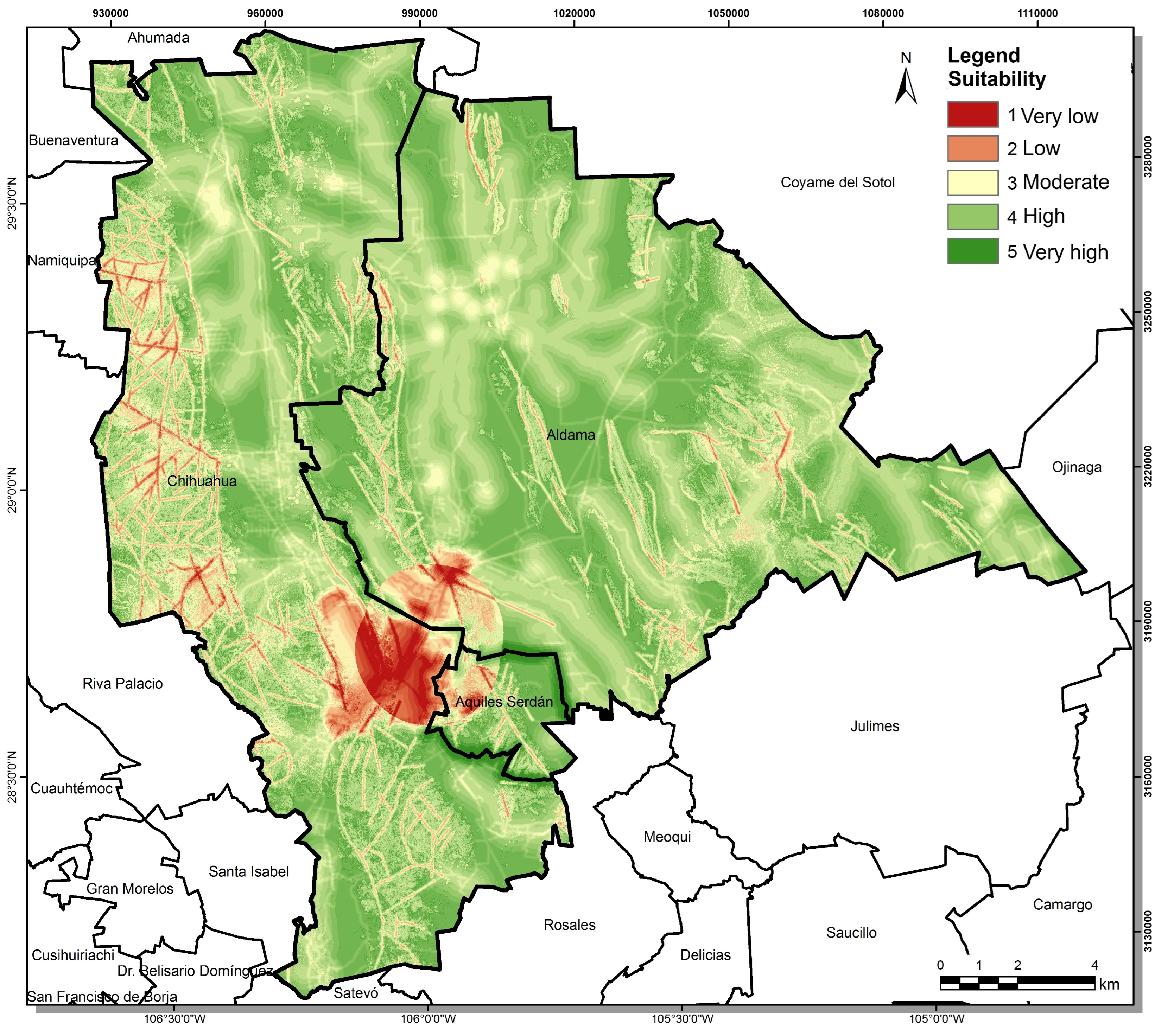
The MCDM-GIS framework, combined with AHP, was used to evaluate the suitability of the study area for landfill development based on 21 criteria. This approach enabled the generation of a five-level spatial suitability representation in a final decision map, weighted by several experts. These areas corresponding to each level of site suitability are shown in Figure 4 and Table 8. Under the AHP-based model, areas classified as High suitability covered 807,572.52 ha, representing 44.71% of the ZM Chihuahua 0801. In contrast, areas classified as Very High suitability covered 533,195 ha, corresponding to 29.52% of the study area.
Figure 4.
Land corresponding to the five suitability levels for landfill development under the AHP approach. Colors represent suitability classes, ranging from red (Very Low) to dark green (Very High).
Table 8.
Land area and percentage corresponding to each suitability level under the AHP approach.
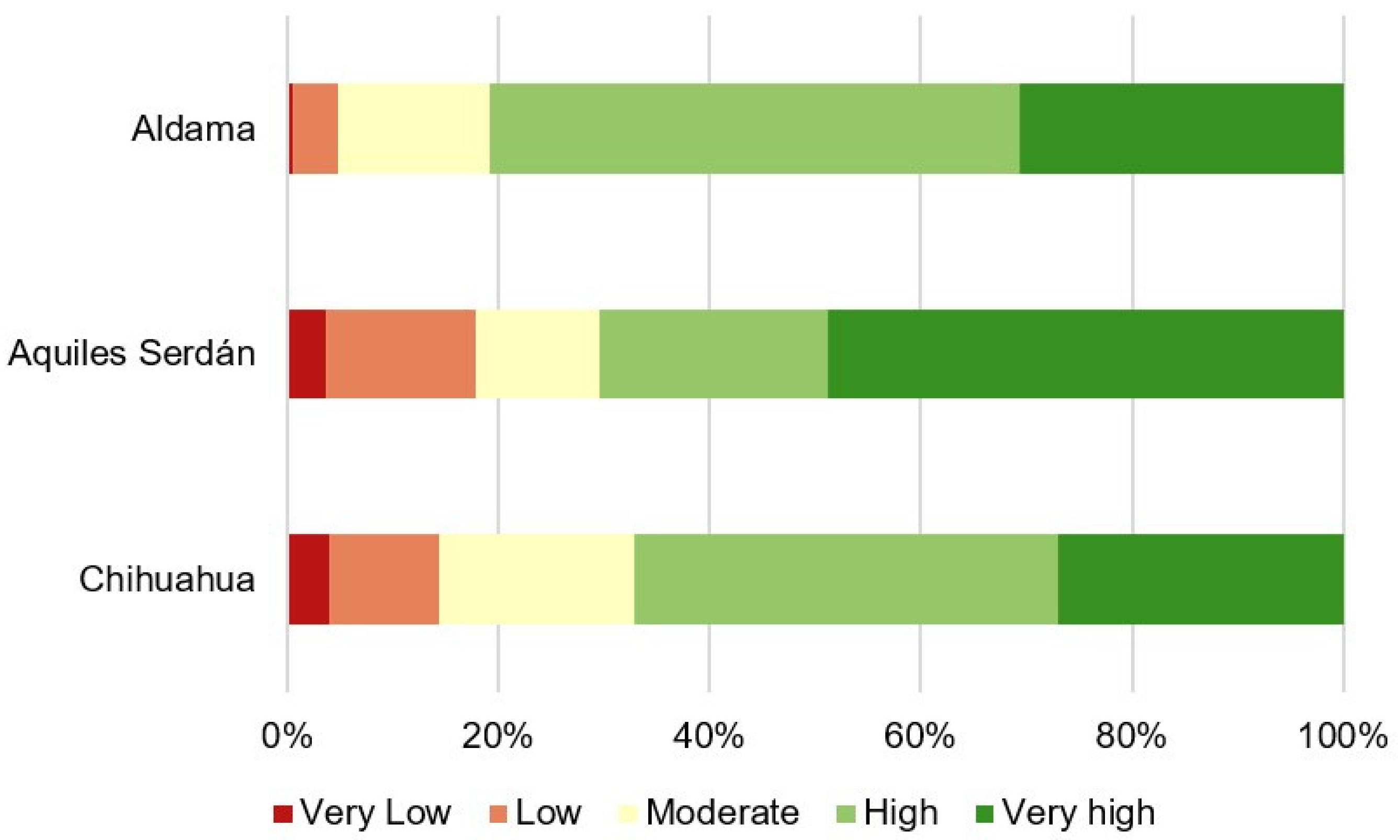
Under the AHP-based non-Boolean suitability model (Figure 5 and Figure 6), sites classified as High suitability form spatially connected zones distributed mainly across the northern portions of the municipalities of Chihuahua and Aldama. In these municipalities, high-suitability areas cover 334,771.74 ha and 462,098.91 ha, respectively. Areas classified as Very High suitability are more spatially concentrated, occurring primarily in the northern and central sectors of Chihuahua and Aldama. Within these municipalities, very high suitability areas cover 226,346.65 ha and 282,713.68 ha, respectively. In Aquiles Serdán, 24,135.19 ha were classified as Very High suitability, mainly in the northeastern part of the municipality.
Figure 5.
Spatial distribution of suitability levels of the landfill development land in ZM Chihuahua 0801.
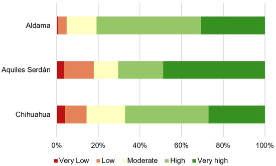
Figure 6.
Landfill development land suitability level occupation percentages by municipality in the ZM Chihuahua 0801.
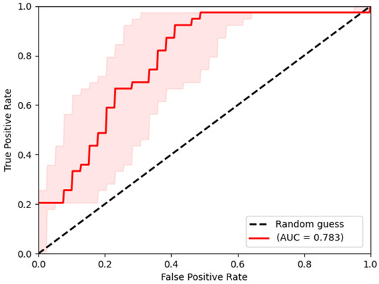
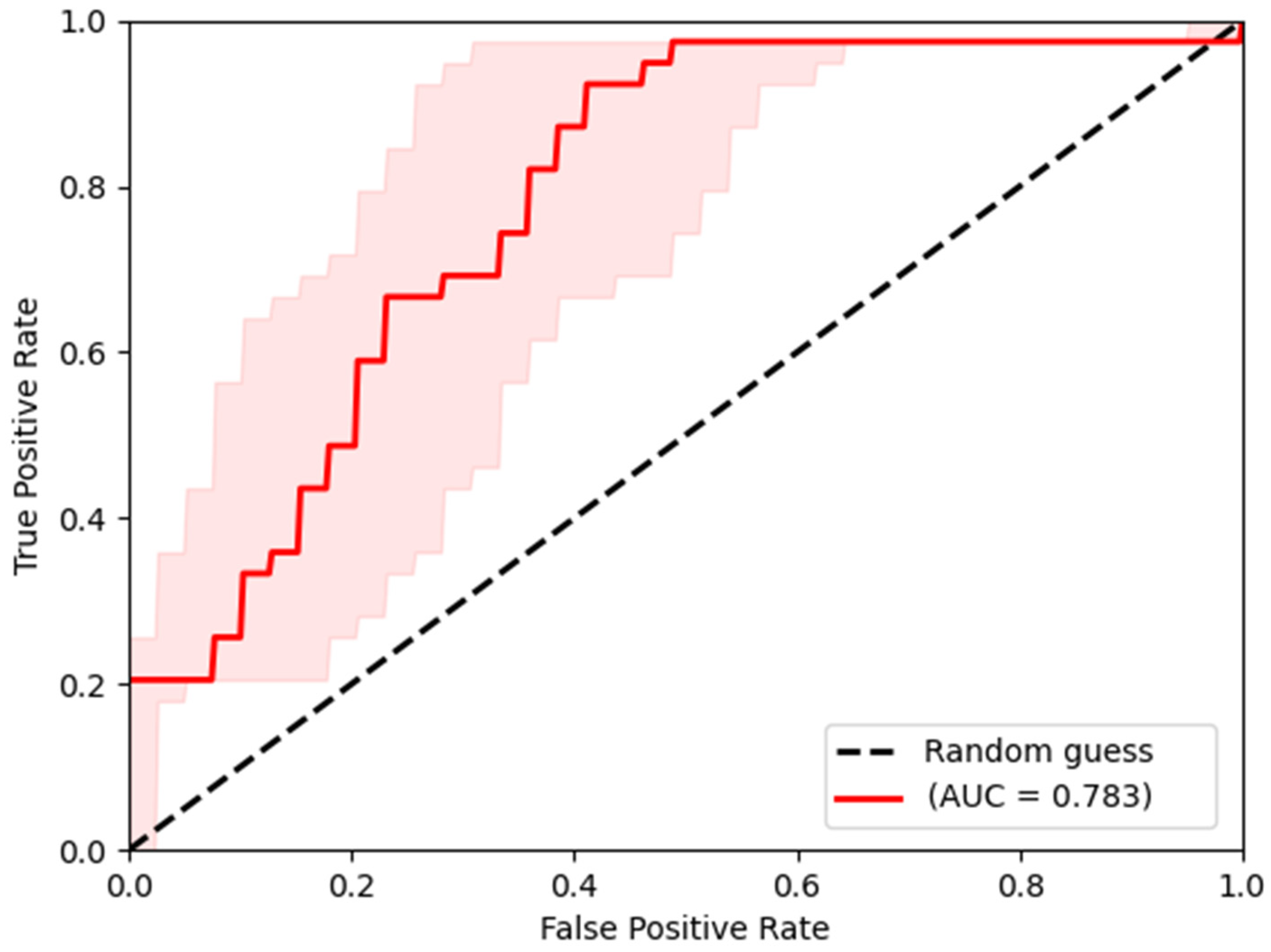
The predictive performance of the weighted suitability model was assessed using receiver operating characteristic (ROC) curve analysis. Figure 7 shows the ROC curve obtained from the comparison between continuous suitability values and technically evaluated candidate landfills. The curve lies above the diagonal reference line representing random classification, indicating that the model performs substantially better than a random prediction. The area under the curve (AUC) value obtained was 0.783, indicating good discriminatory power. This result demonstrates that the suitability model is capable of effectively distinguishing between the most suitable and least suitable areas within the study region. The steep initial rise in the curve reflects a relatively high true positive rate with low false positive rates, suggesting that the model successfully identifies suitable locations and minimizes classification errors. Overall, the ROC analysis supports the robustness and reliability of the proposed AHP-GIS suitability framework.
Figure 7.
Receiver Operating Characteristic (ROC) curve and Area Under the Curve (AUC) for a non-Boolean (suitability) model. The red line represents the ROC curve of the weighted suitability model, the light pink shaded area indicates the confidence interval around the ROC curve, and the black dashed line represents the random-classification reference.
4. Discussion
The results of the spatial suitability analysis indicate that a substantial proportion of the study area presents favorable conditions for landfill development. Specifically, 44.71% of the analyzed territory was classified as having high suitability and 29.52% as very high suitability under the AHP-based model. These results reflect the spatial heterogeneity of environmental, infrastructural, and regulatory conditions across the ZM Chihuahua 0801. The concentration of suitable areas in the northern and central zones of the municipalities of Chihuahua and Aldama underscores the value of spatially explicit decision-support tools for identifying technically viable landfill locations while minimizing potential environmental conflicts.
The comparison between Boolean and non-Boolean methods reveals clear methodological differences in spatial precision, ranking capacity, and decision-support robustness. The Boolean approach applies a dichotomous logic based on regulatory thresholds, classifying areas as either suitable or unsuitable [52]. In contrast, AHP, as a non-Boolean multi-criteria method, assigns relative importance to each criterion through pairwise comparisons and generates continuous suitability surfaces [17,18,19,53]. This distinction is particularly relevant in complex territorial contexts, where environmental and socio-spatial constraints operate along gradients rather than absolute conditions, highlighting the greater analytical flexibility of the AHP approach [52,54].
The weighting process indicates that airport distance, land slope, faults and fractures, and proximity to the inter-municipal boundary are the most influential factors in determining landfill suitability. The prominence of airport distance aligns with the requirements of NOM-083-SEMARNAT-2003, which prioritizes aviation safety due to the risk of bird strikes. Similarly, terrain slope represents a critical physical constraint, as steep gradients increase the likelihood of instability, leachate runoff, and erosion processes [55]. Geological features such as faults and fractures are also relevant, given their potential influence on subsurface permeability and contamination pathways [56]. In addition, the relevance of the inter-municipal boundary reflects the planning objective of locating a facility capable of serving multiple municipalities, thereby improving operational efficiency and regional waste management integration.
The predictive performance of the model, evaluated through ROC curve analysis, yielded an AUC value of 0.783, indicating good discriminatory capacity. This result demonstrates that the integration of regulatory constraints, environmental variables, and expert-based weighting within a GIS framework provides a reliable tool for distinguishing between more and less suitable areas for landfill development [57]. In this sense, the model not only identifies potential sites but also supports decision-making by prioritizing alternatives based on relative suitability [58].
From a methodological perspective, the results confirm that Boolean approaches are effective for preliminary screening and for ensuring compliance with strict regulatory constraints. However, the binary structure limits their ability to represent intermediate suitability conditions and to differentiate between alternative locations. In contrast, the AHP-based model (non-Boolean approaches) captures gradual spatial variation and allows for a more nuanced evaluation of competing criteria, resulting in a more informative prioritization of potential flexibility and realism of multicriteria approaches.
These findings are consistent with previous studies that demonstrate the advantages of integrating AHP with GIS for landfill siting. Applications in regions such as Morocco and Iran have shown that multicriteria approaches provide more differentiated and realistic suitability assessments than purely Boolean methods, reducing the likelihood of excluding viable alternatives [53,54,59]. The results showed that Boolean approaches tend to oversimplify territorial suitability, while AHP produces more consistent and differentiated rankings of alternatives [53,60]. This is particularly relevant in real-world decision-making scenarios, where certain constraints may be mitigated through engineering or management measures rather than treated as absolute exclusions [61].
In Mazandaran, Iran, the AHP-based multi-criteria model integrated geological, hydrological, and land-use variables demonstrated greater sensitivity to spatial variability than binary models [62]. This finding highlights that Boolean methods may either overestimate or underestimate suitable areas depending on the rigidity of thresholds, whereas AHP captures intermediate suitability conditions that better reflect environmental complexity [62,63].
From a critical perspective, this research is consistent with previous literature in recognizing that Boolean methods remain useful as preliminary regulatory screening tools, particularly in ensuring compliance with legally binding constraints [28,48]. However, this study extends existing approaches by demonstrating that, when used in isolation, Boolean logic is insufficient for supporting robust landfill siting decisions in complex metropolitan environments [53].
Fundamentally, this study contributes by integrating Boolean screening with an AHP-based multicriteria evaluation within a GIS framework and incorporating a validation process to assess model performance. This validation step, often absent in other studies, strengthens the reliability, transparency, and applicability of landfill siting analyses, particularly in complex metropolitan contexts [18,20,64].
The relevance of this contribution is particularly evident in arid and semi-arid metropolitan regions such as the Chihuahua metropolitan area, where environmental constraints (water scarcity, soil fragility, and dispersed urban expansion) interact in complex ways [29,30]. In such contexts, the ability of AHP to represent graded suitability and incorporate expert knowledge becomes fundamental for identifying feasible alternatives that may be overlooked under rigid Boolean criteria [19,65].
Overall, the results support the use of hybrid approaches in which Boolean logic is applied for initial constraint filtering, followed by AHP for prioritization [17,53,57]. This combination provides a more robust, transparent, and context-sensitive framework for landfill site selection, improving spatial decision-making and facilitating its transferability to other regions facing similar environmental and territorial challenges [64].
5. Conclusions
The results demonstrate that integrating Boolean regulatory screening with an AHP-based multicriteria suitability model within a GIS environment provides a robust, transparent, and transferable framework for landfill site selection. By incorporating regulatory constraints derived from NOM-083-SEMARNAT-2003 together with expert-based weighting, the proposed approach enables the identification of technically feasible areas while systematically reducing environmental and territorial risks.
A total of 21 criteria were selected based on Mexican regulation, scientific literature, and expert knowledge. The application of the AHP method allowed the assignment of relative weights to each criterion, reflecting their differential influence on landfill suitability. In contrast to rigid exclusion approaches, this method captures gradients of suitability, improving the prioritization of potential sites and supporting more informed and balanced decision-making processes.
The combined use of Boolean constraints and AHP weighting proved effective in balancing regulatory compliance with spatial flexibility. The validation results support the robustness of the model and highlight its applicability for territorial planning, particularly in arid and semi-arid regions where variability directly influences site feasibility.
Furthermore, the use of GIS-based multicriteria models significantly reduces the time and resources required for preliminary identification of suitable areas. However, spatial modeling should be understood as a pre-feasibility stage rather than a definitive decision tool. Field verification, including geological, geohydrological, topographical, geotechnical, and environmental assessments, remains essential prior to final site selection to ensure long-term operational safety and regulatory compliance.
This research contributes to the existing body of knowledge by integrating regulatory screening, multicriteria evaluation, and model validation within a single methodological framework, and approach that remains limited in landfill siting studies. This integration enhances the reliability, transparency, and applicability of decision-making processes in complex territorial contexts, particularly in arid and semi-arid regions.
Finally, landfill site selection is inherently a complex process that must consider environmental, social, technical, and economic factors, as well as public opposition. In this context, the proposed methodology offers a replicable and adaptable tool that can support territorial planning in other urban areas, including the remaining municipalities of the state of Chihuahua, and similar regions across Mexico.
Author Contributions
Conceptualization, J.A.P.-A. and G.S.A.-d.l.R.; methodology, J.A.P.-A. and G.S.A.-d.l.R.; software, G.V.-Q. and M.C.N.-R.; validation, J.A.P.-A. and M.C.V.-A.; formal analysis, J.A.P.-A. and G.S.A.-d.l.R.; investigation, M.C.V.-A. and C.G.G.-G.; resources, M.C.V.-A. and C.G.G.-G.; data curation, G.V.-Q. and M.C.N.-R.; writing—original draft preparation, J.A.P.-A., M.C.V.-A. and L.C.-P.; writing—review and editing, J.A.P.-A., M.C.V.-A. and L.C.-P.; visualization, J.A.P.-A., M.C.V.-A. and L.C.-P.; supervision, J.A.P.-A. and M.C.V.-A.; project administration, M.C.V.-A. and L.C.-P.; funding acquisition, M.C.V.-A. All authors have read and agreed to the published version of the manuscript.
Funding
This research did not receive external funding.
Data Availability Statement
The raw geospatial and analytical datasets supporting the conclusions of this study are available from the corresponding author upon reasonable request.
Conflicts of Interest
The authors declare no conflicts of interest.
References
- Kaza, S.; Yao, L.C.; Bhada-Tata, P.; Van Woerden, F. What a Waste 2.0: A Global Snapshot of Solid Waste Management to 2050; Urban Development Series; World Bank Group: Washington, DC, USA, 2018. [Google Scholar]
- Santhosh, L.G.; Sivakumar Babu, G.L. Landfill site selection based on reliability concepts using the drastic method and AHP integrated with GIS: A case study of Bengaluru city, India. Georisk 2018, 12, 234–252. [Google Scholar] [CrossRef] [Scilit]
- Omoloso, O.; Wise, W.R.; Mortimer, K.; Jraisat, L. Corporate sustainability disclosure: A leather industry perspective. Emerg. Sci. J. 2020, 4, 44–51. [Google Scholar] [CrossRef] [Scilit]
- Palomar, A.A.U.; Sundo, M.B.; Velasco, P.P.; Camus, D.R.D. End-of-pipe waste analysis and integrated solid waste management plan. Civ. Eng. J. 2019, 5, 1970–1982. [Google Scholar] [CrossRef] [Scilit]
- Rahmat, Z.G.; Niri, M.V.; Alavi, N.; Goudarzi, G.; Babaei, A.A.; Baboli, Z.; Hosseinzadeh, M. Landfill site selection using GIS and AHP: A case study of Behbahan, Iran. KSCE J. Civ. Eng. 2017, 21, 111–118. [Google Scholar] [CrossRef] [Scilit]
- Sumathi, V.R.; Natesan, U.; Sarkar, C. GIS-based approach for optimized siting of municipal solid waste landfill. Waste Manag. 2008, 28, 2146–2160. [Google Scholar] [CrossRef] [Scilit]
- Ersoy, H.; Bulut, F.; Berkün, M. Landfill site requirements on the rock environment: A case study. Eng. Geol. 2013, 154, 20–35. [Google Scholar] [CrossRef] [Scilit]
- Ojha, C.S.P.; Goyal, M.K.; Kumar, S. Applying fuzzy logic and the point count system to select landfill sites. Environ. Monit. Assess. 2007, 135, 99–106. [Google Scholar] [CrossRef] [Scilit] [PubMed]
- Kao, J.J.; Lin, H.Y. Multifactor spatial analysis for landfill siting. J. Environ. Eng. 1996, 122, 902–908. [Google Scholar] [CrossRef] [Scilit]
- Jankowski, P. Collaborative spatial decision making in environmental restoration management: An experimental approach. J. Hydroinform. 2000, 2, 197–206. [Google Scholar] [CrossRef] [Scilit]
- Jankowski, P.; Robischon, S.; Tuthill, D.; Nyerges, T.; Ramsey, K. Design considerations and evaluation of a collaborative, spatio-temporal decision support system. Trans. GIS 2006, 10, 335–354. [Google Scholar] [CrossRef] [Scilit]
- Kontos, T.D.; Komilis, D.P.; Halvadakis, C.P. Siting MSW landfills with a spatial multiple criteria analysis methodology. Waste Manag. 2005, 25, 818–832. [Google Scholar] [CrossRef] [Scilit]
- Sener, B.; Süzen, M.L.; Doyuran, V. Landfill site selection by using geographic information systems. Environ. Geol. 2006, 49, 376–388. [Google Scholar] [CrossRef] [Scilit]
- Vasiljević, T.Z.; Srdjević, Z.; Bajčetić, R.; Miloradov, M.V. GIS and the analytic hierarchy process for regional landfill site selection in transitional countries: A case study from Serbia. Environ. Manag. 2012, 49, 445–458. [Google Scholar] [CrossRef] [Scilit]
- Khan, M.M.U.H.; Vaezi, M.; Kumar, A. Optimal siting of solid waste-to-value-added facilities through a GIS-based assessment. Sci. Total Environ. 2018, 610–611, 1065–1075. [Google Scholar] [CrossRef] [Scilit]
- Saaty, T.L. How to make a decision: The analytic hierarchy process. Eur. J. Oper. Res. 1990, 48, 9–26. [Google Scholar] [CrossRef] [Scilit]
- Bante, A.B.; Dararo, K.F.; Dejene, I.N. Solid waste dumping site suitability analysis using geographic information system: A case of Tebela town administration, South Ethiopia. Clean. Waste Syst. 2025, 11, 100310. [Google Scholar] [CrossRef] [Scilit]
- Yadav, A.; Kumar, P.; Kumar, A. Optimizing landfill site selection and solid waste management in urbanizing regions: A geospatial analysis of Rewari city, Haryana, India. Nat. Environ. Pollut. Technol. 2025, 24, B4206. [Google Scholar] [CrossRef] [Scilit]
- Oanh, N.T.; Thanh, P.T.; Long, N.B.; Chien, L.H.; Dinh, N.T.; Thom, T.T.; Bich, N.T.; Elshewy, M.A. Optimal solid waste landfill site identification employing GIS-based multi-criteria decision analysis within Thach That district, Hanoi, Vietnam. Int. J. Geoinform. 2024, 20, 12–24. [Google Scholar] [CrossRef] [Scilit]
- Kontos, T.D.; Zevgolis, Y.G. A fuzzy spatial multiple criteria analysis methodology for solid waste landfill siting. J. Multidiscip. Sci. J. 2024, 7, 502–528. [Google Scholar] [CrossRef] [Scilit]
- Islam, M.S.; Sebastian, R.M.; Kurian, V.; Billal, M.M.; Kumar, A. The development of a framework for the selection of optimal sites for the location of municipal solid waste to value-added facilities through the integration of GIS and fuzzy AHP. Biofuels Bioprod. Biorefin. 2023, 17, 1622–1638. [Google Scholar] [CrossRef] [Scilit]
- Chen, W.; Gu, J.; Zeng, S.; Xie, X. Solid waste landfill site assessment framework based on single-valued neutrosophic hybrid aggregation and multi-criteria analysis. Sustainability 2023, 15, 6021. [Google Scholar] [CrossRef] [Scilit]
- Al-Fares, R.A. Optimal landfill site selection through the application of GIS analysis and geotechnical investigation. Ann. GIS 2024, 30, 383–409. [Google Scholar] [CrossRef] [Scilit]
- Eliawa, A.I. Using geological and topographic maps in site selection of solid waste disposal. Al-Mukhtar J. Sci. 2022, 37, 29–40. [Google Scholar]
- SEMARNAT. Diagnóstico Básico para la Gestión Integral de los Residuos; Secretaría de Medio Ambiente y Recursos Naturales: México, Mexico, 2020. [Google Scholar]
- Caballero-Saldívar, D.E.; de la Garza-Requena, F.R.; del Carmen Andrade-Limas, E.; Briones-Encinia, F. Los rellenos sanitarios: Una alternativa para la disposición final de los residuos sólidos urbanos. CienciaUAT 2011, 6, 14–17. [Google Scholar]
- Buenrostro Delgado, O.; Mendoza, M.; López Granados, E. Análisis comparativo de tres modelos de soporte de decisiones espaciales en la selección de sitios para rellenos sanitarios en la cuenca del lago de Cuitzeo, México. Investig. Geogr. 2005, 57, 21–38. [Google Scholar] [CrossRef] [Scilit]
- NOM-083-SEMARNAT-2003; Norma Oficial Mexicana NOM-083-SEMARNAT-2003. Secretaría de Medio Ambiente y Recursos Naturales: México, Mexico, 2003.
- Rueda-Avellaneda, J.F.; Gomez-Gonzalez, R.; Rivas-García, P.; Benitez-Bravo, R.; Botello-Álvarez, J.E.; Wang, Z. Application of a sustainable location index approach to landfill site selection in Monterrey, Mexico. Waste Manag. Res. 2023, 41, 1014–1025. [Google Scholar] [CrossRef] [Scilit] [PubMed]
- Saldaña-Durán, C.E.; Nájera González, O. Identificación de sitios con potencial para la disposición final de residuos sólidos urbanos en el municipio de Tepic, Nayarit, México. Rev. Int. Contam. Ambient. 2019, 35, 69–77. [Google Scholar] [CrossRef] [Scilit]
- Araiza-Aguilar, J.A.; Rojas-Valencia, M.N.; Nájera-Aguilar, H.A.; Gutiérrez-Hernández, R.F.; García-Lara, C.M. Analysis of a municipal solid waste disposal site: Use of geographic information technology tools for decision making. ISPRS Int. J. Geo-Inf. 2023, 12, 280. [Google Scholar] [CrossRef] [Scilit]
- Zabaleta Santisteban, J.A.; Salas López, R.; Rojas-Briceño, N.B.; Gómez Fernández, D.; Medina Medina, A.J.; Tuesta Trauco, K.M.; Lévano Crisóstomo, J.; Silva-López, J.O. Optimizing landfill site selection using fuzzy-AHP and GIS for sustainable urban planning. Civ. Eng. J. 2024, 10, 1698–1719. [Google Scholar] [CrossRef] [Scilit]
- Gontte, A.T. Geospatial-based landfill site selection in developing countries: An in-depth review of theories, methodologies, and criteria. Int. J. Environ. Prot. Policy 2025, 13, 14–22. [Google Scholar] [CrossRef] [Scilit]
- Gómez, G. Aplicación de Técnicas de Ciclo de Vida al Diseño de un Sistema de Gestión de Residuos Urbanos para la Ciudad de Chihuahua. Doctoral Thesis, Universitat Rovira i Virgili, Tarragona, Spain, 2009. [Google Scholar]
- SEDATU; INEGI. Delimitación de las Zonas Metropolitanas de México; Gobierno de México: Mexico City, Mexico, 2015. [Google Scholar]
- CONAPO. Proyecciones de Población. Available online: https://www.datos.gob.mx/dataset/proyecciones-de-poblacion (accessed on 14 January 2025).
- Gorsevski, P.V.; Donevska, K.R.; Mitrovski, C.D.; Frizado, J.P. Integrating multi-criteria evaluation techniques with geographic information systems for landfill site selection: A case study using ordered weighted average. Waste Manag. 2012, 32, 287–296. [Google Scholar] [CrossRef] [Scilit]
- Kamdar, I.; Ali, S.; Bennui, A.; Techato, K.; Jutidamrongphan, W. Municipal solid waste landfill siting using an integrated GIS-AHP approach: A case study from Songkhla, Thailand. Resour. Conserv. Recycl. 2019, 149, 220–235. [Google Scholar] [CrossRef] [Scilit]
- INEGI. Topografía. Available online: https://www.inegi.org.mx/temas/topografia/ (accessed on 3 March 2025).
- CONANP. Información Espacial de las Áreas Naturales Protegidas. Available online: https://sig.conanp.gob.mx/Shape (accessed on 9 April 2025).
- INEGI. Marco Geoestadístico 2025. Available online: https://www.inegi.org.mx/app/biblioteca/ficha.html?upc=794551163061 (accessed on 18 June 2025).
- CONANP. Humedales México. Available online: https://conanp.gob.mx/conanp/dominios/ramsar/lsr.php (accessed on 7 July 2025).
- CONAGUA. Aguas Subterráneas/Acuíferos. Available online: https://sigagis.conagua.gob.mx (accessed on 29 August 2025).
- INEGI. Geología. Available online: https://www.inegi.org.mx/temas/geologia/ (accessed on 16 October 2025).
- INEGI. Hidrografía. Available online: https://www.inegi.org.mx/temas/hidrografia/ (accessed on 16 October 2025).
- INEGI. Continuo de Elevaciones Mexicano y Modelos Digitales de Elevación. Available online: https://www.inegi.org.mx/app/geo2/elevacionesmex/ (accessed on 4 December 2025).
- FAO. A Framework for Land Evaluation; FAO: Rome, Italy, 1976. [Google Scholar]
- Saaty, T.; Vargas, L. Models, Methods, Concepts and Applications of the Analytic Hierarchy Process; Springer: New York, NY, USA, 2001. [Google Scholar] [CrossRef] [Scilit]
- Barzehkar, M.; Dinan, N.M.; Mazaheri, S.; Tayebi, R.M.; Brodie, G.I. Landfill site selection using GIS-based multi-criteria evaluation: A case study of Gilan Province, Iran. SN Appl. Sci. 2019, 1, 1082. [Google Scholar] [CrossRef] [Scilit]
- Demesouka, O.E.; Anagnostopoulos, K.P.; Siskos, E. Spatial multicriteria decision support for robust land-use suitability: The case of landfill site selection in northeastern Greece. Eur. J. Oper. Res. 2019, 272, 574–586. [Google Scholar] [CrossRef] [Scilit]
- Mallick, J. Municipal solid waste landfill site selection based on fuzzy-AHP and geoinformation techniques in Asir region, Saudi Arabia. Sustainability 2021, 13, 1538. [Google Scholar] [CrossRef] [Scilit]
- Birawida, A.B.; Daud, A.; Mallongi, A.; Silalahi, S.R.; Sila, N.; Todingan, M. Boolean and spatial analysis using GIS to determine landfill waste on Bunaken Island with an environmental health approach. J. Environ. Health 2024, 16, 153–165. [Google Scholar] [CrossRef] [Scilit]
- Mousavi, S.M.; Darvishi, G.; Mobarghaee Dinan, N.; Naghibi, S.A. Optimal landfill site selection based on Boolean and fuzzy methods: A case study in Kermanshah Province, Iran. Land 2022, 11, 1779. [Google Scholar] [CrossRef] [Scilit]
- Abdelouhed, F.; Ahmed, A.; Abdellah, A.; Yassine, B.; Mohammed, I. GIS and remote sensing coupled with AHP for landfill site selection: A case study in Ouarzazate Province, Morocco. J. Eng. Appl. Sci. 2022, 69, 19. [Google Scholar] [CrossRef] [Scilit]
- Elkhrachy, I.; Alhamami, A.; Alyami, S.H. Landfill site selection using multi-criteria decision analysis, remote sensing, and GIS in Najran City, Saudi Arabia. Remote Sens. 2023, 15, 3754. [Google Scholar] [CrossRef] [Scilit]
- Sisay, T.; Teku, D.; Abebaw, E. Solid waste disposal site selection using GIS and the analytic hierarchy process model: A case study in Ethiopia. Front. Sustain. 2025, 6, 1528851. [Google Scholar] [CrossRef] [Scilit]
- Hosmer, D.W.; Lemeshow, S.; Sturdivant, R.X. Applied Logistic Regression, 3rd ed.; Wiley: Hoboken, NJ, USA, 2013. [Google Scholar]
- Arabeyyat, O.S.; Shatnawi, N.; Shbool, M.A.; Al Shraah, A. Landfill site selection for sustainable solid waste management using multi-criteria decision-making: Case study of Al-Balqa Governorate, Jordan. MethodsX 2024, 12, 102591. [Google Scholar] [CrossRef] [Scilit]
- Chabok, M.; Asakereh, A.; Bahrami, H.; Jaafarzadeh, N.O. Selection of MSW landfill site by fuzzy-AHP combined with GIS: A case study in Ahvaz, Iran. Environ. Monit. Assess. 2020, 192, 433. [Google Scholar] [CrossRef] [Scilit] [PubMed]
- Alkaradaghi, K.; Ali, S.S.; Al-Ansari, N.; Laue, J. Landfill site selection using GIS and multi-criteria decision-making AHP and SAW methods: A case study in Sulaimaniyah Governorate, Iraq. In Conference of the Arabian Journal of Geosciences; Springer International Publishing: Cham, Switzerland, 2019; pp. 289–292. [Google Scholar]
- Ali, S.A.; Parvin, F.; Al-Ansari, N.; Pham, Q.B.; Ahmad, A.; Raj, M.S.; Anh, D.T.; Ba, L.H.; Thai, V.N. Sanitary landfill site selection by integrating AHP and FTOPSIS with GIS: A case study of Memari, India. Environ. Sci. Pollut. Res. 2021, 28, 7528–7550. [Google Scholar] [CrossRef] [Scilit] [PubMed]
- Khoshravesh, M.; Amirnejad, H.; Norooz-Valashedi, R.; Solout, K.A. Multi-criteria spatial analysis for locating waste landfill with Boolean and weighted approach in Mazandaran Province, Iran. Environ. Water Eng. 2025, 11, 27–36. [Google Scholar]
- Zarin, R.; Azmat, M.; Naqvi, S.R.; Saddique, Q.; Ullah, S. Landfill site selection by integrating fuzzy logic, AHP, and WLC method based on multi-criteria decision analysis. Environ. Sci. Pollut. Res. 2021, 28, 19726–19741. [Google Scholar] [CrossRef] [Scilit]
- Pasalari, H.; Nodehi, R.N.; Mahvi, A.H.; Yaghmaeian, K.; Charrahi, Z. Landfill site selection using a hybrid system of AHP-fuzzy in GIS environment: A case study in Shiraz city, Iran. MethodsX 2019, 6, 1454–1466. [Google Scholar] [CrossRef] [Scilit]
- Parastatidou, E.; Voudouris, K.; Kazakis, N. Determination of site suitability for a sanitary landfill using GIS and Boolean logic: The case of Chalkidiki, Greece. Environments 2024, 11, 175. [Google Scholar] [CrossRef] [Scilit]

Disclaimer/Publisher’s Note: The statements, opinions and data contained in all publications are solely those of the individual author(s) and contributor(s) and not of MDPI and/or the editor(s). MDPI and/or the editor(s) disclaim responsibility for any injury to people or property resulting from any ideas, methods, instructions or products referred to in the content. |
© 2026 by the authors. Licensee MDPI, Basel, Switzerland. This article is an open access article distributed under the terms and conditions of the Creative Commons Attribution (CC BY) license.