Article

Remote Sensing-Based Mapping of Soil Health Descriptors Across Cyprus

by
Ioannis Varvaris
1,*,
Zampela Pittaki
2,
George Themistokleous
1,
Dimitrios Koumoulidis
1,
Dhouha Ouerfelli
1,
Marinos Eliades
1,
Kyriacos Themistocleous
1 and
Diofantos Hadjimitsis
1,3
1
Eratosthenes Centre of Excellence, 3012 Limassol, Cyprus
2
World Agroforestry Centre, Nairobi 00100, Kenya
3
Department of Civil Engineering and Geomatics, Faculty of Engineering and Technology, Cyprus University of Technology, 3036 Limassol, Cyprus
*
Author to whom correspondence should be addressed.
Environments 2025, 12(8), 283; https://doi.org/10.3390/environments12080283

Submission received: 3 July 2025 / Revised: 6 August 2025 / Accepted: 13 August 2025 / Published: 17 August 2025
(This article belongs to the Special Issue Remote Sensing Technologies for Soil Health Monitoring)

Abstract

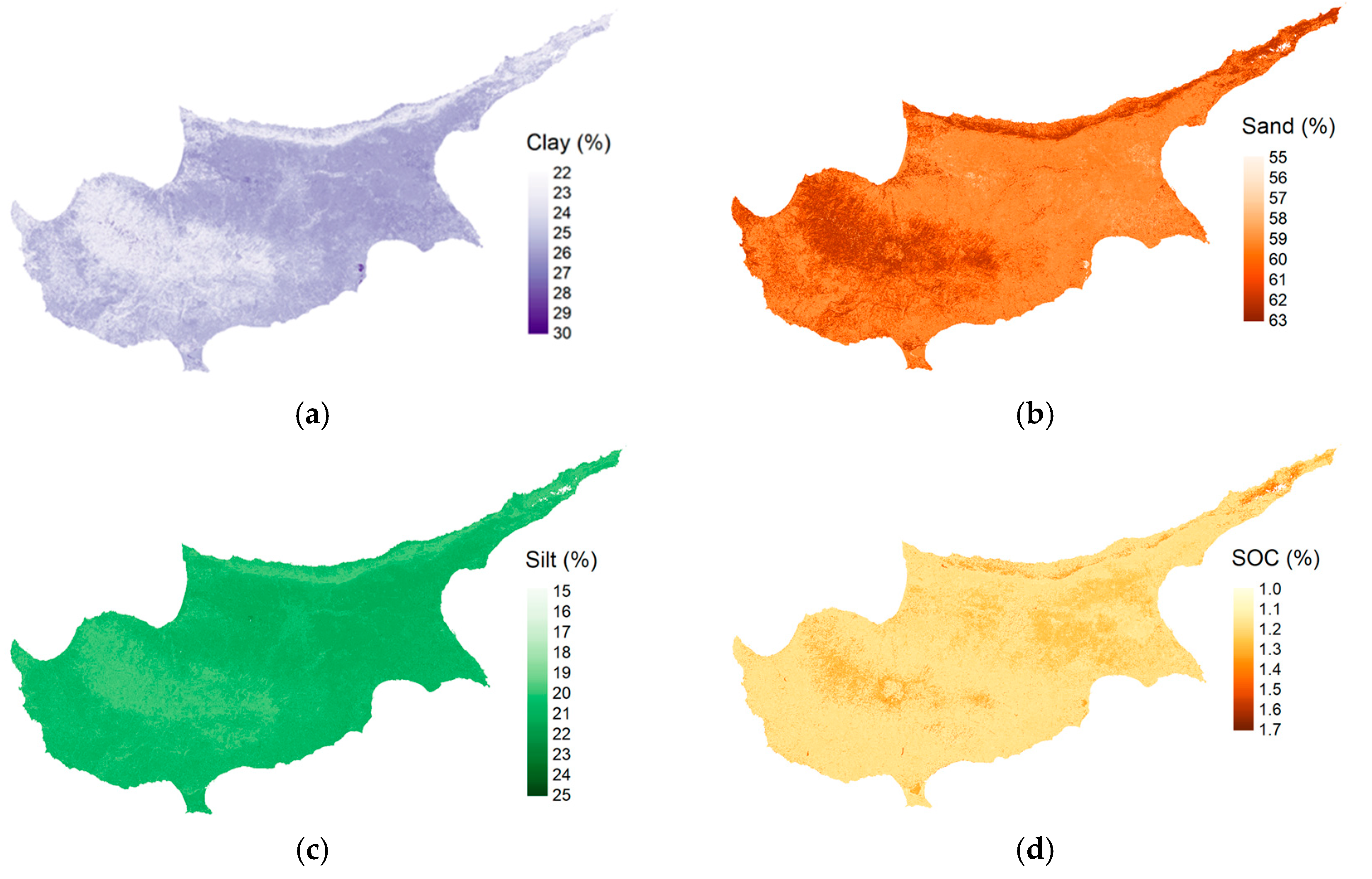
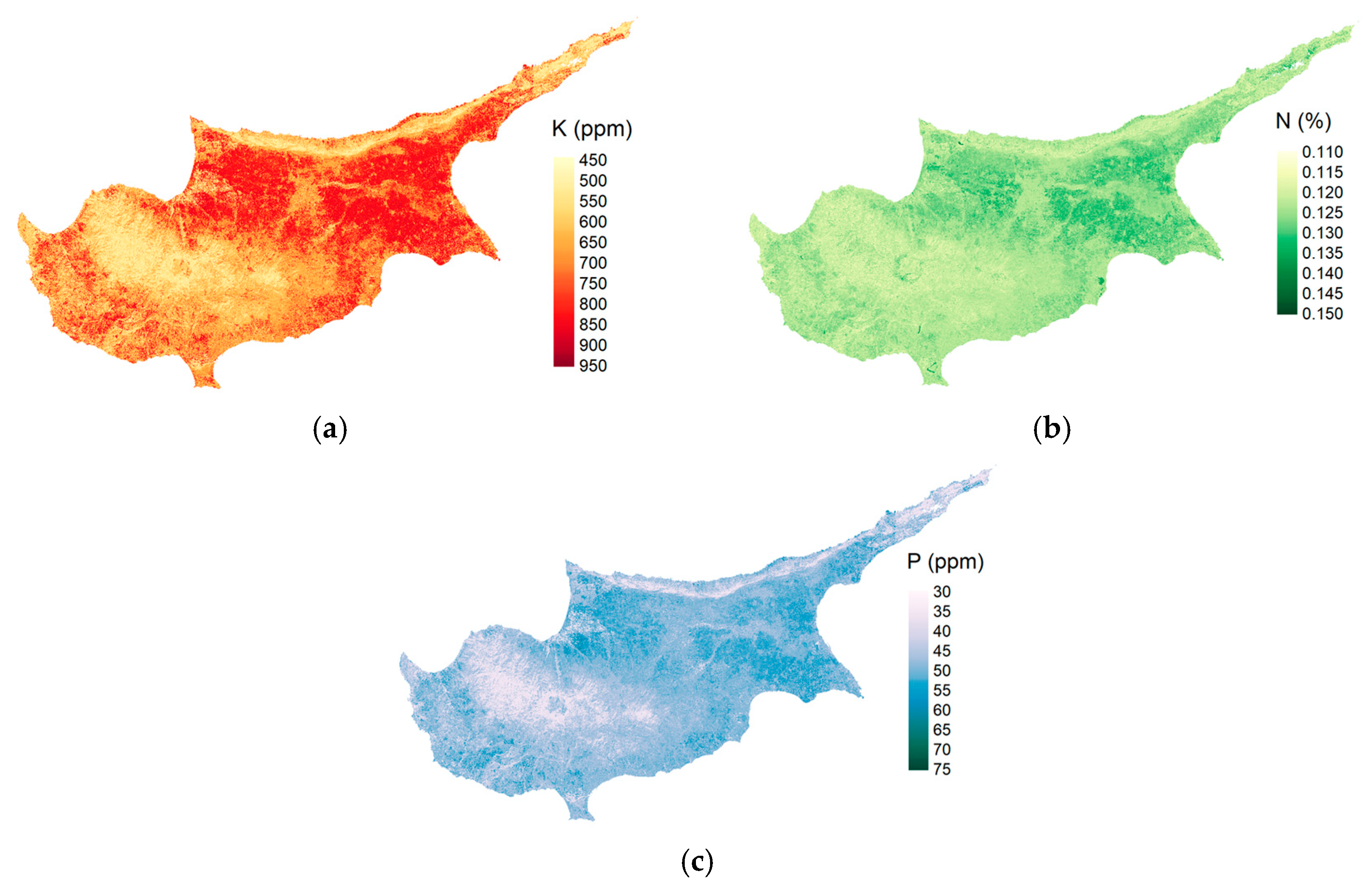
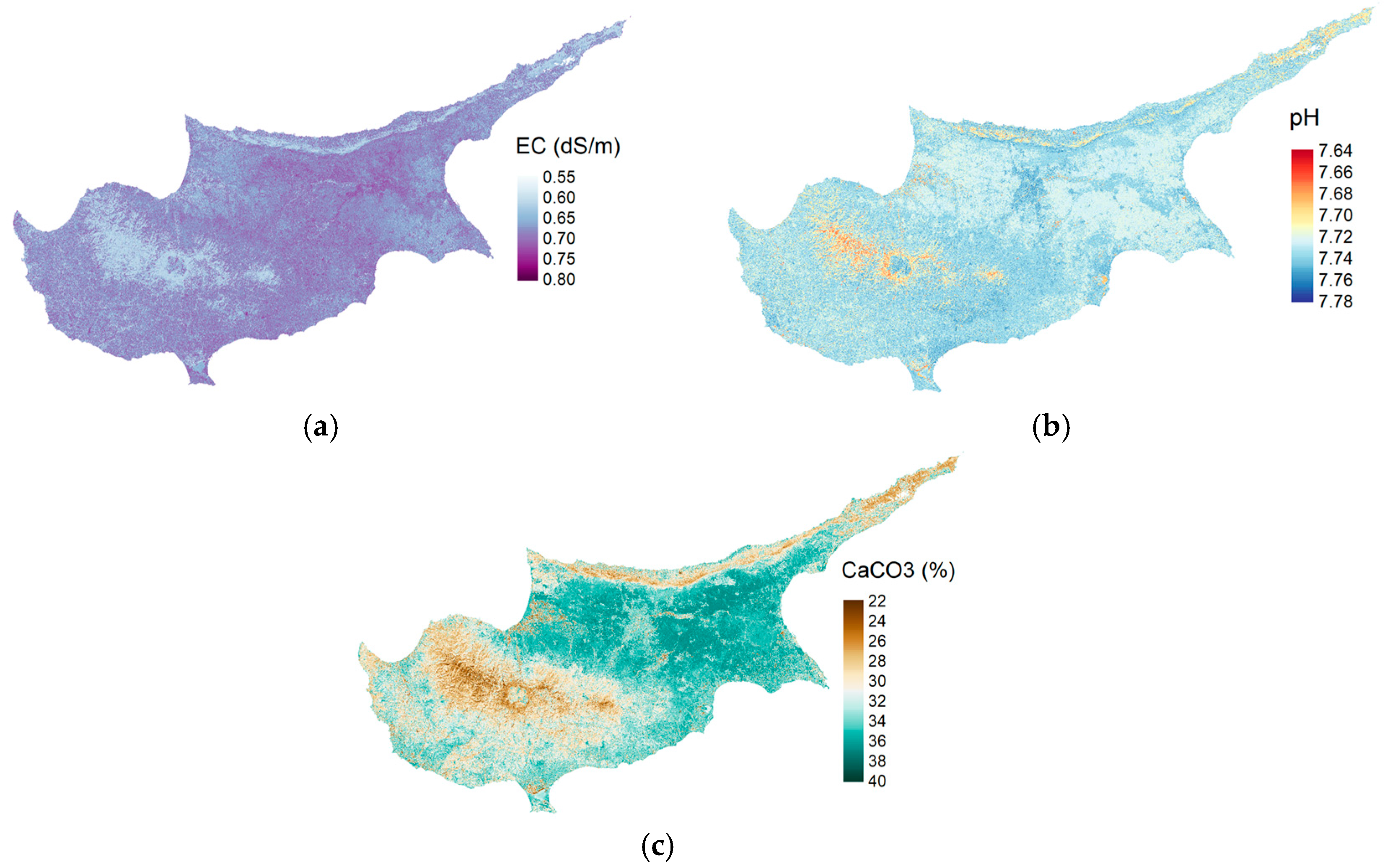
Accurate and spatially detailed soil information is essential for supporting sustainable land use planning, particularly in data-scarce regions such as Cyprus, where soil degradation risks are intensified by land fragmentation, water scarcity, and climate change pressure. This study aimed to generate national-scale predictive maps of key soil health descriptors by integrating satellite-based indicators with a recently released geo-referenced soil dataset. A machine learning model was applied to estimate a suite of soil properties, including organic carbon, pH, texture fractions, macronutrients, and electrical conductivity. The resulting maps reflect spatial patterns consistent with previous studies focused on Cyprus and provide high resolution insights into degradation processes, such as organic carbon loss, and salinization risk. These outputs provide added value for identifying priority zones for soil conservation and evidence-based land management planning. While predictive uncertainty is greater in areas lacking ground reference data, particularly in the northeastern part of the island, the modeling framework demonstrates strong potential for a national-scale soil health assessment. The outcomes are directly relevant to ongoing soil policy developments, including the forthcoming Soil Monitoring Law, and provide spatial prediction models and indicator maps that support the assessment and mitigation of soil degradation.
Keywords: soil health descriptors; machine learning; Soil Monitoring Law; remote sensing; soil degradation; soil health risk assessment; SOC; soil prediction models soil health descriptors; machine learning; Soil Monitoring Law; remote sensing; soil degradation; soil health risk assessment; SOC; soil prediction models