


Abstract
Springs are biodiversity hotspots and climate refugia, yet they remain among the most overlooked and threatened freshwater ecosystems, largely absent from regional monitoring programs. In the Emilia-Romagna Region (Northern Apennines, Italy), where more than 8400 springs are documented but most persist as unmonitored “ghost springs”, we developed and tested an ecohydrogeological framework to support their long-term monitoring and conservation. Twenty-five springs were selected as representatives of five strategic zones, which we identify, defined by aquifer type (Ophiolites, Turbiditic Sandstones, Shallow Marine Sandstones, Triassic Gypsum, and lowland Fontanili) and characterized through integrated hydrogeological, hydrochemical, and biological sampling. Benthic diatoms (393 species in 69 genera) growing on three different substrates (epibryon, epilithon and epipelon) per spring, vegetation, and physical and chemical parameters were analyzed. Diatom assemblage composition differed significantly among zones (PERMANOVA, p < 0.001), structured primarily by electrical conductivity between sites (community level) and by discharge regime between substrates (microhabitat level); the proportion of aerial diatoms (88 species) proved a useful indicator of discharge fluctuations, inferable from a single biological sample. Threatened taxa (41% of evaluated species) concentrated in the ridge zones. Although calibrated in the Northern Apennines, the five-zone framework offers a biologically validated and transferable tool to other regions for spring conservation as sentinel ecosystems under climate change and anthropogenic exploitation.
1. Introduction
Spring ecosystems are unique groundwater-dependent ecosystems (GDEs), occurring where subsurface water flow meets the Earth’s surface through fractures, faults, or geomorphological depressions, and whose physical and chemical characteristics are largely determined by the properties of the aquifer that feeds them [1,2,3]. As ecological transition zones between groundwater and surface environments, springs sustain highly specialized biological communities and provide important ecosystem services, including water supply and habitat provision. Although the global number of springs remains uncertain, they are considered among the most widespread freshwater ecosystem types worldwide [4].
Springs are widely recognized as biodiversity hotspots and ecological refugia, hosting specialized, rare, and endemic taxa, including species listed in the Red Lists of threatened taxa [5]. They also support priority habitats protected under the European Habitats Directive (92/43/EEC), such as petrifying springs (habitat 7220*), currently representing the only spring habitat type protected at the European level [6]. Due to their strong dependence on local hydrogeological conditions, spring ecosystems are particularly sensitive to both natural drivers and anthropogenic pressures, including land-use change, water abstraction, and climate variability. Consequently, springs act as effective sentinels of environmental change across spatial and temporal scales [7,8,9].
Recent research has increasingly highlighted the importance of ecohydrogeological factors that regulate biodiversity in spring ecosystems, emphasizing the role of geological context, aquifer characteristics, hydro-chemical stability, and discharge regime in shaping ecological patterns [7]. Springs contribute significantly to regional and local biodiversity due to their high habitat complexity and many source types. High geological diversity promotes hydro-chemical and geomorphological heterogeneity, which in turn generates high regional biodiversity (γ-diversity) across spring systems. Different lithologies and aquifer types produce distinct hydro-chemical conditions and habitat characteristics, ultimately supporting different biological communities [7]. Springs are characterized by stable discharge regimes and chemically buffered groundwater and commonly host high biodiversity, including specialized and stenotopic taxa, whereas systems affected by hydrological instability or variable flow regimes tend to exhibit simplified communities and reduced ecological integrity [10].
Despite their ecological, cultural, and socioeconomic importance, and all the ecosystem services they provide, springs remain poorly represented in regional and national monitoring programs. This gap is particularly evident in Mediterranean mountain regions, where springs are numerous, highly heterogeneous, and often embedded within managed landscapes.
Based on a review of the literature and historical cartography from the 1930s and 1940s, compiled in 2008 through a collaboration between the Regional Geological, Soil and Seismic Service and the former Institute for Artistic, Cultural and Natural Heritage (IBACN), in the Emilia-Romagna Region (Northern Italy) a total of 8416 springs have been documented, reflecting the complex hydrogeological mosaic and heritage of extraordinary ecological and hydrological value of the Northern Apennines. The mapped springs represent the surface expression of the main regional “water towers” of the Emilia-Romagna Region (RER) [11], highlighting the strategic importance of mountain hydrosystems in sustaining downstream water availability.
Of these, 4065 springs are currently exploited for drinking water supply as well as for industrial and domestic uses, ensuring the continuous delivery of the water provisioning ecosystem service and supporting both human communities and socio-economic activities. This relevance is exemplified by major water supply infrastructures such as the Gabellina aqueduct, the primary water supply backbone of the RER, with a distribution network extending over 1206 km and serving approximately 37,000 inhabitants. The system is fed by 25 springs, 22 of which are located within the Tuscan–Emilian Apennine National Park (PNATE).
The remaining 4351 springs are being further investigated thanks to the participatory inventory project “The Participatory Census of Natural Springs in Emilia-Romagna”, focusing on springs and related groundwater-dependent features [12]. The resulting database [13] currently includes approximately 1100 unmonitored springs, characterized by perennial discharge under natural or near-natural conditions, that we want to certify and field-validate. We define these as “ghost springs”: ecologically significant and geographically distributed across the regional landscape, yet largely unknown and absent from monitoring and conservation programs. These data have enabled the identification of strategic areas for the protection of wetlands and groundwater-dependent habitats, both from quantitative and qualitative perspectives, at the regional scale in Emilia-Romagna [7].
These territories represent the last frontier of naturalness, characterized by a high density of springs still preserved under near-natural conditions and fed by aquifers of exceptional ecological and hydrological value. These aquifers contribute to maintaining the ecological flow of major watercourses and exhibit a climatic resilience higher than the regional average, mainly due to (i) favorable orographic conditions and (ii) high groundwater storage capacity.
Within this context, the identification of representative and strategic spring systems is essential for developing efficient long-term monitoring and conservation frameworks. Since it is not feasible to monitor all springs at the regional scale, the selection of representative ecohydrogeological units provides an effective approach for capturing the environmental variability of groundwater-dependent ecosystems [14,15].
Diatoms are particularly suitable as biological indicators for this purpose. They represent a highly heterogeneous and diverse group of microalgae counting more than 100,000 estimated species [16]. As primary producers they sustain the food webs in aquatic ecosystems, providing at least 20% of global primary production [17]. Diatom species composition in springs is controlled by many environmental determinants such as electrolyte content, discharge, light conditions, current velocity, and algal nutrient concentrations [10]; in fact, some species have very specific environmental preferences [18]. Their sensitivity to groundwater chemistry and discharge variability makes them especially useful for assessing ecohydrogeological differences among spring systems, environmental disturbance and climate change.
The Northern Apennines are distinguished as a remarkably complex geoscape and an area of high geological diversity [19,20,21,22]. This geological complexity generates a broad range of hydrogeological conditions and spring typologies, making the region particularly suitable for investigating relationships between geology, hydrochemistry, and spring biodiversity.
This study provides an ecohydrogeological framework for the identification of strategic spring zones in the Emilia-Romagna Region aimed at bringing “ghost springs” into the conservation and long-term monitoring spotlight. By integrating hydrogeological, physical, chemical, biological and ecological evidence, we identify strategic spring zones that can guide regional monitoring and conservation of spring ecosystems.
2. Materials and Methods
2.1. Study Area
The study was conducted in the Emilia-Romagna Region (Northern Italy), a geologically and geomorphologically complex area spanning the Northern Apennines and adjacent foothills (Figure 1). The region hosts a wide variety of groundwater systems, from siliciclastic and helminthoid flysches to ophiolites and including carbonate and evaporitic fractured aquifers, resulting in diverse spring typologies and hydrochemical conditions [14].
Figure 1.
Location of the study area: the Emilia-Romagna Region, Italy. (a) Location of the Emilia-Romagna Region (red box) within Italy and Europe, showing the main European river network, (b) Detail of the Emilia-Romagna Region (Northern Italy; bold outline), with the city of Bologna and the regional hydrographic network indicated.
The investigated springs encompass a wide range of hydrochemical conditions and habitat characteristics, reflecting the marked ecohydrogeological variability of the Northern Apennines: ranging from high-altitude mountain systems located above the Treeline (>1500 m a.s.l.) to lowland spring-fed systems (Fontanili) occurring at elevations below 50 m a.s.l. Mountain springs associated with ophiolitic and sandstone aquifers are generally located in remote and difficult-to-access areas and therefore preserve a high degree of naturalness. In contrast, lowland Fontanili are often partially modified or managed for drinking water supply and agricultural purposes due to their accessibility and long-standing human use. This diversity makes the region particularly suitable for assessing the relationships between geology, groundwater conditions, and diatom assemblage composition across different spring types.
2.2. Spring Selection and Classification
Starting from the regional historical data, we had the purpose of analyzing 1100 unmonitored springs in natural or semi-natural conditions, with the aim of giving them an identity card. To begin, a total of 25 springs were selected based on their representativeness of major aquifer types, principal regional hydrogeological settings, accessibility, elevations and relevance for long-term monitoring, covering the distribution area of the Region (Figure 2). Four of these sites (Labante, Monte Penna, Poiano, and Fontanile di Corte Valle Re) were originally sampled within the framework of a previous project “EBERS-Exploring the Biodiversity of Emilia-Romagna Springs” [7], while the remaining springs were identified and sampled during field campaigns conducted between 2023 and 2025. The selected sites are important ecological transition zones between groundwater and surface waters, and include rheocrenic, limnocrenic, and helocrenic systems distributed across the Northern Apennines and lowland sectors of the region.
Figure 2.
Photos of the 25 springs analyzed during the samplings. In order: Fontana del Vescovo (a), Fontanaccia (b), Helocrene at Lago Scuro (c), Cusna Est (d), Sorgente della Secchia (e), Monte Penna (f), Aveio (g), Canadello (h), Monte Nero (i), Helocrene at Lago Moo (j), Ramata (k), Tintoria (l), Mulino delle Vene (m), Vignudini (n), Labante (o), Ca’ delle Ghiaie (p), Grotta Gessi (q), Limnocrene Gessi (r), Tanone (s), Poiano (t), Fontanile Beneceto (u), Fontanile Pozzetto (v), Fontanile Castelfranco (w), Fontanile Viarolo (x), Fontanile di Corte Valle Re (y).
Hydrogeological, physico-chemical, and biological information were subsequently integrated to explore similarities among spring systems and to identify representative ecohydrogeological groups within the study area. This classification approach followed conceptual frameworks previously proposed for spring ecosystem characterization and long-term monitoring strategies [7,10,23].
The role of aquifer lithology in structuring spring periphyton has been documented in the literature across different geological and climatic settings, from ophiolitic and carbonate mountain springs in the Dinarides [24] to carbonate spring systems in NE Iran [25] and desert spring networks of the Great Basin and Mojave [26].
The 25 springs were divided into five different groups (Table A1, Appendix A), as coherent groups with ecohydrogeological differences.
Among the investigated systems, five sites (one for each group) are of particular hydrogeological and conservation relevance and exemplify the ecological diversity captured by the sampling design.
The Canadello spring is fed by groundwater flowing through scree deposits derived from serpentinized ophiolitic rocks, from group 1. It is in Ferriere County and about 3 km from the Natura 2000 network (IT4020008—ZSC—ZPS—Monte Ragola, Lago Moò, Lago Bino).
Helocrene at Lago Scuro is the representative perennial spring of group 2, also fed by scree slope deposits, characterized by low mineral content, located along a ridge where the Macigno sandstones (Upper Oligocene–Lower Miocene) outcrop and the headwaters of the Parma and Cedra streams originate (Province of Parma). It is inside the Tuscan–Emilian Apennines National Park, the Natura 2000 network (IT4020020) and the Geological Heritage and Geosites database of the Emilia-Romagna Region.
In group 3, Mulino delle Vene (Bologna Province) is a Limestone-Precipitating Spring (LPS) [6], a unique spring and system of high ecological value, characterized by very low discharge and strongly hypoxic near-substrate conditions, yet currently lacking any formal protection status, making it an emblematic case of the conservation gap.
The Poiano spring (Villa Minozzo municipality, Reggio Emilia Province), in group 4, located within the Tuscan–Emilian Apennine National Park (UNESCO MAB Biosphere Reserve) and the Natura 2000 site IT4030009, represents the largest karst spring in the Emilia-Romagna Region, characterized by exceptionally high-salinity sodium-chloride waters reflecting a deep saline karst circulation, a hydrogeochemical type with no parallel at the regional scale [27,28].
Within group 5, Fontanile di Corte Valle Re (Campegine, Reggio Emilia) exemplifies the lowland spring-fed systems of the Po Plain. Fed by a shallow alluvial aquifer, it lies within the Natura 2000 network (IT4030007) and the “Fontanili di Corte Valle Re” Region, but at the same time is highly impacted by an intense diffuse agricultural pressure.
Detailed physical, morphological and ecological descriptions of each spring are provided in Detailed Description of the 25 Springs; key hydrogeological and physical parameters are summarized in Table 1 and Table 2.
Table 1.
Morphological and physical characteristics of the 25 studied springs, divided in 5 groups: (1) Aveio (AVEIO), Canadello (CANAD), Monte Nero (M-Nero), Helocrene at Lago Moo (LE_MCN_Moo), Monte Penna (Penna); (2) Fontana del Vescovo (Fo-Ves), Cusna Est (Cusn_E), Fontanaccia (Fontanac), Helocrene at Lago Scuro (SCURO), Sorgente della Secchia (SECCH); (3) Ramata (RAMAT), Tintoria (TINTO), Mulino delle Vene (Mu-Ven), Vignudini (VIGNU), Labante (Laban); (4) Limnocrene Gessi (Lim-Ge), Grotta Gessi (Gro-Ge), Tanone (TANON), Ca’ delle Ghiaie (GHIAI), Poiano (PoianoS); (5) Fontanile Beneceto (BENEC), Fontanile Pozzetto (POZZE), Fontanile Viarolo (To-Tre), Fontanile Castelfranco (CF-FON), Fontanile Valle Re (F_VR_Sh). Rheo = Rheocrene spring; Helo = Helocrene spring; LPS = Limestone-Precipitating Spring; Limno = Limnocrene spring.
Table 2.
The 25 springs divided into the five zones.
2.3. Hydrogeological, Physical, and Chemical Data
For each spring, physico-chemical parameters were measured in situ, including water temperature (°C), electrical conductivity (µS cm−1), specific conductance at 25 °C, pH, and dissolved oxygen (mg L−1), titration, oxidation-reduction potential, using an HACH HQ30d data logger (Hach Company, Loveland, CO, USA) equipped with specific probes (pH: PHC10101; electrical conductivity: CDC40101; dissolved oxygen: LDO10101, Eh: MTC1010). Bicarbonate concentrations were measured in situ as well using the Merck Alkalinity visual test kit (Merck KGaA, Darmstadt, Germany). The position of the springs was reported by measuring the geographic coordinates with a GPS (Garmin eTrex 10; Garmin Ltd., Olathe, KS, USA). Discharge data (L s−1) were collected to characterize flow regime and hydrological stability. Hydrochemical data were used to infer groundwater residence time, buffering capacity, and potential links with aquifer lithology, in line with established ecohydrogeological frameworks for spring ecosystems [7,23]. Water samples for major ions and nutrients were kept at ca. 4 °C in fridge bags until analysis. Ca2+, Mg2+, Na+, and K+ were measured using an Agilent 5800 ICP-OES (Agilent Technologies, Santa Clara, CA, USA) at the Centro di Ricerca Ambiente, Energia e Mare, in Ravenna Campus; Cl-, NO3-, and SO42− were analyzed via ion chromatography using a Metrohm 500 IC system; and nutrients (N-NO2-, P-PO43−) via standard absorption spectrometry [23].
2.4. Fieldwork, Sample Processing and Slide Preparation
At each spring, a 10 m transect was established to collect both qualitative and quantitative samples. Benthic diatoms were sampled from the three main substrates: epibryon, epilithon, and epipelon. Epibryon samples were obtained from portions of dominant submerged or near-surface bryophyte species, collected at three points along the transect. Epilithon was sampled by brushing ten cobbles using a toothbrush (quantitative area of approximately 3 × 3 cm = 9 cm2 on each cobble). Epipelon samples were collected by aspirating surface sediment (silt/sand) using a syringe (Ø 2.9 cm), with ten sampling points per site. For every spring, we collected two diatom samples: one of the main substrate (Epilithon or Epipelon), and one of the Epibryon. To avoid contamination, separate tools and containers were used for each substrate, and all samples were clearly labeled by site and substrate [23]. The diatom samples were, in total, 50, two for each of the 25 springs.
Vascular plant and bryophyte communities were surveyed quali-quantitatively at 6 representative springs, covering at least one spring per strategic ecohydrogeological zone. Given the limited number of sampled sites, no formal statistical analysis was performed; results are presented as a qualitative characterization of zone-specific floristic assemblages [29,30].
Sample processing was carried out at the Laboratory of Porosimetry, Limnology and Oceanography at the Department of Biological Sciences, Geological and Environmental, University of Bologna. Diatom samples were treated chemically to remove organic matter. Hydrogen peroxide (H2O2) was added and left to react overnight. Subsequently, samples were heated with potassium dichromate (K2Cr2O7), with temperature gradually increased from 70 °C to 250 °C; hydrochloric acid (HCl, 3 mL) was then added to reduce turbidity. Following digestion, samples were concentrated by evaporation to approximately 15 mL. Repeated centrifugation and rinsing cycles were performed until neutral pH (6–7) was reached.
For slide preparation, aliquots were pipetted into coverslips of 13 × 13 mm and diluted with distilled water to achieve an appropriate diatom density. Preliminary test slides were examined to assess valve concentration and to determine whether additional treatments (HCl or HNO3) were required. Final permanent slides (three replicates per sample: A, B, and C) were prepared, usually after additional acid treatment and washing. Samples were mounted using Naphrax® resin (Brunel Microscopes Ltd., Chippenham, Wiltshire, UK) on a hot plate at 250 °C to ensure permanent fixation. All samples (original samples, suspensions of digested material, and permanent mounts) were cataloged at the Department of Biological, Geological and Environmental Sciences of the University of Bologna.
Among the 25 investigated springs, a subset of 10 sites was selected for further characterization in terms of organic matter and chlorophyll a concentration.
Known volumes of water with material from rocks (Epilithon) scrubbed off from a 9 cm2 area, and from surface sediment (Epipelon) aspirated with Ø 2.9 cm syringes, were homogenized, subsampled with stirring, and filtered (Whatman GF/F), producing 2 filters for each site. For pigment analysis, an aliquot (10–30 mL) was filtered and immediately frozen. For the organic matter the same amount (10–30 mL) was filtered and then dried.
The dried AFDM (Ash-free dry mass) filters were then weighed, ashed at 500 °C for 1 h in a muffle furnace at the Laboratory of Sedimentary Petrography and mineral separation of the University of Bologna, and re-weighted to quantify the organic matter present in the water [31].
The chlorophyll a filters were subsequently analyzed at the Laboratory of Algal Biology (Algo-Lab), University of Bologna, Ravenna Campus, to assess benthic algal biomass. Pigments were extracted in DMSO and quantified spectrophotometrically according to the equations proposed by [32]. Chlorophyll a and pheophytin concentrations were expressed as µg cm−2 of sampled surface.
2.5. Diatom Identification, Elaboration and Statistical Analysis
Diatom counting was conducted at the Di-Li2025-16 microscope, equipped with a BIC-E3S-20C digital camera (Bioimager Inc., Vancouver, BC, Canada), at 1000×, using BioView 3.7 imaging software application. The counting was done up to 400 valves per sample; the most updated taxonomy and nomenclature were used for the morphological identification [33,34,35,36,37]. For each sample, relative and absolute abundances of diatom species’ valves were calculated in tables organized per strategic zone, together with Number of occurrences (N.O.) and Maximum relative abundance (M.R.A.) in all the substrates and sites.
A summary table was compiled, with the ecological preferences of all the diatom species found, including: threat status, assigned according to current Red List data [38,39]; ecological indicator values for pH, trophic state and moisture, following Van Dam et al. [40,41]; ecological characteristics according to Levkov [42]; ecological traits and taxonomy of freshwater diatoms); presence of terrestrial diatoms [43]; and ecological guilds, traits, life-forms and cell-sizes [44].
Shannon–Wiener diversity [45] was calculated using a base-2 logarithm.
Differences in diatom community composition among spring zones were explored using Principal Coordinates Analysis (PCoA) based on Bray–Curtis dissimilarity matrices, computed separately for epilithon/epipelon and epibryon assemblages. The significance of compositional differences among ecohydrogeological zones was tested using permutational multivariate analysis of variance (PERMANOVA; adonis function, 999 permutations).
Hierarchical cluster analyses were performed to investigate similarities among spring systems based on both diatom assemblage composition and hydro-chemical variables in the two different substrates. Cluster analyses based exclusively on water chemistry were additionally used to evaluate the extent to which hydro-chemical patterns reflected the main lithological and hydrogeological settings of the investigated springs.
The relationship between lithological groups and diatom ecological guilds or growth forms (high-profile, low-profile, motile/mobile, and planktonic taxa) was investigated using contingency analyses and Pearson’s chi-squared tests. Standardized residuals were examined to identify overrepresented or underrepresented guilds within specific lithological categories. Correlations between ecological guilds and environmental variables were further explored using correlation matrices, retaining only statistically significant relationships (p < 0.05).
Species diversity was evaluated using Shannon diversity indices calculated separately for Epilithic/Epipelic and Epiphytic assemblages using ANOVA and Kruskal–Wallis tests.
Indicator Species Analysis (IndVal) [46] was performed to identify taxa potentially associated with specific ecohydrogeological groups. The analysis was restricted to diatom species occurring in at least three sampling units (≥3 of the 25 springs). This yielded 57 species for the epilithon and 63 for the epibryon. Statistical significance of each species’ maximum indicator value was assessed by 999 random permutations.
All the statistical analyses were performed using R ver. 4.3.2 [47], employing functions available in the principal packages vegan [48] and labdsv [49].
3. Results
3.1. Regional Ecohydrogeological Framework and Strategic Spring Zones
Based on the regional hydrogeological framework and the spring-selection criteria described in the methods, the 25 investigated springs (Table 2) were assigned to five operational ecohydrogeological zones (Figure 3):
Figure 3.
Conceptual hydrogeological regionalization of spring ecosystems in the Emilia-Romagna Region (modified from: https://doi.org/10.1016/j.ejrh.2025.102183). The crosses on the map represent the 25 sampled springs: the red ones are located inside the strategic zones, the light-blue ones outside. (a) Karst aquifers made of evaporites and limestones; (b) arenitic fractured aquifers (Pantano Formation); (c) igneous and metamorphic fractured aquifers; (d) turbidite fractured aquifers (arenaceous, arenaceous-pelitic, or calcareous-marly); (e) rock units with behavior of aquitard or aquiclude, and unconsolidated deposits (alluvial plains, river valleys, inter-mountainous basins). The 5 strategic zones in the Emilia-Romagna Region (RER) are indicated by polygons with red outlines: (1) The Ophiolites between the Liguria and Emilia-Romagna Regions; (2) turbiditic sandstones between the Tuscany and Emilia-Romagna Regions; (3) Triassic gypsum deposits in the Secchia Valley; (4) Shallow Marine Sandstone deposits; (5) lowland springs in the Po River plain (locally known as Fontanili).
- (i)
- Ophiolites;
- (ii)
- Turbiditic sandstones;
- (iii)
- Shallow Marine Sandstone;
- (iv)
- Triassic gypsum;
- (v)
- Fontanili.
The identified strategic zones correspond to hydrogeological systems characterized by distinct lithological frameworks, groundwater flow regimes, storage capacities, and hydrochemical signatures (Figure A1, Appendix A). Collectively, these systems constitute the primary regional “water towers” [11], supporting springs, wetlands, streams, and river headwaters across the Northern Apennines and adjacent lowlands. Most of the main watercourses of the Emilia-Romagna Region originate within these areas.
Ophiolitic outcrops are in the northwestern sector of the Northern Apennines, along the Liguria–Emilia-Romagna regional boundary. These fractured magmatic rocks originated from the Late Jurassic age, corresponding to approximately 180 million years ago. The aquifers are characterized by relatively low electrical conductivity, relative enrichment in sodium and magnesium and distinctive geochemical signatures associated with ultramafic lithologies (predominantly serpentinized peridotites and associated mafic units), including naturally elevated metal concentrations such as chromium (VI) and (III) [50,51]. Springs associated with these systems generally occur in remote mountainous areas with high environmental integrity.
Turbiditic sandstone systems occur mainly along the Tuscan–Emilian Apennine ridge and are typically associated with high-elevation spring ecosystems characterized by low electrical conductivity, low mineralization, and relatively stable hydrochemical conditions. These aquifers sustain several perennial mountain springs located above the treeline. The area is in the UNESCO Man and the Biosphere (MAB) Reserve of the Tuscan–Emilian Apennines.
Shallow Marine Sandstone deposit systems are mainly distributed in the central sectors of the region and are associated with hydrochemical conditions characterized by relatively low dissolved oxygen concentrations and locally elevated carbon dioxide content, frequently linked to active carbonate precipitation processes (limestone precipitation). These springs exhibit peculiar hydrochemical compositions, including ferruginous waters, reflecting complex groundwater circulation through mineralized sedimentary formations.
Triassic gypsum deposit systems are concentrated mainly within the Secchia Valley and are associated with highly soluble evaporitic formations. This zone represents the most significant karst system in Emilia-Romagna Region, located in the municipality of Villa Minozzo (Reggio Emilia Province). These springs are characterized by elevated electrical conductivity and distinctive hydrochemical signatures resulting from strong groundwater–rock interactions.
Fontanili represent lowland spring-fed systems associated with shallow alluvial aquifers of the Po River Plain. Compared with mountain spring systems, Fontanili are generally characterized by higher nutrient concentrations (e.g., nitrates and phosphates), often contamination (e.g., by Nickel), and stronger anthropogenic influence, reflecting the intensive agricultural land use and urbanized context of the lowlands. These systems have been extensively modified by human activities: the excavation of ditches and channels at natural groundwater discharge points (“risorgive”). These interventions have altered the natural groundwater–surface water interactions, flow regime, and sediment transport processes. Despite these alterations, Fontanili maintain relatively stable hydrological and thermal conditions, as they are directly sustained by groundwater discharge. Historically widespread, Fontanili have experienced a significant decline over the last century, mainly attributed to groundwater extraction, land-use intensification, channelization, and reduced aquifer recharge.
The following sections evaluate whether these predefined zones are supported by hydrochemical and biological evidence, and therefore whether they can function as practical units for regional spring monitoring and conservation.
3.2. Hydrochemistry
Water chemistry partially reflected the main lithological differences among the five strategic zones (Detailed Table of the Chemical parameters in Table A2, Appendix A), with the clearest separation observed for Triassic Gypsum springs in the cluster dendrogram (Figure 4), followed by Ophiolitic systems. The summary of physico-chemical parameters per zone is reported in Table 3.
Figure 4.
Cluster dendrogram chemistry-lithologies. χ2 test: p = 0.00051: significance test.
Table 3.
Summary of physical and -chemical parameters of the 25 investigated springs (5 per strategic ecohydrogeological zone). Values are reported as mean (min–max). Cond. = electrical conductivity; T = water temperature.
Ophiolitic springs (Aveio, Canadello, Monte Nero, Helocrene at Lago Moo, Monte Penna) were characterized by low to very low electrical conductivity (mean 160 µS cm−1, range 62–268), reflecting the limited solubility of ultramafic and siliceous substrates. Ca2+ concentrations were the lowest among all zones (mean 5.5 mg L−1), whilst Mg2+ was disproportionately elevated relative to Ca2+ in the serpentinite-hosted springs (15.7–16.8 mg L−1), consistent with the geochemical signature of ophiolitic aquifers. Nitrate concentrations were low (mean 0.83 mg L−1), and dissolved oxygen saturation was high where measured (mean 94.7%), indicating well-oxygenated, near-pristine conditions. The Penna Spring, located on ophiolitic bedrock along the Ligurian-Emilian ridge, showed lower Mg2+ and higher Ca2+ relative to the serpentinite springs, reflecting local lithological heterogeneity within this zone.
Turbiditic Sandstone springs (Fontana del Vescovo, Cusna Est, Fontanaccia, Helocrene at Lago Scuro, Sorgente della Secchia) displayed the lowest overall mineralization of all five zones, with the lowest mean conductivity (104 µS cm−1) and the lowest mean NO3− concentration (0.20 mg L−1, range 0.003–0.50 mg L−1). These values are consistent with the oligotrophic character of high-elevation, remote mountain springs fed by shallow siliciclastic aquifers, and indicate minimal anthropogenic influence. Dissolved oxygen saturation was high (mean 93.2%), and pH was circumneutral to slightly acidic (mean 7.26), reflecting the low buffering capacity of arenaceous substrates. HCO3− was correspondingly low (mean 90.2 mg L−1), except for Cusna Est (244 mg L−1), which reflects localized carbonate contributions.
Shallow Marine Sandstone springs (Ramata, Tintoria, Mulino delle Vene, Vignudini, Labante) showed markedly higher mineralization compared to the two previous zones (mean conductivity 659 µS cm−1, range 451–863), with elevated Ca2+ (mean 100.1 mg L−1) and HCO3− (mean 393.4 mg L−1), reflecting active carbonate buffering linked to calcareous sandstone and marly lithologies. Mg2+ concentrations were also notably elevated relative to the other non-evaporitic zones (mean 36.4 mg L−1).
Three springs within this zone (Mulino delle Vene, Vignudini, and Labante) are classified as Limestone-Precipitating Springs (LPS) [6], characterized by strongly alkaline to sub-alkaline pH and high Ca2+–HCO3− waters. Dissolved oxygen saturation showed marked within-group variability among the three LPS: Labante recorded the highest value in the zone (86%, discharge 15.5 L s−1, pH 8.20), consistent with rapid groundwater circulation through a well-developed carbonate aquifer; whereas Mulino delle Vene (7.5%, discharge 0.04 L s−1) and Vignudini (13.5%, discharge 0.10 L s−1) showed strongly hypoxic conditions, with very low O2 values, where prolonged groundwater residence time and near-substrate organic matter oxidation are likely responsible for pre-emergence oxygen depletion.
Two iron-rich springs within this group (Ramata and Tintoria) showed elevated SO42− (209.4 and 59.6 mg L−1, respectively), elevated Na+ and Cl−, and field evidence of iron precipitation, representing a geochemically distinctive subtype within the zone, reflected in the cluster dendrogram (Figure 3). Nitrate concentrations remained low across the group (mean 1.12 mg L−1, range 0.01–2.43), consistent with the relatively limited agricultural pressure in the hillslope settings where these springs occur.
Triassic Gypsum springs (Limnocrene Gessi, Grotta Gessi, Tanone, Ca’ delle Ghiaie, Poiano) were by far the most mineralised, dominated by extremely high SO42− (mean 1557 mg L−1, range 1227–2090) and Ca2+ (mean 642 mg L−1), driven by dissolution of evaporitic formations. The Poiano spring, separated in the dendrogram, represents a major outlier within this group: its electrical conductivity (11,560 µS cm−1), Na+ (2250 mg L−1), and Cl− (4370 mg L−1) are exceptional at the regional scale and reflect a deep saline karst circulation distinct from the shallow gypsum aquifer feeding the other four sites [28]. Excluding Poiano, the remaining four springs show a more internally consistent chemical signature (conductivity 2173–2660 µS cm−1), with SO42− and Ca2+ as the dominant ions. Despite their extreme chemistry, dissolved oxygen saturation was relatively high in this group (mean 88.6%), suggesting rapid groundwater circulation through the highly permeable karst network.
Fontanili (Beneceto, Pozzetto, Viarolo, Castelfranco, Valle Re) showed the highest mean NO3− concentration of all zones (mean 16.48 mg L−1, range 0–48 mg L−1), reflecting the strong agricultural imprint of the Po Plain lowland context. Two sites (CF-FON: 31.26 mg L−1; F_VR_Sh: 48 mg L−1) exceeded or approached the EU drinking water threshold of 50 mg L−1, indicating significant contamination from agricultural runoff. Dissolved oxygen saturation was consistently and markedly low (mean 22.6%, range 2.5–36.2%), indicative of strongly reducing conditions typical of shallow alluvial aquifers under intensive land use. Conductivity was moderate and heterogeneous (541–1183 µS cm−1), reflecting variable groundwater residence times and local hydrogeological connectivity. Despite their disturbed chemical status, Fontanili maintained relatively high HCO3− concentrations (mean 360 mg L−1), consistent with carbonate-buffered alluvial groundwater.
Overall, water chemistry alone could not fully discriminate all five zones: while Triassic Gypsum and Ophiolitic springs showed the most distinct signatures, Turbiditic Sandstones, Shallow Marine Sandstones, and Fontanili displayed partial chemical overlap (Figure 3).
3.3. Organic Matter and Primary Production
Ash-free dry mass (AFDM) and chlorophyll a were measured in a subset of 10 springs across four of the five strategic zones (Fontanili were excluded for their sediment substrate) in seven rheocrene springs (AVEIO, Gro-Ge, Fo-Ves, RAMAT, GHIAI, TANON, M-Nero), two LPS (Mu-Ven and VIGNU), and one limnocrene spring (Lim-Ge).
AFDM was used as a proxy for benthic organic matter standing stock. Values ranged from 8.7 to 40.0 g m−2, with the highest values recorded at TANON and RAMAT. Intermediate values were observed at Lim-Ge and VIGNU, whereas the remaining springs showed comparatively lower and more similar AFDM values. Because AFDM was measured on an unbalanced subset of sites and Fontanili were not included, these data were interpreted only descriptively (Table A3, Appendix A).
Chlorophyll a concentration ranged from 0.10 to 13.27 µg cm−2, whereas pheophytin concentrations were much lower and varied from 0.001 to 2.27 µg cm−2. Both pigments exhibited a similar spatial pattern among springs: sites showing high chlorophyll a concentration generally also displayed elevated pheophytin values (Figure A2, Appendix A).
Among the studied springs, VIGNU clearly stood out from all other sites, exhibiting the highest chlorophyll a concentration (13.27 µg cm−2) as well as the highest pheophytin concentration (2.27 µg cm−2). This spring is classified as a Limestone-Precipitating Spring (LPS) and belongs to Shallow Marine Sandstones. The second highest chlorophyll a value was recorded in Mu-Ven (1.15 µg cm−2), which is also a LPS located in the same zone. Similarly, Mu-Ven displayed the second highest pheophytin concentration (0.057 µg cm−2).
In contrast, chlorophyll a concentration in rheocrenic springs ranged from 0.10 µg cm−2 at Gro-Ge to 1.05 µg cm−2 at Fo-Ves. Pheophytin concentrations in these springs were consistently low and did not exceed 0.007 µg cm−2. The only limnocrenic spring, Lim-Ge, exhibited an intermediate chlorophyll a concentration (0.57 µg cm−2) and a relatively high pheophytin concentration (0.054 µg cm−2).
3.4. Diatoms Found in the Five Zones
In our samples we found 69 genera and 393 diatom species. The species with the highest occurrence in the sites are: Achnanthidium lineare, Planothidium lanceolatum (in 23 sites on 25), Amphora micra (20), Gomphonema angustum (18), Meridion circulare, Odontidium mesodon (17), Achnanthidium minutissimum (16), Humidophila perpusilla (15), Nitzschia dissipata (12), Amphora pediculus, Cocconeis lineata, Gomphonema elegantissimum, Nitzschia linearis, Planothidium frequentissimum (11), Denticula tenuis, Eunotia crassiminor (10).
The two most frequent species are Achnanthidium lineare W.Smith and Gomphonema elegantissimum E.Reichardt & Lange-Bertalot, with a maximum relative abundance of 72.77% and 43% respectively.
Indicator Species Analysis (IndVal) [46], restricted to species with N.O. ≥ 3, detected significant indicators (p < 0.05) for four of the five zones (Table A4, Appendix A). The Ophiolites had the strongest and most numerous indicators, including Cocconeis pseudolineata, Planothidium frequentissimum and Humidophila perpusilla, followed by the Turbiditic Sandstones (Achnanthidium lineare, Encyonema silesiacum), Fontanili (Gomphonema pumilum var. rigidum) and the Triassic Gypsum springs (Gomphonema olivaceum). Seven of these indicators were robust to a stricter criterion (p ≤ 0.01 and IndVal > 55%; Table A4, Appendix A). Planothidium frequentissimum was the only species significant on both substrates. No significant indicators were detected for the Shallow Marine Sandstones.
We highlight the most frequent (>10 N.O., Number of Occurrences) and most abundant (>25% M.R.A., Maximum Relative Abundances) species, illustrated in Figure 5; the full list, with Red List and ecological attributes, is provided in Table A5, Appendix A. In particular, Gomphonema angustum and Planothidium frequentissimum are interesting findings, being important discharge fluctuation indicators, and G. elegantissimum is a pioneer species that is very fast in recolonizing. Amphora micra was distinguished for its high N.O., as was A. pediculus for M.R.A.; in the same way, Humidophila perpusilla had a very high N.O., and H. contenta a high M.R.A.
Figure 5.
Light micrographs of the most abundant 26 species. El = Epilithon; Ep = Epipelon; Eb = Epibryon. (A) Nitzschia linearis (TANON, Eb), (B) Tryblionella gracilis (POZZE, Ep), (C) Cocconeis lineata (AVEIO, Eb), (D) Cocconeis placentula (Mu-Ven, Eb), (E) Meridion circulare (SECCH, Eb), (F) Nitzschia dissipata (SECCH, Eb), (G) Gomphonema angustum (Mu-Ven, Eb), (H) Gomphonema elegantissimum (SCURO, Ep), (I) Gomphonema lateripunctatum (RAMAT, Eb), (J) Navicula erifuga (POZZE, Eb), (K) Planothidium lanceolatum (Fo-Ves, Eb), (L) Eunotia crassiminor (SECCH, Eb), (M) Fragilaria famelica (PoianoS, Eb), (N) Sellaphora nigri (M-Nero, Eb), (O) Planothidium frequentissimum (M-Nero, Eb), (P) Odontidium mesodon (SECCH, Eb), (Q) Humidophila perpusilla (M-Nero, Eb), (R) Humidophila contenta (SCURO, Eb), (S) Gomphonema cuneolus (M-Nero, El), (T) Achnanthidium segadelli (BENEC, Eb), (U) Achnanthidium kranzii (Fo-Ves, El), (V) Achnanthidium minutissimum (BENEC, Eb), (W) Achnanthidium lineare (SECCH, El), (X) Denticula tenuis (SCURO, Ep), (Y) Amphora micra (Fo-Ves, Eb), (Z) Amphora pediculus (M-Nero, Eb). Scale bar: 10 µm.
3.5. Diatom Species Diversity
Shannon–Wiener diversity indices were calculated separately for epilithic/epipelic and epibryon assemblages and compared among the five ecohydrogeological zones. No significant differences in species diversity were detected among zones for either substrate (Figure 6 and Figure 7).
Figure 6.
Box plots of Shannon–Wiener diversity indices of diatom assemblages on epilithic/epipelic substrates across the five ecohydrogeological strategic zones. No significant differences were detected among zones (ANOVA: F = 0.282, p = 0.886; Kruskal–Wallis: H = 1.43, p = 0.840). Horizontal bold lines indicate medians; boxes represent the interquartile range (IQR); whiskers extend to 1.5 × IQR; open circles indicate outliers.
Figure 7.
Box plots of Shannon–Wiener diversity indices of diatom assemblages on epibryon substrates across the five ecohydrogeological strategic zones. No significant differences were detected among zones (ANOVA: F = 0.867, p = 0.501; Kruskal–Wallis: H = 4.90, p = 0.298). Horizontal bold lines indicate medians; boxes represent the interquartile range (IQR); whiskers extend to 1.5 × IQR; open circles indicate outliers. The low-diversity outlier in the Evaporite group corresponds to the Poiano spring.
On the epilithic/epipelic substrate, Fontanili shows the highest median Shannon index, followed by Ophiolites, while Turbiditic Sandstone springs show the lowest median values, with considerable internal variability.
On the epibryon substrate, Fontanili again shows the highest median diversity, whereas Shallow Marine Sandstone and Triassic Gypsum springs show the lowest values, the latter with a notable outlier of very low diversity (Shannon index ~0.3), corresponding to the Poiano spring, whose exceptionally extreme hydrochemical conditions (electrical conductivity 11,560 µS cm−1; Section 3.2) are likely responsible for the marked reduction in epibryon species richness and evenness. Despite these apparent differences in central tendency, the high overlap among groups and the wide within-zone variability preclude any statistically significant zone-level differentiation in α-diversity.
3.6. Aerial Diatoms
We found 88, out of a total of 393, aerial diatom species (All reported in Table A6, Appendix A). These diatoms live nearly exclusively outside water bodies and are adapted to periodically dry microhabitats such as wet rocks and bryophytes (Figure 8 and Figure 9). They were selected according to their presence in at least one of these categories: Van dam M (Moisture) index (categories 4 = mainly occurring on wet and moist or temporarily dry places and 5 = nearly exclusively occurring outside water bodies) according to [41]; as terrestrial diatoms according to “Autecology of terrestrial diatoms under anthropic disturbance and across climate zones” [43]; or as aerial according to Red List 2018 Ecological groups; as aerophytes according to [42]
Figure 8.
Histogram of the cumulative abundances in percentage of the 88 aerial diatom species in all the samples of 4 out of 5 strategic zones (Triassic Gypsum was excluded) in the two substrates.
Figure 9.
Light micrographs of some of the most threatened taxa found in our sites. El = Epilithon; Ep = Epipelon; Eb = Epibryon. (A) Caloneis tenuis (Fo-Ves, Eb), (B) Achnanthidium kranzii (Fo-Ves, El), (C) Cavinula pseudoscutiformis (To-Tre, Eb), (D) Cymbella tumidula (Lim-Ge, El), (E) Encyonema vulgare (AVEIO, Eb), (F) Eunotia nymanniana (SCURO, Eb), (G) Eunotia arcubus (BENEC, Eb), (H) Gomphonema vibrio (BENEC, Eb), (I) Stauroforma exiguiformis (To-Tre, Eb), (J) Navicula moenofranconica (CANAD, Ep), (K) Rossithidium petersenii (SCURO, Eb), (L) Navicula exilis (SCURO, Ep). Scale bar: 10 µm.
Aerial taxa are sensitive to pH, anthropogenic disturbances, soil moisture and nitrogen, are very interesting as desiccation-tolerant taxa and moisture/discharge variability indicators and are sensitive to climate change.
Aerial taxa are consistently more abundant on bryophytes (Figure 8), as expected for bryophytes’ microhabitat and high M Van Dam Index [10], in all the zones (except for the Fontanili).
As can be observed, for the Triassic Gypsum zone, the cumulative abundances of aerial species were calculated, but then excluded from the comparison of aerial diatom assemblages. The reason was the absence of valves in three out of ten samples (two epilithic and one bryophyte samples). The remaining samples, in this case, were considered insufficient to provide a reliable zone-level estimate, and their inclusion would risk introducing a systematic underestimation bias in the comparative analysis. Notably, Limnocrene Gessi, given its bryophyte-rich microhabitat, would theoretically be expected to support aerial taxa, suggesting that the observed pattern may partly represent a geochemical artifact rather than a true ecological absence.
The most interesting result comes from the dominant substrate (Epilithon or Epipelon): it is clear that the aerial species are more concentrated on the Ridge zones springs, so in the Turbiditic Sandstones (23.5% cumulative abundance) and in the Ophiolites (22% cumulative abundance).
For reference, the percentage of aerial diatom taxa per strategic zone, including the Triassic Gypsum zone, is reported in Table 4. Despite the sampling limitations discussed above, this overview confirms the overall trend: aerial taxa proportions decrease progressively from ridge zones to lowland springs, with Triassic Gypsum springs (17%) ranking above Fontanili (15%). This result should, however, be interpreted with caution, as the lower overall diatom diversity recorded in the Triassic Gypsum zone, likely reflecting the extreme hydrochemical conditions of evaporitic aquifers, may further contribute to an underestimation of the true proportion of aerial taxa in this zone.
Table 4.
Percentage of aerial diatom species per ecohydrogeological strategic zone. † Triassic Gypsum values are based on 7 out of 10 samples; three samples (two epilithic/epipelic, one bryophyte) yielded no valves and were excluded from calculations.
3.7. Red List Representation
Threat status information was available for 309 out of 393 total species recorded (78.6%), based on consultation of [38]. The complete dataset of relative abundances was analyzed at the sample, site, and zone levels, computing both species-based percentages and cumulative relative abundances per zone, the latter providing a more precise and ecologically informative measure, to quantify the contribution of each threatened taxon by its actual occurrence in the assemblage rather than treating all species equally.
Among the 309 evaluated species, 127 taxa (41%) fall into threat-related or vulnerability categories (1, 2, 3, G, R, V), 28 taxa (9%) were data deficient (D), 154 (49.8%) were classified as not threatened (*); the remaining 84 (4.5%) were absent from the Red List [35,36] (Figure A3, Appendix A).
The number and proportion of threatened species per zone are reported in Table 5. Turbiditic Sandstone springs hosted the highest absolute number and proportion of threatened taxa (38 out of 132 species, 29%), followed by Ophiolites (32/140, 23%), Triassic Gypsum (18/80, 22%), Shallow Marine Sandstones (22/114, 19%), and Fontanili (24/175, 14%).
Table 5.
Percentage of 2018 Diatom Red Lists threatened and vulnerable species in the 5 zones.
To complement the species-count approach, we analyzed the distribution of the most threatened and vulnerable taxa based on cumulative relative abundances (Figure 10), including Red List categories 1, 2, 3, G, R, and V, as well as data-deficient (D) species, known from the literature and experience, to be oligotraphentic or rare.
Figure 10.
Distribution of threatened and vulnerable diatom taxa (categories 2, 3, G, R, V of the 2018 Diatom Red List, plus data-deficient D species known to be oligotraphentic or rare) per ecohydrogeological strategic zone expressed as percentage of cumulative relative abundances.
This analysis confirms and strengthens the pattern observed at the species level: the highest cumulative percentage of threatened taxa was recorded in Turbiditic Sandstone springs (48%), followed by Shallow Marine Sandstones (29%), Fontanili (23%), Ophiolites (22%), and Triassic Gypsum† (13%). Bryophyte substrates generally support higher numbers of threatened taxa than epilithic/epipelic ones, with the notable exception of Turbiditic Sandstones where the pattern is reversed, confirming the exceptional conservation value of this microhabitat in high-elevation ridge springs [10,39].
A further analysis focusing exclusively on the most strongly threatened categories (2 and 3; category 1 was absent from the dataset) confirmed the primacy of Turbiditic Sandstones (11% of total species), followed by Ophiolites (9%), Triassic Gypsum (8%†), Shallow Marine Sandstones (7%), and Fontanili (5%). As discussed above, Triassic Gypsum values are likely underestimated due to incomplete sampling.
The 37 species in categories 2 and 3 together with their Red List ecology, Van Dam N nitrogen uptake metabolism index [40,41], number of occurrences, and sites of record are listed in Table A7, Appendix A.
The majority are oligotraphentic or oligo-dystrophic, characterized by low N Van Dam index values (N = 1–2). Among these, 21 species are recorded at a single site only (N.O. = 1), underscoring their extreme rarity within the regional spring network. SCURO (Helocrene at Lago Scuro, Turbiditic Sandstones) hosts the highest number of categories 2–3 taxa (12 species) among all individual springs.
A noteworthy finding was the occurrence of seven strongly threatened taxa across three Fontanili sites: CF-FON, To-Tre, and POZZE hosted species in categories 2–3, including Encyonema hebridicum, Stauroforma exiguiformis, and Cavinula pseudoscutiformis, despite the impacts present in this area.
Some examples of the threatened species found in our samples are shown in Figure 9.
3.8. Principal Coordinates Analysis (PCoA) Ordination of Diatom Assemblages
The PCoA ordination of epilithic/epipelic assemblages (Figure 11) shows a clearer spatial separation among zones compared to the bryophyte substrate. Ophiolitic (blue) and Turbiditic Sandstone (cyan) springs occupy distinct, non-overlapping regions in the left portion of the ordination space, with Ophiolites forming a compact cluster and Sandstone springs showing moderate internal dispersion. Fontanili (black) and Shallow Marine Sandstones (red) springs partially overlapped in the right portion of the plot, while Triassic gypsum (green) springs occupied an intermediate position with relatively low internal cohesion.
Figure 11.
Principal Coordinate Analysis (PCoA) ordination of diatom assemblages of Epilithon/Epipelon (rocks/sediment) substrate samples, based on Bray–Curtis dissimilarity, with 95% confidence ellipses for each ecohydrogeological zone. PERMANOVA: R2 = 0.306, p = 0.001.
The PCoA ordination of bryophyte assemblages (Figure 12) reveals partial separation among the five ecohydrogeological zones. Ophiolitic springs formed a relatively compact and well-separated cluster in the right portion of the ordination space, reflecting the distinctive geochemical signature of ultramafic aquifers. Alluvial springs (Fontanili) were similarly well-separated, occupying a distinct position with low internal dispersion. Triassic gypsum and Shallow Marine Sandstones springs showed partial overlap along both axes, consistent with the hydrochemical similarities observed between these groups. Turbiditic Sandstone springs displayed the highest internal dispersion among all zones, with samples scattered across a broad ordination space, suggesting high β-diversity within this zone on bryophyte substrates.
Figure 12.
Principal Coordinate Analysis (PCoA) ordination of diatom assemblages of Epibryon substrate samples, based on Bray–Curtis dissimilarity, with 95% confidence ellipses for each ecohydrogeological zone. PERMANOVA: R2 = 0.279, p = 0.001.
Overall, the epilithic/epipelic ordination reflected more clearly the main hydrogeological gradients structuring the spring network, consistent with the higher PERMANOVA R2 obtained for this substrate (R2 = 0.306 vs. 0.279 for epibryon).
3.9. Diatom Ecological Guilds
Diatom ecological guilds, defined as taxonomic–functional diatom groups sharing similar resource use and habitat preferences and coexisting in the same environment [41], showed a significant association with ecohydrogeological zone (Pearson’s χ2 = 24.392, df = 12, p = 0.018). The distribution of the four guilds (high-profile, low-profile, motile, and planktic) across the five strategic zones is shown in Figure 13.
Figure 13.
Heatmap showing high-profile, low-profile, motile, planktic diatom guilds in the five strategic zones [44]. The grey cell highlights the highest Pearson residual in the heatmap, corresponding to the over-representation of high-profile taxa in Turbiditic Sandstone springs.
The heatmap illustrates the zone-specific guild patterns described above, with Turbiditic Sandstones and Fontanili representing the two ecological extremes of the spring network, respectively the least and most disturbed zones in terms of nutrient status and hydrological stability.
Turbiditic Sandstone springs show the most distinctive guild composition, with a marked over-representation of high-profile taxa (Pearson’s residual = +3.06, in grey) and a corresponding under-representation of motile taxa (Pearson’s residual = −2.29), consistent with stable conditions in these oligotrophic, low-disturbance, near-pristine mountain springs. Fontanili show the opposite trend, with motile taxa over-represented relative to expectation, reflecting fine-sediment substrates and elevated nutrient availability in these lowland systems. The planktic guild is absent across all mountain spring zones, as expected given the lotic or hygropetric character of most investigated sites, while marginally more represented in Fontanili, where slower flow and standing water microhabitats may occasionally favor planktic taxa. Triassic Gypsum springs show a tendency toward under-representation of high-profile taxa, likely linked to their extreme hydrochemical conditions [44,52].
Guild composition is further supported by correlation analysis with environmental variables. High-profile taxa show a positive correlation with altitude and negative correlations with electrical conductivity, NO3−, Ca2+, and HCO3−, confirming their association with high-elevation, low-nutrient environments. Motile taxa show the inverse pattern, with positive correlations with electrical conductivity, NO3−, and water temperature, consistent with their prevalence in warmer, more nutrient-rich systems and their higher representation in Fontanili (Figure A4, Appendix A).
3.10. Hierarchical Cluster Analysis of Diatom Assemblages
Hierarchical cluster analysis based on Bray–Curtis dissimilarity identifies five main groups in both the epilithic/epipelic and epibryon diatom assemblages (Figure 14 and Figure 15).
Figure 14.
Cluster dendrogram of diatom assemblages on the dominant substrate (Epilithon/Epipelon).
Figure 15.
Cluster dendrogram of diatom assemblages on Bryophytes (Epibryon).
In the epilithic/epipelic substrate (Figure 14), the most internally coherent cluster comprises springs from the two ridge zones, Turbiditic Sandstone and Ophiolites (SCURO, SECCH, Fo-Ves, Penna, AVEIO, M-Nero), forming the most distinct bi-zonal grouping across both substrates. A second cluster includes a mixed group of Turbiditic Sandstone (Fontacc, Cusn_E) and Ophiolite (LE_MCN_Moo) springs, together with Labante (Shallow Marine Sandstones). A third cluster groups three Triassic Gypsum springs (TANON, GHIAI, PoianoS) with three Fontanili (To-Tre, POZZE, CF-FON). A fourth cluster includes RAMAT (Shallow Marine Sandstones), CANAD (Ophiolite), notably separated from all other ophiolitic springs, together with Lim-Ge and Gro-Ge (Triassic Gypsum). A fifth cluster comprises the remaining Shallow Marine Sandstones springs (Mu-Ven, TINTO, VIGNU) together with the remaining two Fontanili (F_VR_Sh, BENEC).
In the epibryon substrate (Figure 15), the overall cluster structure shows a broadly similar pattern with some differences in internal composition. Ridge springs from the Turbiditic Sandstone (SCURO, Fo-Ves, SECCH, Fontacc) and Ophiolite zones (Penna, AVEIO, M-Nero) again form the most cohesive cluster. A second cluster groups the highly impacted Alluvial springs (F_VR_Sh, To-Tre, CF-FON) with the geochemically extreme PoianoS (Triassic Gypsum). Mu-Ven (Shallow Marine Sandstones) separated from the other calcareous springs and joined TANON and Gro-Ge (Triassic Gypsum). CANAD again clustered separately from the other ophiolitic springs, together with RAMAT (Shallow Marine Sandstones), Lim-Ge (Triassic Gypsum), and POZZE (Fontanili).
Across both substrates, the clustering reveals frequent bi-zonal groupings, where springs from different ecohydrogeological zones share similar diatom assemblages. The most consistent pattern is the grouping of Turbiditic Sandstone and Ophiolite springs across both substrates, and the repeated association between some Triassic Gypsum and Alluvial springs.
The diatom-based cluster structure only partially mirrors the hydrochemical groupings described in Section 3.2 (Figure 4). In the chemical cluster, the clearest separations are driven by Poiano (isolated due to its extreme saline chemistry), the iron springs Ramata and Tintoria (isolated as a geochemically distinctive subtype), and the highly nitrated Fontanili CF-FON and F_VR_Sh. These same sites show anomalous or divergent positions also in the diatom clusters, suggesting that their distinctive chemistry is reflected, at least partially, in assemblage composition. However, the degree of zonal separation is lower in the diatom clusters than in the chemical cluster, as expected, with more frequent cross-zone groupings, consistent with the partial hydrochemical overlap documented among zones and with the role of multiple environmental drivers, beyond chemistry alone, in structuring diatom communities across the spring network [7].
3.11. Spring Vegetation
Vegetation data were available for six springs (at least one per zone). Species richness and community composition differed markedly among zones, broadly following the hydrochemical gradients. The Turbiditic Sandstone springs (Fontana del Vescovo, Cusna Est) supported the richest flora, with subalpine spring-specialist vascular plants and bryophytes reflecting pristine high-altitude conditions, whereas the Triassic Gypsum spring (Poiano) hosted only two species, consistent with its extreme hydrochemistry. The Ophiolite spring (Penna) was bryophyte-dominated, typical of shaded, low-mineralisation mountain springs. Notably, the Shallow Marine Sandstone spring Labante (LPS) [6] hosted a calcicolous bryophyte flora characteristic of the EU priority habitat 7220* “Petrifying springs with tufa formation (Cratoneurion)” [53]. The lowland Fontanile (Corte Valle Re) harbored a sparse, species-poor assemblage typical of Po Plain spring beds [54], consistent with the high nitrate concentration recorded and the diffuse agricultural pressure affecting these systems [55]. The complete species list per spring is provided in Table A8, Appendix A.
4. Discussion
4.1. Ecohydrogeological Framework and Management Relevance in the Emilia-Romagna Region
Following the regional hydrogeological framework and the spring-selection criteria described above, the 25 investigated springs were assigned to five operational ecohydrogeological zones: Ophiolites, Turbiditic Sandstones, Shallow Marine Sandstones, Triassic Gypsum, and Fontanili. These zones were intended as working units designed to represent the main gradients in aquifer type, lithology, groundwater circulation, hydrochemistry, elevation, and land-use pressure across the Emilia-Romagna spring network. Our results support this selection: hydrochemical patterns, diatom assemblage composition, ecological guilds, aerial taxa, Red List representation, and vegetation all showed that the five zones capture biologically meaningful differences among spring ecosystems. This outcome is consistent with the ecohydrogeological framework proposed by [7], who showed that high lithological diversity in the Northern Apennines translates into high regional spring biodiversity (γ-diversity), driven primarily by species turnover (β-diversity) among sites rather than by high richness at individual springs.
A further layer of conservation relevance is provided by the Hydroclimatic Balance analysis for the aquifer recharge period (October–May). The comparison between the last 30 years (1995–2024) and the previous reference period (1965–1994) reveals a widespread recharge deficit across the Emilia-Romagna Region (Figure A5, Appendix A). When combined with the biological evidence, this hydroclimatic information helps distinguish not only which zones are ecologically distinct, but also which spring systems are likely to become most relevant, or most vulnerable, under ongoing climate change.
The two ridge zones (Ophiolites and Turbiditic Sandstones) are the only areas maintaining a stable or non-negative water balance, making them the most resilient mountain hydrosystems in the region under ongoing climate change. These same zones also host the highest proportions of threatened diatom taxa, confirming that ecological integrity and hydroclimatic stability are spatially co-located, and therefore jointly at risk. Conversely, lowland springs, and especially Fontanili, face the most severe projected recharge deficits, compounded by increased agricultural water extraction driven by the same water scarcity that depletes the aquifers. This convergence between biological and climatic evidence strengthens the case for prioritizing ridge-zone springs in future conservation interventions.
The case of Mulino delle Vene, a Limestone-Precipitating Spring (LPS, EU Habitats Directive priority habitat 7220*) located outside any Natura 2000 site, exemplifies the broader gap between ecological value and institutional protection that persists across the region. Two distinct situations require two different policy responses: for springs entirely outside any protection framework, new conservation designations are needed; for those located near but outside existing Natura 2000 boundaries, targeted boundary revisions could substantially extend protection at negligible cost.
A comparable gap between ecological value and monitoring capacity has been addressed elsewhere: on Mt. Tamalpais (California), Kurzweil et al. [56] found a disproportionate share of native and wetland plant diversity confined to a minute fraction of the landscape, and used a simplified, landscape-scale assessment protocol to prioritize the most valuable springs for monitoring and protection.
Our framework also represents a basis for integrating spring ecosystems into regional water-governance instruments, such as the regional Water Protection Plan [57] currently under development in implementation of the EU Water Framework Directive (2000/60/EC) and Italian Legislative Decree 152/2006.
The ecohydrogeological zoning approach proposed here can directly support the identification of these unprotected high-value sites, providing a spatially explicit and biologically validated prioritization tool.
To place our zoning in a broader context, we reviewed studies that classified spring ecosystems by lithology or aquifer type, with comparative research methods (Table A9, Appendix A). Comparable lithology-driven patterns in spring diatom and periphyton assemblages have been reported from Bosnia and Herzegovina [24], Bavaria [10], NE Iran [25] and the western United States [26], indicating that the principle underlying our framework, and the diatom-based indicators it relies on, applies well beyond the Emilia-Romagna Region.
4.2. Hydrochemical Differentiation Among Strategic Zones
Water chemistry reflects the main lithological differences among the five strategic zones, with partial overlap among some groups.
The cluster dendrogram (Figure 4) is a useful tool to understand the drivers of hydrochemical differentiation among the 25 springs, producing groupings that reflect aquifer lithology.
Ophiolites and Turbiditic Sandstones co-cluster in a single large group: these high-elevation, remote systems are both fed by scree slope deposits derived from ophiolitic or arenaceous formations, with limited mineral weathering capacity and short water residence times, generating comparably dilute groundwaters. This pattern is also confirmed by extremely low nitrate concentrations in Turbiditic Sandstone springs (mean 0.20 mg L−1) and the high dissolved oxygen saturation in both zones.
The clearest hydrochemical separation was observed for Triassic Gypsum springs, dominated by sulphate–calcium facies (extremely high SO42−, with a mean of 1557 mg L−1, and Ca2+, with a mean of 642 mg L−1), driven by evaporite dissolution.
The cluster of Mulino delle Vene and Vignudini (Shallow Marine Sandstones) with Beneceto and Pozzetto (Fontanili) is not explained by shared lithology but by a shared physico-chemical condition: very low dissolved oxygen saturation and relatively high conductivity, both reflecting prolonged groundwater residence times and strongly reducing near-substrate conditions.
The two most impacted Fontanili (CF-FON and F_VR_Sh, with NO3− reaching 31 and 48 mg L−1 respectively, approaching the EU drinking water threshold for nitrates of 50 mg L−1) cluster as an isolated pair, separated from the remaining Fontanili by the intensity of their severe anthropogenic imprint, driven by agricultural land use in the Po Plain.
Two geochemically distinctive subtypes deserve specific attention. The iron-rich springs Ramata and Tintoria (Shallow Marine Sandstones), characterized by elevated SO42−, Na+, and Cl− with visible field evidence of iron precipitation, linked to their common origin in the Pantano formation, form a separate subgroup and represent rare microhabitat types. The Poiano spring (Triassic Gypsum) separates from the other four sites due to its exceptional conductivity (11,560 µS cm−1) and anomalous Na+ and Cl− concentrations, consistent with a deep saline karst circulation entirely distinct from the shallow gypsum aquifer feeding the rest of the group [28].
A comparable dominance of electrical conductivity and water temperature in differentiating spring communities has recently been reported for macroinvertebrate assemblages in the southern Swiss Alps [58], where the same variables also track climate-related environmental change over time.
These patterns confirm that hydrochemistry provides a powerful but partial baseline for spring characterization, leading to the integrated approach with biological data.
4.3. Diatom Communities: Zonal Patterns, Aerial Taxa, and Ecological Guilds
Diatom assemblage composition differs significantly among the five ecohydrogeological zones on both substrates (PERMANOVA, p < 0.001), confirming that the proposed zonation captures biologically meaningful gradients and not merely geological or administrative boundaries. The consistency of this result across two independent substrates, each reflecting a distinct microhabitat, strengthens the validity of the strategic-zone framework as a biological monitoring unit.
At the species level, Indicator Species Analysis identified robust indicators for four of the five zones. The Ophiolites were the most distinctive, indicated among others by the aerophilous Humidophila perpusilla (also an ophiolite indicator in [24], independently linking the same taxon to the same lithology in a distinct mountain system) and by Planothidium frequentissimum, itself a discharge-variability indicator, consistent with the high proportion of aerial taxa in this ridge zone. No indicators emerged for the Shallow Marine Sandstones. These taxa offer candidate target species for zone-level monitoring, though the limited number of sites per zone makes them preliminary (Table A4, Appendix A).
Notably, while assemblage composition differed sharply among zones, α-diversity did not: Shannon–Wiener indices showed no significant zone-level differences on either substrate (Figure 6 and Figure 7). This contrast is informative in itself. The zones are distinguished by compositional turnover (β-diversity) rather than local richness (α-diversity). This is fully consistent with the γ-diversity partitioning reported by [7] for Apennine springs, where regional biodiversity is sustained primarily by species replacement among hydrogeologically distinct sites rather than by high diversity at any single spring. The uniformity of α-diversity across zones therefore reinforces, rather than weakens, the network-based conservation rationale: protecting the full range of strategic zones is necessary precisely because each contributes a distinct species set to the regional pool.
The comparison between the two PCoA ordinations (Figure 11 and Figure 12) reveals substrate-specific patterns in how zone membership structures diatom community composition. On the epilithic/epipelic substrate, zone separation was sharper and more closely aligned with the main hydrochemical gradients. These communities respond more directly and consistently to broad-scale environmental drivers such as lithology, conductivity, and nutrient availability, making this substrate the most appropriate for zone-level ecological characterization and routine monitoring. On bryophyte substrates, the ordination pattern was more complex: while Ophiolitic and Fontanili springs remained well-separated, Turbiditic Sandstone springs showed markedly higher internal dispersion. This elevated β-diversity is likely linked to the greater microhabitat heterogeneity of bryophyte substrates in ridge-zone springs, which support a diverse and locally differentiated flora of crenophilous and aerial specialists with narrow ecological ranges and high sensitivity to fine-scale variation in moisture, flow, and light conditions. The higher internal scatter of Turbiditic Sandstone assemblages on bryophytes reflects the taxonomic richness and specialization of this microhabitat in near-pristine, hydrologically variable spring systems [10]. The partial overlap between Evaporite and Calcareous springs in both ordinations is consistent with the hydrochemical similarities documented between these groups. The hierarchical cluster analysis of diatom assemblages (Figure 14 and Figure 15) provides a complementary and more site-resolved picture of the same patterns and reveals that electrical conductivity is also the primary driver of biological differentiation among springs, mirroring its role in the hydrochemical clustering already reported in the Results. At the opposite end, Triassic Gypsum and Fontanili springs, despite their very different geological origins, share high conductivity values and tended to associate in the same clusters, particularly in the epilithic assemblages. Within-zone deviations further support this interpretation: Canadello, a serpentinized ophiolite with anomalously higher conductivity than the other ophiolitic springs, consistently clustered away from its zone counterparts and grouped instead with Ramata and springs from the Gypsum zone. Similarly, Mulino delle Vene, Ramata, and Tintoria, all fed by the Pantano Formation, shared biological affinities that cut across formal zone boundaries, reflecting the common hydrochemical imprint of their shared aquifer.
The distribution of aerial diatom taxa across the five strategic zones supports the hypothesis that discharge regime is a primary driver of aerial diatom abundance in spring ecosystems [10]. Aerial taxa, which tolerate periodic desiccation and sub-aerial conditions, followed a clear zonal gradient, with the percentage decreasing from the two ridge zones (Ophiolites 21%; Turbiditic Sandstones 20%) to the lowland Fontanili (15%), with Shallow Marine Sandstones and Triassic Gypsum springs at intermediate values (17.5% and 17%, respectively). The more precise cumulative abundance percentages of the main substrate decrease always from Turbiditic Sandstones (23.5%) to Shallow Marine Sandstones (12%) (Figure 8).
This gradient closely tracks the hydrogeological nature of the aquifers feeding each zone, and specifically the type of permeability controlling their discharge behavior. Three broad aquifer categories can be distinguished. The first comprises systems with primary (porosity-controlled) permeability, further divided according to recharge: (i) springs fed by scree-slope and debris deposits mantling siliceous or arenaceous bedrock (Ophiolites and Turbiditic Sandstones of the ridge zones) that exhibit the highest discharge variability; and (ii) springs fed by alluvial deposits (Fontanili) whose larger, more inertial aquifers sustain comparatively stable flow. The second category comprises karst systems with secondary permeability by dissolution (Triassic Gypsum), and the third fractured-rock systems with secondary permeability by fracturing (Shallow Marine Sandstones).
The proportion of aerial diatoms mirrors this hydrogeological structure: it is maximal in the scree-fed ridge springs, where high discharge variability combines with very low absolute flow (Turbiditic Sandstone mean 0.17 L s−1), so that flow fluctuations frequently expose the substrate and favor aerial colonization, and minimal in the alluvial-fed Fontanili, where more stable, sustained discharge keeps the substrate permanently submerged.
Notably, a quantitative discharge-variability index (Iv) computed from our data failed to capture this gradient (Table A10, Appendix A): because most springs were sampled only once, all zones returned values above the “variable discharge” threshold, with the highest value in the Shallow Marine Sandstones, a zone with only an intermediate proportion of aerial taxa. Reliable indices require at least a full year of repeated discharge measurements, unavailable for most sites. This contrast underscores the value of the biological signal, which recovers the expected hydrological gradient from a single sampling campaign precisely where the instrumental index fails.
The methodological implication for regional monitoring is promising: aerial diatom taxa appear to provide a useful first-order biological proxy for a spring’s discharge regime, potentially allowing a preliminary assessment from a single biological sample and reducing reliance on multi-season flow campaigns, recession curve analysis, or discharge dataloggers. This relationship is so far supported mainly by qualitative and gradient evidence; some correlations in Figure A4 are weak or non-significant, and quantitative validation on a larger, multi-season dataset will be needed to confirm its predictive value. Even as a preliminary indicator, it would be a valuable advantage in remote, hard-to-access mountain springs, where instrumental monitoring is logistically demanding and costly [10]. Ecological guild composition reflected the same environmental gradient captured by the hydrochemical and taxonomic analyses, providing a functionally coherent interpretation of the zonal patterns. Turbiditic Sandstone springs showed the most distinctive guild structure (Figure 13), with a marked over-representation of high-profile taxa (Pearson’s residual = +3.06) and a corresponding under-representation of motile taxa (−2.29).
High-profile taxa, typically stalked or chain-forming forms that elevate themselves above the substrate surface, thrive under stable, oligotrophic conditions where structured biofilm development and competition for light favor vertical niche differentiation [44,52]. The dominance of this guild in Turbiditic Sandstone springs is therefore consistent with their near-pristine, low-nutrient, low-disturbance character.
At the opposite extreme, Fontanili showed the highest proportion of motile taxa, reflecting fine-sediment substrates and elevated nutrient availability in these lowland systems, a pattern comparable to that reported by [59] for peatland springs under grazing pressure, where nutrient enrichment and substrate instability similarly favor motile guilds over high-profile ones [59].
The planktic guild was virtually absent across all mountain spring zones, as expected given the lotic or hygropetric character of most investigated sites, while marginally more represented in Fontanili, where slower flow and standing-water microhabitats can occasionally favor suspension strategies.
Taken together, the taxonomic, functional, and hydrological dimensions of the diatom data converge on a coherent picture: the ecohydrogeological zones represent distinct biological environments, structured primarily by conductivity gradients at the community level and by discharge regime at the microhabitat level.
4.4. Red List and Ecological Integrity
The presence of Red List diatom taxa further emphasizes the role of spring ecosystems as biodiversity refugia and supports the inclusion of ecohydrogeological criteria within regional conservation and monitoring frameworks.
In fact, the Diatom Red List [38] provides a powerful and underutilized tool for assessing the ecological integrity of freshwater habitats: the proportion and abundance of threatened taxa in an assemblage reflects the cumulative effect of environmental conditions, trophic status, hydrological stability, and anthropogenic pressure, far more integrating than any single physico-chemical parameter [39]. Applied across the five strategic zones, this approach reveals a coherent and ecologically interpretable gradient of conservation value across the regional spring network. Overall, 41% of the 309 evaluated species fell into threat-related or vulnerability categories, a proportion that is high even by European standards and reflects the generally near-natural condition of the investigated springs.
The spatial distribution of threatened taxa across zones was directly consistent with the hydrochemical and ecological gradients described in previous sections. The ridge zones (Turbiditic Sandstones and Ophiolites) showed the highest ecological integrity, with 48% and 29% cumulative relative abundances of threatened and vulnerable taxa (Figure 10).
Turbiditic Sandstone springs hosted the highest proportion of threatened taxa (29% of species; 11% in the most critical categories 2–3), followed by Ophiolites (23%; 9%), Triassic Gypsum (22%; 8%), Shallow Marine Sandstones (19%; 7%), and Fontanili (14%; 5%). This ranking maps almost exactly onto the inverse nitrate gradient across zones: threatened taxa are most concentrated where NO3− concentrations are lowest (Turbiditic Sandstones mean 0.20 mg L−1; Ophiolites 0.83 mg L−1) and least represented where nitrate concentrations are highest (Fontanili mean 16.5 mg L−1, with two sites approaching the EU drinking water threshold of 50 mg L−1). This nitrogen–threat status gradient, observed here across five hydrogeologically distinct spring types within a single region, is fully consistent with the broad-scale pattern documented by [39] across European inland-water ecosystems, and reinforces the value of diatom Red List metrics as sensitive indicators of nitrogen-driven ecological degradation. The low proportions of threatened taxa in Fontanili and Shallow Marine Sandstones are therefore not incidental: they reflect the higher trophic status and greater anthropogenic influence characterizing these zones, conditions that favor tolerant and opportunistic taxa over sensitive oligotraphentic specialists [38,39].
The ecological profile of the 37 most threatened species (categories 2–3, Table A7) further supports this interpretation. These taxa are predominantly oligotraphentic and oligo-dystrophic, characterized by low nitrogen uptake metabolism values (N = 1–2) [37,38], directly reflecting their sensitivity to nitrogen enrichment and their requirement for clean, oligotrophic waters. This demonstrated a markedly negative association between Red List threat categories and nitrate concentrations across a wide range of European inland-water ecosystems: threatened taxa are strongly overrepresented in nitrogen-autotrophic assemblages and underrepresented in nitrogen-heterotrophic ones (Supplementary Figure S1 in Ref. [39]).
Among these 37 species, 21 species were recorded at a single site only, underscoring their extreme rarity within the regional spring network and the irreplaceable role of individual springs, particularly within the Turbiditic Sandstone and Ophiolite zones, in sustaining these vulnerable populations. We note, however, that part of this apparent single-site rarity may reflect the single sampling campaign carried out per spring; repeated, multi-season sampling would help distinguish stronger rarity from limited sampling effort. The concentration of these taxa in the low-conductivity Turbiditic Sandstone and Ophiolite zones nonetheless remains ecologically coherent.
SCURO (Helocrene at Lago Scuro, Turbiditic Sandstones) alone hosted 12 category 2–3 taxa, more than any other individual spring in the dataset.
A particularly notable finding was the presence of Achnanthidium segadelli sp. nov. M.N., a new species recorded at two sites spanning very different ecohydrogeological contexts: SCURO (Turbiditic Sandstones) and BENEC (Fontanili). The species had been previously observed only at Lake Moo, a glacial lake at 1110 m a.s.l. in the Piacenza Province. Its occurrence across two contrasting environments, an oligotrophic high-altitude spring and an alluvial lowland fontanile, is taxonomically significant and suggests a wider ecological tolerance than its known distribution would indicate. This finding highlights the potential of regional spring monitoring programs to contribute to diatom taxonomy and to the discovery and ecological characterization of new or poorly known species.
The unexpected occurrence of seven RL’s category 2–3 species in the most impacted Fontanili sites (CF-FON, To-Tre, POZZE) deserves specific attention. These sites are characterized by high nitrate concentrations and low dissolved oxygen, conditions generally incompatible with the ecological requirements of oligotraphentic specialists such as Encyonema hebridicum, Stauroforma exiguiformis, and Cavinula pseudoscutiformis. Two non-mutually exclusive explanations may account for these occurrences. First, the complex microhabitat mosaic structure and pronounced localized spatial heterogeneity that characterize spring ecotones [7] may allow residual microhabitats of higher quality, such as bryophyte patches with locally reduced nitrogen exposure, to sustain relict populations of sensitive taxa even within otherwise degraded systems. Second, occasional passive dispersal from nearby higher-integrity spring systems cannot be excluded, given the dispersal potential of diatom propagules, although the strength of this mechanism remains debated considering the documented coexistence of cosmopolitan and narrowly distributed taxa within the group [60]. Regardless of mechanism, these findings suggest that even heavily impacted lowland springs may retain pockets of biodiversity of conservation relevance, and that their systematic exclusion from bioassessment programs may lead to an underestimation of regional diatom diversity and threatened species richness.
This reinforces recent calls for an individualized, site-specific approach to spring conservation [58], since the ecological value of a spring cannot be inferred from its degree of human impact alone.
4.5. Spring Vegetation
A first, independent line of evidence supporting the biological relevance of this zonation comes from the vegetation. A qualitative floristic survey of six representative springs (at least one per strategic zone) revealed marked differences in vascular plant and bryophyte assemblages among zones, ranging from the species-rich subalpine communities of Turbiditic Sandstone springs to the near-barren conditions of the Triassic Gypsum spring Poiano, which supported only two species. The fact that an entirely different biological group, surveyed on a small subset of sites, discriminates the same zones reinforces the view that lithology and groundwater chemistry act as primary filters structuring whole biological communities, not only the diatom assemblages that are the focus of this study [7]. The diatom data examined in the following sections corroborate and refine this pattern at finer ecological and taxonomic resolution.
4.6. Organic Matter and Primary Production
In contrast to diatom assemblage composition, aerial taxa, ecological guilds, and Red List representation, AFDM did not provide a strong zone-level signal. The highest values recorded at Tanone and Ramata suggest that benthic organic matter accumulation is mainly controlled by local hydromorphological and microhabitat conditions, such as flow velocity, retention, substrate type, sediment accumulation, and local organic matter inputs, rather than by broad ecohydrogeological zonation (Table A3, Appendix A).
The similar spatial patterns observed for chlorophyll a and pheophytin (Figure A2, Appendix A) indicate that sites supporting the highest algal biomass also exhibited the greatest accumulation of degradation pigments. As pheophytin is primarily produced through the degradation of chlorophyll a during algal senescence and subsequent biological decomposition processes, its concentration is generally related to the amount of photosynthetic biomass produced within the system [61,62].
Among the studied springs, VIGNU was clearly distinguished: this pattern may be associated with its Limestone-Precipitating Spring morphology, characterized by low flow velocity and relatively long water residence times. Such conditions promote hydrological stability and favor the development and accumulation of benthic microalgal communities [23,62]. In addition, local substrate characteristics may further enhance algal biomass by providing suitable surfaces for microphytobenthic colonization and growth. The elevated pheophytin concentration recorded at VIGNU also suggests intense biomass turnover, indicating that high primary production is accompanied by substantial pigment degradation. This interpretation is consistent with the role of pheophytin as a major degradation product of chlorophyll a [61]. On the contrary, the rheocrene springs, particularly Gro-Ge and Fo-Ves, displayed considerably lower chlorophyll a concentration and only trace amounts of pheophytin. The continuous flow conditions characteristic of these springs likely limit the accumulation of benthic algal biomass and reduce the retention of degraded algal material. Consequently, both chlorophyll a and pheophytin concentrations remained substantially lower than those observed in the more stable limnocrenic systems [23,62].
5. Conclusions and Outlook
This study delivers the first integrated ecohydrogeological and biological characterization of spring ecosystems in the Northern Apennines, validating a framework of five strategic zones as operational units for their long-term monitoring and conservation:
- The five strategic ecohydrogeological zones are effective proxies of regional geodiversity and a practical basis for selecting representative sentinel springs: the convergence of hydrochemistry, diatom assemblage composition, ecological guilds, Red List representation, and vegetation confirms that they capture ecologically meaningful gradients;
- The investigated springs host 393 diatom species, of which 41% belong to Red List threat categories, a proportion comparable to that of high ecological-integrity springs and lakes of the Alps;
- The proportion of aerial diatom taxa is a reliable biological indicator of spring discharge regime, offering a practical advance for resource-limited regional monitoring;
- The two ridge zones (Ophiolites and Turbiditic Sandstones) emerged as the most ecologically intact, combining the highest proportions of threatened, oligotraphentic, and aerial taxa with the only positive hydroclimatic balance (BIC) in the region, which makes them a clear conservation priority;
- In contrast, Fontanili form a fundamentally distinct ecohydrological type, shaped by agricultural land use and reducing conditions; meanwhile, high-value springs such as Mulino delle Vene (priority habitat 7220*) persist entirely outside any protection framework, revealing significant gaps in the Natura 2000 network.
These 25 springs provide a starting point for applicable monitoring protocols and the foundation for further developments. They anchor a permanent monitoring network that pairs the Northern Apennines with the Alps, extending southward the long-term spring-monitoring approach running in the Adamello-Brenta Nature Park since 1993: from 2025, ten paired sentinel springs (five Alpine, five Apennine) will be monitored on a five-year cycle. The network connects to the international Springs Above the Treeline (SAT) initiative; three of our above-treeline Turbiditic Sandstone springs are already active SAT sites. It is also being translated into concrete conservation action through an active collaboration with the Parks Office of the UNESCO Man and the Biosphere (MAB) Reserve of the Tuscan–Emilian Apennines, with links to national research infrastructures such as the Italian Long-Term Ecological Research network [63].
The comparable frameworks [24,25,26,56,58] confirms that both the zoning principle and the diatom-based indicators are transferable beyond the Emilia-Romagna Region.
Ultimately, by giving these ghost springs a scientific identity card, this work aims to improve knowledge of springs as a heritage of extraordinary value, and to raise awareness of their ecological importance and vulnerability. Long overlooked in conservation planning, springs can thus take their rightful place as key sentinels of freshwater biodiversity in a changing climate.
Supplementary Materials
The following supporting information can be downloaded at: https://www.mdpi.com/article/10.3390/land15081441/s1.
Author Contributions
Conceptualization, S.S., M.C. and L.P. (Lucia Piana); methodology, S.S., M.C., L.P. (Lucia Piana), and L.P. (Laura Pezzolesi); validation, A.A.S., S.S., M.C., and L.P. (Laura Pezzolesi); formal analysis, D.S. and L.P. (Lucia Piana); investigation, S.S., M.C. and L.P. (Lucia Piana); resources, M.C.; data curation, L.P. (Lucia Piana) and S.S.; writing—original draft preparation, L.P. (Lucia Piana) and S.S.; writing—review and editing, L.P. (Lucia Piana), S.S., M.C., A.A.S., S.A., F.T., F.S., E.D., D.S., M.T., A.P., M.S., L.P. (Laura Pezzolesi), A.G., M.F., A.M. and N.G.; visualization, L.P. (Lucia Piana) and D.S.; supervision, M.C. and L.P. (Laura Pezzolesi); project administration, S.S. and M.C.; funding acquisition, S.S. and M.C. All authors have read and agreed to the published version of the manuscript.
Funding
This research was funded by Regione Emilia-Romagna—Area Geologia, Suoli e Sismica, “Lotto 1—Analisi interdisciplinare per buone pratiche su sorgenti e zone umide nel clima che cambia”, grant number CIG 9844202C78.
Data Availability Statement
The data supporting the findings of this study are available from the corresponding author upon reasonable request. A minimum reproducible dataset, together with the information necessary to replicate the data processing and analyses, is provided in the Supplementary Materials.
Acknowledgments
We thank the Regional Geological, Soil and Seismic Service and the former Institute for Artistic, Cultural and Natural Heritage (IBACN), in the Emilia-Romagna Region, the participatory inventory project “The Participatory Census of Natural Springs in Emilia-Romagna”, the EBERS project—Exploring the Biodiversity of Emilia-Romagna Springs (2011–2013) for the data.
Conflicts of Interest
The authors declare no conflicts of interest.
Appendix A
Table A1.
The 25 springs grouped in the five zones.
Detailed Description of the 25 Springs
- Group 1—Ophiolites (fractured-rock aquifer)
| Group 1 (Ophiolites) | |
| Monte Nero (M-Nero) | 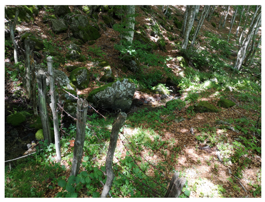 |
| Monte Penna (Penna) | 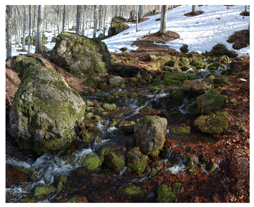 |
| Helocrene at Lake Moo (LE_MCN_Moo) | 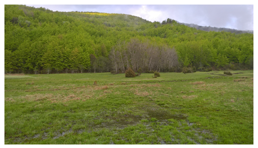 |
| Creno Canadello (CANAD) | 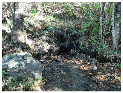 |
| Aveio (AVEIO) | 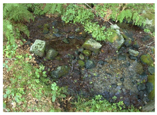 |
Main features: Water springs fed by ophiolitic aquifers are typically characterized by medium to low electrical conductivity and a distinctive hydrochemical signature, marked by relative enrichment in sodium and magnesium. This composition reflects water–rock interactions with ultramafic lithologies, predominantly serpentinized peridotites and associated mafic units. The alteration of these rocks through serpentinization processes plays a key role in controlling groundwater chemistry. These processes promote the release of Mg2+ and Na+. Under such conditions, several elements are mobilized, resulting in elevated concentrations of metals and metalloids such as chromium, nickel, arsenic, uranium, molybdenum, cadmium, antimony, and titanium. The mobility of these elements is strongly influenced by redox conditions and pH. These hydrochemical characteristics have important implications for both environmental quality and ecosystem functioning. Elevated concentrations of potentially toxic elements may constrain water use and influence the composition of biological communities, favoring metal-tolerant and specially adapted species. This hydrogeochemical framework is characteristic of ophiolitic sequences (Middle to Late Jurassic) outcropping along the Northern Apennines, particularly within the ophiolite belt extending between the eastern Liguria and the western sector of the Emilia-Romagna region. This belt includes prominent massifs such as Monte Penna (1735 m a.s.l.), Monte Nero (1752 m a.s.l.), and Monte Ragola (1712 m a.s.l.), where extensive exposures of ultramafic, basalt and serpentinite rocks form a structurally continuous ridge.
In the study area, the springs Penna, AVEIO, M-Nero and CANAD are fed by scree slope deposits. These deposits act as highly permeable aquifers and consist of accumulations of angular rock fragment deposits at the base of cliffs of the Ophiolitic outcrops. Specifically, the Penna spring is fed by groundwater flowing through scree slope deposits derived from basaltic rocks. In contrast, the AVEIO and Monte Nero springs are supplied by groundwater circulating within scree slope deposits derived from ultramafic lithologies. The CANAD spring is fed by groundwater flowing through scree deposits derived from serpentinized ophiolitic rocks. On the other hand, the LE_MCN_Moo Spring is fed by a shallow alluvial aquifer originating from Holocene sedimentation in the Lake Moo basin (1120 m a.s.l., Piacenza Province), resulting from stream flooding activity within the catchment area.
From a conceptual standpoint, these springs are like those found in lowland springs in the Po River plain (fontanili). Finally, all these springs are inside the Natura 2000 network (Penna: IT4020007, AVEIO and M-Nero: IT4010003, CANAD and LE_MCN_Moo: IT4020008) and the Geological Heritage and Geosites database of the Emilia-Romagna Region.
- Group 2—Turbiditic sandstones
| Group 2 (Turbiditic Sand.) | |
| Helocrene at Lake Scuro (SCURO) | 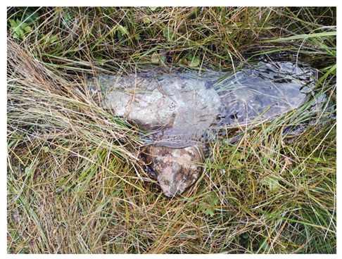 |
| Fontana del Vescovo (Fo-Ves) | 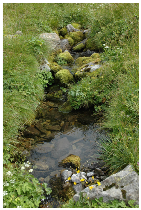 |
| Cusna Est (Cusn_E) | 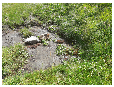 |
| Fontanaccia (Fontanac) | 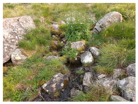 |
| Sorgente della Secchia (SECCH) | 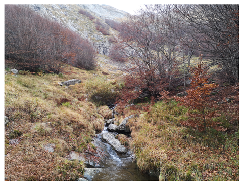 |
Main features: High-altitude springs with very low electrical conductivity. The area is in the UNESCO Man and the Biosphere (MAB) Reserve of the Tuscan–Emilian Apennines.
Fo-Ves and SCURO spring waters are characterized by low mineral content (specific electrical conductivity below 70 µS/cm). The perennial springs are located along a ridge where the Macigno sandstones (Upper Oligocene–Lower Miocene) outcrop and where the headwaters of the Parma and Cedra streams originate (Province of Parma). The springs are fed by scree slope deposits. These deposits act as highly permeable aquifers, naturally filtering and channeling meltwater and rain into distinct discharges. The scree slope deposits consist of accumulations of loose, angular rock fragments at the base of cliffs of the Macigno Formation outcrops. These springs are inside the Tuscan–Emilian Apennines National Park, the Natura 2000 network (IT4020020) and the Geological Heritage and Geosites database of the Emilia-Romagna Region.
Fontanac (spring above the natural treeline) and SECCH are perennial springs, located along a ridge where the Macigno sandstones (Upper Oligocene–Lower Miocene) outcrop, and where the headwaters of the Panaro (Fontanac, Province of Modena) and the Secchia streams (SECCH, Province of Reggio Emilia) originate. This area preserves numerous traces of the last glacial period. The spring waters are characterized by low mineral content (specific electrical conductivity below 100 µS/cm). They are fed by moraine deposits composed of loose, unsorted rock, gravel, and sediment derived from the quartz–feldspar sandstones of the Macigno Formation. These deposits act as highly permeable aquifers, naturally filtering and channeling meltwater and rain into distinct discharges. SECCH spring is within the Tuscan–Emilian Apennines National Park and inside the Natura 2000 network IT4030001 while Fontacc is located within the Modena Apennines Regional Park.
Cusna-est (spring above the natural treeline) is located along a ridge where the Monte Modino sandstone formation outcrop (Upper Oligocene–Lower Miocene), and where the headwaters of the Secchiello stream originate (Reggio Emilia Province). The electrical conductivity of the spring water ranges between 150 and 250 µS/cm. The perennial spring is fed by turbiditic sandstones that, in the study area, form an important aquifer with medium to low permeability controlled by fracturing. The spring is inside the Tuscan–Emilian Apennines National Park, in the Natura 2000 network (IT4030004).
All the springs are listed in the Geological Heritage and Geosites database of the Emilia-Romagna Region.
- Group 3—Shallow Marine Sandstone deposits (fractured-rock aquifer)
| Group 3 (Shallow mar. Sand.) | |
| Labante (Laban) | 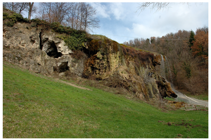 |
| Sorgente Ramata (RAMAT) | 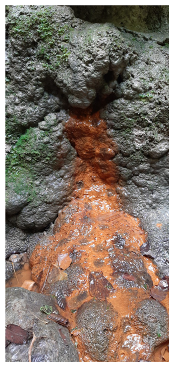 |
| Tintoria (TINTO) | 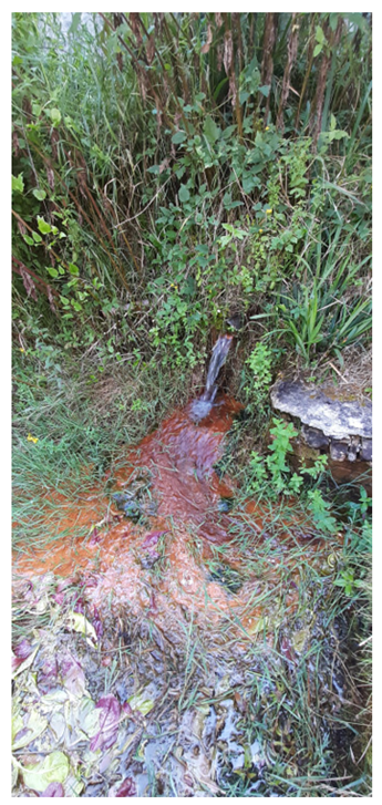 |
| Mulino delle Vene (Mu-Ven) | 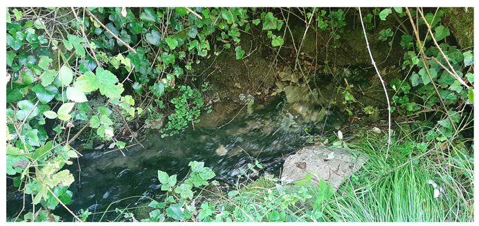 |
| Vignudini (VIGNU) | 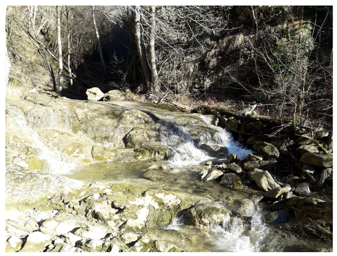 |
Main features: These springs are fed by a fissured aquifer in rocks of the Pantano Formation (Upper Burdigalian to Lower Langhian). These are Shallow Marine Sandstone deposits that are mainly distributed in the central sectors of the Emilia-Romagna Region. This group includes:
- Springs exhibiting peculiar hydrochemical compositions, including ferruginous waters, reflecting complex groundwater circulation through mineralized sedimentary formations.
- Springs generating extensive travertine deposits associated with abundant vegetation. The calcite-rich composition of the Pantano arenite, along with its homogeneous lithology, makes it prone to dissolution. Precipitation at ambient temperature and the consequent formation of carbonate deposits occurs because spring waters rich in calcium and bicarbonate ions, once exposed, tend to deposit calcium carbonate (CaCO3) crystals, which coat everything they come into contact with. These springs are among the priority habitats (Natura 2000 Code: 7220*) according to Directive (92/43; EC) and represent an important example of an ecosystem that depends on the characteristics of groundwater (Groundwater Dependent Ecosystem).
The San Cristoforo of Labante spring (Bologna Province) is one of the most important petrifying spring systems at the regional scale. The spring is associated with active calcium carbonate deposition and the formation of extensive travertine deposits and primary caves. Discharge ranges from approximately 10 to 20 L s−1, and the site is included within the Natura 2000 network (“Labante Petrifying Caves and Springs”, IT4050028). It represents a priority habitat (7220*).
Ferruginous springs are groundwater discharge points characterized by elevated concentrations of dissolved iron. They typically form where groundwater flows through iron-bearing lithologies under reducing (low-oxygen) conditions. Upon exposure to atmospheric oxygen, ferrous iron (Fe2+) is rapidly oxidized to ferric iron (Fe3+), leading to the precipitation of iron oxides and hydroxides and the formation of characteristic reddish to orange deposits in the vicinity of the spring. These systems exert a significant influence on local microbial communities, sedimentation dynamics, and the geochemical composition of receiving surface waters. Historically, springs with distinctive hydrochemical signatures, including sulfurous and ferruginous waters, have been widely utilized for balneological and therapeutic applications, owing to their purported health benefits.
TINTO spring is within the Collina Reggiana—Terre di Matilde Protected Natural and Semi-Natural Landscape, while RAMAT spring is inside the Regional Park Abbazia di Monteveglio and Natura 2000 network IT4050016.
The Mulino delle Vene spring system (Reggio Emilia Province) stands out as one of the largest in the region for mean annual discharge (30–100 L/s) and is considered the main water resource in the Emilia-Romagna Region. The spring system consists of multiple outlets flowing out from several joints and fractures at the bottom of an arenite rock mass outcrop (Pantano Formation) in the vicinity of the Tresinaro River. These springs have not yet been exploited, as knowledge about the hydrogeological characteristics of the aquifer and their hydrological behavior is not fully achieved, due to the complexity of the system. They therefore represent a unique natural freshwater environment, contributing to the local biodiversity. They represent a priority habitat (7220*), and are outside any kind of protection.
The waters of the Vignudini spring reflect the lithological characteristics of the aquifer, with solute concentrations controlled by water–rock interaction processes and groundwater residence time. This results in moderately mineralized waters.
Furthermore, the hydrogeological and chemical properties of the Pantano aquifer provide favorable conditions for the development of specific ecological assemblages. Spring habitats support specialized microbial communities and aquatic organisms adapted to relatively stable physicochemical conditions, thereby contributing to local biodiversity and ecological heterogeneity. Despite this, VIGNU spring is outside any kind of protection.
- Group 4—Triassic gypsum deposits (Karst aquifer)
| Group 4 (Triassic Gypsum) | |
| Poiano (PoianoS) | 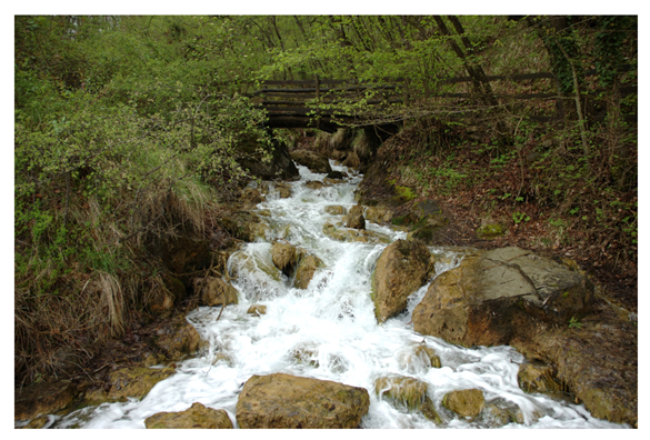 |
| Ca’ delle Ghiaie (GHIAI) | 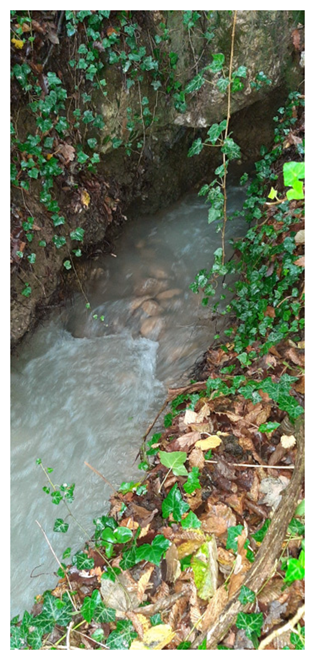 |
| Tanone (TANON) | 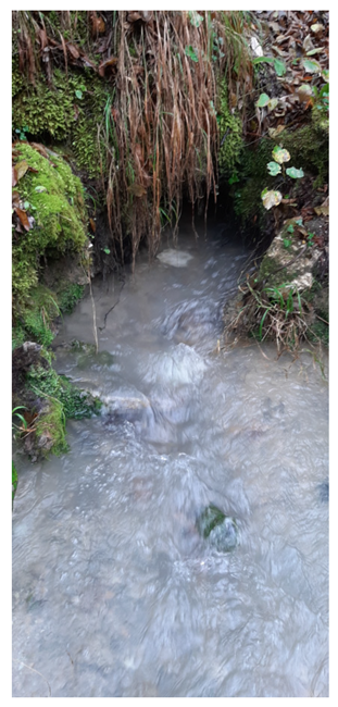 |
| Limnocrene Gessi (Lim-Ge) | 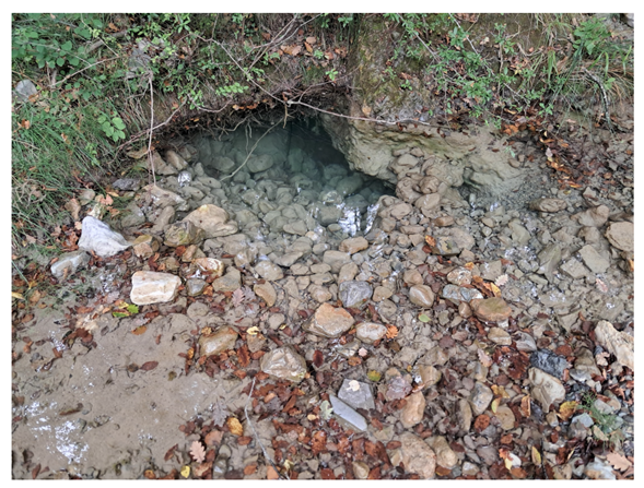 |
| Grotta Gessi (Gro-Ge) | 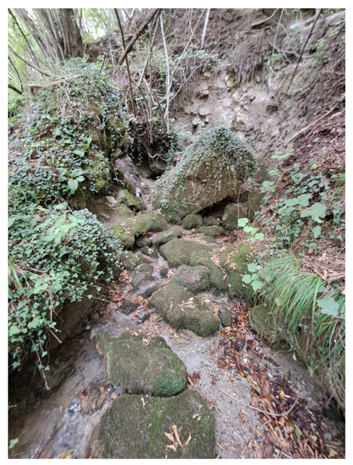 |
Main features: Springs fed by aquifers developed in highly soluble rocks: the Triassic Gypsum of the Secchia Valley, which is the most significant karst system in Emilia-Romagna Region, located in the municipality of Villa Minozzo (Reggio Emilia Province). They are typically characterized by very high electrical conductivity (EC) values. All the springs are located within the following regions:
- UNESCO Man and the Biosphere (MAB) Reserve of the Tuscan–Emilian Apennines, and have been part of the UNESCO World Heritage Site “Karst in the Evaporites and Caves of the Northern Apennines” since 2023;
- Natura 2000 site IT4030009;
- Geosites database of the Emilia-Romagna Region.
In addition to their high discharge (between a minimum of 400 and a maximum of 900 L per second, with an average consistently exceeding 600 L/s), Poiano springs are characterized by highly mineralized sodium-chloride and sulphate waters (electrical conductivity ranges from 11,000 to 13,000 µS/cm). From a hydrogeological perspective, the combination of high discharge and elevated salinity makes the Poiano springs a significant case study for understanding groundwater dynamics in evaporate mountain systems. Moreover, their chemical composition has implications for aquatic ecosystems and limits their suitability for direct potable use, while potentially favoring specific ecological niches adapted to saline conditions.
- Group 5—Lowland springs in the Po River plain, locally known as “Fontanili” (unconsolidated deposits: alluvial plains)
| Group 5 (Fontanili) | |
| Fontanile Valle Re | 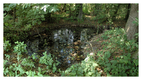 |
| Fontanile Viarolo (Fontanellato Fontanile) (PR) | 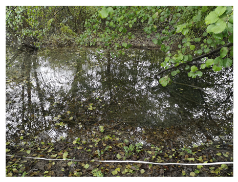 |
| Fontanile Castelfranco (MO) | 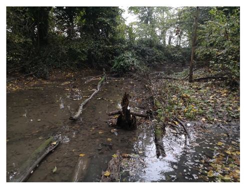 |
| Fontanile Beneceto | 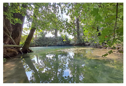 |
| Fontanile Pozzetto | 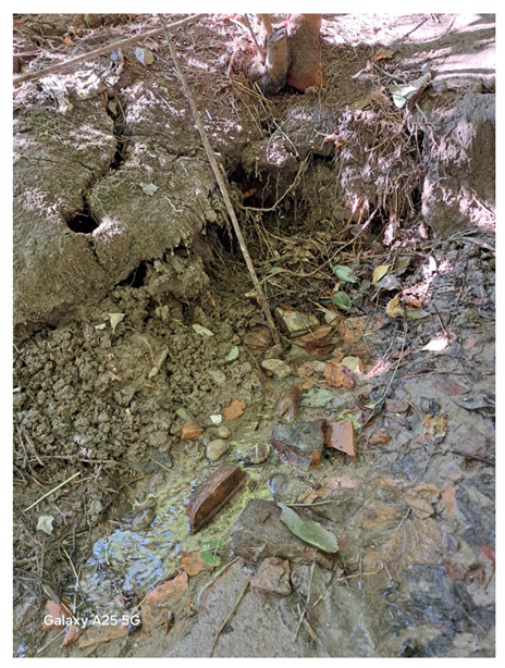 |
Main features: Fontanili are lowland spring-fed systems associated with shallow alluvial aquifers of the Po River Plain. Compared with mountain spring systems, they are generally characterized by higher nutrient concentrations (e.g., nitrates and phosphates), increased electrical conductivity, and frequent contamination by trace elements (e.g., Ni), reflecting the influence of intensive agricultural land use and other anthropogenic pressures typical of lowland environments.
These systems have been extensively modified by human activities. In particular, the excavation of ditches and channels at natural groundwater discharge points (“risorgive”) has allowed their systematic incorporation into irrigation networks. Such interventions have altered the natural groundwater–surface water interactions, flow regime, and sediment transport processes.
Despite these alterations, Fontanili maintain relatively stable hydrological and thermal conditions, as they are directly sustained by groundwater discharge. These conditions support specific biological communities adapted to stable physicochemical conditions, including groundwater-dependent and stenothermal species.
Historically widespread, Fontanili have experienced a significant decline over the last century. Of the more than 400 springs documented from a historical standpoint in the Emilia-Romagna Region, only a limited number remain active today. This reduction is mainly attributed to groundwater extraction, land-use intensification, channelization, and reduced aquifer recharge, which have progressively impaired the functioning of these spring systems.
Finally, some springs are inside the Natura 2000 network (To-Tre: IT4020017, F_VR_Sh: IT4030007), Torrile and Trecasali Regional Reserve (To-Tre), Fontanili di Corte Valle Re Regional Reserve (F_VR_Sh) and the Geological Heritage and Geosites database of the Emilia-Romagna Region (F_VR_Sh). POZZE, BENEC and CF-FON are outside any kind of protection.
Figure A1.
The five most representative springs: one for each strategic zone. (A) Monte Penna (Ophiolites); (B) Fontana del Vescovo (Turbiditic sandstones); (C) Poiano (Triassic gypsum deposits); (D) Fontanile Castelfranco (Fontanili); (E) Labante (Shallow Marine Sandstone deposits).
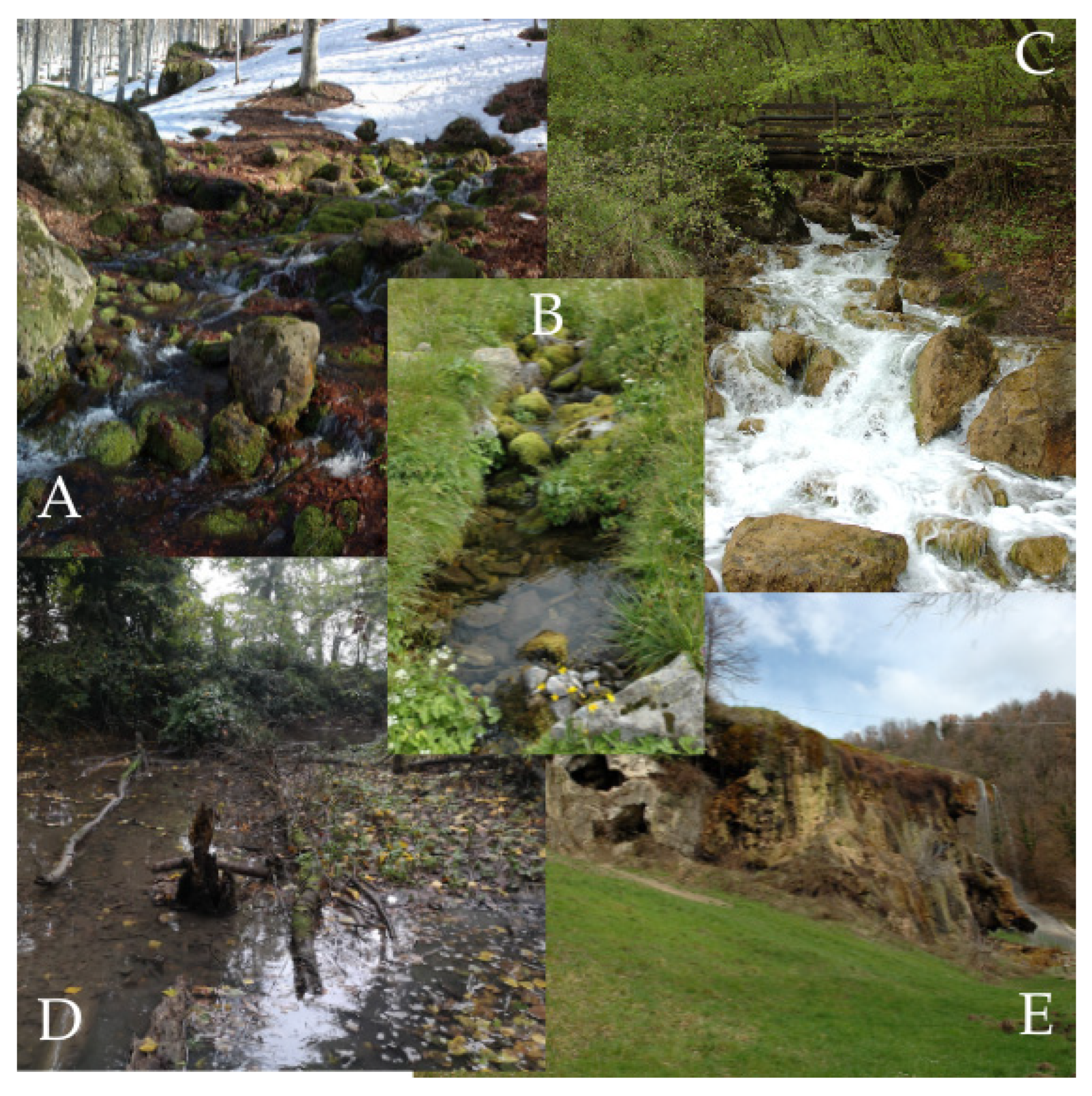
Figure A2.
Spatial variation in chlorophyll a and pheophytin concentrations across the studied springs (µg cm−2).
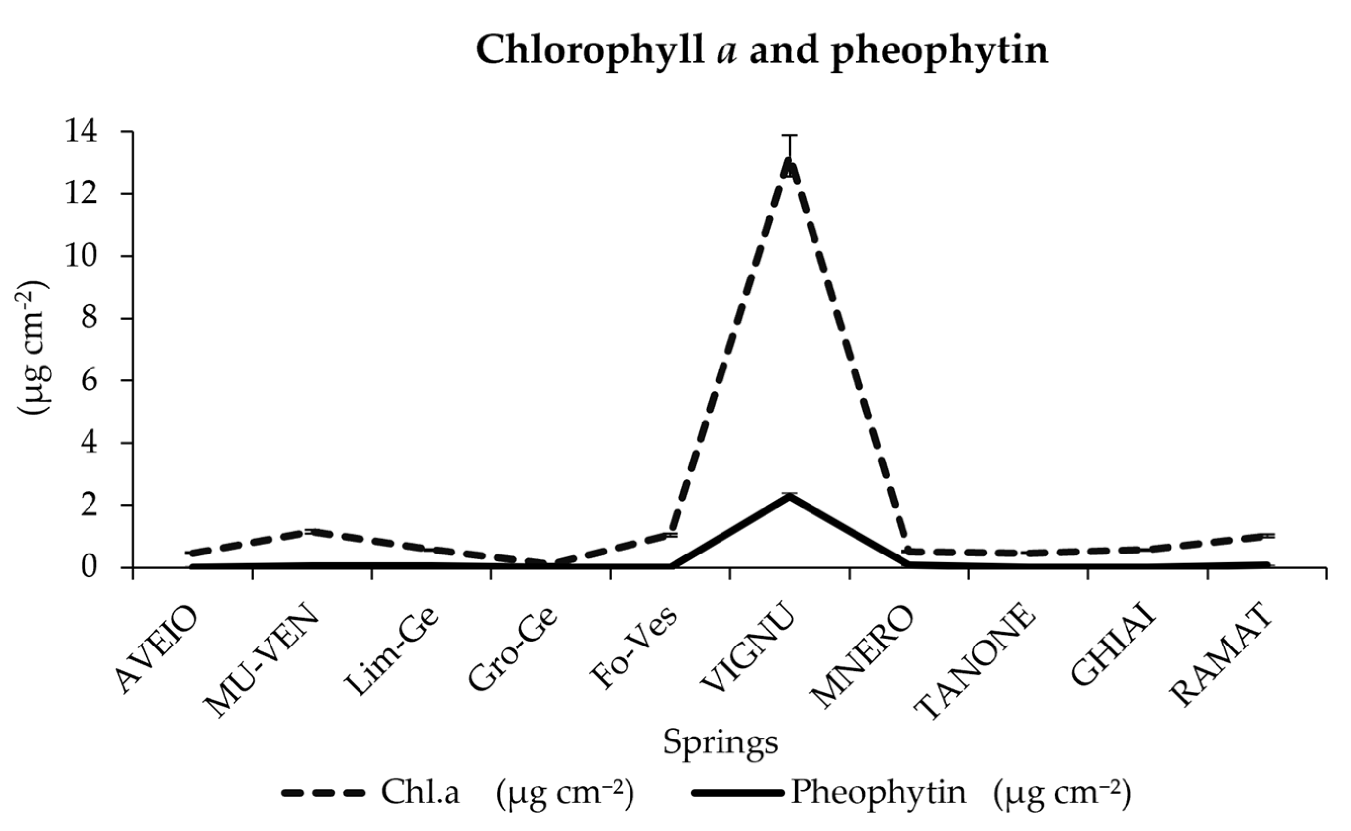
Table A2.
Detailed chemical parameters of the 25 springs studied.
Table A3.
Ash-free dry mass (AFDM, g m−2) measured at ten springs across four of the five strategic zones (Fontanili excluded). Values are reported by strategic zone and site.
Table A4.
Significant diatom indicator species per strategic zone and substrate (IndVal; Dufrêne & Legendre, 1997 [46]; p < 0.05; species occurring in ≥3 sites). No significant indicators were found for the Shallow Marine Sandstones on either substrate. Planothidium frequentissimum (*) was the only species significant on both substrates.
Table A5.
List of the 26 species selected with ≥10 records or >25% maximum relative abundance. Red List 2018 threat categories: 0 = presumed extinct, 1 = threatened with extinction, 2 = strongly threatened, 3 = threatened, G = threat of unknown extent, R = extremely rare, V = declining, D = data insufficient, * = not threatened. 2018 RL’s Ecology categories: ae = aerial, o = oligotraphentic, oc = oligotraphentic carbonate, od = oligotraphentic distrophic, eu = eutraphentic to tolerant, ? = unknown [38].
Table A6.
88 aerial species, selected according to Van dam M (Moisture) index (categories 4 = mainly occurring on wet and moist or temporarily dry places; 5 = nearly exclusively occurring outside water bodies); terrestrial diatoms according to “Autecology of terrestrial diatoms under anthropic disturbance and across climate zones”, Foets et al., 2021 [43]; Red List 2018 Ecological groups as aerial; ecology of “Diatom-Atlas-of-Macedonia draft” by Prof. Dr. Zlatko Levkov as aerophyte. 2018 RL’s Ecology categories: ae = aerial, o = oligotraphentic, oc = oligotraphentic carbonate, od = oligotraphentic distrophic, eu = eutraphentic to tolerant, hal = halophilic, ? = unknown [38]. N.A. = Not Available.
Figure A3.
Proportion of the 393 total diatom species recorded, classified according to the 2018 Diatom Red List [38]: threatened/vulnerable (categories 1, 2, 3, G, R, V; 41% of evaluated species), data insufficient (D; 9%), not threatened (*; 49.8%), and not evaluated (species absent from the Red List; 4.5%, n = 84). Percentages for the first three categories are calculated on the 309 evaluated species; the not-evaluated category is calculated on the total of 393 species.
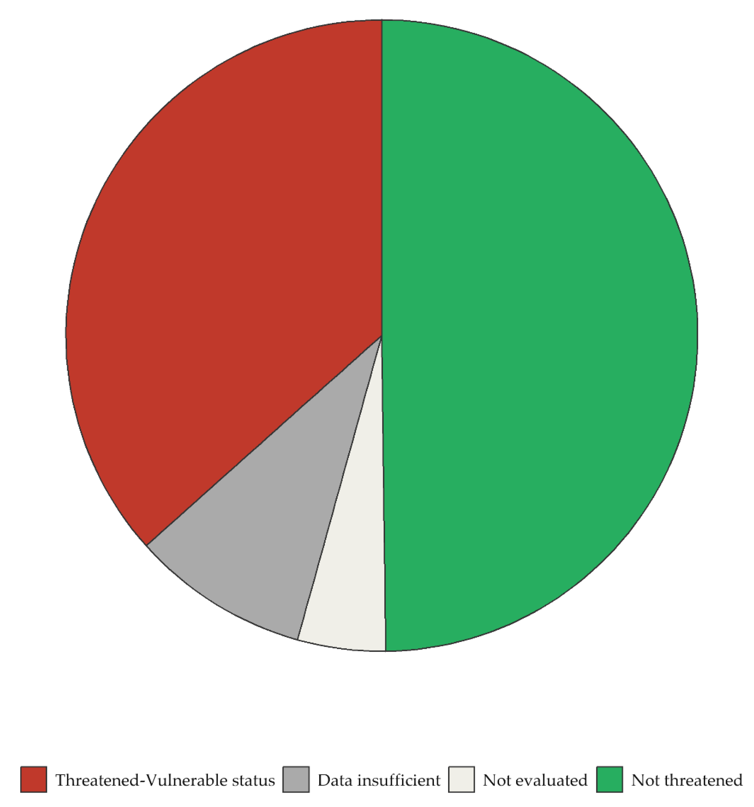
Table A7.
The 37 species recorded in the most threatened categories of the 2018 Diatom Red List (category 2 = Strongly Threatened; category 3 = Threatened). Red List Ecology follows [38]: o = oligotraphentic, oc = oligotraphentic carbonate, od = oligotraphentic dystrophic, ae = aerial; N Van Dam Index: nitrogen uptake metabolism according to [40], updated in [41]: 1 = nitrogen-autotrophic taxa, tolerating very small concentrations of organically bound nitrogen, 2 = nitrogen-autotrophic taxa, tolerating elevated concentrations of organically bound nitrogen; N.O.= Number of Occurrences, calculated on the 50 samples (2 substrates × 25 springs); the number of sites may differ from N.O. as multiple samples (2 substrates) per spring were analyzed.
Figure A4.
Significant correlations (p < 0.05) between morphology (High-Profile, Low-Profile, Mobile, Plaktonic) and environmental parameters.
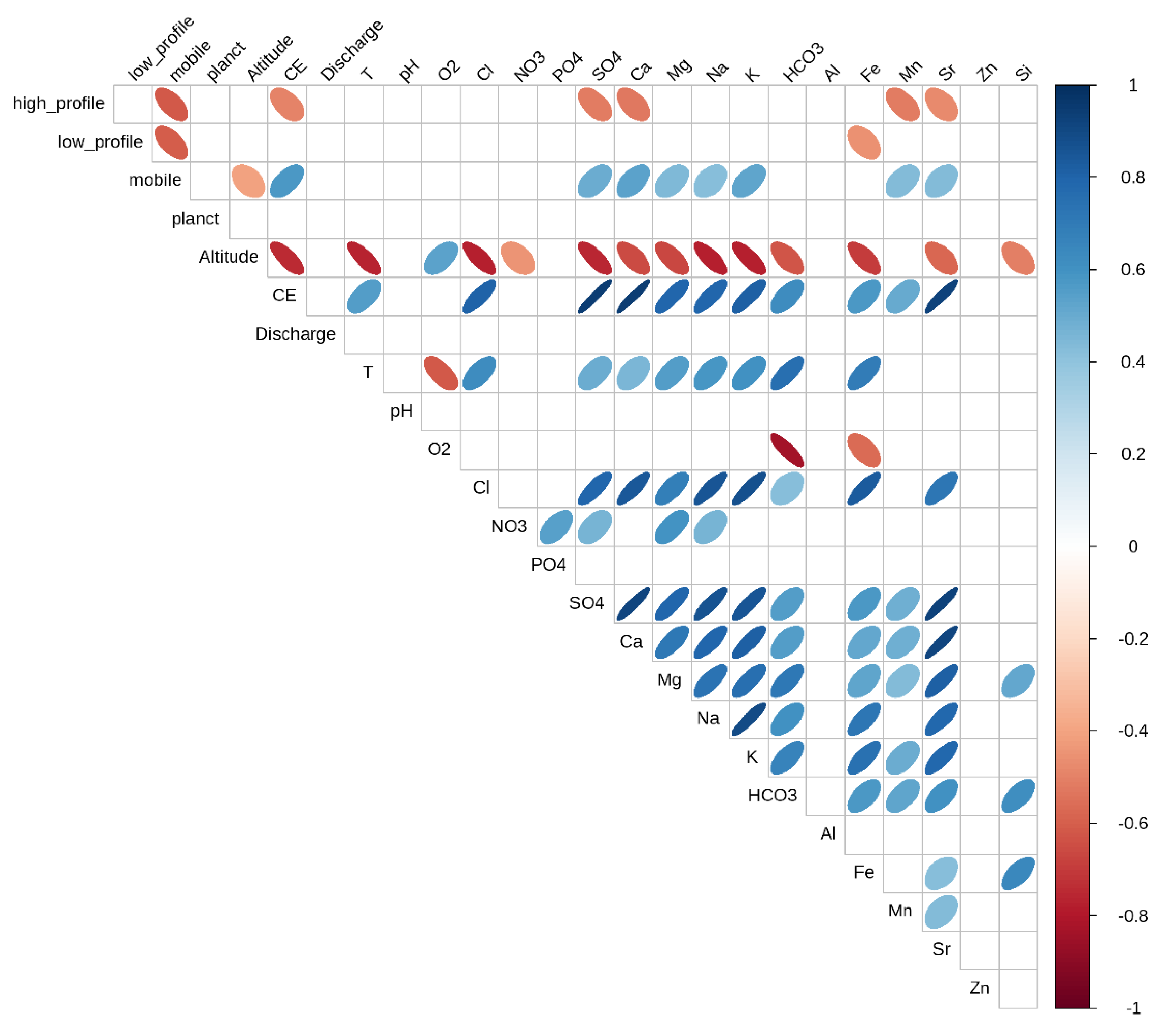
Table A8.
Plant taxa recorded at the six springs surveyed for vegetation (at least one per strategic zone).
Figure A5.
Hydroclimatic Balance (BIC) for the aquifer recharge period (October–May), 1995–2024 minus 1965–1994 in the Emilia-Romagna Region [27].
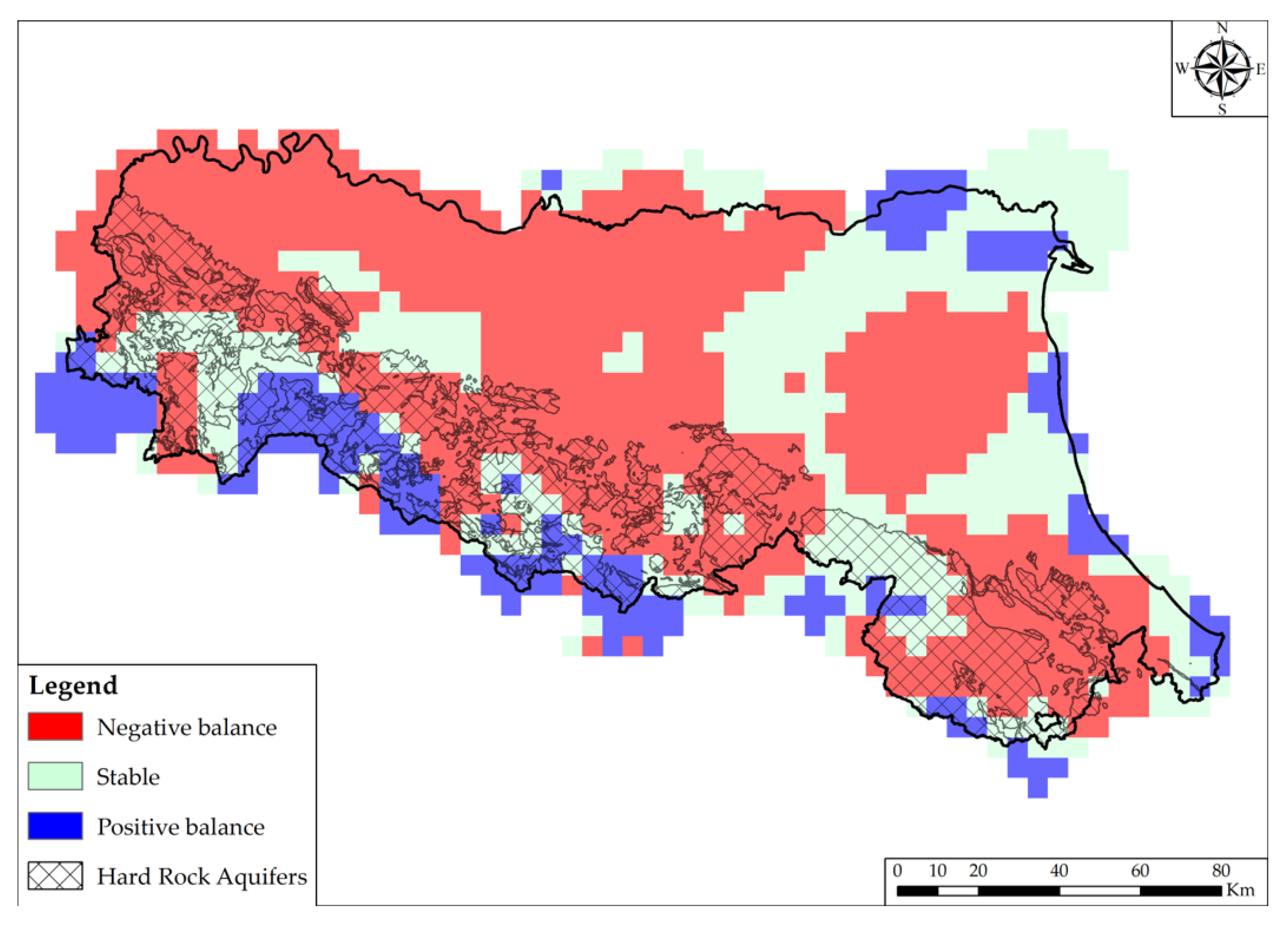
Table A9.
Comparison of the present study with published investigations applying similar integrated or diatom-based approaches to spring ecosystems.
Table A10.
Discharge variability index per zone (Iv ≤ 0.25: Constant discharge, with springs fed by large underground reservoirs maintaining stable baseflow conditions largely independent of short-term meteorological fluctuations; 0.25 < Iv ≤ 1: Sub-variable discharge, with springs partially influenced by seasonal precipitation patterns, with moderate flow fluctuations reflecting a buffered but not fully decoupled hydrological response; Iv > 1: Variable discharge, with springs strongly influenced by direct precipitation events and snowmelt, exhibiting marked discharge fluctuations and rapid hydrological response to meteorological forcing).
References
- van der Kamp, G. The Hydrogeology of Springs in Relation to the Biodiversity of Spring Fauna: A Review. J. Kans. Entomol. Soc. 1995, 68, 4–17. [Google Scholar]
- Stevens, L.E.; Schenk, E.R.; Springer, A.E. Springs Ecosystem Classification. Ecol. Appl. 2021, 31, e2218. [Google Scholar] [CrossRef] [Scilit] [PubMed]
- von Fumetti, S.; Aberhalden, A. Monitoring Potential Impacts of Climate Change on the Biodiversity of Springs and Springbrooks in the Central Alps. Aquat. Sci. 2024, 86, 80. [Google Scholar] [CrossRef] [Scilit]
- Glazier, D.S. Springs. In Encyclopedia of Inland Waters; Likens, G.E., Ed.; Academic Press Elsevier: Amsterdam, The Netherlands, 2009; Volume 1, pp. 734–755. [Google Scholar]
- Cantonati, M.; Füreder, L.; Gerecke, R.; Jüttner, I.; Cox, E.J. Crenic Habitats, Hotspots for Freshwater Biodiversity Conservation: Toward an Understanding of Their Ecology. Freshw. Sci. 2012, 31, 463–480. [Google Scholar] [CrossRef] [Scilit]
- Cantonati, M.; Segadelli, S.; Ogata, K.; Tran, H.; Sanders, D.; Gerecke, R.; Rott, E.; Filippini, M.; Gargini, A.; Celico, F. A Global Review on Ambient Limestone-Precipitating Springs (LPS): Hydrogeological Setting, Ecology, and Conservation. Sci. Total Environ. 2016, 568, 624–637. [Google Scholar] [CrossRef] [Scilit] [PubMed]
- Cantonati, M.; Segadelli, S.; Spitale, D.; Gabrieli, J.; Gerecke, R.; Angeli, N.; De Nardo, M.T.; Ogata, K.; Wehr, J.D. Geological and Hydrochemical Prerequisites of Unexpectedly High Biodiversity in Spring Ecosystems at the Landscape Level. Sci. Total Environ. 2020, 740, 140157. [Google Scholar] [CrossRef] [Scilit] [PubMed]
- Cantonati, M.; Lichtenwöhrer, K.; Leonhardt, G.; Seifert, L.; Mustoni, A.; Hotzy, R.; Schubert, E.; Blattner, L.; Bilous, O.; Lotz, A.; et al. Using Springs as Sentinels of Climate Change in Nature Parks North and South of the Alps: A Critical Evaluation of Methodological Aspects and Recommendations for Long-Term Monitoring. Water 2022, 14, 2843. [Google Scholar] [CrossRef] [Scilit]
- Kløve, B.; Ala-aho, P.; Bertrand, G.; Boukalova, Z.; Ertürk, A.; Goldscheider, N.; Ilmonen, J.; Karakaya, N.; Kupfersberger, H.; Kvœrner, J.; et al. Groundwater Dependent Ecosystems. Part I: Hydroecological Status and Trends. Environ. Sci. Policy 2011, 14, 770–781. [Google Scholar] [CrossRef] [Scilit]
- Cantonati, M.; Casoria, C.; Gerecke, R.; Bilous, O.P.; Maisto, G.; Segadelli, S.; Spitale, D.; Steinbauer, A.; Vogel, S.; Saber, A.A. Diatom Indicators of Fluctuating/Intermittent Discharge from Springs in Two Bavarian Nature Conservation Areas. Diversity 2023, 15, 915. [Google Scholar] [CrossRef] [Scilit]
- Immerzeel, W.W.; Lutz, A.F.; Andrade, M.; Bahl, A.; Biemans, H.; Bolch, T.; Hyde, S.; Brumby, S.; Davies, B.J.; Elmore, A.C.; et al. Importance and Vulnerability of the World’s Water Towers. Nature 2020, 577, 364–369. [Google Scholar] [CrossRef] [Scilit] [PubMed]
- Il Censimento Partecipato Delle Sorgenti Naturali dell’Emilia-Romagna. Available online: https://ambiente.regione.emilia-romagna.it/it/geologia/geologia/acque/risorse-montagna/censimento-partecipato-sorgenti (accessed on 15 June 2026).
- Sorgenti e Unità Geologiche Sede di Acquiferi. Available online: https://servizimoka.regione.emilia-romagna.it/mokaApp/apps/rocce_magazzino/index.html (accessed on 15 June 2026).
- Segadelli, S.; Vescovi, P.; Ogata, K.; Chelli, A.; Zanini, A.; Boschetti, T.; Petrella, E.; Toscani, L.; Gargini, A.; Celico, F. A Conceptual Hydrogeological Model of Ophiolitic Aquifers (Serpentinised Peridotite): The Test Example of Mt. Prinzera (Northern Italy). Hydrol. Process. 2017, 31, 1058–1073. [Google Scholar] [CrossRef] [Scilit]
- Gargini, A.; Vincenzi, V.; Piccinini, L.; Zuppi, G.M.; Canuti, P. Groundwater Flow Systems in Turbidites of the Northern Apennines (Italy): Natural Discharge and High Speed Railway Tunnel Drainage. Hydrogeol. J. 2008, 16, 1577–1599. [Google Scholar] [CrossRef] [Scilit]
- Mann, D.G.; Vanormelingen, P. An Inordinate Fondness? The Number, Distributions, and Origins of Diatom Species. J. Eukaryot. Microbiol. 2013, 60, 414–420. [Google Scholar] [CrossRef] [Scilit] [PubMed]
- Mann, D.G. The Species Concept in Diatoms. Phycologia 1999, 38, 437–495. [Google Scholar] [CrossRef] [Scilit]
- Smol, J.P.; Stoermer, E.F. The Diatoms: Applications for the Environmental and Earth Sciences; Cambridge University Press: Singapore, 2010. [Google Scholar]
- Castellarin, A. Alps-Apennines and Po Plain-Frontal Apennines Relations. In Anatomy of an Orogen: The Apennines and Adjacent Mediterranean Basins; Vai, G.B., Martini, I.P., Eds.; Springer: Dordrecht, The Netherlands, 2001; pp. 177–195. [Google Scholar] [CrossRef] [Scilit]
- Boccaletti, M.; Bonini, M.; Corti, G.; Gasperini, P.; Martelli, L.P.L.; Severi, P.; Vannucci, G.; Moratti, G.; Sarti, G. Carta Sismotettonica Della Regione Emilia Romagna, Scala 1/250000, Note Illustrative. 2004. Available online: https://it.scribd.com/document/309603791/CARTA-SISMOTETTONICA-DELLA-REGIONE-EMILIA-ROMAGNA (accessed on 19 April 2026).
- Marroni, M.; Meneghini, F.; Pandolfi, L. Anatomy of the Ligure-Piemontese Subduction System: Evidence from Late Cretaceous–Middle Eocene Convergent Margin Deposits in the Northern Apennines, Italy. Int. Geol. Rev. 2010, 52, 1160–1192. [Google Scholar] [CrossRef] [Scilit]
- Conti, P.; Cornamusini, G.; Carmignani, L. An Outline of the Geology of the Northern Apennines (Italy), with Geological Map at 1:250,000 Scale. Ital. J. Geosci. 2020, 139, 149–194. [Google Scholar] [CrossRef] [Scilit]
- Cantonati, M.; Angeli, N.; Bertuzzi, E.; Spitale, D.; Lange-Bertalot, H. Diatoms in Springs of the Alps: Spring Types, Environmental Determinants, and Substratum. Freshw. Sci. 2012, 31, 499–524. [Google Scholar] [CrossRef] [Scilit]
- Kamberović, J.; Plenković-Moraj, A.; Borojević, K.K.; Udovič, M.G.; Žutinić, P.; Hafner, D.; Cantonati, M. Algal Assemblages in Springs of Different Lithologies (Ophiolites vs. Limestone) of the Konjuh Mountain (Bosnia And Herzegovina). Acta Bot. Croat. 2019, 78, 66–81. [Google Scholar] [CrossRef] [Scilit]
- Panahy Mirzahasanlou, J.; Musaabad, L.A.; Mahmoodlu, M.G.; Bahalkeh, A. An Ecological and Hydrochemical Study of Three Springs in NE Iran with the Emphasis on Diatom Diversity. Limnologica 2021, 90, 125908. [Google Scholar] [CrossRef] [Scilit]
- Sada, D.W.; Thomas, J.M. Relationships Between Aquatic Ecology, Landscapes, Hydrogeology and Hydrochemistry in Great Basin and Mojave Desert Spring Systems USA. Ecohydrology 2025, 18, e70035. [Google Scholar] [CrossRef] [Scilit]
- ARPAE Emilia-Romagna. Rapporto IdroMeteoClima Emilia-Romagna—Dati 2024; ARPAE: Bologna, Italy, 2024; pp. 78–89. [Google Scholar]
- Chiesi, M.; De Waele, J.; Forti, P. Origin and Evolution of a Salty Gypsum/Anhydrite Karst Spring: The Case of Poiano (Northern Apennines, Italy). Hydrogeol. J. 2010, 18, 1111–1124. [Google Scholar] [CrossRef] [Scilit]
- Portale della Flora d’Italia—Portal to the Flora of Italy. Available online: http://dryades.units.it/floritaly (accessed on 15 June 2026).
- Aleffi, M.; Tacchi, R.; Poponessi, S. New Checklist of the Bryophytes of Italy. Cryptogam. Bryol. 2020, 41, 147–195. [Google Scholar] [CrossRef] [Scilit]
- Hauer, F.R.; Lamberti, G. Methods in Stream Ecology: Volume 1: Ecosystem Structure; Academic Press: Cambridge, MA, USA, 2017. [Google Scholar]
- Ritchie, P.D.L.; Clarke, J.J.; Cox, P.M.; Huntingford, C. Overshooting Tipping Point Thresholds in a Changing Climate. Nature 2021, 592, 517–523. [Google Scholar] [CrossRef] [Scilit] [PubMed]
- Lange-Bertalot, H.; Hofmann, G.M.; Werum, M.; Cantonati, M. Freshwater Benthic Diatoms of Central Europe. Over 800 Common Species Used in Ecological Assessment; English Edition with Updated Taxonomy and Added Species; Koeltz Botanical Books: Koenigstein, Germany, 2017. [Google Scholar]
- Guiry, M.D.; Guiry, G.M. AlgaeBase. World-wide electronic publication, University of Galway, Ireland. Available online: https://www.algaebase.org (accessed on 1 August 2026).
- Kociolek, J.P.; Blanco, S.; Coste, M.; Ector, L.; Liu, Y.; Karthick, B.; Kulikovskiy, M.; Lundholm, N.; Ludwig, T.V.; Potapova, M.; et al. DiatomBase. Available online: https://www.diatombase.org (accessed on 3 May 2026).
- Spaulding, S.A.; Potapova, M.G.; Bishop, I.W.; Lee, S.S.; Gasperak, T.S.; Jovanoska, E.; Furey, P.C.; Edlund, M.B. Diatoms.Org: Supporting Taxonomists, Connecting Communities. Diatom Res. 2021, 36, 291–304. [Google Scholar] [CrossRef] [Scilit] [PubMed]
- Jüttner, I.; Carter, C.; Cox, E.J.; Ector, L.; Jones, V.; Kelly, M.G.; Kennedy, B.; Mann, D.G.; Turner, J.A.; Van de Vijver, B.; et al. 2026 Freshwater Diatom Flora of Britain and Ireland. Amgueddfa Cymru—National Museum Wales. Available online: https://naturalhistory.museumwales.ac.uk/diatoms (accessed on 16 June 2026).
- Hofmann, G.; Lange-Bertalot, H.; Werum, M.; Klee, R. Rote Liste und Gesamtartenliste der limnischen Kieselalgen (Bacillariophyta) Deutschlands. In Rote Liste Gefährdeter Tiere, Pflanzen und Pilze Deutschlands; Band 7: Pflanzen. Münster (Landwirtschaftsverlag); Metzing, D., Hofbauer, N., Ludwig, G., Matzke-Hajek, G., Eds.; Naturschutz und Biologische Vielfalt: Bonn, Germany, 2018; Volume 70, pp. 601–708. [Google Scholar]
- Cantonati, M.; Hofmann, G.; Spitale, D.; Werum, M.; Lange-Bertalot, H. Diatom Red Lists: Important Tools to Assess and Preserve Biodiversity and Habitats in the Face of Direct Impacts and Environmental Change. Biodivers. Conserv. 2022, 31, 453–477. [Google Scholar] [CrossRef] [Scilit]
- Van Dam, H.; Mertens, A.; Sinkeldam, J. A Coded Checklist and Ecological Indicator Values of Freshwater Diatoms from The Netherlands. Neth. J. Aquat. Ecol. 1994, 28, 117–133. [Google Scholar] [CrossRef] [Scilit]
- Mertens, A.; van der Wal, J.; Verweij, G.; Pex, B.; van Dulmen, A.; van Dam, H. A Revised List of Diatom Ecological Indicator Values in The Netherlands. Ecol. Indic. 2025, 172, 113219. [Google Scholar] [CrossRef] [Scilit]
- Levkov, Z. Diatom Atlas of Macedonia. 2026. Available online: https://www.diatomatlas.mk (accessed on 3 July 2026).
- Foets, J.; Stanek-Tarkowska, J.; Teuling, A.J.; Van de Vijver, B.; Wetzel, C.E.; Pfister, L. Autecology of Terrestrial Diatoms under Anthropic Disturbance and across Climate Zones. Ecol. Indic. 2021, 122, 107248. [Google Scholar] [CrossRef] [Scilit]
- Rimet, F.; Bouchez, A. Life-Forms, Cell-Sizes and Ecological Guilds of Diatoms in European Rivers. Knowl. Manag. Aquat. Ecosyst. 2012, 406, 01. [Google Scholar] [CrossRef] [Scilit]
- Shannon, C.E. A Mathematical Theory of Communication. Bell Syst. Tech. J. 1948, 27, 379–423. [Google Scholar] [CrossRef] [Scilit]
- Dufrêne, M.; Legendre, P. Species Assemblages and Indicator Species: The Need for a Flexible Asymmetrical Approach. Ecol. Monogr. 1997, 67, 345–366. [Google Scholar] [CrossRef] [Scilit]
- Team, R.C. R A Language and Environment for Statistical Computing, R Foundation for Statistical. Computing. 2020. Available online: https://cir.nii.ac.jp/crid/1370298755636824325 (accessed on 1 June 2026).
- Oksanen, J.; Simpson, G.L.; Blanchet, F.G.; Kindt, R.; Legendre, P.; Minchin, P.R.; O’Hara, R.B.; Solymos, P.; Stevens, M.H.H.; Szoecs, E.; et al. Vegan: Community Ecology Package, 2026. Available online: https://cran.r-project.org/web/packages/vegan/index.html (accessed on 16 June 2026).
- Roberts, D.W. Labdsv: Ordination and Multivariate Analysis for Ecology, 2026. Available online: https://cran.r-project.org/web/packages/labdsv/index.html (accessed on 16 June 2026).
- Lombini, A.; Dinelli, E.; Ferrari, C.; Simoni, A. Plant–Soil Relationships in the Serpentinite Screes of Mt. Prinzera (Northern Apennines, Italy). J. Geochem. Explor. 1998, 64, 19–33. [Google Scholar] [CrossRef] [Scilit]
- Boschetti, T.; Segadelli, S.; Gori, F.; Antolini, G.; Bellini, L.; Raso, A.; Selmo, E.; Barbieri, M.; Iacumin, P.; Guidetti, E.; et al. A Preliminary Study on the Effects of Rainfall-Related Conditions on Chromium Increase in Ultramafic-Hosted Springs: A Possible Climate Change Concern? Sci. Total Environ. 2025, 958, 177826. [Google Scholar] [CrossRef] [Scilit] [PubMed]
- Passy, S.I. Diatom Ecological Guilds Display Distinct and Predictable Behavior along Nutrient and Disturbance Gradients in Running Waters. Aquat. Bot. 2007, 86, 171–178. [Google Scholar] [CrossRef] [Scilit]
- European Commission; DG-ENV. Interpretation Manual of European Union Habitats; European Commission, DG-ENV: Brussels, Belgium, 2013; Volume 28, pp. 1–144. [Google Scholar]
- Giupponi, L.; Borgonovo, G.; Leoni, V.; Zuccolo, M.; Bischetti, G.B. Vegetation and Water of Lowland Spring-Wells in Po Plain (Northern Italy): Ecological Features and Management Proposals. Wetl. Ecol. Manag. 2022, 30, 357–374. [Google Scholar] [CrossRef] [Scilit]
- Balestrini, R.; Delconte, C.A.; Sacchi, E.; Buffagni, A. Groundwater-Dependent Ecosystems as Transfer Vectors of Nitrogen from the Aquifer to Surface Waters in Agricultural Basins: The Fontanili of the Po Plain (Italy). Sci. Total Environ. 2021, 753, 141995. [Google Scholar] [CrossRef] [Scilit] [PubMed]
- Kurzweil, J.R.; Abdi, R.; Stevens, L.; Hogue, T.S. Utilization of Ecological Indicators to Quantify Distribution and Conservation Status of Mt. Tamalpais Springs, Marin County, California. Ecol. Indic. 2021, 125, 107544. [Google Scholar] [CrossRef] [Scilit]
- Piano di Tutela Delle Acque 2030. Available online: https://ambiente.regione.emilia-romagna.it/it/acque/pianificazione/piano-di-tutela-delle-acque-2030 (accessed on 16 June 2026).
- Pedimina, T.; Bontà, S.; Fumetti, S.v. Spatio-Temporal Comparison of Springs in the Southern Swiss Alps—Implications for Spring Conservation. Water 2026, 18, 1510. [Google Scholar] [CrossRef] [Scilit]
- Cid-Rodríguez, M.; Cantonati, M.; Spitale, D.; Galluzzi, G.; Zaccone, C. Using diatoms and physical and chemical parameters to monitor cow-pasture impact in peat cores from mountain mires. Sci. Total Environ. 2024, 926, 171779. [Google Scholar] [CrossRef] [Scilit] [PubMed]
- Vanormelingen, P.; Verleyen, E.; Vyverman, W. The Diversity and Distribution of Diatoms: From Cosmopolitanism to Narrow Endemism. Biodivers. Conserv. 2008, 17, 393–405. [Google Scholar] [CrossRef] [Scilit]
- Lorenzen, C.J. Determination of Chlorophyll and Pheo-Pigments: Spectrophotometric Equations. Limnol. Oceanogr. 1967, 12, 343–346. [Google Scholar] [CrossRef] [Scilit]
- Wetzel, R.G. Limnology Lake and River Ecosystems; Academic Press Elsevier: San Diego, CA, USA, 2001; Available online: https://www.scirp.org/reference/referencespapers?referenceid=3158217 (accessed on 10 June 2026).
- Long Term Ecological Research. Available online: https://www.lteritalia.it/?page_id=1034 (accessed on 15 June 2026).
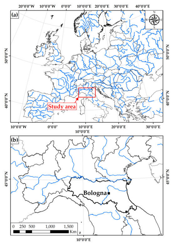
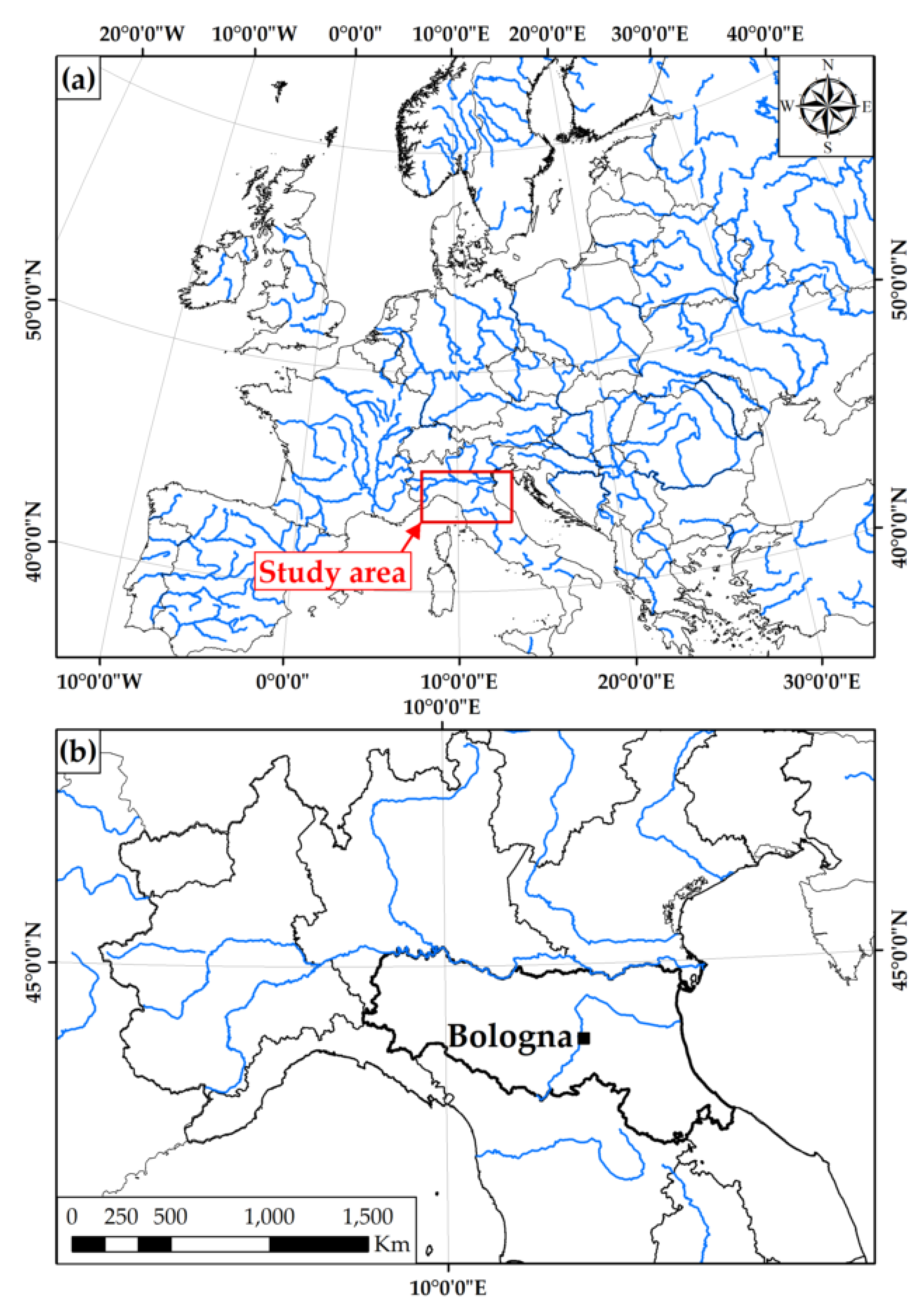
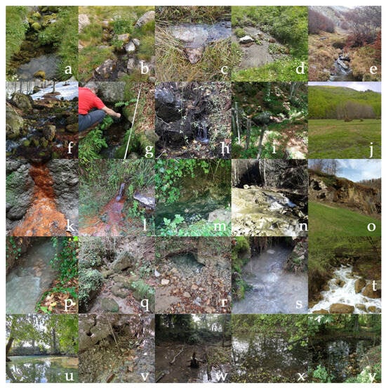
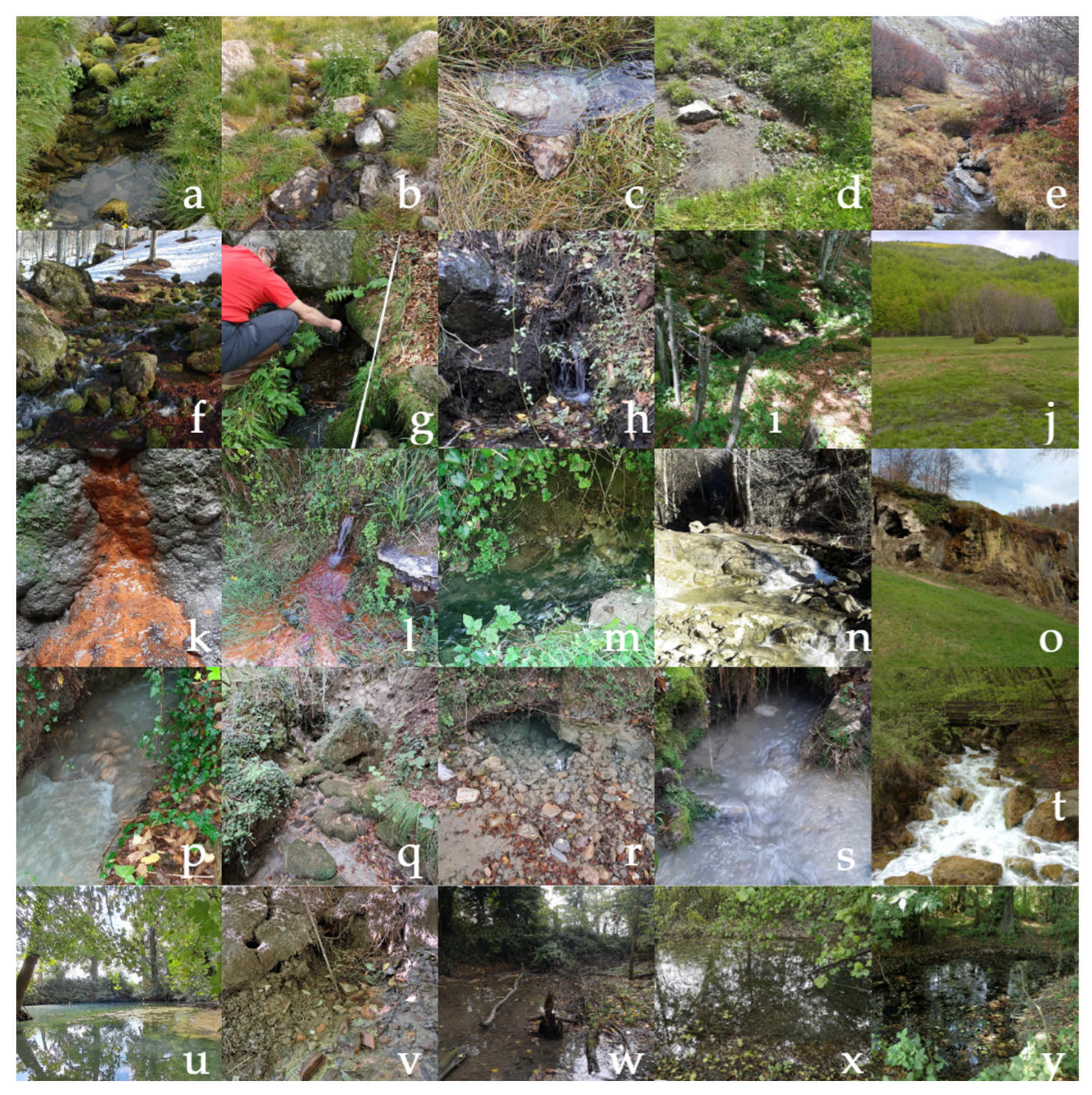
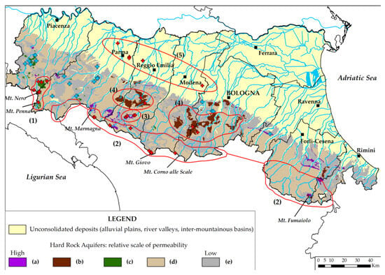
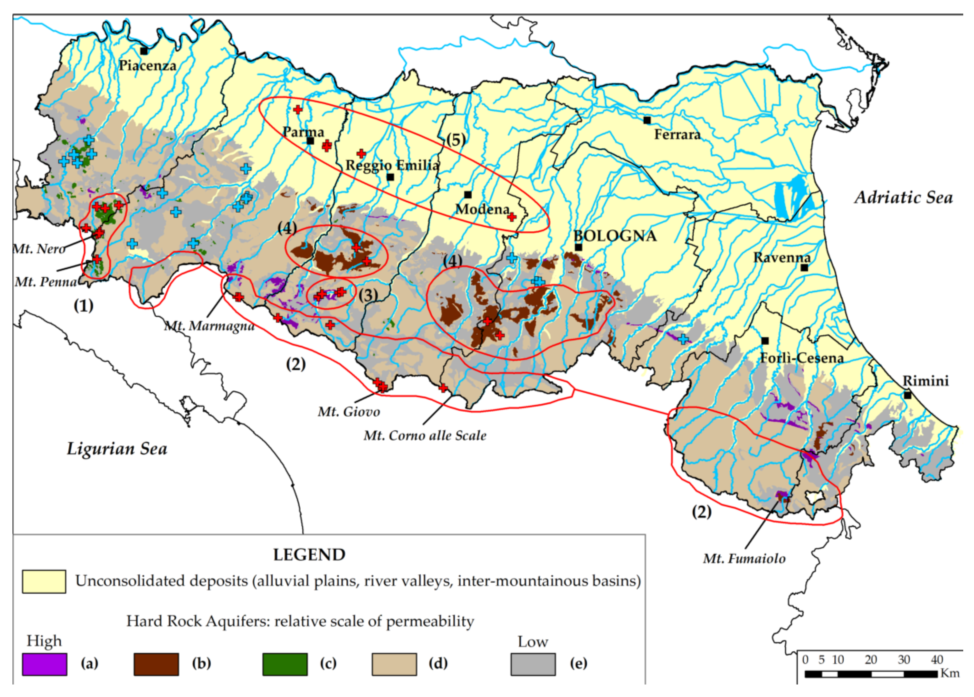
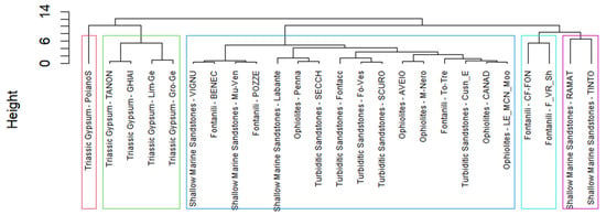
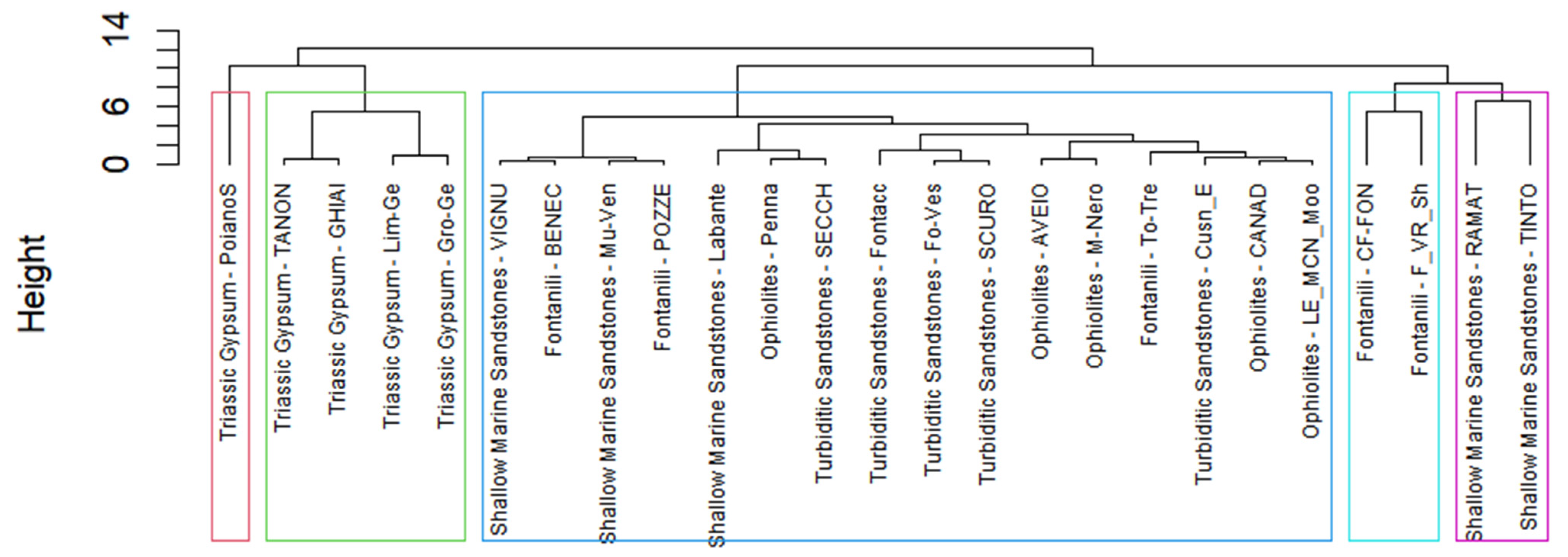
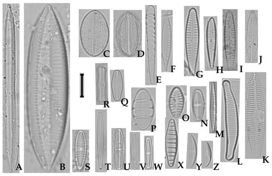
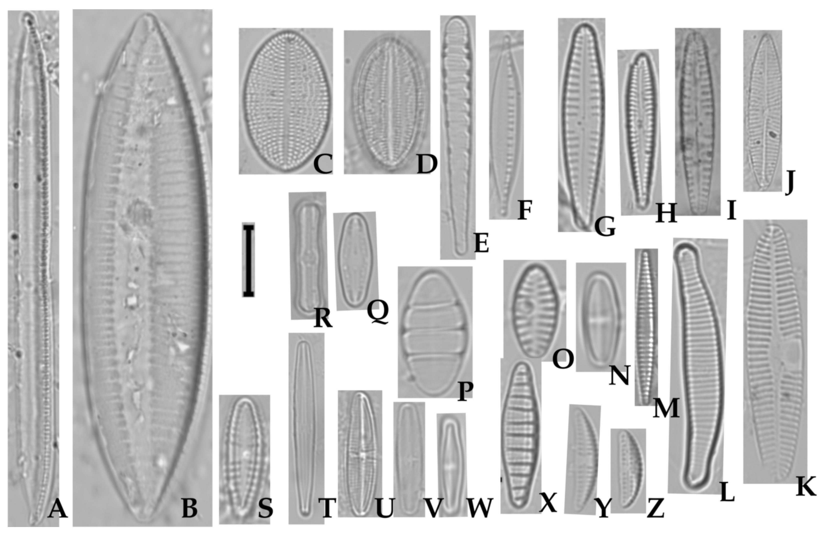
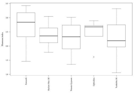
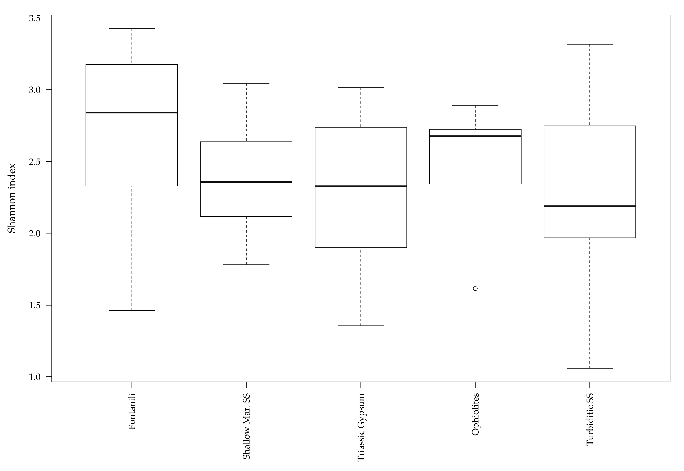
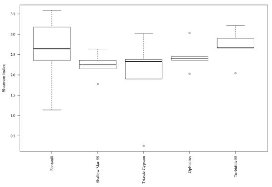
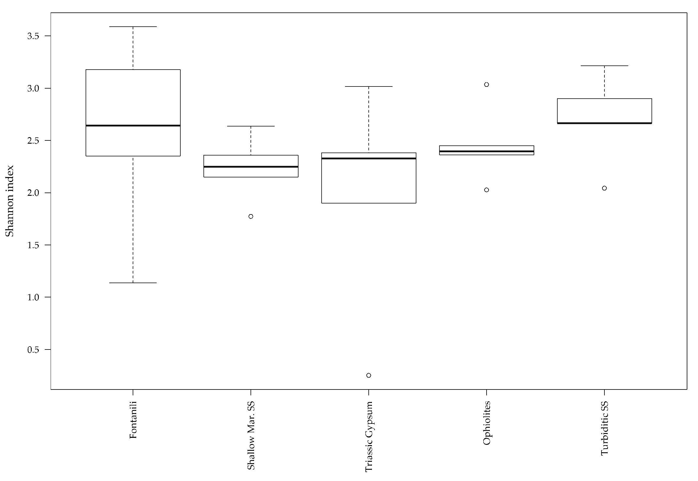
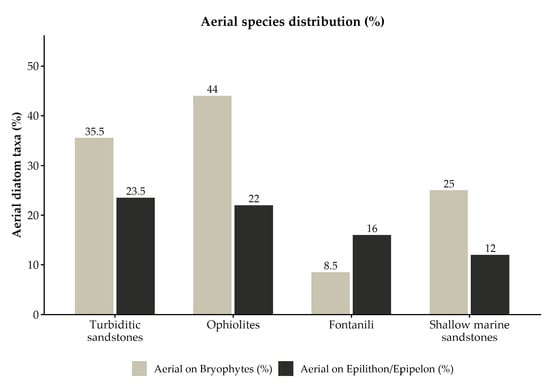
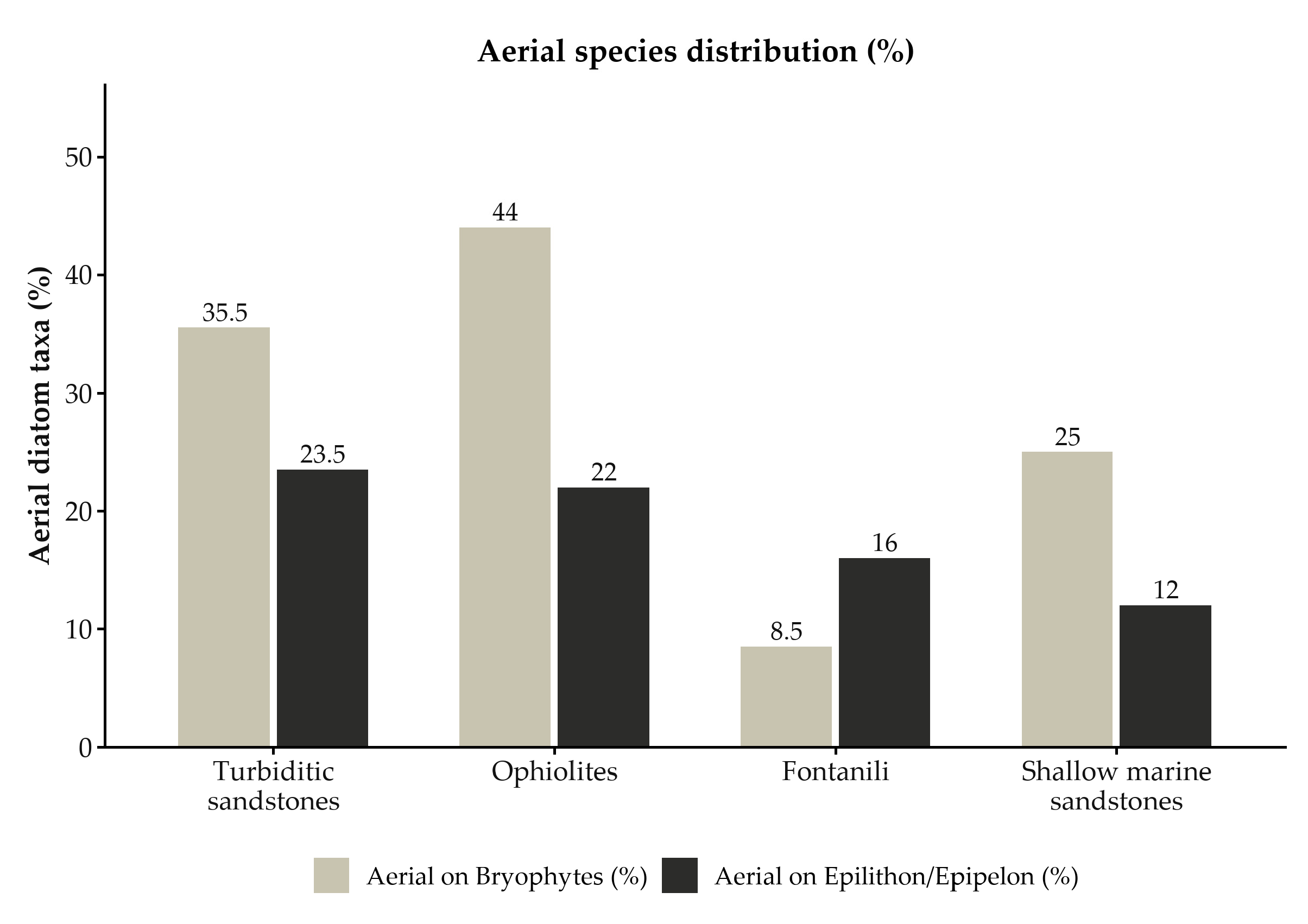
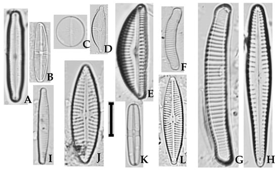
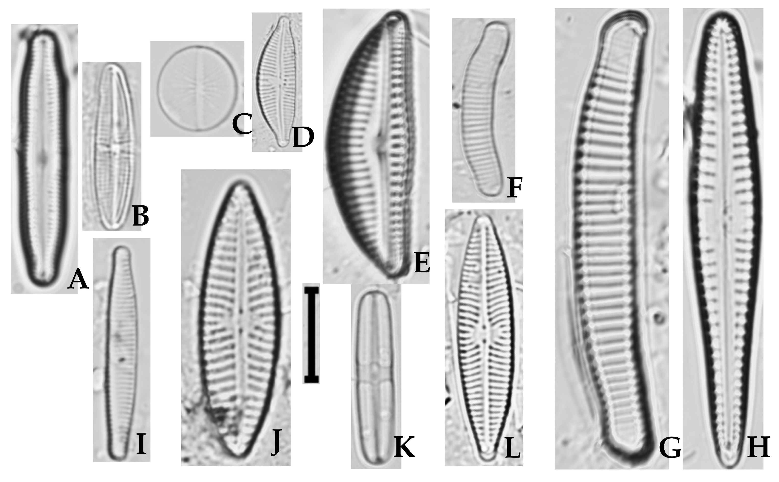
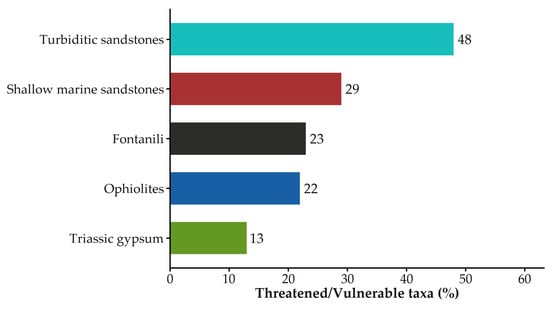
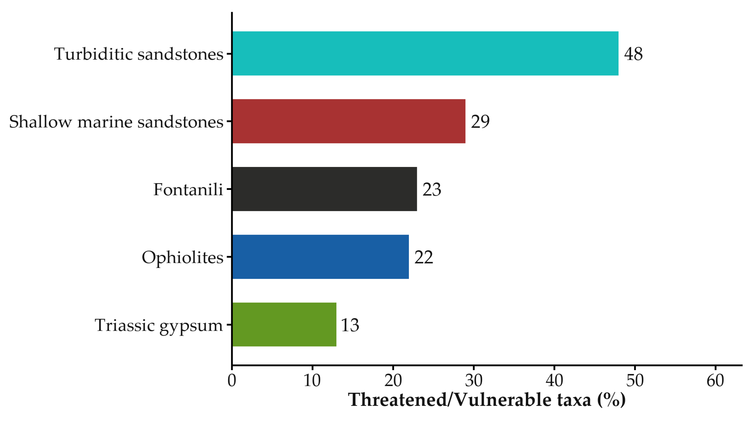
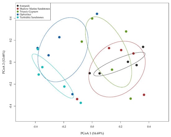
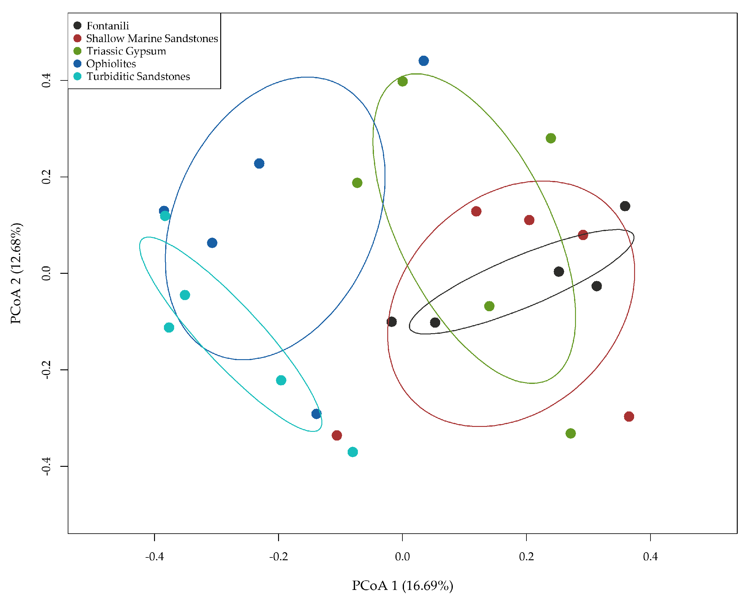
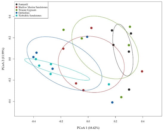
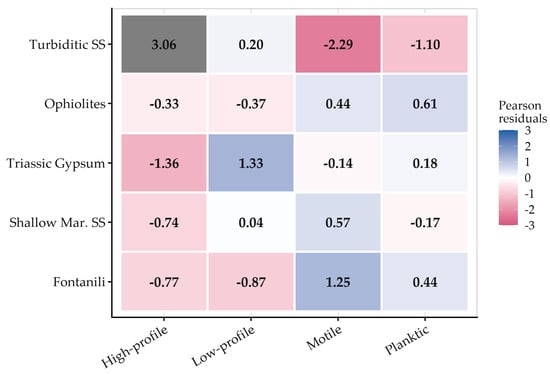
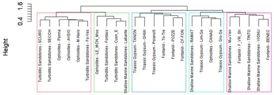
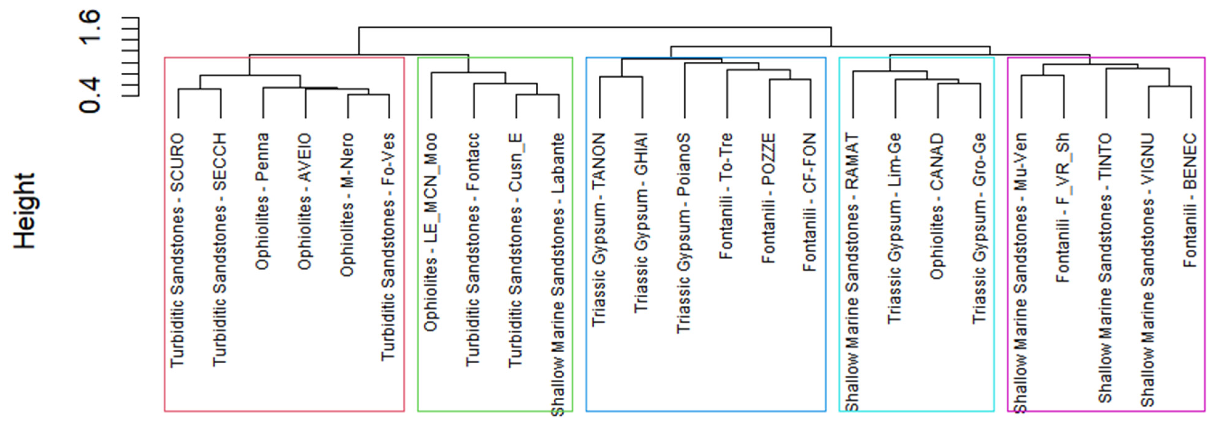
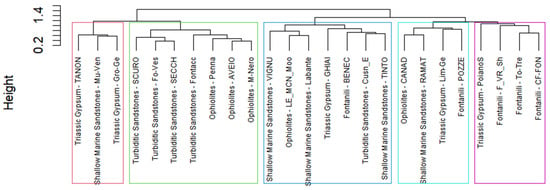
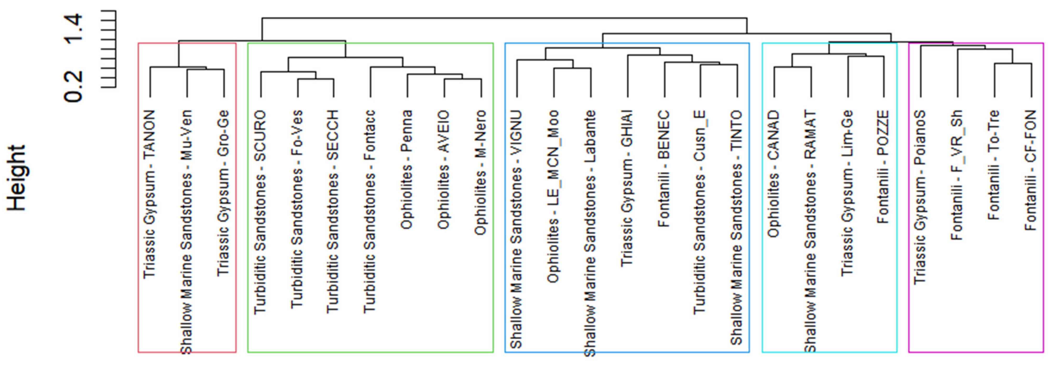

Disclaimer/Publisher’s Note: The statements, opinions and data contained in all publications are solely those of the individual author(s) and contributor(s) and not of MDPI and/or the editor(s). MDPI and/or the editor(s) disclaim responsibility for any injury to people or property resulting from any ideas, methods, instructions or products referred to in the content. |
© 2026 by the authors. Licensee MDPI, Basel, Switzerland. This article is an open access article distributed under the terms and conditions of the Creative Commons Attribution (CC BY) license.