


Abstract
The management of water resources is a critical factor in the emergence of civilizations, particularly in arid regions like the Arabian Peninsula. The ancient Marib Dam represents a systematic application of hydraulic planning within the Sabaean civilization. This study analyzes the scientific rationale behind the dam’s site selection by assessing key hydrological and geomorphological factors using Geographic Information Systems (GISs) and Weighted Overlay Analysis (WOA). The analysis revealed that the dam’s location precisely corresponds with a (very high) potential runoff accumulation zone, a critical area constituting only 0.8% of the total landscape studied. By providing this quantitative assessment, this study moves beyond historical interpretation to offer the first geospatial evidence that the dam’s site selection was deliberate and quantitatively informed, establishing a replicable model for the field of archaeohydrology.
1. Introduction
The availability and management of water resources represent the main factors in the emergence and trajectory of human civilizations, particularly in arid environments like the Arabian Peninsula. Unlike the predictable riverine systems of Mesopotamia and Egypt, ancient Arabian societies faced scarce and ephemeral water resources, necessitating the development of sophisticated hydraulic engineering to harness seasonal floodwaters from wadis [1]. The Sabaean civilization in ancient Yemen stands as a paramount example of this ingenuity, and their monumental achievement, the Great Marib Dam, epitomizes the mastery of a challenging hydrological regime.
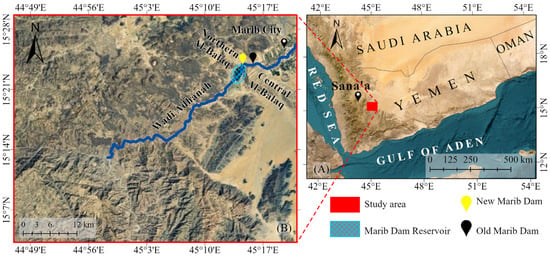
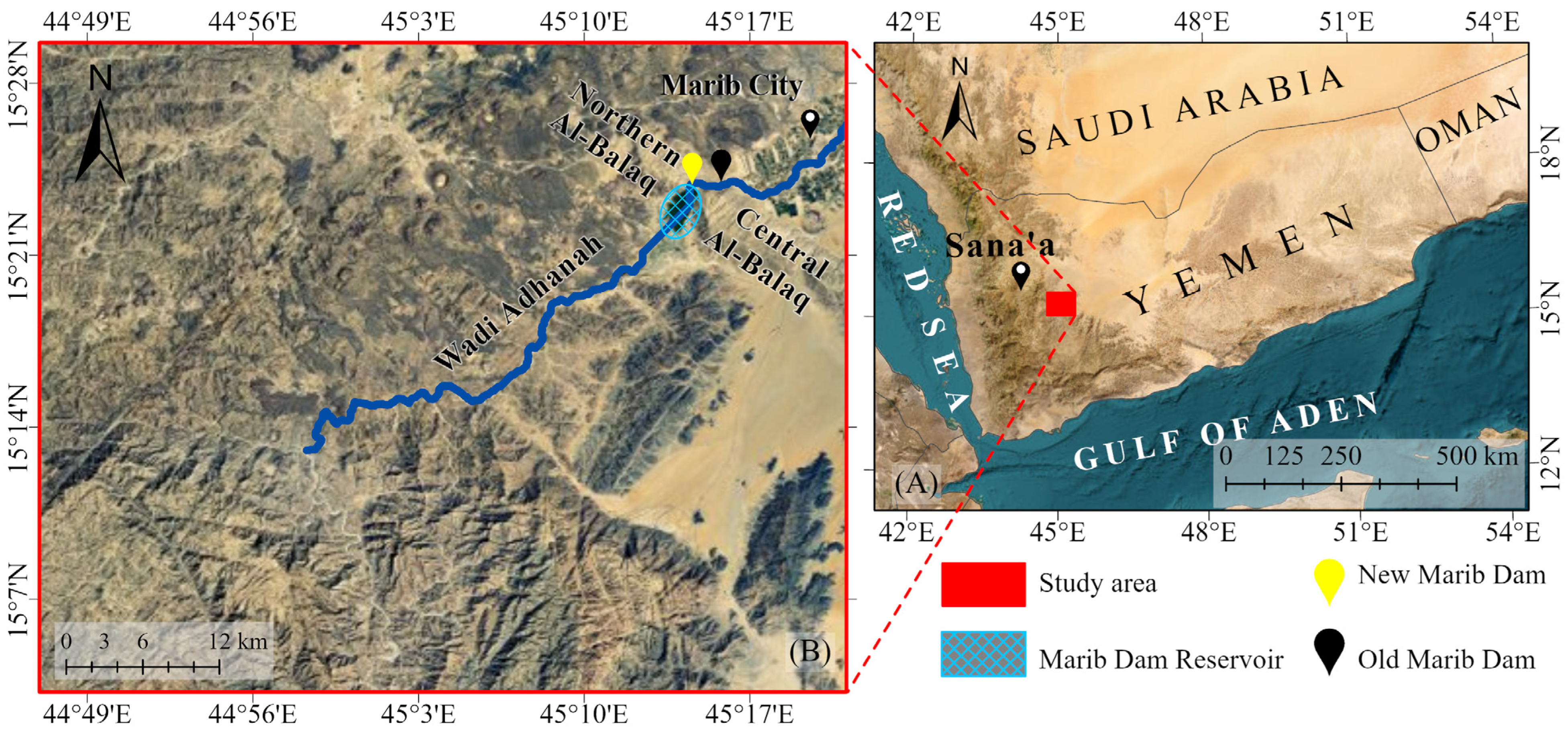
The Sabaean civilization in ancient Yemen represents a notable case of hydraulic planning, where the construction of the Marib Dam demonstrates a systematic approach to managing a challenging hydrological regime. Dating back to at least the early first millennium BCE [2,3], the Marib Dam was not merely a storage structure, but a highly integrated system designed for flood control, water diversion, and distribution to vast agricultural lands through a complex network of canals [4]. The long-term success of this massive undertaking was fundamentally dependent on the astute selection of its construction site (Figure 1). The dam was strategically placed at a natural topographic constriction in Wadi Adhanah, where the location offered inherent advantages for structural stability, minimized construction volume, and maximized control over powerful floodwaters. This distinctive Dam location is one of the cornerstones of its effective functionality and longevity.
Figure 1.
Geographic location of the Marib Dam study area: (A) Regional context of the study area within the Republic of Yemen, (B) Detailed view of the site showing the ancient and modern dams, Marib city, and the Central and Northern Al-Balaq ranges (World Imagery Wayback-2014) (Maps created in March 2025 using ArcGIS Pro (Microsoft 365)).
While the historical and archaeological significance of the Marib Dam is well-documented [5,6], previous investigations have primarily offered qualitative and semi-quantitative explanations for its site selection. For instance, Brunner [1,7] highlighted the strategic use of the natural limestone (bottleneck) at Wadi Adhanah to minimize dam length and maximize foundation stability, while Vogt [5] provided insights into the hydraulic capacity and sedimentation management of the slices. However, the scientific rationale underpinning the Sabaean choice of its specific location has not been quantitatively assessed using updated geospatial analysis.
Based on the global studies about the analysis of the mega water structures, the current study is aiming to utilize Geographic Information Systems (GISs) and a Weighted Overlay Analysis (WOA) to emphasize the Dam site and its environmental characteristics. The selection of WOA is justified by its extensive application in contemporary geoarchaeology to decipher the logic of ancient site selection. Globally, this method has been successfully employed to model ancient settlement patterns and water resource management; for instance, Vujičić et al. [8] utilized Multi-Criteria Decision Analysis (MCDA) to evaluate site suitability, while Guechi et al. [9] demonstrated the efficacy of hybrid GIS-AHP models in predicting ancient locations in arid desert environments with high accuracy. These integrated datasets can guide and scientifically contribute to some aspects about the Dam site selection and functionality. The sources of this data are based on aerial images, geological, geomorphological and hydrological datasets.
This strategic approach reflects a broader global tradition of ancient hydraulic engineering, in which early societies demonstrated remarkable ingenuity in managing water resources under diverse environmental conditions. For example, the Jawa Dam in Jordan (4th millennium BCE) represents one of the earliest known efforts to capture and store episodic runoff in hyper-arid environments [10]. Similarly, the hydraulic systems developed by the Nabataean civilization and Roman Empire across North Africa and Spain, including gravity dams, diversion channels, and flood-control structures, demonstrate a sophisticated understanding of hydrological processes, geomorphological settings, and optimal site selection for mitigating flash floods and enhancing water availability [11]. Comparable “engineering intelligence” is also evident in the water management practices of the Minoan civilization and Mycenaean civilization, where integrated systems were employed not only for water supply but also for soil conservation and agricultural sustainability. These examples highlight that ancient dam construction was not merely a response to environmental constraints, but rather a manifestation of advanced, context-specific knowledge systems that integrated hydrology, engineering, and landscape management [12].
2. The Study Site
Marib represents one of the most significant ancient urban centers in the southern Arabian Peninsula, located approximately 120 km east of Sana’a (Figure 1). As the capital of the Sabaean kingdom, Marib played a pivotal role in the political, economic, and hydraulic history of South Arabia. One of its most remarkable engineering achievements is the ancient Marib Dam, and the related hydraulic structure [13].
Positioned west of the ancient city, the Marib Dam is believed to be aligned with its original location, approximately 1 km from the urban center [14]. Strategically constructed across Wadi Adhanah, the dam is situated within a natural topographic constriction formed between the Central Al-Balaq and Northern Al-Balaq mountain ranges, near the wadi’s downstream extent (Figure 1) [5]. Geographically, the dam was constructed within a deeply incised gorge formed by erosional processes along the foothills of the mountain ridges that delineate the transition between the highlands and the semi-flat area. These ridges extend between Marib and Shabwa, demarcating a region historically referred to as Mafazat Sayhad, and presently known as Ramlat al-Sab’atayn [3]. The strategic Dam placement at a distinctive geomorphological juncture facilitated the regulation of seasonal floodwaters and ensured optimal water retention and distribution for various activities.
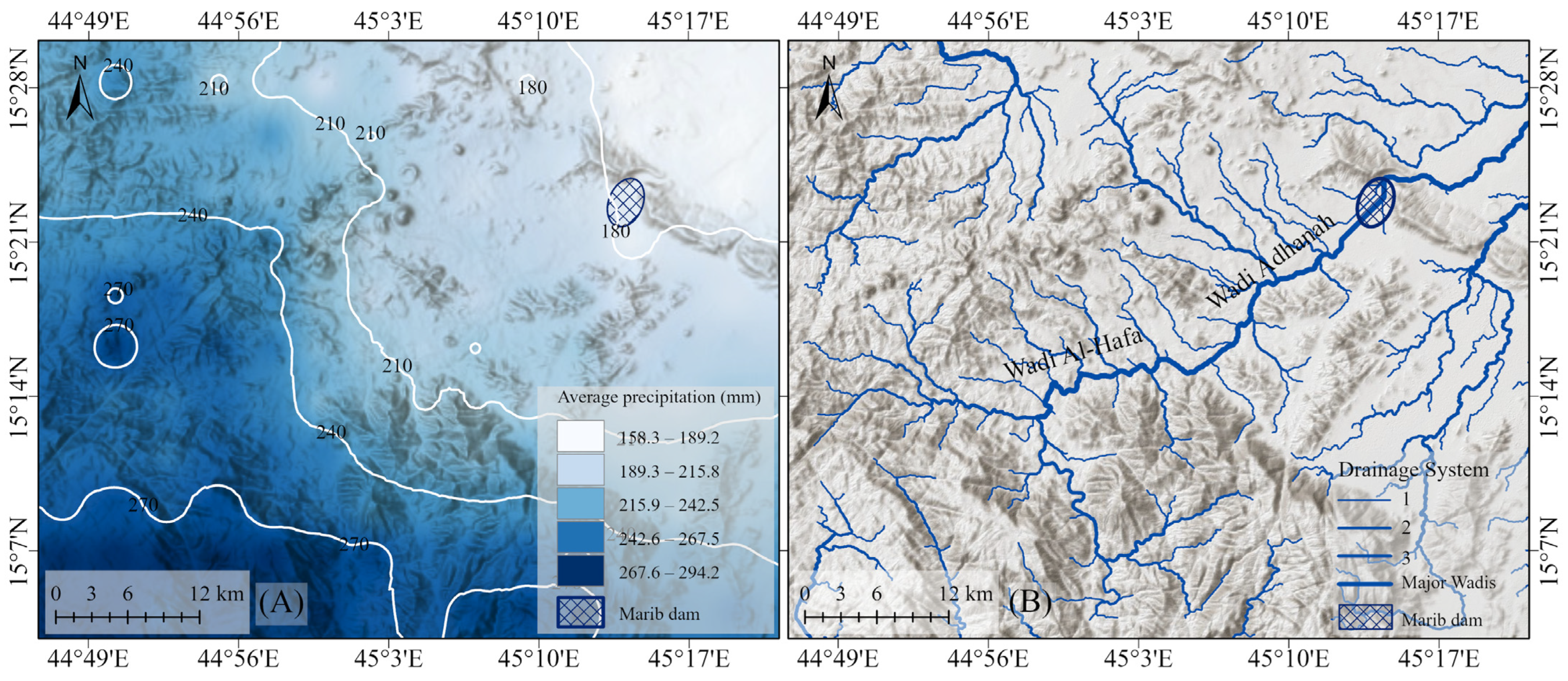
The study area is located to the west of Marib and to the east of Sana’a, within a transitional zone that is influenced by the climatic dynamics of both regions. The Marib region is characterized by semi-arid climate conditions and higher temperatures compared to the cooler western highlands of Yemen [15]. Precipitation in the region is moderate, ranging between 158.3 mm and 294.2 mm (Figure 2A).
Figure 2.
(A) Map showing the average annual precipitation (in millimeters) across the study area. (B) Drainage system map illustrating the hydrological network based on Strahler’s stream order classification, including major wadis that channel runoff towards Marib Dam (Maps created in March 2025 using ArcGIS Pro).
Hydrologically, the region’s drainage network dictates runoff pathways toward the Marib Dam. The total catchment area of the Wadi Adhanah basin supplying the dam was calculated in this study based on aerial photos (Figure 1 and Figure 2) to be 1448.16 km2. Precipitation from the western highlands converges into this extensive basin, which subsequently discharges into the main wadi tributary.
3. Historical Background of the Marib Dam
The structural remains of the ancient Marib Dam provide unequivocal evidence of the advanced hydraulic engineering developed by the Sabaean civilization. While its origins are ancient, scholars suggest the dam reached its final architectural configuration during the mid-first millennium BCE, a timeline supported by extensive archaeological and epigraphic evidence [3,15]. Inscriptions carved on the dam’s structure offer critical insights into its long history; the earliest known record dates to the mid-8th century BCE under the Sabaean ruler Sumuhuali Yanuf, while later inscriptions from the Himyarite period document subsequent repairs and modifications over centuries [16].
The dam’s construction evolved from rudimentary beginnings into a monumental feat of engineering. Initial water control efforts involved simple stone and clay barriers designed to mitigate floodwater [12]. Over time, these evolved into the final, massive structure, which measured approximately 580 m in length and grew in height from an initial 4 m to a final 7 m around 500 BCE [17]. This packed-earth and stone-reinforced edifice was not merely a barrier, but a highly sophisticated system designed for long-term water management. According to Brunner [1], the system functioned primarily as a water diversion structure rather than a continuous storage reservoir. At its operational peak, it effectively controlled seasonal flash floods to irrigate an extensive agricultural surface area of approximately 9600 hectares, divided into the Northern and Southern oases.
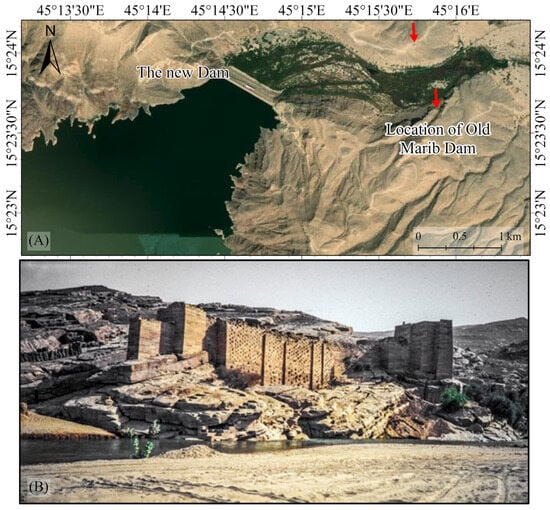
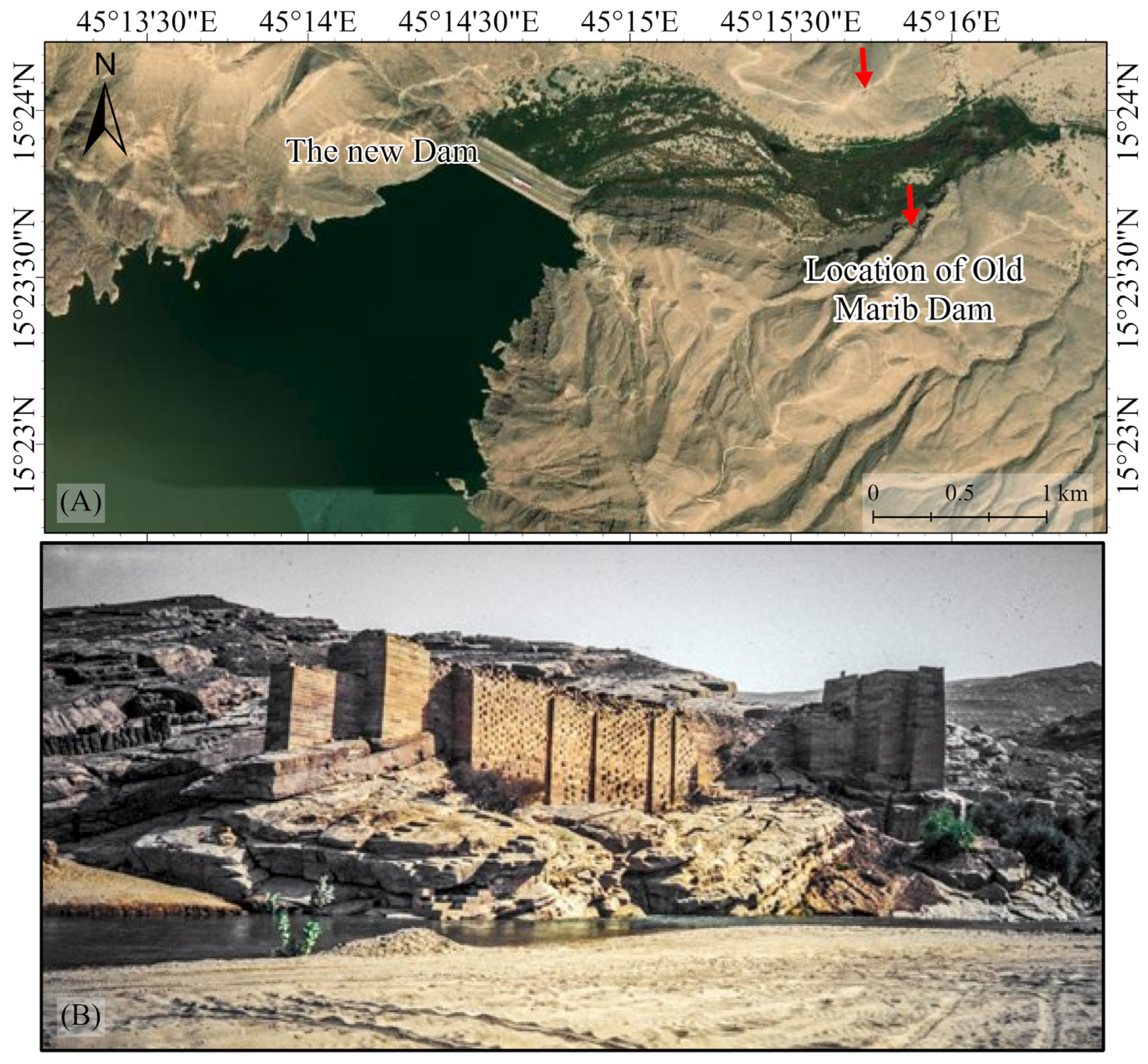
Functionally, the Marib Dam was an integrated system for strategic water distribution. Its most critical components were two primary outlets, located on the northern and southern sides of the structure (Figure 3). These outlets allowed engineers to precisely regulate water discharge into a complex network of primary and subsidiary channels. This network efficiently directed water to irrigate vast agricultural fields on both banks of the Wadi Adhanah, demonstrating a high level of hydraulic control and strategic agricultural planning that sustained the Sabaean kingdom [13].
Figure 3.
(A) The locations of the old and new Marib Dams, arrows indicate the location of old Dam, and (B) photo for the Dam overview.
4. Datasets and Methods
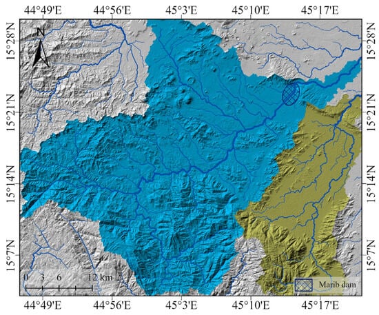
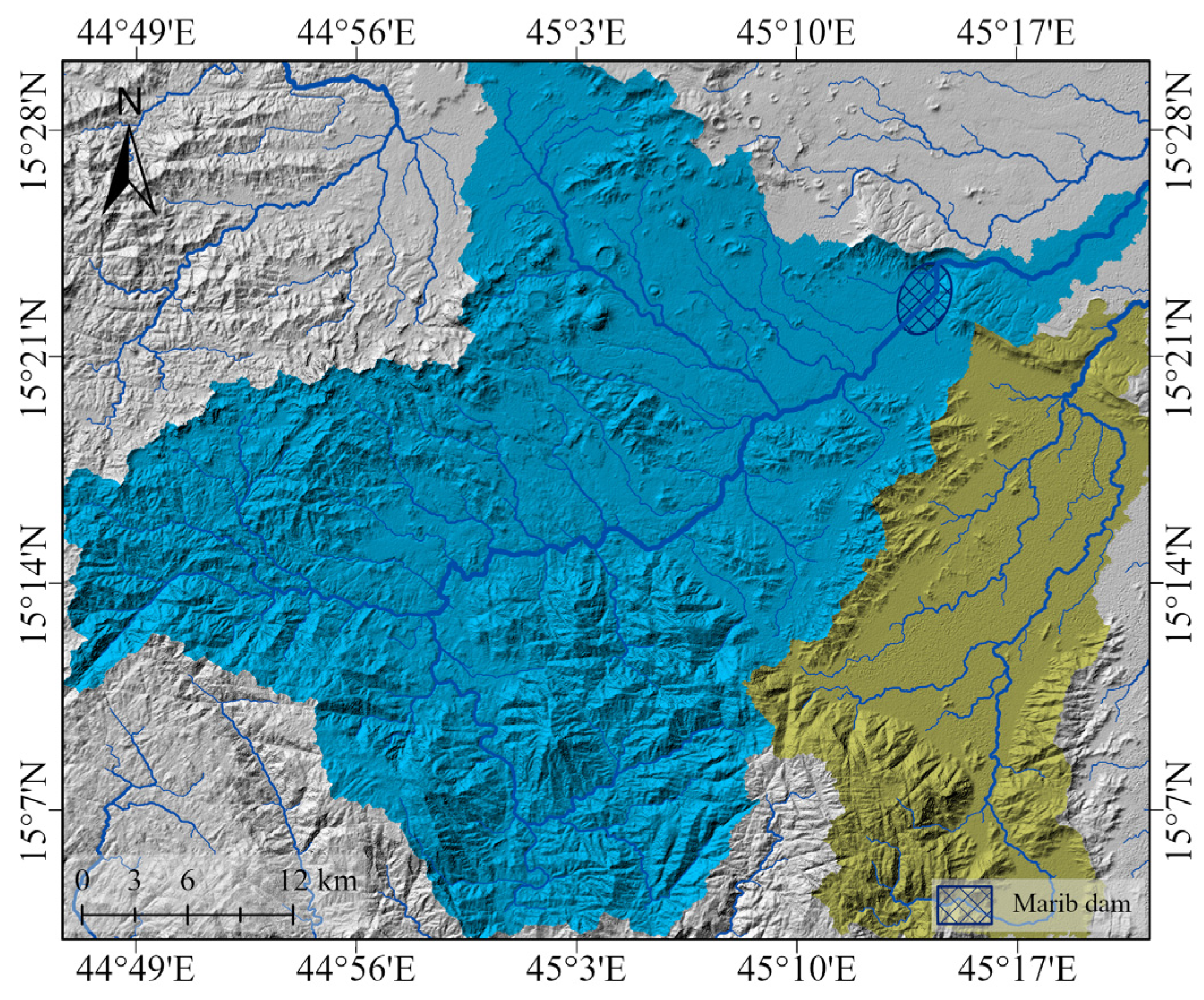
The methodology for this study was designed to assess the optimal site for the ancient Marib Dam by utilizing remote sensing data and spatial analysis techniques, a cornerstone of modern landscape archaeology [18]. The core of the analytical approach was to integrate key environmental and topographic variables to model surface runoff accumulation patterns (Figure 4), thereby revealing the hydrological rationale behind the dam’s historical placement [19,20,21].
Figure 4.
Watershed map of the study area, derived from 12.5 m DEM data, this map shows drainage basins and runoff flow paths created in March 2025 using ArcGIS Pro.
4.1. Data Sources and Preprocessing
The analysis was found on several key datasets. A 12.5 m resolution Digital Elevation Model (DEM), acquired from the Alaska Satellite Facility (Alaska Satellite Facility (ASF), 2025), served as the primary layer for deriving essential topographic and hydrological variables, including elevation, slope gradients, and drainage density. To incorporate the climatic context, long-term precipitation records from 2010 to 2024 were obtained from the Center for Hydrometeorology and Remote Sensing (CHRS) database, specifically the CHIRPS dataset [22]. Additionally, lithological data, which characterizes the distribution and properties of rock formations, were sourced from the Yemen Geological Survey Authority to understand their impact on infiltration and runoff, a crucial factor in ancient settlement viability [23].
The processing workflow began with the georeferencing and resampling of all spatial datasets to ensure perfect alignment within a unified GIS environment. Using ArcGIS Pro, we extracted key terrain attributes from the DEM. To ensure hydrological consistency, the initial DEM underwent a preprocessing stage using the Fill tool to remove topographic sinks and artifacts. The hydrological modeling tools were then employed to delineate drainage networks and calculate drainage density. The stream network was extracted based on a flow accumulation threshold of 30,000 cells, which effectively isolated the primary wadi systems. A watershed map was also produced to define basin boundaries and flow directions (Figure 4), providing the structural framework for the runoff model.
The processing workflow began with the georeferencing and resampling of all spatial datasets to ensure perfect alignment within a unified GIS environment. Using ArcGIS Pro, we extracted key terrain attributes from the DEM. The hydrological modeling tools were employed to delineate drainage networks and calculate drainage density. A watershed map was also produced to define basin boundaries and flow directions (Figure 4), providing the structural framework for the runoff model.
4.2. Weighted Overlay Analysis (WOA)
To integrate the multiple contributing factors into a single comprehensive model, the Weighted Overlay Analysis (WOA) method was applied. This approach is well-established in GIS-based archaeology for evaluating the logic behind ancient site selection [24]. The efficacy of this method in contemporary geoarchaeology is further supported by studies such as Vujičić et al. [8], who utilized Multi-Criteria Decision Analysis (MCDA) for site suitability, and Guechi et al. [9], who demonstrated that hybrid GIS-AHP models achieve high predictive accuracy in arid desert environments. We created raster layers for the five key parameters: elevation, slope, drainage density, lithology, and precipitation. Each layer was normalized and reclassified based on its hydrological significance in influencing water accumulation [19,20], utilizing the Natural Breaks (Jenks) method to ensure statistically sound threshold divisions.
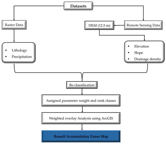
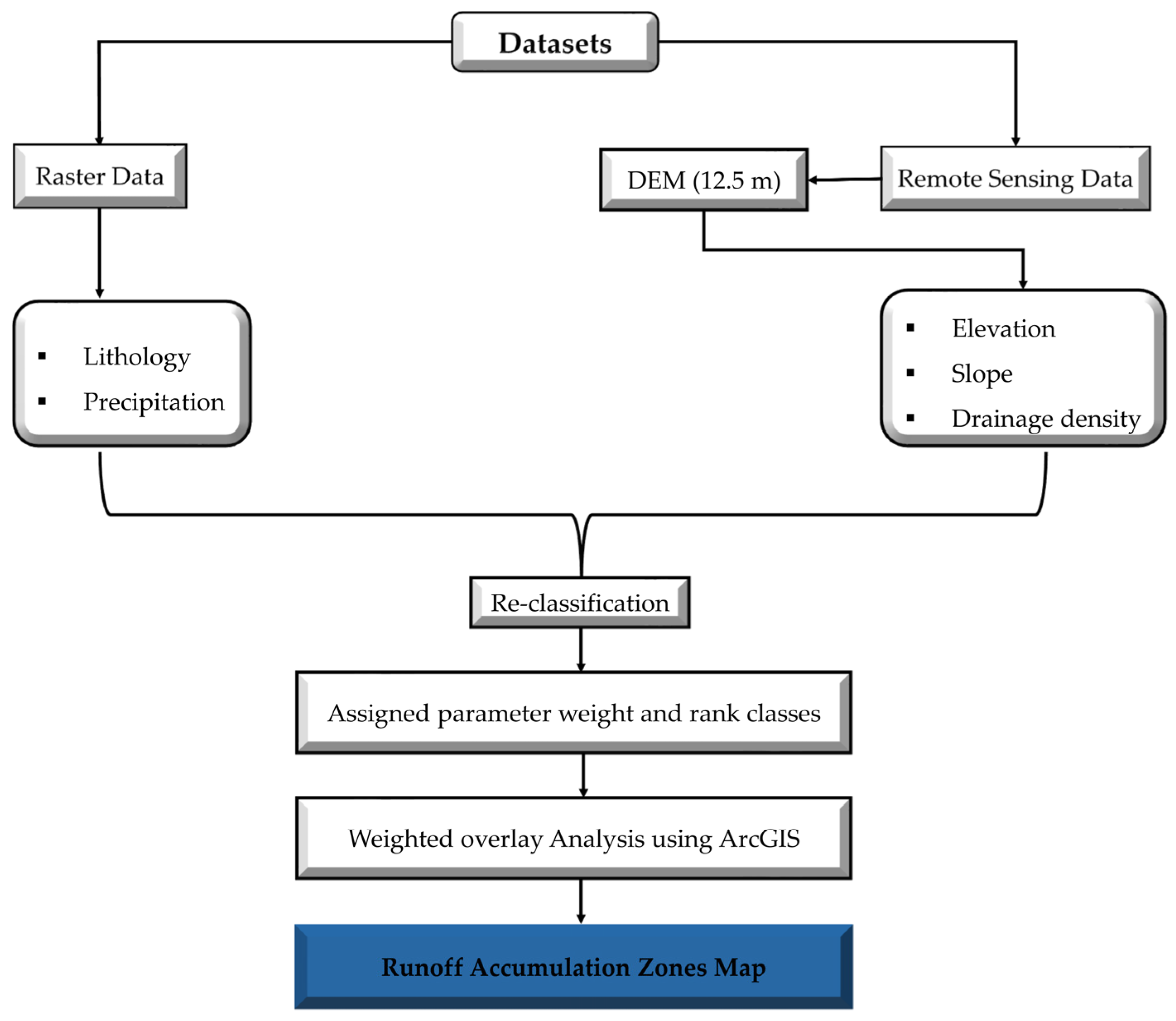
Following reclassification, each parameter was assigned a specific weight to reflect its relative impact, adopting a weighting logic consistent with recent studies on flood susceptibility in arid environments [19]. To ensure the reliability of the model, the robustness of these weights was verified through a sensitivity check by varying the parameter values, which confirmed the stability of the suitability results. Drainage density received the highest weight (30%) as a primary indicator of hydrological connectivity and runoff concentration efficiency. While surface runoff initiates as sheet flow across all slopes, a higher drainage density reflects a more integrated network capable of rapidly transforming diffuse surface flow into concentrated channel flow. Positioning the dam at the convergence of such high-density networks was essential for ensuring a predictable hydraulic head. It was followed by elevation and slope; each was assigned a high weight of 25%. Elevation was included not merely to identify a topographic low, but to reflect the Hydraulic Potential Gradient. A substantial elevation differential between the western highlands (up to 2479 m) and the dam site (1119 m) was critical for providing the necessary gravity-driven head to distribute water across the vast agricultural plains. This aligns with the need to consider the catchment area, as the selected site functions as the terminal outlet for the 1448.16 km2 basin, capturing the maximum possible runoff before it enters the flatter desert zones. Lithology was given a moderate weight (15%), while precipitation received the lowest weight (5%). This hierarchical distribution aligns with the methodology of Alharbi (2024) [19], who prioritized drainage density and topography as the primary drivers of flood dynamics in arid lands. However, the weights in this study were specifically calibrated to reflect the dam’s function, which relies on capturing concentrated runoff generated in the high-precipitation western highlands, a factor more directly captured by drainage density and terrain characteristics than by local rainfall values [25,26,27]. The complete classification criteria, ranks, and weights are detailed in (Table 1) This process resulted in a composite map that categorizes the study area into zones with varying potential for runoff accumulation, allowing for a clear assessment of the Marib Dam’s site suitability. The entire systematic process is illustrated in the methodology flowchart (Figure 5).
Table 1.
Classifications of the layers utilized in the overlay analysis of water accumulation zones, along with their influences, classes, and scales.
Figure 5.
A flowchart illustrates the systematic processing steps of mapping runoff and catchment zones around Marib Dame site.
5. Result
The results of the geospatial analysis conducted to evaluate the environmental factors that likely influenced the Sabaean choice for the Marib Dam’s location are presented and discussed. The findings are presented in two main stages. First, the spatial characteristics of the five key parameters are analyzed: drainage density, elevation, slope, lithology, and precipitation. Second, the composite Runoff Accumulation Model is presented, which integrates these parameters to identify zones with high hydrological potential. This structure displays evidence that provides a quantitative basis for assessing the optimality of the dam’s ancient site.
5.1. Topographic Characteristics (Elevation and Slope)
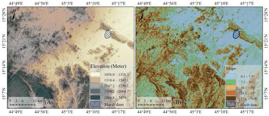
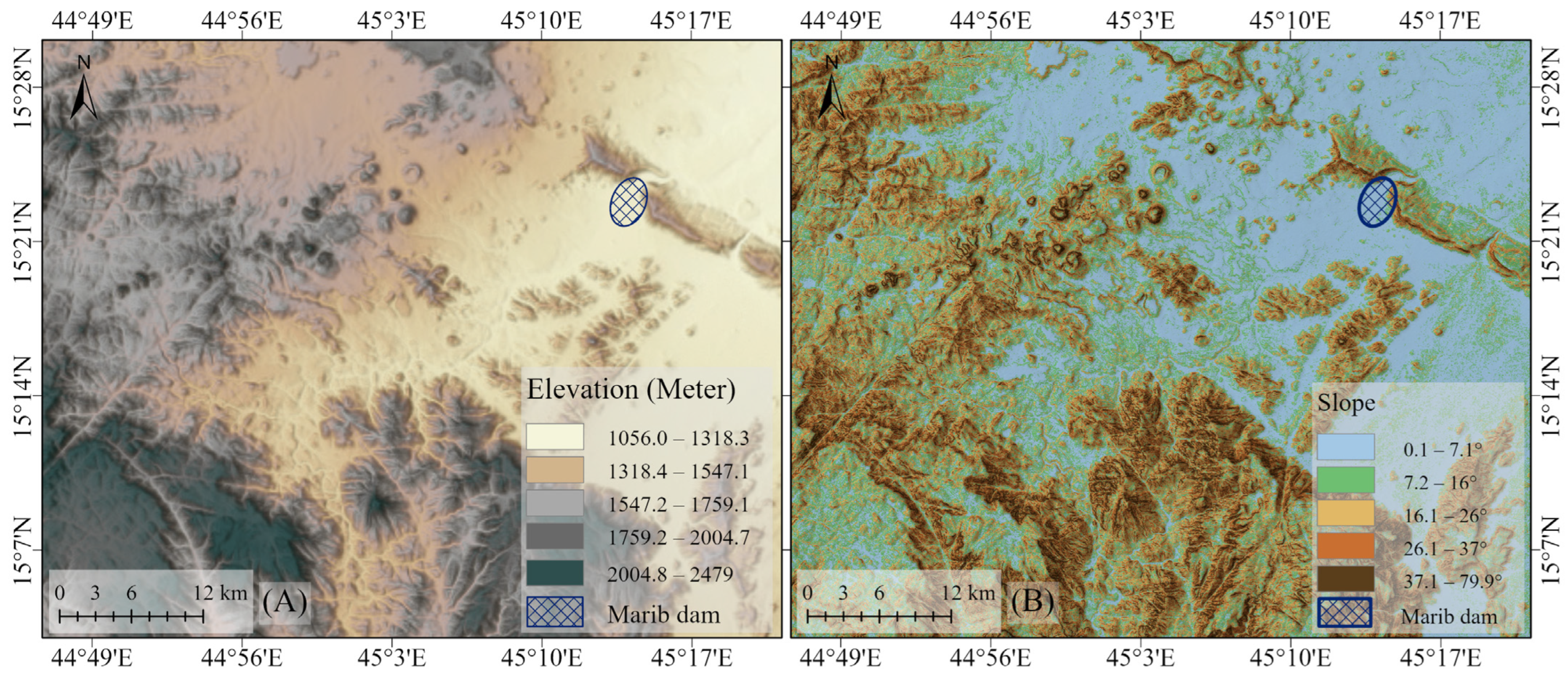
The topographic characteristics of the study area, derived from the 12.5 m ALOS PALSAR DEM, reveal a landscape of significant relief that was fundamental to the region’s hydrological system. The elevation map (Figure 6A) shows a distinct topographical gradient, with altitudes ranging from 2479 m in the southwestern highlands to 1056 m in the northeastern plains. The ancient Marib Dam is situated in these lower-lying eastern areas, strategically positioned to receive runoff generated in the elevated western catchment.
Figure 6.
(A) Digital Elevation Model (DEM) and (B) Slope map of the study area. Both layers were generated from 12.5 m ALOS PALSAR DEM data using ArcGIS Pro (March 2025) to analyze the topographic variations and gradient percentages influencing water flow.
The slope map (Figure 6B) complements this by illustrating the variability in terrain steepness, with values ranging from 0.1° to 79.9°. The steepest slopes are concentrated in the mountainous southwestern region, characterized by the Pre-Cambrian Basement Complex, which naturally promotes rapid runoff generation. In contrast, extensive areas of gentle slope (0.1–7.1°) dominate the northeastern plains, including the immediate vicinity of the dam site. This gentle topography in the dam area was ideal for slowing water velocity, facilitating sediment deposition, and enabling controlled water distribution.
5.2. Comparative Analysis via Topographic Sections
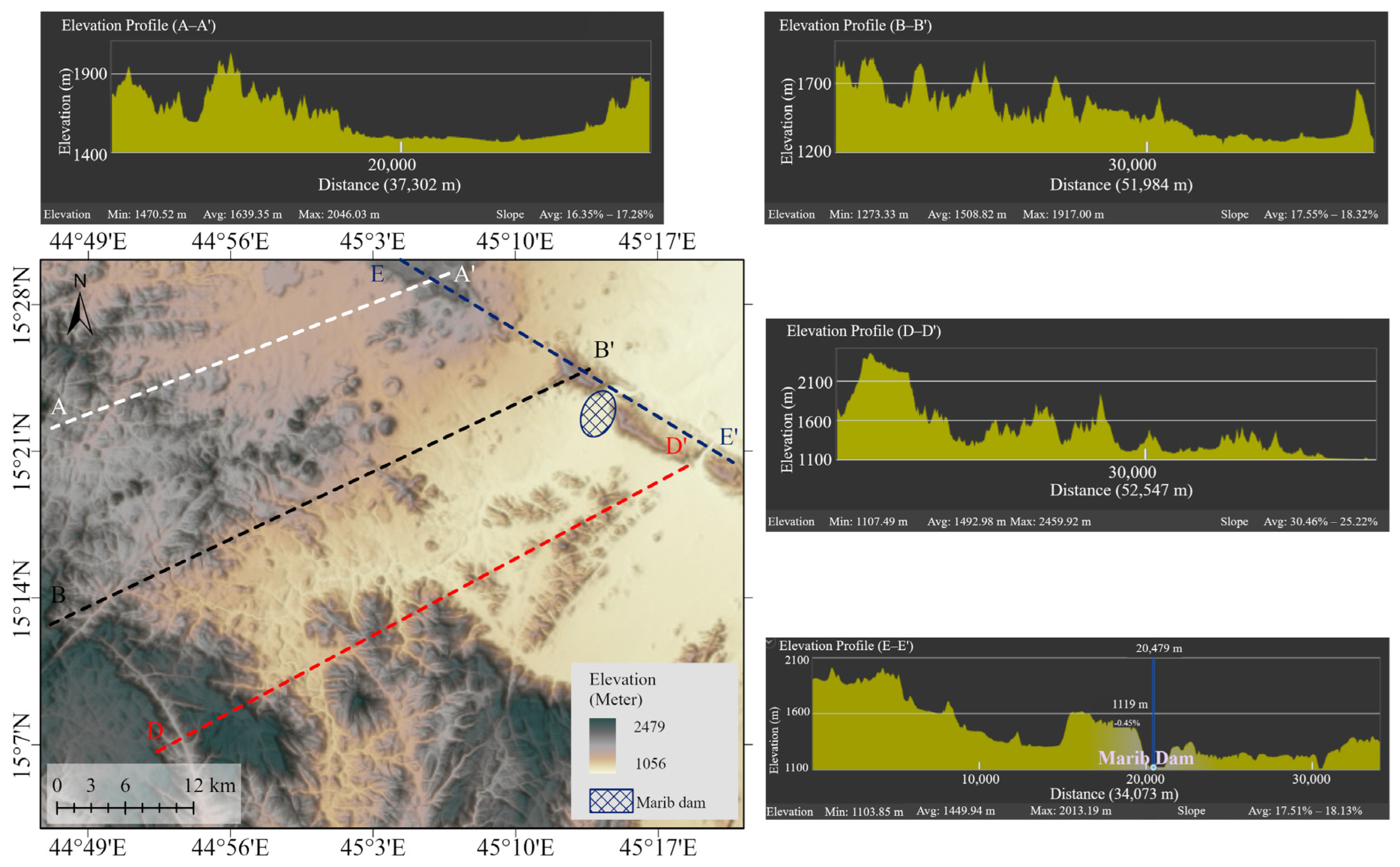
To evaluate the geomorphological rationale for the dam’s placement, a comparative analysis was conducted using four topographic profiles (Figure 7). While the longitudinal profiles (A, B, and D) establish the broader catchment context and high-energy runoff zones, the transverse cross-section E–E′ provides a detailed view of the specific dam axis. This profile reveals a profound topographic constriction where the main channel is framed by the steep flanks of Central Al-Balaq and Northern Al-Balaq. At this precise location, the channel floor is situated at an elevation of 1119 m, representing a natural ‘bottleneck’ in the landscape.
Figure 7.
Topographic profiles of the study area. The profiles, generated from 12.5 m DEM data in ArcGIS Pro (March 2025), show elevation changes and runoff directions. Sections (A–A′, B–B′, and E–E′ demonstrate elevation changes in the Dam area. Section D–D′ identifies a potential accumulation zone, providing a topographic comparison with the actual dam site.
The analysis highlights a critical trade-off made by the Sabaean engineers. Although profile D–D′ reveals a basin favorable for water accumulation upstream, its distance from the Marib oasis, the historical heart of Sabaean agriculture, rendered it impractical. According to archaeological and historical accounts, the primary settlement and agricultural zones were naturally concentrated at the mouth of Wadi Adhanah, between the Balaq mountains, where natural flood recession farming was already practiced. Therefore, the site selection was not a circular choice but a strategic enhancement of a preexisting socio-economic hub.
In contrast, the selected site offered a superior synergy of geomorphological and strategic factors. The topographic profiles in (Figure 7) reveal a continuous mountain ridge that acts as a natural barrier to runoff; however, the Marib Dam was strategically positioned at the significant natural breach (break) in this ridge. This location, situated at the natural topographic constriction between the Balaq mountains, provided a pre-determined hydraulic conduit that forced seasonal floodwater into a narrow, controllable throat. Utilizing this natural ‘gap’ allowed for the construction of the Sadaf (the two main sluice structures), essential for diverting water into the northern and southern primary canals. This site was hydrologically superior because it functioned as a natural regulator, capturing maximum flow from the denser wadi network while remaining immediately adjacent to the alluvial plains. Thus, the dam was built to stabilize and expand an existing settlement by exploiting a unique geomorphological feature that offered inherent advantages for flow regulation and structural stability.
5.3. Lithology
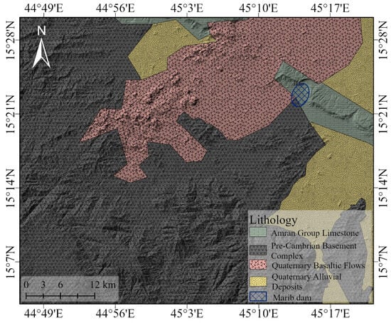
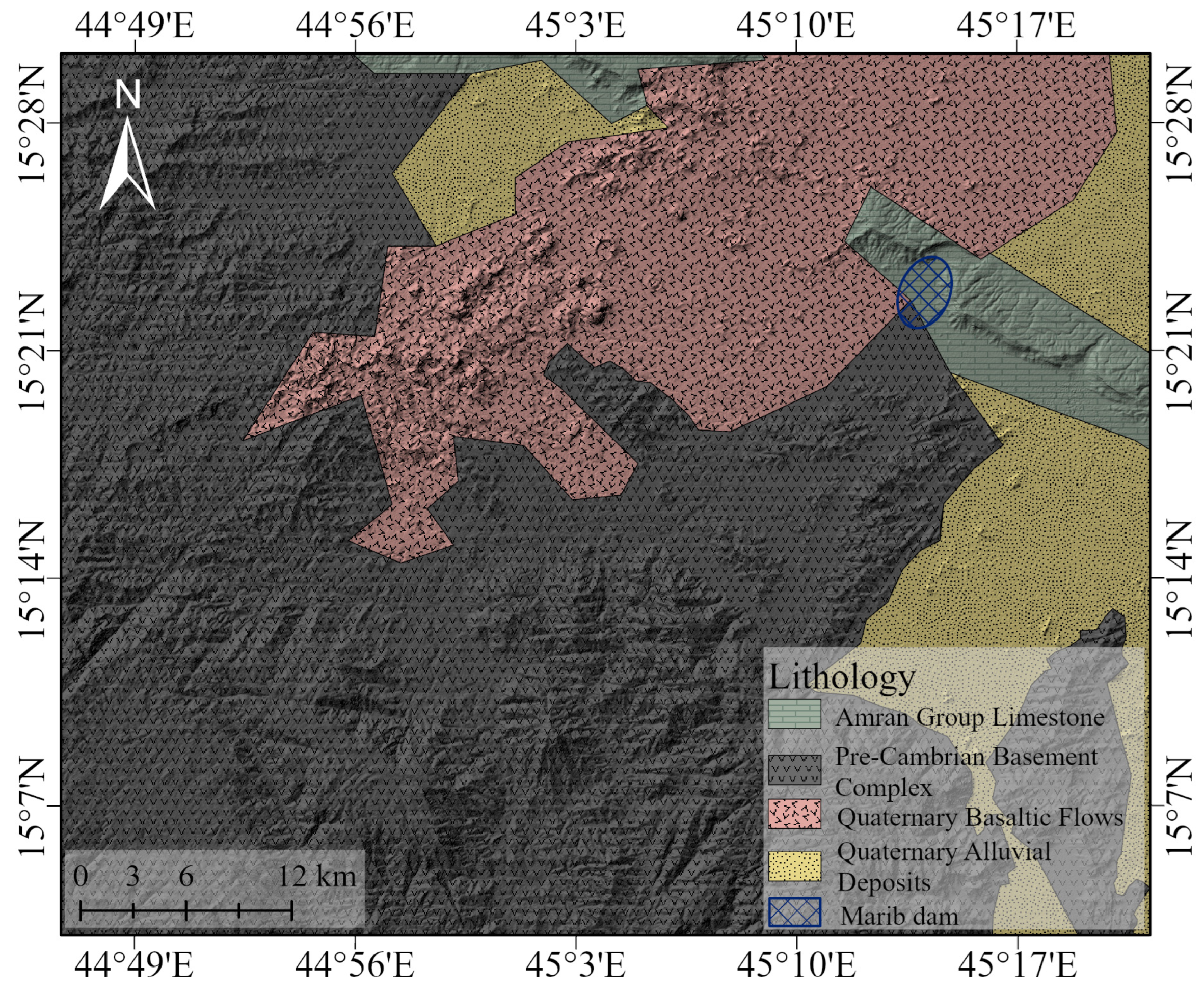
The lithological distribution across the study area is a critical factor influencing runoff dynamics, topographical relief, and ultimately, ancient water management strategies. The region’s geology is characterized by a diverse stratigraphic sequence, comprising the Pre-Cambrian basement complex, Quaternary basaltic flow, Amran Group limestone, and Quaternary alluvial deposits [28].
The Pre-Cambrian complex, which forms the elevated terrains, dominates the southwestern sector of the catchment (Figure 8). It is characterized by negligible primary porosity and impermeable crystalline fabric. These formations significantly limit water infiltration and act as primary generators of surface runoff. Strategically, the Marib Dam was constructed at the interface between these elevated, impermeable zones and the lower-lying porous units, a position that allowed for the efficient capture and control of runoff.
Figure 8.
Generalized geological map of the study area. The map illustrates the distribution of rock formations and geological units, processed in ArcGIS Pro (March 2025). It highlights the lithological foundation of the dam site and the surrounding catchment area.
In contrast, the Quaternary alluvial deposits are concentrated in the lower-lying northeastern and southeastern parts of the study area. Due to their unconsolidated nature and high effective permeability, these sediments facilitate groundwater recharge and naturally reduce overland flow. Further, the Quaternary basalts flows and limited outcrops of limestone display moderate permeability through secondary porosity and fracturing, contributing to localized water retention and subsurface drainage pathways (Figure 8).
This deliberate positioning of the dam to leverage the sharp geological and topographical contrast between impermeable highlands and porous lowlands underscores the topographic and lithological rational applied by the Sabaeans. By harnessing this natural setting, they maximized water retention and runoff control, which was fundamental to sustaining agricultural productivity and ensuring long-term settlement stability.
5.4. Rainfall Distribution
The region’s precipitation patterns, analyzed using CHRS data from 2010–2024, are a key driver of the hydrological system feeding the dam. The analysis reveals a pronounced east–west precipitation gradient across the study area (Figure 2A).
Mean annual rainfall is lowest in the arid eastern plains surrounding the Marib Dam site, with values ranging from 158.3 mm to 189.2 mm. In sharp contrast, the western highlands receive the maximum precipitation, ranging from 267.6 mm to 294.2 mm, due to topographic effects. This steep gradient is critical: while local rainfall at the dam site is minimal, the intense precipitation in the western mountains generates the substantial runoff that the dam was designed to capture.
5.5. Drainage Density
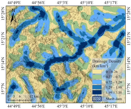
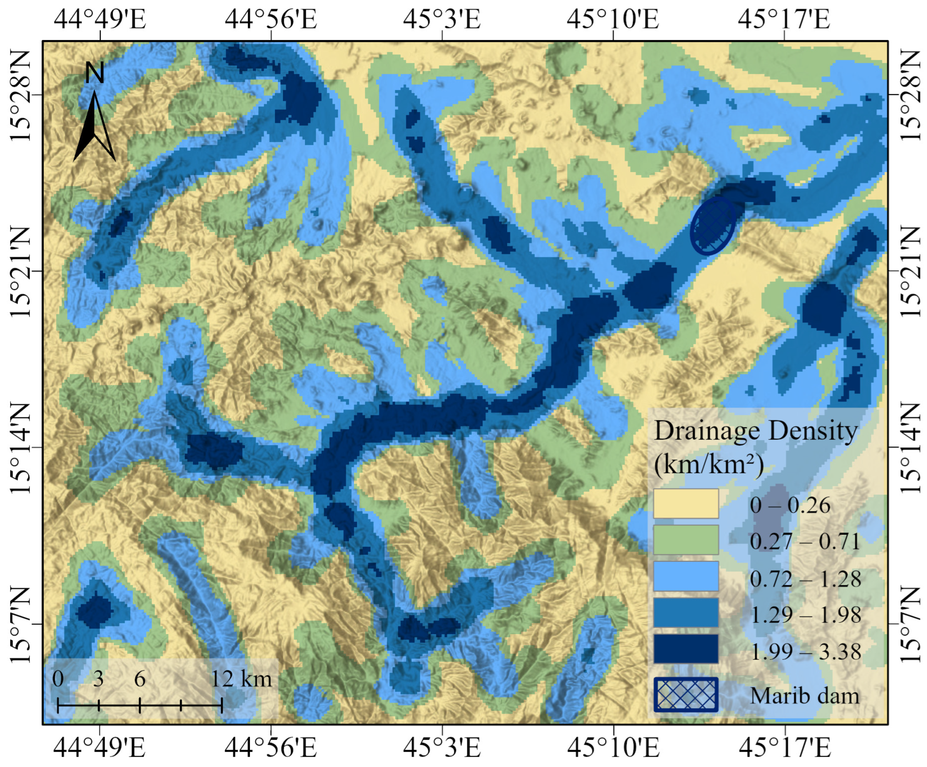
Drainage density, which measures the concentration of natural water channels, is the direct outcome of the interaction between topography, lithology, and rainfall [29]. The drainage density map (Figure 9) reveals a highly efficient hydrological network designed to funnel runoff from the highlands.
Figure 9.
Drainage density distribution in the study area. The map illustrates the drainage density calculated from 12.5 m DEM data. It was produced in ArcGIS Pro (March 2025) to identify areas of high runoff concentration and their relationship to the dam’s catchment efficiency.
The analysis shows a clear spatial pattern where the highest drainage density values, reaching up to 3.38 km/km2, are concentrated in the steep, impermeable basement rock terrain of the western highlands. These zones act as the primary runoff-generating engines for the entire catchment. Crucially, the Marib Dam is strategically located along the main wadi, which serves as the primary artery of this high-density network. This positioning ensured that the dam intercepted the maximum possible volume of channeled surface water flowing from the extensive and well-drained upstream areas.
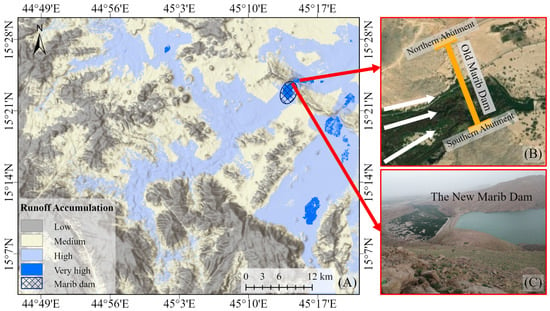
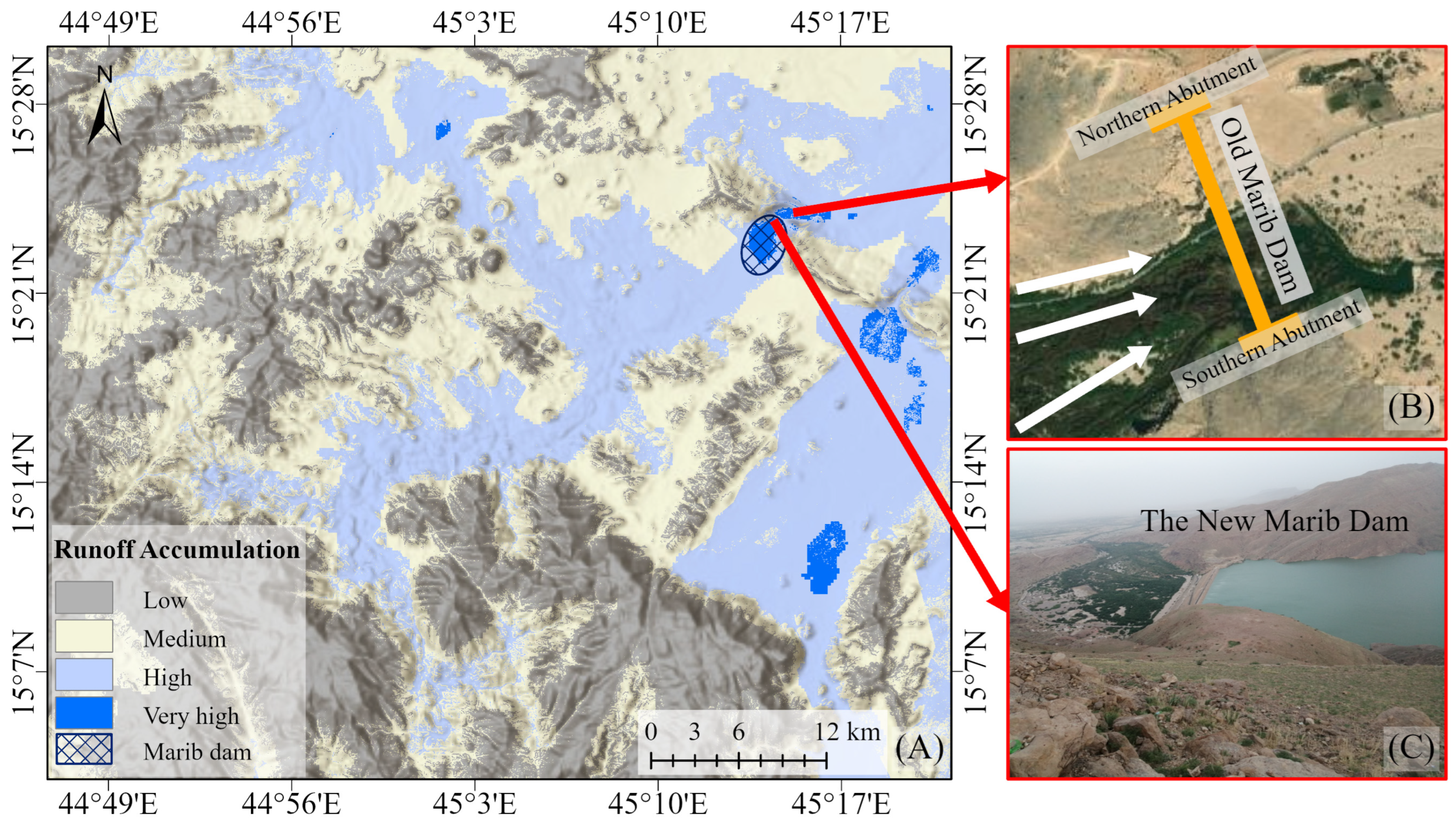
5.6. The Integrated Runoff Accumulation Model
The synthesis of the individual environmental parameters through Weighted Overlay Analysis (WOA) produced the final runoff accumulation map, which represents the primary outcome of this study (Figure 10). This map classifies the 3087 km2 study area into four distinct categories of hydrological potential: low (34.4%), medium (37.8%), high (26.9%), and a critical very high category (0.8%). The most significant finding of this analysis is the precise positioning of the ancient Marib Dam. within this (very high) potential zone, which functions as the primary hydrological outlet for a 1448.16 km2 catchment area. This provides quantitative evidence that the dam’s location was strategically selected at the optimal point of maximum runoff concentration, demonstrating a systematic engineering rationale in site selection.
Figure 10.
Runoff accumulation and field validation map of the study area. (A) The map classifies runoff potential into four hierarchical zones (low, moderate, high, and very high). The model was generated in ArcGIS Pro (March 2025) to visualize the spatial concentration of water flow (white arrows) toward the dam site, integrated with selected reference photos from the study location. (B) The old Marib Dam (C) The new Marib Dam.
This optimal placement is not coincidental; it reflects a sophisticated understanding of multiple interacting factors. The site functions as a natural hydrological connection, capturing the confluence of numerous wadis descending from the western highlands, where the combination of steep slopes, orographic rainfall, and a dense drainage network generate the most significant runoff [30,31]. Topographically, the dam was ingeniously placed within a natural constriction of Wadi Adhanah between the Central Al-Balaq and Northern Al-Balaq mountains. This strategic choice minimized construction volume and enhanced stability while maximizing control over seasonal floods. Furthermore, the site’s geology amplified its suitability: impermeable upstream basement rocks ensured maximum runoff, while porous downstream Quaternary sediments were ideal for water retention.
The integrated analysis reinforces the conclusion that the Sabaean site selection aligns with the principles of modern multi-criteria geospatial assessment. They balanced a synergistic combination of high drainage density, an efficient elevation gradient, and favorable lithology with strategic proximity to settlements to select a site that was optimal for sustainable irrigation and long-term flood management. Therefore, quantitative analysis of the environmental factors greatly shows how ancient engineering was profoundly informed by a deep and integrative understanding of environmental systems (Figure 10).
6. Conclusions
This archaeohydrological study, through the application of Weighted Overlay Analysis, quantitatively demonstrates that the ancient Marib Dam is strategically situated within a zone of very high runoff accumulation potential, confirming the hydrological suitability of its location. Geological distribution analysis further indicates that lithological conditions played a significant role in shaping the regional topography and enhancing the structural stability required for effective water management. Remote sensing-derived topographic data revealed pronounced elevation variations surrounding the dam site, underscoring the strategic geomorphological positioning of the structure for efficient surface water harvesting.
Analysis of rainfall patterns during the period 2010–2024 provided additional insight into the spatial distribution of precipitation inputs contributing to runoff generation across the study area. Furthermore, drainage density analysis clarified the hydrological framework of the basin and demonstrated that the dam is located within a zone characterized by high to very high drainage density, thereby maximizing its capacity to intercept and regulate surface runoff.
Collectively, these findings move beyond historical interpretation by providing robust geospatial and quantitative evidence that the location of the Marib Dam was the result of a deliberate site selection strategy based on identifiable environmental parameters This reflects the Sabaean civilization’s advanced understanding of regional hydrological, geological, and geomorphological systems and their capacity to integrate this knowledge into large-scale hydraulic infrastructure planning. Moreover, the methodological framework employed in this study offers a powerful and replicable approach for investigating ancient water-management systems, illustrating how modern geospatial and remote sensing techniques can be used to reconstruct the environmental logic underpinning historical engineering achievements. The ingenuity demonstrated by the Sabaeans in managing water resources within a challenging arid environment not only attests to their sophisticated technical knowledge but also provides valuable insights for contemporary sustainable water-resource management in regions facing increasing hydrological stress.
Author Contributions
Conceptualization, A.A. and M.M.; methodology, A.A.; software, A.A.; validation, A.A. and M.M.; formal analysis, A.A.; investigation, M.M.; resources, M.M.; data curation, A.A.; writing—original draft preparation, A.A.; writing—review and editing, M.M.; visualization, M.M.; supervision, M.M.; project administration, M.M.; funding acquisition, M.M. All authors have read and agreed to the published version of the manuscript.
Funding
This research was funded by the Ongoing Research Funding program (ORF-2026-89), King Saud University, Riyadh, Saudi Arabia.
Data Availability Statement
The authors confirm that the manuscript data is available on request.
Acknowledgments
The authors would like to thank the Ongoing Research Funding program (ORF-2026-89), King Saud University, Riyadh, Saudi Arabia for funding this work.
Conflicts of Interest
The authors declare no conflicts of interest.
References
- Brunner, U. The Great Dam and the Sabean Oasis of Marib. Irrig. Drain. Syst. 2000, 14, 167–182. [Google Scholar] [CrossRef] [Scilit]
- Abdullah, Y.M. Studies in the History and Archaeology of Ancient Yemen: Research and Articles, 2nd ed.; Dar al-Fikr: Damascus, Syria, 1990. [Google Scholar]
- Damaj, L.A. Agricultural Crops in Ancient Yemen: A Historical Study, 1st ed.; Ecclesiastical Library; University Publishing House: Sanaa, Yemen, 2012. [Google Scholar]
- Brunner, U. The Beginnings of Irrigation. In Yemen in the Land of the Queen of Sheba; Abdullah, Y., Ed.; Arab World Institute: Paris, France; Dar Al Ahali: Damascus, Syria, 1999. [Google Scholar]
- Vogt, B. Towards a new dating of the great dam of Mārib. Preliminary results of the 2002 fieldwork of the German Institute of Archaeology. In Proceedings of the Seminar for Arabian Studies; Archaeopress: Oxfordshire, UK, 2004; pp. 377–388. [Google Scholar]
- Bretton, J.F. Arabia Felix during the Kingdom of Saba. In Yemeni Annals; French Institute for Archaeology and Social Sciences: Sana’a, Yemen, 2002. [Google Scholar]
- Brunner, U. Die Erforschung der Antiken Oase von Mārib Mit Hilfe Geomorphologischer Untersuchungsmethoden; von Zabern: Saverne, France, 1983. [Google Scholar]
- Vujičić, M.D.; Vasiljević, D.A.; Hose, T.A.; Tasić, N.; Morar, C.; Ðurić, A.; Marković, S.B. A multi-criteria decision analysis with special reference to loess and archaeological sites in Serbia (Could geosciences and archaeology cohabitate?). Open Geosci. 2018, 10, 333–343. [Google Scholar] [CrossRef] [Scilit]
- Guechi, I.; Gherraz, H.; Korichi, A.; Alkama, D. Predicting archaeological sites locations in desert areas, using GIS-AHP-GeoTOPSIS model: Southwestern Algeria, Bechar. Archaeologies 2023, 19, 471–499. [Google Scholar] [CrossRef] [Scilit]
- Akasheh, T.S. Ancient and modern watershed management in Petra. J. Arid Environ. 2002, 50, 511–522. [Google Scholar] [CrossRef] [Scilit]
- Depreux, B.; AlMushawh, M.; McPhillips, S.; Chung-To, G.; Colin, S.; Chambraud, E.; Guadagnini, K.; AlShilali, S.; AlDughailbi, M.; AlRashidi, F.; et al. New insights into early Islamic hydro-agricultural strategies in northwest Arabia. Geoarchaeology 2023, 40, e70030. [Google Scholar] [CrossRef] [Scilit]
- UNESCO World Heritage Centre. Ancient Dams of Arabia. 2021. Available online: https://whc.unesco.org (accessed on 21 January 2026).
- Taiman, A.M.S. Ancient Marib Dam: A case study. In Proceedings of the 17th Annual Scientific Meeting of the Society, 1st ed.; Society of History and Archaeology, Gulf Cooperation Council: Manama, Bahrain, 2017. [Google Scholar]
- Vogt, B. Marib, the Capital of Saba. In Yemen: In the Land of the Queen of Sheba; Arab World Institute: Paris, France; Dar Al Ahali: Damascus, Syria, 1999. [Google Scholar]
- United Nations Framework Convention on Climate Change (UNFCCC). Yemen’s Second National Communication Under the United Nations Framework Convention on Climate Change; UNFCCC: Bonn, Germany, 2013; Available online: https://unfccc.int/sites/default/files/resource/yemnc2.pdf (accessed on 21 January 2026).
- Jawad, A. The Chapter on the History of the Arabs Before Islam, 2nd ed.; Dar Al Saki, Baghdad, Iraq, 1993; Volume 2. [Google Scholar]
- Francaviglia, V.M. Dating the ancient dam of Ma’rib (Yemen). J. Archaeol. Sci. 2000, 27, 645–653. [Google Scholar] [CrossRef] [Scilit]
- Conolly, J.; Lake, M. Geographical Information Systems in Archaeology; Cambridge University Press: Cambridge, UK, 2006. [Google Scholar]
- Alharbi, T. A Weighted Overlay Analysis for Assessing Urban Flood Risks in Arid Lands: A Case Study of Riyadh, Saudi Arabia. Water 2024, 16, 397. [Google Scholar] [CrossRef] [Scilit]
- AlAli, A.M.; Salih, A.; Hassaballa, A. Geospatial-based analytical hierarchy process (AHP) and weighted product model (WPM) techniques for mapping and assessing flood susceptibility in the Wadi Hanifah Drainage Basin, Riyadh Region, Saudi Arabia. Water 2023, 15, 1943. [Google Scholar] [CrossRef] [Scilit]
- Alene, A.; Yibeltal, M.; Abera, A.; Andualem, T.G.; Lee, S.S. Identifying rainwater harvesting sites using integrated GIS and a multi-criteria evaluation approach in semi-arid areas of Ethiopia. Appl. Water Sci. 2022, 12, 238. [Google Scholar] [CrossRef] [Scilit]
- Funk, C.; Peterson, P.; Landsfeld, M.; Pedreros, D.; Verdin, J.; Shukla, S.; Michaelsen, J. The climate hazards infrared precipitation with stations—A new environmental record for monitoring extremes. Sci. Data 2015, 2, 150066. [Google Scholar] [CrossRef] [Scilit] [PubMed]
- Wilkinson, T.J. Archaeological landscapes of the Near East; University of Arizona Press: Tucson, AZ, USA, 2003. [Google Scholar]
- Gaffney, V.L.; Stančič, Z. GIS approaches to regional analysis: A case study of the island Hvar. Am. J. Archaeol. 1991, 97, 4. [Google Scholar]
- Mays, L.W. Ancient Water Technologies; Springer: Dordrecht, The Netherlands, 2010; pp. 95–100. [Google Scholar]
- Beckers, B.; Berking, J.; Schütt, B. Ancient water harvesting methods in the drylands of the Mediterranean and Western Asia. J. Anc. Stud. 2013, 2, 145–164. [Google Scholar]
- Mahmoud, S.H.; Alazba, A.A. Geomorphological and geophysical information system analysis of major rainwater-harvesting basins in Al-Baha region, Saudi Arabia. Arab. J. Geosci. 2015, 8, 9959–9971. [Google Scholar] [CrossRef] [Scilit]
- Al-Kharbash, S.A.; Al-Inba’awi, M.I. Geology of Yemen; Obadi Center for Studies and Publishing: Sana’a, Yemen, 1995. [Google Scholar]
- Pasupuleti, L.N.; Penugonda, S.K.; Mallidi, R.; Jala, P.; Jyothula, H. Optimising model selection for the morphometric analysis of a drainage basin. Water Pract. Technol. 2026, 21, wpt2025180. [Google Scholar] [CrossRef] [Scilit]
- Awanda, D.; Nurul, H.A.; Musfiroh, Z.; Dwi, N.D. Spatial analysis for potential water catchment areas using GIS: Weighted overlay technique. IOP Conf. Ser. Earth Environ. Sci. 2017, 98, 012054. [Google Scholar] [CrossRef] [Scilit]
- Angelakis, A.N.; Baba, A.; Valipour, M.; Dietrich, J.; Fallah-Mehdipour, E.; Krasilnikoff, J.; Bilgic, E.; Passchier, C.; Tzanakakis, V.A.; Kumar, R.; et al. Water Dams: From ancient to present times and into the future. Water 2024, 16, 1889. [Google Scholar] [CrossRef] [Scilit]

Disclaimer/Publisher’s Note: The statements, opinions and data contained in all publications are solely those of the individual author(s) and contributor(s) and not of MDPI and/or the editor(s). MDPI and/or the editor(s) disclaim responsibility for any injury to people or property resulting from any ideas, methods, instructions or products referred to in the content. |
© 2026 by the authors. Licensee MDPI, Basel, Switzerland. This article is an open access article distributed under the terms and conditions of the Creative Commons Attribution (CC BY) license.