


Abstract
The unique environmental settings and increasing human activity in Northeast China have intensified gully erosion, threatening food security and sustainable development. However, systematic studies of environmental thresholds driving gully erosion remain scarce. This study analyzed erosion gullies across four typical regions of Northeast China using Google Earth imagery (2011 to 2021) and field survey data (2021) to investigate the (1) conditions under which gullies most frequently form and develop and (2) conditions conducive to gully stabilization. Results showed that, in semi-humid areas, gullies mainly developed on cultivated land with a gradient of 6–15°, though catchment area thresholds varied. In contrast, in the semi-arid mountain and hilly area, developing gullies grew fastest in forested areas with low vegetation coverage. Overall, while there were differences across the four regions, gullies were most likely to form on cultivated land, while stabilized gullies were concentrated in forested areas. These findings indicate that the conversion of cultivated land to forested land slows the development of erosional gullies. In addition, rainfall promotes the formation of new gullies and inhibits the growth of eroded gullies by reducing the effective drainage area. The results provide a theoretical basis for the prevention and control of gully erosion.
1. Introduction
Gully erosion is one of the main and most severe forms of land degradation worldwide, impairing land use efficiency and reducing grain production [1]. The black soil region in Northeast China, a major grain-producing area, has become a typical black soil erosion zone globally due to frequent agricultural tillage triggering widespread gully erosion [2]. Additionally, the annual rate of gully erosion within the Hailun County watershed, Heilongjiang Province, was 1.86 times greater than that of sheet erosion over the period 2013–2018, emphasizing the profound threat posed by gully erosion in the Black Soil Region of Northeast China [3,4,5]. This lack of effective management has resulted in an increase in the number of gullies from 295,600 to 666,700 and an expansion in the total gully area from 3648.42 km2 to 4029.57 km2 between 2011 and 2020 [6,7,8,9]. Gully erosion control has become a priority in soil and water conservation work in the black soil region of Northeast China, and there is an urgent need to intensify efforts to advance the relevant fundamental and preliminary work. Nevertheless, the environmental thresholds conducive to initiation, development, and cessation of eroded gullies have not been adequately investigated, posing significant challenges to gully erosion control in this region.
Gully erosion can be defined as a critical process, the initiation and development of which depend on whether a certain critical threshold is exceeded [10]. The spatial variation in these developmental thresholds directly determines the susceptibility, evolutionary pathways, and potential hazard severity of gullies [11,12,13,14]. These thresholds are influenced by a range of environmental factors, including climate, topography, and land use [15,16,17,18]. As the primary external driving force, extremity, and volume of rainfall not only directly regulate the runoff erosion capacity, affect the erosion rate, and reactivates stable gullies, but also are the key factors driving gully initiation and expansion [19]. Once the intensity exceeds the soil anti-erosion threshold, it leads to rapid gully head retreat and reduced gully wall stability, a phenomenon particularly pronounced during intense rainfall events [20,21].
Topographic features, such as catchment area and slope, are the most important influencing factors for gully erosion. By regulating the concentrated volume and the erosion energy of runoff, their development thresholds can be directly altered. The “topographic threshold” theory [22] defined as the power function relationship between the catchment area above the gully head (A) and slope (S), expressed as S = aA−b, has been widely applied to assess gully susceptibility [23,24,25], and has shown differentiated core influencing factors in erosion gully studies in different regions. In South Africa, a larger catchment area is essential for sustained gully development, underscoring its dominant role in the underlying erosion process. While in the low mountainous and hilly area of Northeast China, erosion gullies mostly occur on 6–9° slope farmland [26], and the slope and micro-topographic changes have a significant impact on their development. At the same time, improper road construction will further induce large-scale erosion gullies by expanding the catchment area size [27], demonstrating the combined influence of natural terrain factors and human activities. Additionally, a gully erosion model for the Loess Plateau was established, using the SBAS-InDSR technology combined with terrain attributes, demonstrating that headcut erosion is significantly correlated with factors such as slope angle above the gully head and catchment area.
Land use type influence threshold by altering the surface erosion resistance. Agricultural land is more prone to gully erosion due to insufficient vegetation protection [28,29,30,31]. In different regions, grassland and farmland will exhibit a higher rate and intensity of gully development when the vegetation coverage decreases. Forest destruction significantly weakens the surface erosion resistance, causing erosion to rapidly exceed the natural balance threshold and trigger severe erosion [32,33]. Conversely, land use restoration can regulate the hydrological process by increasing soil infiltration and reducing surface runoff [34,35,36]. Even if vegetation is overall sparse, the stems and roots of herbaceous plants can form a biological barriers, raise the hydrodynamic threshold for sediment initiation and restrict the development of gullies.
Although a series of studies have been conducted on gully development thresholds globally, no studies have systematically summarized the development thresholds of eroded gullies in Northeast China. Such research is important for predicting the critical conditions under which eroded gullies reach a stable state or new gullies initiate in specific environmental settings. As a key indicator for determining whether eroded gullies exist or not, the development threshold of eroded gullies varies under comprehensive environmental conditions. Therefore, a clear understanding of the thresholds of comprehensive environmental conditions, such as critical slope gradients and catchment areas, for eroded gully development in this region is a prerequisite for formulating prevention and control strategies and carrying out soil and water conservation.
Therefore, this study selected typical small watersheds under different environmental conditions in the black soil region of Northeast China as research objects. Using ten years of high-resolution remote sensing images and combined with field surveys, the development of erosion gullies was systematically analyzed. Specifically, this study aimed to (1) reveal the relationship between the development of eroded gullies and the environmental factors in their location and (2) clarify the environmental thresholds for eroded gullies to cease expansion or continue development.
2. Materials and Methods
2.1. Study Area
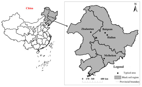
Based primarily on the spatial differentiation of the dominant erosive driving forces, this study selected four typical small watersheds (Figure 1). These watersheds represent natural conditions and gully development in Northeast China. which ensures their representativeness in terms of climate, geomorphology, and land use.
Figure 1.
Black soil region of Northeast China and four typical regions location.
- (1)
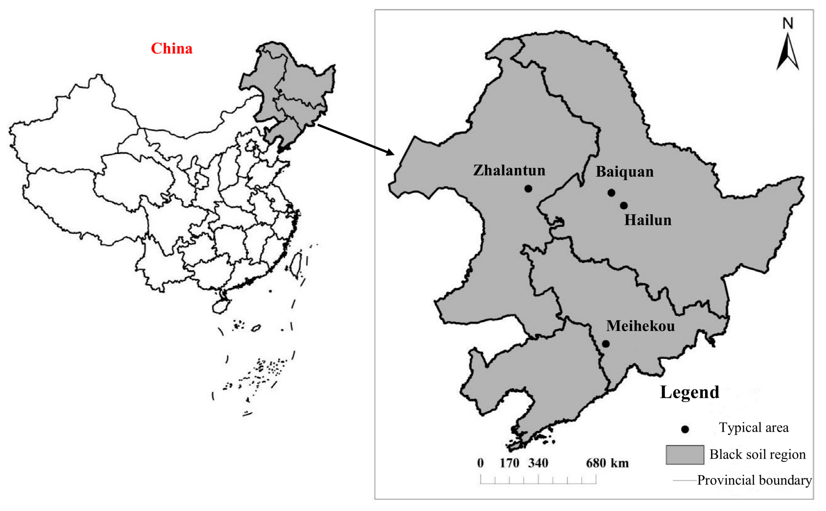
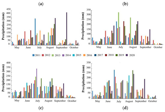
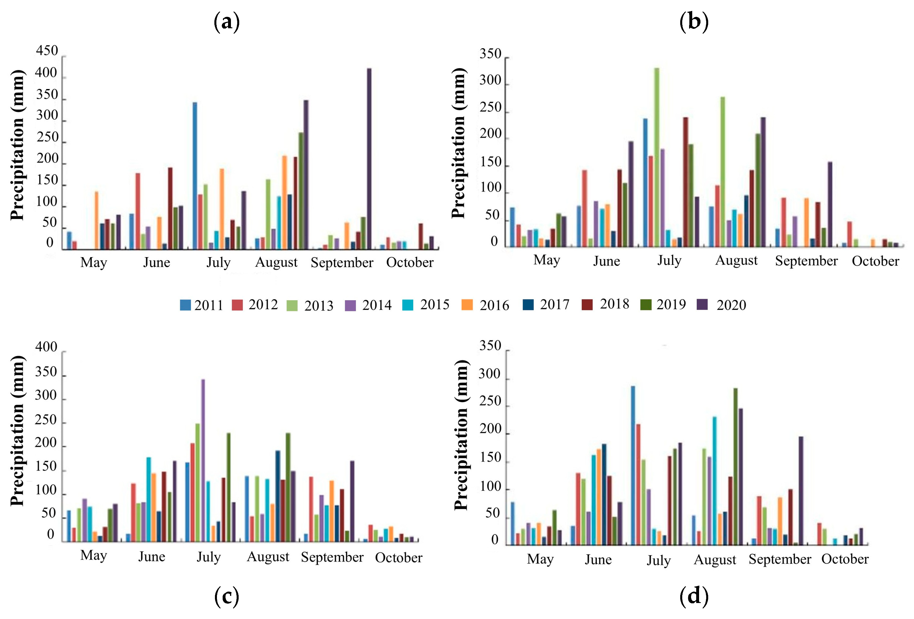
- Climatic characteristics: Meihekou, Hailun, Baiquan, and Zhalantun are located in the southeastern, northeastern, central, and northwestern parts of the Black Soil Region in Northeast China, respectively. Meihekou has an average annual rainfall of 700–800 mm, Hailun 550–650 mm, Baiquan 500–600 mm, and Zhalantun 400–500 mm. Precipitation generally increases from west to east and north to south, and these four areas serve as a transitional sequence from humid to semi-arid climates (Figure 2).Figure 2. Monthly rainfall by region, (a) is Meihekou, (b) is Hailun, (c) is Baiquan, (d) is for Zalantun.
- (2)
- Geomorphological features: The areas are situated in low mountainous regions (Meihekou), rolling hill areas (Hailun and Baiquan), and mountainous-hilly regions (Zhalantun), reflecting the complex and diverse topography of the region.
- (3)
- land use type: In Meihekou, sloping farmland accounts for 68.3% of the total cultivated land, with a vegetation coverage rate of only 31.2%, the terrain fragmentation degree is relatively low, and the relative erosion risk is moderate. Hailun, a major grain-producing area with 81.5% farmland, the erosion risk is high due to loose soil, low vegetation coverage, and a >40% reduction in topsoil anti-erosion capacity caused by frequent cultivation. This high risk accelerates gully development; Baiquan has a cultivated land proportion (79.8%) and vegetation coverage similar to those of Hailun. However, its terrain fragmentation is 27.6% higher, resulting in a patchy distribution of cultivated land and consequently a high relative erosion risk. In Zhalantun, the proportion of cultivated land is relatively low, the vegetation coverage is the lowest (28.7%), and the terrain fragmentation is the highest. The combined effect of sparse vegetation and high fragmentation results in the highest relative erosion risk.
- (4)
- Gully erosion development: The four typical areas are located in three provinces (autonomous regions) where erosion gullies are the most severe within the Northeast Black Soil Region. Meihekou has a gully density of 2.8–3.2 km/km2 and the proportion of developing gullies is 87.73%. Hailun has a gully density of 6.5 km/km2 and the proportion of developing gullies is 84.79%. Baiquan is characterized by a medium-sized gully proportion of 60.66% and the proportion of developing gullies is 81.58%. Zhalantun has a gully density of 3.5–4.0 km/km2, and the proportion of developing gullies is 92.1%, ranking first among the four areas and having representative significance for conducting research. The spatial variation in gully erosion features across these four areas makes them ideal typical study sites for exploring gully erosion mechanisms in the Northeast Black Soil Region. Therefore, Meihekou, Hailun, Baiquan, and Zhalantun were selected as typical areas.
2.2. Field Rechecks of Erosion Gullies
This study adopted two on-site field verification methods for gully erosion.
- (1)
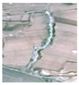
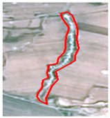
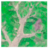
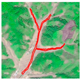
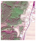
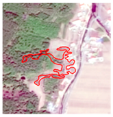
- Verification of the presence of erosion gullies: Based on the erosion gully data from the 2011 and 2021 Chinese Water Resources Surveys, 10 erosion gullies were randomly selected from each county (district) for field verification. Proportional sampling was implemented to select no less than 5% of the imagery, covering the spatial variability of the study area. Through the combination of field verification measurements and 2 m Google Earth images interpretation, gully extraction results were rigorously inspected. The conformity of gully boundary delineation, accuracy of gully type interpretation, and integrity of essential spatial data (length, width, and position coordinates) were validated to confirm the authenticity and dependability of the extracted information. All vector segments were required to form closed loops, with established topological relationships. If the gully patch boundaries exhibited significant deviations, they were redrawn. Additionally, the correct interpretation rate of the gullies was required to be no less than 90%; otherwise, re-identification was conducted. This process determined the accuracy of the erosion channel interpretation (Table 1).Table 1. Site review of gully. The red line area represents the erosion gullies.
- (2)
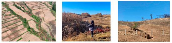
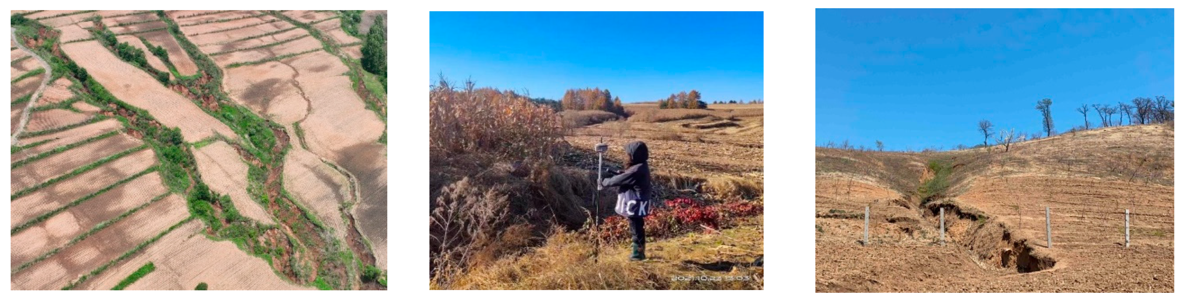
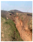
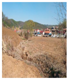
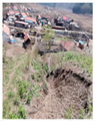
- Verification of gully erosion rates: Real-Time Kinematic (RTK) technology was adopted, with a dynamic measurement accuracy of 1 cm ± 1 ppm horizontally and 2 cm ± 1 ppm vertically. Field verification was conducted on 3–4 erosion gullies selected from each county (district) (Table 2) during late May to early June of each survey year to minimize vegetation interference. This timing was synchronized with the acquisition period of the corresponding spring satellite imagery used for gully interpretation, ensuring consistency in phenological conditions for accurate validation. The collected data were preprocessed using Excel and converted into a format readable by GIS. Using ArcGIS 10.8, the elevation points measured at the bottom of the gullies were connected with those measured at the sides of the gullies, and the information such as the gully length and area was extracted (Figure 3).Table 2. Variation in length and area of erosion gully measured on site.Figure 3. Field investigation of erosion gullies.
2.3. Data Processing
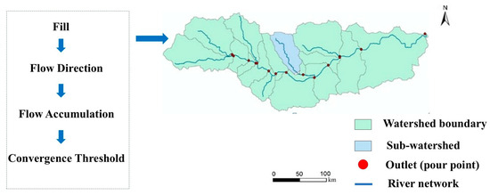
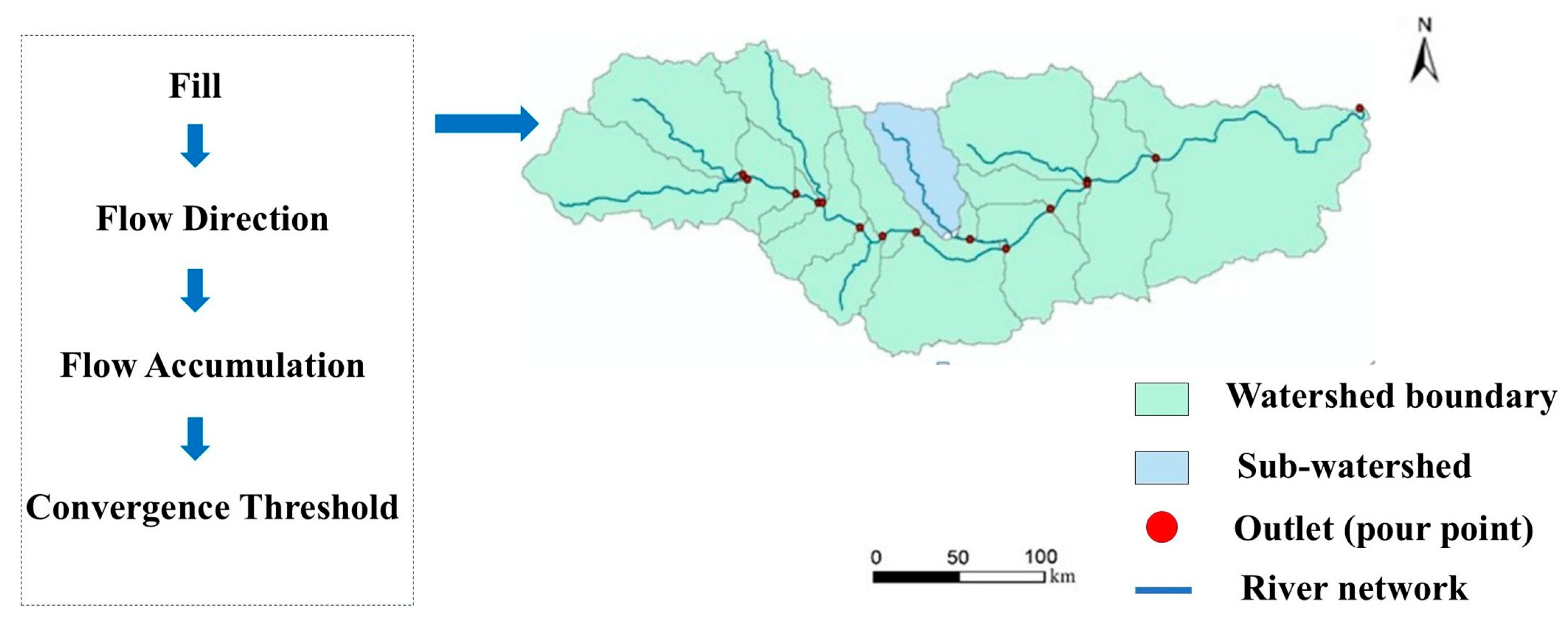
Using Google Earth’s 2 m imagery and the ArcSWAT plugin in ArcGIS 10.8, 30% of each study area was sampled as small watersheds of equal total area. Based on a 12.5 m DEM, catchment areas were delineated through hydrological processing—including depression filling, D8 flow direction analysis, and flow accumulation (Figure 4). Using thresholds of 40, 20, 20, and 1000 [37] for Meihekou and the other three sites, respectively, stream networks were extracted, vectorized, and overlaid with mapped erosion gullies to derive corresponding catchment boundaries and calculate their areas.
Figure 4.
Watershed extraction.
2.4. Gully Data and Procession
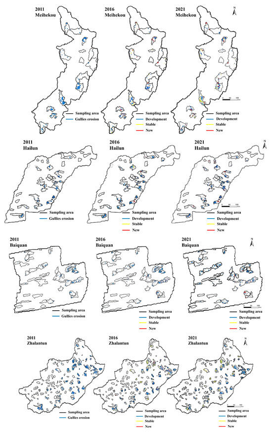
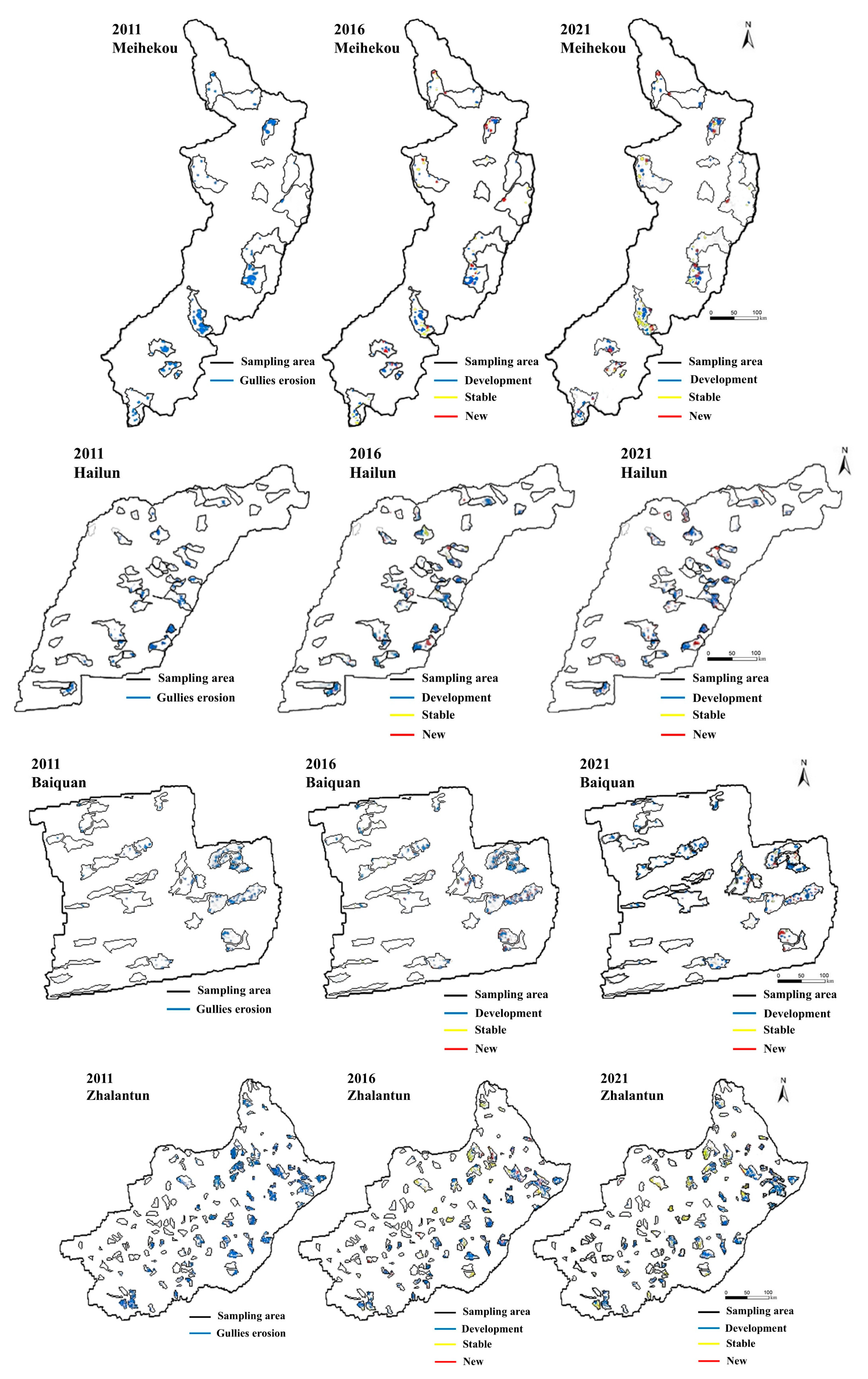
Erosion gully data were based on 2 m Google Earth images. To minimize the impact of factors such as vegetation and snow cover, historical satellite images from spring were selected for collection, resulting in the interpretation of 9376 erosion gullies. This outcome was derived from a wall-to-wall interpretation based on high-resolution imagery across the four study areas, constituting the complete “gully population” for this research rather than a sampled subset. The image was overlaid with an erosion gully surface layer in ArcGIS 10.8. The start and end latitude/longitude coordinates of the interpreted gullies were input into OvitalMap to verify their actual existence. Gully erosion data of the black soil region in Northeast China from 2011 were used as the baseline data for the first phase, whereas data from 2016 and 2021 served as the data for the second and third phases, respectively. The gully head was defined as the intersection point between the primary water flow path and the gully boundary, whereas the gully outlet was defined as the endpoint of the water flow path at the gully bottom. Gully length was calculated as the length of the flow path along the gully bottom or flow path, while the gully area was defined as the projected area within the gully boundary, that is, the boundary between the gully and non-gully areas (Figure 5). Although this estimation method has certain errors, the rationality of using this method to determine gully heads was verified through field surveys conducted in 2021.
Figure 5.
Interpretation of erosion gully of different regions. The black line represents the sampling area (with the same total area). Development indicates development gullies, stable indicates stable gullies, and new indicates newly formed gullies.
Based on morphological changes observed between consecutive monitoring periods (2011–2016 and 2016–2021), a gully is classified as developing if any of its morphological parameters-length, area, or average width-increased by ≥10% across two consecutive phases; conversely, it is classified as stable gullies if all morphological parameters changed by <10%. This classification aims to clarify the environmental conditions under which gullies are most likely to continue developing (“developing gullies”), remain essentially static (“stable gullies”), or newly form (“newly formed gullies”).
3. Results
3.1. Spatio-Temporal Characteristics of Erosion Gully
According to the parameter changes in developing gullies in different regions from 2011 to 2016 and 2016 to 2021 (Table 3), influenced by the base number of erosion gullies, the number, length and area of development gullies in Zhalantun are higher than those in other areas, with the number being 4 times, 1.8 times and 2.4 times that of Meihekou, Hailun and Baiquan, respectively. Therefore, direct comparison of absolute values is insufficient to reflect the true intensity of erosion activity, and growth rates based on relative changes offer greater interpretive value. The number of development gullies in Hailun has increased the most with a growth rate of 23.2%, which was significantly higher than other regions. The growth rate of the number of development gullies in Meihekou is also relatively high at 20.9%.
Table 3.
Statistical table of inventory and changes in morphological parameters of developmental erosion gullies.
In 2011, the developing gullies in Meihekou were concentrated in the north-central region and the transition zone of southern low mountains and hills, while expanding toward the northeastern and western margins during the period 2016–2021. For Hailun, developing gullies were mainly distributed in the north-central area and the transition zone of western plain and rolling hills in 2011; by 2016–2021, they expanded to the eastern margin with fragmented distribution in the southern region. In Baiquan, development gullies were concentrated in the central-eastern and eastern plains rolling hills interaction zone in 2011, and later shifted to the western hills, southern and northeastern areas. In Zhalantun, development gullies were widely concentrated in the central-eastern and southwestern areas in 2011, and continued to develop in the central and northeastern rolling hills agricultural areas while expanded to the west from 2016 to 2021.
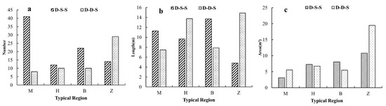
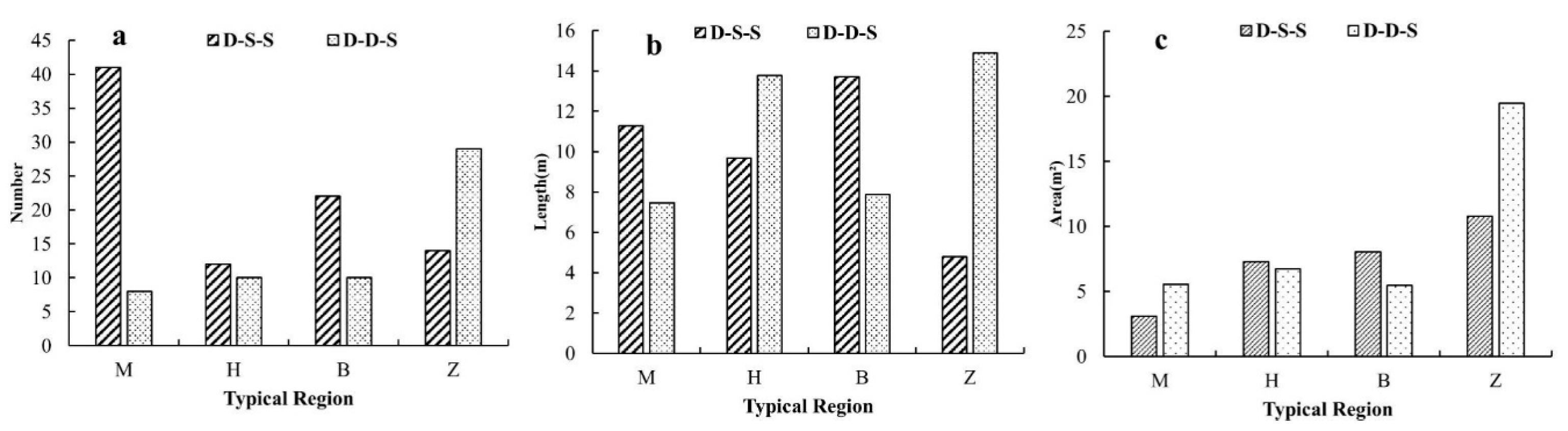
The spatial distribution of the stable gullies has significantly changed over time. In Meihekou, stable gullies were distributed in the central low-lying hills in 2016, and in 2021 it concentrated in the southeastern and northern areas. For Hailun, stable gullies were scattered in the central rolling hills in 2016, and it concentrated in the southeastern and northern areas in 2021; In Baiquan, stable gullies were located in the western and central areas in 2011, and it concentrated in the low-disturbance areas with slopes < 8° in the southeastern and northern regions by 2021; In Zhalantun, stable gullies were distributed in the western and central areas in 2016, and it moved to the northern and southern areas in 2021. The stable gullies in each typical area can be classified into two types: continuous stability (development-stability-stability) from 2011 to 2016 and transition from development to stability (development–development–stability). The Meihehuo stable gullies had the largest number, reaching 49, followed by Zhalantun, Baiquan, and Hailun with 43, 32, and 22, respectively (Figure 6).
Figure 6.
(a) Number, (b) length, and (c) area of stable trenches in Meihekou (M), Hailun (H), Baiquan (B), and Zhalantun (Z). D and S are development gully and stable gully, respectively.
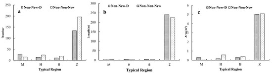
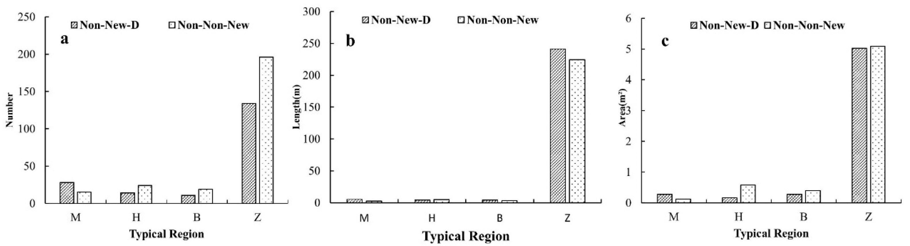
Newly formed gullies were classified into two categories: those that emerged in 2016 and persisted until 2021 (nonexistent-newly formed developing) and those that emerged in 2021 (nonexistent–nonexistent–newly formed). Owing to topographic differences, the number of newly formed gullies in Zhalantun was significantly higher than that in the other regions, reaching 330, with a total length of 465.85 km and a total area of 10.11 km2 (Figure 7). In terms of spatial development, newly formed gullies in Meihekou were initially concentrated in the southwestern region in 2016, and in the northern and eastern areas with intense human disturbance in 2021; For Hailun, newly formed gullies originated in the southwestern region in 2016 and additional ones emerged in the northern region with frequent cultivation in the later period. In Baiquan, newly formed gullies were concentrated in croplands with slopes > 15° in the southwestern region in 2016, and new gullies were added in sloping croplands in the eastern and western regions in 2021. In Zhalantun, newly formed gullies appeared in croplands with slopes > 10° in the southeastern region and the southwestern region in 2016, and new ones emerged in the forest-grassland destruction zones in the eastern and northern regions in 2021. This is similar to the development patterns summarized in the dynamic monitoring work of erosion gullies at the site (Table 4). In Meihekou, the increment in length of each erosion gully was significantly smaller than that in area. The number, length and area parameters of the developing gullies in Hailun and Baiquan are similar. Notably, in Zhalantun, the strong runoff scouring energy brought by the long slopes leads to the largest length and area of developing gullies.
Figure 7.
(a) Number, (b) length and (c) area of newborn trenches in each typical area. Non and New are non-formed gully and newly formed gully, respectively.
Table 4.
Environmental conditions of typical stability gullies in each typical area.
3.2. Environmental Characteristics of Erosion Gully
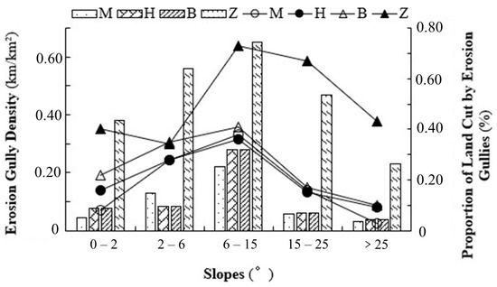
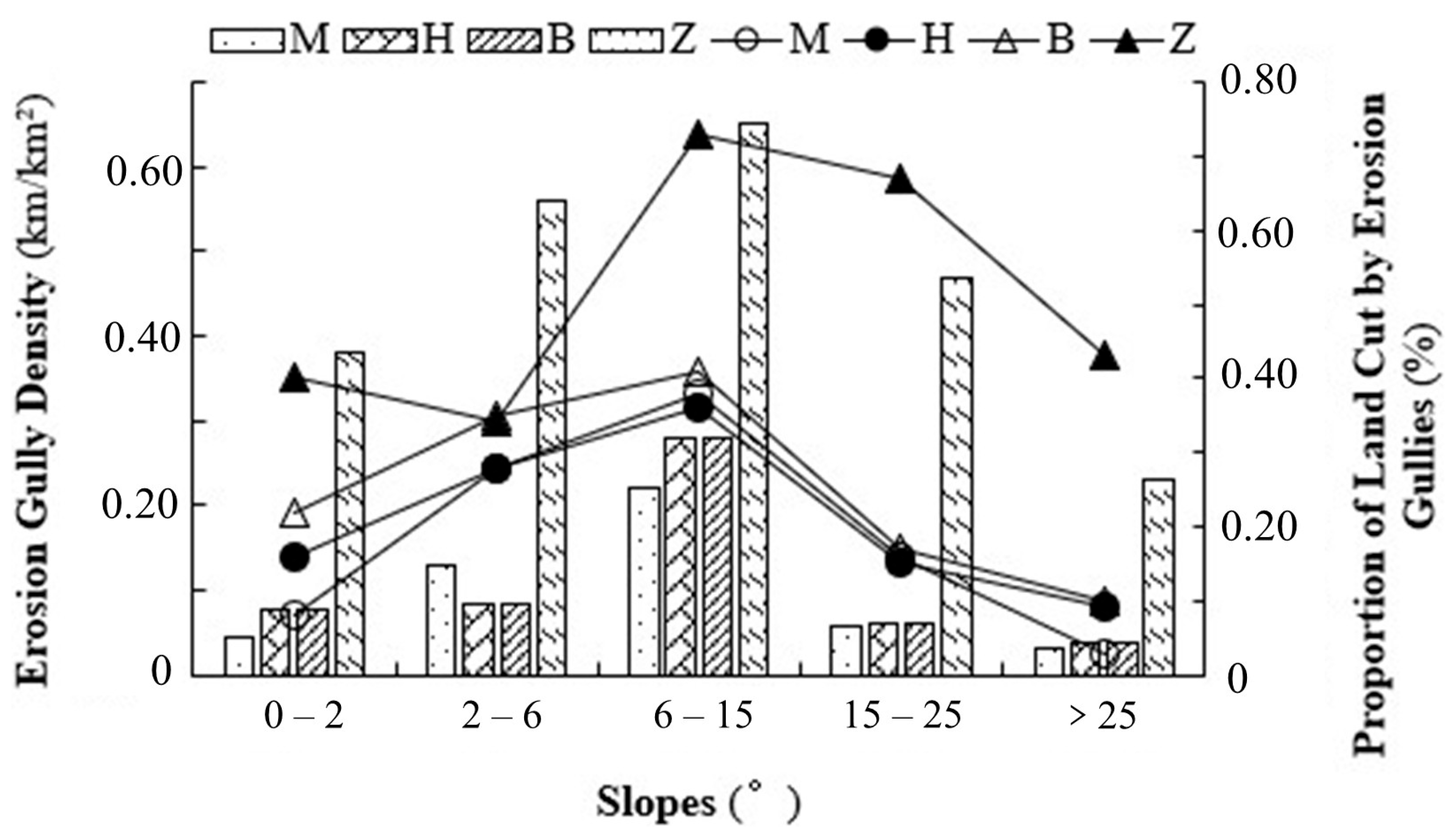
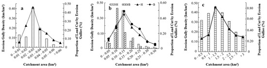
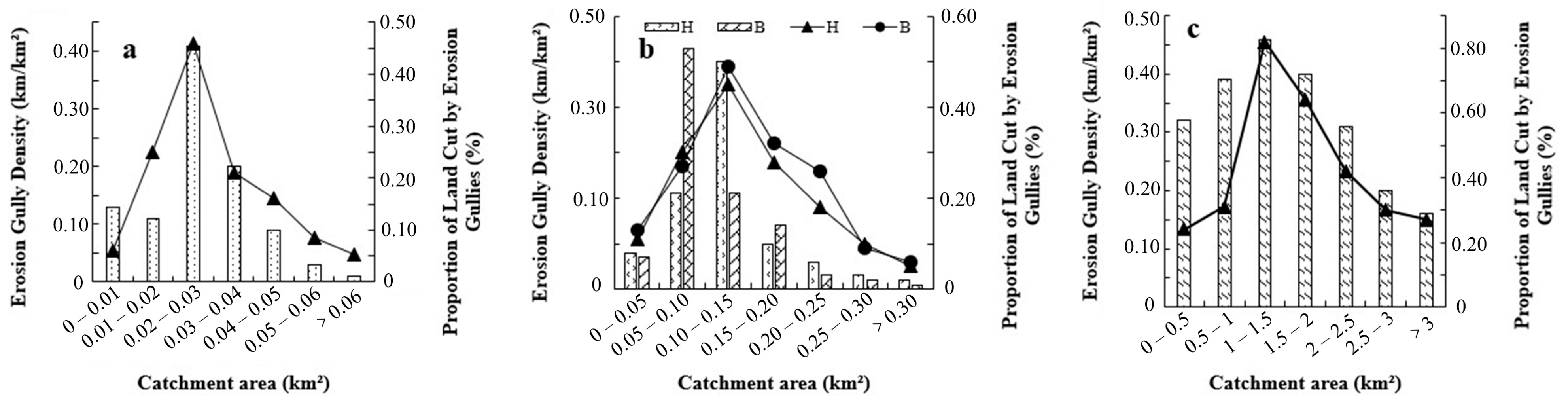
The precipitation distribution in Meihekou City throughout the year is extremely uneven, with rainstorm events in 6–8 accounting for the vast majority of the annual precipitation. Slope gradients are concentrated between 5° and 15°, and land use is dominated by cropland (Figure 8). Gully-prone areas are concentrated in croplands with a catchment area of 0.02–0.03 km2 and a slope of 6–15°. Notably, stable gullies account for the highest proportion among the four regions, with typical stable gullies mostly distributed in forestland with a slope of 2–6° and a corresponding catchment area concentrated in 0.01–0.02 km2 (Figure 9). Importantly, the distribution characteristics of new gullies are highly consistent with those of gully-prone areas, mainly developing in cropland-grassland transition zones with a catchment area of 0.02–0.03 km2 and a slope of 6–15°.
Figure 8.
Erosion gully Density and proportion of cut land in different areas under different slopes. M, H, B, and Z are Meihekou, Hailun, Baiquan, and Zhalantun, respectively. The x axis represents the slope (°); the left y axis corresponds to the bar chart, indicating the density of gullies in this area; the right y axis corresponds to the line graph, representing the proportion of land cut by erosion.
Figure 9.
Density of erosion gully and proportion of cut land in different regions under the catchment area: (a) Meihekou, (b) Hailun (H) and Baiquan (B), and (c) Zhalantun, respectively. The x axis represents the area of the catchment region (km2); the left y axis corresponds to the bar chart, indicating the density of gullies in this area; the right y axis corresponds to the line graph, representing the proportion of land cut by erosion.
Hailun and Baiquan are both important grain production bases in China, with cropland coverage exceeding 70% in both regions. The terrain is dominated by gentle rolling plains, and the black soil, while exhibiting prominent fertility has poor structural stability and low erosion resistance. Driven by these environmental conditions, gully-prone areas are concentrated on croplands with a catchment area of 0.1–0.15 km2 and a slope of 6–15°. Specifically, stable gullies mainly form on forestland with a catchment area of 0.05–0.1 km2 and a slope of 6–15°. In contrast, new gullies are distributed in low-slope areas, primarily developing on sloping croplands with a catchment area of 0.05–0.1 km2 and slopes of 0–2° or 2–6°. Although the slope of this area is relatively gentle, the soil structure degradation caused by intensive agricultural activities has become the key driving factor for the emergence of new erosion gullies.
The terrain of Zhalantun is dominated by rolling hills and alluvial river valley terraces, with its erosion susceptibility ranking first among the four regions. Land use in the area exhibits a spatially interlaced pattern of grassland, cropland, and forestland. Excessive grazing and irrational grassland exploitation have led to severe vegetation degradation, further exacerbating ecosystem vulnerability. Compared with the previous three regions, the gully-prone areas in Zhalantun are concentrated in degraded forestland (low-quality forestland) with a catchment area of 1–1.5 km2 and a slope of 6–15°. Such forestland has low vegetation coverage and weak protective capacity, making it difficult to resist rainfall-induced hydraulic erosion. Specifically, stable gullies have a relatively smaller catchment area, mostly ranging from 0.5–1 km2. Newly formed gullies develop in farmland-forest mixed zones with a catchment area of 0.5–1 km2 and slope of 2–6° or 6–15°. Furthermore, intense rainstorm events in Zhalantun provide the driving force for the vertical down cutting and horizontal widening of gullies. They are also key environmental factors that promote the increase in length and area of erosion gullies, resulting in the largest gully scale among the four regions.
4. Discussion
4.1. Relationship Between Gully Development and Catchment Area
An erosional gully is a surface landform that results from the interaction of multiple factors. Its development occurs when external forces exceed the inherent resistance of the soil to erosion [38]. Rainfall, as the core driver of soil erosion, not only promotes gully expansion by concentrating surface runoff to scour channel beds but also triggers gravitational erosion phenomena such as landslides and rockfalls [39,40]. These processes often act synergistically to accelerate gully development. Topography is also a critical factor. By regulating the hydrodynamic conditions of slope runoff, gullies tend to occur on steeper slopes with concentrated runoff [41]. In addition, the catchment area significantly influences the development of gully erosion.
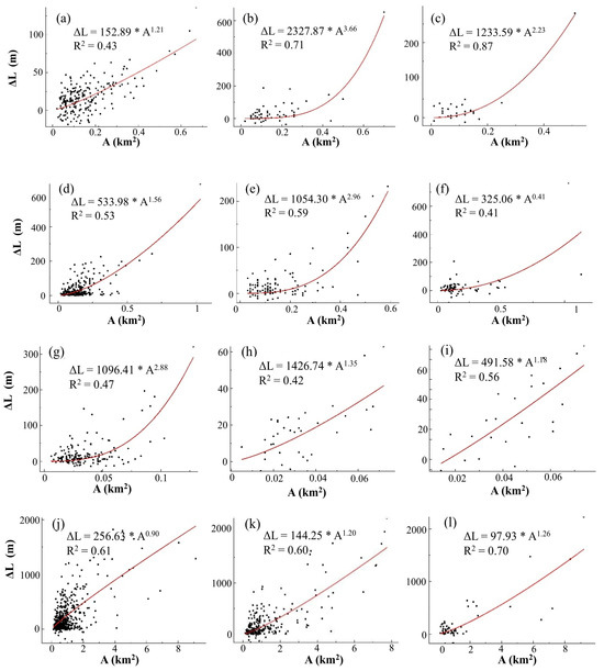
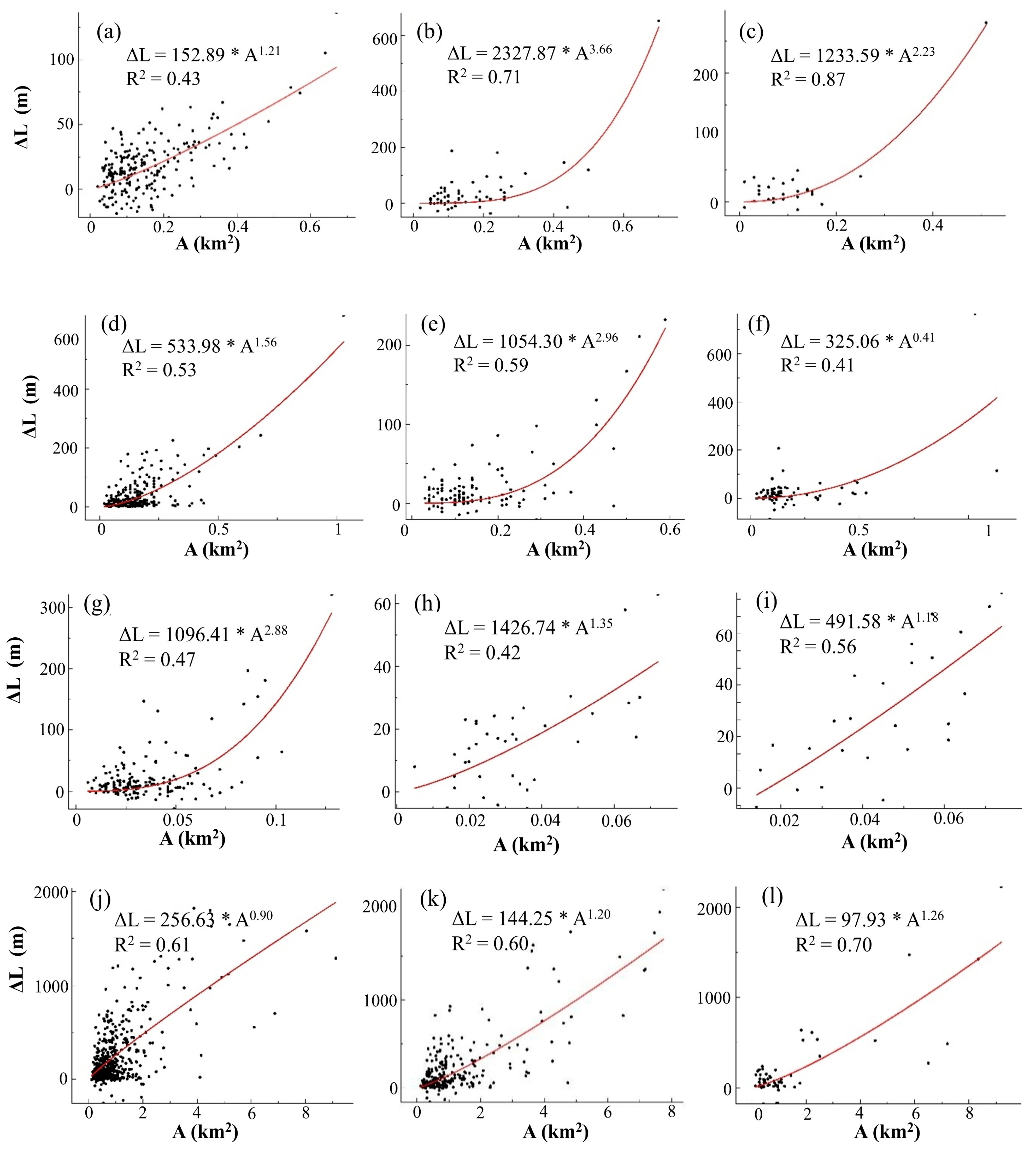
The first quantitative fitting analysis of the relationship between gully development characteristics and catchment area revealed a significant positive correlation between gully length and catchment area. This indicates that, as a carrier for surface runoff convergence, catchment size directly regulates the potential for gully length development. Furthermore, the fitting results for this relationship varied significantly across different typical regions and land use types. For instance, the relationship between gully length variation in gullies and catchment area demonstrated the best fit for grassland in Meihekou (Figure 10). This reflects the significant driving role of runoff convergence in gully extension under grassland vegetation cover conditions. In contrast, in Hailun and Baiquan, the optimal fittings were observed for grassland (ΔL = 1054.30 × A2.96) and forestland (ΔL = 2127.87 × A3.66), respectively. Additionally, the fitting equation for grassland gullies in Zhalantun was (ΔL = 97.93 × A1.26), exhibiting a pronounced linear trend. This may be related to low vegetation coverage and runoff scouring processes in arid environments.
Figure 10.
Fitting curve of erosion gully change and catchment area in Meihekou (a–c), Hailun (d–f), Baiquan (g–i), Zhalantun (j–l). The left column, the middle column, and the right column, respectively, represent the cultivated land, woodland, and grassland of each region. The x axis represents the area of the catchment region, and the y axis represents the variation in gullies length.
Catchment formation reflects the combined effects of changes in land use and topography. Topographic factors, such as catchment size and slope geometry, are important determinants of the development scale of gully length. Under different land use types, the fitting results for gully length changes relative to catchment area exhibited significant differences, with grassland showing the best fit and forested land the worst. Gully development is significantly affected not only in croplands but also in areas with intense human disturbance and low vegetation coverage. Human disturbance activities may disrupt soil aggregates; meanwhile, the original slopes may also be affected to a certain extent. Runoff flows continuously from uphill to downhill, and its scouring capacity is constantly enhanced, thereby intensifying soil loss and ultimately accelerating the development process of gully erosion. Therefore, in areas with higher vegetation cover, the development of eroded gullies was less influenced by the catchment area.
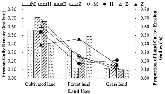
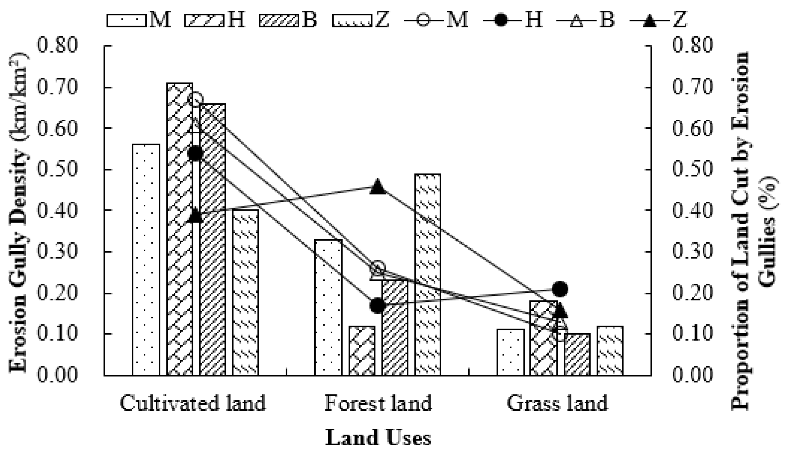
After clarifying the influence of factors such as catchment area on gully length, this study explored the intrinsic relationship between gully length and area changes, as well as the differences across distinct geographical regions (Figure 11). Statistical analysis of field observations of the changes in the length and area of each gully revealed that the increase in gully length was significantly smaller than the increase in gully area. This indicates that gully development was primarily dominated by gully bank expansion, increasing the eroded area. This is primarily because as headwater runoff scours the gully head, it advances continuously while the gully banks expand, relatively slowing upstream erosion and consequently causing the gully area to steadily increase [42]. Across different regions, the slope gradient of the semi-arid hilly areas was higher than that of the semi-humid low-mountain hilly and rolling hill areas (Figure 11). Moreover, these semiarid regions are mostly covered by forest with poor vegetation conditions, resulting in a weak capacity to intercept rainfall and absorb surface runoff, leading to a relatively large amount of surface runoff in the area. In addition, the high slope gradient and long slope length in these regions further enhanced the scouring velocity and kinetic energy of the surface runoff. Consequently, the gullies in the semiarid mountainous and hilly regions exhibited the longest lengths and largest areas. Parameters such as the number, length, and area of gullies in the semi-humid floodplain and hill floodplain areas are relatively similar. The extensive erosion area and widespread distribution of these gullies, coupled with the continuous occurrence of gully erosion and freeze–thaw action, have led to a continuous deterioration of the soil ecological environment and poor physicochemical properties.
Figure 11.
Erosion gully density and proportion of cut land in different land use regions. M, H, B, and Z are Meihekou, Hailun, Baiquan, and Zhalantun, respectively. The x axis represents the type of land use; the left y axis corresponds to the bar chart, indicating the density of gullies in this area; the right y axis corresponds to the line graph, representing the proportion of land cut by erosion.
4.2. Thresholds of Gully Development
The development of erosion gullies exhibits a threshold effect, ceasing or significantly slowing once the threshold is reached. This process can be promoted to a stable state through artificial regulation of environmental conditions. Data from typical areas between 2011 and 2021 showed significant variations in the number, length, and area of stable gullies across different regions (Figure 11), which are closely related to land use changes, the impact of slope length on vegetation cover, and topographic constraints. Meihekou City, in the semi-humid low mountainous hilly region, has a relatively large number of stable gullies but a small total area. This is attributed to terrains with gentler slopes and shorter slope lengths, which are more conducive to vegetation cover. Sufficient vegetation reduces soil scouring by surface runoff and inhibits gully expansion. Conversely, Zhalantun exhibited the greatest total length and area of stable gullies, despite not having the highest number. Steeper and longer slopes resulted in progressively reduced forest cover and vegetation as the slope length increased. This diminishes vegetation’s capacity to effectively absorb soil nutrients and moisture [43], intensifying surface runoff and gradually shifting stable gullies toward cultivated slopes [44]. The characteristics of the stable gullies in Hailun City and Baiquan County fall between these two types, which are associated with their moderate levels of slope length, vegetation coverage, and topographic conditions.
Overall, in semi-humid, low mountainous, hilly, and rolling hill areas, the dominant land use type in stable gullies shifted from cropland to forestland compared to developed gullies, with a decreasing trend in the catchment area. Socioeconomic development drives the conversion of existing forests and grasslands into economically valuable farmlands [45,46]. Frequent agricultural activities on farmland disrupt the original soil structure, continuously providing the necessary conditions for the development of eroded gullies. Developing gullies in croplands typically exhibit rapid growth and are more numerous [47]. In contrast, forested areas exhibited higher vegetation coverage and lower runoff volumes and velocities than croplands. Correspondingly, both slope gradient and catchment area are reduced, which helps stabilize gullies and ultimately allows them to reach a developmental threshold, turning into stable gullies. Zhalantun has low annual precipitation and high temperatures, and forestland accounts for approximately 60% of its area. Both developing and stable gullies were primarily distributed in forestland. However, the quality of the forestland is poor, consisting mostly of low-coverage and sparse forests with limited soil and water conservation functions, which results in a relatively high number of developing gullies. Nevertheless, forested areas can intercept 15–30% of precipitation through canopy interception, reduce radiation, and decrease surface runoff and the expansion of erosion gully cracks. With a small proportion of croplands and minimal human disturbance in this region, erosional gullies can develop stably, although stable gully lengths remain short. The reforestation of cultivated land may increase the length of stable gullies. The longest stable gullies are distributed in forestlands with catchment areas of 0.5–1 km2 and slopes of 2–6°, sharing the same land use type as developing gullies but differing in slope and catchment area. The shortest stable gullies were located in croplands with catchment areas of 0.5–1 km2 and slopes of 6–15° (Table 4).
Analysis of data on newly formed gullies in typical areas from 2011 to 2021 revealed that Meihekou City recorded 43 newly formed gullies, with a total length and area of 7.47 km and 0.43 km2, respectively; Hailun City recorded 36 newly formed gullies, totaling 8.77 km in length and 0.74 km2 in area; Baiquan County recorded 30 newly formed gullies, with a total length and area of 7.12 km and 0.68 km2, respectively; and Zhalantun City recorded 330 newly formed gullies, with a total length and area of 465.85 km and 10.11 km2, respectively.
The formation of erosional gullies is driven by natural and human factors. In Meihekou City, located in a semi-humid low-hilly area, abundant precipitation and low elevation facilitate surface runoff formation. Steep slopes further accelerate runoff scouring in the soil and runoff erosion readily forms erosion gullies. In Hailun City and Baiquan County (rolling hill areas), intensive agricultural activities exert a greater influence on gully initiation than climatic factors. These activities disrupt the soil structure, and the accumulated precipitation enhances the runoff scouring power and velocity, leading to gully formation. In the semi-arid mountainous hilly area of Zhalantun, despite the high proportion of forest land, its quality is generally poor, with low vegetation coverage. Therefore, rainfall scours the land surface, deepens and widens sheets, and causes rill erosion, triggering numerous newly formed gullies.
The distribution environments of newly formed gullies varied by region. In the semi-humid low mountainous and hilly areas, newly formed gullies concentrate on cropland and grassland with catchment areas of 0.02–0.03 km2 and slopes of 6–15°, frequently appearing in steep slopes with small catchment areas. In the rolling hill area, newly formed gullies occurred on croplands with catchment areas of 0.05–0.1 km2 and slopes of 0–2° or 2–6°, similar to the distribution environment of locally developed gullies but significantly different from the stable threshold environment of erosion gullies. In the semi-arid hilly region, newly formed gullies were distributed on cropland and forestland with larger catchment areas of 0.5–1 km2 and slopes of 2–6° or 6–15°. The distribution characteristics of the newly formed gullies in the rolling hill and semi-arid areas were opposite to those in the semi-humid, low-mountainous hilly areas.
Overall, newly formed gullies resembled developed gullies and were primarily distributed across croplands and grasslands. Croplands experienced intense human disturbance and low vegetation cover, whereas areas with high vegetation cover exhibited significantly lower soil erosion than low-cover regions (Figure 7). In contrast, forestland leverages dense vegetation to conserve water [48] and soil and water conservation [49]. For instance, forest canopies intercept and absorb 15–30% of atmospheric precipitation, whereas litterfall captures rainfall, prevents direct erosion by raindrops, and maintains soil structural stability. Vegetation moderates the microclimate by reducing solar radiation. Consequently, the number, length, and area of both newly formed and developing gullies in the forestland were consistently smaller than those in the croplands and grasslands. In croplands, the limited capacity of crops to regulate runoff and attenuate solar radiation results in substantially higher numbers of newly formed and developing gullies compared with forested land and grassland. In semiarid mountainous and hilly areas, insufficient precipitation impairs forest vegetation growth, and croplands within these areas cannot effectively regulate runoff, thereby significantly increasing the probability of newly formed gullies. Precipitation and topography are key factors in the formation of new gullies [50], where concentrated rainfall-induced soil erosion evolves from sheet and rill erosion into new gullies.
Newly formed gullies in forestlands result from vegetation damage caused by excessive logging and grazing, leading to scaly erosion. The slope gradient is a critical determinant of soil erosion severity, influencing not only soil growth and development but also runoff velocity. Steeply sloped farmlands can develop rill erosion through torrential rainfall runoff. Rill gullies develop into new gullies under runoff, with the surface runoff serving as the core driving force for their expansion. Newly formed gullies gradually evolve into wide, shallow, trough-shaped gullies, and then into cut gullies with headwater cascades, ultimately forming terminal U-gullies [51]. Changes in precipitation and environmental factors were key drivers of the evolution of newly formed gullies into larger-scale development gullies (Table 5).
Table 5.
Environmental conditions of typical new gullies in each typical area.
4.3. Limitations
This study had certain limitations. Although factors such as precipitation, topography, and catchment area have been identified as influencing gully development rates and watershed boundaries have been precisely delineated using hydrological analysis, a sufficient quantitative analysis of the contribution and impact of drainage systems in the watershed runoff process has not been conducted. Future research should obtain high-precision topographic data and develop more precise simulation algorithms to deepen our understanding of the influencing factors and intrinsic mechanisms of gully development. Second, different landscape patterns may promote or inhibit gully development by altering the flow paths and dynamic characteristics.
To address this research gap, it is necessary to adjust the area ratio of croplands, forestland, and grasslands and optimize the spatial configuration of landscape patches, thereby achieving the goal of curbing gully erosion. Additionally, freeze–thaw cycles increase soil erodibility, which is a key factor affecting gully erosion under different topographic, soil, and vegetation conditions. Therefore, future research should incorporate more climate indicators and their induced soil parameters to elucidate the mechanisms of gully erosion. In summary, future in-depth exploration focusing on landscape patterns, runoff processes and modeling, and long-term series monitoring of freeze–thaw effects will serve as important complementary directions for this research. However, despite these limitations, this study quantified the contributions of precipitation, topography, and catchment environmental conditions to the formation and development of gully erosion, thus laying a foundation for subsequent related research and practice.
5. Conclusions
This study focused on four typical black soil regions of Northeast China. By integrating Google Earth images from 2011 to 2021 and field monitoring data from 2021, the relationship between gully erosion and environmental conditions was analyzed, and the development thresholds of gully erosion were identified. The results show that the total number of gullies will increase from 2011 to 2021. A significant positive correlation was found between catchment area and gully length, with the gully scale determined by catchment size and slope length. Furthermore, croplands were the main distribution areas for both developed and newly formed gullies. Low-quality forest land is also prone to gully erosion. In contrast, conversion from croplands to forestlands significantly inhibited the development of gully erosion, primarily because of the stable increase in vegetation cover. Furthermore, for the four typical regions, forest land was the most favorable land use type for stable gully persistence, primarily concentrated in the slope gradient range of 6–15°. This study identified the critical environmental thresholds for gully development, providing a scientific basis for gully erosion control in the black soil region of Northeast China. Future research should focus on understanding the impacts of region-specific environmental variables on gully formation.
Author Contributions
Conceptualization, H.H. and H.F.; Methodology, H.H.; software, H.H.; validation, H.H.; formal analysis, H.H. and R.M.; resources, H.F. and R.M.; data curation, H.H. and H.F.; writing—original draft preparation, H.H. and H.F.; visualization, H.F.; supervision, H.F.; project administration, H.F.; funding acquisition, H.F. All authors have read and agreed to the published version of the manuscript.
Funding
This research was funded by The National Key R&D Program of China, grant number (2024YFD1501200).
Data Availability Statement
The original contributions presented in the study are included in the article, further inquiries can be directed to the corresponding author.
Conflicts of Interest
The authors declare no conflicts of interest.
References
- Liu, S.L.; Dong, Y.H.; Li, D.; Liu, Q.; Wang, J.; Zhang, X.L. Effects of Different Terrace Protection Measures in a Sloping Land Consolidation Project Targeting Soil Erosion at the Slope Scale. Ecol. Eng. 2013, 53, 46–53. [Google Scholar] [CrossRef] [Scilit]
- Wen, Y.; Kasielke, T.; Li, H.; Zepp, H.; Zhang, B. A Case-study on History and Rates of Gully Erosion in Northeast China. Land Degrad. Dev. 2021, 32, 4254–4266. [Google Scholar] [CrossRef] [Scilit]
- Zhu, J.; Hou, C. Analysis of Difference for Gully Density and the Relationship between Terrain Factors and Gully Density in the Losses Plateau Based on Google Earth and GIS. J. Phys. Conf. Ser. 2021, 1881, 032083. [Google Scholar] [CrossRef] [Scilit]
- De Geeter, S.; Verstraeten, G.; Poesen, J.; Campforts, B.; Vanmaercke, M. A Data Driven Gully Head Susceptibility Map of Africa at 30 m Resolution. Environ. Res. 2023, 224, 115573. [Google Scholar] [CrossRef] [Scilit]
- Svoray, T.; Markovitch, H. Catchment Scale Analysis of the Effect of Topography, Tillage Direction and Unpaved Roads on Ephemeral Gully Incision. Earth Surf. Process. Landf. 2009, 34, 1970–1984. [Google Scholar] [CrossRef] [Scilit]
- Yang, S.; Guan, Y.; Zhao, C.; Zhang, C.; Bai, J.; Chen, K. Determining the Influence of Catchment Area on Intensity of Gully Erosion Using High-Resolution Aerial Imagery: A 40-Year Case Study from the Loess Plateau, Northern China. Geoderma 2019, 347, 90–102. [Google Scholar] [CrossRef] [Scilit]
- Guan, X.; Zhang, Y.; Niu, H.; Shi, P.; Cao, M.; Zu, P.; Xu, D.; Zhao, Q.; Wang, B.; Cui, L.; et al. Seasonal Evolution of Soil Respiration and Sources of Respirable Carbon in Three Forest Stands on the Loess Plateau of China. Land Degrad. Dev. 2024, 35, 5701–5712. [Google Scholar] [CrossRef] [Scilit]
- Parkner, T.; Page, M.J.; Marutani, T.; Trustrum, N.A. Development and Controlling Factors of Gullies and Gully Complexes, East Coast, New Zealand. Earth Surf. Process. Landf. 2006, 31, 187–199. [Google Scholar] [CrossRef] [Scilit]
- Xu, Y.; Luo, L.; Guo, W.; Jin, Z.; Tian, P.; Wang, W. Revegetation Changes Main Erosion Type on the Gully Slope on the Chinese Loess Plateau Under Extreme Rainfall: Reducing Gully Erosionand Promoting Shallow Landslides. Water Resour. Res. 2024, 60, e2023WR036307. [Google Scholar] [CrossRef] [Scilit]
- Nyssen, J.; Poesen, J.; Moeyersons, J.; Luyten, E.; Veyret-Picot, M.; Deckers, J.; Haile, M.; Govers, G. Impact of Road Building on Gully Erosion Risk: A Case Study from the Northern Ethiopian Highlands. Earth Surf. Process. Landf. 2002, 27, 1267–1283. [Google Scholar] [CrossRef] [Scilit]
- Luffman, I.E.; Nandi, A.; Spiegel, T. Gully Morphology, Hillslope Erosion, and Precipitation Characteristics in the Appalachian Valley and Ridge Province, Southeastern USA. Catena 2015, 133, 221–232. [Google Scholar] [CrossRef] [Scilit]
- Poesen, J.; Nachtergaele, J.; Verstraeten, G.; Valentin, C. Gully Erosion and Environmental Change: Importance and Research Needs. Catena 2003, 50, 91–133. [Google Scholar] [CrossRef] [Scilit]
- Derose, R.C.; Gomez, B.; Marden, M.; Trustrum, N.A. Gully Erosion in Mangatu Forest, New Zealand, Estimated from Digital Elevation Models. Earth Surf. Process. Landf. 1998, 23, 1045–1053. [Google Scholar] [CrossRef] [Scilit]
- Liu, C.; Fan, H.; Jiang, Y.; Ma, R.; Song, S. Gully Erosion Susceptibility Assessment Based on Machine Learning-A Case Study of Watersheds in Tuquan County in the Black Soil Region of Northeast China. Catena 2023, 222, 106798. [Google Scholar] [CrossRef] [Scilit]
- Han, Z.; Zhong, S.; Ni, J.; Shi, Z.; Wei, C. Estimation of Soil Erosion to Define the Slope Length of Newly Reconstructed Gentle-Slope Lands in Hilly Mountainous Regions. Sci. Rep. 2019, 9, 4676. [Google Scholar] [CrossRef] [Scilit]
- Zhang, X.C.; Wang, Z.L. Interrill Soil Erosion Processes on Steep Slopes. J. Hydrol. 2017, 548, 652–664. [Google Scholar] [CrossRef] [Scilit]
- Hayas, A.; Peña, A.; Vanwalleghem, T. Predicting Gully Width and Widening Rates from Upstream Contribution Area and Rainfall: A Case Study in SW Spain. Geomorphology 2019, 341, 130–139. [Google Scholar] [CrossRef] [Scilit]
- Vandekerckhove, L.; Poesen, J.; Govers, G. Medium-Term Gully Headcut Retreat Rates in Southeast Spain Determined from Aerial Photographs and Ground Measurements. Catena 2003, 50, 329–352. [Google Scholar] [CrossRef] [Scilit]
- Borrelli, P.; Lugato, E.; Montanarella, L.; Panagos, P. A New Assessment of Soil Loss Due to Wind Erosion in European Agricultural Soils Using a Quantitative Spatially Distributed Modelling Approach. Land Degrad. Dev. 2017, 28, 335–344. [Google Scholar] [CrossRef] [Scilit]
- Wu, Y.; Cheng, H. Monitoring of Gully Erosion on the Loess Plateau of China Using a Global Positioning System. Catena 2005, 63, 154–166. [Google Scholar] [CrossRef] [Scilit]
- Cui, M.; Cai, Q.; Zhu, A.; Fan, H. Soil Erosion along a Long Slope in the Gentle Hilly Areas of Black Soil Region in Northeast China. J. Geogr. Sci. 2007, 17, 375–383. [Google Scholar] [CrossRef] [Scilit]
- Conoscenti, C.; Azzara, G.; Sheshukov, A.Y. Pixel-Scale Gully Erosion Susceptibility: Predictive Modeling with R Using Gully Inventory Consistent with Terrain Variables. Catena 2025, 257, 109091. [Google Scholar] [CrossRef] [Scilit]
- Valentin, C.; Poesen, J.; Li, Y. Gully Erosion: Impacts, Factors and Control. Catena 2005, 63, 132–153. [Google Scholar] [CrossRef] [Scilit]
- Xiao, J.; Zhu, Y.; Chen, J.; Yang, S.; Xu, M.; Li, B.; Hu, H. Moderate Thinning Is More Conducive to Soil Organic Carbon Stability of Planted Forests. For. Ecol. Manag. 2025, 596, 123052. [Google Scholar] [CrossRef] [Scilit]
- Castillo, C.; Gómez, J.A. A Century of Gully Erosion Research: Urgency, Complexity and Study Approaches. Earth-Sci. Rev. 2016, 160, 300–319. [Google Scholar] [CrossRef] [Scilit]
- Tang, J.; Liu, G.; Xie, Y.; Duan, X.; Wang, D.; Zhang, S. Annual Variation of Ephemeral Gully Erosion in a Cultivated Catchment. Geoderma 2021, 401, 115166. [Google Scholar] [CrossRef] [Scilit]
- Torri, D.; Poesen, J. A Review of Topographic Threshold Conditions for Gully Head Development in Different Environments. Earth-Sci. Rev. 2014, 130, 73–85. [Google Scholar] [CrossRef] [Scilit]
- Duan, P.; Fu, R.; Nottingham, A.T.; Domeignoz-Horta, L.A.; Yang, X.; Du, H.; Wang, K.; Li, D. Tree Species Diversity Increases Soil Microbial Carbon Use Efficiency in a Subtropical Forest. Glob. Change Biol. 2023, 29, 7131–7144. [Google Scholar] [CrossRef] [Scilit] [PubMed]
- Feng, J.; Wang, C.; Gao, J.; Ma, H.; Li, Z.; Hao, Y.; Qiu, X.; Ru, J.; Song, J.; Wan, S. Changes in Plant Litter and Root Carbon Inputs Alter Soil Respiration in Three Different Forests of a Climate Transitional Region. Agric. For. Meteorol. 2024, 358, 110212. [Google Scholar] [CrossRef] [Scilit]
- Majhi, A.; Nyssen, J.; Verdoodt, A. What Is the Best Technique to Estimate Topographic Thresholds of Gully Erosion? Insights from a Case Study on the Permanent Gullies of Rarh Plain, India. Geomorphology 2021, 375, 107547. [Google Scholar] [CrossRef] [Scilit]
- Huang, D.; Du, P.; Walling, D.E.; Ning, D.; Wei, X.; Liu, B.; Wang, J. Using Reservoir Deposits to Reconstruct the Impact of Recent Changes in Land Management on Sediment Yield and Sediment Sources for a Small Catchment in the Black Soil Region of Northeast China. Geoderma 2019, 343, 139–154. [Google Scholar] [CrossRef] [Scilit]
- Lin, Z.; Liao, D.; He, L.; Tang, Q.; Wei, J.; Wu, Z.; Deng, Y. The Study on Morphological Evolution Process of Gully Headcut Erosion in Granite Red Soil Hilly Area Based on an in Situ Scouring Experiment. Geomorphology 2023, 441, 108900. [Google Scholar] [CrossRef] [Scilit]
- Bastola, S.; Dialynas, Y.G.; Bras, R.L.; Noto, L.V.; Istanbulluoglu, E. The Role of Vegetation on Gully Erosion Stabilization at a Severely Degraded Landscape: A Case Study from Calhoun Experimental Critical Zone Observatory. Geomorphology 2018, 308, 25–39. [Google Scholar] [CrossRef] [Scilit]
- Đokić, M.; Manić, M.; Đorđević, M.; Gocić, M.; Čupić, A.; Jović, M.; Dragović, R.; Gajić, B.; Smičiklas, I.; Dragović, S. Remote Sensing and Nuclear Techniques for High-Resolution Mapping and Quantification of Gully Erosion in the Highly Erodible Area of the Malčanska River Basin, Eastern Serbia. Environ. Res. 2023, 235, 116679. [Google Scholar] [CrossRef] [Scilit] [PubMed]
- Kong, W.; Eisenhauer, N.; Peñuelas, J.; Qiu, L.; Gou, X.; Song, Y.; Jiao, J.; Jia, X.; Wang, X.; Shao, M.; et al. Climate and Soil pH Modulate Global Negative Effects of Nitrogen Enrichment on Soil Nematodes. Soil Biol. Biochem. 2025, 208, 109860. [Google Scholar] [CrossRef] [Scilit]
- Vanmaercke, M.; Panagos, P.; Vanwalleghem, T.; Hayas, A.; Foerster, S.; Borrelli, P.; Rossi, M.; Torri, D.; Casali, J.; Borselli, L.; et al. Measuring, Modelling and Managing Gully Erosion at Large Scales: A State of the Art. Earth-Sci. Rev. 2021, 218, 103637. [Google Scholar] [CrossRef] [Scilit]
- Huang, D.; Su, L.; Fan, H.; Zhou, L.; Tian, Y. Identification of Topographic Factors for Gully Erosion Susceptibility and Their Spatial Modelling Using Machine Learning in the Black Soil Region of Northeast China. Ecol. Indic. 2022, 143, 109376. [Google Scholar] [CrossRef] [Scilit]
- Wu, Y.; Zheng, Q.; Zhang, Y.; Liu, B.; Cheng, H.; Wang, Y. Development of Gullies and Sediment Production in the Black Soil Region of Northeastern China. Geomorphology 2008, 101, 683–691. [Google Scholar] [CrossRef] [Scilit]
- Xiao, J.; Song, F.; Su, F.; Song, S.; Wei, C. Exploring the Interaction Mechanism of Natural Conditions and Human Activities on Wetland Ecosystem Services Value. J. Clean. Prod. 2023, 426, 139161. [Google Scholar] [CrossRef] [Scilit]
- Liu, S.; Yao, S. The Effect of Precipitation on the Cost-Effectiveness of Sloping Land Conversion Program: A Case Study of Shaanxi Province, China. Ecol. Indic. 2021, 132, 108251. [Google Scholar] [CrossRef] [Scilit]
- Liu, H.; Qian, F.; Ding, W.; Gómez, J.A. Using 3D Scanner to Study Gully Evolution and Its Hydrological Analysis in the Deep Weathering of Southern China. Catena 2019, 183, 104218. [Google Scholar] [CrossRef] [Scilit]
- Wang, C.; Cai, C.; Deng, Y. Tiny Niche Terrain Induces Gully Headcut Retreat. Earth Surf. Process. Landf. 2024, 49, 2260–2277. [Google Scholar] [CrossRef] [Scilit]
- Vandekerckhove, L.; Poesen, J.; Oostwoud Wijdenes, D.; Nachtergaele, J.; Kosmas, C.; Roxo, M.J.; De Figueiredo, T. Thresholds for Gully Initiation and Sedimentation in Mediterranean Europe. Earth Surf. Process. Landf. 2000, 25, 1201–1220. [Google Scholar] [CrossRef]
- Wang, B.; Zhang, Z.; Wang, X.; Zhao, X.; Yi, L.; Hu, S. The Suitability of Remote Sensing Images at Different Resolutions for Mapping of Gullies in the Black Soil Region, Northeast China. Remote Sens. 2021, 13, 2367. [Google Scholar] [CrossRef] [Scilit]
- Dong, Y.; Wu, Y.; Qin, W.; Guo, Q.; Yin, Z.; Duan, X. The Gully Erosion Rates in the Black Soil Region of Northeastern China: Induced by Different Processes and Indicated by Different Indexes. Catena 2019, 182, 104146. [Google Scholar] [CrossRef] [Scilit]
- Zhao, Y.; Wang, Y.; Zhou, J.; Sun, H.; Jin, Z. Spatiotemporal Soil Water Storage Variation Comparison between Newly Formed and Untreated Gully Land Sites under a Land Restoration Project and Associated Implications on Land Management. Ecol. Eng. 2022, 180, 106670. [Google Scholar] [CrossRef] [Scilit]
- Tang, J.; Xie, Y.; Wu, Y.; Liu, G. Influence of Precipitation Change and Topography Characteristics on the Development of Farmland Gully in the Black Soil Region of Northeast China. Catena 2023, 224, 106999. [Google Scholar] [CrossRef] [Scilit]
- Yu, W.-J.; Jiao, J.-Y.; Wang, D.-L.; Wang, N.; Wang, Z.-J.; Zhao, H.-K. Seed Population Dynamics on Abandoned Slopes in the Hill and Gully Loess Plateau Region of China. Ecol. Eng. 2016, 94, 427–436. [Google Scholar] [CrossRef] [Scilit]
- Ni, S.; Zhou, Y.; Cai, C.; Wang, J.; Wang, D. Insights into Linkage between Water Erosion and Benggang Formation: Trajectory Tracing from Slope to Gully. Catena 2025, 254, 109001. [Google Scholar] [CrossRef] [Scilit]
- Zhang, Y.; Li, P.; Hu, L.; Shi, Y.; Niu, Y.; Zhu, X.; Li, D. A thorough accuracy assessment of MT-InSAR for soil erosion monitoring in the hilly and gully Loess Plateau. J. Hydrol. 2025, 655, 132939. [Google Scholar] [CrossRef] [Scilit]
- Guan, Y.; Yang, X.; Zhao, C.; Lou, H.; Chen, K.; Zhang, C.; Wu, B. Monitoring long-term gully erosion and topographic thresholds in the marginal zone of the Chinese Loess Plateau. Soil Tillage Res. 2025, 205, 104800. [Google Scholar] [CrossRef] [Scilit]

Disclaimer/Publisher’s Note: The statements, opinions and data contained in all publications are solely those of the individual author(s) and contributor(s) and not of MDPI and/or the editor(s). MDPI and/or the editor(s) disclaim responsibility for any injury to people or property resulting from any ideas, methods, instructions or products referred to in the content. |
© 2025 by the authors. Licensee MDPI, Basel, Switzerland. This article is an open access article distributed under the terms and conditions of the Creative Commons Attribution (CC BY) license.