Article

Exploring Visitor Patterns in Island Natural Parks: The Relationship Between Photo Locations, Trails, and Land Use


1
Department of Geography, Faculty of Arts and Humanities, University of Porto, 4150-564 Porto, Portugal
2
Centre of Geography and Spatial Planning Studies (CEGOT), Department of Geography, Faculty of Arts and Humanities, University of Porto, 4150-564 Porto, Portugal
3
Department of Soil Science and Agricultural Chemistry, Faculty of Biology, Campus Vida, University of Santiago de Compostela, 15782 Santiago de Compostela, Spain
*
Author to whom correspondence should be addressed.
Land 2024, 13(12), 2003; https://doi.org/10.3390/land13122003
Submission received: 20 October 2024 / Revised: 14 November 2024 / Accepted: 20 November 2024 / Published: 25 November 2024

Abstract

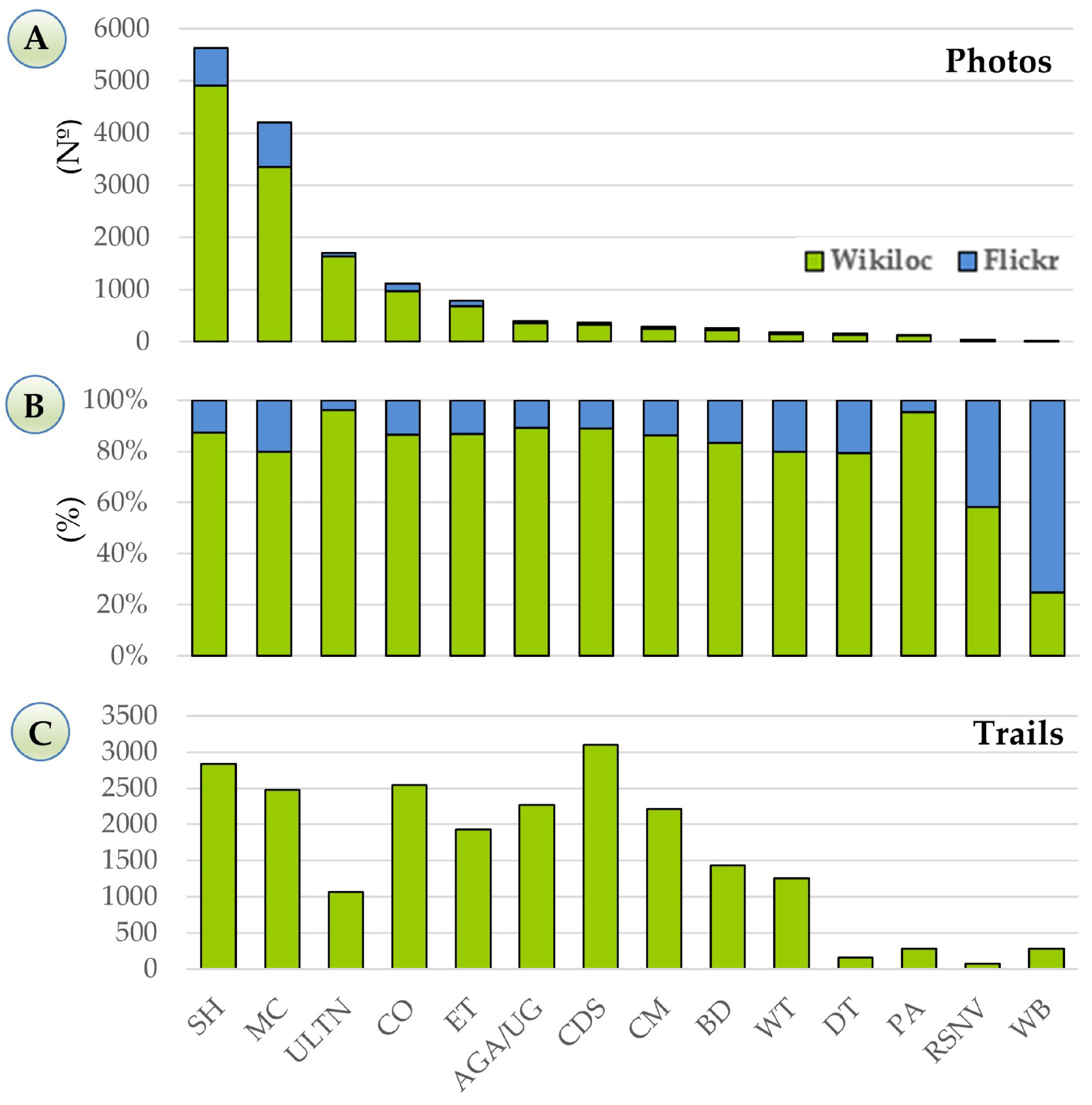
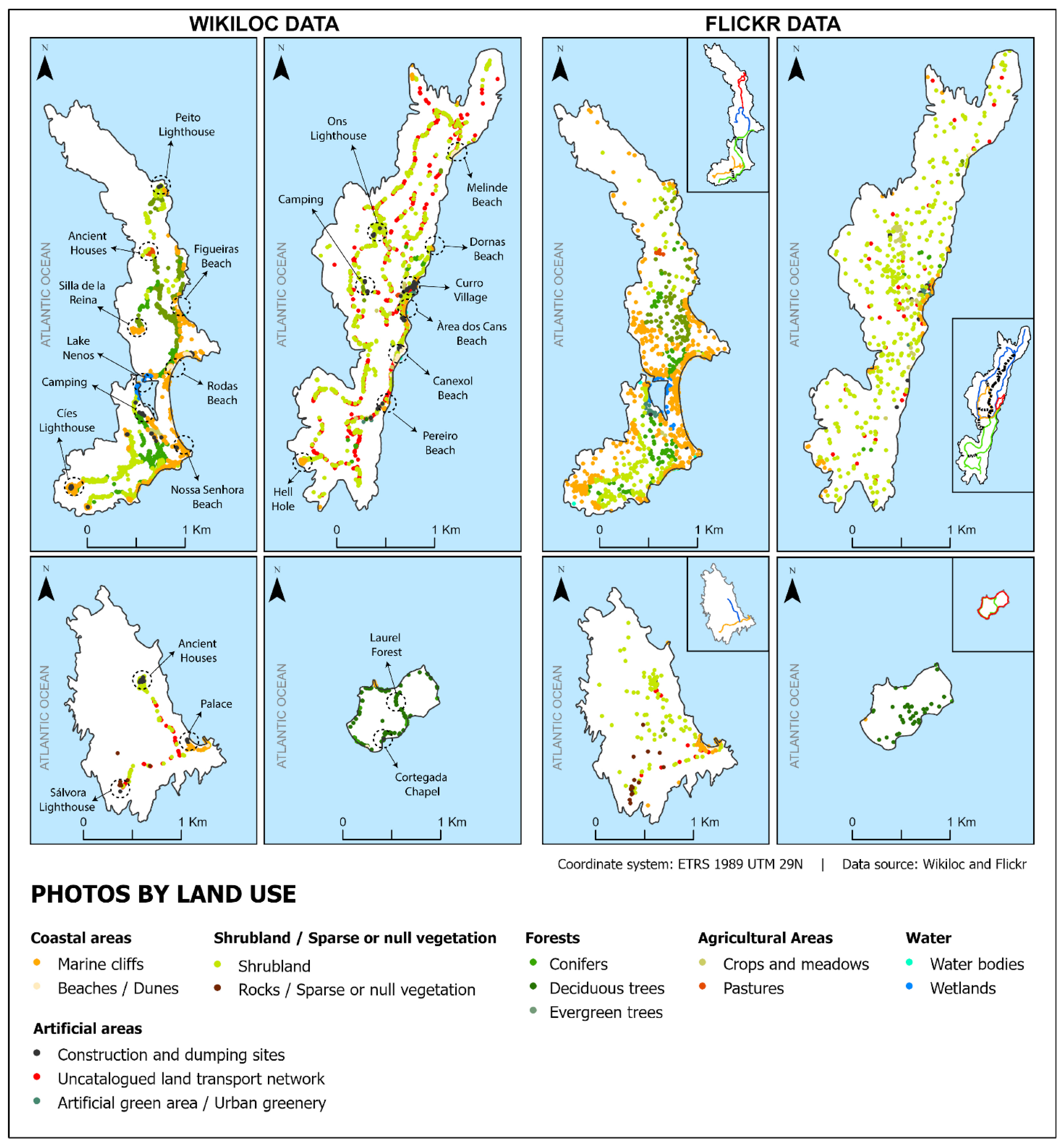
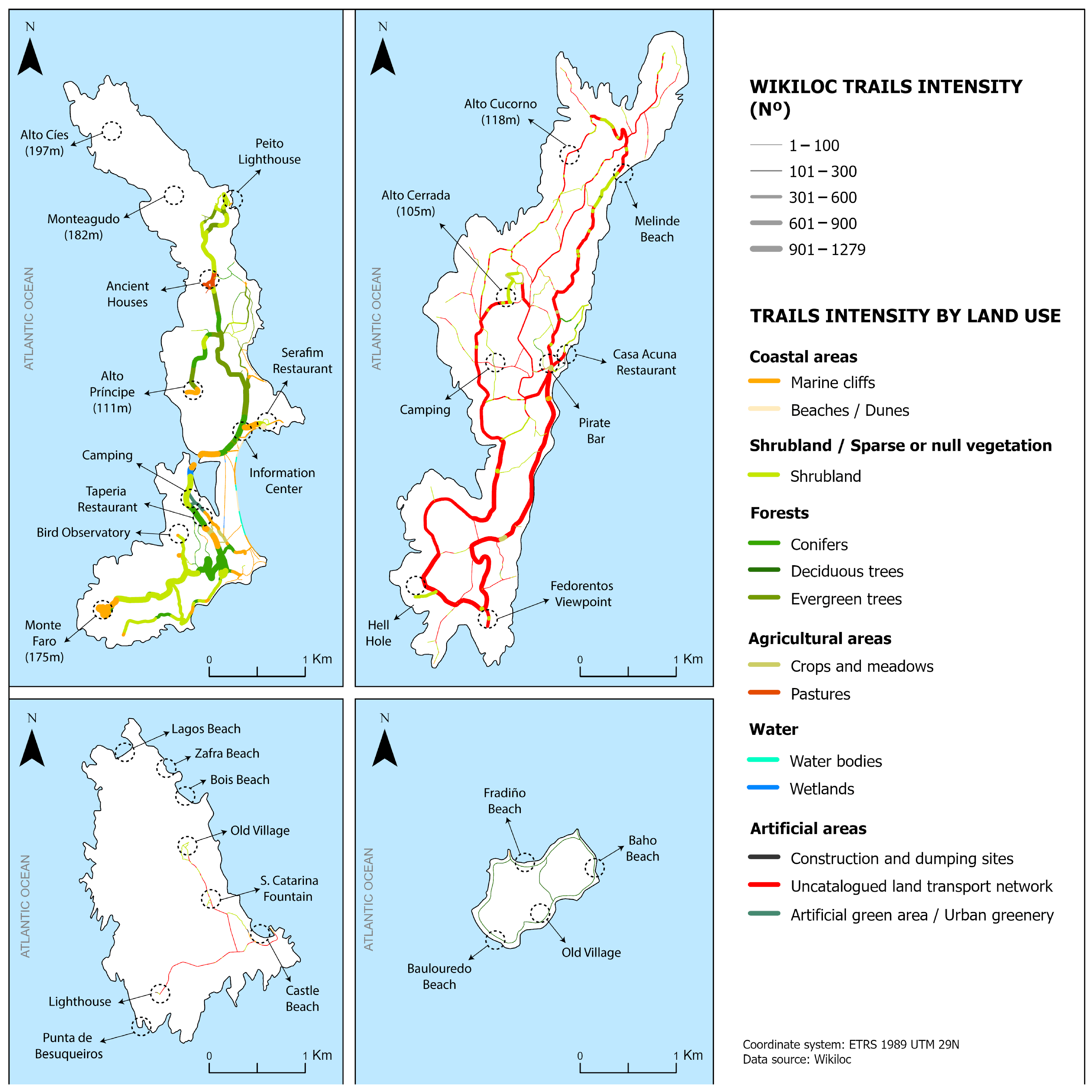
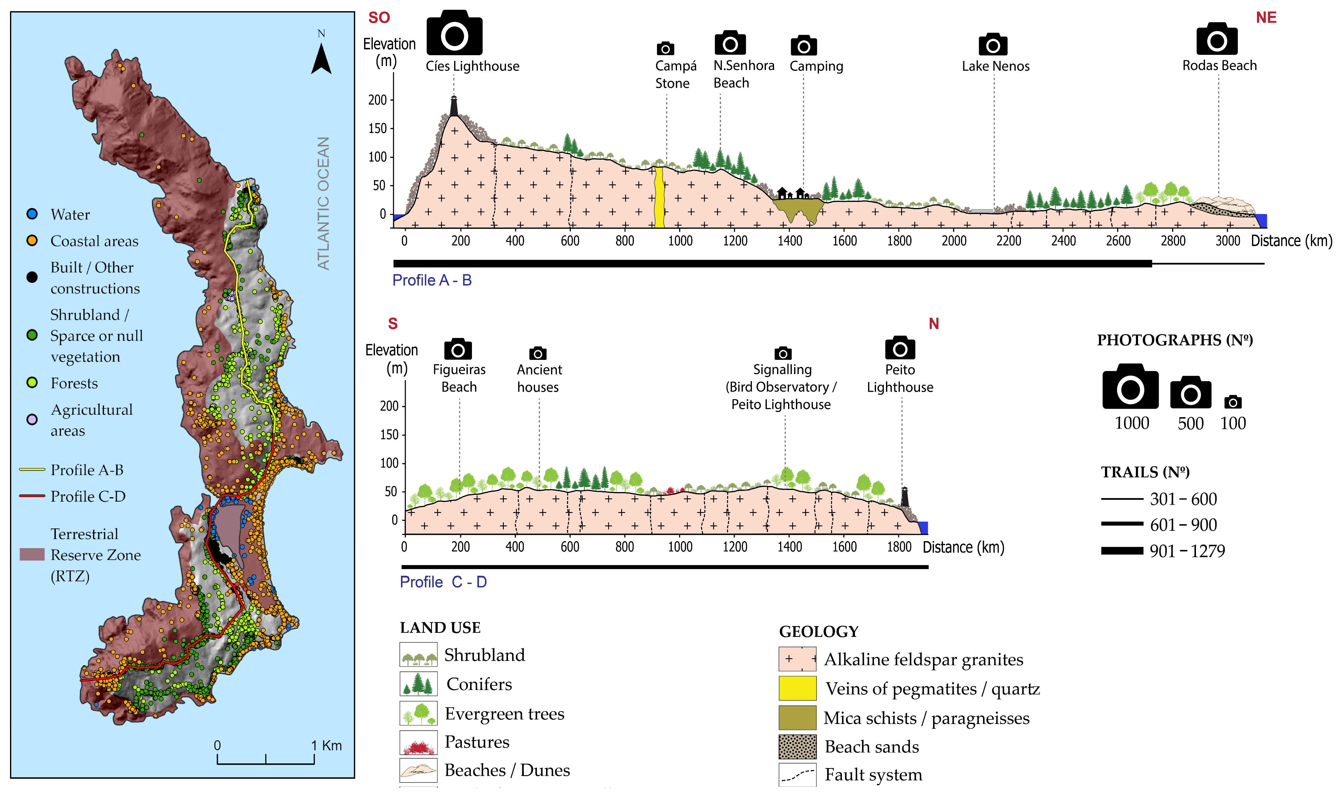
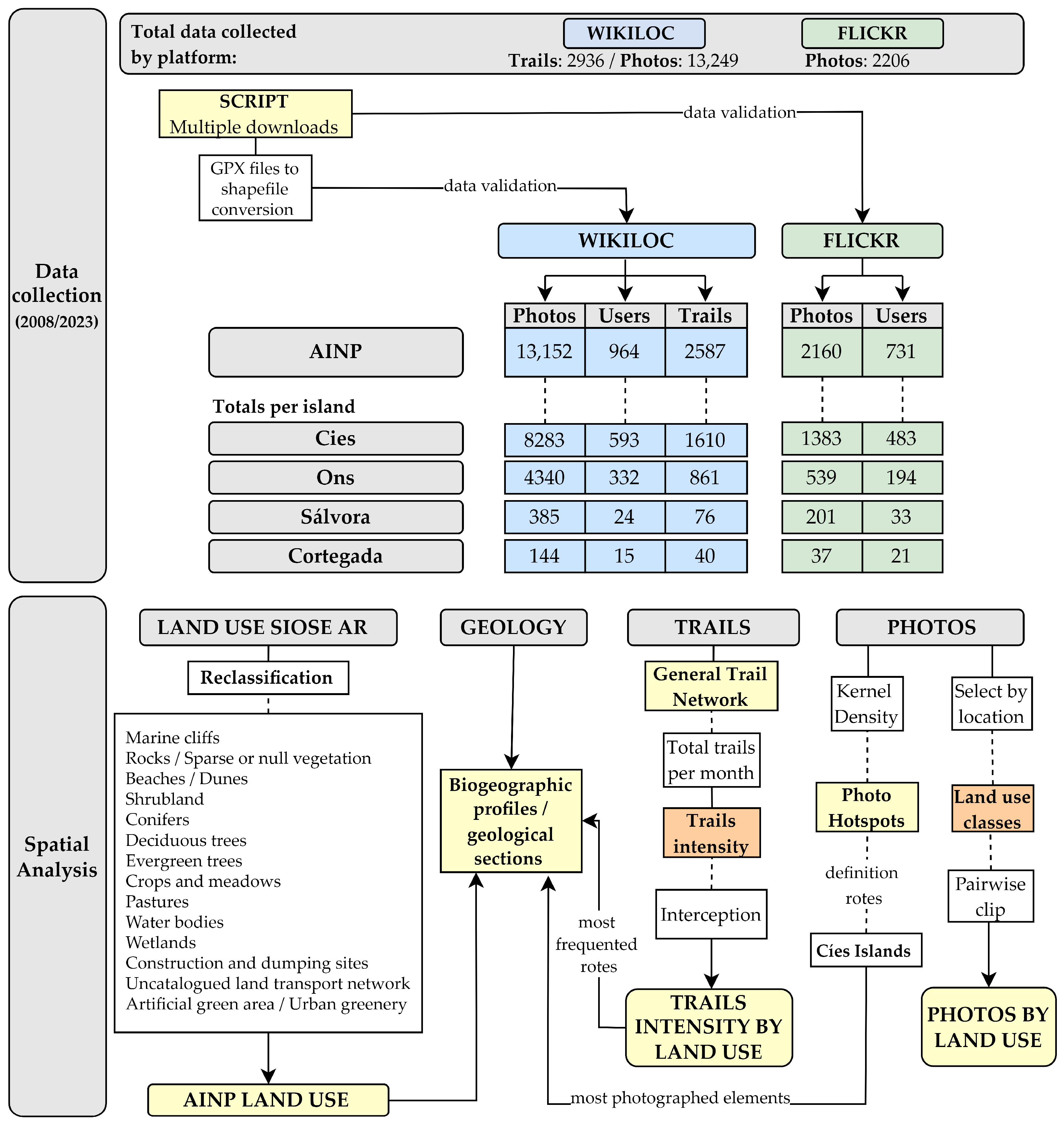
Overcrowding in national parks and protected areas can cause irreversible damage to the environment, compromising the quality of soil, water, wildlife, and vegetation. Thus, it is critical for park managers to have detailed information on visitor activities and spatial dynamics in order to prioritise actions capable of mitigating undesirable impacts in the most frequently visited areas. In this article, we use georeferenced trails and photographs from the Wikiloc and Flickr web platforms to determine the spatial visitation patterns in the Atlantic Islands of Galicia National Park (AINP) from 2008 to 2023. Maps showing trail usage intensity and the distribution of photographs according to land use allowed us to identify the most frequented land uses by visitors and the areas of highest tourist pressure within the AINP. The results show that distribution patterns vary between platforms. Shrubland (37%) and marine cliffs (27%) were the most photographed land uses by visitors, while artificial areas (14%) were the most frequented by Wikiloc users. Cíes island emerges as the most popular tourist destination, as evidenced by the greater number of trails and photographs compared to Ons, Sálvora, and Cortegada. This study shows how social media data, specifically trails and geotagged photographs from Wikiloc and Flickr, can support and complement the monitoring of visitor use and impact in protected areas.
Keywords: Wikiloc; Flickr; geotagged photos; trails intensity; land use; spatial patterns; protected areas Wikiloc; Flickr; geotagged photos; trails intensity; land use; spatial patterns; protected areas