Next Issue
Volume 14, September-2
Previous Issue
Volume 14, August-2


Water, Volume 14, Issue 17 (September-1 2022) – 180 articles

Cover Story (view full-size image): 
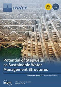
Stepwells are one of the many water-storing structures of ancient India that help us learn and understand hydraulics engineering in the course of human history. Significant progress has been made in our understanding of ancient rainwater gathering and desert agriculture since the researchers in these fields began their initial work only a few decades ago. The remnants of water-harvesting cultures in dry terrain are neither remarkable nor dramatic, but these structures are linked to great architectural and engineering works, and yet the topic is still underappreciated in public and political view. This review looks at not only the innovative solutions and productive uses that were available thousands of years ago, but also what they mean as well as how important they are for problems now and in the long term, since water is and always has been the most valuable resource for humans. View this paper
  • Issues are regarded as officially published after their release is announced to the table of contents alert mailing list.
  • You may sign up for e-mail alerts to receive table of contents of newly released issues.
  • PDF is the official format for papers published in both, html and pdf forms. To view the papers in pdf format, click on the "PDF Full-text" link, and use the free Adobe Reader to open them.
Order results
Result details
Section
Select all
Export citation of selected articles as:
2 pages, 181 KiB  
Editorial
Evaluation of Reanalysis Data in Meteorological and Climatological Applications: Spatial and Temporal Considerations
by Theodoros Mavromatis
Water 2022, 14(17), 2769; https://doi.org/10.3390/w14172769 - 05 Sep 2022
Cited by 1 | Viewed by 1221
Abstract
Reanalysis datasets are among the most used gridded data for the study of weather and climate [...] Full article
17 pages, 4383 KiB  
Article
Attribution Analysis of Runoff in the Upper Reaches of Jinsha River, China
by Le Wang, Hui Cao, Yurong Li, Baofei Feng, Hui Qiu and Hairong Zhang
Water 2022, 14(17), 2768; https://doi.org/10.3390/w14172768 - 05 Sep 2022
Cited by 3 | Viewed by 1737
Abstract
The upper Jinsha River is an important ecological reserve and hydropower energy base in China. This paper uses relative importance analysis to analyze the causes of runoff changes from the perspectives of early runoff, rainfall, snowfall, evaporation and soil water content. The results [...] Read more.
The upper Jinsha River is an important ecological reserve and hydropower energy base in China. This paper uses relative importance analysis to analyze the causes of runoff changes from the perspectives of early runoff, rainfall, snowfall, evaporation and soil water content. The results show that the factors influencing runoff in the upper Jinsha River are complex and have significant spatial and temporal heterogeneity. From November to March, the main factor is the runoff in the preceding month, the contribution of which can be more than 85%; from April to May, the runoff is significantly affected by snow, and its contribution in May is more than 65%. The snow affecting the runoff is mainly located near Gangtuo station and Batang station, and its influence has a time lag of about one month, In June, the influence factors of the runoff are quite complicated, and the contribution of the early runoff, rainfall, snow, evaporation and soil water content is relatively close; from July to September, the runoff is mainly influenced by the rainfall above Batang station, its average contribution being more than 50% and higher than 80% in August. Runoff in July and August is mainly affected by the rainfall in the same period, and in September is mainly affected by the rainfall in the preceding month. In October, the main influence factors are runoff and rainfall of the preceding month, and their contributions are more than 70%. Full article
(This article belongs to the Special Issue Hydrological Response to Climate Change)
Show Figures

Figure 1

11 pages, 1870 KiB  
Article
Long-Term Exposure to Polystyrene Nanoplastics Impairs the Liver Health of Medaka
by Yinfeng Zhou, Li Zhao, Haijing Xu, Elvis Genbo Xu, Mingyou Li and Youji Wang
Water 2022, 14(17), 2767; https://doi.org/10.3390/w14172767 - 05 Sep 2022
Cited by 8 | Viewed by 2364
Abstract
Nanoplastic (NP) has become a global environmental concern due to its potentially wide distribution and unknown impacts on organisms. Many laboratory studies have reported the short-term toxicity of NPs but their long-term effects are unclear. Here, the chronic hepatoxic effects of NPs (diameter [...] Read more.
Nanoplastic (NP) has become a global environmental concern due to its potentially wide distribution and unknown impacts on organisms. Many laboratory studies have reported the short-term toxicity of NPs but their long-term effects are unclear. Here, the chronic hepatoxic effects of NPs (diameter 100 nm; 0, 10, and 104 items/L) in medaka (Oryzias latipes) were evaluated after three-month exposure by investigating the alterations in enzymatic biomarkers (digestion, oxidative status, and immunity) and histopathology in the liver. The trypsin and chymotrypsin activities of digestive enzymes were induced at a low concentration of NPs (10 items/L) but inhibited at high concentration (104 items/L); only the amylase activity was significantly decreased in all NP-treated medaka. Oxidative stress was also induced by NP exposure, which was indicated by the responsive superoxide dismutase and catalase. Lysozyme was significantly reduced after exposure to a high concentration of NPs, while alkaline phosphatase was significantly induced at a low concentration. Exposure to NPs also caused liver damage (e.g., congestion and dilated sinusoids). Taken together, our findings show that chronic exposure to NPs at low particle concentrations can impair the liver health of medaka by affecting liver enzymatic functions and causing histological damage. This implies potentially long-term threats of NPs to aquatic organisms, which call for more long-term aquatic toxicological studies on various species using low environmental concentrations. Full article
Show Figures

Graphical abstract

16 pages, 3533 KiB  
Article
A Study on the Optimal Deep Learning Model for Dam Inflow Prediction
by Beom-Jin Kim, You-Tae Lee and Byung-Hyun Kim
Water 2022, 14(17), 2766; https://doi.org/10.3390/w14172766 - 05 Sep 2022
Cited by 4 | Viewed by 2052
Abstract
In the midst of climate change, the need for accurate predictions of dam inflow to reduce flood damage along with stable water supply from water resources is increasing. In this study, the process and method of selecting the optimal deep learning model using [...] Read more.
In the midst of climate change, the need for accurate predictions of dam inflow to reduce flood damage along with stable water supply from water resources is increasing. In this study, the process and method of selecting the optimal deep learning model using hydrologic data over the past 20 years to predict dam inflow were shown. The study area is Andong Dam and Imha Dam located upstream of the Nakdong River in South Korea. In order to select the optimal model for predicting the inflow of two dams, sixteen scenarios (2 × 2 × 4) are generated considering two dams, two climatic conditions, and four deep learning models. During the drought period, the RNN for Andong Dam and the LSTM for Imha Dam were selected as the optimal models for each dam, and the difference between observations was the smallest at 4% and 2%, respectively. In typhoon conditions, the GRU for Andong Dam and the RNN for Imha Dam were selected as optimal models. In the case of Typhoon Maemi, the GRU and the RNN showed a difference of 2% and 6% from the observed maximum inflow, respectively. The optimal recurrent neural network-based models selected in this study showed a closer prediction to the observed inflow than the SFM, which is currently used to predict the inflow of both dams. For the two dams, different optimal models were selected according to watershed characteristics and rainfall under drought and typhoon conditions. In addition, most of the deep learning models were more accurate than the SFM under various typhoon conditions, but the SFM showed better results under certain conditions. Therefore, for efficient dam operation and management, it is necessary to make a rational decision by comparing the inflow predictions of the SFM and deep learning models. Full article
Show Figures

Figure 1

17 pages, 3737 KiB  
Article
Land-Use Pattern as a Key Factor Determining the Water Quality, Fish Guilds, and Ecological Health in Lotic Ecosystems of the Asian Monsoon Region
by Blandina Genes Kakore, Md Mamun, Sang-Jae Lee and Kwang-Guk An
Water 2022, 14(17), 2765; https://doi.org/10.3390/w14172765 - 05 Sep 2022
Cited by 2 | Viewed by 1863
Abstract
Land-use patterns influence water quality in lotic ecosystems worldwide; consequently, deteriorating water quality affects fish communities and composition and the ecological health of water bodies. This study aimed to evaluate how land use, stream order, and elevation regulate water quality and ecological health [...] Read more.
Land-use patterns influence water quality in lotic ecosystems worldwide; consequently, deteriorating water quality affects fish communities and composition and the ecological health of water bodies. This study aimed to evaluate how land use, stream order, and elevation regulate water quality and ecological health in 64 streams based on the following four land cover types: namely, forest, agriculture, urban upstream, and urban downstream regions. Spatial analysis revealed that urban downstream areas had higher nutrient concentrations [total phosphorus (TP) as follows: 117 µg/L; total nitrogen (TN): 5.57 mg/L] and organic pollutants [chemical oxygen demand (COD): 7.71] than other regions. Empirical analysis indicated that TP (R2 = 0.46) had a high relation with chlorophyll-a (Chl-a) compared to TN (R2 = 0.23) and TN:TP (R2 = 0.20). Elevation, stream order, and monsoon season significantly impact nutrients, organic matter, suspended particles, ionic content, and algal chlorophyll concentrations. The index of biotic integrity (IBI) was significantly positively correlated with elevation (R2 = 0.387), indicating that forest streams (high elevation) had better water quality and ecological health than lower-elevation streams. The proportion of insectivore species shows a significant negative relationship with biological oxygen demand (BOD) (R2 = 0.123) and TP (R2 = 0.155). The multi-metric index of biotic integrity (IBI) model suggested that the ecological health of forest streams was in fair condition. In contrast, agricultural streams were in poor condition, and urban upstream and downstream were in very poor conditions. The outcomes of this study indicated that land-use patterns and elevation largely regulate the water quality and ecological health of the streams. Full article
Show Figures

Figure 1

18 pages, 3542 KiB  
Article
Mathematical Model for the Movement of Two-Pipe Vehicles in a Straight Pipe Section
by Xiaomeng Jia, Xihuan Sun and Yongye Li
Water 2022, 14(17), 2764; https://doi.org/10.3390/w14172764 - 05 Sep 2022
Viewed by 1191
Abstract
In the design process for a two-pipe vehicles transportation system, some simple mathematical models are required to quickly calculate the main characteristics of the system. For this purpose, an easy-to-handle mathematical model for the concentric annular gap flow is proposed, and the velocity [...] Read more.
In the design process for a two-pipe vehicles transportation system, some simple mathematical models are required to quickly calculate the main characteristics of the system. For this purpose, an easy-to-handle mathematical model for the concentric annular gap flow is proposed, and the velocity expression for the concentric annular gap flow is solved using cylindrical coordinates. According to the force characteristics of the two-pipe vehicles, a mathematical model of the two-pipe vehicle motion is established, and the motion and force balance equations of the two-pipe vehicles are deduced. The experimental results are in good agreement with the model results. The factors affecting the two-pipe vehicles movement speed are analyzed, and the standard regression coefficient method in multiple regression analysis is used to determine the influence degree of each factor on the movement speed of the two-pipe vehicles. The research presented in this paper not only enriches the annular gap flow theory, but also provides a theoretical reference for the development of the two-pipe vehicles transportation technology and provides technical support for the realization of relevant industrial applications. Full article
(This article belongs to the Section Hydraulics and Hydrodynamics)
Show Figures

Figure 1

15 pages, 4590 KiB  
Article
Long-Term Trend and Inter-Annual Variation of Ocean Heat Content in the Bohai, Yellow, and East China Seas
by Min Yang, Xinyu Guo, Junyong Zheng and Qun Sun
Water 2022, 14(17), 2763; https://doi.org/10.3390/w14172763 - 05 Sep 2022
Cited by 1 | Viewed by 1914
Abstract
The long-term trend and interannual variation of ocean heat content (OHC) in the Bohai Sea, Yellow Sea, and East China Sea (BYECS) were examined using 27 years (1993–2019) of daily reanalysis data from the Japan Coastal Ocean Predictability Experiment 2 (JCOPE2M). The annual [...] Read more.
The long-term trend and interannual variation of ocean heat content (OHC) in the Bohai Sea, Yellow Sea, and East China Sea (BYECS) were examined using 27 years (1993–2019) of daily reanalysis data from the Japan Coastal Ocean Predictability Experiment 2 (JCOPE2M). The annual mean OHC was 4.25 × 10²¹ J, with a linear warming rate of 0.13 W m−2 with a confidence level of 95%. The spatial distributions for the annual and linear trends of OHC in the BYECS were inhomogeneous, and a considerable quantity of heat was stored on the outer shelf. The warming rate was considerably elevated in the areas northeast of Taiwan and southwest of Kyushu, showing a rate greater than that of the Pacific and global oceans by a factor of 4–5. Heat budget analysis indicated that the Taiwan Strait (TAS) is the dominant source of heat for the BYECS. The mechanisms of the OHC interannual variation in the outer and inner shelves varied. On the outer shelf, the OHC interannual variation was dependent on the Kuroshio onshore intrusion, while on the inner shelf, the OHC interannual variation was related to the variation in air-sea heat flux. The rapid warming in the outer shelf corresponded to the increasing trends of heat transport across northeast Taiwan and southwest Kyushu, which were dominated by the temporal variation of current velocity. Full article
(This article belongs to the Special Issue Coastal and Continental Shelf Dynamics in a Changing Climate II)
Show Figures

Figure 1

20 pages, 1754 KiB  
Review
Review of Groundwater Withdrawal Estimation Methods
by Marco Antonio Meza-Gastelum, José Rubén Campos-Gaytán, Jorge Ramírez-Hernández, Claudia Soledad Herrera-Oliva, José Juan Villegas-León and Alejandro Figueroa-Núñez
Water 2022, 14(17), 2762; https://doi.org/10.3390/w14172762 - 05 Sep 2022
Cited by 3 | Viewed by 2043
Abstract
The demand for groundwater resources in arid and semi-arid regions has increased due to their progressive use in agriculture, industry and domestic activities. Among the difficulties and uncertainties that arise when managing groundwater resources is the calculation of groundwater withdrawals (GWW). The objective [...] Read more.
The demand for groundwater resources in arid and semi-arid regions has increased due to their progressive use in agriculture, industry and domestic activities. Among the difficulties and uncertainties that arise when managing groundwater resources is the calculation of groundwater withdrawals (GWW). The objective of this research work is to review the existing literature on the methods developed to estimate GWW by providing a summary of the advances, limitations and opportunities that the different methods developed on this topic could offer by identifying, categorizing and synthesizing the studies with a focus on developing a systematic guide so that researchers and practitioners conducting GWW studies can be informed of the most popular techniques, and the authors’ experiences in recent years. Therefore, a literature search was conducted in the EEE, Google Scholar, SCOPUS, SpringerLink, ScienceDirect, Taylor & Francis Group and Wiley-Blackwell databases, using the following keywords: Groundwater AND (Withdrawal OR Pumping OR Abstraction) AND (Prediction OR Estimation). Thirty-four journal articles published between 1970 and 2021 were chosen based on the selection criteria, characteristics and capabilities of the approaches used for evaluation in GWW extraction. We concluded that the different methods for groundwater pumping estimation that have been reviewed in this work have advantages and disadvantages in their application. Direct approaches are very old and are still working uncertainty in their application is presented with possible human errors or in the measurement system. On the other hand, indirect methods have evolved along with technological advances, which have brought significant improvements and accuracy to these approaches. Full article
(This article belongs to the Section Hydrogeology)
Show Figures

Figure 1

19 pages, 3434 KiB  
Article
Study on the Sources of Salinity of Groundwater in Holocene and Late Pleistocene Sediments Based on Hydrochemical and Isotopic Methods in Southern Laizhou Bay
by Yawen Chang, Xuequn Chen, Qinghua Guan, Chanjuan Tian, Dan Liu and Dandan Xu
Water 2022, 14(17), 2761; https://doi.org/10.3390/w14172761 - 05 Sep 2022
Cited by 3 | Viewed by 1501
Abstract
A survey of the hydrochemistry and isotopes of the Quaternary aquifer on the southern coast of Laizhou Bay provides new insights into the hydrodynamic and geochemical relationships between freshwater, seawater, and brine at different depths in coastal sediments. This study used a combination [...] Read more.
A survey of the hydrochemistry and isotopes of the Quaternary aquifer on the southern coast of Laizhou Bay provides new insights into the hydrodynamic and geochemical relationships between freshwater, seawater, and brine at different depths in coastal sediments. This study used a combination of groundwater level analysis, hydrochemistry, and isotopic methods to study the chemical characteristics of groundwater and the origin of groundwater recharge and salinity. Because the sedimentary structure of the area and the formation background of saltwater were important factors controlling the distribution of groundwater, we analyzed the distribution of groundwater in Holocene and Late Pleistocene sediments. The variation of groundwater levels in the Holocene and Late Pleistocene sediments in the saline–freshwater transition zone over time showed that the Holocene and Late Pleistocene groundwater flow directions differed in the saltwater–freshwater transition zone. From south to north in the study area, the hydrochemical types of groundwater in the Holocene and Late Pleistocene sediments were as follows: HCO3-Ca (freshwater), SO4-Mg and HCO3-Ca (brackish water), Cl-Na·Mg (saltwater), and Cl-Na (brine). The results of the hydrochemical and isotopic studies indicated that the saltwater in the Holocene and Late Pleistocene sediments and the brine in the Late Pleistocene sediments were the result of evaporation. The salinity of freshwater in the Holocene sediments was produced by rock weathering, while the salinity of freshwater in the Late Pleistocene sediments was not only derived from rock weathering, but was also affected by evaporation and precipitation. The salinity of brackish water in the Holocene and Late Pleistocene sediments was derived from evaporation and precipitation. Ultimately, the origin of groundwater recharge in the Holocene and Late Pleistocene sediments was atmospheric precipitation. Full article
(This article belongs to the Special Issue Coastal Aquifers: Seawater/Saltwater Intrusion)
Show Figures

Figure 1

12 pages, 3816 KiB  
Article
Determining Soil Available Water Capacity and Reasonable Irrigation Volume in Dryland Pasture
by Ruijun Jiang, Tonglu Li, Zhijie Jia and Yonglu Dong
Water 2022, 14(17), 2760; https://doi.org/10.3390/w14172760 - 05 Sep 2022
Cited by 1 | Viewed by 1671
Abstract
Among the methods used to describe soil-available water in terms of yield, field water capacity and permanent wilting coefficient were considered as the upper and lower boundaries, respectively, for normal plant growth. This study investigated the soil properties and groundwater resources of the [...] Read more.
Among the methods used to describe soil-available water in terms of yield, field water capacity and permanent wilting coefficient were considered as the upper and lower boundaries, respectively, for normal plant growth. This study investigated the soil properties and groundwater resources of the Hailiutu pasture in Inner Mongolia, China. Soil water characteristics and hydraulic conductivity function curves of the pasture soil were measured based on filter paper method. Experimental results showed that air-entry and residual value were determined to be 34.6% and 13.1%, corresponding to the field water capacity and permanent wilting coefficient, respectively, and the available water capacity was 218.0 mm. The downward velocity of the soil wetting front in the silt is 3.0 mm/h. Site investigation revealed that the pasture was a natural capillary barrier, and its critical suction could optimize the upper boundary of irrigation. Considering the limited underground water resources, shallow water level, and the transpiration of Caragana Korshinskii in the pasture, an available drip irrigation method was designed. The spacing between drip irrigation pipes is 60 cm, the spacing between drip holes is 60 cm, the drip irrigation volume per hole is 475.2~838.8 mL/d, the drip irrigation time is 110~200 min at each night. Each hectare pasture exhausts 13.5~22.5 m3 water each day. Field tests showed that the proposed method is feasible and can be used for irrigation in dryland pastures. Full article
Show Figures

Figure 1

18 pages, 4300 KiB  
Article
Research on Temporal and Spatial Differentiation and Impact Paths of Agricultural Grey Water Footprints in the Yellow River Basin
by Ruifan Xu, Jianwen Shi, Dequan Hao, Yun Ding and Jianzhong Gao
Water 2022, 14(17), 2759; https://doi.org/10.3390/w14172759 - 05 Sep 2022
Cited by 4 | Viewed by 1602
Abstract
The scientific evaluation of water pollution in the Yellow River Basin was directly related to the sustainable utilization of water resources and the green development of the agricultural economy in this region. In this study, we focused on the planting industry, and measured [...] Read more.
The scientific evaluation of water pollution in the Yellow River Basin was directly related to the sustainable utilization of water resources and the green development of the agricultural economy in this region. In this study, we focused on the planting industry, and measured the agricultural grey water footprint of 73 prefecture-level cities in the Yellow River Basin from 2000 to 2019. We used spatial autocorrelation analysis to reveal temporal and spatial differentiation characteristics, and we used the path analysis method to study the factors influencing the temporal evolution and spatial distribution. Taking 2015 as the study period, the agricultural grey water footprint showed a trend of first rising and then falling. The values and growth rates of the agricultural grey water footprint in different regions were quite different. According to the natural breakpoint method, the agricultural grey water footprints were divided into low, middle, high, and very high groups. There were obvious spatial differences in the agricultural grey water footprints, and these differences gradually decreased. Generally, the H–L and the L–L types were dominant. From 2000 to 2019, most prefecture-level cities maintained the same transition changes as those in the neighboring regions. Crop yield, economic scale, population scale, urban and rural structure, and technological innovation were found to be the key elements of spatiotemporal variation in the agricultural grey water footprint. Full article
(This article belongs to the Special Issue Soil and Water Pollution in Agriculture)
Show Figures

Figure 1

23 pages, 6005 KiB  
Article
Product- and Hydro-Validation of Satellite-Based Precipitation Data Sets for a Poorly Gauged Snow-Fed Basin in Turkey
by Gökçen Uysal
Water 2022, 14(17), 2758; https://doi.org/10.3390/w14172758 - 05 Sep 2022
Cited by 4 | Viewed by 2038
Abstract
Satellite-based Precipitation (SBP) products are receiving growing attention, and their utilization in hydrological applications is essential for better water resource management. However, their assessment is still lacking for data-sparse mountainous regions. This study reveals the performances of four available PERSIANN family products of [...] Read more.
Satellite-based Precipitation (SBP) products are receiving growing attention, and their utilization in hydrological applications is essential for better water resource management. However, their assessment is still lacking for data-sparse mountainous regions. This study reveals the performances of four available PERSIANN family products of low resolution near real-time (PERSIANN), low resolution bias-corrected (PERSIANN-CDR), and high resolution real-time (PERSIANN-CCS and PERSIANN-PDIR-Now). The study aims to apply Product-Validation Experiments (PVEs) and Hydro-Validation Experiments (HVEs) in a mountainous test catchment of the upper Euphrates Basin. The PVEs are conducted on different temporal scales (annual, monthly, and daily) within four seasonal time periods from 2003 to 2015. HVEs are accomplished via a multi-layer perceptron (MLP)-based rainfall-runoff model. The Gauge-based Precipitation (GBP) and SBP are trained and tested to simulate daily streamflows for the periods of 2003–2008 and 2009–2011 water years, respectively. PVEs indicate that PERSIANN-PDIR-Now comprises the least mean annual bias, and PERSIANN-CDR gives the highest monthly correlation with the GBP data. According to daily HVEs, MLP provides a compromising alternative for biased data sets; all SBP models show reasonably high Nash–Sutcliffe Efficiency for the training (above 0.80) and testing (0.62) periods, while the PERSIANN-CDR-based MLP (0.88 and 0.79) gives the highest performance. Full article
Show Figures

Figure 1

19 pages, 9037 KiB  
Article
Numerical Simulation of Axial-Flow Pump Cavitation Based on Variable Frequency Speed Regulation
by Jincheng Ye, Linwei Tan, Weidong Shi, Cheng Chen and Egbo Munachi Francis
Water 2022, 14(17), 2757; https://doi.org/10.3390/w14172757 - 04 Sep 2022
Cited by 1 | Viewed by 1466
Abstract
In order to investigate the influence of variable voltage and variable frequency (VVVF) regulation on the cavitation performance of the axial-flow pump, numerical simulation and experiments were used to analyze the cavitation performance of an axial-flow pump under different VVVF modes. The VVVF [...] Read more.
In order to investigate the influence of variable voltage and variable frequency (VVVF) regulation on the cavitation performance of the axial-flow pump, numerical simulation and experiments were used to analyze the cavitation performance of an axial-flow pump under different VVVF modes. The VVVF modes were uniform acceleration with constant acceleration, variable acceleration with increasing acceleration, variable acceleration with decreasing acceleration, and its corresponding deceleration scheme. Furthermore, a comprehensive performance test rig was built for the pump to carry out cavitation visualization tests which verified the accuracy of numerical simulation. For the uniform acceleration scheme with constant acceleration, the change of flow field inside the impeller was stable, the expansion rate of cavitation was slow, and the growth rate of the cavitation volume was the slowest. For the variable acceleration scheme with decreasing acceleration, the cavitation extended rapidly due to the large initial velocity. For the variable acceleration scheme with increasing acceleration, cavitation extension was the slowest. The growth rate of the cavity volume of the two variable acceleration schemes was faster than that of the uniform acceleration scheme, and the changing trend was consistent. This feature indicates that the impeller rotation speed has a significant impact on cavitation, and excessive rotation speed will rapidly extend the cavitation. By monitoring the influence of cavitation on pressure distribution under VVVF, it was shown that the three acceleration schemes all produce large pressure fluctuation. For the uniform acceleration scheme with constant acceleration, the fluctuation range of pressure was more balanced, and the pressure dropped slowly. For the acceleration scheme with higher acceleration, the pressure fluctuation amplitude increased in the late stage of acceleration and the pressure decline speed accelerated. For the acceleration scheme with decreasing acceleration, the pressure showed a downward trend with violent fluctuations in the early stage and gradually tended to be flat in the late stage. Full article
(This article belongs to the Special Issue CFD in Fluid Machinery Design and Optimization)
Show Figures

Figure 1

20 pages, 5019 KiB  
Article
Economic Viability and Seasonal Impacts of Integrated Rice-Prawn-Vegetable Farming on Agricultural Households in Southwest Bangladesh
by Md. Mehedi Alam, Kishor Kumar Tikadar, Neaz A. Hasan, Rabeya Akter, Abul Bashar, A. K. Shakur Ahammad, Mohammad Mahmudur Rahman, Md Rushna Alam and Mohammad Mahfujul Haque
Water 2022, 14(17), 2756; https://doi.org/10.3390/w14172756 - 04 Sep 2022
Cited by 8 | Viewed by 3126
Abstract
Integrated aquaculture is an efficient method to address food scarcity and land resources. This study analysed the impacts of integrated rice–prawn–vegetable farms (RPVF) compared with conventional rice farms (CRF) on farming households in southwest Bangladesh, in terms of cropping pattern, financial profitability and [...] Read more.
Integrated aquaculture is an efficient method to address food scarcity and land resources. This study analysed the impacts of integrated rice–prawn–vegetable farms (RPVF) compared with conventional rice farms (CRF) on farming households in southwest Bangladesh, in terms of cropping pattern, financial profitability and viability, and cash-flow. Data were collected through face-to-face recall interviews from farmers of CRF and RPVF. For RPVF, farmers cultivated diverse produce in the wet season, such as prawn/shrimp, carps in reservoirs and vegetables on dikes, and boro rice with vegetables in the dry season, whereas only rice was cultivated in both seasons for CRF. The annual hectare−1 net revenue from integrated RPVF was USD 2742.7, 3.6 times higher than for CRF (USD 756.6). RPVF had a higher undiscounted benefit–cost ratio (BCR) of 1.58 as compared with 1.34 for CRF. Net Present Value (NPV) and discounted BCR show that the integrated RPVF has higher potential and profitability than CRF. Year-round vegetable production and selling have resulted in a smooth cash-flow in integrated RPVF. Authorised extension agencies, such as the Department of Fisheries and Department of Agricultural Extension collaboratively can promote RPVF in other potential parts of Bangladesh, through which farmers can benefit year after year by investing farm income for the same farm and envisage food security. Full article
(This article belongs to the Special Issue Aquaculture and Nutrition)
Show Figures

Figure 1

31 pages, 12020 KiB  
Article
Effects of Environmental Factors on Suspended Sediment Plumes in the Continental Shelf Out of Danshuei River Estuary
by Wen-Cheng Liu, Hong-Ming Liu and Chih-Chieh Young
Water 2022, 14(17), 2755; https://doi.org/10.3390/w14172755 - 04 Sep 2022
Cited by 3 | Viewed by 2136
Abstract
The effects of environmental factors on suspended sediment plumes in the continental shelf out of the Danshuei River estuary were numerically investigated using an unstructured-grid three-dimensional hydrodynamic model (SCHISM) together with a suspended sediment (SS) module. The coupled model (SCHISM-SS) was calibrated and [...] Read more.
The effects of environmental factors on suspended sediment plumes in the continental shelf out of the Danshuei River estuary were numerically investigated using an unstructured-grid three-dimensional hydrodynamic model (SCHISM) together with a suspended sediment (SS) module. The coupled model (SCHISM-SS) was calibrated and validated against the in situ measurement data in 2016. Consistent with the observation results, the model simulations satisfactorily reproduced the water levels, velocities, salinities, and suspended sediment concentrations. The model was then applied to explore the role of various environmental factors in the dynamics of suspended sediment plumes from the estuary to the adjacent coastal seas. These factors include tidal forcing, salinity, river discharge, and wind stress. Analysis and comparisons of different scenario results indicated that the suspended sediment plume was greatly affected by tides, e.g., a longer plume distance resulted from a larger flux under tidal motions. A higher sediment concentration in the plume in the offshore area was also found during the neap tide, relative to that observed during the spring tide. In addition, salinity affects the movement of density currents and the spread of the sediment plume, i.e., the plume distance is longer due to the residual circulation when a salinity difference is present. Further, an extreme river flow could occur during typhoon periods and would discharge a greater water volume into the coastal region, causing the suspended sediment plume to expand from the near shore. Finally, the directions of prevailing winds can slightly influence the sediment plumes. Full article
(This article belongs to the Special Issue Marine Environmental Research)
Show Figures

Figure 1

17 pages, 4431 KiB  
Article
Effects of Climatic Variability on Soil Water Content in an Alpine Kobresia Meadow, Northern Qinghai–Tibetan Plateau, China
by Mengke Si, Xiaowei Guo, Yuting Lan, Bo Fan and Guangmin Cao
Water 2022, 14(17), 2754; https://doi.org/10.3390/w14172754 - 04 Sep 2022
Cited by 3 | Viewed by 1603
Abstract
Soil moisture dynamics play an active role in ecological and hydrological processes. Although the variation of the soil water moisture of multiple ecosystems have been well-documented, few studies have focused on soil hydrological properties by using a drying and weighing method in a [...] Read more.
Soil moisture dynamics play an active role in ecological and hydrological processes. Although the variation of the soil water moisture of multiple ecosystems have been well-documented, few studies have focused on soil hydrological properties by using a drying and weighing method in a long time series basis in the Qinghai-Tibet Plateau (QTP). In this study, 13 year (2008–2020) time-series observational soil moisture data and environmental factors were analyzed in a humid alpine Kobresia meadow on the Northern Qinghai–Tibetan Plateau. The results showed no significant upward trend in soil water content during the 2008–2020 period. In the growth season (May–October), the soil water content showed a trend of decreasing firstly, then increasing, and finally, decreasing. Correlation analysis revealed that five meteorology factors (temperature, humidity, net radiation, dew point temperature, and vapor pressure) and a biomass element (above-ground biomass) had a significant effect on the soil moisture, and air temperature impacted the soil water variation negatively in 0–50 cm, indicating that global warming would reduce soil moisture. Humidity and net radiation made a difference on shallow soil (0–10 cm), while dew point temperature and vapor pressure played a role on the deep soil (30–50 cm). Above-ground biomass only effected 30–50 cm soil moisture variation, and underground biomass had little effect on the soil moisture variation. This indirectly indicated that below-ground biomass is not limited by soil moisture. These results provide new insights for the rational allocation of water resources and management of vegetation in alpine meadows, in the context of climate change. Full article
(This article belongs to the Special Issue Impacts of Climate Change on Water Resources and Water Risks)
Show Figures

Figure 1

26 pages, 9725 KiB  
Article
A Coupled SWAT-AEM Modelling Framework for a Comprehensive Hydrologic Assessment
by K. Sangeetha, Balaji Narasimhan and R. Srinivasan
Water 2022, 14(17), 2753; https://doi.org/10.3390/w14172753 - 04 Sep 2022
Cited by 1 | Viewed by 3386
Abstract
This study attempts to integrate a Surface Water (SW) model Soil and Water Assessment Tool (SWAT) with an existing steady-state, single layer, unconfined heterogeneous aquifer Analytic Element Method (AEM) based Ground Water (GW) model, named Bluebird AEM engine, for a comprehensive assessment of [...] Read more.
This study attempts to integrate a Surface Water (SW) model Soil and Water Assessment Tool (SWAT) with an existing steady-state, single layer, unconfined heterogeneous aquifer Analytic Element Method (AEM) based Ground Water (GW) model, named Bluebird AEM engine, for a comprehensive assessment of SW and GW resources and its management. The main reason for integrating SWAT with the GW model is that the SWAT model does not simulate the distribution and dynamics of GW levels and recharge rates. To overcome this issue, often the SWAT model is coupled with the numerical GW model (either using MODFLOW or FEFLOW), wherein the spatial and temporal patterns of the interactions are better captured and assessed. However, the major drawback in integrating the two models (SWAT with—MODFLOW/FEM) is its conversion from Hydrological Response Unit’s (HRU)/sub-basins to grid/elements. To couple them, a spatial translation system is necessary to move the inputs and outputs back and forth between the two models due to the difference in discretization. Hence, for effective coupling of SW and GW models, it may be desirable to have both models with a similar spatial discretization and reduce the need for rigorous numerical techniques for solving the PDEs. The objective of this paper is to test the proof of concept of integrating a distributed hydrologic model with an AEM model at the same spatial units, primarily focused on surface water and groundwater interaction with a shallow unconfined aquifer. Analytic Element Method (AEM) based GW models seem to be ideal for coupling with SWAT due to their innate character to consider the HRU, sub-basin, River, and lake boundaries as individual analytic elements directly without the need for any further discretization or modeling units. This study explores the spatio-temporal patterns of groundwater (GW) discharge rates to a river system in a moist-sub humid region with SWAT-AEM applied to the San Jacinto River basin (SJRB) in Texas. The SW-GW interactions are explored throughout the watershed from 2000–2017 using the integrated SWAT-AEM model, which is tested against stream flow and GW levels. The integrated SWAT-AEM model results show good improvement in predicting the stream flow (R2 = 0.65–0.80) and GW levels as compared to the standalone SWAT model. Further, the integrated model predicted the low flows better compared to the standalone SWAT model, thus accounting for the SW-GW interactions. Almost 80% of the stream network experiences an increase in groundwater discharge rate between 2000 and 2017 with an annual average GW discharge rate of 1853 Mm3/year. The result from the study seems promising for potential applications of SWAT-AEM coupling in regions with considerable SW-GW interactions. Full article
(This article belongs to the Special Issue SWAT Modeling - New Approaches and Perspective)
Show Figures

Figure 1

12 pages, 2119 KiB  
Article
Digestate of Fecal Sludge Enhances the Tetracycline Removal in Soil Microbial Fuel Cells
by Han Cui, Jing Wang, Kun Feng and Defeng Xing
Water 2022, 14(17), 2752; https://doi.org/10.3390/w14172752 - 04 Sep 2022
Cited by 1 | Viewed by 1604
Abstract
The soil pollution of agricultural lands is increasingly being caused by the widely used antibiotic tetracycline (TC) in the animal husbandry industry. Soil microbial fuel cells (SMFCs) provide a promising strategy for the bioremediation of contaminated soil. However, our current understanding of the [...] Read more.
The soil pollution of agricultural lands is increasingly being caused by the widely used antibiotic tetracycline (TC) in the animal husbandry industry. Soil microbial fuel cells (SMFCs) provide a promising strategy for the bioremediation of contaminated soil. However, our current understanding of the bioremediation of TC-contaminated soil by SMFC is still limited. Here, we investigated the influence of fecal sludge (FS) digestate on TC biodegradation efficiency and extracellular electron transfer in SMFCs. The addition of FS digestate was beneficial to electricity generation by SMFC, and thus enhanced the removal efficiency of TC in the SMFC. After 25 days, the SMFC with fecal sludge digestate showed a TC removal efficiency of 64.5%, compared to values of 25.2% and 21.4% observed for a SMFC and an open-circuit SMFC operating without the addition of fecal sludge digestate, respectively. Moreover, the addition of FS digestate was favorable for electricity generation by SMFCs, and the average current density and the maximum power density of the SMFC with fecal sludge digestate were 0.054 A/m3 and 8.85 W/m3, respectively. The enrichment of Desulfuromonas and Pseudomonas in the electrode biofilms might account for their high TC removal efficiency and electricity generation. The SMFC with fecal sludge digestate provides a promising approach for the simultaneous disposal of fecal sludge digestate and the bioremediation of antibiotics-contaminated-soil. Full article
(This article belongs to the Special Issue Agricultural Environment and Water Technology)
Show Figures

Graphical abstract

19 pages, 1585 KiB  
Article
Influence of Suspended Mussel Aquaculture and an Associated Invasive Ascidian on Benthic Macroinvertebrate Communities
by Lisa Robichaud, Philippe Archambault, Gaston Desrosiers and Christopher W. McKindsey
Water 2022, 14(17), 2751; https://doi.org/10.3390/w14172751 - 03 Sep 2022
Cited by 1 | Viewed by 1538
Abstract
Many benthic macroinvertebrates are associated with cultured bivalves but are normally excluded from studies on the environmental effects of bivalve aquacultures. We evaluated the hypothesis that mussel aquaculture increases overall “benthic” macroinvertebrate productivity by considering both sediment- and mussel sock-associated macroinvertebrates. It was [...] Read more.
Many benthic macroinvertebrates are associated with cultured bivalves but are normally excluded from studies on the environmental effects of bivalve aquacultures. We evaluated the hypothesis that mussel aquaculture increases overall “benthic” macroinvertebrate productivity by considering both sediment- and mussel sock-associated macroinvertebrates. It was predicted that the presence of the invasive ascidian Styela clava would increase this effect by increasing the mussel sock’s biogenic structure. Macroinvertebrates in sediments and on mussel socks were sampled in eight bays on Prince Edward Island, Canada: three were invaded by Styela clava and there were five where it was absent. Infaunal macroinvertebrates associated with benthic sediments (sediment macroinvertebrates) within leases were less abundant relative to the control locations outside of leases and showed a trend towards decreased biomass and productivity. Abundance of mussel sock-associated macroinvertebrates was greater in bays with S. clava than in bays without it. When sediment and mussel sock macroinvertebrates were considered together as “benthic” communities within mussel leases and compared to sediment macroinvertebrate communities outside of leases, “benthic” macroinvertebrate abundance, biomass, and productivity were greater inside mussel leases than in areas outside of them. The presence of S. clava did not influence this trend. Although the ecological role of the macroinvertebrates associated with suspended mussels is likely not equivalent to those associated with benthic sediments, the presence of macroinvertebrates on suspended mussels, in some measure, offsets the impacts on the abundance, biomass, and productivity of macroinvertebrate communities at the farm-scale. Full article
(This article belongs to the Special Issue Recent Advances in Environmental Interactions of Marine Aquaculture)
Show Figures

Figure 1

18 pages, 4091 KiB  
Article
Brown Trout Upstream Passage Performance for a Fishway with Water Drops between Pools beyond Fish Passage Design Recommendations
by Francisco Javier Bravo-Córdoba, Juan Francisco Fuentes-Pérez, Ana García-Vega, Francisco Jesús Peñas, José Barquín and Francisco Javier Sanz-Ronda
Water 2022, 14(17), 2750; https://doi.org/10.3390/w14172750 - 03 Sep 2022
Cited by 4 | Viewed by 2454
Abstract
This work aims to assess brown trout (Salmo trutta) passage through a free-flow pool-weir-type fishway with hydrodynamic notches and extreme water drops between pools. It consists of an old-school fishway design, commonly constructed in salmon rivers of Spain during the period [...] Read more.
This work aims to assess brown trout (Salmo trutta) passage through a free-flow pool-weir-type fishway with hydrodynamic notches and extreme water drops between pools. It consists of an old-school fishway design, commonly constructed in salmon rivers of Spain during the period of 1950–1980. To assess their performance, a field test was designed with confined trial conditions during the spawning migratory season. The mean water drop between pools was 0.65 m and the total water height considered for the trial was 11.8 m. The monitoring was carried out using PIT telemetry. The initial hypothesis, considering the fishway design and assessment guidelines, classified this structure as hardly insurmountable. Results showed an ascent success of 19% with a median transit time of 29.1 min/m of ascended height. Larger fish and fishway sections with lower values of volumetric power dissipation were related to a better performance in the passage. The results suggest that in certain circumstances, such as limited construction areas where other design or management options are difficult to implement (e.g., canyons), this type of fishway may be an alternative for the upstream passage of at least a small proportion of the brown trout population, although a selection effect is expected. Full article
(This article belongs to the Special Issue Advances and Experiences in Fishway Design and Assessment)
Show Figures

Figure 1

31 pages, 9386 KiB  
Article
Performance Enhancement of Specific Adsorbents for Hardness Reduction of Drinking Water and Groundwater
by Parnian Ghanbarizadeh, Mohammad Mehdi Parivazh, Mohsen Abbasi, Shahriar Osfouri, Mohammad Javad Dianat, Amir Rostami, Mahdieh Dibaj and Mohammad Akrami
Water 2022, 14(17), 2749; https://doi.org/10.3390/w14172749 - 03 Sep 2022
Cited by 2 | Viewed by 2406
Abstract
One of the most advantageous methods for lowering water hardness is the use of low-cost adsorbents. In this research, the effectiveness of natural zeolite (clinoptilolite type), activated carbon, and activated alumina was evaluated. These adsorbents were sequentially modified by NaCl, HCl, and NaCl-HCL [...] Read more.
One of the most advantageous methods for lowering water hardness is the use of low-cost adsorbents. In this research, the effectiveness of natural zeolite (clinoptilolite type), activated carbon, and activated alumina was evaluated. These adsorbents were sequentially modified by NaCl, HCl, and NaCl-HCL to improve their ability to adsorb. The contact time and the amount of adsorbent used in the adsorption process were investigated experimentally to determine their effects. The results indicated that the best contact time for hardness reduction was 90 min, and the best concentrations of adsorbents in drinking water for zeolite, activated carbon, and activated alumina were 40, 60, and 60 g/L, respectively. In addition, for groundwater, these figures were 60, 40, and 40 g/L, respectively. The greatest possible decreases in total hardness under the best conditions by natural zeolite, activated carbon, and activated alumina adsorbents were 93.07%, 30.76%, and 56.92%, respectively, for drinking water and 59.23%, 15.67 %, and 39.72% for groundwater. According to the results obtained from experiments, NaCl-modified zeolite, natural zeolite, and NaCl-HCl-modified activated carbon performed better in terms of parameter reduction. The equilibrium data were well fitted by the Langmuir isotherm model, whereas the kinetic data for the adsorption process were consistent with the pseudo-second-order model. The equilibrium study of the adsorption process by the Morris–Weber model revealed that both chemical and physical adsorption are involved. Full article
Show Figures

Figure 1

17 pages, 2738 KiB  
Article
Crop Water Deficit and Supplemental Irrigation Requirements for Potato Production in a Temperate Humid Region (Prince Edward Island, Canada)
by Serban Danielescu, Kerry T. B. MacQuarrie, Bernie Zebarth, Judith Nyiraneza, Mark Grimmett and Mona Levesque
Water 2022, 14(17), 2748; https://doi.org/10.3390/w14172748 - 03 Sep 2022
Cited by 8 | Viewed by 2188
Abstract
The global increase in potato production and yield is expected to lead to increased irrigation needs and this has prompted concerns with respect to the sustainability of irrigation water sources, such as groundwater. The magnitude, and inter- and intra-annual variation, of the crop [...] Read more.
The global increase in potato production and yield is expected to lead to increased irrigation needs and this has prompted concerns with respect to the sustainability of irrigation water sources, such as groundwater. The magnitude, and inter- and intra-annual variation, of the crop water requirements and irrigation needs for potato production together with their impact on aquifer storage in a temperate humid region (Prince Edward Island, Canada) were estimated by using long-term (i.e., 2010–2019) daily soil water content (SWC). The amount of supplemental irrigation required for the minimal irrigation scenario (SWC = 70% of field capacity; 0.7 FC) was relatively small (i.e., 17.0 mm); however, this increased significantly, to 85.2 and 189.6 mm, for the moderate (SWC = 0.8 FC) and extensive (SWC = 0.9 FC) irrigation scenarios, respectively. The water supply requirement for the growing season (GS) increased to 154.9 and 344.7 mm for a moderately efficient irrigation system (55% efficiency) for the SWC = 0.8 FC and SWC = 0.9 FC irrigation scenarios, respectively. Depending on the efficiency and the areal extent of the irrigation system, the irrigation water supply requirement can approach or exceed both the GS and annual groundwater recharge. The methodology developed in this research has been translated into a free online tool (SWIB—Soil Water Stress, Irrigation Requirement and Water Balance), which can be applied to other areas or crops where an estimation of soil water deficit and irrigation requirement is sought. Full article
Show Figures

Figure 1

21 pages, 14947 KiB  
Article
Analysis of Hydraulic Performance and Flow Characteristics of Inlet and Outlet Channels of Integrated Pump Gate
by Chuanliu Xie, Weipeng Xuan, Andong Feng and Fei Sun
Water 2022, 14(17), 2747; https://doi.org/10.3390/w14172747 - 02 Sep 2022
Cited by 4 | Viewed by 1593
Abstract
The integrated pump gate structure can improve the shortcomings of traditional asymmetric pumping stations with large floor space, but its internal flow mechanism is not clear, which affects its efficient, stable, and safe operation. In order to reveal its internal fluid flow characteristics, [...] Read more.
The integrated pump gate structure can improve the shortcomings of traditional asymmetric pumping stations with large floor space, but its internal flow mechanism is not clear, which affects its efficient, stable, and safe operation. In order to reveal its internal fluid flow characteristics, numerical simulations based on the N-S equation with the SST k-ω turbulence model are used in this paper, and experimental validation is carried out. The test results yielded an efficiency of 60.50% near the design flow condition, corresponding to a flow rate of 11.5 L/s, a head of 2.7569 m, a hydraulic loss of 0.064 m in the inlet channel, and a hydraulic loss of 1.337 m in the outlet channel. The integrated pump gate has a uniform inlet water flow pattern, less undesirable flow pattern, and a large backflow vortex in the outlet water. This paper reveals the internal flow characteristics of its integrated pump gate inlet and outlet water, and the research results can provide some reference for the design, theoretical analysis, and application of similar integrated pump gates. Full article
(This article belongs to the Special Issue Advancement in the Fluid Dynamics Research of Reversible Pump-Turbine)
Show Figures

Figure 1

21 pages, 5964 KiB  
Article
Understanding Flood Vulnerability in Local Communities of Kogi State, Nigeria, Using an Index-Based Approach
by Peter Oyedele, Edinam Kola, Felix Olorunfemi and Yvonne Walz
Water 2022, 14(17), 2746; https://doi.org/10.3390/w14172746 - 02 Sep 2022
Cited by 3 | Viewed by 4999
Abstract
In West Africa, the impacts of flooding are becoming more severe with climate warming. Flood-prone communities in Kogi State in north-central Nigeria are affected by annual flooding and some extreme flood events. The negative impacts remain a major obstacle to development, environmental sustainability, [...] Read more.
In West Africa, the impacts of flooding are becoming more severe with climate warming. Flood-prone communities in Kogi State in north-central Nigeria are affected by annual flooding and some extreme flood events. The negative impacts remain a major obstacle to development, environmental sustainability, and human security, exacerbating poverty in the region. Reducing and managing the impacts of flooding are increasingly becoming a challenge for individual households. Analysing vulnerability to flooding (a function of exposure, susceptibility, and lack of resilience) and identifying its causes using an index-based approach to achieve sustainable flood risk management were the focus of this study. A semi-structured questionnaire was used to collect relevant data from 400 households in 20 purposively selected communities. Based on expert opinions and an extensive literature review, 16 sets of relevant indicators were developed. These indicators were normalised and aggregated to compute the flood vulnerability index (FVI) for each community. This was then used to compare, classify, and rank communities in terms of their vulnerability to flooding. The results of the study showed that the selected communities were at varying levels of the risk of flooding. Four of the communities including the Onyedega, Ogba Ojubo, Odogwu, and Ichala Edeke communities were found to have very high vulnerability to flooding compared to others. Several factors such as poor building structures, lack of evacuation and flood management measures, over-dependence of households on agriculture, lack of diversification of economic activities, and weak household economic capacity were identified as causes. These findings are useful for developing flood risk reduction and adaptation strategies, such as ecosystem-based approaches, to reduce current and future vulnerability to flooding in Nigeria and other developing countries with similar conditions. Full article
Show Figures

Figure 1

11 pages, 1782 KiB  
Article
Comparison of Two Types of Survey Designs for Acoustic Estimates of Fish Resources in the Three Gorges Reservoir, China
by Yuxi Lian, Shaowen Ye, Małgorzata Godlewska, Geng Huang, Jiacheng Wang, Jiashou Liu and Zhongjie Li
Water 2022, 14(17), 2745; https://doi.org/10.3390/w14172745 - 02 Sep 2022
Cited by 2 | Viewed by 1541
Abstract
Pre-planning for a rational survey design is essential to improve the reliability and efficiency of the acoustic assessment of fishery resources in large water bodies. In this study, we compared the differences in acoustic estimates of fish resources between triangular and parallel transect [...] Read more.
Pre-planning for a rational survey design is essential to improve the reliability and efficiency of the acoustic assessment of fishery resources in large water bodies. In this study, we compared the differences in acoustic estimates of fish resources between triangular and parallel transect designs in the Three Gorges Reservoir (TGR, China), aiming to provide a reference for fishery acoustic survey planning in such canyon-shaped reservoirs. We conducted hydroacoustic surveys using an echosounder (SIMRAD EY60, 120 kHz) in the Yangtze mainstream near the dam and an adjacent tributary with triangular and parallel designs. The independent samples t-test showed that the acoustic estimates of fish density were not significantly different between these two types of survey designs for both mainstream and tributary. The Fisher’s exact test indicated that there was no significant difference in fish size distributions, as measured by target strength (TS), between survey designs either. In view of reducing time spent in nearshore areas to improve efficiency and ensure safety, we recommend that the triangular design with reliable coverage be given priority for hydroacoustic sampling in the TGR and similar canyon-shaped reservoirs, especially when sampling at night. Full article
(This article belongs to the Special Issue Hydroacoustics in Marine, Transitional and Freshwaters)
Show Figures

Figure 1

16 pages, 4185 KiB  
Article
Abundance and Diversity of Nitrifying Microorganisms in Marine Recirculating Aquaculture Systems
by Qintong Li, Ryo Hasezawa, Riho Saito, Kunihiro Okano, Kazuya Shimizu and Motoo Utsumi
Water 2022, 14(17), 2744; https://doi.org/10.3390/w14172744 - 02 Sep 2022
Cited by 3 | Viewed by 2285
Abstract
Recirculating aquaculture systems (RAS) are important for water quality management in aquaculture facilities, and can help resume water consumption. However, information about the community structure of the micro-ecosystem existing in biofilters, especially the participation of the known nitrifying groups (i.e., AOA, AOB, NOB, [...] Read more.
Recirculating aquaculture systems (RAS) are important for water quality management in aquaculture facilities, and can help resume water consumption. However, information about the community structure of the micro-ecosystem existing in biofilters, especially the participation of the known nitrifying groups (i.e., AOA, AOB, NOB, and comammox Nitrospira), remains to be fully clarified. In this research, we compared the community structures in three RAS systems operated at different temperatures in a marine aquarium, through both amoA-targeted qPCR assay and 16S rRNA-targeted next-generation sequencing. As result, AOA was the primary nitrifier in the biofilters and was typically abundant and diverse in high-temperature samples (ca. 25 °C). NOB’s relative abundance patterns were numerically similar to that of AOA, suggesting a cooperation relationship between AOA and NOB in the marine RAS system. AOB was at a comparable level with AOA in medium-temperature samples (ca. 19 °C), while their abundance sharply decreased in high-temperature samples. The number of observed OTUs of AOA in high-temperature samples was 1.9 and 1.5 times as much as that detected in low (ca. 10 °C) and medium temperature samples respectively, suggesting a much more diverse and predominant occurrence of AOA at high temperatures. Comammox Nitrospira was only detected at a low level in the biofilter samples, suggesting a negligible contribution to the nitrification process in such ammonia-limited, saline biofilms. Although comammox Nitrospira cannot be detected by 16S rRNA-based analysis, the high diversity and abundance of NOB that were detected in high-temperature samples indicated the prospective possibility of the occurrence of complete ammonia oxidation at high temperatures. Full article
(This article belongs to the Topic Microorganisms in Aquatic Environments)
Show Figures

Figure 1

21 pages, 3136 KiB  
Article
A Hybrid Spatial–Analytical Network Process Model for Groundwater Inventory in a Semi-Arid Hard Rock Aquifer System—A Case Study
by Selvakumar Radhakrishnan, Rajani Ramachandran, Gunasekaran Murali and Nikolai Ivanovich Vatin
Water 2022, 14(17), 2743; https://doi.org/10.3390/w14172743 - 02 Sep 2022
Cited by 2 | Viewed by 1642
Abstract
Growing agricultural, industrial, and residential needs have increased the demand for groundwater resources. Targeting groundwater has become a challenging endeavour because of the complex interplay between varying climatic, geological, hydrological, and physiographic elements. This study proposes a hybrid RS, GIS, and ANP method [...] Read more.
Growing agricultural, industrial, and residential needs have increased the demand for groundwater resources. Targeting groundwater has become a challenging endeavour because of the complex interplay between varying climatic, geological, hydrological, and physiographic elements. This study proposes a hybrid RS, GIS, and ANP method to delineate groundwater zones. The resource was evaluated using seven surface hydrological and six subsurface aquifer parameters. The analytic network process model was used to determine the global priority vectors of each subclass. Surface and subsurface groundwater potential maps were created by assigning the resulting weights and spatially integrating them. Later, an integrated potential map was created by combining them. The validation of the obtained results using water level data demonstrates that the integrated map accurately predicted the zones. The area under study has 172.94 km2 of good groundwater potential. An area of 393.01 km2 is classified as having a moderate potential, and an area of 410 km2 is classified as having low potential. These findings will be beneficial to regional policymaking and long-term groundwater management. The results show that an integrated approach using ANP can better determine the groundwater potential zones in semi-arid zones. Full article
(This article belongs to the Section Hydrogeology)
Show Figures

Figure 1

14 pages, 2490 KiB  
Technical Note
Developing and Applying a QGIS-Based Model That Accounts for Nonpoint Source Pollution Due to Domestic Animals
by Hanyong Lee, Jong-Yoon Park and Youn Shik Park
Water 2022, 14(17), 2742; https://doi.org/10.3390/w14172742 - 02 Sep 2022
Viewed by 1633
Abstract
Watershed management must take into account both the quantity and quality of water. Therefore, many hydrological models have been developed for hydrological and water quality prediction for various purposes. The Spreadsheet Tool for Estimating Pollutant Loads (STEPL), which was developed in the United [...] Read more.
Watershed management must take into account both the quantity and quality of water. Therefore, many hydrological models have been developed for hydrological and water quality prediction for various purposes. The Spreadsheet Tool for Estimating Pollutant Loads (STEPL), which was developed in the United States for water quality regulation, can predict both the quantity and quality of water, and has the advantage of including information on livestock. However, complex characteristics of the watershed must be generated by users for use as input data, and simulations only yield annual average values. Therefore, in this study, we developed a model that overcomes these limitations using geographic information data and enabling monthly predictions. The model developed in the study estimates monthly direct runoff and baseflow using daily rainfall data, while the STEPL model employs average annual approaches that are limited to consider seasonal variances of hydrological behaviors. It was developed for use within the QGIS software, and was applied to a watershed covering an area of 128.71 km2, considering information on livestock, soil, and land use. The model exhibited good predictive accuracy for four nonpoint source (NPS) pollutant loads and river flow, displaying acceptable criteria greater than 0.83 for river flow rates and 0.71 for all NPS pollutant load rates during calibration and validation. Full article
(This article belongs to the Special Issue Point-Source and Diffuse Water Pollution)
Show Figures

Figure 1

17 pages, 6302 KiB  
Article
A Quick Survey of the Most Vulnerable Areas of a Water Distribution Network Due to Transients Generated in a Service Line: A Lagrangian Model Based on Laboratory Tests
by Silvia Meniconi, Filomena Maietta, Stefano Alvisi, Caterina Capponi, Valentina Marsili, Marco Franchini and Bruno Brunone
Water 2022, 14(17), 2741; https://doi.org/10.3390/w14172741 - 02 Sep 2022
Cited by 5 | Viewed by 1504
Abstract
This paper analyses the propagation and mechanisms of interaction of a pressure wave in a looped water distribution network by means of laboratory and numerical tests. Transients are generated by the complete and fast closure of a valve, simulating an end-user maneuver, located [...] Read more.
This paper analyses the propagation and mechanisms of interaction of a pressure wave in a looped water distribution network by means of laboratory and numerical tests. Transients are generated by the complete and fast closure of a valve, simulating an end-user maneuver, located at the downstream end section of a service line. The adequate length of the service line allows capturing each single pressure wave inserted into the network. The executed tests and successive analysis by means of a Lagrangian model (LM) highlight the effect of the network topology and the location of the transient generation point but in a more expeditious way with respect to the use of a complete transient model. The most excited part of the system is the one in close proximity of the end-user and then the corresponding service line. Within the network, pressure waves accumulate in the areas with the smallest diameter pipes. By means of the refined LM—which is able to capture the pressure extreme values occurring in the first phases of the transient—the vulnerability maps of the network are provided. Such maps identify the nodes subjected to the most severe pressure waves in terms of both frequency and amplitude. The exposure level to transients of each node is synthesized by the value of the vulnerability index proposed in this paper. Full article
(This article belongs to the Special Issue Integrated Management of Water Distribution Systems)
Show Figures

Figure 1

19 pages, 2512 KiB  
Article
Research on Financial Support, Technological Improvement and Marine Economic Development for China’s Coastal Regions
by Yingying Liang, Shuang Zhang, Jianlu Li and Liangliang Guo
Water 2022, 14(17), 2740; https://doi.org/10.3390/w14172740 - 02 Sep 2022
Viewed by 1700
Abstract
Financial support (capital) and technological improvement are the crucial factors in any industry, and they are also the major factors of marine economics. However, the government has supplied a great deal of capital and the marine economy has been deeply explored and researched [...] Read more.
Financial support (capital) and technological improvement are the crucial factors in any industry, and they are also the major factors of marine economics. However, the government has supplied a great deal of capital and the marine economy has been deeply explored and researched using advanced technology. The marine industry is still not the mainstay industry in Chinese industry. Considering this, the issues of how to address financial support, technical improvement and marine economics are common foci within the government and society, especially regarding the economic growth of China. It is necessary to develop the marine economy. However, many scholars only pay attention to the aspects of marine financial support, marine technology and marine economic development separately, and no scholars have studied the relationship between the three at present. Therefore, this article establishes a model to conduct empirical tests regarding the relationship between financial support, technological improvement and marine economic development using panel data from 11 coastal regions in China. The results show that financial support has a negative impact on technological improvement, but it has a positive impact on marine economic efficiency. Technological improvement has a positive impact on financial support and marine economic efficiency. However, marine economic efficiency has a negative impact on financial support, and it has a positive impact on technological improvement. Through impulse response analysis, there is a significant correlation between them. This article calculates marine economic efficiency with the SBM-DEA model and analyzes relationships with the BVAR model, which is proposed to improve the development and efficiency of the marine economy. Financial support should be used in the rather important parts of the marine economy so that the marine economy can achieve returns in the short-term and attract more circulating funds to enter the marine economy, which impacts the long-term stable and sustainable growth of the marine economy. Moreover, financial support, financial liberalization, technological research and technological creation in the progress of marine economic construction should focus on effectively using circulating funds, which provides geo-advantages and aids in building a new marine economic ecological circle. Full article
(This article belongs to the Special Issue Marine Economic Development and Conservation)
Show Figures

Figure 1

Previous Issue
Back to TopTop