You are currently viewing a new version of our website. To view the old version click .

Remote Sensing, Volume 9, Issue 1

January 2017 - 98 articles

Cover Story: 
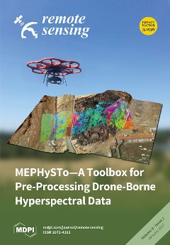
Unmanned Aerial Systems (UAS) or drones feature increasing popularity due to their ability to acquire high quality imagery of hardly accessible areas precisely, fast, and at any time. Equipped with a hyperspectral sensor, UAS are able to deliver characteristic spectral information for each recorded pixel, which may provide indications about type and composition of outcropping material. However, unpredictable movements of the drone as well as complex viewing geometry and illumination of the Earth’s surface require careful geometric and radiometric corrections of the acquired data. These corrections are crucial, especially in geological applications. MEPHySTo is a new dedicated Python-based open-source toolbox for the processing of drone-borne hyperspectral data. The created accurately corrected datasets are specifically designed for the challenges of geological surveys such as mineral exploration and lithological mapping. View the paper.

Articles (98)

  • Article
  • Open Access
26 Citations
13,852 Views
21 Pages

19 January 2017

The impact of Crowdsourcing and citizen science activities on academia, businesses, governance and society has been enormous. This is more prevalent today with citizens and communities collaborating with organizations, businesses and authorities to c...

  • Article
  • Open Access
39 Citations
9,428 Views
14 Pages

A Self-Calibrating Runoff and Streamflow Remote Sensing Model for Ungauged Basins Using Open-Access Earth Observation Data

  • Ate Poortinga,
  • Wim Bastiaanssen,
  • Gijs Simons,
  • David Saah,
  • Gabriel Senay,
  • Mark Fenn,
  • Brian Bean and
  • John Kadyszewski

18 January 2017

Due to increasing pressures on water resources, there is a need to monitor regional water resource availability in a spatially and temporally explicit manner. However, for many parts of the world, there is insufficient data to quantify stream flow or...

  • Feature Paper
  • Article
  • Open Access
183 Citations
23,200 Views
17 Pages

18 January 2017

Drone-borne hyperspectral imaging is a new and promising technique for fast and precise acquisition, as well as delivery of high-resolution hyperspectral data to a large variety of end-users. Drones can overcome the scale gap between field and air-bo...

  • Article
  • Open Access
16 Citations
9,045 Views
14 Pages

18 January 2017

Pulse ecological events have major impacts on regional and global biogeochemical cycles, potentially inducing a vast set of cascading ecological effects. This study analyzes the widespread reproductive event of bamboo (Melocanna baccifera) that occur...

  • Article
  • Open Access
16 Citations
6,818 Views
21 Pages

Mapping Extent Dynamics of Small Lakes Using Downscaling MODIS Surface Reflectance

  • Xianghong Che,
  • Yaping Yang,
  • Min Feng,
  • Tong Xiao,
  • Shengli Huang,
  • Yang Xiang and
  • Zugang Chen

17 January 2017

Lake extent is an indicator of water capacity as well as the aquatic ecological and environmental conditions. Due to the small sizes and rapid water dynamics, monitoring the extent of small lakes fluctuating between 2.5 and 30 km2 require observation...

  • Feature Paper
  • Article
  • Open Access
50 Citations
7,097 Views
13 Pages

Characterization of Active Layer Thickening Rate over the Northern Qinghai-Tibetan Plateau Permafrost Region Using ALOS Interferometric Synthetic Aperture Radar Data, 2007–2009

  • Yuanyuan Jia,
  • Jin-Woo Kim,
  • C. K. Shum,
  • Zhong Lu,
  • Xiaoli Ding,
  • Lei Zhang,
  • Kamil Erkan,
  • Chung-Yen Kuo,
  • Kun Shang and
  • Kuo-Hsin Tseng
  • + 1 author

17 January 2017

The Qinghai-Tibetan plateau (QTP), also known as the Third Pole and the World Water Tower, is the largest and highest plateau with distinct and competing surface and subsurface processes. It is covered by a large layer of discontinuous and sporadic a...

  • Article
  • Open Access
75 Citations
17,375 Views
25 Pages

DInSAR-Based Detection of Land Subsidence and Correlation with Groundwater Depletion in Konya Plain, Turkey

  • Fabiana Caló,
  • Davide Notti,
  • Jorge Pedro Galve,
  • Saygin Abdikan,
  • Tolga Görüm,
  • Antonio Pepe and
  • Füsun Balik Şanli

17 January 2017

In areas where groundwater overexploitation occurs, land subsidence triggered by aquifer compaction is observed, resulting in high socio-economic impacts for the affected communities. In this paper, we focus on the Konya region, one of the leading ec...

  • Article
  • Open Access
11 Citations
9,862 Views
25 Pages

Is Spatial Resolution Critical in Urbanization Velocity Analysis? Investigations in the Pearl River Delta

  • Chunzhu Wei,
  • Thomas Blaschke,
  • Pavlos Kazakopoulos,
  • Hannes Taubenböck and
  • Dirk Tiede

17 January 2017

Grid-based urbanization velocity analysis of remote sensing imagery is used to measure urban growth rates. However, it remains unclear how critical the spatial resolution of the imagery is to such grid-based approaches. This research therefore invest...

  • Article
  • Open Access
9 Citations
7,172 Views
17 Pages

16 January 2017

This paper proposes a novel method of segment-tree filtering to improve the classification accuracy of hyperspectral image (HSI). Segment-tree filtering is a versatile method that incorporates spatial information and has been widely applied in image...

  • Article
  • Open Access
98 Citations
15,606 Views
29 Pages

Assessing the Potential of Sentinel-2 and Pléiades Data for the Detection of Prosopis and Vachellia spp. in Kenya

  • Wai-Tim Ng,
  • Purity Rima,
  • Kathrin Einzmann,
  • Markus Immitzer,
  • Clement Atzberger and
  • Sandra Eckert

16 January 2017

Prosopis was introduced to Baringo, Kenya in the early 1980s for provision of fuelwood and for controlling desertification through the Fuelwood Afforestation Extension Project (FAEP). Since then, Prosopis has hybridized and spread throughout the regi...

of 10

Get Alerted

Add your email address to receive forthcoming issues of this journal.

XFacebookLinkedIn
Remote Sens. - ISSN 2072-4292