Skip to Content
You are currently on the new version of our website. Access the old version .

Remote Sensing, Volume 8, Issue 10

2016 October - 93 articles

Cover Story: 
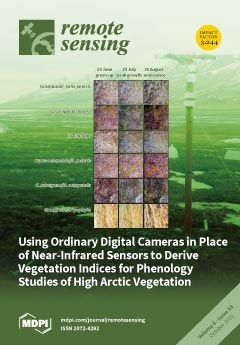
Monitoring vegetation phenology with digital color cameras has become highly popular now that time lapse cameras are commonly available at low cost. Their applicability and accuracy in high-arctic environments, however, remains unknown. In our study, we studied three camera-derived greenness indices in six different plant species/groups in a high-arctic valley, and compared these to measurements with non-imaging normalized difference vegetation index (NDVI) sensors. All three greenness indices from the color cameras captured similar vegetation attributes to the NDVI. However, the Green Red Vegetation Index (GRVI) was the most correlated with the NDVI among all six plant species/groups, and successfully recorded the timing of the green-up, plant growth period and senescence in all plant species/groups. Thus, camera-derived greenness indices are useful methods to track the phenology of vegetation in high-arctic environments. View this pape

Articles (93)

  • Feature Paper
  • Article
  • Open Access
304 Citations
16,722 Views
18 Pages

The Influences of Climate Change and Human Activities on Vegetation Dynamics in the Qinghai-Tibet Plateau

  • Ke Huang,
  • Yangjian Zhang,
  • Juntao Zhu,
  • Yaojie Liu,
  • Jiaxing Zu and
  • Jing Zhang

23 October 2016

Grasslands occupy nearly three quarters of the land surface of the Qinghai-Tibet plateau (QTP) and play a critical role in regulating the ecological functions of the QTP. Ongoing climate change and human interference have greatly affected grasslands...

  • Feature Paper
  • Article
  • Open Access
40 Citations
8,632 Views
16 Pages

23 October 2016

How to accurately determine the mechanical parameters of rockfill is one of the key issues of concrete-face rockfill dams. Parameter back-analysis using internal or external monitoring data has been proven to be an efficient way to solve this problem...

  • Feature Paper
  • Article
  • Open Access
40 Citations
9,527 Views
21 Pages

23 October 2016

Rice growth monitoring is very important as rice is one of the staple crops of the world. Rice variables as quantitative indicators of rice growth are critical for farming management and yield estimation, and synthetic aperture radar (SAR) has great...

  • Article
  • Open Access
58 Citations
15,067 Views
24 Pages

23 October 2016

The paper discusses our studies of oil pollution in the Black and Caspian Seas. The research was based on a multi-sensor approach on satellite survey data. A combined analysis of oil film signatures in satellite synthetic aperture radar (SAR) and opt...

  • Article
  • Open Access
31 Citations
7,679 Views
20 Pages

Hybrid-SAR Technique: Joint Analysis Using Phase-Based and Amplitude-Based Methods for the Xishancun Giant Landslide Monitoring

  • Tengteng Qu,
  • Ping Lu,
  • Chun Liu,
  • Hangbin Wu,
  • Xiaohang Shao,
  • Hong Wan,
  • Nan Li and
  • Rongxing Li

23 October 2016

Early detection and early warning are of great importance in giant landslide monitoring because of the unexpectedness and concealed nature of large-scale landslides. In China, the western mountainous areas are prone to landslides and feature many gia...

  • Feature Paper
  • Article
  • Open Access
21 Citations
9,654 Views
19 Pages

23 October 2016

A single-band surface temperature retrieval method is proposed, aiming at achieving a better accuracy by exploiting the integration of aerial thermal images with LiDAR data and ground surveys. LiDAR data allow the generation of a high resolution digi...

  • Article
  • Open Access
22 Citations
7,629 Views
19 Pages

Interannual Variability in Dry Mixed-Grass Prairie Yield: A Comparison of MODIS, SPOT, and Field Measurements

  • Donald C. Wehlage,
  • John A. Gamon,
  • Donnette Thayer and
  • David V. Hildebrand

22 October 2016

Remote sensing is often used to assess rangeland condition and biophysical parameters across large areas. In particular, the relationship between the Normalized Difference Vegetation Index (NDVI) and above-ground biomass can be used to assess rangela...

  • Article
  • Open Access
155 Citations
18,833 Views
18 Pages

Separability Analysis of Sentinel-2A Multi-Spectral Instrument (MSI) Data for Burned Area Discrimination

  • Haiyan Huang,
  • David P. Roy,
  • Luigi Boschetti,
  • Hankui K. Zhang,
  • Lin Yan,
  • Sanath Sathyachandran Kumar,
  • Jose Gomez-Dans and
  • Jian Li

22 October 2016

Biomass burning is a global phenomenon and systematic burned area mapping is of increasing importance for science and applications. With high spatial resolution and novelty in band design, the recently launched Sentinel-2A satellite provides a new op...

  • Article
  • Open Access
40 Citations
9,740 Views
21 Pages

22 October 2016

Studying phytoplankton functional types (PFTs) from space is possible due to recent advances in remote sensing. Though a variety of products are available, the limited number of wavelengths available compared to the number of model parameters needed...

  • Article
  • Open Access
16 Citations
7,940 Views
18 Pages

Remote Sensing of Particle Cross-Sectional Area in the Bohai Sea and Yellow Sea: Algorithm Development and Application Implications

  • Shengqiang Wang,
  • Yu Huan,
  • Zhongfeng Qiu,
  • Deyong Sun,
  • Hailong Zhang,
  • Lufei Zheng and
  • Cong Xiao

22 October 2016

Suspended particles in waters play an important role in determination of optical properties and ocean color remote sensing. To link suspended particles to their optical properties and thereby remote sensing reflectance (Rrs(λ)), cross-sectional area...

  • Article
  • Open Access
12 Citations
5,861 Views
19 Pages

Scale-Aware Pansharpening Algorithm for Agricultural Fragmented Landscapes

  • Mario Lillo-Saavedra,
  • Consuelo Gonzalo-Martín,
  • Angel García-Pedrero and
  • Octavio Lagos

21 October 2016

Remote sensing (RS) has played an important role in extensive agricultural monitoring and management for several decades. However, the current spatial resolution of satellite imagery does not have enough definition to generalize its use in highly-fra...

  • Article
  • Open Access
43 Citations
12,341 Views
23 Pages

Relasphone—Mobile and Participative In Situ Forest Biomass Measurements Supporting Satellite Image Mapping

  • Matthieu Molinier,
  • Carlos A. López-Sánchez,
  • Timo Toivanen,
  • Ilkka Korpela,
  • José J. Corral-Rivas,
  • Renne Tergujeff and
  • Tuomas Häme

21 October 2016

Due to the high cost of traditional forest plot measurements, the availability of up-to-date in situ forest inventory data has been a bottleneck for remote sensing image analysis in support of the important global forest biomass mapping. Capitalizing...

  • Article
  • Open Access
10 Citations
7,221 Views
16 Pages

A Shape-Adjusted Tridimensional Reconstruction of Cultural Heritage Artifacts Using a Miniature Quadrotor

  • Théo Louiset,
  • Anthony Pamart,
  • Eloi Gattet,
  • Thibaut Raharijaona,
  • Livio De Luca and
  • Franck Ruffier

20 October 2016

The innovative automated 3D modeling procedure presented here was used to reconstruct a Cultural Heritage (CH) object by means of an unmanned aerial vehicle. Using a motion capture system, a small low-cost quadrotor equipped with a miniature low-reso...

  • Article
  • Open Access
41 Citations
9,464 Views
15 Pages

Post-Fire Changes in Forest Biomass Retrieved by Airborne LiDAR in Amazonia

  • Luciane Yumie Sato,
  • Vitor Conrado Faria Gomes,
  • Yosio Edemir Shimabukuro,
  • Michael Keller,
  • Egidio Arai,
  • Maiza Nara Dos-Santos,
  • Irving Foster Brown and
  • Luiz Eduardo Oliveira e Cruz de Aragão

20 October 2016

Fire is one of the main factors directly impacting Amazonian forest biomass and dynamics. Because of Amazonia’s large geographical extent, remote sensing techniques are required for comprehensively assessing forest fire impacts at the landscape level...

  • Article
  • Open Access
11 Citations
6,493 Views
17 Pages

A Modified Three-Stage Inversion Algorithm Based on R-RVoG Model for Pol-InSAR Data

  • Qi Zhang,
  • Tiandong Liu,
  • Zegang Ding,
  • Tao Zeng and
  • Teng Long

20 October 2016

In this paper, a modified two-layer scattering model is applied to a three-stage algorithm for high-precision retrieval of forest parameters from Polarimetric Synthetic Aperture Radar Interferometry (Pol-InSAR) data. Traditional Random-Volume-over-Gr...

  • Article
  • Open Access
90 Citations
18,172 Views
18 Pages

Mapping Smallholder Wheat Yields and Sowing Dates Using Micro-Satellite Data

  • Meha Jain,
  • Amit K. Srivastava,
  • Balwinder-Singh,
  • Rajiv K. Joon,
  • Andrew McDonald,
  • Keitasha Royal,
  • Madeline C. Lisaius and
  • David B. Lobell

20 October 2016

Remote sensing offers a low-cost method for developing spatially continuous crop production statistics across large areas and through time. Nevertheless, it has been difficult to characterize the production of individual smallholder farms, given that...

  • Communication
  • Open Access
20 Citations
7,024 Views
10 Pages

Abrupt Change in Forest Height along a Tropical Elevation Gradient Detected Using Airborne Lidar

  • Jeffrey Wolf,
  • Gilles Brocard,
  • Jane Willenbring,
  • Stephen Porder and
  • María Uriarte

20 October 2016

Most research on vegetation in mountain ranges focuses on elevation gradients as climate gradients, but elevation gradients are also the result of geological processes that build and deconstruct mountains. Recent findings from the Luquillo Mountains,...

  • Article
  • Open Access
26 Citations
8,810 Views
17 Pages

Guidance Index for Shallow Landslide Hazard Analysis

  • Cheila Avalon Cullen,
  • Rafea Al-Suhili and
  • Reza Khanbilvardi

20 October 2016

Rainfall-induced shallow landslides are one of the most frequent hazards on slanted terrains. Intense storms with high-intensity and long-duration rainfall have high potential to trigger rapidly moving soil masses due to changes in pore water pressur...

  • Article
  • Open Access
38 Citations
9,107 Views
25 Pages

Taking Advantage of the ESA G-POD Service to Study Ground Deformation Processes in High Mountain Areas: A Valle d’Aosta Case Study, Northern Italy

  • Martina Cignetti,
  • Andrea Manconi,
  • Michele Manunta,
  • Daniele Giordan,
  • Claudio De Luca,
  • Paolo Allasia and
  • Francesca Ardizzone

20 October 2016

This paper presents a methodology taking advantage of the GPOD-SBAS service to study the surface deformation information over high mountain regions. Indeed, the application of the advanced DInSAR over the arduous regions represents a demanding task....

  • Letter
  • Open Access
7 Citations
7,465 Views
9 Pages

Using Google Earth Surface Metrics to Predict Plant Species Richness in a Complex Landscape

  • Sebastián Block,
  • Edgar J. González,
  • J. Alberto Gallardo-Cruz,
  • Ana Fernández,
  • Jonathan V. Solórzano and
  • Jorge A. Meave

20 October 2016

Google Earth provides a freely available, global mosaic of high-resolution imagery from different sensors that has become popular in environmental and ecological studies. However, such imagery lacks the near-infrared band often used in studying veget...

  • Article
  • Open Access
23 Citations
9,594 Views
24 Pages

20 October 2016

Mediterranean temporary ponds on Doñana’s aeolian sands form an extensive system of small dynamic water bodies, dependent on precipitation and groundwater, of considerable importance for biodiversity conservation. Different areas of the aeolian sands...

  • Article
  • Open Access
201 Citations
17,727 Views
17 Pages

20 October 2016

Remote sensing continues to be an invaluable tool in earthquake damage assessments and emergency response. This study evaluates the effectiveness of multilayer feedforward neural networks, radial basis neural networks, and Random Forests in detecting...

  • Article
  • Open Access
16 Citations
8,007 Views
16 Pages

19 October 2016

Urban area expansion is one of the most critical types of worldwide change, and most urban areas are experiencing increased growth in population and infrastructure development. Urban change leads to many changes in the daily activities of people livi...

  • Article
  • Open Access
20 Citations
6,345 Views
31 Pages

19 October 2016

Because traditional decision tree (DT) induction methods cannot efficiently take advantage of geospatial knowledge in the classification of remotely sensed imagery, several researchers have presented a co-location decision tree (CL-DT) method that co...

  • Article
  • Open Access
14 Citations
8,801 Views
20 Pages

Indicators for Assessing Habitat Values and Pressures for Protected Areas—An Integrated Habitat and Land Cover Change Approach for the Udzungwa Mountains National Park in Tanzania

  • Andreas B. Brink,
  • Javier Martínez-López,
  • Zoltan Szantoi,
  • Pablo Moreno-Atencia,
  • Andrea Lupi,
  • Lucy Bastin and
  • Grégoire Dubois

19 October 2016

Assessing the status and monitoring the trends of land cover dynamics in and around protected areas is of utmost importance for park managers and decision makers. Moreover, to support the Convention on Biological Diversity (CBD)’s Strategic Action Pl...

  • Article
  • Open Access
9 Citations
9,177 Views
17 Pages

Secondary Fault Activity of the North Anatolian Fault near Avcilar, Southwest of Istanbul: Evidence from SAR Interferometry Observations

  • Faqi Diao,
  • Thomas R. Walter,
  • Federico Minati,
  • Rongjiang Wang,
  • Mario Costantini,
  • Semih Ergintav,
  • Xiong Xiong and
  • Pau Prats-Iraola

18 October 2016

Strike-slip faults may be traced along thousands of kilometers, e.g., the San Andreas Fault (USA) or the North Anatolian Fault (Turkey). A closer look at such continental-scale strike faults reveals localized complexities in fault geometry, associate...

  • Article
  • Open Access
43 Citations
8,390 Views
15 Pages

18 October 2016

Detailed monitoring of vegetation changes in ice-free areas of Antarctica is crucial to determine the effects of climate warming and increasing human presence in this vulnerable ecosystem. Remote sensing techniques are especially suitable in this dis...

  • Article
  • Open Access
6 Citations
5,094 Views
9 Pages

18 October 2016

Oil floating on the sea surface can be detected by both passive and active methods using the ultraviolet-to-microwave spectrum, whereas oil immersed below the sea surface can signal its presence only in visible light. This paper presents an optical m...

  • Article
  • Open Access
66 Citations
17,214 Views
22 Pages

18 October 2016

In the past few years, volunteers have produced geographic information of different kinds, using a variety of different crowdsourcing platforms, within a broad range of contexts. However, there is still a lack of clarity about the specific types of t...

  • Article
  • Open Access
70 Citations
10,393 Views
17 Pages

Using Ordinary Digital Cameras in Place of Near-Infrared Sensors to Derive Vegetation Indices for Phenology Studies of High Arctic Vegetation

  • Helen B. Anderson,
  • Lennart Nilsen,
  • Hans Tømmervik,
  • Stein Rune Karlsen,
  • Shin Nagai and
  • Elisabeth J. Cooper

17 October 2016

To remotely monitor vegetation at temporal and spatial resolutions unobtainable with satellite-based systems, near remote sensing systems must be employed. To this extent we used Normalized Difference Vegetation Index NDVI sensors and normal digital...

  • Article
  • Open Access
67 Citations
8,124 Views
20 Pages

Spatiotemporal Variations of Lake Surface Temperature across the Tibetan Plateau Using MODIS LST Product

  • Kaishan Song,
  • Min Wang,
  • Jia Du,
  • Yue Yuan,
  • Jianhang Ma,
  • Ming Wang and
  • Guangyi Mu

17 October 2016

Satellite remote sensing provides a powerful tool for assessing lake water surface temperature (LWST) variations, particularly for large water bodies that reside in remote areas. In this study, the MODIS land surface temperature (LST) product level 3...

  • Article
  • Open Access
77 Citations
11,360 Views
16 Pages

Mid-Season High-Resolution Satellite Imagery for Forecasting Site-Specific Corn Yield

  • Nahuel R. Peralta,
  • Yared Assefa,
  • Juan Du,
  • Charles J. Barden and
  • Ignacio A. Ciampitti

16 October 2016

A timely and accurate crop yield forecast is crucial to make better decisions on crop management, marketing, and storage by assessing ahead and implementing based on expected crop performance. The objective of this study was to investigate the potent...

  • Article
  • Open Access
1 Citations
5,196 Views
21 Pages

Towards Operational Detection of Forest Ecosystem Changes in Protected Areas

  • Cristina Tarantino,
  • Francesco Lovergine,
  • Madhura Niphadkar,
  • Richard Lucas,
  • Stefano Nativi and
  • Palma Blonda

16 October 2016

This paper discusses the application of the Cross-Correlation Analysis (CCA) technique to multi-spatial resolution Earth Observation (EO) data for detecting and quantifying changes in forest ecosystems in two different protected areas, located in Sou...

  • Article
  • Open Access
70 Citations
8,801 Views
30 Pages

16 October 2016

Due to its large space-time variability, the wet tropospheric correction (WTC) is still considered a significant error source in satellite altimetry. This paper presents the GNSS (Global Navigation Satellite Systems) derived Path Delay Plus (GPD+), t...

  • Article
  • Open Access
32 Citations
6,016 Views
14 Pages

Landsat and Local Land Surface Temperatures in a Heterogeneous Terrain Compared to MODIS Values

  • Gemma Simó,
  • Vicente García-Santos,
  • Maria A. Jiménez,
  • Daniel Martínez-Villagrasa,
  • Rodrigo Picos,
  • Vicente Caselles and
  • Joan Cuxart

15 October 2016

Land Surface Temperature (LST) as provided by remote sensing onboard satellites is a key parameter for a number of applications in Earth System studies, such as numerical modelling or regional estimation of surface energy and water fluxes. In the cas...

  • Article
  • Open Access
21 Citations
6,708 Views
19 Pages

Discrimination of Settlement and Industrial Area Using Landscape Metrics in Rural Region

  • Xinyu Zheng,
  • Yang Wang,
  • Muye Gan,
  • Jing Zhang,
  • Longmei Teng,
  • Ke Wang,
  • Zhangquan Shen and
  • Ling Zhang

15 October 2016

Detailed and precise information of land-use and land-cover (LULC) in rural area is essential for land-use planning, environment and energy management. The confusion in mapping residential and industrial areas brings problems in energy management, en...

  • Article
  • Open Access
9 Citations
4,924 Views
20 Pages

A Multi-Resolution Blending Considering Changed Regions for Orthoimage Mosaicking

  • Jun Pan,
  • Mi Wang,
  • Xiaohui Cao,
  • Shengtong Chen and
  • Fen Hu

14 October 2016

Blending processing based on seamlines in image mosaicking is a procedure designed to obtain a smooth transition between images along seamlines and make seams invisible in the final mosaic. However, for high-resolution aerial orthoimages in urban are...

  • Article
  • Open Access
26 Citations
7,778 Views
20 Pages

14 October 2016

Remote sensing-based approaches to lithological mapping are traditionally pixel-oriented, with classification performed on either a per-pixel or sub-pixel basis with complete disregard for contextual information about neighbouring pixels. However, in...

  • Article
  • Open Access
40 Citations
9,369 Views
18 Pages

14 October 2016

Spatially varying haze is a common feature of most satellite images currently used for land cover classification and mapping and can significantly affect image quality. In this paper, we present a high-fidelity haze removal method based on Haze Optim...

  • Article
  • Open Access
103 Citations
12,010 Views
29 Pages

Analysis of Landslide Evolution Affecting Olive Groves Using UAV and Photogrammetric Techniques

  • Tomás Fernández,
  • José Luis Pérez,
  • Javier Cardenal,
  • José Miguel Gómez,
  • Carlos Colomo and
  • Jorge Delgado

13 October 2016

This paper deals with the application of Unmanned Aerial Vehicles (UAV) techniques and high resolution photogrammetry to study the evolution of a landslide affecting olive groves. The last decade has seen an extensive use of UAV, a technology in clea...

  • Article
  • Open Access
59 Citations
7,911 Views
22 Pages

Evaluation of the Performance of Three Satellite Precipitation Products over Africa

  • Aleix Serrat-Capdevila,
  • Manuel Merino,
  • Juan B Valdes and
  • Matej Durcik

13 October 2016

We present an evaluation of daily estimates from three near real-time quasi-global Satellite Precipitation Products—Tropical Rainfall Measuring Mission (TRMM) Multi-satellite Precipitation Analysis (TMPA), Precipitation Estimation from Remotely Sense...

  • Article
  • Open Access
81 Citations
14,863 Views
24 Pages

13 October 2016

This study analyses the expansion of urban growth and land cover changes in five Saudi Arabian cities (Riyadh, Jeddah, Makkah, Al-Taif and the Eastern Area) using Landsat images for the 1985, 1990, 2000, 2007 and 2014 time periods. The classification...

  • Article
  • Open Access
50 Citations
5,746 Views
23 Pages

13 October 2016

Bistatic Synthetic Aperture Radar (SAR) has attracted increasing attention in recent years due to its unique advantages, such as the ability of forward-looking imaging. In translational variant bistatic forward-looking SAR (TV-BFSAR), it is difficult...

  • Article
  • Open Access
95 Citations
7,957 Views
17 Pages

12 October 2016

Environmental monitoring of Earth from space has provided invaluable information for understanding land–atmosphere water and energy exchanges. However, the use of satellite-based precipitation observations in hydrologic and environmental applications...

  • Article
  • Open Access
2 Citations
5,585 Views
18 Pages

11 October 2016

Based on a widely used satellite precipitation product (TRMM Multi-satellite Precipitation Analysis 3B43), we analyzed the spatiotemporal variability of precipitation over the Pacific Ocean for 1998–2014 at seasonal and interannual timescales, separa...

  • Technical Note
  • Open Access
12 Citations
7,627 Views
10 Pages

11 October 2016

Flash floods need to be monitored from a safe place, ideally with noncontact instruments installed at a riverbank and oriented so that they look obliquely at the water surface. The “inclined Lidar” technique could be useful for this purpose. It works...

  • Article
  • Open Access
9 Citations
6,942 Views
12 Pages

10 October 2016

Urban heat islands (UHIs) have been long studied using both ground-based observations of air temperature and remotely sensed thermal infrared (TIR) data. While ground-based observations lack spatial detail even in the occasional “dense” urban network...

  • Article
  • Open Access
82 Citations
15,418 Views
26 Pages

10 October 2016

The urban heat island (UHI) phenomenon is a harmful environmental problem in urban areas affecting both climatic and ecological processes. This paper aims to highlight and monitor the spatial distribution of Surface UHI (SUHI) in the Casablanca regio...

  • Article
  • Open Access
11 Citations
5,607 Views
19 Pages

A Sparsity-Based InSAR Phase Denoising Algorithm Using Nonlocal Wavelet Shrinkage

  • Dongsheng Fang,
  • Xiaolei Lv,
  • Yong Wang,
  • Xue Lin and
  • Jiang Qian

10 October 2016

An interferometric synthetic aperture radar (InSAR) phase denoising algorithm using the local sparsity of wavelet coefficients and nonlocal similarity of grouped blocks was developed. From the Bayesian perspective, the double- l 1 norm regular...

of 2

Get Alerted

Add your email address to receive forthcoming issues of this journal.

XFacebookLinkedIn
Remote Sens. - ISSN 2072-4292