


Highlights
What are the main findings?
- To address the challenges of low visual discriminability, ambiguous boundaries, and diverse scales inherent in loess landslides, we proposed the MPES-YOLO model, which innovatively combines a multi-scale partial convolution and exponential moving average (MPCE) module, a selective edge enhancement (SEE) module, and an SIoU loss function.
- Evaluated across three distinct datasets, the model achieved optimal results: following initial verification on the publicly available Bijie dataset, it reduced parameters by 23.3% while reaching an mAP@0.5 of 91.9% in the Yan’an City experiment, and demonstrated strong generalization with an mAP@0.5 of 97.4% in the Ningxia region.
What are the implications of the main findings?
- The findings demonstrate the model’s effectiveness in dealing with the difficulties of complex loess terrains, specifically proving its ability to accurately detect small-scale targets and irregular boundaries while maintaining an optimal balance between detection accuracy and computational efficiency.
- By overcoming the limitations of traditional methods with a robust and lightweight architecture, this framework shows significant potential for practical application in automated loess landslide detection and large-scale geological disaster early warning systems.
Abstract
Loess landslides in northwestern China are highly unstable and difficult to distinguish due to sparse vegetation and their spectral and morphological similarity to the surrounding terrain. These landslides demonstrate considerable diversity in manifestation, encompassing shallow translational slides, small-scale features, partially obscured formations, and instances with irregular or poorly defined boundaries. To address the above issues, we propose MPES-YOLO, a multi-scale lightweight YOLO-based framework with selective edge enhancement to detect loess landslides. This model is based on the YOLOv8 architecture and incorporates a multi-scale partial convolution and exponential moving average (MPCE) module to improve multi-scale feature representation while reducing computational cost and enhancing small-target sensitivity. Additionally, to address ambiguous boundaries, a selective edge enhancement (SEE) module is introduced to extract authentic object edges from original images and inject them into key training layers, improving boundary perception. Finally, SIoU is adopted to improve geometric consistency for irregular landslide boundary localization. This paper first verified the basic detection performance of MPES-YOLO on the publicly available Bijie landslide dataset. Then, an experimental study was conducted in the loess landslides of Yan’an City, Shaanxi Province. The mAP@0.5 was 91.9%, and the parameter quantity was reduced by 23.3% compared with the baseline model. A generalization experiment was also carried out on the landslides in the Ningxia region, with the mAP@0.5 being 97.4%. The results show that MPES-YOLO achieves a strong balance between detection accuracy and computational efficiency, providing an effective and scalable solution for automated loess landslide detection and geological disaster early warning.
1. Introduction
As a common geological disaster, landslides are often extremely destructive [1]. They are typically triggered by natural factors such as heavy rainfall and earthquakes, as well as other human activities. Recent decades have witnessed an escalating frequency of landslide events attributed to climate change, demographic expansion, and accelerated urbanization, resulting in substantial risks to human settlements, natural ecosystems, critical infrastructure, and property [2,3]. Furthermore, the northwestern region of China is primarily composed of loose, low-cohesion loess soils, rendering it highly unstable and susceptible to geological hazards, including loess collapses and landslides. These hazards are characterized by rapid onset and wide coverage [4,5]. These phenomena present significant perils to the inhabitants and property within the loess plateau region [6]. As a result, it is of paramount importance to investigate and detect landslide disasters, especially in loess-covered zones.
Since the 1970s, remote sensing technology has become a vital tool in geoscience due to its all-weather capability, high speed, and efficiency. As a large-scale observation method, it has been extensively employed for landslide detection and identification [7]. Current remote sensing-based landslide detection approaches can be broadly classified into two principal categories: visual interpretation techniques and computer vision-based methodologies. In visual interpretation, researchers can accurately delineate landslide areas using remote sensing images. However, this method demands extensive expertise and practical experience from interpreters [8]. What’s more, when dealing with complex scenarios like loess landslides, it is not only time-consuming and labor-intensive, but also demands more specialized expertise and hands-on experience. Methods based on computer vision for landslide identification generally employ classifiers, including Support Vector Machines (SVM), Random Forests (RF), Decision Trees (DT), and K-means clustering [9,10,11]. Compared to manual visual interpretation methods, machine learning enables automated feature extraction while significantly improving efficiency in processing large-scale datasets. Among them, as an extension and deepening of the neural network part of machine learning, deep learning can form more abstract and stable features by building a large number of training samples for model training, so as to improve the recognition accuracy of targets [12]. Besides, deep learning models are broadly divided into two categories: single-stage and two-stage models, based on their need for region proposal generation. Two-stage target detection algorithms, such as Faster R-CNN and Mask R-CNN, have certain advantages in providing accuracy, but the detection speed of the model is relatively slow due to the need to extract the candidate region of the landslide twice [13,14]. In contrast, single-stage models include models like the YOLO series, SSD, and RetinaNet, which can achieve end-to-end transmission and improve detection speed substantially [15,16].
Deep learning methodologies have gained widespread adoption across diverse computer vision applications, owing to their superior feature extraction and representational capabilities [17], with landslide detection emerging as a prominent application domain [18,19,20,21]. The application of deep learning methods in landslide detection is mainly categorized into two aspects. The first one is the improvement of detection accuracy. For instance, Liu et al. proposed a Multi-Scale Spatial Context Background Enhancement (MSSCBE) method combining with Mask R-CNN, which effectively reduces misclassification between bare land and landslides, achieving an improvement in F1-score [22]. Ghorbanzadeh et al. proposed an integrated framework combining the ResU-Net deep learning model and rule-based OBIA, which significantly improved the accuracy of landslide detection [23]. Wang et al. proposed a YOLO + U-Net deep learning method, which effectively improved the accuracy of landslide identification in multi-scale complex backgrounds and significantly reduced the problems of false detection and missed detection [24]. The second one is the optimization of detection efficiency. Dai et al. proposed an end-to-end lightweight model based on the EMO backbone and GhostNet, reducing parameters by 48.13% while maintaining a processing speed of 62 FPS [25]. Similarly, Cheng et al. introduced the YOLO-SA model, which replaces standard convolutions with Ghost modules, cutting parameters by 48% [26]. These advancements demonstrate significant progress in balancing accuracy, efficiency, and real-time performance in landslide detection tasks.
Although the deep learning in the above research has shown excellent performance in landslide detection and other fields, it still faces three key challenges in the detection of loess landslides. Firstly, current publicly available landslide datasets suffer from several limitations: the number of landslide samples is limited, the category changes are small, the background is simple, and most of the landslides have high vegetation coverage. The above phenomenon can lead to compromised generalization capability in the detection model. Secondly, while deep learning architectures demonstrate proficiency in local feature extraction, they exhibit inherent limitations in capturing comprehensive global contextual information, thereby complicating the differentiation of landslides from morphologically similar natural terrain features in heterogeneous environments. This challenge is particularly pronounced for loess landslides, where characteristic geomorphological signatures, notably the distinctive armchair-shaped morphology, exhibit substantial textural, chromatic, and geometric similarities to various natural landforms. These similarities frequently lead to misidentification, resulting in misclassification and omission of the model. Thirdly, the application of YOLOv8 in detecting old landslides has received limited research attention. Therefore, it is necessary to further strengthen the detection ability of deep learning in various landslide scenarios and improve the detection rate. To address these gaps, this study investigates the YOLOv8 object detection framework and proposes a series of methodological improvements.
Based on the aforementioned research, this study uses the optical remote sensing data of loess landslides in Northwest China for experiments. The study area exhibits three distinctive characteristics: low vegetation coverage, diverse landslide forms, and complex backgrounds. These characteristics can be used as the benchmark for landslide detection and segmentation tasks. We also validated the model’s generalizability on the Bijie dataset. Furthermore, building upon the YOLOv8 architecture, this research proposes an efficient lightweight multi-scale framework with selective edge enhancement for landslide detection algorithm named MPES-YOLO. Our major contributions can be summarized as follows:
- This paper proposes a Multi-scale Partial Convolution and Exponential Moving Average (MPCE) module. To reduce the learning of interfering features while improving the detection accuracy for loess landslides at different scales, we employ a multi-scale convolutional kernel architecture and adaptive channel allocation strategy to reduce computational costs and suppress redundant feature learning. Furthermore, to enhance the feature representation capability for occluded targets and small-scale targets, we further integrate an exponential moving average (EMA) mechanism on this foundation.
- Due to the highly irregular and fuzzy boundary features of loess landslides, this paper proposes a selective Edge Enhancement (SEE) module. This module uses the Laplacian operator to extract the real geological body edges from the original remote sensing images and dynamically injects edge information in the key training layer, thereby significantly improving the accuracy of the model in recognizing the fuzzy boundaries of loess landslides.
- This paper replaces the original CIoU with SIoU. By using a four-dimensional decomposition strategy of angle, distance, shape, and IoU, it precisely captures landslide directional features and irregular geometric shapes. This approach improves the detection sensitivity and localization accuracy of loess landslide boundaries.
- The model was first evaluated on the Bijie landslide dataset to confirm its basic performance, then transferred to loess landslide scenarios, effectively reducing false detections caused by complex backgrounds and enhancing robustness in loess regions. Further generalization experiments in the geologically distinct yet loess-covered Ningxia region demonstrated the model’s cross-regional applicability, thereby supporting its practical deployment across diverse loess terrains.
The rest of the paper is organized as follows. Section 2 provides an overview of the adopted data and the overall structure of the MPES-YOLO model. Section 3 presents the comprehensive experimental results and analysis. Section 4 discusses the features of MPES-YOLO and the future research work and Section 5 presents conclusions.
2. Study Area and Data Preprocessing
In this study, to systematically evaluate the generalization capability and applicability of the proposed model across diverse geographic environments and landslide types, a multi-regional experimental framework consisting of three representative study areas was established. To support model training and feature learning, the Yan’an region in Shaanxi Province was selected as the primary study area, enabling the extraction of typical morphological and textural characteristics of loess landslides. To validate the model’s generalization ability under different geographic conditions, the Bijie landslide dataset was adopted as an independent external dataset. Furthermore, to assess the model’s applicability to more complex landslide types, the Ningxia region—characterized by the development of deep-seated landslides—was selected for extended validation.
However, acquiring large-scale, high-quality annotated loess landslide data remains a significant challenge, primarily due to the complexity of the terrain and the scarcity of reliable labels. To address this limitation, an offline data augmentation strategy was employed to expand the original dataset, thereby increasing data diversity and improving the robustness of the model. Through the integration of multi-regional experimental design and data augmentation, a comprehensive evaluation of the model’s cross-regional and cross-type performance was achieved. A brief summary of the datasets from the three study areas is provided in Table 1 below.
Table 1.
Summary of study areas and datasets.
2.1. Experimental Data—Yan’an
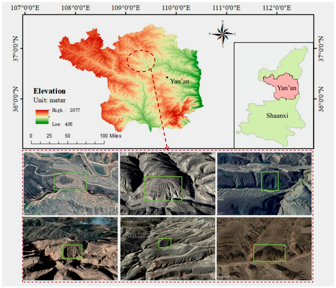
The study area includes Yan’an City in Shaanxi Province, located in the gully region of the Loess Plateau. This region is characterized by thick loess deposits, loose soil structure, and intense soil erosion, resulting in highly dissected terrain with dense gullies [27,28,29]. Frequent human activities further increase the susceptibility to geological hazards such as landslides and collapses, with loess landslides being the dominant type.
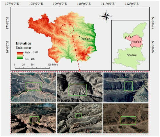
At present, orthophoto dataset is used for most of the landslide detection methods. However, due to the weathering, water erosion and vegetation coverage, landslides on the orthogonal projection do not have obvious characteristics, increasing the difficulty of model checking. Therefore, in the data acquisition process of this experiment, the visual interpretation method was used to rotate the images in the Google Earth 3D scene. As shown in Figure 1, the landslide was judged based on the images from multiple oblique perspectives instead of a single orthophoto perspective, and the oblique image at the perspective with the most obvious optical features was selected to replace the orthophoto images. In the field verification process, we conducted on-site investigations to determine whether a slope belongs to a landslide by examining the basic geological conditions such as slope gradient, slope height, slope integrity, rock and soil structure, and drainage conditions, combined with typical landslide geomorphic features including chair-shaped terrain, trailing edge cracks, sinkholes, and steep benches on the slope. Finally, by setting the image parameters in Google Earth, we selected the old landslides with more obvious morphology and texture, and labels were given manually and checked carefully by experts.
Figure 1.
Study area of loess landslide. The green box represents the ground truth.
The loess landslide data used in this paper contains 152 images with landslides, which is insufficient to meet the training requirements of high-precision landslide detection models. However, obtaining a large amount of optical remote sensing data in this landslide monitoring area still faces great challenges. To ensure the continuity of the experiment while maintaining detection performance, this study implemented an offline data augmentation method for these data.
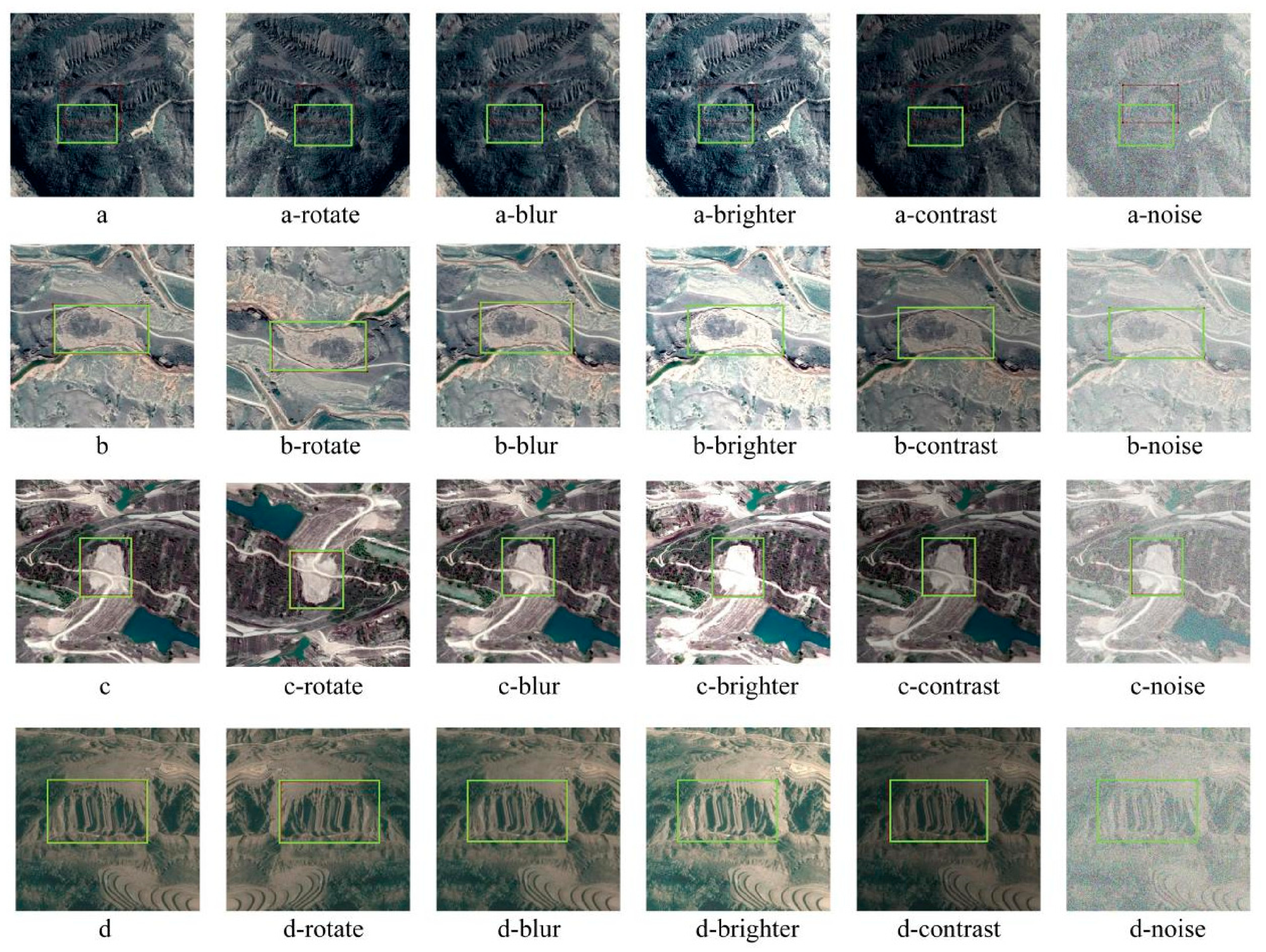
The specific methodology is as follows: Data augmentation was performed through transformations such as rotation, horizontal flipping, brightness adjustment, contrast adjustment, blurring, and noise injection. A total of 1064 landslide images constituted the final dataset, randomly allocated across training, validation, and test sets according to an 8:1:1 ratio. As shown in Figure 2, the first column displays the original landslide images, and the subsequent five columns show the results after offline augmentation. It can be seen from the figure that while maintaining structural similarity with the original images, the augmented data has significant changes compared to the source images in terms of brightness, contrast, and texture details. These carefully generated variant samples have great training value and can effectively support subsequent model learning.
Figure 2.
Different preprocessing results of loess landslides. The green box represents the ground truth.
2.2. Bijie Landslide Dataset
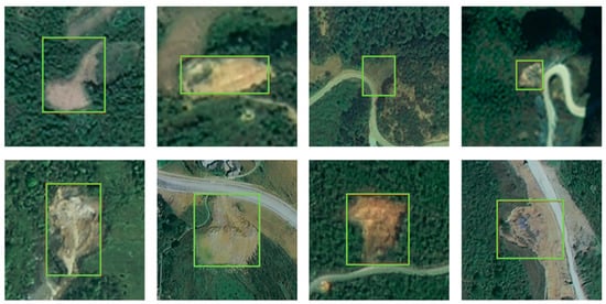
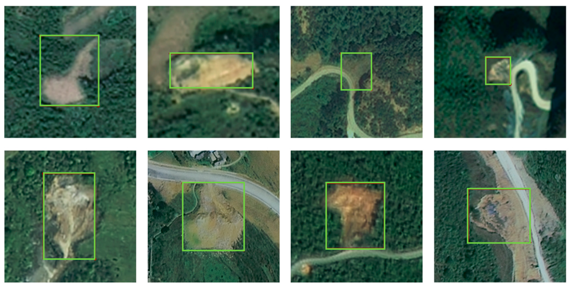
To assess the geographical generalizability of the proposed model, the Bijie landslide dataset (Wuhan University) was used as an independent external validation dataset. The study area is located in northwestern Guizhou Province, China. As shown in Figure 3, it is characterized by complex mountainous terrain, fragile ecological conditions, and unstable geological settings, which contribute to a high susceptibility to landslides. The dataset comprises 770 landslide samples derived from optical remote sensing imagery. These samples were divided into training, validation, and testing sets with a ratio of 8:1:1.
Figure 3.
The instances of Bijie landslide datasets. The green box represents the ground truth.
2.3. Generalization Validation Region—Ningxia
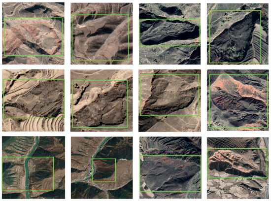
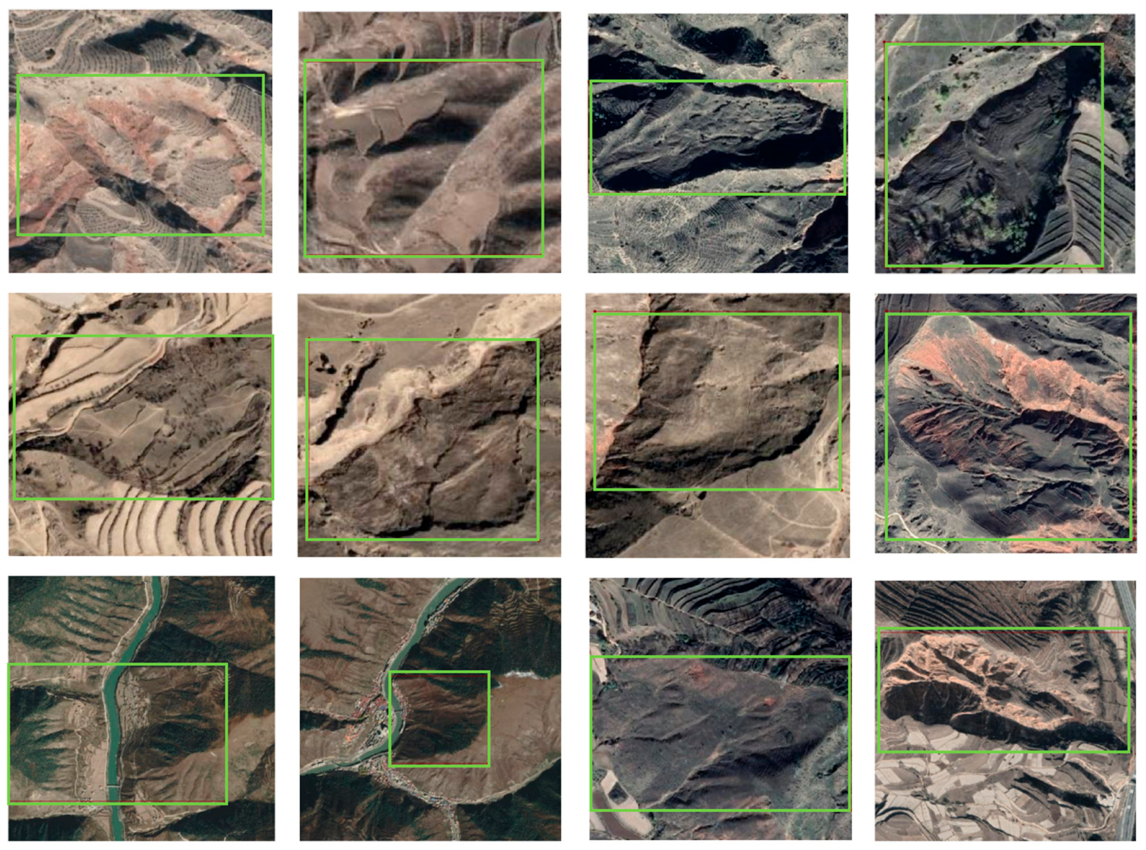
To evaluate the cross-regional generalization capability of the proposed model, the Ningxia landslide dataset was used as an independent validation dataset. The study area is located on the western margin of the Loess Plateau. Landslides in this region are primarily characterized by large-scale shallow failures with indistinct boundaries and low spectral contrast in optical imagery, which poses challenges for automated detection. As illustrated in Figure 4, these landslides present tonal variations ranging from gray-brown to pale yellow, with relatively low spectral contrast compared to adjacent undisturbed loess deposits. These distinctive spectral and morphological characteristics pose significant challenges for automated detection algorithms while providing an ideal testing platform for evaluating model transferability across similar loess environments.
Figure 4.
The instances of Ningxia loess landslide. The green box represents the ground truth.
The dataset consists of 338 high-resolution optical remote sensing images. To improve the robustness of model training, data augmentation techniques, including rotation and flipping, were applied to expand the dataset to 2028 images. The augmented dataset was then randomly divided into training and validation sets with a ratio of 7:3. Validation on this independent region helps mitigate overfitting to specific training areas and enables a more objective evaluation of the model’s generalization performance across varying loess environments.
3. Materials and Methods
3.1. Overall Framework of MPES-YOLO
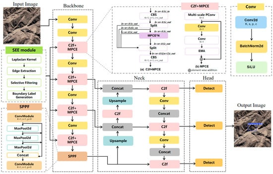
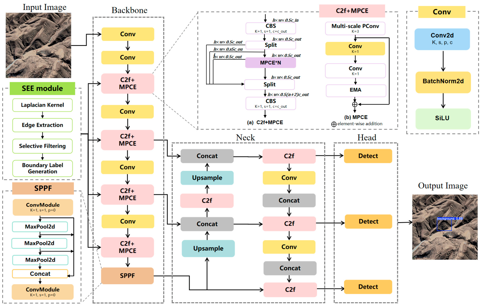
As a critically fragile ecosystem within China, the Loess Plateau experiences frequent loess landslides that serve as a primary constraint on sustainable socioeconomic advancement in the region [30]. Since the loess landslide is similar to the surrounding environmental background, there is a characteristic that the landslide boundary is not obvious. The traditional YOLOv8 detection model demonstrates limited effectiveness in detecting loess landslides, often resulting in both missed detections and false positives. Therefore, based on the above problems, this paper proposes an improved model MPES-YOLO based on YOLOv8, and its structure is shown in Figure 5. The model consists of three main parts: the backbone, the neck, and the detection head.
Figure 5.
The overall framework of MPES-YOLO model.
YOLOv8 was selected as the baseline model due to its superior performance in handling multi-scale targets and computational efficiency requirements essential for loess landslide detection. YOLOv8 is a real-time object detection model that offers fast and accurate performance and is proficient in tasks including image classification, object detection and tracking, instance segmentation, and pose estimation [31]. The core architecture of YOLOv8 consists of a backbone, a neck structure and a detection head [32]. Loess landslides exhibit significant scale variations, ranging from small-scale features manifesting as subtle textural changes to large-scale landslides displaying distinct armchair-shaped morphological features. YOLOv8’s enhanced feature pyramid network effectively addresses this multi-scale challenge, making it particularly suitable for the diverse landslide types encountered in loess environments. YOLOv8 improves the cross-layer connections in the feature pyramid by introducing a more efficient C2f module and SPPF (Spatial Pyramid Pooling—Fast) structure, enhancing the perception ability of small targets and blurred edges, and is able to better capture landslide edges [33]. In addition, in landslide detection, YOLOv8 is more suitable for visual tasks that require a balance between performance and efficiency compared to two-stage detectors, while its anchor-free design better accommodates the irregular shapes of loess landslides. Therefore, YOLOv8 not only maintains the signature real-time performance of the YOLO series but also improves landslide detection accuracy.
In the backbone network, this paper introduces a novel MPCE module that integrates multi-scale partial convolution and EMA mechanism. The multi-scale partial convolution employs different scale convolution kernels to perform sparse computation on 1/4 of the input channels. Through an intelligent channel allocation strategy, it captures multi-level spatial features while significantly reducing computational load. The EMA mechanism dynamically enhances the feature response of occluded targets and small targets. Through parameter smoothing processing, it improves detection accuracy in complex backgrounds. Additionally, this paper introduces a boundary detection SEE module that utilizes the Laplacian operator to extract authentic edge information from original images and performs selective edge filtering in conjunction with manually annotated bounding boxes. The processed edge features are then integrated into the MPCE module to further enhance the model’s boundary perception capability and feature representation for landslides.
3.2. MPCE Module
3.2.1. Multi-Scale Lightweight Partial Convolution Block
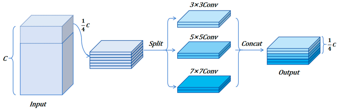
In optical remote sensing imagery, loess landslide bodies exhibit extremely high similarity to the surrounding loess environment in terms of spectral, textural, and morphological characteristics. Following landslide occurrence, the surface of the landslide mass remains composed of loess material, making it nearly indistinguishable from undisturbed loess slopes in terms of color and texture. This high degree of similarity leads to substantial misdetection and omission errors in traditional detection methods. To minimize interference feature learning in loess landslides while reducing parameters, we introduce lightweight partial convolution. This approach can selectively filter landslide-like textures in loess backgrounds during practical applications, thereby reducing false detection rates. Partial convolution performs convolution operations on only 1/4 of the input channels, reducing computational complexity to 1/16 of standard convolution while retaining most feature extraction capabilities [34,35,36].
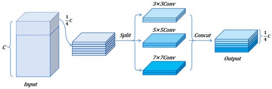
Considering the multi-scale feature distribution of loess landslides, small-scale landslides exhibit local texture variations while large-scale landslides present armchair-shaped overall morphology. This paper performs convolution computation on only 1/4 of the channels while introducing a multi-scale parallel processing mechanism. The convolution channels are further processed using different-scale convolution kernels. As shown in Figure 6, the kernel sizes are set to 3 × 3, 5 × 5, and 7 × 7, which can extract details and regional information from different scales of loess landslides from small to large. Multiple parallel convolution kernels of different sizes enable the backbone and neck parts of the detection network to simultaneously extract features at different scales. This approach can more comprehensively capture target details and contextual information. Finally, the convolution results from each branch are concatenated to fuse multi-scale information, enhance feature representation capability, and enable the model to better detect landslides of different sizes. Embedding the improved PConv module into the C2f structure can fully exploit multi-scale and complex texture features in loess landslides, enhancing the model’s feature representation capability. Meanwhile, the method of processing only partial convolution channels can significantly reduce floating-point operations. Its efficient computational characteristics reduce the model’s computational complexity while ensuring model performance.
Figure 6.
The structure of multi-scale lightweight partial convolution.
3.2.2. Exponential Moving Average Block
In the Loess Plateau environment, normal features such as natural gullies, erosion traces, and sparse vegetation areas may exhibit visual similarity to landslides, resulting in gradient oscillations and parameter instability during model training. Conventional training approaches struggle to effectively address the unique characteristics of this geological environment. To address the training fluctuations caused by high similarity between loess landslides and surrounding terrain, and the problem of abnormal samples affecting training results, we introduce the EMA mechanism into the MPCE module.
EMA is a technique for deep learning model training. It improves the generalization ability and stability of the model by smoothing the model weights. In deep learning, EMA maintains a non-trainable “shadow parameter” that combines historical and current weights through weighted averaging. Recent weights are given higher importance, controlled by a decay coefficient β typically ranging from 0.9 to 0.999, thereby enhancing the model’s generalization capability [37,38]. Specifically, the updated rule of EMA is as follows:
where, represents the EMA values for the current time, represents the EMA value of the previous time, represents the model parameters at the current time and β represents the attenuation rate.
This EMA mechanism makes model parameters update smoother and more stable. Adding EMA to the C2f module effectively alleviates feature oscillation in deep networks, improving multi-scale feature fusion stability and small object detection accuracy without increasing inference overhead. In loess landslide detection, EMA can effectively smooth the training fluctuations caused by some complex backgrounds in the loess area through the moving average processing of model parameters, so that the model can maintain the sensitivity to the landslide and reduce the false detection rate. In view of the high similarity between loess landslide and surrounding terrain, EMA can prevent the model from overfitting on a small number of abnormal samples by retaining historical parameter information.
3.3. Selective Edge Enhancement Module
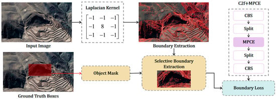
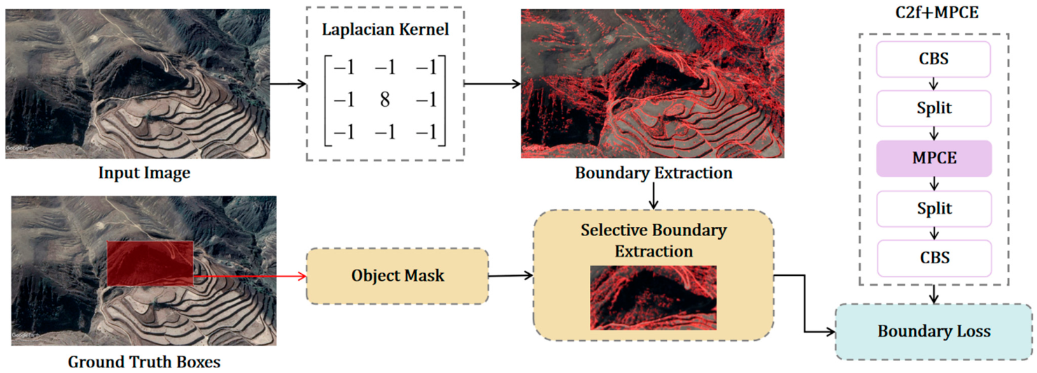
In the loess plateau environment, landslides typically exhibit armchair-shaped or elliptical morphologies with highly irregular contours that differ significantly from simple rectangular approximations. Traditional object detection methods primarily rely on rectangular bounding box annotations for training, but this approach cannot adequately capture the complex irregular boundary features of loess landslides. To address these limitations, this paper proposes an SEE module that directly extracts authentic geological boundary information from original remote sensing images and injects this information into the feature learning process during critical training stages. The process is shown in Figure 7.
Figure 7.
Detailed description of the edge detection SEE module.
Unlike traditional methods that generate boundary labels through simple rectangular box delineation, the SEE module employs the Laplacian operator to extract authentic geological boundaries from original remote sensing images. The Laplacian operator is a second-order differential operator that is particularly sensitive to rapid intensity changes characteristic of geological boundaries [39]. However, performing edge detection on entire images introduces substantial background noise and irrelevant boundaries. Therefore, the SEE module adopts a selective edge extraction strategy that utilizes ground truth bounding box information to filter relevant geological boundaries. This selective extraction process ensures that only landslide-related boundaries are retained while eliminating background interference from vegetation, roads, and other irrelevant features.
During forward propagation, when reaching designated convolutional layers, the system extracts edge information from input images in real-time, generates boundary labels, and integrates them into loss computation. This dynamic approach ensures that boundary information synchronizes with current samples while avoiding pre-computation storage overhead.
Traditional geometric assumptions often fail to adequately represent the diverse morphological expressions of slope instability phenomena. The SEE module enhances boundary localization accuracy, particularly for irregularly shaped landslides, providing a solid foundation for accurate landslide detection in complex loess plateau environments.
3.4. Bounding Box Loss Function
IoU (Intersection over Union) is a fundamental geometric metric that measures the spatial overlap between predicted and ground truth bounding boxes. YOLOv8 employs CIoU loss, but it fails to consider angular information and complex shape matching characteristics. Loess landslides primarily develop along slope orientations, exhibiting distinct directional distributions, with the major axis of landslide bodies typically aligned with the slope aspect. This directional characteristic constitutes a critical geometric feature for landslide identification. However, the CIoU loss function cannot capture angular deviations between predicted bounding boxes and ground truth bounding boxes, preventing the model from learning the directional features of landslides during training. Therefore, this paper replaces CIoU with the more precise SIoU loss function [40], which decomposes bounding box regression loss into four key components to enhance detection accuracy for loess landslides.
- (1)
- Angle cost. It primarily measures the directional deviation between the predicted bounding box and the ground truth annotation. This component constrains the orientation accuracy of predicted boxes by computing the geometric angular relationship between the two bounding boxes.
- (2)
- Distance cost. It optimizes spatial position deviations between the center points of predicted and ground truth boxes, providing independent constraints in both horizontal and vertical directions.
- (3)
- Shape cost. It independently optimizes width and height matching accuracy of predicted boxes, circumventing the limitations of traditional aspect ratio constraints.
- (4)
- Integrating all components, the final SIoU loss function is formulated as follow:
Loess landslides mostly develop along slope directions with obvious directionality, and landslide bodies exhibit elliptical or armchair-shaped distributions. The angle loss of SIoU can precisely match the main development direction of landslides and is more sensitive to inclined and rotated landslide boundaries. Meanwhile, the shape loss of SIoU independently handles width and height variations, better processing asymmetric and irregular shapes, thereby enhancing boundary localization accuracy. Through this multi-dimensional geometric constraint, the SIoU loss function can better handle the core issues such as blurred boundaries, irregular shapes, and obvious directionality in the detection of loess landslides, thereby significantly improving the detection accuracy and the accuracy of boundary positioning.
4. Result and Analysis
4.1. Experimental Setting and Evaluation Indices
To ensure the detection accuracy of the final model, all experiments in this paper were conducted under identical hardware and software conditions. The specific environmental parameter configurations are detailed in Table 2.
Table 2.
Environment parameters of experiments.
Meanwhile, this study adopted PyTorch 3.9 as the deep learning framework and YOLOv8 as the benchmark network model for experimental implementation. To guarantee the comparability of experimental results across different model configurations, consistent hyperparameters were set throughout the entire training process. Specifically, the training was conducted for 300 epochs with a batch size of 4, and all input images were uniformly resized to a resolution of 640 × 640 pixels. The initial learning rate was set to 0.01, and a weight decay of 0.0005 was applied to prevent overfitting. There are 1064 positive landslide sample images in the loess landslide dataset. In order to meet the model training requirements of deep learning, the data set is divided into training set, test set and verification set according to the rate of 8:1:1, which contains 851, 106 and 107 optical images respectively, and each image contains at least one landslide area.
In this experiment, we selected precision (P), recall (R), mAP@0.5, and mAP@0.5:0.95 as evaluation metrics for comparative analysis to assess the performance of the MPES-YOLO model in loess landslide identification. The specific formulas are as follows:
where P shows the percentage of correct positive predictions, which reflects the reliability of detection results. In the formula, TP represents the number of true targets correctly detected, while FP denotes the number of background regions mistakenly identified as targets. R measures the proportion of true targets correctly detected by the model, indicating its capability to avoid missed detections while FN in the formula represents the number of true targets that were not detected.
However, precision and recall typically exhibit a trade-off relationship. Therefore, the F1-score is introduced to balance these two metrics. Additionally, to comprehensively evaluate the detection accuracy across multiple categories, this research assesses and compares both mAP at a fixed IoU threshold of 0.5 and the average mAP across IoU thresholds ranging from 0.5 to 0.95, serving as one of the key references for evaluating landslide identification accuracy.
4.2. Performance of the MPES-YOLO for Landslide Detection on Bijie Dataset
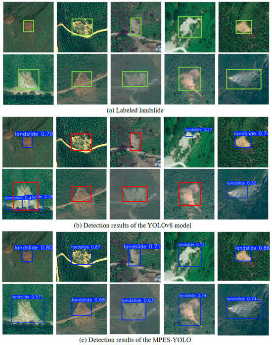
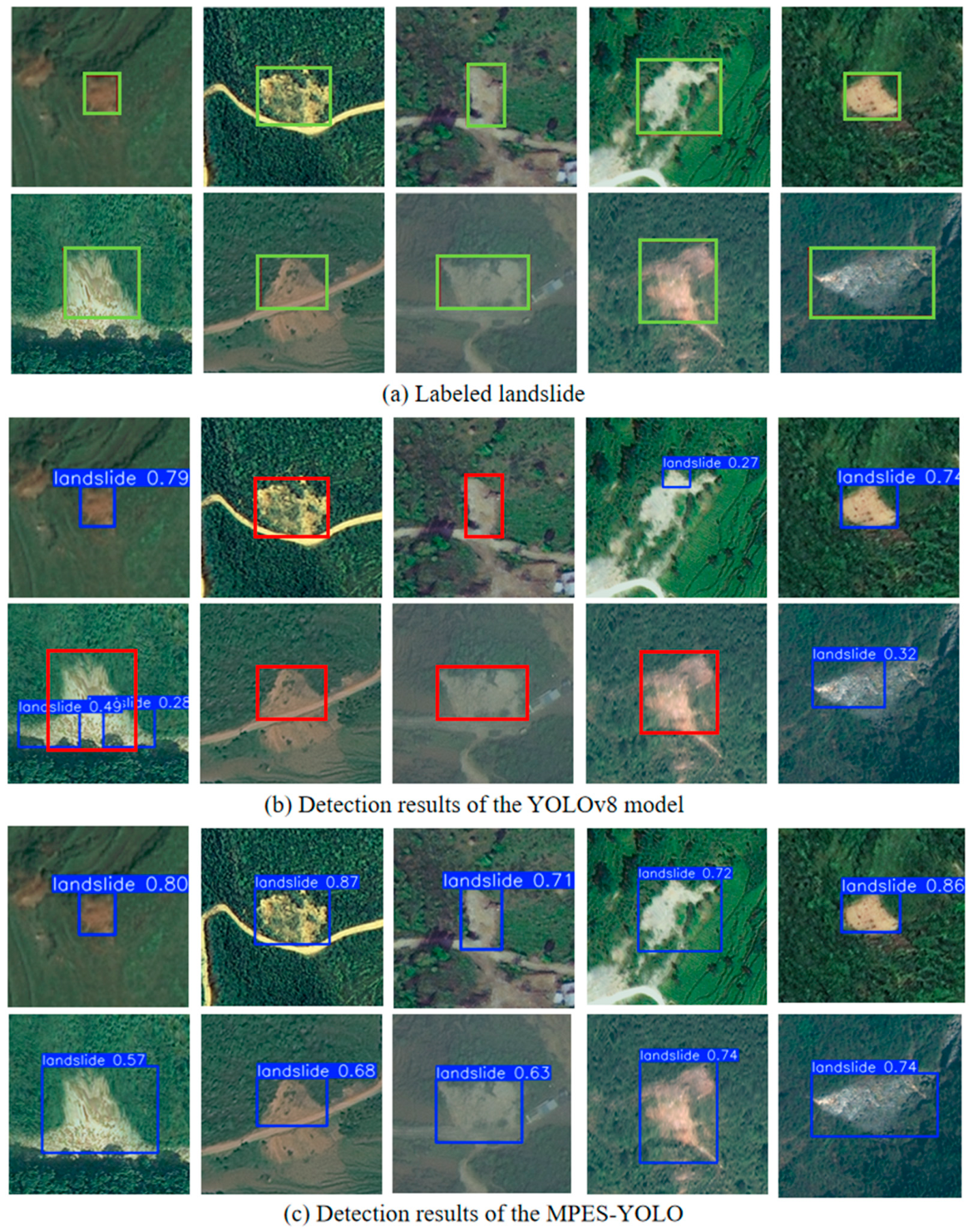
To evaluate the fundamental detection capability of the proposed model, experiments were conducted on the Bijie dataset, which contains clear landslide features and abundant samples. As the Bijie region differs markedly from loess landslide areas in geological conditions, terrain, and vegetation coverage, it serves to assess the model’s adaptability to diverse environments. The same training parameters and software–hardware settings as those used for loess landslides were adopted. The results are shown in Figure 8.
Figure 8.
Example of experimental results. The green box represents ground truth, the red box represents false negative and false positive.
Figure 8 shows the detection results of the original YOLOv8 model and the improved MPES-YOLO model. As illustrated, YOLOv8 tends to produce both false negatives and false positives in multi-landslide scenarios and under significant background interference. The SEE module in MPES-YOLO introduces edge constraints that alleviate boundary ambiguity and enhance the representation of landslide edges. Meanwhile, multi-scale partial convolution suppresses interference features by processing 1/4 of the input channels with different kernel sizes in parallel, enabling efficient extraction of multi-level spatial features while reducing computational cost. Combined with EMA-based multi-scale feature fusion and SIoU for refined boundary localization, MPES-YOLO significantly improves detection performance in complex environments. In scenarios involving multiple or small-scale landslides, it effectively reduces both false negatives and false positives, thereby improving detection accuracy.
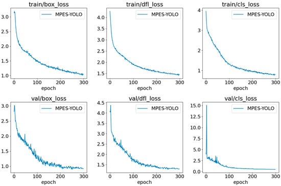
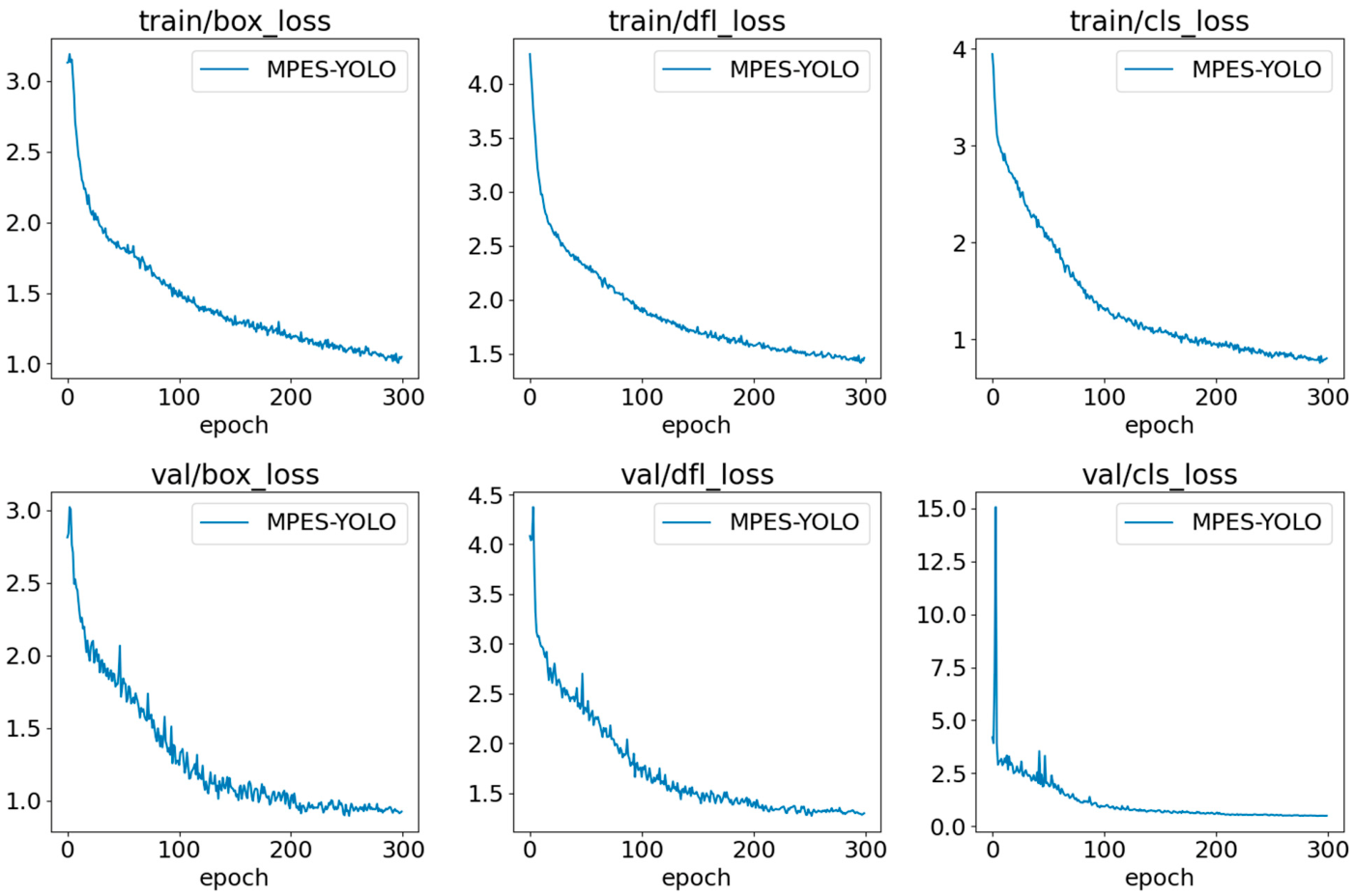
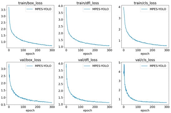
Additionally, the training loss curves of the MPES-YOLO model are shown in Figure 9. During training, the bounding box loss (box_loss), distribution focal loss (dfl_loss), and classification loss (cls_loss) all exhibit a consistent downward trend. The close alignment between training and validation losses indicates good convergence and generalization. Over 300 epochs, all loss metrics gradually stabilize, further confirming the effectiveness of MPES-YOLO for landslide detection in the Bijie dataset.
Figure 9.
Training and validation loss curves of MPES-YOLO model for Bijie landslide detection.
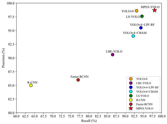
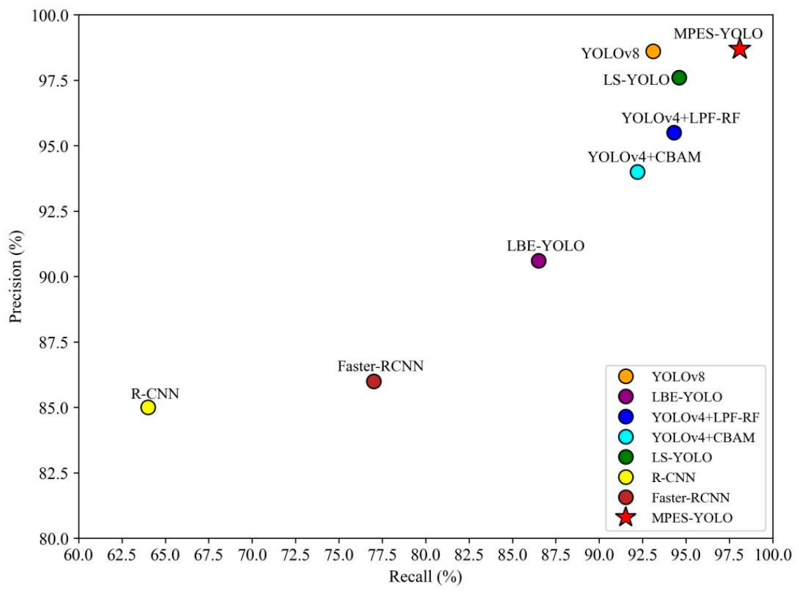
As reported in Table 3, MPES-YOLO achieves the best overall performance on the Bijie dataset, with precision, recall, F1-score, and mAP@0.5 reaching 98.7%, 98.1%, 98.4%, and 99.5%, respectively. Figure 10 further visualizes the comparative performance of different models in terms of precision and recall, providing a more intuitive illustration of the results in Table 3. Compared with the baseline YOLOv8, recall is improved by 5.0 percentage points, along with higher F1-score and mAP@0.5, indicating more reliable detection in complex environments. As shown in Figure 10, MPES-YOLO is positioned closest to the upper-right corner, demonstrating its superior balance between precision and recall. In contrast, although YOLOv8 and LS-YOLO achieve relatively high precision, their recall remains slightly lower, while LBE-YOLO exhibits a noticeable decrease in precision. Compared with other YOLO-based variants, including LBE-YOLO and LS-YOLO, MPES-YOLO consistently achieves superior or competitive results across all metrics, demonstrating a more balanced performance. In contrast, traditional two-stage detectors such as R-CNN and Faster R-CNN show notably lower recall and F1-scores, indicating limited suitability for this task. These visual observations are consistent with the quantitative results presented in Table 3, further validating the robustness of MPES-YOLO. Overall, these results confirm that MPES-YOLO achieves higher detection accuracy and stronger generalization across landslide datasets with varying geographical characteristics.
Table 3.
Results of generalization experiment on Bijie dataset.
Figure 10.
Scatter plot of precision and recall.
4.3. Performance of the MPES-YOLO for Loess Landslide Detection in Yan’an Area
To better demonstrate the effectiveness of the MPES-YOLO model and its improvements, this paper conducts comparative experiments between the enhanced model and other advanced detection models such as YOLOv8, YOLOv10 and YOLOv11. The detailed results of these comparisons are presented in Table 4. YOLOv8 serves as the baseline model, while YOLOv10 and YOLOv11 represent recent improvements in lightweight design and feature fusion strategies, respectively.
Table 4.
Evaluation of loess landslide detection results in Yan’an Area.
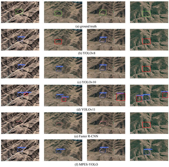
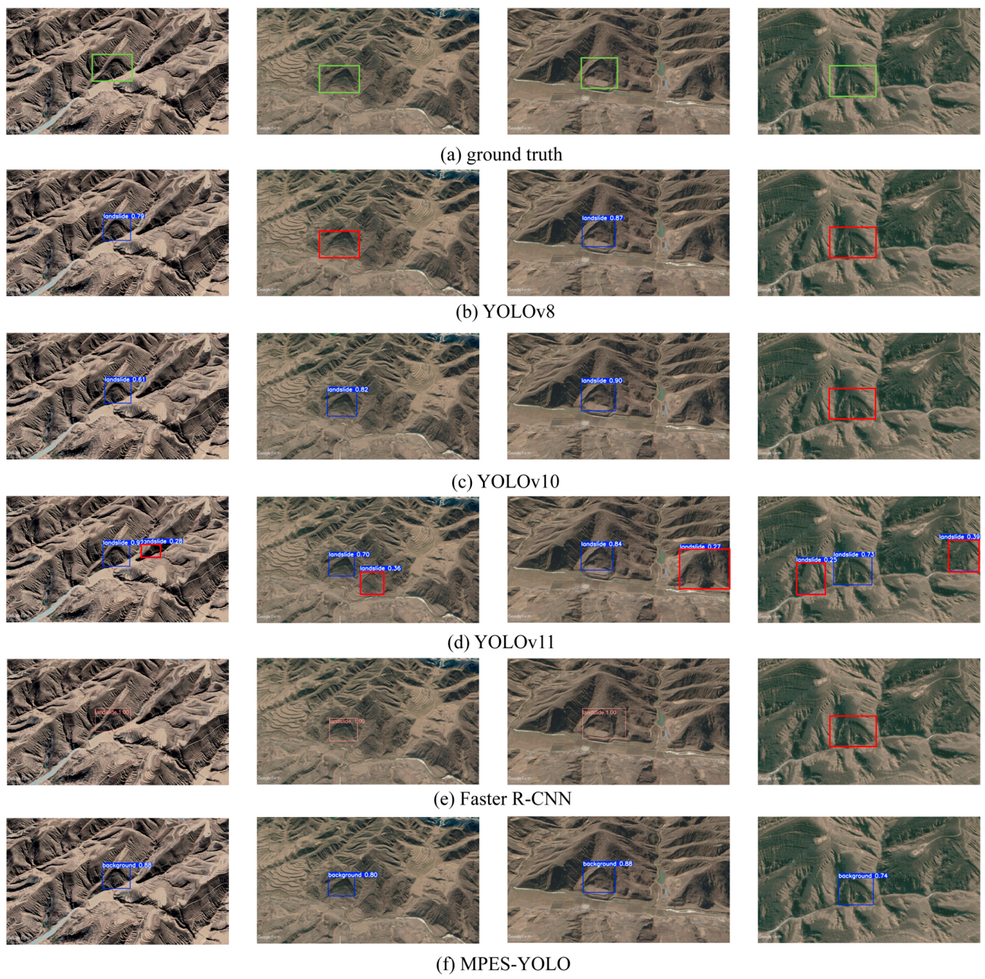
According to the specified experimental environment and training parameters, this study trains the MPES-YOLO model on the loess landslide dataset. The comparison results are shown in Figure 11. In Figure 11a–d, the visual interpretation results and the detection outputs of YOLOv8, YOLOv10, YOLOv11, and MPES-YOLO are presented, respectively. Red bounding boxes indicate false detections and missed detections for intuitive comparison. The MPES-YOLO proposed in this paper demonstrates superior detection performance for individual landslide targets, accurately localizing landslide regions and delineating boundaries. In contrast, all comparison models exhibit missed detections to varying degrees. YOLOv8 tends to miss targets when landslide features are indistinct or similar to the background, whereas YOLOv11 is more prone to false detections, particularly for small targets. In contrast, the MPES-YOLO model achieves higher confidence and accuracy, reflecting stronger feature representation and robustness.
Figure 11.
Results of loess landslide detection and comparison of different models. The green box represents ground truth, the red box represents false negative and false positive.
From the comparison results in Table 4, it can be observed that MPES-YOLO significantly improves recall and mAP metrics while maintaining efficient inference speed. Faster R-CNN, as a representative two-stage detection model, yields relatively lower performance in this task, with a precision of 92.1% and a recall of 75.5%. In contrast, the one-stage YOLO series models exhibit inherent advantages in balancing accuracy and inference efficiency, and the proposed MPES-YOLO further outperforms all compared methods across core metrics. Compared to other models, YOLOv8 demonstrates the best overall performance, with mAP@0.5:0.95 reaching 82.3% and maintaining efficient inference speed. However, its higher parameter count and computational overhead pose limitations in resource-constrained deployment scenario. Additionally, YOLOv11 achieves high precision of 97.6%, but still suffers from missed detections and increased computational cost. In contrast, the MPES-YOLO model achieves a better balance between accuracy and detection efficiency, with detection precision reaching 98.2% and mAP@0.5 achieving 91.9%. Meanwhile, the model reduces parameters by 23.3%, decreases floating-point operations by 21%, and compresses the model size to one-quarter of the original. Regarding computational efficiency, YOLO achieves the fastest inference speed of 18.3 ms per image compared to the baseline YOLOv8’s 19.2 ms. Under identical hardware configurations, MPES-YOLO requires approximately 3.4 h for 300 epochs of training compared to YOLOv8’s 4.0 h, representing a 15% reduction in training time. Furthermore, MPES-YOLO demonstrates strong robustness in complex backgrounds and represents the optimal solution for comprehensive performance.
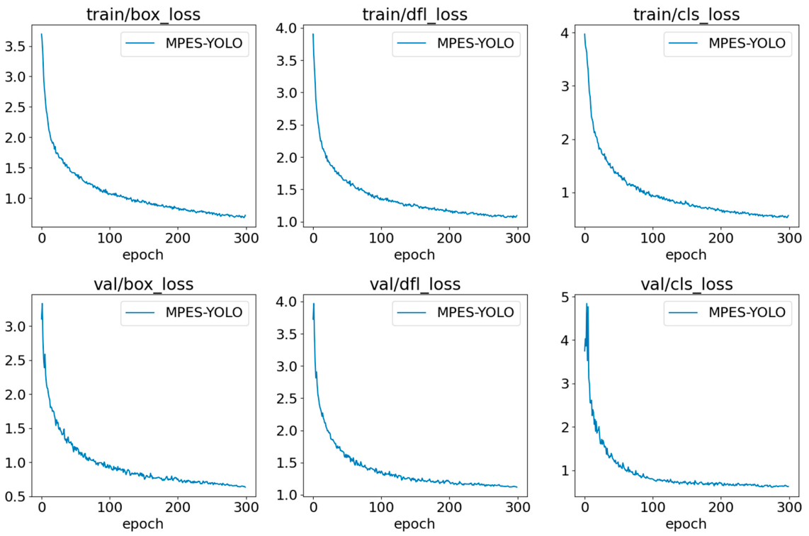
To validate the training stability and convergence performance, Figure 12 presents the learning curves of the MPES-YOLO model during the training process. All loss components exhibit smooth and stable convergence over 300 epochs. The consistent downward trends in both training and validation losses confirm the effectiveness of the proposed model architecture and training strategy. Moreover, the parallel trajectories of training and validation curves demonstrate robust generalization capability, validating that the MPES-YOLO model is well-suited for loess landslide detection tasks with stable and reliable performance.
Figure 12.
Training and validation loss curves of MPES-YOLO model for loess landslide detection.
4.4. Performance of the MPES-YOLO for Landslide Detection in Ningxia Area
To validate the generalization capability of the MPES-YOLO model across different loess environments, this study conducted independent verification experiments on the Ningxia landslide dataset. As a critical component of the Loess Plateau, the Ningxia region exhibits geological conditions that are both similar to and distinctly different from the Yan’an study area, providing an ideal testing environment for evaluating model cross-regional adaptability.
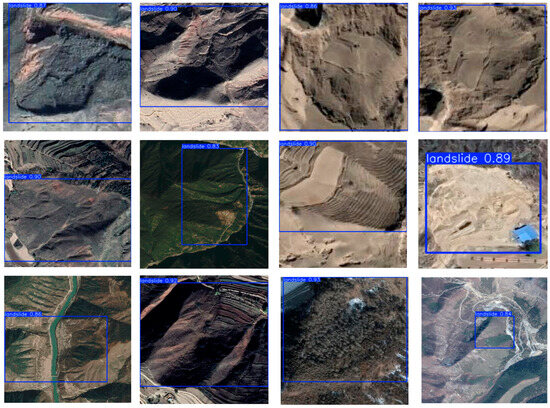
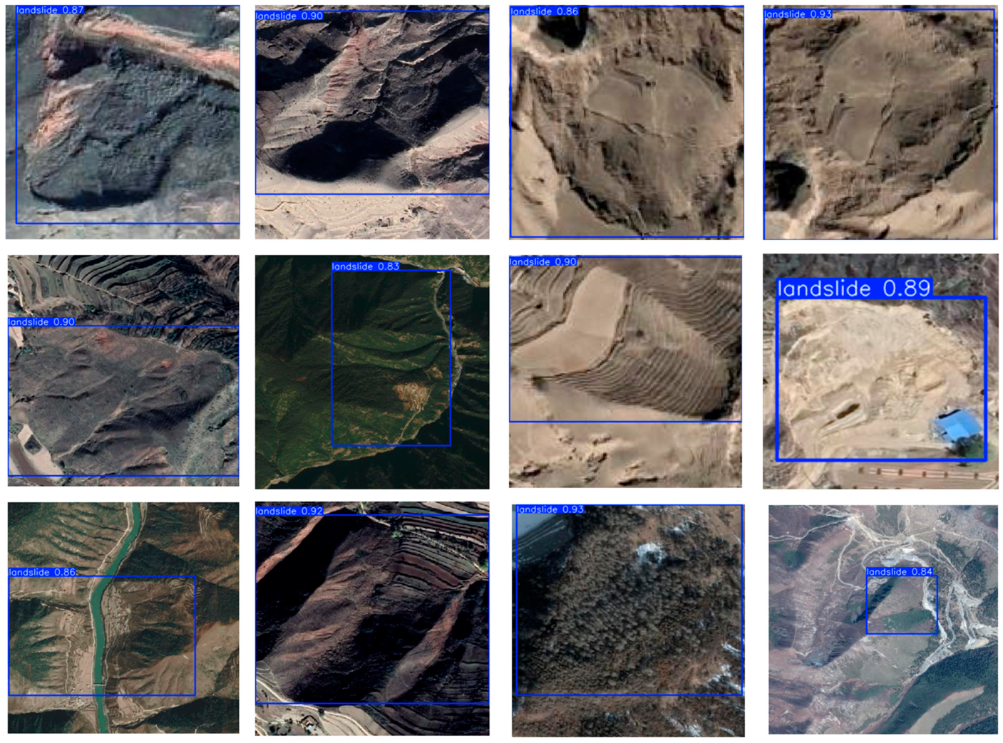
Figure 13 presents the detection results of MPES-YOLO on the Ningxia landslide dataset. The results demonstrate that MPES-YOLO maintains high detection accuracy across typical landslide types in Ningxia. For typical loess landslides morphologically similar to those in the Yan’an region, MPES-YOLO accurately identifies landslide boundaries. These landslides display distinct headscarps and lateral boundaries, forming clear contrasts with the background loess, and the model’s detection accuracy reaches levels comparable to those achieved on the Yan’an dataset.
Figure 13.
Results of Ningxia loess landslide detection.
For landslide areas with relatively high vegetation coverage, MPES-YOLO demonstrates robust detection capabilities. Despite the increased spectral complexity introduced by vegetation, the model successfully locates landslide boundaries through multi-scale feature extraction and edge enhancement mechanisms. This result indicates that MPES-YOLO possesses the capability to handle landslide detection under varying vegetation coverage conditions. For large-scale shallow landslides characteristic of the Ningxia region, these landslides typically exhibit gentle boundary transitions and relatively low spectral contrast, yet MPES-YOLO effectively captures the complete boundary extents of these landslides through SEE module boundary enhancement and MPCE module multi-scale feature fusion, achieving accurate detection. MPES-YOLO achieves superior detection performance on the Ningxia landslide dataset. The model achieved a precision of 91.5%, a recall of 95.3%, and an mAP@0.5 of 97.4%. These results confirm strong generalization capability in the Ningxia region under complex environmental conditions.
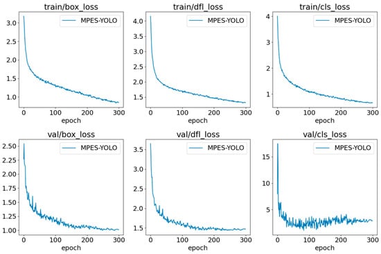
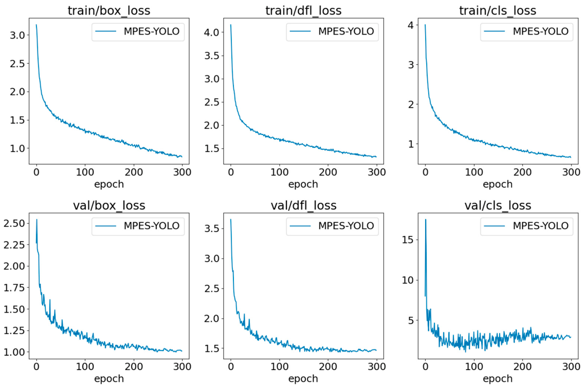
Finally, Figure 14 presents the training and validation loss curves of the MPES-YOLO model during the training process on the Ningxia dataset. Throughout the training process, the bounding box loss, distribution focal loss, and classification loss all exhibit steady downward trends and ultimately achieve convergence. The training and validation losses maintain good consistency, indicating that the model possesses excellent convergence properties and generalization capability. The smooth convergence trends further validate the effectiveness of the proposed model architecture and training strategy.
Figure 14.
Training and validation loss curves of MPES-YOLO model for Ningxia loess landslide detection.
4.5. Visualization of Selective Edge Enhancement Results
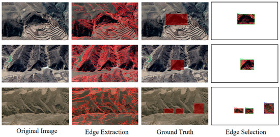
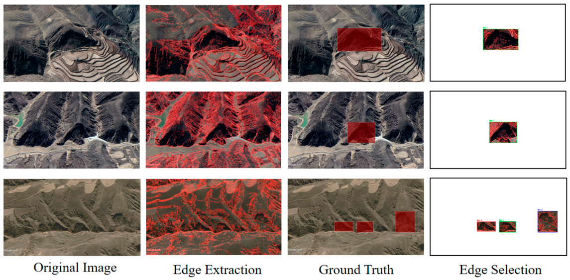
To conduct an in-depth analysis of the SEE module’s effectiveness in loess landslide detection, this study provides a detailed examination of the selective edge enhancement visualization results. Figure 15 demonstrates the edge enhancement effects of the SEE module on loess landslide samples.
Figure 15.
Selective edge enhancement results on loess landslide.
The visualization results reveal that the SEE module excels at processing the irregular boundaries of loess landslides. Loess landslides typically exhibit complex morphologies in elliptical or armchair-like shapes. Their boundaries are characterized by high irregularity and ambiguity. Traditional rectangular bounding box annotation methods struggle to accurately represent such complex geometric features. In contrast, the SEE module extracts authentic geological boundary information. This enables better capture of the actual contour characteristics of landslide bodies and provides more precise boundary constraint information for the model.
However, conventional Laplacian edge detection alone presents significant limitations. While it can extract edge information from images, it introduces substantial background noise and irrelevant boundaries. These include edge features from vegetation, roads, buildings, and other ground objects. Such interference not only increases computational burden but may also mislead the model’s learning process. The SEE module’s selective edge extraction strategy significantly addresses this issue. It utilizes manually annotated ground truth bounding box information for spatial constraints. This approach effectively filters out irrelevant edge information outside landslide regions while preserving only geological boundary features related to landslide targets. Figure 15 shows that the selectively filtered edge information becomes clearer and more accurate. It effectively highlights the contour boundaries of landslide bodies while suppressing background interference.
The feature fusion visualization results demonstrate effective integration between edge information processed by the SEE module and multi-scale features extracted by the MPCE module. This integration creates richer and more discriminative feature representations. The fusion strategy not only enhances the model’s perception capability for landslide boundaries but also improves detection accuracy for occluded targets and small-scale targets.
4.6. Ablation Experiment
Furthermore, this research conducted an ablation study to further evaluate the performance of each enhancement and improvement strategies in the model and the detail results are shown in Table 5.
Table 5.
Results of ablation experiment in Yan’an Area.
Through comprehensive analysis of the ablation study results and visual comparisons, the proposed improvement strategies demonstrate significant effectiveness within the YOLOv8 framework. These strategies not only enable detection of landslides with varying backgrounds and sizes, but also effectively enhance computational speed and detection accuracy.
Test 1 represents the original YOLOv8 model, achieving an mAP of 88% for loess landslide detection, with 8.1 GFLOPs computational cost and a model size of 5.97 MB.
By replacing the original convolution with multi-scale lightweight partial convolution, we not only improved the accuracy to 96.8% but also significantly reduced computational complexity, with the model size decreasing from 5.97 MB to 4.62 MB, demonstrating effective lightweight performance. The incorporation of EMA mitigates training fluctuations caused by complex backgrounds, leading to improvements in both accuracy and mAP@0.5, while partially compensating for the missed detection issues introduced by partial convolution.
The SEE module introduced in this work extracts authentic edge information from target regions using the Laplacian operator, resulting in a 1.3% improvement in precision and a 0.8% increase in mAP, indicating its effectiveness in addressing false detections caused by boundary blur. Furthermore, comparing Test 6 and Test 7 reveals that the SEE module enhances detection accuracy without affecting FLOPs or model size, confirming the efficiency of the edge information fusion strategy. Finally, SIoU further improved the detection accuracy for loess landslides.
Test 9 demonstrates that the proposed MPES-YOLO model achieves optimal overall performance with an mAP of 91.9%, a 21% reduction in FLOPs, and a model size of only 4.58 MB. The ablation studies confirm that all three improvement strategies proposed for the YOLOv8 object detection model are practically viable enhancements that effectively capture the complex geometric relationships of landslide boundaries, thereby strengthening the model’s capability to accurately delineate landslide extents and providing robust support for reliable geological hazard monitoring applications.
5. Discussion
The MPES-YOLO model proposed in this study introduces a robust solution for loess landslide detection by optimizing the balance between accuracy and computational efficiency. Unlike mainstream models, our framework addresses the specific challenges of complex backgrounds and multi-scale features inherent in loess terrain while significantly reducing the demand on hardware resources. These improvements are primarily driven by the MPCE module, which integrates multi-scale partial convolution with EMA attention to eliminate redundant feature computation. This architectural refinement allowed us to reduce the computational cost from 8.1 GFLOPs to 6.4 GFLOPs and the model size from 5.97 MB to 4.58 MB without compromising the representation of occluded or multi-scale targets. Furthermore, the SEE module utilizes the Laplacian operator to strengthen the model’s perception of landslide edges, effectively mitigating the boundary ambiguity often caused by the similarity between landslides and the surrounding loess environment.
Experimental evaluations across the Bijie, Yan’an, and Ningxia datasets confirm that MPES-YOLO achieves superior performance and strong generalization capabilities. In the Yan’an region, the model improved mAP@0.5 by 3.9%, 4.1%, and 3.0% compared to YOLOv8, YOLOv10, and YOLOv11, respectively, while maintaining a rapid inference speed of 18.3 ms. The robustness of the model was further evidenced in the Ningxia region, where it maintained stable performance despite the presence of large-scale shallow slides characterized by weak textures and smooth transitions. This stability is attributed to the synergistic effect of the MPCE module’s multi-scale capture and the SEE module’s edge enhancement, enabling reliable detection across diverse geological conditions.
Despite these advancements, certain limitations remain. The current training dataset is limited in scale and diversity, which may impact the model’s performance in extremely complex geological settings. Additionally, the reliance on optical remote sensing imagery alone makes it difficult to capture subtle early-stage deformation signals that multi-source data like SAR could provide. Future work will therefore focus on introducing transfer learning strategies to enhance adaptability under small-sample conditions and exploring multi-modal data fusion by integrating optical imagery with deformation monitoring data to improve sensitivity to early-stage landslide activities.
6. Conclusions
In the Loess Plateau region, landslides vary significantly in size and shape, with textures that are highly similar to the surrounding background. This makes them easily blend with the environment and poses considerable challenges for effective detection in orthophoto remote sensing images. To address these challenges, a deep learning-based model named MPES-YOLO is proposed, which integrates an MPCE module and an edge detection SEE module, while replacing the loss function with SIoU. In our experiments, we first tested MPES-YOLO on the Bijie dataset where landslide features are relatively obvious. The model achieved 99.5% mAP@0.5 detection accuracy, validating its effectiveness. We applied our model to the intelligent identification of typical loess landslides in Yan’an and Ningxia areas. The results show that the detection accuracy of MPES-YOLO reaches 91.9% and 97.4% respectively, while the model parameters are reduced by 23.3%. The validation results indicate that MPES-YOLO can effectively enhance detection capabilities for small targets and occluded targets in loess landslide detection, while possessing the ability to transfer across similar geological environments. This research not only achieves rapid and accurate detection of landslide disasters but also advances the practical application of landslide monitoring in loess regions and provides new technological approaches for early warning and disaster mitigation.
Author Contributions
Conceptualization, H.C. and J.X.; methodology, H.C. and J.S.; validation, H.C. and J.S.; formal analysis, H.C. and B.W.; investigation, H.C. and J.S.; resources, J.X.; writing—original draft preparation, H.C. and J.S.; writing—review and editing, J.X., H.S. and P.L.; visualization, Z.Z. and B.W.; supervision, J.X.; funding acquisition, J.X. and P.L. All authors have read and agreed to the published version of the manuscript.
Funding
This work was supported in part by the National Key R&D Program of China (2023YFC3008300 & 2023YFC3008304, 2022YFC3004302); in part by Major Program of the National Natural Science Foundation of China (41941019); in part by National Natural Science Foundation of China (42371356, 42171348, 41929001); in part by the Shaanxi Province Science and Technology Innovation Team under Grant 2021TD51, in part by the Shaanxi Province Geoscience Big Data and Geohazard Prevention Innovation Team under Grant 2022; in part by the Fundamental Research Funds for the Central Universities (300102262202, 300102260301/087, 300102264915, 300102260404/087, 300102262902, 300102269103, 300102269304, 300102269205, 300102262712); in part by the Northwest Engineering Corporation Limited Major Science and Technology Projects (XBY-YBKJ-2023-23); and in part by The Key Scientific and Technological Project of Power China Corporation (KJ-2023-022).
Data Availability Statement
The original contributions presented in this study are included in the article. Further inquiries can be directed to the corresponding author.
Conflicts of Interest
Author Haixing Shang was employed by the company Northwest Engineering Corporation Ltd. The remaining authors declare that the research was conducted in the absence of any commercial or financial relationships that could be construed as a potential conflict of interest.
References
- Zhang, Y.; Ayyub, B.M.; Gong, W.; Tang, H. Risk assessment of roadway networks exposed to landslides in mountainous regions—A case study in Fengjie County, China. Landslides 2023, 20, 1419–1431. [Google Scholar] [CrossRef] [Scilit]
- Qiu, H.; Su, L.; Tang, B.; Yang, D.; Ullah, M.; Zhu, Y.; Kamp, U. The effect of location and geometric properties of landslides caused by rainstorms and earthquakes. Earth Surf. Process. Landf. 2024, 49, 2067–2079. [Google Scholar] [CrossRef] [Scilit]
- Luo, J.; Zhao, Z.; Li, W.; Huang, L.; Zhao, W. Landslide hazard assessment of an urban agglomeration in central Guizhou Province based on an information value method and SVM, bagging, DNN algorithm. Sci. Rep. 2025, 15, 2483. [Google Scholar] [CrossRef] [Scilit]
- Zhao, K.; Qiu, H.; Liu, Y.; Liu, Z.; Huangfu, W.; Tang, B.; Yang, D.; Yang, G. Probability of rainfall-induced landslides coupled with effective-duration threshold and soil moisture. J. Hydrol. Reg. Stud. 2025, 57, 102112. [Google Scholar] [CrossRef] [Scilit]
- Gao, S.; Xi, J.; Li, Z.; Ge, D.; Guo, Z.; Yu, J.; Wu, Q.; Zhao, Z.; Xu, J. Optimal and multi-view strategic hybrid deep learning for old landslide detection in the loess plateau, Northwest China. Remote Sens. 2024, 16, 1362. [Google Scholar] [CrossRef] [Scilit]
- Shi, X.; Zhang, L.; Zhong, Y.; Zhang, L.; Liao, M. Detection and characterization of active slope deformations with Sentinel-1 InSAR analyses in the southwest area of Shanxi, China. Remote Sens. 2020, 12, 392. [Google Scholar] [CrossRef] [Scilit]
- Chen, X.; Zhao, C.; Liu, X.; Zhang, S.; Xi, J.; Khan, B.A. An embedding swin transformer model for automatic slow-moving landslide detection based on insar products. IEEE Trans. Geosci. Remote Sens. 2024, 62, 5223915. [Google Scholar] [CrossRef] [Scilit]
- Li, H.; He, Y.; Xu, Q.; Deng, J.; Li, W.; Wei, Y. Detection and segmentation of loess landslides via satellite images: A two-phase framework. Landslides 2022, 19, 673–686. [Google Scholar] [CrossRef] [Scilit]
- Yilmaz, I. Comparison of landslide susceptibility mapping methodologies for Koyulhisar, Turkey: Conditional probability, logistic regression, artificial neural networks, and support vector machine. Environ. Earth Sci. 2010, 61, 821–836. [Google Scholar] [CrossRef] [Scilit]
- Can, R.; Kocaman, S.; Gokceoglu, C. A comprehensive assessment of XGBoost algorithm for landslide susceptibility mapping in the upper basin of Ataturk dam, Turkey. Appl. Sci. 2021, 11, 4993. [Google Scholar] [CrossRef] [Scilit]
- Chang, Z.; Huang, J.; Huang, F.; Bhuyan, K.; Meena, S.R.; Catani, F. Uncertainty analysis of non-landslide sample selection in landslide susceptibility prediction using slope unit-based machine learning models. Gondwana Res. 2023, 117, 307–320. [Google Scholar] [CrossRef] [Scilit]
- Schmidhuber, J. Deep learning in neural networks: An overview. Neural Netw. 2015, 61, 85–117. [Google Scholar] [CrossRef] [Scilit]
- Ren, S.; He, K.; Girshick, R.; Sun, J. Faster R-CNN: Towards real-time object detection with region proposal networks. IEEE Trans. Pattern Anal. Mach. Intell. 2016, 39, 1137–1149. [Google Scholar] [CrossRef] [Scilit]
- He, K.; Gkioxari, G.; Dollár, P.; Girshick, R. Mask r-cnn. In Proceedings of the IEEE International Conference on Computer Vision; IEEE Computer Society: Los Alamitos, CA, USA, 2017; pp. 2961–2969. [Google Scholar]
- Sapkota, R.; Qureshi, R.; Flores-Calero, M.; Badgujar, C.; Nepal, U.; Poulose, A.; Zeno, P.; Vaddevolu, U.B.P.; Khan, S.; Karkee, M. Yolov10 to its genesis: A decadal and comprehensive review of the you only look once series. arXiv 2024, arXiv:2406.19407. [Google Scholar] [CrossRef] [Scilit]
- Liu, W.; Anguelov, D.; Erhan, D.; Szegedy, C.; Reed, S.; Fu, C.Y.; Berg, A.C. Ssd: Single shot multibox detector. In Proceedings of the Computer Vision–ECCV 2016: 14th European Conference, Amsterdam, The Netherlands, 11–14 October 2016; Part I 14; Springer International Publishing: Cham, Switzerland, 2016; pp. 21–37. [Google Scholar]
- Wang, G.; Chen, Y.; An, P.; Hong, H.; Hu, J.; Huang, T. UAV-YOLOv8: A small-object-detection model based on improved YOLOv8 for UAV aerial photography scenarios. Sensors 2023, 23, 7190. [Google Scholar] [CrossRef] [Scilit] [PubMed]
- Chen, X.; Zhao, C.; Xi, J.; Lu, Z.; Ji, S.; Chen, L. Deep learning method of landslide inventory map with imbalanced samples in optical remote sensing. Remote Sens. 2022, 14, 5517. [Google Scholar] [CrossRef] [Scilit]
- Chen, X.; Zhao, C.; Lu, Z.; Xi, J. Landslide Inventory Mapping Based on Independent Component Analysis and UNet3+: A Case of Jiuzhaigou, China. IEEE J. Sel. Top. Appl. Earth Obs. Remote Sens. 2023, 17, 2213–2223. [Google Scholar] [CrossRef] [Scilit]
- Jiang, W.; Xi, J.; Li, Z.; Zang, M.; Chen, B.; Zhang, C.; Liu, Z.; Gao, S.; Zhu, W. Deep learning for landslide detection and segmentation in high-resolution optical images along the Sichuan-Tibet transportation corridor. Remote Sens. 2022, 14, 5490. [Google Scholar] [CrossRef] [Scilit]
- Jiang, W.; Xi, J.; Li, Z.; Ding, M.; Yang, L.; Xie, D. Landslide detection and segmentation using mask R-CNN with simulated hard samples. Geomat. Inf. Sci. Wuhan Univ. 2023, 48, 1931–1942. [Google Scholar]
- Liu, X.; Xu, L.; Zhang, J. Landslide detection with Mask R-CNN using complex background enhancement based on multi-scale samples. Geomat. Nat. Hazards Risk 2024, 15, 2300823. [Google Scholar] [CrossRef] [Scilit]
- Ghorbanzadeh, O.; Shahabi, H.; Crivellari, A.; Homayouni, S.; Blaschke, T.; Ghamisi, P. Landslide detection using deep learning and object-based image analysis. Landslides 2022, 19, 929–939. [Google Scholar] [CrossRef] [Scilit]
- Wang, H.; Liu, J.; Zeng, S.; Xiao, K.; Yang, D.; Yao, G.; Yang, R. A novel landslide identification method for multi-scale and complex background region based on multi-model fusion: YOLO+ U-Net. Landslides 2024, 21, 901–917. [Google Scholar] [CrossRef] [Scilit]
- Dai, J.; Dai, X.; Zhang, R.; Ma, J.; Li, W.; Lu, H.; Li, W.; Liang, S.; Dai, T.; Zhao, L.; et al. Using lightweight method to detect landslide from satellite imagery. Int. J. Appl. Earth Obs. Geoinf. 2024, 135, 104303. [Google Scholar] [CrossRef] [Scilit]
- Cheng, L.; Li, J.; Duan, P.; Wang, M. A small attentional YOLO model for landslide detection from satellite remote sensing images. Landslides 2021, 18, 2751–2765. [Google Scholar] [CrossRef] [Scilit]
- Li, J.; Zhang, J.; Fu, Y. CTHNet: A CNN–Transformer Hybrid Network for Landslide Identification in Loess Plateau Regions Using High-Resolution Remote Sensing Images. Sensors 2025, 25, 273. [Google Scholar] [CrossRef] [Scilit] [PubMed]
- Sun, Y.; Tada, R.; Chen, J.; Liu, Q.; Toyoda, S.; Tani, A.; Ji, J.; Isozaki, Y. Tracing the provenance of fine-grained dust deposited on the central Chinese Loess Plateau. Geophys. Res. Lett. 2008, 35, L01804. [Google Scholar] [CrossRef] [Scilit]
- Fu, B.; Chen, L.; Ma, K.; Zhou, H.; Wang, J. The relationships between land use and soil conditions in the hilly area of the loess plateau in northern Shaanxi, China. Catena 2000, 39, 69–78. [Google Scholar] [CrossRef] [Scilit]
- Yu, Z.; Chang, R.; Chen, Z. Automatic detection method for loess landslides based on GEE and an improved YOLOX algorithm. Remote Sens. 2022, 14, 4599. [Google Scholar] [CrossRef] [Scilit]
- Feng, H.; Chen, X.; Duan, Z. LCDDN-YOLO: Lightweight Cotton Disease Detection in Natural Environment, Based on Improved YOLOv8. Agriculture 2025, 15, 421. [Google Scholar] [CrossRef] [Scilit]
- Yang, R.; Yuan, D.; Zhao, M.; Zhao, Z.; Zhang, L.; Fan, Y.; Liang, G.; Zhou, Y. Camellia oleifera Tree Detection and Counting Based on UAV RGB Image and YOLOv8. Agriculture 2024, 14, 1789. [Google Scholar] [CrossRef] [Scilit]
- Zhang, X.; Zuo, G. Small target detection in UAV view based on improved YOLOv8 algorithm. Sci. Rep. 2025, 15, 421. [Google Scholar] [CrossRef] [Scilit]
- Chen, J.; Kao, S.H.; He, H.; Zhuo, W.; Wen, S.; Lee, C.H.; Chan, S.H.G. Run, don’t walk: Chasing higher FLOPS for faster neural networks. In Proceedings of the IEEE/CVF Conference on Computer Vision and Pattern Recognition; IEEE: New York City, NY, USA, 2023; pp. 12021–12031. [Google Scholar]
- Zhou, M.; Wan, X.; Yang, Y.; Zhang, J.; Li, S.; Zhou, S.; Jiang, X. EBR-YOLO: A Lightweight Detection Method for Non-Motorized Vehicles Based on Drone Aerial Images. Sensors 2025, 25, 196. [Google Scholar] [CrossRef] [Scilit] [PubMed]
- Li, J.; Yu, C.; Wei, W.; Li, J.; Huang, K.; Hussian, A.; Liu, X.; Zhou, Y. A Multi-scale Feature Fusion Network Focusing on Small Objects in UAV-View. Cogn. Comput. 2025, 17, 89. [Google Scholar] [CrossRef] [Scilit]
- Yu, F.; Liu, J. Switching Current Predictive Control of a Permanent Magnet Synchronous Motor Based on the Exponential Moving Average Algorithm. Energies 2024, 17, 3577. [Google Scholar] [CrossRef] [Scilit]
- Williams, B.M.; Durvasula, P.K.; Brown, D.E. Urban freeway traffic flow prediction: Application of seasonal autoregressive integrated moving average and exponential smoothing models. Transp. Res. Rec. 1998, 1644, 132–141. [Google Scholar] [CrossRef] [Scilit]
- Zhang, J.; Shao, M.; Wan, Y.; Meng, L.; Cao, X.; Wang, S. Boundary-aware spatial and frequency dual-domain transformer for remote sensing urban images segmentation. IEEE Trans. Geosci. Remote Sens. 2024, 62, 5637718. [Google Scholar] [CrossRef] [Scilit]
- Gevorgyan, Z. SIoU loss: More powerful learning for bounding box regression. arXiv 2022, arXiv:2205.12740. [Google Scholar] [CrossRef] [Scilit]
- Du, Y.; Xu, X.; He, X. Optimizing geo-hazard response: LBE-YOLO’s innovative lightweight framework for enhanced real-time landslide detection and risk mitigation. Remote Sens. 2024, 16, 534. [Google Scholar] [CrossRef] [Scilit]
- Yang, Y.; Miao, Z.; Zhang, H.; Wang, B.; Wu, L. Lightweight attention-guided YOLO with level set layer for landslide detection from optical satellite images. IEEE J. Sel. Top. Appl. Earth Obs. Remote Sens. 2024, 17, 3543–3559. [Google Scholar] [CrossRef] [Scilit]
- Zhang, W.; Liu, Z.; Zhou, S.; Qi, W.; Wu, X.; Zhang, T.; Han, L. LS-YOLO: A novel model for detecting multiscale landslides with remote sensing images. IEEE J. Sel. Top. Appl. Earth Obs. Remote Sens. 2024, 17, 4952–4965. [Google Scholar] [CrossRef] [Scilit]
- Tanatipuknon, A.; Aimmanee, P.; Watanabe, Y.; Murata, K.T.; Wakai, A.; Sato, G.; Tungpimolrut, K.; Keerativittayanun, S.; Karnjana, J. Study on combining two faster R-CNN models for landslide detection with a classification decision tree to improve the detection performance. J. Disaster Res. 2021, 16, 588–595. [Google Scholar] [CrossRef] [Scilit]

Disclaimer/Publisher’s Note: The statements, opinions and data contained in all publications are solely those of the individual author(s) and contributor(s) and not of MDPI and/or the editor(s). MDPI and/or the editor(s) disclaim responsibility for any injury to people or property resulting from any ideas, methods, instructions or products referred to in the content. |
© 2026 by the authors. Licensee MDPI, Basel, Switzerland. This article is an open access article distributed under the terms and conditions of the Creative Commons Attribution (CC BY) license.