Article

Global Land Cover Assessment Using Spatial Uniformity Validation Dataset
1
United Graduate School of Agricultural Science, Tokyo University of Agricultural and Technology, 3-21-1 Chuuo, Ami 300-0393, Ibaraki, Japan
2
Geological Survey of Japan, National Institute of Advanced Industrial Science and Technology, Tsukuba Central 7, Higashi 1-1-1, Tsukuba 305-8567, Ibaraki, Japan
3
College of Agriculture, Ibaraki University, 3-21-1 Chuo, Ami 300-0393, Ibaraki, Japan
*
Author to whom correspondence should be addressed.
Remote Sens. 2021, 13(15), 2950; https://doi.org/10.3390/rs13152950
Submission received: 30 June 2021 / Revised: 20 July 2021 / Accepted: 23 July 2021 / Published: 27 July 2021
(This article belongs to the Special Issue Recent Advances in Satellite Derived Global Land Product Validation)

Abstract

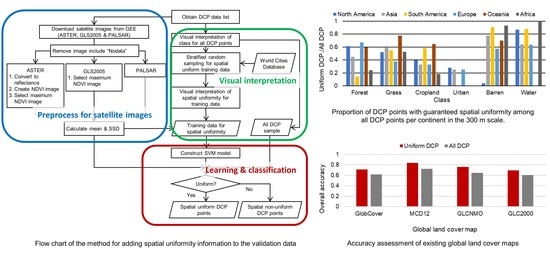
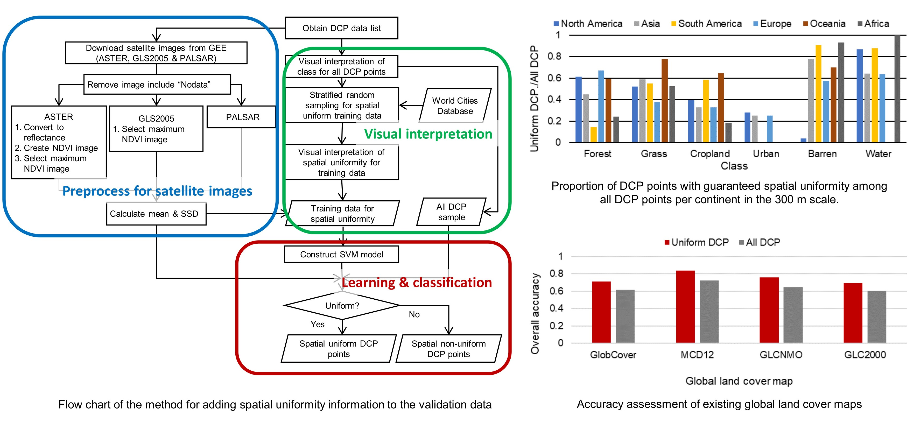
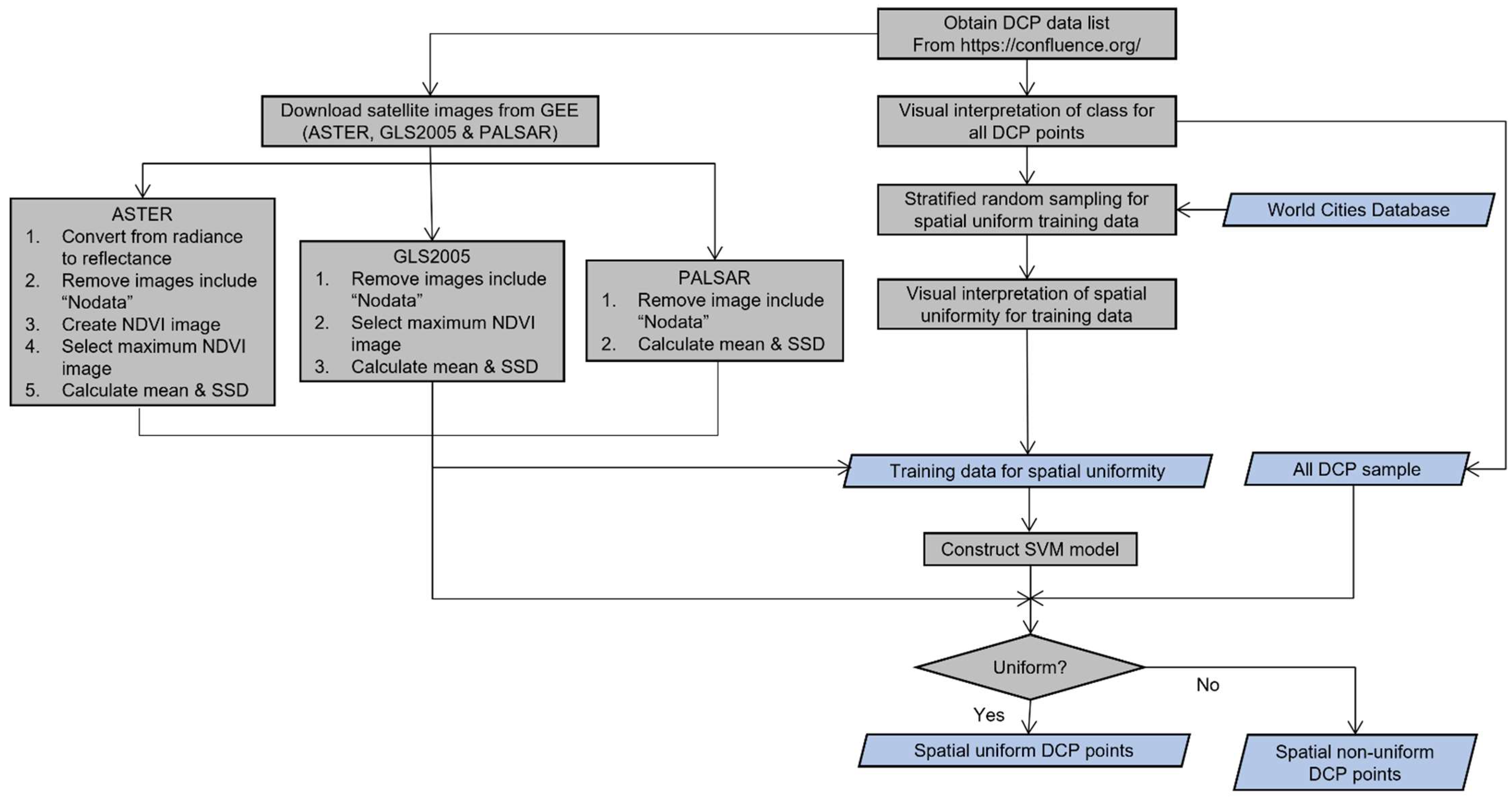
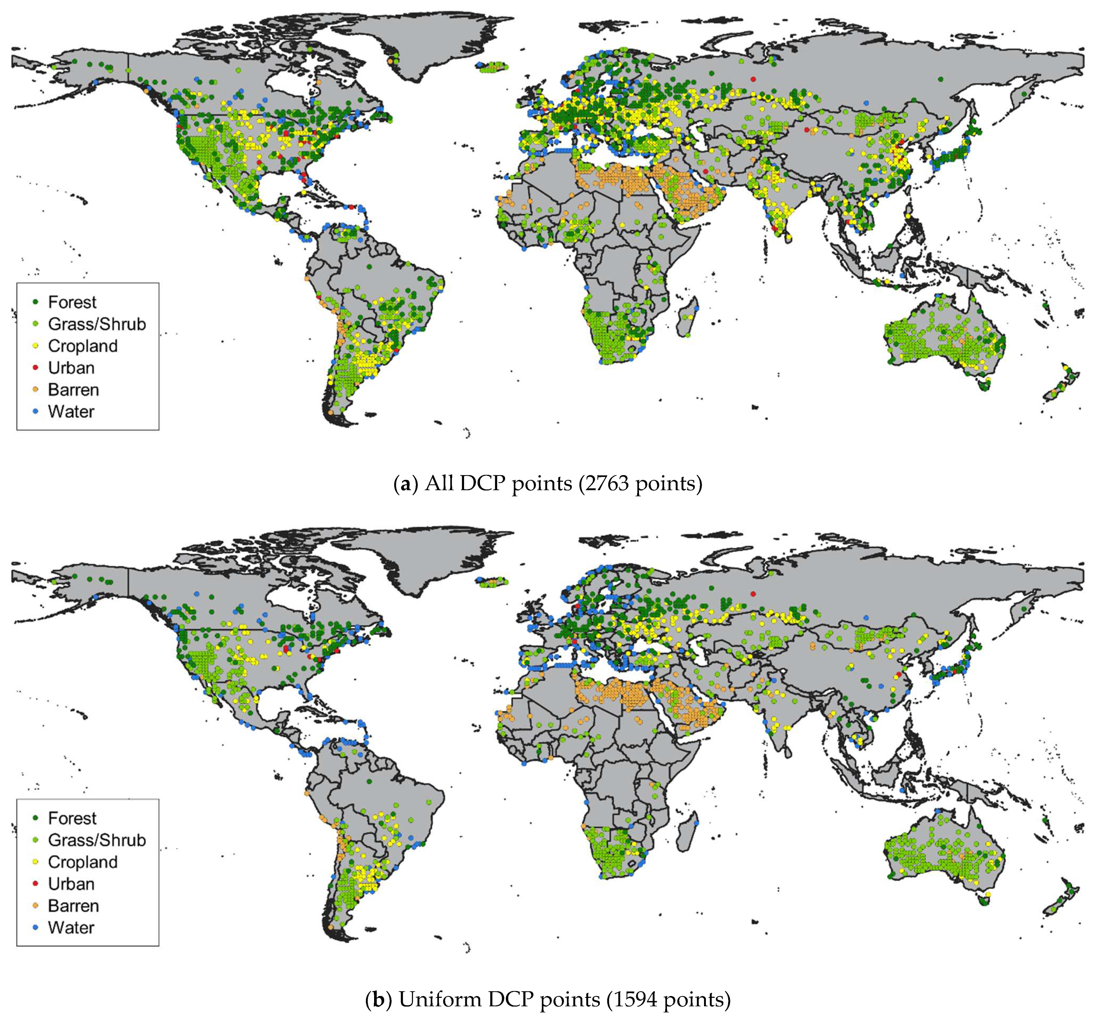
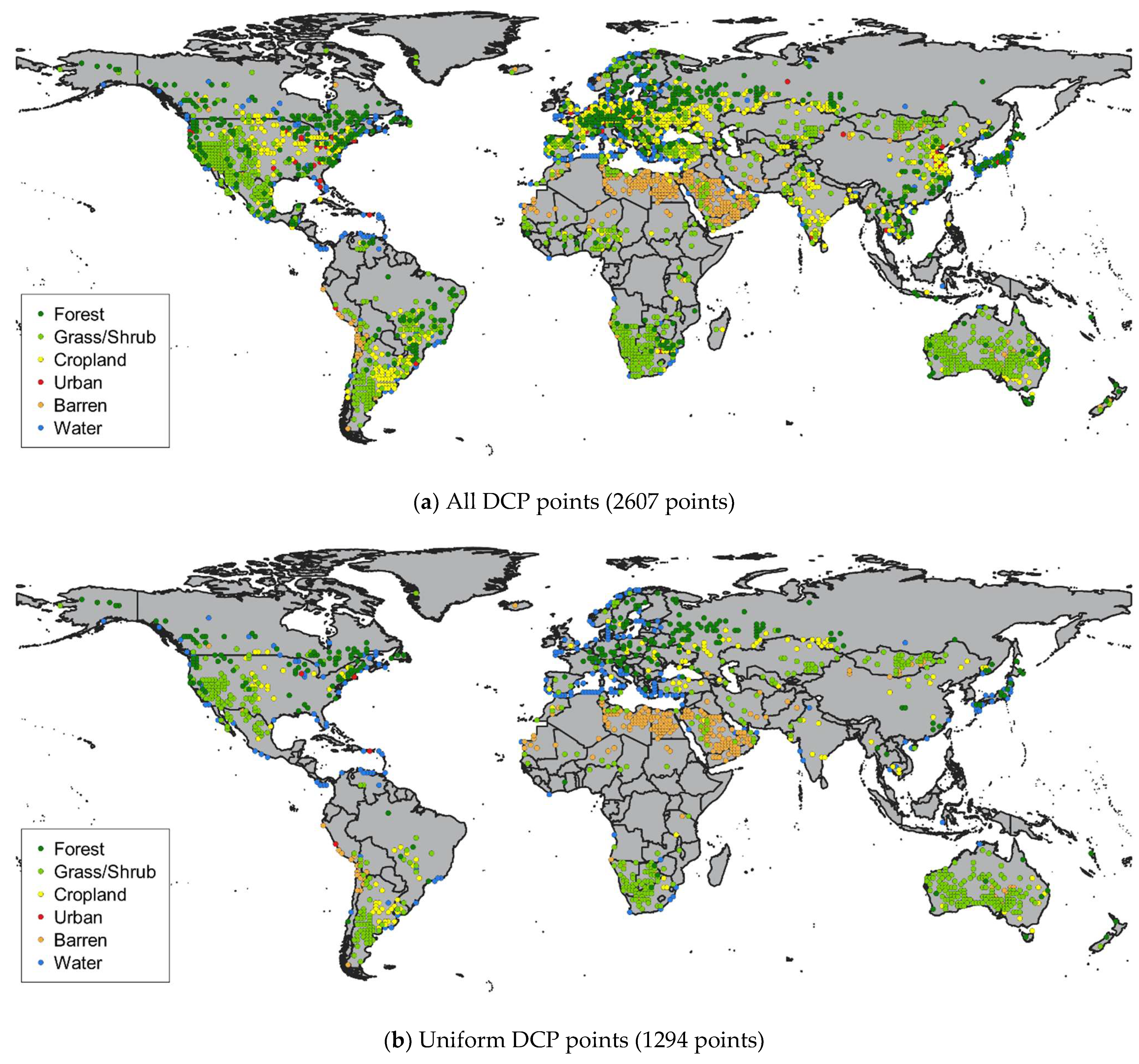
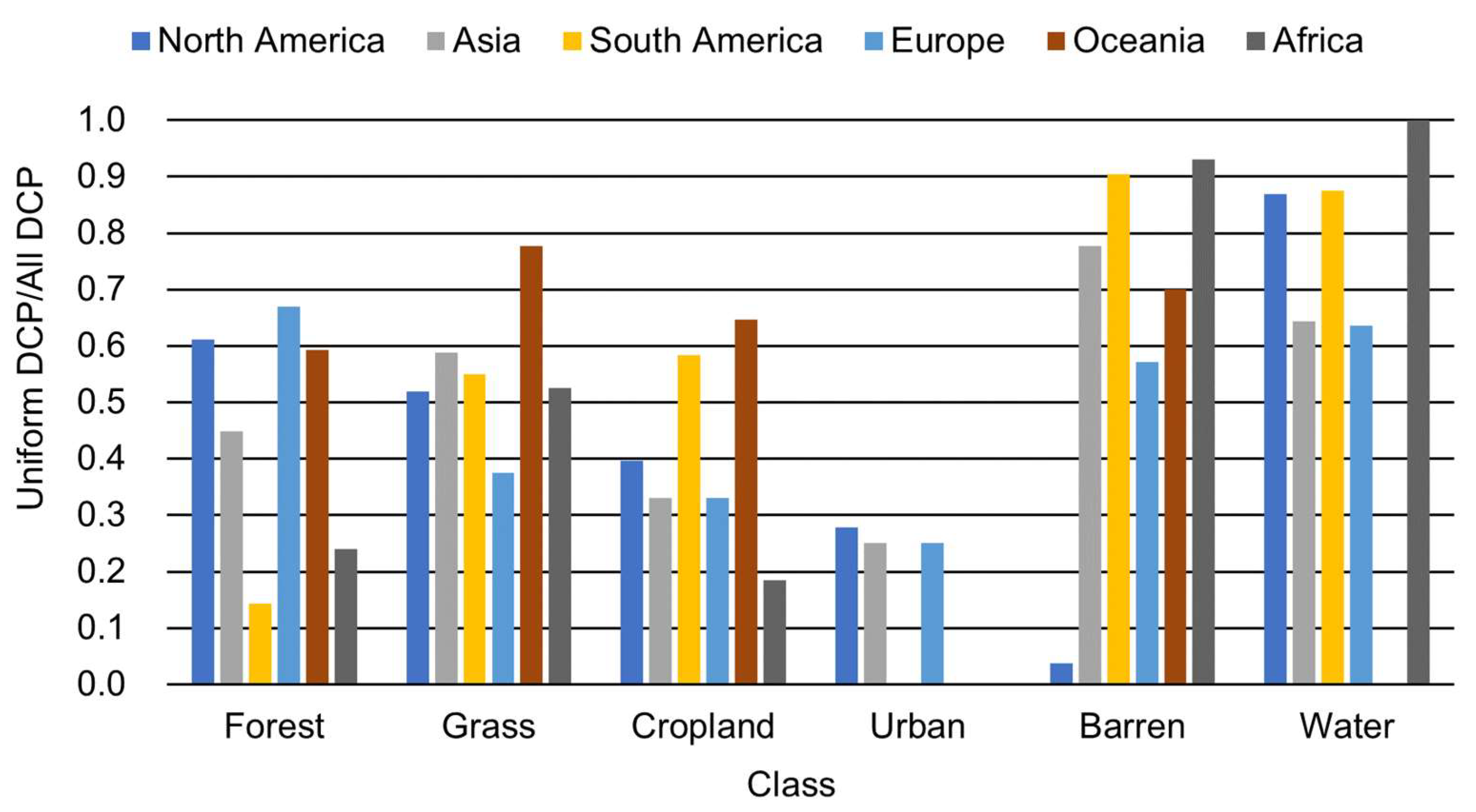
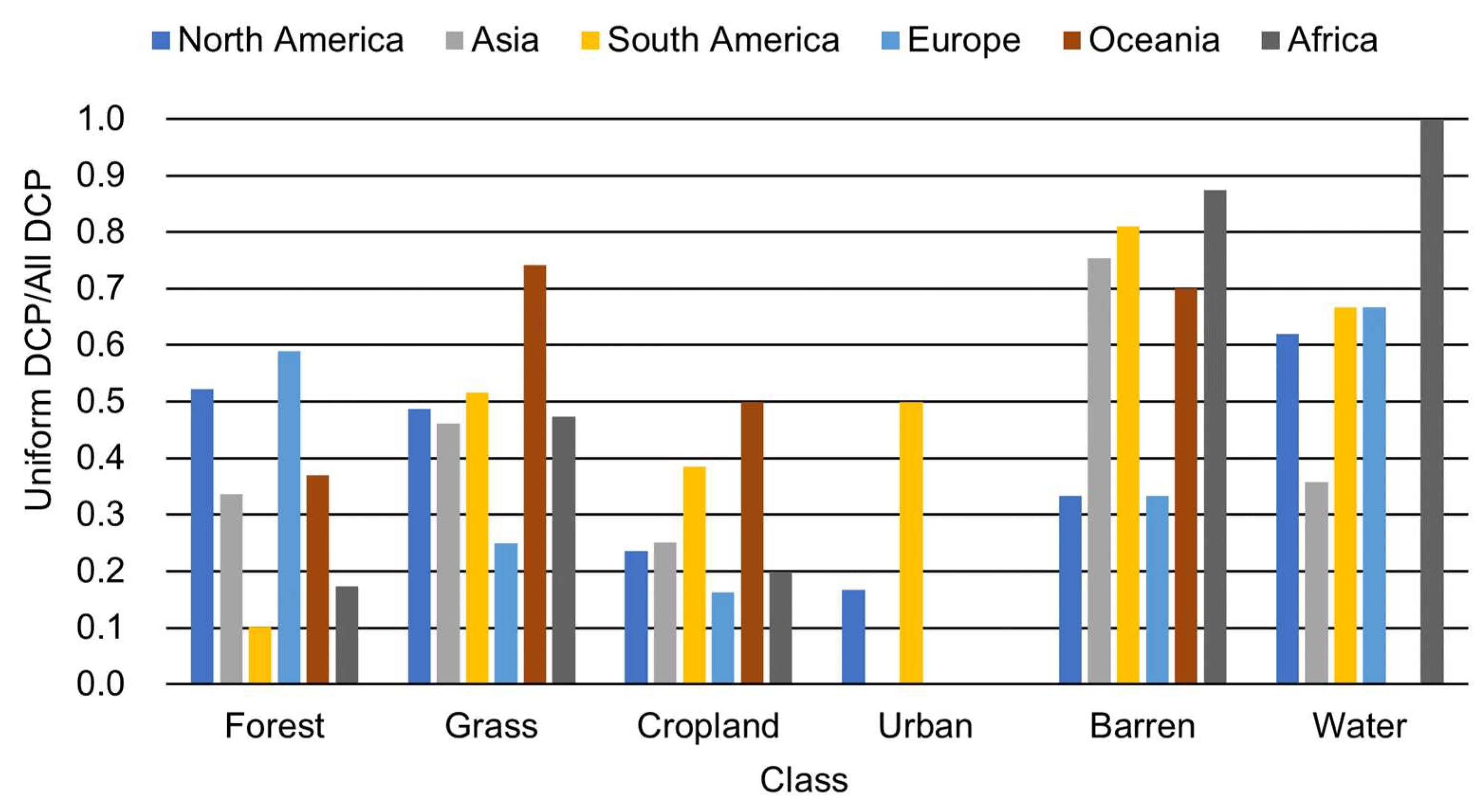
The Degree Confluence Project (DCP) is a volunteer-based validation dataset that comprises useful information for global land cover map validation. However, there is a problem with using DCP points as validation data for the accuracy assessment of land cover maps. While resolutions of typical global land cover maps are several hundred meters to several kilometers, DCP points can only guarantee an area of several tens of meters that can be confirmed by ground photographs. So, the objective of this study is to create a land cover map validation dataset with added spatial uniformity information using satellite images and DCP points. For this, we devised a new method to semiautomatically guarantee the spatial uniformity of DCP validation data points at any resolution. This method can judge the validation data with guaranteed uniformity with a user’s accuracy of 0.954. Furthermore, we conducted the accuracy assessment for the existing global land cover maps by the DCP validation data with guaranteed spatial uniformity and found that the trends differed by class and region.
Keywords: Degree Confluence Project; global land cover map; land cover map validation; spatial uniformity; support vector machine Degree Confluence Project; global land cover map; land cover map validation; spatial uniformity; support vector machine
Graphical Abstract