


Abstract
Inland diving sites may contain routes, attractions, and infrastructure, but these elements do not determine how a future underwater tourist trail should be organized. This study applies an emerging pre-implementation framework using an 85-record database of Polish inland diving sites compiled from specialist diving sources, operator and institutional materials, maps, and scientific publications. All records were screened; thirty-seven identifiable arrangements in 31 records were assessed using three route-confirmation criteria (T1–T3): spatial identification, reproducibility, and current use. Confirmed arrangements were characterized by organizational status and a seven-feature formalization profile (F1–F7). Seven local cases and one auxiliary spatial-scale case were then selected to examine resource relationships, alternative trail-organization variants, and seven pre-implementation assessment areas (Z1–Z7). Twenty arrangements in 17 records were confirmed: 16 formal, two informal, and two with undetermined status. Guidance and current documentation were more often confirmed than ongoing maintenance. Case analysis showed that resources may be retained, separated, connected, or used selectively, but no single configuration suited all cases. In all seven local variants, relationships with sensitive environmental features remained undetermined; user information was incomplete and long-term maintenance was not fully confirmed. The framework structures decisions and identifies evidence gaps before design; it does not certify achieved sustainability.
1. Introduction
Scuba diving tourism is closely linked to the management of marine and coastal resources because access, visitor behavior, safety, ecosystem sensitivity, and the organization of tourism services interact at the same sites [1,2,3]. Research on marine diving destinations shows that unmanaged or concentrated use can increase ecological pressure, whereas visitor-use management, guiding practices, information, carrying-capacity approaches, and spatial organization can reduce avoidable impacts [4,5,6,7,8,9]. The same caution applies to inland waters. Access arrangements should reflect local environmental characteristics and sensitivity, and structured movement should not be assumed to be beneficial in itself [9,10]. Inland waters are less represented in the literature on diving tourism and underwater trails, although lakes, reservoirs, springs, and flooded excavations support diverse recreational uses [10,11,12,13,14]. A single inland diving site may combine shore facilities, established patterns of underwater movement, natural and anthropogenic attractions, guidance elements, and conservation or management constraints. These elements do not by themselves constitute an underwater tourist trail, nor do they establish that creating one would be justified. Previous studies of inland-water recreation, diving sites, and underwater landscapes have examined ecological pressures, tourism conditions, site organization, infrastructure, and scenic or interpretive values [10,11,12,13,14,15,16,17]. What remains less developed is the decision-making stage that precedes trail design: which existing elements should be treated as resources, which relationships among them are sufficiently documented, which should be retained or connected, and which should remain outside a future solution. The analysis treats the existing organization of a diving site as a baseline for assessment rather than as a ready-made trail. The approach is explicitly pre-implementation. It identifies conditions, constraints, and information gaps that should be resolved before design or implementation; it does not measure the environmental, social, or economic effects of an operating trail. In this article, “development toward a sustainable underwater tourist trail” denotes a direction of planning in which access is adapted to site-specific resources, safety requirements, management capacity, and conservation needs, not confirmation that sustainability has already been achieved. The main objective was to determine how the existing organization of diving and elements of underwater recreational space can provide a basis for possible underwater tourist trails in selected Polish inland water bodies.
Four linked tasks structured the analysis: identifying and characterizing documented routes and connection systems; examining relationships among routes, route fragments, and attractions in contrasting cases; assessing alternative ways of using these resources in possible trail organization; and identifying pre-implementation conditions and evidence gaps. These tasks are expressed as four research questions (RQs), designated RQ1–RQ4, at the end of Section 2.
2. Theoretical Background and Research Context
2.1. Diving Sites and the Organization of Underwater Recreational Space
A diving site is more than a water-entry point. It may include access infrastructure, shore-based facilities, the underwater space used by divers, natural and anthropogenic attractions, and recurrent patterns of use [1,2,3,10,11,12,13,14]. A spatially defined diving area may therefore contain entry and exit points, training zones, platforms, wrecks, technical structures, bottom forms, vegetation, and orientation elements. Their significance depends not only on their presence but also on their spatial and functional relationships [15,16,17]. The complexity of a diving area, however, does not by itself establish the existence of a route or an underwater tourist trail. From a sustainable-use perspective, channeling diver movement is also not automatically beneficial. Marine studies show that impacts depend on user behavior, experience, guiding practices, intensity of use, and the location of activity [4,5,6,7,8]. Concentrating use can reduce dispersed movement while increasing pressure on selected bottom areas or sensitive habitats. These findings justify attention to visitor behavior and spatial organization, but they should not be transferred mechanically to inland waters, where environmental conditions and patterns of use differ. Accordingly, the analysis distinguishes diving sites and diving areas from routes and trails. The first two concepts describe the spatial setting of recreational use; routes organize repeated movement within that setting; a tourist trail adds a deliberate layer of access organization, information, interpretation, management, and continuity. A site may contain a complex diving area without a confirmed route, and a future trail may in some cases be organized around selected attractions even where no established route has been documented.
2.2. Formal and Informal Routes and Underwater Attractions as Resources for Future Trail Development
Underwater orientation may rely on compass headings, depth changes, bottom morphology, distinctive objects, or deliberately installed guidance such as lines and markers [12,13,14,17]. The presence of a guideline is neither necessary nor sufficient to confirm a route. A single dive track, a one-off user account, a map of attractions, or one connection between objects may indicate use of space without demonstrating a recognizable and repeatedly used movement arrangement. For this reason, the analysis distinguishes a route’s possible existence in the field from its documentary confirmation; Section 3 provides the operational rules. Routes also differ in how they emerge and are organized. Within this framework, a formal route has a documented relationship to an identifiable entity involved in its designation, organization, maintenance, updating, or rules of use. An informal route develops primarily through repeated user practice and can remain spatially recognizable without a confirmed organizer. Research on informal terrestrial trail networks illustrates how repeated use can create persistent spatial patterns outside formally designated systems [18], although underwater conditions require separate criteria because visibility, orientation, environmental variability, and safety differ. The absence of evidence for an organizer is therefore not sufficient by itself to classify a route as informal. Organizational status and formalization are treated as related but distinct dimensions. Status describes how a route is organized; the seven-feature formalization profile (F1–F7) describes observable organizational features such as guidance, documentation, maintenance, rules, and assignable responsibility. Neither dimension measures legality, safety, attractiveness, sustainability, or readiness for future trail development. A formal route may be weakly documented or maintained, while an informal route may be spatially legible and repeatedly used. Underwater attractions form a second resource layer. Natural features such as walls, boulders, vegetation patches, submerged trees, and bottom forms, as well as anthropogenic objects such as wrecks or technical structures, can contribute to recreational, scenic, and interpretive value [15,16]. Attractions may also act as orientation points or concentrate movement, but attractiveness and orientation are not equivalent functions. Tourism-route research emphasizes that attractions acquire route-level meaning through spatial and functional connection rather than mere proximity [19]. A future underwater trail may therefore retain an existing route, connect several routes or fragments, selectively incorporate attractions, create new local connections, or exclude elements that are poorly justified. Existing routes and attractions are treated here as resources for assessment, not as a ready-made trail.
2.3. From Existing Routes and Underwater Attractions to an Underwater Tourist Trail: The Polish Context and International Approaches
A tourist trail is more than a line connecting points; it organizes access to attractions, information, and forms of activity [9,19,20]. In underwater settings, orientation, safety, interpretation, conservation requirements, and maintenance are additional concerns [9,20,21,22,23]. Accordingly, the term “underwater tourist trail” denotes a deliberately organized system for tourist access to underwater space, agreed with the competent entity or entities responsible for access, management, or protection at the site. It may combine spatial connections, rules of use, user information, interpretation, conservation requirements, and arrangements for maintaining the adopted form of access. Poland does not currently have a uniform procedure for designating, marking, registering, and maintaining underwater tourist trails. The Water Law Act provides a general legal context for recreation, tourism, and water sports but does not establish an explicit underwater-trail category analogous to the listed hiking or cycling trails [24]. The Polish Tourist and Sightseeing Society trail-marking instructions likewise regulate several trail types without defining underwater tourist trails [25]. These absences should not be interpreted as a legal prohibition; they indicate that underwater trail organization is not covered by one uniform national system. Existing practice nevertheless shows several forms of structured underwater access. The “Biebrza on the Other Side of the Surface” trail operates within the access and conservation rules of Biebrza National Park [26], while Polish maritime regulations organize access to selected wrecks without creating one continuous trail [27,28,29].
International examples further show that underwater access can be organized through self-guided diving routes, protected-area trails, underwater archaeological parks, groups of accessible heritage sites, or nature-oriented snorkeling trails [20,21,22,23,30,31,32,33,34,35]. These solutions differ in spatial form, information provision, conservation rules, interpretation, and maintenance. Table 1 summarizes the examples used here not as models to be copied, but as evidence that no single geometry or management form defines an underwater tourist trail.
Table 1.
Selected approaches to organizing underwater routes, trails, and diving sites as comparative examples.
The comparative lesson is therefore not that inland sites should progress toward one standard trail form. Instead, assess each site’s existing organization separately from decisions about future use. This distinction underpins the analytical sequence adopted here: first identify what exists and how it is organized; then consider how selected elements might be used, at what spatial scale, and under which environmental, organizational, and functional conditions.
2.4. Conditions for Development Toward a Sustainable Underwater Tourist Trail
Before implementation, a trail’s full environmental, social, and economic sustainability cannot be demonstrated. However, a pre-implementation assessment can identify conditions that should be resolved before advancing a design. The literature reviewed above supports seven linked areas. First, nature conservation and environmental conditions require a site-specific assessment of sensitive features and the effects of concentrating or redirecting use [4,5,6,7,8,9,10,20,22,23,36]. Second, safety and orientation concern access organization, guidance, rules, and information appropriate to the site and intended users [9,20,21,22,23]. Third, spatial organization concerns the coherence of connections among entry and exit points, routes, attractions, restricted areas, and the scale at which a proposed solution is considered [9,20,21,22,23,36]. Fourth, tourism value and interpretive potential depend on whether selected resources form a meaningful recreational or educational experience rather than merely a collection of objects [15,16,37]. Fifth, where cultural heritage may be involved, value, protection requirements, documentation, and access must be assessed separately from tourism attractiveness [30,31,32,33,34,38,39,40,41]. Sixth, user information should communicate access, depth, routes or areas, attractions, rules, restrictions, and conservation requirements [9,20,21,23,42]. Seventh, organizational continuity concerns the capacity to maintain infrastructure, update information, respond to change, and sustain the adopted form of access over time [9,20,36,43,44,45]. These areas are not a complete sustainability model, a weighted index, or a set of mutually compensatory indicators. A strength in one area cannot offset an unresolved environmental or safety issue in another. Their purpose is to structure a documentary pre-implementation assessment and to show where available evidence is sufficient, partial, negative, or still undetermined. The assessment demonstrates an emerging framework; it does not validate a final universal method.
2.5. Research Gap, Analytical Contribution, and Research Questions
Existing research has examined scuba-diving impacts and management, underwater routes and trails already in operation, visitor information, carrying capacity, cultural-heritage access, and the organization of diving sites [4,5,6,7,8,9,20,21,22,23,30,31,32,33,34,35,36,37,38,39,40,41,42,43,44,45,46,47,48]. Less attention has been given to a prior decision stage: how to move from an existing and organizationally diverse diving space to a justified future trail concept without assuming that every route, attraction, or infrastructure element should be incorporated. The contribution is analytical rather than normative: the framework separates the identification of current site organization from decisions about future use and illustrates how a pre-implementation assessment can structure those decisions while retaining unresolved evidence as an explicit result.
The analysis addresses the following four RQs:
RQ1. Which routes and connection systems can be confirmed in the 85-record research database, and how are confirmed arrangements characterized by organizational status and the F1–F7 formalization profile?
RQ2. How do confirmed routes, route fragments, orientation features, and underwater attractions relate within the selected contrasting case studies?
RQ3. Which trail-organization variants can be derived from these existing relationships, including retention, separation, integration, selective use, or insufficient justification?
RQ4. Which of the seven pre-implementation assessment areas (Z1–Z7) are met, partially met, not met, or undetermined for the analyzed variants, and which evidence gaps must be resolved before further design or implementation?
3. Materials and Methods
3.1. Research Design and Source Material
The research design combined document analysis [49] and a comparative multiple-case study [50,51] within a qualitative comparative framework supplemented by descriptive statistics. The 85-record database was not designed as a statistically representative sample and did not result from a one-time purposive selection from a predefined population. It was developed iteratively as a research database through documentary searches and the collection, organization, and verification of information on Polish inland diving sites. Records were added as distinct sites were identified in specialist diving sources, materials produced by site managers and operators, maps and plans, scientific publications, and institutional documents. The final number of 85 records was an outcome of database construction rather than an a priori sample size. The database was closed for the present study after the final source review on 24 September 2026. Closure marked the end of the project-specific search and verification cycle; it did not imply that all inland diving sites in Poland had been identified. A record was retained when all of the following conditions were met:
- The site could be distinguished from other records;
- The available information could be examined using comparable source categories and the same assessment rules;
- Diving use and at least one element relevant to the organization of underwater recreational space were confirmed.
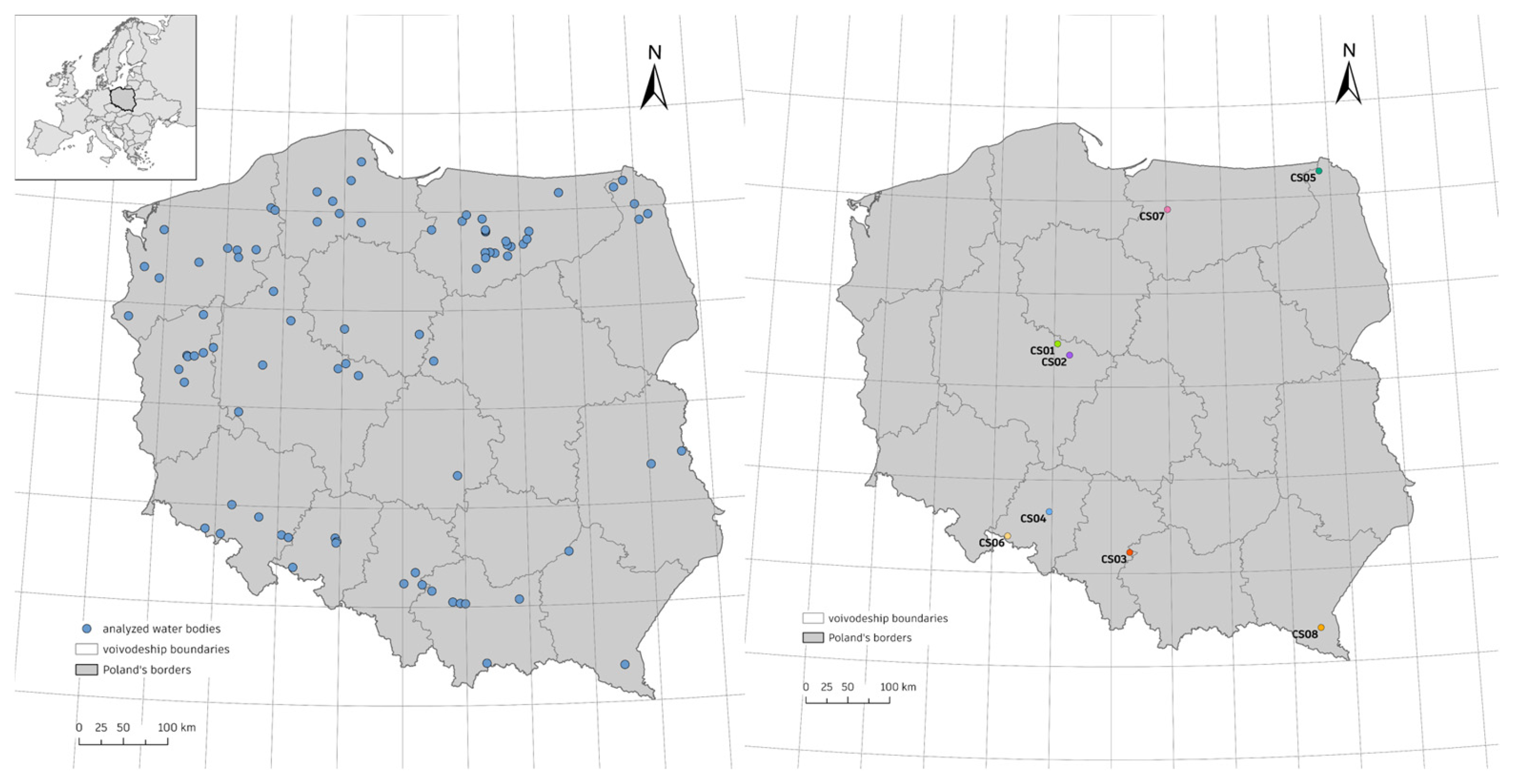
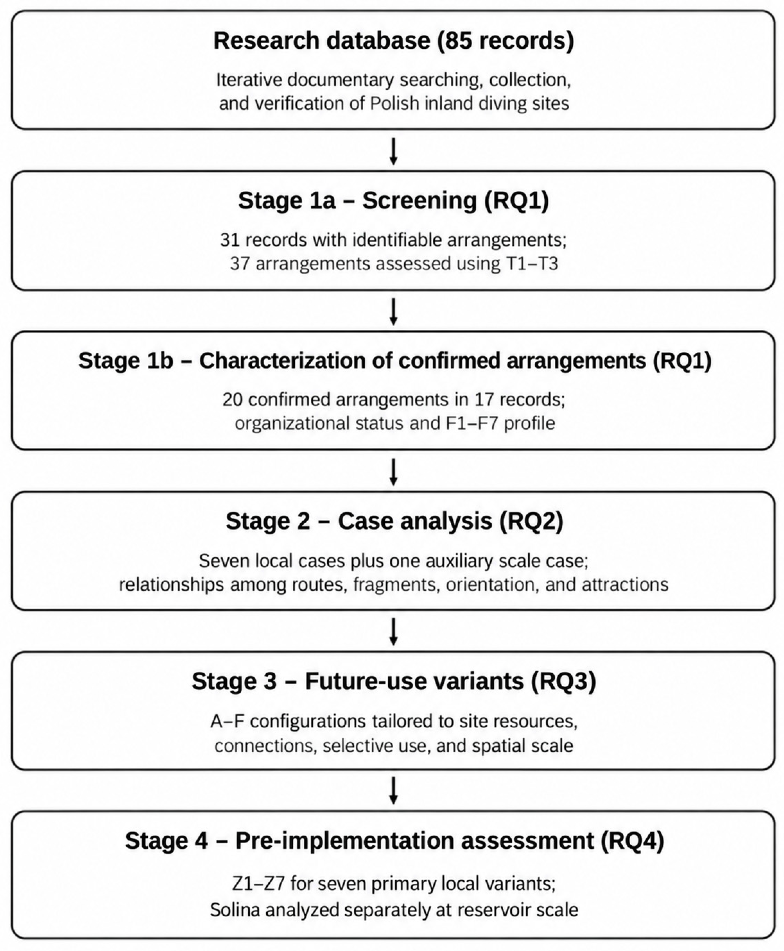
A record did not necessarily correspond to one water-entry point, one diving area, or one route. Identity and potential duplication were checked using names, locations, source materials, and available spatial data. Source categories included diving-area maps and plans, route and connection diagrams, operator materials, institutional documents, dive descriptions, photographs, and publications. For each record, applicable source categories were examined using common documentary assessment rules rather than requiring an identical set of sources. Lack of confirmation in one category was not treated as evidence of absence, and assessment of current use required contemporary evidence available during the 2025–2026 study period. The point-location layer was used only to identify sites and prepare Figure 1; it was not treated as evidence of route geometry or environmental relationships. The analysis then proceeded through four linked stages aligned with the research questions. Stage 1 screened all 85 records, identified arrangements that could be evaluated with the three route-confirmation criteria (T1–T3), and characterized confirmed arrangements by organizational status and the seven-feature formalization profile (F1–F7) (RQ1). Stage 2 selected contrastive case studies after screening and examined relationships among routes, fragments, orientation features, and attractions (RQ2). Stage 3 formulated site-specific trail-organization variants (A–F) for possible future use (RQ3). Stage 4 assessed those variants in seven pre-implementation assessment areas (Z1–Z7) (RQ4). Figure 2 summarizes the workflow. Counts and percentages describe only this research database and are not estimates of prevalence across all Polish inland diving sites. Detailed coded assessments and case-selection documentation are provided in the Supplementary Materials (Files S1 and S2).
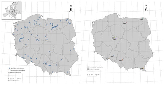
Figure 1.
Spatial distribution of water bodies represented in the 85-record database (left) and locations of the eight case studies included in the in-depth analysis (right). The inset map shows the location of Poland in Europe. Case-study identifiers CS01–CS07 denote local cases, whereas CS08 denotes an auxiliary analysis at the scale of the entire reservoir. Points indicate approximate locations and should not be interpreted as water-entry points or boundaries of the areas used for diving. Generalized national boundary: Natural Earth [52].
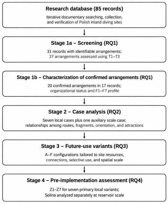
Figure 2.
Analytical workflow from database construction to pre-implementation assessment. Stage 1 addresses RQ1 through T1–T3 screening and characterization of confirmed arrangements; Stages 2–4 address RQ2–RQ4, respectively. Counts refer to the closed research database and the subsequent analytical subsets. RQ = research question; T1–T3 = route-confirmation criteria.
3.2. Route Identification, Organizational Status, and Formalization Profile
Screening covered all 85 records without presuming that a route was present. When the documentation allowed an arrangement to be identified, it was assessed against T1–T3 (Table 2): identification of a path in space, reproducibility, and current use. The analytical unit could be a named route, a course, or a connection system that could not be reliably subdivided on the basis of the available sources. Only T1 = T2 = T3 = 1 confirmed an arrangement. A positive value meant documentary confirmation, not field measurement of every segment. Reproducibility could be supported by lines or markings, but also by distinctive objects, bottom forms, depth, or direction. Current use required contemporary evidence; historical information alone was insufficient. An undetermined result (NR) denoted insufficient grounds for a positive or negative determination, while outside the assessment scope (ND) was used only when an earlier result made further assessment inapplicable. Detailed rules remain in Table S2a.
Table 2.
Criteria for confirming routes and connection systems.
Organizational status was assigned only after route confirmation. FORMAL required a documented relationship between the specific route and an identifiable entity involved in designation, organization, maintenance, updating, or rules of use; publication of a map or management of the adjacent shore alone was insufficient. INFORMAL required evidence of repeated current user practice and no confirmed organizing entity after the documentary search. When neither determination was supported, status remained NR.
The F1–F7 profile was assessed separately (Table 3) to describe organizational structuring: an associated entity (F1), recognizable arrangement (F2), guidance or marking (F3), current documentation (F4), maintenance (F5), rules of use (F6), and assignable responsibility for maintenance and updating (F7). Features were coded YES, PARTIAL, NO, or NR and were not summed into a score. F1 and F2 were interpreted mainly as descriptive/control features because of their logical relationship with organizational status and T1-T2. The profile therefore characterizes existing organization; it is not a ranking of route quality or sustainability.
Table 3.
Features of the qualitative formalization profile.
3.3. Purposive Selection of Case Studies After Screening
Case studies were selected once, after completion of the screening stage, using purposive contrast rather than statistical representativeness [53]. The primary candidate pool comprised the 17 records containing at least one confirmed arrangement. Six local cases (CS01–CS06) were selected to capture analytically distinct combinations of water-body origin, site organization, route-attraction relationships, orientation, and conservation context. Their purpose was not to represent a typical Polish diving site but to expose contrasts relevant to RQ2–RQ4; Table 4 and Table S7 state the specific function of each case. Two additional cases served defined contrastive functions despite the absence of a confirmed route at the analyzed scale. Lake Narie in Kretowiny (CS07) represented an organized diving area with an identifiable operator, facilities, attractions, and an arrangement for which T1 and T3 were confirmed, but T2 remained NR. The Solina Reservoir (CS08) was retained as an auxiliary case to examine the consequences of adopting the scale of an entire large reservoir. Variants A–F and Z1–Z7 were not used to select cases. The in-depth analysis comprised seven local cases and one separate spatial-scale case.
Table 4.
Case studies included in the in-depth analysis and their functions in purposive selection.
3.4. Analysis of Trail Variants and Z1–Z7 Assessment Areas
Each case analysis adopted an explicitly defined spatial scope and did not assume that one water body should contain one trail or that one existing route should correspond to one future trail. The analysis jointly considered confirmed routes and connection systems, route fragments, entry and exit points, attractions, orientation features, available conservation information, and the organization of use. The procedure organized possible uses of these resources into six analytical trail-organization variants (A–F; Table 5). A, B, C, and F describe spatial configurations; D denotes selective use and may accompany another solution; E denotes insufficient justification for the proposal being considered. The codes are alternatives for structuring analysis, not a quality scale or developmental sequence.
Table 5.
Variants for using the existing organization of diving in trail development.
The assessment then applied the seven pre-implementation areas (Z1–Z7) to each defined variant. Table 6 summarizes both the assessment areas and the coding categories transferred from the Supplementary Materials for clarity. The assessment categories were met (M), partially met (PM), not met (N), undetermined (NR), and outside the assessment scope (ND). M required documentary confirmation that the condition was met within the defined scope; PM required a confirmed basis plus a specific missing component; N required documented non-fulfillment or incompatibility; NR indicated insufficient evidence; and ND indicated that the area was outside the adopted scope of that variant. Lack of information alone was not coded as N. Z1 required evidence linking the specific variant to sensitive environmental features or conservation requirements; general protected-area status was insufficient. Z2 concerned organizational conditions for safety and orientation, not technical diving-safety approval. Z6 concerned information for the specific variant, while Z7 concerned a documented approach to maintaining and updating that variant. Together, these areas structure the pre-implementation assessment; they are not a validated sustainability score and are not mutually compensatory.
Table 6.
Z1–Z7 pre-implementation assessment areas and assessment categories.
3.5. Quality Control and Interpretive Limitations
The assessment process applied the operational rules to the collected documentation. Quality control included consistency checks between sources and codes, repeated reviews of T1–T3 decisions, organizational-status assignments, all 20 F profiles, the 70 Z assessments, and the case-selection logic. Aggregate results were recalculated from the detailed coded data, and NR was retained as a distinct value rather than converted to zero or a negative result. Interpretive limits were built into reporting. Record-level, arrangement-level, and variant-level results were kept separate because one record could contain more than one arrangement and alternative variants could refer to the same case. Public documentation is also uneven: formal routes are more likely to generate maps, rules, and operator materials than routes maintained mainly through user practice. This may increase the probability of confirming formal arrangements. The Z assessments likewise represent what can be established documentarily before implementation; they do not replace field-based environmental surveys, technical safety assessment, observation of actual user behavior, or economic and social feasibility studies. Solina was analyzed separately at the entire-reservoir scale, and its Z results were excluded from the cross-case counts for the seven local variants.
4. Results
4.1. Route Identification, Organizational Status, and Formalization (RQ1)
Screening of all 85 records identified 37 arrangements in 31 records for T1–T3 assessment. Twenty arrangements occurring in 17 records met all three confirmation criteria; 16 remained undetermined, and one did not meet the route criteria (Table 7). The 54 records without an arrangement suitable for T1–T3 assessment were retained in the record-level denominator but did not enter arrangement-level classification. Most non-confirmations reflected insufficient documentary evidence rather than evidence that no route existed in the field. The 37 arrangements also differed in scale: some were individual routes, and others were connection systems analyzed jointly because the available sources did not support finer subdivision. Detailed T1–T3 results are provided in Table S4.
Table 7.
Results of the screening analysis at the record and arrangement levels.
Among the 20 confirmed arrangements, 16 were FORMAL, 2 were INFORMAL, and in two cases the organizational status remained undetermined (NR). This distribution applies only to confirmed arrangements in the research database. F1 and F2 had limited discriminatory value because they were logically linked to organizational status and prior route confirmation. Greater variation occurred in F3-F7 (Table 8): guidance or marking was confirmed in 17 arrangements and current documentation in 12, whereas ongoing maintenance was confirmed in only three and remained NR in 17. Rules of use and assignable responsibility were documented more often than maintenance itself. Complete F profiles are provided in Table S5.
Table 8.
F1–F7 profile for the 20 confirmed arrangements: counts and proportions of assessments.
4.2. Case Relationships and Trail-Organization Variants (RQ2-RQ3)
Six of the seven local case studies contained at least one confirmed route or connection system. Lake Narie (CS07) was retained as a contrast because an organized diving area and the NRI-01 arrangement were documented, but reproducibility remained NR and a contemporary route was not confirmed. The selected cases exposed different relationships among route organization, orientation, attractions, and water-body type, as summarized in Table 4. These relationships led to different future-use variants (Table 9). Existing routes could form the principal element of a local trail (A), remain separate (C), be selectively incorporated with fragments or attractions (D), or be compared with broader integration (B or F). At Solina, the entire-reservoir proposal lacked sufficient justification (E), without excluding future local solutions. The case results did not produce a single preferred trail form; they demonstrated that the appropriate configuration depends on the existing site structure and the spatial scale adopted.
Table 9.
Decisions concerning trail variants in the case studies.
4.3. Pre-Implementation Conditions and Evidence Gaps (RQ4)
Across the seven primary local variants, Z4 (tourism and interpretive value) was the most consistently supported area, whereas Z1 (nature conservation and environmental protection) remained NR in every case because the available documentation did not relate the proposed variants to sensitive local features with sufficient precision (Table 10). Z6 (user information) was PM in all seven local cases, indicating useful existing information but no complete information set for a future trail. Z7 (organizational continuity) was PM in five cases and NR in two. Z2 and Z3 varied with the existing organization and the proposed spatial configuration. Z5 was NR where heritage significance or requirements were unresolved and ND where that domain was outside the adopted scope of the variant. Alternative variants for Honoratka and Koparki showed that changing spatial configuration can change the assessment, particularly Z3. The Solina entire-reservoir case was analyzed separately: Z3 was N at that scale, Z4 was PM, and the remaining areas were NR. These results identify conditions that require additional evidence before design; they do not certify or reject a site as sustainable.
Table 10.
Cross-case Z1–Z7 assessment for the seven local solutions and the auxiliary CS08 case.
5. Discussion
The discussion follows the sequence of RQ1–RQ4, moving from the identification and organization of existing routes to future-use variants and the conditions that should be resolved before implementation.
5.1. Existing Routes and Attractions Require Evaluation, Not Automatic Conversion into a Trail
The results support a distinction that is often blurred in practice: an existing diving route is not the same analytical object as a future underwater tourist trail. Trail research and visitor-management guidance emphasize that access organization must integrate spatial form, information, interpretation, user management, and resource protection rather than merely connect attractions [9,19,20,21,22,23,36,46]. The case studies show why this distinction matters. A confirmed route may be retained, separated from other routes, selectively used, or left outside a proposed solution; conversely, an organized diving area can contain attractions and infrastructure without a route that meets the confirmation criteria. The analytical value lies in separating the description of current organization from the decision about future use. The same logic applies to formal and informal routes. Formal status indicates a documented organizational relationship, not higher sustainability or automatic readiness for implementation. Informal routes may reveal stable user practices and legible spatial organization, while formal routes may still lack evidence of maintenance, current information, or environmental fit. Recreation-management research similarly cautions against treating formal designation or infrastructure as a substitute for site-specific evidence about impacts and management effectiveness [9,36,43,44]. In the research database, formal routes were easier to document, which likely reflects both genuine organization and documentary visibility. The predominance of formal status among confirmed arrangements should not be generalized to all routes used in Poland. For RQ1-RQ3, the main implication is procedural: route confirmation, organizational status, formalization profile, and future trail configuration should be treated as successive but non-equivalent decisions. This prevents a common shortcut in which existing infrastructure is interpreted as evidence that a trail already exists or should be expanded. Compared with studies that start from already designed or operating trails, such as self-guided routes in the Algarve, carrying-capacity planning at Isabel Island, or MPA trail systems [20,21,22,23], the present analysis addresses an earlier decision stage. This distinction matters because evidence of current use is not equivalent to evidence that a specific future configuration is environmentally or organizationally justified. In practice, a pre-implementation framework can function as a filter: it can identify which existing elements deserve further design work and which proposals require additional evidence before resources are committed.
5.2. Organizational Status and the Formalization Profile Describe Existing Conditions, Not Future Trail Readiness
The F1–F7 profile helps describe where the existing organization is strong and where evidence is missing, but the pattern should not be read as a maturity scale. F1 and F2 are partly constrained by the logic of route confirmation, while F3–F7 provide more informative contrasts. In particular, the gap between visible guidance/documentation and confirmed maintenance is important. Trail-sustainability research identifies maintenance, monitoring, and adaptive management as recurring conditions for durable recreational access [36,43,44,45]. The findings suggest that these functions should be examined separately rather than inferred from the presence of an operator, infrastructure, or published map. For managers, the distinction has practical value. A manager considering a future trail needs to know not only whether a route can be identified, but who can update information, maintain essential elements, respond to environmental change, and revise access rules. The profile has a diagnostic rather than evaluative function: it indicates which organizational components are documented and which require further verification. That function is consistent with the study’s pre-implementation purpose and avoids converting heterogeneous documentary evidence into a single score. That finding also refines the interpretation of formalization. In visitor-use management, durable access depends on monitoring, maintenance, defined desired conditions, and the capacity to adapt management when conditions change [9,36,43,44,45]. The low confirmation of F5 relative to F3 and F4 suggests that visible infrastructure and published information are poor proxies for operational continuity. For managers, this means that documentation of who maintains what, and how information is updated, should be treated as a separate planning requirement rather than assumed from organizational presence.
5.3. Tourism Attractiveness Is Not Equivalent to Cultural Heritage Value
Tourism attractiveness and cultural-heritage significance also require separate treatment. Wrecks, vehicles, technical structures, submerged trees, walls, or unusual bottom forms may be valuable to divers, but recreational appeal does not establish heritage status or conservation requirements. Underwater cultural-heritage research stresses the need to combine access with documentation, protection, interpretation, and site-specific management [30,31,32,33,34,38,39,40,41]. This is why Z5 remained NR in several cases even where anthropogenic attractions were well documented. The distinction has practical consequences. If an object is later confirmed as heritage, access rules, interpretation, or the spatial form of a trail may need to change; conversely, an attractive technical object that has no recognized heritage significance may still support tourism or orientation. The framework avoids treating tourism value as a proxy for cultural value. It also leaves room for future heritage assessment where the documentary evidence is incomplete, rather than forcing an unsupported positive or negative classification. This distinction is especially important for management because the same object can require different treatment depending on its documented significance, material vulnerability, legal context, and relationship with visitor movement. International approaches to accessible underwater heritage show that public access is typically embedded in a wider system of documentation, interpretation, protection, and site-specific rules rather than based on attraction value alone [30,31,32,33,34,38,39,40,41]. Where heritage significance is confirmed, route design may need to address not only what visitors can see, but how they approach, interpret, and interact with the resource. Where significance remains unverified, presenting an object as heritage could overstate the available evidence and lead to inappropriate management assumptions. For this reason, an NR for Z5 is analytically useful. It identifies a point at which specialist heritage assessment may be required before a future trail is promoted through a heritage narrative. Interpretation can still support environmental education and visitor understanding, but interpretive potential should not be treated as proof of formal heritage value [38,39,40]. In practical trail planning, heritage confirmation is better treated as an input to design and management than as a descriptive label attached to an attractive underwater object.
5.4. Organizational and Spatial Feasibility Is Not Equivalent to Sustainability
RQ4 exposed the strongest limit of the documentary approach: Z1 remained undetermined in all seven local variants. General protected-area status or environmental information was not sufficient to establish how a proposed trail variant would relate to local sensitive habitats, bottom features, or conservation requirements. This result is consistent with recreation-ecology research showing that visitor impacts depend on spatial concentration, behavior, intensity, and site sensitivity [4,5,6,7,8,36,44,47]. It cannot be assumed that routing users through a defined corridor will necessarily reduce environmental pressure. Field-based environmental assessment is required before implementation decisions can be justified. The same caution applies to safety and user behavior. Z2 addresses organizational conditions for access and orientation; it is not a technical diving-safety certification. Z6 shows that useful information already exists at many sites, but information for a future trail would need to be integrated, current, and explicitly linked to the chosen variant. Studies of underwater routes and visitor management show that interpretation, user information, and behavior are part of the management mechanism rather than promotional additions [9,20,21,22,23,42,48]. Z7 similarly identifies whether continuity and updating can be assigned, not whether a future system is financially or institutionally guaranteed. These distinctions explain why favorable tourism value cannot compensate for unresolved environmental, safety, or continuity issues. Environmental uncertainty also clarifies the role of carrying-capacity and impact literature. Existing studies show that impacts cannot be inferred from visitor numbers or route existence alone; behavior, spatial concentration, substrate or habitat sensitivity, and management measures alter outcomes [4,5,6,7,8,22,47]. The fact that Z1 remained NR in all seven local variants does not weaken the framework; it shows that documentary screening can identify the point at which field evidence becomes indispensable. A planning process that proceeds despite that boundary would risk converting an organizationally coherent variant into an environmentally unsupported recommendation.
5.5. Information, Users, Organizational Continuity, and Spatial Scale Shape Pre-Implementation Decisions
The combined findings can support a more robust decision-making process for managers, protected-area authorities, local governments, and diving-site operators. A practical sequence is to identify existing organization, define the appropriate spatial scale, compare feasible configurations, and then determine which environmental, safety, information, heritage, and continuity questions remain unresolved. This resembles adaptive visitor-use approaches in which management choices are linked to site conditions and revised as evidence changes [9,36,43,44,45]. The Solina case illustrates why scale should be tested explicitly: rejection of an entire-reservoir concept does not imply that no local solution is possible. There may also be implications for tourism entrepreneurship, but these were not directly measured. Dive centers and local service providers could use the framework to identify where investment in interpretation, information, maintenance, or coordination would be necessary before expanding a tourism product [19,46,54]. However, the analysis did not assess costs, demand, business models, local acceptance, or economic returns. These questions are better treated as a future research agenda than as demonstrated benefits. Linking later-stage environmental and organizational assessment with stakeholder and business analysis would provide a more complete basis for sustainable tourism planning. From a decision-support perspective, the sequence can also help prevent premature investment in an attractive but insufficiently justified concept. A variant may be well supported in terms of tourism and interpretation (Z4) while environmental relationships (Z1), safety organization (Z2), or continuity and maintenance (Z7) remain unresolved. In that situation, strengths in one area should not compensate for missing evidence in another. Instead, the unresolved conditions become explicit tasks for the next planning stage, such as field-based environmental surveys, a technical safety review, assignment of maintenance responsibility, or design of user information. This non-compensatory logic is consistent with visitor-use approaches that link desired conditions, monitoring, and management actions rather than relying on a single aggregate score [9,36,43,44,45]. The same structure can give actors with different responsibilities a common diagnostic picture. Protected-area managers may focus on environmental constraints, site operators on access, information, and maintenance, and tourism planners on spatial organization and interpretation. Implementation would still require these perspectives to be reconciled; the framework supports coordination of evidence rather than transfer of responsibility [2,3,9,55]. Similarly, route scale should be treated as a management choice rather than a property of the water body. Visitor-use frameworks emphasize matching management actions to spatially defined conditions and monitoring units [9,43,44,45]. The contrast between Narie and Solina shows that a water-body boundary can be too broad for a coherent tourism solution. Later applications should test local or nested spatial units before assuming a lake- or reservoir-wide trail concept.
5.6. Limits to Generalization and the Study’s Analytical Contribution
Several limitations define the scope of the conclusions. First, the 85 records form a constructed research database, not a representative sample of all inland diving sites in Poland. The database was built iteratively from available documentation and then closed for the present analysis; reported proportions describe this material only. Second, the availability of documentary evidence is uneven. Formal arrangements are more likely to generate maps, regulations, and operator materials than routes maintained mainly through user practice, so informal routes may be less likely to be confirmed. Third, the 37 arrangements are not spatially equivalent: some are single routes, and others are connection systems analyzed at a broader level. Fourth, some coding decisions involve an interpretive component. The procedure applied explicit rules, repeated consistency checks, and NR where evidence was insufficient, but it was not designed as an independent-rater reliability study. Fifth, Z1–Z7 do not constitute a complete sustainability model. They organize selected pre-implementation questions and deliberately keep unresolved evidence visible; they do not replace field surveys, technical safety assessment, stakeholder research, economic analysis, or post-implementation monitoring. The framework should be understood as emerging and demonstrative rather than final or universally validated. Within these limits, the study contributes a decision sequence that can be tested elsewhere: identify current site organization, distinguish route confirmation from organizational status, select the relevant spatial scale, formulate alternative future-use configurations, and assess each configuration without allowing strengths in one area to compensate for unresolved constraints in another. This shifts attention from asking whether an existing route “is” a trail to asking which elements should be used, in what configuration, and under what conditions. Transferability should be judged analytically rather than statistically [50,51,53,56]. The sequence and categories can be tested in other inland diving contexts, although documentation, spatial scale, institutional setting, and evidentiary basis may differ. Repeated applications can show which decision rules remain stable and which require contextual adjustment. The framework presents a transparent, documented analytical sequence that can be tested in other contexts; it does not establish universal thresholds or a fully validated sustainability standard. Future research should test the framework in additional inland contexts, compare independent assessments, incorporate field-based environmental and safety evidence, examine stakeholder and business feasibility, and follow selected sites longitudinally after management interventions [36,43,44,45].
6. Conclusions
For RQ1, screening of the 85-record research database identified 37 arrangements in 31 records. Twenty arrangements in 17 records met T1–T3; 16 were formal, two informal, and two had undetermined organizational status. The F1–F7 profiles showed that guidance and current documentation were more often confirmed than ongoing maintenance. These results describe the analyzed database rather than the prevalence of route types across Poland.
For RQ2 and RQ3, the case studies showed that routes, fragments, orientation features, and attractions can relate in different ways and do not support one universal trail configuration. Existing routes may form the main element of a trail, remain separate, be integrated selectively, or be combined with attractions and new local connections. In some cases, the analysis may justify not advancing a proposal at the chosen scale. Organizational status and formalization describe the existing state; they do not determine how a future trail should be organized.
For RQ4, the main pre-implementation limitation was environmental evidence. Z1 remained undetermined in all seven local variants, so the available evidence does not establish the environmental justification of any proposed solution. User information was incomplete in every local case and long-term maintenance was not fully confirmed. These outcomes identify the additional investigations needed before design or implementation; they do not demonstrate that a trail is either sustainable or infeasible.
Contrast cases clarified two additional points. Lake Narie showed that an organized diving area with facilities and attractions is not equivalent to a confirmed route. The Solina analysis showed that insufficient justification for one trail at the scale of an entire reservoir does not exclude local alternatives. The spatial boundary of a water body should not be assumed to define the appropriate spatial unit for a tourism solution.
The main contribution is a pre-implementation analytical sequence that separates what currently exists from decisions about future use. The emerging framework is intended to structure documentary assessment and expose evidence gaps, not to function as a final validated sustainability method. Before implementation, its outputs should be complemented by field-based environmental and safety assessment, stakeholder and economic analysis, and a defined mechanism for long-term maintenance and updating.
Supplementary Materials
The following supporting information can be downloaded at https://www.mdpi.com/article/10.3390/su182110857/s1. The Supplementary Materials comprise two accompanying files. File S1: Supplementary definitions, operational criteria, and case-study documentation. This file contains Table S1: Concepts used in the study; Table S2a–f: Identification and assessment rules, Criteria for confirming routes or systems of connections, Organizational status, Formalization profile F1–F7, Variants describing the relationship between existing resources and a future trail, Assessment domains Z1–Z7, Categories used to assess Z conditions; Section S1: Evidentiary basis of the assessments and limits of case-study interpretation; and Table S8: Documents cited in the case-study descriptions. File S2: Supplementary assessment data and reproducibility workbook. This file contains Table S3: Aggregate results for the 85-record research database; Table S4: T criteria for all 37 arrangements; Table S5: F1–F7 profiles for the 20 confirmed arrangements; Table S6: All variants and 70 Z assessments; and Table S7: Pool for the one-time purposive selection of case studies. The workbook also contains the formulas used to reproduce the reported summaries.
Author Contributions
Conceptualization, A.Ź. and P.D.; methodology, A.Ź. and P.D.; validation, A.Ź., P.D. and Z.Z.; formal analysis, A.Ź. and P.D.; investigation, A.Ź., P.D. and Z.Z.; resources, A.Ź., P.D. and Z.Z.; data curation, A.Ź., P.D. and Z.Z.; writing—original draft preparation, A.Ź. and P.D.; writing—review and editing, A.Ź. and P.D.; visualization, A.Ź., P.D. and Z.Z.; supervision, A.Ź. and P.D. All authors have read and agreed to the published version of the manuscript. A.Ź. and P.D. contributed equally to this work.
Funding
This research received no external funding.
Institutional Review Board Statement
Not applicable. This study was based on document analysis and did not involve human participants or animals.
Informed Consent Statement
Not applicable.
Data Availability Statement
The public Supplementary Materials comprise File S1 (supplementary definitions, operational criteria, and case-study documentation) and File S2 (the accompanying assessment-data workbook). Together, these files provide aggregate results for the 85-record research database, coded assessments supporting the T1–T3, F1–F7, and Z1–Z7 analyses, and documentation of the eight named case studies. The formulas included in File S2 allow the reported summaries to be reproduced. The complete working catalog of 85 records, including the full identification key, detailed location-level information, and the complete source-linkage structure, is retained by the authors as a non-public research database developed for ongoing research. The confidential identification key and complete source-linkage documentation may be made available to the editor and reviewers for confidential verification. Materials necessary to verify specific assessments reported in this article may be made available to other researchers upon reasonable request, subject to the scope of the verification request. The public Supplementary Materials do not include complete attraction inventories, detailed coordinates, spatial layers, or materials not used to derive the reported findings. Reproducing the published counts and summaries from the coded data does not substitute for verification of the underlying source evidence.
Acknowledgments
During the preparation of this manuscript, the authors used ChatGPT (OpenAI; model version 5.6) to assist with English translation and language polishing. The tool was not used for study design, data generation, data analysis, or interpretation of the results. All AI-assisted text was reviewed and edited by the authors, who take full responsibility for the final content of the manuscript.
Conflicts of Interest
The authors declare no conflicts of interest.
Abbreviations
The following abbreviations and analytical codes are used in this manuscript:
| BALTACAR | Baltic History Beneath Surface—Underwater Heritage Trails In Situ and Online |
| CS | Case study; used in the identifiers CS01–CS08 |
| T1–T3 | Criteria for confirming routes and connection systems |
| F1–F7 | Features of the qualitative route-formalization profile |
| A–F | Trail-organization variant codes |
| Z1–Z7 | Pre-implementation assessment areas for trail variants |
| M | Met |
| PM | Partially met |
| N | Not met |
| NR | Undetermined because the available evidence is insufficient for a reliable assessment |
| ND | Outside the assessment scope defined for the given variant |
| SM | Supplementary Materials |
| RQ | Research question; used in the identifiers RQ1–RQ4 |
References
- Musa, G.; Dimmock, K. (Eds.) Scuba Diving Tourism; Routledge: Abingdon, UK, 2013. [Google Scholar]
- Dimmock, K.; Musa, G. Scuba Diving Tourism System: A Framework for Collaborative Management and Sustainability. Mar. Policy 2015, 54, 52–58. [Google Scholar] [CrossRef] [Scilit]
- Lucrezi, S.; Milanese, M.; Markantonatou, V.; Cerrano, C.; Sarà, A.; Palma, M.; Saayman, M. Scuba Diving Tourism Systems and Sustainability: Perceptions by the Scuba Diving Industry in Two Marine Protected Areas. Tour. Manag. 2017, 59, 385–403. [Google Scholar] [CrossRef] [Scilit]
- Giglio, V.J.; Luiz, O.J.; Ferreira, C.E.L. Ecological Impacts and Management Strategies for Recreational Diving: A Review. J. Environ. Manag. 2020, 256, 109949. [Google Scholar] [CrossRef] [Scilit]
- Sumanapala, D.; Dimmock, K.; Wolf, I.D. A Review of Ecological Impacts from Recreational SCUBA Diving: Current Evidence and Future Practice. Tour. Hosp. Res. 2023, 23, 564–577. [Google Scholar] [CrossRef] [Scilit]
- Hipólito, C.; Lopes, F.; Gonçalves, J.; Calado, H. A Critical Approach to Existing Management Perspectives in Scuba Diving: A Step in Defining Ecological Carrying Capacity. Sustainability 2024, 16, 1762. [Google Scholar] [CrossRef] [Scilit]
- Ottone, L.; Mancini, G.; Ventura, D.; Belluscio, A.; Jona Lasinio, G.; Casoli, E. A Multi-Faceted Approach to Assess the Sustainability of Diving Tourism: The Case of Rome’s MPA. Mar. Pollut. Bull. 2025, 221, 118504. [Google Scholar] [CrossRef] [Scilit]
- Lin, B.; Bearpark, T.; Roche, R.C.; McGuire, J.; Jakub, R.; Prabuning, D.; Weber, E.U.; Wilcove, D.S. Causes and Correlates of Unsustainable Scuba Diving Tourism on Coral Reefs. Conserv. Lett. 2026, 19, e70055. [Google Scholar] [CrossRef] [Scilit]
- Leung, Y.-F.; Spenceley, A.; Hvenegaard, G.; Buckley, R. Tourism and Visitor Management in Protected Areas: Guidelines for Sustainability; Groves, C., Ed.; IUCN: Gland, Switzerland, 2018. [Google Scholar] [CrossRef] [Scilit]
- Meyer, N.; Schafft, M.; Wegner, B.; Wolter, C.; Arlinghaus, R.; Venohr, M.; von Oheimb, G. A Day on the Shore: Ecological Impacts of Non-Motorised Recreational Activities in and around Inland Water Bodies. J. Nat. Conserv. 2021, 64, 126073. [Google Scholar] [CrossRef] [Scilit]
- Iannaccone, B.; Domaracká, L.; Tometzová, D.; Gabániová, L. Assessment of the Recreational Potential of Flooded Quarries in Slovakia. Sustainability 2024, 16, 9602. [Google Scholar] [CrossRef] [Scilit]
- Cichowska, J.B.; Mreła, A. Recreational Use of an Artificial Water Reservoir in Case of the Piechcin Diving Base. Geogr. Tour. 2021, 9, 57–69. [Google Scholar] [CrossRef]
- Źróbek, R.; Źróbek-Sokolnik, A.; Dynowski, P. Problemy i wyzwania zagospodarowania przestrzeni podwodnej jezior. In Wyzwania i Perspektywy Geografii Społeczno-Ekonomicznej i Gospodarki Przestrzennej; Stachowiak, K., Kudłak, R., Eds.; Bogucki Wydawnictwo Naukowe: Poznań, Poland; Komitet Przestrzennego Zagospodarowania Kraju PAN: Warsaw, Poland, 2024; Volume 25/217, pp. 403–413, (In Polish). [Google Scholar] [CrossRef] [Scilit]
- Dynowski, P.; Źróbek-Sokolnik, A. Uwarunkowania rozwoju podwodnej turystyki i rekreacji jeziornej w Polsce. In Uwarunkowania Rozwoju Rekreacji Jeziornej. Tom II; Borkowski, G., Tritt, R., Eds.; Bogucki Wydawnictwo Naukowe: Poznań, Poland, 2024; pp. 63–86, (In Polish). [Google Scholar] [CrossRef] [Scilit]
- Senetra, A.; Źróbek-Sokolnik, A.; Wasilewicz-Pszczółkowska, M.; Dynowski, P.; Czaplicka, M. Proposal of a Point Valuation Method for the Assessment of the Sight-Aesthetic Value of the Underwater Landscapes of Lakes in the Context of Exploration Tourism. Acta Sci. Pol. Adm. Locorum 2023, 22, 225–240. [Google Scholar] [CrossRef] [Scilit]
- Dynowski, P.; Źróbek-Sokolnik, A.; Czaplicka, M.; Senetra, A. The Sight-Aesthetic Value of the Underwater Landscapes of Lakes in the Context of Exploration Tourism. Photogramm. Eng. Remote Sens. 2024, 90, 89–97. [Google Scholar] [CrossRef] [Scilit]
- Zdunko, Z.; Dynowski, P. Spatial Organisation of Underwater Recreational Space at Inland Diving Sites. Pol. J. Nat. Sci. 2026, 41. in press. [Google Scholar]
- Wimpey, J.; Marion, J.L. A Spatial Exploration of Informal Trail Networks within Great Falls Park, VA. J. Environ. Manag. 2011, 92, 1012–1022. [Google Scholar] [CrossRef] [Scilit]
- Briedenhann, J.; Wickens, E. Tourism Routes as a Tool for the Economic Development of Rural Areas-Vibrant Hope or Impossible Dream? Tour. Manag. 2004, 25, 71–79. [Google Scholar] [CrossRef] [Scilit]
- Baude, J.L.; Blouet, S.; Dupuy de la Grandrive, R.; Jourdan, E.; Piante, C. Underwater Trails Handbook; MedPAN North Project, WWF-France: Marseille, France, 2012. [Google Scholar]
- Rangel, M.O.; Pita, C.B.; Gonçalves, J.M.S.; Oliveira, F.; Costa, C.; Erzini, K. Developing Self-Guided Scuba Dive Routes in the Algarve, Portugal, and Analysing Visitors’ Perceptions. Mar. Policy 2014, 45, 194–203. [Google Scholar] [CrossRef] [Scilit]
- Ríos-Jara, E.; Galván-Villa, C.M.; Rodríguez-Zaragoza, F.A.; López-Uriarte, E.; Muñoz-Fernández, V.T. The Tourism Carrying Capacity of Underwater Trails in Isabel Island National Park, Mexico. Environ. Manag. 2013, 52, 335–347. [Google Scholar] [CrossRef] [Scilit]
- Abbad, K.; Semroud, R.; Andreu-Boussut, V.; Bengoufa, S. Underwater Trail: A Tool for an Integrated Management of Marine Protected Areas in the Western Mediterranean Basin. Reg. Stud. Mar. Sci. 2022, 49, 102095. [Google Scholar] [CrossRef] [Scilit]
- Act of 20 July 2017—Water Law. Consolidated Text: Journal of Laws 2025, Item 960, as Amended; Legal Status Verified on 8 September 2026. Available online: https://eli.gov.pl/eli/DU/2025/960/ogl (accessed on 8 September 2026).
- Polish Tourist and Sightseeing Society. Instrukcja Znakowania Szlaków Turystycznych PTTK [PTTK Trail Marking Instructions]. Available online: https://pttk.pl/wp-content/uploads/2024/01/Instrukcja-znakowania-szlakow.pdf (accessed on 2 September 2026).
- Biebrza National Park. Order No. 8/2025 of the Director of Biebrza National Park of 18 April 2025 on the methods of making areas of Biebrza National Park accessible for tourism and recreation. Available online: https://bbpn.gov.pl/uploads/files/68020bf67fb4e423341496.pdf (accessed on 2 September 2026).
- Act of 20 March 2025 Amending the Act on the Maritime Areas of the Republic of Poland and Maritime Administration and the Act on Investments in the Construction of External Ports. Journal of Laws 2025, item 409. Available online: https://eli.gov.pl/eli/DU/2025/409/ogl (accessed on 2 September 2026).
- Maritime Office in Gdynia. Order No. 18 of the Director of the Maritime Office in Gdynia of 16 July 2026 on the list of wrecks open to diving for which a wreck-diving permit is not required. Available online: https://www.umgdy.gov.pl/akt_prawny/zarzadzenie-nr-18-dyrektora-urzedu-morskiego-w-gdyni-z-dnia-16-lipca-2026-r-w-sprawie-okreslenia-listy-wrakow-udostepnionych-do-nurkowania-na-ktore-nie-jest-wymagane-uzyskanie-pozwolenia-na-nurkowan/ (accessed on 2 September 2026).
- Maritime Office in Szczecin. Order No. 3 of the Director of the Maritime Office in Szczecin of 29 July 2026 on the list of wrecks open to diving for which a wreck-diving permit is not required. Available online: https://www.ums.gov.pl/akty-prawne/zarzadzenia-dyrektora-urzedu/7-zarzadzenia-du (accessed on 2 September 2026).
- UNESCO. Example of Best Practice: Italy—Underwater Archaeological Park of Baia (Parco sommerso di Baia). Available online: https://www.unesco.org/en/underwater-heritage/best-practice-italy (accessed on 1 September 2026).
- Parco Archeologico Sommerso di Baia. Regulation: Underwater Visits in the Submerged Archaeological Park of Baia. Available online: https://www.parcoarcheologicosommersodibaia.it/en/regulation/ (accessed on 2 September 2026).
- Israel Nature and Parks Authority. Birth of a National Park: Underwater Archaeological Park in Caesarea. Available online: https://en.parks.org.il/new/birth-of-a-national-park/ (accessed on 1 September 2026).
- Heritage Malta. Underwater Cultural Heritage Unit. Available online: https://heritagemalta.mt/departments/underwater-cultural-heritage-unit/ (accessed on 2 September 2026).
- Central Baltic Programme. BALTACAR: Baltic History Beneath Surface—Underwater Heritage Trails In Situ and Online. Available online: https://database.centralbaltic.eu/project/67.html (accessed on 2 September 2026).
- Parc national de Port-Cros et Porquerolles. Sentier Sous-Marin Balisé de la Palud. Available online: https://portcros-parcnational.fr/fr/sentier-sous-marin-balise-de-la-palud (accessed on 1 September 2026).
- Marion, J.L. Trail Sustainability: A State-of-Knowledge Review of Trail Impacts, Influential Factors, Sustainability Ratings, and Planning and Management Guidance. J. Environ. Manag. 2023, 340, 117868. [Google Scholar] [CrossRef] [Scilit]
- Nowacki, M. Heritage Interpretation and Sustainable Development: A Systematic Literature Review. Sustainability 2021, 13, 4383. [Google Scholar] [CrossRef] [Scilit]
- Manglis, A.; Fourkiotou, A.; Papadopoulou, D. A Roadmap for the Sustainable Valorization of Accessible Underwater Cultural Heritage Sites. Heritage 2021, 4, 4700–4715. [Google Scholar] [CrossRef] [Scilit]
- Argyropoulos, V.; Stratigea, A. Sustainable Management of Underwater Cultural Heritage: The Route from Discovery to Engagement: Open Issues in the Mediterranean. Heritage 2019, 2, 1588–1613. [Google Scholar] [CrossRef] [Scilit]
- UNESCO. Convention on the Protection of the Underwater Cultural Heritage; UNESCO: Paris, France, 2001. [Google Scholar]
- Bulut, N.; Yüceer, H. A Literature Review on the Management of Underwater Cultural Heritage. Ocean Coast. Manag. 2023, 245, 106837. [Google Scholar] [CrossRef] [Scilit]
- Rangel, M.O.; Pita, C.B.; Gonçalves, J.M.S.; Oliveira, F.; Costa, C.; Erzini, K. Eco-Touristic Snorkelling Routes at Marinha Beach (Algarve): Environmental Education and Human Impacts. Mar. Policy 2015, 60, 62–69. [Google Scholar] [CrossRef] [Scilit]
- Miller, Z.D.; Freimund, W.; Crabtree, S.A.; Ryan, E.P. No Limits of Acceptable Change: A Proposed Research Framework for Informing Visitor Use Management in the Context of Cultural Resources. Sustainability 2021, 13, 377. [Google Scholar] [CrossRef] [Scilit]
- Monz, C.A.; Cole, D.N.; Leung, Y.-F.; Marion, J.L. Sustaining Visitor Use in Protected Areas: Future Opportunities in Recreation Ecology Research Based on the USA Experience. Environ. Manag. 2010, 45, 551–562. [Google Scholar] [CrossRef] [Scilit]
- Sakrak Ekin, G.; Ekin, Y.; Akbulut, O.; Celik, T. Carrying Capacity and Adaptive Visitor Use Management for Sustainable Parks and Protected Recreation Areas: A Critical Narrative Review. Sustainability 2026, 18, 8037. [Google Scholar] [CrossRef] [Scilit]
- Rhormens, M.S.; Pedrini, A.G.; Ghilardi-Lopes, N.P. Implementation Feasibility of a Marine Ecotourism Product on the Reef Environments of the Marine Protected Areas of Tinharé and Boipeba Islands (Cairu, Bahia, Brazil). Ocean Coast. Manag. 2017, 139, 1–11. [Google Scholar] [CrossRef] [Scilit]
- Rico Fernández, P.; Rivera, A. SCUBA Diver Behavior, Diver Carrying Capacity and Its Implications for Sustainable Reef Management. Mar. Policy 2024, 165, 106199. [Google Scholar] [CrossRef] [Scilit]
- Bessa, E.; Gonçalves-de-Freitas, E. How Does Tourist Monitoring Alter Fish Behavior in Underwater Trails? Tour. Manag. 2014, 45, 253–259. [Google Scholar] [CrossRef] [Scilit]
- Bowen, G.A. Document Analysis as a Qualitative Research Method. Qual. Res. J. 2009, 9, 27–40. [Google Scholar] [CrossRef] [Scilit]
- Yin, R.K. Case Study Research and Applications: Design and Methods, 6th ed.; SAGE: Thousand Oaks, CA, USA, 2018. [Google Scholar]
- Flyvbjerg, B. Five Misunderstandings about Case-Study Research. Qual. Inq. 2006, 12, 219–245. [Google Scholar] [CrossRef] [Scilit]
- Natural Earth. Admin 0: Countries, 1:110,000,000. Generalized National Boundaries; Naturalearth_Lowres Dataset. Available online: https://www.naturalearthdata.com/downloads/110m-cultural-vectors/110m-admin-0-countries/ (accessed on 25 September 2026).
- Patton, M.Q. Qualitative Research & Evaluation Methods, 4th ed.; SAGE: Thousand Oaks, CA, USA, 2015. [Google Scholar]
- Gerungan, A.; Chia, K.W. Scuba Diving Operators’ Perspective of Scuba Diving Tourism Business in Nusa Penida, Indonesia. J. Outdoor Recreat. Tour. 2020, 31, 100328. [Google Scholar] [CrossRef] [Scilit]
- McCool, S.F. Constructing Partnerships for Protected Area Tourism Planning in an Era of Change and Messiness. J. Sustain. Tour. 2009, 17, 133–148. [Google Scholar] [CrossRef] [Scilit]
- Drisko, J.W. Transferability and Generalization in Qualitative Research. Res. Soc. Work Pract. 2025, 35, 102–110. [Google Scholar] [CrossRef] [Scilit]

Disclaimer/Publisher’s Note: The statements, opinions and data contained in all publications are solely those of the individual author(s) and contributor(s) and not of MDPI and/or the editor(s). MDPI and/or the editor(s) disclaim responsibility for any injury to people or property resulting from any ideas, methods, instructions or products referred to in the content. |
© 2026 by the authors. Licensee MDPI, Basel, Switzerland. This article is an open access article distributed under the terms and conditions of the Creative Commons Attribution (CC BY) license.