


Abstract
The Nabataean Kingdom, which flourished between the fourth century BCE and the second century CE, produced a remarkable architectural heritage across the arid landscapes in northwestern Arabia and Jordan. Nabataean architectural heritage is characterized by complex rock-cut monuments, intricate decorative carvings, and ongoing deterioration processes, creating significant challenges for accurate digital documentation, information management, and conservation. Despite the increasing scholarly attention devoted to these sites, the available documentation and datasets remain fragmented across institutions, disciplinary domains, and digital formats, limiting their accessibility and long-term management. While Historic Building Information Modeling (HBIM) has become an effective system for modeling historic structures, existing approaches often emphasize geometric reconstruction of monuments with limited integration of detailed decorative elements and multidisciplinary heritage information. This study proposes a centralized HBIM framework for the documentation and management of Nabataean architectural heritage by integrating terrestrial laser scanning, close-range photogrammetry, and parametric HBIM. The proposed workflow combines accurate geometric acquisition with semantic information management within a unified workset-based HBIM environment. A major contribution of this research is the development of a dedicated digital library of Nabataean decorative motifs, comprising high-resolution textured mesh models that preserve the intricate geometry and visual characteristics of recurring sculptural elements. These meshes are accurately scaled and georeferenced using laser scanning data and integrated into the HBIM environment to support systematic classification, reuse, and heritage information management. Furthermore, a hybrid mesh–HBIM approach is introduced by integrating realistic mesh models with the parametric HBIM representation of the monument, enabling detailed documentation and analysis of intricate carvings and deteriorated surfaces that cannot be adequately represented using conventional parametric modeling alone. Finally, architectural, historical, conservation, geological, and condition assessment datasets are consolidated within a centralized HBIM platform organized through the proposed workset structure to facilitate efficient data management, and interdisciplinary collaboration. The proposed framework advances current HBIM methodologies by integrating realistic decorative asset libraries, hybrid mesh–parametric modeling, and centralized heritage information management, providing a transferable methodology for the digital documentation and information management of Nabataean and other complex archaeological heritage sites. The framework establishes a structured basis for future applications in condition monitoring, conservation planning, knowledge preservation, and sustainable heritage management.
1. Introduction
The Nabataean civilization, known for its architectural ingenuity and cultural significance, left behind a remarkable legacy, as evidenced by the ancient cities of Hegra (Al-Hijr) in Saudi Arabia and Petra in Jordan [1,2]. These UNESCO World Heritage sites are not only symbols of regional identity, but they also provide invaluable resources for studying ancient Arab urbanism, engineering, and artistic expression [3,4,5]. Despite the considerable historical and cultural significance of Nabataean architecture, it faces complex challenges related to environmental degradation [6,7,8], increasing tourism pressures [9,10], and difficulties in heritage site management [11]. Additionally, the fragmentation of such heritage data across institutions and countries impedes the pursuit of sustainable preservation and effective documentation. Considering these challenges, the establishment of a comprehensive digital archive that consolidates digital survey results, historical documentation, and conservation records into a single system is essential for ensuring accessibility and collaboration among stakeholders [12,13].
Accordingly, the development of centralized Historic Building Information Modeling (HBIM) for Nabataean architectural heritage provides a unified digital platform that supports coordinated stakeholder collaboration while ensuring sustainable preservation and management of heritage data [14,15]. HBIM integrates diverse datasets—including historical documentation, geometric survey data, weathering analyses, and conservation records—within a unified parametric digital environment [16,17,18]. HBIM may thus be utilized to link data and associate information to both the entire constructed building and specific architectural features [19,20]. Organizing the central model into multiple thematic worksets allows different specialists to work simultaneously on specific components while maintaining data integrity and avoiding conflicts. However, the development of specialized parametric objects capable of accurately representing the architectural geometry and construction methodologies of historic buildings continues to present considerable challenges. This difficulty stems from the inherent limitations of existing BIM-based modeling libraries, which are predominantly oriented toward contemporary architectural practices and offer insufficient support for the complexities and uniqueness of historical structures. As a result, the research field is increasingly focused on the creation of HBIM libraries of specific architectural components [21,22], along with the advancement of open-source platforms to facilitate data sharing and collaboration [23,24].
Developing useful HBIM libraries for historical structures requires the collection of highly detailed and accurate spatial and visual data [25]. This process begins with the use of advanced data acquisition methods such as terrestrial laser scanning (TLS) and photogrammetry [26]. Terrestrial laser scanning (TLS) produces high-density point clouds that accurately capture the geometric characteristics of the architectural elements [27]. Despite the potential of TLS, these systems are not capable of being exclusively employed for the purpose of recording historical structures in a detailed and realistic manner [28,29]. The majority of TLS devices have the ability to color their point clouds by acquiring digital images through an attached built-in camera. Nonetheless, the ideal camera placement may not always align with the scanner’s location, resulting in color data that may lack the requisite quality to effectively view surface characteristics and conditions [30]. Another issue is the mixed-pixel effect, which can occur when laser pulses interact with surface edges, potentially affecting the accuracy of the coordinates of the collected points [31,32]. In such cases, the laser beam may have difficulty accurately recording sharp edges, thin protrusions, and abrupt surface transitions, which can result in erroneous point-cloud measurements and localized data gaps [33]. Unfortunately, the impact of these inaccuracies cannot be evaluated separately [34]. On the other hand, photogrammetry provides a valuable complementary approach for generating high-resolution three-dimensional models of fine decorative elements, where both geometric precision and realistic surface textures are essential for detailed analysis and digital heritage documentation. The significant advantage of photogrammetry lies in its flexibility during data acquisition. Images can be captured from a wide range of positions and angles, enabling the documentation of complex geometries and hard-to-reach areas that may be difficult to capture using terrestrial laser scanners [35]. The primary obstacles include limitations in image quality, camera networks surrounding the surveyed item, shadows, and model scale, which may affect the final 3D point cloud of the photogrammetric model [36,37]. Recent studies have confirmed the potential of combining multi-source data to support the digitization of complex heritage structures [38,39]. Several hybrid approaches have recently been proposed to enhance input datasets for accurate HBIM object modeling [40,41,42,43,44]. Murphy et al. developed an HBIM approach based on laser- and image-based surveys and parametric libraries, enabling the creation of detailed models that represent information beyond the visible surface of historic structures, including their construction methods and material composition.
On the one hand, the irregular and unique characteristics of historic buildings make HBIM more challenging and complex than conventional BIM modeling. Currently, many research groups are investigating methods to address the irregular geometries of historic structures within HBIM workflows. Murphy et al. [45] developed irregular HBIM structures using Geometric Description Language (GDL). Barazzetti [46] employed non-uniform rational B-splines (NURBS) curves to preserve the geometric details of complex structures during BIM-based reconstruction from point clouds. Yang et al. [47] proposed a mesh-to-HBIM workflow that transfers holistic surface meshes into semantically enriched HBIM models while reducing the need for manual intervention during the modeling process.
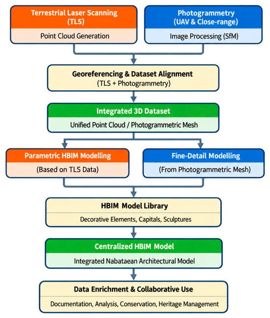
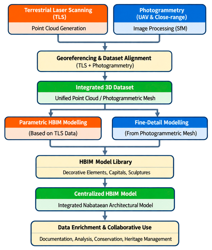
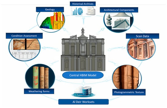
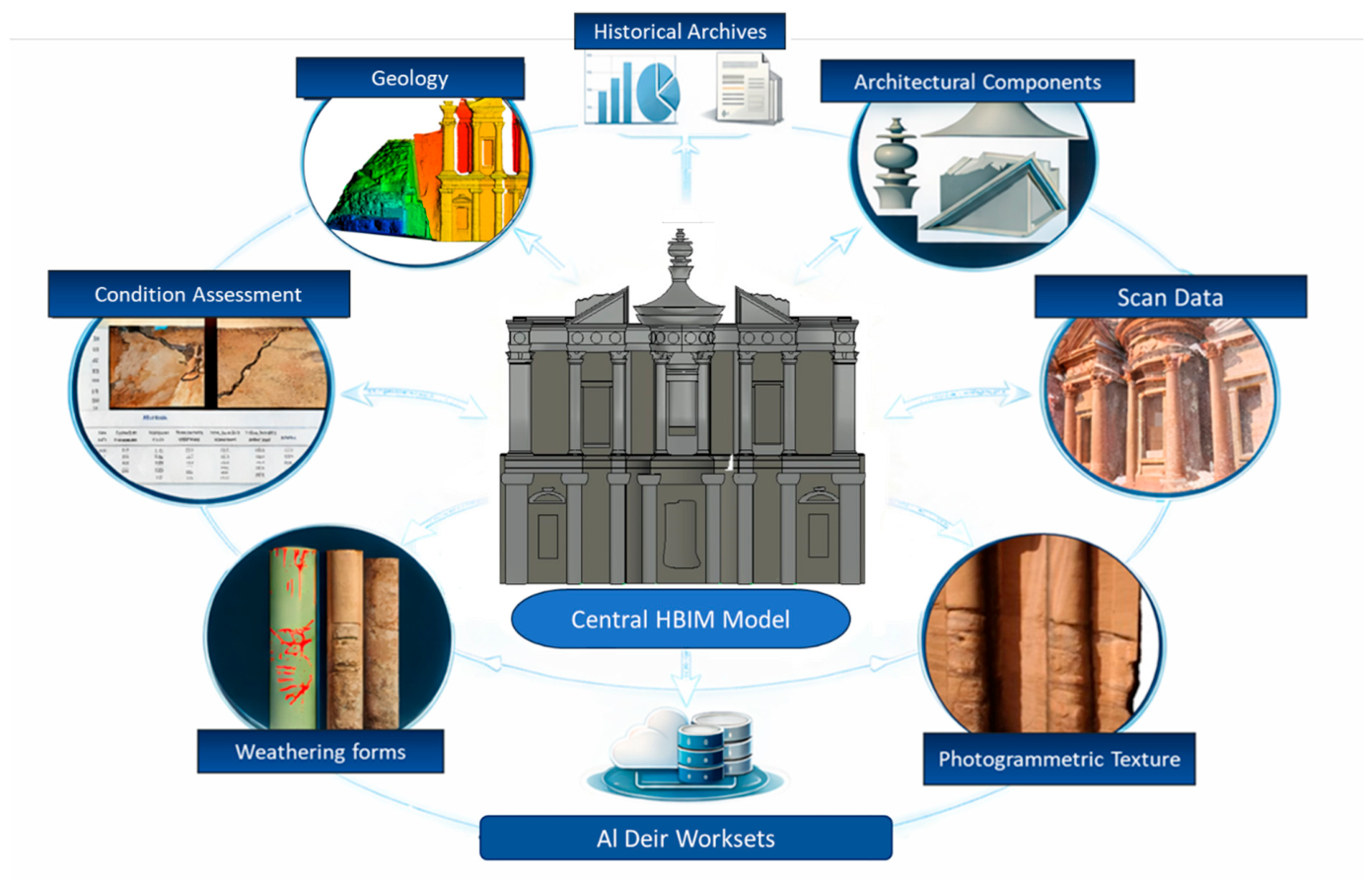
This study builds upon the authors’ previous research on the digital documentation and HBIM of Nabataean architectural heritage [48,49]. While the earlier studies focused on the documentation and modeling of individual monuments, the present work extends this research by proposing centralized HBIM for comprehensive heritage information management and long-term conservation. The new proposed framework integrates multi-source datasets, introduces a dedicated digital library of Nabataean decorative motifs, combines high-resolution mesh models with parametric HBIM representations, and organizes heritage information within a workset-based collaborative environment. Within this framework, shown in Figure 1, TLS data are employed to reconstruct the primary architectural geometry as parametric HBIM elements, providing the structural backbone of the model, while photogrammetry is used to capture complex and decorative elements, which are subsequently processed into high-resolution textured mesh models. These photogrammetric meshes are scaled and accurately oriented using the georeferenced TLS data, ensuring both spatial consistency and geometric fidelity within the HBIM environment. The decorative meshes are incorporated into a dedicated HBIM family library, allowing standardized reuse across multiple monuments. The proposed central HBIM models are further organized into thematic worksets, enabling multiple specialists to collaborate efficiently on specific components while maintaining data integrity.
Figure 1.
Proposed methodological workflow for the development of a centralized HBIM framework for Nabataean architecture.
Accordingly, this study addresses the following research questions: (1) How can TLS, close-range photogrammetry, and HBIM be integrated within a unified workflow for documenting complex Nabataean architectural heritage? (2) How can recurring irregular decorative elements be represented as reusable mesh-based HBIM components while retaining their geometric and visual characteristics? (3) How can heterogeneous geometric, historical, conservation, geological, and condition-related information be organized within a centralized HBIM environment to support structured heritage information management?
Overall, the proposed framework advances current HBIM methodologies through the following key contributions:
- A centralized HBIM framework is proposed integrating geometric, semantic, historical, conservation, geological, and condition assessment data within a unified workset-based platform.
- A digital library of Nabataean decorative motifs is developed, comprising high-resolution textured mesh models for systematic documentation, classification, reuse, and heritage information management.
- A hybrid mesh–HBIM integration approach is used that combines realistic photogrammetric meshes with parametric HBIM models, preserving both geometric fidelity and semantic information for accurate representation and analysis of complex and deteriorated architectural features that cannot be adequately represented using conventional parametric modeling alone.
The article is organized as follows: Section 2 provides an overview of Nabataean heritage sites, emphasizing their most significant monuments and architectural features. Section 3 details the data acquisition and modeling of Nabataean monuments and tombs using terrestrial laser scanning and photogrammetry. Section 4 discusses data fusion. Section 5 presents the development of an HBIM family library for Nabataean decorative elements, while Section 6 outlines the proposed central HBIM model and the collaborative workflow. Section 7 discusses the results, and Section 8 concludes the paper.
2. Nabataean Heritage Sites
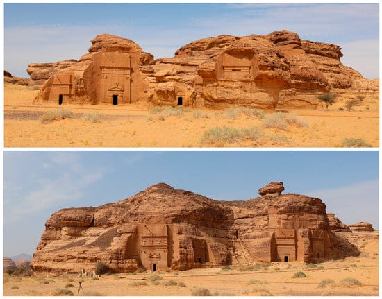
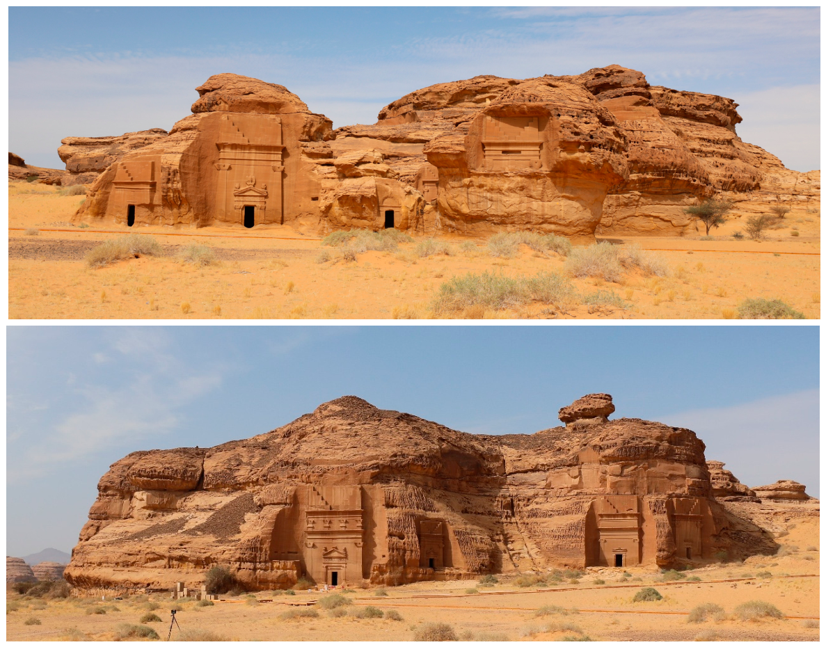
The Nabataeans were an Arab tribe that first appeared in the sixth century BC in the desert east of Jordan after migrating from the southeastern Arabian Peninsula. The Nabataean Kingdom controlled many of the trade routes of the region which formed the main source of their wealth between the second century BCE and the end of the first century CE. Among the most important urban centers of the Nabataean Kingdom was Hegra (also known as Madā’in Ṣāliḥ), located in AlUla in Saudi Arabia. Following Petra in importance, Hegra was the second major city of the Nabataean Kingdom and remains one of the most significant archaeological landscapes that illustrate the development and achievements of Nabataean civilization. The site extends across approximately 52 hectares and is distinguished by its sandstone outcrops that host a remarkable concentration of rock-cut funerary monuments. Hegra is particularly renowned for its well-preserved tomb façades, shown in Figure 2, whose architectural complexity and decorative richness reflect the social and economic status of the families or groups interred within them. In addition to the monumental façades carved into isolated rock formations, simpler burial pits located higher on the surrounding outcrops likely belonged to individuals of lower social standing. The quantity, preservation, and diversity of decorated tombs at Hegra make the site unique within the broader Nabataean cultural landscape [50].
Figure 2.
Hegra Tombs, Jabal al-Khuraymat necropolis.
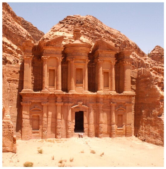
Another remarkable example of rock-cut architecture and urban planning, reflecting the cultural, economic, and political significance of the Nabataeans in the region, is Petra, the capital city of the Nabataean Kingdom. Petra was inscribed on the UNESCO World Heritage List in 1985 and was later recognized in 2007 as one of the Seven New Wonders of the World. The city flourished as a major urban and commercial hub along the Nabataean trade network, and its archaeological landscape preserves a remarkable assemblage of temples, tombs, colonnaded streets, water management systems, and ceremonial spaces that collectively demonstrate the technological sophistication and artistic achievements of Nabataean civilization. Among the most impressive monuments in Petra is Al-Deir (The Monastery), Petra, one of the largest and most monumental rock-cut façades at the site, shown in Figure 3. The monument is accessed through an ascending pathway of approximately 800 rock-cut steps that lead to a remarkably well-preserved façade measuring approximately 47 m in width and 48.3 m in height. Architecturally, the upper register of the façade is composed of two half-pediments flanking a central circular tholos crowned by a conical roof and urn. The tholos is framed by columns with characteristic Nabataean horned capitals, while the pediments are linked by a continuous frieze decorated with a simplified motif of alternating triglyphs and discs. The façade is further articulated by a monumental central doorway framed by pilasters, capitals, and additional decorative architectural elements, emphasizing the monumentality and symbolic significance of the structure. Despite its exceptional preservation and global significance, increasing concerns have emerged in recent decades regarding the conservation of Petra’s monuments. Environmental monitoring studies conducted at the site have identified significant deterioration and weathering affecting the interior chamber walls of several monuments. These degradation processes have been attributed to multiple interacting factors, including fluctuations in internal relative humidity, salt crystallization, intensive visitor activity, and limitations in conservation strategies and site management practices [7,8,51,52].
Figure 3.
Al-Deir monument in ancient Petra city.
The Tombs at Hegra Historical Site
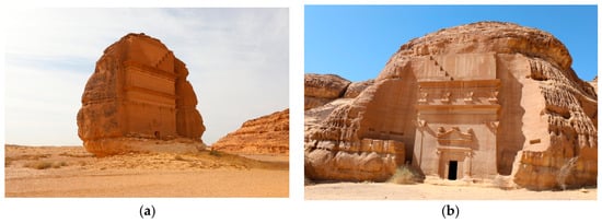
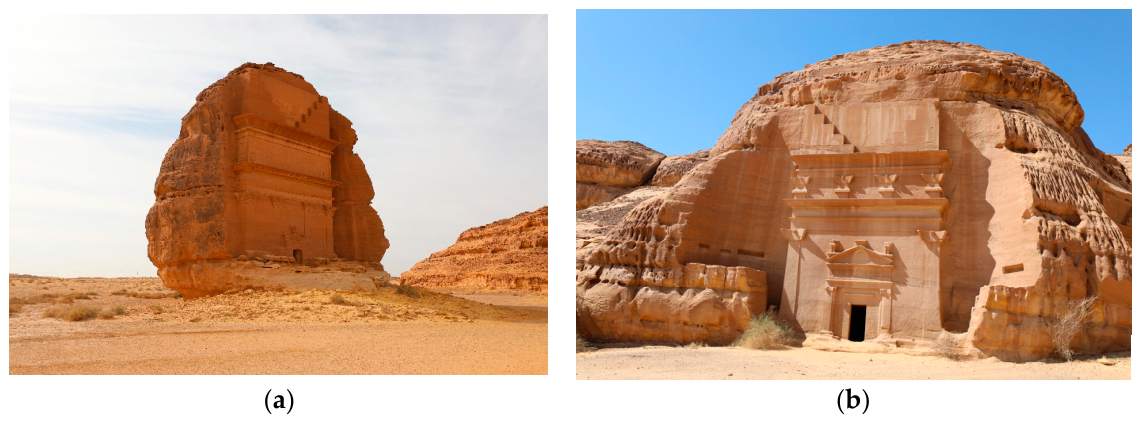
Hegra is a collection of over 110 massive sandstone tombs carved directly into the rocks protruding from the desert, demonstrating the ingenuity and creativity of ancient Nabataean culture. The rock-cut tombs of Hegra stand as remarkable testaments to the Nabataean civilization, providing valuable insights into their social and cultural practices. Many tombs bear inscriptions detailing the identities of their commissioners, the dates of construction, and the craftsmen responsible for their creation. Numerous mythological animals, vegetal motifs, and religious symbols are shown on both the interior and exterior of the main Nabataean tombs, reflecting to a significant extent Nabataean funerary beliefs and ritual practices. A wide variety of symbolic elements are carved on the tomb façades, including grotesque masks, serpents, falcons, sphinxes, Medusa reliefs, rosettes, and solar disks, which represent some of the most prominent motifs in Nabataean funerary architecture. The most prominent tomb is Liyhan Son of Koza’s 72-foot-tall sandstone monolith; it is designated as IGN 110 and shown in Figure 4a. The enormous, stand-alone rock, although unfinished, is the unofficial image of Hegra. Another distinguished tomb designated as IGN 22, shown in Figure 4b, is regarded as one of the most elaborate and richly decorated tombs within the Jabal al-Khuraymat necropolis. Refs. [53,54] were the first scholars to systematically map and catalogue the Nabataean monuments, during which they also proposed the earliest typological classification of Nabataean tomb façades. According to their classification, seven main tomb types were identified. The archaeological site of Hegra preserves examples of five of these types, including Pylon Tombs, Step Tombs, Proto-Hegr Tombs, Hegr Tombs, and Arch Tombs.
Figure 4.
(a) Tomb IGN 110 known as the tomb of Liyhan, son of Kuza; (b) Tomb IGN 22 in Jabal al-Khuraymat necropolis.
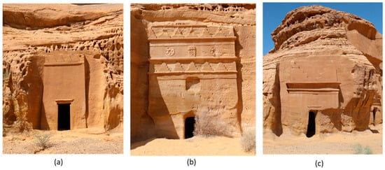
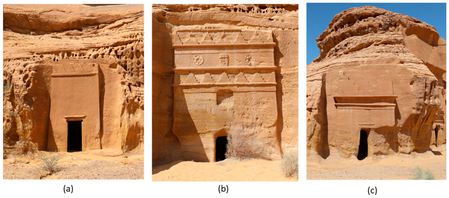
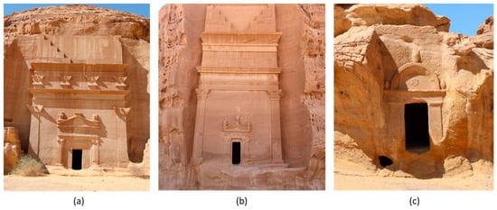
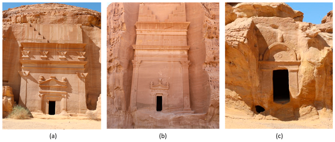
Pylon-type tombs (Figure 5a,b) are characterized by façades ornamented with one or two rows of stepped crowsteps, complemented by a half-crowstep at each corner and framed by relief moldings above and below. A horizontal groove positioned above the entrance was likely intended to accommodate either the tomb owner’s inscription or an ornamental stone molding. In contrast, step tombs (Figure 5c) feature façades composed of two opposing stepped motifs situated above a cavetto (concave) cornice. The stepped motif, which originated in the Assyrian–Achaemenid architectural tradition, was subsequently adopted and reinterpreted by the Nabataeans, who modified it to create a distinctive decorative element for these tomb façades.
Figure 5.
(a) Pylon tomb of one crowstep; (b) Pylon tomb with two crowstep; (c) Step tomb.
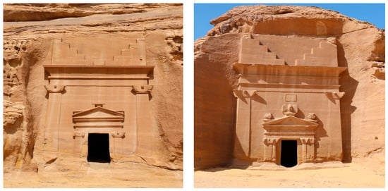
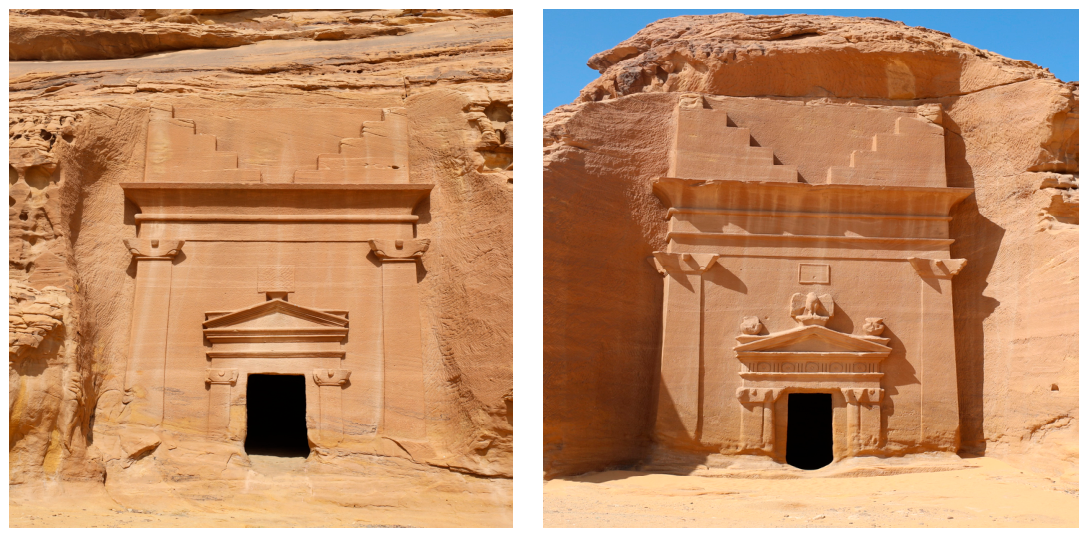
The Proto-Hegr tomb façade (Figure 6) features two opposing sets of steps, complemented by a cavetto cornice and fascia, creating a distinctive architectural arrangement. The architraves are supported by pilasters with Nabataean capitals. This type has steps, pilasters, but no attic. The Hegr tomb type on the other hand, shown in Figure 7a,b, is characterized by a distinct architectural composition. Over a cavetto cornice, the tomb façade has two sets of steps that face each other and fascia. The classical entablature is supported by pilasters, with a non-decorative attic above it. Finally, the arch-type tomb façade (Figure 7c) is characterized by a single or double arch supported by corner pilasters. In some cases, the entrance doorway is additionally framed by pilasters crowned with capitals, which support a second arch that may feature a central decorative element.
Figure 6.
Examples of Proto-Hegr tombs.
Figure 7.
(a,b) Examples of Hegr tombs; (c) The Arch tomb.
3. Data Collection and Processing
The data were systematically collected from the archaeological site of Hegra and Petra, employing advanced techniques such as laser scanning and photogrammetry. These methodologies enabled the generation of highly accurate 3D models and high-resolution imagery as input for facilitating comprehensive documentation of the sites’ architectural features. Laser scanning, with its precise measurement capabilities, and photogrammetry, with its ability to capture intricate surface details and color, proved essential in preserving and analyzing this historically significant architecture.
3.1. Laser Data
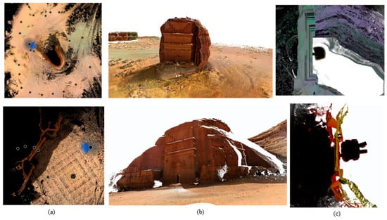
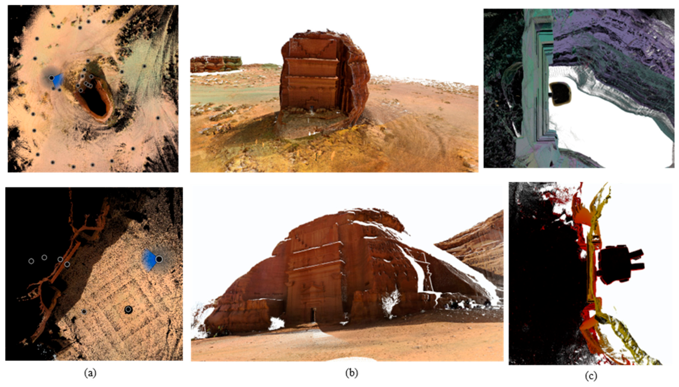
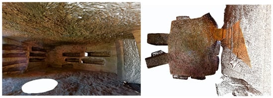
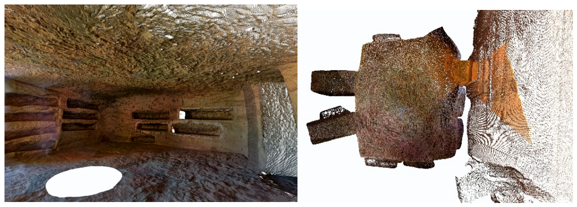
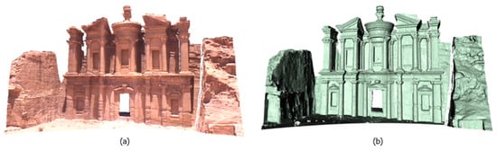
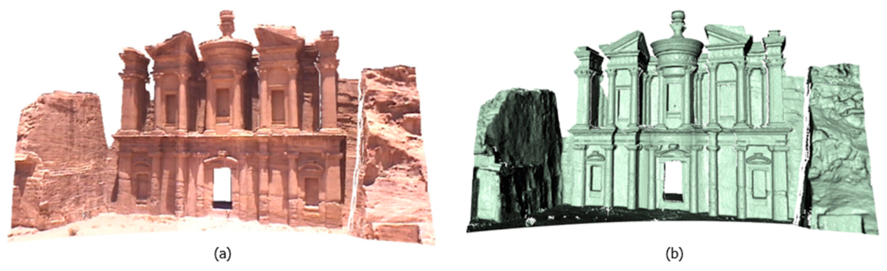
The Leica RTC360 scanner was employed to capture TLS data from the Hegra archaeological site. This scanner is capable of acquiring up to two million colored points per second, with a measurement range extending from 0.5 to 130 m and a wide field of view of 360° × 300°. It is equipped with a calibrated spherical 36-megapixel camera that captures images within the same 360° × 300° field of view. The RGB values acquired are mapped onto 3D coordinates to generate color representation of the scene. A key advantage of the Leica RTC360 system is its automatic registration of the captured scans, enhancing field efficiency during data acquisition. However, this process requires careful planning of scan locations to ensure sufficient overlap between adjacent stations. For the tomb of Liyhan IGN 110, a total of twenty-nine scans were collected, four of which were taken from the interior. The resulting model consists of over 403 million points, with an average ground sampling distance (GSD) of 6 mm. In contrast, the scanning plan for Tomb IGN 22 in the Jabal al-Khuraymat necropolis involved seven stations, three exterior and four interiors. The merged point-cloud model for this tomb contains over 77.1 million colored points, with an average GSD of 8 mm for the exterior scans and 5 mm for the interior scans. Following the acquisition of TLS data, a post-processing phase was conducted to remove noise and unwanted points. Subsequently, the interior and exterior scans were registered into a unified coordinate system using Autodesk ReCap Pro 2026.1 software, producing the final point-cloud scene with integrated color information captured by the TLS camera. The scanning workflow including the planning of scan positions, registration and merging of the individual scans, and generation of the resulting registered point clouds is shown in Figure 8. The interior scans of Hegra Tomb IGN 22. which further reveal the spatial arrangement of the burial graves within the tomb chamber, providing detailed geometric documentation of the internal architectural configuration, are shown in Figure 9. The data from Petra on the other hand was acquired using the Mensi GS100 laser scanner, which offers a panoramic field of view of 360° horizontally and 60° vertically. The instrument is capable of recording up to 5000 points per second, with a measurement accuracy of approximately 6 mm at a maximum scanning range of 100 m. During data acquisition, an integrated calibrated camera captures video snapshots at a resolution of 768 × 576 pixels, which are automatically registered and mapped onto the corresponding laser point measurements. To mitigate occlusions, five scans were conducted from different viewpoints at the Al-Deir monument, resulting in a dataset comprising nearly six million points, shown in Figure 10, with an average ground sampling distance (GSD) of approximately 3 cm.
Figure 8.
Laser scanning data for Tomb IGN 110 and IGN 22. (a) Scanning work plan. (b) Merging the scans. (c) Top view.
Figure 9.
Interior scans of Hegra Tomb IGN 22 reveal the spatial arrangement of the burial graves within the tomb chamber.
Figure 10.
Laser scanning data for Petra Monastery: (a) 3d point cloud. (b) Meshed model.
3.2. Photogrammetric Data
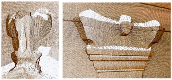
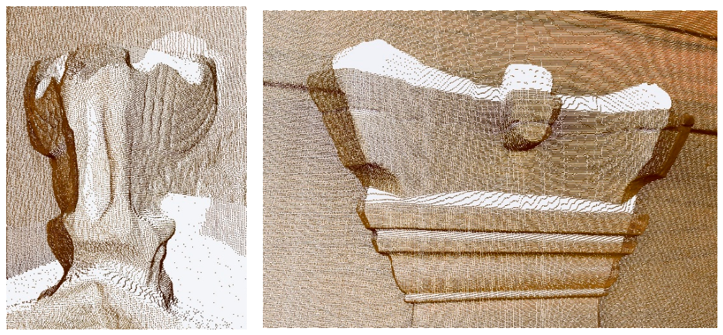
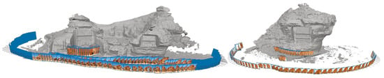
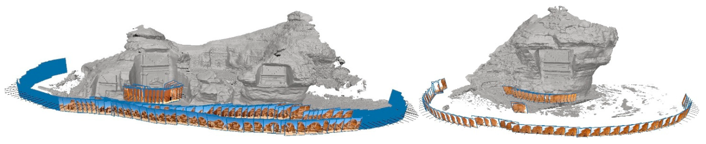
Laser scanning techniques, while highly effective for capturing large-scale architectural geometry, may present certain limitations when documenting fine reliefs and discontinuous edges. In such cases, the laser beam may have difficulty accurately recording sharp edges, thin protrusions, and abrupt surface transitions, which can result in erroneous point-cloud measurements and localized data gaps, as shown in Figure 11. As a result, photogrammetry provides a valuable complementary approach for generating high-resolution three-dimensional models of fine decorative elements, where both geometric precision and realistic surface textures are essential for detailed analysis and digital heritage documentation. The significant advantage of photogrammetry lies in its flexibility during data acquisition. Images can be captured from a wide range of positions and angles, enabling documentation of complex geometries and hard-to-reach areas that may be difficult to capture using terrestrial laser scanners. Consequently, digital images were acquired for photogrammetric processing using a Canon EOS 5D Mark IV camera, with a resolution of 6720 × 4480 pixels at Hegra, and a Nikon D2X camera, with a resolution of 4288 × 2848 pixels at Petra. The digital images of the monument were acquired in near-simultaneous intervals to ensure consistent lighting conditions and uniform radiometric properties, thereby enhancing the visual quality and interpretability of surface features and tomb inscriptions. Image acquisition was performed using a 35 mm fixed focal length lens to ensure consistent camera geometry throughout the photogrammetric survey. Agisoft Metashape was used to process the captured images and generate three-dimensional models within an arbitrary coordinate system; selected results are illustrated in Figure 12 and Figure 13. The next section will demonstrate how terrestrial laser scanning (TLS) was employed to establish ground control points (GCPs) for the orientation and scaling of the photogrammetric datasets.
Figure 11.
Examples of limitations in terrestrial laser scanning when capturing fine reliefs and sharp edges, resulting in localized gaps and inaccuracies in the point cloud.
Figure 12.
Examples of camera positions for photogrammetric data acquisition.
Figure 13.
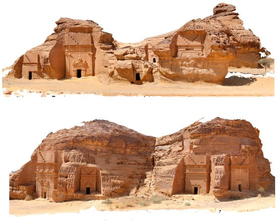
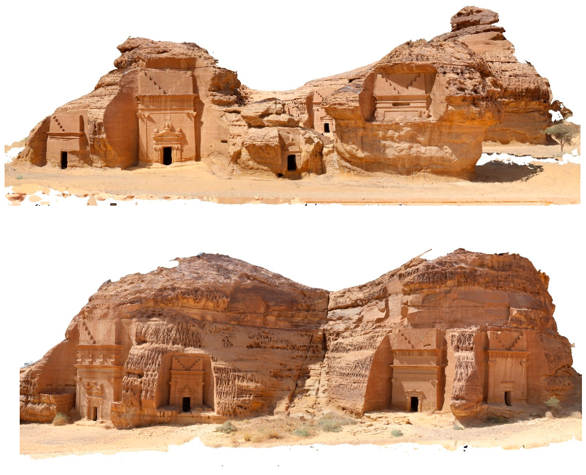
Final 3D textured models of Hegra Tombs, Jabal al-Khuraymat necropolis.
The datasets integrated in this study originate from documentation campaigns conducted at different sites and periods. Consequently, a fully harmonized archival record of all photogrammetric processing parameters, such as exact Agisoft processing-quality settings, mesh face counts, texture resolution, final model file sizes, and equivalent LOD descriptors, was not consistently available for all datasets at the time of the present comparative integration study. To avoid retrospectively reconstructing or inferring undocumented values, the manuscript reports only acquisition and processing parameters that could be verified from the available project records. This limitation does not affect the demonstrated integration workflow but restricts direct benchmarking of processing performance across all case-study datasets.
4. Data Integration and Registration Assessment of Laser Scanning and Photogrammetry
The registration assessment presented in this section is intended to evaluate the internal consistency of the TLS–photogrammetry alignment for the demonstrated case rather than to provide independent end-to-end validation of the complete HBIM workflow.
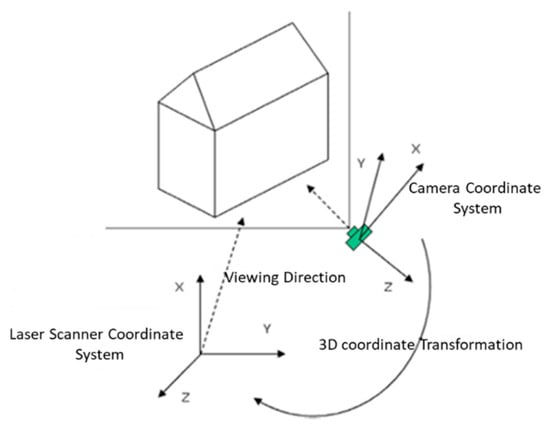
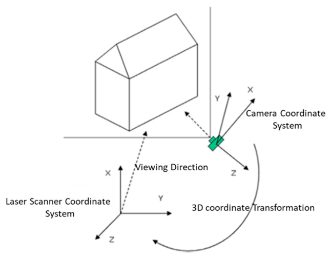
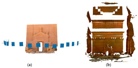
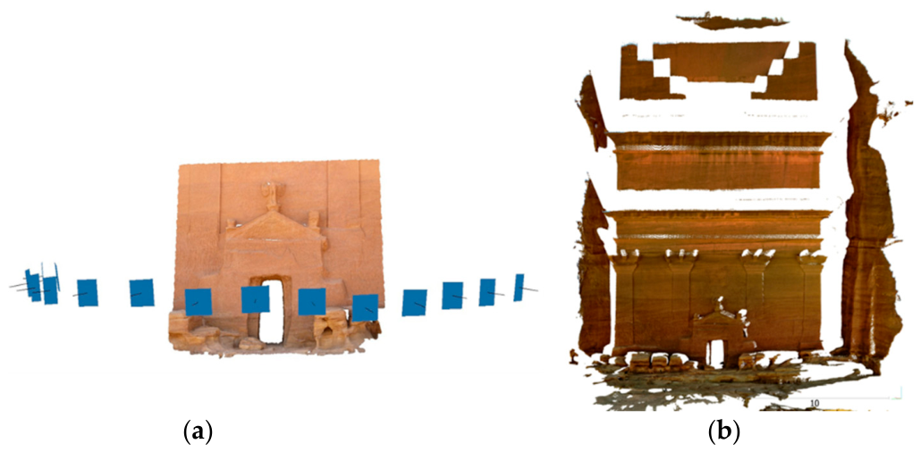
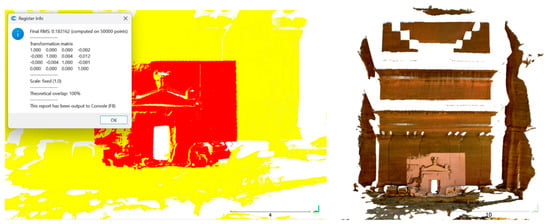
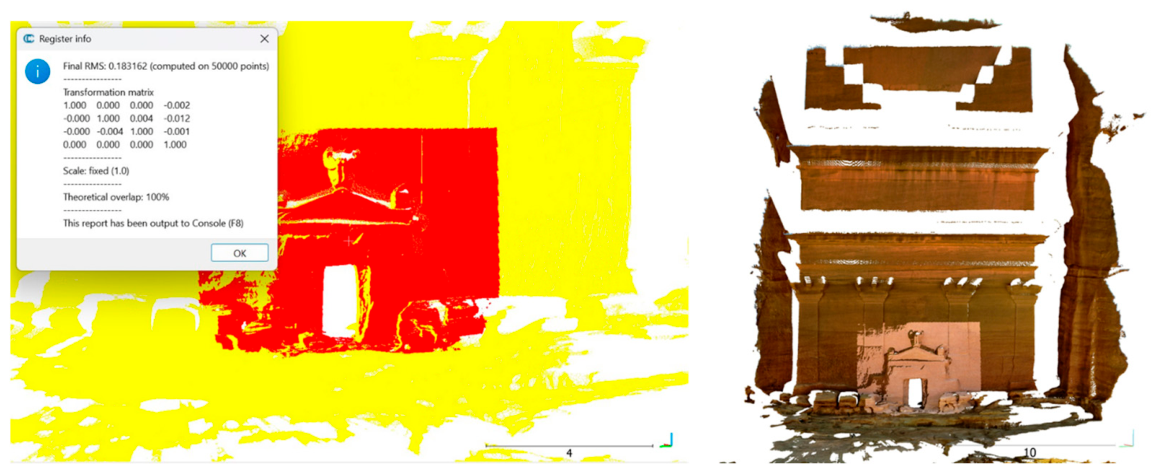
The integration of terrestrial laser scanning (TLS) and photogrammetry represents a fundamental step in the development of an accurate and scalable HBIM framework for Nabataean heritage. This integration enables the production of metrically accurate and scale-consistent photogrammetric outputs. These outputs are subsequently utilized to generate HBIM families representing fine architectural details, preserving both geometric precision and morphological richness. To integrate models derived from heterogeneous sensor datasets, accurate registration is essential. The spatial alignment of the photogrammetric model with respect to the three-dimensional laser scanning model was achieved through pose estimation, which determines both position and orientation, as illustrated in Figure 14. This process relied on a set of clearly identifiable corresponding points that could be reliably recognized in both datasets. At least three corresponding points were selected from clearly identifiable and geometrically distinctive features within the overlapping areas of the two datasets and spatially distributed across the model to ensure a stable initial alignment. A preliminary alignment was first established using CloudCompare v2.14.beta software, followed by fine registration using the Iterative Closest Point (ICP) algorithm implemented in CloudCompare [55]. The results of the combined pose and scale registration of the image-based point cloud withw the laser-scanning point cloud are presented in Figure 14. For the Tomb of IGN 110, presented in Figure 15, the alignment of the photogrammetric and TLS datasets was refined using the ICP algorithm in CloudCompare. As reported in the ICP registration results shown in Figure 16, the alignment achieved a root mean square (RMS) residual of 0.18 mm, calculated by CloudCompare using 50,000 points selected by the software.
Figure 14.
Pose estimation and scaling process of the photogrammetric point cloud aligned with the laser scanning reference.
Figure 15.
(a) Photogrammetric dataset in an arbitrary (scale-less) coordinate system; (b) terrestrial laser scanning (TLS) data utilized as a reference framework for scaling and accurate registration.
Figure 16.
Final registration results of the photogrammetric and TLS datasets, including the aligned point clouds and associated registration parameters.
The reported 0.18 mm RMS value refers specifically to the ICP fine-registration test conducted for Tomb IGN 110 and was not used as a common accuracy metric for all monuments or datasets examined in this study. The remaining datasets were processed according to their respective acquisition and modeling requirements, and no claim is made that the same numerical registration accuracy was achieved across all cases.
The photogrammetric point cloud is shown in red, while the laser-scanner (TLS) point cloud is shown in yellow. This value represents the internal residual of the ICP registration between the photogrammetric and TLS point clouds and should not be interpreted as the absolute accuracy or overall uncertainty of the complete survey, registration, or HBIM workflow.
No dedicated sensitivity analysis was conducted to quantify the robustness of ICP under systematically varied point-cloud density or noise conditions. The ICP result should therefore be interpreted as a dataset-specific fine-registration outcome rather than as evidence of algorithmic robustness across heterogeneous acquisition conditions. The influence of point density, noise level, overlap, and initial alignment quality on registration performance represents an important topic for future comparative assessment.
5. HBIM Families’ Library of the Nabataean Decorative Elements
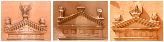
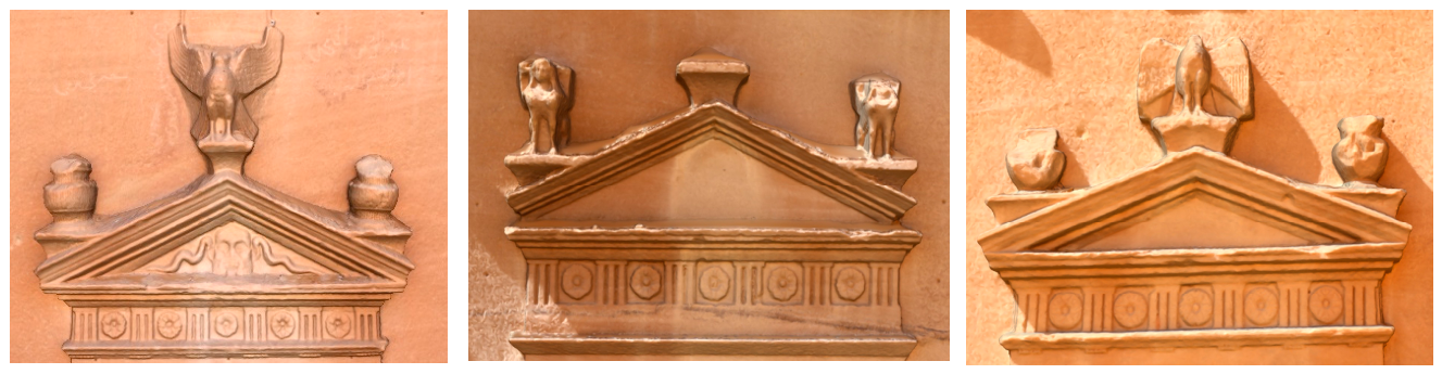
The development of an HBIM families’ library for Nabataean decorative elements is essential due to the wide variety and symbolic significance of motifs carved on Nabataean tomb façades. These façades feature numerous symbolic elements, including grotesque masks, serpents, falcons, sphinxes, Medusa reliefs, rosettes, and solar disks, which represent some of the most prominent motifs in Nabataean funerary architecture. Such elements are repeatedly used across many tombs and monumental façades, often with similar geometric configurations and stylistic characteristics as shown in Figure 17. This repetition highlights the importance of creating a structured digital library of HBIM families that can be reused directly within BIM models.
Figure 17.
Examples of recurring Nabataean decorative elements carved on various tomb façades, documented and reconstructed using 3D photogrammetric modeling.
Reuse within the HBIM environment follows a component-based principle: a decorative family may be reused when the motif type and morphological characteristics are sufficiently comparable, while project-specific scale, provenance, condition, and documentation attributes are retained or updated for the receiving monument rather than copied indiscriminately.
For the purposes of this study, the decorative-element library is organized as a structured, heritage-specific collection rather than as a fully standardized external repository. The primary classification level is based on motif type (e.g., eagle, sphinx, serpent, rosette, Medusa, and related recurring elements), while provenance information records the monument and site from which each component was documented. Each HBIM component is associated with a unique identifier and a set of descriptive metadata fields, including motif type, material, source monument, documentation method, condition information, and external documentation references. The present implementation focuses on classification, reuse, and information association within the HBIM environment. Formal cross-platform version management, standardized naming conventions across institutions, and public open-access repository mechanisms were not implemented and are therefore identified as future development requirements rather than demonstrated outcomes of the present study.
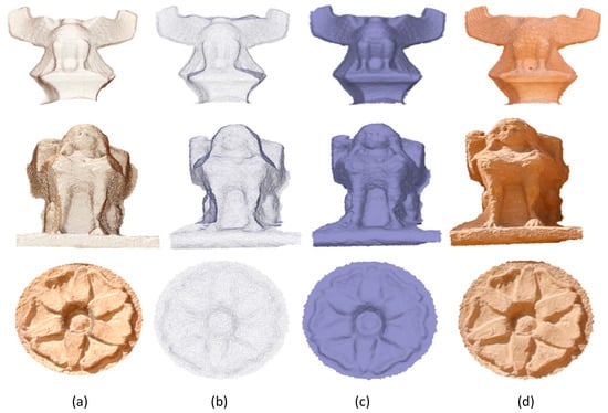
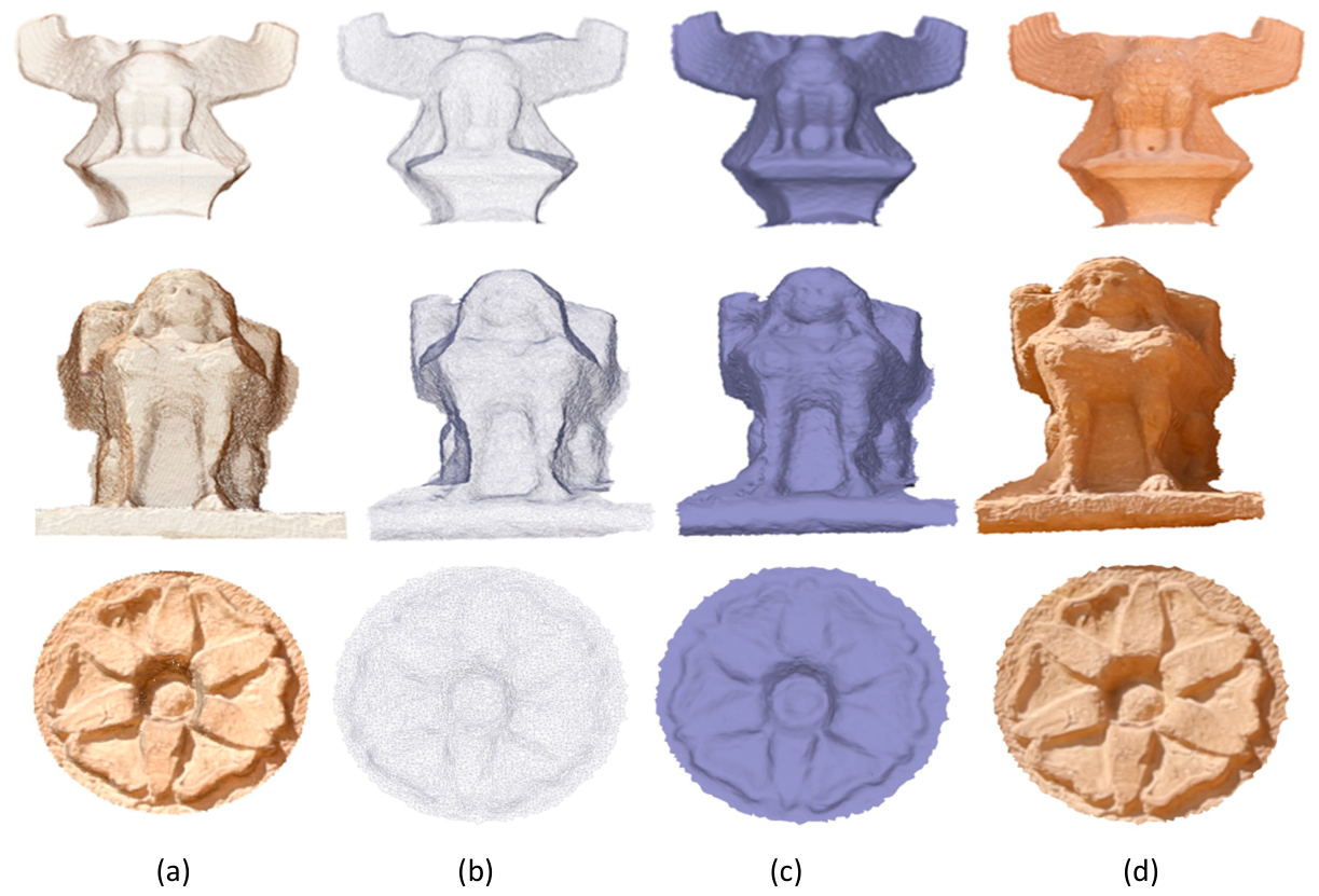
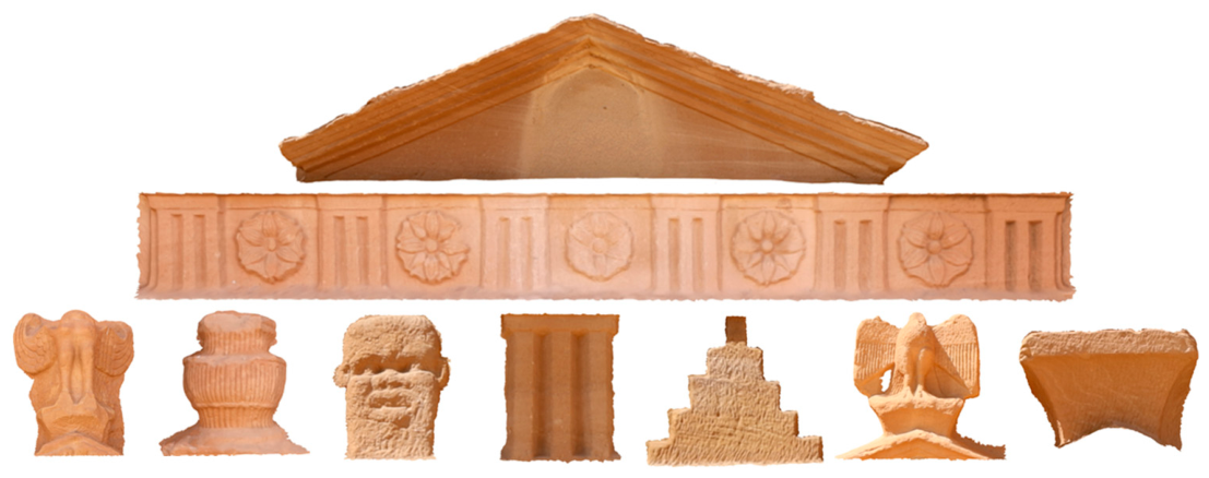
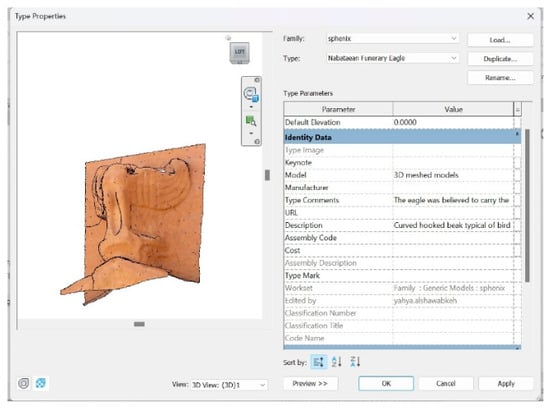
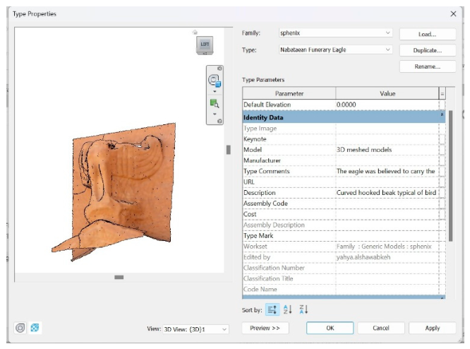
Due to the highly intricate geometry and irregular relief of Nabataean decorative carvings, parametric modeling approaches are often insufficient to accurately represent their complex morphological details. Therefore, mesh-based modeling is adopted as a more suitable method for preserving the authenticity and geometric complexity of these carvings. To accurately document these decorative components, photogrammetry techniques are employed to capture both their detailed geometry and surface color information. The resulting high-resolution models are processed into mesh geometries and subsequently integrated into the HBIM environment as reusable components. Figure 18 and Figure 19 illustrate examples of photogrammetry-derived mesh models of Nabataean decorative elements, while Figure 20 presents an example of the HBIM family generated in Autodesk Revit for the eagle motif.
Figure 18.
Photogrammetric reconstruction process of Nabataean decorative motifs showing the modeling stages: (a) point cloud generation; (b) triangulated mesh formation; (c) solid model derivation; (d) textured mesh model.
Figure 19.
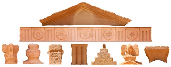
Examples of photogrammetry-derived mesh models of Nabataean decorative elements.
Figure 20.
An example of the HBIM family generated in Autodesk Revit for the eagle motif.
6. Proposed HBIM Central Model
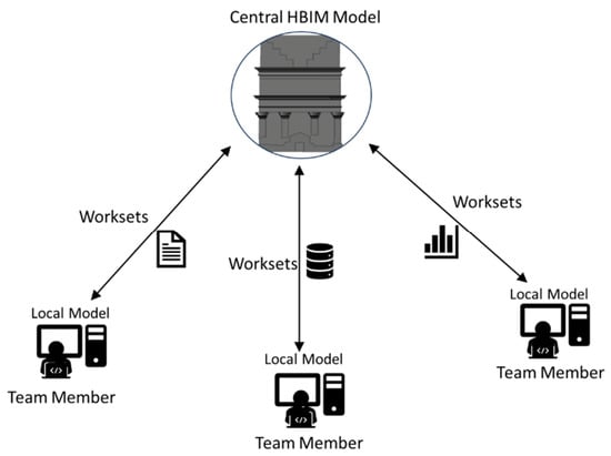
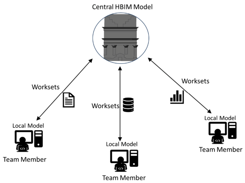
The significance of BIM resides in its capacity to transform static documentation into an intelligent, dynamic archive that facilitates multidisciplinary collaboration. At the core of this approach is the central HBIM model, which functions as a consolidated digital repository, integrating heterogeneous datasets into a single coordinated environment. By centralizing these diverse data sources, the central model ensures data consistency, enables iterative updates, and preserves legacy material in a manner that is accessible, reusable, and scalable for future research, conservation planning, and educational initiatives. The proposed HBIM workflow adopted for the documentation of Nabataean monuments is based on the integration of survey data, parametric modeling, and collaborative information management within a unified central BIM model. The geometric data acquired through terrestrial laser scanning and close-range photogrammetry provide the primary source for accurate three-dimensional representation. The BIM model is developed in Autodesk Revit using a central model-based work-sharing approach, where the central model functions as a shared digital archive, as shown in Figure 21. Within this collaborative environment, Revit worksets are employed as a core work-sharing mechanism to subdivide the BIM model into editable subsets, enabling simultaneous multi-user collaboration. Each element is assigned to a specific workset, allowing controlled access, ownership management, and coordinated synchronization of changes.
Figure 21.
HBIM work-sharing using the Revit central HBIM model that allows multiple team members to work on the same project model at the same time.
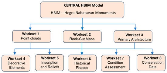
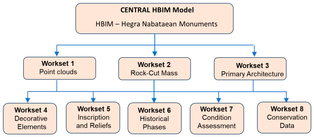
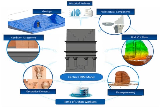
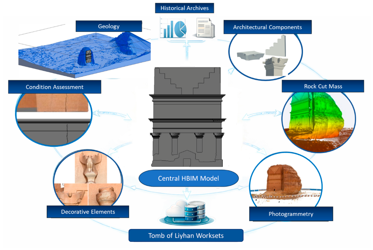
For the HBIM documentation of Nabataean monuments, the proposed workset structure organizes the central HBIM model into thematic worksets, as illustrated in Figure 22. The worksets provide a structured environment for integrating and managing heterogeneous heritage information within a single centralized HBIM platform. All spatial datasets used within each case study were aligned within a common project coordinate framework derived from the available survey control. Because the investigated datasets originate from different documentation campaigns and sites, a single common EPSG code is not asserted for all datasets in this study.
Figure 22.
Proposed HBIM workset structure for the collaborative documentation of Nabataean monuments using the central HBIM model.
The processed point clouds and photogrammetric outputs constitute the primary geometric reference for the modeling process. Architectural elements, including rock-cut walls, façades, chambers, columns, architectural features, and decorative elements, are modeled as HBIM objects and positioned according to the surveyed geometry. Each modeled element is assigned a unique identifier and a set of customized HBIM parameters. These parameters provide the link between the geometric objects and their associated historical, material, conservation, and condition-assessment information.
The historical-phase workset associates architectural elements with their corresponding construction or modification phases, while the conservation and condition-assessment workset records information such as material type, deterioration category, damage location, severity, and conservation status. Photographs, orthophotos, inspection records, and other documentation can be associated with the relevant HBIM elements through their unique IDs and corresponding parameters or external file references. In this way, the central HBIM model functions not only as a three-dimensional representation of the monument but also as an information hub in which geometric, historical, architectural, and conservation datasets are spatially and semantically linked to individual heritage elements.
To demonstrate the implementation of this workflow, two representative case studies are examined: Al-Farid monument in Hegra and Al-Deir monument in Petra. The first phase focuses on the precise production of HBIM models representing the architectural and decorative components of Nabataean monuments. The second phase involves the establishment of a central HBIM model organized through multiple worksets, which function as thematic layers for the management and enrichment of heritage information.
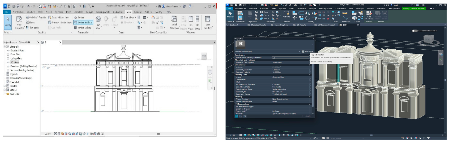
The BIM process was carried out in two stages. In the first stage the geometric reconstruction of architectural elements—such as walls, columns, façades, and structural features—is carried out based on point-cloud data derived from laser scanning, whereas the second stage involved the incorporation of previously developed mesh-based families representing complex decorative motifs derived from photogrammetric models. Standard BIM workflows typically rely on predefined two- and three-dimensional object families that facilitate efficient and rapid model generation. However, Nabataean monuments incorporate distinctive architectural and structural features that are not represented within conventional BIM libraries. Consequently, the modeling process required the creation of customized components within the BIM environment. The HBIM models were therefore developed in Autodesk Revit using a combination of system families and in-place families in order to accurately represent the architectural characteristics of the monuments. System families were primarily employed to model standard architectural components such as walls and roofs. These families rely on defined dimensional parameters—including wall and roof thicknesses, as well as door width, height, and depth—to generate accurate geometric profiles while maintaining the parametric behavior of the modeled elements. In contrast, in-place families proved more suitable for representing unique, highly complex, and free-form architectural elements that are specific to the Nabataean monuments. Accordingly, new in-place families were created and implemented within the BIM environment, with their geometric profiles directly derived from point-cloud data. For each component, a set of family parameters was defined, including dimensional attributes, material properties, and descriptive information related to condition assessment.
For example, an in-place façade component was assigned dimensional parameters describing its width, height, and depth, together with material-related attributes and descriptive fields including Element_ID, Material_Type, Condition_Status, Deterioration_Type, Damage_Severity, Conservation_Status, and Documentation_Reference. These parameters enable each modeled component to function not only as a geometric object but also as an information-bearing heritage entity that can be linked to photographs, orthophotos, condition records, and external documentation.
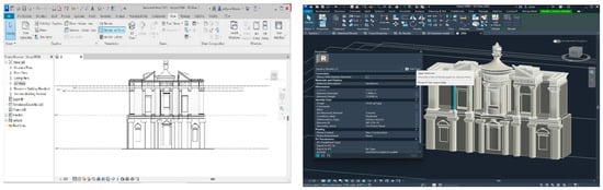
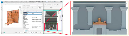
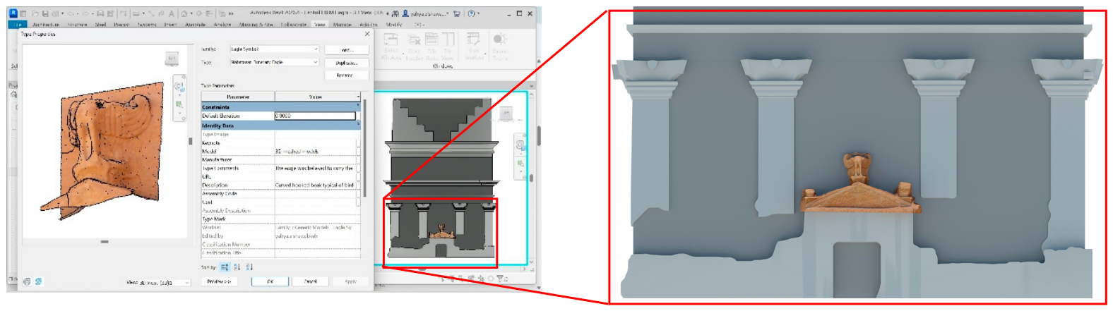
To accurately identify and delineate these architectural elements, the point-cloud data were segmented into sectional views and elevations, which served as the primary reference for tracing and reconstructing the components within the HBIM model as shown in Figure 23. In the second stage of the HBIM process, the previously developed mesh-based families representing complex decorative motifs derived from photogrammetric models were directly integrated into the produced HBIM model, as illustrated in Figure 24.
Figure 23.
Tracing and modeling architectural elements in the HBIM reconstruction workflow.
Figure 24.
Mesh-based families of Nabataean decorative motifs incorporated into the HBIM model.
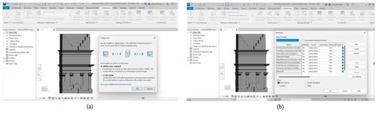
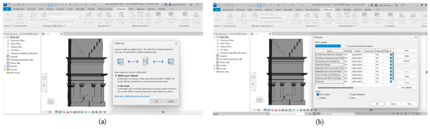
In the second phase, the central HBIM models of Al-Farid Tomb in Hegra and Al-Deir Monument in Petra were developed in Autodesk Revit using a centralized modeling workflow. The process began with the creation of a single central HBIM project file that serves as the primary repository for all modeling and documentation activities as shown in Figure 25a. To facilitate efficient collaboration and structured data management, the central model was organized using a set of HBIM-oriented worksets shown in Figure 25b, Figure 26 and Figure 27. This hierarchical organization allows multiple researchers to work simultaneously on different components of the model while maintaining data consistency and semantic clarity within the shared HBIM environment. For individual modeling tasks, team members generated local copies of the central model within Revit. These local models enable researchers to work independently on specific elements of the monuments, including tomb façades, parametric architectural components, and decorative or epigraphic features. During the modeling process, users periodically synchronized their work with the central model using the Synchronize with central function. This process uploads individual modifications, incorporates updates made by other collaborators, and automatically manages element ownership. Through this workflow, the HBIM models of Al-Farid and Al-Deir were progressively enriched, ensuring version consistency and supporting collaborative development of a comprehensive digital archive of Nabataean monuments.
Figure 25.
(a) Producing central HBIM models; (b) the proposed worksets.
Figure 26.
Central HBIM model of the Tomb of Liyhan, Son of Kuza, showing the integration and linkage of heritage information from different thematic worksets.
Figure 27.
Central HBIM model of the Tomb of Al-Deir in Petra, showing the integration and linkage of heritage information from different thematic worksets.
7. Results and Discussion
The implemented workflow produced three principal outcomes. First, multi-source TLS and photogrammetric datasets were integrated into common monument-scale HBIM environments. For Tomb IGN 110, the ICP fine-registration procedure in CloudCompare produced an internal RMS residual of 0.18 mm over 50,000 points; this value represents registration residual rather than absolute model accuracy. Second, recurring Nabataean decorative motifs were reconstructed as reusable high-resolution mesh-based HBIM components. Third, central HBIM models were organized through thematic worksets and customized parameters linking geometric elements with historical, material, condition, conservation, and contextual information. These results demonstrate the technical implementation of the proposed workflow; however, collaboration efficiency, user performance, long-term monitoring effectiveness, and conservation-decision outcomes were not quantitatively evaluated in the present study.
The management of Nabataean heritage data has long been challenged by fragmentation, as datasets are typically dispersed across multiple institutions, disciplinary domains, and heterogeneous digital formats. This dispersion limits not only data accessibility but also its long-term usability, ultimately constraining effective conservation, monitoring, and research continuity. The absence of a shared and centralized platform results in duplicated efforts, inconsistent documentation standards, and difficulties in integrating new data with existing records. Therefore, this paper proposes an HBIM framework tailored for Nabataean heritage. Unlike previous HBIM studies that mainly focused on the digital documentation of individual heritage buildings or the geometric reconstruction of architectural elements [21,25,44,45,52], the proposed framework introduces a more comprehensive and integrated approach for managing Nabataean architectural heritage. The main contribution lies in the development of a centralized HBIM environment that combines multi-source datasets, including high-resolution photogrammetric models, laser scanning data, historical documentation, condition assessments, and conservation information. Another key advancement is the integration of a structured workset-based organization strategy, which provides a structured mechanism for data organization, collaborative model development, and future updating of the HBIM model. This approach is intended to facilitate interdisciplinary workflows among archaeologists, conservators, architects, and researchers, providing a sustainable digital framework for the documentation, analysis, and preservation of Nabataean heritage.
Furthermore, the proposed framework introduces a novel HBIM-based library of Nabataean decorative motifs, representing recurring sculptural elements such as mythological faces, eagles, snakes, sphinxes, and griffins. This library represents a dedicated reusable collection of Nabataean decorative components developed within the scope of the present study. Rather than claiming a universally first-of-its-kind library, its contribution lies in structuring recurring Nabataean decorative motifs as reusable high-resolution mesh-based HBIM components within a centralized heritage-information environment. The integration of these detailed mesh-based assets within a centralized HBIM environment provides a reusable digital resource for heritage documentation, comparative analysis, and conservation applications. The proposed framework therefore extends the role of HBIM from building-level information management toward the preservation and management of detailed architectural heritage components as shown in Figure 26 and Figure 27.
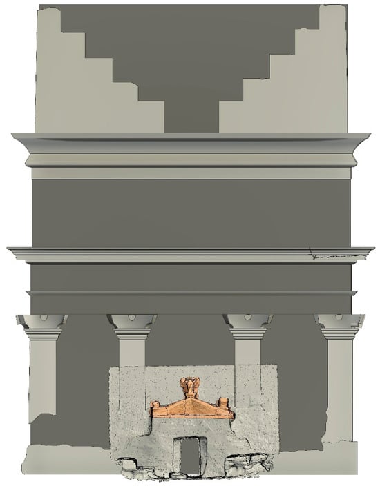
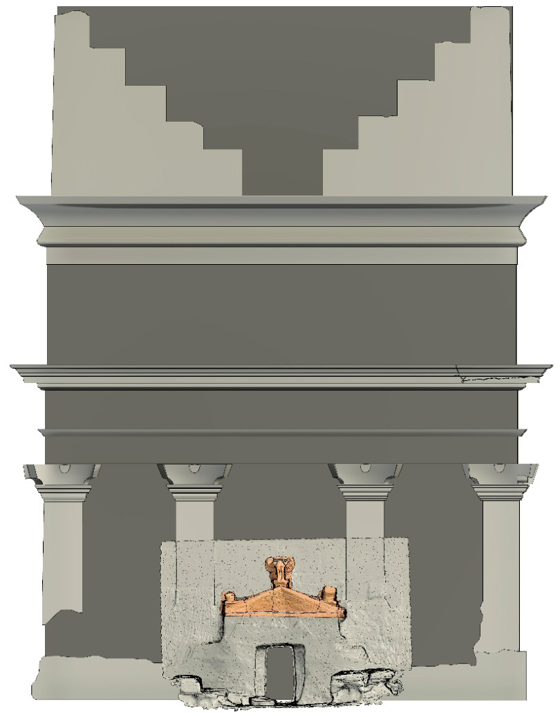
Another significant contribution of the proposed framework is the integration of high-resolution photogrammetric mesh models with the parametric HBIM representation of the monument. The mesh models are accurately registered to the parametric model using georeferenced laser scanning data, ensuring consistent scale, spatial alignment, and seamless data integration within the centralized HBIM environment. This hybrid representation combines the advantages of both approaches: the parametric model provides efficient information management and semantic organization, while the mesh model preserves the fine geometric and textural details that cannot be adequately represented by parametric objects alone. The integration is particularly valuable for architectural components exhibiting surface deterioration, weathering, or complex sculptural features, where realistic mesh data enable detailed condition assessment and support further multidisciplinary investigations as shown in Figure 28.
Figure 28.
Integration of high-resolution photogrammetric mesh models with the centralized parametric HBIM model, where realistic mesh data enable detailed surface deterioration.
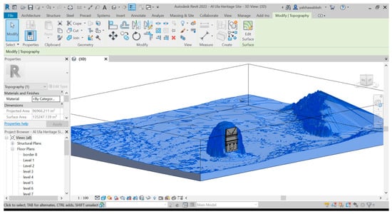
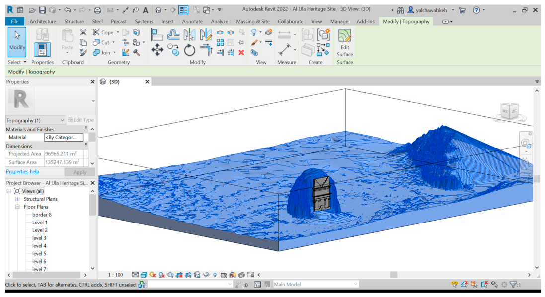
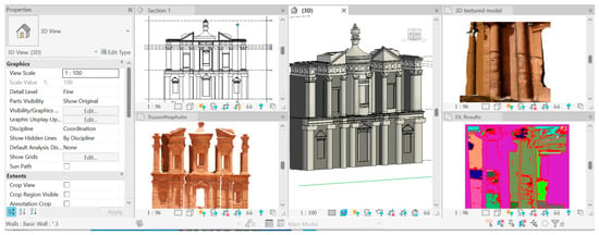
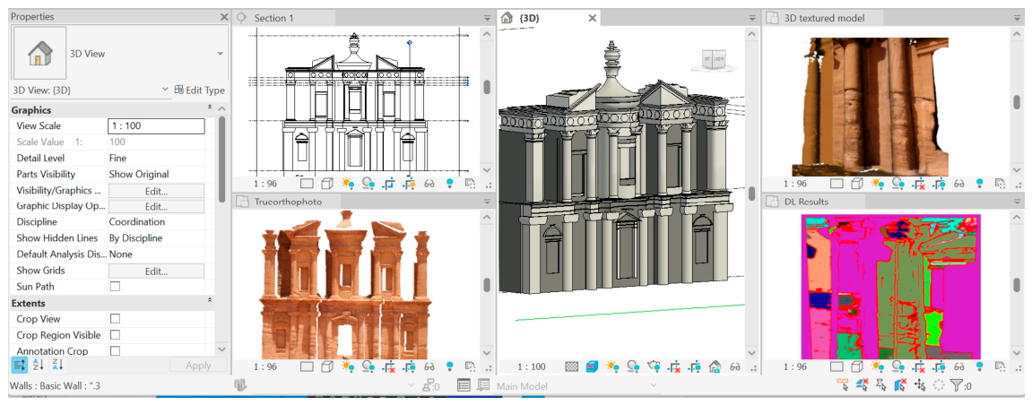
In addition to the architectural and archaeological components, the framework incorporates topographic information describing the natural setting, rock formations, terrain characteristics, and spatial relationship between the monuments and their surrounding landscape, as shown in Figure 29. These datasets are georeferenced and integrated within a common spatial reference framework, ensuring consistent spatial positioning across the HBIM environment. All spatial datasets are referenced to a common coordinate system, allowing geometric information derived from terrestrial laser scanning (TLS), photogrammetry, topographic surveys, and survey control points to be accurately aligned with the HBIM model. This georeferenced integration establishes a spatial link between the monument, its geological context, and the surrounding topography, thereby supporting comprehensive documentation, spatial analysis, conservation assessment, and future management of Nabataean heritage sites. Contextual information, orthophoto, along with other derived data, were also integrated into the Historic Building Information Model (HBIM), as illustrated in Figure 30. This integration provides a unified environment for stakeholders involved in the conservation process.
Figure 29.
Integration of topographic information with the HBIM model through georeferenced survey points, establishing a spatial link between the monument and its surrounding terrain.
Figure 30.
Examples of associating orthophotos, and inspection/condition records with corresponding HBIM elements.
The proposed workflow can be compared with previous approaches developed by Yang et al. and Barazzetti et al. to address the geometric complexity of historic structures. Yang et al. [47] proposed a mesh-to-HBIM workflow in which the surface mesh is first segmented in the Rhino 3D environment and subsequently transformed into solid geometry and semantic HBIM elements. This approach provides a systematic pathway for converting detailed surface meshes into semantically structured BIM components. However, the workflow remains largely building-specific, as the surface mesh of each building must be segmented and interpreted to generate the corresponding HBIM elements. In contrast, the present workflow focuses on documenting recurring decorative motifs and irregular architectural elements using photogrammetry and converting them into reusable HBIM families. Once developed, these families can be incorporated into other HBIM projects containing similar architectural features, thereby reducing the need to repeatedly reconstruct and segment recurring components for each building. The proposed approach therefore shifts the emphasis from building-specific mesh segmentation toward the development of a reusable library of heritage-specific HBIM components. Similarly, Barazzetti [46] proposed a multi-step, manual or semi-automated workflow based on NURBS curves and surfaces for reconstructing complex and irregular architectural elements. Their approach involves the extraction of discontinuity lines corresponding to the boundaries of constructive elements, followed by the generation and parametrization of NURBS surfaces. While this method can effectively preserve the geometric characteristics of complex structures, the reconstruction of highly fragmented or heavily ornamented elements remains challenging. The parametrization of complex geometries may introduce local geometric problems, such as surface intersections resulting from the offsetting of objects composed of multiple surfaces. In comparison, the present workflow addresses recurring decorative elements, enabling the representation of fine-grained irregular geometric details and morphological variations characteristic of Nabataean decorative motifs.
Beyond digital documentation and information management, geometrically reliable HBIM models may also provide a structured basis for future quantitative structural and conservation analyses. Previous studies have demonstrated that geometric irregularities derived from surveying and modeling can influence the predicted structural response of historic masonry, while integrated experimental and numerical approaches can support the evaluation of conservation-compatible interventions. Although no structural or numerical simulation was conducted in the present study, the centralized HBIM environment may provide a future interface through which geometric, material, condition, and structural-analysis information can be linked to specific heritage components. Accordingly, numerical modeling is considered a prospective extension of the framework rather than a capability validated in the present study.
The proposed workflow combines parametric modeling of the main building components with mesh-based BIM of irregular and fine architectural details; this hybrid strategy helps reduce the size and computational complexity of the final BIM model while preserving the geometric characteristics of complex elements. However, the accuracy and efficiency of the registration process may be influenced by computational performance, particularly when handling large-scale buildings and high-density laser-scanning and photogrammetric datasets. The substantial size of point clouds and meshes may exceed the processing capabilities of available hardware, potentially affecting the efficiency and stability of the registration workflow. In addition, the level of detail captured in decorative motifs depends largely on the number and quality of the acquired images and the subsequent mesh-generation process. Insufficient image coverage or image quality may therefore result in incomplete or less detailed geometric representations of intricate decorative elements.
Limitations and Transferability
The proposed workflow also presents several practical limitations. Its implementation currently depends substantially on proprietary software, particularly Autodesk Revit, which may limit reproducibility across alternative HBIM environments. The exchange of complex textured meshes together with associated semantic information through IFC or other openBIM workflows was not systematically evaluated in this study and requires further investigation.
Similarly, formal compliance with broader information-management and semantic-interoperability standards, including Industry Foundation Classes (IFC), and CIDOC CRM, was not evaluated in the present implementation. These standards provide important reference frameworks for future development of cross-platform information exchange, lifecycle information management, and semantic interoperability beyond the current Revit-based environment.
The creation of customized in-place families and the organization of heritage-specific semantic information also involve significant manual interpretation and modeling effort. In addition, scalability may become challenging when the framework is applied to substantially larger archaeological complexes or very high-density datasets. While TLS–photogrammetry integration, hybrid mesh–HBIM representation, semantic association, and thematic worksets are conceptually transferable to other heritage contexts, the proposed decorative-motif library is inherently site- and typology-specific and would require adaptation for other architectural traditions.
8. Conclusions
This study presented a comprehensive HBIM framework for the digital documentation and management of Nabataean architectural heritage through the integration of terrestrial laser scanning, close-range photogrammetry, and Historic Building Information Modeling. The proposed workflow combines accurate geometric acquisition with semantic information to establish a centralized digital heritage platform. A major contribution of this research is the development of a dedicated digital library of Nabataean decorative motifs, captured as high-resolution textured mesh models that preserve the intricate geometry and visual characteristics of recurring architectural elements. These models are accurately georeferenced using laser scanning data and converted into BIM families to support classification, reuse, and information management. The proposed workset-based organization will further improve data management and interdisciplinary collaboration by integrating architectural models, photogrammetric meshes, historical documentation, condition assessments, and geological information within a unified HBIM environment.
Despite these contributions, several limitations remain. The decorative motifs are currently represented as non-editable mesh geometry and therefore lack fully modifiable geometric parameters. In addition, the registration and modeling workflow may become computationally demanding when processing large-scale monuments and high-density laser-scanning and photogrammetric datasets. Future work will therefore focus on developing more flexible and parametric representations of decorative motifs, while retaining the fine geometric characteristics captured through photogrammetry. The computational performance of the workflow will also be optimized through improved data processing and mesh simplification, and more efficient registration strategies to facilitate the handling of large-scale buildings and high-density datasets. Furthermore, the integration with GIS will be developed to establish a spatially referenced heritage information system, where GIS serves as a large-scale foundation map for integrating multiple Nabataean monuments and their surrounding landscape. This integration will enable spatial analysis, site-level heritage management, and seamless linkage between regional geospatial information and detailed monument-scale HBIM models.
Author Contributions
Conceptualization, Y.A. and A.B.; methodology, Y.A.; software, Y.A. and A.B.; validation, Y.A. and A.B.; formal analysis, Y.A.; resources, Y.A. and A.B.; data curation, Y.A. and A.B.; writing—original draft preparation, Y.A.; writing—review and editing, Y.A. and A.B.; visualization, Y.A. and A.B. All authors have read and agreed to the published version of the manuscript.
Funding
The authors gratefully acknowledge the Deanship of Scientific Research (DSR) at King Abdulaziz University, Jeddah, Saudi Arabia, for funding this project under grant No. (IPP: 1011-137-2026) and for providing technical support.
Institutional Review Board Statement
Not applicable.
Informed Consent Statement
Not applicable.
Data Availability Statement
Data are not available for legal reasons. The site documentation was conducted under confidentiality agreements with the relevant stakeholders. These agreements permit publication of the results and outputs presented in this article but do not permit sharing additional site files or underlying datasets with third parties, including for internal archiving. Therefore, no additional dataset is available for public access or internal archiving.
Acknowledgments
The authors would like to express their sincere appreciation to King Abdulaziz University and the Deanship of Scientific Research (DSR), Jeddah, Saudi Arabia, for their valuable technical and administrative support throughout this research.
Conflicts of Interest
The authors declare no conflicts of interest.
References
- Tschanz, D.W. The Nabataeans: A Brief History of Petra and Madain Saleh; Medina Publishing: Cowes, UK, 2012. [Google Scholar]
- Bowersock, G.W. Roman Arabia; Harvard University Press: Cambridge, CA, USA, 1983. [Google Scholar]
- McKenzie, J. The Architecture of Petra; Oxford University Press: Oxford, UK, 1990. [Google Scholar]
- Taylor, J. Petra and the Lost Kingdom of the Nabataeans; Harvard University Press: Cambridge, MA, USA, 2001. [Google Scholar]
- Nehmé, L. The Nabataeans: The Mada’in Saleh Excavations. In Winter Enrichment Program; KAUST: Thuwal, Saudi Arabia, 2015. [Google Scholar]
- Paolini, A.; Vafadari, A.; Cesaro, G.; Santana Quintero, M.; Van Balen, K.; Vileikis, O.; Fakhoury, L. Risk Management at Heritage Sites; UNESCO: Paris, France, 2012. [Google Scholar]
- Paradise, T.R. Architecture and Deterioration in Petra: Issues, Trends, and Warnings. In Tourism and Archaeological Heritage Management at Petra; Comer, D.C., Ed.; Springer: New York, NY, USA, 2012; Volume 1, pp. 79–104. [Google Scholar] [CrossRef] [Scilit]
- El-Gohary, M.A. Environmental Impacts: Weathering Factors, Mechanism and Forms Affected the Stone Decaying in Petra. J. Afr. Earth Sci. 2017, 135, 204–212. [Google Scholar] [CrossRef] [Scilit]
- Mustafa, M.H.; Tayeh, S.N.A. The Impacts of Tourism Development on the Archaeological Site of Petra and Local Communities in Surrounding Villages. Asian Soc. Sci. 2011, 7, 88–95. [Google Scholar] [CrossRef] [Scilit]
- Lubick, N. Petra: An Eroding Ancient City. Geotimes 2004, 49, 22–27. [Google Scholar]
- Cesaro, G.; Jamhawi, M.; Al-Taher, H.; Farajat, I.; Orbaşli, A. Learning from Participatory Practices: The Integrated Management Plan for Petra World Heritage Site in Jordan. J. Herit. Manag. 2023, 8, 125–141. [Google Scholar] [CrossRef] [Scilit]
- Quintero, M.; Cesaro, G.; Ishakat, F.; Vandesande, A.; Vileikis Tamayo, O.; Vadafari, A.; Paolini, A.; Van Balen, K.; Fakhoury, L. Protecting unesco world heritage properties’s integrity: The role of recording and documentation in risk management for petra. Int. Arch. Photogramm. Remote Sens. Spat. Inf. Sci. 2012, XXXIX-B5, 121–126. [Google Scholar] [CrossRef] [Scilit]
- Amato, A. Towards the Interoperability of Metadata for Cultural Heritage. In Complex, Intelligent and Software Intensive Systems; Barolli, L., Ed.; Springer Nature: Cham, Switzerland, 2023; pp. 309–317. [Google Scholar]
- Parente, M.; Bruno, N.; Ottoni, F. HBIM and Information Management for Knowledge and Conservation of Architectural Heritage: A Review. Heritage 2025, 8, 306. [Google Scholar] [CrossRef] [Scilit]
- Lovell, L.J.; Davies, R.J.; Hunt, D.V.L. The Application of Historic Building Information Modelling (HBIM) to Cultural Heritage: A Review. Heritage 2023, 6, 6691–6717. [Google Scholar] [CrossRef] [Scilit]
- Giovannini, E.C.; Bono, J. From Sources to Levels of Reference (LoRef) for the Virtual Reconstructions of the Priene Theatre: An Interoperable and Informative HBIM Workflow. Int. Arch. Photogramm. Remote Sens. Spat. Inf. Sci. 2026, XLVIII-2/W12-2026, 167–174. [Google Scholar] [CrossRef] [Scilit]
- Argasiński, K.; Tomczak, A. Enhancing Semantic Interoperability of Heritage BIM-Based Asset Preservation. Heritage 2025, 8, 410. [Google Scholar] [CrossRef] [Scilit]
- Lanzara, E.; Scandurra, S.; Pulcrano, M.; Acquaviva, S.; Gallo, M.; Palomba, D.; di Luggo, A. VPL for HBIM: Algorithmic Generative Processes for the Thematic Mapping of Information Models. In Architectural Graphics; Ródenas-López, M.A., Calvo-López, J., Salcedo-Galera, M., Eds.; Springer International Publishing: Cham, Switzerland, 2022; pp. 453–463. [Google Scholar]
- Song, Y.M.; Kang, S.H.; Han, J.Y.; Kim, H.J.; Kim, S.Y.; Do, H.R. HBIM (Heritage Building Information Modeling) Strategy for Managing Repair of Wooden Architectural Heritage in Korea. Int. Arch. Photogramm. Remote Sens. Spat. Inf. Sci. 2025, XLVIII-M-9-2025, 1407–1412. [Google Scholar] [CrossRef] [Scilit]
- Moyano, J.; Carreño, E.; Nieto-Julián, J.E.; Gil-Arizón, I.; Bruno, S. Systematic Approach to Generate Historical Building Information Modelling (HBIM) in Architectural Restoration Project. Autom. Constr. 2022, 143, 104551. [Google Scholar] [CrossRef] [Scilit]
- Daniels, L.; Georgopoulos, A. Doric temple HBIM library for cultural heritage management. ISPRS Ann. Photogramm. Remote Sens. Spat. Inf. Sci. 2023, X-M-1-2023, 55–62. [Google Scholar] [CrossRef] [Scilit]
- Baik, A. A Comprehensive Heritage BIM Methodology for Digital Modelling and Conservation of Built Heritage: Application to Ghiqa Historical Market, Saudi Arabia. Remote Sens. 2024, 16, 2833. [Google Scholar] [CrossRef] [Scilit]
- Scandurra, S.; di Luggo, A. BSDD to document state of preservation of architectural heritage in open-HBIM systems. Int. Arch. Photogramm. Remote Sens. Spat. Inf. Sci. 2023, XLVIII-M-2–2023, 1427–1434. [Google Scholar] [CrossRef] [Scilit]
- Diara, F. HBIM Open Source: A Review. ISPRS Int. J. Geo-Inf. 2022, 11, 472. [Google Scholar] [CrossRef] [Scilit]
- Banfi, F.; Liu, W. The State of HBIM in Digital Heritage: A Critical and Bibliometric Assessment of Six Emerging Frontiers (2015–2025). Appl. Sci. 2026, 16, 906. [Google Scholar] [CrossRef] [Scilit]
- Bac-Bronowicz, J.; Piech, I.; Wojciechowska, G. Integrated TLS-UAV Workflow for HBIM Generation in Heritage Documentation. Remote Sens. 2026, 18, 857. [Google Scholar] [CrossRef] [Scilit]
- Liu, J.; Willkens, D.; Gentry, R. Developing a Practice-Based Guide to Terrestrial Laser Scanning (TLS) for Heritage Documentation. Heritage 2025, 8, 313. [Google Scholar] [CrossRef] [Scilit]
- Alshawabkeh, Y. Color and Laser Data as a Complementary Approach for Heritage Documentation. Remote Sens. 2020, 12, 3465. [Google Scholar] [CrossRef] [Scilit]
- Gines, J.L.C.; Cervera, C.B. Toward Hybrid Modeling and Automatic Planimetry for Graphic Documentation of the Archaeological Heritage: The Cortina Family Pantheon in the Cemetery of Valencia. Int. J. Archit. Herit. 2020, 14, 1210–1220. [Google Scholar] [CrossRef] [Scilit]
- Dostal, C.; Yamafune, K. Photogrammetric Texture Mapping: A Method for Increasing the Fidelity of 3D Models of Cultural Heritage Materials. J. Archaeol. Sci. Rep. 2018, 18, 430–436. [Google Scholar] [CrossRef] [Scilit]
- Stałowska, P.; Suchocki, C.; Rutkowska, M. Crack Detection in Building Walls Based on Geometric and Radiometric Point Cloud Information. Autom. Constr. 2022, 134, 104065. [Google Scholar] [CrossRef] [Scilit]
- Wang, Q.; Sohn, H.; Cheng, J.C.P. Development of a Mixed Pixel Filter for Improved Dimension Estimation Using AMCW Laser Scanner. ISPRS J. Photogramm. Remote Sens. 2016, 119, 246–258. [Google Scholar] [CrossRef] [Scilit]
- Tang, P.; Akinci, B.; Huber, D. Quantification of Edge Loss of Laser Scanned Data at Spatial Discontinuities. Autom. Constr. 2009, 18, 1070–1083. [Google Scholar] [CrossRef] [Scilit]
- Mechelke, K.; Kersten, T.; Lindstaedt, M. Comparative Investigations into the Accuracy Behaviour of the New Generation of Terrestrial Laser Scanning Systems. In Proceedings of the 8th Conference on Optical 3D Measurement Techniques, Zurich, Switzerland, 9–12 July 2007; Volume 1. [Google Scholar]
- Sapirstein, P. Accurate Measurement with Photogrammetry at Large Sites. J. Archaeol. Sci. 2016, 66, 137–145. [Google Scholar] [CrossRef] [Scilit]
- Tscharf, A.; Rumpler, M.; Fraundorfer, F.; Mayer, G.; Bischof, H. On the use of uavs in mining and archaeology—Geo-accurate 3d reconstructions using various platforms and terrestrial views. ISPRS Ann. Photogramm. Remote Sens. Spat. Inf. Sci. 2015, II-1/W1, 15–22. [Google Scholar] [CrossRef] [Scilit]
- Arza-García, M.; Gil-Docampo, M.; Ortiz-Sanz, J. A Hybrid Photogrammetry Approach for Archaeological Sites: Block Alignment Issues in a Case Study (the Roman Camp of A Cidadela). J. Cult. Herit. 2019, 38, 195–203. [Google Scholar] [CrossRef] [Scilit]
- Murtiyoso, A.; Grussenmeyer, P.; Suwardhi, D.; Awalludin, R. Multi-Scale and Multi-Sensor 3D Documentation of Heritage Complexes in Urban Areas. ISPRS Int. J. Geo-Inf. 2018, 7, 483. [Google Scholar] [CrossRef] [Scilit]
- Reinoso-Gordo, J.F.; Gámiz-Gordo, A.; Barrero-Ortega, P. Digital Graphic Documentation and Architectural Heritage: Deformations in a 16th-Century Ceiling of the Pinelo Palace in Seville (Spain). ISPRS Int. J. Geo-Inf. 2021, 10, 85. [Google Scholar] [CrossRef] [Scilit]
- Alshawabkeh, Y.; Baik, A.; Miky, Y. Integration of Laser Scanner and Photogrammetry for Heritage BIM Enhancement. ISPRS Int. J. Geo-Inf. 2021, 10, 316. [Google Scholar] [CrossRef] [Scilit]
- Sztwiertnia, D.; Ochałek, A.; Tama, A.; Lewińska, P. HBIM (Heritage Building Information Modell) of the Wang Stave Church in Karpacz—Case Study. Int. J. Archit. Herit. 2021, 15, 713–727. [Google Scholar] [CrossRef] [Scilit]
- López, F.J.; Lerones, P.M.; Llamas, J.; Gómez-García-Bermejo, J.; Zalama, E. A Framework for Using Point Cloud Data of Heritage Buildings Toward Geometry Modeling in A BIM Context: A Case Study on Santa Maria La Real De Mave Church. Int. J. Archit. Herit. 2017, 11, 965–986. [Google Scholar] [CrossRef] [Scilit]
- Banfi, F.; Brumana, R.; Stanga, C. Extended Reality and Informative Models for the Architectural Heritage: From Scan-to-Bim Process to Virtual and Augmented Reality. Virtual Archaeol. Rev. 2019, 10, 14–30. [Google Scholar] [CrossRef] [Scilit]
- Miky, Y.; Alshawabkeh, Y.; Baik, A. Using Deep Learning for Enrichment of Heritage BIM: Al Radwan House in Historic Jeddah as a Case Study. Herit. Sci. 2024, 12, 255. [Google Scholar] [CrossRef] [Scilit]
- Murphy, M.; McGovern, E.; Pavia, S. Historic Building Information Modelling—Adding Intelligence to Laser and Image Based Surveys of European Classical Architecture. ISPRS J. Photogramm. Remote Sens. 2013, 76, 89–102. [Google Scholar] [CrossRef] [Scilit]
- Barazzetti, L. Parametric As-Built Model Generation of Complex Shapes from Point Clouds. Adv. Eng. Inform. 2016, 30, 298–311. [Google Scholar] [CrossRef] [Scilit]
- Yang, X.; Lu, Y.-C.; Murtiyoso, A.; Koehl, M.; Grussenmeyer, P. HBIM Modeling from the Surface Mesh and Its Extended Capability of Knowledge Representation. ISPRS Int. J. Geo-Inf. 2019, 8, 301. [Google Scholar] [CrossRef] [Scilit]
- Alshawabkeh, Y.; Baik, A. Integration of Photogrammetry and Laser Scanning for Enhancing Scan-to-HBIM Modeling of Al Ula Heritage Site. Herit. Sci. 2023, 11, 147. [Google Scholar] [CrossRef] [Scilit]
- Alshawabkeh, Y.; Baik, A.; Miky, Y. HBIM for Conservation of Built Heritage. ISPRS Int. J. Geo-Inf. 2024, 13, 231. [Google Scholar] [CrossRef] [Scilit]
- Nehmé, L. Towards an Understanding of the Urban Space of Madāʾin Ṣāliḥ, Ancient Ḥegrā, through Epigraphic Evidence. In Proceedings of the Seminar for Arabian Studies; Archaeopress: London, UK, 2005; pp. 155–175. [Google Scholar]
- Fitzner, B.; Heinrichs, K. Damage Diagnosis at Stone Monuments—Weathering Forms, Damage Categories and Damage Indices. Acta-Univ. Carol. Geol. 2001, 1, 12–13. [Google Scholar]
- Eklund, S. Stone Weathering in the Monastic Building Complex on Mountain of St Aaron in Petra, Jordan, Faculty of Arts, Institute for Cultural Research. 2008. Available online: https://api.semanticscholar.org/CorpusID:161354391 (accessed on 1 July 2026).
- Brünnow, R.E.; von Domaszewski, A. Die Provincia Arabia; K.J. Trübner: Strassburg, France, 1904; Volume 1. [Google Scholar]
- Musil, A. Die Provincia Arabia von R. E. Brünnow, A. v. Domaszewski Und J. Euting. Wien. Z. Kunde Morgenl. 1904, 18, 379–404. [Google Scholar]
- Besl, P.J.; McKay, N.D. A Method for Registration of 3-D Shapes. IEEE Trans. Pattern Anal. Mach. Intell. 1992, 14, 239–256. [Google Scholar] [CrossRef] [Scilit]
Disclaimer/Publisher’s Note: The statements, opinions and data contained in all publications are solely those of the individual author(s) and contributor(s) and not of MDPI and/or the editor(s). MDPI and/or the editor(s) disclaim responsibility for any injury to people or property resulting from any ideas, methods, instructions or products referred to in the content. |
© 2026 by the authors. Licensee MDPI, Basel, Switzerland. This article is an open access article distributed under the terms and conditions of the Creative Commons Attribution (CC BY) license.