


Abstract
Accurate characterization of coastal environments requires high-resolution spatial data and robust analytical workflows which are capable of capturing the complexity of intertidal surfaces and engineered shoreline structures. This study presents a field application of terrestrial and vessel-based LiDAR with AI-assisted point-cloud processing to support coastal mapping and shoreline analysis in a complex tidal flat environment. Field measurements were conducted in a geomorphologically dynamic estuarine system dominated by wide tidal flats and diverse natural and artificial coastal features. A comparative assessment of terrestrial laser scanning (TLS) and vessel-based mobile mapping system (MMS) data revealed distinct platform characteristics: TLS provided long-range, high-fidelity geometric measurements suitable for broad intertidal zones, whereas vessel-based MMS offered rapid and continuous coverage but exhibited range-related limitations in offshore and distal areas. To extract key coastal features, an AI-assisted workflow was implemented in Trimble Business Center (TBC), primarily using the TLS dataset as the input for feature extraction. The vessel-based MMS data were used to evaluate complementary acquisition characteristics, including coverage continuity, scanning range, accessibility, and visualization of coastal features, rather than as direct input for joint TLS–MMS AI classification. A manually curated training dataset consisting of 80 object-level point-clouds—cars, streetlights, powerlines, and fences—was used to train a custom extraction model, while TBC’s built-in AI tools were employed to automatically separate ground surfaces, vegetation, and built structures from the TLS point-cloud. The TLS-based AI-assisted workflow produced a multilayered representation of the TLS data, enabling detailed delineation of intertidal flats, engineered shoreline structures, and adjacent artificial objects. Quantitative evaluation based on comparison with manually annotated ground truth yielded an overall F1-score of approximately 0.87, indicating practical extraction performance for the evaluated object types. The results highlight the complementary strengths of TLS and vessel-based MMS data and the practical applicability of TLS-based AI-assisted point-cloud processing in complex coastal settings. The results indicate that TLS-based AI-assisted point-cloud processing, supported by vessel-based MMS comparison, can provide an operationally useful approach for coastal feature extraction, shoreline monitoring, and coastal infrastructure assessment in complex tidal flat environments. By improving the acquisition, interpretation, and management of high-resolution coastal spatial information, the proposed workflow can support sustainable shoreline monitoring, coastal infrastructure maintenance, and evidence-based coastal environmental management in vulnerable tidal flat environments.
1. Introduction
Coastal zones are dynamic and fragile environments shaped by continuous geomorphological processes, tidal fluctuations, and anthropogenic influences. Accurate spatial information is essential for monitoring shoreline change, assessing coastal hazards, and implementing effective environmental management strategies [1,2,3,4,5]. In recent years, climate-induced factors such as accelerated sea level rise, more frequent storm events, and rapid morphological transitions have heightened the demand for high-resolution coastal mapping tools capable of capturing detailed three-dimensional coastal features for reliable monitoring and analysis.
Traditional coastal monitoring approaches, such as manual delineation, aerial photography, and satellite-derived analysis, often lack the spatial resolution, vertical accuracy, and comprehensive 3D representation required for detailed coastal characterization [6,7,8,9,10,11]. To address these limitations, terrestrial laser scanning (TLS) has proven highly effective for capturing micro-topographic variations and complex geometry in coastal zones [12], while multi-temporal TLS datasets enable the quantification of fine-scale volumetric and morphological changes along dynamic beach-dune systems [13]. As a result, LiDAR technology has gained considerable attention due to its ability to capture high-density point-clouds and fine-scale topographic features. Numerous studies have applied LiDAR-based techniques to coastal environments [12,13,14,15]. For example, Lim et al. (2015) conducted a multiscale investigation of dune-cliff evolution using long-term airborne LiDAR datasets, while Crapoulet et al. (2016) utilized LiDAR-derived DEMs to identify coastal areas vulnerable to sea level rise [14,15]. These studies demonstrate the value of LiDAR for coastal monitoring; however, many existing applications remain focused on elevation-based analysis, DEM generation, or shoreline-position assessment rather than operational object-level feature extraction from field-measured coastal point-clouds.
Recent advances in unmanned aerial systems (UASs), vessel-based mobile mapping systems (MMSs), and machine learning/artificial intelligence have further expanded the capabilities of coastal mapping. Ren et al. (2024) proposed an enhanced PointNet++ architecture to classify UAS-LiDAR point-clouds in estuarine environments with high accuracy [16]. In Korea, Ahn et al. (2025) analyzed shoreline change in inaccessible regions using Sentinel-2 and Landsat imagery [17]. Vessel-based MMS has also been shown to overcome terrestrial accessibility constraints by enabling rapid visual and geometric data collection along extended navigable shorelines [18]. Previous studies have further demonstrated that multi-platform sensor use can reduce data occlusions and improve the structural completeness of 3D models in complex engineered coastal settings [19]. Park and Lee (2025) assessed the applicability of multiple UAV aircraft types for shoreline surveys [20], while time-series DEM correction for coastal dune monitoring has been demonstrated using UAV photogrammetry [21]. Additional studies have employed CORONA satellite imagery to analyze long-term shoreline variability and numerical hydrodynamic models to investigate flow changes associated with coastal structures [22,23].
Despite these advances, relatively few studies have examined the practical field-based use of terrestrial and vessel-based LiDAR platforms in wide tidal flat environments where accessibility, surface moisture, sediment heterogeneity, and transient water coverage strongly influence data acquisition and interpretation. In particular, limited attention has been given to how TLS and vessel-based MMS can play different but complementary roles in real coastal field surveys, with TLS supporting high-density local feature extraction and vessel-based MMS providing water-side coverage, accessibility, and visualization. In addition, the operational use of commercial AI-assisted point-cloud processing tools, such as Trimble Business Center (TBC), for extracting and interpreting coastal features from field-measured TLS data remains insufficiently documented. This study addresses these gaps by presenting a field-based evaluation of complementary TLS and vessel-based MMS acquisition characteristics in a complex tidal flat environment and by applying a TBC-based AI-assisted point-cloud processing workflow primarily to TLS data for coastal feature extraction and shoreline-management support. Table 1 presents a summary of existing studies.
Table 1.
Summary of existing studies.
Although these studies provide meaningful contributions to coastal research, several important limitations remain. First, most prior works rely on single-platform datasets such as airborne LiDAR, UAV photogrammetry, satellite imagery, or numerical modeling, which often lead to limited perspectives, occlusions, and incomplete representations of coastal terrain and structures. Second, machine learning/artificial intelligence has been applied only sparingly to field-measured point-clouds in coastal settings, and even fewer studies have examined complex tidal flat environments characterized by moisture variation, sediment heterogeneity, and transient water coverage. Automated extraction of these features remains challenging due to the structural complexity of artificial blocks, where moisture fluctuations, variable surface reflectance, and diverse material compositions often degrade classification accuracy [24]. To overcome this, artificial intelligence architectures, particularly point-centered networks, show high performance in extracting object-level features from heterogeneous geomorphic data [25], and automated structural extraction from dense 3D points enhances the efficiency of coastal asset monitoring and hazard mitigation [26]. Third, integrated use of multi-platform LiDAR (e.g., terrestrial laser scanning and vessel-based mobile mapping systems) for coastal feature extraction remains largely unexplored, despite its potential to provide complementary viewpoints and improve geometric completeness. Table 2 presents the Research Gap Analysis.
Table 2.
Research gap analysis.
To address these gaps, this study presents a field application of terrestrial and vessel-based LiDAR with AI-assisted point-cloud processing in a complex tidal flat environment. Previous studies have shown that semantic interpretation of large-scale outdoor point-clouds can support object-level mapping and scene understanding, while geometric descriptors, such as surface normals and local curvature, are useful for point-cloud classification of complex structures [27,28]. In addition, high-resolution topographic data derived from field surveys and multi-sensor observations have been used to support shoreline analysis, hydrodynamic interpretation, and coastal vulnerability assessment [29]. Building on these established research directions, this study focuses on the field application and evaluation of complementary terrestrial and vessel-based LiDAR platforms, together with TBC-based AI-assisted point-cloud processing applied primarily to TLS data under real coastal field conditions. In this study, “multi-platform” refers to the combined field use and comparative evaluation of TLS and vessel-based MMS, rather than a fully integrated TLS–MMS AI classification framework. The vessel-based MMS data were used to assess complementary acquisition characteristics, including scanning range, coverage continuity, accessibility, and visualization of coastal features. Specifically, this study compares the platform-specific characteristics of TLS and vessel-based MMS, applies TBC-based AI-assisted feature extraction primarily to terrestrial LiDAR data, and evaluates the resulting object-level extraction performance using manually annotated reference data. The findings are intended to provide applied guidance for shoreline monitoring, coastal infrastructure assessment, and the operational use of TLS-based AI-assisted point-cloud tools supported by vessel-based LiDAR comparison in tidal flat environments. From a sustainability perspective, this workflow contributes to evidence-based coastal monitoring and management by providing high-resolution spatial information that can support shoreline-condition assessment, coastal infrastructure maintenance, and sustainable management of vulnerable tidal flat environments.
2. Study Area and Methodology
2.1. Study Area
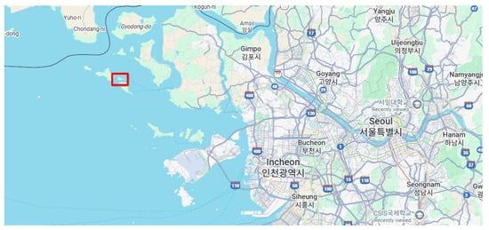
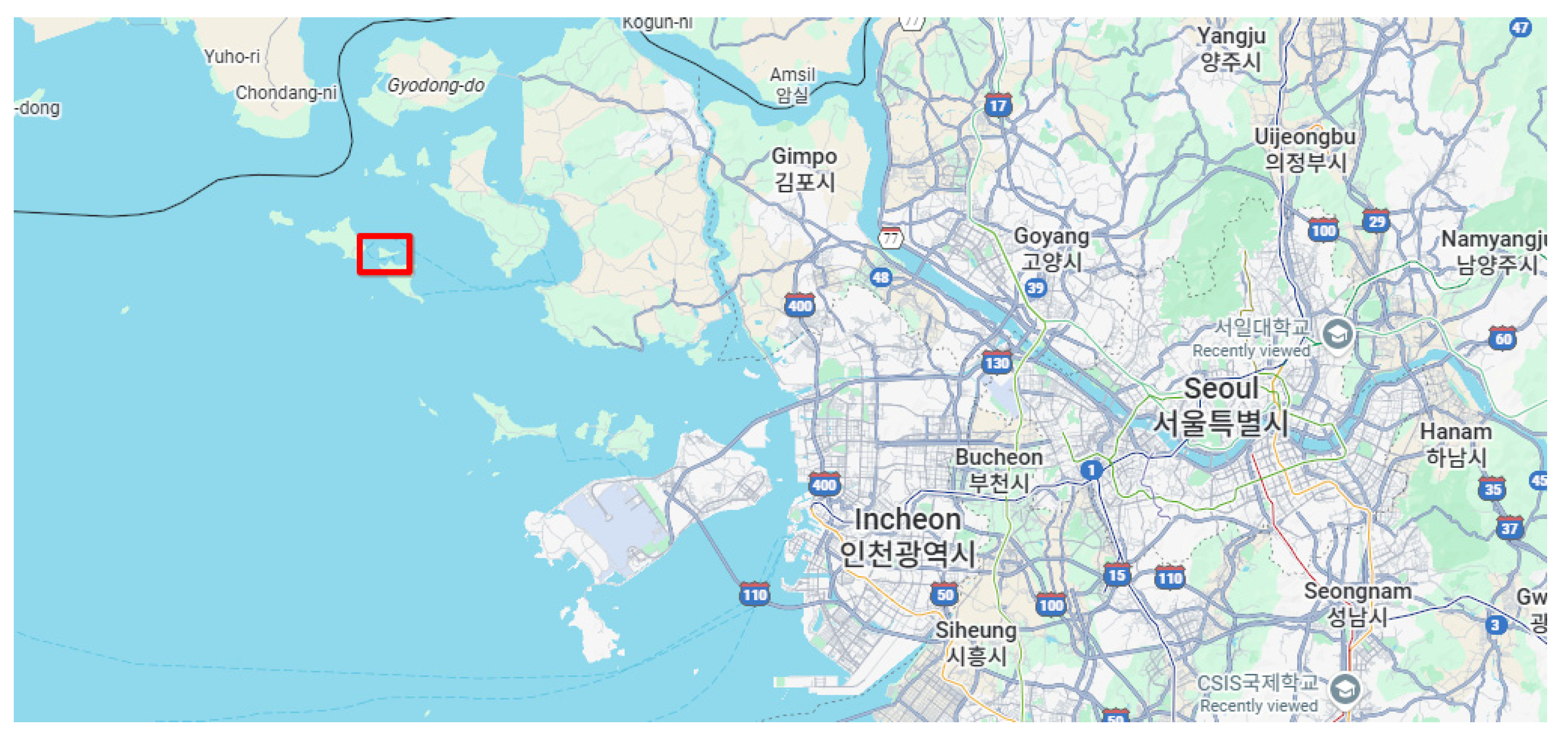
The study was conducted in the Hangang Estuary, a geomorphologically complex coastal zone located in the northwestern part of South Korea. The estuary forms the transitional interface between the Han River freshwater system and the tidal regime of the Yellow Sea, creating a dynamic environment shaped by the interplay of fluvial and marine processes. The region is characterized by a broad tidal flat system, extensive mudflats, and low-lying coastal plains, making it one of the most ecologically and hydrologically significant estuarine environments in the Korean Peninsula. Figure 1 shows the study area.
Figure 1.
Location of the study area.
The Hangang Estuary exhibits a large tidal range, typically exceeding 6–7 m during spring tides, which results in substantial exposure and inundation of the intertidal zone over a single tidal cycle. This high tidal amplitude contributes to rapid shoreline shifts, strong sediment transport, and cyclic morphological change. The estuary’s sedimentary environment is dominated by fine-grained silts and muds, with surface moisture and reflectance varying significantly according to tide stage, influencing LiDAR return characteristics, and making it an ideal site for evaluating multi-platform LiDAR classification performance.
Morphologically, the estuary includes tidal flat surfaces, shallow channels, sandbars, embankments, revetments, riprap structures, and natural vegetated shorelines. These diverse coastal features provide a suitable environment for testing object-level extraction using artificial intelligence. The presence of anthropogenic structures such as levees, flood-control facilities, and shoreline protection installations further underscores the relevance of this study to shoreline management and coastal infrastructure monitoring.
The region’s accessibility varies considerably depending on tide conditions, with large portions becoming unreachable during high tide. This unique terrain constraint underscores the usefulness of the combined use and comparative evaluation of terrestrial laser scanning (TLS) and vessel-based mobile mapping systems (MMSs) for improving 3D coverage under different accessibility conditions. The combination of exposed mudflats, shallow water zones, and artificial structures offers an optimal natural laboratory for assessing the complementary strengths of different LiDAR platforms and evaluating their performance in a real-world coastal environment.
2.2. Dataset and Methods
In this study, TLS and vessel-based MMS datasets were used for different but complementary purposes. The TLS dataset served as the primary input for AI-assisted feature extraction because of its high geometric fidelity, stable georeferencing from fixed scan stations, and detailed representation of intertidal surfaces and engineered shoreline structures. In contrast, the vessel-based MMS dataset was used to evaluate complementary acquisition characteristics, including continuous shoreline coverage, accessibility from the water, scanning range, and visualization of coastal features.
- Terrestrial Laser Scanning (TLS)
Terrestrial Laser Scanning (TLS) was conducted using a Trimble SX12 (Trimble Inc., Westminster, CO, USA), a scanning total station that integrates high-precision angle and distance measurements with rapid 3D laser scanning capabilities. The SX12 enables the simultaneous acquisition of survey-grade georeferencing and dense point-cloud data within a single platform, making it particularly suitable for coastal environments where positional accuracy and structural detail are equally important.
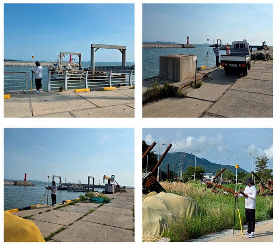
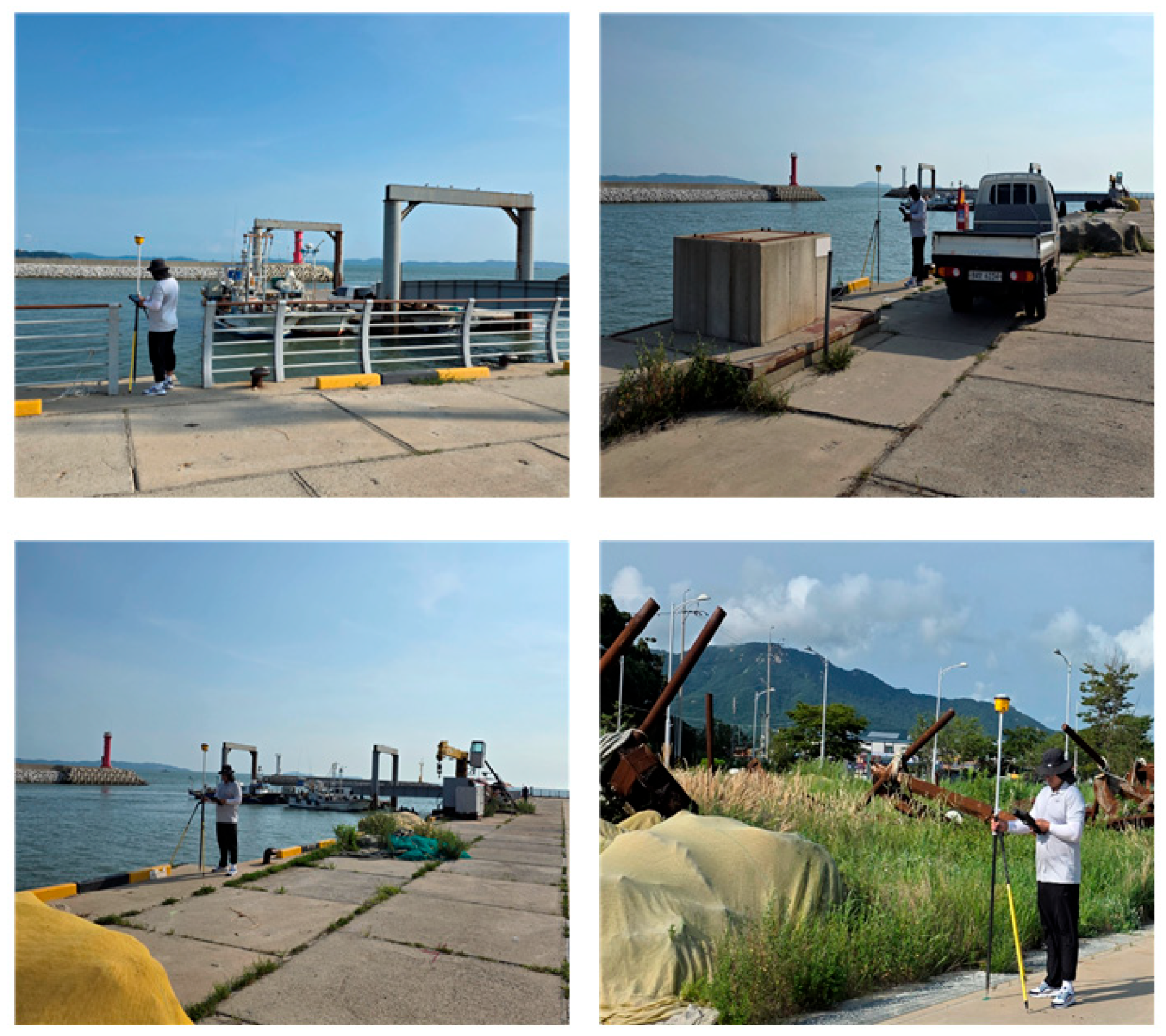
To establish a reliable spatial reference framework, four GNSS control points were installed around port area. Each control point was observed using survey-grade GNSS equipment and served as a fixed station for positioning and orienting the TLS instrument. The SX12 was mounted on a tripod centered precisely over each control point, ensuring that all TLS scans were directly tied to a common geodetic coordinate system. Figure 2 shows the measurement of control points.
Figure 2.
Measurement of control points.
TLS surveys were carried out during low-tide conditions to maximize exposure of the intertidal flats, harbor infrastructure, and shoreline protection structures. From each of the four control-point locations, the SX12 performed full-resolution 3D scans covering the tidal flat surface, revetments, embankments, quay walls, riprap zones, and associated coastal facilities within the harbor. The combined observations from the four scanning stations provided overlapping coverage that facilitated robust registration and minimized occlusions caused by terrain undulations or man-made structures.
The resulting TLS dataset offers high-density point-cloud information with precise geospatial control, providing detailed representation of both natural coastal features and engineered structures. In this study, the TLS dataset served as the primary input for the subsequent TBC-based AI-assisted feature extraction, while the MMS dataset was used for complementary comparison of acquisition characteristics.
- Vessel-Based Mobile Mapping System (MMS)
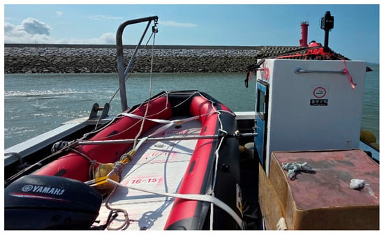
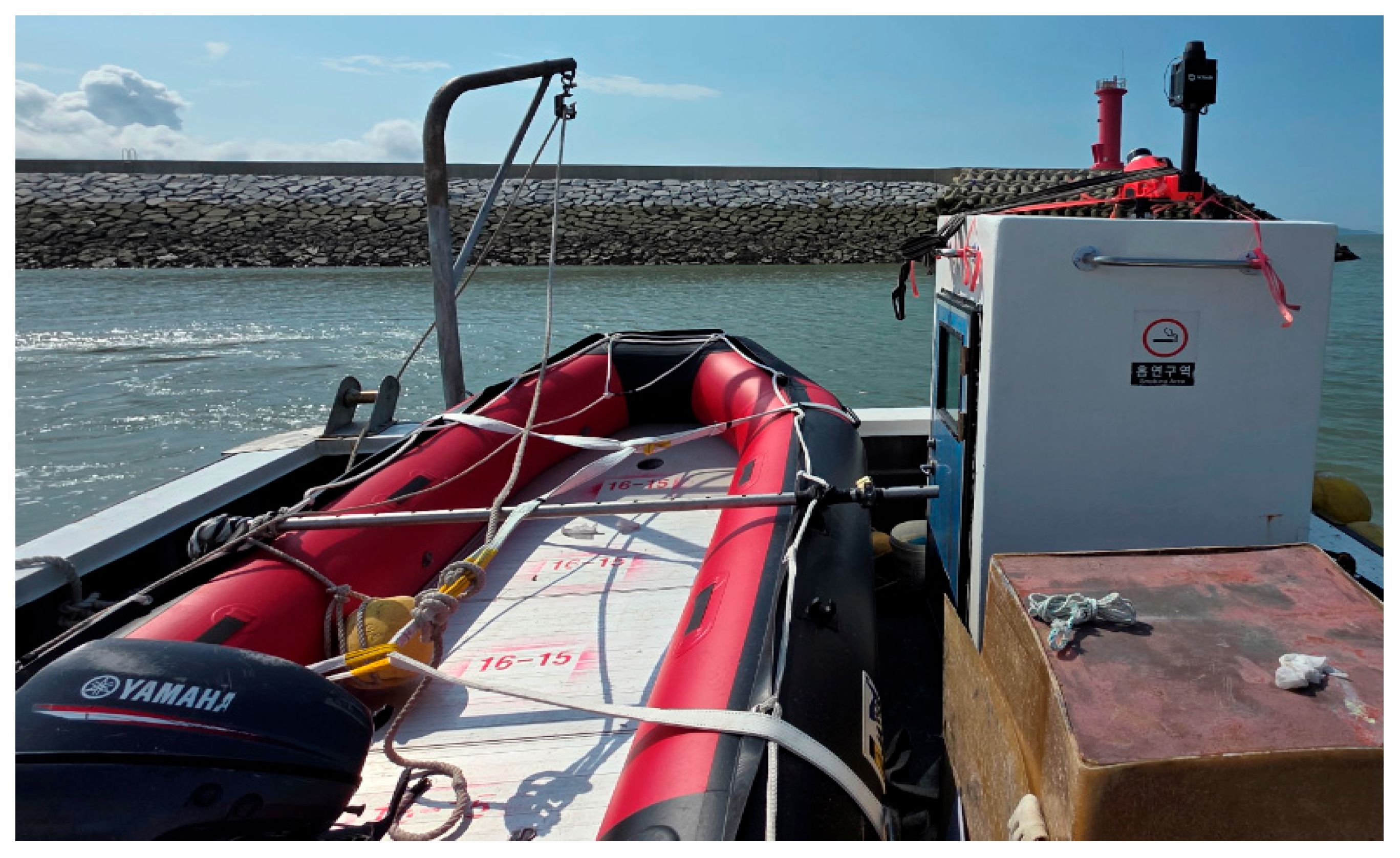
Vessel-based mobile mapping was performed using a 3DT Scanfly EVO (3D TARGET S.r.l., Castenedolo, Italy), a versatile mobile mapping system (MMS) designed for deployment on various platforms such as vessels, cars and backpack configurations. The system integrates a high-resolution LiDAR sensor with an inertial navigation system (INS), enabling the continuous acquisition of dense 3D point-cloud data along coastal transects. To ensure high positional accuracy, all MMS trajectories were processed using a Post-Processing Kinematic (PPK) workflow with GNSS correction data. Figure 3 shows vessel-based MMS.
Figure 3.
MMS equipment installed on the survey vessel.
For this study, the MMS unit was mounted on a general-purpose survey vessel, allowing stable and consistent data acquisition across the nearshore environment. Operating from a full-sized survey vessel enabled wider scanning coverage and improved instrument stability, particularly in areas influenced by tidal dynamics and variable sea conditions. The survey routes were planned to provide overlapping coverage of the shoreline, exposed tidal flats, rocky outcrops, and engineered coastal features, including navigation aids, breakwaters, quay walls, piers, and other coastal infrastructure.
The continuous scanning capability of the MMS facilitated the generation of high-density point-clouds with reduced occlusions, especially around complex geometric structures and low-relief intertidal surfaces. PPK-corrected trajectories significantly enhanced the absolute spatial accuracy of the MMS dataset and ensured compatibility with the TLS data collected from fixed ground stations. The vessel-based MMS observations served as a complementary dataset for evaluating platform-specific acquisition characteristics, including coverage continuity, accessibility, and range-related limitations. In this study, the MMS data were not used as direct input for joint TLS–MMS AI classification; instead, they were used to support comparison and visualization of coastal feature acquisition under tidal flat conditions.
3. Point Cloud Generation
3.1. Terrestrial LiDAR
The terrestrial LiDAR data acquired using the Trimble SX12 were processed in Trimble Business Center (TBC), which provides an integrated environment for point-cloud management, survey data adjustment, and geospatial data export. Because the SX12 functions as a scanning total station, each scan position was already referenced to a GNSS-derived control point through backsight observations during field acquisition. As a result, no additional target-based or cloud-to-cloud registration was required, and all scans were automatically aligned within a unified geodetic coordinate system.
The raw TLS datasets from each scan station were imported into TBC, where they were inspected for completeness, overlap, and acquisition quality. TBC’s point-cloud processing tools were used to visualize individual scans, verify instrument orientation, and remove any erroneous or low-quality points captured due to reflective surfaces or atmospheric noise. After quality control, the individual station scans were merged into a single, combined point-cloud, preserving the absolute coordinates established during field operations.
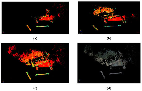
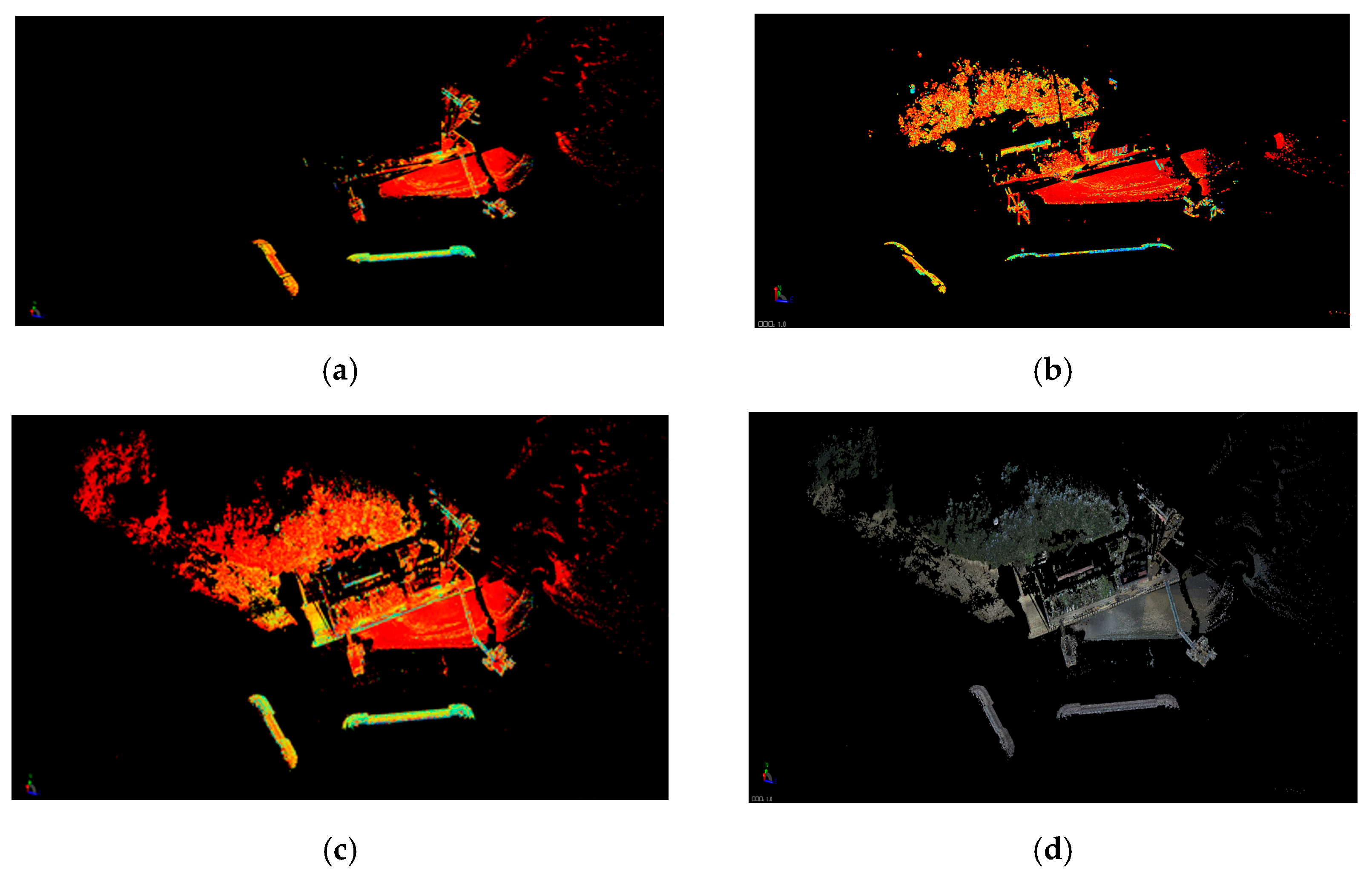
The overall workflow consisted of importing raw SX12 scan files, verifying station metadata and backsight orientation, inspecting and cleaning point-cloud segments, merging all stations into a unified dataset, and exporting the final TLS point-cloud for subsequent analysis, comparison, and AI-assisted feature extraction. This processing sequence is illustrated in Figure 4, and examples of the intermediate and final TLS point-cloud products are shown in Figure 5. The resulting dataset provides a high-density, georeferenced 3D representation of the coastal terrain and structures. In this study, the processed TLS point-cloud served as the primary input for the subsequent TBC-based AI-assisted feature extraction because of its high geometric fidelity, stable georeferencing, and detailed representation of intertidal surfaces and engineered shoreline structures. Although GNSS control points, backsight observations, PPK trajectory processing, and visual quality inspection were used to ensure geospatial consistency, detailed quantitative registration uncertainty metrics, such as point-to-point RMSE or independent check-point residuals, were not available for all datasets. This limitation should be addressed in future surveys through independent check points and standardized point-cloud quality metrics.
Figure 4.
Data processing sequence. (a) Importing raw data; (b) verifying station metadata and backsight orientation; (c) inspecting and cleaning point-cloud; (d) merging all stations into a unified segments dataset.
Figure 5.
TLS point-cloud products.
3.2. Vessel-Based MMS
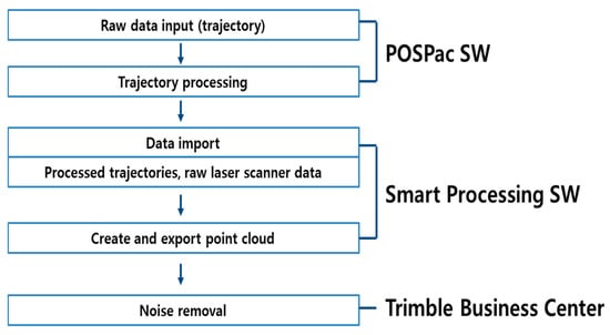
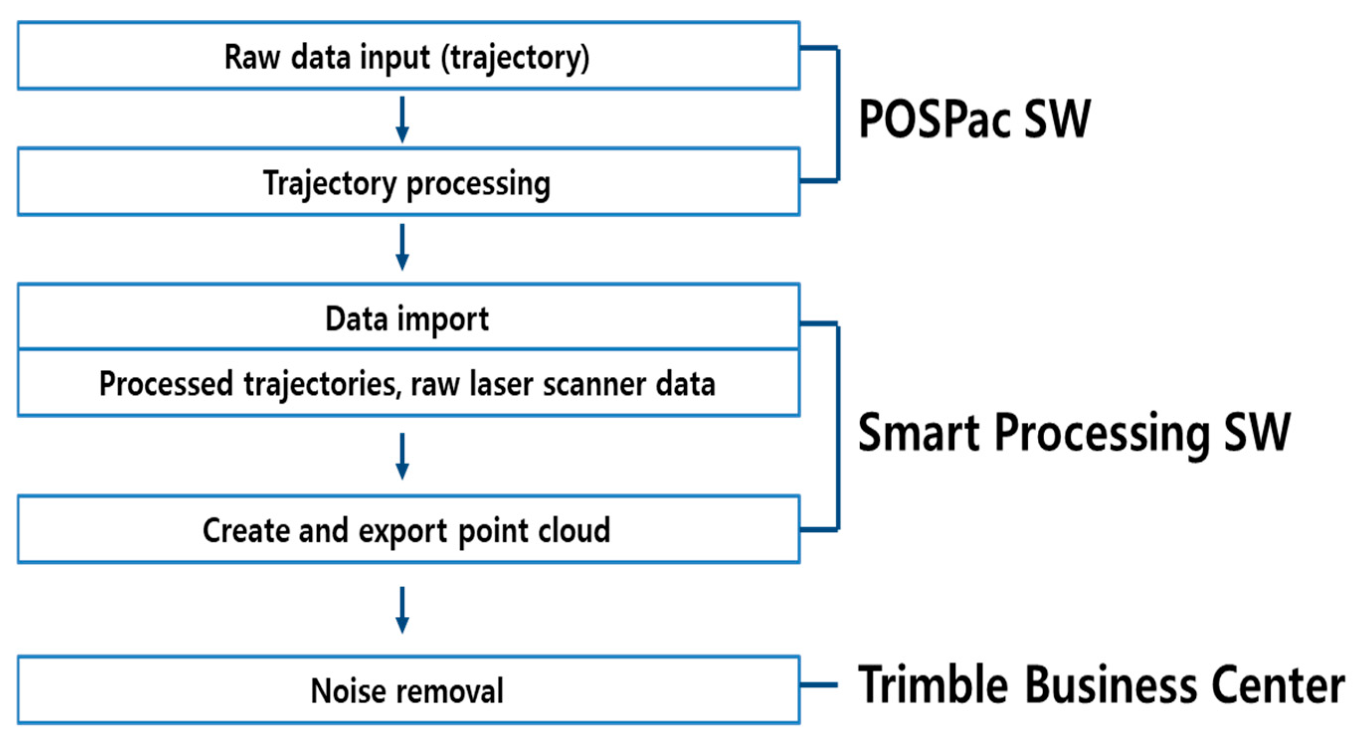
The vessel-based MMS data collected using the 3DT Scanfly EVO were processed through a two-stage workflow consisting of (1) trajectory computation and (2) point-cloud generation. The trajectory was first processed using POSPac, which performs Post-Processing Kinematic (PPK) corrections by integrating raw GNSS measurements with inertial navigation system (INS) data. This step produced a high-accuracy navigation solution representing the vessel’s position and orientation throughout the survey. The completed trajectory file was then imported into the Smart Processing Software, where the MMS LiDAR scans were combined with the corrected navigation data to generate a georeferenced point-cloud (Figure 6).
Figure 6.
Vessel-Based MMS data processing workflow.
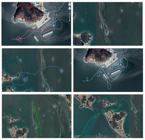
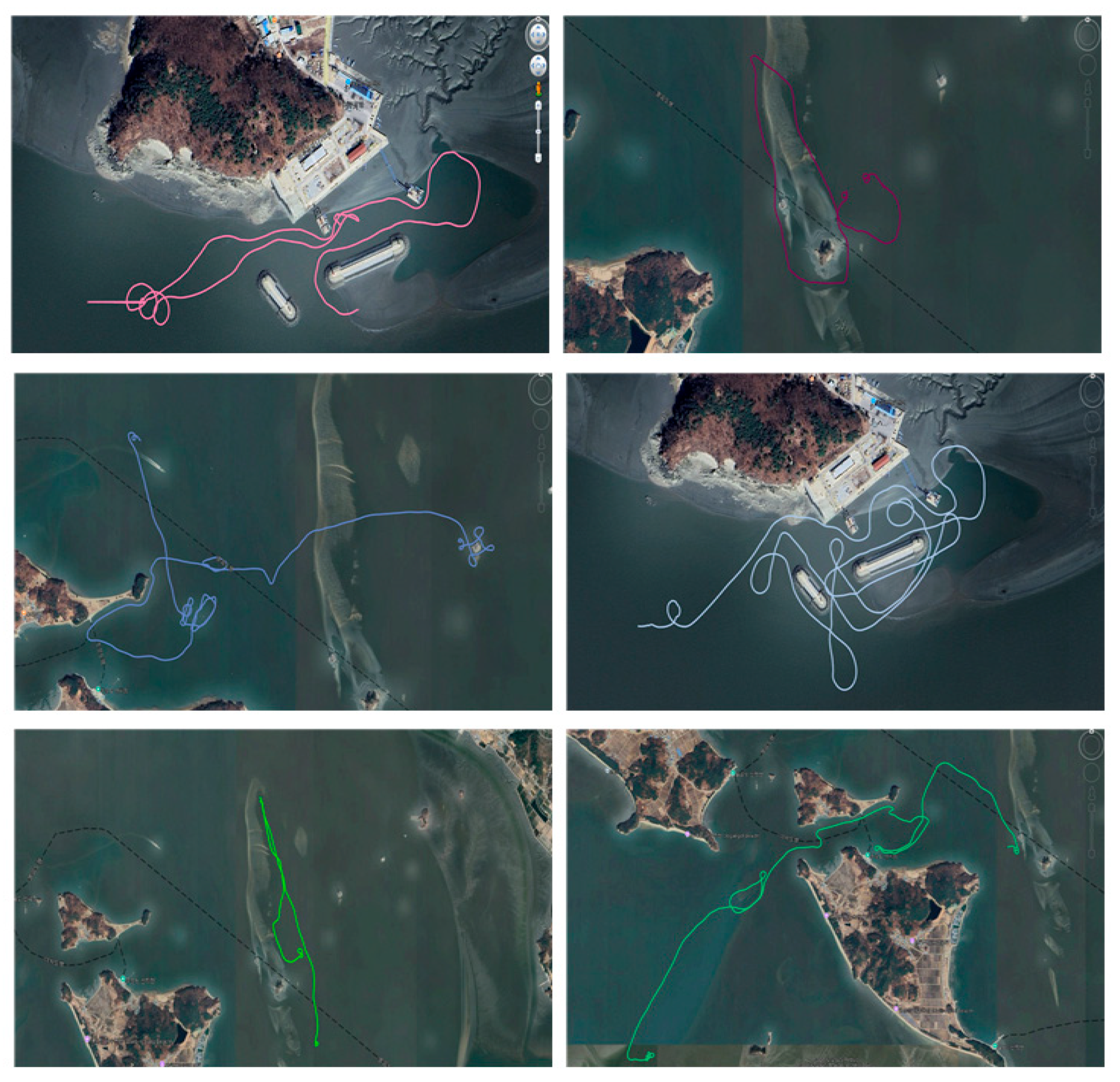
Because the coastal survey area is strongly influenced by tidal variation, MMS data were acquired multiple times across different tidal stages to ensure sufficient coverage of exposed intertidal surfaces and shoreline features. The survey vessel’s navigation tracks for each acquisition session are shown in Figure 7, highlighting the repeated passes and overlapping trajectories designed to reduce occlusions and maximize feature visibility.
Figure 7.
Survey vessel’s navigation tracks.
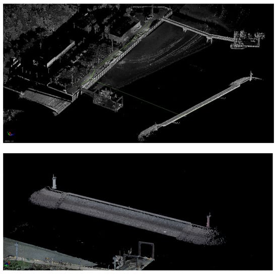
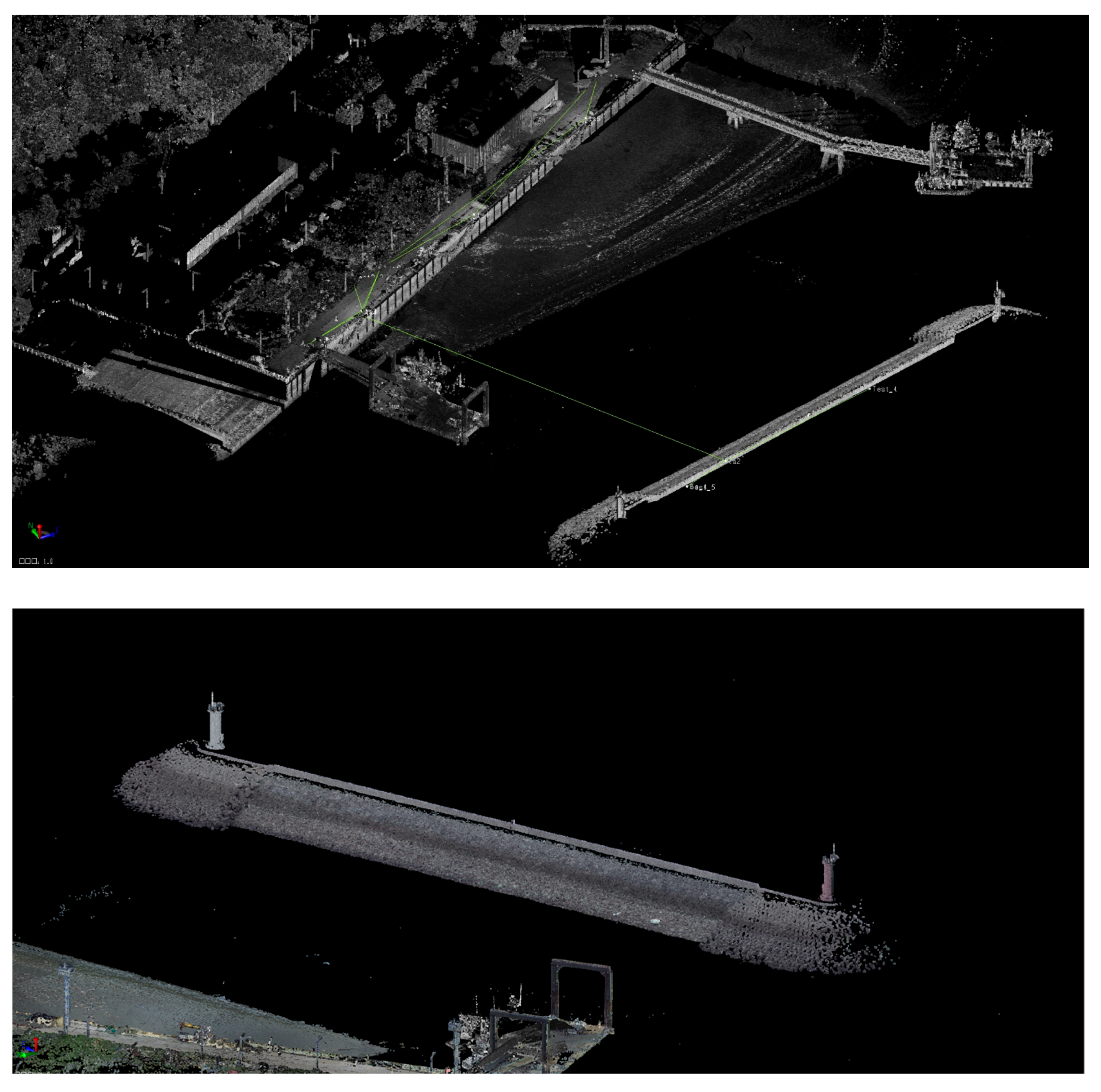
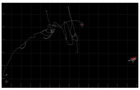
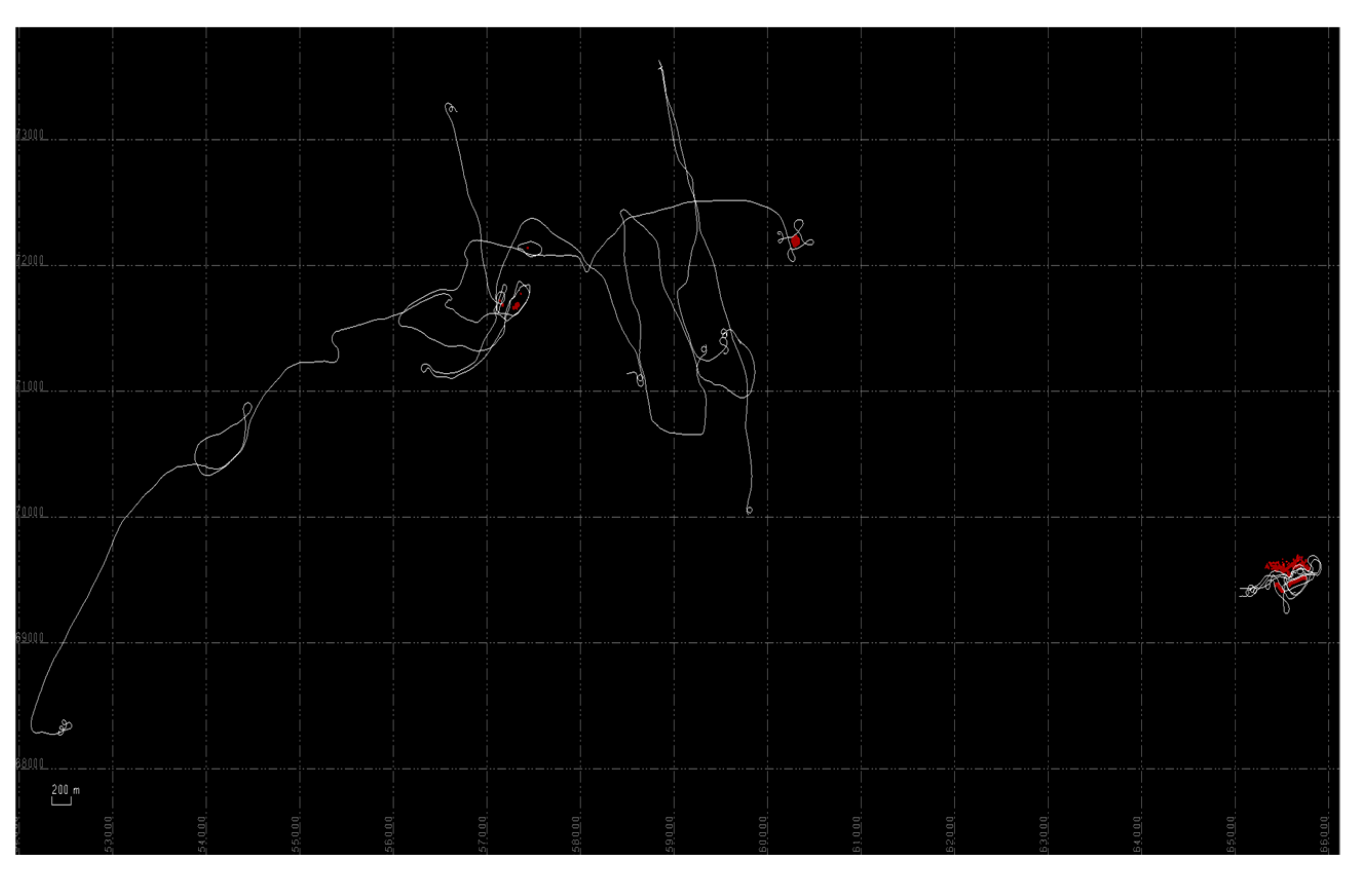
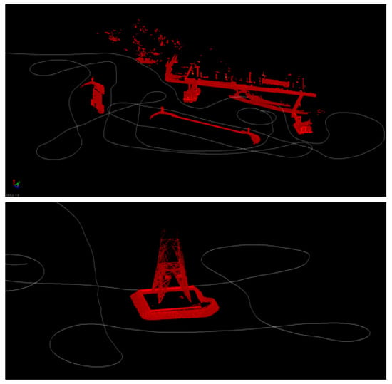
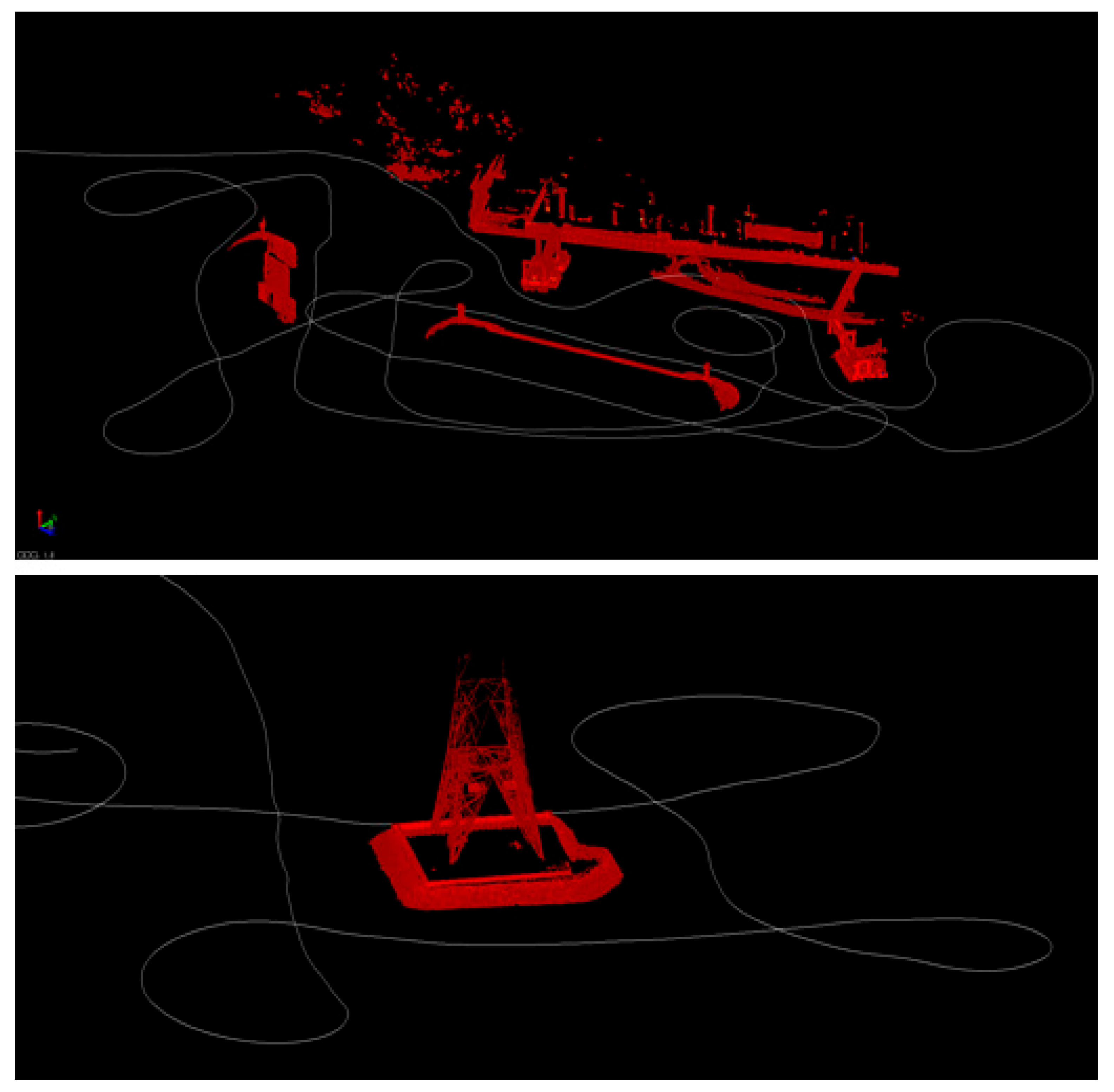
Following trajectory refinement, point-cloud generation was performed by extracting only the track segments corresponding to the areas of interest, including shoreline structures, tidal flat regions, rocky outcrops, and coastal facilities. This selective extraction minimized unnecessary data volume and improved processing efficiency. After the initial point-cloud was produced, a noise-removal procedure was applied to eliminate outliers caused by water-surface reflections, dynamic wave motion, and other environmental factors. The final MMS point-cloud, illustrated in Figure 8 and Figure 9, provides dense and spatially accurate 3D measurements suitable for comparative evaluation with the TLS dataset. In this study, the vessel-based MMS point-cloud was used as a complementary dataset for evaluating platform-specific acquisition characteristics, including coverage continuity, water-based accessibility, and range-related limitations, rather than as direct input for joint TLS–MMS AI classification.
Figure 8.
Full trajectory and point-cloud data.
Figure 9.
Point-cloud data of vessel-based MMS.
3.3. Comparison of Dataset Characteristics
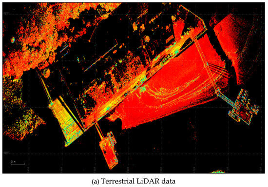
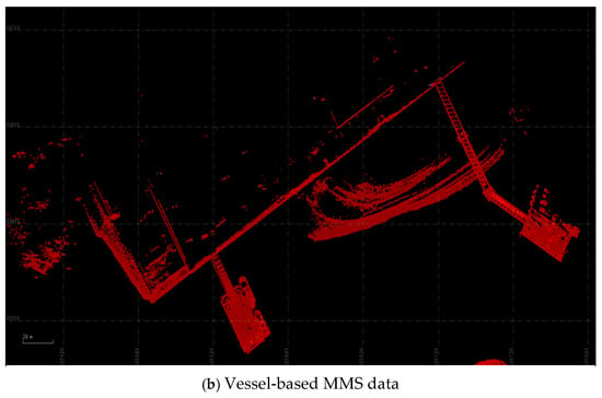
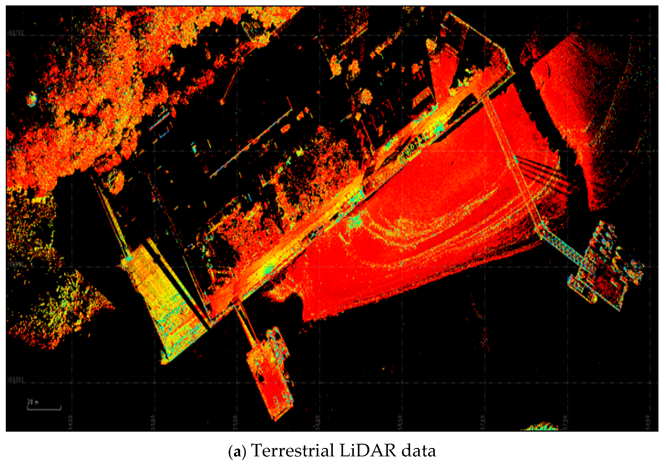
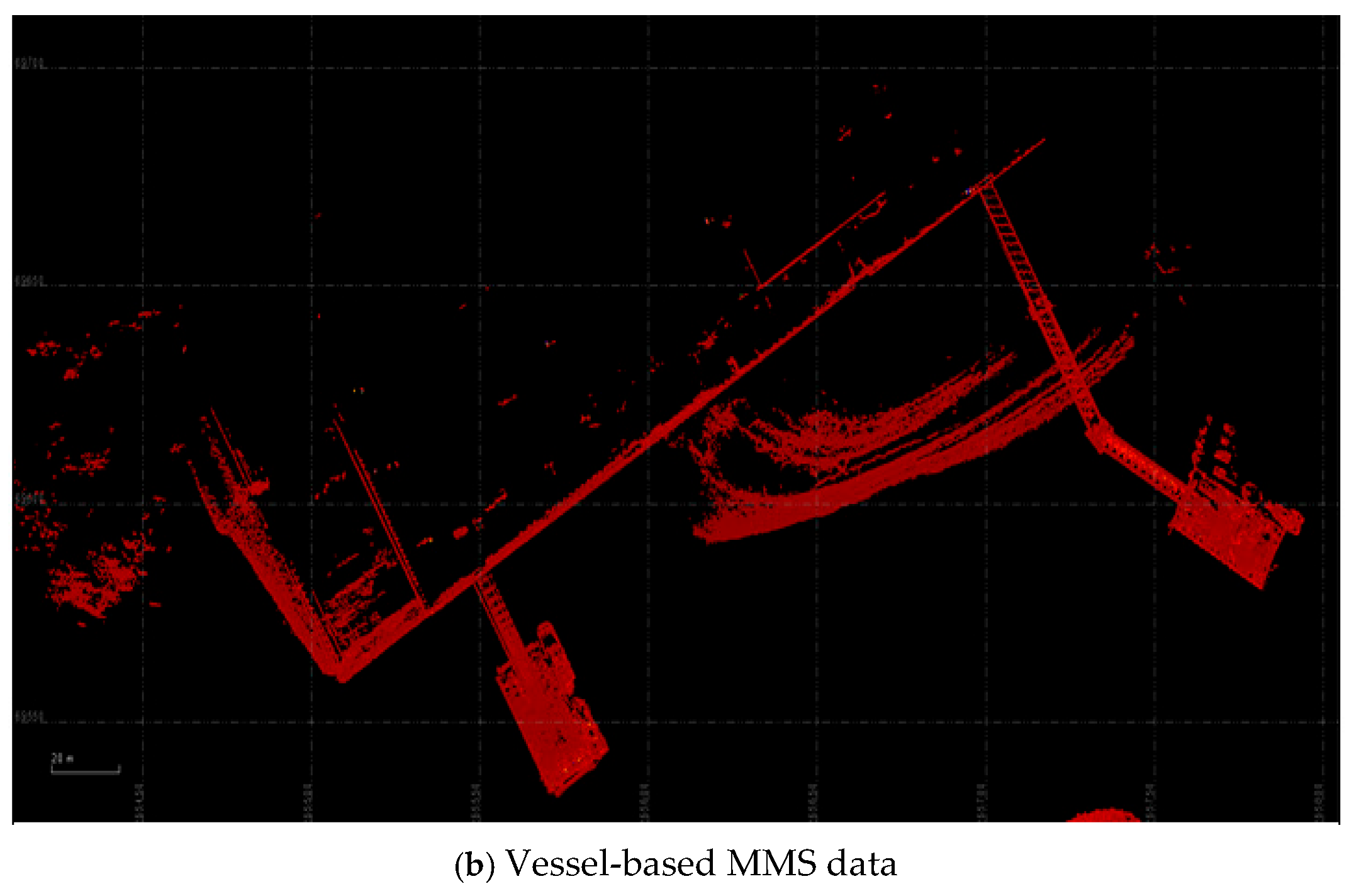
Although the vessel-based MMS provided rapid and continuous data acquisition along the coastal survey routes, its effective scanning range, approximately 150 m for the 3DT Scanfly EVO, was considerably shorter than that of the terrestrial laser scanner, which can capture features up to 600 m away. As a result, the MMS dataset exhibited narrower spatial coverage, particularly in wide intertidal zones and offshore areas where the distance between the vessel and the target features exceeded the system’s maximum range.
This difference in scanning range led to observable disparities in point-cloud density and completeness between the two platforms. The TLS dataset captured a broader extent of shoreline structures and intertidal terrain, whereas the MMS dataset provided higher coverage continuity along the vessel’s navigation path but reduced visibility in areas further from the coast. These contrasts highlight the complementary nature of the two platforms: MMS excels in efficient data collection along accessible coastal paths and provides useful comparative visualization of shoreline features, while TLS offers greater scanning range and higher geometric fidelity at longer distances. Accordingly, the TLS dataset was used as the primary input for subsequent AI-assisted feature extraction, whereas the MMS dataset was used to evaluate coverage continuity, accessibility, and range-related limitations.
A comparative visualization of the two datasets (Figure 10) clearly illustrates these characteristics. In the MMS-derived point-cloud, features closer to the shoreline appear with high density and detail, while distal regions show reduced coverage due to range limitations. Conversely, the TLS point-cloud maintains consistent coverage across a wider spatial extent. This comparative analysis provides essential context for interpreting the platform-specific roles of TLS and vessel-based MMS in coastal mapping. In the subsequent feature-extraction stage, the TLS dataset was used as the primary input for TBC-based AI-assisted processing, while the vessel-based MMS dataset provided complementary information on coverage continuity, water-based accessibility, and range-related limitations. The contribution of the vessel-based MMS dataset was therefore not to improve the custom AI-assisted extraction directly, but to provide complementary acquisition information on shoreline coverage, accessibility, and water-side visualization that could not be fully obtained from TLS alone.
Figure 10.
Comparative visualization of the two datasets.
4. Coastal Feature Extraction
This study employed a TBC-based AI-assisted workflow to extract relevant coastal and artificial features primarily from the terrestrial LiDAR point-cloud dataset. Within the overall field-based workflow, the vessel-based MMS dataset was used as a complementary source for comparing platform-specific acquisition characteristics and visualizing coastal features, whereas the TLS dataset served as the main input for AI-assisted feature extraction. Combining custom model training with commercial point-cloud processing workflows can support standardized operational pipelines for coastal environmental management [30]. Furthermore, accurate identification of shoreline protection structures is important for evaluating long-term infrastructural integrity under rising sea levels [31]. To improve class separability and model stability, the training dataset was constructed from TLS data acquired in this project and supplementary object-level point-cloud samples collected from external sources. These supplementary samples contained object types, including cars, streetlights, powerlines, and fences, which were incorporated as additional training classes to help distinguish selected non-coastal artificial objects from shoreline-related features. These custom-trained classes were not intended to provide a comprehensive classification of coastal geomorphological features; rather, they were used as an object-level filtering and separation component within the TLS-based workflow. The TLS-based AI-assisted feature-extraction workflow consisted of (1) dataset preparation using TLS and supplementary object-level samples, (2) feature encoding, (3) custom model training and AI-assisted classification in TBC, and (4) post-processing of extracted features.
TBC provides AI-assisted point-cloud analysis tools, including customizable model training modules, built-in automated classification functions, and feature-extraction capabilities. These tools were used for TLS-based dataset preparation, custom object-level model training, built-in automated classification, and post-processing in this study.
4.1. Training Dataset
To prepare a supervised learning dataset for TLS-based AI-assisted feature extraction, this study constructed a training set using field-acquired TLS point-clouds and supplementary object-level point-cloud samples from external sources, all processed within Trimble Business Center (TBC). TLS data from the study area were manually examined to identify coastal-relevant features such as intertidal sediment surfaces, rock outcrops, vegetated margins, revetments, breakwaters, embankments, and quay-wall structures. In addition to these coastal features, supplementary artificial-object samples were prepared as separate training classes to help distinguish shoreline-related structures from non-coastal objects typically present around human-impacted coastal zones. However, these artificial-object classes were not intended to represent dedicated coastal geomorphological categories, but were used to support object-level separation of selected non-coastal features before coastal feature interpretation.
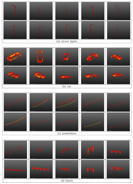
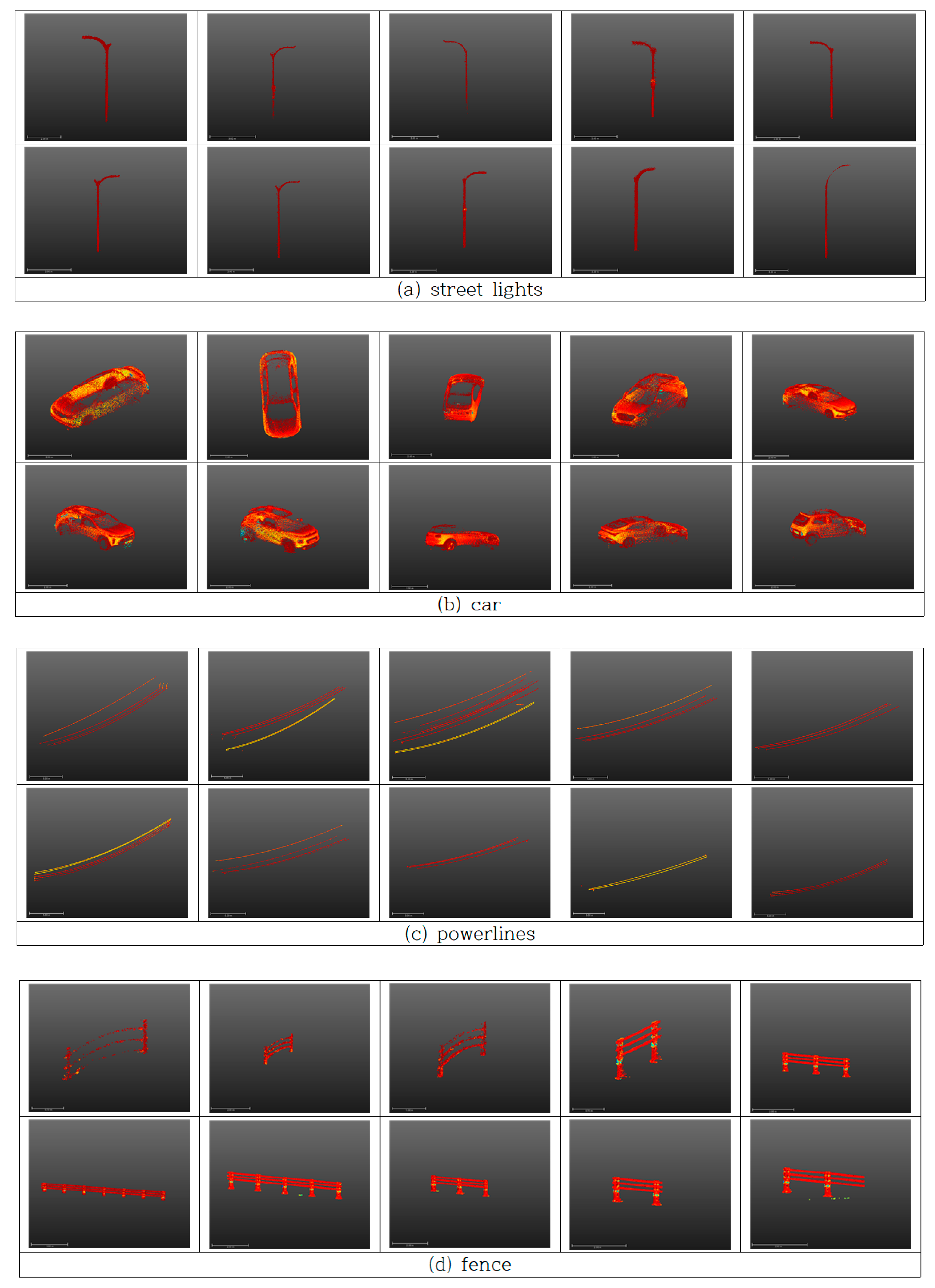
For this purpose, object-level samples were manually extracted by human operators through visual inspection and point-level selection, producing high-quality training examples with minimal background noise. A total of 80 individual object-level point-cloud samples were curated, consisting of 20 cars, 20 streetlights, 20 powerlines or utility poles, and 20 fence segments. Figure 11 shows representative examples from the training dataset.
Figure 11.
Portion of the training dataset.
These four categories were selected because they exhibit distinct geometric characteristics, frequently appear near coastal environments, and may be misidentified as coastal or shoreline-related features if not adequately represented during training. Using 20 samples per category reflects a balance between the need for intra-class geometric diversity and the practical constraints of manual object-level extraction. Although the number of samples was limited, the dataset was intended to provide representative object-level training examples for the TBC-based custom model, rather than to support large-scale general-purpose deep-learning model development.
All TLS-derived and supplementary point-cloud samples were divided into spatial blocks and normalized in terms of coordinate scale, intensity distribution, and point density to improve consistency among datasets acquired from different environments and sensors. This prepared dataset provided a coherent foundation for custom model training and TBC-based AI-assisted feature extraction from TLS data in complex intertidal environments.
4.2. AI-Assisted Feature Extraction from TLS Point Clouds
The feature extraction process was implemented using the AI-assisted point-cloud analysis tools provided in Trimble Business Center (TBC), with the TLS point-cloud used as the primary input dataset. TBC incorporates point-cloud classification and feature-extraction tools that support object-level recognition in 3D point-clouds, enabling AI-assisted extraction of structural and geomorphic features from TLS data [32,33]. The workflow consisted of three major stages: (1) preprocessing and feature encoding of the TLS point-cloud, (2) custom model inference and built-in TBC classification, and (3) post-processing of extracted features.
In the preprocessing stage, the TLS point-cloud was segmented into manageable spatial blocks, and each block was encoded with geometric and radiometric attributes computed within TBC. These attributes included 3D coordinates, intensity, local curvature, surface normals, roughness indices, and neighborhood-scale geometric descriptors. Such multi-attribute feature encoding supported the recognition of structural elements of coastal environments, including the shape, slope, and surface texture of intertidal and engineered features [33].
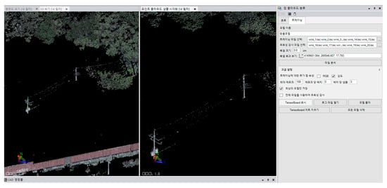
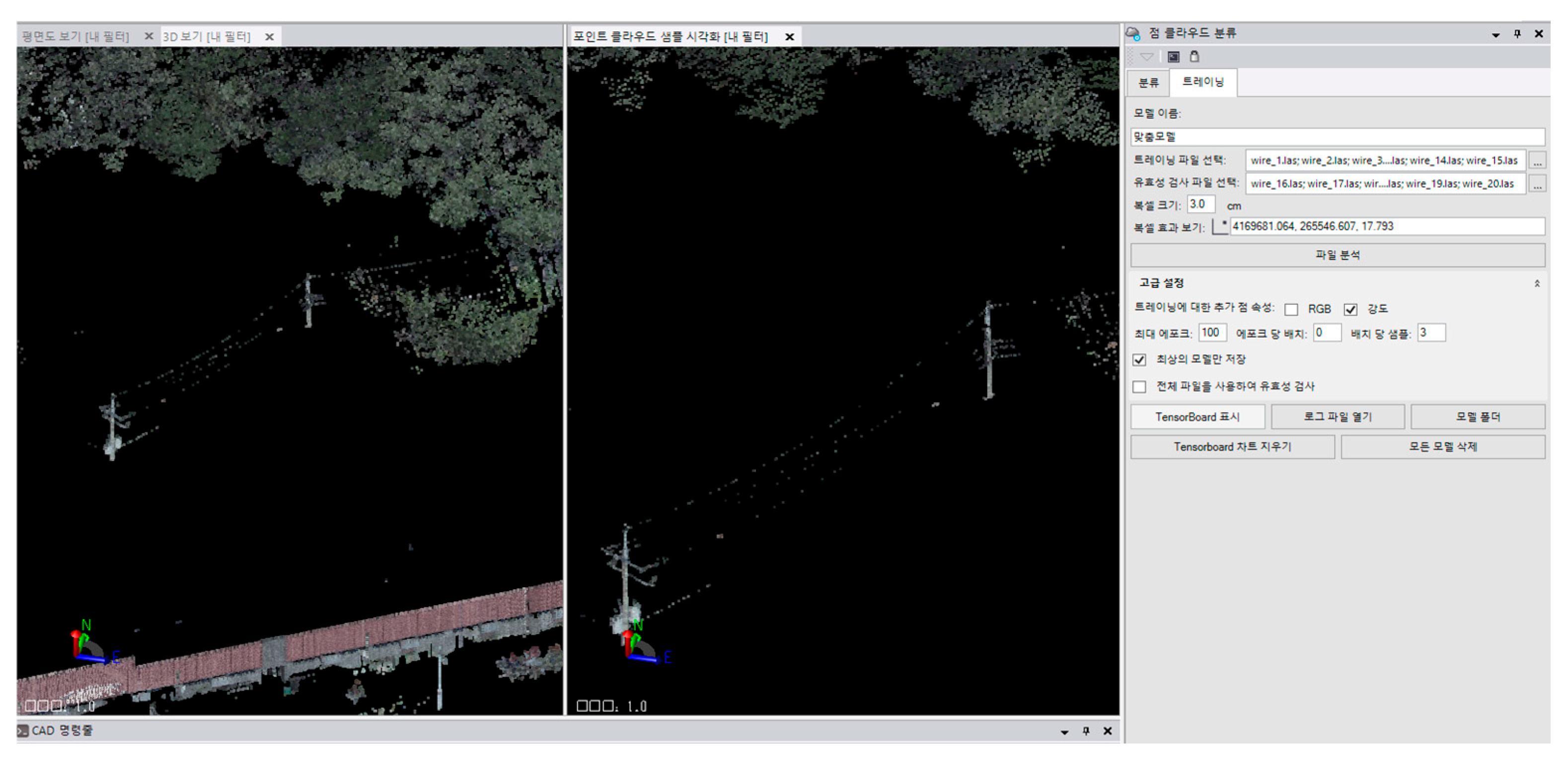
For model inference, the custom-trained TBC model was applied to TLS point-cloud blocks to identify selected non-coastal artificial-object classes, while TBC’s built-in classification tools were used to separate broader surface categories such as ground, vegetation, and built structures. The model utilized the manually constructed training dataset described in Section 4.1, enabling the system to distinguish selected artificial objects from shoreline-related features within the scanning range. Accordingly, the custom-trained model should be interpreted as an object-level filtering and separation component within the TLS-based workflow, rather than as a complete coastal geomorphological classification model. During the inference process, each point was assigned a feature label based on the learned geometric patterns, and adjacent blocks were processed with overlapping margins to ensure seamless classification across the entire TLS point-cloud. TBC’s GPU-accelerated inference engine facilitated efficient processing even for high-density coastal scans. Figure 12 shows the training interface for AI-assisted feature extraction.
Figure 12.
Training interface for AI-assisted feature extraction.
Following the initial model output, TBC’s post-processing tools were applied to refine the extracted features. These tools included spatial smoothing filters to improve label continuity, intensity- and elevation-based masking to reduce tide-related artifacts, and morphological adjustments to refine edge delineation along vertical or angular structures such as revetments and quay walls. The final refined outputs consisted of feature-specific point-clouds representing intertidal surfaces, rocky exposures, engineered coastal structures, and other shoreline components used for coastal interpretation. This TLS-based AI-assisted extraction workflow provided a structured method for separating selected artificial objects and supporting the interpretation of coastal features from TLS data while leveraging both manually prepared object-level training samples and TBC’s built-in classification functions.
Two complementary extraction strategies were used for the TLS point-cloud: (1) a custom-trained object extraction procedure based on manually prepared samples and (2) TBC’s built-in automated classification tools for general terrain and structural categories.
In the custom-trained procedure, the model used the manually curated dataset described in Section 4.1, which consisted of four object classes: cars, streetlights, powerlines, and fences. These objects were selected because they represent common artificial features that may appear within TLS point-clouds and may affect coastal feature interpretation if they are not separately identified. Using TBC’s training interface, spatial blocks of the TLS dataset were processed through the custom-trained model, which assigned class labels to points based on learned geometric and radiometric signatures. This enabled selected artificial objects to be separated before coastal feature interpretation. In addition to the custom-trained procedure, TBC’s built-in automated classification tools were used for general-purpose point-cloud categorization. This automated feature extraction was applied to segment the TLS dataset into three broad categories:
- -
- Ground (including intertidal flats and exposed mud surfaces);
- -
- Vegetation;
- -
- Buildings or built structures.
These classes were generated using TBC’s native AI-assisted segmentation tools, which analyze local surface geometry, elevation patterns, and intensity gradients to assign category labels. The automated ground extraction supported the separation of intertidal flat surfaces, while the vegetation and building classes provided contextual information for interpreting shoreline features.
Because the AI-assisted classification was implemented within the proprietary TBC environment, detailed internal model settings, including the exact network architecture, optimization procedure, number of training epochs, inference thresholds, and low-level GPU implementation, were not fully accessible. Therefore, the workflow should be interpreted as an operational TBC-based AI-assisted point-cloud processing procedure rather than as a fully reproducible open-source machine-learning framework.
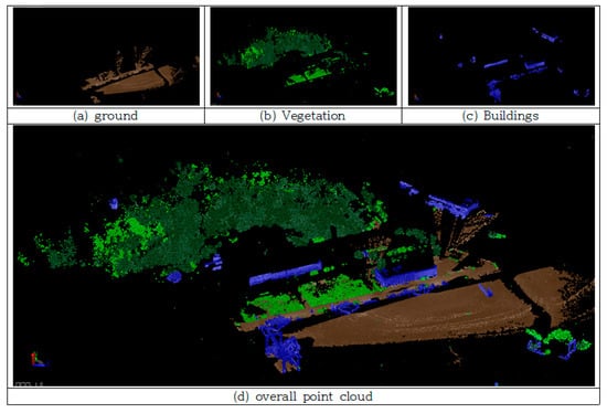
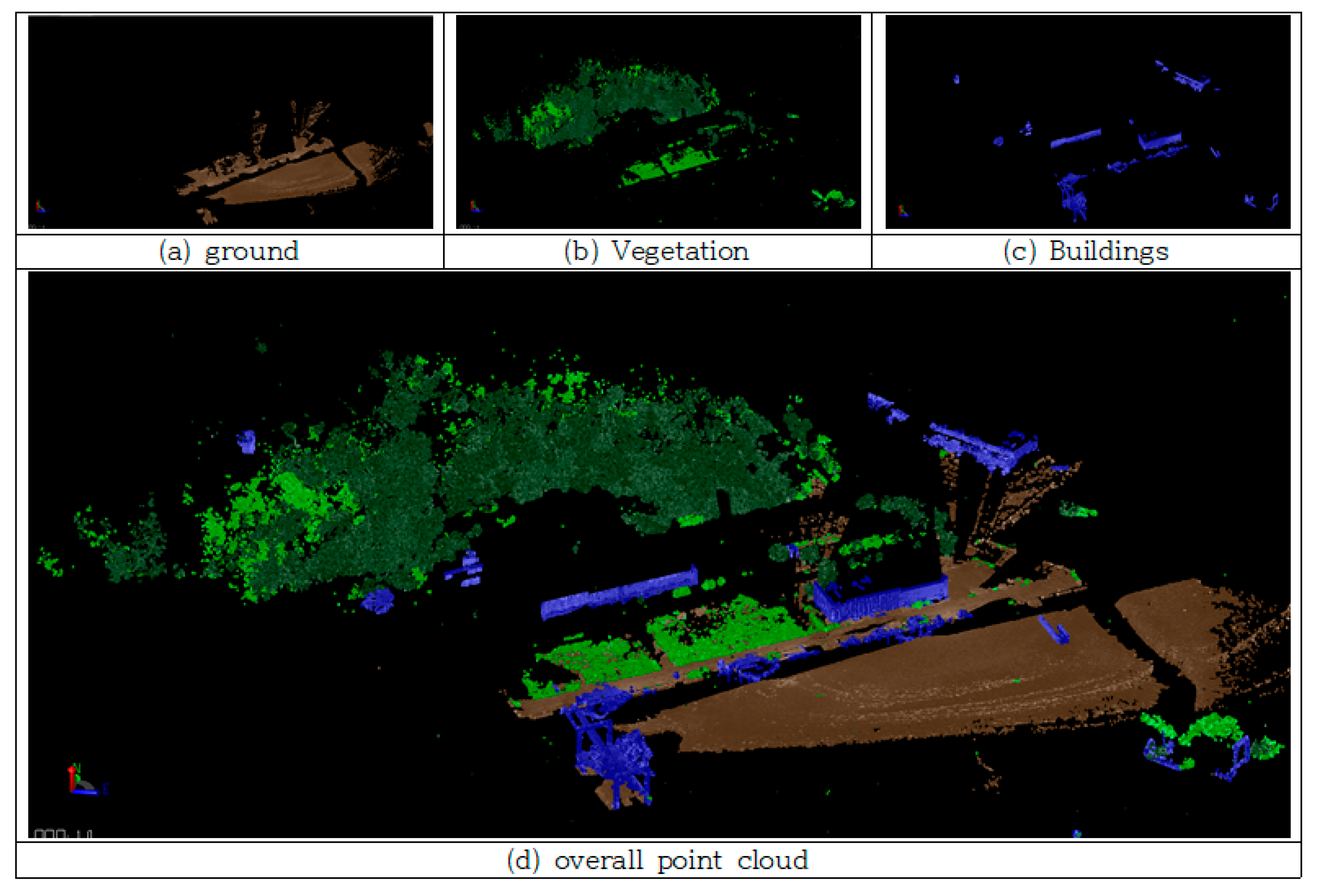
By combining the custom-trained object extraction and the built-in TBC classification, the TLS-based workflow produced a multilayered feature map that distinguishes between (1) selected artificial non-coastal objects identified through custom training and (2) broad natural and structural categories extracted using TBC’s built-in classification tools. The resulting classification outputs, which identify intertidal ground, buildings, and vegetation, are illustrated in Figure 13 and were used as baseline information for subsequent coastal feature interpretation.
Figure 13.
Feature extraction results—ground, vegetation, buildings.
4.3. Extraction and Shoreline Management
The outputs from both the custom AI-assisted feature extractor and TBC’s built-in automated surface-type separation were combined to produce a multilayered object-level representation of the TLS dataset. In the first stage, the custom model, trained on manually curated examples of cars, streetlights, powerlines, and fences, was applied to the TLS point-cloud to isolate non-coastal artificial objects. This object-separation process helped reduce potential interference from unrelated artificial structures in the interpretation of coastal terrain and engineered shoreline features. Extracted artificial objects were stored as independent layers, enabling their exclusion or further analysis depending on the needs of subsequent coastal studies.
Following this object-level separation, TBC’s automated feature-extraction tools were used to delineate major surface groups within the TLS dataset, specifically ground surfaces (including intertidal mudflats), vegetated areas, and built structures. The ground extraction supported the identification of the spatial extent and surface texture of the intertidal zone, while the built-structure output represented the geometry of revetments, quay walls, and other coastal installations. Vegetated areas were also effectively isolated, providing insights into natural shoreline elements and their interface with engineered coastal infrastructure.
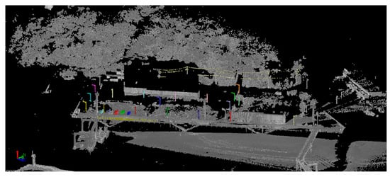
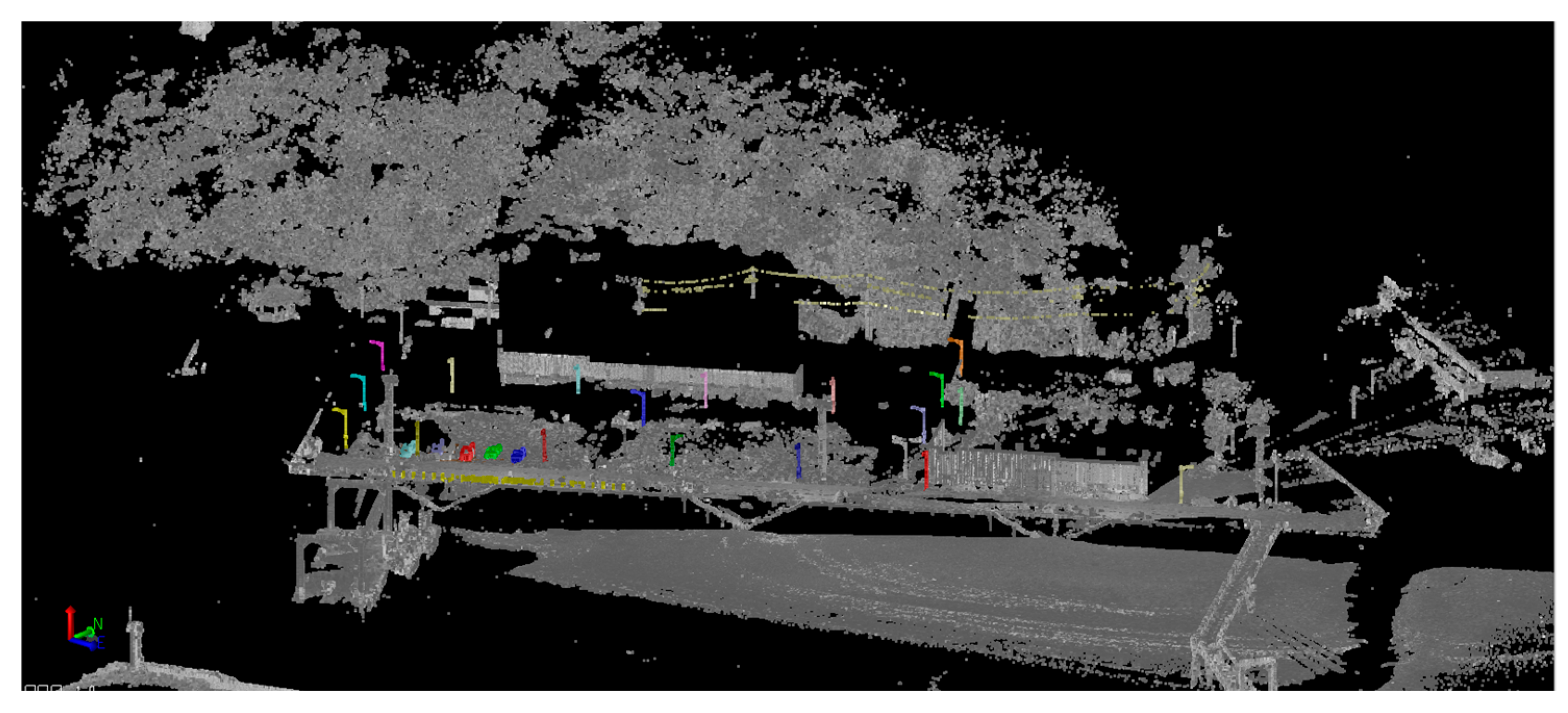
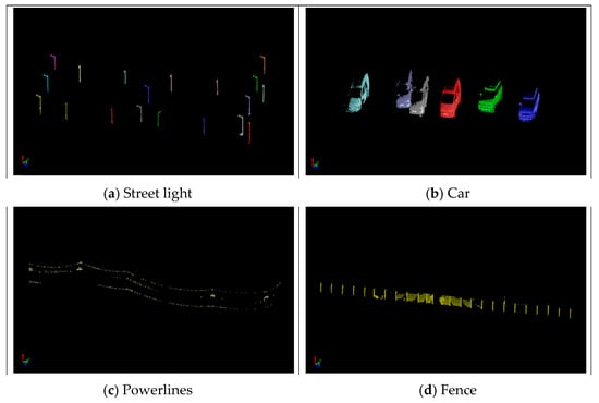
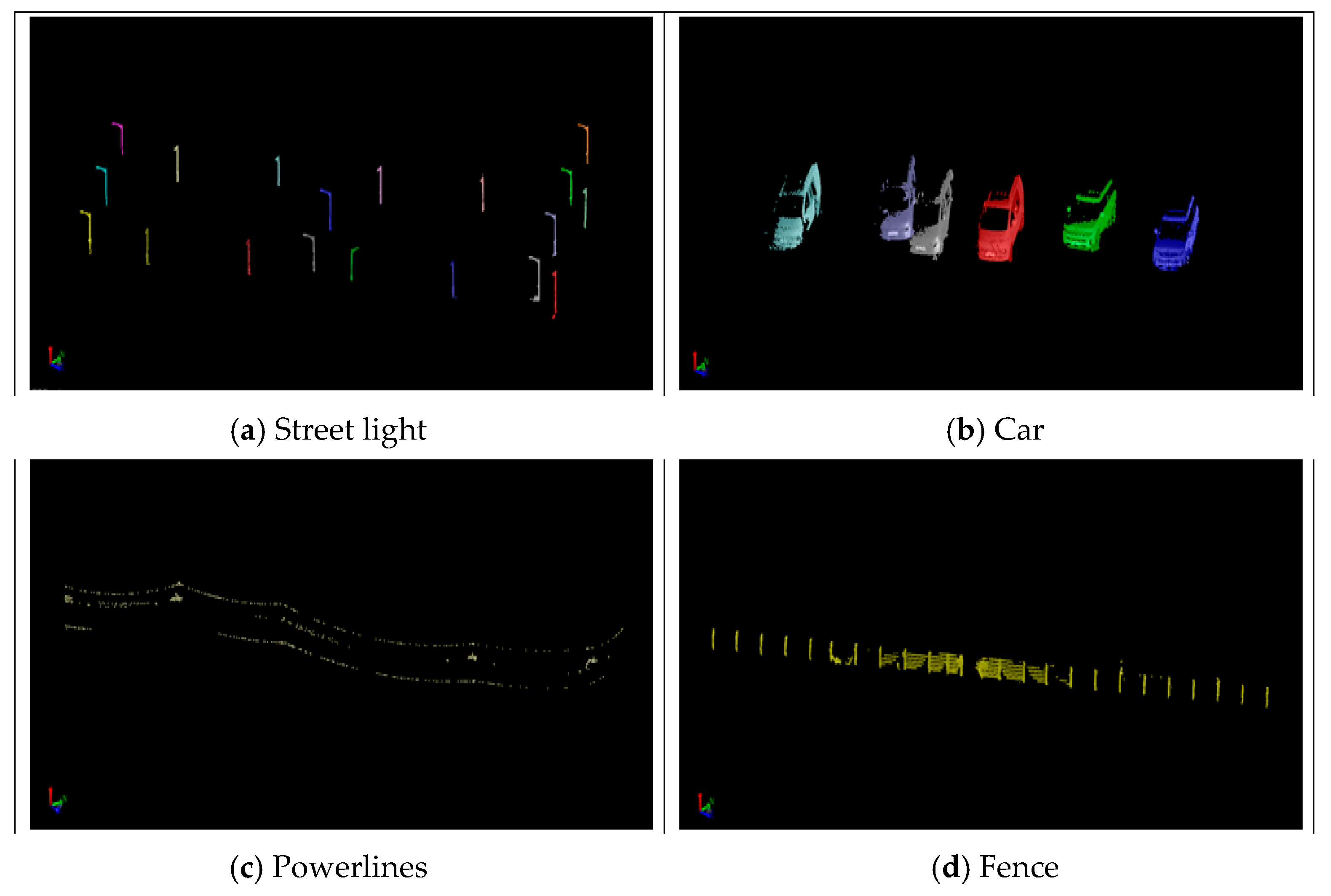
These extracted objects and surfaces were visually inspected and compared with the original TLS dataset as an initial qualitative check to assess the consistency and completeness of the TLS-based extraction process. The feature-separated results, including the delineation of mudflat surfaces, vegetation patches, and built structures, are shown in Figure 14. These results indicate that the TLS-based AI-assisted workflow can support the identification of broad coastal surface and structural components while preserving their main geometric characteristics. The resulting object-level representation provides useful baseline information for interpreting shoreline conditions, assessing engineered coastal structures, and supporting subsequent analyses of coastal morphology and environmental change. Figure 15 shows the extracted artificial-object separation layer.
Figure 14.
Object extraction result.
Figure 15.
Extracted artificial object layer.
To quantitatively evaluate the performance of the TLS-based object-extraction workflow, a comparative assessment was conducted between the TBC-derived extraction outputs and the manually identified ground-truth objects within the TLS dataset [34]. The ground-truth reference was established through visual inspection by an experienced operator, who individually annotated all instances of streetlights, cars, powerlines, and fences present in the study area.
For each object category, the number of correctly extracted instances (true positives), missed instances (false negatives), and incorrectly detected instances (false positives) was determined based on spatial correspondence between the extracted results and the ground-truth annotations [35]. Based on these values, three standard performance metrics, precision, recall, and F1-score, were calculated to provide a balanced assessment of the object-extraction performance. Precision reflects the reliability of the objects identified by the system, whereas recall measures the completeness of object detection relative to the ground truth. The F1-score, defined as the harmonic mean of precision and recall, offers an integrated measure of extraction performance across categories.
Recall measures the proportion of actual target objects that were correctly extracted by the TLS-based object-extraction workflow [34,35,36]. It quantifies the ability of the workflow to detect relevant instances within the dataset. A high recall value indicates that few true objects were missed. Mathematically, recall is defined as:
where TP (True Positive) is the number of correctly extracted objects, and FN (False Negative) is the number of objects that were present in the dataset but not extracted by the workflow.
The F1-score is the harmonic mean of precision and recall, providing a balanced measure of extraction performance when both missed detections and incorrect detections are important [37,38,39,40]. It is especially useful for datasets with uneven object distributions or when false positives and false negatives carry similar significance.
The evaluation results for the four object types are summarized in Table 3, providing a quantitative assessment of the TLS-based feature-extraction workflow.
Table 3.
Evaluation results for the four object types.
The quantitative results indicate that the TLS-based object-extraction workflow produced generally stable performance for the evaluated artificial-object categories in the study area, with overall precision, recall, and F1-score values of approximately 0.868, 0.868, and 0.869, respectively. Among the four object types, streetlights and fences showed relatively higher extraction performance, which may be attributed to their distinctive geometric signatures and relatively stable representation within TLS point-clouds. These objects typically possess clear vertical or linear structural patterns, enabling the workflow to identify them more consistently in complex coastal environments. Although the evaluation was performed on manually annotated reference objects within the same study area, the validation did not constitute a fully independent transferability test across different coastal sites, tidal conditions, or point-density settings. Therefore, the reported values should be interpreted as a site-specific object-level evaluation of the selected artificial-object extraction results.
In contrast, cars exhibited slightly lower recall and F1-scores. This reduction may be related to partial occlusions and variable surface reflectance caused by their three-dimensional shape and material properties, which can lead to incomplete point returns in certain scanning positions. Powerlines showed the lowest performance among the evaluated artificial-object categories. This result is consistent with the characteristics of thin, elevated linear structures, which are highly sensitive to TLS scan angle, distance, and point-spacing resolution [37,38]. Their narrow geometry increases the likelihood of missing points during scanning, which may result in lower recall values.
Despite these challenges, the overall extraction results suggest that the TLS-based TBC AI-assisted workflow can support the identification of diverse artificial objects within TLS datasets. The manually curated training samples provided a useful basis for object-level feature extraction, and the resulting workflow may support downstream coastal analysis tasks, including shoreline interpretation and the separation of non-coastal objects prior to coastal feature mapping [39,40].
From a coastal geomorphological perspective, the extracted TLS-based layers provide useful information for interpreting shoreline morphology and coastal condition. The delineation of intertidal mudflat surfaces, rocky exposures, vegetation patches, revetments, quay walls, and other engineered structures helps describe the spatial arrangement of natural and artificial shoreline components. These features are relevant to practical shoreline management because they provide baseline information for identifying areas where intertidal surfaces, vegetation boundaries, and engineered coastal structures interact. In particular, the object- and surface-level representation derived from TLS data can support field inspection, shoreline-condition assessment, and the prioritization of areas requiring further monitoring or maintenance.
5. Conclusions
This study presented a practical field-based workflow for coastal feature extraction using terrestrial laser scanning (TLS), vessel-based mobile mapping system (MMS) data acquisition, point-cloud processing, and AI-assisted feature analysis. A geomorphologically complex estuarine environment characterized by extensive tidal flats and varied coastal structures was used as the testbed for evaluating the practical applicability of complementary LiDAR data-acquisition platforms and TBC-based AI-assisted point-cloud processing.
TLS and vessel-based MMS data revealed different but complementary strengths in coastal environments. TLS provided long-range and high-fidelity geometric measurements capable of capturing wide intertidal zones and engineered shoreline structures, whereas vessel-based MMS offered rapid and continuous scanning along accessible coastal paths but exhibited range-related limitations in distal areas. These results indicate that the two platforms can provide mutually supportive datasets, and that platform selection and combined use should be determined according to site conditions, target features, accessibility, operational constraints, and mapping objectives.
Building on the field-measured TLS dataset, an AI-assisted feature extraction workflow was implemented in Trimble Business Center (TBC). A manually curated training set composed of 80 object-level point-clouds, including cars, streetlights, powerlines, and fences, was used to improve the identification of non-coastal artificial objects. In parallel, TBC’s built-in AI tools were employed to separate ground surfaces, vegetated regions, and built structures. By combining the custom-trained model and TBC’s automated extraction capabilities, the workflow generated a multilayered representation of the study area, supporting the delineation of intertidal surfaces, engineered coastal structures, and adjacent artificial features.
Quantitative evaluation performed through comparison with manually annotated reference data yielded an overall F1-score of approximately 0.87, indicating that the workflow can support practical object-level feature extraction in coastal environments. Streetlights and fences were extracted with relatively high accuracy due to their distinct geometric characteristics, whereas cars and powerlines showed comparatively lower recall because of partial occlusions and thin structural geometry. These results suggest that the extraction performance is affected by object geometry, point density, occlusion, scan distance, and the quality and diversity of training samples. Therefore, the workflow is useful for operational coastal analysis, while further validation is needed for more complex and diverse coastal scenes.
Overall, the findings suggest that field-measured TLS data, supported by vessel-based MMS comparison and TBC-based AI-assisted point-cloud processing, can provide an operationally useful approach for sustainable shoreline monitoring, coastal infrastructure assessment, coastal infrastructure maintenance, and evidence-based coastal environmental management in tidal flat environments. Rather than claiming methodological novelty, the contribution of this study lies in the practical application and evaluation of complementary LiDAR platforms and AI-assisted point-cloud processing under real coastal field conditions. From a sustainability perspective, the proposed workflow can support the systematic monitoring of natural and engineered shoreline systems, provide spatial evidence for maintenance and management decisions, and contribute to sustainable coastal management in vulnerable tidal flat environments under increasing environmental and climatic pressures. Because the present study was based on data acquired during a limited field survey period, further research is needed to evaluate sedimentary processes, tidal flat dynamics, and coastal vulnerability through repeated multi-temporal surveys under different tidal, seasonal, and hydrodynamic conditions. Future work should also expand the validation dataset, develop larger domain-specific coastal training datasets and classes, and include spatially independent validation, confusion-matrix-based evaluation, and robustness tests under varying scan geometries and point-density levels to assess the transferability of the workflow across different coastal environments.
Author Contributions
Conceptualization, J.P.; Methodology, J.P.; Validation, K.L. and J.H.; Investigation, J.P.; Writing—original draft, J.P.; Writing—review & editing, K.L. and J.H.; Visualization, K.L. and J.H.; Supervision, K.L. and J.H.; Project administration, J.P. All authors have read and agreed to the published version of the manuscript.
Funding
This research received no external funding.
Institutional Review Board Statement
Not applicable.
Informed Consent Statement
Not applicable.
Data Availability Statement
The data supporting the findings of this study are available from the corresponding authors upon reasonable request.
Conflicts of Interest
The authors declare no conflict of interest.
References
- Li, Y.; Wang, S.; Zhao, X.; Shi, W.; Zhang, Y. Changes of coastline and tidal flat and its implication for coastal geomorphology in Bohai Bay, China. Ocean Coast. Manag. 2024, 241, 106619. [Google Scholar]
- Smith, K.E.L.; Feagin, R.A.; Plumlee, M.; Lenz, E.J. Coastal Wetland Shoreline Change Monitoring: Remote Sensing Applications and Implications. Remote Sens. 2021, 13, 3030. [Google Scholar] [CrossRef] [Scilit]
- Burden, A.; Smeaton, C.; Angus, S.; Garbutt, A.; Jones, L.; Lewis, H.D.; Rees, S.M. Impacts of Climate Change on Coastal Habitats, Relevant to the Coastal and Marine Environment around the UK. MCCIP Sci. Rev. 2020, 228–255. [Google Scholar] [CrossRef]
- Sun, Y.; Fan, D.; Du, Y.; Li, B. Anthropogenic Forcing on the Coevolution of Tidal Creeks and Vegetation in the Dongtan Wetland, Changjiang Estuary. Remote Sens. 2025, 17, 1692. [Google Scholar] [CrossRef] [Scilit]
- Rafeeque, M.K.; Bharadwaj, A.; Elezebath George, M.; Suresh Babu, D.S.; Prasad, T.K. Paleoshoreline to Anthropocene Coast: Assessing Coastal Stability and Vulnerability in Response to Sea Level Changes. J. Disaster Sci. Manag. 2025, 1, 13. [Google Scholar] [CrossRef] [Scilit]
- Papakonstantinou, A.; Topouzelis, K.; Pavlogeorgatos, G. Coastline Extraction and Change Detection Using Unmanned Aerial Vehicles (UAVs) and Sentinel-2 Satellite Imagery: Evaluating Accuracy and Limitations. Remote Sens. 2023, 15, 1127. [Google Scholar] [CrossRef] [Scilit]
- Tan, B.; Cooper, H.; Bartley, M.L.F.; Johnson, C.; Fagherazzi, S.; Fichot, C.G. Monitoring Coastal Shoreline Change Using PlanetScope Imagery. Estuar. Coast. Shelf Sci. 2026, 334, 109783. [Google Scholar] [CrossRef] [Scilit]
- Holzner, J.; Strunz, G.; Martinis, S.; Plank, S. Analyzing Coastal Dynamics by Means of Multi-Sensor Satellite Imagery at the East Frisian Island of Langeoog, Germany. Sci. Rep. 2025, 15, 7372. [Google Scholar] [CrossRef] [Scilit] [PubMed]
- Khurram, S.; Pour, A.B.; Bagheri, M.; Ariffin, E.H.; Akhir, M.F.; Hamzah, S.B. Satellite-Based Multi-Decadal Shoreline Change Detection Using Landsat Remote Sensing Data Series. Remote Sens. 2025, 17, 3334. [Google Scholar] [CrossRef] [Scilit]
- Muir, F.M.E.; Davies, G.; Baker, T.; Olhede, S. VedgeSat: An Automated, Open-Source Toolkit for Coastal Monitoring Using Satellite Imagery. Earth Surf. Process. Landf. 2024, 49, 1598–1613. [Google Scholar] [CrossRef] [Scilit]
- Huang, C.; Zhang, H.; Zhao, J. High-Efficiency Determination of Coastline by Combination of Tidal Level and Coastal Zone DEM from UAV Tilt Photogrammetry. Remote Sens. 2020, 12, 2189. [Google Scholar] [CrossRef] [Scilit]
- Pye, K.; Blott, S.J. Spatial and temporal variations in beach-dune system evolution assessed using terrestrial laser scanning (TLS) and LiDAR. Earth Surf. Process. Landf. 2016, 41, 495–512. [Google Scholar] [CrossRef] [Scilit]
- Onyekwelu, C.; O’Shea, M.; Murphy, J. Micro-topographic coastal change detection using multi-temporal terrestrial laser scanning datasets. Coast. Eng. 2022, 173, 104085. [Google Scholar]
- Lim, M.; Dunning, S.A.; Burke, M.; King, H.; King, N. Quantification and implications of change in organic carbon bearing coastal dune cliffs: A multiscale analysis from the Northumberland coast, UK. Remote Sens. Environ. 2015, 163, 1–12. [Google Scholar] [CrossRef] [Scilit]
- Crapoulet, A.; Levoy, F.; Héquette, A.; Bretel, P. Using LiDAR Topographic Data for Identifying Coastal Areas Vulnerable to Sea-Level Rise. J. Coast. Res. 2006, 22, 1120–1133. [Google Scholar] [CrossRef] [Scilit]
- Ren, Y.; Xu, W.; Guo, Y.; Liu, Y.; Tian, Z.; Lv, J.; Guo, Z.; Guo, K. MLF-PointNet++: A Multifeature-Assisted and Multilayer Fused Neural Network for LiDAR-UAS Point Cloud Classification in Estuarine Areas. Remote Sens. 2024, 16, 3131. [Google Scholar] [CrossRef] [Scilit]
- Ahn, S.; Kim, D.; Kang, H.; Kim, G. Analysis of Shoreline Change in Inaccessible Coastal Regions Using Sentinel-2 and Landsat Satellite Imagery. J. Korean Soc. Surv. Geod. Photogramm. Cartogr. 2025, 43, 513–526. [Google Scholar] [CrossRef] [Scilit]
- Michoud, C.; Carrea, D.; Costa, S.; Delacourt, C.; Davidson, R.; Jaboyedoff, M. Land and vessel-based mobile mapping systems (MMS) for rapid geometric data collection along dynamic shorelines. Mar. Geol. 2019, 415, 105963. [Google Scholar] [CrossRef] [Scilit]
- Guimaraes, P.V.; Oliveira, F.S.; Guedes, R.M.C. Integrating multi-platform sensors for structurally complete 3D modeling of engineered coastlines. J. Coast. Res. 2021, 37, 582–595. [Google Scholar] [CrossRef] [Scilit]
- Park, J.K.; Lee, K.W. Analysis of the Usability of UAV by Type of Aircraft for Coastline Change Surveys. J. Korean Soc. Surv. Geod. Photogramm. Cartogr. 2025, 43, 45–51. [Google Scholar] [CrossRef] [Scilit]
- Choi, S.-K.; Lee, S.-K.; Choi, D.-Y.; Lim, H. Time-series UAV DEM Elevation Correction for Coastal Dune Change Monitoring. J. Korean Soc. Surv. Geod. Photogramm. Cartogr. 2023, 41, 627–640. [Google Scholar] [CrossRef] [Scilit]
- Ahn, S.; Kim, G.; Lee, H.N. Analysis of Coastline Changes in the Yeongdong Region Using Aerial Photos and CORONA Satellite Images. J. Korean Soc. Surv. Geod. Photogramm. Cartogr. 2022, 40, 187–193. [Google Scholar] [CrossRef]
- Jang, C. Comparison of tidal current patterns at the Geum River estuary before and after construction of the Geum River bank and coastal structures. J. Korea Acad.-Ind. Coop. Soc. 2021, 22, 601–610. [Google Scholar] [CrossRef]
- Alho, P.; Kukko, A.; Hyyppä, H.; Kaartinen, H. Point-cloud classification challenges in coastal zones under moisture variations and variable surface reflectance. Estuar. Coast. Shelf Sci. 2018, 207, 114–127. [Google Scholar] [CrossRef] [Scilit]
- Qi, C.R.; Yi, L.; Su, H.; Guibas, L.J. PointNet. Deep hierarchical feature learning on point sets in a metric space. Adv. Neural Inf. Process. Syst. 2017, 30, 5099–5108. [Google Scholar]
- Vosselman, G.; Gorte, B.G.H.; Sithole, G.; Rabbani, T. Automated structural feature extraction from dense 3D points for coastal infrastructure hazard mitigation. ISPRS J. Photogramm. Remote Sens. 2014, 92, 102–115. [Google Scholar] [CrossRef] [Scilit]
- Landry, T.R.; Mahoney, C.J.; Slocum, K.R. Semantic segmentation of large-scale outdoor point clouds for regional shoreline management. Sustainability 2023, 15, 6542. [Google Scholar] [CrossRef] [Scilit]
- Weinmann, M.; Jutzi, B.; Hinz, S.; Mallet, C. Geometric feature encoding and local descriptors for classification of linear and vertical artificial structures. ISPRS J. Photogramm. Remote Sens. 2015, 105, 214–228. [Google Scholar] [CrossRef] [Scilit]
- Vousdoukas, M.I.; Almeida, L.P.; Ferreira, Ó. High-resolution topography derived from multi-sensor integration supporting hydrodynamic modeling and vulnerability assessments. Nat. Hazards 2012, 63, 893–911. [Google Scholar]
- Rentsch, M.; Krzystek, P. Combining custom deep-learning models with commercial software workflows for standardized coastal environmental management pipelines. Comput. Geosci. 2020, 144, 104581. [Google Scholar]
- Incoul, A.; De Sloover, L.; Stal, C.; De Wulf, A. Accurate extraction of shoreline protection structures to evaluate long-term infrastructural integrity. J. Mar. Sci. Eng. 2021, 9, 392. [Google Scholar] [CrossRef] [Scilit]
- Passalacqua, P.; Belmont, P.; Staley, D.M. Multi-platform LiDAR frameworks bridging the resolution gap between satellite observations and localized surveys. Geomorphology 2015, 239, 33–55. [Google Scholar] [CrossRef] [Scilit]
- Wulder, M.A.; Loveland, T.R.; Roy, D.P.; Crawford, C.J. Artificial intelligence-driven geomorphic feature extraction for rapid post-storm damage assessment and coastal recovery planning. Remote Sens. Environ. 2022, 270, 112856. [Google Scholar] [CrossRef] [Scilit]
- AlZoman, R.M.; Alrasheed, H.; Kim, B.; Kim, H. A Comparative Study of Traffic Classification Techniques Using Machine Learning Algorithms. Sensors 2021, 21, 4677. [Google Scholar] [CrossRef] [Scilit] [PubMed]
- Fränti, P.; Korhonen, J.; Öinonen, S. Soft Precision and Recall: A Re-examination of the Measures in Pattern Recognition. Pattern Recognit. Lett. 2023, 157, 161–168. [Google Scholar] [CrossRef] [Scilit]
- Christen, P. A Review of the F-Measure: Its History, Properties, Criticism and Use. ACM Comput. Surv. 2023, 56, 87. [Google Scholar] [CrossRef] [Scilit]
- Goutte, C.; Gaussier, É. A Probabilistic Interpretation of Precision, Recall and F-Score, with Implication for Evaluation. Inf. Process. Manag. 2021, 58, 102664. [Google Scholar] [CrossRef] [Scilit]
- Sadeli, A.F.; Lawanda, I.I. Recall, Precision, and F-Measure for Evaluating Information Retrieval System in Electronic Document Management Systems (EDMS). Khizanah Hikmah J. Ilmu Perpust. Inf. Dan Kearsipan 2023, 11, 231–241. [Google Scholar] [CrossRef] [Scilit]
- Hinojosa Lee, M.C.; Álvaro-Garcia, J.; Ruiz-Moreno, M.; Heredia-Navas, V. Performance Metrics for Multilabel Emotion Classification: Precision, Recall and F1-Score Analysis. Appl. Sci. 2024, 14, 9863. [Google Scholar] [CrossRef] [Scilit]
- Li, Z.; Xu, S.; Zhang, H. Comparative Evaluation of Precision, Recall, and F1-Score Metrics in Machine Learning-Based Object Detection. Mathematics 2024, 12, 1552. [Google Scholar]

Disclaimer/Publisher’s Note: The statements, opinions and data contained in all publications are solely those of the individual author(s) and contributor(s) and not of MDPI and/or the editor(s). MDPI and/or the editor(s) disclaim responsibility for any injury to people or property resulting from any ideas, methods, instructions or products referred to in the content. |
© 2026 by the authors. Licensee MDPI, Basel, Switzerland. This article is an open access article distributed under the terms and conditions of the Creative Commons Attribution (CC BY) license.